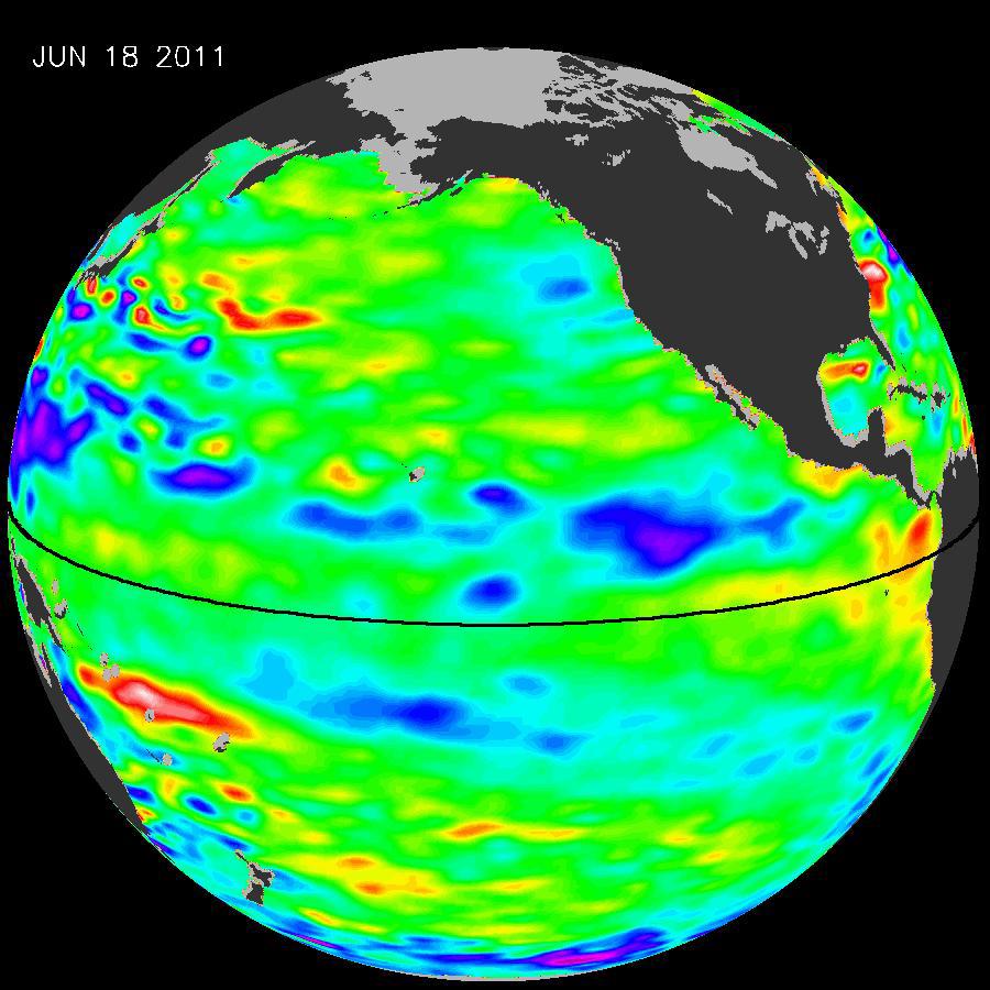
The latest image of Pacific Ocean sea surface heights from the NASA/European Ocean Surface Topography Mission/Jason-2 oceanography satellite, dated June 11, 2010, shows that the tropical Pacific has switched from warm (red) to cold (blue) during the last few months. The blue area in the center of the image depicts the recent appearance of cold water hugging the equator, which the satellite measures as a region of lower-than-normal sea level. Remnants of the El Niño warm water pool, shown here in red and yellow, still linger north and south of the equator in the center of the image.
The image shows sea surface height relative to normal ocean conditions. Red (warmer) areas are about 10 centimeters (4 inches) above normal. Green areas indicate near-normal conditions. Purple (cooler) areas are 14 to 18 centimeters (6 to 7 inches) below normal. Blue areas are 5 to 13 centimeters (2 to 5 inches) below normal.
"The central equatorial Pacific Ocean could stay colder than normal into summer and beyond, because sea level is already about 10 centimeters (4 inches) below normal, creating a significant deficit of the heat stored in the upper ocean," said JPL oceanographer and climatologist Bill Patzert. "The next few months will reveal if the current cooling trend will eventually evolve into a long-lasting La Niña situation."
A La Niña is essentially the opposite of an El Niño. During a La Niña, trade winds in the western equatorial Pacific are stronger than normal and the cold water that normally exists along the coast of South America extends to the central equatorial Pacific. La Niñas change global weather patterns and are associated with less moisture in the air, resulting in less rain along the coasts of North and South America. They also tend to increase the formation of tropical storms in the Atlantic.
"For the American Southwest, La Niñas usually bring a dry winter, not good news for a region that has experienced normal rain and snowpack only once in the past five winters," said Patzert.
OSTM/Jason 2 is an international endeavor with responsibility for satellite development and launch shared between NASA and CNES. The U.S. National Oceanic and Atmospheric Administration (NOAA) is responsible for satellite operations, and JPL is managing the mission for NASA. Data processing is being carried out by CNES, the European Organisation for the Exploitation of Meteorological Satellites (EUMETSAT) and NOAA.
For more information on NASA's ocean surface topography missions, see http://sealevel.jpl.nasa.gov/ or to view the latest Jason data see http://sealevel.jpl.nasa.gov/science/jason1-quick-look/.
 Planetary Data System


