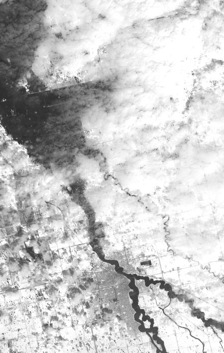
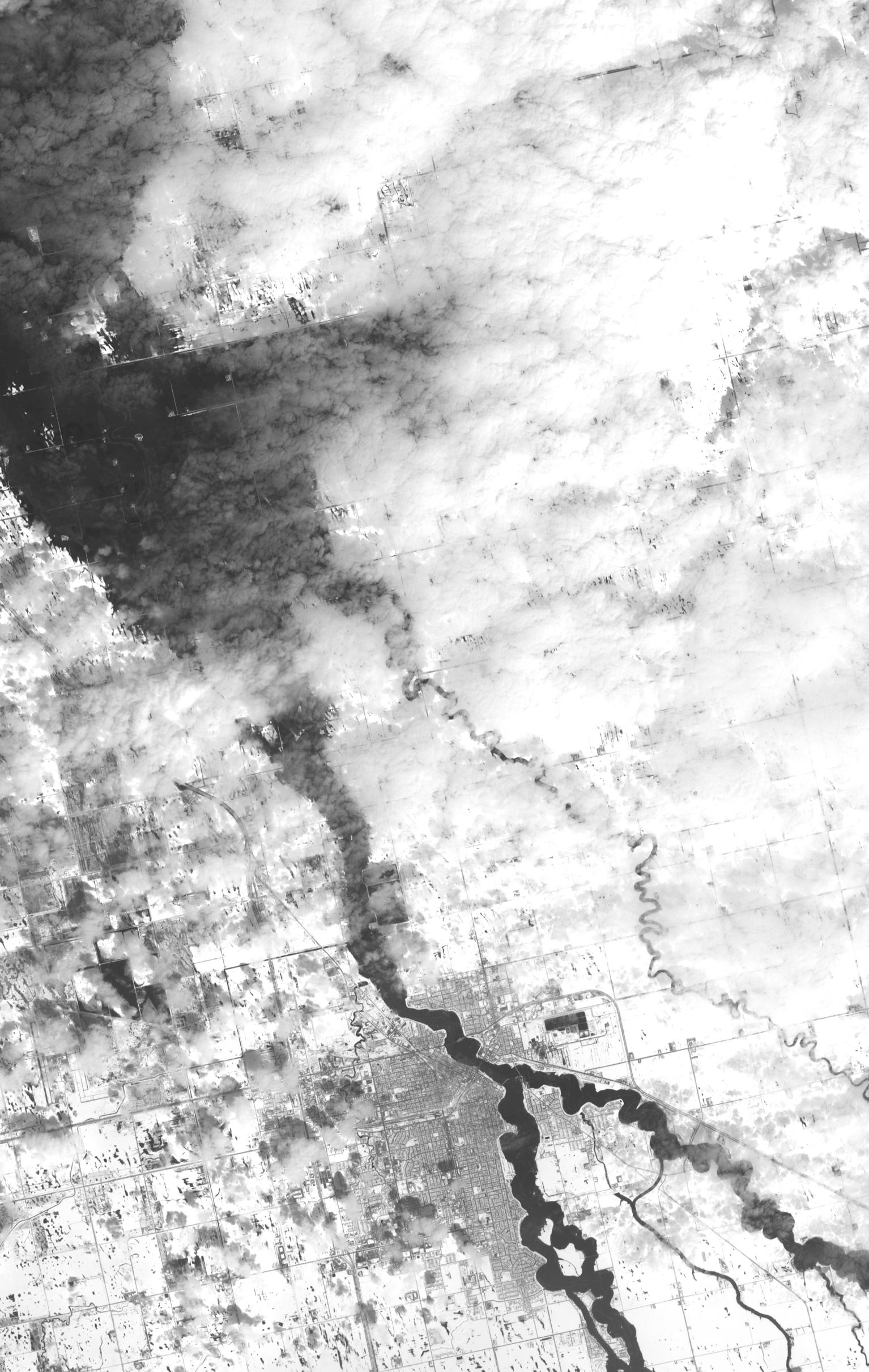
The annual spring thaw in the upper Midwest is underway. Along the Red River in North Dakota, floodwaters are moving northward into Canada. In this image, acquired from the Advanced Spaceborne Thermal Emission and Reflection Radiometer (ASTER) instrument on NASA's Terra spacecraft, the snow-covered ground contrasts with the dark tones of water under a broken cloud cover. The wiggly Red River at Grand Forks is at high levels. Several miles downriver and upriver (off this image to the south), inundated fields attest to the arrival of flood waters in the city. On April 15, Reuters reported that the Red River crested at the third highest level on record at Grand Forks. Grand Forks and neighboring East Grand Forks, Minn., have permanent flood barriers that have protected them. This image was acquired two days later, on April 17, 2011, covers an area of 23 by 36.3 kilometers (14.3 by 22.5 miles), and is located at 48.2 degrees north latitude, 97 degrees west longitude.
With its 14 spectral bands from the visible to the thermal infrared wavelength region and its high spatial resolution of 15 to 90 meters (about 50 to 300 feet), ASTER images Earth to map and monitor the changing surface of our planet. ASTER is one of five Earth-observing instruments launched Dec. 18, 1999, on Terra. The instrument was built by Japan's Ministry of Economy, Trade and Industry. A joint U.S./Japan science team is responsible for validation and calibration of the instrument and data products.
The broad spectral coverage and high spectral resolution of ASTER provides scientists in numerous disciplines with critical information for surface mapping and monitoring of dynamic conditions and temporal change. Example applications are: monitoring glacial advances and retreats; monitoring potentially active volcanoes; identifying crop stress; determining cloud morphology and physical properties; wetlands evaluation; thermal pollution monitoring; coral reef degradation; surface temperature mapping of soils and geology; and measuring surface heat balance.
The U.S. science team is located at NASA's Jet Propulsion Laboratory, Pasadena, Calif. The Terra mission is part of NASA's Science Mission Directorate, Washington, D.C.
More information about ASTER is available at http://asterweb.jpl.nasa.gov/.