Click on an image for detailed information
Click on a column heading to sort in ascending or descending order

My
List |
Addition Date
|
Target
|
Mission
|
Instrument
|
Size
|

|
2001-11-28 |
Earth
|
Terra
|
MISR
|
1698x2372x3 |
|
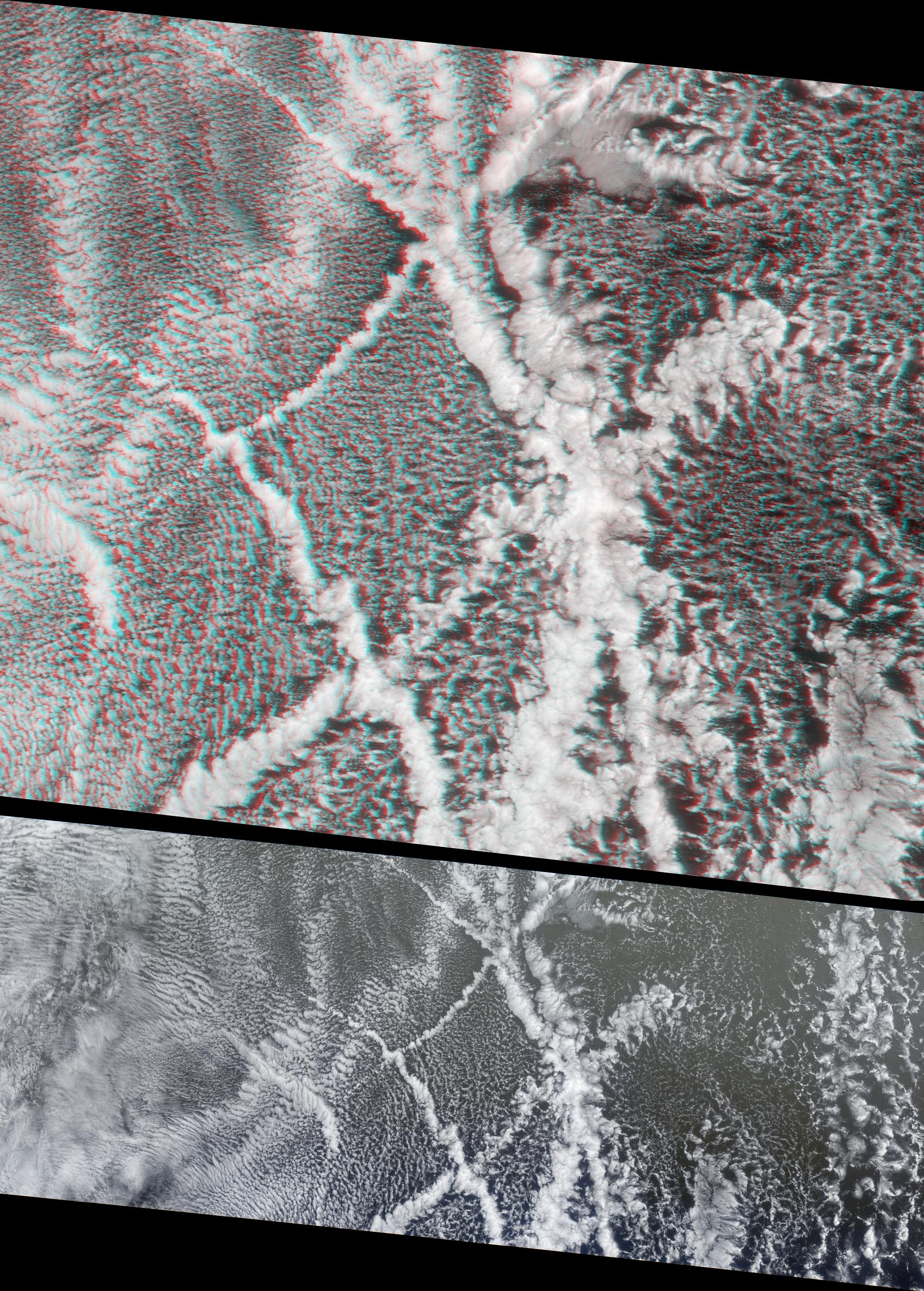
-
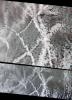
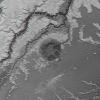
PIA03433:
-
Ship Tracks in a Stratiform Cloud Layer
Full Resolution:
TIFF
(10.73 MB)
JPEG
(839.9 kB)
|
|
|
2001-11-29 |
Callisto
|
Galileo
|
Solid-State Imaging
|
1280x774x1 |
|
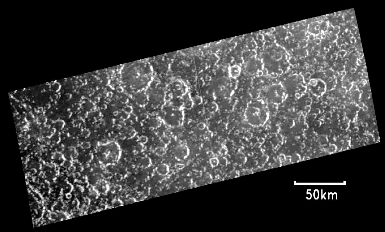
-
PIA02593:
-
Opposite Side of Callisto from Valhalla Impact
Full Resolution:
TIFF
(609.1 kB)
JPEG
(121.2 kB)
|
|
|
2001-12-05 |
Earth
|
Terra
|
MISR
|
1156x886x3 |
|
-
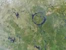
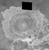
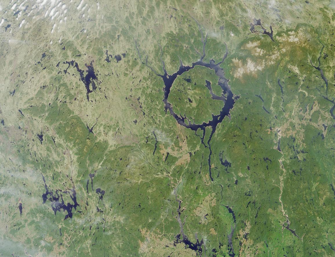
PIA03434:
-
Manicouagan Impact Structure, Quebec
Full Resolution:
TIFF
(3.305 MB)
JPEG
(210.9 kB)
|
|
|
2002-02-13 |
Earth
|
Terra
|
MISR
|
1084x1300x3 |
|
-
PIA03444:
-
Where on Earth...? MISR Mystery Image Quiz #6:
Lagoa dos Patos
Full Resolution:
TIFF
(3.34 MB)
JPEG
(280.3 kB)
|
|
|
2002-02-16 |
Mars
|
Mars Global Surveyor (MGS)
|
Mars Orbiter Camera (MOC)
|
3889x2958x1 |

|
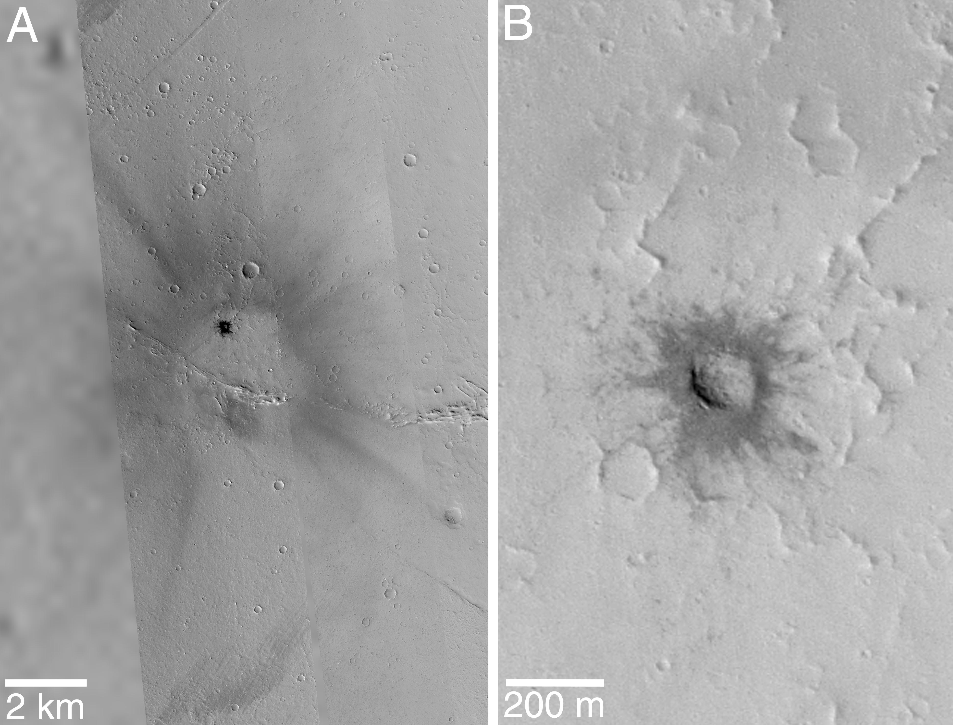
-
PIA03469:
-
Fresh Impact Crater and Rays in Tharsis
Full Resolution:
TIFF
(7.301 MB)
JPEG
(828.3 kB)
|
|
|
2002-03-01 |
Mars
|
2001 Mars Odyssey
|
THEMIS
|
2920x600x1 |
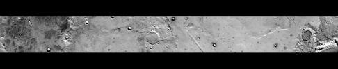
|
-
PIA03483:
Daytime Infrared, Terra Sirenum
Full Resolution:
TIFF
(527.2 kB)
JPEG
(165.6 kB)
|
|
|
2002-03-05 |
Mars
|
2001 Mars Odyssey
|
THEMIS
|
952x474x1 |
|
-
PIA03481:
-
Acheron Fossae in Visible Light
Full Resolution:
TIFF
(391.5 kB)
JPEG
(62.4 kB)
|
|
|
2002-04-23 |
Mars
|
Mars Global Surveyor (MGS)
|
Mars Orbiter Camera (MOC)
|
933x1689x3 |
|
-
PIA03750:
-
Volcanoes Ceraunius Tholus and Uranius Tholus
Full Resolution:
TIFF
(5.031 MB)
JPEG
(269.5 kB)
|
|
|
2002-04-23 |
Mars
|
Mars Global Surveyor (MGS)
|
Mars Orbiter Camera (MOC)
|
1024x1070x1 |
|
-
PIA03754:
-
Gullies and Layers in Crater Wall in Newton
Full Resolution:
TIFF
(1.134 MB)
JPEG
(227.8 kB)
|
|
|
2002-04-23 |
Mars
|
Mars Global Surveyor (MGS)
|
Mars Orbiter Camera (MOC)
|
2560x1024x3 |
|
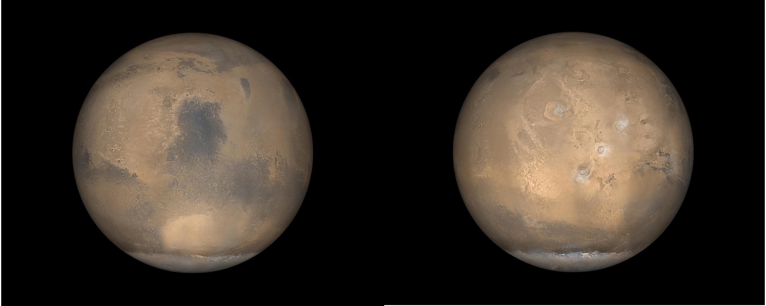
-
PIA03755:
-
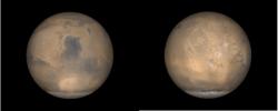
Global Views of Mars in late Northern Summer
Full Resolution:
TIFF
(2.993 MB)
JPEG
(129.4 kB)
|
|
|
2002-05-07 |
Mars
|
Mars Global Surveyor (MGS)
|
Mars Orbiter Camera (MOC)
|
836x1441x1 |
|
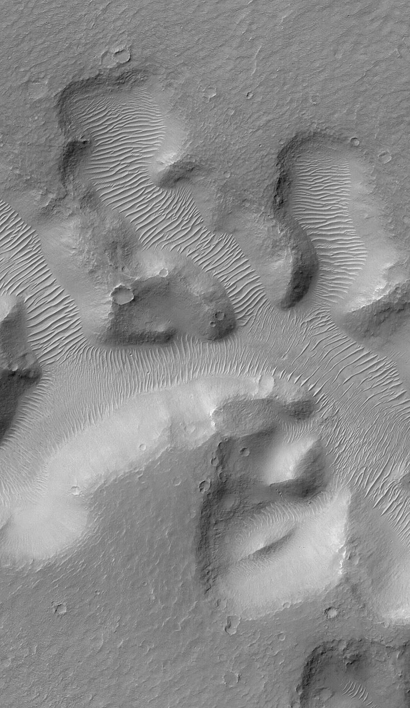
-
PIA03779:
-
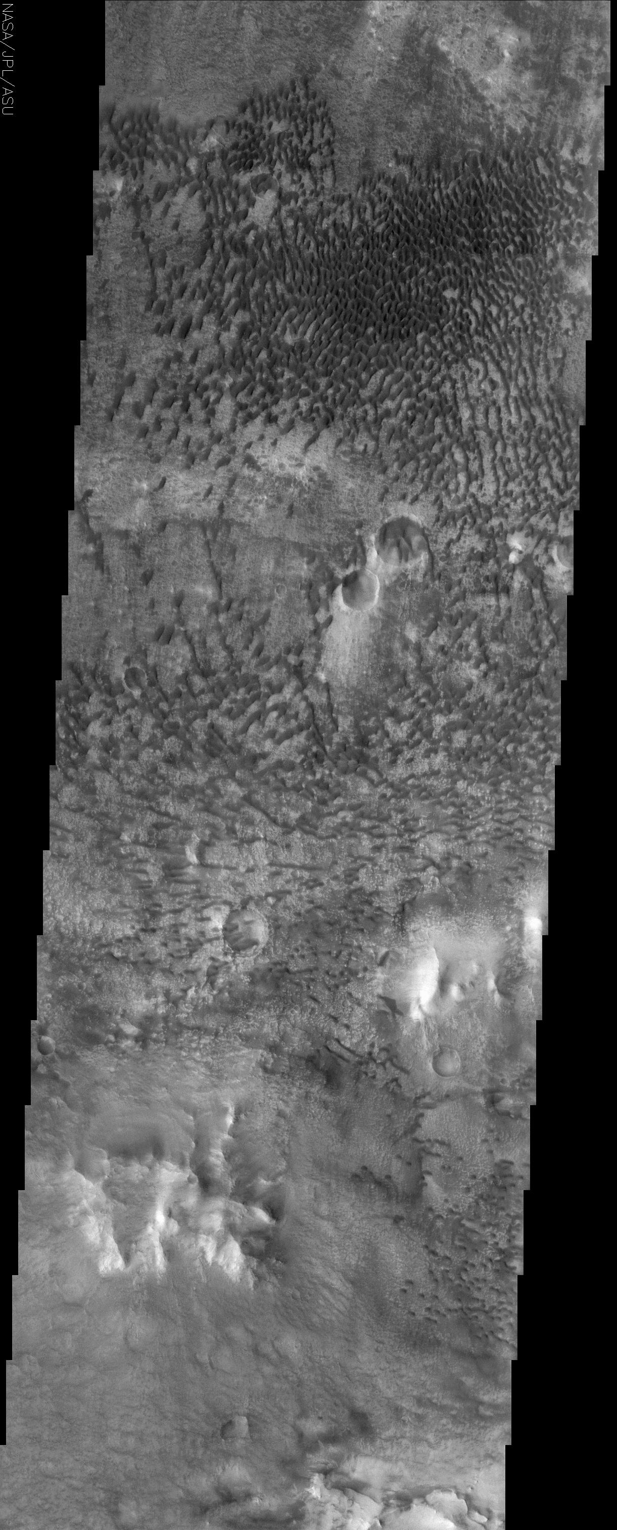
Nirgal Vallis and its Windblown Dunes
Full Resolution:
TIFF
(1.199 MB)
JPEG
(215.2 kB)
|
|
|
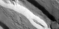
2002-05-21 |
Mars
|
2001 Mars Odyssey
|
THEMIS
|
1238x3043x1 |
|
-
PIA03758:
-
Layered Deposits on the floor of Ganges Chasma
Full Resolution:
TIFF
(1.774 MB)
JPEG
(456.8 kB)
|
|
|
2002-05-21 |
Mars
|
2001 Mars Odyssey
|
THEMIS
|
1236x3025x1 |

|
-
PIA03761:
-
Isidis Rim
Full Resolution:
TIFF
(2.351 MB)
JPEG
(567.3 kB)
|
|
|
2002-05-21 |
Mars
|
2001 Mars Odyssey
|
THEMIS
|
1228x3025x1 |
|
-
PIA03763:
-
Olympus Mons Lava Flows
Full Resolution:
TIFF
(1.84 MB)
JPEG
(623.5 kB)
|
|
|
2002-05-21 |
Mars
|
2001 Mars Odyssey
|
THEMIS
|
1238x3043x1 |
|
-
PIA03766:
-
Medusae Fossae Formation
Full Resolution:
TIFF
(1.771 MB)
JPEG
(473.2 kB)
|
|
|
2002-05-21 |
Mars
|
2001 Mars Odyssey
|
THEMIS
|
1239x3043x1 |
|
-
PIA03767:
-
Southern rim of Isidis Planitia basin
Full Resolution:
TIFF
(1.499 MB)
JPEG
(306.7 kB)
|
|
|
2002-05-21 |
Mars
|
2001 Mars Odyssey
|
THEMIS
|
1217x3061x1 |
|
-
PIA03769:
-
Eastern Floor of Holden Crater
Full Resolution:
TIFF
(1.993 MB)
JPEG
(482.5 kB)
|
|
|
2002-05-21 |
Mars
|
2001 Mars Odyssey
|
THEMIS
|
1235x3079x1 |
|
-
PIA03770:
-
Medusae Fossae Formation
Full Resolution:
TIFF
(2.158 MB)
JPEG
(725.6 kB)
|
|
|
2002-05-21 |
Mars
|
2001 Mars Odyssey
|
THEMIS
|
1215x3061x1 |
|
-
PIA03771:
-
Holden Crater/Uzboi Valles
Full Resolution:
TIFF
(1.853 MB)
JPEG
(472.2 kB)
|
|
|
2002-05-21 |
Mars
|
2001 Mars Odyssey
|
THEMIS
|
1201x3043x1 |
|
-
PIA03772:
-
Bosporus Planum
Full Resolution:
TIFF
(1.78 MB)
JPEG
(526.2 kB)
|
|
|
2002-05-23 |
Mars
|
2001 Mars Odyssey
|
THEMIS
|
1172x2791x1 |
|
-
PIA03782:
-
Knobby Terrain in Northern Arabia Terra
Full Resolution:
TIFF
(1.532 MB)
JPEG
(451.6 kB)
|
|
|
2002-05-23 |
Mars
|
2001 Mars Odyssey
|
THEMIS
|
1237x3151x1 |
|
-
PIA03784:
-
Crustal Fractures of Ophir Planum
Full Resolution:
TIFF
(1.52 MB)
JPEG
(298.5 kB)
|
|
|
2002-05-23 |
Mars
|
2001 Mars Odyssey
|
THEMIS
|
1235x3043x1 |
|
-
PIA03785:
-
Cratered terrain in Terra Meridiani
Full Resolution:
TIFF
(1.725 MB)
JPEG
(384.2 kB)
|
|
|
2002-05-23 |
Mars
|
2001 Mars Odyssey
|
THEMIS
|
1236x3025x1 |
|
-
PIA03788:
-
Degraded Crater Rim
Full Resolution:
TIFF
(1.696 MB)
JPEG
(380.5 kB)
|
|
|
2002-05-23 |
Mars
|
2001 Mars Odyssey
|
THEMIS
|
1240x3169x1 |

|
-
PIA03790:
-
Pavonis Mons
Full Resolution:
TIFF
(1.237 MB)
JPEG
(269 kB)
|
|
|
2002-06-04 |
Mars
|
2001 Mars Odyssey
|
THEMIS
|
1189x3007x1 |
|
-
PIA03796:
-
Utopia Planitia
Full Resolution:
TIFF
(1.833 MB)
JPEG
(534.5 kB)
|
|
|
2002-06-04 |
Mars
|
2001 Mars Odyssey
|
THEMIS
|
1236x3097x1 |
|
-
PIA03797:
-
Hesperia Planum
Full Resolution:
TIFF
(2.142 MB)
JPEG
(678.1 kB)
|
|
|
2002-06-04 |
Mars
|
2001 Mars Odyssey
|
THEMIS
|
1207x3061x1 |
|
-
PIA03798:
-
Hadriaca Patera
Full Resolution:
TIFF
(1.952 MB)
JPEG
(582 kB)
|
|
|
2002-06-07 |
Mars
|
Mars Global Surveyor (MGS)
|
Mars Orbiter Camera (MOC)
|
2235x1298x1 |
|
-
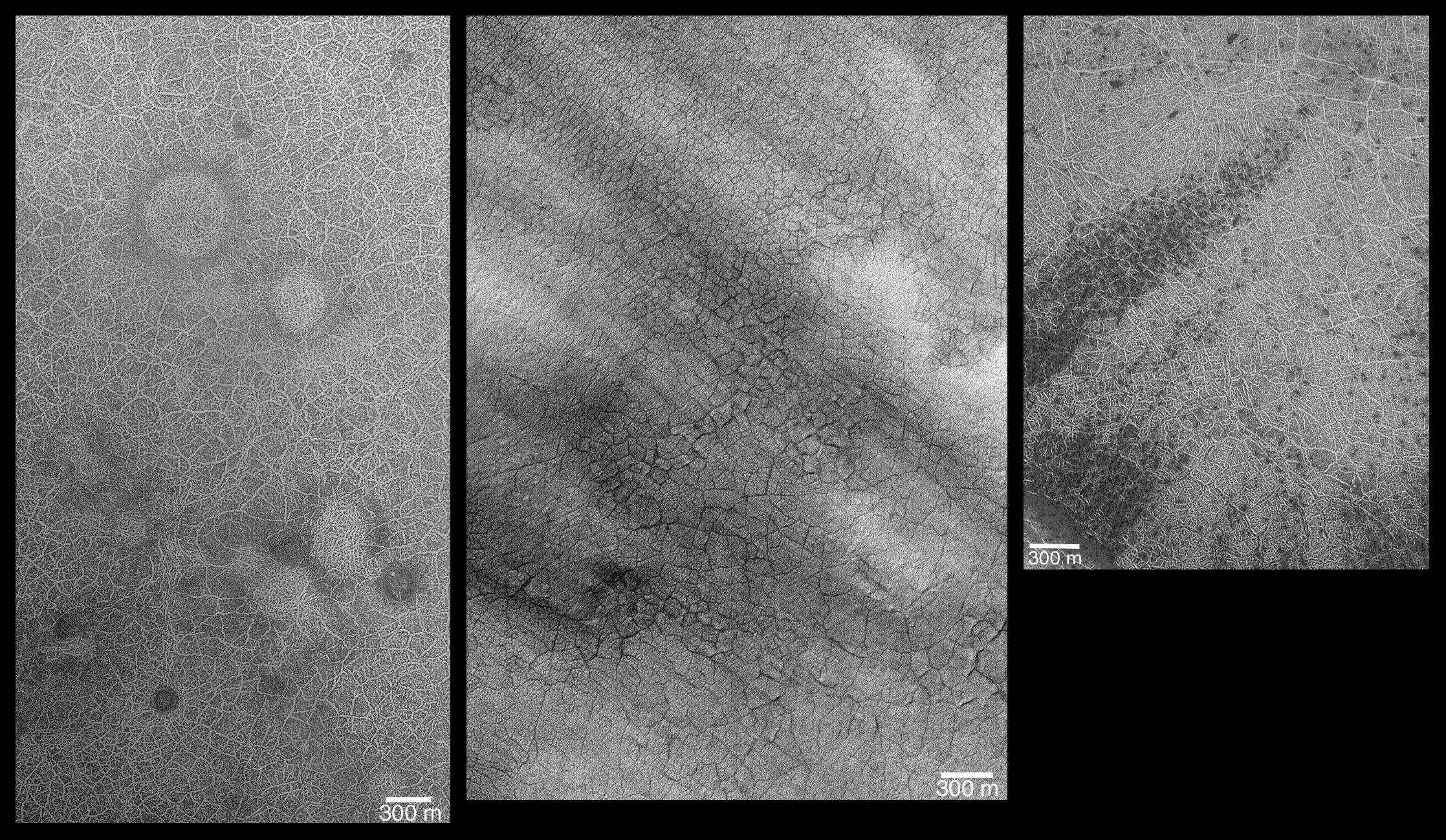
PIA03496:
-
Southern Hemisphere Polygonal Patterned Ground
Full Resolution:
TIFF
(2.906 MB)
JPEG
(915.9 kB)
|
|
|
2002-06-17 |
Mars
|
2001 Mars Odyssey
|
THEMIS
|
1235x3043x1 |

|
-
PIA03809:
-
Coprates Chasma
Full Resolution:
TIFF
(1.395 MB)
JPEG
(291.4 kB)
|
|
|
2002-06-17 |
Mars
|
2001 Mars Odyssey
|
THEMIS
|
1222x3025x1 |
|
-
PIA03811:
-
Northern Arabia Etched Terrain
Full Resolution:
TIFF
(1.756 MB)
JPEG
(488.2 kB)
|
|
|
2002-06-17 |
Mars
|
2001 Mars Odyssey
|
THEMIS
|
1239x3043x1 |

|
-
PIA03818:
-
Floor of Juventae Chasma
Full Resolution:
TIFF
(1.515 MB)
JPEG
(321.1 kB)
|
|
|
2002-06-17 |
Mars
|
2001 Mars Odyssey
|
THEMIS
|
1234x3025x1 |
|
-
PIA03819:
-
Lava Flows in Eastern Tharsis
Full Resolution:
TIFF
(2.019 MB)
JPEG
(714.7 kB)
|
|
|
2002-06-17 |
Mars
|
2001 Mars Odyssey
|
THEMIS
|
1231x3025x1 |
|
-
PIA03821:
-
Southeastern Scarp of Olympus Mons
Full Resolution:
TIFF
(1.621 MB)
JPEG
(378 kB)
|
|
|
2002-06-17 |
Mars
|
2001 Mars Odyssey
|
THEMIS
|
1230x2935x1 |
|
-
PIA03825:
-
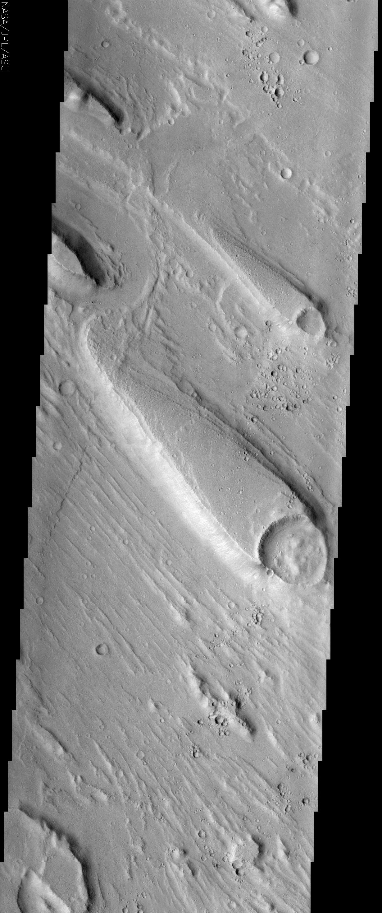
Streamlined Islands in Ares Valles
Full Resolution:
TIFF
(1.743 MB)
JPEG
(469.7 kB)
|
|
|
2002-06-17 |
Mars
|
2001 Mars Odyssey
|
THEMIS
|
1221x3025x1 |

|
-
PIA03828:
-
Floor of Baldet Crater
Full Resolution:
TIFF
(1.809 MB)
JPEG
(504.9 kB)
|
|
|
2002-06-17 |
Mars
|
2001 Mars Odyssey
|
THEMIS
|
1233x2971x1 |
|
-
PIA03829:
-
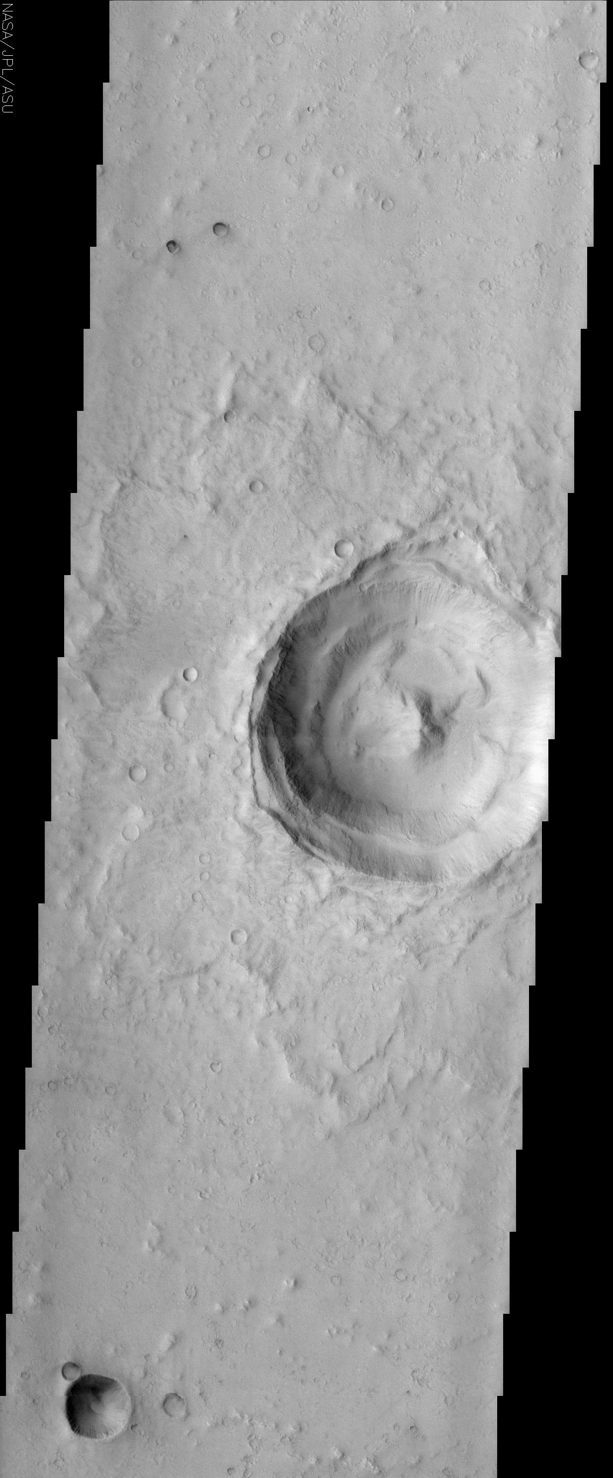
Impact Crater with Peak
Full Resolution:
TIFF
(1.555 MB)
JPEG
(375.9 kB)
|
|
|
2002-06-26 |
Mars
|
2001 Mars Odyssey
|
THEMIS
|
1240x3043x1 |
|
-
PIA03830:
-
Canyons and Mesas of Aureum Chaos
Full Resolution:
TIFF
(1.623 MB)
JPEG
(342.9 kB)
|
|
|
2002-06-26 |
Mars
|
2001 Mars Odyssey
|
THEMIS
|
1199x3061x1 |
|
-
PIA03833:
-
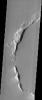
Claritas Fossae
Full Resolution:
TIFF
(1.679 MB)
JPEG
(378.9 kB)
|
|
|
2002-06-26 |
Mars
|
2001 Mars Odyssey
|
THEMIS
|
1227x3061x1 |
|
-
PIA03837:
-
Small Volcano in Terra Cimmeria
Full Resolution:
TIFF
(1.637 MB)
JPEG
(355.9 kB)
|
|
|
2002-06-27 |
Mars
|
2001 Mars Odyssey
|
THEMIS
|
1189x3007x1 |
|
-
PIA03836:
-
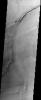
Tantalus Fossae
Full Resolution:
TIFF
(1.705 MB)
JPEG
(442.6 kB)
|
|
|
2002-07-03 |
Earth
|
Terra
|
MISR
|
1214x1700x3 |
|
-
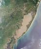
PIA03714:
-
Mars Researchers Rendezvous on Remote Arctic Island
Full Resolution:
TIFF
(6.404 MB)
JPEG
(518.2 kB)
|
|
|
2002-07-03 |
Mars
|
2001 Mars Odyssey
|
THEMIS
|
1239x3043x1 |
|
-
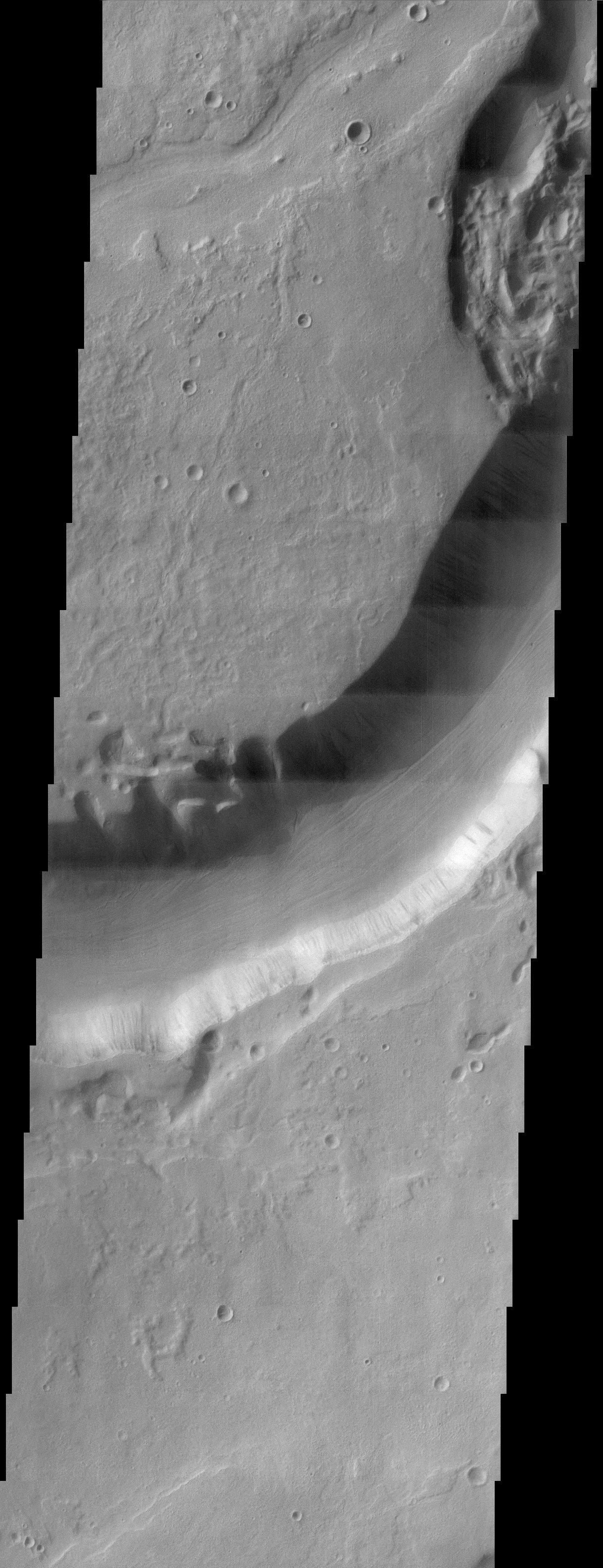
PIA03838:
-
Candor Chasma
Full Resolution:
TIFF
(1.56 MB)
JPEG
(391.6 kB)
|
|
|
2002-07-03 |
Mars
|
2001 Mars Odyssey
|
THEMIS
|
1183x3007x1 |
|
-
PIA03841:
-
Ismenia Fossae
Full Resolution:
TIFF
(1.71 MB)
JPEG
(440 kB)
|
|
|
2002-07-03 |
Mars
|
2001 Mars Odyssey
|
THEMIS
|
1224x3025x1 |
|
-
PIA03842:
-
Hephaestus Fossae
Full Resolution:
TIFF
(1.59 MB)
JPEG
(460.2 kB)
|
|
|
2002-07-05 |
Moon
|
Ranger 9
|
TV Camera
|
550x473x3 |
|
-
PIA03495:
-
Live from the Moon - Impact!

Full Resolution:
|
|
|
2002-07-08 |
Mars
|
2001 Mars Odyssey
|
THEMIS
|
1221x3025x1 |
|
-
PIA03843:
-
Amazonis Planitia
Full Resolution:
TIFF
(1.351 MB)
JPEG
(326.1 kB)
|
|
|
2002-07-22 |
Mars
|
2001 Mars Odyssey
|
THEMIS
|
1239x3043x1 |

|
-
PIA03900:
-
Ulysses Patera
Full Resolution:
TIFF
(1.65 MB)
JPEG
(381.2 kB)
|
|
|
2002-07-22 |
Mars
|
2001 Mars Odyssey
|
THEMIS
|
314x1234x3 |
|
-
PIA03901:
-
1st Manned Lunar Landing and 1st Robotic Mars Landing Commemorative Release: Viking 1 Landing Site in Chryse Planitia - Infrared Image
Full Resolution:
TIFF
(389.6 kB)
JPEG
(74.88 kB)
|
|
|
2002-07-22 |
Mars
|
2001 Mars Odyssey
|
THEMIS
|
1037x644x3 |
|
-
PIA03902:
-
1st Manned Lunar Landing and 1st Robotic Mars Landing Commemorative Release: Viking 1 Landing Site in Chryse Planitia - Visible Image
Full Resolution:
TIFF
(670.3 kB)
JPEG
(121.2 kB)
|
|
|
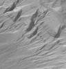
2002-08-05 |
Mars
|
2001 Mars Odyssey
|
THEMIS
|
1237x3043x1 |
|
-
PIA03909:
-
Poynting Crater Ejecta
Full Resolution:
TIFF
(1.969 MB)
JPEG
(575.1 kB)
|
|
|
2002-08-07 |
Mars
|
Mars Global Surveyor (MGS)
|
Mars Orbiter Camera (MOC)
|
1825x1876x1 |
|
-
PIA03914:
-
Partially-Exhumed Crater in Northern Terra Meridiani: Mosaic of M04-01289, E17-01676, and M21-01646
Full Resolution:
TIFF
(3.286 MB)
JPEG
(557.6 kB)
|
|
|
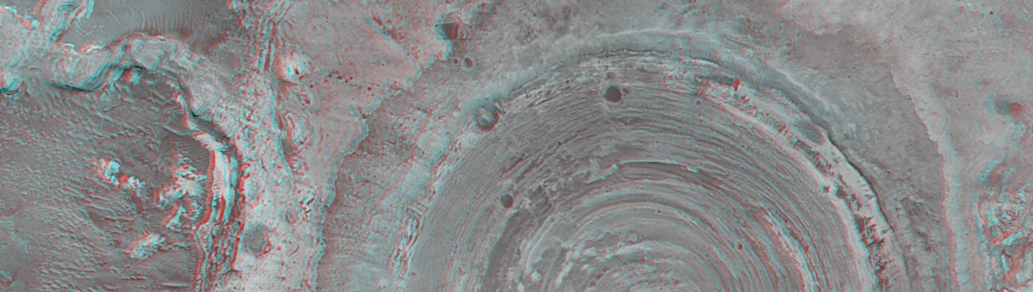
2002-08-07 |
Mars
|
Mars Global Surveyor (MGS)
|
Mars Orbiter Camera (MOC)
|
1490x422x3 |
|
-
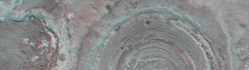
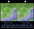
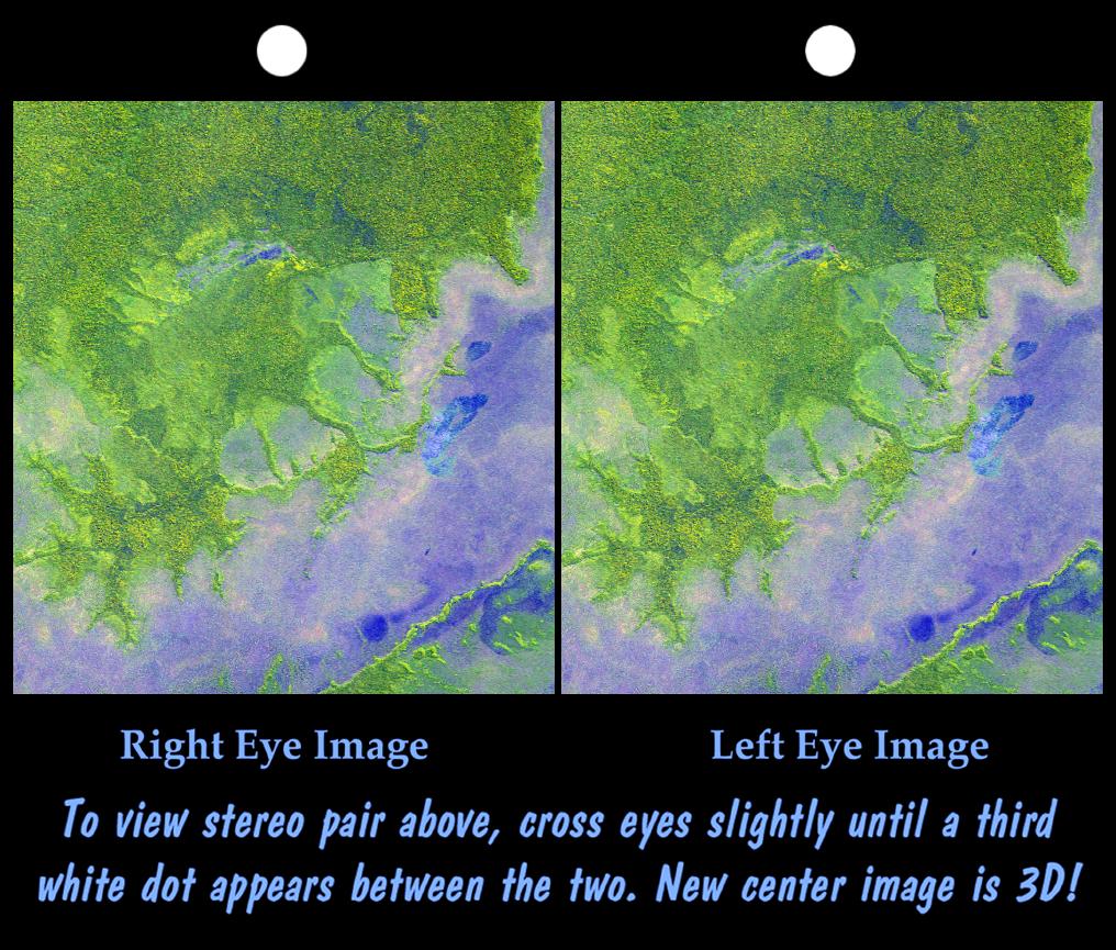
PIA03915:
Partially-Exhumed Crater in Northern Terra Meridiani: Stereo Anaglyph of overlapping coverage in M04-01289 and E17-01676
Full Resolution:
TIFF
(1.919 MB)
JPEG
(114.7 kB)
|
|
|
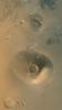
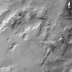
2002-08-07 |
Mars
|
Mars Global Surveyor (MGS)
|
Mars Orbiter Camera (MOC)
|
300x300x1 |
|
-
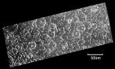
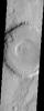
PIA03918:
-
"Inca City" is Part of a Circular Feature
Full Resolution:
TIFF
(82.41 kB)
JPEG
(13.81 kB)
|
|
|
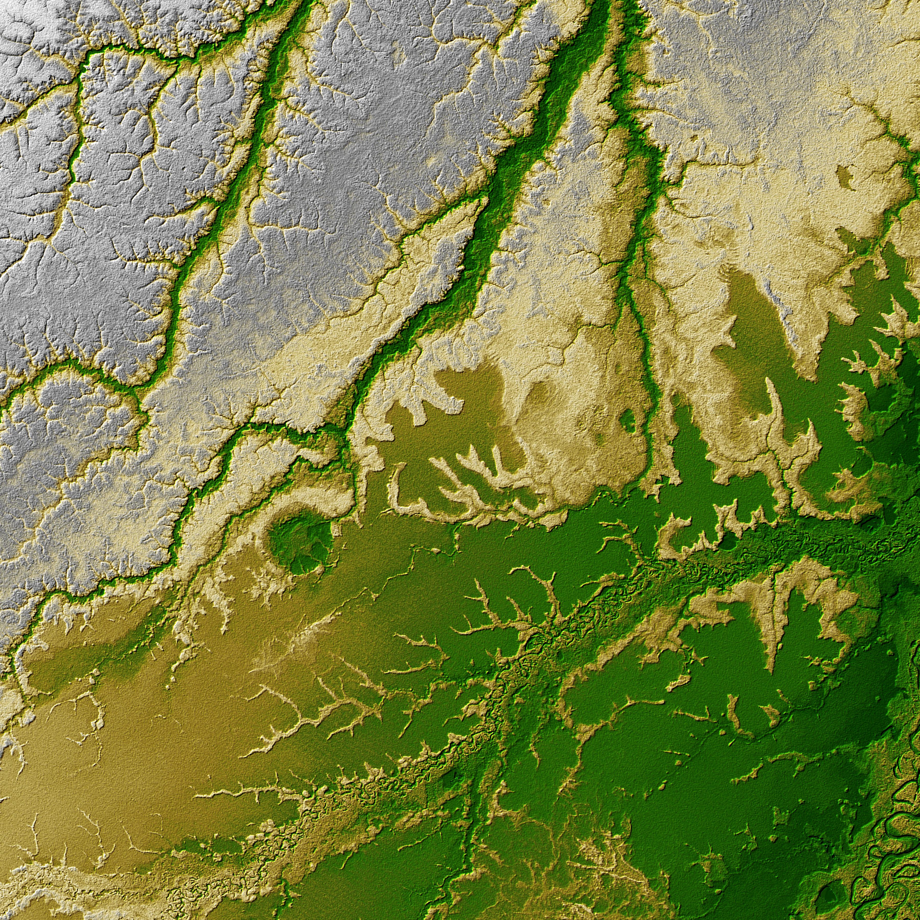
2002-09-13 |
Earth
|
Shuttle Radar Topography Mission (SRTM)
|
C-Band Interferometric Radar
|
3601x3601x3 |

|
-
PIA03359:
-
Shaded Relief with Height as Color, Iturralde Structure, Bolivia
Full Resolution:
TIFF
(38.9 MB)
JPEG
(3.517 MB)
|
|
|
2002-09-17 |
Earth
|
Terra
|
ASTER
|
1192x998x3 |
|
-
PIA03859:
-
Iturralde Crater, Bolivia
Full Resolution:
TIFF
(3.573 MB)
JPEG
(482.4 kB)
|
|
|
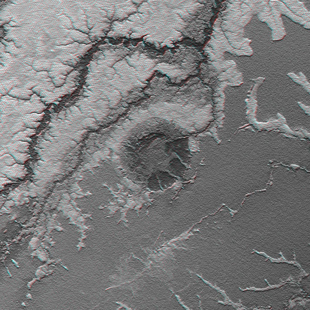
2002-09-26 |
Earth
|
Shuttle Radar Topography Mission (SRTM)
|
C-Band Interferometric Radar
|
1200x1200x3 |
|
-
PIA03362:
-
Anaglyph: Shaded Relief and Height as Brightness, Iturralde Structure, Bolivia
Full Resolution:
TIFF
(3.729 MB)
JPEG
(366.1 kB)
|
|
|
2002-09-26 |
Earth
|
Shuttle Radar Topography Mission (SRTM)
|
C-Band Interferometric Radar
|
1016x865x3 |
|
-
PIA03363:
-
Stereo Pair with ASTER Image, Iturralde Structure, Bolivia
Full Resolution:
TIFF
(2.168 MB)
JPEG
(186.8 kB)
|
|
|
2002-10-10 |
Mars
|
Mars Global Surveyor (MGS)
|
Mars Orbiter Camera (MOC)
|
4145x2993x3 |
|
-
PIA03872:
-
18,812 New MGS MOC Images Archived and Online
Full Resolution:
TIFF
(31.49 MB)
JPEG
(2.115 MB)
|
|
|
2002-11-15 |
Mars
|
2001 Mars Odyssey
|
THEMIS
|
1240x3043x1 |
|
-
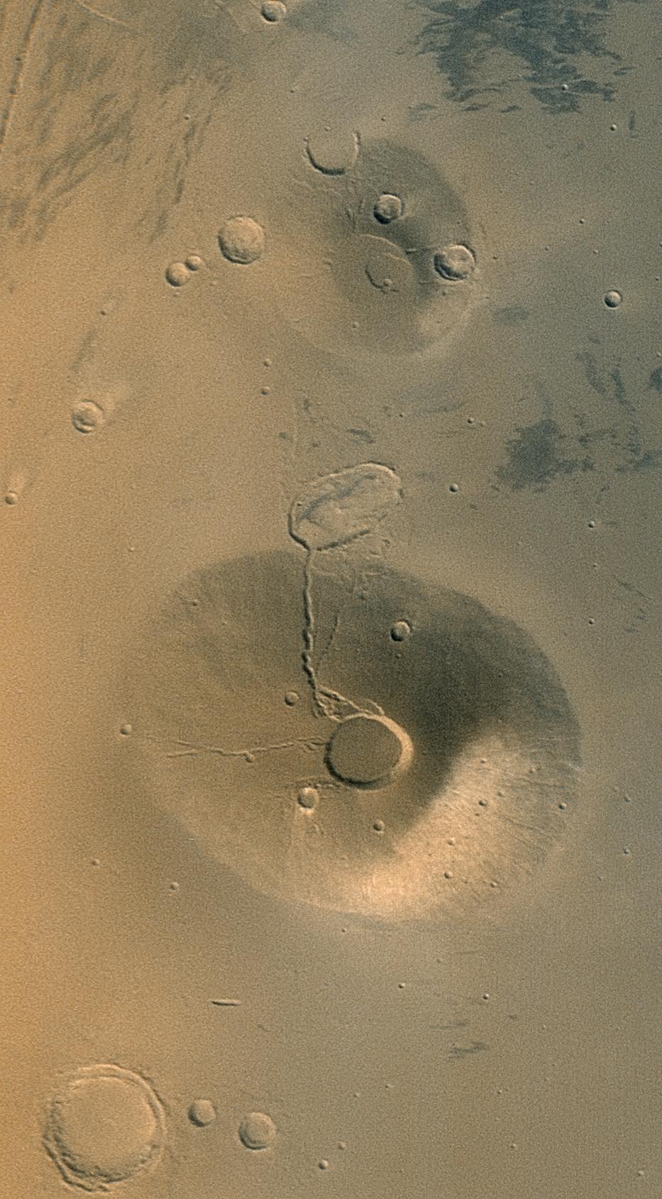
PIA04004:
-
Small volcanic crater near Pavonis Mons (Released 14 November 2002
Full Resolution:
TIFF
(3.427 MB)
JPEG
(786.8 kB)
|
|
|
2002-11-22 |
Mars
|
2001 Mars Odyssey
|
THEMIS
|
1207x3061x1 |
|
-
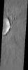
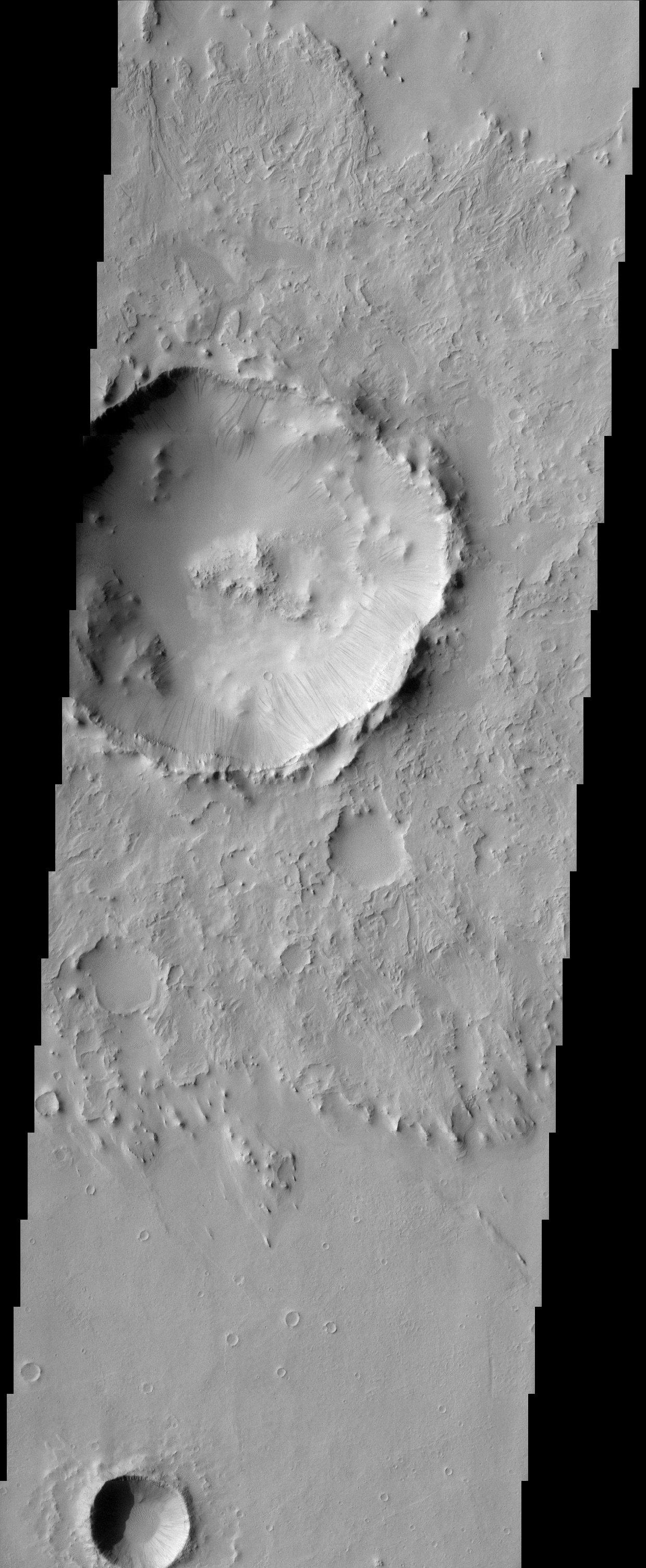
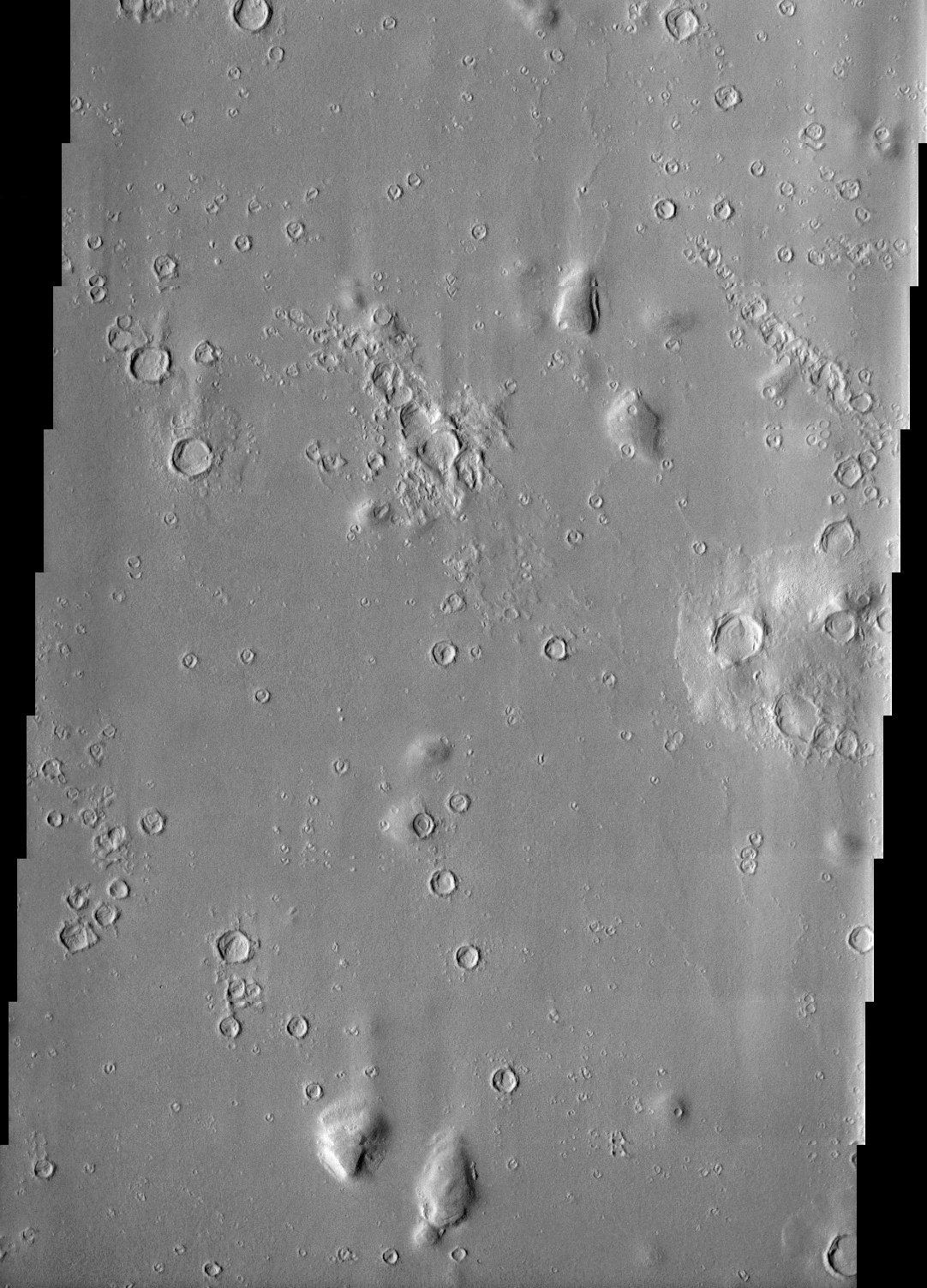
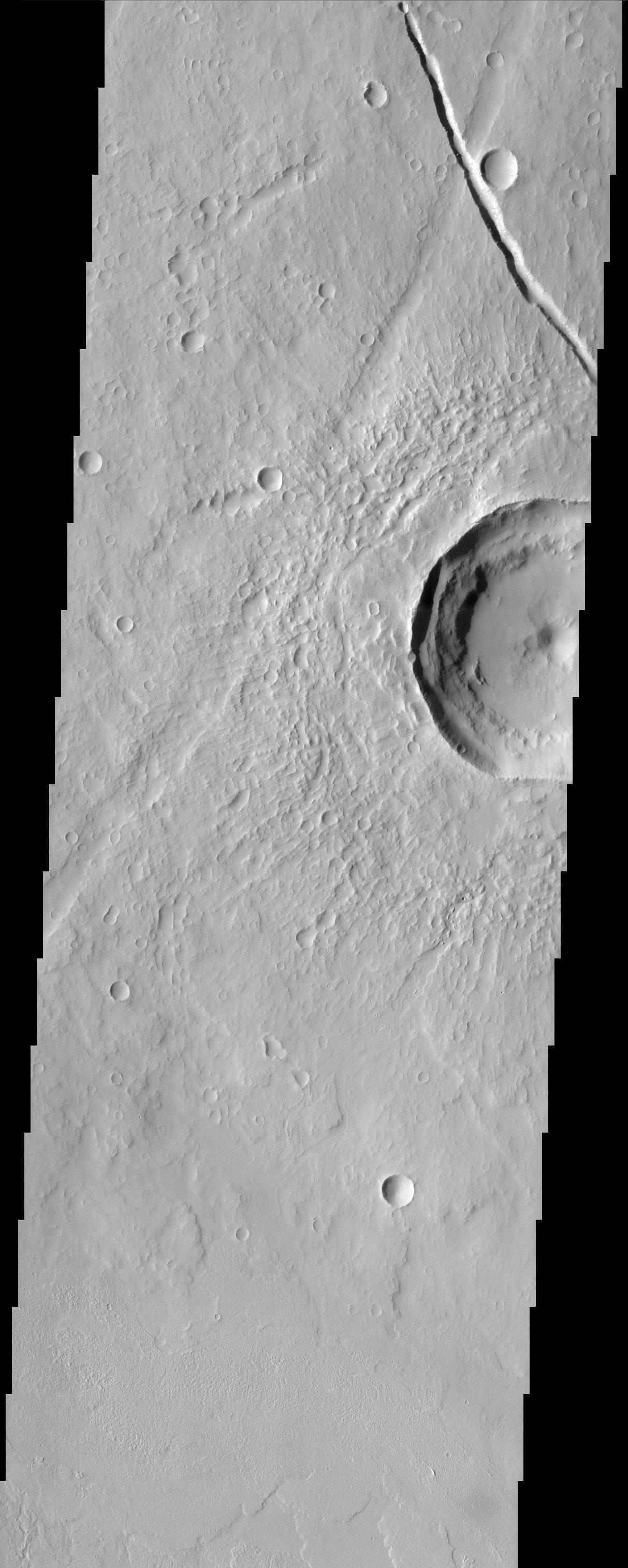
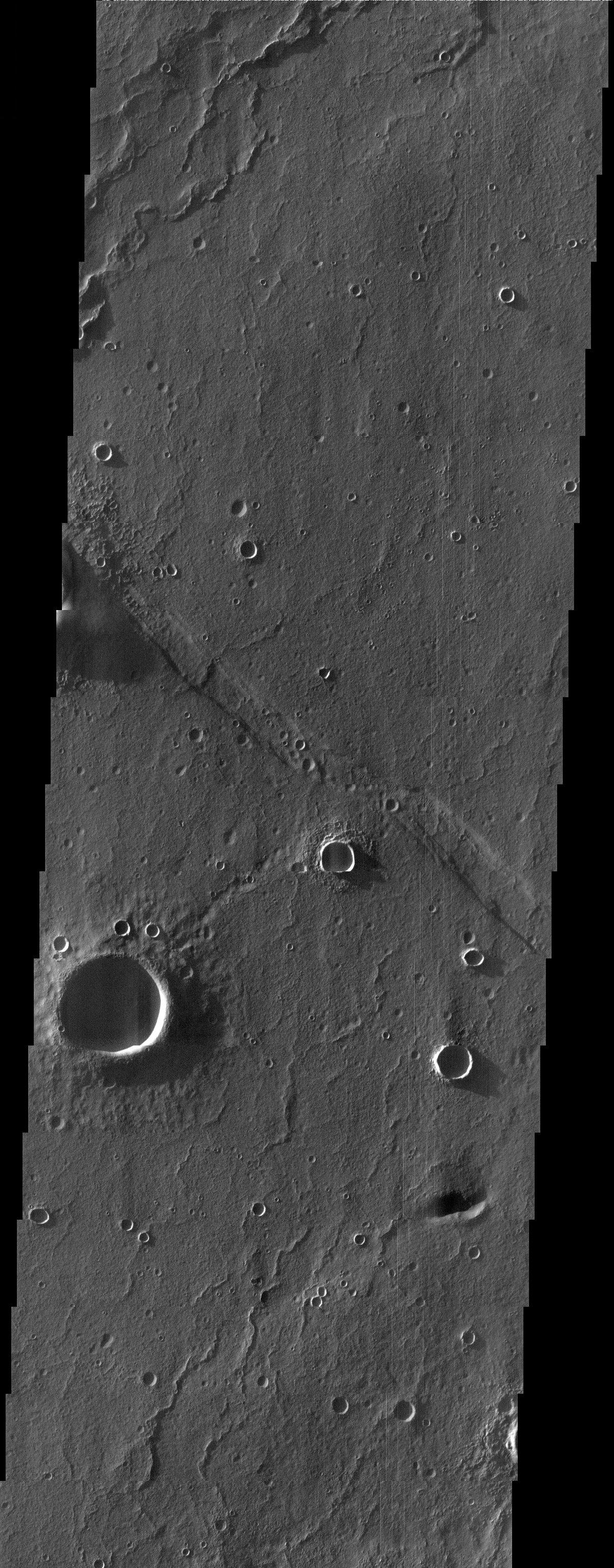
PIA04006:
-
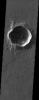
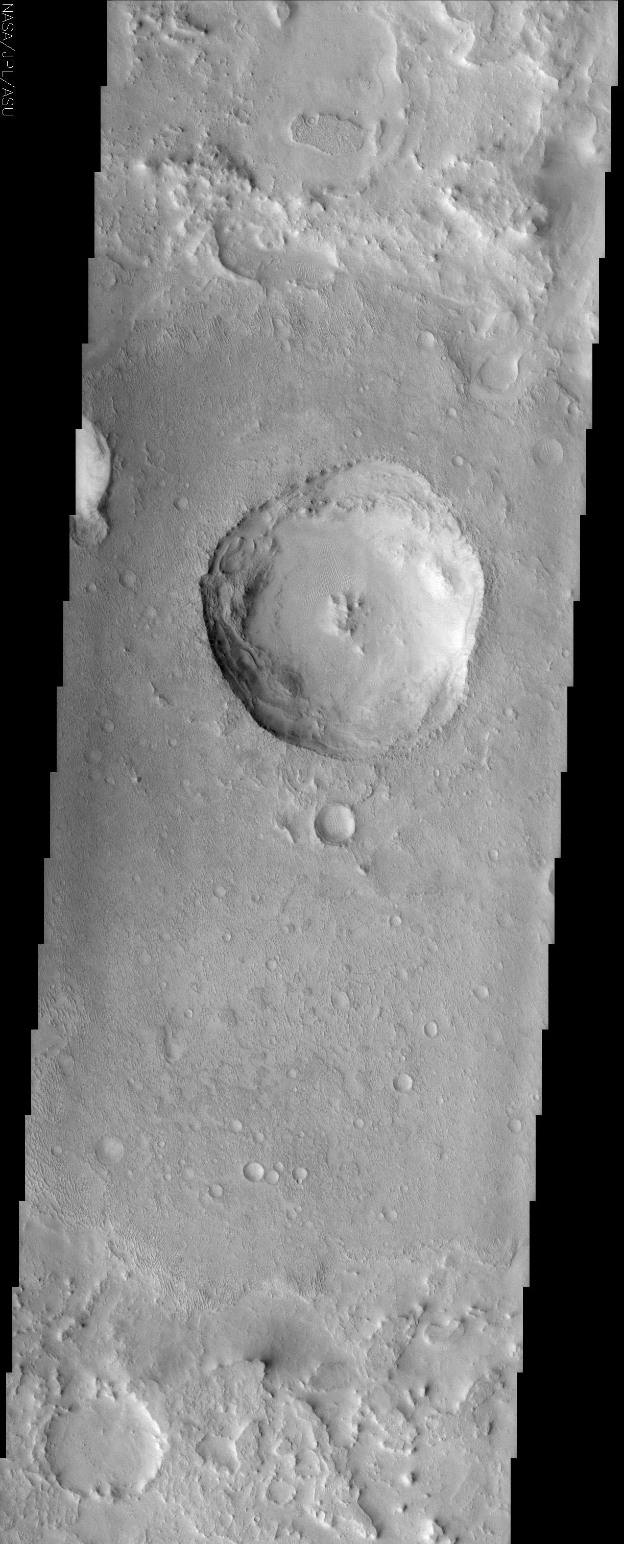
Impact Crater
Full Resolution:
TIFF
(3.022 MB)
JPEG
(533.2 kB)
|
|
|
2002-11-23 |
Mars
|
2001 Mars Odyssey
|
THEMIS
|
1239x3043x1 |
|
-
PIA04008:
-
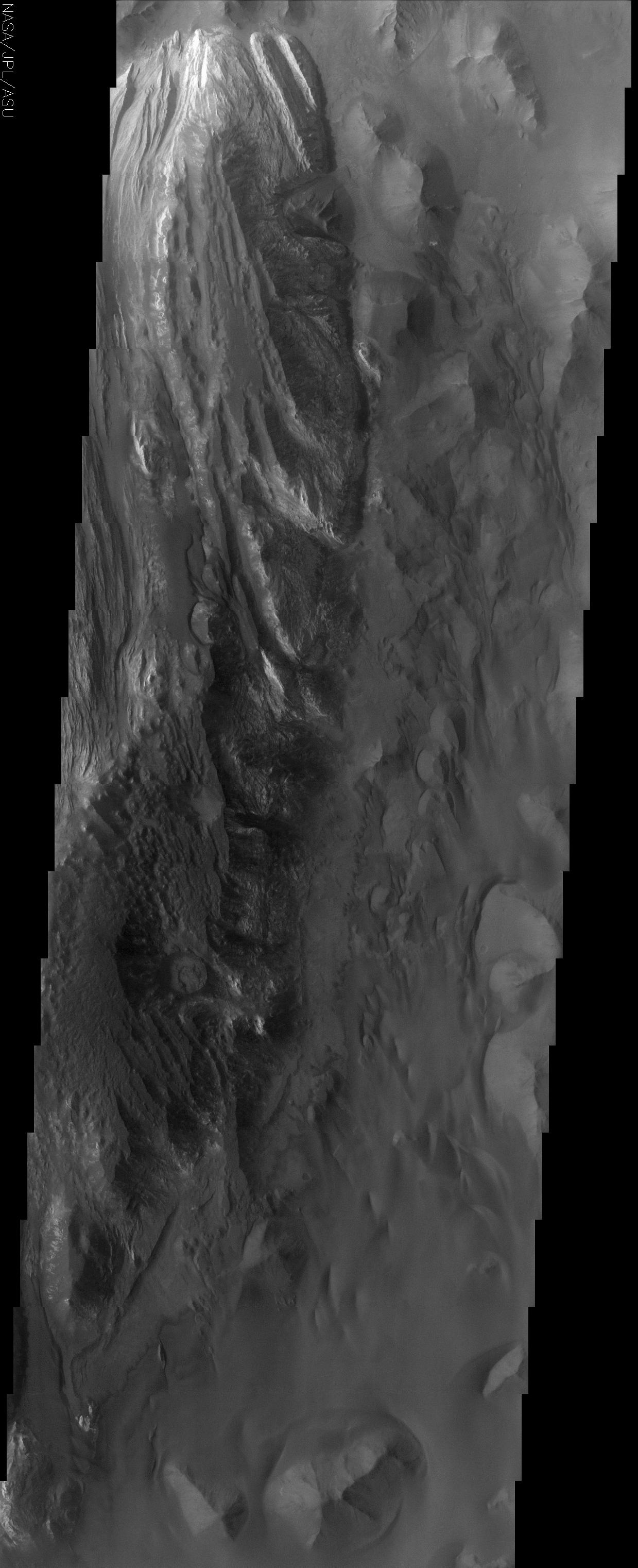
Libya Montes
Full Resolution:
TIFF
(3.175 MB)
JPEG
(502.2 kB)
|
|
|
2002-11-23 |
Mars
|
2001 Mars Odyssey
|
THEMIS
|
1219x3169x1 |

|
-
PIA04009:
-
Dao Vallis
Full Resolution:
TIFF
(3.44 MB)
JPEG
(645.9 kB)
|
|
|
2002-11-26 |
Mars
|
2001 Mars Odyssey
|
THEMIS
|
1240x3007x1 |
|
-
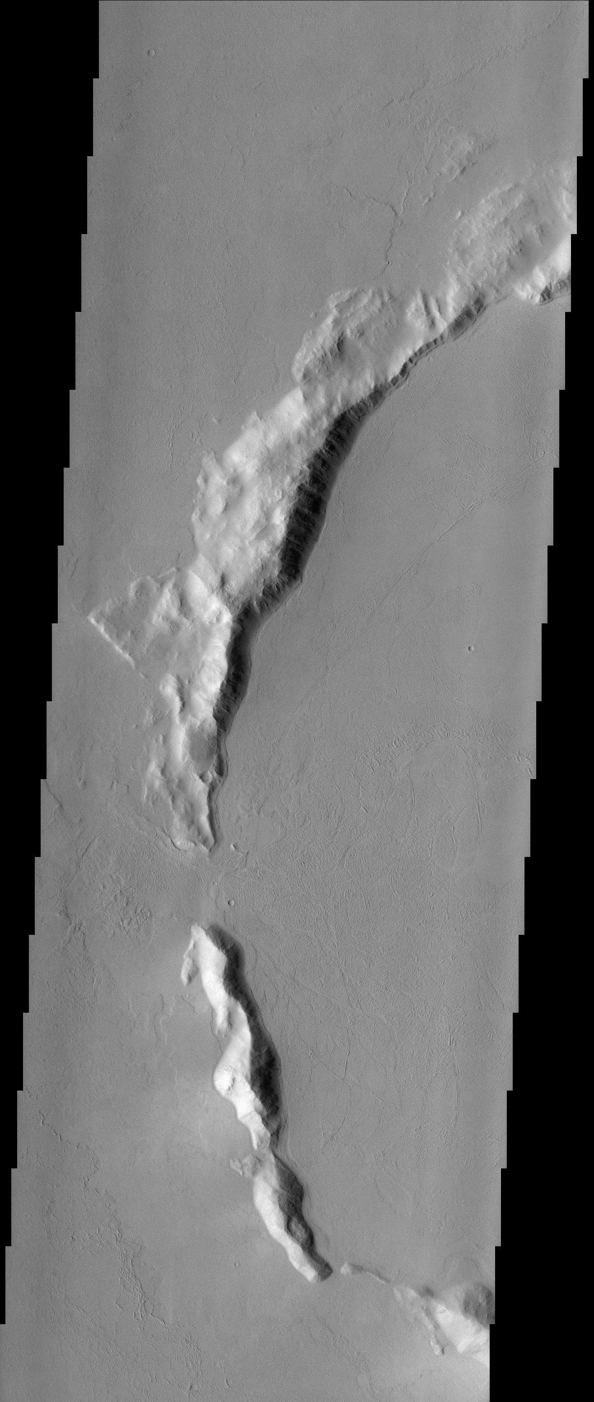
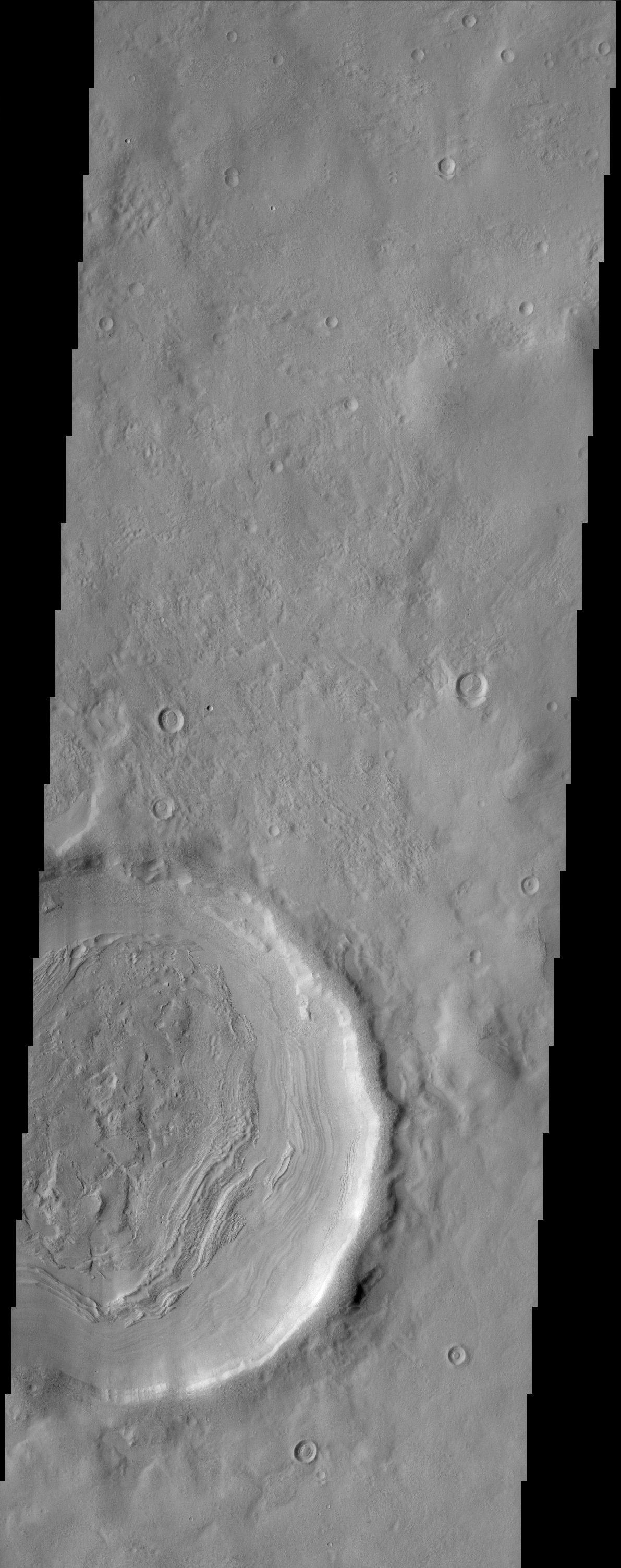
PIA04012:
-
Meroe Patera
Full Resolution:
TIFF
(3.43 MB)
JPEG
(617.6 kB)
|
|
|
2002-12-04 |
Mars
|
2001 Mars Odyssey
|
THEMIS
|
1213x2863x1 |
|
-
PIA04018:
-
Buried Crater
Full Resolution:
TIFF
(2.923 MB)
JPEG
(518.5 kB)
|
|
|
2002-12-07 |
Mars
|
2001 Mars Odyssey
|
THEMIS
|
547x1024x3 |
|
-
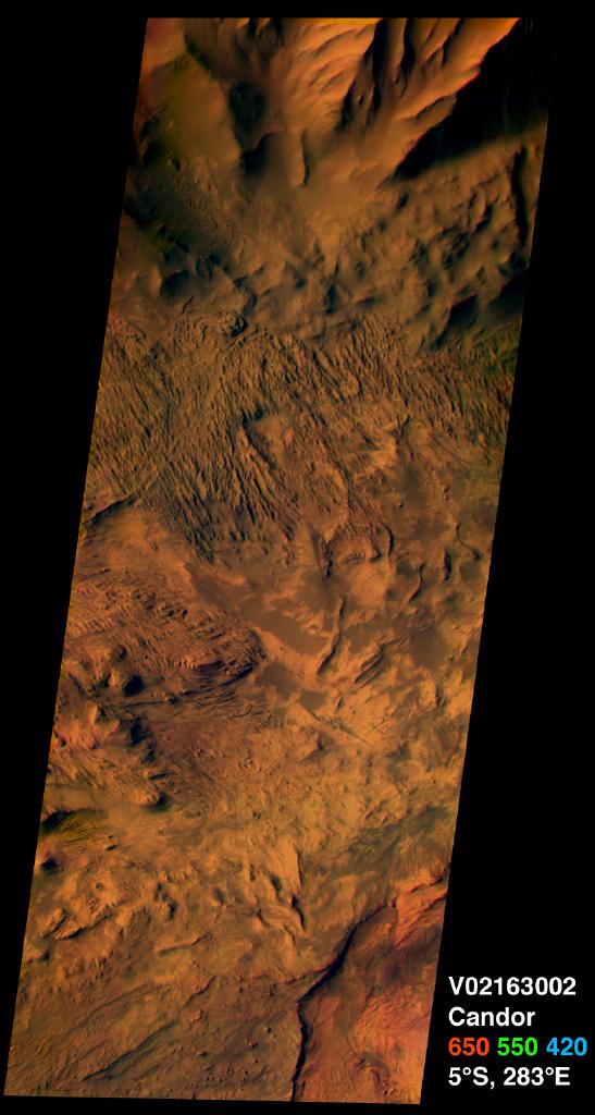
PIA03738:
-
Candor Chasma on Mars, in Color
Full Resolution:
TIFF
(1.313 MB)
JPEG
(78.48 kB)
|
|
|
2002-12-07 |
Mars
|
2001 Mars Odyssey
|
THEMIS
|
1238x338x1 |
|
-
PIA03739:
Martian Highlands at Night in Infrared
Full Resolution:
TIFF
(419.1 kB)
JPEG
(95.04 kB)
|
|
|
2002-12-13 |
Mars
|
2001 Mars Odyssey
|
THEMIS
|
1191x3007x1 |
|
-
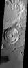
PIA04021:
-
Impact Crater
Full Resolution:
TIFF
(2.815 MB)
JPEG
(420.6 kB)
|
|
|
2002-12-13 |
Mars
|
2001 Mars Odyssey
|
THEMIS
|
1082x1503x1 |
|
-
PIA04025:
-
Fluidized crater ejecta
Full Resolution:
TIFF
(1.524 MB)
JPEG
(280.1 kB)
|
|
|
2002-12-13 |
Mars
|
2001 Mars Odyssey
|
THEMIS
|
1217x3061x1 |
|
-
PIA04027:
-
Crater Upon Crater
Full Resolution:
TIFF
(3.379 MB)
JPEG
(593.3 kB)
|
|
|
2002-12-16 |
Mars
|
2001 Mars Odyssey
|
THEMIS
|
1186x3115x1 |
|
-
PIA04031:
-
Reull Vallis
Full Resolution:
TIFF
(3.368 MB)
JPEG
(584.1 kB)
|
|
|
2002-12-16 |
Mars
|
2001 Mars Odyssey
|
THEMIS
|
1231x3025x1 |
|
-
PIA04036:
-
Yardangs near Olympus Mons
Full Resolution:
TIFF
(3.46 MB)
JPEG
(792.9 kB)
|
|
|
2002-12-16 |
Mars
|
2001 Mars Odyssey
|
THEMIS
|
1210x3025x1 |
|
-
PIA04039:
-
Lava Flows around Olympus Mons
Full Resolution:
TIFF
(3.315 MB)
JPEG
(688.9 kB)
|
|
|
2002-12-17 |
Mars
|
2001 Mars Odyssey
|
THEMIS
|
858x1606x3 |
|
-
PIA04028:
-
Candor Chasma on Mars, in Color
Full Resolution:
TIFF
(3.323 MB)
JPEG
(191.8 kB)
|
|
|
2002-12-17 |
Mars
|
Mars Global Surveyor (MGS)
|
Mars Orbiter Camera (MOC)
|
2968x3262x1 |
|
-
PIA04051:
-
Athabasca Vallis Streamlined "Islands"
Full Resolution:
TIFF
(9.231 MB)
JPEG
(1.496 MB)
|
|
|
2002-12-17 |
Mars
|
Mars Global Surveyor (MGS)
|
Mars Orbiter Camera (MOC)
|
1702x1376x3 |

|
-
PIA04053:
-
The Martian Northern Plains
Full Resolution:
TIFF
(6.569 MB)
JPEG
(452.7 kB)
|
|
|
2002-12-18 |
Mars
|
2001 Mars Odyssey
|
THEMIS
|
1169x2845x1 |
|
-
PIA04041:
-
Acidalia Planitia
Full Resolution:
TIFF
(3.019 MB)
JPEG
(550.2 kB)
|
|
|
2002-12-18 |
Mars
|
2001 Mars Odyssey
|
THEMIS
|
1194x2971x1 |
|
-
PIA04044:
-
Floor of Hellas Basin
Full Resolution:
TIFF
(3.552 MB)
JPEG
(1.058 MB)
|
|
|
2002-12-18 |
Mars
|
2001 Mars Odyssey
|
THEMIS
|
1084x1503x1 |
|
-
PIA04045:
-
Late Afternoon Sun
Full Resolution:
TIFF
(1.498 MB)
JPEG
(271.8 kB)
|
|
|
2002-12-18 |
Mars
|
2001 Mars Odyssey
|
THEMIS
|
1186x3079x1 |

|
-
PIA04049:
-
Impact Crater
Full Resolution:
TIFF
(3.229 MB)
JPEG
(638.3 kB)
|
|
|
2002-12-19 |
Mars
|
2001 Mars Odyssey
|
THEMIS
|
1181x2845x1 |
|
-
PIA04057:
-
Cydonia Landscape
Full Resolution:
TIFF
(2.926 MB)
JPEG
(540.3 kB)
|
|
|
2002-12-19 |
Mars
|
2001 Mars Odyssey
|
THEMIS
|
1235x3025x1 |
|
-
PIA04058:
-
Henry Crater
Full Resolution:
TIFF
(3.171 MB)
JPEG
(618.5 kB)
|
|
|
2002-12-19 |
Mars
|
2001 Mars Odyssey
|
THEMIS
|
1106x1521x1 |
|
-
PIA04061:
-
Appollinaris Patera
Full Resolution:
TIFF
(1.411 MB)
JPEG
(244.3 kB)
|
|
|
2002-12-19 |
Mars
|
2001 Mars Odyssey
|
THEMIS
|
1183x3061x1 |
|
-
PIA04066:
-
Reull Vallis
Full Resolution:
TIFF
(3.007 MB)
JPEG
(543.8 kB)
|
|
|
2002-12-20 |
Mars
|
2001 Mars Odyssey
|
THEMIS
|
1239x3007x1 |

|
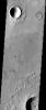
-
PIA04073:
-
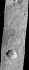
Impact crater
Full Resolution:
TIFF
(3.065 MB)
JPEG
(526.7 kB)
|
|
|
2002-12-20 |
Mars
|
2001 Mars Odyssey
|
THEMIS
|
1082x1503x1 |
|
-
PIA04076:
-
Hecates Tholus
Full Resolution:
TIFF
(1.571 MB)
JPEG
(311.2 kB)
|
|
|
2003-01-09 |
Mars
|
2001 Mars Odyssey
|
THEMIS
|
1213x3025x1 |
|
-
PIA04080:
-
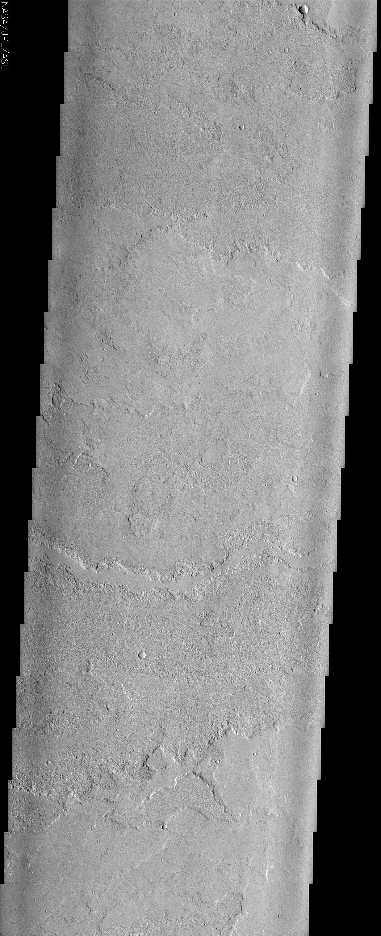
Resurfaced Mars
Full Resolution:
TIFF
(2.852 MB)
JPEG
(461.8 kB)
|
|
|
2003-01-15 |
Mars
|
2001 Mars Odyssey
|
THEMIS
|
1228x3025x1 |
|
-
PIA04086:
-
Impact Crater
Full Resolution:
TIFF
(2.761 MB)
JPEG
(414.7 kB)
|
|
|
2003-01-15 |
Mars
|
2001 Mars Odyssey
|
THEMIS
|
1199x3061x1 |

|
-
PIA04087:
-
Southern Sand Dunes
Full Resolution:
TIFF
(3.494 MB)
JPEG
(857.6 kB)
|
|
|
2003-01-22 |
Mars
|
2001 Mars Odyssey
|
THEMIS
|
1203x3007x1 |
|
-
PIA04091:
-
Erosion Effects
Full Resolution:
TIFF
(3.203 MB)
JPEG
(597 kB)
|
|
|
2003-01-28 |
Mars
|
2001 Mars Odyssey
|
|
1196x3007x1 |
|
-
PIA04094:
-
Elysium Planitia
Full Resolution:
TIFF
(3.128 MB)
JPEG
(545.5 kB)
|
|
|
2003-02-10 |
Mars
|
2001 Mars Odyssey
|
THEMIS
|
1229x2989x1 |
|
-
PIA04403:
-
Arabia Terra
Full Resolution:
TIFF
(3.179 MB)
JPEG
(444.3 kB)
|
|
|
2003-02-12 |
Mars
|
2001 Mars Odyssey
|
THEMIS
|
1194x2827x1 |
|
-
PIA04405:
-
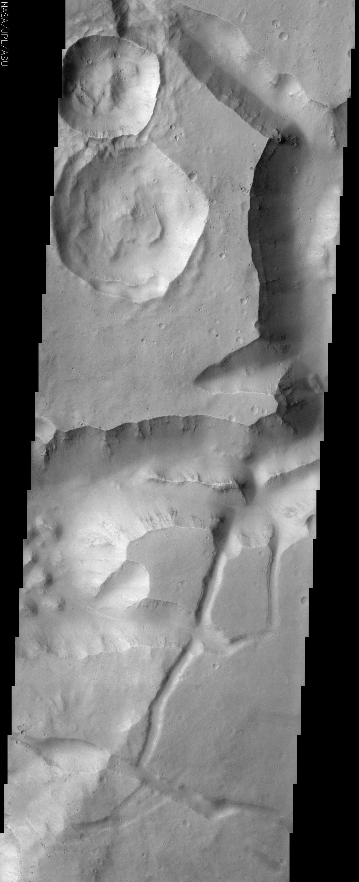
A Tale of Two Craters
Full Resolution:
TIFF
(3.065 MB)
JPEG
(635.5 kB)
|
|
|
2003-02-14 |
Mars
|
2001 Mars Odyssey
|
THEMIS
|
1215x3025x1 |
|
-
PIA04407:
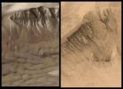
-
Layered Deposits in Terby Crater
Full Resolution:
TIFF
(3.68 MB)
JPEG
(913.7 kB)
|
|
|
2003-02-18 |
Mars
|
2001 Mars Odyssey
|
THEMIS
|
1222x3133x1 |

|
-
PIA04410:
-
Crater Wall and Floor
Full Resolution:
TIFF
(3.199 MB)
JPEG
(468.1 kB)
|
|
|
2003-02-26 |
Mars
|
2001 Mars Odyssey
|
THEMIS
|
1196x3007x1 |
|
-
PIA04431:
-
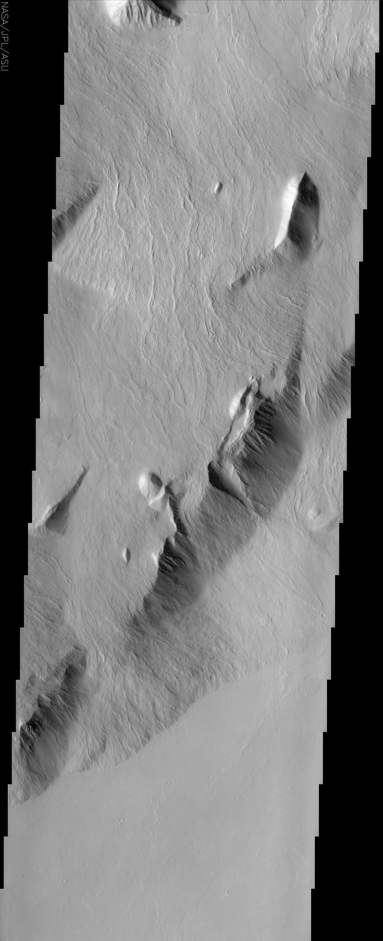
Lycus Sulci
Full Resolution:
TIFF
(3.601 MB)
JPEG
(1.021 MB)
|
|
|
2003-03-06 |
Mars
|
2001 Mars Odyssey
|
THEMIS
|
1227x3025x1 |
|
-
PIA04436:
-
Crater Chains
Full Resolution:
TIFF
(3.097 MB)
JPEG
(464.6 kB)
|
|
|
2003-03-06 |
Earth
|
Shuttle Radar Topography Mission (SRTM)
|
C-Band Interferometric Radar
|
9600x7240x3 |
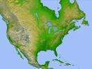
|
-
PIA03377:
-
Shaded Relief with Height as Color, North America
Full Resolution:
TIFF
(130.7 MB)
JPEG
(56.09 MB)
|
|
|
2003-03-06 |
Earth
|
Shuttle Radar Topography Mission (SRTM)
|
C-Band Interferometric Radar
|
9600x7240x3 |
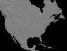
|
-
PIA03378:
-
Anaglyph, North America
Full Resolution:
TIFF
(94.73 MB)
JPEG
(9.055 MB)
|
|
|
2003-03-06 |
Earth
|
Shuttle Radar Topography Mission (SRTM)
|
C-Band Interferometric Radar
|
18001x11438x3 |
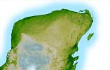
|
-
PIA03379:
-
Shaded Relief with Height as Color, Yucatan Peninsula, Mexico
Full Resolution:
TIFF
(395.4 MB)
JPEG
(50.01 MB)
|


