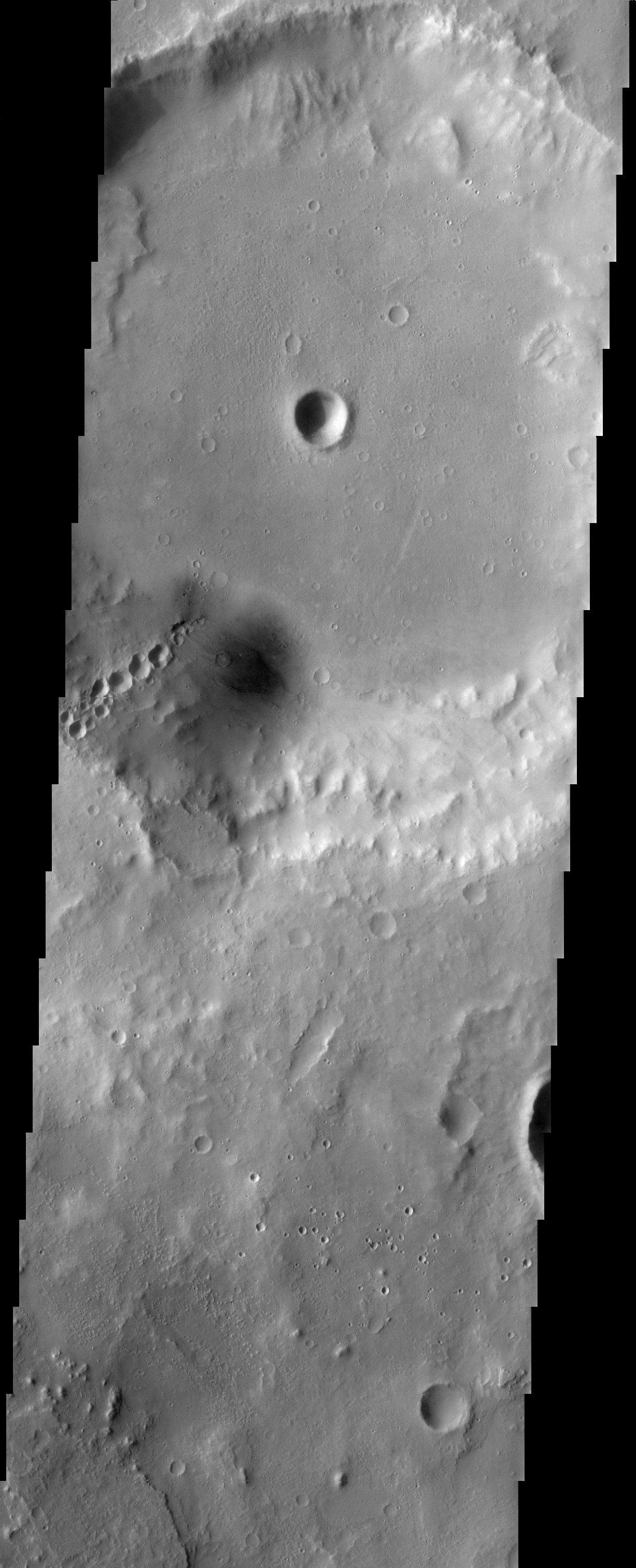
The large crater at the top of this THEMIS visible image has several other craters inside of it. Most noticeable are the craters that form a "chain" on the southern wall of the large crater. These craters are a wonderful example of secondary impacts. They were formed when large blocks of ejecta from an impact crashed back down onto the surface of Mars. Secondaries often form radial patterns around the impact crater that generated them, allowing researchers to trace them back to their origin.
Note: this THEMIS visual image has not been radiometrically nor geometrically calibrated for this preliminary release. An empirical correction has been performed to remove instrumental effects. A linear shift has been applied in the cross-track and down-track direction to approximate spacecraft and planetary motion. Fully calibrated and geometrically projected images will be released through the Planetary Data System in accordance with Project policies at a later time.
NASA's Jet Propulsion Laboratory manages the 2001 Mars Odyssey mission for NASA's Office of Space Science, Washington, D.C. The Thermal Emission Imaging System (THEMIS) was developed by Arizona State University, Tempe, in collaboration with Raytheon Santa Barbara Remote Sensing. The THEMIS investigation is led by Dr. Philip Christensen at Arizona State University. Lockheed Martin Astronautics, Denver, is the prime contractor for the Odyssey project, and developed and built the orbiter. Mission operations are conducted jointly from Lockheed Martin and from JPL, a division of the California Institute of Technology in Pasadena.
Image information: VIS instrument. Latitude 19.3, Longitude 347.5 East (12.5 West). 19 meter/pixel resolution.
