|
Your search criteria found 3151 images Feature Name |
| My List |
Addition Date | Target | Mission |
Instrument
|
Size |

|
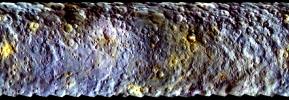
2014-11-17 | Vesta |
Dawn |
3075x1545x3 | |

|
|||||
|
|
2014-11-17 | Vesta |
Dawn |
1290x2250x1 | |
|
|||||
|
|
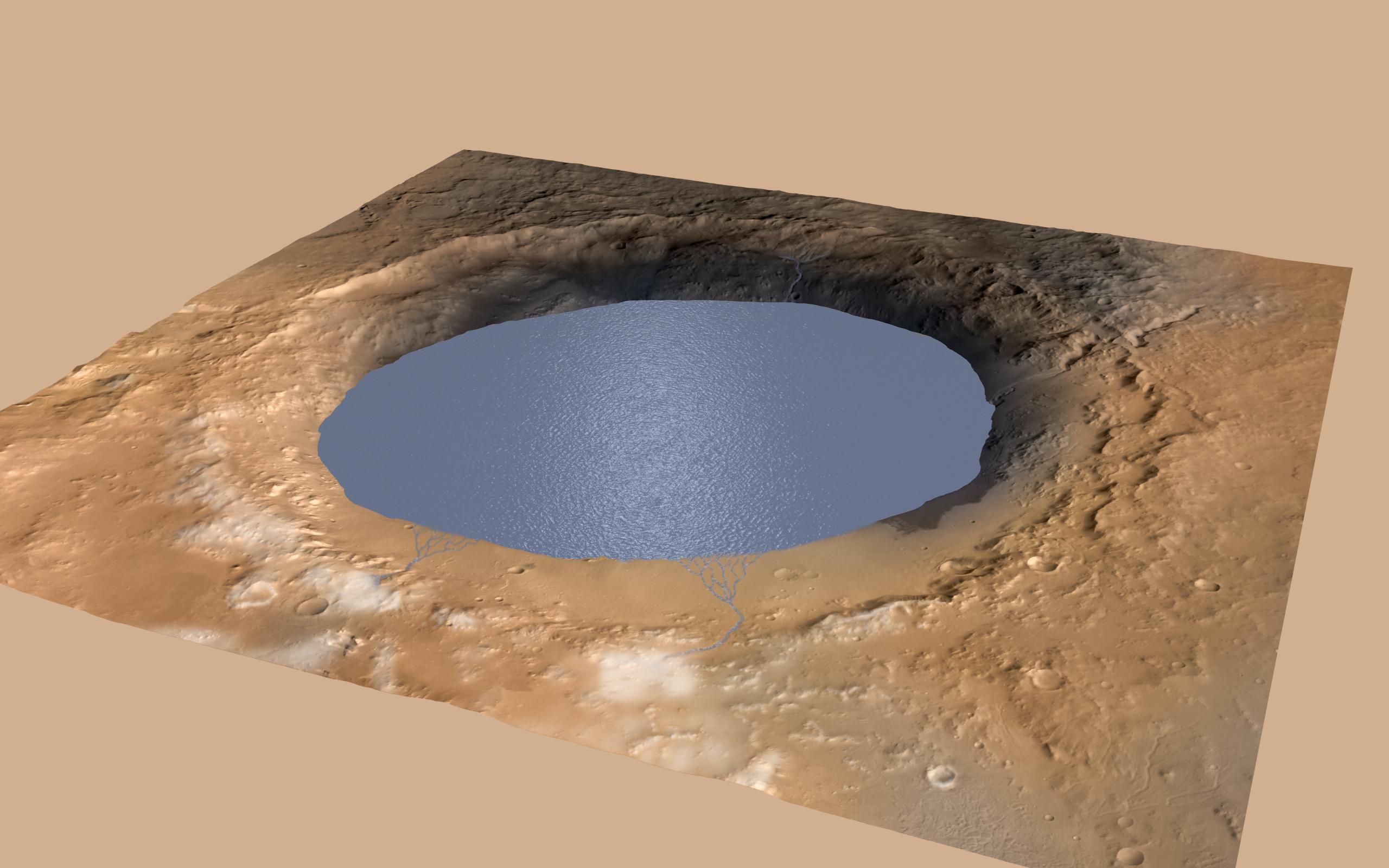
2014-12-08 | Mars |
Mars Science Laboratory (MSL) |
2560x1600x3 | |
|
|||||
|
|
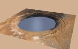
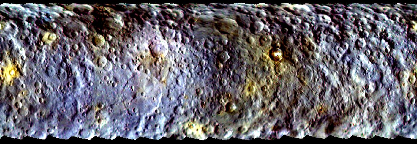
2015-04-13 | Ceres |
Dawn |
1377x476x3 | |
|
|||||
|
|
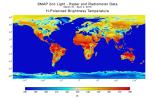
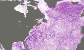
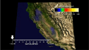
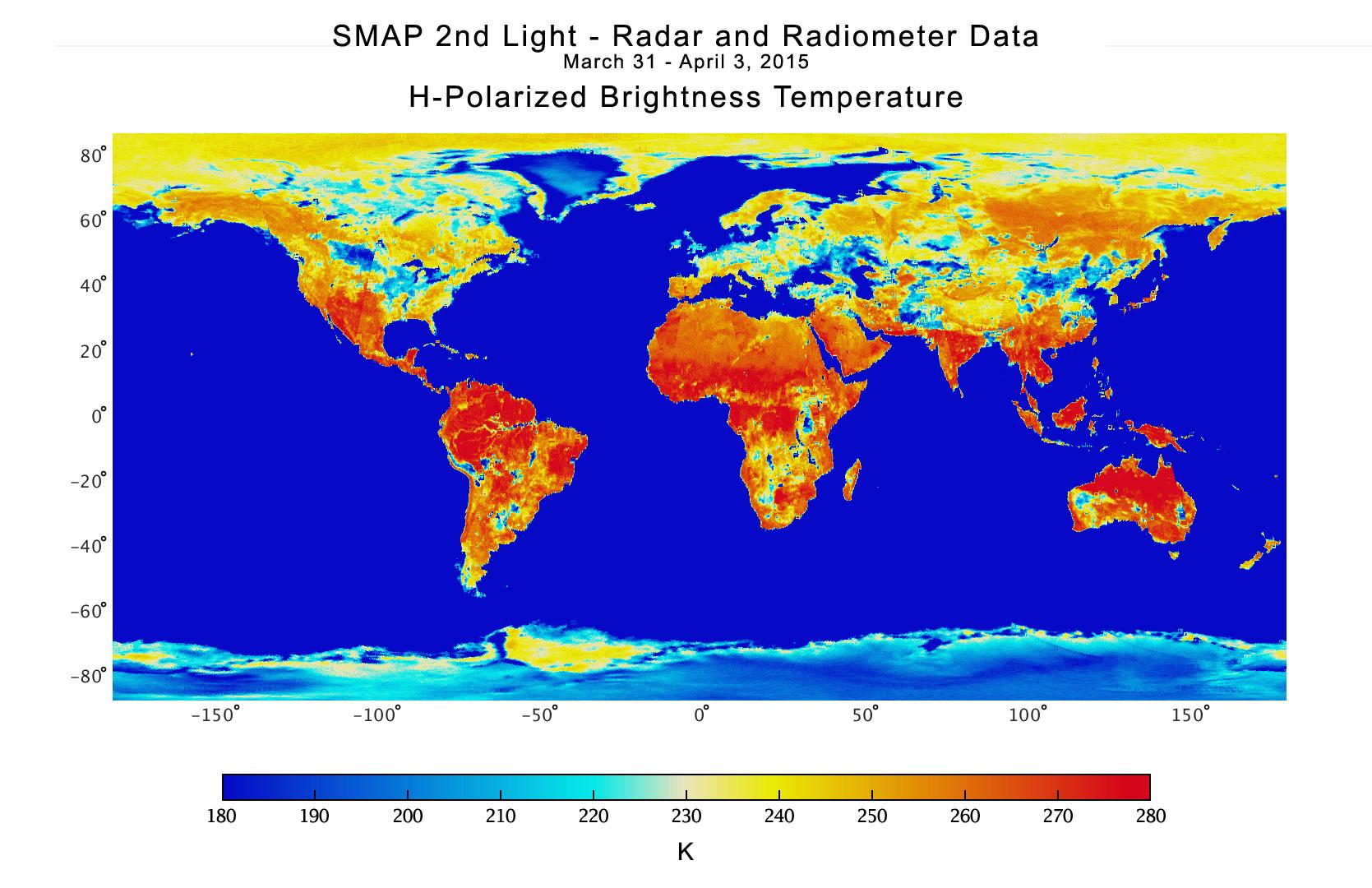
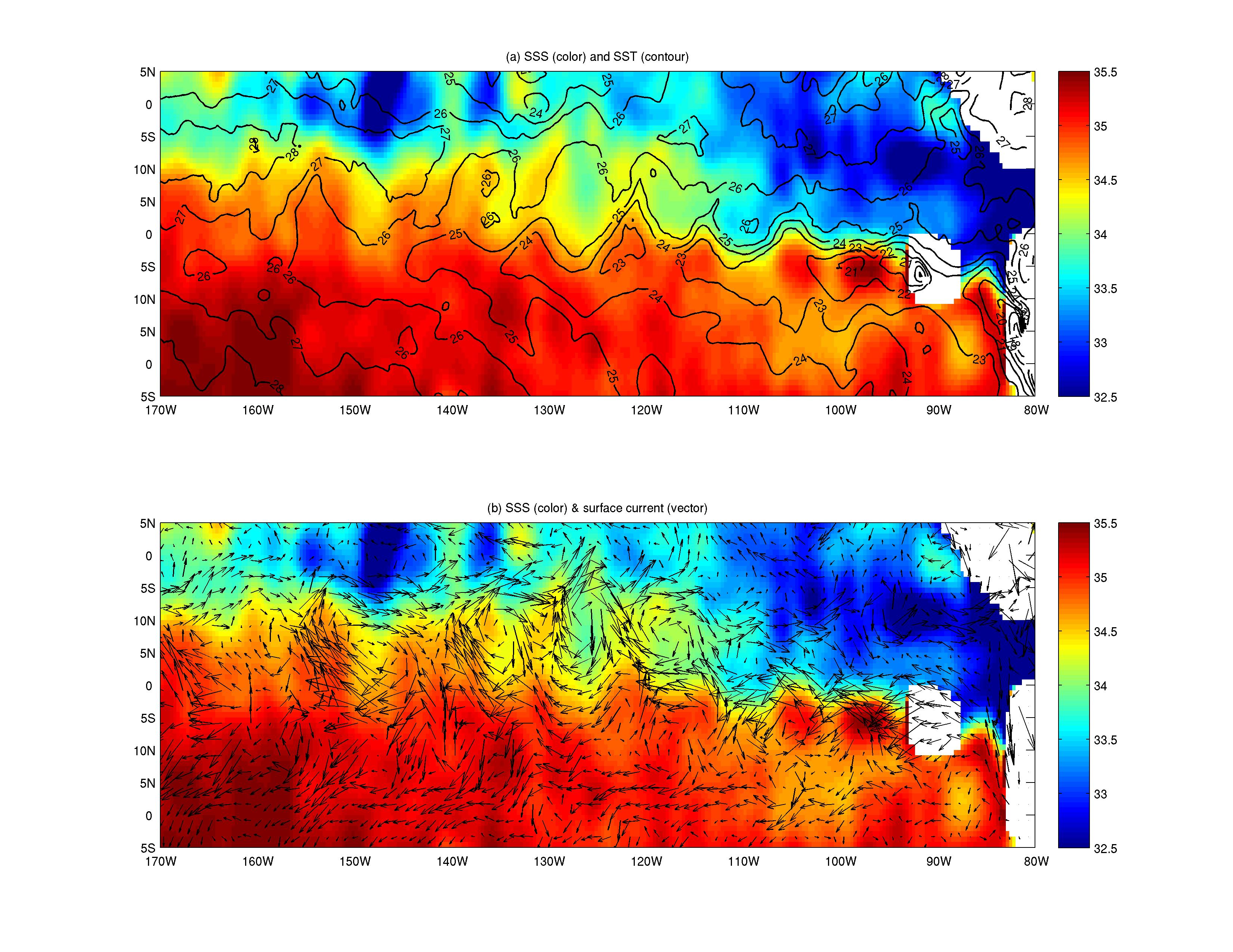
2015-04-21 | Earth |
SMAP |
1669x1080x3 | |
|
|||||
|
|
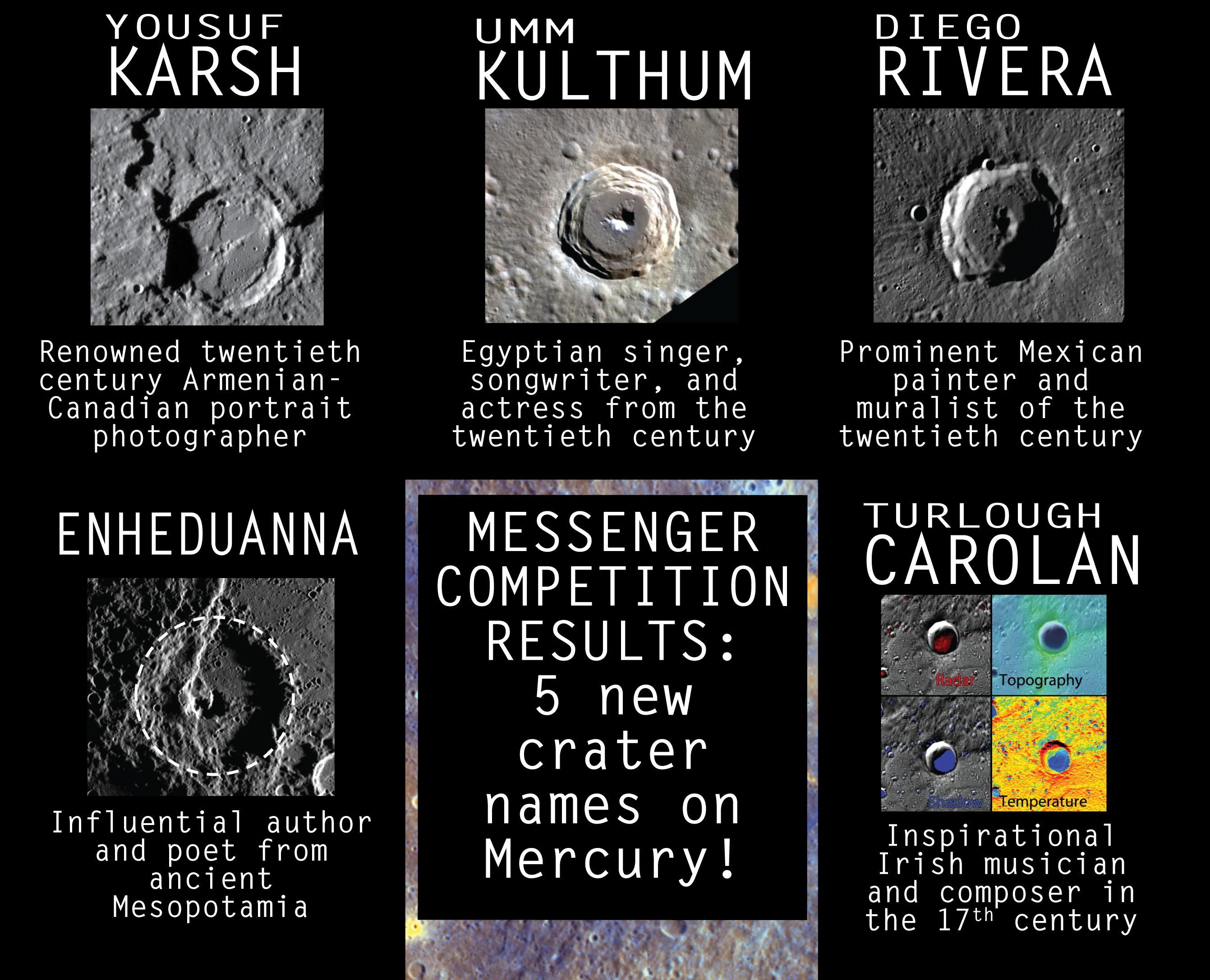
2015-04-29 | Mercury |
MESSENGER |
2683x2175x3 | |

|
|||||
|
|
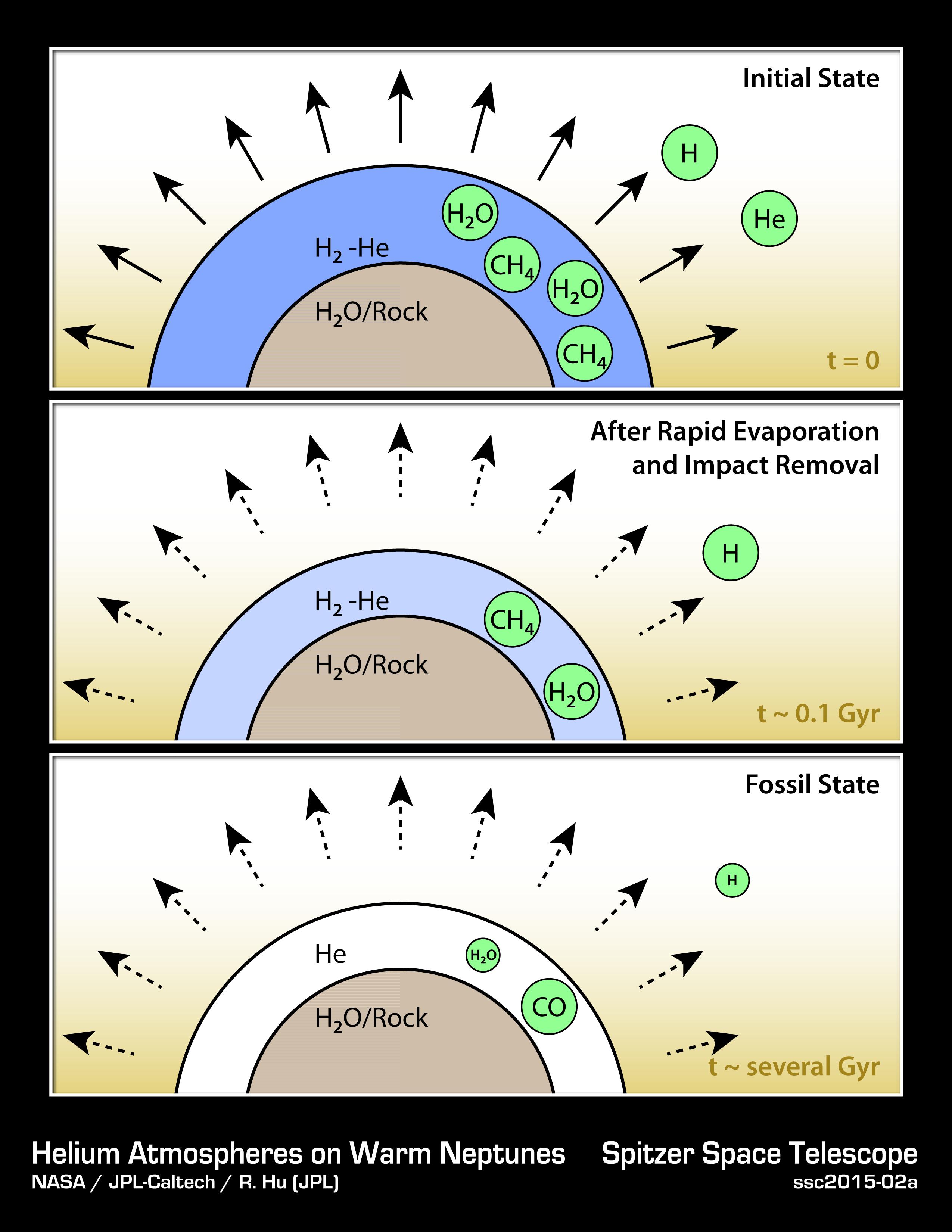
2015-06-11 |
Spitzer Space Telescope |
2550x3300x3 | ||
|
|||||
|
|
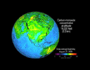
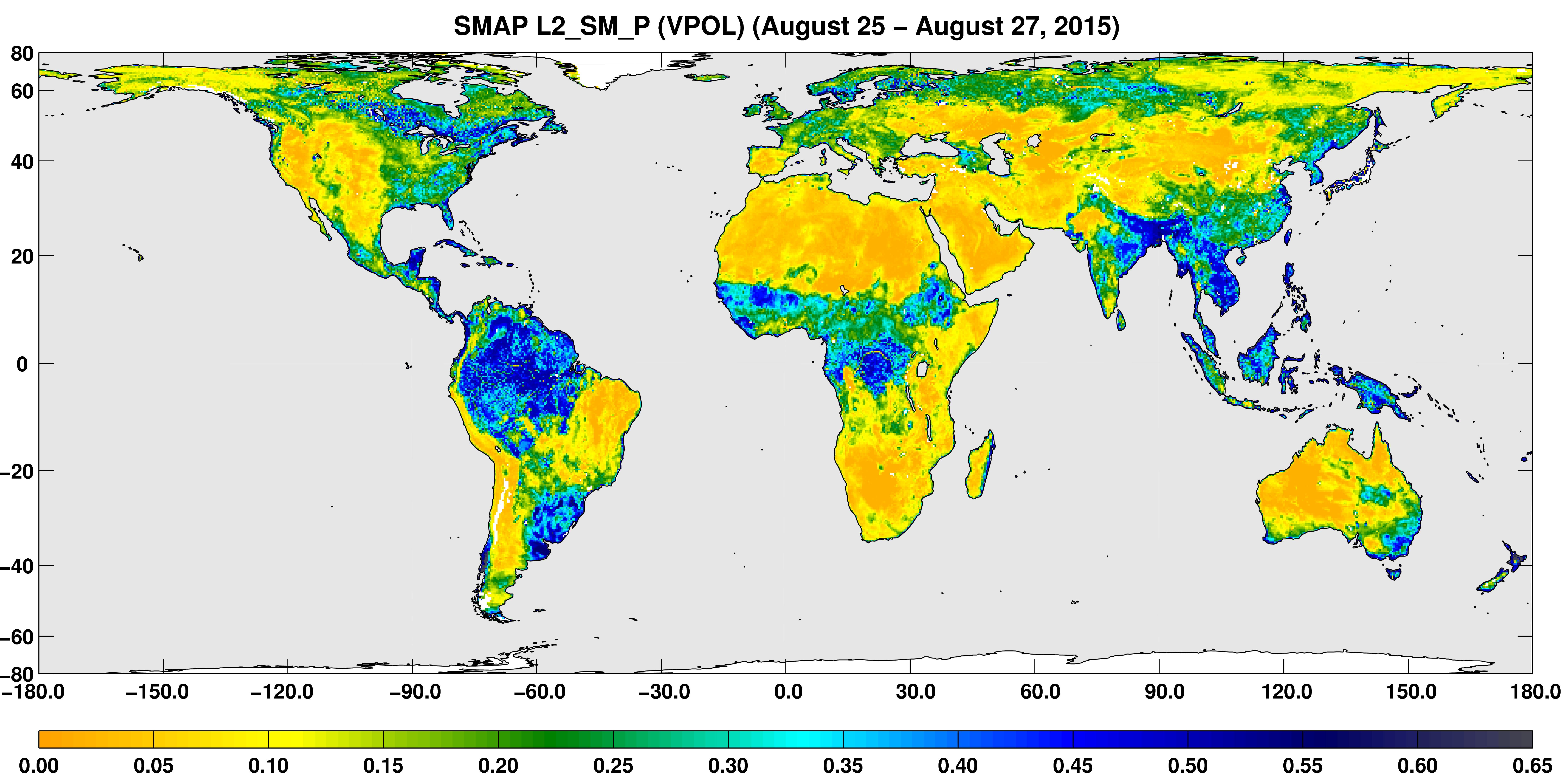
2015-09-02 | Earth |
SMAP |
7592x3775x3 | |
|
|||||
|
|
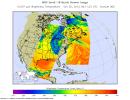
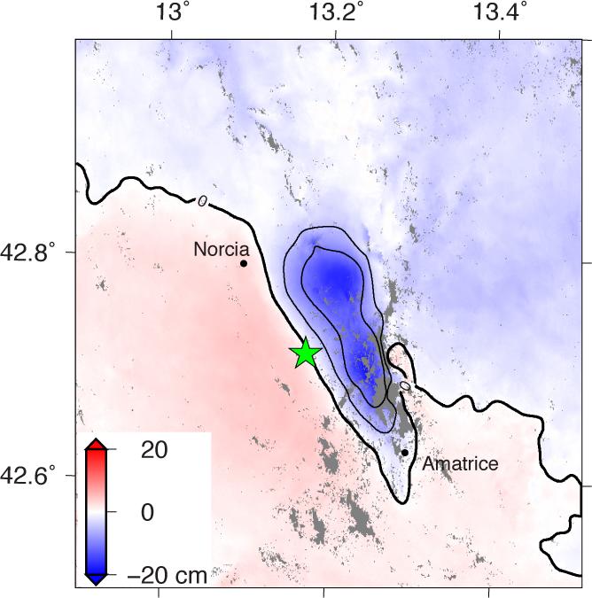
2015-10-08 | Earth |
SMAP |
1093x1153x3 | |
|
|||||
|
|
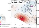
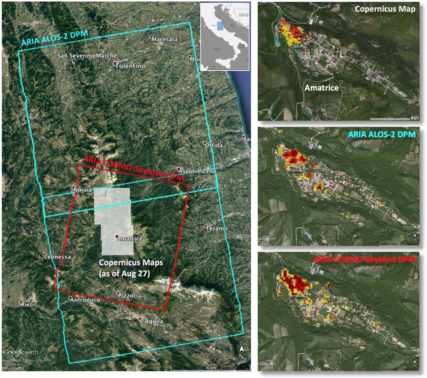
2016-08-31 | Earth |
ARIA |
668x675x3 | |
|
|||||
|
|
2016-09-01 | Earth |
ARIA |
1390x1231x3 | |

|
|||||
|
|
2016-10-05 | Earth |
ARIA |
1313x1164x3 | |
|
|||||
|
|
2016-11-16 | Earth |
ARIA |
1119x1289x3 | |

|
|||||
|
|
2016-12-13 | Mars |
Mars Science Laboratory (MSL) |
1920x1080x3 | |

|
|||||
|
|
2017-06-30 | Asteroid |
Catalina Sky Survey (CSS) |
714x679x3 | |
|
|||||
|
|
2017-07-20 | Mars |
Hubble Space Telescope |
3000x2400x3 | |

|
|||||
|
|
2017-09-20 | Earth |
ARIA |
1860x1896x3 | |
|
|||||
|
|
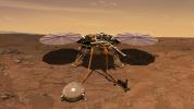
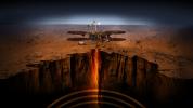
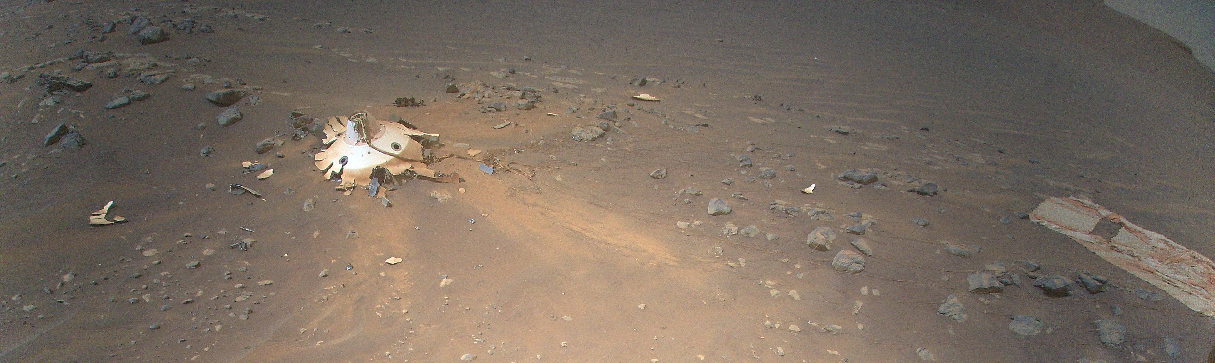
2018-01-25 |
InSight |
4527x6036x3 | ||
|
|||||
|
|
2018-01-25 |
InSight |
7680x4320x3 | ||
|
|||||
|
|
2018-01-25 |
InSight |
1920x1080x3 | ||

|
|||||
|
|
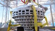
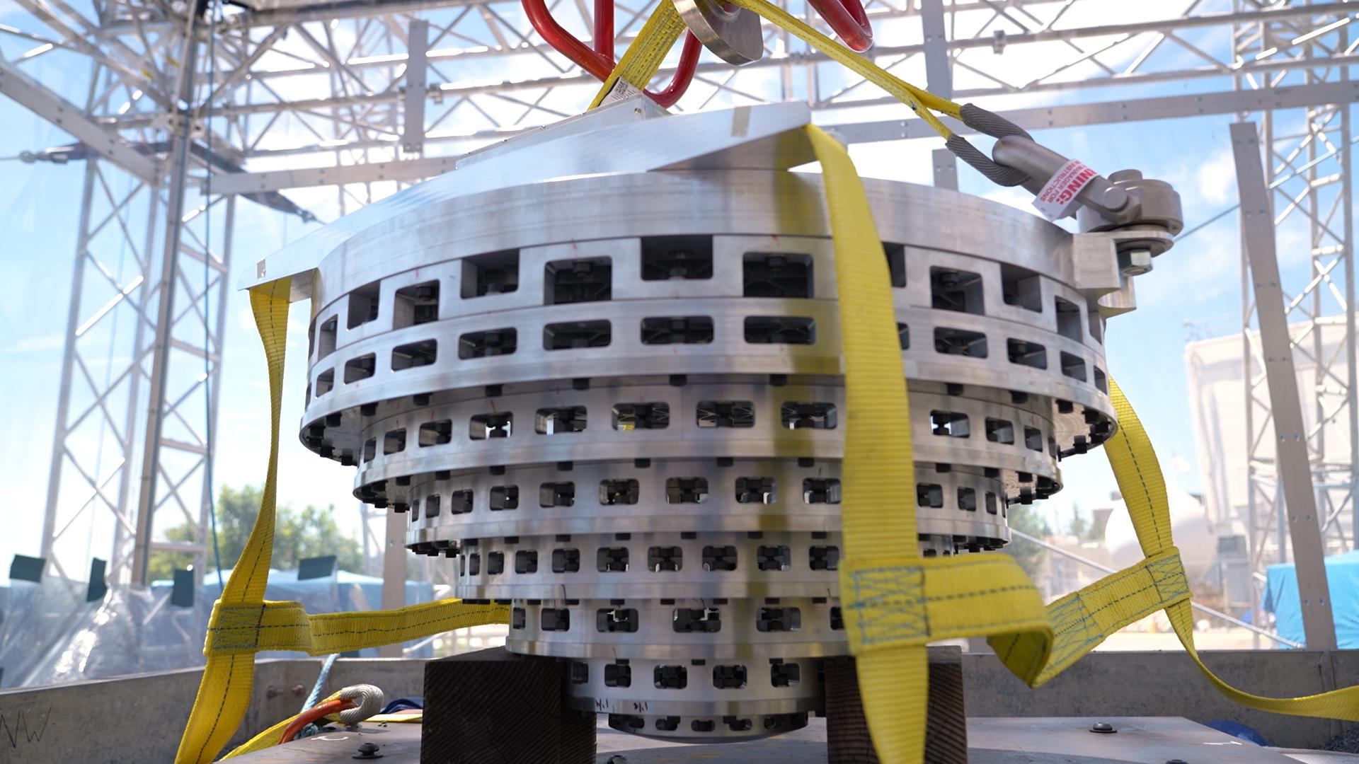
2018-02-13 |
Mars 2020 Rover |
4928x3264x3 | ||
|
|||||
|
|
2018-02-13 |
Mars 2020 Rover |
4928x3264x3 | ||
|
|||||
|
|
2018-02-13 |
Mars 2020 Rover |
4928x3264x3 | ||
|
|||||
|
|
2018-02-21 | Earth | 3778x2234x3 | ||
|
|||||
|
|
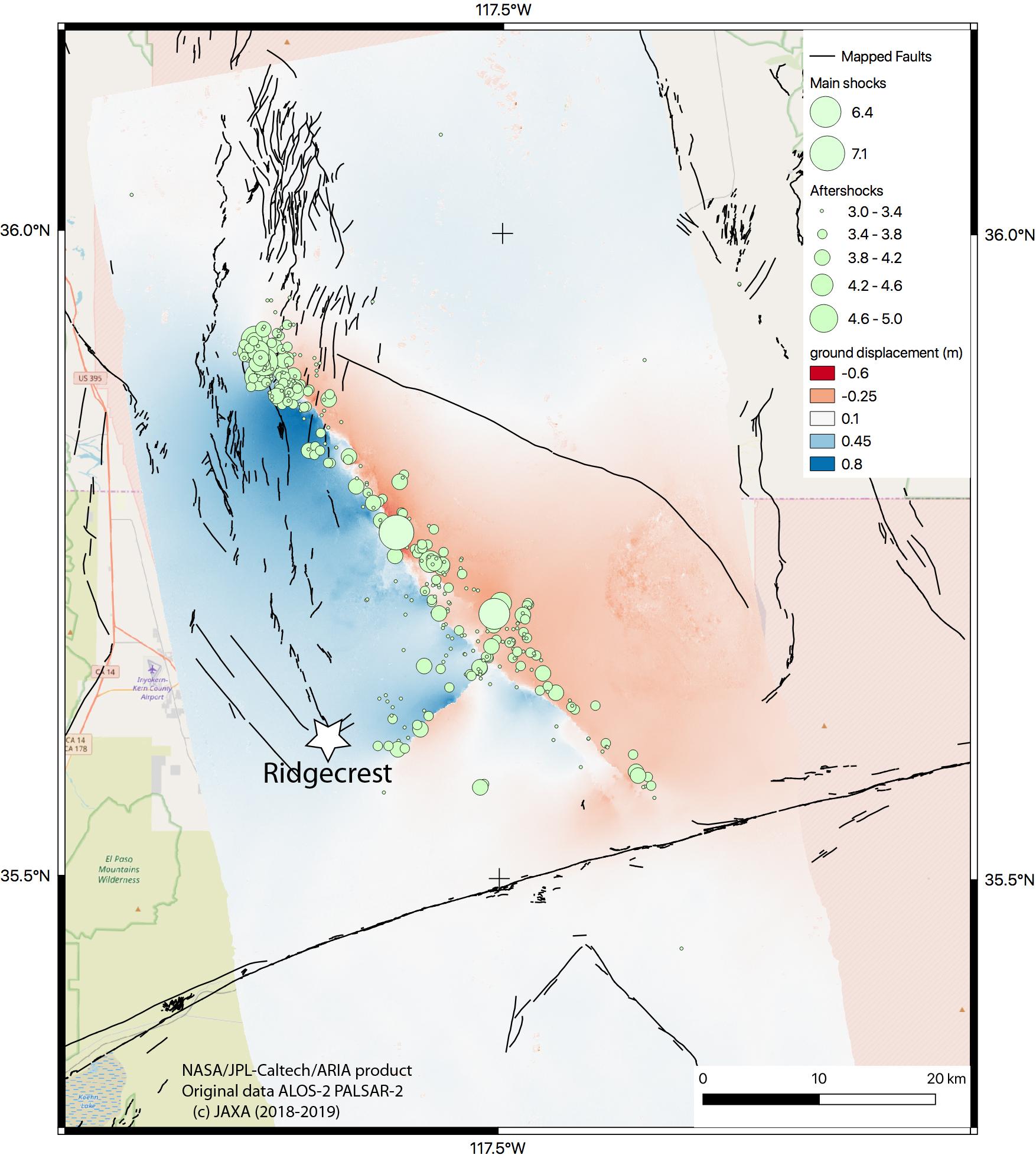
2018-02-22 | Earth |
ARIA |
2850x2116x3 | |
|
|||||
|
|
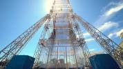
2018-10-30 |
InSight |
3840x2160x3 | ||
|
|||||
|
|
2019-07-11 | Earth |
ARIA |
1754x1959x3 | |
|
|||||
|
|
2019-11-05 | Earth |
ECOSTRESS |
720x715x3 | |
|
|||||
|
|
2020-06-17 |
Mars 2020 Project |
4159x3327x3 | ||

|
|||||
|
|
2020-06-17 |
Mars 2020 Project |
5681x3787x3 | ||

|
|||||
|
|
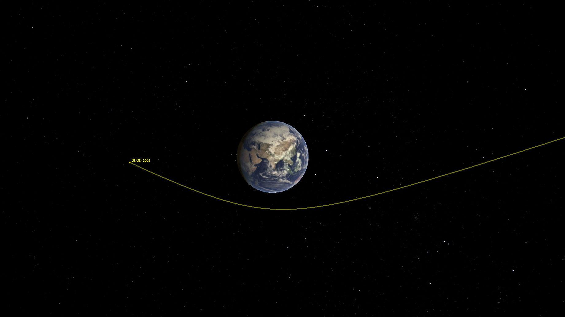
2020-08-18 | Asteroid | 1841x1033x3 | ||
|
|||||
|
|
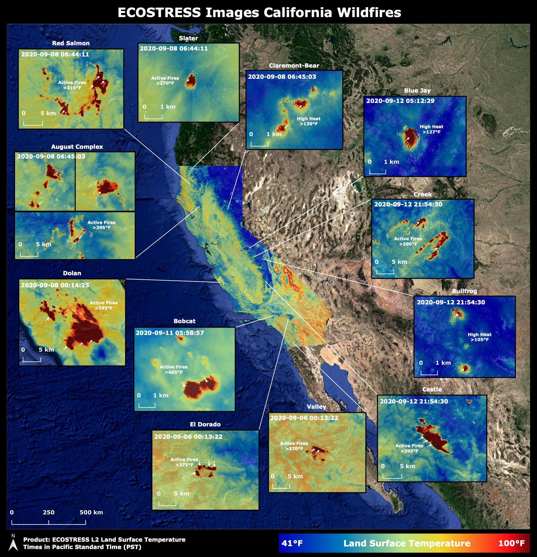
2020-10-02 | Earth |
ECOSTRESS |
1825x1894x3 | |

|
|||||
|
|
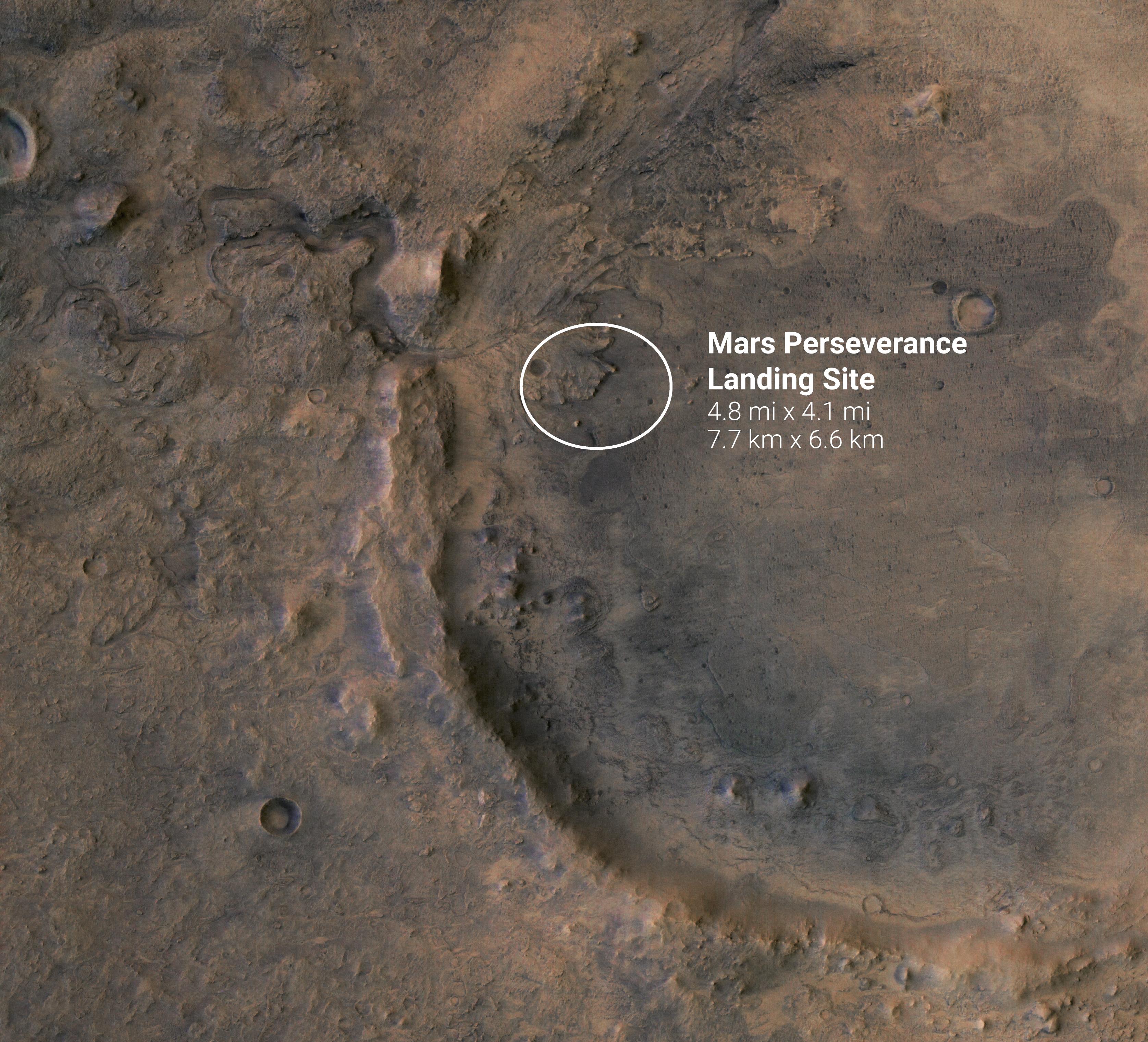
2021-01-08 |
Mars 2020 Rover |
3351x3042x3 | ||
|
|||||
|
|
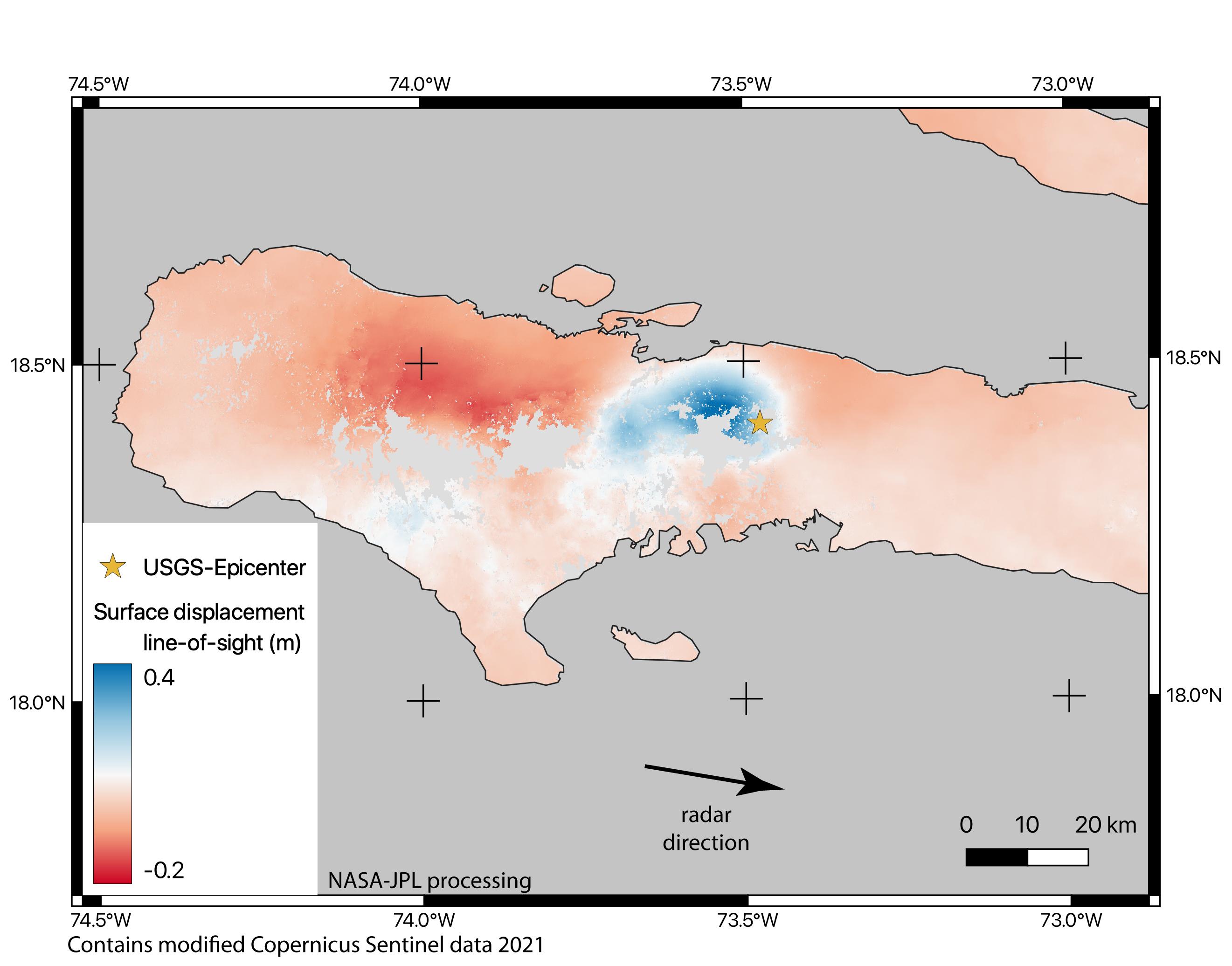
2021-08-17 | Earth |
ARIA |
2642x2072x3 | |
|
|||||
|
|
2021-10-07 | Earth |
ECOSTRESS |
3507x2480x3 | |
|
|||||
|
|
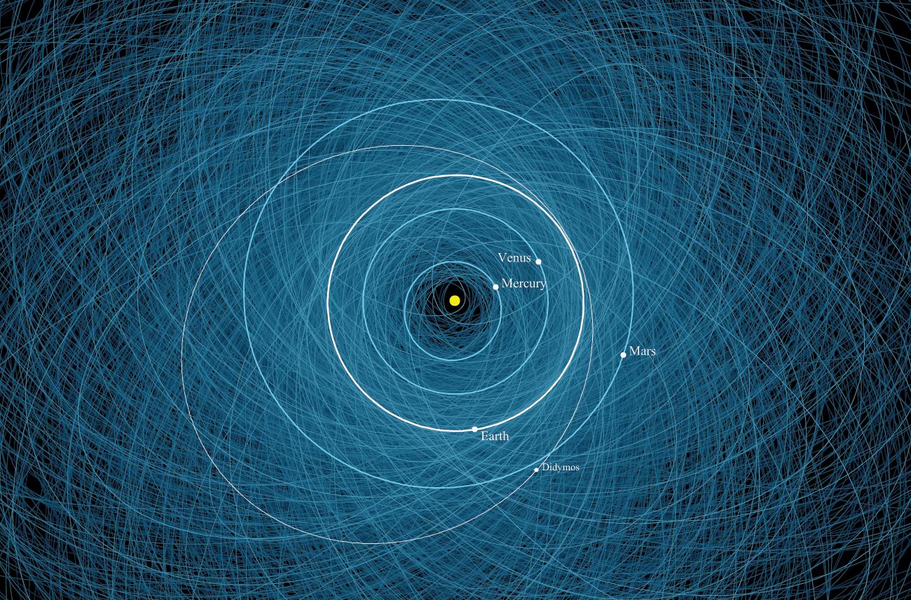
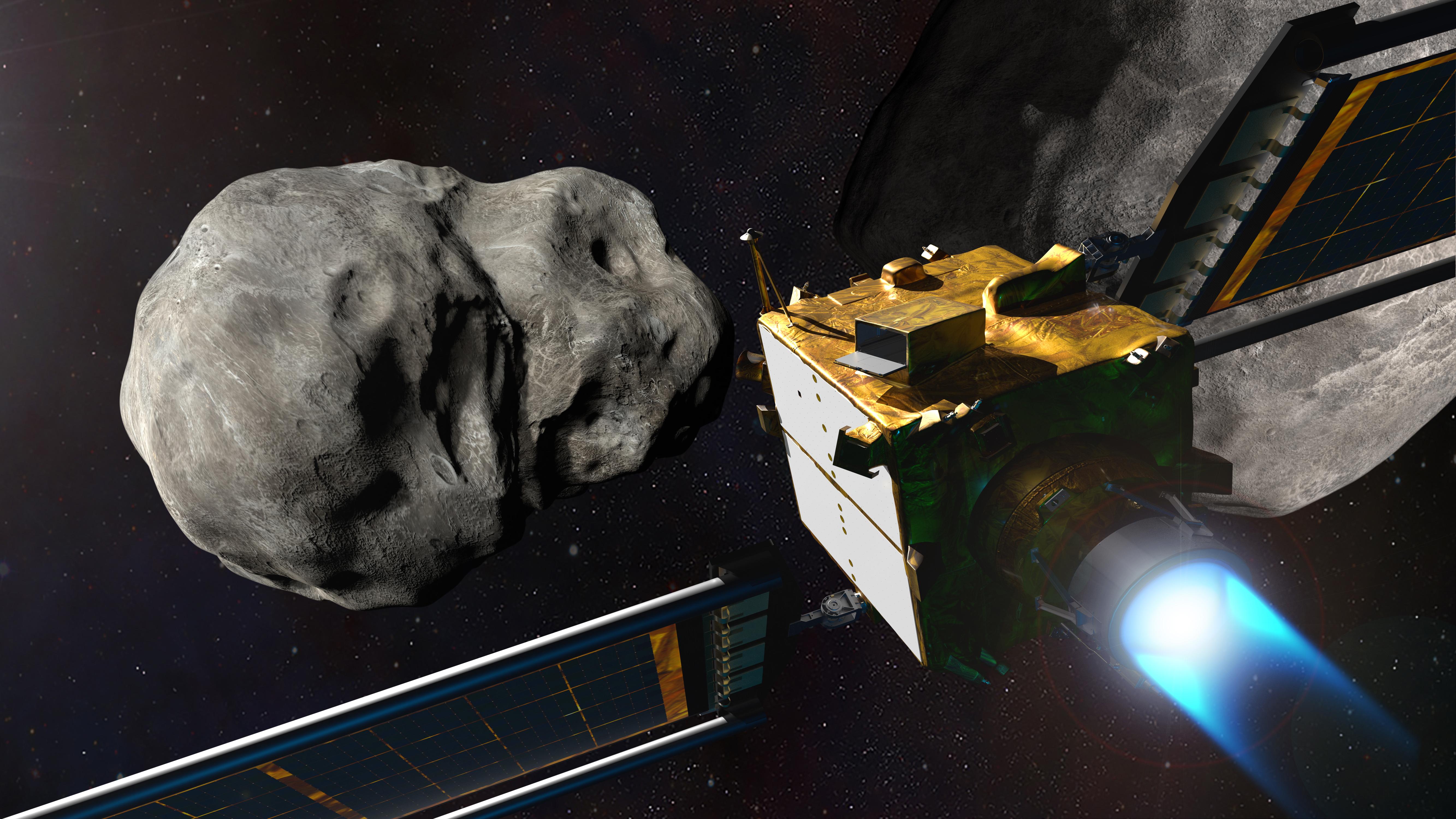
2021-11-17 | Asteroid |
Double Asteroid Redirect Test (DART) |
1300x856x3 | |
|
|||||
|
|
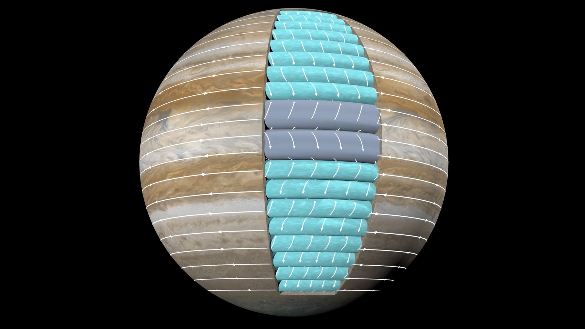
2022-01-20 | Jupiter |
Juno |
1920x1080x3 | |
|
|||||
|
|
2022-03-15 | Asteroid | 1440x830x3 | ||
|
|||||
|
|
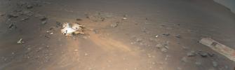
2022-04-27 | Mars |
Mars Helicopter |
3884x1161x3 | |
|
|||||
|
|
2022-08-04 | Earth |
ECOSTRESS |
3507x2480x3 | |
|
|||||
|
|
2022-09-22 | Asteroid |
Double Asteroid Redirection Test (DART) |
5333x3000x3 | |

|
|||||
|
|
2022-10-20 |
Simplified High Impact Energy Landing Device (SHIELD) |
1920x1080x3 | ||
|
|||||
|
|
2022-10-20 |
Simplified High Impact Energy Landing Device (SHIELD) |
1920x1080x3 | ||
|
|||||
|
|
2022-10-27 | Mars |
InSight |
976x942x3 | |

|
|||||
|
|
2022-11-14 | Earth |
Surface Water and Ocean Topography (SWOT) |
1920x1080x3 | |
|
|||||
|
|
2023-06-27 | Earth |
Surface Water and Ocean Topography (SWOT) |
1125x1122x3 | |
|
|||||
|
|
2023-08-14 | Earth |
Polar Radiant Energy in the Far-InfraRed Experiment (PREFIRE) |
1920x1080x3 | |
|
|||||
|
|
2023-10-18 | Earth |
Sentinel-6/Jason-CS |
1586x783x3 | |
|
|||||
|
|
2023-10-26 | Mars | 2221x1288x3 | ||
|
|||||
|
|
2023-10-26 | Mars | 2852x1169x3 | ||
|
|||||
|
|
2024-01-17 | Earth |
Landsat |
1440x960x3 | |
|
|||||
|
|
2024-01-17 | Earth |
Landsat |
1440x1100x3 | |
|
|||||
|
|
2024-03-04 | Europa |
Juno |
3840x4883x3 | |

|
|||||
|
|
2024-03-29 | Mars |
Mars Helicopter |
628x469x3 | |
|
|||||
|
|
2024-03-29 | Mars |
Mars Helicopter |
4000x2250x3 | |
|
|||||
|
|
1998-06-03 | Moon |
Lunar Orbiter |
610 Millimeter Lunar Orbiter Camera |
2000x1100x1 |
|
|||||
|
|
2005-09-07 | Ceres |
Hubble Space Telescope |
Advanced Camera for Surveys |
250x250x3 |
|
|||||
|
|
2002-09-17 | Earth |
Terra |
ASTER |
1192x998x3 |
|
|||||
|
|
2008-02-19 | Earth |
Terra |
ASTER |
1607x1480x3 |
|
|||||
|
|
2008-02-29 | Earth |
Terra |
ASTER |
1666x1772x3 |
|
|||||
|
|
2008-06-30 | Earth |
Terra |
ASTER |
3858x2484x3 |
|
|||||
|
|
2012-04-30 | Earth |
Terra |
ASTER |
4000x2400x3 |
|
|||||
|
|
2012-08-25 | Earth |
Terra |
ASTER |
2620x1850x3 |

|
|||||
|
|
2013-01-29 | Earth |
Terra |
ASTER |
4284x8520x3 |
|
|||||
|
|
2015-06-17 | Earth |
Terra |
ASTER |
535x365x3 |
|
|||||
|
|
2016-01-20 | Earth |
Terra |
ASTER |
2532x2544x3 |

|
|||||
|
|
2016-07-01 | Earth |
Terra |
ASTER |
2200x2076x3 |
|
|||||
|
|
2017-10-23 | Earth |
Terra |
ASTER |
4098x4175x3 |
|
|||||
|
|
2018-07-28 | Earth |
Terra |
ASTER |
1280x720x3 |
|
|||||
|
|
2019-03-28 | Earth |
Terra |
ASTER |
3202x3673x3 |
|
|||||
|
|
2020-04-10 | Earth |
Terra |
ASTER |
600x600x3 |
|
|||||
|
|
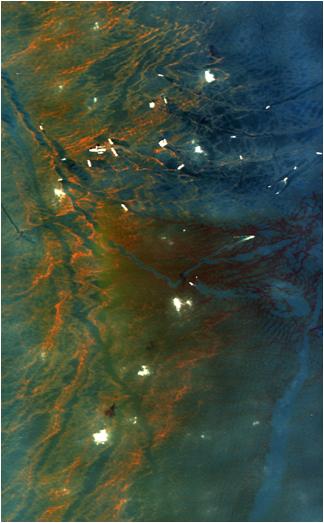
2010-05-27 | Earth |
AVIRIS |
324x523x3 | |

|
|||||
|
|
2016-06-27 | Earth |
Earth Observing System (EOS) |
AVIRIS |
1019x1278x3 |
|
|||||
|
|
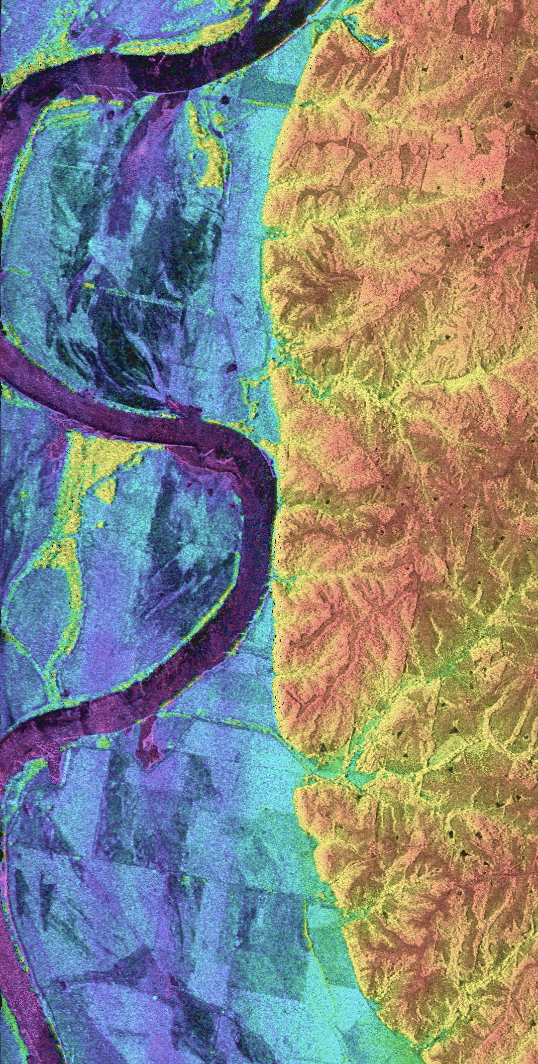
1999-04-15 | Earth |
Airborne Synthetic Aperture Radar (AIRSAR) |
AirSAR |
1081x2137x3 |

|
|||||
|
|
2004-03-13 | Mars |
Mars Exploration Rover (MER) |
Alpha Particle X-ray Spectrometer Microscopic Imager Moessbauer Spectrometer |
2048x2048x1 |
|
|||||
|
|
1998-04-02 | Earth |
TOPEX/Poseidon |
Altimeter |
2550x2545x3 |
|
|||||
|
|
1998-07-03 | Earth |
TOPEX/Poseidon |
Altimeter |
901x900x3 |
|
|||||
|
|
1998-11-04 | Earth |
TOPEX/Poseidon |
Altimeter |
1912x1908x3 |
|
|||||
|
|
1998-07-03 | Earth |
TOPEX/Poseidon |
Altimeter |
923x900x3 |
|
|||||
|
|
1998-07-03 | Earth |
TOPEX/Poseidon |
Altimeter |
900x900x3 |
|
|||||
|
|
1998-07-21 | Earth |
TOPEX/Poseidon |
Altimeter |
902x900x3 |
|
|||||
|
|
1998-09-26 | Earth |
TOPEX/Poseidon |
Altimeter |
900x900x3 |
|
|||||
|
|
1999-08-23 | Earth |
TOPEX/Poseidon |
Altimeter |
902x900x3 |
|
|||||
|
|
1999-11-18 | Earth |
TOPEX/Poseidon |
Altimeter |
902x900x3 |
|
|||||
|
|
2000-05-07 | Earth |
TOPEX/Poseidon |
Altimeter |
900x900x3 |
|
|||||
|
|
2008-04-22 | Earth |
Jason-1 |
Altimeter |
900x900x3 |
|
|||||
|
|
2008-07-31 | Earth |
Jason-1 |
Altimeter |
919x699x3 |
|
|||||
|
|
2008-12-13 | Earth |
Jason-1 |
Altimeter |
900x900x3 |
|
|||||
|
|
2010-03-16 | Earth |
OSTM/Jason-2 |
Altimeter |
900x900x3 |
|
|||||
|
|
2012-06-12 | Earth |
Aquarius |
Aquarius |
3300x2550x3 |
|
|||||
|
|
2013-11-11 |
Spitzer Space Telescope |
ALMA IRAC |
1500x1500x3 | |
|
|||||
|
|
2018-11-12 | Sol (our sun) |
SDO |
Atmosphere Imaging Assembly |
1445x1445x3 |
|
|||||
|
|
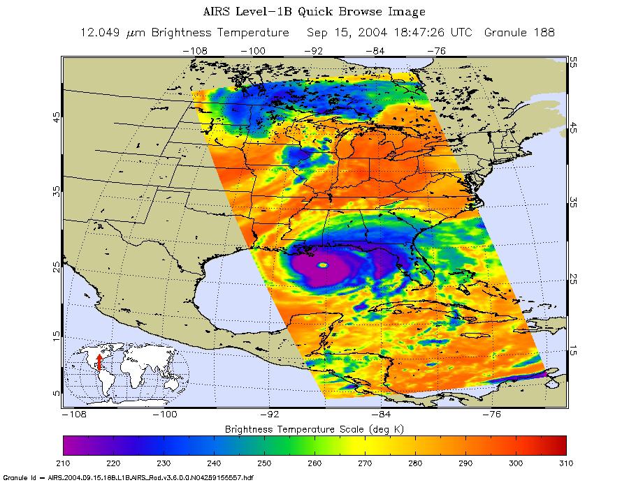
2004-09-15 | Earth |
Aqua |
AIRS |
900x695x3 |
|
|||||
|
|
2008-07-22 | Earth |
Aqua |
AIRS |
1026x577x3 |
|
|||||
|
|
2009-09-04 | Earth |
Aqua |
AIRS |
640x500x3 |
|
|||||
|
|
2011-07-29 | Earth |
Aqua |
AIRS |
927x1000x3 |
|
|||||
|
|
2012-10-30 | Earth |
Aqua |
AIRS |
900x695x3 |
|
|||||
|
|
2015-05-07 | Earth |
Aqua |
AIRS |
737x467x3 |
|
|||||
|
|
2020-09-14 | Earth |
Aqua |
AIRS |
1600x900x3 |
|
|||||
|
|
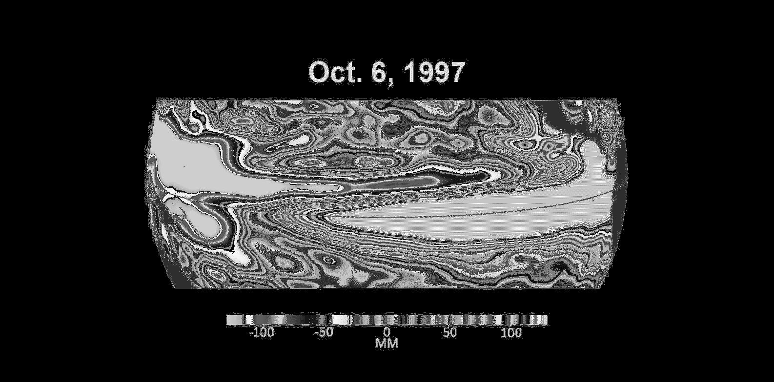
1997-08-15 | Mars |
Mars Pathfinder (MPF) |
Atmospheric Structure / Meteorology Instrument |
684x504x1 |

|
|||||

|
 |
 |
 |
|
|
|
|
|
|
|

|
| 1-100 | 101-200 | 201-300 | 301-400 | 401-500 | 501-600 | 601-700 | 701-800 | 801-900 | 901-1000 |
| Currently displaying images: 101 - 200 of 3151 |