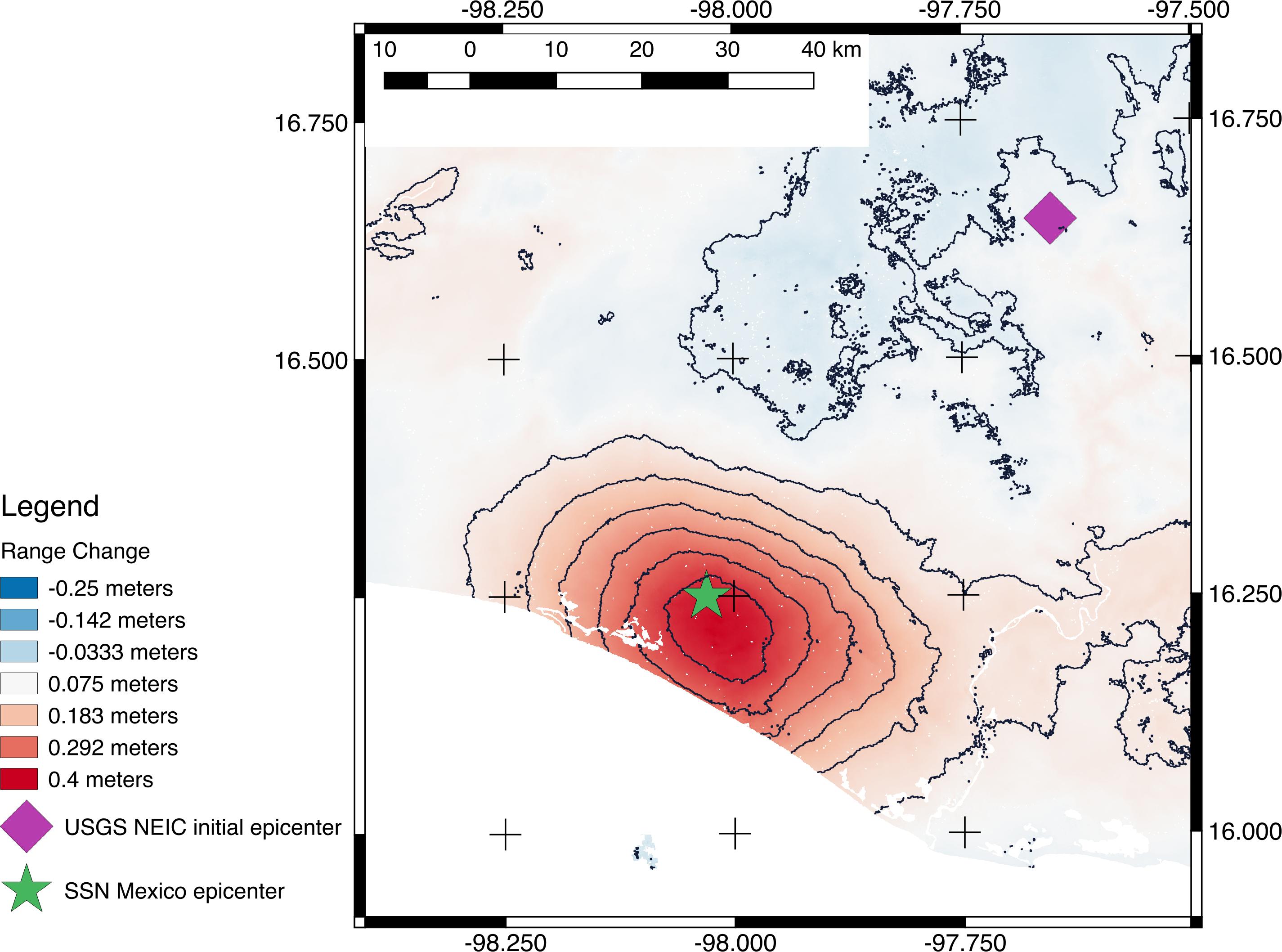
Scientists with the Advanced Rapid Imaging and Analysis project (ARIA), a collaboration between NASA's Jet Propulsion Laboratory in Pasadena, California, and Caltech, also in Pasadena, using synthetic aperture radar (SAR) data from the European Union's Copernicus Sentinel-1B satellite, operated by the European Space Agency, generated a map of the deformation of Earth's surface caused by the Feb. 16, 2018 magnitude 7.2 Pinotepa earthquake in Oaxaca, Mexico. The deformation map is produced from automated interferometric processing of the SAR data using the JPL ARIA data system in response to a signal received from the U.S. Geological Survey. The false-color map shows the amount of permanent surface movement that occurred almost entirely due to the quake, as viewed by the satellite, during a 12-day interval between two Sentinel-1 images acquired on Feb. 5 and Feb. 17, 2018.
The map shows that the location of the earthquake was close to the coast, far from the initial U.S. Geological Survey epicenter location. These data were used by USGS to revise their finite fault model, ShakeMap, and PAGER damage estimate products for the earthquake, important information used to assess the impact of earthquakes and to inform response efforts.
Through these maps, NASA and its partners are contributing important observations and expertise that can assist with response to earthquakes and other natural or human-produced hazards.
The Pinotepa quake was the largest in the area since a magnitude 8.2 earthquake in the Gulf of Tehuantepec in September 2017. The area struck by this event has a relatively sparse population, but some towns and small cities were affected. The earthquake was felt as far away as Mexico City.
From the pattern of deformation in the map, scientists have determined that the earthquake fault slip was on a subduction zone fault beneath the coast and caused as much as 13.8 inches (35 centimeters) of uplift of the ground surface. The map depicts motion towards the satellite (up and west) in the direction of the radar's line-of-sight, with contours every 2 inches (5 centimeters). Symbols show preliminary USGS (purple diamond) and Mexican seismic network (SSN; green star) estimated locations of the earthquake's epicenter.
Contains modified Copernicus Sentinel data (2018) processed by ESA and NASA/JPL-Caltech.
