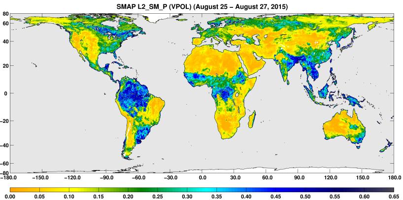
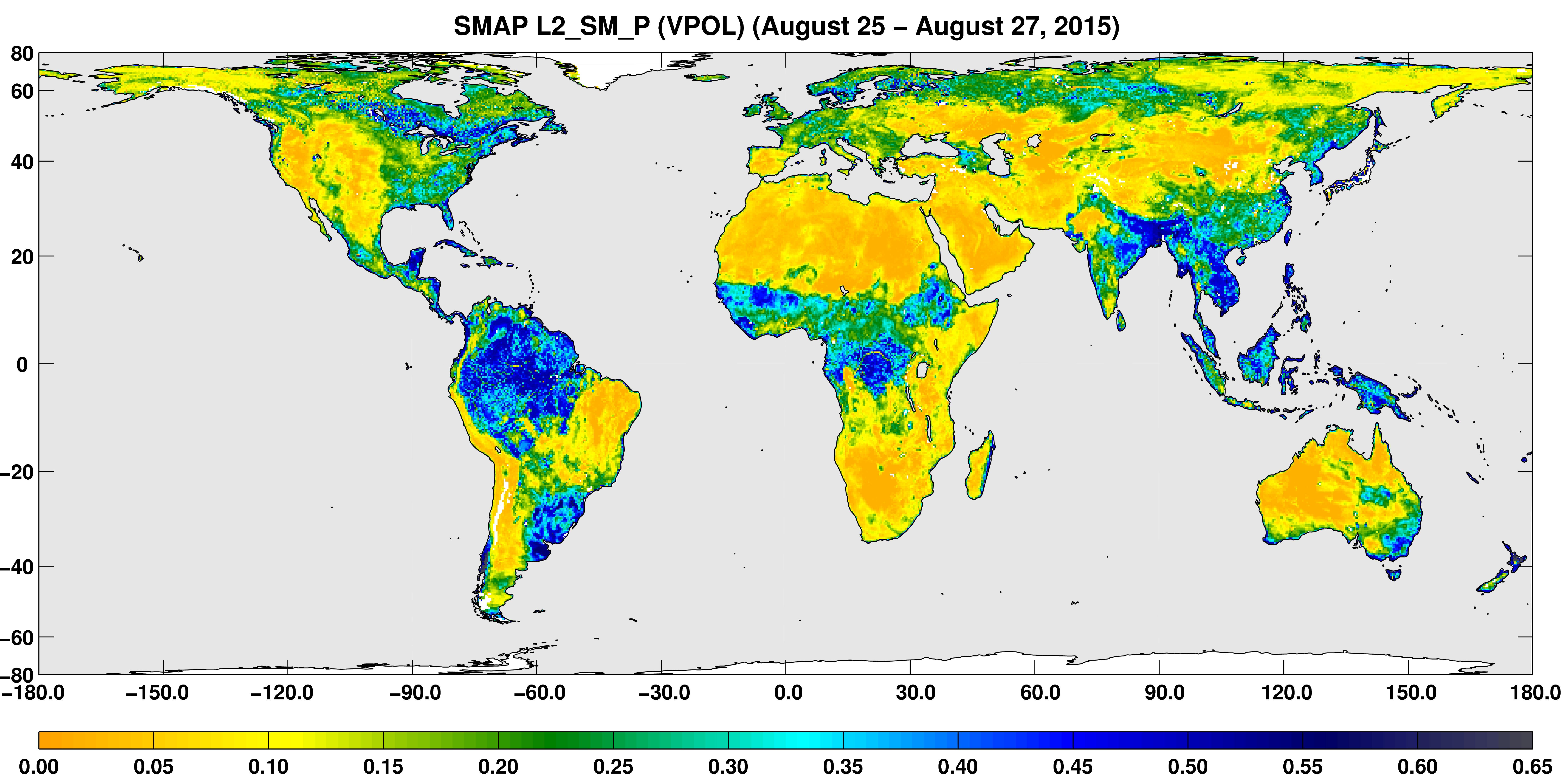
A three-day composite global map of surface soil moisture as retrieved from SMAP's radiometer instrument between Aug. 25-27, 2015. Dry areas appear yellow/orange, such as the Sahara Desert, western Australia and the western U.S. Wet areas appear blue, representing the impacts of localized storms. White areas indicate snow, ice or frozen ground.
SMAP is managed for NASA's Science Mission Directorate in Washington by JPL with participation by NASA's Goddard Space Flight Center, Greenbelt, Maryland. JPL is responsible for project management, system engineering, instrument management, the radar instrument, mission operations and the ground data system. Goddard is responsible for the radiometer instrument. Both centers collaborate on the science data processing and delivery of science data products to the Alaska Satellite Facility and the National Snow and Ice Data Center for public distribution and archiving. NASA's Launch Services Program at NASA's Kennedy Space Center in Florida is responsible for launch management. JPL is managed for NASA by the California Institute of Technology in Pasadena.
For more information about SMAP, visit http://smap.jpl.nasa.gov.