My
List |
Addition Date
|
Target
|
Mission
|
Instrument
|
Size
|

|
2019-07-22 |
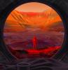
Mars
|
|
|
1400x788x3 |
|
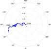
-
PIA23344:
-
Seismic Waves Inside Mars (Artist's Concept)
Full Resolution:
TIFF
(1.043 MB)
JPEG
(66.01 kB)
|
|
|
2019-11-05 |
Earth
|
|
|
1440x960x3 |

|
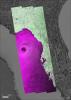
-
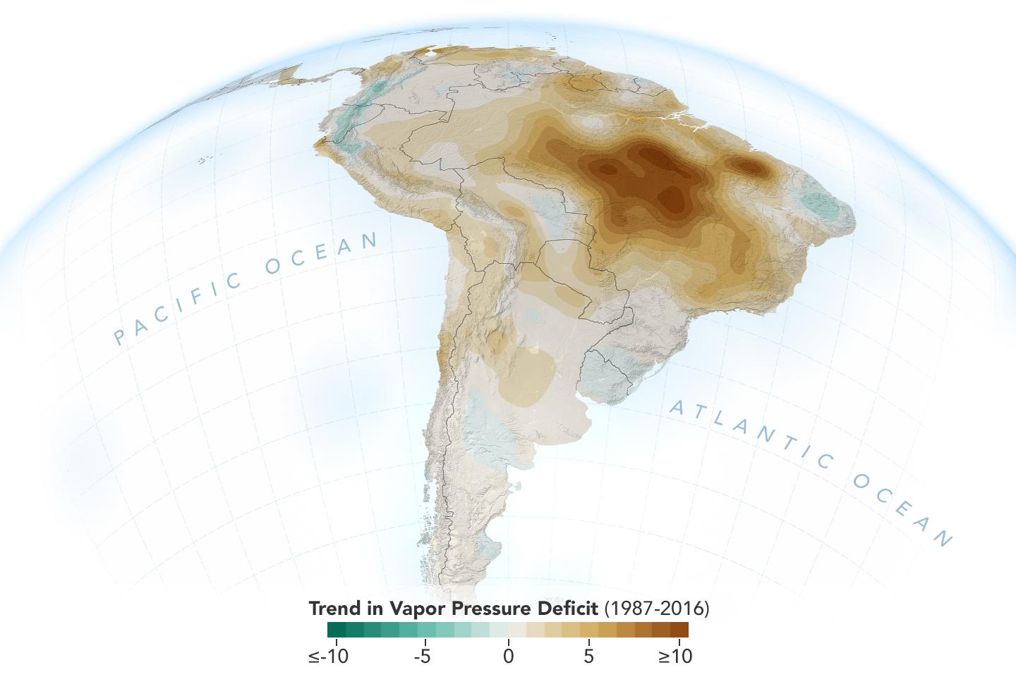
PIA23425:
-
New Study Shows Atmosphere in the Amazon Drying Out
Full Resolution:
TIFF
(1.789 MB)
JPEG
(96.3 kB)
|
|
|
2019-12-05 |
Asteroid
|
|
|
535x398x3 |
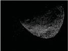
|
-
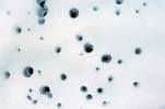
PIA23554:
-
Asteroid Bennu Particles
Full Resolution:
TIFF
(201.2 kB)
JPEG
(24.09 kB)
|
|
|
2019-12-05 |
Asteroid
|
|
|
2532x1417x3 |
|
-
PIA23555:
-
Bennu Particles (Animation)
Full Resolution:
TIFF
(1.12 MB)
JPEG
(116 kB)
|
|
|
2019-12-10 |
Mars
|
|
|
960x540x3 |
|
-
PIA23515:
-
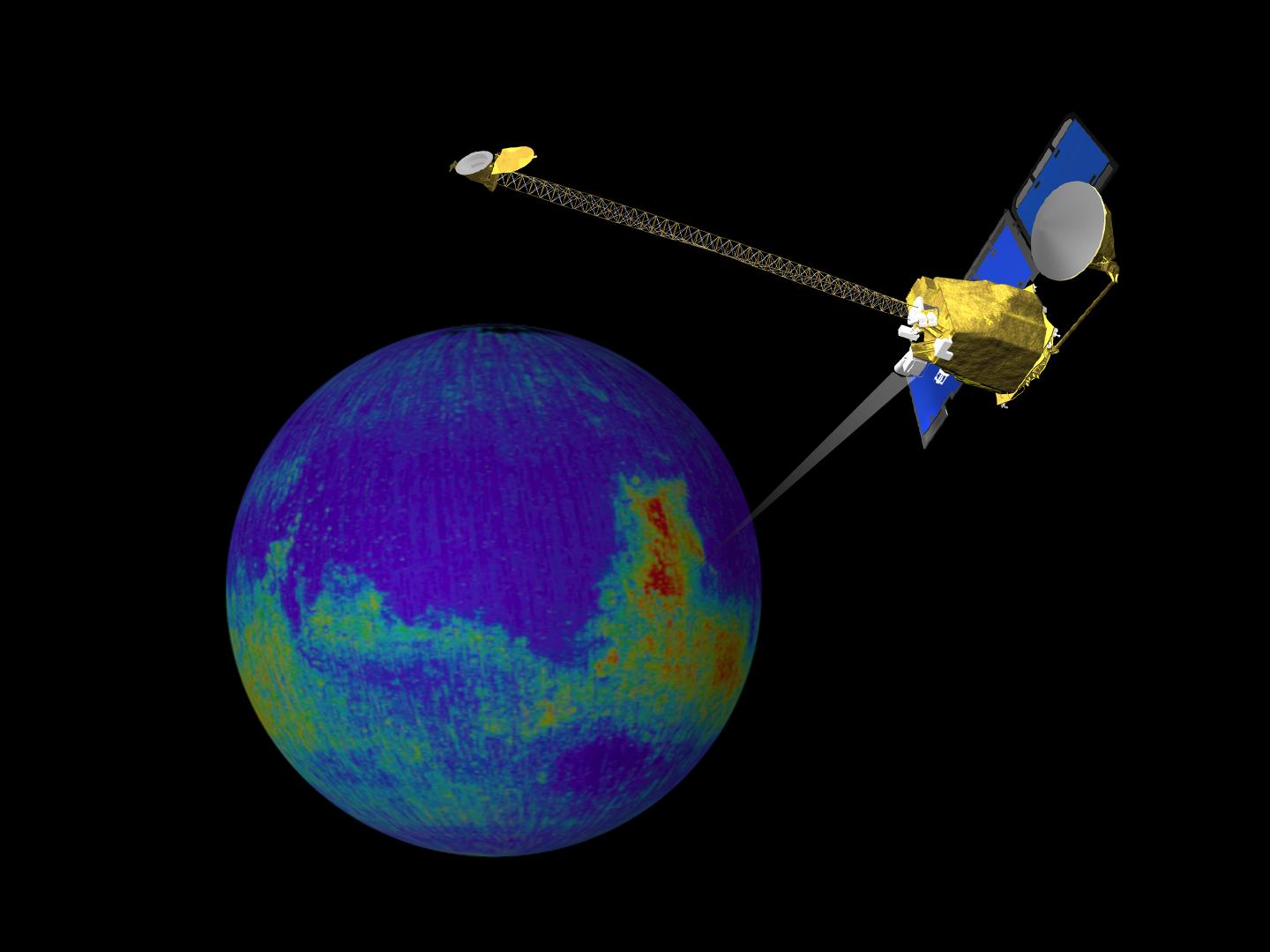
Water Ice Marked on Mars Globe (Illustration)
Full Resolution:
TIFF
(1.004 MB)
JPEG
(35.16 kB)
|
|
|
2020-04-15 |
Earth
|
|
|
1920x1080x3 |
|
-
PIA23686:
-
White Smoker Ocean Vents
Full Resolution:
TIFF
(6.172 MB)
JPEG
(270.2 kB)
|
|
|
2020-06-16 |
Mars
|
|
|
2500x2569x3 |
|
-
PIA23900:
-
NASA Astronaut Stands on Mars (Illustration)
Full Resolution:
TIFF
(12.43 MB)
JPEG
(499.2 kB)
|
|
|
2020-07-28 |
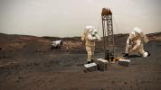
Mars
|
|
|
1600x900x3 |
|
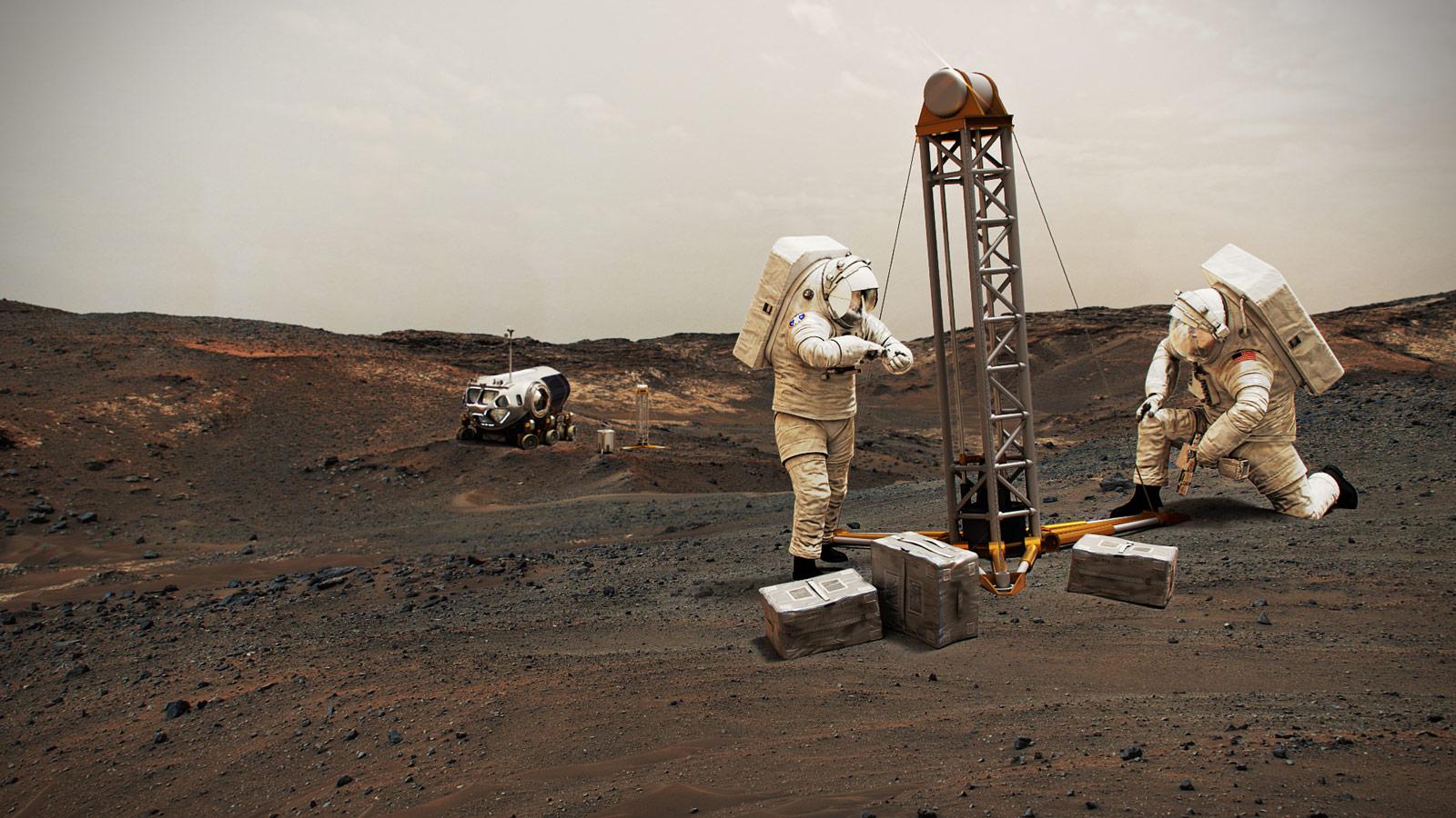
-
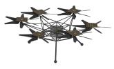
PIA24031:
-
NASA Astronauts on Mars (Illustration)
Full Resolution:
TIFF
(3.599 MB)
JPEG
(221.1 kB)
|
|
|
2020-07-28 |
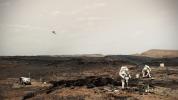
Mars
|
|
|
1920x1080x3 |
|
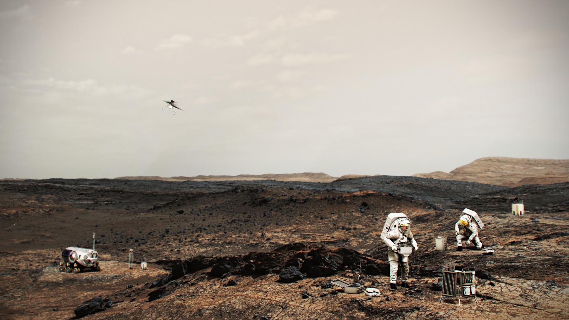
-
PIA24032:
-
NASA Astronauts on Mars With Helicopter (Illustration)
Full Resolution:
TIFF
(4.556 MB)
JPEG
(220 kB)
|
|
|
2020-08-18 |
Asteroid
|
|
|
1841x1033x3 |
|
-
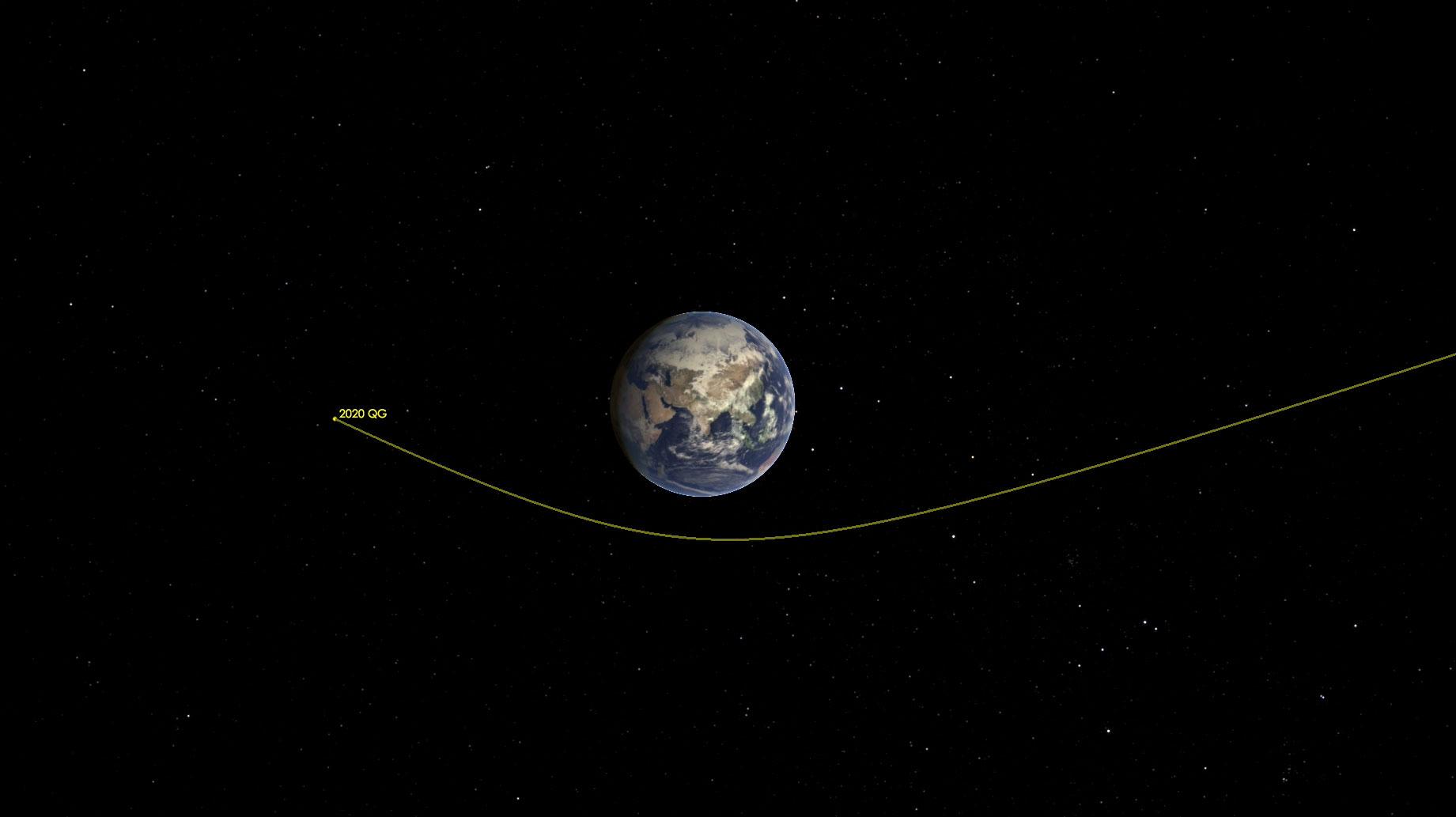
PIA24037:
-
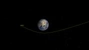
Asteroid 2020 QG Zips Around the Earth (Illustration)
Full Resolution:
TIFF
(518.8 kB)
JPEG
(64.57 kB)
|
|
|
2020-08-18 |
Asteroid
|
|
ZTF
|
1814x1298x3 |
|
-
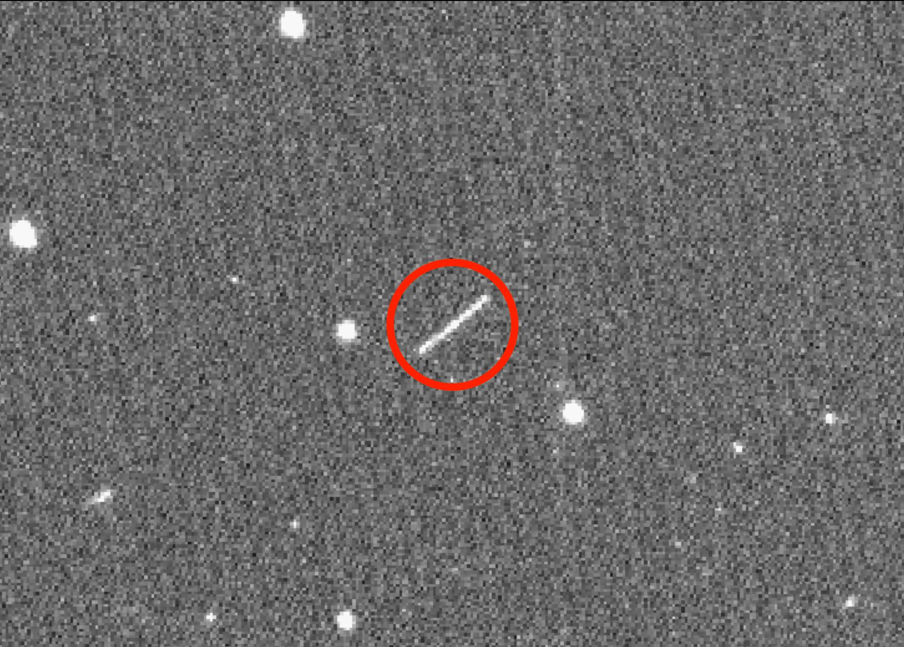
PIA24038:
-
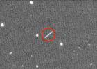
Asteroid 2020 QG as Seen Through ZTF Telescope
Full Resolution:
TIFF
(3.107 MB)
JPEG
(364.5 kB)
|
|
|
2020-09-02 |
Earth
|
|
AVIRIS-NG
|
3999x2249x3 |
|
-
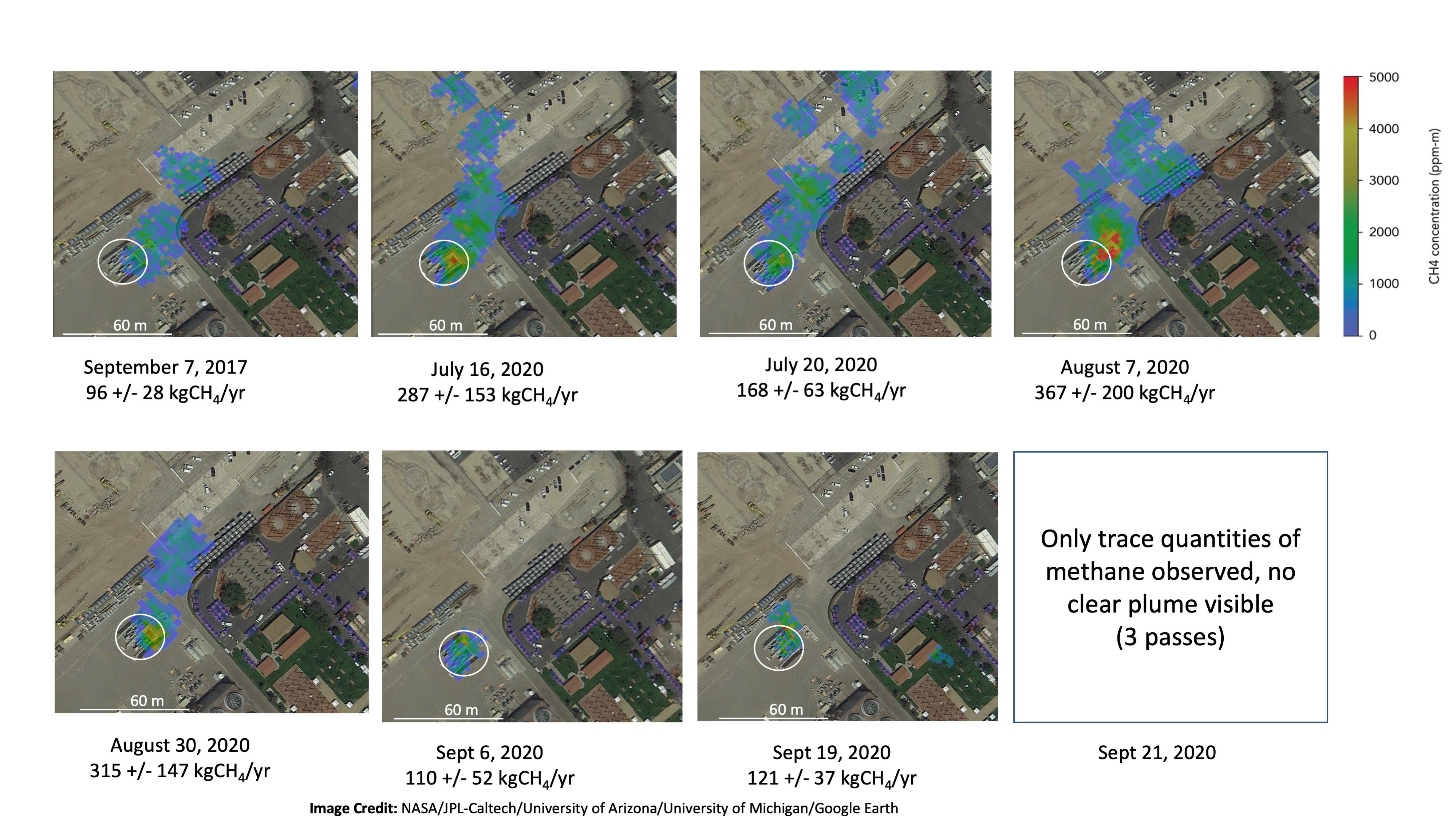
PIA24019:
-
NASA Instrument Tracks Power Plant Methane Emissions
Full Resolution:
TIFF
(13.87 MB)
JPEG
(866 kB)
|
|
|
2020-09-15 |
Earth
|
|
UAVSAR
|
1280x720x3 |

|
-
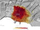
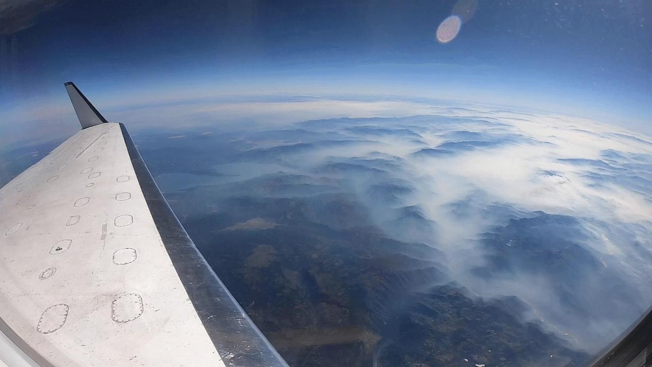
PIA24102:
-
NASA's UAVSAR Flights Observe California Fires
Full Resolution:
TIFF
(2.43 MB)
JPEG
(81.83 kB)
|
|
|
2020-09-23 |
Earth
|
|
|
8000x5955x3 |
|
-
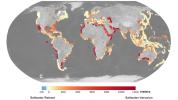
PIA23790:
-
OASIS Study Project (Illustration)
Full Resolution:
TIFF
(104.1 MB)
JPEG
(4.095 MB)
|
|
|
2020-10-20 |
Mars
|
|
|
3840x2160x3 |
|
-
PIA24172:
-
Ancient Jezero Crater (Illustration)
Full Resolution:
TIFF
(23.48 MB)
JPEG
(965 kB)
|
|
|
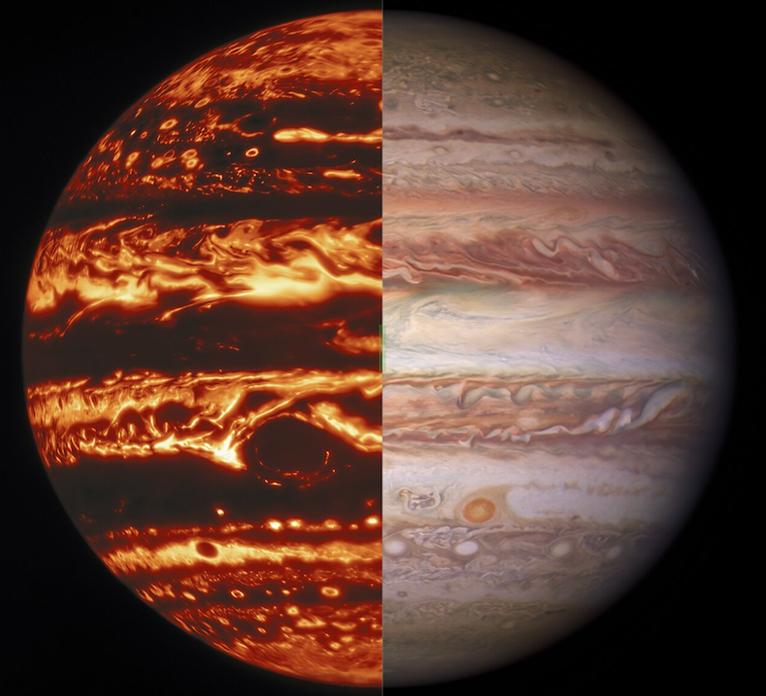
2020-10-27 |
Jupiter
|
|
|
1185x1973x3 |
|
-
PIA23990:
-
Jovian Sprite (Illustration)
Full Resolution:
TIFF
(4.375 MB)
JPEG
(115.4 kB)
|
|
|
2021-01-27 |
Earth
|
|
|
1024x768x3 |

|
-
PIA24374:
-
Lake Salda Rocks
Full Resolution:
TIFF
(2.36 MB)
JPEG
(146.1 kB)
|
|
|
2021-01-27 |
Earth
|
|
|
1024x768x3 |

|
-
PIA24375:
-
Lake Salda Beach
Full Resolution:
TIFF
(2.112 MB)
JPEG
(189.6 kB)
|
|
|
2021-01-27 |
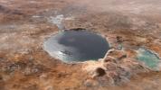
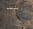
Mars
|
|
|
4029x3567x3 |
|
-
PIA24377:
-
Mars Probe Landing Ellipses
Full Resolution:
TIFF
(37.84 MB)
JPEG
(1.847 MB)
|
|
|
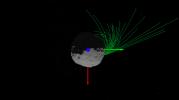
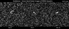
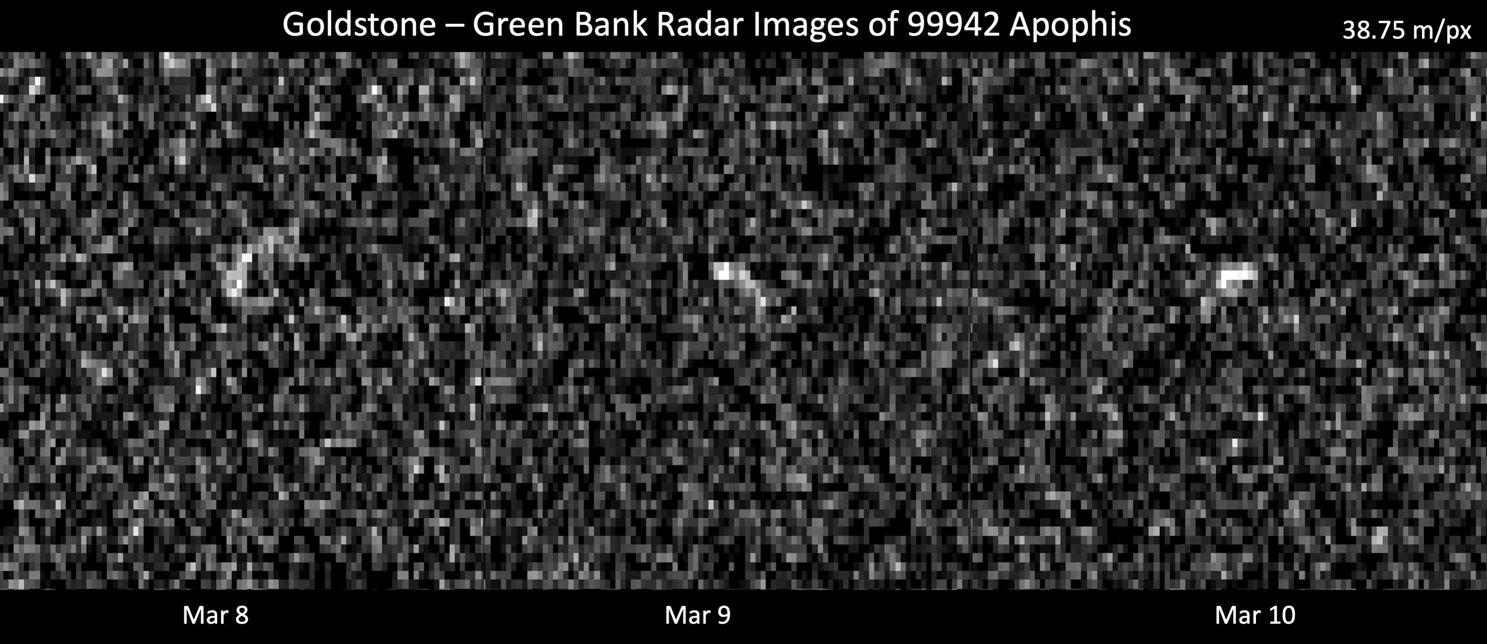
2021-03-26 |
Asteroid
|
|
Deep Space Network
|
2999x1300x1 |
|
-
PIA24168:
-
Radar Observations of Asteroid 99942 Apophis
Full Resolution:
TIFF
(1.73 MB)
JPEG
(419.4 kB)
|
|
|
2021-04-05 |
Asteroid
|
|
Deep Space Network
|
1254x958x1 |
|
-
PIA24561:
-
Goldstone Radar Observations of Asteroid 2001 FO32
Full Resolution:
TIFF
(916.4 kB)
JPEG
(154.5 kB)
|
|
|
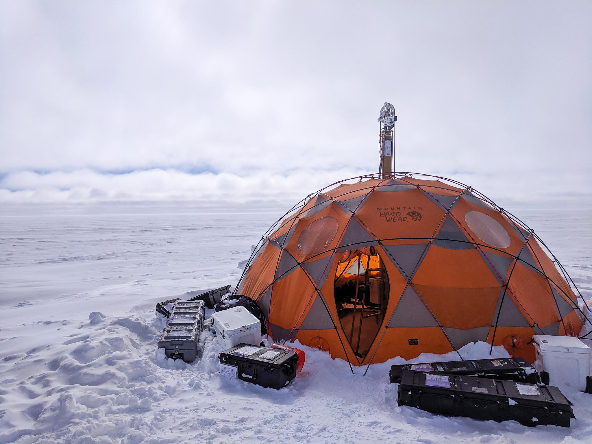
2021-04-07 |
Earth
|
|
WATSON
|
2048x1536x3 |

|
-
PIA24169:
-
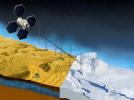
WATSON's Field Test in Greenland
Full Resolution:
TIFF
(7.031 MB)
JPEG
(319.2 kB)
|
|
|
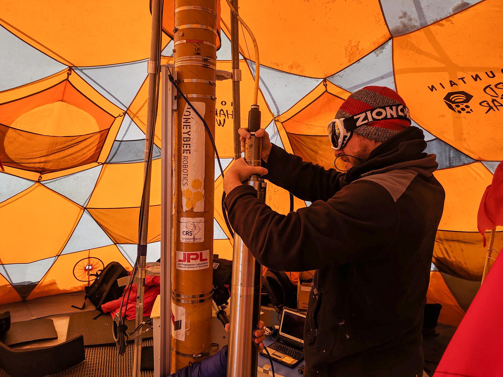
2021-04-07 |
Earth
|
|
WATSON
|
2048x1536x3 |

|
-
PIA24170:
-
Preparing WATSON for Borehole Descent
Full Resolution:
TIFF
(8.505 MB)
JPEG
(413.1 kB)
|
|
|
2021-04-07 |
Earth
|
|
WATSON
|
2244x4128x3 |
|
-
PIA24140:
-
Fluorescence Map of a Greenland Borehole
Full Resolution:
TIFF
(7.9 MB)
JPEG
(385.4 kB)
|
|
|
2021-10-13 |
Earth
|
|
UAVSAR
|
3300x2550x3 |
|
-
PIA23782:
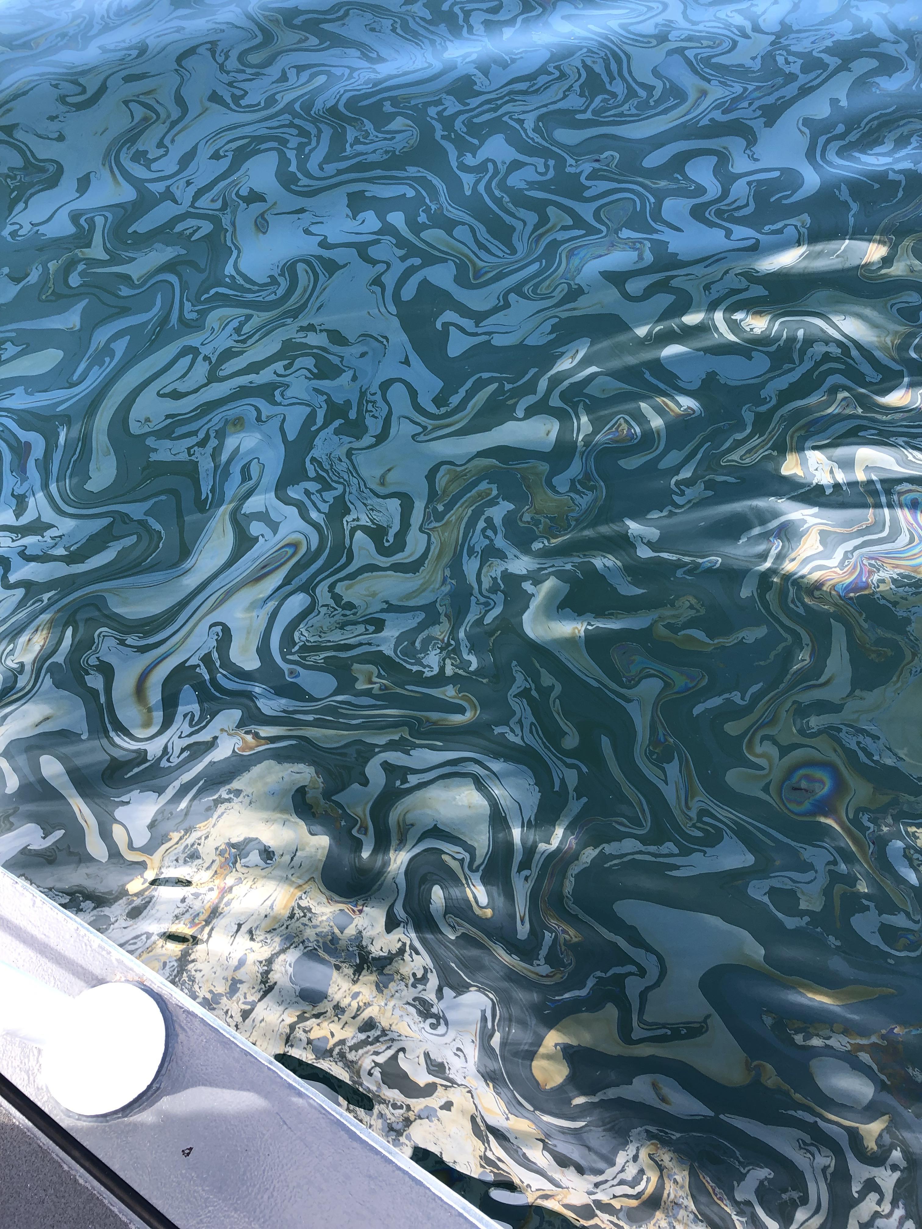
-
UAVSAR Oil Slicks
Full Resolution:
TIFF
(13.21 MB)
JPEG
(2.027 MB)
|
|
|
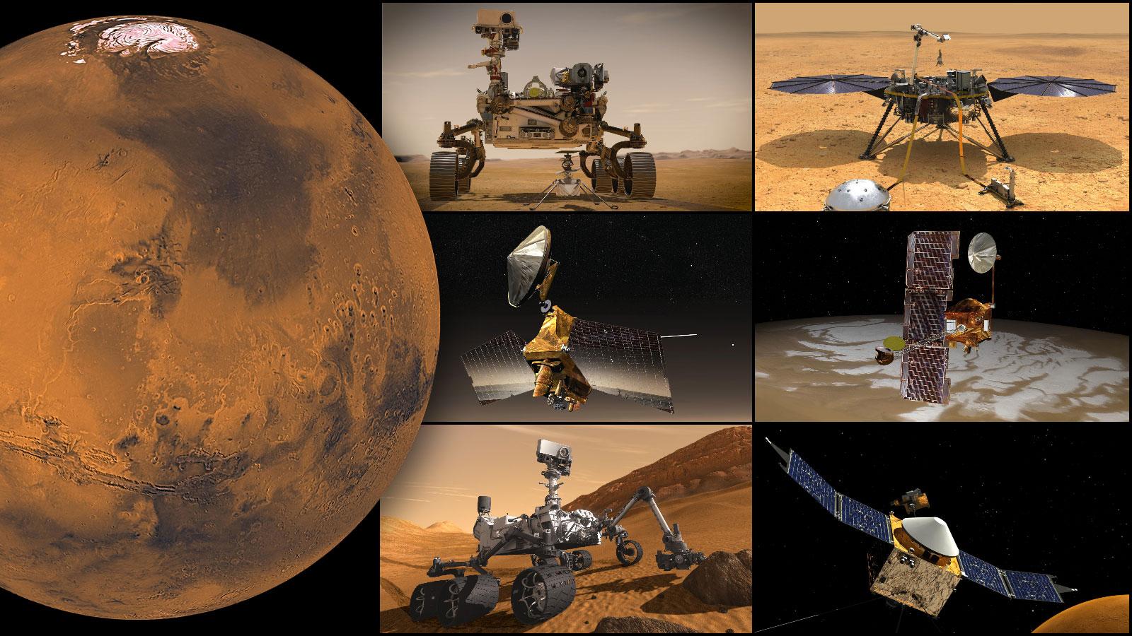
2021-09-28 |
Mars
|
|
|
1600x900x3 |
|
-
PIA24838:
-
NASA's Mars Missions
Full Resolution:
TIFF
(3.67 MB)
JPEG
(236.6 kB)
|
|
|
2021-10-13 |
Earth
|
|
UAVSAR
|
4032x3024x3 |

|
-
PIA24901:
-
UAVSAR Flight Crew
Full Resolution:
TIFF
(22.67 MB)
JPEG
(1.01 MB)
|
|
|
2021-10-28 |
Jupiter
|
|
Hubble Space Telescope
Gemini North Telescope
|
766x696x3 |
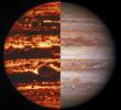
|
-
PIA24818:
-
Jupiter's Bands
Full Resolution:
TIFF
(1.385 MB)
JPEG
(59.74 kB)
|
|
|
2021-12-13 |
Earth
|
|
UAVSAR
|
3024x4032x3 |

|
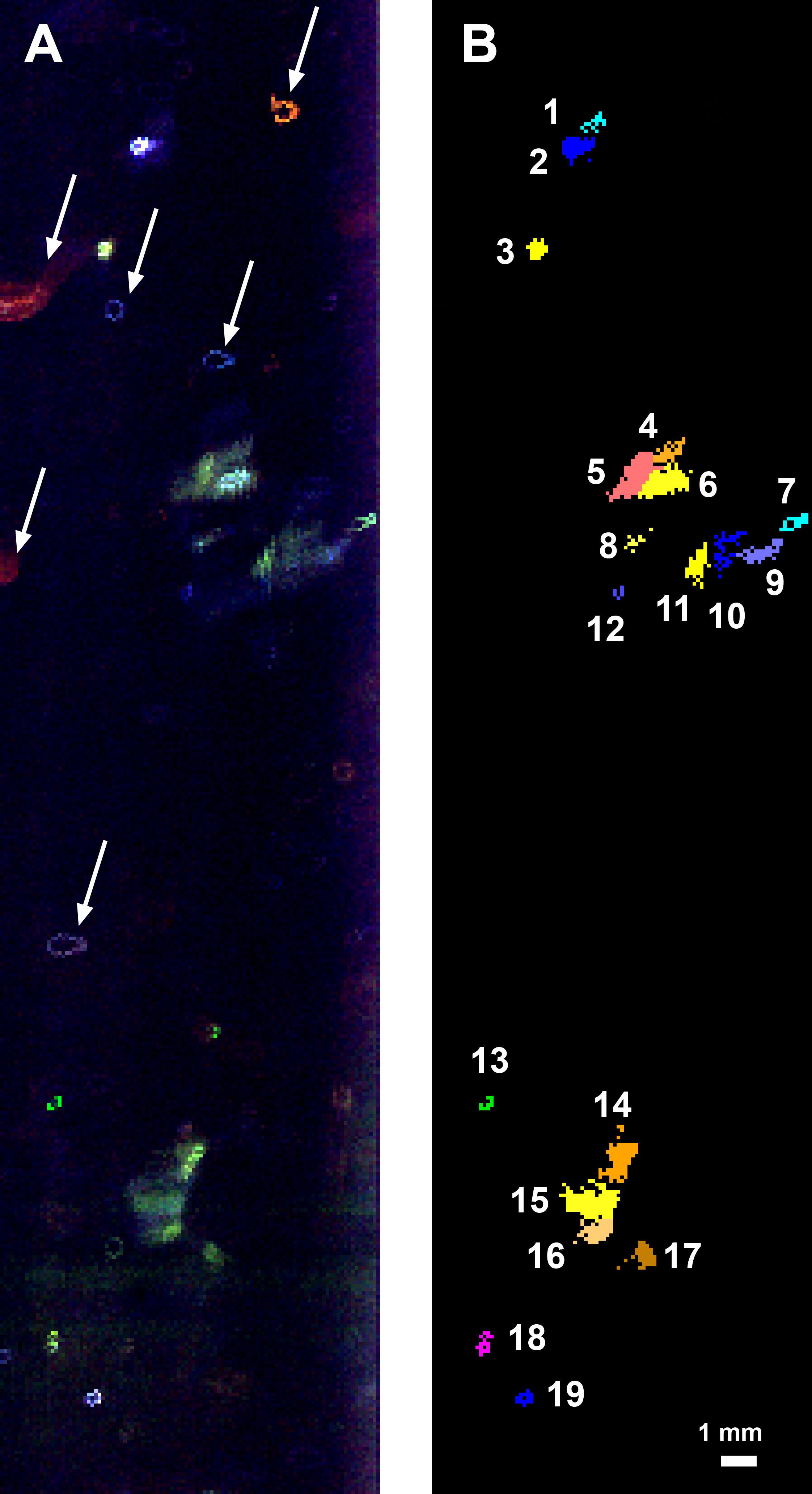
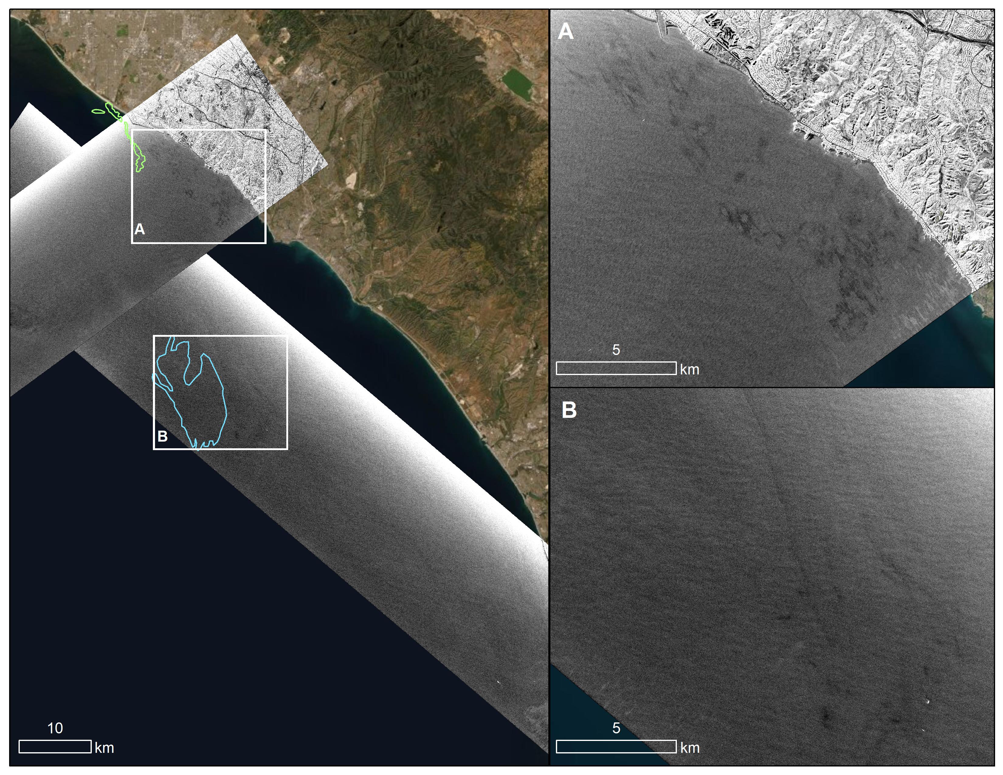
-
PIA23699:
-
Natural Oil Seepage Off California Coast
Full Resolution:
TIFF
(34.33 MB)
JPEG
(1.609 MB)
|
|
|
2022-03-15 |
Asteroid
|
|
|
1440x830x3 |
|
-
PIA24568:
-
Animation of Asteroid 2022 EB5's Orbit Before Hitting Earth's Atmosphere
Full Resolution:
TIFF
(248.9 kB)
JPEG
(41.43 kB)
|
|
|
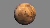
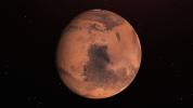
2022-05-17 |
Mars
|
|
|
3840x2160x3 |
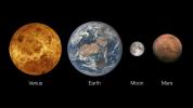
|
-
PIA25285:
-
Venus, Earth and Its Moon, and Mars
Full Resolution:
TIFF
(7.907 MB)
JPEG
(486.8 kB)
|
|
|
2022-08-10 |
Earth
|
|
|
4456x5324x3 |
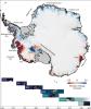
|
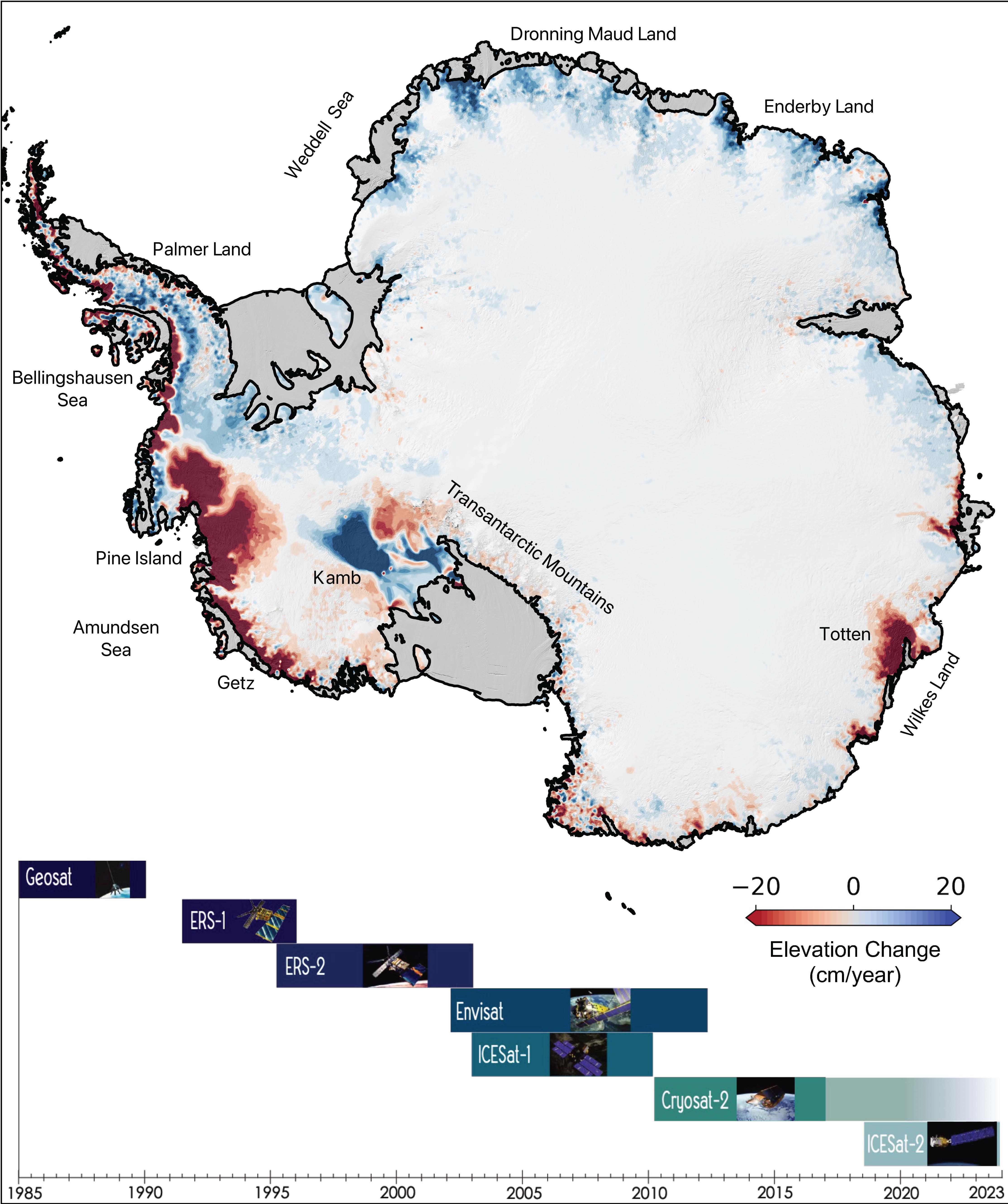
-
PIA24990:
-
The Antarctic Ice Sheet's Changing Height
Full Resolution:
TIFF
(18.38 MB)
JPEG
(1.304 MB)
|
|
|
2022-12-19 |
Earth
|
|
UAVSAR
|
3750x3750x3 |

|
-
PIA25526:
-
Airborne NASA Radar Maps Mauna Loa Lava Changes in Hawaii
Full Resolution:
TIFF
(11.11 MB)
JPEG
(1.418 MB)
|
|
|
2023-03-17 |
Earth
|
|
|
3300x2550x3 |
|
-
PIA25775:
-
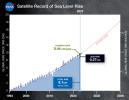
30 Years of Sea Level Rise
Full Resolution:
TIFF
(5.404 MB)
JPEG
(446.5 kB)
|
|
|
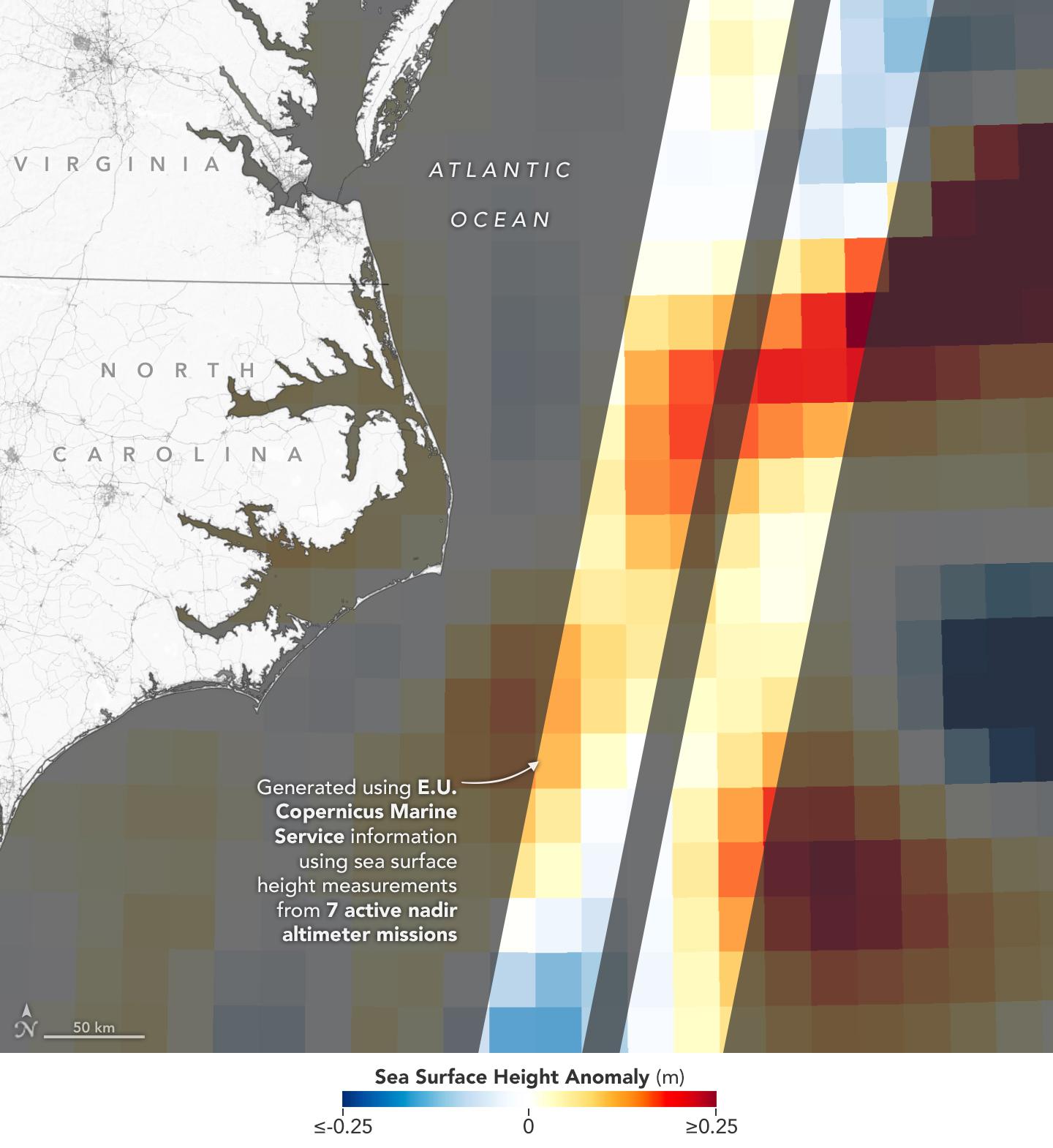
2023-03-24 |
Earth
|
|
|
1440x1570x3 |
|
-
PIA25773:
-
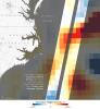
Sea Level Visualization of Gulf Stream
Full Resolution:
TIFF
(2.24 MB)
JPEG
(159 kB)
|
|
|
2023-05-15 |
Earth
|
|
|
1440x700x3 |
|
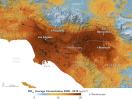
-
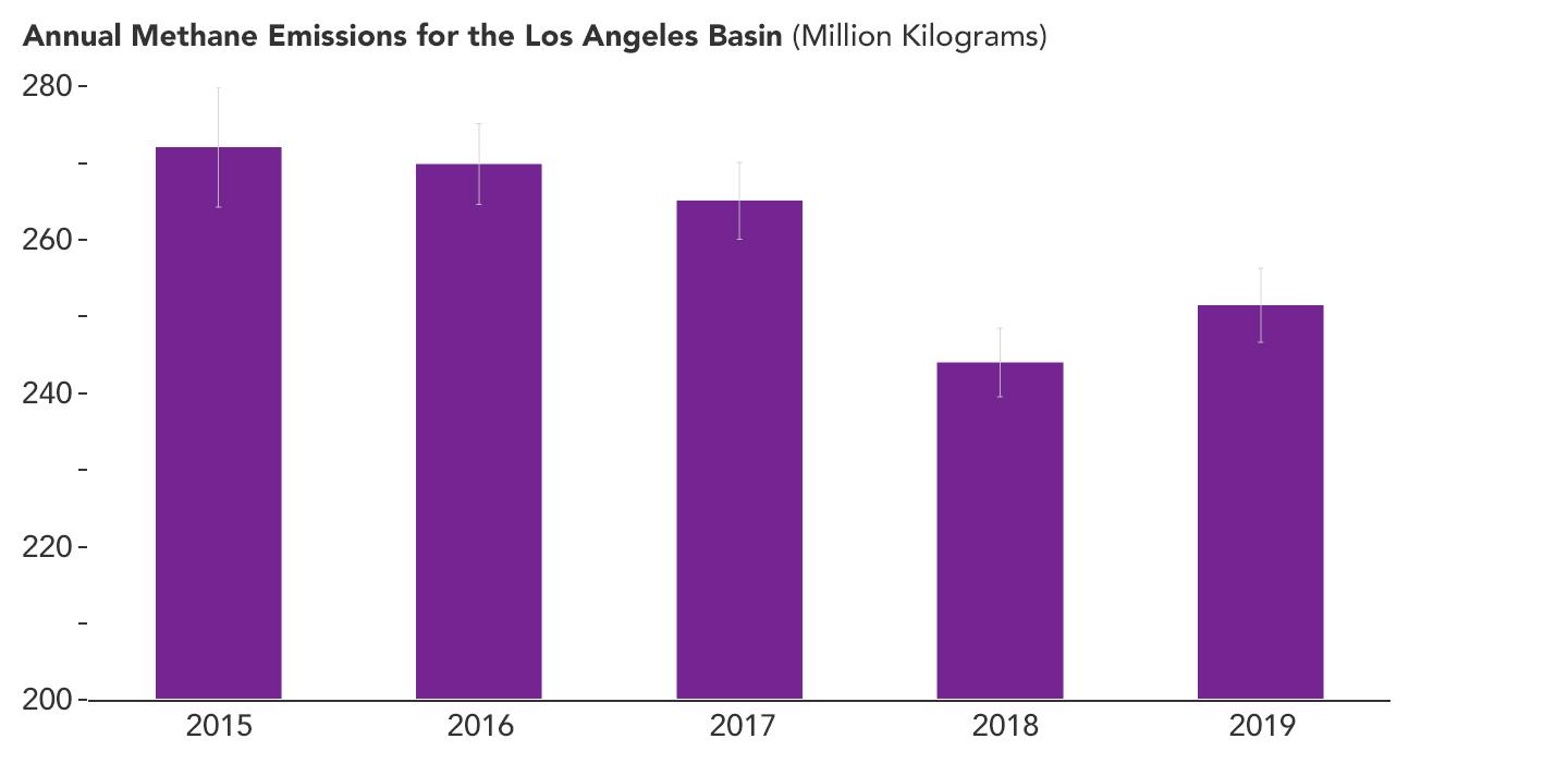
PIA25863:
-
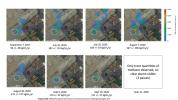
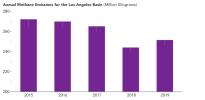
Declining Methane Emissions in the Los Angeles Basin
Full Resolution:
TIFF
(181.3 kB)
JPEG
(46.55 kB)
|
|
|
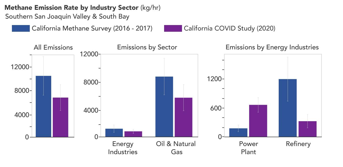
2023-05-15 |
Earth
|
|
|
1440x700x3 |

|
-
PIA25864:
-
Declining Methane Emissions at California Oil Fields and Refineries
Full Resolution:
TIFF
(325.1 kB)
JPEG
(73.03 kB)
|
|
|
2023-05-23 |
Uranus
|
|
Very Large Array
|
1166x458x3 |
|
-
PIA25951:
-
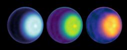
Uranus Cyclone With Color Added
Full Resolution:
TIFF
(874.3 kB)
JPEG
(26.6 kB)
|
|
|
2023-09-27 |
Earth
|
|
InSAR
|
2036x1446x3 |
|
-
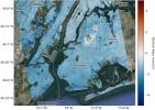
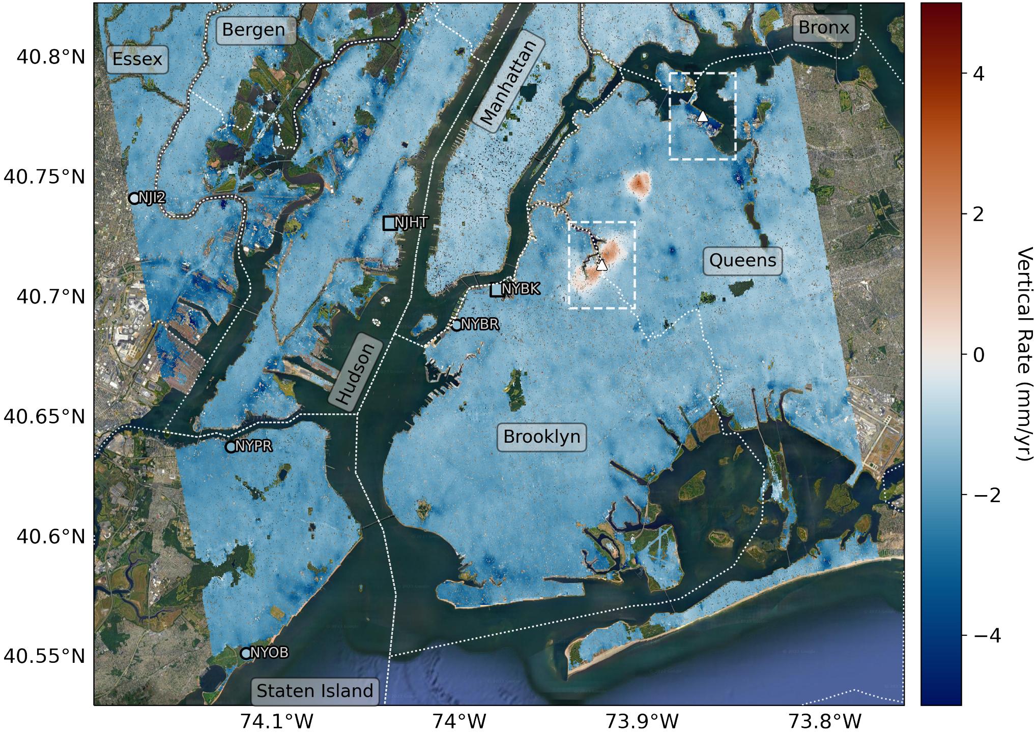
PIA25527:
-
Map of New York City Subsidence and Uplift
Full Resolution:
TIFF
(7.442 MB)
JPEG
(516.4 kB)
|
|
|
2023-09-27 |
Earth
|
|
InSAR
|
1584x934x3 |
|
-
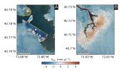
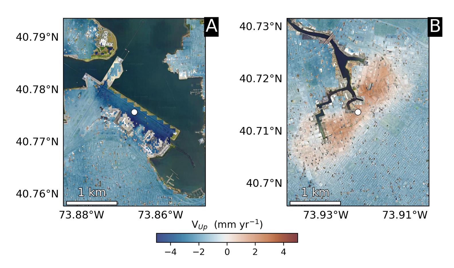
PIA25528:
-
Hot Spots of Subsidence, Uplift in New York City
Full Resolution:
TIFF
(2.374 MB)
JPEG
(173.7 kB)
|
|
|
2023-10-26 |
Mars
|
|
|
2221x1288x3 |
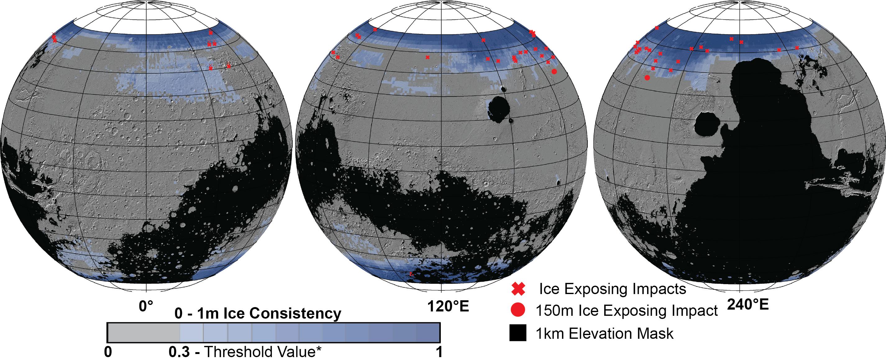
|
-
PIA26045:
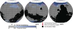
-
SWIM Map Shows Subsurface Water Ice on Mars
Full Resolution:
TIFF
(6.232 MB)
JPEG
(404 kB)
|
|
|
2023-10-26 |
Mars
|
|
|
2852x1169x3 |
|
-
PIA26046:
-
Distribution of Buried Ice on Mars
Full Resolution:
TIFF
(3.622 MB)
JPEG
(582.8 kB)
|
|
|
2024-07-19 |
Earth
|
|
|
1654x1578x3 |
|
-
PIA26120:
-
Meandering Path of Earth's Spin Axis
Full Resolution:
TIFF
(362.3 kB)
JPEG
(108.7 kB)
|
|
|
2024-10-02 |
Earth
|
|
SAR
|
2480x3507x3 |
|
-
PIA26414:
-
NASA's OPERA Project Generates Radar Image of Hurricane Helene
Full Resolution:
TIFF
(18.81 MB)
JPEG
(2.337 MB)
|
|
|
2024-10-02 |
Asteroid
|
|
ATLAS
|
1367x970x3 |
|
-
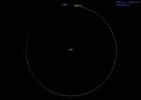
PIA26452:
-
Asteroid 2024 PT5's Orbit Around the Sun (Animation)
Full Resolution:
TIFF
(195.3 kB)
JPEG
(38.41 kB)
|
|
|
2024-10-09 |
Earth
|
|
ASTER
MODIS
|
1440x1090x3 |
|
-
PIA26415:
-
Particulate Pollution and Warehouses in the Los Angeles Region
Full Resolution:
TIFF
(3.991 MB)
JPEG
(272.1 kB)
|
|
|
2024-10-17 |
Earth
|
|
|
4928x3264x3 |
|
-
PIA26409:
-
Cryoconite Holes on Matanuska Glacier
Full Resolution:
TIFF
(24.12 MB)
JPEG
(923.8 kB)
|
|
|
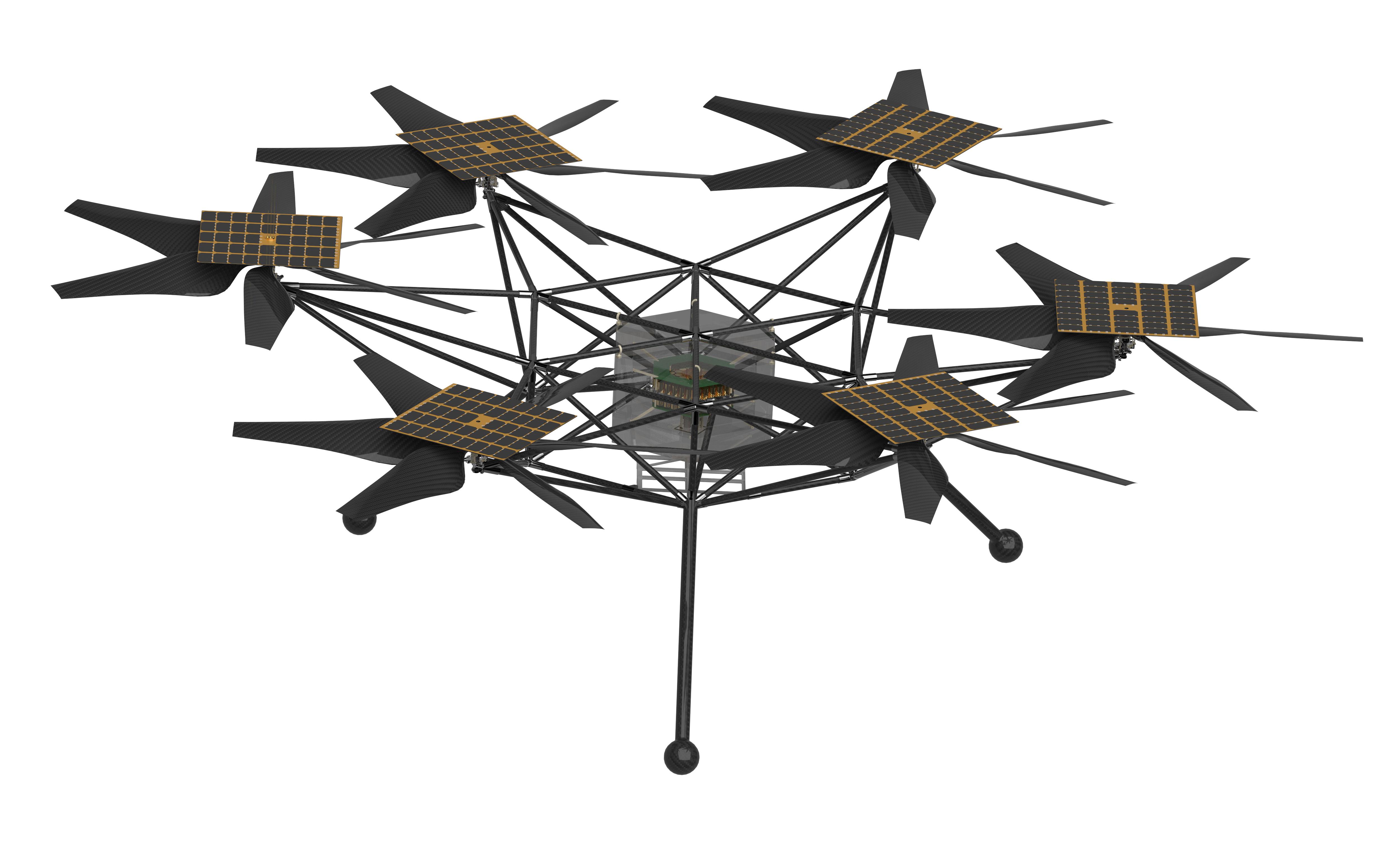
2024-12-11 |
Mars
|
|
|
5000x3026x3 |
|
-
PIA26375:
-
NASA's Mars Chopper Concept (Rendering)
Full Resolution:
TIFF
(4.595 MB)
JPEG
(679 kB)
|
|
|
2024-12-11 |
Earth
|
|
|
7831x4404x3 |
|
-
PIA26491:
-
Projections of Saltwater Intrusion in Coastal Watersheds by 2100
Full Resolution:
TIFF
(26.01 MB)
JPEG
(2.08 MB)
|
|
|
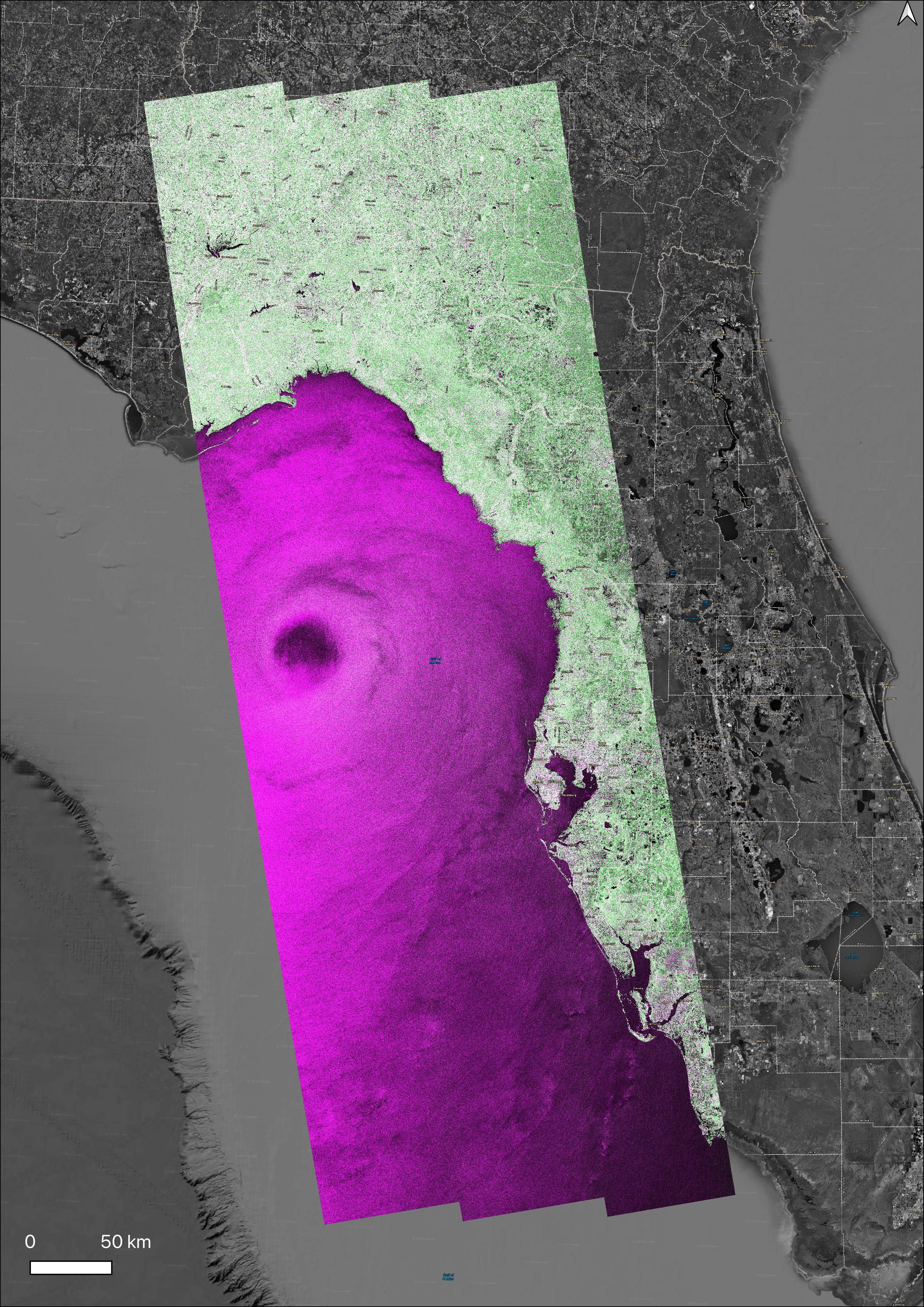
2025-01-31 |
Earth
|
|
UAVSAR
|
1440x1090x3 |
|
-
PIA26495:
-
NASA Radar Looks at Palos Verdes Landslides
Full Resolution:
TIFF
(2.762 MB)
JPEG
(259.6 kB)
|
|
|
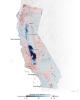
2025-02-10 |
Earth
|
|
InSAR
|
1440x1800x3 |
|
-
PIA25530:
-
Map of California Subsidence and Uplift
Full Resolution:
TIFF
(3.216 MB)
JPEG
(222.6 kB)
|
|
|
2025-04-23 |
Earth
|
|
AVIRIS-3
|
1920x1080x3 |

|
-
PIA26497:
-
AVIRIS-3 Sensor Captures Data on Wildfire Near Castleberry, Alabama
Full Resolution:
TIFF
(6.223 MB)
JPEG
(393 kB)
|
|
|
2025-04-23 |
Earth
|
|
AVIRIS-3
|
1440x600x3 |

|
-
PIA26498:
-
AVIRIS-3 Sensor Captures Data on Wildfire Near Perdido, Alabama
Full Resolution:
TIFF
(2.497 MB)
JPEG
(175.8 kB)
|
|
|
2025-04-23 |
Earth
|
|
AVIRIS-3
|
1440x600x3 |

|
-
PIA26499:
-
AVIRIS-3 Sensor Captures Data on Wildfire Near Mount Vernon, Alabama
Full Resolution:
TIFF
(2.518 MB)
JPEG
(173 kB)
|
|
|
2025-06-06 |
Earth
|
|
SAR
|
1920x985x3 |

|
-
PIA26494:
-
NASA Portal Details Land Motion Across North America
Full Resolution:
TIFF
(2.941 MB)
JPEG
(184.7 kB)
|
|
|
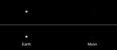
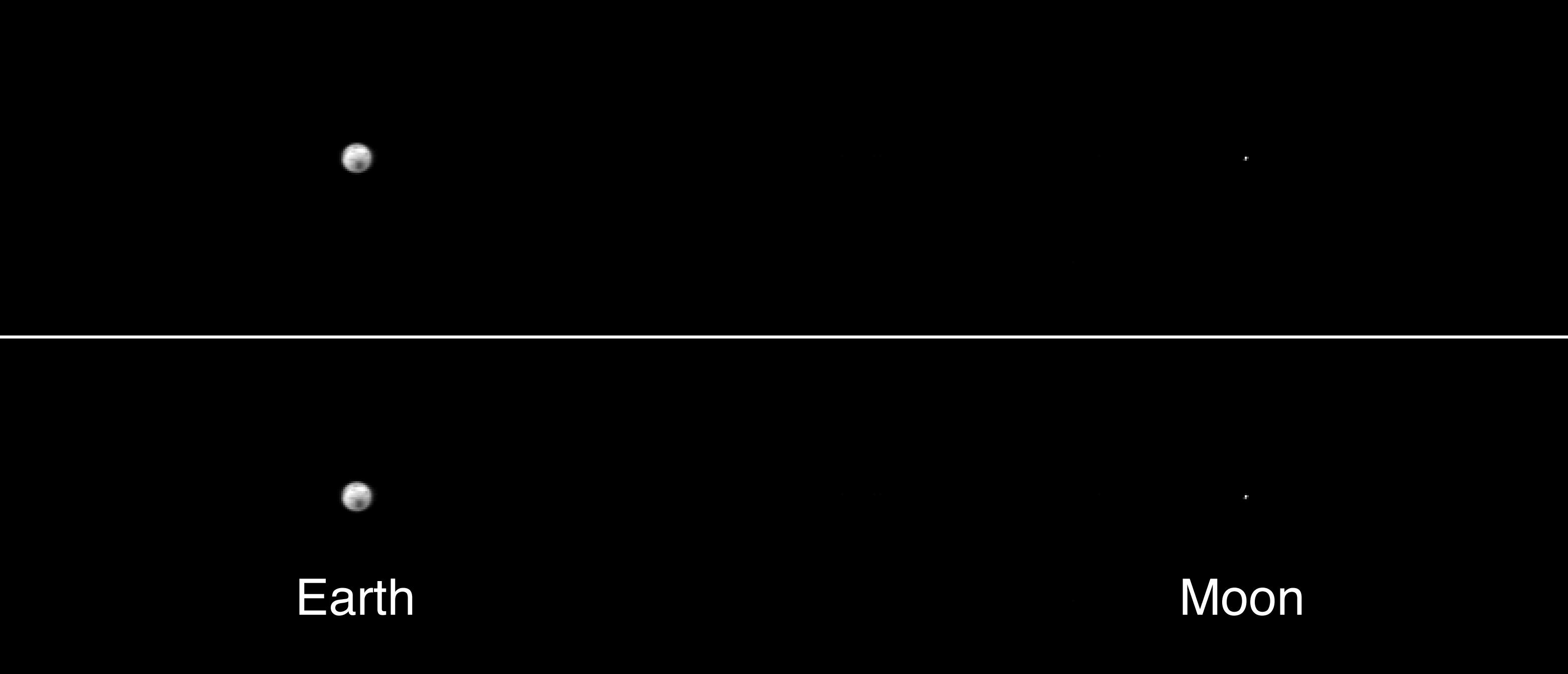
2001-04-26 |
Earth
|
2001 Mars Odyssey
|
THEMIS
|
3000x1681x3 |
|
-
PIA00558:
-
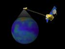
2001 Mars Odyssey Images Earth (Visible and Infrared)
Full Resolution:
TIFF
(2.994 MB)
JPEG
(217.5 kB)
|
|
|
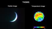
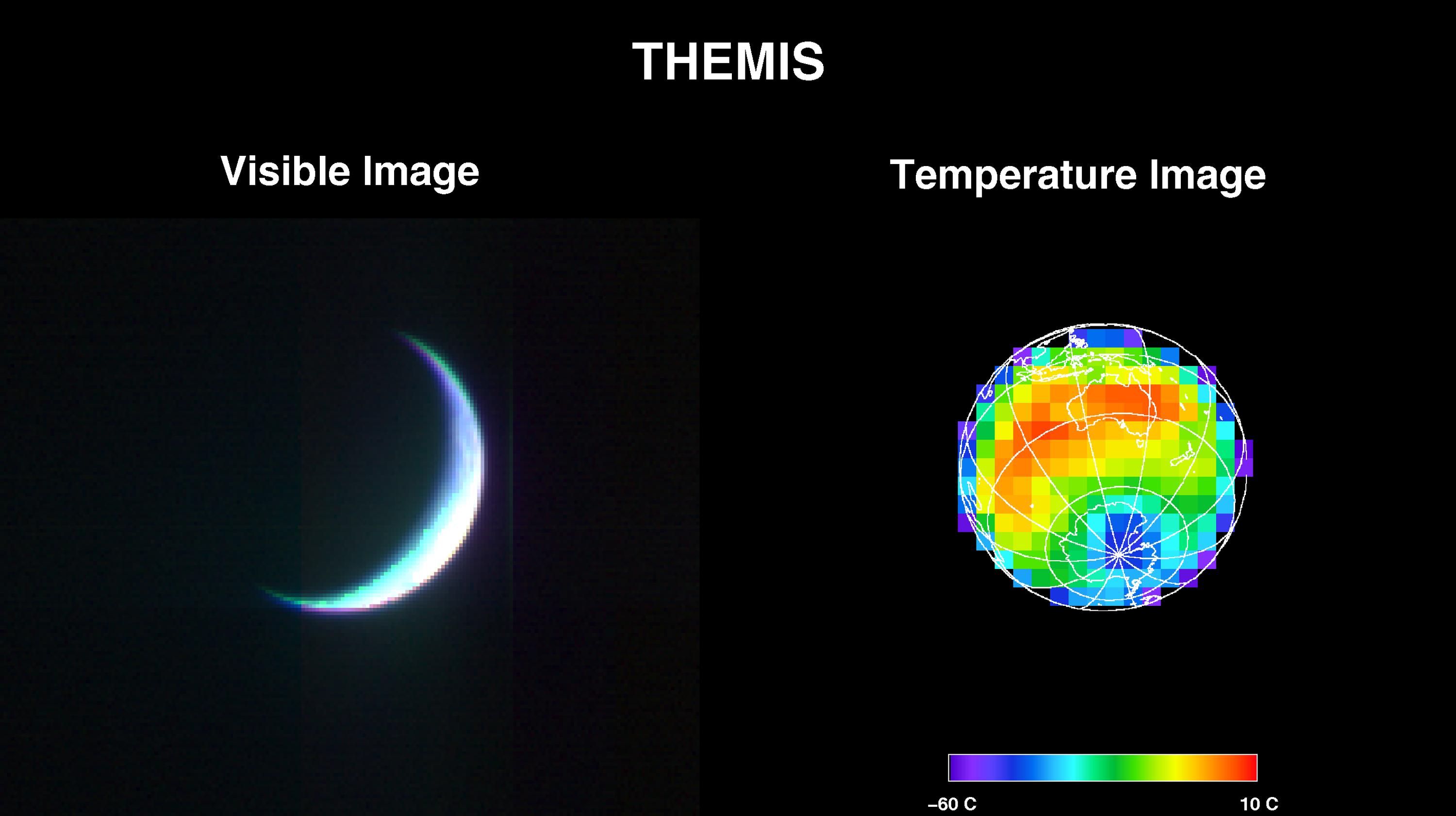
2001-05-01 |
Earth
|
2001 Mars Odyssey
|
THEMIS
|
3124x1342x1 |
|
-
PIA00559:
-
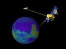
The Earth and Moon As Seen by 2001 Mars Odyssey's Thermal Emission Imaging System
Full Resolution:
TIFF
(101.6 kB)
JPEG
(69.4 kB)
|
|
|
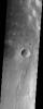
2009-06-26 |
Mars
|
2001 Mars Odyssey
|
THEMIS
|
1297x2904x1 |
|
-
PIA11894:
-
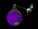
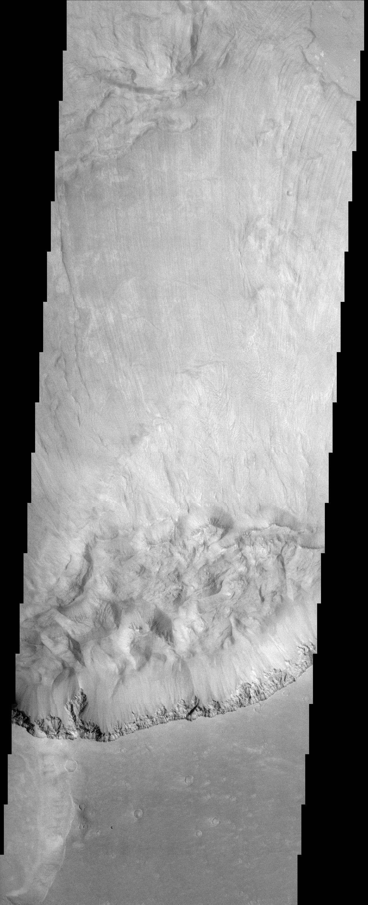
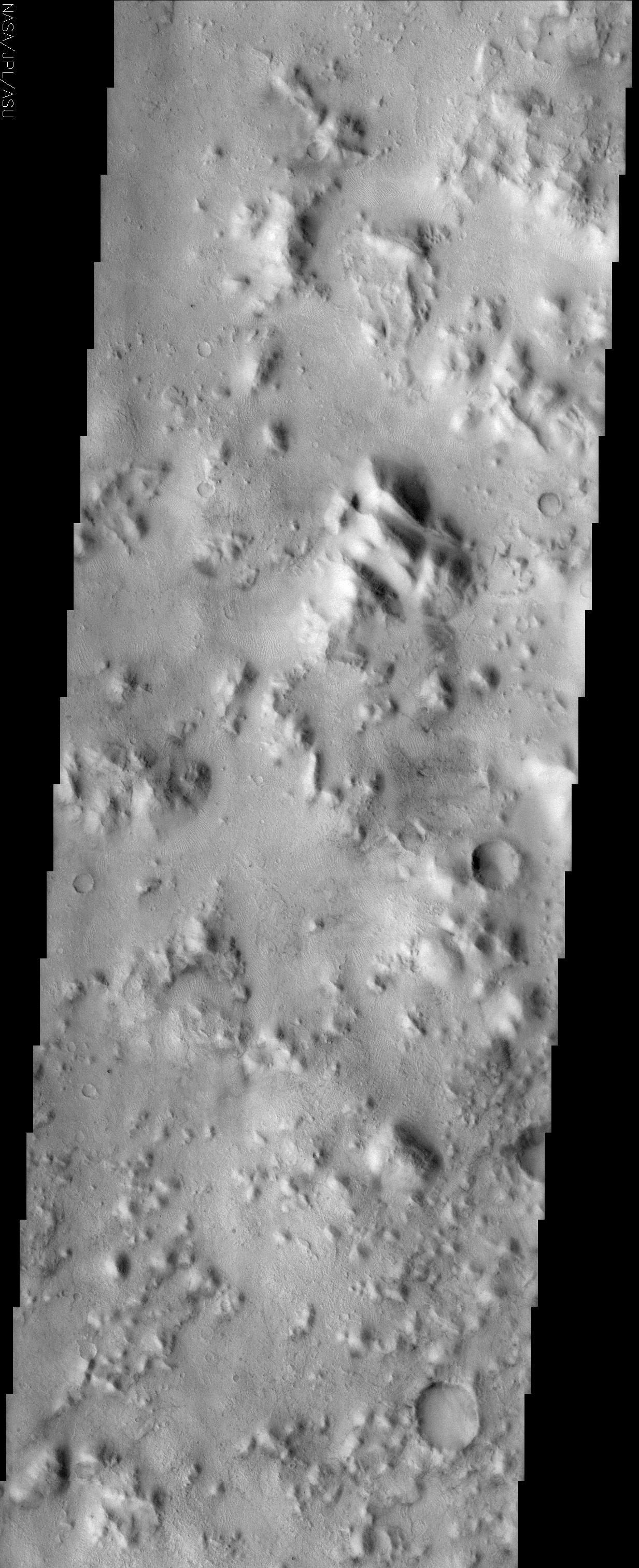
Olympus Mons
Full Resolution:
TIFF
(3.771 MB)
JPEG
(409.9 kB)
|
|
|
2001-03-27 |
Mars
|
2001 Mars Odyssey
|
Mars Orbiter Camera (MOC)
THEMIS
|
1440x1080x3 |
|
-
PIA03219:
-
Still From Odyssey Clip 1
Full Resolution:
TIFF
(997.2 kB)
JPEG
(53.55 kB)
|
|
|
2001-03-27 |
Mars
|
2001 Mars Odyssey
|
Mars Orbiter Camera (MOC)
THEMIS
|
1440x1080x3 |
|
-
PIA03220:
-
Still From Odyssey Clip 2
Full Resolution:
TIFF
(1.256 MB)
JPEG
(77.47 kB)
|
|
|
2001-03-27 |
Mars
|
2001 Mars Odyssey
|
Mars Orbiter Camera (MOC)
THEMIS
|
1440x1080x3 |
|
-
PIA03221:
-
Still From Odyssey Clip 3
Full Resolution:
TIFF
(977.6 kB)
JPEG
(61.99 kB)
|
|
|
2022-08-25 |
Mars
|
2001 Mars Odyssey
|
THEMIS
|
670x1419x1 |

|
-
PIA25479:
-
Daedalia Planum
Full Resolution:
TIFF
(758.4 kB)
JPEG
(180 kB)
|
|
|
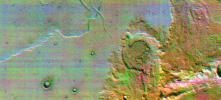
2001-11-09 |
Mars
|
2001 Mars Odyssey
|
THEMIS
|
1990x2192x3 |

|
-
PIA03459:
-
First THEMIS Image of Mars
Full Resolution:
TIFF
(3.93 MB)
JPEG
(262.9 kB)
|
|
|
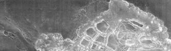
2001-11-13 |
Mars
|
2001 Mars Odyssey
|
THEMIS
|
3658x2671x3 |
|
-
PIA03461:
-
First THEMIS Infrared and Visible Images of Mars
Full Resolution:
TIFF
(4.385 MB)
JPEG
(645.9 kB)
|
|
|
2002-03-01 |
Mars
|
2001 Mars Odyssey
|
Mars Radiation Experiment
|
3000x2400x3 |
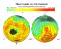
|
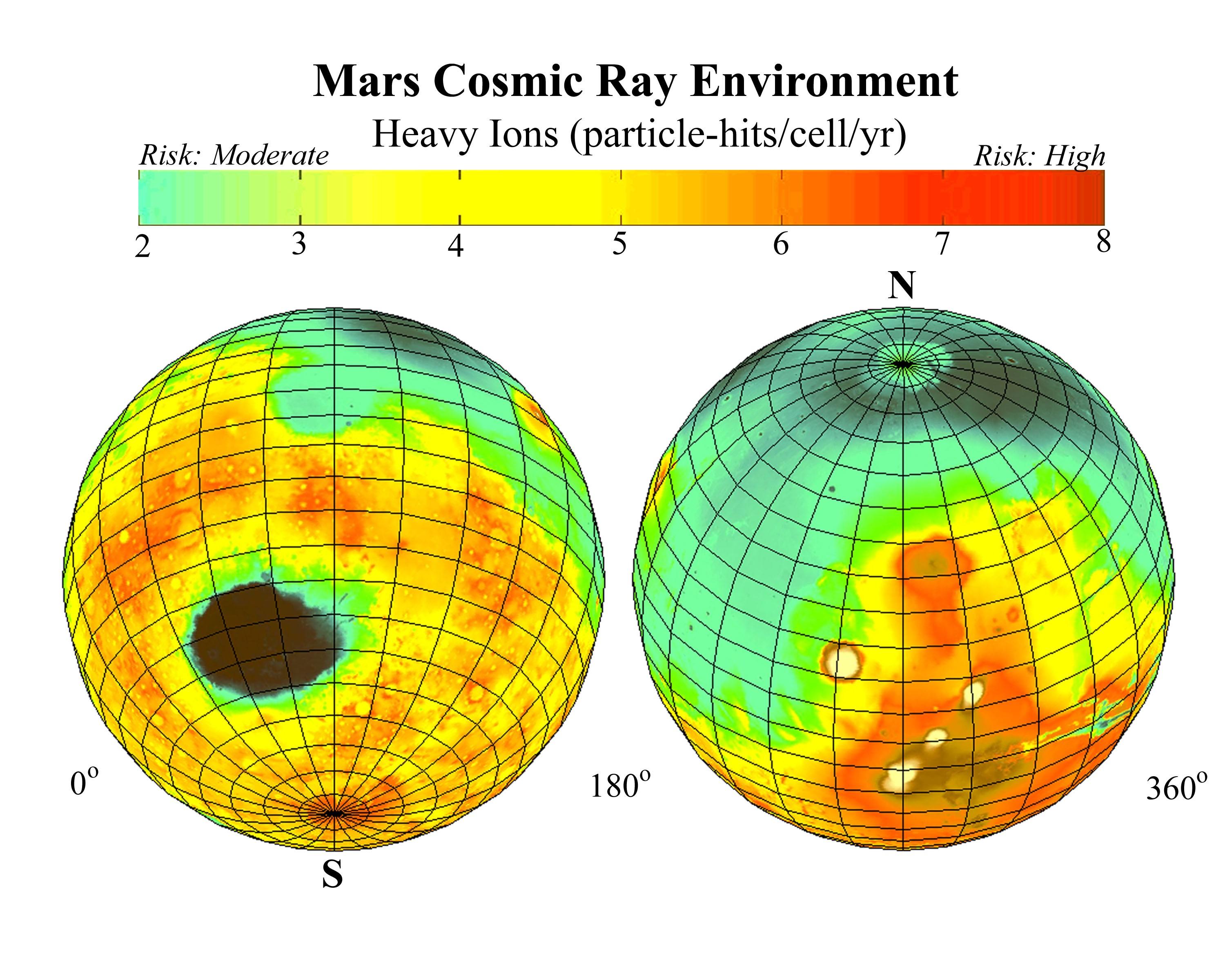
-
PIA03479:
-
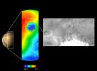
Estimated Radiation on Mars, Hits per Cell Nucleus
Full Resolution:
TIFF
(9.078 MB)
JPEG
(628.5 kB)
|
|
|
2002-03-01 |
Mars
|
2001 Mars Odyssey
|
Mars Radiation Experiment
|
3000x2400x3 |

|
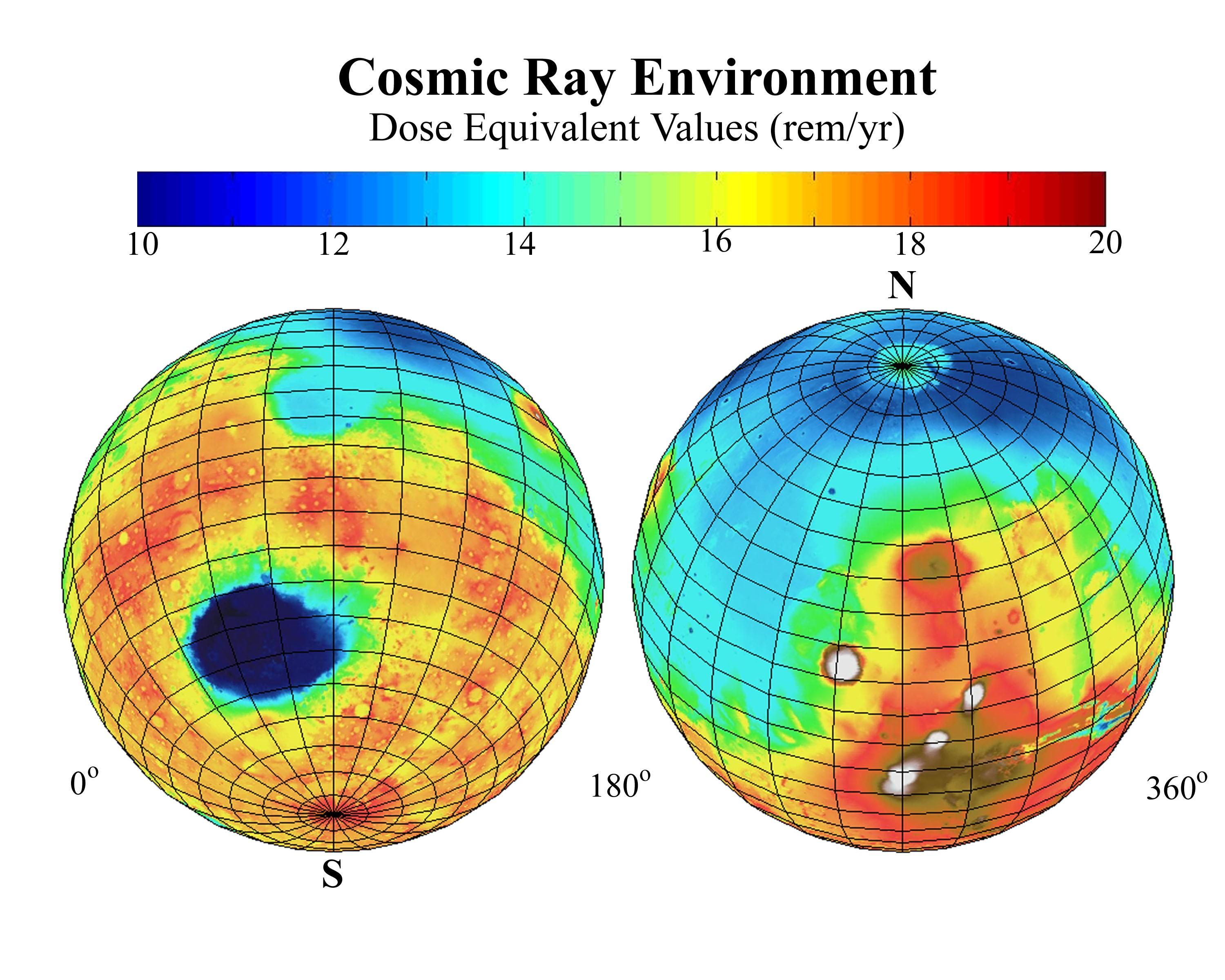
-
PIA03480:
-
Estimated Radiation Dosage on Mars
Full Resolution:
TIFF
(10.13 MB)
JPEG
(625.5 kB)
|
|
|
2002-03-05 |
Mars
|
2001 Mars Odyssey
|
THEMIS
|
952x474x1 |
|
-
PIA03481:
-
Acheron Fossae in Visible Light
Full Resolution:
TIFF
(391.5 kB)
JPEG
(62.4 kB)
|
|
|
2002-03-01 |
Mars
|
2001 Mars Odyssey
|
THEMIS
|
697x314x1 |
|
-
PIA03482:
-
Channel at Night in Thermal Infrared
Full Resolution:
TIFF
(223.6 kB)
JPEG
(54.94 kB)
|
|
|
2002-03-01 |
Mars
|
2001 Mars Odyssey
|
THEMIS
|
2920x600x1 |
|
-
PIA03483:
Daytime Infrared, Terra Sirenum
Full Resolution:
TIFF
(527.2 kB)
JPEG
(165.6 kB)
|
|
|
2002-03-01 |
Mars
|
2001 Mars Odyssey
|
THEMIS
|
665x302x3 |
|
-
PIA03484:
-
Color Infrared, Terra Sirenum
Full Resolution:
TIFF
(780.3 kB)
JPEG
(60.56 kB)
|
|
|
2002-03-01 |
Mars
|
2001 Mars Odyssey
|
THEMIS
|
1063x320x1 |
|
-
PIA03485:
-
Hydaspis Chaos in Nighttime Infrared
Full Resolution:
TIFF
(375.6 kB)
JPEG
(65.8 kB)
|
|
|
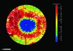
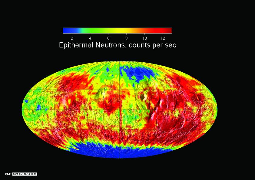
2002-03-01 |
Mars
|
2001 Mars Odyssey
|
Gamma Ray Spectrometer Suite
|
842x595x3 |

|
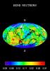
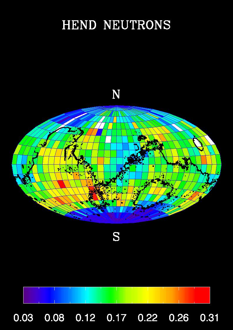
-
PIA03486:
-
Global Neutron View
Full Resolution:
TIFF
(579.3 kB)
JPEG
(80.85 kB)
|
|
|
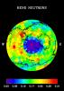
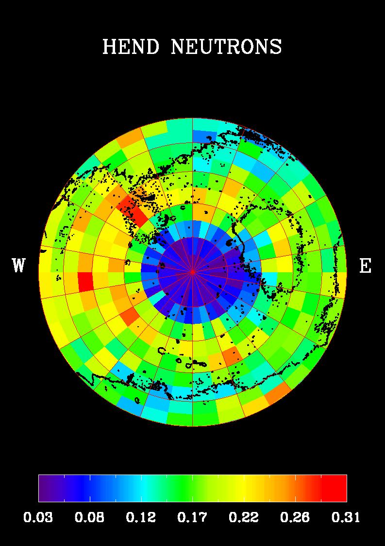
2002-03-01 |
Mars
|
2001 Mars Odyssey
|
Gamma Ray Spectrometer Suite
|
842x595x3 |
|
-
PIA03487:
-
South Pole Neutron View
Full Resolution:
TIFF
(581.8 kB)
JPEG
(80.74 kB)
|
|
|
2002-03-01 |
Mars
|
2001 Mars Odyssey
|
Gamma Ray Spectrometer Suite
|
793x1123x3 |
|
-
PIA03488:
-
Southern Hemisphere Neutron Map
Full Resolution:
TIFF
(90.83 kB)
JPEG
(131.3 kB)
|
|
|
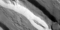
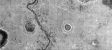
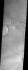
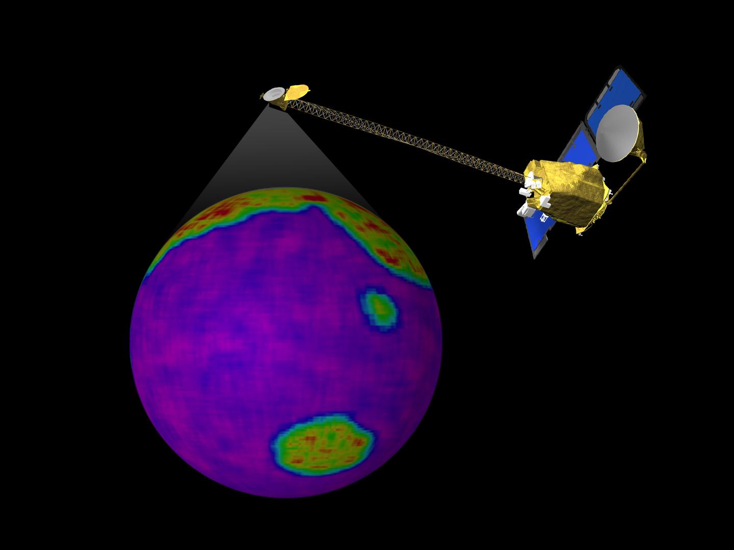
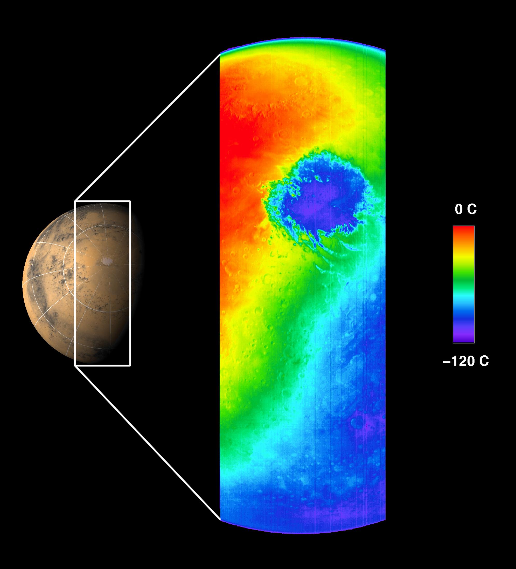
2002-03-06 |
Mars
|
2001 Mars Odyssey
|
Gamma Ray Spectrometer Suite
|
793x1123x3 |
|
-
PIA03489:
-
Global Map, High-Energy Neutrons
Full Resolution:
TIFF
(88.48 kB)
JPEG
(141.2 kB)
|
|
|
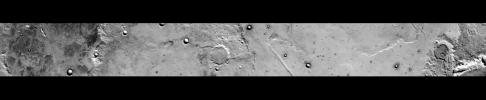
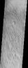
2003-01-13 |
Mars
|
2001 Mars Odyssey
|
THEMIS
|
320x1404x1 |
|
-
PIA04085:
-
IR view of lava flows
Full Resolution:
TIFF
(430.1 kB)
JPEG
(67.28 kB)
|
|
|
2002-04-25 |
Mars
|
2001 Mars Odyssey
|
THEMIS
|
1212x3061x1 |
|
-
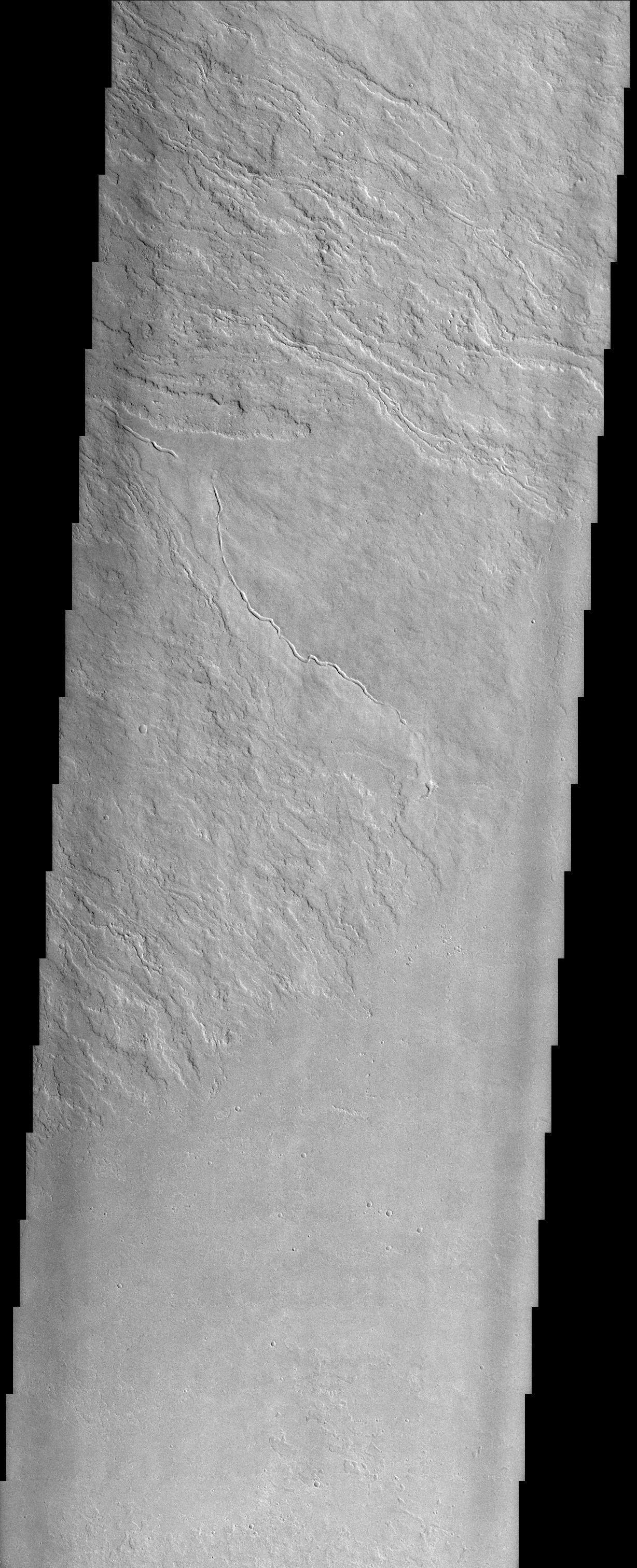
PIA03756:
-
Nirgal Vallis (Released 27 March 2002)
Full Resolution:
TIFF
(1.766 MB)
JPEG
(501.7 kB)
|
|
|
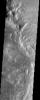
2002-05-21 |
Mars
|
2001 Mars Odyssey
|
THEMIS
|
1183x3061x1 |
|
-
PIA03757:
-
Gullied Craters 41°S
Full Resolution:
TIFF
(1.722 MB)
JPEG
(400.2 kB)
|
|
|
2002-05-21 |
Mars
|
2001 Mars Odyssey
|
THEMIS
|
1238x3043x1 |
|
-
PIA03758:
-
Layered Deposits on the floor of Ganges Chasma
Full Resolution:
TIFF
(1.774 MB)
JPEG
(456.8 kB)
|
|
|
2002-05-21 |
Mars
|
2001 Mars Odyssey
|
THEMIS
|
1237x3043x1 |
|
-
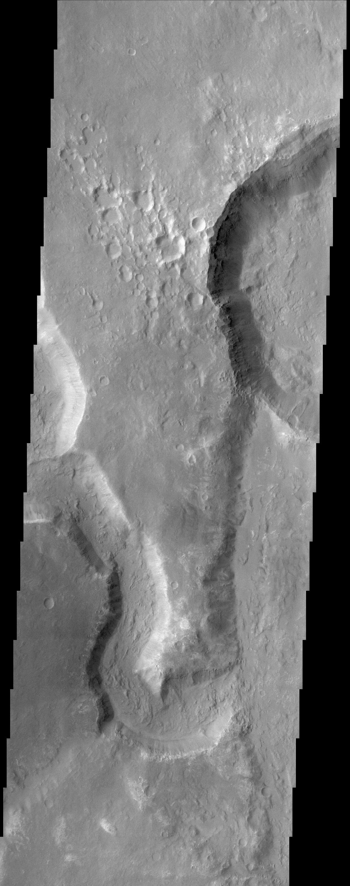
PIA03759:
-
Ganges Chasma Landslide
Full Resolution:
TIFF
(1.716 MB)
JPEG
(465.6 kB)
|
|
|
2002-05-21 |
Mars
|
2001 Mars Odyssey
|
THEMIS
|
1235x3025x1 |
|
-
PIA03760:
-
Rim of Henry Crater
Full Resolution:
TIFF
(1.495 MB)
JPEG
(322.6 kB)
|
|
|
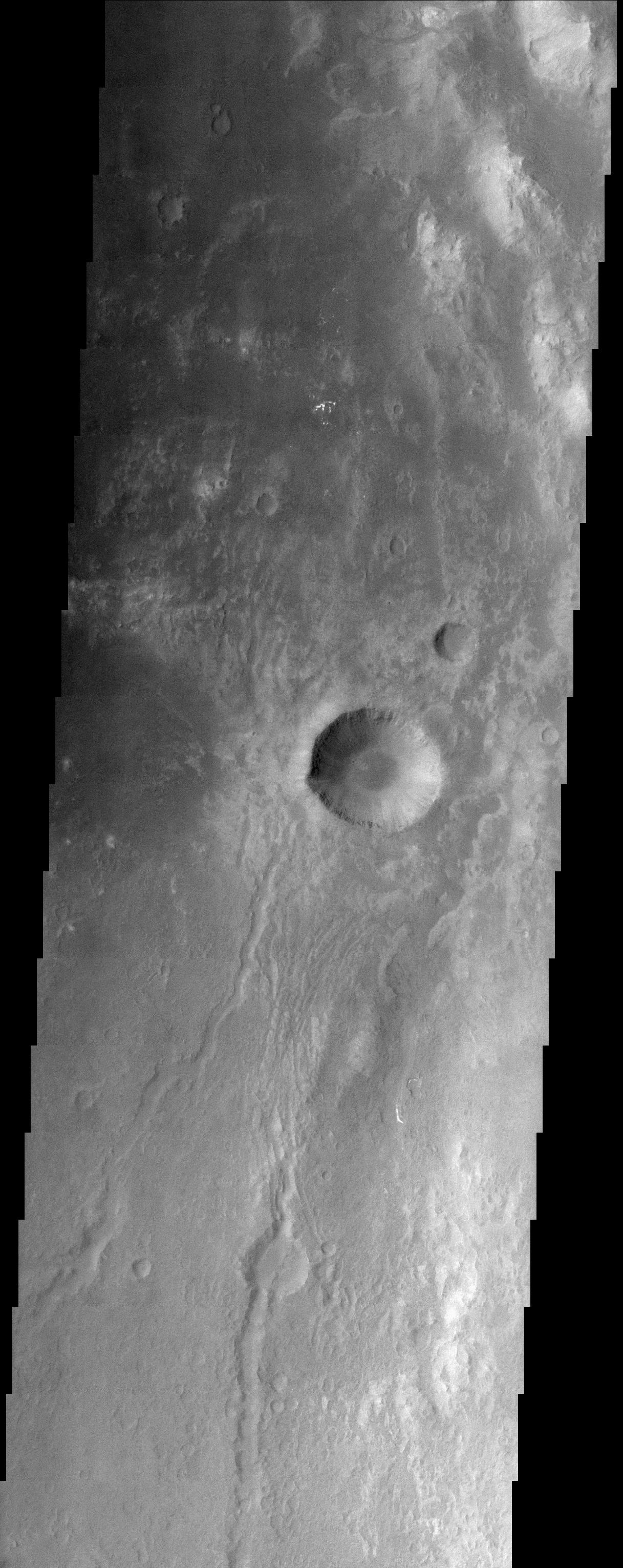
2002-05-21 |
Mars
|
2001 Mars Odyssey
|
THEMIS
|
1236x3025x1 |

|
-
PIA03761:
-
Isidis Rim
Full Resolution:
TIFF
(2.351 MB)
JPEG
(567.3 kB)
|
|
|
2002-05-21 |
Mars
|
2001 Mars Odyssey
|
THEMIS
|
1240x3043x1 |

|
-
PIA03762:
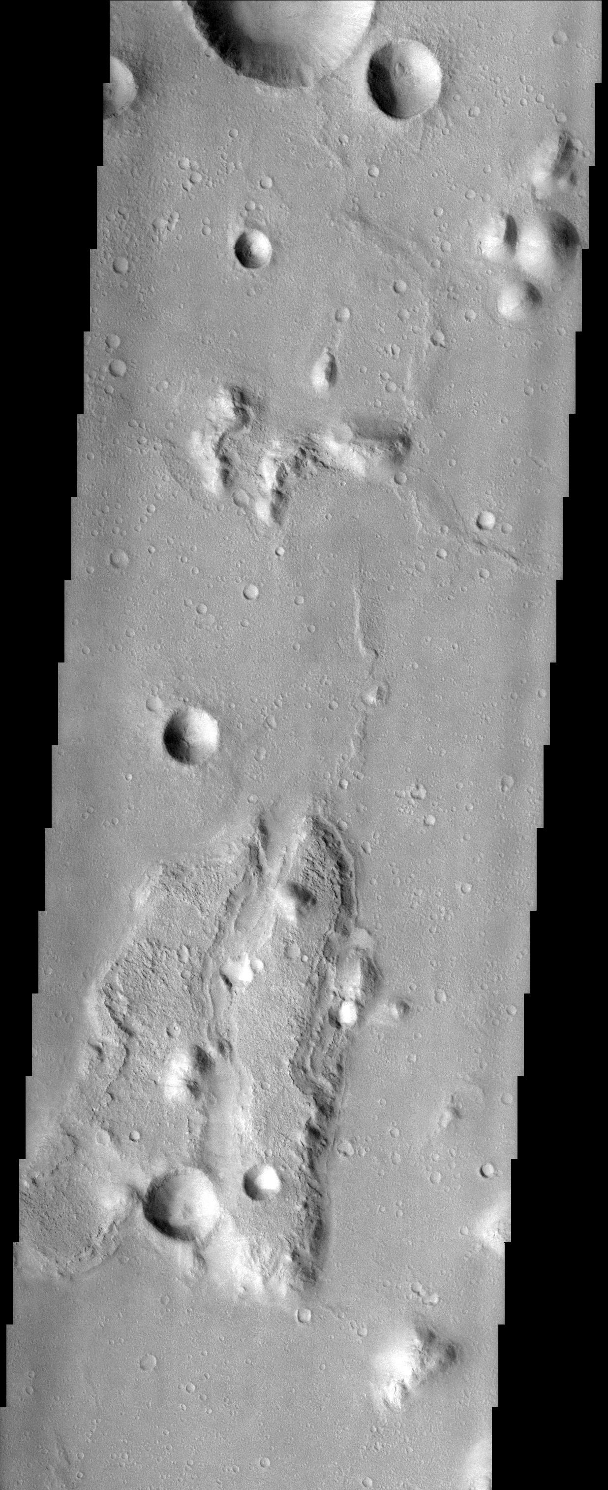
-
Naktong Valles
Full Resolution:
TIFF
(1.8 MB)
JPEG
(496.3 kB)
|
|
|
2002-05-21 |
Mars
|
2001 Mars Odyssey
|
THEMIS
|
1228x3025x1 |
|
-
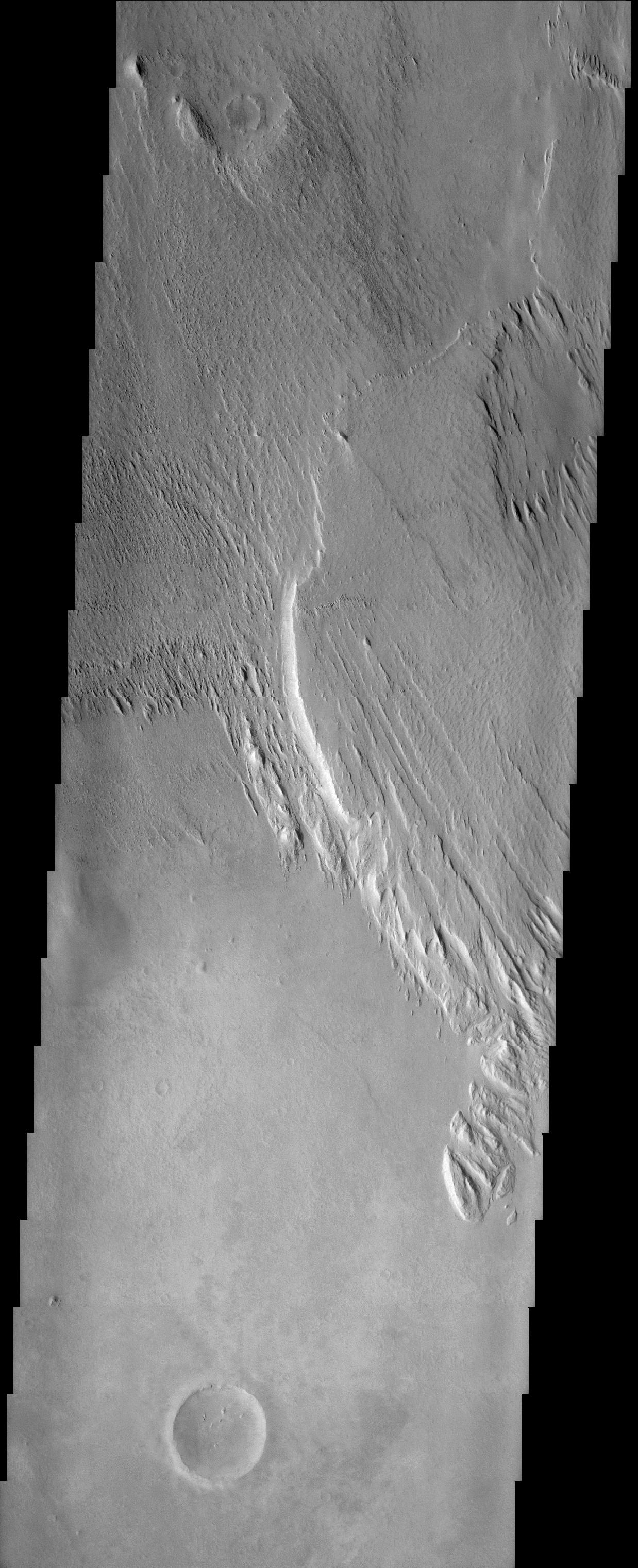
PIA03763:
-
Olympus Mons Lava Flows
Full Resolution:
TIFF
(1.84 MB)
JPEG
(623.5 kB)
|
|
|
2002-05-21 |
Mars
|
2001 Mars Odyssey
|
THEMIS
|
1189x3061x1 |
|
-
PIA03764:
-
Gorgonum Chaos
Full Resolution:
TIFF
(1.874 MB)
JPEG
(519.7 kB)
|
|
|
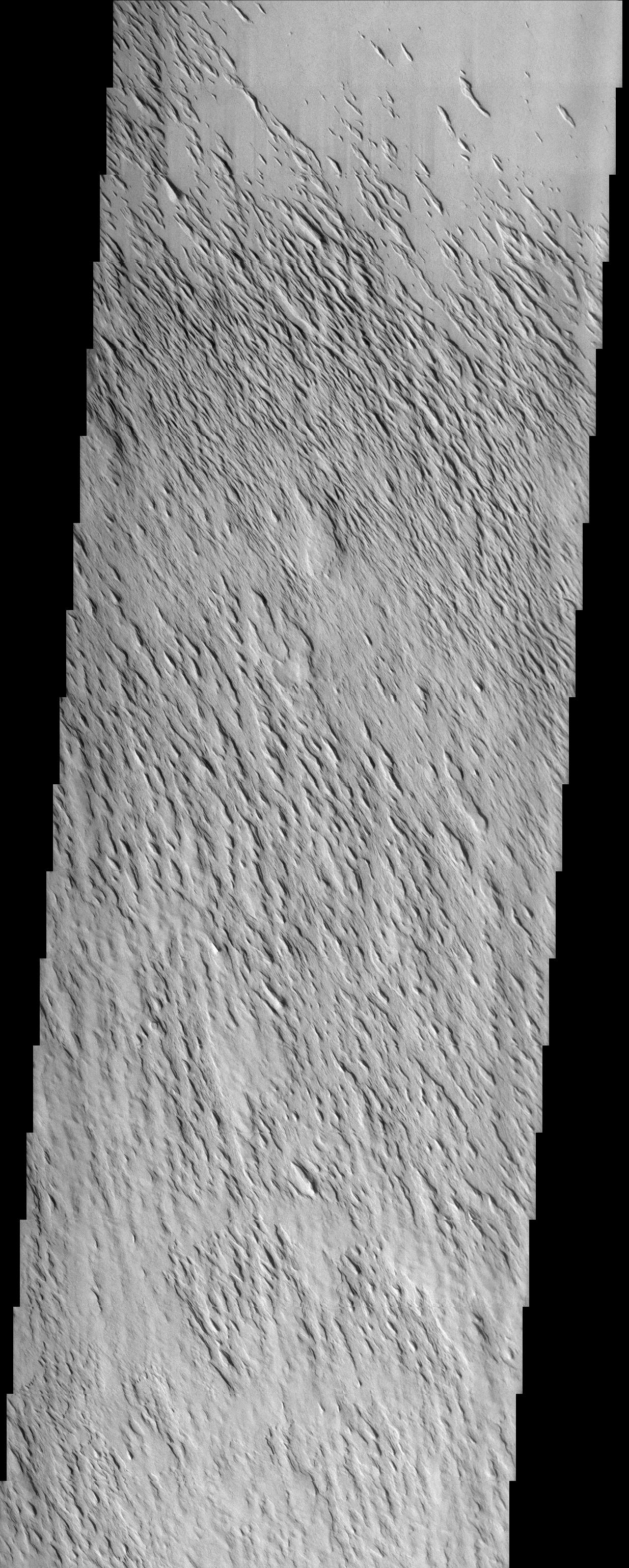
2002-05-21 |
Mars
|
2001 Mars Odyssey
|
THEMIS
|
1210x3061x1 |
|
-
PIA03765:
-
Uzboi Vallis, Nirgal Vallis, and Luki Crater
Full Resolution:
TIFF
(1.812 MB)
JPEG
(449.6 kB)
|
|
|
2002-05-21 |
Mars
|
2001 Mars Odyssey
|
THEMIS
|
1238x3043x1 |
|
-
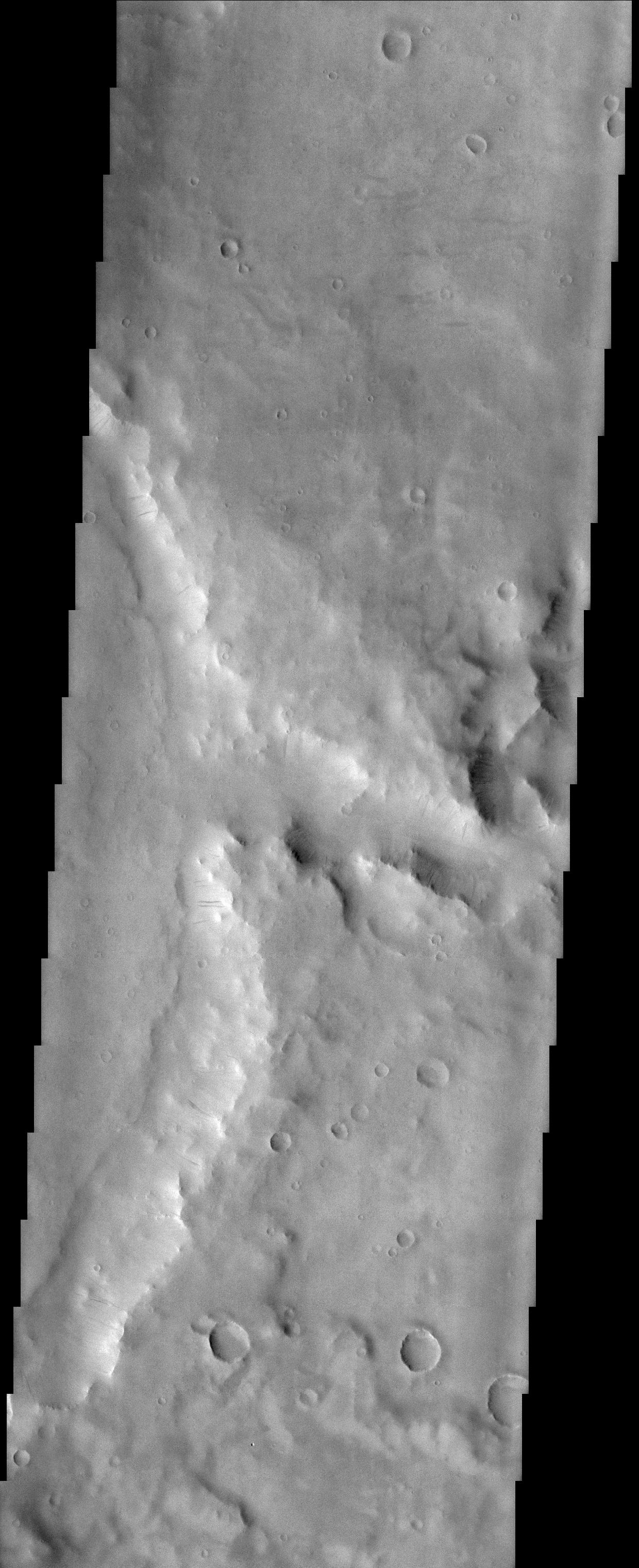
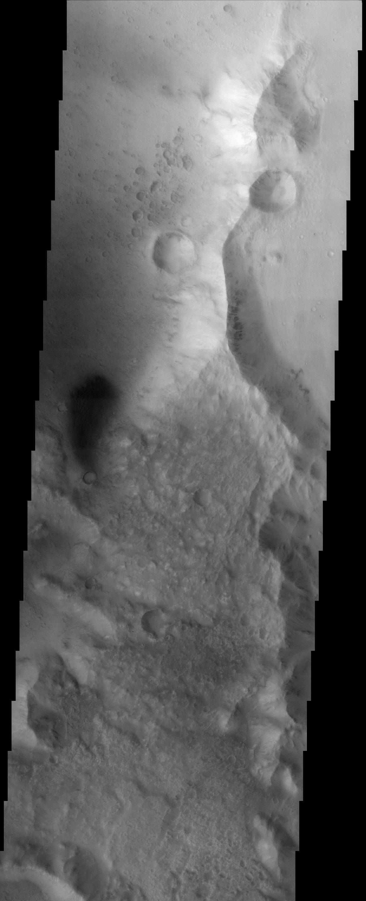
PIA03766:
-
Medusae Fossae Formation
Full Resolution:
TIFF
(1.771 MB)
JPEG
(473.2 kB)
|
|
|
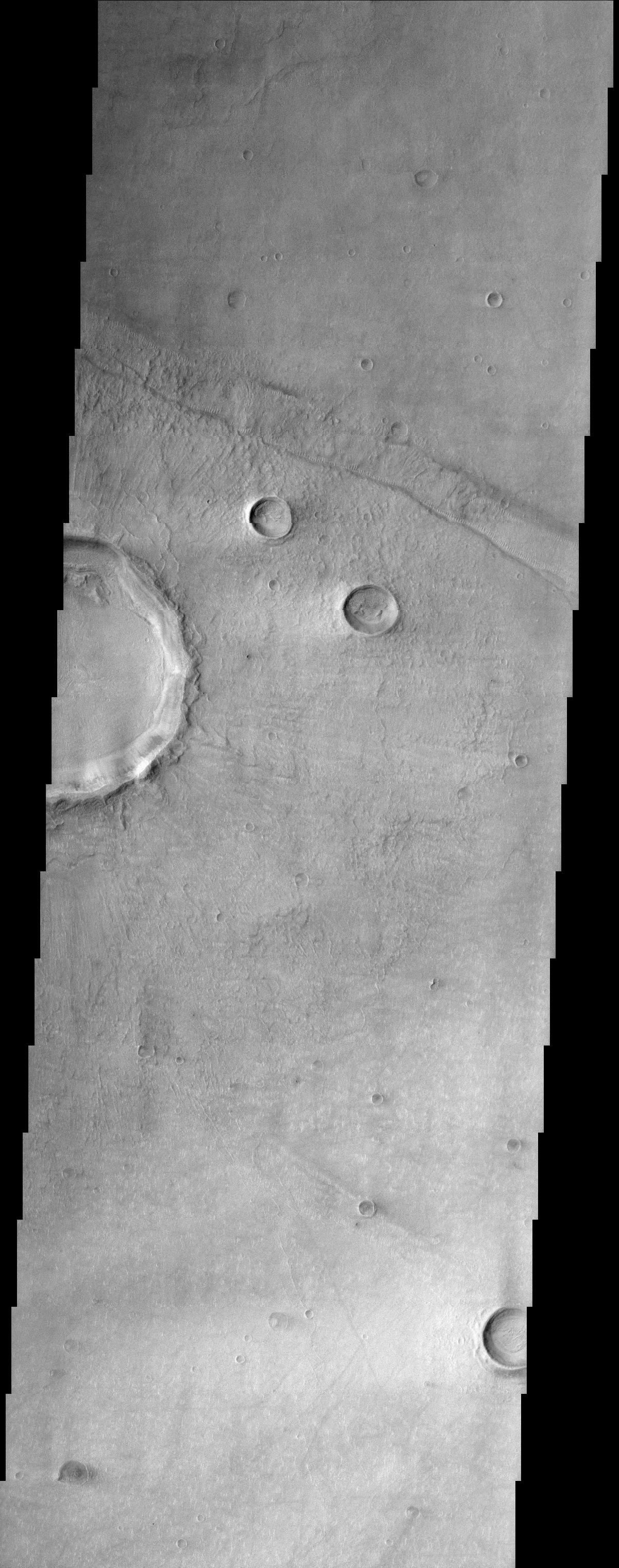
2002-05-21 |
Mars
|
2001 Mars Odyssey
|
THEMIS
|
1239x3043x1 |
|
-
PIA03767:
-
Southern rim of Isidis Planitia basin
Full Resolution:
TIFF
(1.499 MB)
JPEG
(306.7 kB)
|
|
|
2002-05-21 |
Mars
|
2001 Mars Odyssey
|
THEMIS
|
967x2738x1 |

|
-
PIA03768:
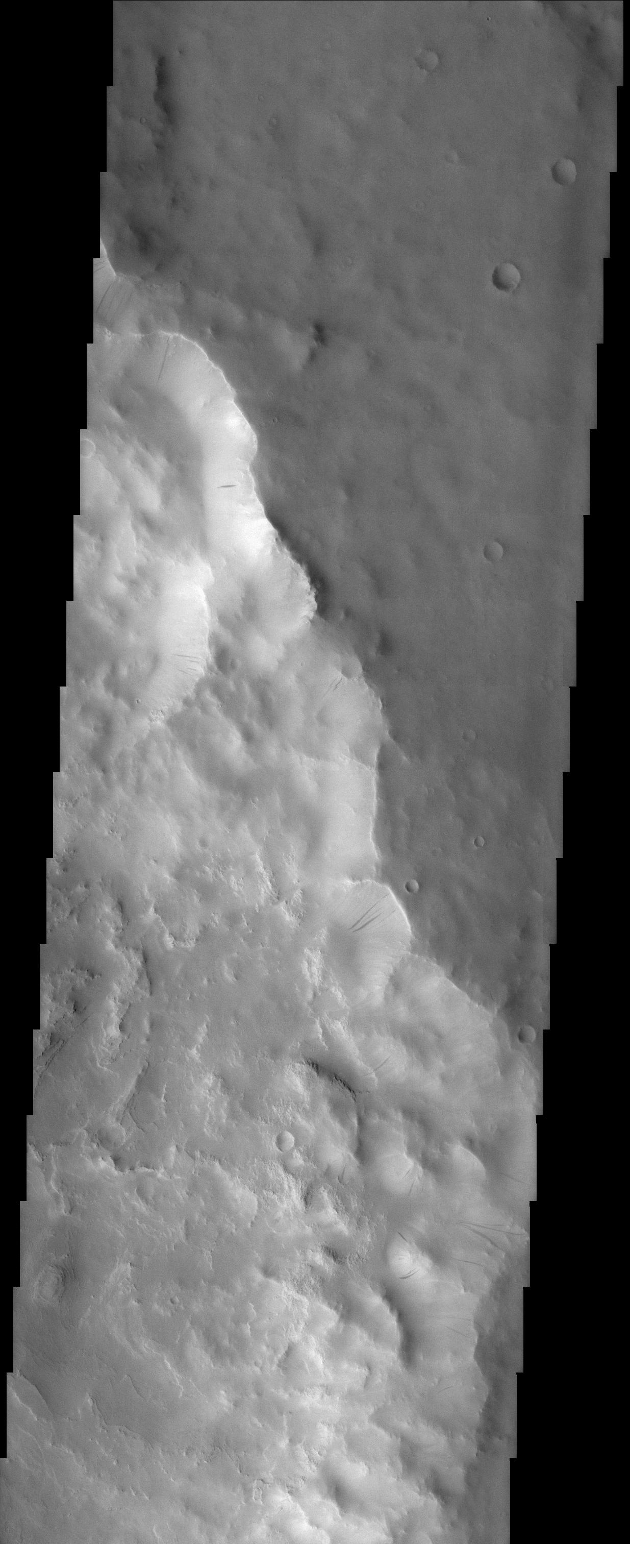
-
The So-Called "Face on Mars"
Full Resolution:
TIFF
(2.651 MB)
JPEG
(266.6 kB)
|
|
|
2002-05-21 |
Mars
|
2001 Mars Odyssey
|
THEMIS
|
1217x3061x1 |
|
-
PIA03769:
-
Eastern Floor of Holden Crater
Full Resolution:
TIFF
(1.993 MB)
JPEG
(482.5 kB)
|
|
|
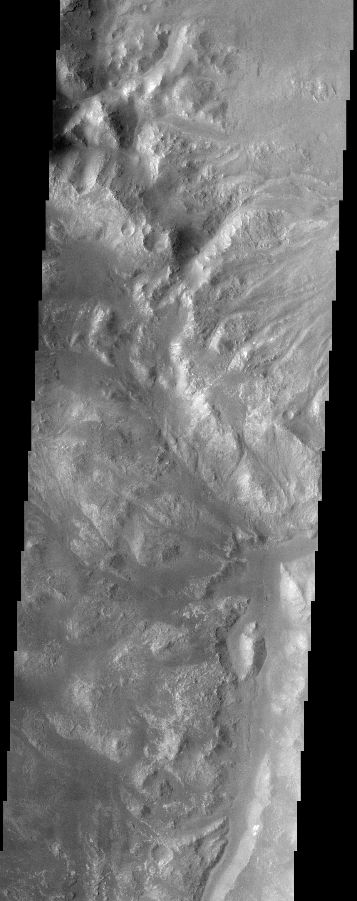
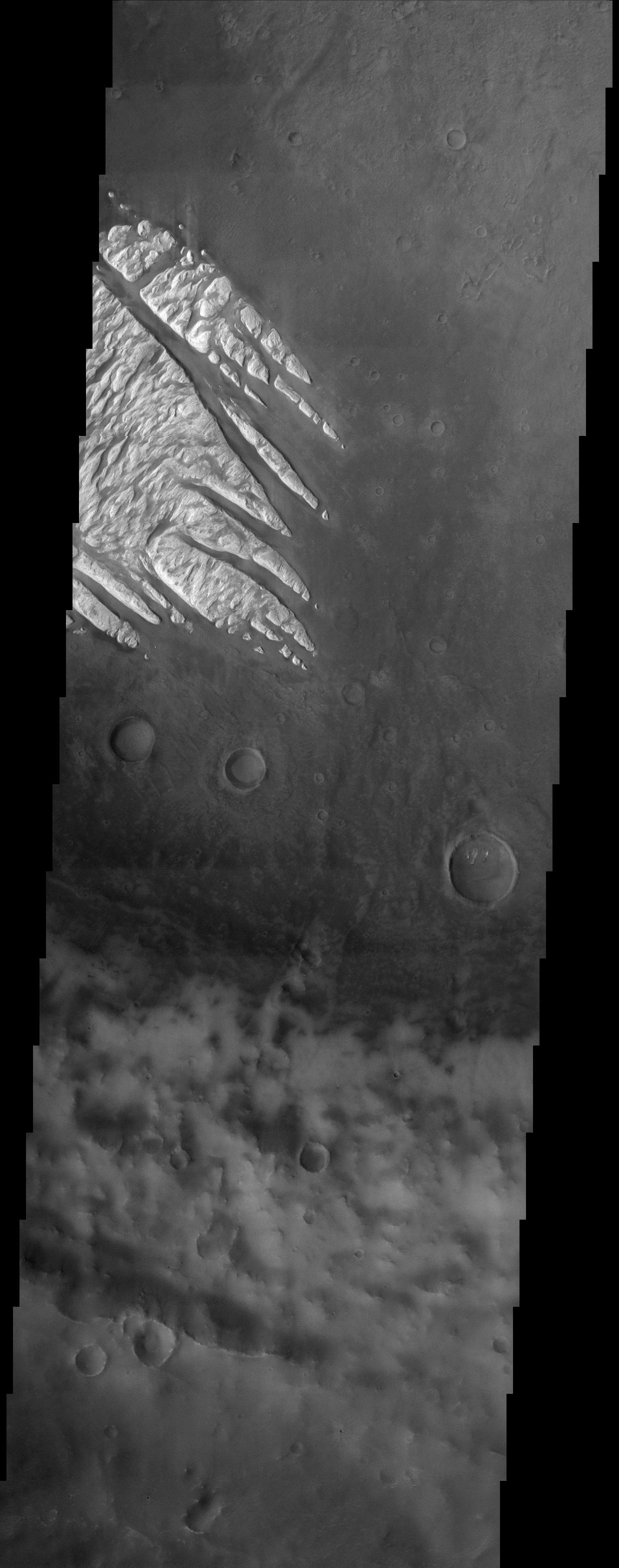
2002-05-21 |
Mars
|
2001 Mars Odyssey
|
THEMIS
|
1235x3079x1 |
|
-
PIA03770:
-
Medusae Fossae Formation
Full Resolution:
TIFF
(2.158 MB)
JPEG
(725.6 kB)
|
|
|
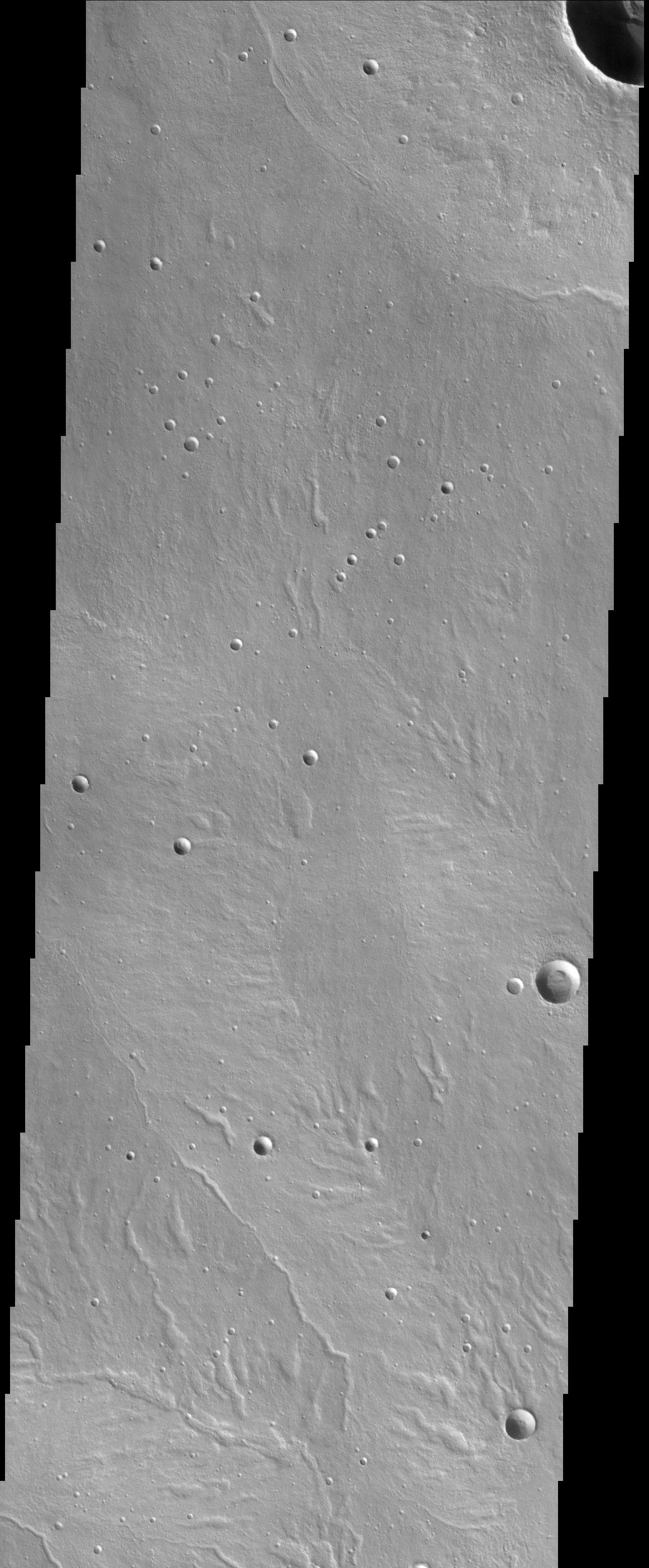
2002-05-21 |
Mars
|
2001 Mars Odyssey
|
THEMIS
|
1215x3061x1 |
|
-
PIA03771:
-
Holden Crater/Uzboi Valles
Full Resolution:
TIFF
(1.853 MB)
JPEG
(472.2 kB)
|
|
|
2002-05-21 |
Mars
|
2001 Mars Odyssey
|
THEMIS
|
1201x3043x1 |
|
-
PIA03772:
-
Bosporus Planum
Full Resolution:
TIFF
(1.78 MB)
JPEG
(526.2 kB)
|
|
|
2002-05-21 |
Mars
|
2001 Mars Odyssey
|
THEMIS
|
1238x3133x1 |
|
-
PIA03773:
-
White Rock
Full Resolution:
TIFF
(1.416 MB)
JPEG
(326.6 kB)
|
|
|
2002-05-21 |
Mars
|
2001 Mars Odyssey
|
THEMIS
|
1163x2809x1 |
|
-
PIA03774:
-
Alba Patera
Full Resolution:
TIFF
(1.249 MB)
JPEG
(390.9 kB)
|
|
|
2002-05-21 |
Mars
|
2001 Mars Odyssey
|
THEMIS
|
1154x2989x1 |
|
-
PIA03775:
-
A Cloudy Day on Mars
Full Resolution:
TIFF
(1.825 MB)
JPEG
(591.9 kB)
|
|
|
2002-05-21 |
Mars
|
2001 Mars Odyssey
|
THEMIS
|
1233x3025x1 |
|
-
PIA03776:
-
Cerberus
Full Resolution:
TIFF
(1.795 MB)
JPEG
(503.7 kB)
|
|
|
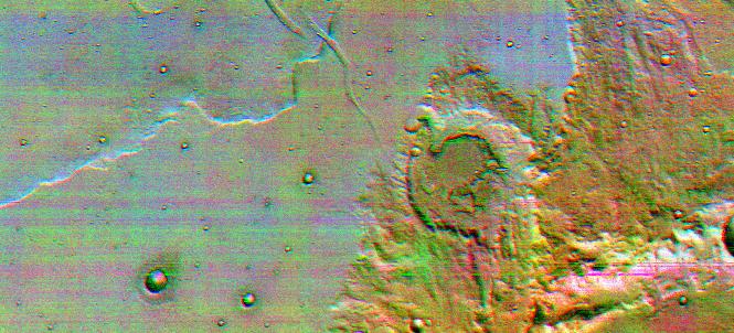
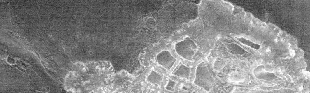
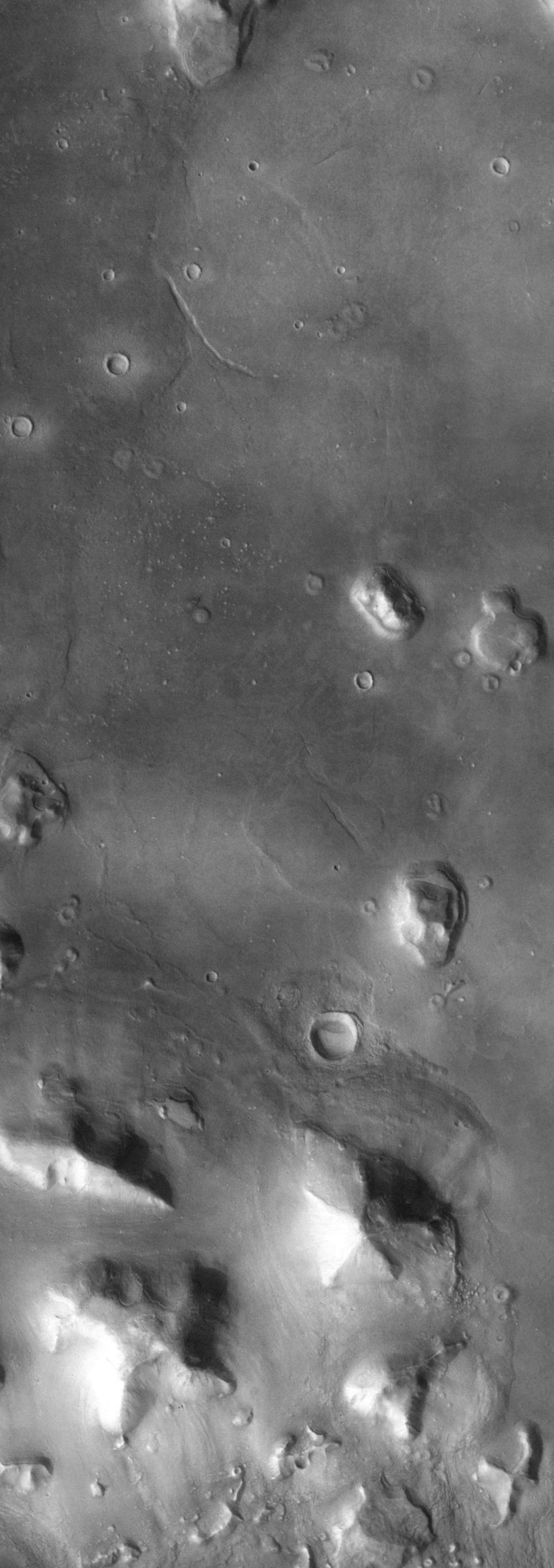
2002-05-23 |
Mars
|
2001 Mars Odyssey
|
THEMIS
|
1172x2791x1 |
|
-
PIA03782:
-
Knobby Terrain in Northern Arabia Terra
Full Resolution:
TIFF
(1.532 MB)
JPEG
(451.6 kB)
|
|
|
2002-05-23 |
Mars
|
2001 Mars Odyssey
|
THEMIS
|
1238x3043x1 |
|
-
PIA03783:
-
Noctis Labyrinthus
Full Resolution:
TIFF
(1.263 MB)
JPEG
(270.1 kB)
|
|
|
2002-05-23 |
Mars
|
2001 Mars Odyssey
|
THEMIS
|
1237x3151x1 |
|
-
PIA03784:
-
Crustal Fractures of Ophir Planum
Full Resolution:
TIFF
(1.52 MB)
JPEG
(298.5 kB)
|
 Planetary Data System


