- Original Caption Released with Image:
-
(Released 18 April 2002)
The Science
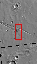
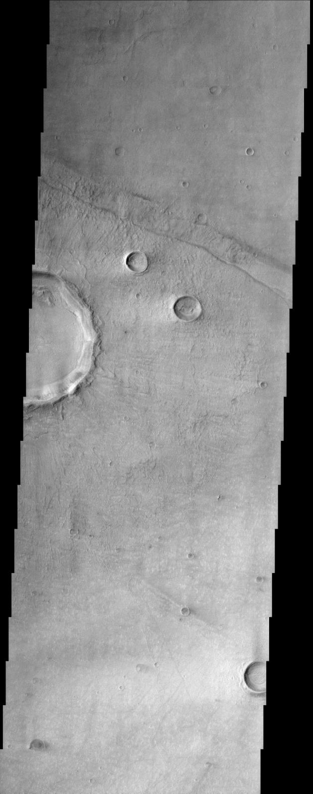
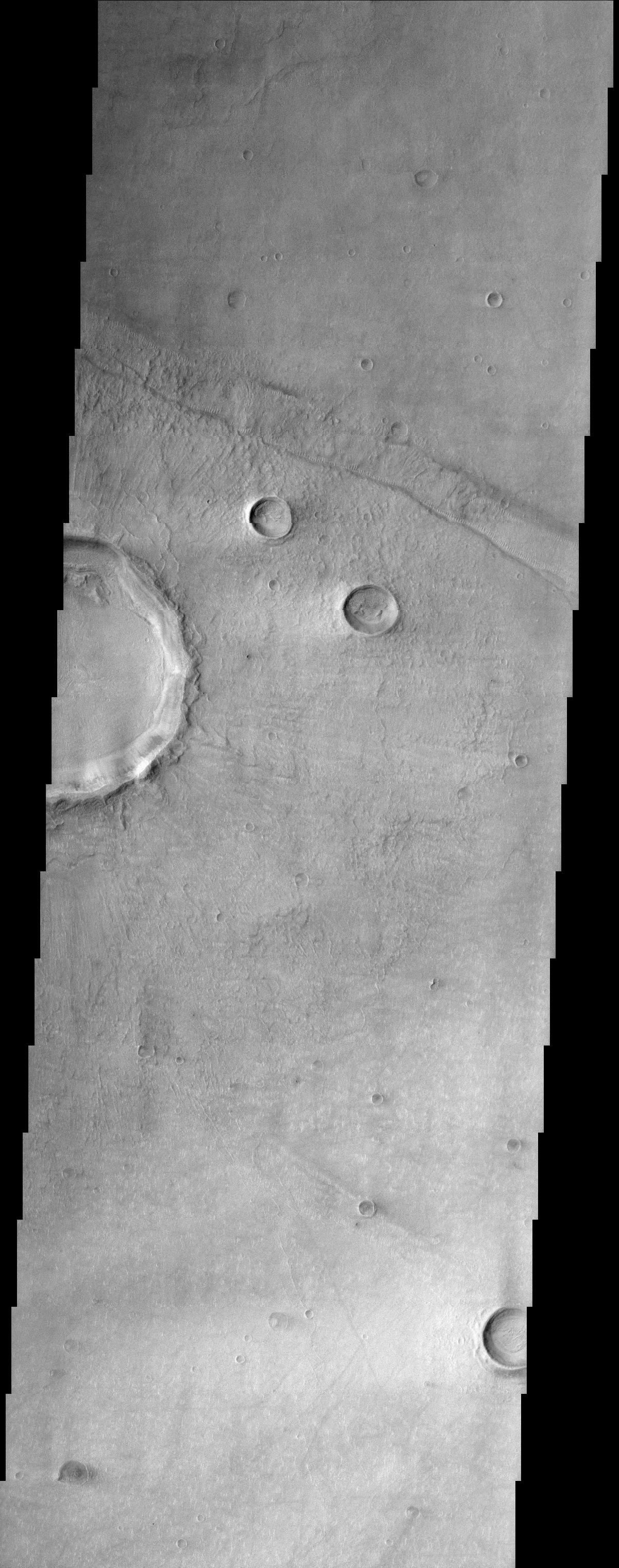
This THEMIS image is of Bosporus Planum, located in a region of smooth plains that appear to have formed from lava flows. A crater, ~7 km in diameter, on the left edge of the image has produced an ejecta blanket that can be seen radiating from the crater. Lobes of ejecta such as those seen close to the crater rim are not formed at most typical craters and may indicate that there was a ice component in the sub-surface material when the impact occurred. A linear depression trending from the northwest to southeast along the top of the image is about 1 to 2 km wide. This may be a tectonic feature, known as a graben, that forms when a region is under stresses that are pulling it apart. There are numerous small bright dunes or ripples along the margins of the floor of this linear feature that have formed perpendicular to the sides of the graben. This pattern of ripples suggests that the wind was blowing down the graben canyon. Similar small bright dunes can be faintly seen on top of the crater ejecta along ridges (most apparent directly to the east of the crater) and along the southern margin of the interior deposits in the crater. Bright wind streaks are also apparent in this area to the west (right) of several large craters. These streaks likely formed when very small particle size materials (like dust) is deposited on the surface and then protected from removal by the wind shadow produced by the crater's rim. Shorter dark streaks, possible deposits of dark sand, have formed to the east side of the smaller craters. These streaks on opposite sides of craters may indicate that there have been different wind patterns in the area, blowing in opposite directions. Subtle ridges near the south end of the image hint that there may have been other graben that have been nearly filled in. Many of the craters in this image have a subdued, buried appearance and may have been partially filled by lava flows or mantled by dust.
A short geologic history of the area in this image can be created using the basic principles of geology, such as the principle of superposition (deposits that lie on top of other materials are younger). The linear depression must have formed after the deposition of the lava plains since it is a feature that would not have been otherwise preserved. Ejecta from the large crater has been deposited inside and over the edges of the linear depression, thus the crater must have formed after the linear depression. Finally, the bright dunes and dust streaks formed last because they have been deposited on top of all of these different features.
The Story
Splat! Take a look at the lumpy edge of the large crater half (left-hand side of the image) and compare it to the much neater rims of other craters in the region. Why is there such a difference? Scientists believe that when something hit the surface of Mars long ago, ice may have been present in the subsurface and was "regurgitated" upward into the Martian air along with dirt and rock, "splooshing" outward. When that happened, the mixed-up, ejected material created a wavering, batter-like edge that is not typical for most (ice-free) craters. More ejected material from this same impact radiates much farther out from the crater, giving it a vague, sun-like appearance.
Many of the small craters in this image appear much fainter and more subdued than the others. Their ghostly appearance may be due to a lava flow that smoothed out most of the terrain in this image, partially burying them . . . . Or???? Maybe it was a layer of dust that settled in this region to accomplish the same concealed look.
And what about that scar-like trek that cuts through the upper third of the image? It's an elongated fault created when a crust-breaking, tectonic force ripped apart the Martian terrain, leaving a long depression on the surface. This feature is called a graben, and we find them on Earth too (think of Death Valley, the lowest dry land in the United States, or the Jordan Dead Sea depression). The graben's rumpled, scar-like appearance is only enhanced by the stitchy-looking sand dunes that run down its sides. This dune pattern shows that the Martian wind probably blew down through the graben canyon to create their ruffled appearance.
The wind doesn't have its way everywhere, though. The brighter surface material on the western side of the two diagonally positioned smaller craters is probably a layer of dust that has been shielded from removal by the craters' higher rims. Dark streaks (possibly dark sand) on the opposite side of these craters reveal that the wind has been blowing to no avail in the opposite direction too.
So, think that explains everything in this image? Here's a quick geology quiz! Which features happened first? The dunes, the lava plains, the big crater, or the linear depression called a graben? To find out if you're right, check out the last paragraph in The Science caption. Hint! Whatever happened later has to be on top of whatever came before.
- Image Credit:
-
NASA/JPL/Arizona State University
Image Addition Date: -
2002-05-21
|
 Planetary Data System


