|
Your search criteria found 2605 images Target is Earth (and available satellites) |
| My List |
Addition Date |
Target
|
Mission | Instrument | Size |

|
1998-04-28 | Earth |
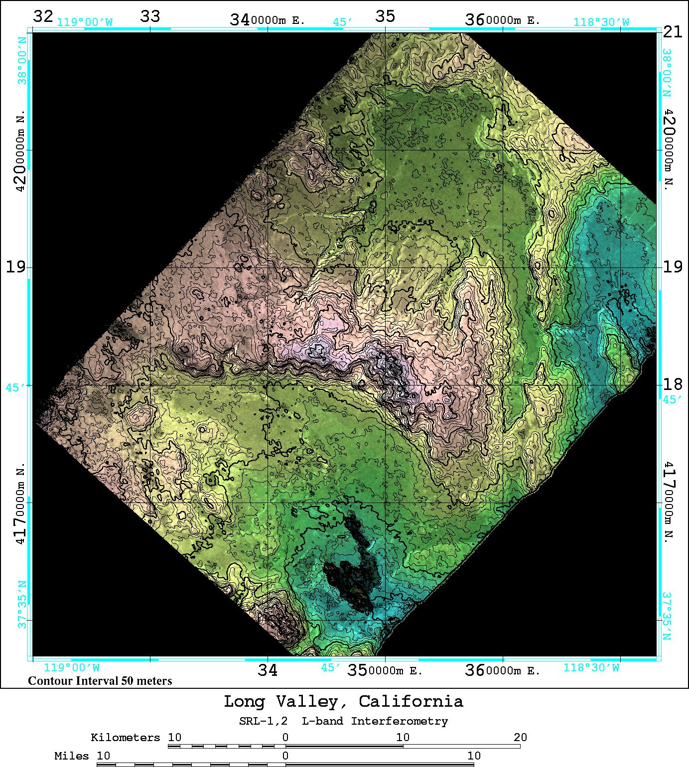
Spaceborne Imaging Radar-C/X-Band Synthetic Aperture Radar |
Imaging Radar |
2188x1201x3 |

|
|||||
|
|
1999-04-15 | Earth |
Spaceborne Imaging Radar-C/X-Band Synthetic Aperture Radar |
Imaging Radar |
2010x1800x1 |
|
|||||
|
|
1998-04-28 | Earth |
Spaceborne Imaging Radar-C/X-Band Synthetic Aperture Radar |
Imaging Radar |
1660x3000x3 |

|
|||||
|
|
1998-04-28 | Earth |
Spaceborne Imaging Radar-C/X-Band Synthetic Aperture Radar |
Imaging Radar |
3930x2880x3 |

|
|||||
|
|
1998-04-14 | Earth |
Spaceborne Imaging Radar-C/X-Band Synthetic Aperture Radar |
Imaging Radar |
2430x3078x3 |

|
|||||
|
|
1998-04-14 | Earth |
Spaceborne Imaging Radar-C/X-Band Synthetic Aperture Radar |
Imaging Radar |
1676x4000x3 |
|
|
|||||
|
|
1998-04-14 | Earth |
Spaceborne Imaging Radar-C/X-Band Synthetic Aperture Radar |
Imaging Radar |
1950x3000x3 |
|
|||||
|
|
1998-04-14 | Earth |
Spaceborne Imaging Radar-C/X-Band Synthetic Aperture Radar |
Imaging Radar |
3112x4817x3 |

|
|||||
|
|
1998-04-14 | Earth |
Spaceborne Imaging Radar-C/X-Band Synthetic Aperture Radar |
Imaging Radar |
1498x3000x3 |

|
|||||
|
|
1998-04-09 | Earth |
Spaceborne Imaging Radar-C/X-Band Synthetic Aperture Radar |
Imaging Radar |
3022x3018x3 |
|
|||||
|
|
1999-08-09 | Earth |
QuikScat |
SeaWinds Scatterometer |
1193x1193x3 |
|
|||||
|
|
1999-08-09 | Earth |
QuikScat |
SeaWinds Scatterometer |
1193x1193x3 |
|
|||||
|
|
1999-09-23 | Earth |
Global Rain Forest Mapping Project (GRFM) |
JERS-1 SAR |
2552x997x3 |
|
|||||
|
|
1999-09-27 | Earth |
Spaceborne Imaging Radar-C/X-Band Synthetic Aperture Radar |
L-Band Imaging Radar |
1200x2501x3 |
|
|
|||||
|
|
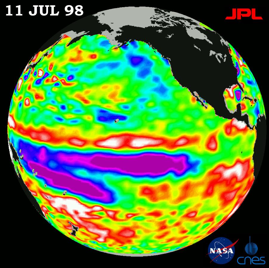
1998-07-03 | Earth |
TOPEX/Poseidon |
Altimeter |
901x900x3 |
|
|||||
|
|
1998-11-04 | Earth |
TOPEX/Poseidon |
Altimeter |
1912x1908x3 |
|
|||||
|
|
1998-07-03 | Earth |
TOPEX/Poseidon |
Altimeter |
695x900x3 |
|
|||||
|
|
1998-07-03 | Earth |
TOPEX/Poseidon |
Altimeter |
923x900x3 |
|
|||||
|
|
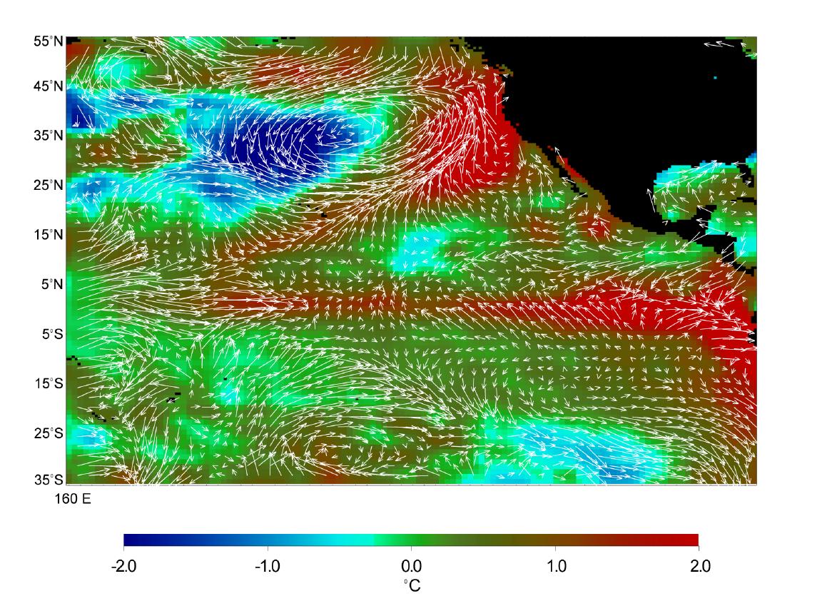
1998-07-03 | Earth |
Advanced Earth Observing Satellite (ADEOS) |
MLS |
1152x849x3 |
|
|||||
|
|
1998-07-03 | Earth |
TOPEX/Poseidon |
Altimeter |
900x900x3 |
|
|||||
|
|
1998-07-21 | Earth |
TOPEX/Poseidon |
Altimeter |
902x900x3 |
|
|||||
|
|
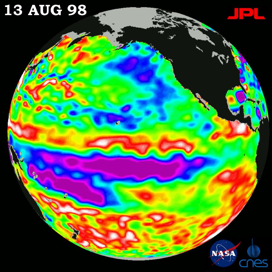
1998-07-23 | Earth |
Geostationary Operational Environmental Satellite 7 (GOES-7) |
1523x1603x3 | |

|
|||||
|
|
1998-09-26 | Earth |
TOPEX/Poseidon |
Altimeter |
900x900x3 |
|
|||||
|
|
1998-09-26 | Earth |
TOPEX/Poseidon |
Altimeter |
902x900x3 |
|
|||||
|
|
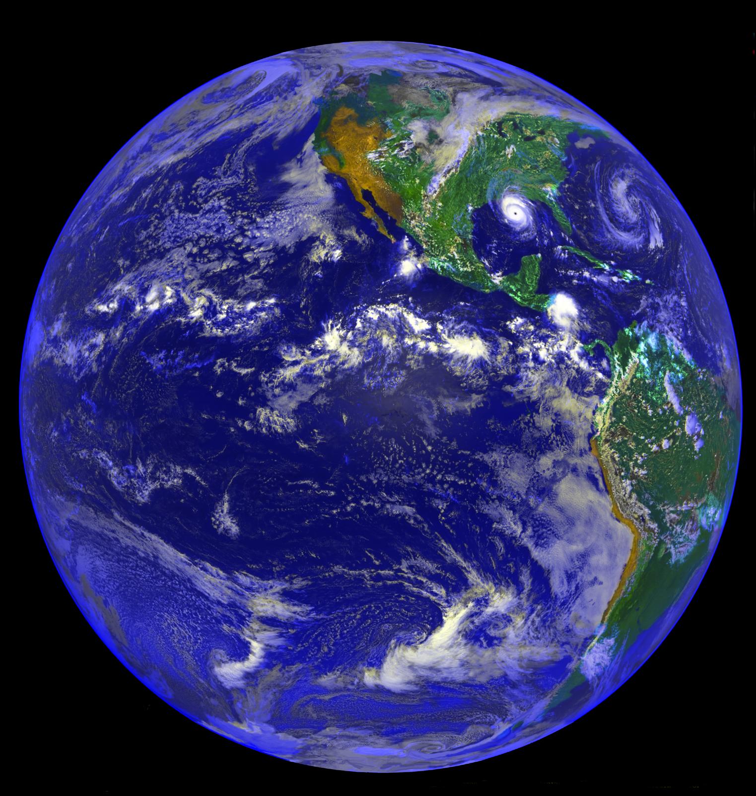
1998-10-30 | Earth |
Voyager |
VG Imaging Science Subsystem |
2012x2994x3 |

|
|||||
|
|
1998-12-05 | Earth |
TOPEX/Poseidon |
Altimeter |
902x900x3 |
|
|||||
|
|
1998-12-05 | Earth |
TOPEX/Poseidon |
Altimeter |
902x900x3 |
|
|||||
|
|
1999-04-15 | Earth |
TOPEX/Poseidon |
Altimeter |
900x900x3 |
|
|||||
|
|
1999-04-15 | Earth |
TOPEX/Poseidon |
Altimeter |
902x900x3 |
|
|||||
|
|
1999-06-21 | Earth |
TOPEX/Poseidon |
Altimeter |
900x900x3 |
|
|||||
|
|
1999-08-23 | Earth |
TOPEX/Poseidon |
Altimeter |
902x900x3 |
|
|||||
|
|
2002-11-01 | Earth |
Shuttle Radar Topography Mission (SRTM) Terra |
ASTER C-Band Interferometric Radar |
1152x870x3 |

|
|||||
|
|
1999-01-27 | Earth |
Spaceborne Imaging Radar-C/X-Band Synthetic Aperture Radar |
804x1330x3 | |

|
|||||
|
|
1999-01-27 | Earth |
Spaceborne Imaging Radar-C/X-Band Synthetic Aperture Radar |
784x1765x1 | |
|
|
|||||
|
|
1999-01-27 | Earth |
Spaceborne Imaging Radar-C/X-Band Synthetic Aperture Radar |
788x1838x3 | |
|
|
|||||
|
|
1999-01-27 | Earth |
Spaceborne Imaging Radar-C/X-Band Synthetic Aperture Radar |
1536x972x3 | |
|
|||||
|
|
1999-01-27 | Earth |
Spaceborne Imaging Radar-C/X-Band Synthetic Aperture Radar |
698x2299x3 | |
|
|
|||||
|
|
1999-01-27 | Earth |
Spaceborne Imaging Radar-C/X-Band Synthetic Aperture Radar |
866x1813x3 | |
|
|
|||||
|
|
1999-01-27 | Earth |
Spaceborne Imaging Radar-C/X-Band Synthetic Aperture Radar |
768x2026x3 | |
|
|
|||||
|
|
1999-01-27 | Earth |
Spaceborne Imaging Radar-C/X-Band Synthetic Aperture Radar |
1440x972x3 | |

|
|||||
|
|
1999-01-27 | Earth |
Spaceborne Imaging Radar-C/X-Band Synthetic Aperture Radar |
1116x1130x3 | |
|
|||||
|
|
1999-01-27 | Earth |
Spaceborne Imaging Radar-C/X-Band Synthetic Aperture Radar |
1042x1433x3 | |

|
|||||
|
|
1999-01-27 | Earth |
Spaceborne Imaging Radar-C/X-Band Synthetic Aperture Radar |
736x994x3 | |

|
|||||
|
|
1999-01-27 | Earth |
Spaceborne Imaging Radar-C/X-Band Synthetic Aperture Radar |
1280x1024x3 | |
|
|||||
|
|
2002-11-01 | Earth |
Shuttle Radar Topography Mission (SRTM) Terra |
ASTER C-Band Interferometric Radar |
1152x870x3 |
|
|||||
|
|
1999-01-27 | Earth |
Spaceborne Imaging Radar-C/X-Band Synthetic Aperture Radar |
1700x2200x3 | |
|
|||||
|
|
1999-01-27 | Earth |
Spaceborne Imaging Radar-C/X-Band Synthetic Aperture Radar |
1700x2200x3 | |
|
|||||
|
|
1999-01-27 | Earth |
Spaceborne Imaging Radar-C/X-Band Synthetic Aperture Radar |
1280x1024x3 | |
|
|||||
|
|
1999-01-27 | Earth |
Spaceborne Imaging Radar-C/X-Band Synthetic Aperture Radar |
670x900x3 | |

|
|||||
|
|
1999-01-27 | Earth |
Spaceborne Imaging Radar-C/X-Band Synthetic Aperture Radar |
1440x862x3 | |
|
|||||
|
|
1999-01-27 | Earth |
Spaceborne Imaging Radar-C/X-Band Synthetic Aperture Radar |
1440x961x3 | |
|
|||||
|
|
1999-01-27 | Earth |
Spaceborne Imaging Radar-C/X-Band Synthetic Aperture Radar |
1114x1295x3 | |

|
|||||
|
|
1999-01-27 | Earth |
Spaceborne Imaging Radar-C/X-Band Synthetic Aperture Radar |
690x2309x1 | |
|
|
|||||
|
|
1999-01-27 | Earth |
Spaceborne Imaging Radar-C/X-Band Synthetic Aperture Radar |
1075x2000x3 | |

|
|||||
|
|
1999-01-27 | Earth |
Spaceborne Imaging Radar-C/X-Band Synthetic Aperture Radar |
798x585x1 | |
|
|||||
|
|
1999-01-27 | Earth |
Spaceborne Imaging Radar-C/X-Band Synthetic Aperture Radar |
376x828x3 | |
|
|
|||||
|
|
1999-01-27 | Earth |
Spaceborne Imaging Radar-C/X-Band Synthetic Aperture Radar |
990x2655x3 | |
|
|
|||||
|
|
1999-05-01 | Earth |
Spaceborne Imaging Radar-C/X-Band Synthetic Aperture Radar |
639x697x3 | |
|
|||||
|
|
1999-05-01 | Earth |
Spaceborne Imaging Radar-C/X-Band Synthetic Aperture Radar |
939x681x3 | |
|
|||||
|
|
1999-05-01 | Earth |
Spaceborne Imaging Radar-C/X-Band Synthetic Aperture Radar |
944x1025x3 | |
|
|||||
|
|
1999-05-01 | Earth |
Spaceborne Imaging Radar-C/X-Band Synthetic Aperture Radar |
840x2700x3 | |
|
|
|||||
|
|
1999-05-01 | Earth |
Spaceborne Imaging Radar-C/X-Band Synthetic Aperture Radar |
1375x892x1 | |

|
|||||
|
|
1999-05-01 | Earth |
Spaceborne Imaging Radar-C/X-Band Synthetic Aperture Radar |
1301x1247x3 | |
|
|||||
|
|
1999-05-01 | Earth |
Spaceborne Imaging Radar-C/X-Band Synthetic Aperture Radar |
1280x924x3 | |
|
|||||
|
|
1999-05-01 | Earth |
Spaceborne Imaging Radar-C/X-Band Synthetic Aperture Radar |
1211x1025x3 | |
|
|||||
|
|
1999-05-01 | Earth |
Spaceborne Imaging Radar-C/X-Band Synthetic Aperture Radar |
1251x2734x3 | |
|
|
|||||
|
|
1999-05-01 | Earth |
Spaceborne Imaging Radar-C/X-Band Synthetic Aperture Radar |
911x2119x3 | |
|
|
|||||
|
|
1999-05-01 | Earth |
Spaceborne Imaging Radar-C/X-Band Synthetic Aperture Radar |
788x983x3 | |
|
|||||
|
|
1999-05-01 | Earth |
Spaceborne Imaging Radar-C/X-Band Synthetic Aperture Radar |
916x807x3 | |

|
|||||
|
|
1999-05-01 | Earth |
Spaceborne Imaging Radar-C/X-Band Synthetic Aperture Radar |
756x2688x3 | |
|
|
|||||
|
|
1999-05-01 | Earth |
Spaceborne Imaging Radar-C/X-Band Synthetic Aperture Radar |
692x1326x1 | |
|
|||||
|
|
1999-05-01 | Earth |
Spaceborne Imaging Radar-C/X-Band Synthetic Aperture Radar |
952x1000x3 | |

|
|||||
|
|
1999-05-01 | Earth |
Spaceborne Imaging Radar-C/X-Band Synthetic Aperture Radar |
1142x982x3 | |
|
|||||
|
|
1999-05-01 | Earth |
Spaceborne Imaging Radar-C/X-Band Synthetic Aperture Radar |
1024x750x3 | |
|
|||||
|
|
1999-05-01 | Earth |
Spaceborne Imaging Radar-C/X-Band Synthetic Aperture Radar |
1361x2890x3 | |
|
|
|||||
|
|
1999-05-01 | Earth |
Spaceborne Imaging Radar-C/X-Band Synthetic Aperture Radar |
1392x1152x3 | |
|
|||||
|
|
1999-05-01 | Earth |
Spaceborne Imaging Radar-C/X-Band Synthetic Aperture Radar |
1020x1020x3 | |
|
|||||
|
|
1999-05-01 | Earth |
Spaceborne Imaging Radar-C/X-Band Synthetic Aperture Radar |
1020x1020x1 | |
|
|||||
|
|
1999-05-01 | Earth |
Spaceborne Imaging Radar-C/X-Band Synthetic Aperture Radar |
864x1322x3 | |

|
|||||
|
|
1999-06-25 | Earth |
Spaceborne Imaging Radar-C/X-Band Synthetic Aperture Radar |
1536x1024x3 | |
|
|||||
|
|
1999-05-01 | Earth |
Spaceborne Imaging Radar-C/X-Band Synthetic Aperture Radar |
1840x2750x1 | |
|
|||||
|
|
1999-05-01 | Earth |
Spaceborne Imaging Radar-C/X-Band Synthetic Aperture Radar |
1383x1540x3 | |
|
|||||
|
|
1999-05-01 | Earth |
Spaceborne Imaging Radar-C/X-Band Synthetic Aperture Radar |
2000x3000x1 | |
|
|||||
|
|
1999-05-01 | Earth |
Spaceborne Imaging Radar-C/X-Band Synthetic Aperture Radar |
692x1024x1 | |
|
|||||
|
|
1999-05-01 | Earth |
Spaceborne Imaging Radar-C/X-Band Synthetic Aperture Radar |
664x750x1 | |
|
|||||
|
|
1999-05-01 | Earth |
Spaceborne Imaging Radar-C/X-Band Synthetic Aperture Radar |
726x651x3 | |

|
|||||
|
|
1999-05-01 | Earth |
Spaceborne Imaging Radar-C/X-Band Synthetic Aperture Radar |
2048x1365x3 | |
|
|||||
|
|
1999-05-01 | Earth |
Spaceborne Imaging Radar-C/X-Band Synthetic Aperture Radar |
406x1000x3 | |
|
|
|||||
|
|
1999-05-01 | Earth |
Spaceborne Imaging Radar-C/X-Band Synthetic Aperture Radar |
X-Band Radar |
1840x2760x1 |
|
|||||
|
|
1999-05-01 | Earth |
Spaceborne Imaging Radar-C/X-Band Synthetic Aperture Radar |
2000x1500x3 | |

|
|||||
|
|
1999-05-01 | Earth |
Spaceborne Imaging Radar-C/X-Band Synthetic Aperture Radar |
914x1818x3 | |
|
|||||
|
|
1999-05-01 | Earth |
Spaceborne Imaging Radar-C/X-Band Synthetic Aperture Radar |
1101x900x3 | |
|
|||||
|
|
2002-10-30 | Earth |
Terra |
MISR |
2328x1614x3 |
|
|||||
|
|
1999-05-01 | Earth |
Spaceborne Imaging Radar-C/X-Band Synthetic Aperture Radar |
2290x1727x3 | |
|
|||||
|
|
1999-05-01 | Earth |
Spaceborne Imaging Radar-C/X-Band Synthetic Aperture Radar |
1024x1024x3 | |
|
|||||
|
|
1999-05-01 | Earth |
Spaceborne Imaging Radar-C/X-Band Synthetic Aperture Radar |
1024x1024x3 | |
|
|||||
|
|
1999-05-01 | Earth |
Spaceborne Imaging Radar-C/X-Band Synthetic Aperture Radar |
X-Band Radar |
1024x1024x1 |

|
|||||
|
|
1999-05-01 | Earth |
Spaceborne Imaging Radar-C/X-Band Synthetic Aperture Radar |
740x2035x3 | |
|
|
|||||
|
|
1999-05-01 | Earth |
Spaceborne Imaging Radar-C/X-Band Synthetic Aperture Radar |
1202x835x3 | |

|
|||||
|
|
1999-05-01 | Earth |
Spaceborne Imaging Radar-C/X-Band Synthetic Aperture Radar |
2254x2248x3 | |
|
|||||

|
 |
|
|
|
 |
 |
|
|
|
|

|
| 1-100 | 101-200 | 201-300 | 301-400 | 401-500 | 501-600 | 601-700 | 701-800 | 801-900 | 901-1000 |
| Currently displaying images: 401 - 500 of 2605 |