My
List |
Addition Date
|
Target
|
Mission
|
Instrument
|
Size
|

|
2000-04-07 |
Mars
|
Mars Global Surveyor (MGS)
|
Mars Orbiter Camera (MOC)
|
1336x1168x3 |
|
-
PIA02381:
-
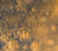
Cydonia: Wide Angle Color Image
Full Resolution:
TIFF
(4.201 MB)
JPEG
(196.6 kB)
|

|
2000-04-07 |
Mars
|
Mars Global Surveyor (MGS)
|
Mars Orbiter Camera (MOC)
|
1024x5248x1 |

|
-
PIA02382:
-
Cydonia: Two Years Later
Full Resolution:
TIFF
(3.85 MB)
JPEG
(630.9 kB)
|

|
2000-04-07 |
Mars
|
Mars Global Surveyor (MGS)
|
Mars Orbiter Camera (MOC)
|
768x3712x1 |

|
-
PIA02383:
-
Cydonia: Two Years Later
Full Resolution:
TIFF
(1.834 MB)
JPEG
(472.8 kB)
|

|
2000-04-07 |
Mars
|
Mars Global Surveyor (MGS)
|
Mars Orbiter Camera (MOC)
|
1024x6016x1 |

|
-
PIA02384:
-
Cydonia: Two Years Later
Full Resolution:
TIFF
(4.324 MB)
JPEG
(742.1 kB)
|

|
2000-04-07 |
Mars
|
Mars Global Surveyor (MGS)
|
Mars Orbiter Camera (MOC)
|
672x9856x1 |

|
-
PIA02385:
-
Cydonia: Two Years Later
Full Resolution:
TIFF
(5.211 MB)
JPEG
(906.6 kB)
|

|
2000-04-07 |
Mars
|
Mars Global Surveyor (MGS)
|
Mars Orbiter Camera (MOC)
|
512x2432x1 |

|
-
PIA02386:
-
Cydonia: Two Years Later
Full Resolution:
TIFF
(595.9 kB)
JPEG
(336.8 kB)
|

|
2000-04-07 |
Mars
|
Mars Global Surveyor (MGS)
|
Mars Orbiter Camera (MOC)
|
1024x7680x1 |

|
-
PIA02387:
-
Cydonia: Two Years Later
Full Resolution:
TIFF
(3.687 MB)
JPEG
(1.371 MB)
|

|
2000-04-07 |
Mars
|
Mars Global Surveyor (MGS)
|
Mars Orbiter Camera (MOC)
|
512x8064x1 |

|
-
PIA02388:
-
Cydonia: Two Years Later
Full Resolution:
TIFF
(2.664 MB)
JPEG
(439.3 kB)
|

|
2000-04-07 |
Mars
|
Mars Global Surveyor (MGS)
|
Mars Orbiter Camera (MOC)
|
768x5888x1 |

|
-
PIA02389:
-
Cydonia: Two Years Later
Full Resolution:
TIFF
(2.78 MB)
JPEG
(724.8 kB)
|

|
2000-04-11 |
Mars
|
Mars Global Surveyor (MGS)
|
Mars Orbiter Camera (MOC)
|
2496x972x1 |
|
-
PIA02390:
-
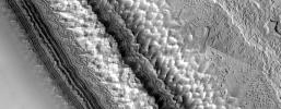
High-Resolution South Polar Cap Mosaics
Full Resolution:
TIFF
(2.268 MB)
JPEG
(248.1 kB)
|

|
2000-04-11 |
Mars
|
Mars Global Surveyor (MGS)
|
Mars Orbiter Camera (MOC)
|
2493x972x3 |
|
-
PIA02391:
-
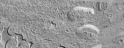
High-Resolution South Polar Cap Mosaics
Full Resolution:
TIFF
(1.84 MB)
JPEG
(284.7 kB)
|

|
2000-04-20 |
Mars
|
Mars Global Surveyor (MGS)
|
Mars Orbiter Camera (MOC)
|
512x15488x3 |

|
-
PIA02392:
-
A Traverse Across the Summit of Olympus Mons
Full Resolution:
TIFF
(5.766 MB)
JPEG
(1.069 MB)
|

|
2000-04-29 |
Mars
|
Mars Global Surveyor (MGS)
|
Mars Orbiter Camera (MOC)
|
1690x1234x3 |
|
-
PIA02393:
-
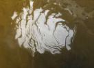
South Polar Cap, Summer 2000
Full Resolution:
TIFF
(5.016 MB)
JPEG
(142.7 kB)
|

|
2000-04-29 |
Mars
|
Mars Global Surveyor (MGS)
|
Mars Orbiter Camera (MOC)
|
528x655x3 |

|
-
PIA02394:
-
The Frosty Rims of Lomonosov Crater in Winter
Full Resolution:
TIFF
(1.022 MB)
JPEG
(21.97 kB)
|

|
2000-05-22 |
Mars
|
Mars Global Surveyor (MGS)
|
Mars Orbiter Camera (MOC)
|
800x7000x3 |

|
-
PIA02395:
-
A Valley in the Libya Montes
Full Resolution:
TIFF
(10.34 MB)
JPEG
(706.3 kB)
|

|
2000-05-22 |
Mars
|
Mars Global Surveyor (MGS)
|
Mars Orbiter Camera (MOC)
|
2174x987x3 |
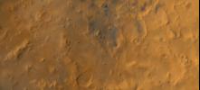
|
-
PIA02396:
-
A Regional View of the Libya Montes
Full Resolution:
TIFF
(4.827 MB)
JPEG
(153.5 kB)
|

|
2000-05-22 |
Mars
|
Mars Global Surveyor (MGS)
|
Mars Orbiter Camera (MOC)
|
800x7000x1 |

|
-
PIA02397:
-
The Plains of Central Terra Meridiani
Full Resolution:
TIFF
(4.047 MB)
JPEG
(836.7 kB)
|

|
2000-05-22 |
Mars
|
Mars Global Surveyor (MGS)
|
Mars Orbiter Camera (MOC)
|
512x1381x1 |

|
-
PIA02398:
-
Layers and a Dust Devil in Melas Chasma
Full Resolution:
TIFF
(692.5 kB)
JPEG
(191.1 kB)
|

|
1999-09-08 |
Mars
|
Mars Pathfinder (MPF)
|
Imager for Mars Pathfinder
|
7238x3135x3 |
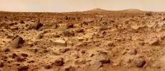
|
-
PIA02405:
-
Twin Peaks in Super Resolution - Left Eye
Full Resolution:
TIFF
(65.93 MB)
JPEG
(2.307 MB)
|

|
1999-09-08 |
Mars
|
Mars Pathfinder (MPF)
|
Imager for Mars Pathfinder
|
7296x3135x3 |
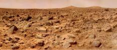
|
-
PIA02406:
-
Twin Peaks in Super Resolution - Right Eye
Full Resolution:
TIFF
(70.57 MB)
JPEG
(2.584 MB)
|

|
2000-11-03 |
Mars
|
Galileo
Mars Global Surveyor (MGS)
|
Mars Orbiter Camera (MOC)
Solid-State Imaging
|
2800x1824x3 |

|
-
PIA02570:
-
Earth Mars Comparison
Full Resolution:
TIFF
(5.946 MB)
JPEG
(269.4 kB)
|

|
2000-09-05 |
Mars
|
Mars Pathfinder (MPF)
|
Imager for Mars Pathfinder
|
4096x4096x3 |
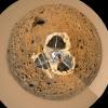
|
-
PIA02652:
-
Mars Pathfinder "Filled Donut" Mosaic
Full Resolution:
TIFF
(43.45 MB)
JPEG
(1.781 MB)
|

|
2000-09-08 |
Mars
|
Mars Global Surveyor (MGS)
|
Mars Orbiter Camera (MOC)
|
2400x2400x3 |
|
-
PIA02653:
-
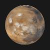
Mars Daily Global Image from April 1999
Full Resolution:
TIFF
(9.058 MB)
JPEG
(341.5 kB)
|

|
2000-05-22 |
Mars
|
Mars Global Surveyor (MGS)
|
Mars Orbiter Camera (MOC)
|
1368x1319x3 |
|
-
PIA02800:
-
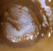
The Martian North Polar Cap in Summer
Full Resolution:
TIFF
(4.691 MB)
JPEG
(162 kB)
|

|
2000-05-22 |
Mars
|
Mars Global Surveyor (MGS)
|
Mars Orbiter Camera (MOC)
|
836x3919x1 |

|
-
PIA02801:
-
Ridged Terrain on the Floor Melas Chasma
Full Resolution:
TIFF
(3.129 MB)
JPEG
(558.5 kB)
|

|
2000-05-22 |
Mars
|
Mars Global Surveyor (MGS)
|
Mars Orbiter Camera (MOC)
|
512x1837x1 |

|
-
PIA02802:
-
Hot-Cross-Bun' on the Northern Plains
Full Resolution:
TIFF
(841.6 kB)
JPEG
(166 kB)
|

|
2000-09-07 |
Mars
|
Mars Global Surveyor (MGS)
|
MOLA
|
524x462x1 |
|
-
PIA02803:
-
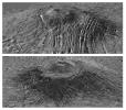
Major Martian Volcanoes from MOLA - Alba Patera
Full Resolution:
TIFF
(239.9 kB)
JPEG
(52.87 kB)
|

|
2000-09-07 |
Mars
|
Mars Global Surveyor (MGS)
|
MOLA
|
524x462x1 |
|
-
PIA02804:
-
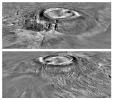
Major Martian Volcanoes from MOLA - Arsia Mons
Full Resolution:
TIFF
(231.1 kB)
JPEG
(52.9 kB)
|

|
2000-09-07 |
Mars
|
Mars Global Surveyor (MGS)
|
MOLA
|
2100x900x1 |
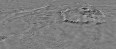
|
-
PIA02805:
-
Major Martian Volcanoes from MOLA - Olympus Mons
Full Resolution:
TIFF
(1.538 MB)
JPEG
(270.9 kB)
|

|
2000-09-07 |
Mars
|
Mars Global Surveyor (MGS)
|
MOLA
|
2100x900x1 |
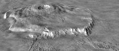
|
-
PIA02806:
-
Major Martian Volcanoes from MOLA - Olympus Mons
Full Resolution:
TIFF
(1.451 MB)
JPEG
(205 kB)
|

|
2000-09-12 |
Mars
|
Mars Global Surveyor (MGS)
|
Mars Orbiter Camera (MOC)
|
885x1369x3 |

|
-
PIA02807:
-
Recent Mars and Earth Dust Storms Compared
Full Resolution:
TIFF
(3.507 MB)
JPEG
(164.4 kB)
|

|
2000-10-06 |
Mars
|
Mars Global Surveyor (MGS)
|
MOLA
|
669x441x3 |
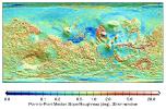
|
-
PIA02808:
-
MOLA Global Roughness Map of Mars
Full Resolution:
TIFF
(248.3 kB)
JPEG
(114.3 kB)
|

|
2000-10-06 |
Mars
|
Mars Global Surveyor (MGS)
|
MOLA
|
669x441x3 |
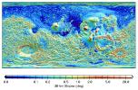
|
-
PIA02809:
-
MOLA Global Map of Surface Gradients on Mars
Full Resolution:
TIFF
(254.8 kB)
JPEG
(128.2 kB)
|

|
2000-10-06 |
Mars
|
Mars Global Surveyor (MGS)
|
Mars Orbiter Camera (MOC)
|
1637x1062x3 |
|
-
PIA02810:
-
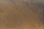
Looking Out Across Dao, Niger, and Harmakhis Valles
Full Resolution:
TIFF
(4.302 MB)
JPEG
(171.7 kB)
|

|
2000-10-16 |
Mars
|
Mars Global Surveyor (MGS)
|
Mars Orbiter Camera (MOC)
|
2068x2512x3 |

|
-
PIA02811:
-
Frosted Southern Plains in Early Spring
Full Resolution:
TIFF
(11.42 MB)
JPEG
(234.1 kB)
|

|
2000-10-16 |
Mars
|
Mars Global Surveyor (MGS)
|
Mars Orbiter Camera (MOC)
|
451x2375x3 |

|
-
PIA02812:
-
Spring Thaw in Northwestern Planum Australe
Full Resolution:
TIFF
(2.155 MB)
JPEG
(75.1 kB)
|

|
2000-10-16 |
Mars
|
Mars Global Surveyor (MGS)
|
Mars Orbiter Camera (MOC)
|
672x2603x1 |

|
-
PIA02813:
-
Groovy Terrain in Mangala Valles
Full Resolution:
TIFF
(1.84 MB)
JPEG
(368 kB)
|

|
2000-10-16 |
Mars
|
Mars Global Surveyor (MGS)
|
Mars Orbiter Camera (MOC)
|
672x1242x1 |

|
-
PIA02814:
-
Channels and Gullies in Nirgal Vallis--The Work of Water?
Full Resolution:
TIFF
(732 kB)
JPEG
(172.3 kB)
|

|
2000-10-16 |
Mars
|
Mars Global Surveyor (MGS)
|
Mars Orbiter Camera (MOC)
|
1010x1010x3 |
|
-
PIA02815:
-
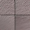
South Polar Terrain in 3-D
Full Resolution:
TIFF
(3.018 MB)
JPEG
(209.5 kB)
|

|
2001-01-17 |
Mars
|
Mars Global Surveyor (MGS)
|
Thermal Emission Spectrometer
|
4000x2769x3 |
|
-
PIA02816:
-
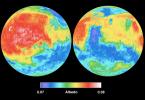
Mars Albedo
Full Resolution:
TIFF
(20.01 MB)
JPEG
(715.4 kB)
|

|
2001-01-17 |
Mars
|
Mars Global Surveyor (MGS)
|
|
4000x2769x3 |
|
-
PIA02817:
-
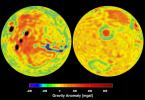
Mars Gravity Anomoly Map
Full Resolution:
TIFF
(16.6 MB)
JPEG
(619.8 kB)
|

|
2001-01-17 |
Mars
|
Mars Global Surveyor (MGS)
|
Thermal Emission Spectrometer
|
4000x2769x3 |
|
-
PIA02818:
-
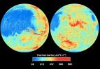
Mars Thermal Inertia
Full Resolution:
TIFF
(21.3 MB)
JPEG
(883.2 kB)
|

|
2001-01-17 |
Mars
|
Mars Global Surveyor (MGS)
|
Magnetometer
|
4000x2769x3 |
|
-
PIA02819:
-
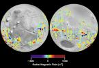
Mars Crustal Magnetic Field Remnants
Full Resolution:
TIFF
(11.85 MB)
JPEG
(959.2 kB)
|

|
2001-01-17 |
Mars
|
Mars Global Surveyor (MGS)
|
MOLA
|
4000x2769x3 |
|
-
PIA02820:
-
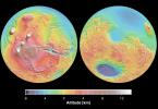
Mars Topography
Full Resolution:
TIFF
(21.78 MB)
JPEG
(1.109 MB)
|

|
2000-11-01 |
Mars
|
Mars Global Surveyor (MGS)
|
Mars Orbiter Camera (MOC)
|
3047x2279x3 |
|
-
PIA02824:
-
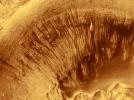
Evidence for Recent Liquid Water on Mars: Channeled Aprons in a Small Crater within Newton Crater
Full Resolution:
TIFF
(5.505 MB)
JPEG
(1.132 MB)
|

|
2000-11-11 |
Mars
|
Mars Global Surveyor (MGS)
|
Mars Orbiter Camera (MOC)
|
1340x510x3 |
|
-
PIA02827:
-
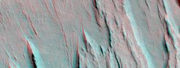
A 3-D Look at Wind-Sculpted Ridges in Aeolis
Full Resolution:
TIFF
(2.174 MB)
JPEG
(118.7 kB)
|

|
2000-11-18 |
Mars
|
Mars Global Surveyor (MGS)
|
Mars Orbiter Camera (MOC)
|
1024x2816x1 |

|
-
PIA02828:
-
Autumn Afternoon in Hale Crater
Full Resolution:
TIFF
(2.212 MB)
JPEG
(333.9 kB)
|

|
2000-11-27 |
Mars
|
Mars Global Surveyor (MGS)
|
Mars Orbiter Camera (MOC)
|
797x1069x3 |

|
-
PIA02833:
-
The Frosted Craters of Northern Spring and Southern Autumn - Lomonosov Crater
Full Resolution:
TIFF
(1.51 MB)
JPEG
(38.46 kB)
|

|
2000-11-27 |
Mars
|
Mars Global Surveyor (MGS)
|
Mars Orbiter Camera (MOC)
|
768x829x3 |

|
-
PIA02834:
-
The Frosted Craters of Northern Spring and Southern Autumn - Unnamed Crater
Full Resolution:
TIFF
(1.635 MB)
JPEG
(49.11 kB)
|

|
2000-11-27 |
Mars
|
Mars Global Surveyor (MGS)
|
Mars Orbiter Camera (MOC)
|
393x395x3 |
|
-
PIA02835:
-
The Frosted Craters of Northern Spring and Southern Autumn - Barnard Crater
Full Resolution:
TIFF
(326.4 kB)
JPEG
(10.34 kB)
|

|
2000-11-27 |
Mars
|
Mars Global Surveyor (MGS)
|
Mars Orbiter Camera (MOC)
|
893x891x3 |
|
-
PIA02836:
-
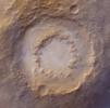
The Frosted Craters of Northern Spring and Southern Autumn - Lowell Crater
Full Resolution:
TIFF
(2.421 MB)
JPEG
(74.91 kB)
|

|
2000-12-04 |
Mars
|
Mars Global Surveyor (MGS)
|
Mars Orbiter Camera (MOC)
|
1024x1322x3 |

|
-
PIA02839:
-
Layered Outcrops of Far West Candor Chasma
Full Resolution:
TIFF
(4.395 MB)
JPEG
(241.8 kB)
|

|
2000-12-04 |
Mars
|
Mars Global Surveyor (MGS)
|
Mars Orbiter Camera (MOC)
|
512x875x3 |

|
-
PIA02840:
-
Layered Material in West Arabia Terra Crater
Full Resolution:
TIFF
(1.261 MB)
JPEG
(135.4 kB)
|

|
2000-12-05 |
Mars
|
Mars Global Surveyor (MGS)
|
Mars Orbiter Camera (MOC)
|
512x875x3 |

|
-
PIA02841:
-
Layered Material in West Arabia Terra Crater
Full Resolution:
TIFF
(1.283 MB)
JPEG
(114 kB)
|

|
2000-12-05 |
Mars
|
Mars Global Surveyor (MGS)
|
Mars Orbiter Camera (MOC)
|
512x875x3 |

|
-
PIA02842:
-
Layered Material in West Arabia Terra Crater
Full Resolution:
TIFF
(1.12 MB)
JPEG
(111.5 kB)
|

|
2000-12-05 |
Mars
|
Mars Global Surveyor (MGS)
|
Mars Orbiter Camera (MOC)
|
835x7367x1 |

|
-
PIA02843:
-
Sediment History Preserved in Gale Crater Central Mound
Full Resolution:
TIFF
(5.051 MB)
JPEG
(734.4 kB)
|

|
2000-12-05 |
Mars
|
Mars Global Surveyor (MGS)
|
Mars Orbiter Camera (MOC)
|
781x1073x1 |

|
-
PIA02844:
-
Sediment History Preserved in Gale Crater Central Mound
Full Resolution:
TIFF
(845.7 kB)
JPEG
(140.4 kB)
|

|
2000-12-05 |
Mars
|
Mars Global Surveyor (MGS)
|
Mars Orbiter Camera (MOC)
|
780x1173x1 |

|
-
PIA02845:
-
Sediment History Preserved in Gale Crater Central Mound
Full Resolution:
TIFF
(874.7 kB)
JPEG
(139.1 kB)
|

|
2000-12-05 |
Mars
|
Mars Global Surveyor (MGS)
|
Mars Orbiter Camera (MOC)
|
836x916x3 |

|
-
PIA02846:
-
Sediment History Preserved in Gale Crater Central Mound
Full Resolution:
TIFF
(2.273 MB)
JPEG
(155.6 kB)
|

|
2000-12-05 |
Mars
|
Mars Global Surveyor (MGS)
|
Mars Orbiter Camera (MOC)
|
512x1642x1 |

|
-
PIA02847:
-
Light-toned Layered Outcrops in Valles Marineris Walls
Full Resolution:
TIFF
(848.8 kB)
JPEG
(172.5 kB)
|

|
2000-12-05 |
Mars
|
Mars Global Surveyor (MGS)
|
Mars Orbiter Camera (MOC)
|
836x3158x1 |

|
-
PIA02848:
-
'White Rock' of Pollack Crater
Full Resolution:
TIFF
(2.816 MB)
JPEG
(603.9 kB)
|

|
2000-12-05 |
Mars
|
Mars Global Surveyor (MGS)
|
Mars Orbiter Camera (MOC)
|
518x894x1 |

|
-
PIA02849:
-
'White Rock' of Pollack Crater
Full Resolution:
TIFF
(453.8 kB)
JPEG
(96.46 kB)
|

|
2001-01-13 |
Mars
|
Mars Global Surveyor (MGS)
|
Mars Orbiter Camera (MOC)
|
2003x601x1 |

|
-
PIA02897:
-
North Polar Cap Layers and Frost on the First Day of Summer
Full Resolution:
TIFF
(886.7 kB)
JPEG
(209.9 kB)
|

|
2001-01-13 |
Mars
|
Mars Global Surveyor (MGS)
|
Mars Orbiter Camera (MOC)
|
2003x601x1 |

|
-
PIA02898:
-
North Polar Ice Cap Surface
Full Resolution:
TIFF
(1.247 MB)
JPEG
(404.5 kB)
|

|
2001-01-13 |
Mars
|
Mars Global Surveyor (MGS)
|
Mars Orbiter Camera (MOC)
|
2003x601x1 |

|
-
PIA02899:
-
Complex exposures of North Polar layered material
Full Resolution:
TIFF
(1.13 MB)
JPEG
(239 kB)
|

|
2000-11-04 |
Mars
|
Mariner Mars 1964 (Mariner 4)
|
|
600x550x1 |
|
-
PIA02979:
-
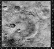
Mariner Crater
Full Resolution:
TIFF
(405.6 kB)
JPEG
(102.7 kB)
|

|
2000-11-04 |
Mars
|
Mariner Mars 1964 (Mariner 4)
|
|
479x450x1 |
|
-
PIA02980:
-
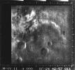
Atlantis Region on Mars - Mariner 4
Full Resolution:
TIFF
(180.5 kB)
JPEG
(43.25 kB)
|

|
2000-11-04 |
Mars
|
Mariner Mars 1969 (Mariner 7)
|
|
640x360x1 |
|
-
PIA02981:
-
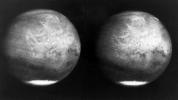
Mars full disk approach view from Mariner 7
Full Resolution:
TIFF
(108.3 kB)
JPEG
(29.53 kB)
|

|
2000-11-04 |
Mars
|
Viking
|
|
1124x1040x3 |
|
-
PIA02982:
-
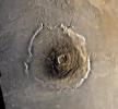
Color Mosaic of Olympus Mons
Full Resolution:
TIFF
(3.086 MB)
JPEG
(192.7 kB)
|

|
2000-11-04 |
Mars
|
Mariner Mars 1971 (Mariner 9)
|
|
2701x2116x1 |
|
-
PIA02983:
-
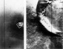
Mariner 9 views of shield volcano
Full Resolution:
TIFF
(4.705 MB)
JPEG
(516.3 kB)
|

|
2000-11-04 |
Mars
|
Viking
|
|
595x742x3 |

|
-
PIA02984:
-
Photomosiac of Olympus Mons
Full Resolution:
TIFF
(1.244 MB)
JPEG
(94.69 kB)
|

|
2000-11-04 |
Mars
|
Viking
|
|
1169x1055x1 |
|
-
PIA02985:
-
Dust storm in the Thaumasia region of Mars
Full Resolution:
TIFF
(384.9 kB)
JPEG
(152.2 kB)
|

|
2000-11-07 |
Mars
|
Viking
|
|
600x600x3 |
|
-
PIA02987:
-
Photomosiac of the Tharsis Region
Full Resolution:
TIFF
(827.6 kB)
JPEG
(47.71 kB)
|

|
2000-11-22 |
Mars
|
Mariner Mars 1971 (Mariner 9)
|
|
4288x6265x1 |

|
-
PIA02989:
-
South Polar Cap of Mars as seen by Mariners 9 & 7
Full Resolution:
TIFF
(23.13 MB)
JPEG
(3.019 MB)
|

|
2000-11-10 |
Mars
|
Viking
|
Visual Imaging Subsystem - Camera A
|
11649x5721x3 |
|
-
PIA02992:
-
Mars Digital Image Mosaic Globe
Full Resolution:
TIFF
(120 MB)
JPEG
(8.664 MB)
|

|
2000-11-10 |
Mars
|
Mars Global Surveyor (MGS)
|
MOLA
|
11649x5723x3 |
|
-
PIA02993:
-
Mars Orbiter Laser Altimiter (MOLA) Globe
Full Resolution:
TIFF
(158.6 MB)
JPEG
(11 MB)
|

|
2000-11-22 |
Mars
|
Mariner Mars 1971 (Mariner 9)
|
|
5484x4461x1 |
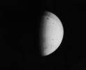
|
-
PIA02995:
-
Nix Olympica Identified by Mariner 9 on Mars Approach
Full Resolution:
TIFF
(9.878 MB)
JPEG
(1.116 MB)
|

|
2000-11-22 |
Mars
|
Mariner Mars 1971 (Mariner 9)
|
|
4967x3860x1 |
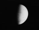
|
-
PIA02996:
-
South Pole as viewed by Mariner 9 on Mars Approach
Full Resolution:
TIFF
(7.276 MB)
JPEG
(568 kB)
|

|
2000-11-22 |
Mars
|
Mariner Mars 1971 (Mariner 9)
|
|
5925x4847x1 |
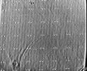
|
-
PIA02997:
-
Mariner 9 View of Arsia Silva
Full Resolution:
TIFF
(29.36 MB)
JPEG
(4.353 MB)
|

|
2000-11-22 |
Mars
|
Mariner Mars 1971 (Mariner 9)
|
|
7278x3159x1 |
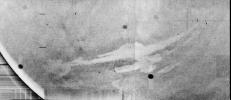
|
-
PIA02998:
-
Mariner 9 views Canyon System emerging from Martian Dust Storm
Full Resolution:
TIFF
(16.73 MB)
JPEG
(2.845 MB)
|

|
2000-11-22 |
Mars
|
Mariner Mars 1971 (Mariner 9)
|
|
5360x4419x1 |
|
-
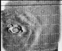
PIA02999:
-
Mariner 9 views Ascraeus Mons standing above the Martian Dust Storm
Full Resolution:
TIFF
(23.15 MB)
JPEG
(3.465 MB)
|

|
2000-11-22 |
Mars
|
Mariner Mars 1971 (Mariner 9)
|
|
5287x4384x1 |
|
-
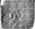
PIA03100:
-
Mariner 9 views Ascraeus Lacus above the Martian Dust Storm
Full Resolution:
TIFF
(23.33 MB)
JPEG
(3.518 MB)
|

|
2001-07-21 |
Mars
|
Hubble Space Telescope
|
WFPC2
|
500x500x3 |
|
-
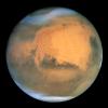
PIA03154:
-
Hubble Captures Best View of Mars Ever Obtained from Earth
Full Resolution:
TIFF
(463.3 kB)
JPEG
(17.85 kB)
|

|
2001-07-30 |
Mars
|
Viking
|
Camera 1
|
8550x1852x1 |

|
-
PIA03163:
Morning on Chryse Planitia - Viking Lander 1 Camera 1 Mosaic
Full Resolution:
TIFF
(6.985 MB)
JPEG
(1.413 MB)
|

|
2001-07-30 |
Mars
|
Viking
|
Camera 1
|
8550x1852x1 |

|
-
PIA03164:
Morning on Chryse Planitia - Viking Lander 1 Camera 2 Mosaic
Full Resolution:
TIFF
(7.228 MB)
JPEG
(1.383 MB)
|

|
2001-07-30 |
Mars
|
Viking
|
Camera 1
|
8550x1852x1 |

|
-
PIA03165:
Afternoon on Chryse Planitia - Viking Lander 1 Camera 1 Mosaic
Full Resolution:
TIFF
(6.989 MB)
JPEG
(1.123 MB)
|

|
2001-07-30 |
Mars
|
Viking
|
Camera 1
|
8550x1852x1 |

|
-
PIA03166:
Afternoon on Chryse Planitia - Viking Lander 1 Camera 2 Mosaic
Full Resolution:
TIFF
(7.736 MB)
JPEG
(1.24 MB)
|

|
2001-10-13 |
Mars
|
Mars Global Surveyor (MGS)
|
Mars Orbiter Camera (MOC)
|
1339x2847x1 |

|
-
PIA03168:
-
Snapshot of Southern Spring Dust Storm Activity
Full Resolution:
TIFF
(1.977 MB)
JPEG
(192.2 kB)
|

|
2001-10-13 |
Mars
|
Mars Global Surveyor (MGS)
|
Mars Orbiter Camera (MOC)
|
522x734x3 |

|
-
PIA03169:
-
Springtime on the Martian South Polar Cap
Full Resolution:
TIFF
(954.6 kB)
JPEG
(34.89 kB)
|

|
2001-10-13 |
Mars
|
Mars Global Surveyor (MGS)
|
Mars Orbiter Camera (MOC)
|
6144x1536x3 |

|
-
PIA03170:
The 2001 Great Dust Storms - Hellas/Syrtis Major
Full Resolution:
TIFF
(11.1 MB)
JPEG
(376.4 kB)
|

|
2001-10-13 |
Mars
|
Mars Global Surveyor (MGS)
|
Mars Orbiter Camera (MOC)
|
6144x1536x3 |

|
-
PIA03171:
The 2001 Great Dust Storms - Tharsis
Full Resolution:
TIFF
(11.29 MB)
JPEG
(378.3 kB)
|

|
2001-10-13 |
Mars
|
Mars Global Surveyor (MGS)
|
Mars Orbiter Camera (MOC)
|
1595x740x1 |
|
-
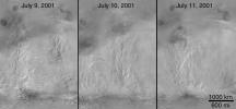
PIA03172:
-
The 2001 Great Dust Storms - Daedalia/Claritas/Syria Dust Plumes
Full Resolution:
TIFF
(743.2 kB)
JPEG
(120.8 kB)
|

|
2001-10-13 |
Mars
|
Hubble Space Telescope
|
WFPC2
|
2826x1677x3 |
|
-
PIA03173:
-
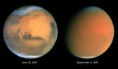
Scientists Track "Perfect Storm" on Mars
Full Resolution:
TIFF
(7.452 MB)
JPEG
(168.7 kB)
|

|
2001-10-26 |
Mars
|
Mars Global Surveyor (MGS)
|
Mars Orbiter Camera (MOC)
|
600x900x1 |

|
-
PIA03174:
-
Fractures/Pits in Northern Plains (Utopia Plains: 44.9 N, 274.7 W)
Full Resolution:
TIFF
(349.4 kB)
JPEG
(190.4 kB)
|

|
2001-10-26 |
Mars
|
Mars Global Surveyor (MGS)
|
Mars Orbiter Camera (MOC)
|
492x900x1 |

|
-
PIA03175:
-
Toe of Ganges Chasma Landslide ( 8.0 S, 44.4W)
Full Resolution:
TIFF
(256.8 kB)
JPEG
(129.7 kB)
|

|
2001-10-26 |
Mars
|
Mars Global Surveyor (MGS)
|
Mars Orbiter Camera (MOC)
|
600x900x1 |

|
-
PIA03176:
-
Dunes in Herschel Crater (Herschel Crater: 15.7 S, 228.8 W)
Full Resolution:
TIFF
(276.1 kB)
JPEG
(126.1 kB)
|

|
2001-10-31 |
Mars
|
Mars Global Surveyor (MGS)
|
Mars Orbiter Camera (MOC)
|
595x900x1 |

|
-
PIA03177:
-
Ancient Layered Rocks in Schiaparelli Crater
Full Resolution:
TIFF
(250.6 kB)
JPEG
(116 kB)
|

|
2001-11-21 |
Mars
|
Mars Global Surveyor (MGS)
|
Mars Orbiter Camera (MOC)
|
336x809x1 |

|
-
PIA03178:
-
MOC's 100,000th Image
Full Resolution:
TIFF
(183.5 kB)
JPEG
(44.18 kB)
|

|
2001-12-11 |
Mars
|
Mars Global Surveyor (MGS)
|
Mars Orbiter Camera (MOC)
|
1048x524x1 |
|
-
PIA03179:
-
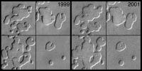
MOC Observes Changes in the South Polar Cap: Evidence for Recent Climate Change on Mars
Full Resolution:
TIFF
(515.7 kB)
JPEG
(117.9 kB)
|

|
2001-12-11 |
Mars
|
Mars Global Surveyor (MGS)
|
Mars Orbiter Camera (MOC)
|
2421x3220x3 |

|
-
PIA03180:
-
MOC View of the Martian South Polar Residual Cap
Full Resolution:
TIFF
(16.51 MB)
JPEG
(1.335 MB)
|

 Planetary Data System


