Your search criteria found 1726 images
Mission
Go to PIAxxxxx:
Refine this list of images by:
Target:
Spacecraft:
Instrument:
Click on an image for detailed information
Click on a column heading to sort in ascending or descending order
My
List
Addition DateSort Ascending Target Mission Instrument Size
Add Image to Favorite List 2011-08-04 Mars Mars Reconnaissance Orbiter (MRO)
HiRISE
1600x1200x1
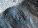
This image contrasts gullies and recurring warm-season slope flows appearing in the same crater, in the middle southern latitudes of Mars. It was taken Nov. 27, 2007, by the HiRISE camera onboard NASA's Mars Reconnaissance Orbiter.
PIA14501:
Gullies and Newly Identified Flow Features in Same Mars Crater
Full Resolution:     TIFF (1.922 MB)     JPEG (196.2 kB)
Add Image to Favorite List 2011-08-04 Mars Mars Reconnaissance Orbiter (MRO)
HiRISE
1269x1448x3
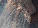
This image, combining orbital imagery with 3-D modeling, shows flows that appear in spring and summer on a slope inside Mars' Newton crater. The source observation was made May 30, 2011, by the HiRISE camera onboard NASA's Mars Reconnaissance Orbiter.
PIA14479:
Oblique View of Warm Season Flows in Newton Crater
Full Resolution:     TIFF (5.519 MB)     JPEG (285.1 kB)
Add Image to Favorite List 2011-08-04 Mars Mars Reconnaissance Orbiter (MRO)
HiRISE
2515x1530x3
This image comes from observations of a well-preserved crater on Terra Cimmeria by the HiRISE camera onboard NASA's Mars Reconnaissance Orbiter.
PIA14478:
Warm-Season Flows in Well-Preserved Crater in Terra Sirenum (Six-Image Sequence)
Full Resolution:     TIFF (3.854 MB)     JPEG (597.1 kB)
Add Image to Favorite List 2011-08-04 Mars Mars Reconnaissance Orbiter (MRO)
HiRISE
2147x1319x3
This image comes from observations of steep crater slopes on Terra Cimmeria by the HiRISE camera onboard NASA's Mars Reconnaissance Orbiter.
PIA14477:
Warm-Season Flows on Steep Slope in Slope in Terra Cimmeria (Eight-Image Sequence)
Full Resolution:     TIFF (2.837 MB)     JPEG (404.1 kB)
Add Image to Favorite List 2011-08-04 Mars Mars Reconnaissance Orbiter (MRO)
HiRISE
2453x2033x3
This image comes from observations of Horowitz crater by the HiRISE camera onboard NASA's Mars Reconnaissance Orbiter. The features that extend down the slope during warm seasons are called recurring slope lineae.
PIA14476:
Warm-Season Flows on Slope in Horowitz Crater (Nine-Image Sequence)
Full Resolution:     TIFF (4.994 MB)     JPEG (594.9 kB)
Add Image to Favorite List 2011-08-04 Earth Mars Reconnaissance Orbiter (MRO)
HiRISE
1578x1065x3
This image comes from observations of Horowitz crater by the HiRISE camera onboard NASA's Mars Reconnaissance Orbiter. The features that extend down the slope during warm seasons are called recurring slope lineae.
PIA14475:
Warm-Season Flows on Slope in Horowitz Crater (Eight-Image Sequence)
Full Resolution:     TIFF (1.684 MB)     JPEG (231.7 kB)
Add Image to Favorite List 2011-08-04 Mars Mars Reconnaissance Orbiter (MRO)
HiRISE
1642x1534x3
This image comes from observations of Newton crater by the HiRISE camera onboard NASA's Mars Reconnaissance Orbiter where features appear and incrementally grow during warm seasons and fade in cold seasons.
PIA14474:
Dark Flows in Newton Crater Extending During Summer (Six-Image Sequence)
Full Resolution:     TIFF (2.524 MB)     JPEG (394.1 kB)
Add Image to Favorite List 2011-08-04 Mars Mars Reconnaissance Orbiter (MRO)
HiRISE
1917x1528x3
This image comes from observations of Newton crater by the HiRISE camera onboard NASA's Mars Reconnaissance Orbiter. The features that extend down the slope during warm seasons are called recurring slope lineae.
PIA14473:
Warm-Season Flows on Slope in Newton Crater (Five-Image Sequence)
Full Resolution:     TIFF (2.934 MB)     JPEG (471.7 kB)
Add Image to Favorite List 2011-08-04 Mars Mars Reconnaissance Orbiter (MRO)
HiRISE
1839x1518x3
This image comes from observations of Newton crater by the HiRISE camera onboard NASA's Mars Reconnaissance Orbiter; warm-season features might be evidence of salty liquid water active on Mars today.
PIA14472:
Warm-Season Flows on Slope in Newton Crater (Six-Image Sequence)
Full Resolution:     TIFF (2.796 MB)     JPEG (373.5 kB)
Add Image to Favorite List 2011-07-15 Mars Mars Reconnaissance Orbiter (MRO)
HiRISE
2560x1920x3
The suggested area in this observation from NASA's Mars Reconnaissance Orbiter is characterized by a group of cones, shield-like features, and round mounds. They are a few hundred meters to kilometers in diameter but their heights are unknown.
PIA14462:
Small Mounds in Chryse Planitia
Full Resolution:     TIFF (14.76 MB)     JPEG (818.8 kB)
Add Image to Favorite List 2011-07-15 Mars Mars Reconnaissance Orbiter (MRO)
HiRISE
2560x1920x3
NASA's Mars Reconnaissance Orbiter captured this image of the Claritas Fossae region, characterized by systems of 'graben.' A graben forms when a block of the planet's crust drops down between two faults, due to extension, or pulling, of the crust.
PIA14461:
Faults in Claritas Fossae
Full Resolution:     TIFF (14.76 MB)     JPEG (655.1 kB)
Add Image to Favorite List 2011-07-15 Mars Mars Reconnaissance Orbiter (MRO)
HiRISE
840x333x3
This anaglyph from NASA's Mars Reconnaissance Orbiter shows erosional features formed by seasonal frost near the south pole of Mars. 3D glasses are necessary to view this image.
PIA14460:
Erosion Features near the South Pole of Mars (Anaglyph)
Full Resolution:     TIFF (840.3 kB)     JPEG (78.15 kB)
Add Image to Favorite List 2011-07-15 Mars Mars Reconnaissance Orbiter (MRO)
HiRISE
2560x1920x3
This image from NASA's Mars Reconnaissance Orbiter shows erosional features formed by seasonal frost near the south pole of Mars. During the winter, high latitudes on Mars build up deposits of carbon dioxide frost that can be several feet thick.
PIA14459:
Erosion Features near the South Pole of Mars
Full Resolution:     TIFF (14.76 MB)     JPEG (1.003 MB)
Add Image to Favorite List 2011-06-08 Mars Mars Exploration Rover (MER)
Mars Reconnaissance Orbiter (MRO)
CTX
2948x2193x3
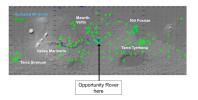
The yellow line on this map shows where NASA's Mars Rover Opportunity has driven from the place where it landed in January 2004, inside Eagle crater, upper left end of track, to a point about 2.2 miles away from reaching the rim of Endeavour crater.
PIA14135:
Eagle to Endeavour: Opportunity's Path, Sol 2609
Full Resolution:     TIFF (19.4 MB)     JPEG (1.319 MB)
Add Image to Favorite List 2011-06-08 Mars Mars Exploration Rover (MER)
Mars Reconnaissance Orbiter (MRO)
HiRISE
8192x5789x3
This image shows the portion of the rim of Endeavour crater given the informal name 'Spirit Point.' This is the location where the team operating NASA's Mars Exploration Rover Opportunity plans to drive the rover to its arrival at the Endeavour rim.
PIA14134:
Opportunity's First Goal at Endeavour Crater: 'Spirit Point'
Full Resolution:     TIFF (47.47 MB)     JPEG (3.48 MB)
Add Image to Favorite List 2011-04-21 Mars Mars Reconnaissance Orbiter (MRO)
HiRISE
2497x2054x1
NASA's Mars Reconnaissance Orbiter took these images of an area near Mars' south pole where coalescing or elongated pits are interpreted as signs of an underlying deposit of frozen carbon dioxide, or 'dry ice.'
PIA13987:
Pitting from Sublimation of Underlying Dry-Ice Layer
Full Resolution:     TIFF (5.135 MB)     JPEG (856.6 kB)
Add Image to Favorite List 2011-04-21 Mars Mars Reconnaissance Orbiter (MRO)
Shallow Subsurface Radar (SHARAD)
9380x8299x3
NASA's Mars Reconnaissance Orbiter color-codes thickness estimates in a newly found, buried deposit of frozen carbon dioxide, dry ice, near the south pole of Mars contains ~30 times more carbon dioxide than previously estimated to be frozen near the pole.
PIA13986:
Thickness Map of Buried Carbon-Dioxide Deposit
Full Resolution:     TIFF (233.5 MB)     JPEG (4.87 MB)
Add Image to Favorite List 2011-04-21 Mars Mars Reconnaissance Orbiter (MRO)
Shallow Subsurface Radar (SHARAD)
1775x380x1
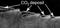
This cross-section view of underground layers near Mars' south pole is a radargram based on data from the Shallow Subsurface Radar (SHARAD) instrument on NASA's Mars Reconnaissance Orbiter.
PIA13985:
Cross Section of Buried Carbon-Dioxide Ice on Mars
Full Resolution:     TIFF (675.5 kB)     JPEG (116.5 kB)
Add Image to Favorite List 2011-03-09 Mars Mars Reconnaissance Orbiter (MRO)
HiRISE
2560x1920x3
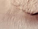
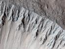
This NASA's Mars Reconnaissance Orbiter shows many channels on a scarp in the Hellas impact basin. On Earth we would call these gullies. Some larger channels on Mars that are sometimes called gullies are big enough to be called ravines on Earth.
PIA13802:
True Gullies on Mars
Full Resolution:     TIFF (14.76 MB)     JPEG (1.255 MB)
Add Image to Favorite List 2011-03-09 Mars Mars Exploration Rover (MER)
Mars Reconnaissance Orbiter (MRO)
HiRISE
2254x1522x3
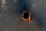
NASA's Mars Reconnaissance Orbiter acquired this color image on March 9, 2011, of 'Santa Maria' crater, showing NASA's Mars Exploration Rover Opportunity perched on the southeast rim. The rover is the bluish speck on the crater rim (arrow).
PIA13803:
Opportunity is Still Smiling
Full Resolution:     TIFF (10.3 MB)     JPEG (1.155 MB)
Add Image to Favorite List 2011-03-08 Mars Mars Reconnaissance Orbiter (MRO)
CRISM
HiRISE
995x599x3
This false-color image NASA's Mars Reconnaissance Orbiter shows that fractures and possible layers are visible in the light-toned rock exposure containing the carbonates. The location is inside an unnamed crater on the uplifted rim of Huygens crater.
PIA13800:
Fractures in Carbonate-Bearing Rocks at Mars' Huygens Basin
Full Resolution:     TIFF (1.791 MB)     JPEG (139 kB)
Add Image to Favorite List 2011-02-14 Mars Mars Reconnaissance Orbiter (MRO)
CTX
420x487x3
This wide-view picture of a heart-shaped feature in Arabia Terra on Mars was taken on May 23, 2010, by NASA's Mars Reconnaissance Orbiter. A small impact crater near the tip of the heart is responsible for the formation of the bright, heart-shaped feature
PIA13799:
Heart-Shaped Feature in Arabia Terra (Wide View)
Full Resolution:     TIFF (206.5 kB)     JPEG (25.93 kB)
Add Image to Favorite List 2011-02-14 Mars Mars Reconnaissance Orbiter (MRO)
CTX
377x487x3
This picture of a heart-shaped feature in Arabia Terra on Mars was taken on May 23, 2010, by NASA's Mars Reconnaissance Orbiter. A small impact crater near the tip of the heart is responsible for the formation of the bright, heart-shaped feature.
PIA13798:
Heart-Shaped Feature in Arabia Terra
Full Resolution:     TIFF (185.6 kB)     JPEG (41.39 kB)
Add Image to Favorite List 2011-02-03 Mars Mars Reconnaissance Orbiter (MRO)
HiRISE
934x1412x3
Three images of the same location, taken by NASA's Mars Reconnaissance Orbiter at different times on Mars, show seasonal activity causing sand avalanches and ripple changes on a Martian dune. Time sequence of the images progresses from top to bottom.
PIA13797:
Seasonal Changes in Northern Mars Dune Field
Full Resolution:     TIFF (3.962 MB)     JPEG (221.3 kB)
Add Image to Favorite List 2011-02-02 Mars Mars Reconnaissance Orbiter (MRO)
HiRISE
2560x1920x3
This image from NASA's Mars Reconnaissance Orbiter shows part of the floor of Rabe Crater, a large impact crater in the Southern highlands. Dark dunes cover part of crater's floor, and contrast with the surrounding bright-colored outcrops.
PIA13728:
Thumbprint Texture on Dark Dunes in Rabe Crater
Full Resolution:     TIFF (14.76 MB)     JPEG (553.7 kB)
Add Image to Favorite List 2011-01-21 Mars Mars Reconnaissance Orbiter (MRO)
HiRISE
2560x1920x3
The bright areas in this image from NASA's Mars Reconnaissance Orbiter are covered by carbon dioxide frost, and the 'swiss cheese' terrain typical of the south polar residual cap covers much of the imaged area.
PIA13727:
Circular Feature in South Polar Residual Cap
Full Resolution:     TIFF (14.76 MB)     JPEG (937.3 kB)
Add Image to Favorite List 2011-01-12 Mars Mars Reconnaissance Orbiter (MRO)
HiRISE
2560x1920x3
NASA's Mars Reconnaissance Orbiter shows the surface outside this large crater is relatively dark, while the interior wall of the crater exposes lighter, layered bedrock of diverse colors.
PIA13726:
Layers Exposed in Crater Near Mawrth Vallis
Full Resolution:     TIFF (14.76 MB)     JPEG (650.8 kB)
Add Image to Favorite List 2011-01-05 Mars Mars Reconnaissance Orbiter (MRO)
HiRISE
2560x1920x3
This image from NASA's Mars Reconnaissance Orbiter shows an area of layered deposits in Candor Chasma. Sheets and dunes of dark-toned sand cover the light-toned, layered bedrock.
PIA13725:
Layered Bedrock in Candor Chasma
Full Resolution:     TIFF (14.76 MB)     JPEG (831.1 kB)
Add Image to Favorite List 2011-01-04 Mars Mars Exploration Rover (MER)
Mars Reconnaissance Orbiter (MRO)
HiRISE
1347x1277x1
NASA's Mars Reconnaissance Orbiter acquired this image of the Opportunity rover on the southwest rim of 'Santa Maria' crater on New Year's Eve 2010. Opportunity is imaging the crater's interior to better reveal the geometry of rock layers.
PIA13754:
Mars Orbiter Sees Rover Opportunity at Crater Edge
Full Resolution:     TIFF (1.722 MB)     JPEG (195 kB)
Add Image to Favorite List 2010-12-20 Mars Mars Reconnaissance Orbiter (MRO)
HiRISE
2560x1920x3
This image from NASA's Mars Reconnaissance Orbiter shows Nili Fossae region of Mars, one of the largest exposures of clay minerals, and a prime candidate landing site for Mars Science Laboratory rover, Curiosity.
PIA13724:
Nili Fossae Trough, Candidate MSL Landing Site
Full Resolution:     TIFF (14.76 MB)     JPEG (844 kB)
Add Image to Favorite List 2010-12-17 Mars Mars Exploration Rover (MER)
Mars Reconnaissance Orbiter (MRO)
CTX
1460x1080x3
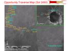
This map shows the path that NASA's Mars Exploration Rover Opportunity followed from the 1,813th Martian day, or sol, to Sol 2450 (Dec. 15, 2010) when Opportunity approached a crater informally named 'Santa Maria.'
PIA13731:
Opportunity Traverse Map, Sol 2450
Full Resolution:     TIFF (4.739 MB)     JPEG (178 kB)
Add Image to Favorite List 2010-12-17 Mars Mars Exploration Rover (MER)
Mars Reconnaissance Orbiter (MRO)
CTX
1392x1080x3
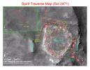
This map shows the path that NASA's Mars Exploration Rover Spirit followed from the 743rd Martian day (Feb. 4, 2009), or sol, to Sol 2471 (Dec. 15, 2010). Spirit has been at a sand-trap location called 'Troy' since April 2009.
PIA13730:
Spirit Traverse Map, Sol 2471
Full Resolution:     TIFF (4.519 MB)     JPEG (176.5 kB)
Add Image to Favorite List 2010-12-17 Mars Mars Reconnaissance Orbiter (MRO)
HiRISE
2560x1920x3
This image from NASA's Mars Reconnaissance Orbiter is one of the rare examples of a fresh 'lunar-like' crater on Mars. The impact crater formed in the Tharsis region.
PIA13723:
A Fresh, Lunar-Like Crater on Mars
Full Resolution:     TIFF (14.76 MB)     JPEG (855.5 kB)
Add Image to Favorite List 2010-12-16 Mars Mars Reconnaissance Orbiter (MRO)
CRISM
4023x7854x3
This map indicates some of the geological information gained from orbital observations of Endeavour Crater, which has been the long-term destination for NASA's Mars Exploration Rover Opportunity since mid-2008.
PIA13708:
Geologic Map, West Rim of Endeavour Crater, Mars
Full Resolution:     TIFF (94.79 MB)     JPEG (4.431 MB)
Add Image to Favorite List 2010-12-16 Mars Mars Reconnaissance Orbiter (MRO)
HiRISE
8192x7051x1
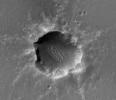
This image of Santa Maria Crater was taken by HiRISE camera on NASA's Mars Reconnaissance Orbiter where NASA's rover Opportunity approached Santa Maria Crater in December 2010.
PIA13706:
Orbital Observations of Crater on Mars Rover's Route
Full Resolution:     TIFF (57.82 MB)     JPEG (2.181 MB)
Add Image to Favorite List 2010-12-16 Mars Mars Reconnaissance Orbiter (MRO)
CTX
4664x7746x3
The red line on this map shows where NASA's Mars Rover Opportunity has driven from the place where it landed in January 2004, inside Eagle Crater, at the upper left end of the track, to where it reached on Nov. 30, 2010.
PIA13705:
Opportunity's Path on Mars Through Sol 2436
Full Resolution:     TIFF (108.4 MB)     JPEG (5.199 MB)
Add Image to Favorite List 2010-12-16 Mars Mars Reconnaissance Orbiter (MRO)
CRISM
2736x2250x3
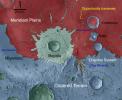
This map indicates geological units in the region of Mars around a smaller area where NASA's Mars Exploration Rover Opportunity has driven from early 2004 through late 2010.
PIA13704:
Geologic Setting of Opportunity Traverse and Meridiani Planum
Full Resolution:     TIFF (18.47 MB)     JPEG (486.1 kB)
Add Image to Favorite List 2010-12-16 Mars Mars Express (MEX)
Mars Global Surveyor (MGS)
Mars Reconnaissance Orbiter (MRO)
Altimeter
CRISM
Visible and Infrared Mineralogical Mapping Spectrometer
2999x1515x3
On this map of Mars, spectrometers on spacecraft orbiting Mars have detected clay minerals (green) and hydrated minerals-- clays, sulfates and others (blue).
PIA13703:
Regions of Mars with Clays and Hydrated Minerals Identified from Orbit
Full Resolution:     TIFF (13.63 MB)     JPEG (581.5 kB)
Add Image to Favorite List 2010-12-01 Mars Mars Reconnaissance Orbiter (MRO)
HiRISE
2048x3145x1
This image from NASA's Mars Reconnaissance Orbiter is a proposed future Mars landing site in Acidalia Planitia targets densely occurring mounds thought to be mud volcanoes.
PIA13652:
Proposed Future Mars Landing Site: Acidalia Planitia Mud Volcanoes
Full Resolution:     TIFF (6.447 MB)     JPEG (1.617 MB)
Add Image to Favorite List 2010-12-01 Mars Mars Reconnaissance Orbiter (MRO)
HiRISE
2048x3737x1
This image from NASA's Mars Reconnaissance Orbiter shows a graben (a trough formed when the ground drops between two parallel faults) and a lava flow in the Tharsis volcanic province of Mars. North is up.
PIA13651:
Graben Cutting Lava Flow in Tharsis
Full Resolution:     TIFF (7.661 MB)     JPEG (938.6 kB)
Add Image to Favorite List 2010-12-01 Mars Mars Reconnaissance Orbiter (MRO)
HiRISE
2048x3086x1
Two dark, rimless pits are located to the northwest of Ascraeus Mons in the Tharsis volcanic region of Mars in this image from NASA's Mars Reconnaissance Orbiter. They are situated in the midst of a wispy, dark, boomerang-shaped deposit.
PIA13650:
Dark Rimless Pits in the Tharsis Region
Full Resolution:     TIFF (6.327 MB)     JPEG (508.2 kB)
Add Image to Favorite List 2010-11-17 Mars Mars Reconnaissance Orbiter (MRO)
HiRISE
2560x1920x3
This image from NASA's Mars Reconnaissance Orbiter shows an arcuate ridge in Terra Meridiani.The ridge is most likely a former streambed, now exposed in inverted relief.
PIA13614:
Curvilinear Ridge in Terra Meridiani
Full Resolution:     TIFF (14.76 MB)     JPEG (708.1 kB)
Add Image to Favorite List 2010-11-16 Mars Mars Reconnaissance Orbiter (MRO)
HiRISE
2560x1920x3
This observation from NASA's Mars Reconnaissance Orbiter shows the edge of a dark dune field on the floor of Proctor Crater in the Southern highlands of Mars. The dark dunes are composed of basaltic sand that has collected on the bottom of the crater.
PIA13613:
Proctor Crater Dune Field
Full Resolution:     TIFF (14.76 MB)     JPEG (685.5 kB)
Add Image to Favorite List 2010-11-15 Mars Mars Reconnaissance Orbiter (MRO)
HiRISE
2560x1920x3
This image from NASA's Mars Reconnaissance Orbiter shows the funnel-shaped terminus of Lethe Vallis, a winding channel in the Elysium Planitia region of Mars; the floor is covered in solidified lava and blanketed by a thin layer of light-toned dust.
PIA13612:
End of Lethe Vallis
Full Resolution:     TIFF (14.76 MB)     JPEG (944.5 kB)
Add Image to Favorite List 2010-11-12 Mars Mars Reconnaissance Orbiter (MRO)
HiRISE
2560x1920x3
The crater shown in this image from NASA's Mars Reconnaissance Orbiter has very few craters superposed on it, which attests to its youth. It also has very steep slopes and a sharp rim; more evidence of its young age.
PIA13611:
Fresh Crater with Gullies
Full Resolution:     TIFF (14.76 MB)     JPEG (768.3 kB)
Add Image to Favorite List 2010-11-11 Mars Mars Reconnaissance Orbiter (MRO)
HiRISE
2560x1920x3
This observance from NASA's Mars Reconnaissance Orbiter shows a formation of large outflow channels on Mars' Aureum Chaos.
PIA13610:
Light-Toned Outcrop in Aureum Chaos
Full Resolution:     TIFF (14.76 MB)     JPEG (663.9 kB)
Add Image to Favorite List 2010-11-10 Mars Mars Reconnaissance Orbiter (MRO)
HiRISE
2560x1920x3
This image from NASA's Mars Reconnaissance Orbiter shows a number of unusual, quasi-circular structures that apparently formed within bright flows in Meridiani Planum.
PIA13608:
Concentric Structures in Meridiani Planum
Full Resolution:     TIFF (14.76 MB)     JPEG (925.2 kB)
Add Image to Favorite List 2010-10-31 Mars Mars Reconnaissance Orbiter (MRO)
CRISM
CTX
1472x874x3
This false color image from NASA's Mars Reconnaissance Orbiter indicates that the volcanic cone in the Nili Patera caldera on Mars has hydrothermal mineral deposits on the southern flanks and nearby terrains.
PIA13556:
Mars Volcanic Cone with Hydrothermal Deposits
Full Resolution:     TIFF (3.867 MB)     JPEG (193.8 kB)
Add Image to Favorite List 2010-10-29 Mars Mars Reconnaissance Orbiter (MRO)
HiRISE
724x945x1
The gullies on a Martian sand dune in this trio of images from NASA's Mars Reconnaissance Orbiter deceptively resemble features on Earth that are carved by streams of water. The dunes lie inside Matara Crater.
PIA13544:
Gully Changes on Martian Sand Dune
Full Resolution:     TIFF (685.1 kB)     JPEG (132.2 kB)
Add Image to Favorite List 2010-10-28 Mars Mars Reconnaissance Orbiter (MRO)
HiRISE
2560x1920x3
This observance from NASA's Mars Reconnaissance Orbiter covers a pit in the lower West flank of Arsia Mons, one of the four giant volcanos of the Tharsis region. Many layers are exposed in the pit, probably marking individual lava flows.
PIA13540:
Layers in Arsia Mons Volcano
Full Resolution:     TIFF (14.76 MB)     JPEG (1.504 MB)
Add Image to Favorite List 2010-10-27 Mars Mars Reconnaissance Orbiter (MRO)
HiRISE
2560x1920x3
The Russell Crater dune field is covered seasonally by carbon dioxide frost; this image from NASA's Mars Reconnaissance Orbiter shows the dune field after the frost has sublimated. There are just a few patches left of the bright seasonal frost.
PIA13539:
Russell Crater Dunes, Defrosted
Full Resolution:     TIFF (14.76 MB)     JPEG (1.303 MB)
Add Image to Favorite List 2010-10-25 Mars Mars Reconnaissance Orbiter (MRO)
HiRISE
2560x1920x3
This observation from NASA's Mars Reconnaissance Orbiter shows a Southern hemisphere crater with gullies, dunes, periglacial modification, bright rock deposits, and dust devil tracks.
PIA13538:
Southern Hemisphere Crater with Dune Field
Full Resolution:     TIFF (14.76 MB)     JPEG (1.1 MB)
Add Image to Favorite List 2010-10-23 Mars Mars Reconnaissance Orbiter (MRO)
HiRISE
2560x1920x3
In this image from NASA's Mars Reconnaissance Orbiter, there are at least two distinct geologic units, a light-toned bedrock and a surface veneer of dark-toned material that contains sand dunes.
PIA13537:
Strengths of Materials in Ganges Mensa
Full Resolution:     TIFF (14.76 MB)     JPEG (1.115 MB)
Add Image to Favorite List 2010-10-22 Mars Mars Reconnaissance Orbiter (MRO)
HiRISE
2560x1920x3
This image from NASA's Mars Reconnaissance Orbiter shows the southern latitude Hale Crater, a rather large, pristine elliptical crater possessing sharp features, impact melt bodies ponded throughout the structure and few overprinting impact craters.
PIA13536:
Light-Toned Gully Materials on Hale Crater Wall
Full Resolution:     TIFF (14.76 MB)     JPEG (1.078 MB)
Add Image to Favorite List 2010-10-21 Mars Mars Reconnaissance Orbiter (MRO)
HiRISE
2560x1920x3
This image from NASA's Mars Reconnaissance Orbiter shows blocks of bright, layered rock embedded in darker material that are thought to have been deposited by a giant flood that occurred when Uzboi Valles breached the rim of Holden Crater.
PIA13533:
Flood-Emplaced Blocks in Holden Crater
Full Resolution:     TIFF (14.76 MB)     JPEG (886.2 kB)
Add Image to Favorite List 2010-10-19 Mars Mars Reconnaissance Orbiter (MRO)
HiRISE
2560x1920x3
This observation from NASA's Mars Reconnaissance Orbiter covers a portion of the Martian equatorial plains called Elysium Planitia. In this location, lava that was once flowing across the surface interacted with multiple obstructions.
PIA13484:
Flow Obstructions and Wakes Southeast of Elysium Planitia
Full Resolution:     TIFF (14.76 MB)     JPEG (1.413 MB)
Add Image to Favorite List 2010-10-18 Mars Mars Reconnaissance Orbiter (MRO)
HiRISE
2560x1920x3
This observation from NASA's Mars Reconnaissance Orbiter shows Becquerel Crater, one of several impact craters in Arabia Terra that have light-toned layered deposits along the crater floor. The layers appear to be only a few meters thick.
PIA13483:
Lots of Layering in Becquerel Crater
Full Resolution:     TIFF (14.76 MB)     JPEG (1.026 MB)
Add Image to Favorite List 2010-10-15 Mars Mars Reconnaissance Orbiter (MRO)
HiRISE
2560x1920x3
This observation from NASA's Mars Reconnaissance Orbiter shows fractured mounds on the southern edge of Elysium Planitia. The fractures that crisscross their surfaces are probably composed of solidified lava.
PIA13482:
Fractured Mounds in Elysium Planitia
Full Resolution:     TIFF (14.76 MB)     JPEG (1.177 MB)
Add Image to Favorite List 2010-10-14 Mars Mars Reconnaissance Orbiter (MRO)
HiRISE
2560x1920x3
This image from NASA's Mars Reconnaissance Orbiter shows dunes on the floor of Herschel Crater. Steep faces ('slipfaces') are oriented downwind, in the direction of motion of the dunes. A dune-free area downwind of the crater is seen at the image center.
PIA13481:
Dunes in Herschel Crater
Full Resolution:     TIFF (14.76 MB)     JPEG (947.3 kB)
Add Image to Favorite List 2010-10-13 Mars Mars Reconnaissance Orbiter (MRO)
HiRISE
2560x1920x3
This image from NASA's Mars Reconnaissance Orbite is centered on a small cone on the side of one of Mars' giant shield volcanoes. The cone shows some layers of hard rock but most of it is made of relatively soft material.
PIA13480:
Possible Cinder Cone on the Southern Flank of Pavonis Mons
Full Resolution:     TIFF (14.76 MB)     JPEG (929 kB)
Add Image to Favorite List 2010-10-12 Mars Mars Reconnaissance Orbiter (MRO)
HiRISE
2560x1920x3
This image from NASA's Mars Reconnaissance Orbiter shows an approximately 7-meter diameter fresh crater and dark ejecta blanket. These small impact craters continue to form on Mars, and are most easily recognized in areas covered by bright dust.
PIA13479:
New Impact Crater
Full Resolution:     TIFF (14.76 MB)     JPEG (1.291 MB)
Add Image to Favorite List 2010-08-26 Mars Mars Reconnaissance Orbiter (MRO)
MCS
962x545x3
The Mars Climate Sounder instrument on NASA's Mars Reconnaissance Orbiter maps the vertical distribution of temperatures, dust, water vapor and ice clouds in the Martian atmosphere as the orbiter flies a near-polar orbit.
PIA13353:
Martian Atmosphere Profiles
Full Resolution:     TIFF (1.575 MB)     JPEG (68.18 kB)
Add Image to Favorite List 2010-08-26 Mars Reconnaissance Orbiter (MRO)
MCS
555x582x3
The Mars Climate Sounder instrument, shown here prior to its installation onto NASA's Mars Reconnaissance Orbiter for the mission's 2006 launch, will get a similar-looking sibling at Mars in 2016.
PIA13352:
Climate Sounder Instrument for Mars Reconnaissance Orbiter
Full Resolution:     TIFF (970.4 kB)     JPEG (72.69 kB)
Add Image to Favorite List 2010-08-04 Mars Mars Reconnaissance Orbiter (MRO)
HiRISE
774x565x3
At the center of this view of an area of mid-latitude northern Mars, a fresh crater about 6 meters (20 feet) in diameter holds an exposure of bright material, blue in this false-color image observed by NASA's Mars Reconnaissance Orbiter.
PIA13315:
Exposed Ice in a Fresh Crater
Full Resolution:     TIFF (1.314 MB)     JPEG (78.91 kB)
Add Image to Favorite List 2010-07-13 Mars Mars Reconnaissance Orbiter (MRO)
HiRISE
2560x1920x3
This image from NASA's Mars Reconnaissance Orbiter shows a variety of surface textures within the south polar residual cap of Mars. It was taken during the southern spring, when the surface was covered by seasonal carbon dioxide frost and is easily seen.
PIA13269:
South Polar Layered Deposits and Residual Cap
Full Resolution:     TIFF (14.76 MB)     JPEG (454.2 kB)
Add Image to Favorite List 2010-07-13 Mars Mars Reconnaissance Orbiter (MRO)
HiRISE
2560x1920x3
This image from NASA's Mars Reconnaissance Orbiter is a view of the sand dune field in Richardson Crater covered with seasonal frost. The frost is a combination of frozen carbon dioxide and some water ice that covers the dunes in the winter and spring.
PIA13268:
Sand Dune Field in Richardson Crater
Full Resolution:     TIFF (14.76 MB)     JPEG (773.4 kB)
Add Image to Favorite List 2010-07-13 Mars Mars Reconnaissance Orbiter (MRO)
HiRISE
2560x1920x3
This observation from NASA's Mars Reconnaissance Orbiter shows part of the floor of a large impact crater in the southern highlands, north of the giant Hellas impact basin.
PIA13266:
Light Outcrop on Crater Floor
Full Resolution:     TIFF (14.76 MB)     JPEG (649.9 kB)
Add Image to Favorite List 2010-07-13 Mars Mars Reconnaissance Orbiter (MRO)
HiRISE
2560x1920x3
This observation from NASA's Mars Reconnaissance Orbiter shows the very steep side of a plateau, part of the northern limit of the Kasei Valles system, which is one of the largest outflow channel systems on Mars.
PIA13265:
(Almost) Silent Rolling Stones in Kasei Valles
Full Resolution:     TIFF (14.76 MB)     JPEG (952.1 kB)
Add Image to Favorite List 2010-07-07 Mars Mars Reconnaissance Orbiter (MRO)
HiRISE
2560x1920x3
This observation from NASA's Mars Reconnaissance Orbiter shows part of Gorgonum Chaos, a large cluster of chaotic terrain found in the southern hemisphere.
PIA13267:
Gullies on Gorgonum Chaos Mesas
Full Resolution:     TIFF (14.76 MB)     JPEG (1.36 MB)
Add Image to Favorite List 2010-07-07 Mars Mars Reconnaissance Orbiter (MRO)
HiRISE
2560x1920x3
This image from NASA's Mars Reconnaissance Rover shows a degraded impact crater in the southern highlands. Part of the crater rim is visible at the top and bottom of the image, with the boulder-covered crater floor in the center.
PIA13264:
Bouldery Deposit on Crater Floor
Full Resolution:     TIFF (14.76 MB)     JPEG (1.131 MB)
Add Image to Favorite List 2010-06-24 Mars Mars Express (MEX)
Mars Reconnaissance Orbiter (MRO)
Context Camera
High Resolution Stereo Camera
617x543x3
This view of Stokes Crater is a mosaic of images taken by NASA's Mars Reconnaissance Orbiter and ESA's Mars Express showing at least one of the nine craters in the northern lowlands of Mars with exposures of hydrated minerals detected from orbit.
PIA13214:
Hydrated Minerals Exposed at Stokes, Northern Mars
Full Resolution:     TIFF (1.006 MB)     JPEG (45.72 kB)
Add Image to Favorite List 2010-06-09 Mars Mars Reconnaissance Orbiter (MRO)
HiRISE
2560x1920x3
This image from NASA's Mars Reconnaissance Orbiter shows the west-facing side of an impact crater in the mid-latitudes of Mars' northern hemisphere. This crater has gullies along its walls that are composed of alcoves, channels and debris aprons.
PIA13186:
Northern Hemisphere Gullies on West-Facing Crater Slope, Mars
Full Resolution:     TIFF (14.76 MB)     JPEG (726.1 kB)
Add Image to Favorite List 2010-06-09 Mars Mars Reconnaissance Orbiter (MRO)
HiRISE
2560x1920x3
This image captured by NASA's Mars Reconnaissance Orbiter from the Gordii Dorsum region of Mars shows a large area covered with polygonal ridges in an almost geometric pattern.
PIA13185:
Polygonal Ridge in Gordii Dorsum Region, Mars
Full Resolution:     TIFF (14.76 MB)     JPEG (622.3 kB)
Add Image to Favorite List 2010-05-26 Mars Mars Reconnaissance Orbiter (MRO)
Shallow Subsurface Radar (SHARAD)
1936x939x1
This image shows a cross-section of a portion of the north polar ice cap of Mars, derived from data acquired from NASA's Mars Reconnaissance Orbiter's Shallow Radar instrument. The data depict the region's internal ice structure.
PIA13164:
North Polar Cap Cross Section
Full Resolution:     TIFF (1.82 MB)     JPEG (575.5 kB)
Add Image to Favorite List 2010-05-05 Mars Mars Reconnaissance Orbiter (MRO)
HiRISE
1456x1805x1
This image from NASA's Mars Reconnaissance Orbiter covers a small portion of the northwest quadrant of Hellas Basin, or Hellas Planitia, on southern Mars; Hellas is one of the largest impact craters in the solar system.
PIA13097:
Intra-Crater Structure in NW Hellas Basin, Mars
Full Resolution:     TIFF (2.631 MB)     JPEG (371.1 kB)
Add Image to Favorite List 2010-04-29 Mars Mars Reconnaissance Orbiter (MRO)
HiRISE
2560x1920x3
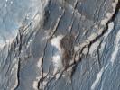
Ius Chasma is one of several canyons that make up Valles Marineris, the largest canyon system in the Solar System as seen by NASA's Mars Reconnaissance Orbiter.
PIA13077:
Floor of Ius Chasma
Full Resolution:     TIFF (14.76 MB)     JPEG (862.9 kB)
Add Image to Favorite List 2010-04-29 Mars Mars Reconnaissance Orbiter (MRO)
HiRISE
2560x1920x3
This image captured by NASA's Mars Reconnaissance Orbiter shows the edge of a dark dune field on the floor of Proctor Crater, a 150 kilometer diameter crater in the southern highlands of Mars.
PIA13076:
Proctor Crater Dune Field
Full Resolution:     TIFF (14.76 MB)     JPEG (978.5 kB)
Add Image to Favorite List 2010-04-29 Mars Mars Reconnaissance Orbiter (MRO)
HiRISE
2560x1920x3
This image taken by NASA's Mars Reconnaissance Orbiter features three newly-formed slope streaks. These are features which occur on crater walls, hills, and other slopes on Mars.
PIA13075:
Newly-Formed Slope Streaks
Full Resolution:     TIFF (14.76 MB)     JPEG (811.8 kB)
Add Image to Favorite List 2010-04-29 Mars Mars Reconnaissance Orbiter (MRO)
HiRISE
2560x1920x3
This image taken by NASA's Mars Reconnaissance Orbiter shows gullies in a semi-circular trough in Noachis Terra. The gullies are observed to face all directions.
PIA13074:
Gullied Trough in Noachis Terra
Full Resolution:     TIFF (14.76 MB)     JPEG (1.183 MB)
Add Image to Favorite List 2010-04-29 Mars Mars Reconnaissance Orbiter (MRO)
HiRISE
2560x1920x3
This image taken by NASA's Mars Reconnaissance Orbiter shows a part of a central mound in an impact crater in Arabia Terra.
PIA13073:
Yardangs within a Large Crater
Full Resolution:     TIFF (14.76 MB)     JPEG (604.5 kB)
Add Image to Favorite List 2010-04-29 Mars Mars Reconnaissance Orbiter (MRO)
HiRISE
2560x1920x3
This image taken by NASA's Mars Reconnaissance Orbiter shows a series of parallel layers eroding into peculiar knobs and hills.
PIA13072:
Reading the Geologic Record
Full Resolution:     TIFF (14.76 MB)     JPEG (476.9 kB)
Add Image to Favorite List 2010-03-31 Mars Mars Reconnaissance Orbiter (MRO)
HiRISE
800x600x3
The Martian north polar layered deposits are an ice sheet much like the Greenland ice sheet on the Earth in this image from NASA's Mars Reconnaissance Orbiter. This Martian ice sheet contains many layers that record variations in the Martian climate.
PIA12997:
Icy Layers and Climate Fluctuations near the Martian North Pole
Full Resolution:     TIFF (1.442 MB)     JPEG (110.2 kB)
Add Image to Favorite List 2010-03-31 Mars Mars Reconnaissance Orbiter (MRO)
HiRISE
800x600x3
The terrain in this image from NASA's Mars Reconnaissance Orbiter lies in the Deuteronilus Mensae region along the highland-lowland dichotomy boundary in the northern hemisphere of Mars.
PIA12996:
Lobate Debris Apron in Deuteronilus Mensae
Full Resolution:     TIFF (1.442 MB)     JPEG (115.4 kB)
Add Image to Favorite List 2010-03-31 Mars Mars Reconnaissance Orbiter (MRO)
HiRISE
800x600x3
This image captured by NASA's Mars Reconnaissance Orbiter covers some high-standing topography just outside the rim of an impact crater about 30 kilometers (19 miles) in diameter near a Martian hill named Zephyria Tholus.
PIA12995:
Dust-Mantled Topography near Zephyria Tholus
Full Resolution:     TIFF (1.442 MB)     JPEG (50.73 kB)
Add Image to Favorite List 2010-03-31 Mars Mars Reconnaissance Orbiter (MRO)
HiRISE
800x600x3
This image from NASA's Mars Reconnaissance Orbiter shows a portion of the floor in Palos Crater on equatorial Mars. The floor appears bumpy with high-standing layered knobs; most of its terrain is weathering into meter-size (yard-size) polygonal blocks.
PIA12994:
Deposits on the Floor of Palos Crater
Full Resolution:     TIFF (1.442 MB)     JPEG (121.2 kB)
Add Image to Favorite List 2010-03-31 Mars Mars Reconnaissance Orbiter (MRO)
HiRISE
800x600x3
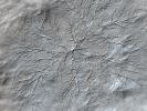
This image taken by NASA's Mars Reconnaissance Orbiter shows Samara Valles, one of the longest ancient valley systems on Mars; its surface is mantled with dust as evidenced by the system of dunes that line the valley floor.
PIA12993:
Dunes on Floor of Samara Valles, Mars
Full Resolution:     TIFF (1.442 MB)     JPEG (88.38 kB)
Add Image to Favorite List 2010-03-31 Mars Mars Reconnaissance Orbiter (MRO)
HiRISE
800x600x3
This image taken by NASA's Mars Reconnaissance Orbiter covers the northern edge of the largest volcano in the solar system, Olympus Mons on Mars; its margin is defined by a massive cliff many kilometers (several miles) tall.
PIA12992:
Collapsing Volcano; Edge of Olympus Mons
Full Resolution:     TIFF (1.442 MB)     JPEG (85.87 kB)
Add Image to Favorite List 2010-03-31 Mars Mars Reconnaissance Orbiter (MRO)
HiRISE
800x600x3
This image taken by NASA's Mars Reconnaissance Orbiter reveals meter-scale (yard-scale) surface textures of mesas and knobs in the Aureum Chaos region of Mars. Aureum Chaos is a wide region of plateaus, mesas, and knobs.
PIA12991:
Mesas in Aureum Chaos
Full Resolution:     TIFF (1.442 MB)     JPEG (82.46 kB)
Add Image to Favorite List 2010-03-31 Mars Mars Reconnaissance Orbiter (MRO)
HiRISE
800x600x3
This image taken by NASA's Mars Reconnaissance Orbiter in the Cydnus Rupes region, shows that the northern plains of Mars are rock and boulder strewn landscapes otherwise devoid of major features except a few impact craters.
PIA12990:
Boulder Strewn Plain in Northern Utopia Planitia
Full Resolution:     TIFF (1.442 MB)     JPEG (173.6 kB)
Add Image to Favorite List 2010-03-24 Mars Mars Reconnaissance Orbiter (MRO)
HiRISE
502x478x1
This image, acquired by NASA's Mars Reconnaissance Orbiter, shows the rover Opportunity perched on the edge of 'Concepción' crater, a fresh crater with dark rays that clearly overprint the north-trending, wind-shaped ripples, in Meridiani Planum.
PIA12969:
Opportunity at 'Concepción' Crater, Seen from Orbit
Full Resolution:     TIFF (240.4 kB)     JPEG (36.8 kB)
Add Image to Favorite List 2010-03-22 Mars Mars Reconnaissance Orbiter (MRO)
HiRISE
2560x1920x3
This image from NASA's Mars Reconnaissance Orbiter was targeted to study knobs in Mars' northern plains, north of Scandia Crater. The knobs are clearly imaged, but what surprised scientists was a dust devil visible in the south-central part of the image.
PIA12876:
Record-Breaking Dust Devil Caught in the Act
Full Resolution:     TIFF (14.76 MB)     JPEG (1.34 MB)
Add Image to Favorite List 2010-03-10 Mars Mars Reconnaissance Orbiter (MRO)
HiRISE
2560x1920x3
In the winter a layer of carbon dioxide ice (dry ice) covers the north polar sand dunes as shown by NASA's Mars Reconnaissance Orbiter. In the spring the sublimation of the ice (going directly from ice to gas) causes a host of uniquely Martian phenomena.
PIA12957:
A Burst of Spring
Full Resolution:     TIFF (14.76 MB)     JPEG (859.2 kB)
Add Image to Favorite List 2010-03-10 Mars Mars Reconnaissance Orbiter (MRO)
HiRISE
2560x1920x3
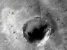
This image taken by NASA's Mars Reconnaissance Orbiter shows part of Cerberus Fossae, a long system of extensional (normal) faults arranged in trough-bounding (graben-bounding) pairs.
PIA12956:
Cerberus Fossae East of the Head of Athabasca Valles
Full Resolution:     TIFF (14.76 MB)     JPEG (670.5 kB)
Add Image to Favorite List 2010-03-10 Mars Mars Reconnaissance Orbiter (MRO)
HiRISE
2560x1920x3
This image taken by NASA's Mars Reconnaissance Orbiter covers part of a candidate landing site that appears to be a shallow depression with a deposit perhaps consisting of chlorides, like table salt.
PIA12955:
Candidate Landing Site in Possible Salt Playa
Full Resolution:     TIFF (14.76 MB)     JPEG (1.104 MB)
Add Image to Favorite List 2010-03-04 Mars Mars Reconnaissance Orbiter (MRO)
HiRISE
630x763x3
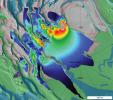
Three pairs of before and after images from NASA's Mars Reconnaissance Orbiter illustrate movement of ripples on dark sand dunes in the Nili Patera region of Mars.
PIA12860:
Changes in Ripples on Martian Dunes in Nili Patera
Full Resolution:     TIFF (1.444 MB)     JPEG (97.85 kB)
Add Image to Favorite List 2010-03-04 Mars Mars Reconnaissance Orbiter (MRO)
HiRISE
630x512x3
Two pairs of side-by-side, before and after images from NASA's Mars Reconnaissance Orbiter illustrate changes in the shape of edges of dark sand dunes in the Nili Patera region of Mars.
PIA12859:
Changes at Edges of Dark Dunes in Nili Patera, Mars
Full Resolution:     TIFF (968.9 kB)     JPEG (78.11 kB)
Add Image to Favorite List 2010-03-04 Mars Mars Reconnaissance Orbiter (MRO)
HiRISE
630x257x3
Before and after images from NASA's Mars Reconnaissance Orbiter illustrate occurrence of new streaks on the slip face of a dark sand dune in the Nili Patera region of Mars.
PIA12858:
Changes on Dune Slip Face, Nili Patera, Mars
Full Resolution:     TIFF (486.5 kB)     JPEG (30.09 kB)
Add Image to Favorite List 2010-03-04 Mars Mars Reconnaissance Orbiter (MRO)
CTX
535x645x1
The upper portion of this map is from an observation by the Context Camera on NASA's Mars Reconnaissance Orbiter of a field of dark sand dunes in the Nili Patera region of Mars.
PIA12857:
Location Map for Images of Changing Martian Dunes
Full Resolution:     TIFF (345.6 kB)     JPEG (82.61 kB)
Add Image to Favorite List 2010-03-03 Mars Mars Reconnaissance Orbiter (MRO)
HiRISE
2560x1920x3
This image from NASA's Mars Reconnaissance Orbiter shows a swath of a debris apron east of Hellas Basin. Features like this are often found surrounding isolated mountains in this area. Original release date March 3, 2010.
PIA12883:
Craters on an Ice-Rich Débris Apron
Full Resolution:     TIFF (14.76 MB)     JPEG (892.6 kB)
Add Image to Favorite List 2010-03-03 Mars Mars Reconnaissance Orbiter (MRO)
HiRISE
2560x1920x3
This image from NASA's Mars Reconnaissance Orbiter shows part of an unnamed crater, itself located inside the much larger Newton Crater, in Terra Sirenum. Original release date March 3, 2010.
PIA12882:
Northern Meridiani Etched Terrain and Hematite Plains Contact
Full Resolution:     TIFF (14.76 MB)     JPEG (820.3 kB)
Retrieve Previous Set  Jump to a Previous Set   Jump to a Previous Set   Jump to a Previous Set   Jump to a Previous Set   Jump to a Previous Set   Jump to a Previous Set   Jump to a Previous Set   Jump to a Previous Set   Jump to a Previous Set   Jump to a Previous Set   Retrieve Next Set 
 1-100   101-200   201-300   301-400   401-500   501-600   601-700   701-800   801-900   901-1000 
Currently displaying images: 1101 - 1200 of 1726