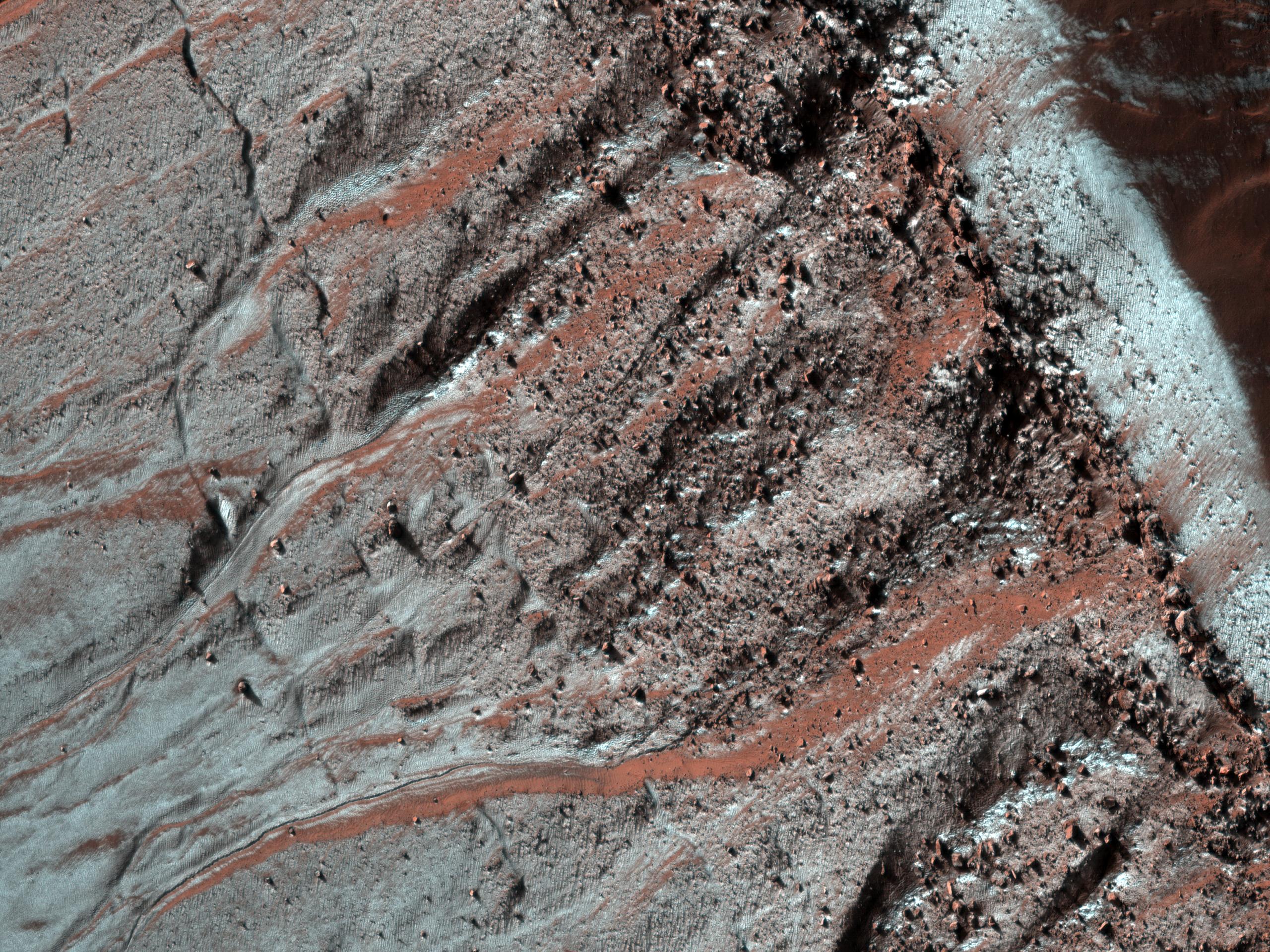
This observation shows gullies in a semi-circular trough in Noachis Terra. The gullies are observed to face all directions.
It is interesting to note that the gully morphology seen here depends on the orientation of the gullies. The morphology differences are most pronounced on the sunlit slope, with the gullies facing south (down) being more deeply incised than those facing the west. It is unknown what caused the different gully morphologies, but there are several possibilities.
Gullies are proposed to form at locations determined by the availability of a forming liquid (thought to be water) and/or the amount of insolation the slope receives, among other factors. It is possible that the deeper gullies experienced more erosional events or that their erosional events were more effective for undetermined reasons. It is also possible that the gullies formed at different times such that they did not have the same amount of water -- either for an individual flow or total -- available to them. Also, the underlying topography could make the gullies appear relatively more incised without this actually being the case.
The majority of the gullies on both sides of the trough appear to originate at a boulder-rich layer visible in the subimage. The layer appears dark on the sunlit slope because the boulders sticking out from the slopes cast shadows. If these gullies formed by water from the subsurface, then it is possible that this layer is a permeable layer that conducted water to the surface. The layer is deteriorating and traveling down slope in the form of boulders. These boulders can clearly be seen in the alcoves of the gullies on both sides of the trough.
The University of Arizona, Tucson, operates the HiRISE camera, which was built by Ball Aerospace & Technologies Corp., Boulder, Colo. NASA's Jet Propulsion Laboratory, a division of the California Institute of Technology, Pasadena, manages the Mars Reconnaissance Orbiter for the NASA Science Mission Directorate, Washington. Lockheed Martin Space Systems, Denver, is the spacecraft development and integration contractor for the project and built the spacecraft.
 Planetary Data System


