PDS logoPlanetary Data System
PDS Information
Find a Node - Use these links to navigate to any of the 8 publicly accessible PDS Nodes.

This bar indicates that you are within the PDS enterprise which includes 6 science discipline nodes and 2 support nodes which are overseen by the Project Management Office at NASA's Goddard Space Flight Center (GSFC). Each node is led by an expert in the subject discipline, supported by an advisory group of other practitioners of that discipline, and subject to selection and approval under a regular NASA Research Announcement.
Click here to return to the Photojournal Home Page Click here to view a list of Photojournal Image Galleries Photojournal_inner_header
Latest Images  |  Spacecraft & Technology  |  Animations  |  Space Images App  |  Feedback  |  Photojournal Search  
My Favorite Images from the Planetary Photojoural
I have 9 images in my list


The first time you select an image to My List, a separate browser window will open. This page will list the set of images you have selected as favorites from the Photojournal. This list is kept for a short period of time, approximately 60 days. The way we associate you with your list is through a persistent cookie left on your computer. This cookie is nothing more than a unique key that allows the Photojournal to make this association. Once created, this list is only modifiable from the same computer. Information stored in the cookie on your computer is used by the Photojournal server only during your session. If you configure your Web browser not to use cookies, you will not be able to create and refer back to a personal list of favorite images. To view your current list, click on a marked entry for your list from the catalog page, or add another favorite. For more information, see JPL's Privacy Policy.
My
List
Catalog # Target Mission Instrument Addition Date Size
Remove Image from Favorite List PIA12531 Titan Cassini-Huygens
ISS - Narrow Angle
2010-01-20 1000x1000x1
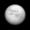
NASA's Cassini spacecraft gazes at several albedo features on Saturn's largest moon, Titan. Left to right are four dark regions: Fensal, Aztlan, Aaru and a part of Senkyo.
Title:
Dark Quartet
Remove Image from Favorite List PIA10506 Tethys Cassini-Huygens
ISS - Narrow Angle
2008-11-05 1020x1020x1
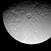
The prominent crater Telemachus sits within the northern reaches of Ithaca Chasma on Saturn's moon Tethys in this image captured by NASA's Cassini spacecraft on Sept. 24, 2008.
Title:
Crater and Canyon
Remove Image from Favorite List PIA19199 Mars 2001 Mars Odyssey
THEMIS
2015-02-12 1340x2698x3
This image captured by NASA's 2001 Mars Odyssey spacecraft is of an unnamed crater in Noachis Terra. Part of the crater floor contains a dune field. Dust devil tracks are visible east of the dunes.
Title:
Dunes and Dust Devils
Remove Image from Favorite List PIA15084 Vesta Dawn
Framing Camera
2011-11-19 6400x3007x3
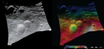
These images from NASA's Dawn spacecraft show the Domitia crater in Vesta's northern hemisphere and the topography of the surrounding region, which includes the 'Snowman' craters.
Title:
Topography and Albedo Image of Domitia Crater
Remove Image from Favorite List PIA25185 Earth Terra
ASTER
2022-03-23 2585x2251x3
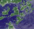
NASA's Terra spacecraft shows Japan's Geiyo Archipelago in the Seito Inland Sea.
Title:
Geiyo Archipelago, Japan
Remove Image from Favorite List PIA23898 Mars Mars Science Laboratory (MSL)
Mastcam
2020-08-03 20251x4204x3
The Mast Camera, or Mastcam, on NASA's Curiosity Mars rover used its telephoto lens to capture Mount Sharp in the morning illumination on Oct. 13, 2019.
Title:
A Dramatic View of Mars' Mount Sharp
Remove Image from Favorite List PIA13039 Moon Lunar Reconnaissance Orbiter (LRO)
Lunar Reconnaissance Orbiter Camera (NAC)
2010-04-15 1000x1000x1
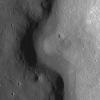
A sinuous rille created by a lava flow snakes around the base of a massif in the Prinz-Harbinger region on the Moon in this image taken by NASA's Lunar Reconnaissance Orbiter.
Title:
Rimae Prinz Region - Constellation Region of Interest
Remove Image from Favorite List PIA21150 Mars Mars Reconnaissance Orbiter (MRO)
Mars Science Laboratory (MSL)
ChemCam
HiRISE
2016-12-13 2809x2025x3
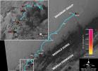
This map shows the route driven by NASA's Curiosity Mars rover (blue line) and locations where the rover's ChemCam instrument detected the element boron (dots, colored by abundance of boron according to the key at right).
Title:
Where's Boron? Mars Rover Detects It
Remove Image from Favorite List PIA14877 Mars Mars Reconnaissance Orbiter (MRO)
HiRISE
2011-11-17 781x1019x1
The eastern margin of a rippled dune in Herschel Crater on Mars moved an average distance of three meters (about three yards) between March 3, 2007 and December 1, 2010, in one of two images taken by NASA's Mars Reconnaissance Orbiter.
Title:
Shifting Sand in Herschel Crater Animation Icon