My
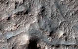
List |
Addition Date
|
Target
|
Mission
|
Instrument
|
Size
|

|
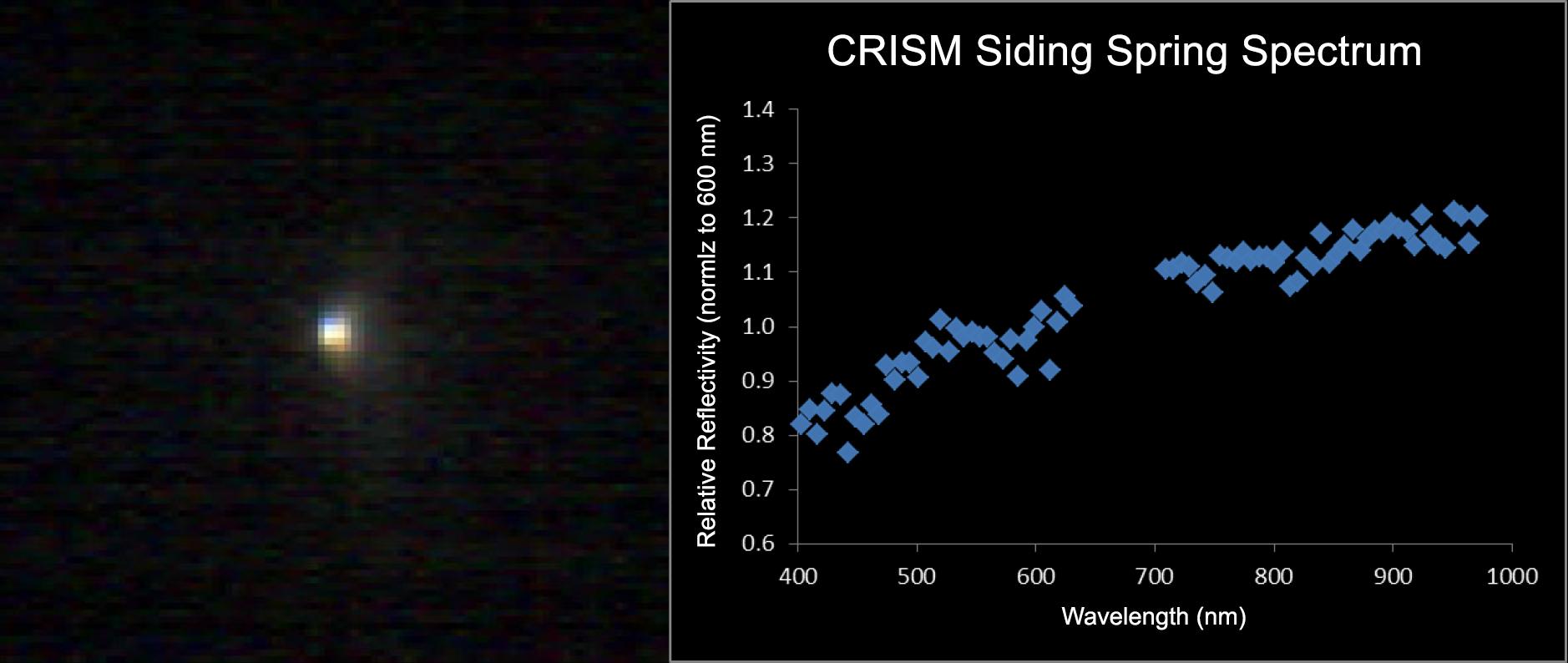
2014-11-07 |
Mars
|
Mars Reconnaissance Orbiter (MRO)
|
CRISM
|
1878x794x3 |
|
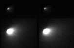
-
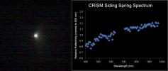
PIA18865:
-
Mars-Orbiting Spectrometer Shows Dusty Comet's Spectrum
Full Resolution:
TIFF
(4.475 MB)
JPEG
(94.77 kB)
|
|
|
2014-11-07 |
Mars
|
Mars Reconnaissance Orbiter (MRO)
|
HiRISE
|
1692x1128x1 |
|
-
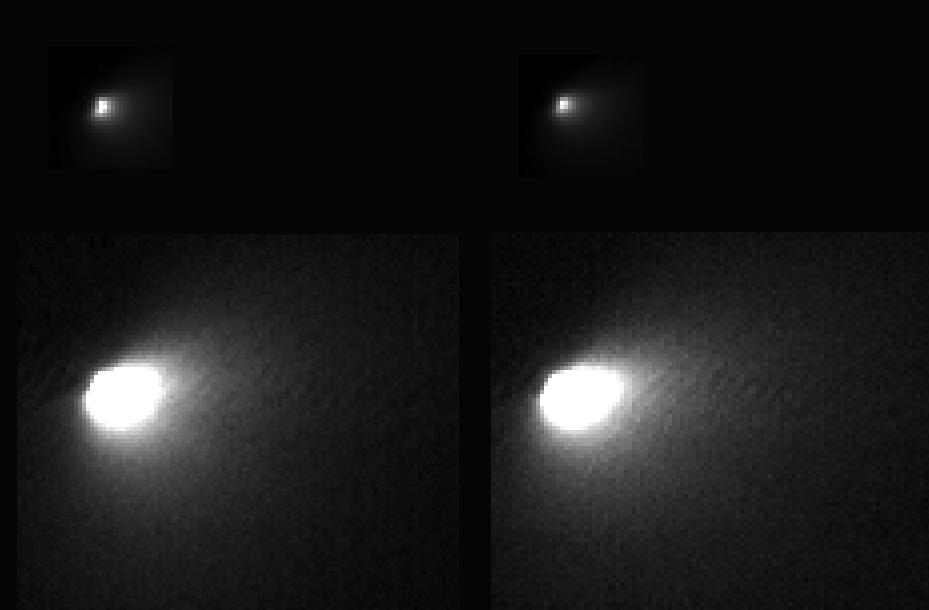
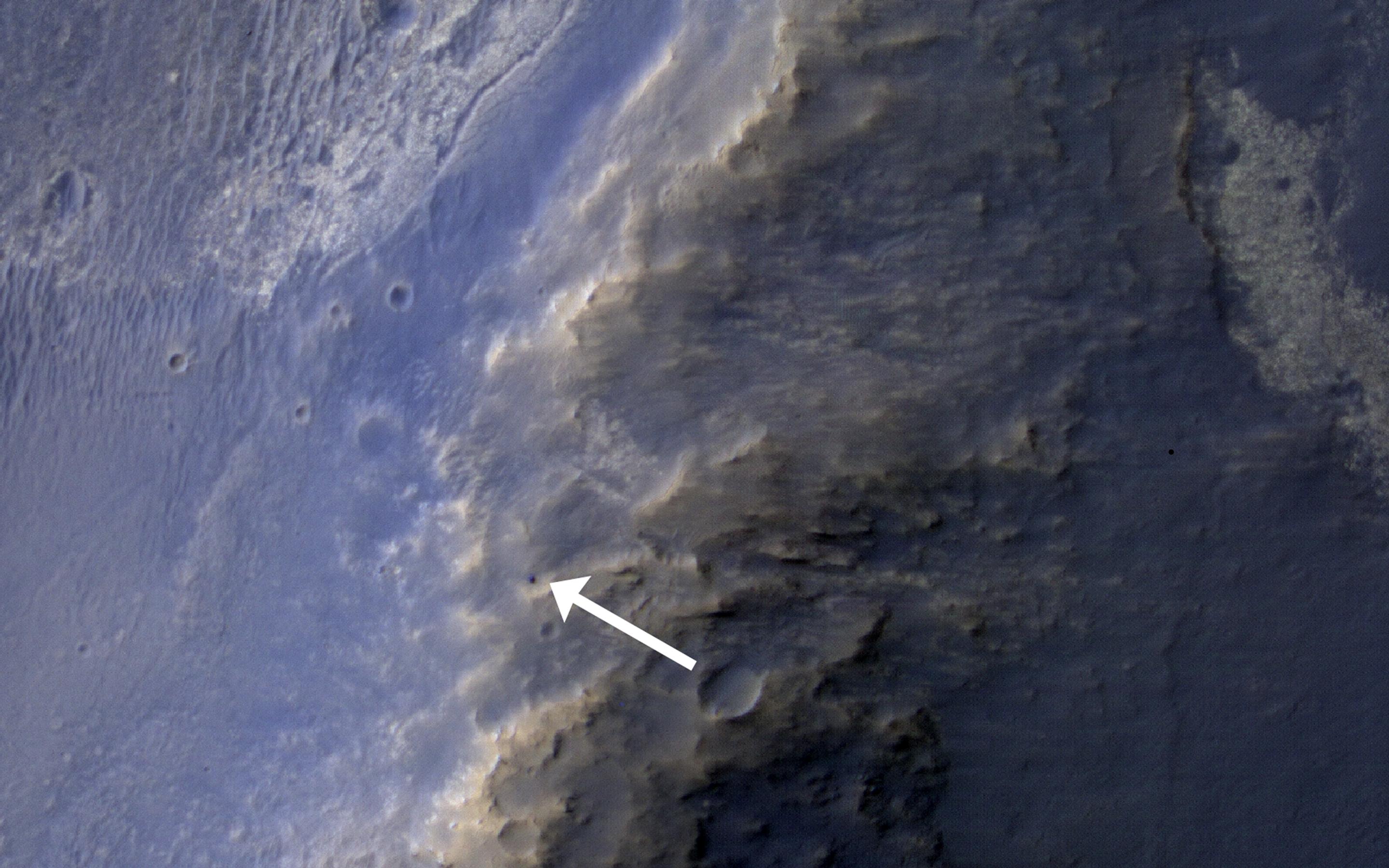
PIA18863:
-
Mars Orbiter Sizes Up Passing Comet
Full Resolution:
TIFF
(1.911 MB)
JPEG
(66.52 kB)
|
|
|
2014-11-07 |
Mars
|
Mars Reconnaissance Orbiter (MRO)
|
HiRISE
|
973x779x3 |
|
-
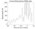
PIA18862:
-
Brightness Rhythm of Mars Flyby Comet Is Clue to Rotation Rate
Full Resolution:
TIFF
(759 kB)
JPEG
(58.15 kB)
|
|
|
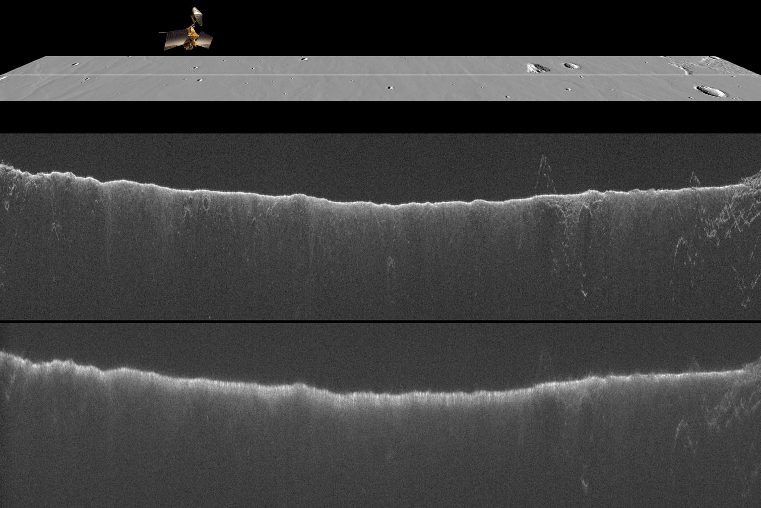
2014-11-07 |
Mars
|
Mars Reconnaissance Orbiter (MRO)
|
Shallow Subsurface Radar (SHARAD)
|
1534x1024x3 |
|
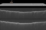
-
PIA18861:
-
Radar Indication of Effect of Comet Flyby on Martian Ionosphere
Full Resolution:
TIFF
(4.714 MB)
JPEG
(192.9 kB)
|
|
|
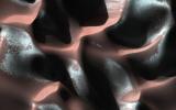
2014-10-29 |
Mars
|
Mars Reconnaissance Orbiter (MRO)
|
HiRISE
|
2880x1800x3 |
|
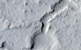
-
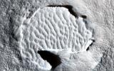
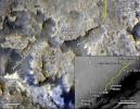
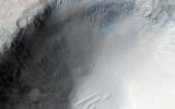
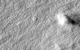
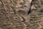
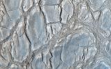
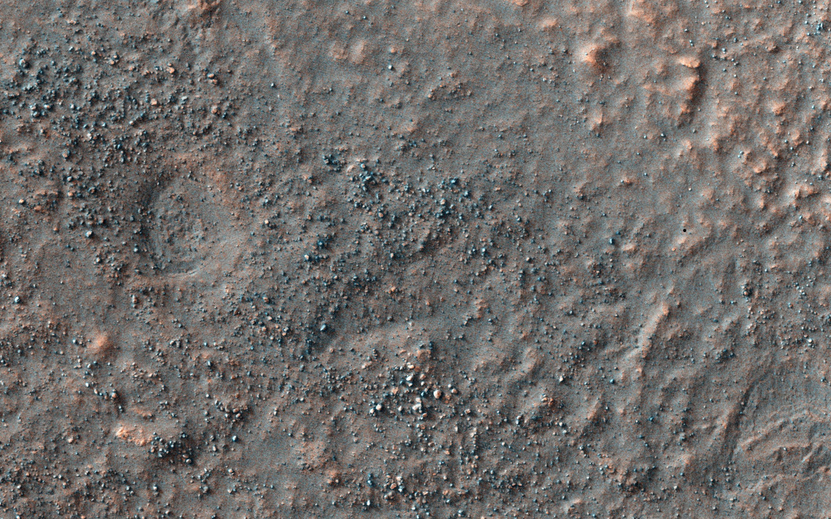
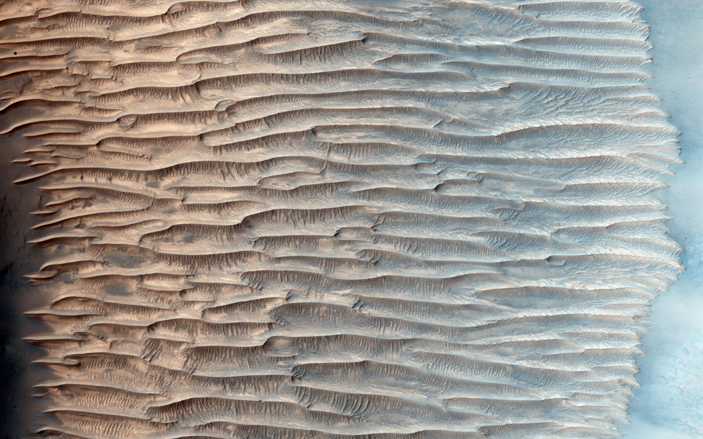
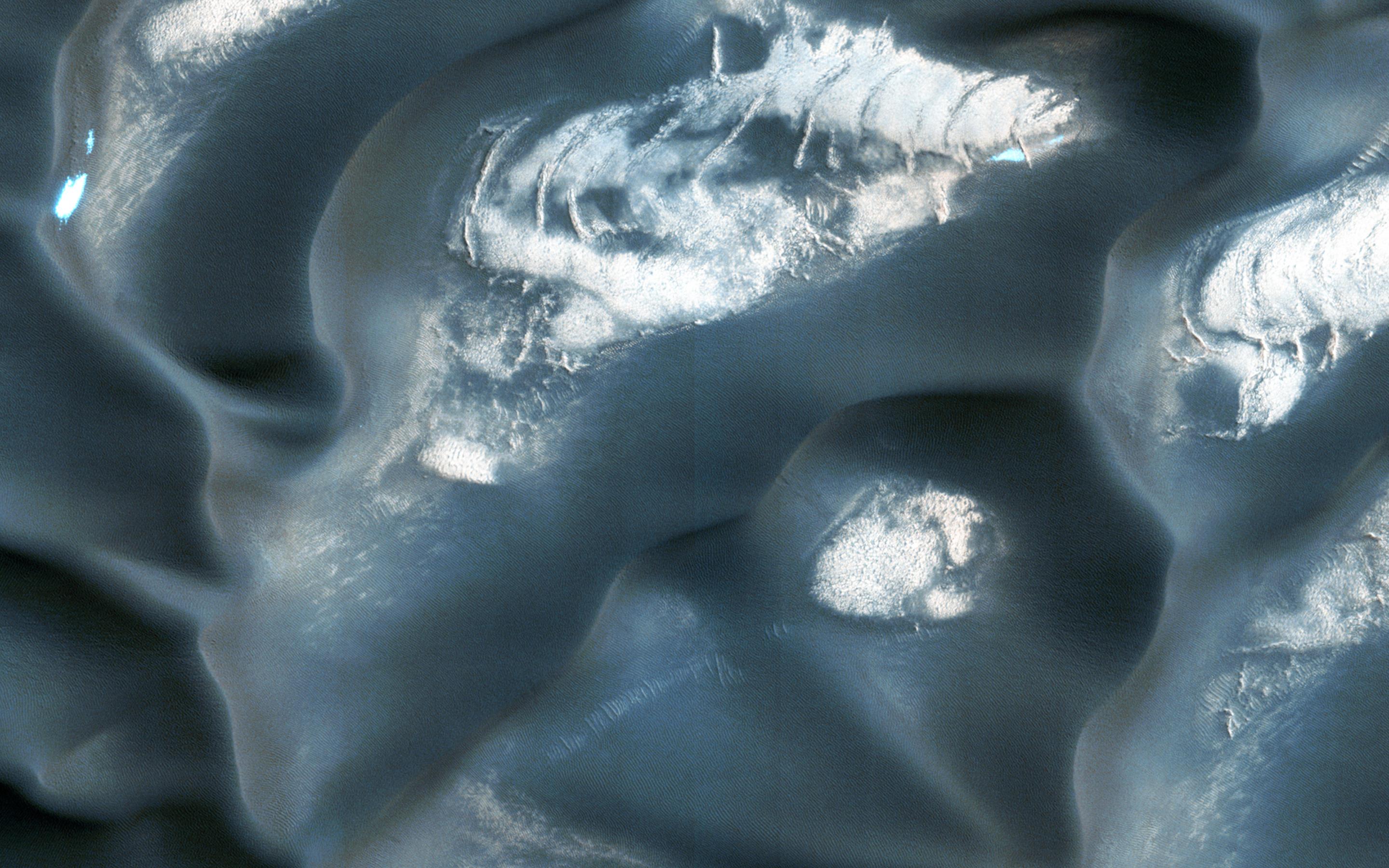
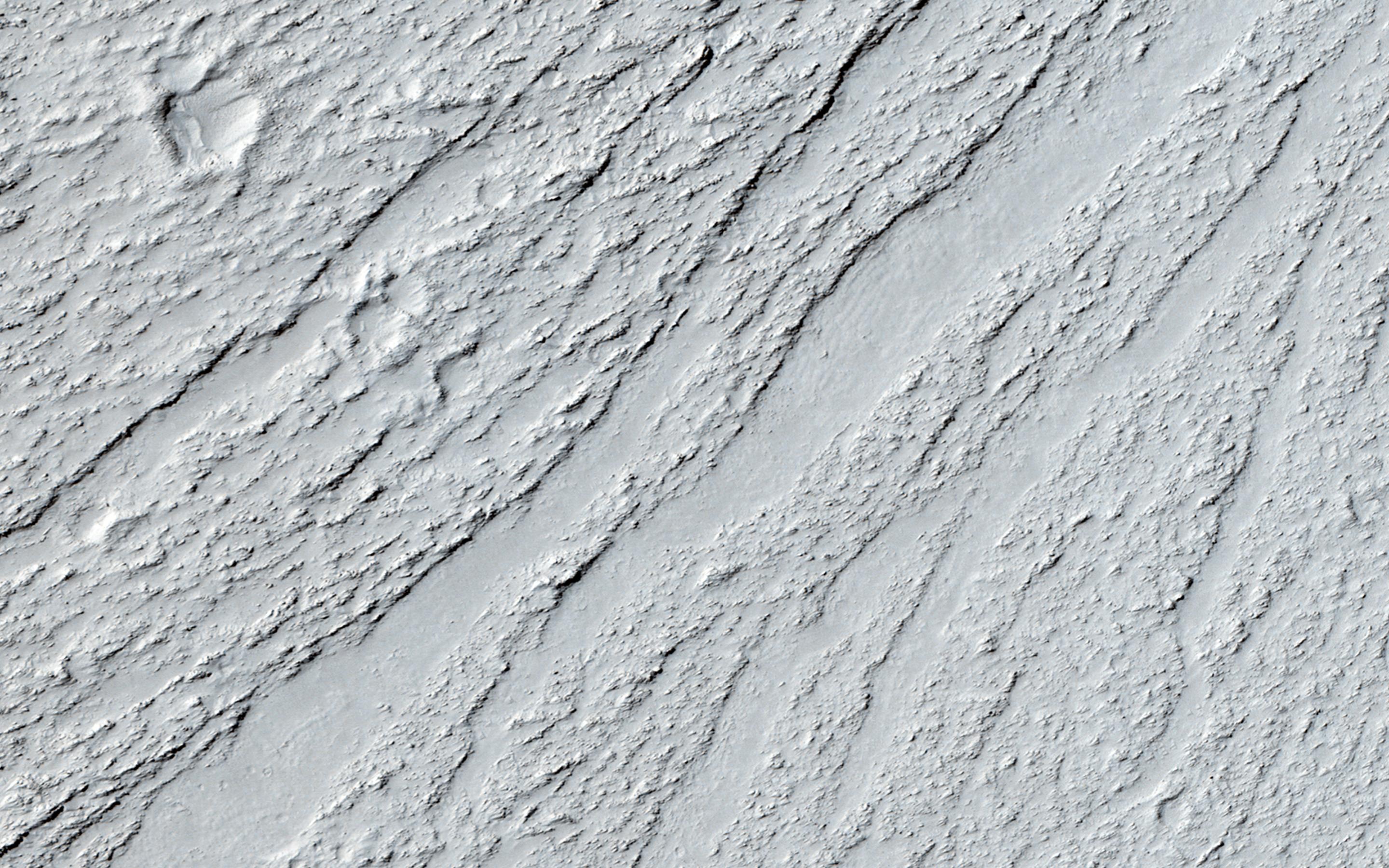
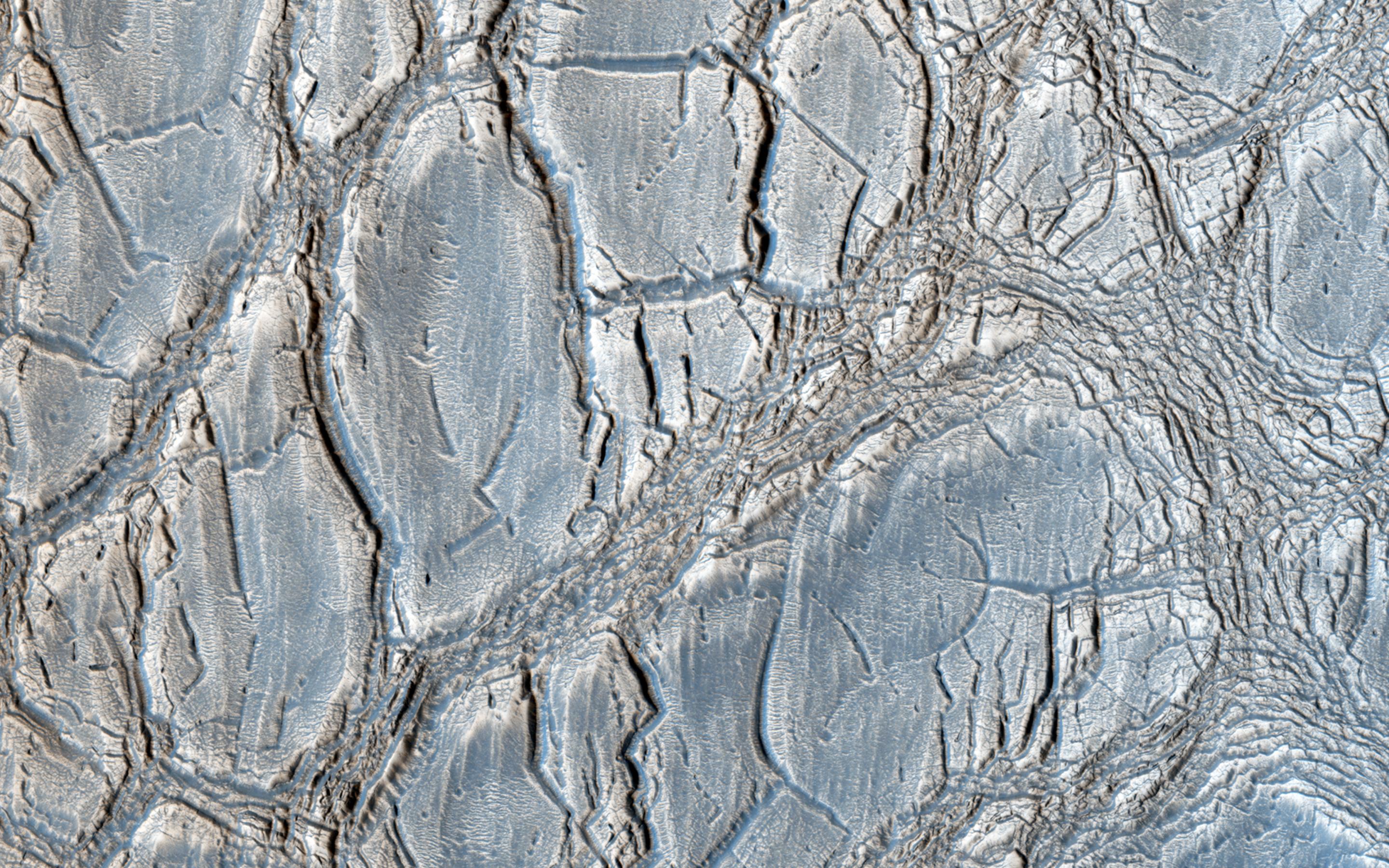
PIA18890:
-
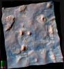
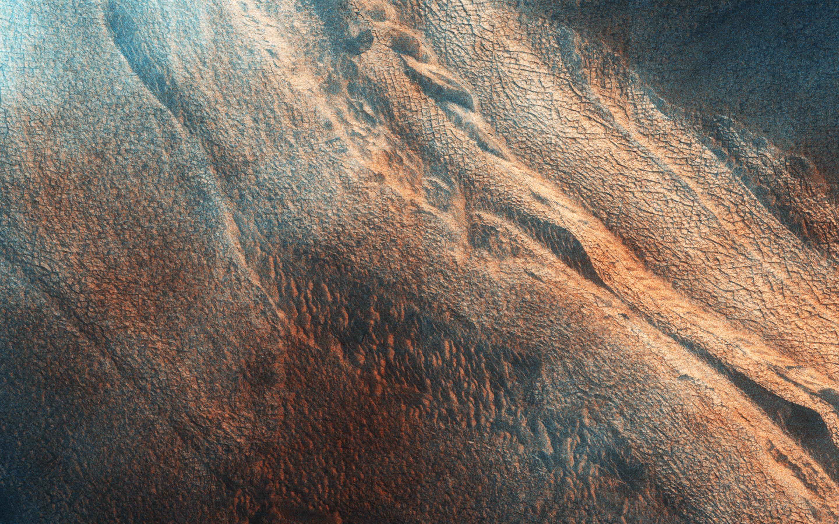
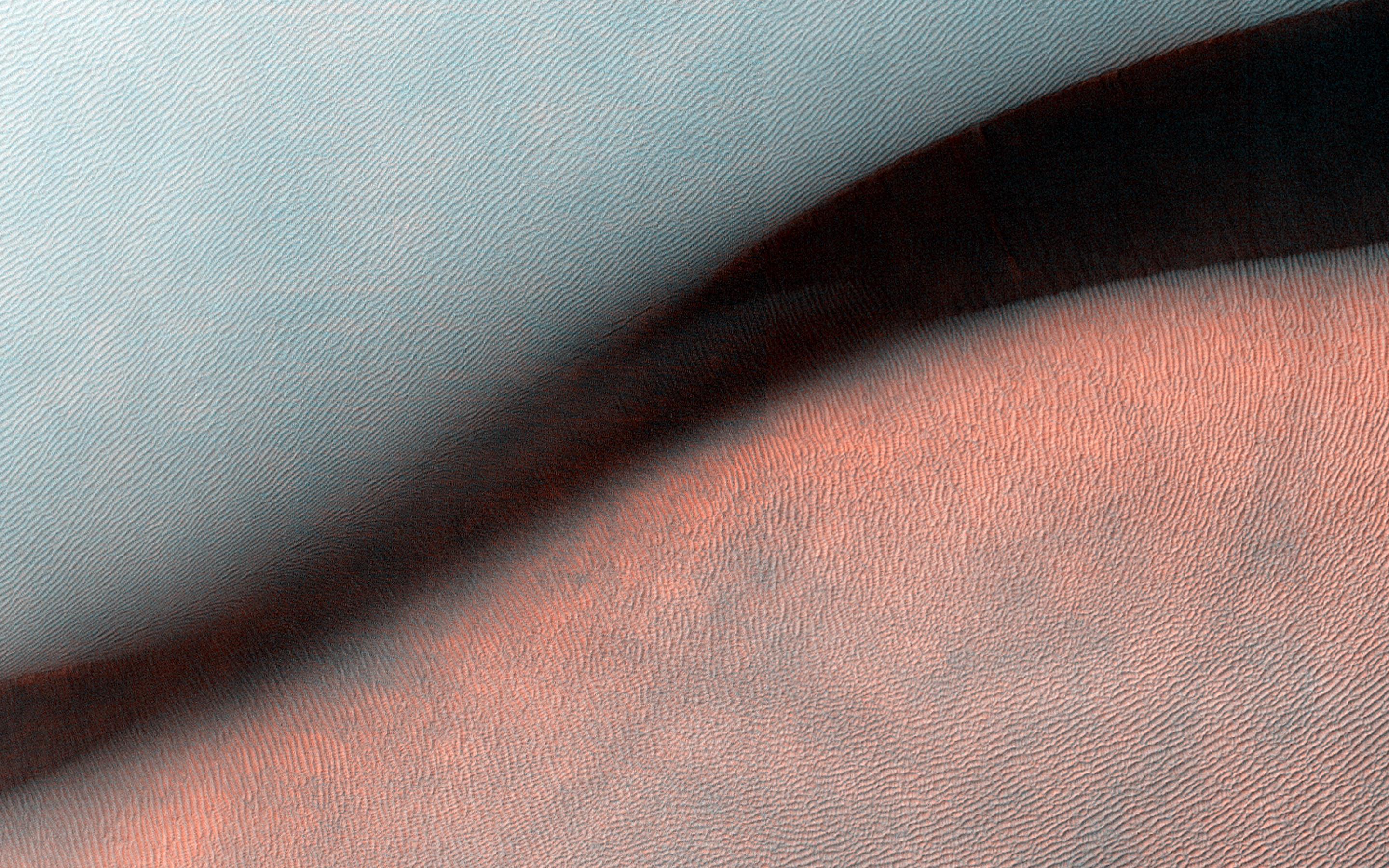
Hardened Dunes in Arcadia Planitia
Full Resolution:
TIFF
(15.56 MB)
JPEG
(968.1 kB)
|
|
|
2014-10-29 |
Mars
|
Mars Reconnaissance Orbiter (MRO)
|
HiRISE
|
2880x1800x3 |
|
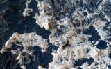
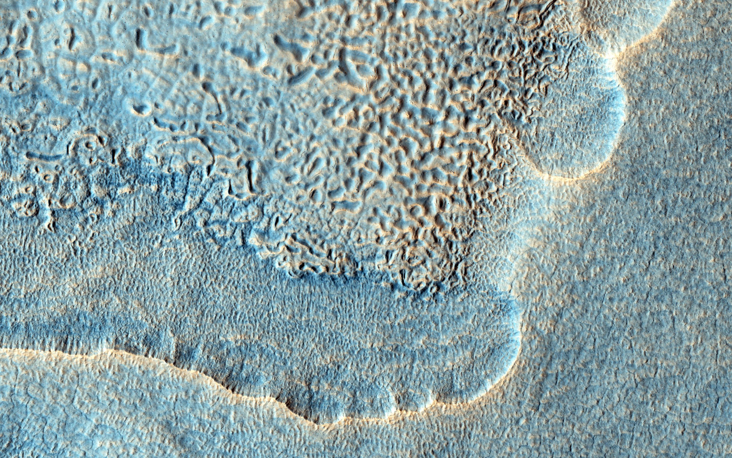
-
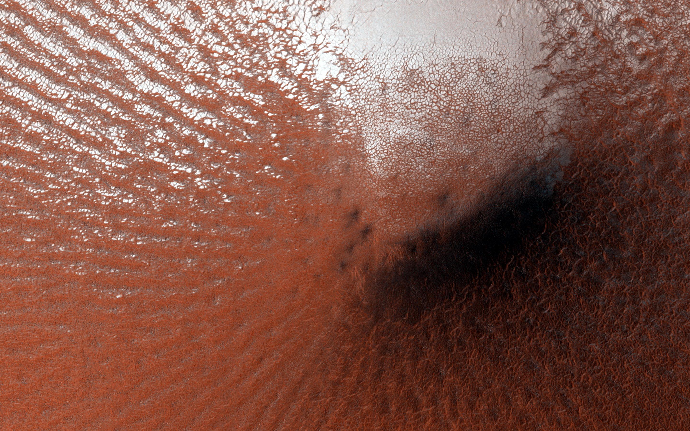
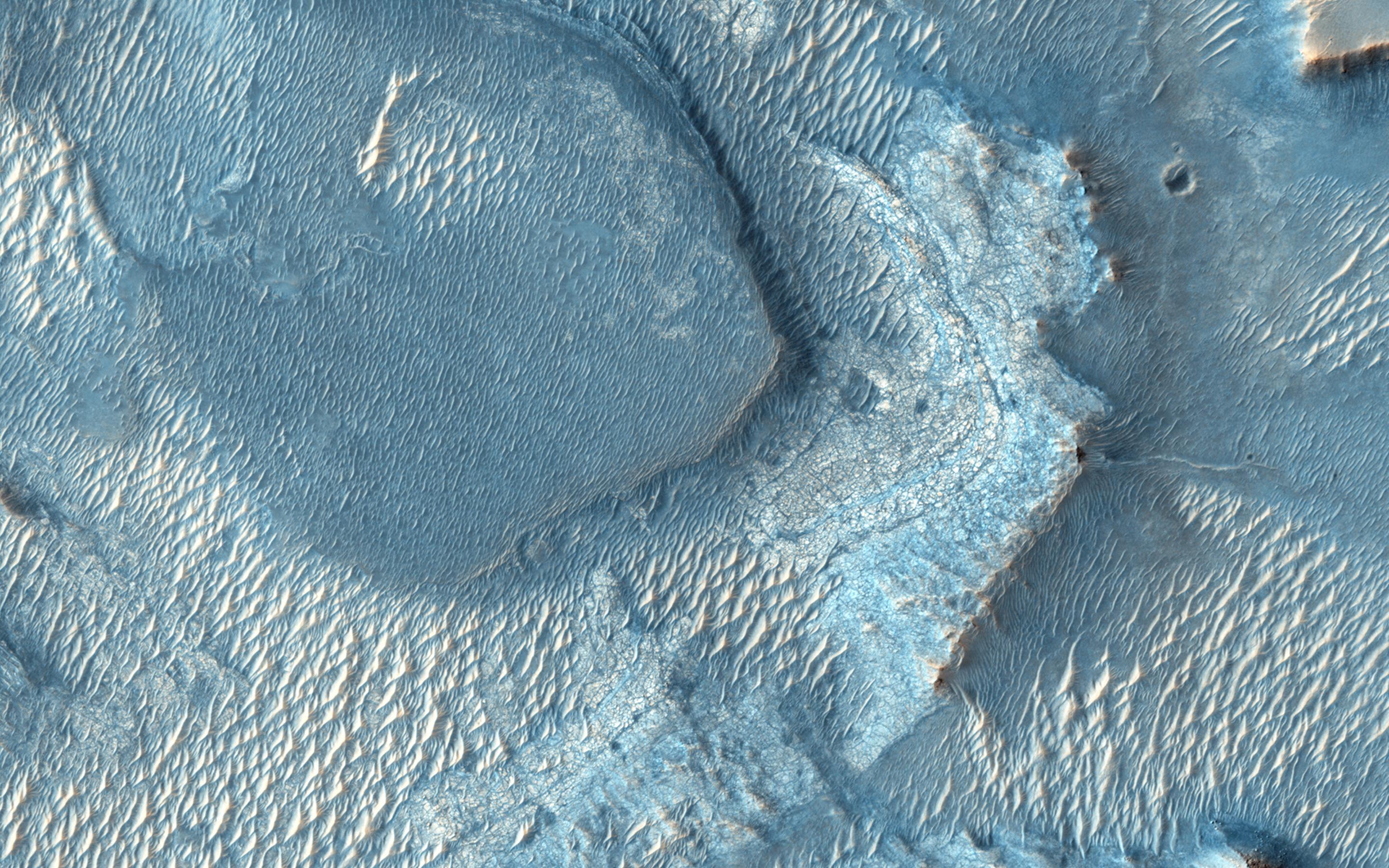
PIA18889:
-
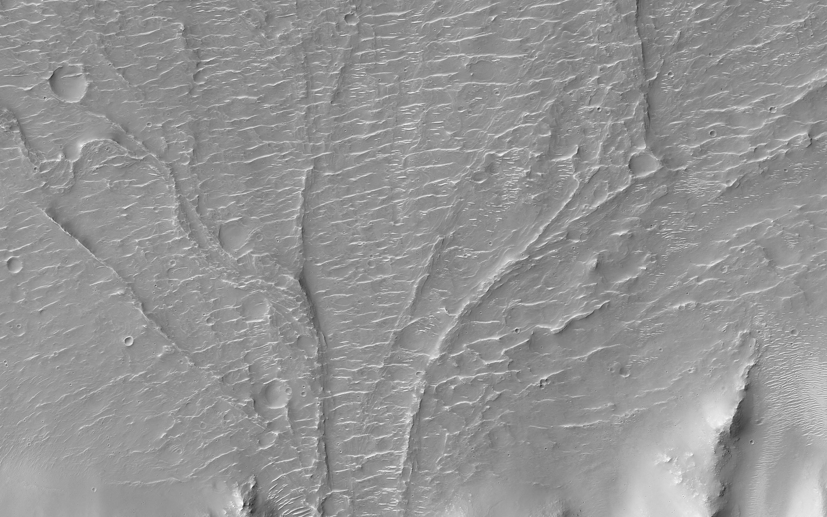
Sand Sources Near Athabasca Valles
Full Resolution:
TIFF
(15.56 MB)
JPEG
(844.8 kB)
|
|
|
2014-10-29 |
Mars
|
Mars Reconnaissance Orbiter (MRO)
|
HiRISE
|
2880x1800x3 |

|
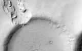
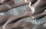
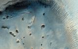
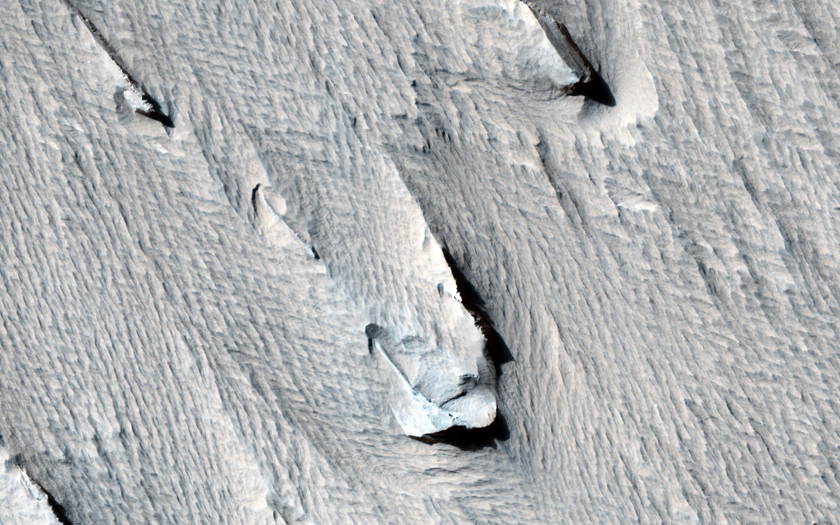
-
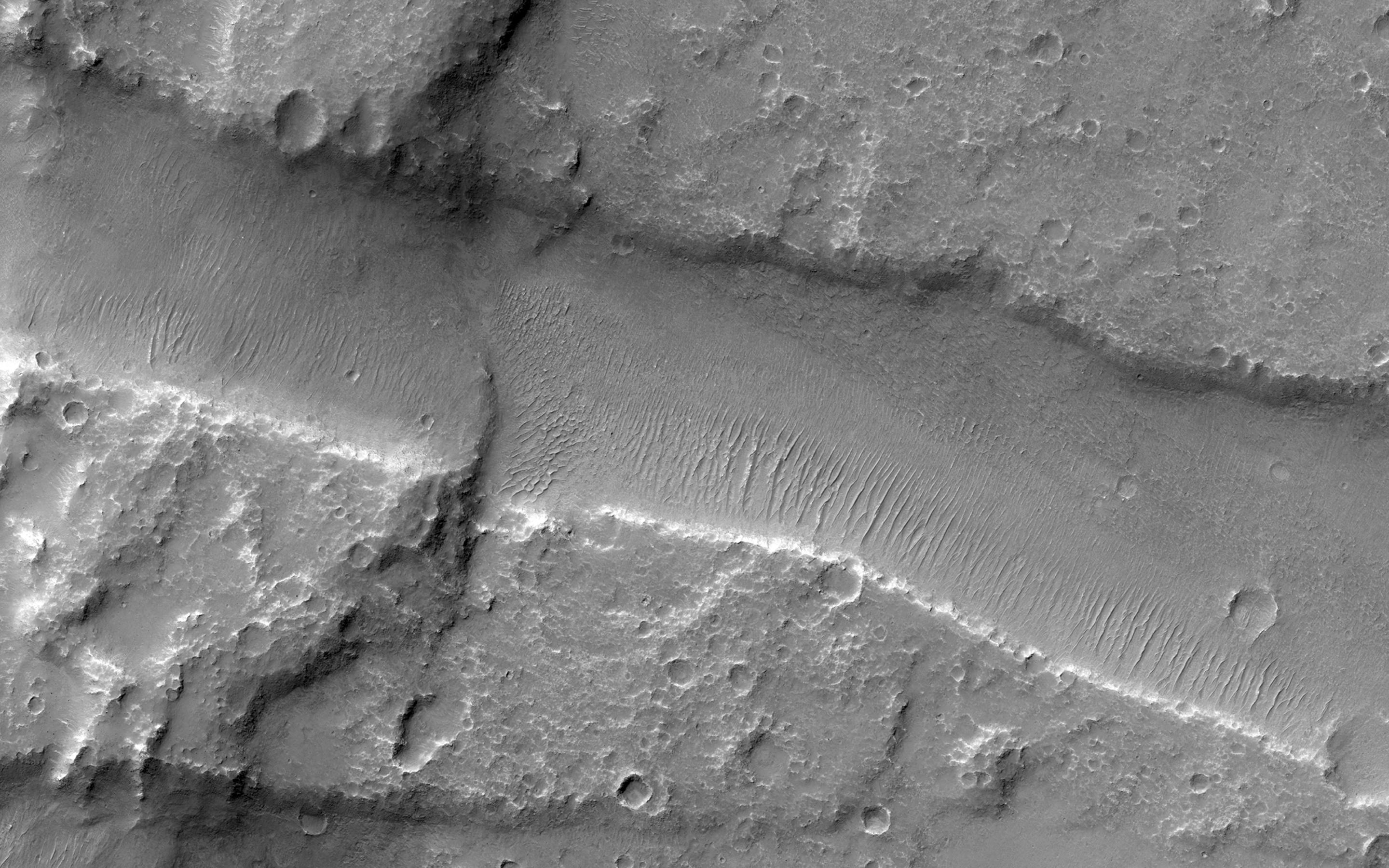
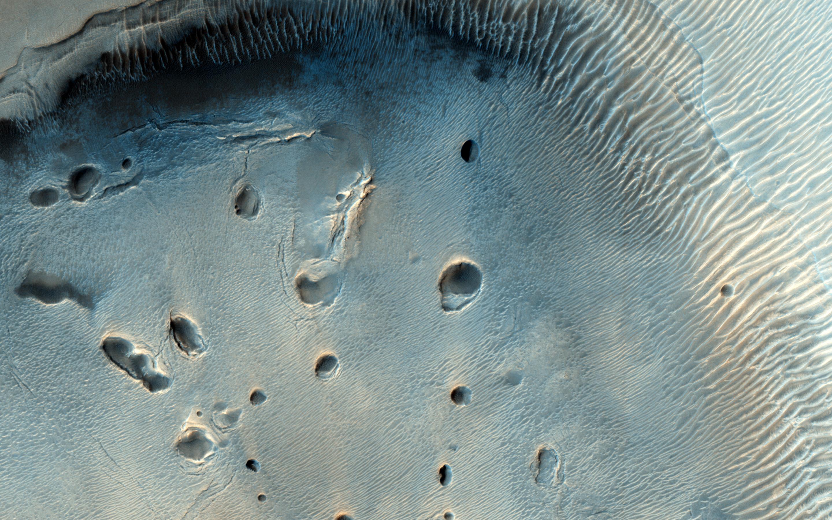
PIA18888:
-
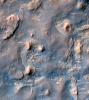
Search for the Mars 2 Debris Field
Full Resolution:
TIFF
(15.56 MB)
JPEG
(1.2 MB)
|
|
|
2014-10-29 |
Mars
|
Mars Reconnaissance Orbiter (MRO)
|
HiRISE
|
2880x1800x1 |
|
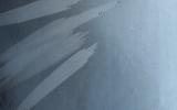
-
PIA18887:
-
Which Way is Up?
Full Resolution:
TIFF
(5.191 MB)
JPEG
(506.4 kB)
|
|
|
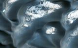
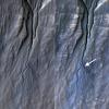
2014-10-24 |
Mars
|
Mars Reconnaissance Orbiter (MRO)
|
CRISM
|
1010x500x3 |
|
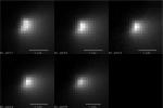
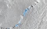
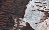
-
PIA15291:
-
Images From Mars-Orbiting Spectrometer Show Comet's Coma
Full Resolution:
TIFF
(1.516 MB)
JPEG
(38.03 kB)
|
|
|
2014-10-20 |
Mars
|
Mars Reconnaissance Orbiter (MRO)
|
HiRISE
|
929x610x1 |
|
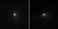
-
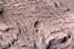
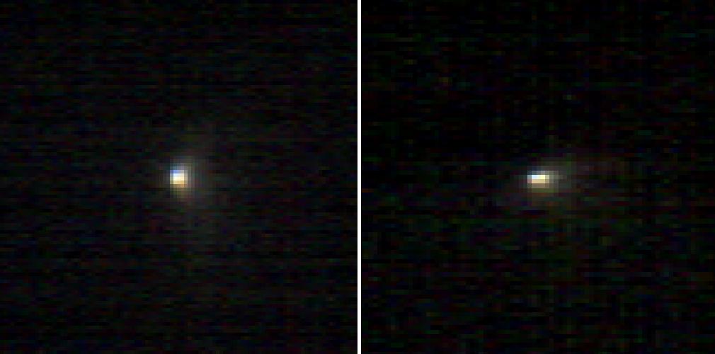
PIA18618:
-
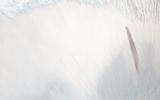
First Resolved Image of a Long-Period Comet's Nucleus
Full Resolution:
TIFF
(567.5 kB)
JPEG
(26.9 kB)
|
|
|
2014-10-15 |
Mars
|
Mars Reconnaissance Orbiter (MRO)
|
HiRISE
|
2880x1800x3 |

|
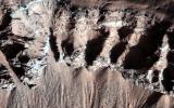
-
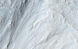
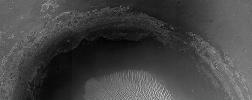
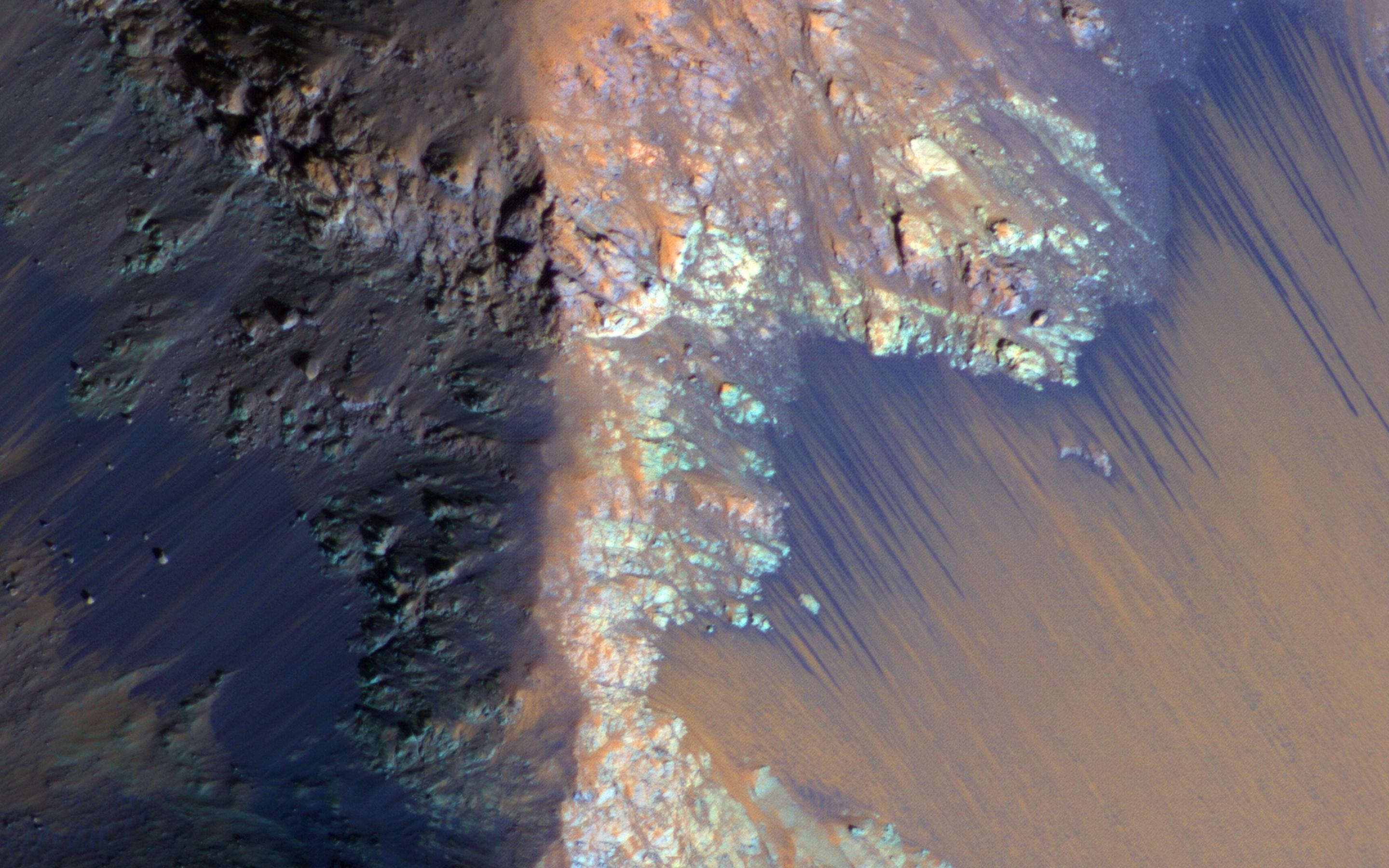
PIA18832:
-
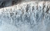
Perennial Frost in a Crater on the Northern Plains
Full Resolution:
TIFF
(15.56 MB)
JPEG
(895.2 kB)
|
|
|
2014-10-15 |
Mars
|
Mars Reconnaissance Orbiter (MRO)
|
HiRISE
|
2880x1800x3 |
|
-
PIA18831:
-
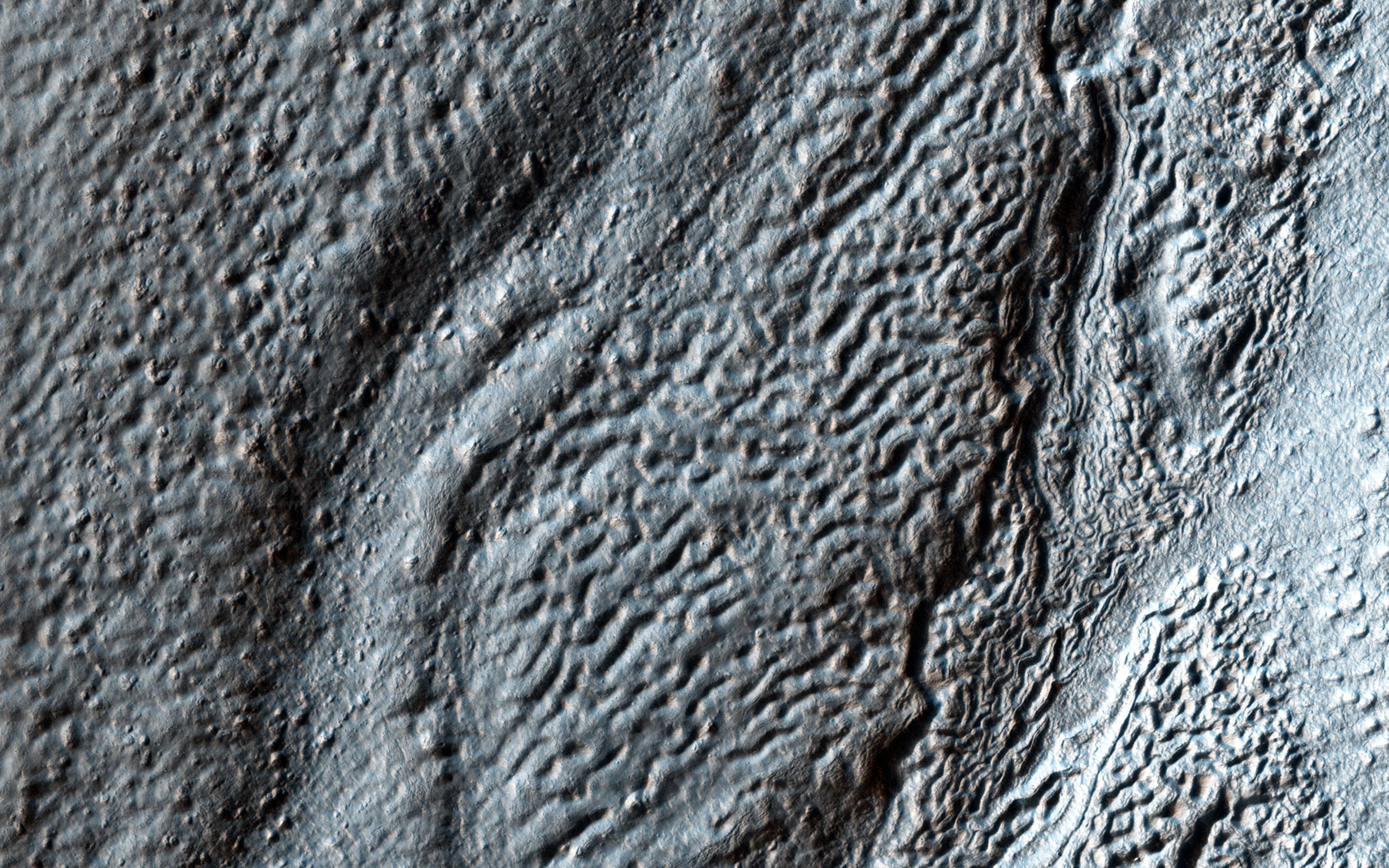
A Collection of Landforms in Eastern Elysium Planitia
Full Resolution:
TIFF
(15.56 MB)
JPEG
(595.3 kB)
|
|
|
2014-10-15 |
Mars
|
Mars Reconnaissance Orbiter (MRO)
|
HiRISE
|
2880x1800x1 |

|
-
PIA18830:
-
Mounds of Layered Material on the West Edge of Melas Chasma
Full Resolution:
TIFF
(5.191 MB)
JPEG
(662.3 kB)
|
|
|
2014-10-15 |
Mars
|
Mars Reconnaissance Orbiter (MRO)
|
HiRISE
|
2880x1800x3 |

|
-
PIA18829:
-
A Light Toned Deposit in Arsinoes Chaos
Full Resolution:
TIFF
(15.56 MB)
JPEG
(693 kB)
|
|
|
2014-10-01 |
Mars
|
Mars Reconnaissance Orbiter (MRO)
|
HiRISE
|
2880x1800x3 |

|
-
PIA18820:
-
Dome and Barchan Dunes in Newton Crater
Full Resolution:
TIFF
(15.56 MB)
JPEG
(1.351 MB)
|
|
|
2014-10-01 |
Mars
|
Mars Reconnaissance Orbiter (MRO)
|
HiRISE
|
2880x1800x3 |
|
-
PIA18819:
-
Bright Slope Streaks in Arabia Terra
Full Resolution:
TIFF
(15.56 MB)
JPEG
(556.2 kB)
|
|
|
2014-10-01 |
Mars
|
Mars Reconnaissance Orbiter (MRO)
|
HiRISE
|
2880x1800x3 |
|
-
PIA18818:
-
Continual Dune and Ripple Migration in Nili Patera
Full Resolution:
TIFF
(15.56 MB)
JPEG
(807.2 kB)
|
|
|
2014-10-01 |
Mars
|
Mars Reconnaissance Orbiter (MRO)
|
HiRISE
|
2880x1800x3 |

|
-
PIA18817:
-
Possible Future Mars Landing Site in Oxia Planum
Full Resolution:
TIFF
(15.56 MB)
JPEG
(705.9 kB)
|
|
|
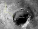
2014-09-25 |
Mars
|
Mars Reconnaissance Orbiter (MRO)
Mars Science Laboratory (MSL)
|
HiRISE
|
3300x2550x3 |
|
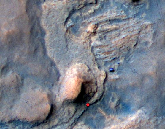
-
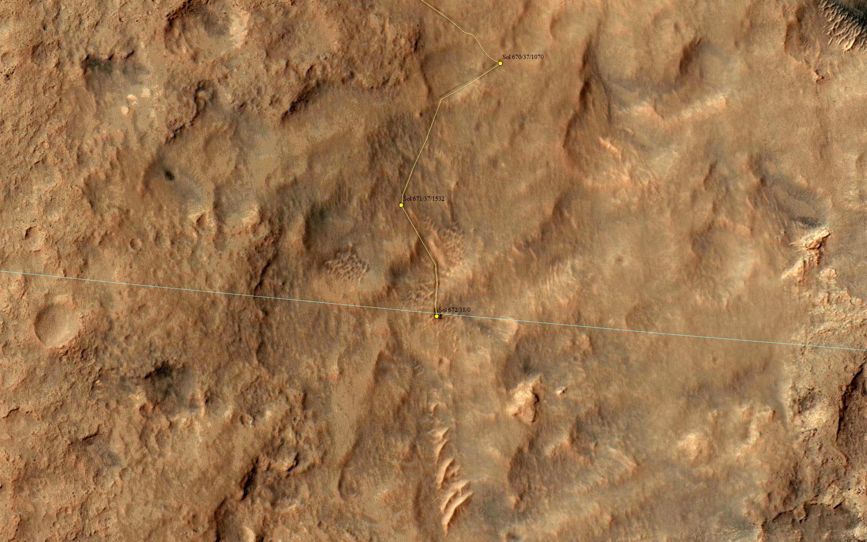
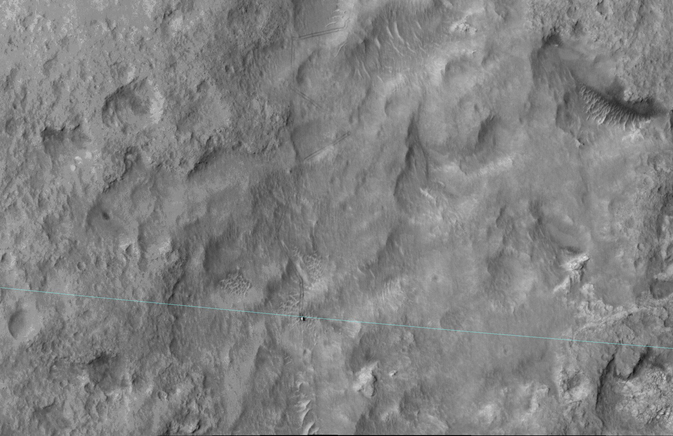
PIA18607:
-
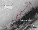
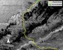
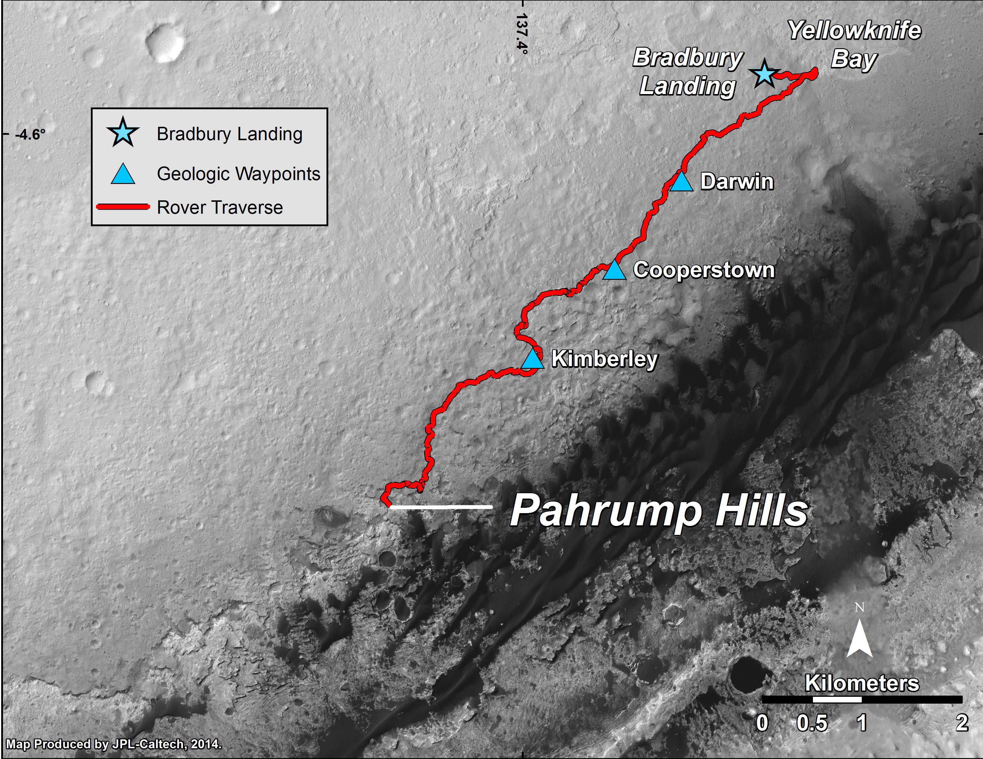
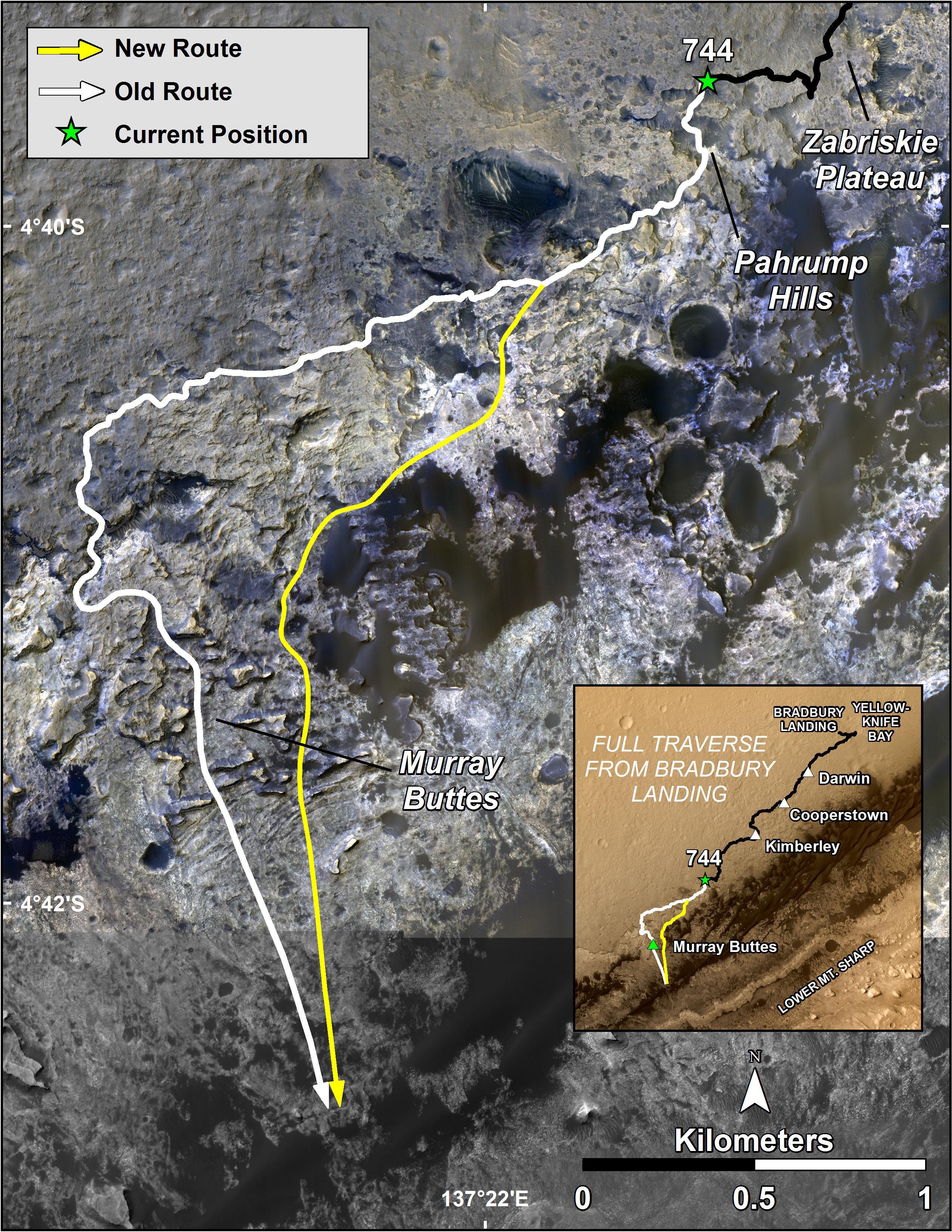
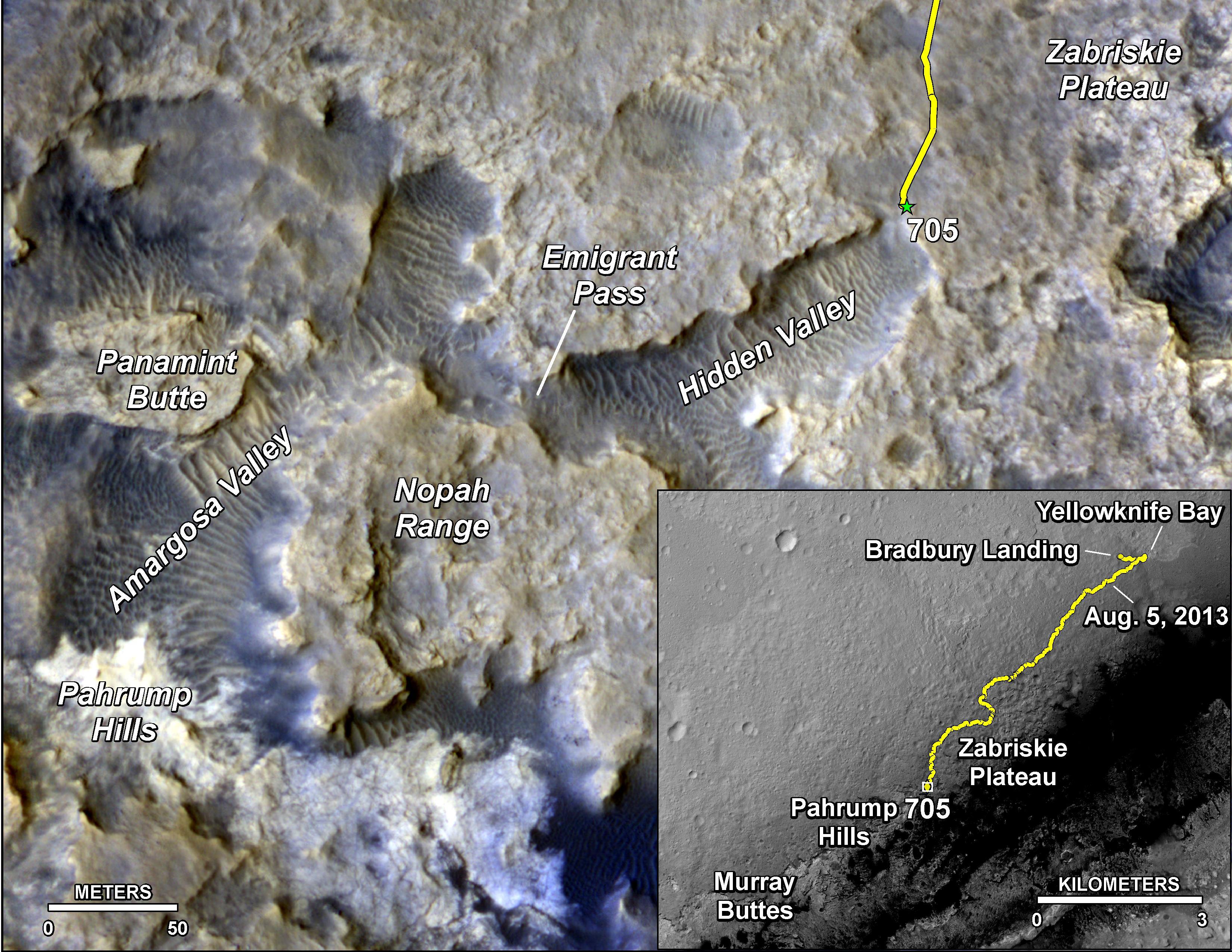
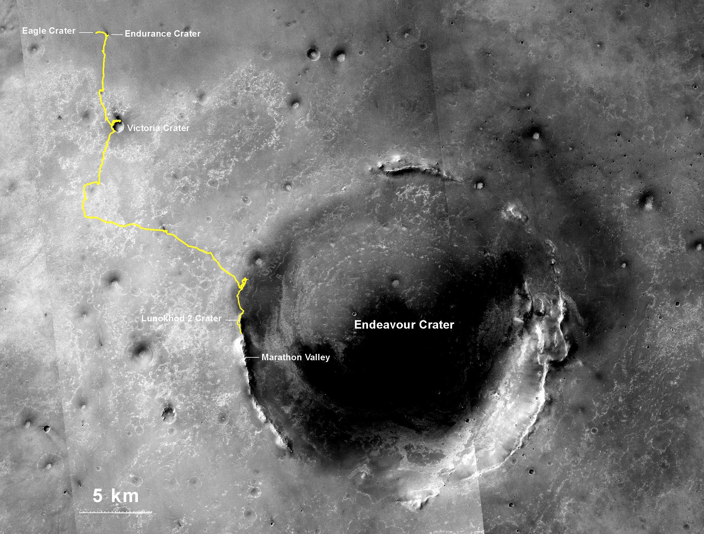
Curiosity Mars Rover's Route from Landing to 'Pahrump Hills'
Full Resolution:
TIFF
(25.26 MB)
JPEG
(1.571 MB)
|
|
|
2014-09-11 |
Mars
|
Mars Reconnaissance Orbiter (MRO)
Mars Science Laboratory (MSL)
|
HiRISE
|
3000x2400x3 |
|
-
PIA18785:
-
Geological Transition
Full Resolution:
TIFF
(21.61 MB)
JPEG
(2.032 MB)
|
|
|
2014-09-11 |
Mars
|
Mars Reconnaissance Orbiter (MRO)
Mars Science Laboratory (MSL)
|
HiRISE
|
1927x1542x3 |

|
-
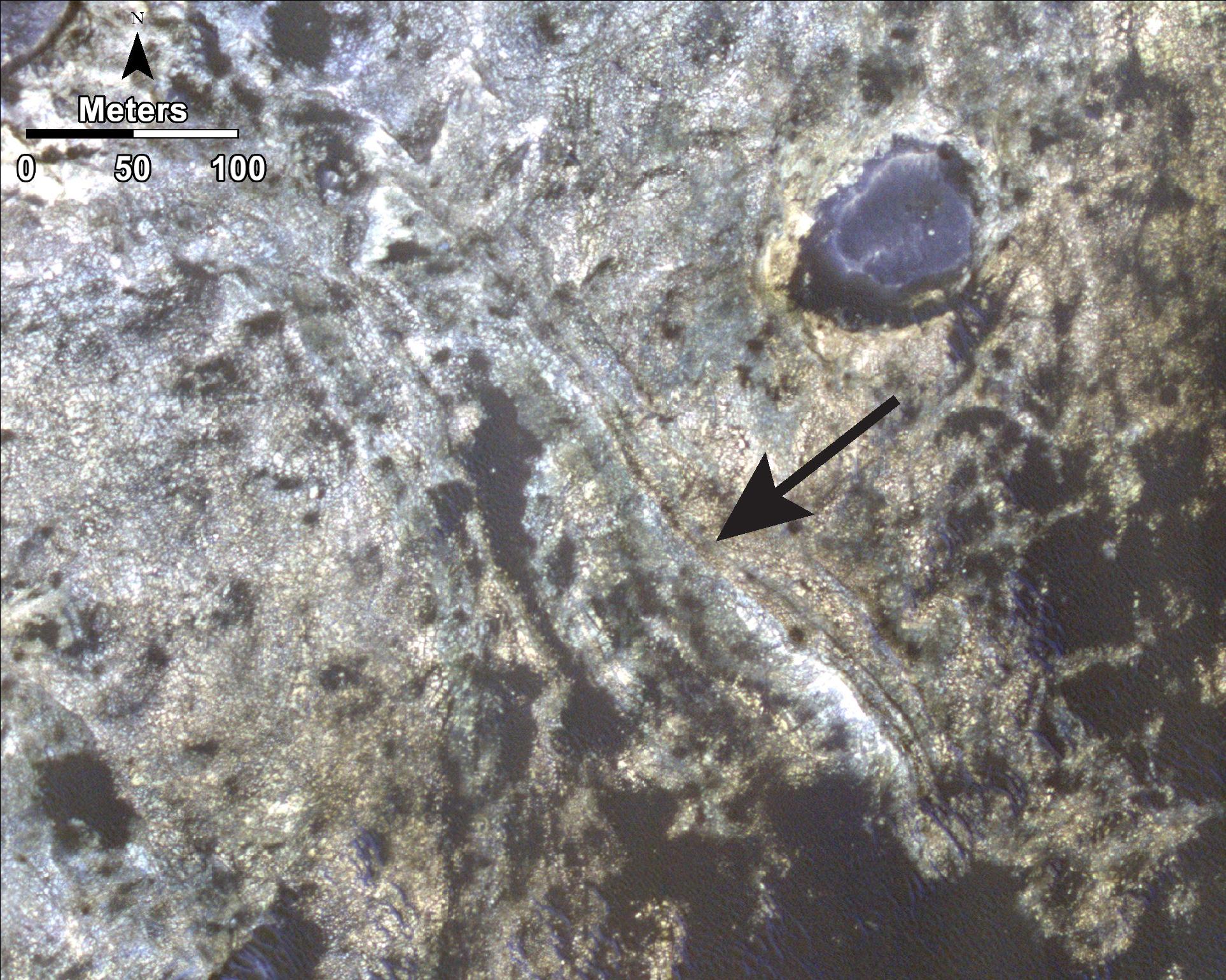
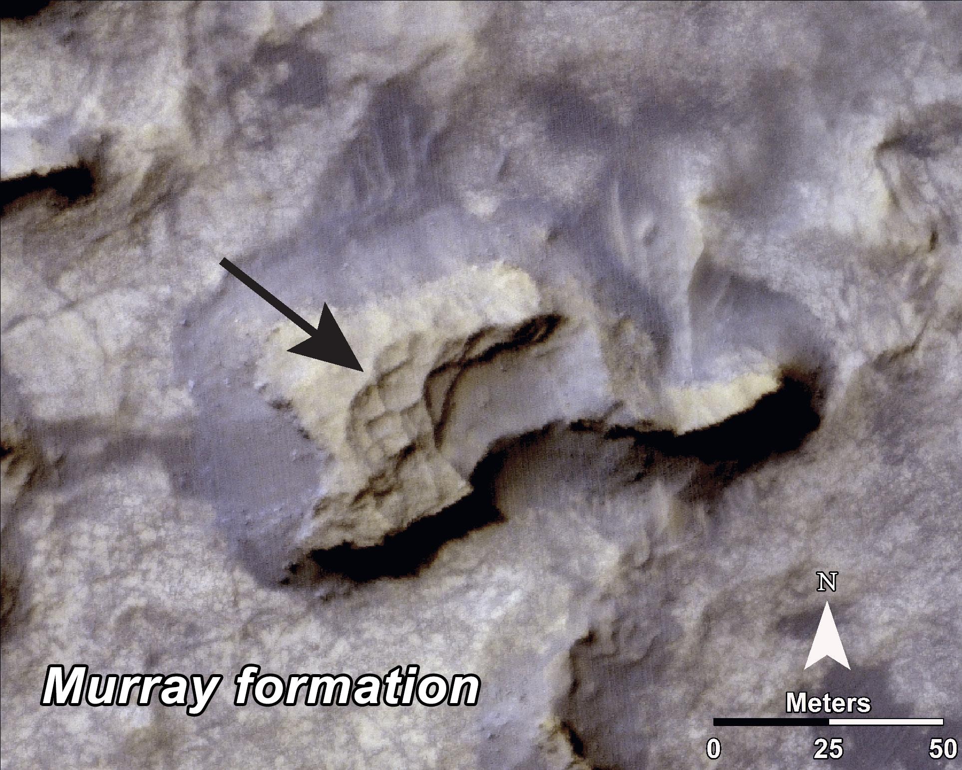
PIA18784:
-
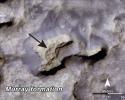
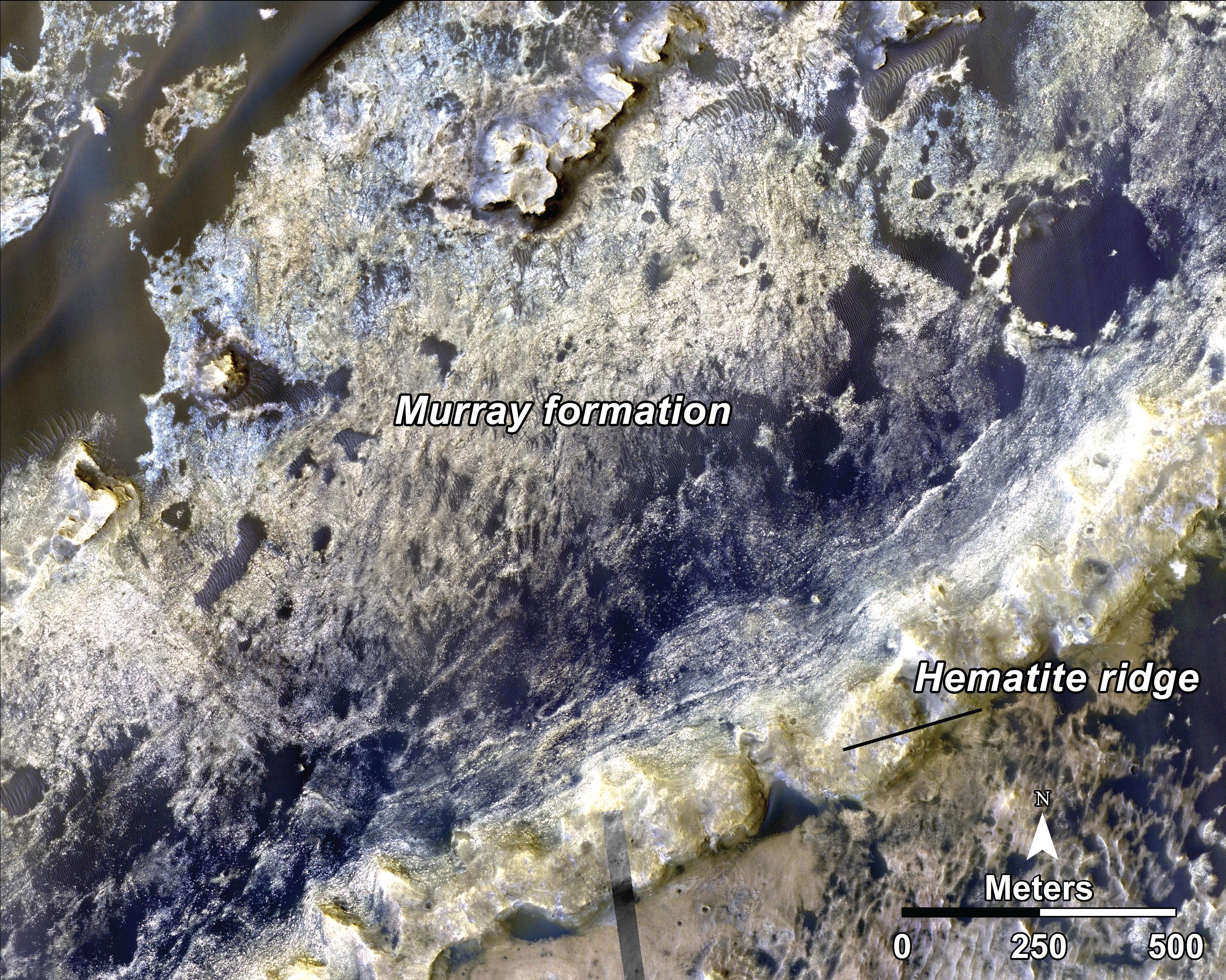
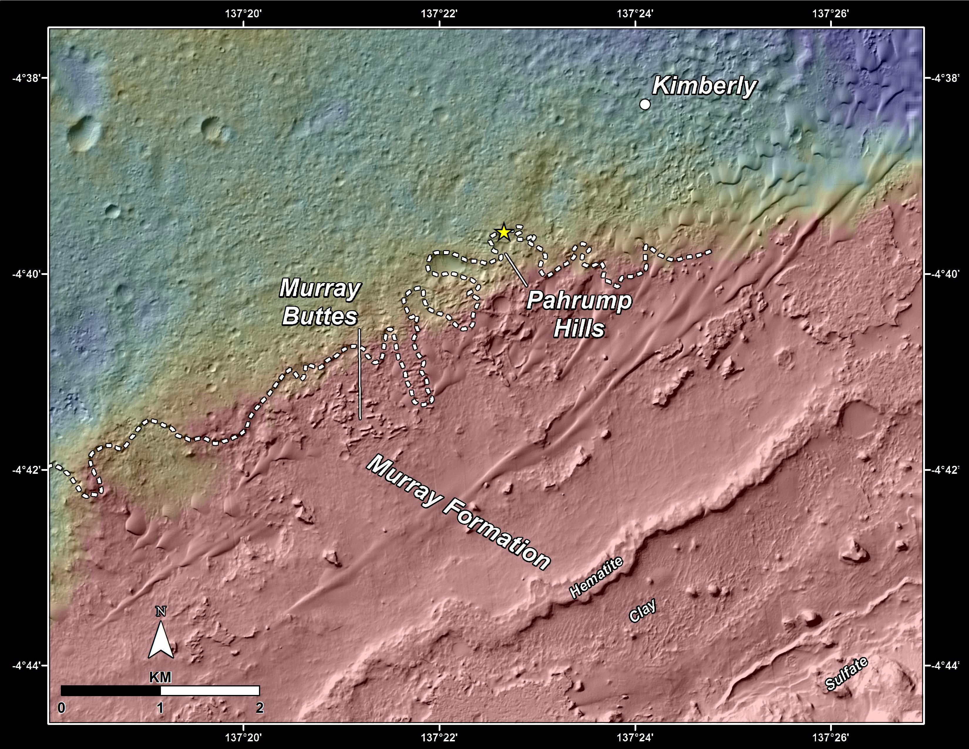
Bands on the 'Murray Formation'
Full Resolution:
TIFF
(8.918 MB)
JPEG
(563 kB)
|
|
|
2014-09-11 |
Mars
|
Mars Reconnaissance Orbiter (MRO)
Mars Science Laboratory (MSL)
|
HiRISE
|
1927x1542x3 |
|
-
PIA18783:
-
'Murray Buttes' Mesa
Full Resolution:
TIFF
(8.918 MB)
JPEG
(471.3 kB)
|
|
|
2014-09-11 |
Mars
|
Mars Reconnaissance Orbiter (MRO)
Mars Science Laboratory (MSL)
|
HiRISE
|
4173x3008x3 |
|
-
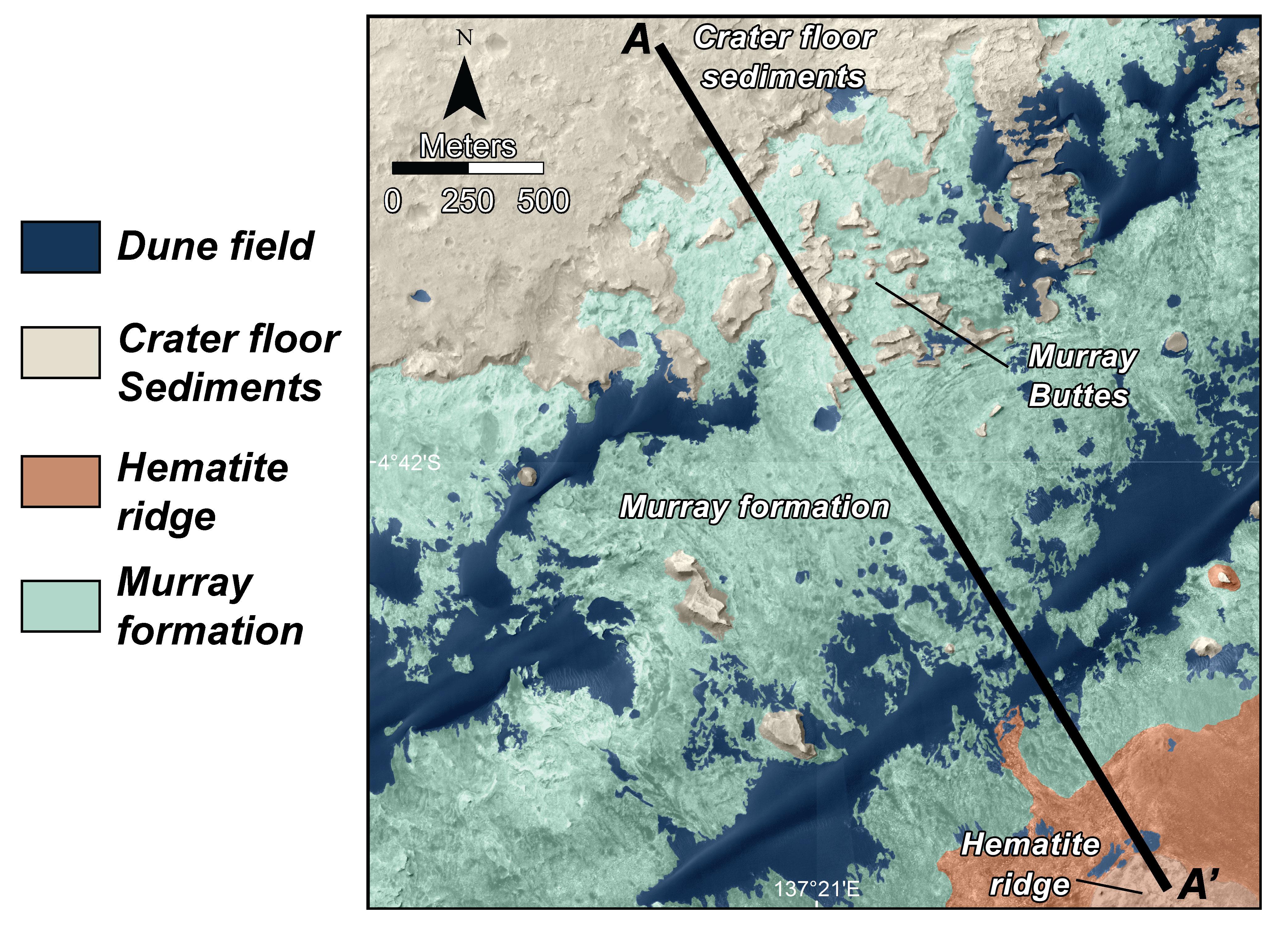
PIA18781:
-
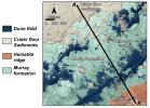
Map of Lower Mount Sharp
Full Resolution:
TIFF
(37.68 MB)
JPEG
(1.64 MB)
|
|
|
2014-09-11 |
Mars
|
Mars Reconnaissance Orbiter (MRO)
Mars Science Laboratory (MSL)
|
HiRISE
|
4890x3912x3 |
|
-
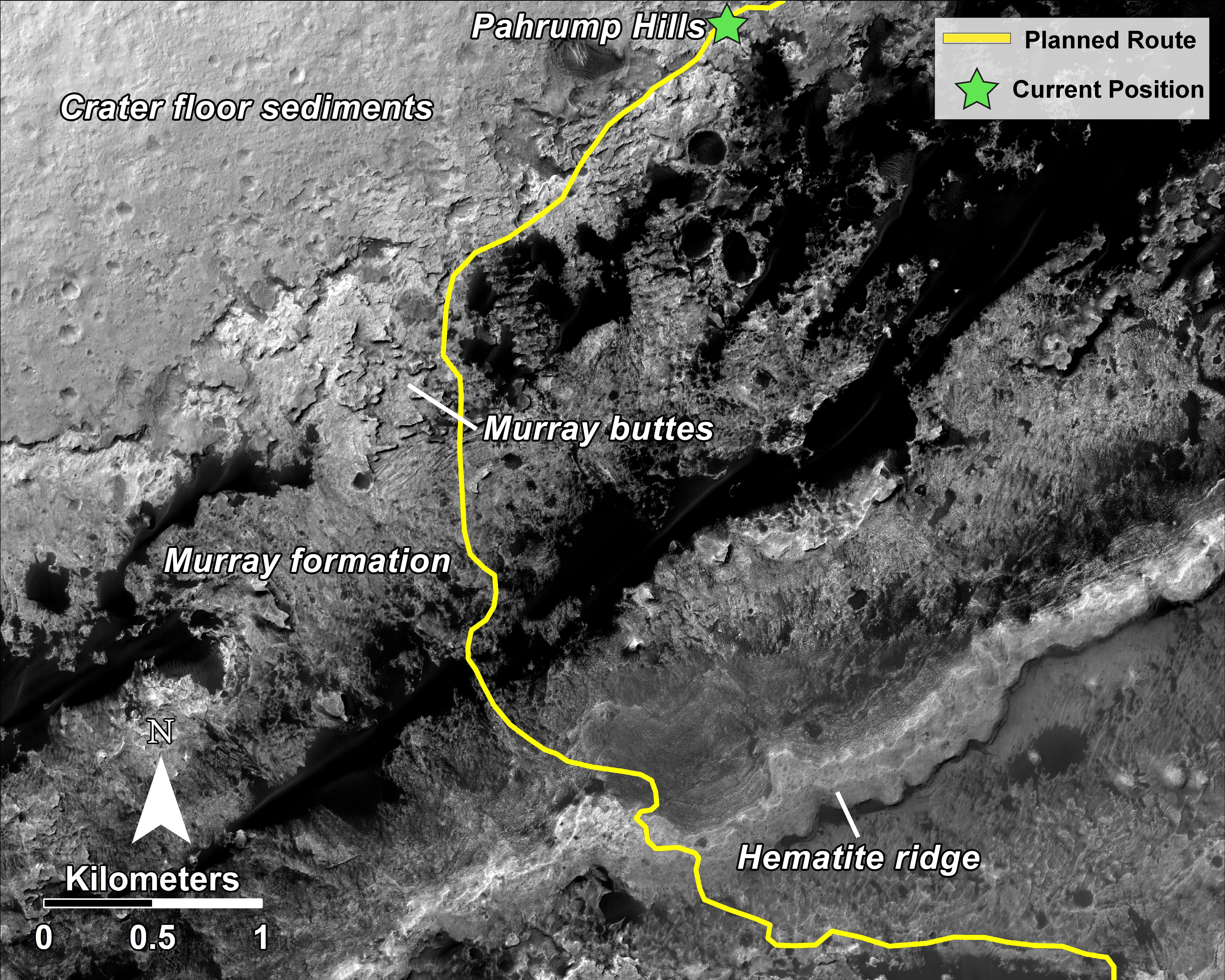
PIA18780:
-
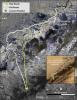
Curiosity Rover Planned Route
Full Resolution:
TIFF
(57.42 MB)
JPEG
(3.739 MB)
|
|
|
2014-09-11 |
Mars
|
Mars Reconnaissance Orbiter (MRO)
Mars Science Laboratory (MSL)
|
HiRISE
|
2550x3300x3 |
|
-
PIA18475:
-
Curiosity's Next Steps
Full Resolution:
TIFF
(25.25 MB)
JPEG
(1.735 MB)
|
|
|
2014-09-11 |
Mars
|
Mars Reconnaissance Orbiter (MRO)
Mars Science Laboratory (MSL)
|
HiRISE
|
3300x2550x3 |

|
-
PIA18474:
-
Slopes of Mount Sharp
Full Resolution:
TIFF
(25.26 MB)
JPEG
(1.023 MB)
|
|
|
2014-09-10 |
Mars
|
Mars Reconnaissance Orbiter (MRO)
|
HiRISE
|
2880x1800x1 |
|
-
PIA18807:
-
Overlapping Lobate Lava Flows in Daedalia Planum
Full Resolution:
TIFF
(5.191 MB)
JPEG
(515.1 kB)
|
|
|
2014-09-10 |
Mars
|
Mars Reconnaissance Orbiter (MRO)
|
HiRISE
|
2880x1800x3 |
|
-
PIA18806:
-
Banded TARs in Iapygia
Full Resolution:
TIFF
(15.56 MB)
JPEG
(738.2 kB)
|
|
|
2014-09-10 |
Mars
|
Mars Reconnaissance Orbiter (MRO)
|
HiRISE
|
2880x1800x3 |
|
-
PIA18805:
-
Mysterious Light-Toned Deposit in Vinogradov Crater
Full Resolution:
TIFF
(15.56 MB)
JPEG
(1.01 MB)
|
|
|
2014-09-10 |
Mars
|
Mars Reconnaissance Orbiter (MRO)
|
HiRISE
|
2880x1800x3 |
|
-
PIA18804:
-
Chaos in Eridania Basin
Full Resolution:
TIFF
(15.56 MB)
JPEG
(684.1 kB)
|
|
|
2014-08-27 |
Mars
|
Mars Reconnaissance Orbiter (MRO)
|
HiRISE
|
2880x1800x3 |

|
-
PIA18776:
-
A New Impact Crater Near NASA's InSight Landing Region
Full Resolution:
TIFF
(15.56 MB)
JPEG
(1.268 MB)
|
|
|
2014-08-27 |
Mars
|
Mars Reconnaissance Orbiter (MRO)
|
HiRISE
|
2880x1800x3 |
|
-
PIA18775:
-
Mantled Terrain in the Southern Mid-Latitudes
Full Resolution:
TIFF
(15.56 MB)
JPEG
(874.7 kB)
|
|
|
2014-08-27 |
Mars
|
Mars Reconnaissance Orbiter (MRO)
|
HiRISE
|
2880x1800x3 |
|
-
PIA18774:
-
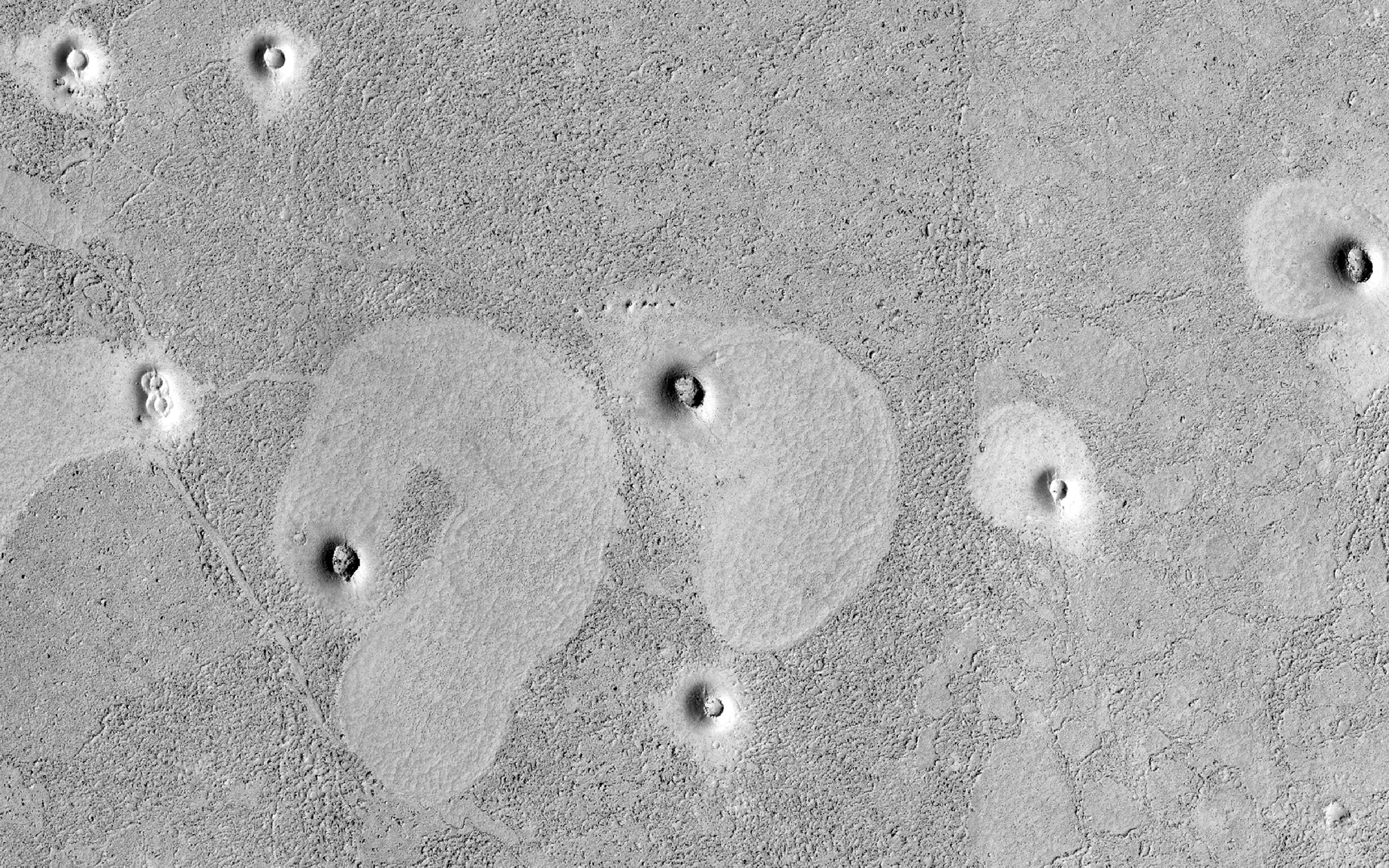
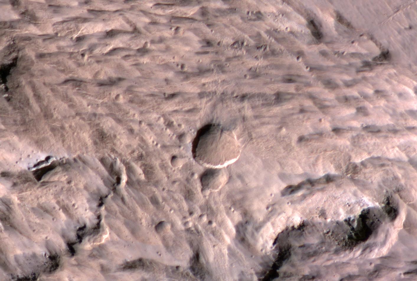
Weird Crater
Full Resolution:
TIFF
(15.56 MB)
JPEG
(933 kB)
|
|
|
2014-08-27 |
Mars
|
Mars Reconnaissance Orbiter (MRO)
|
HiRISE
|
2880x1800x3 |
|
-
PIA18773:
-
A Possible Landing Site in Aram Dorsum for the ExoMars Rover
Full Resolution:
TIFF
(15.56 MB)
JPEG
(608.6 kB)
|
|
|
2014-08-13 |
Mars
|
Mars Reconnaissance Orbiter (MRO)
|
HiRISE
|
2311x1486x1 |
|
-
PIA18594:
-
An Irregular, Upright Boulder on Mars
Full Resolution:
TIFF
(3.438 MB)
JPEG
(414 kB)
|
|
|
2014-08-13 |
Mars
|
Mars Reconnaissance Orbiter (MRO)
|
HiRISE
|
2880x1800x3 |
|
-
PIA18647:
-
Glaciation at the Eastern Hellas Margin
Full Resolution:
TIFF
(15.56 MB)
JPEG
(1.016 MB)
|
|
|
2014-08-13 |
Mars
|
Mars Reconnaissance Orbiter (MRO)
|
HiRISE
|
2880x1800x3 |
|
-
PIA18646:
-
The Side of Chasma Boreale
Full Resolution:
TIFF
(15.56 MB)
JPEG
(1.215 MB)
|
|
|
2014-08-13 |
Mars
|
Mars Reconnaissance Orbiter (MRO)
|
HiRISE
|
2880x1800x1 |

|
-
PIA18645:
-
Strange Cones and Flows
Full Resolution:
TIFF
(5.191 MB)
JPEG
(1.315 MB)
|
|
|
2014-08-01 |
Mars
|
Mars Reconnaissance Orbiter (MRO)
Mars Science Laboratory (MSL)
|
HiRISE
|
3300x2550x3 |
|
-
PIA18408:
-
Sandy Martian Valleys in Curiosity's Near Future
Full Resolution:
TIFF
(25.26 MB)
JPEG
(1.213 MB)
|
|
|
2014-07-30 |
Mars
|
Mars Reconnaissance Orbiter (MRO)
|
HiRISE
|
2880x1800x3 |
|
-
PIA18635:
-
Layers and Sand on the Floor of Schiaparelli Crater
Full Resolution:
TIFF
(15.56 MB)
JPEG
(1.025 MB)
|
|
|
2014-07-30 |
Mars
|
Mars Reconnaissance Orbiter (MRO)
|
HiRISE
|
2880x1800x3 |

|
-
PIA18634:
-
Frosty Gullies
Full Resolution:
TIFF
(15.56 MB)
JPEG
(1.386 MB)
|
|
|
2014-07-30 |
Mars
|
Mars Reconnaissance Orbiter (MRO)
|
HiRISE
|
2880x1800x1 |
|
-
PIA18633:
-
Preserving Ice from a Vanished Terrain
Full Resolution:
TIFF
(5.191 MB)
JPEG
(798.5 kB)
|
|
|
2014-07-30 |
Mars
|
Mars Reconnaissance Orbiter (MRO)
|
HiRISE
|
2880x1800x3 |
|
-
PIA18632:
-
Water-Bearing Rocks in Noctis Labyrinthus
Full Resolution:
TIFF
(15.56 MB)
JPEG
(986.8 kB)
|
|
|
2014-07-28 |
Mars
|
Mars Exploration Rover (MER)
Mars Reconnaissance Orbiter (MRO)
|
CTX
|
2420x1838x3 |
|
-
PIA18404:
-
Opportunity's Journey Exceeds 25 Miles
Full Resolution:
TIFF
(13.35 MB)
JPEG
(943.2 kB)
|
|
|
2014-07-16 |
Mars
|
Mars Reconnaissance Orbiter (MRO)
|
HiRISE
|
2880x1800x3 |
|
-
PIA18625:
-
Ancient Lake Sediments in a Crater
Full Resolution:
TIFF
(15.56 MB)
JPEG
(768 kB)
|
|
|
2014-07-16 |
Mars
|
Mars Reconnaissance Orbiter (MRO)
|
HiRISE
|
2880x1800x3 |
|
-
PIA18624:
-
The Icy Surface of the North Polar Cap
Full Resolution:
TIFF
(15.56 MB)
JPEG
(1.095 MB)
|
|
|
2014-07-16 |
Mars
|
Mars Reconnaissance Orbiter (MRO)
|
HiRISE
|
2880x1800x3 |
|
-
PIA18623:
-
Ridges in Eridania Basin
Full Resolution:
TIFF
(15.56 MB)
JPEG
(768.2 kB)
|
|
|
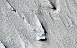
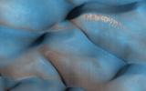
2014-07-10 |
Mars
|
Mars Reconnaissance Orbiter (MRO)
|
HiRISE
|
1250x1150x1 |
|
-
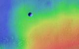
PIA18400:
-
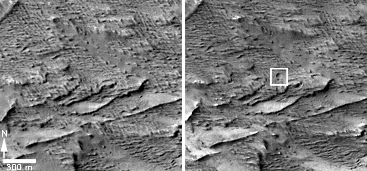
Changes Near Downhill End of a Martian Gully
Full Resolution:
TIFF
(1.439 MB)
JPEG
(144.3 kB)
|
|
|
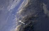
2014-07-10 |
Mars
|
Mars Reconnaissance Orbiter (MRO)
|
HiRISE
|
2880x1800x3 |
|
-
PIA18538:
-
Activity in Martian Gully
Full Resolution:
TIFF
(15.56 MB)
JPEG
(1.044 MB)
|
|
|
2014-07-08 |
Mars
|
Mars Reconnaissance Orbiter (MRO)
|
HiRISE
|
2880x1800x3 |
|
-
PIA18581:
-
Curiosity Offside!
Full Resolution:
TIFF
(15.56 MB)
JPEG
(689.5 kB)
|
|
|
2014-07-08 |
Mars
|
Mars Reconnaissance Orbiter (MRO)
|
HiRISE
|
2312x1497x3 |
|
-
PIA18399:
-
Curiosity Mars Rover Reaching Edge of Its Landing Ellipse
Full Resolution:
TIFF
(3.467 MB)
JPEG
(504.4 kB)
|
|
|
2014-07-02 |
Mars
|
Mars Reconnaissance Orbiter (MRO)
|
HiRISE
|
2880x1800x3 |
|
-
PIA18622:
-
An Impact Crater in Isidis Planitia
Full Resolution:
TIFF
(15.56 MB)
JPEG
(682.5 kB)
|
|
|
2014-07-02 |
Mars
|
Mars Reconnaissance Orbiter (MRO)
|
HiRISE
|
2880x1800x3 |

|
-
PIA18621:
-
A Revealing Landslide in Hebes Chasma
Full Resolution:
TIFF
(15.56 MB)
JPEG
(599 kB)
|
|
|
2014-07-02 |
Mars
|
Mars Reconnaissance Orbiter (MRO)
|
HiRISE
|
2880x1800x3 |
|
-
PIA18620:
-
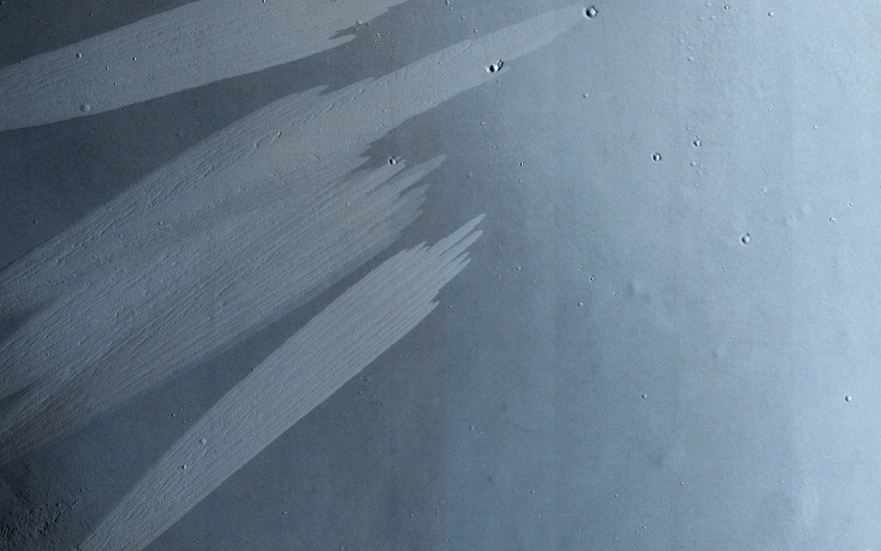
Feathery Ridges
Full Resolution:
TIFF
(15.56 MB)
JPEG
(822.4 kB)
|
|
|
2014-07-02 |
Mars
|
Mars Reconnaissance Orbiter (MRO)
|
HiRISE
|
2880x1800x3 |
|
-
PIA18589:
-
A Giant Cave on a Giant Volcano
Full Resolution:
TIFF
(15.56 MB)
JPEG
(824.1 kB)
|
|
|
2014-06-18 |
Mars
|
Mars Reconnaissance Orbiter (MRO)
|
HiRISE
|
2880x1800x3 |
|
-
PIA18588:
-
Moving Mass Material on a Mesa
Full Resolution:
TIFF
(15.56 MB)
JPEG
(650.1 kB)
|
|
|
2014-06-18 |
Mars
|
Mars Reconnaissance Orbiter (MRO)
|
HiRISE
|
2880x1800x3 |
|
-
PIA18587:
-
Waiting for Dust Devils
Full Resolution:
TIFF
(5.191 MB)
JPEG
(1.172 MB)
|
|
|
2014-06-18 |
Mars
|
Mars Reconnaissance Orbiter (MRO)
|
HiRISE
|
2880x1800x3 |

|
-
PIA18586:
-
Blockfall on the North Polar Layered Deposits
Full Resolution:
TIFF
(15.56 MB)
JPEG
(790.1 kB)
|
|
|
2014-06-18 |
Mars
|
Mars Reconnaissance Orbiter (MRO)
|
HiRISE
|
2880x1800x3 |
|
-
PIA18585:
-
Sand Dune Catch and Release
Full Resolution:
TIFF
(15.56 MB)
JPEG
(743.6 kB)
|
|
|
2014-06-04 |
Mars
|
Mars Reconnaissance Orbiter (MRO)
|
HiRISE
|
2880x1800x1 |

|
-
PIA18513:
-
An Alluvial Fan in a Low-Latitude Crater
Full Resolution:
TIFF
(5.191 MB)
JPEG
(646.5 kB)
|
|
|
2014-06-04 |
Mars
|
Mars Reconnaissance Orbiter (MRO)
|
HiRISE
|
2880x1800x3 |
|
-
PIA18512:
-
Touring a Dusty Region
Full Resolution:
TIFF
(15.56 MB)
JPEG
(623.1 kB)
|
|
|
2014-06-04 |
Mars
|
Mars Reconnaissance Orbiter (MRO)
|
HiRISE
|
840x333x1 |
|
-
PIA18511:
-
A Large Crater in Meridiani Planum
Full Resolution:
TIFF
(280.2 kB)
JPEG
(73.14 kB)
|
|
|
2014-06-04 |
|
Mars Reconnaissance Orbiter (MRO)
|
HiRISE
|
2880x1800x3 |

|
-
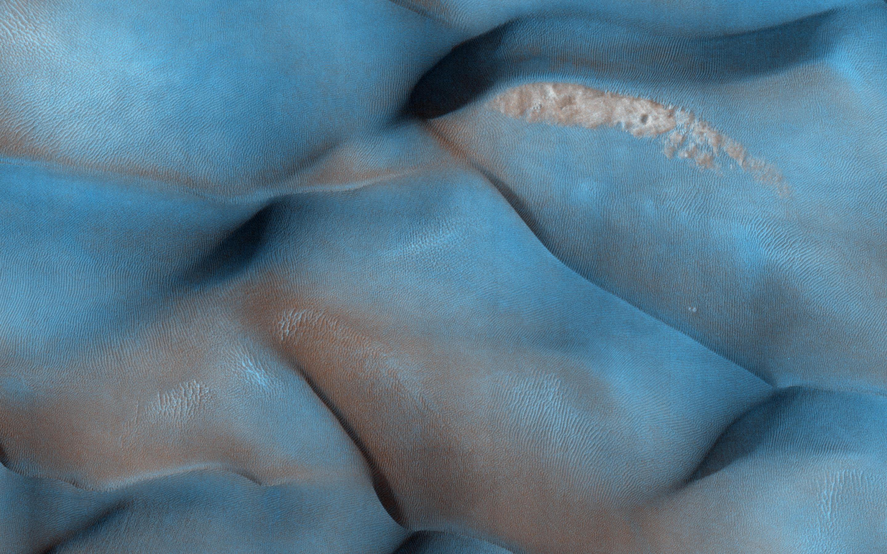
PIA18510:
-
The Draa of Mars
Full Resolution:
TIFF
(15.56 MB)
JPEG
(1.014 MB)
|
|
|
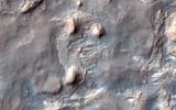
2014-05-22 |
Mars
|
Mars Reconnaissance Orbiter (MRO)
|
HiRISE
|
741x493x3 |
|
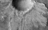
-
PIA18385:
-
Landslides Near Fresh Crater on Mars
Full Resolution:
TIFF
(1.097 MB)
JPEG
(56.47 kB)
|
|
|
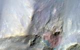
2014-05-22 |
Mars
|
Mars Reconnaissance Orbiter (MRO)
|
HiRISE
|
1413x951x3 |
|
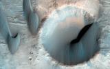
-
PIA18384:
-
Large, Fresh Crater Surrounded by Smaller Craters
Full Resolution:
TIFF
(4.033 MB)
JPEG
(174.3 kB)
|
|
|
2014-05-22 |
Mars
|
Mars Reconnaissance Orbiter (MRO)
|
CTX
|
1500x699x1 |

|
-
PIA18383:
-
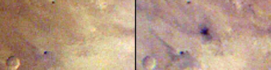
Before-and-After Views Confirm Fresh Craters
Full Resolution:
TIFF
(1.05 MB)
JPEG
(153.2 kB)
|
|
|
2014-05-22 |
Mars
|
Mars Reconnaissance Orbiter (MRO)
|
HiRISE
|
2880x1800x1 |

|
-
PIA18772:
-
Global Eyes on an Impact Prize
Full Resolution:
TIFF
(5.191 MB)
JPEG
(700.7 kB)
|
|
|
2014-05-22 |
Mars
|
Mars Reconnaissance Orbiter (MRO)
|
CTX
|
1980x2176x1 |
|
-
PIA18382:
-
Fresh Mars Crater Confirmed Within Impact Scar
Full Resolution:
TIFF
(4.313 MB)
JPEG
(1.148 MB)
|
|
|
2014-05-22 |
Mars
|
Mars Reconnaissance Orbiter (MRO)
|
HiRISE
|
2880x1800x3 |
|
-
PIA18771:
-
At the Edge of a Polar Cap
Full Resolution:
TIFF
(15.56 MB)
JPEG
(796.4 kB)
|
|
|
2014-05-22 |
Mars
|
Mars Reconnaissance Orbiter (MRO)
|
HiRISE
|
2880x1800x1 |
|
-
PIA18649:
-
The Busy Flank of Arsia Mons
Full Resolution:
TIFF
(5.191 MB)
JPEG
(682.4 kB)
|
|
|
2014-05-22 |
Mars
|
Mars Reconnaissance Orbiter (MRO)
|
MARCI
|
928x242x3 |
|
-
PIA18381:
Best-Ever Pinning Down When a Space Rock Hit Mars
Full Resolution:
TIFF
(674.2 kB)
JPEG
(28.52 kB)
|
|
|
2014-05-22 |
Mars
|
Mars Reconnaissance Orbiter (MRO)
|
MARCI
|
1700x1700x3 |

|
-
PIA18380:
-
Impact Scar Detected in Mars Weathercam Image
Full Resolution:
TIFF
(8.674 MB)
JPEG
(222.2 kB)
|
|
|
2014-05-22 |
Mars
|
Mars Reconnaissance Orbiter (MRO)
|
HiRISE
|
2880x1800x3 |
|
-
PIA18648:
-
What Gullies Can Say
Full Resolution:
TIFF
(15.56 MB)
JPEG
(696.7 kB)
|
|
|
2014-05-21 |
Mars
|
Mars Reconnaissance Orbiter (MRO)
|
HiRISE
|
840x333x1 |
|
-
PIA17482:
-
New Impact Site
Full Resolution:
TIFF
(280.2 kB)
JPEG
(95.43 kB)
|
|
|
2014-04-30 |
Mars
|
Mars Reconnaissance Orbiter (MRO)
|
HiRISE
|
2880x1800x3 |

|
-
PIA18244:
-
The Active Dunes of Nili Patera
Full Resolution:
TIFF
(15.56 MB)
JPEG
(786.7 kB)
|
|
|
2014-04-30 |
Mars
|
Mars Reconnaissance Orbiter (MRO)
|
HiRISE
|
2880x1800x3 |
|
-
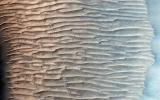
PIA18243:
-
Changing Dunes and Ripples in Olympia Undae
Full Resolution:
TIFF
(15.56 MB)
JPEG
(700.2 kB)
|
|
|
2014-04-30 |
Mars
|
Mars Reconnaissance Orbiter (MRO)
|
HiRISE
|
2880x1800x3 |

|
-
PIA18242:
-
Sunken and Pitted Ejecta
Full Resolution:
TIFF
(15.56 MB)
JPEG
(1.028 MB)
|
|
|
2014-04-30 |
Mars
|
Mars Reconnaissance Orbiter (MRO)
|
HiRISE
|
2880x1800x3 |
|
-
PIA18241:
-
Yardangs Forming Near Gordii Dorsum
Full Resolution:
TIFF
(15.56 MB)
JPEG
(734.8 kB)
|
|
|
2014-04-25 |
Mars
|
Mars Reconnaissance Orbiter (MRO)
|
HiRISE
|
556x437x3 |

|
-
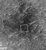
PIA18085:
-
Location of Mars Sandstone Target 'Windjana'
Full Resolution:
TIFF
(729.4 kB)
JPEG
(45.28 kB)
|
|
|
2014-04-16 |
Mars
|
Mars Reconnaissance Orbiter (MRO)
|
HiRISE
|
2880x1800x3 |
|
-
PIA18227:
-
Curiosity Ready to Drill for Gold at the Kimberley
Full Resolution:
TIFF
(15.56 MB)
JPEG
(735.3 kB)
|
|
|
2014-04-16 |
Mars
|
Mars Reconnaissance Orbiter (MRO)
|
HiRISE
|
2880x1800x3 |
|
-
PIA18226:
-
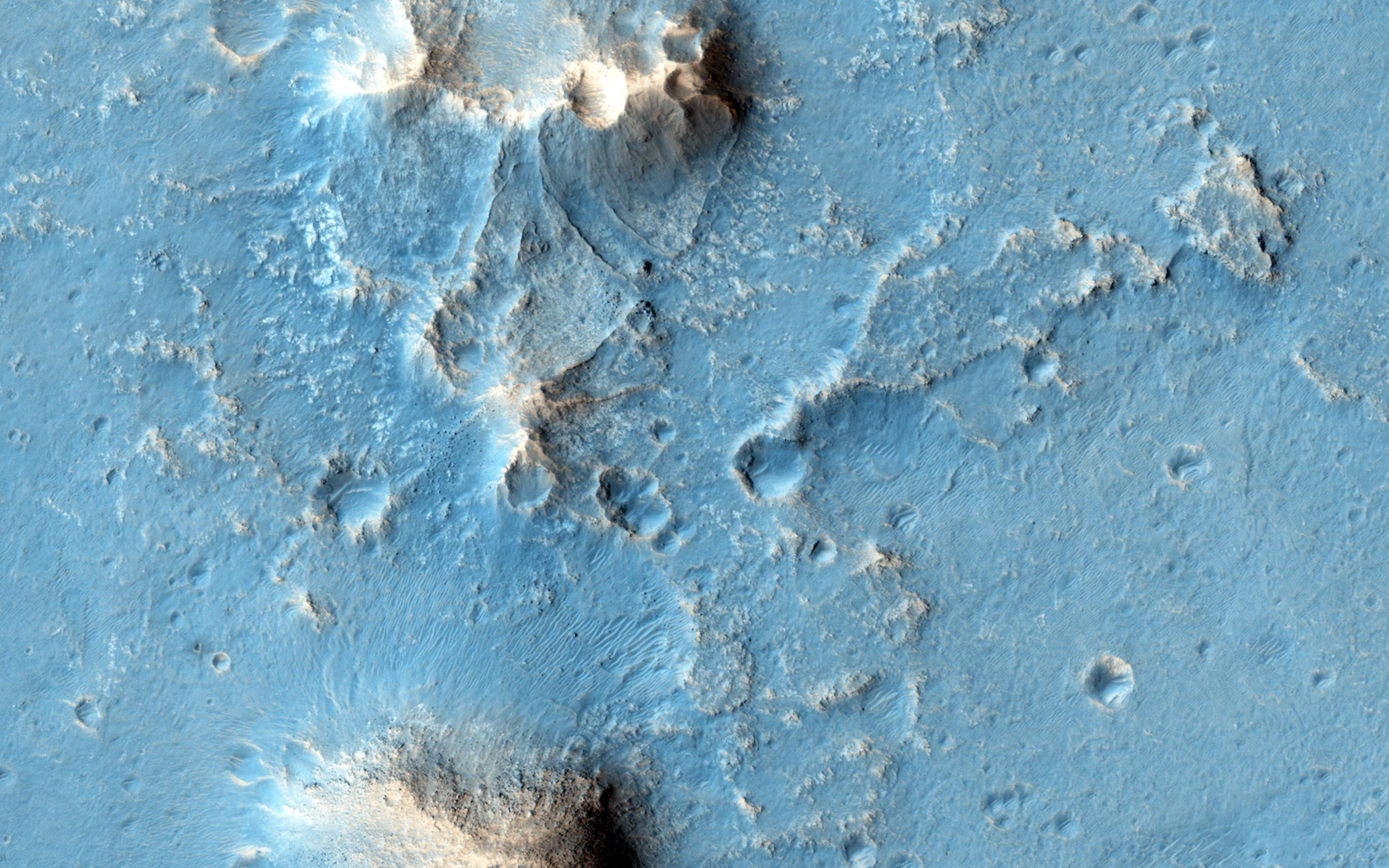
A Big Block of Red Bedrock
Full Resolution:
TIFF
(15.56 MB)
JPEG
(570.4 kB)
|
|
|
2014-04-16 |
Mars
|
Mars Reconnaissance Orbiter (MRO)
|
HiRISE
|
2880x1800x3 |
|
-
PIA18225:
-
Equatorial Gullies on Mars
Full Resolution:
TIFF
(15.56 MB)
JPEG
(886.3 kB)
|
|
|
2014-04-16 |
Mars
|
Mars Reconnaissance Orbiter (MRO)
|
HiRISE
|
2880x1800x3 |
|
-
PIA18224:
-
A Surprise Landslump in Melas Chasma
Full Resolution:
TIFF
(15.56 MB)
JPEG
(662.5 kB)
|
|
|
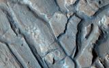
2014-04-16 |
Mars
|
Mars Reconnaissance Orbiter (MRO)
Mars Science Laboratory (MSL)
|
HiRISE
|
3287x3497x3 |
|
-
PIA18082:
-
Stereo View of Curiosity and Rover Tracks at 'the Kimberley,' April 2014
Full Resolution:
TIFF
(34.5 MB)
JPEG
(791.9 kB)
|
|
|
2014-04-16 |
Mars
|
Mars Reconnaissance Orbiter (MRO)
Mars Science Laboratory (MSL)
|
HiRISE
|
1322x1482x3 |
|
-
PIA18081:
-
Curiosity and Rover Tracks at 'the Kimberley,' April 2014
Full Resolution:
TIFF
(5.88 MB)
JPEG
(347.6 kB)
|
|
|
2014-04-09 |
Mars
|
Mars Reconnaissance Orbiter (MRO)
|
HiRISE
|
2880x1800x3 |
|
-
PIA18122:
-
Opportunity Rover on Valentine's Day 2014
Full Resolution:
TIFF
(15.56 MB)
JPEG
(565 kB)
|
|
|
2014-04-09 |
Mars
|
Mars Reconnaissance Orbiter (MRO)
|
HiRISE
|
2880x1800x3 |
|
-
PIA18121:
-
Chevrons on a Flow Surface in Marte Vallis
Full Resolution:
TIFF
(15.56 MB)
JPEG
(834.3 kB)
|
|
|
2014-04-09 |
Mars
|
Mars Reconnaissance Orbiter (MRO)
|
HiRISE
|
2880x1800x1 |
|
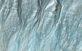
-
PIA18120:
-
Finding Faults in Melas Chasma
Full Resolution:
TIFF
(5.191 MB)
JPEG
(747.3 kB)
|
|
|
2014-04-09 |
Mars
|
Mars Reconnaissance Orbiter (MRO)
|
HiRISE
|
2880x1800x3 |
|
-
PIA18119:
-
Recurring Slope Lineae in Coprates Chasma
Full Resolution:
TIFF
(15.56 MB)
JPEG
(572.3 kB)
|
|
|
2014-04-09 |
Mars
|
Mars Reconnaissance Orbiter (MRO)
|
HiRISE
|
2880x1800x3 |
|
-
PIA17919:
-
Two-Color Dunes in Meridiani Terra
Full Resolution:
TIFF
(15.56 MB)
JPEG
(858.4 kB)
|
|
|
2014-04-09 |
Mars
|
Mars Reconnaissance Orbiter (MRO)
|
HiRISE
|
2880x1800x1 |
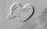
|
-
PIA17918:
-
A Heart in Ascraeus Mons
Full Resolution:
TIFF
(5.191 MB)
JPEG
(751.7 kB)
|
|
|
2014-04-09 |
Mars
|
Mars Reconnaissance Orbiter (MRO)
|
HiRISE
|
2880x1800x1 |
|
-
PIA17917:
-
Slumping Terraces on a Crater Wall
Full Resolution:
TIFF
(5.191 MB)
JPEG
(678 kB)
|
|
|
2014-04-09 |
Mars
|
Mars Reconnaissance Orbiter (MRO)
|
HiRISE
|
2880x1800x3 |
|
-
PIA17916:
-
Opportunity Rover's Winter Work at Murray Ridge
Full Resolution:
TIFF
(15.56 MB)
JPEG
(576.8 kB)
|
|
|
2014-03-26 |
Mars
|
Mars Reconnaissance Orbiter (MRO)
|
HiRISE
|
2880x1800x3 |
|
-
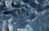
PIA17910:
-
An Unusual Mound
Full Resolution:
TIFF
(15.56 MB)
JPEG
(1.045 MB)
|
|
|
2014-03-26 |
Mars
|
Mars Reconnaissance Orbiter (MRO)
|
HiRISE
|
2880x1800x3 |

|
-
PIA17909:
-
A Large, Banded Angular Fragment in Nili Fossae
Full Resolution:
TIFF
(15.56 MB)
JPEG
(963.6 kB)
|
|
|
2014-03-26 |
Mars
|
Mars Reconnaissance Orbiter (MRO)
|
HiRISE
|
2880x1800x3 |
|
-
PIA17908:
-
A Dark-Toned, Pitted Mound in a Crater in Northeast Arabia Terra
Full Resolution:
TIFF
(15.56 MB)
JPEG
(774.2 kB)
|
|
|
2014-03-26 |
Mars
|
Mars Reconnaissance Orbiter (MRO)
|
HiRISE
|
2880x1800x3 |
|
-
PIA17907:
-
Bedrock in a Trough in Asimov Crater
Full Resolution:
TIFF
(15.56 MB)
JPEG
(914.3 kB)
|
|
|
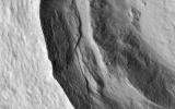
2014-03-19 |
Mars
|
Mars Reconnaissance Orbiter (MRO)
|
HiRISE
|
2880x1800x3 |
|
-
PIA17906:
-
A New Gully Channel in Terra Sirenum
Full Resolution:
TIFF
(15.56 MB)
JPEG
(754 kB)
|
|
|
2014-03-19 |
Mars
|
Mars Reconnaissance Orbiter (MRO)
|
HiRISE
|
800x800x3 |
|
-
PIA17958:
-
A New Gully Channel in Terra Sirenum, Mars
Full Resolution:
TIFF
(1.921 MB)
JPEG
(100.4 kB)
|
|
|
2014-03-12 |
|
Mars Reconnaissance Orbiter (MRO)
|
HiRISE
|
2880x1800x3 |
|
-
PIA18118:
-
Dramatic Dune Destination
Full Resolution:
TIFF
(15.56 MB)
JPEG
(672.5 kB)
|
 Planetary Data System


