
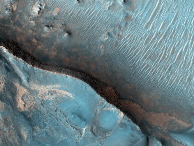
Figure 1
Click on the image for larger versionThe Nili Fossae region of Mars is one of the largest exposures of clay minerals discovered by the OMEGA spectrometer on Mars Express and mapped in greater detail by the CRISM spectrometer on MRO (see the gallery).
In the High Resolution Imaging Science Experiment (HiRISE) IRB color (Figure 1), dark blue regions are basaltic in composition, including sand-sized material that bounces around in the wind to form dunes. Basalt in the most common type of volcanic rock on the Earth and other terrestrial planets.
The light-toned areas (with a variety of colors) and covered by small-scale fractures is the clay-rich material. Clay minerals contain hydrogen and oxygen (i.e., water) within their mineral structure, and may also preserve organic materials, so there is great interest in studying these deposits to understand past environments that could have supported life.
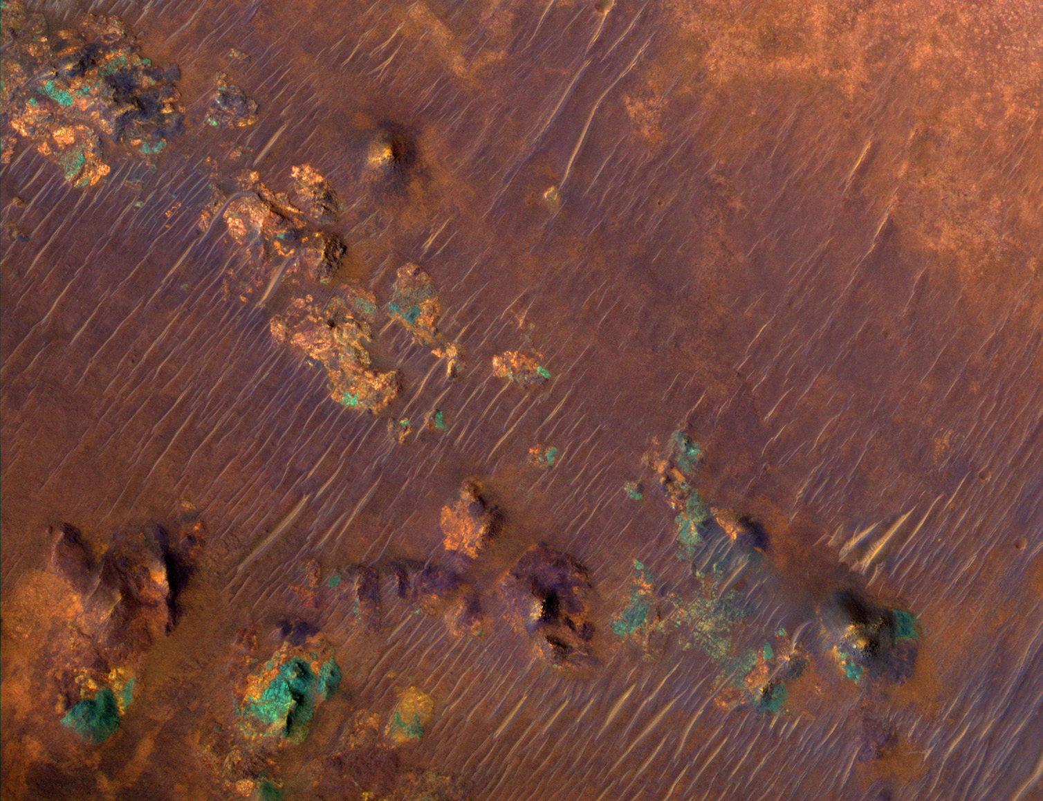
We are also releasing a video produced by the digital animation group at the Jet Propulsion Laboratory (JPL), scrolling from south to north over this image, as a simulation of the view from the MRO spacecraft.The colors have been specially enhanced for this video, beyond the standard enhancements applied to all HiRISE color images. A sample of the enhanced color is shown here; the purple areas are basaltic materials, orange areas are rich in clays, and the blue-green patches are outcops of unaltered rocks rich in the mineral pyroxene. This would be a wonderful place for detailed exploration by a rover like Mars Science Laboratory (MSL).
NASA's Jet Propulsion Laboratory, a division of the California Institute of Technology in Pasadena, manages the Mars Reconnaissance Orbiter for NASA's Science Mission Directorate, Washington. Lockheed Martin Space Systems, Denver, built the spacecraft. The High Resolution Imaging Science Experiment is operated by the University of Arizona, Tucson, and the instrument was built by Ball Aerospace & Technologies Corp., Boulder, Colo.
Originally released October 10, 2007
 Planetary Data System


