My
List |
Addition Date
|
Target
|
Mission
|
Instrument
|
Size
|

|
2017-02-16 |
Mars
|
Mars Reconnaissance Orbiter (MRO)
|
HiRISE
|
2880x1800x3 |

|
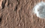
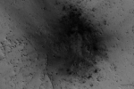
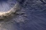
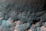
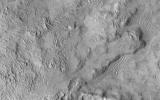
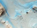
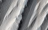
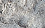
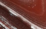
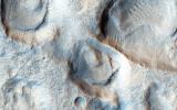
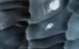
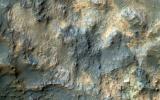
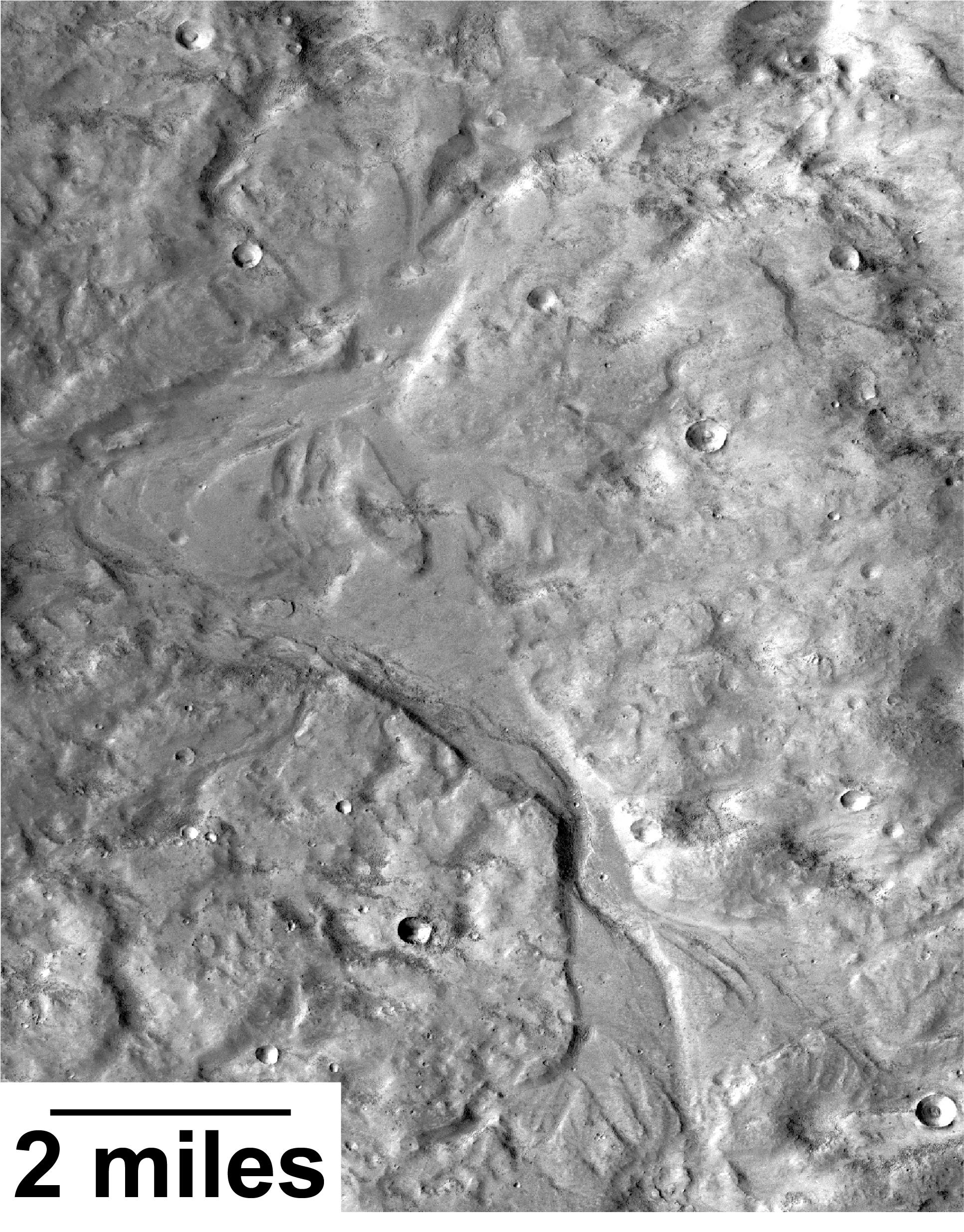
-
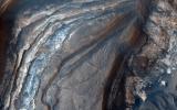
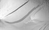
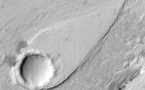
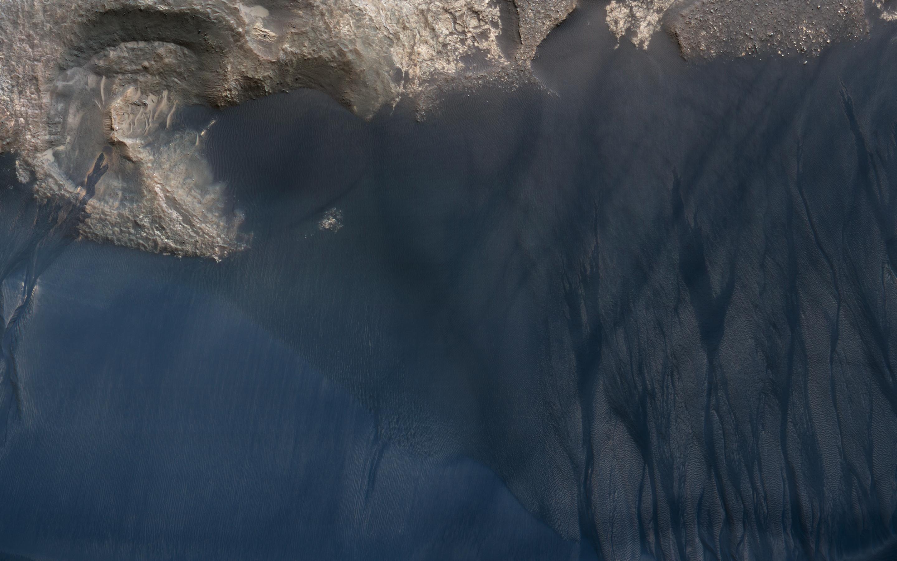
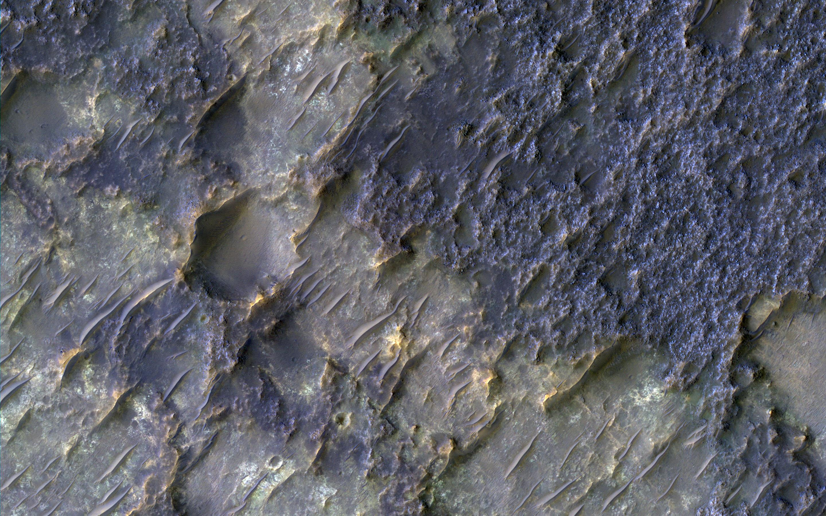
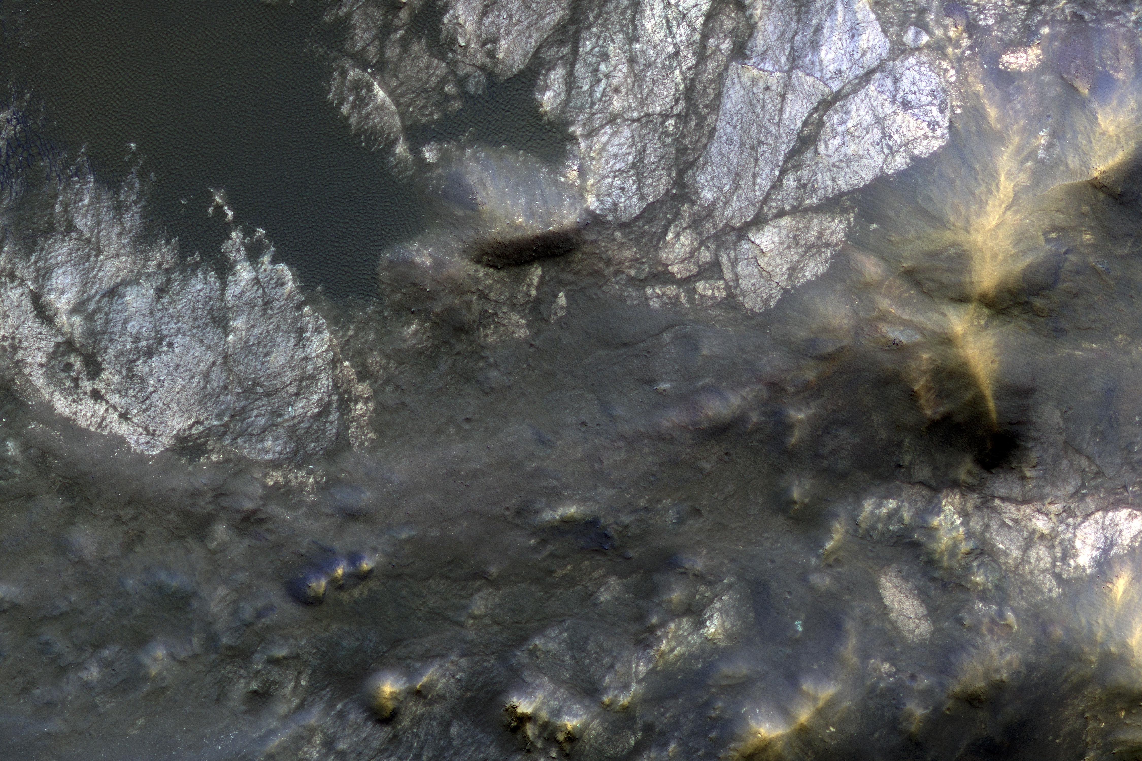
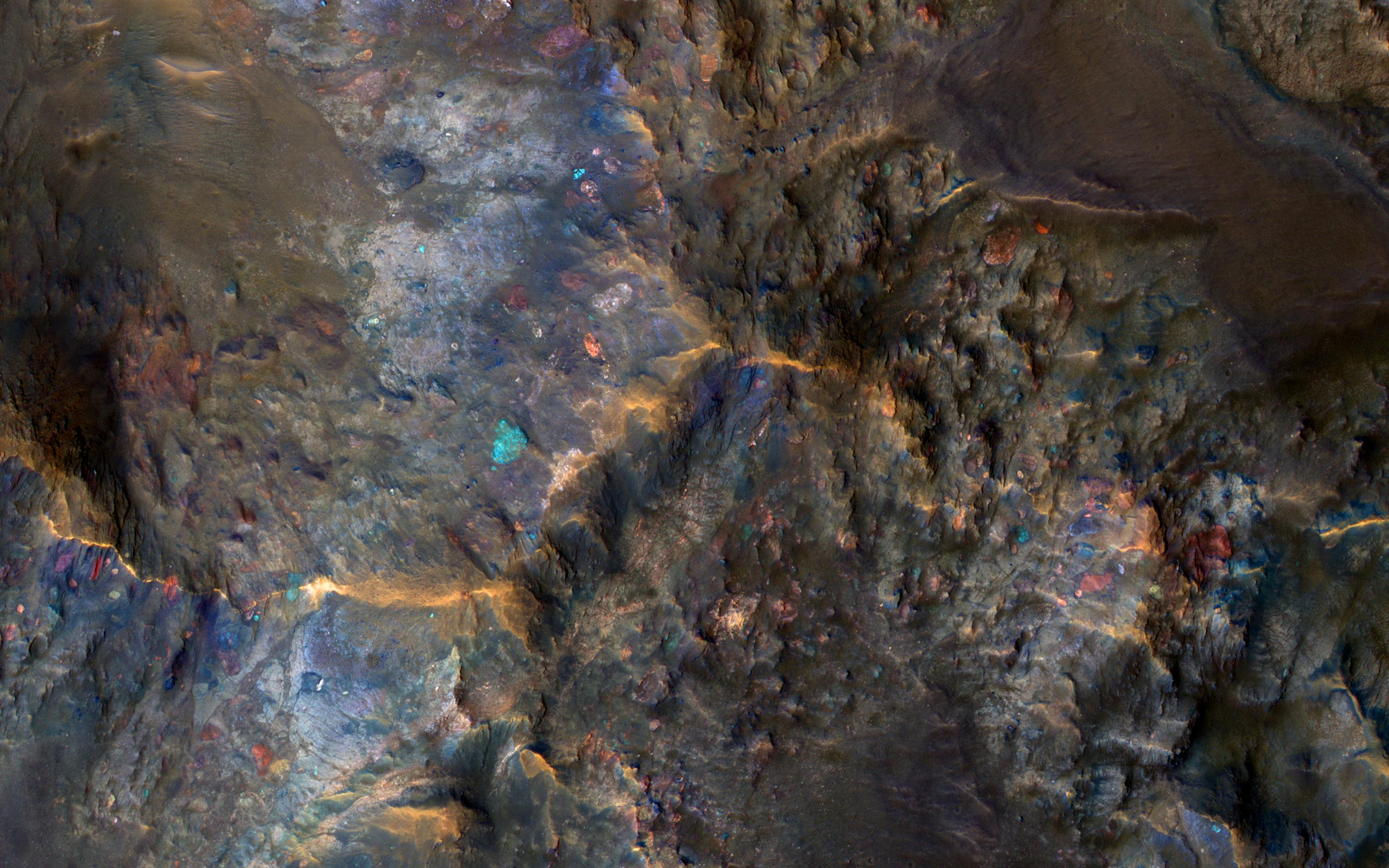
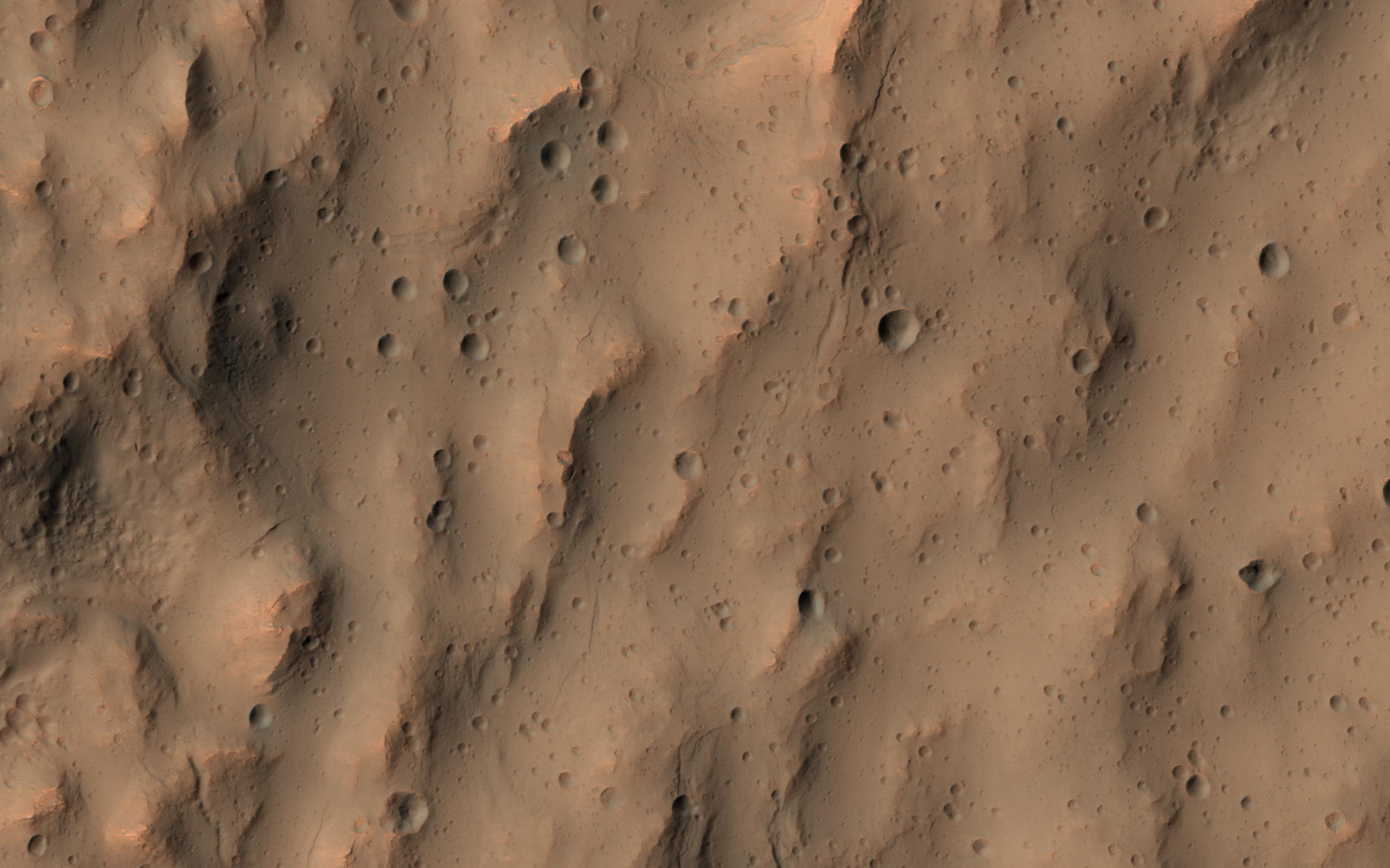
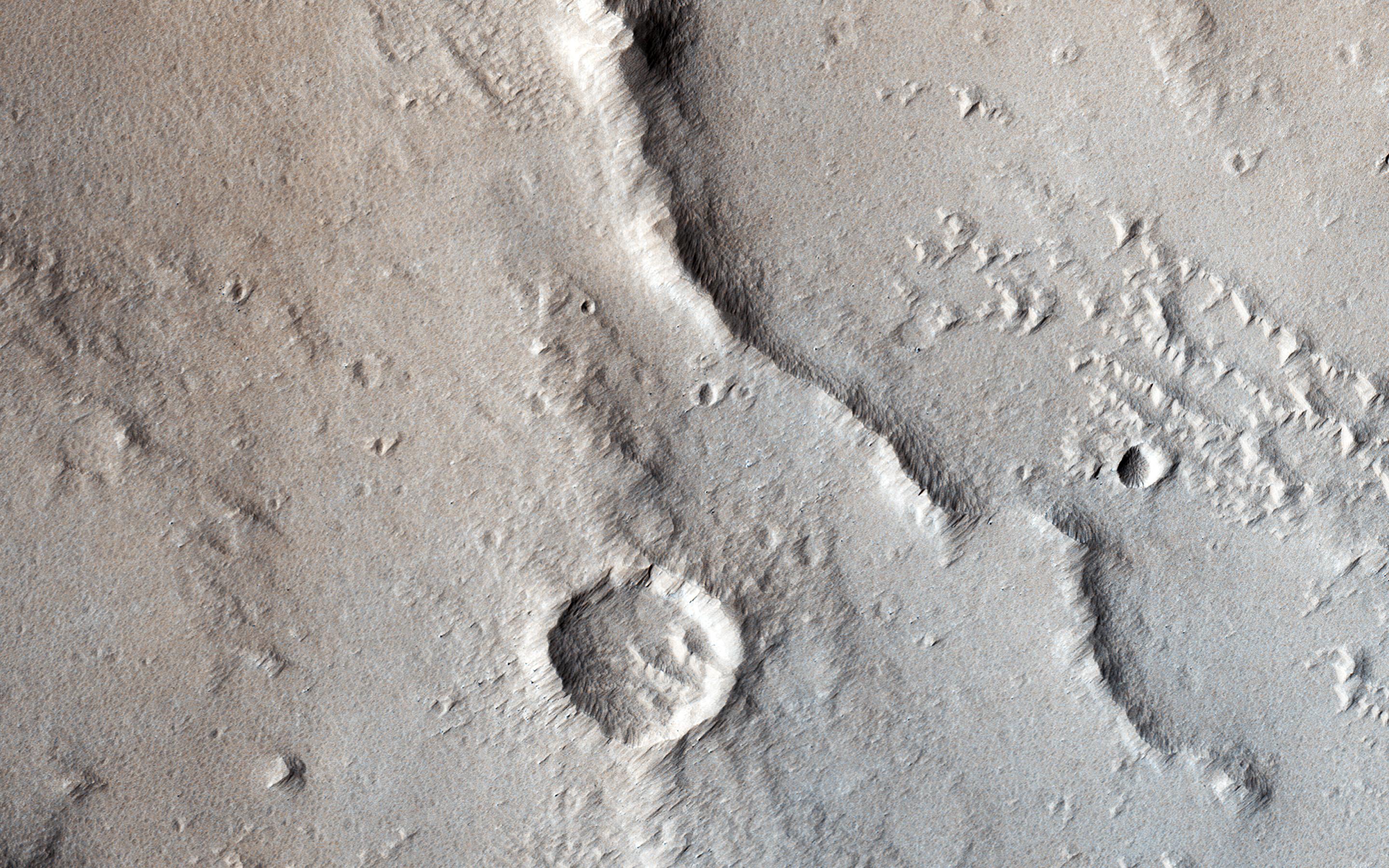
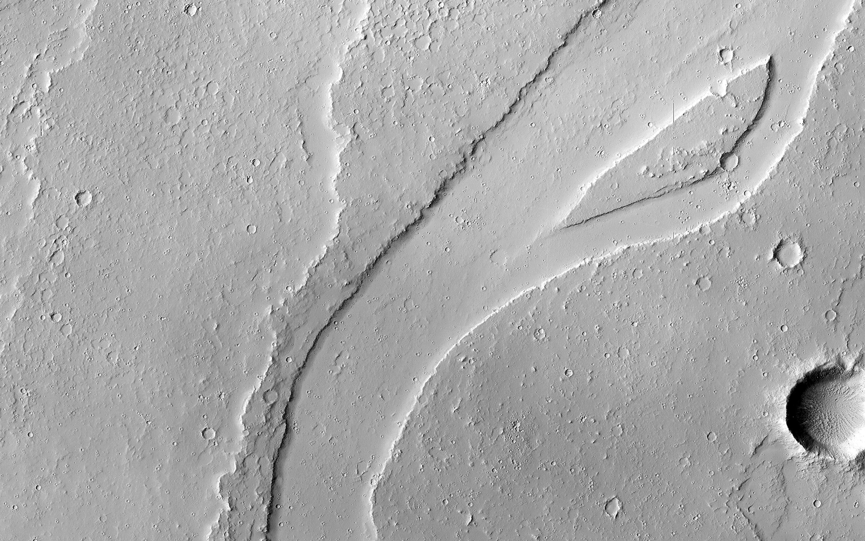
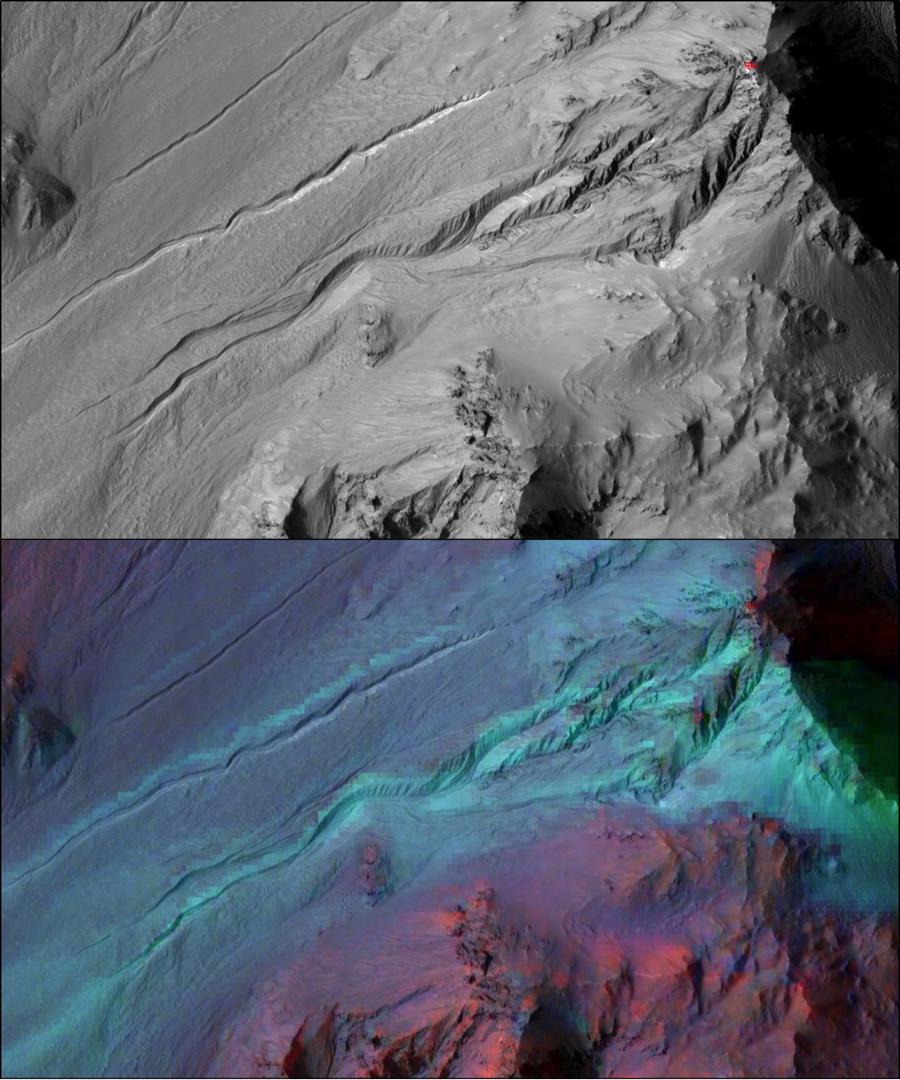
PIA21458:
-
Scars of Erosion
Full Resolution:
TIFF
(12.9 MB)
JPEG
(489.1 kB)
|
|
|
2017-02-15 |
Mars
|
Mars Reconnaissance Orbiter (MRO)
|
HiRISE
|
2880x1800x3 |
|
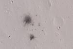
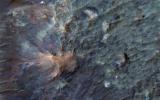
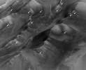
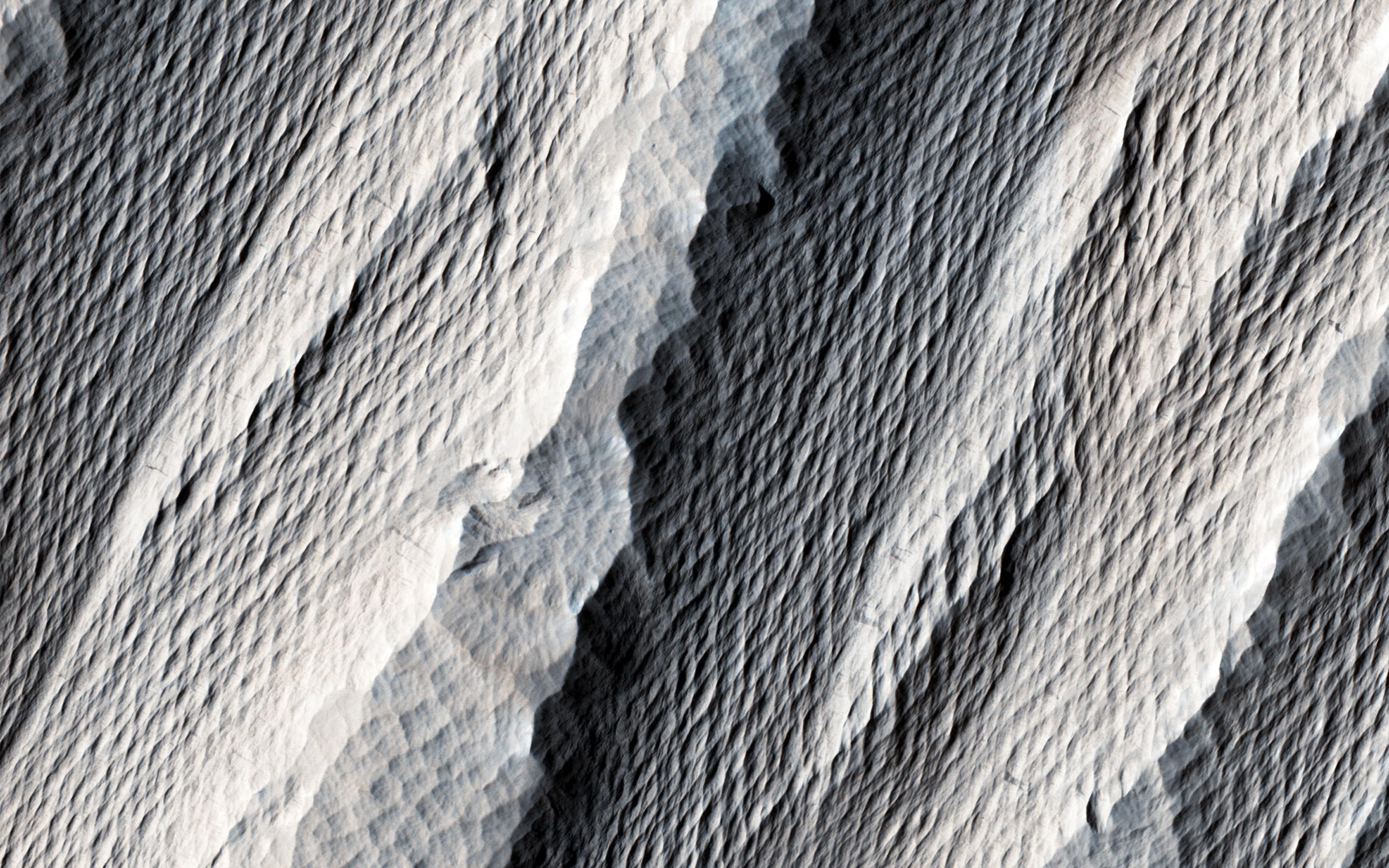
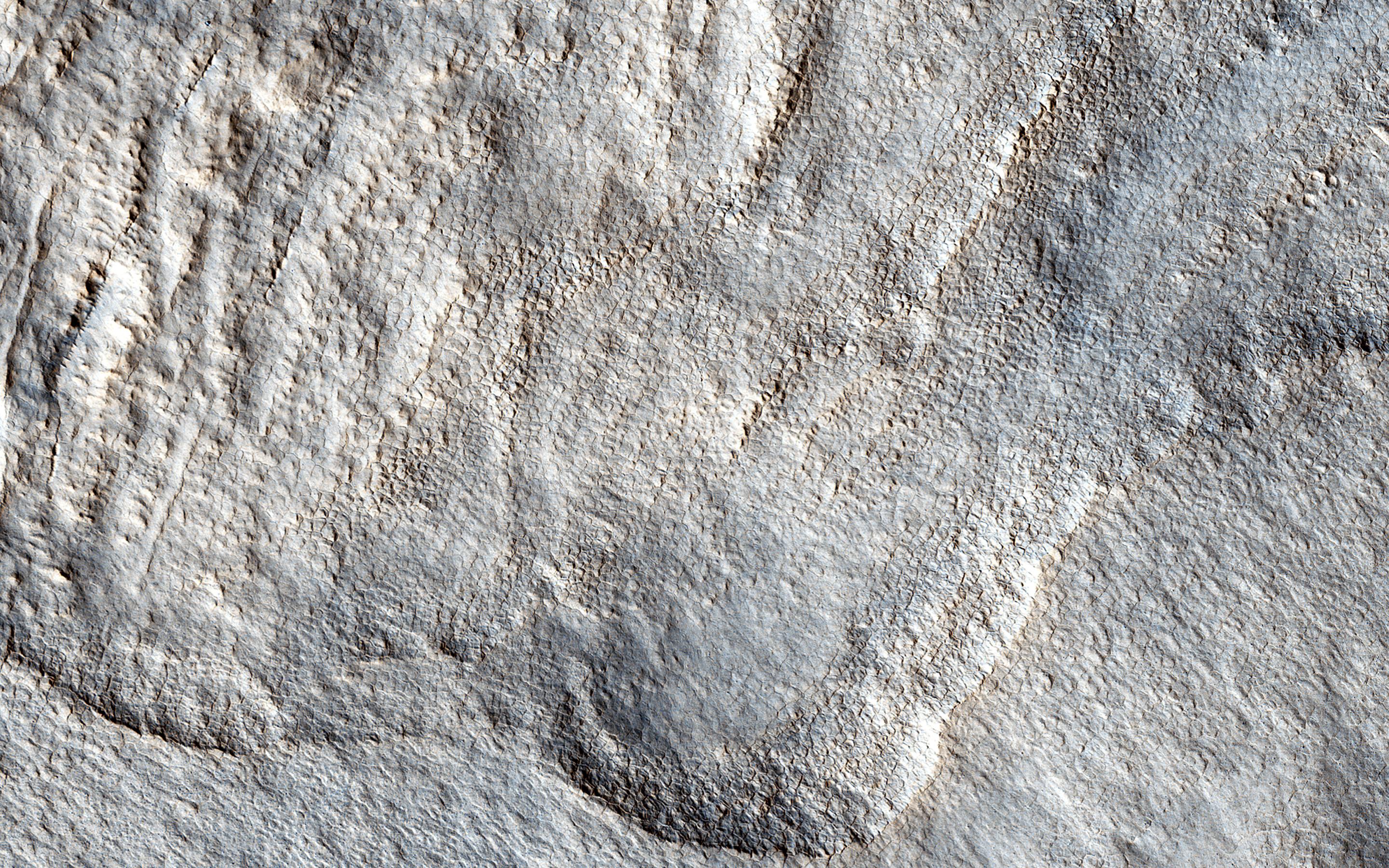
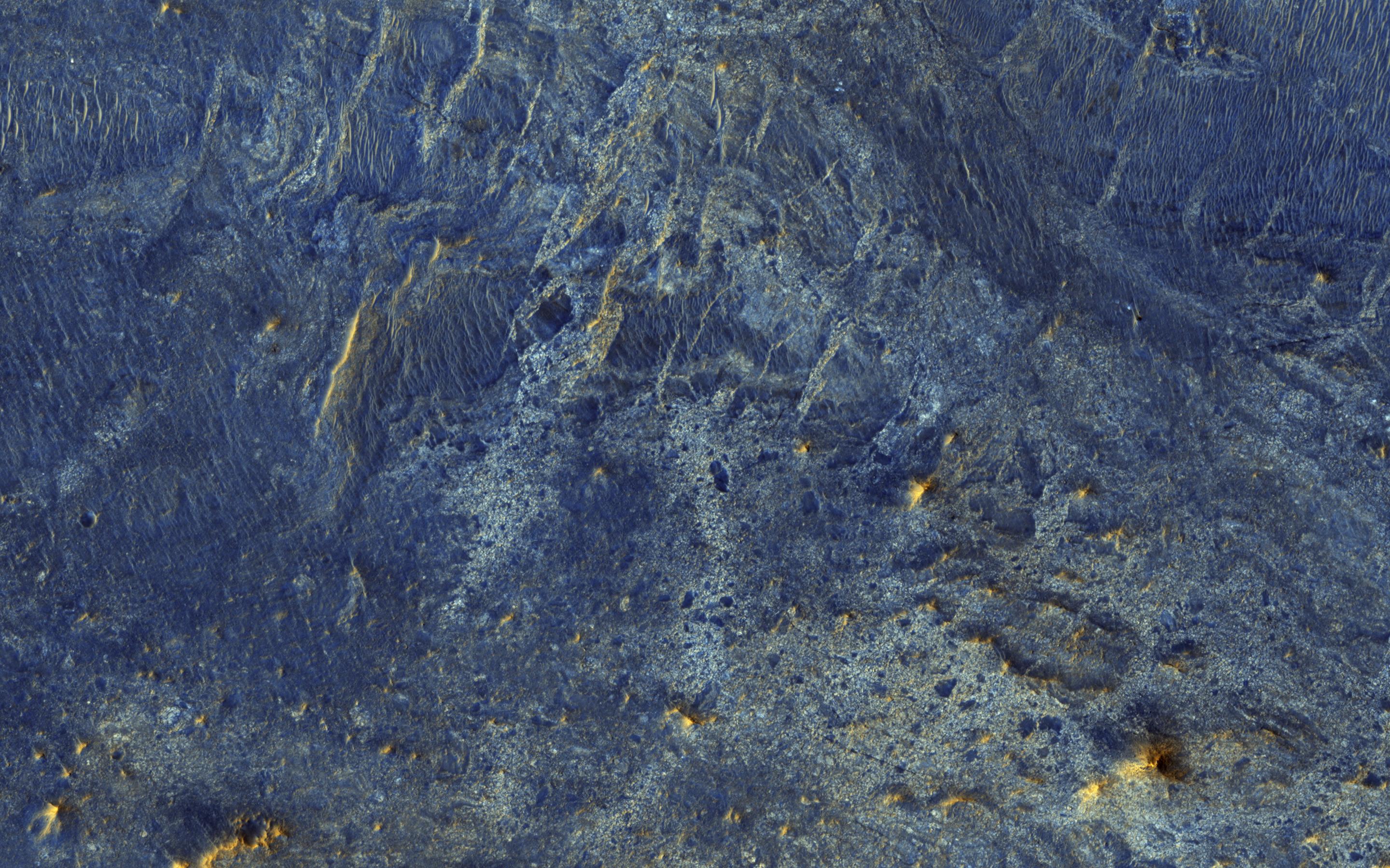
-
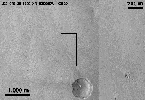
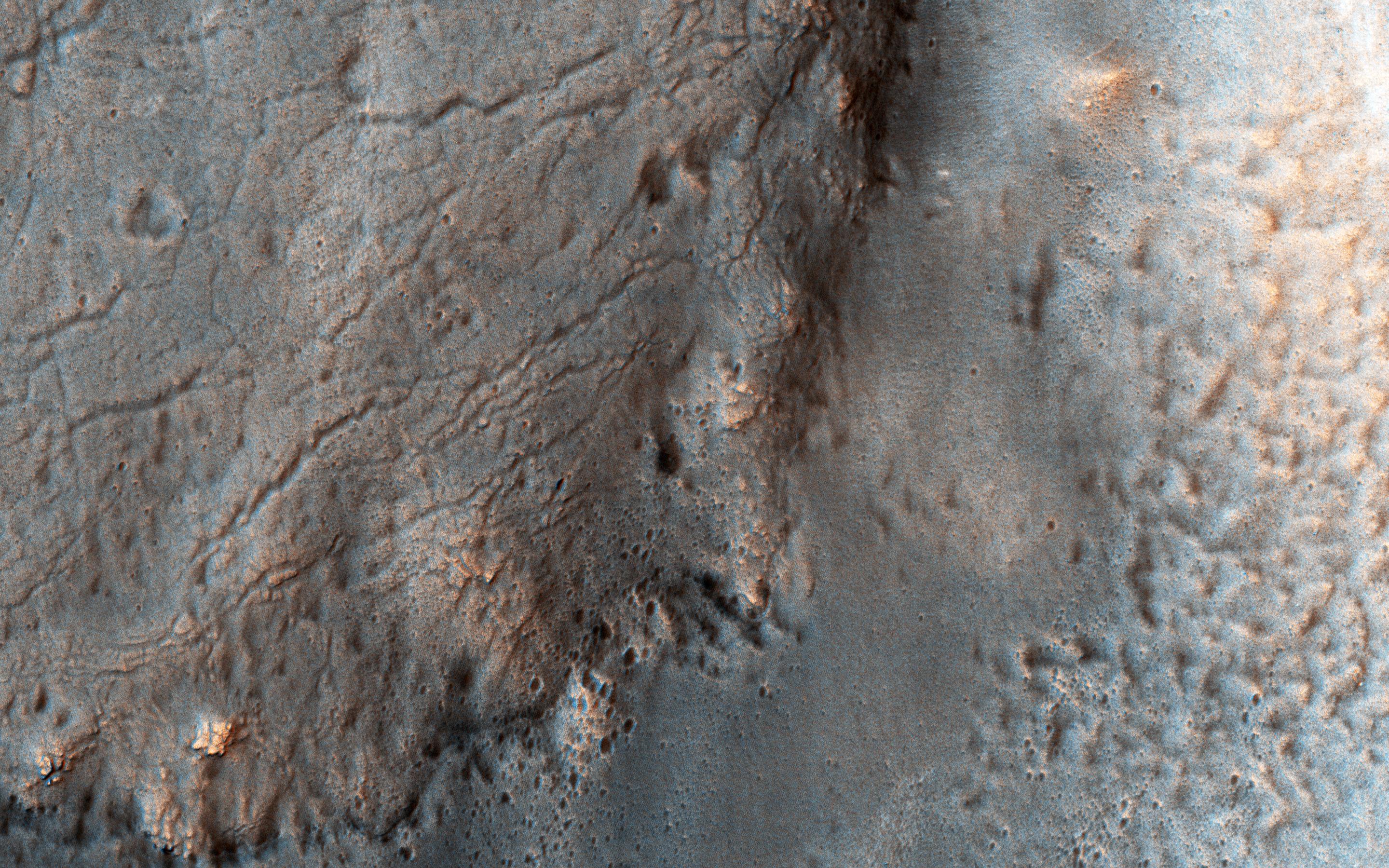
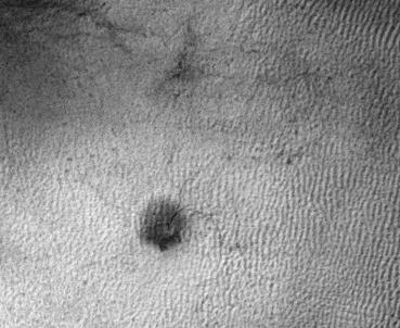
PIA21457:
-
A Dust Devil on Hilly Terrain
Full Resolution:
TIFF
(15.56 MB)
JPEG
(967.1 kB)
|
|
|
2017-02-14 |
Mars
|
Mars Reconnaissance Orbiter (MRO)
|
HiRISE
|
2880x1800x3 |

|
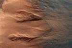
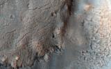
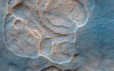
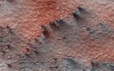
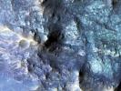
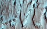
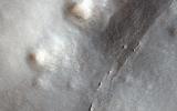
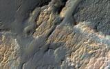
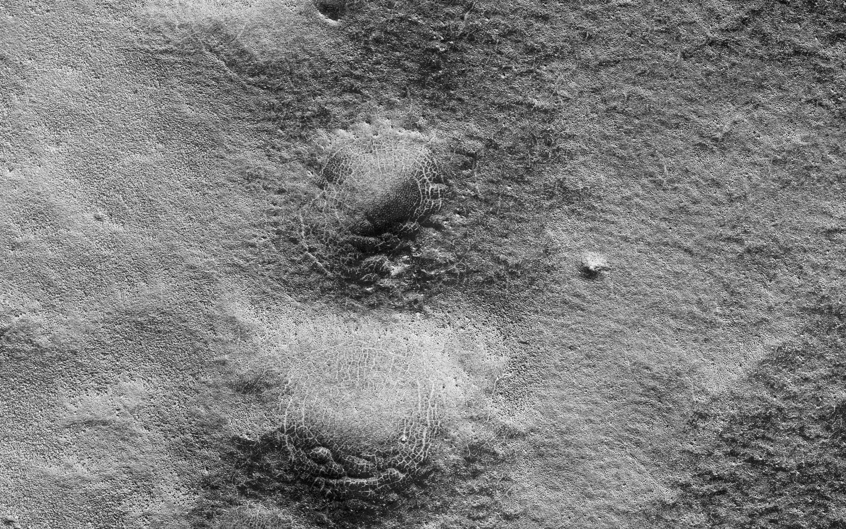
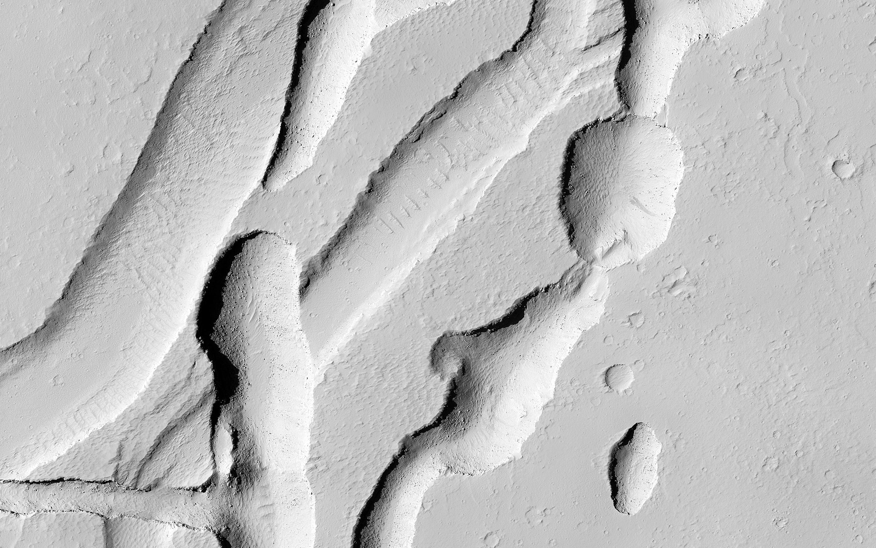
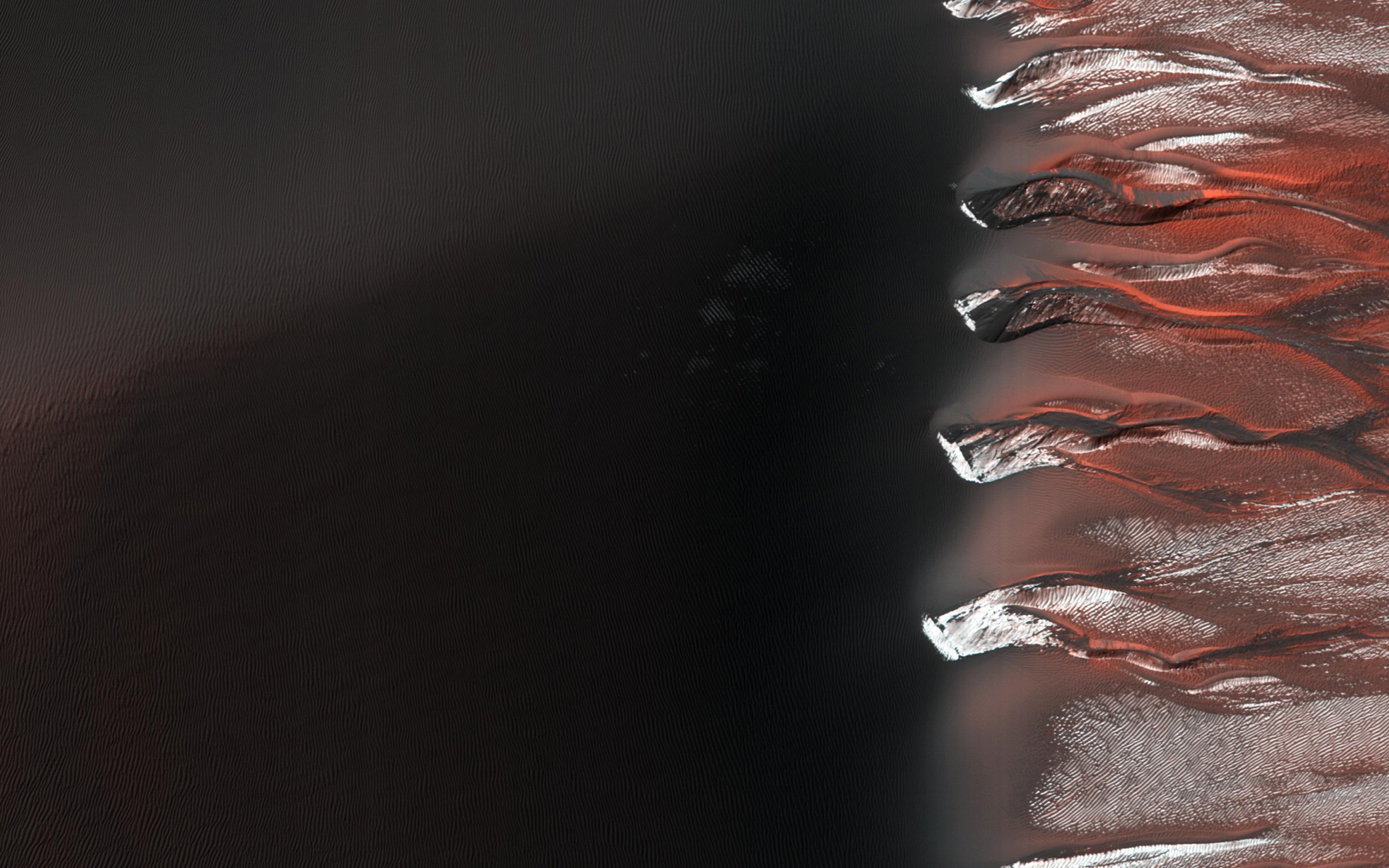
-
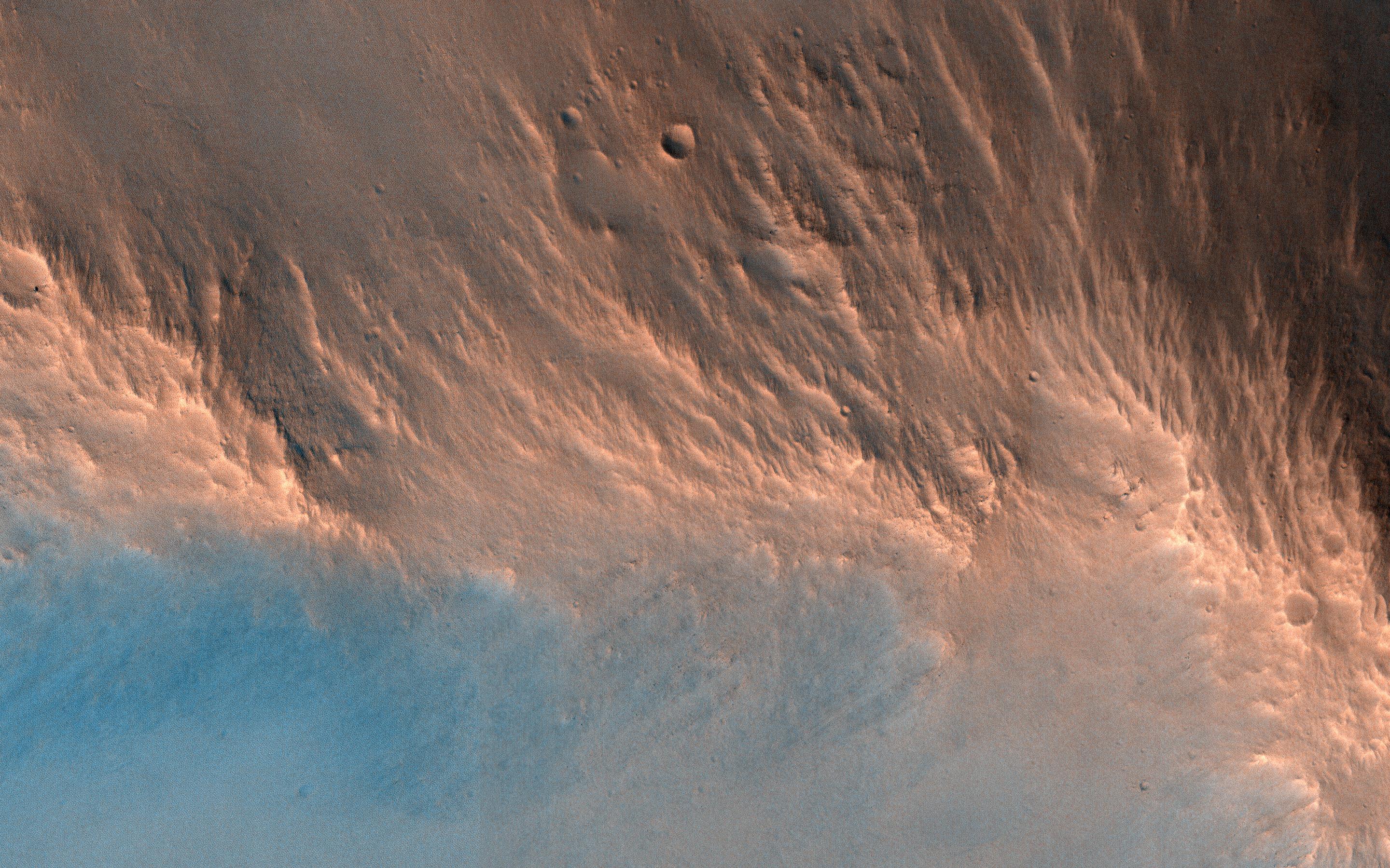
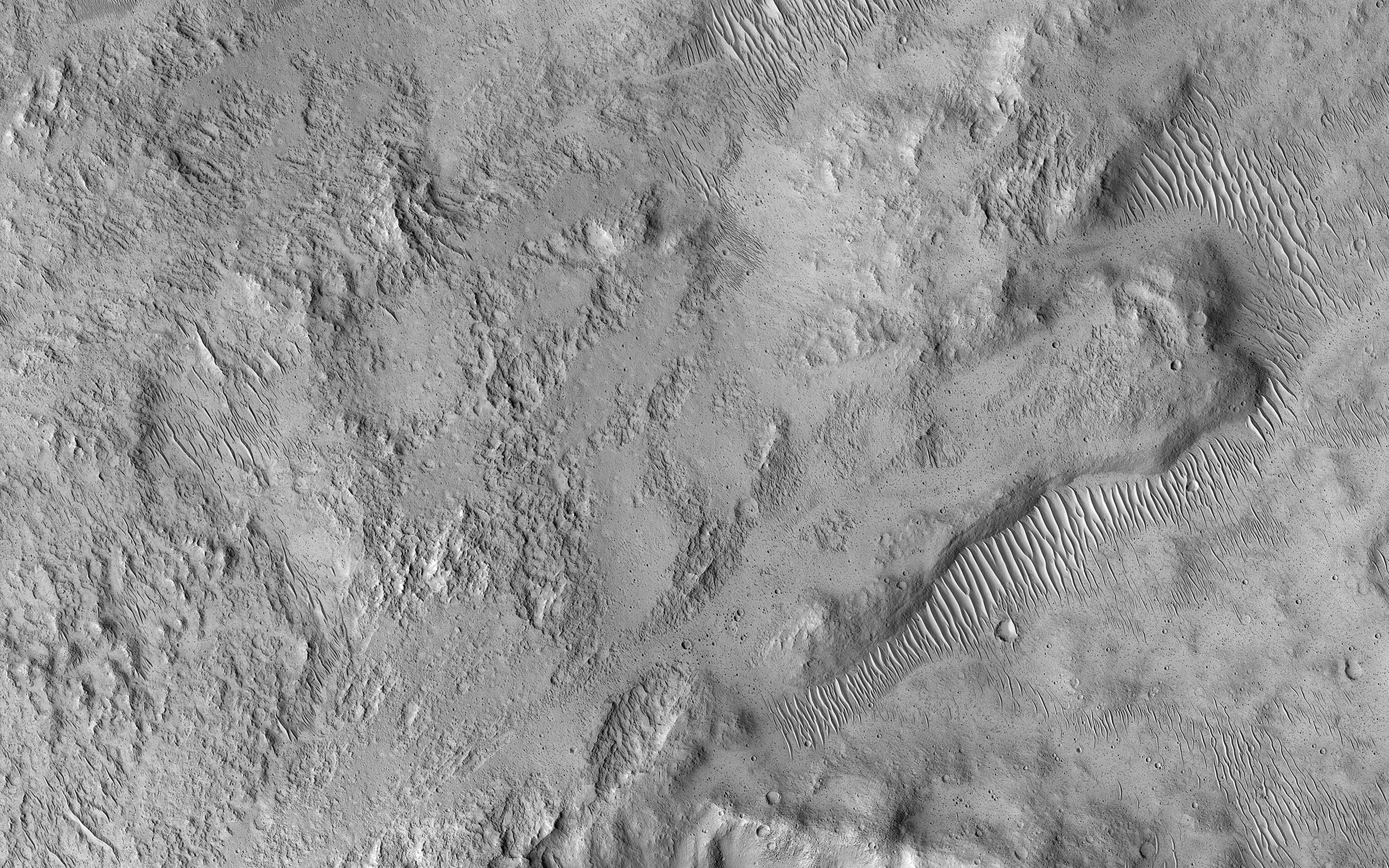
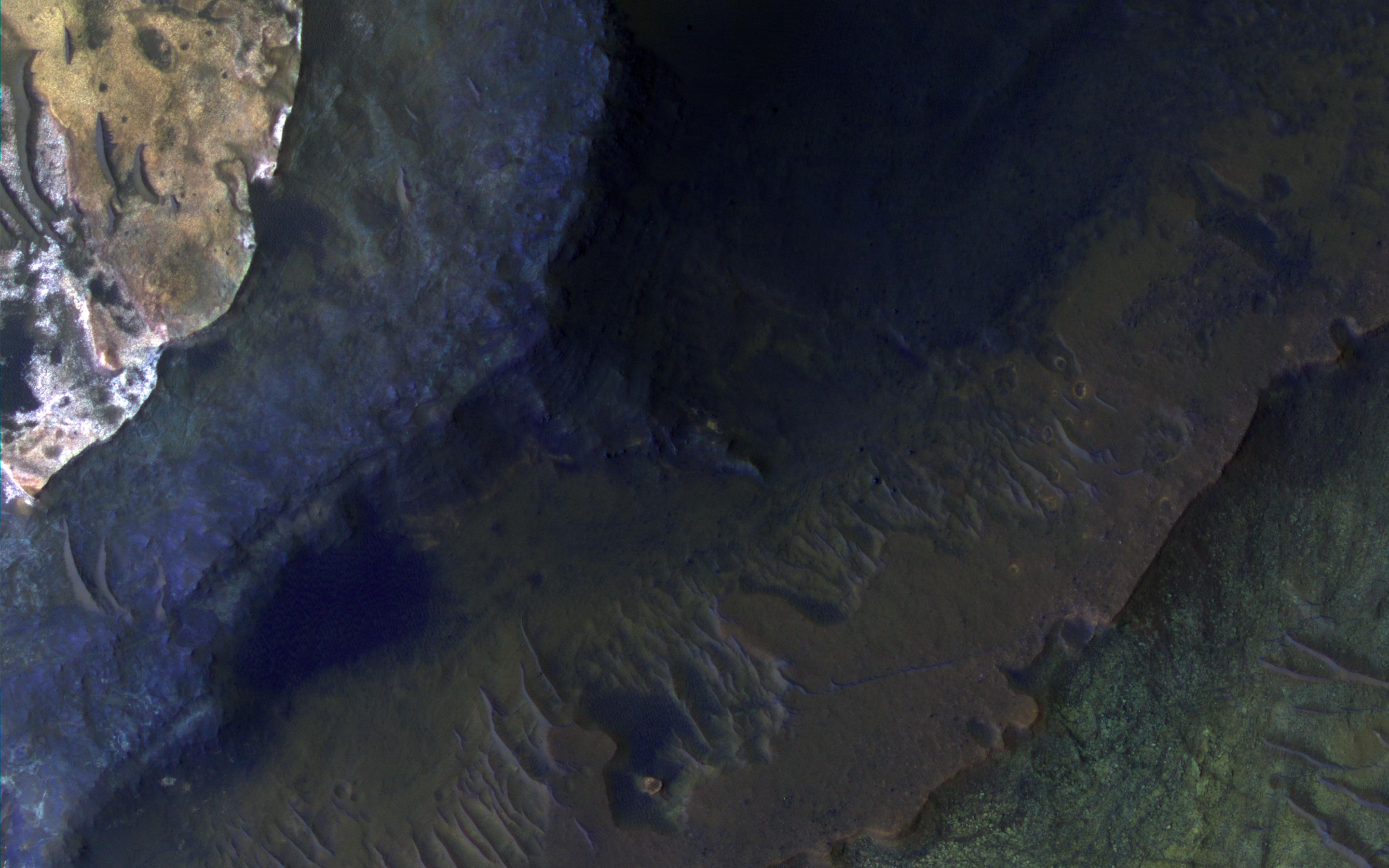
PIA21456:
-
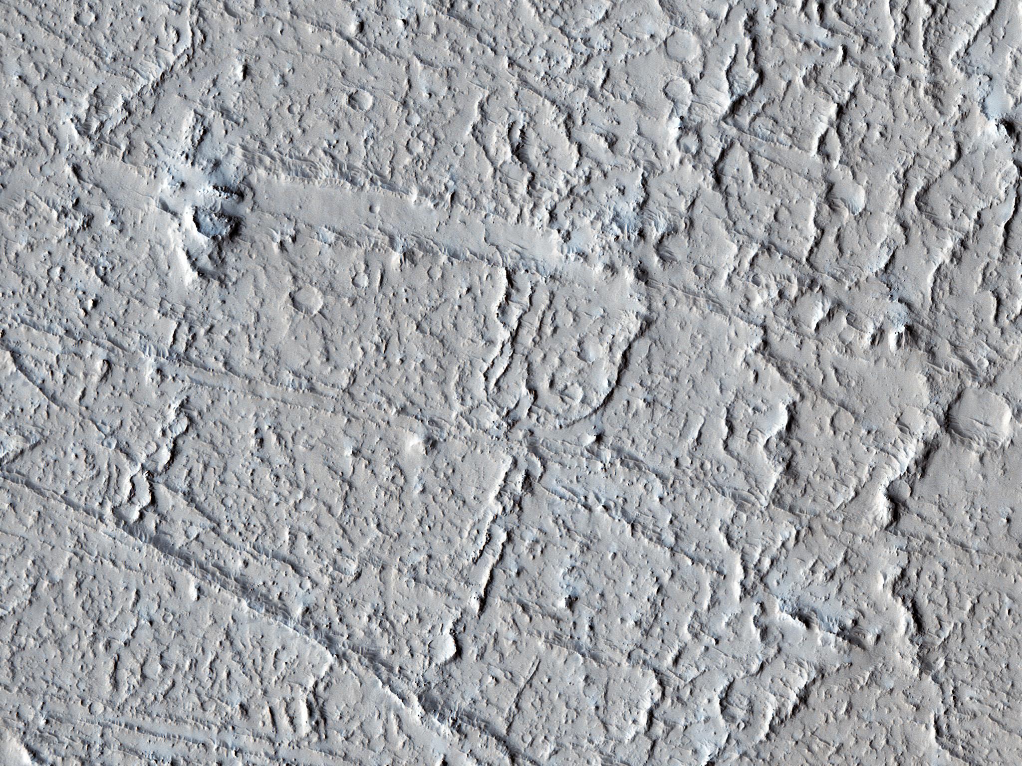
Old Features and New
Full Resolution:
TIFF
(15.56 MB)
JPEG
(936.1 kB)
|
|
|
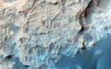
2017-02-13 |
Mars
|
Mars Reconnaissance Orbiter (MRO)
|
HiRISE
|
2880x1800x3 |
|
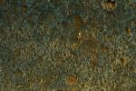
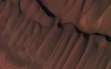
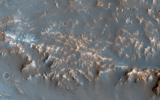
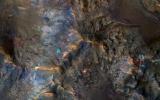
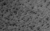
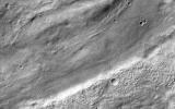
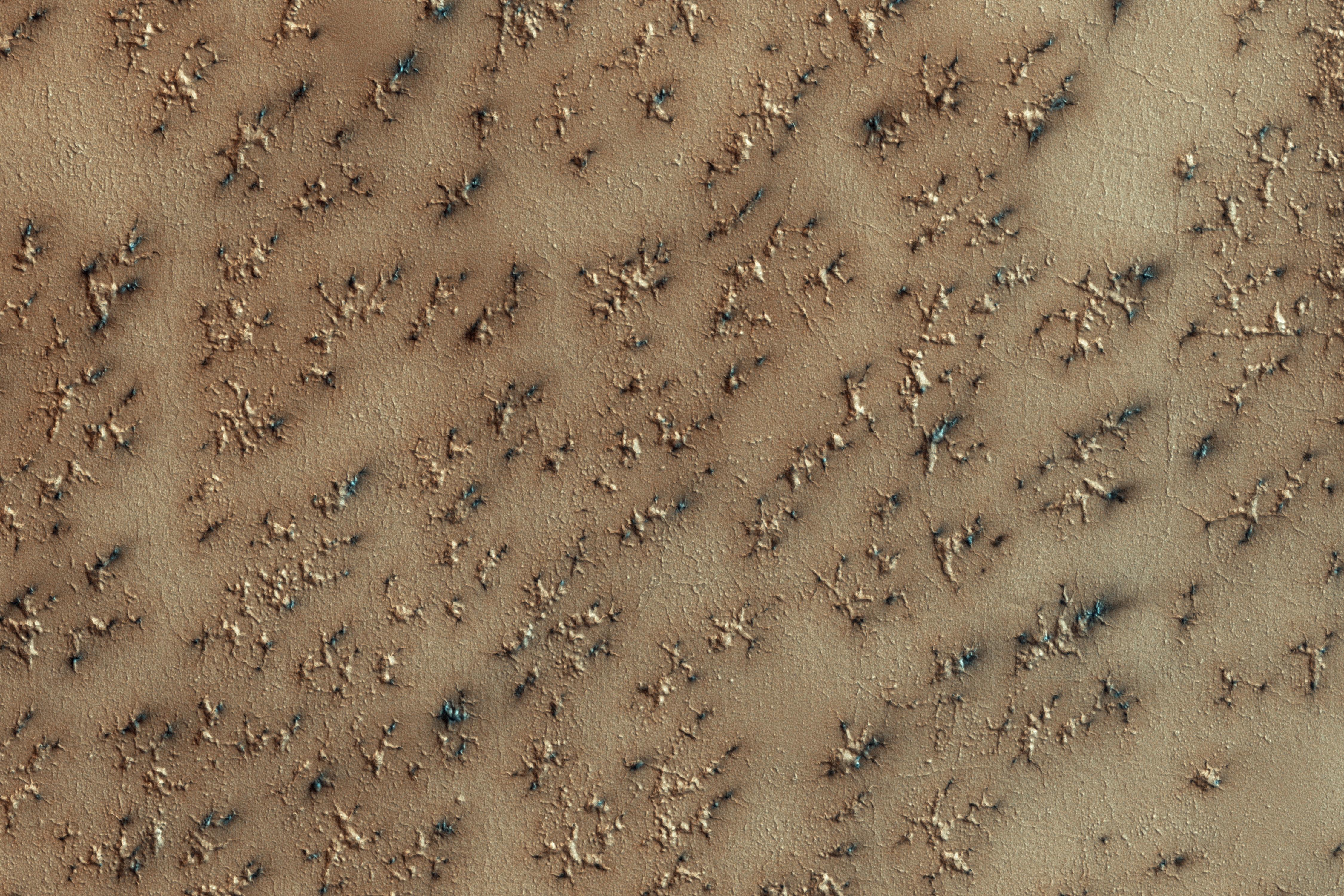
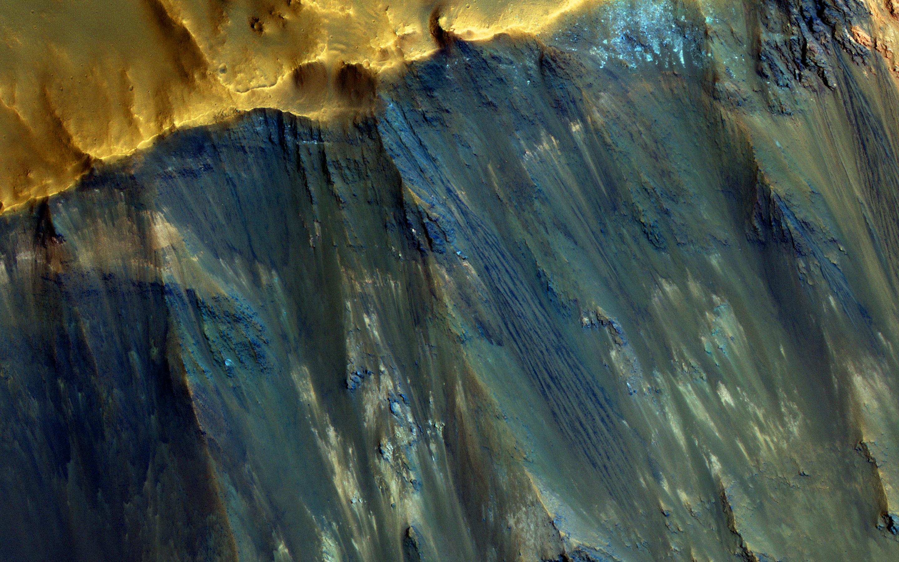
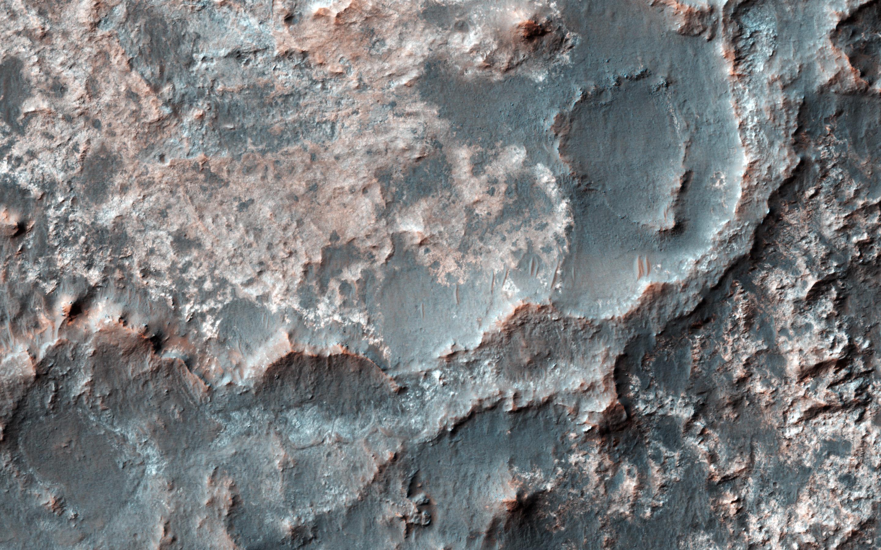
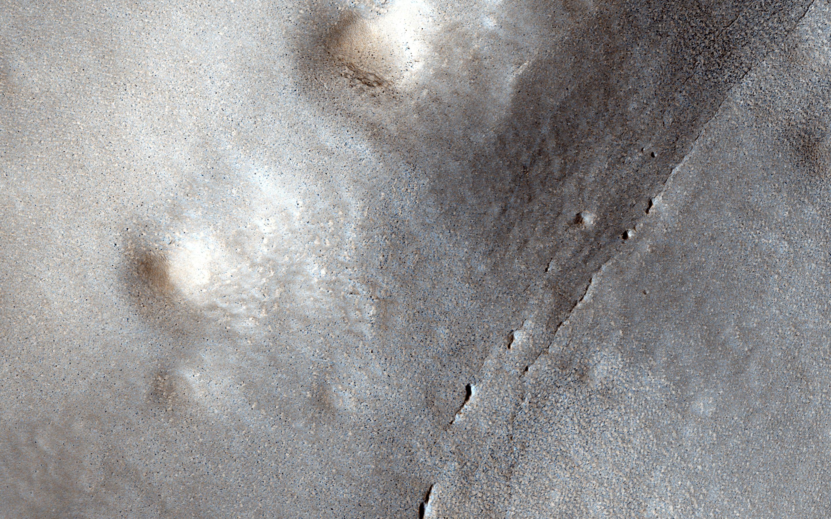
-
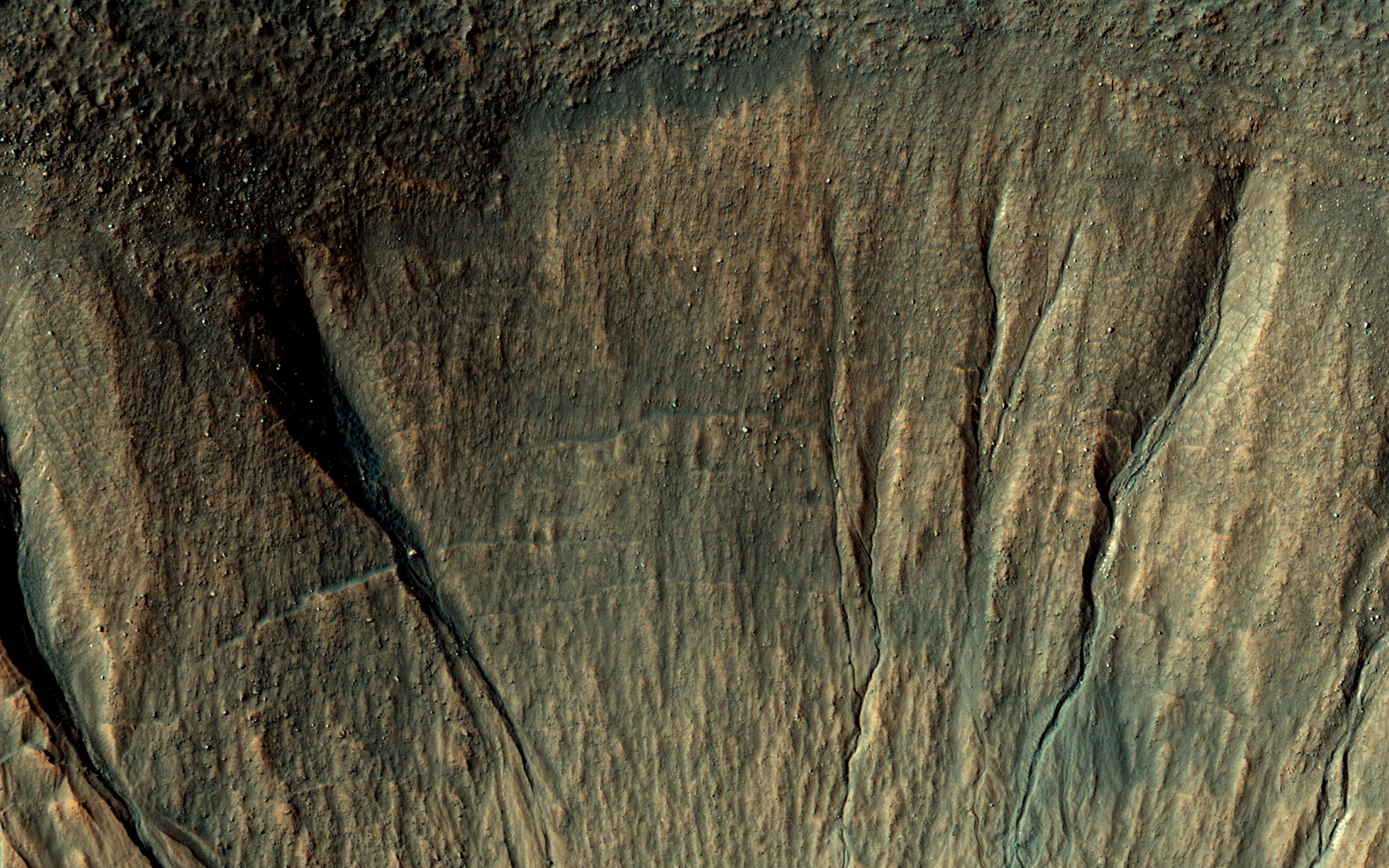
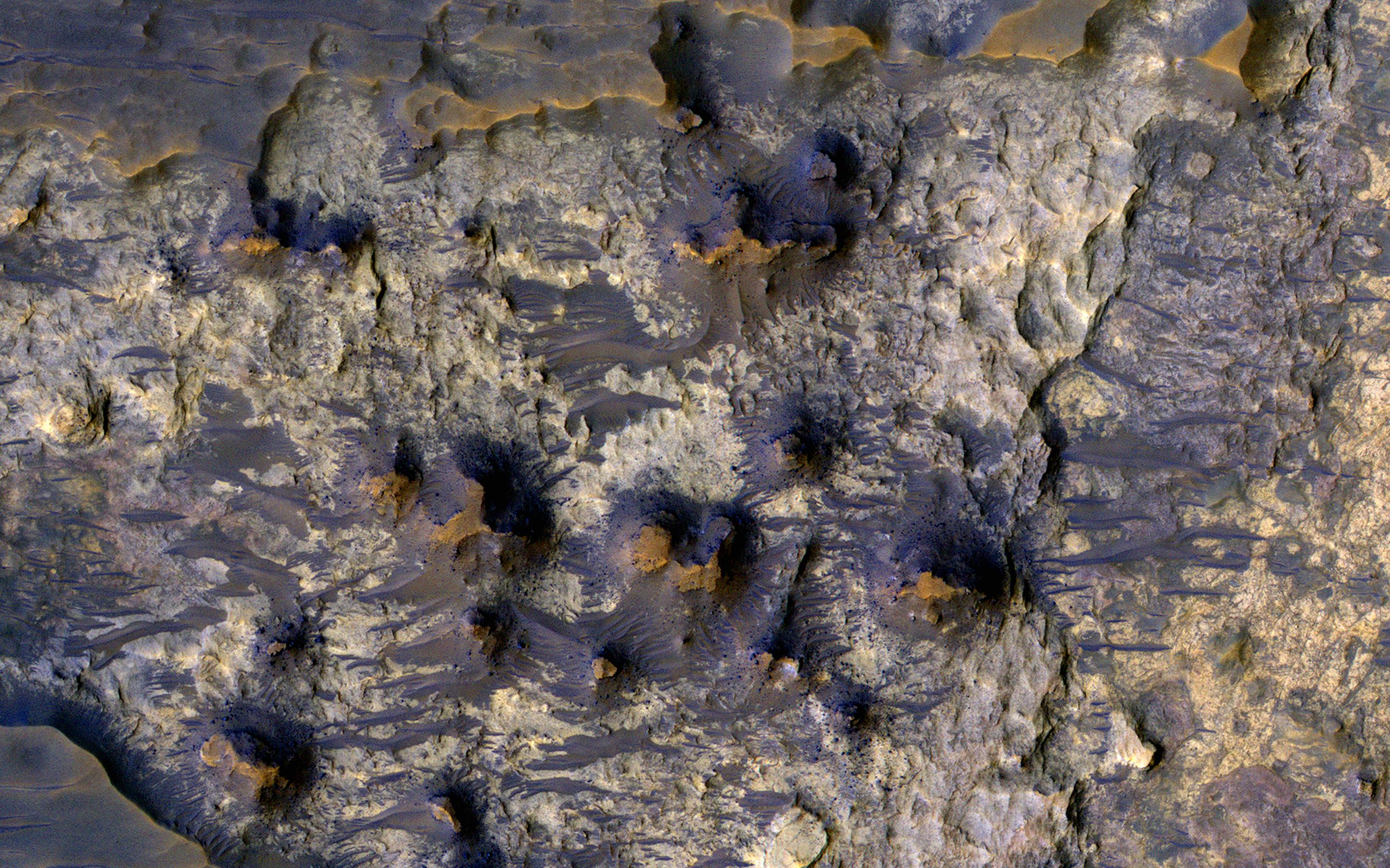
PIA21455:
-
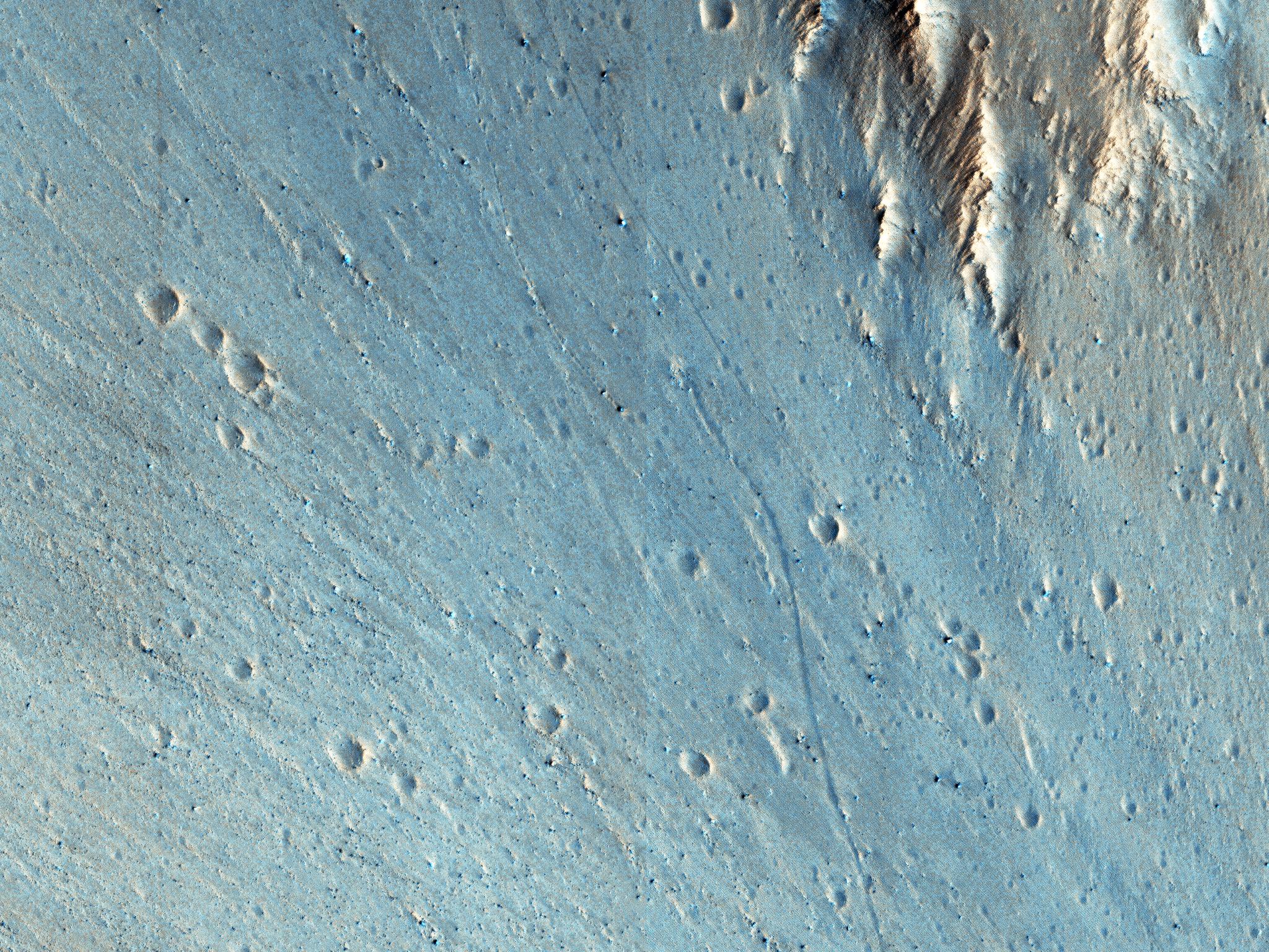
Better Preserved on Mars than on Earth
Full Resolution:
TIFF
(15.56 MB)
JPEG
(770.8 kB)
|
|
|
2017-02-10 |
Mars
|
Mars Reconnaissance Orbiter (MRO)
|
HiRISE
|
2880x1800x1 |
|
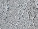
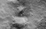
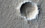
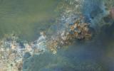
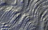
-
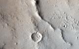
PIA21454:
-
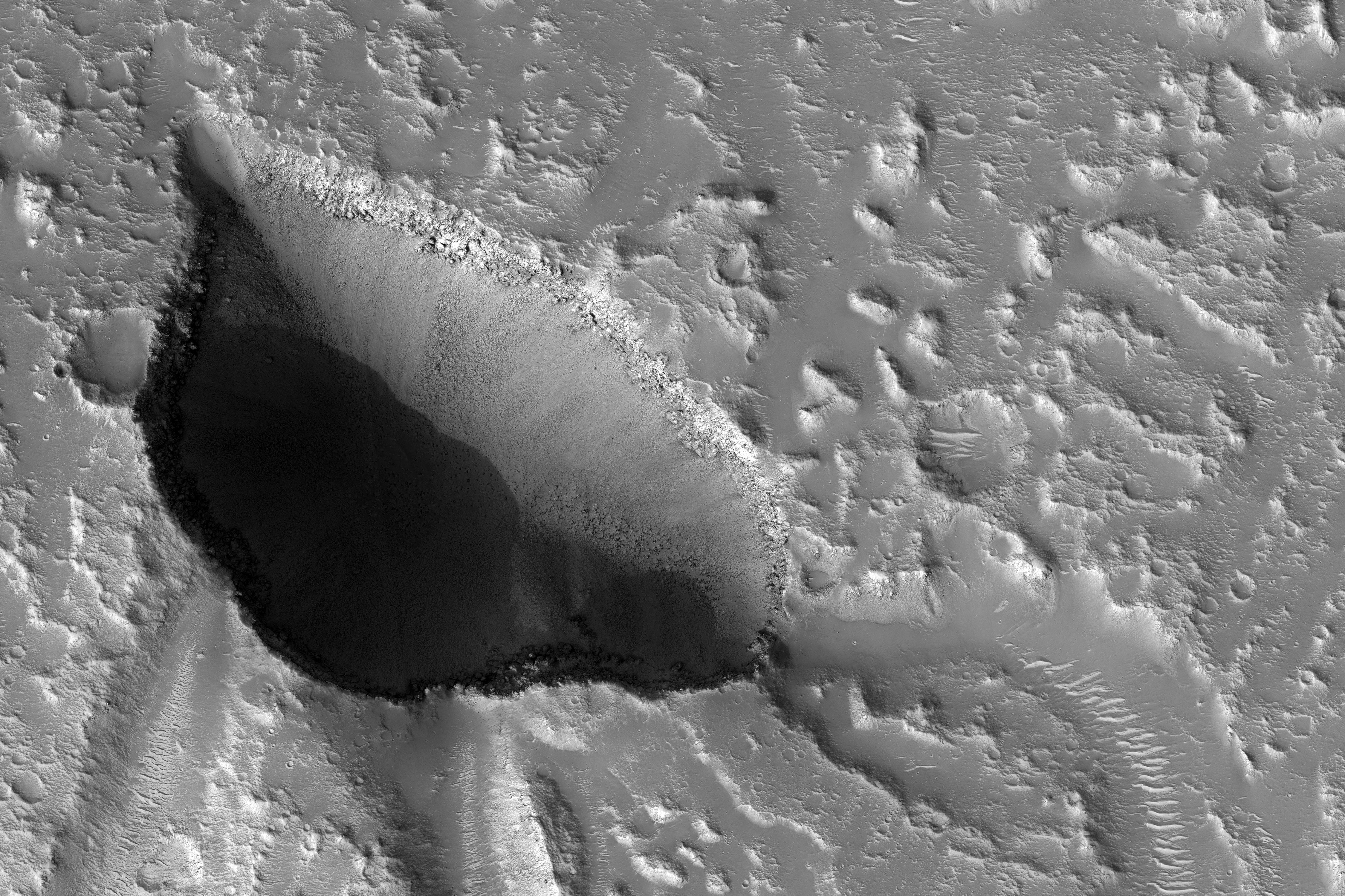
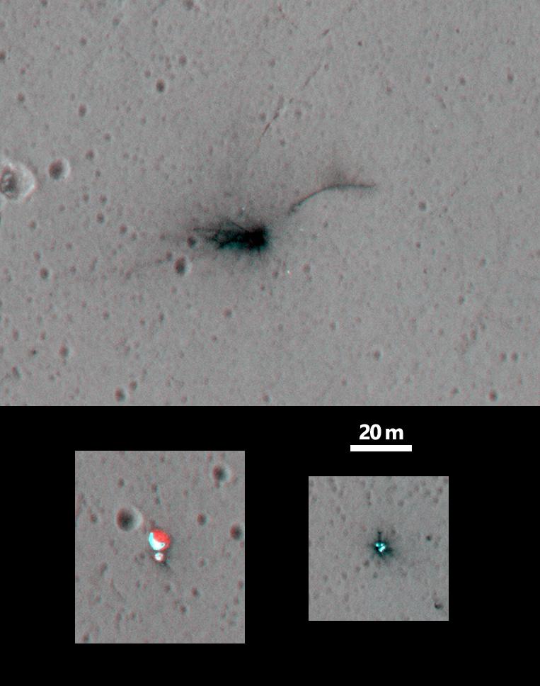
A Dragonfly-Shaped Crater
Full Resolution:
TIFF
(4.23 MB)
JPEG
(565.9 kB)
|
|
|
2017-02-09 |
Mars
|
Mars Reconnaissance Orbiter (MRO)
|
HiRISE
|
2880x1800x3 |
|
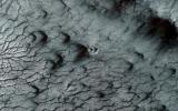
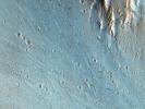
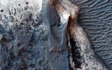
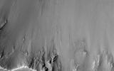
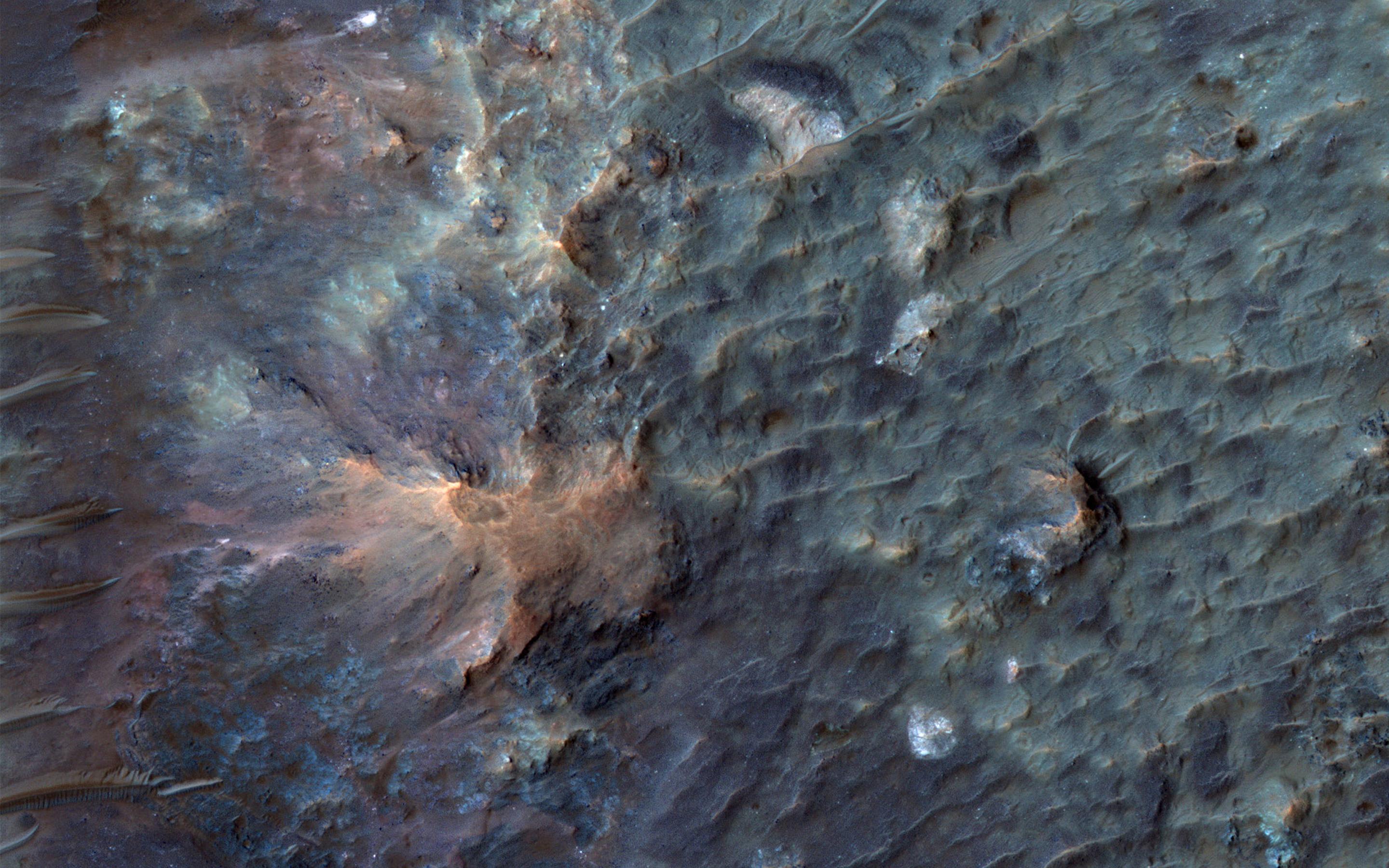
-
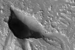
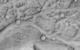
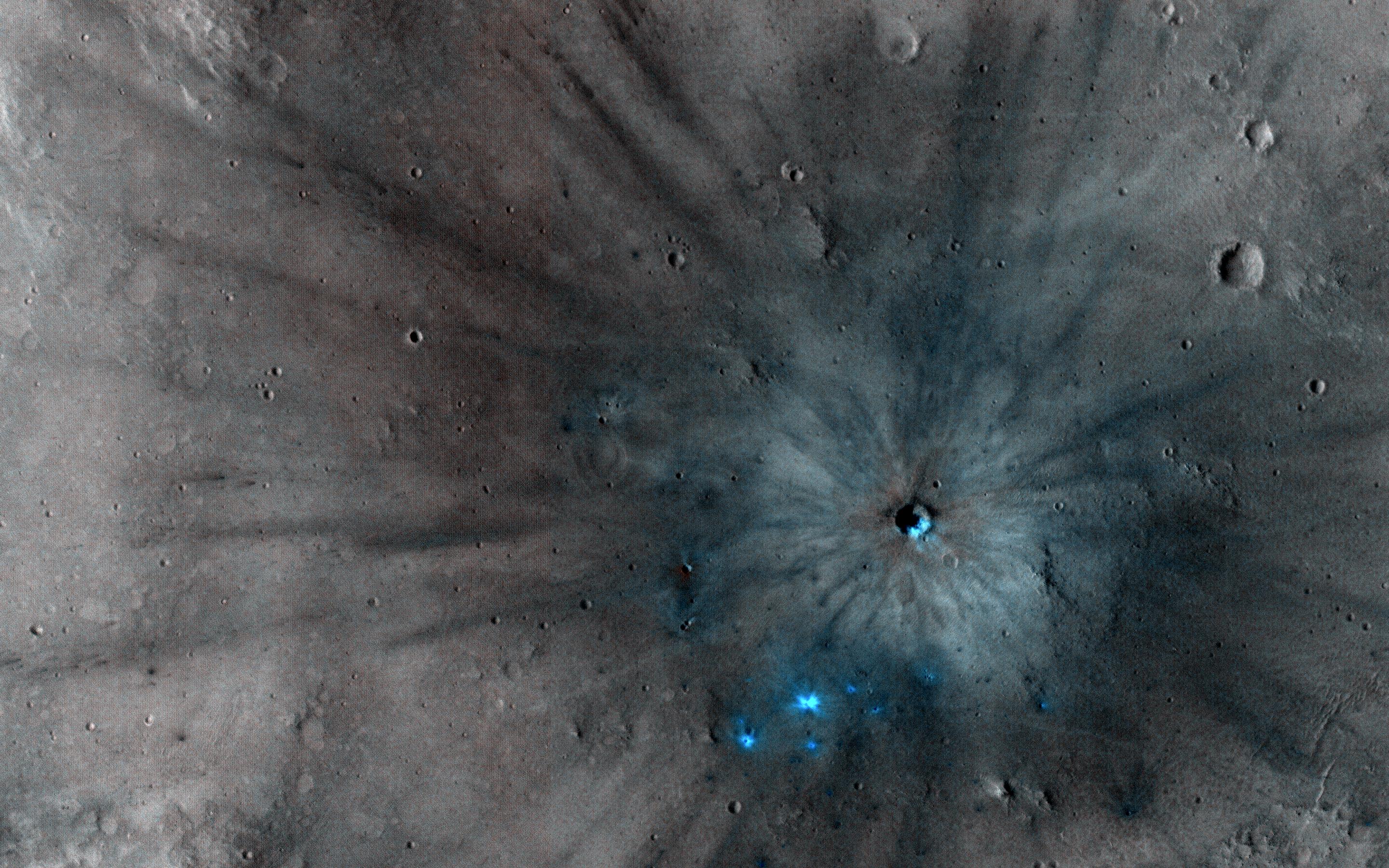
PIA21451:
-
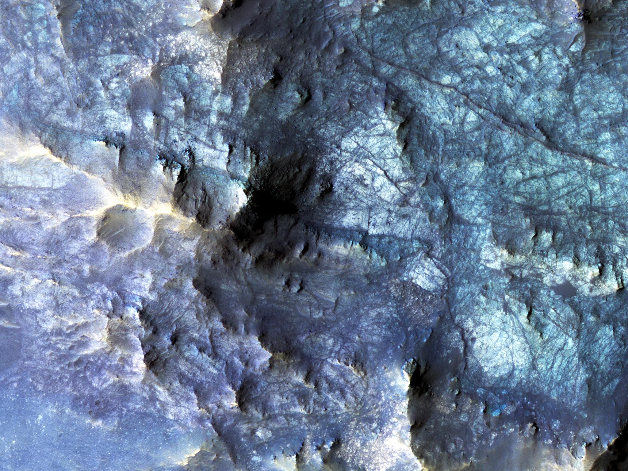
Unlocking an Impact Crater's Clues
Full Resolution:
TIFF
(15.56 MB)
JPEG
(1.016 MB)
|
|
|
2017-02-08 |
Mars
|
Mars Reconnaissance Orbiter (MRO)
|
HiRISE
|
2880x1800x3 |

|
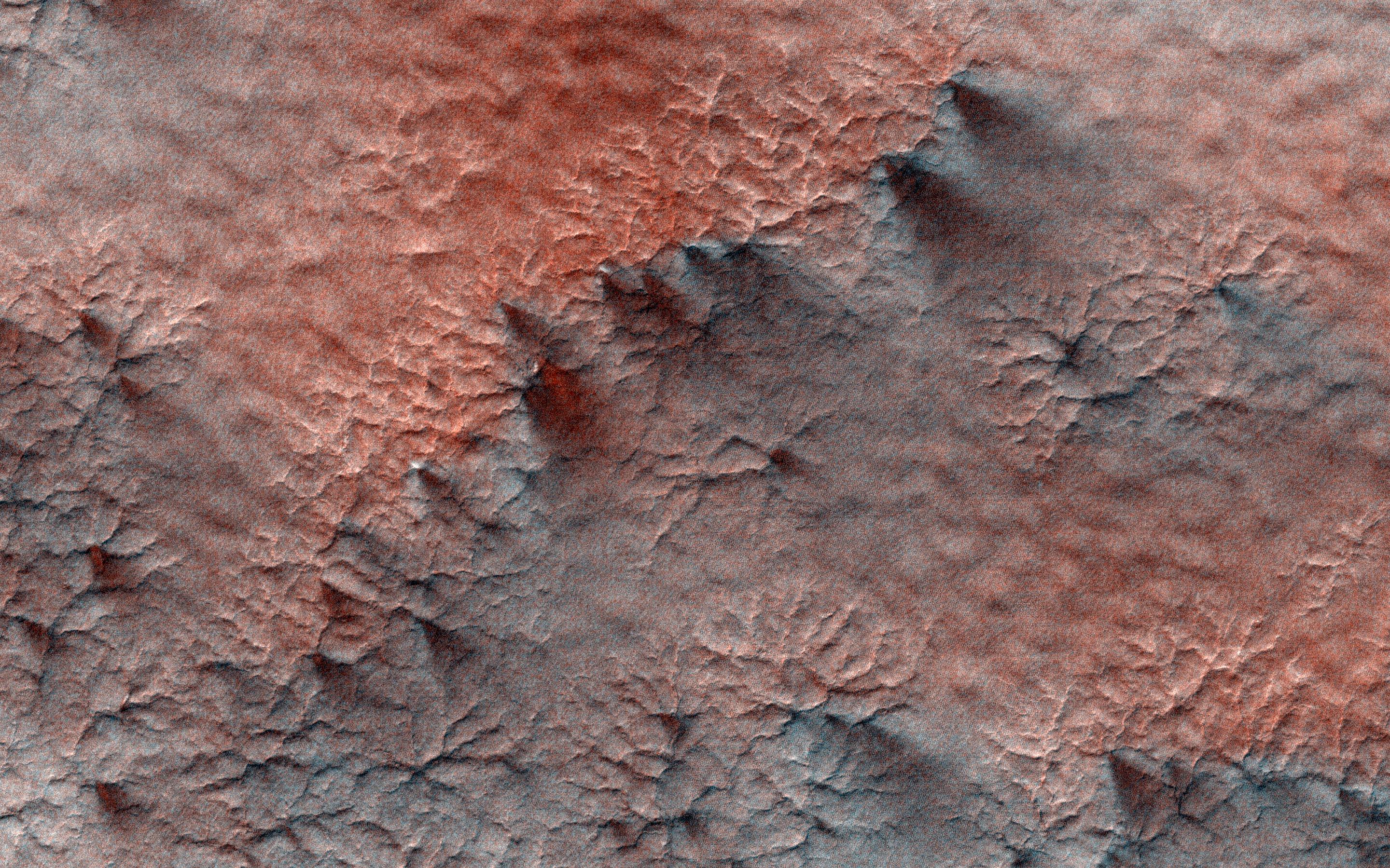
-
PIA08395:
-
A Nine Kilometer Impact Crater and Its Central Peak
Full Resolution:
TIFF
(15.56 MB)
JPEG
(1.096 MB)
|
|
|
2017-02-08 |
Mars
|
Mars Reconnaissance Orbiter (MRO)
|
HiRISE
|
1992x1328x1 |
|
-
PIA21267:
-
Mars Reconnaissance Orbiter Observes Changes

Full Resolution:
TIFF
(2.19 MB)
JPEG
(494.5 kB)
|
|
|
2017-02-07 |
Mars
|
Mars Reconnaissance Orbiter (MRO)
|
HiRISE
|
2736x1824x3 |
|
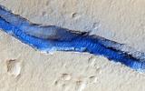
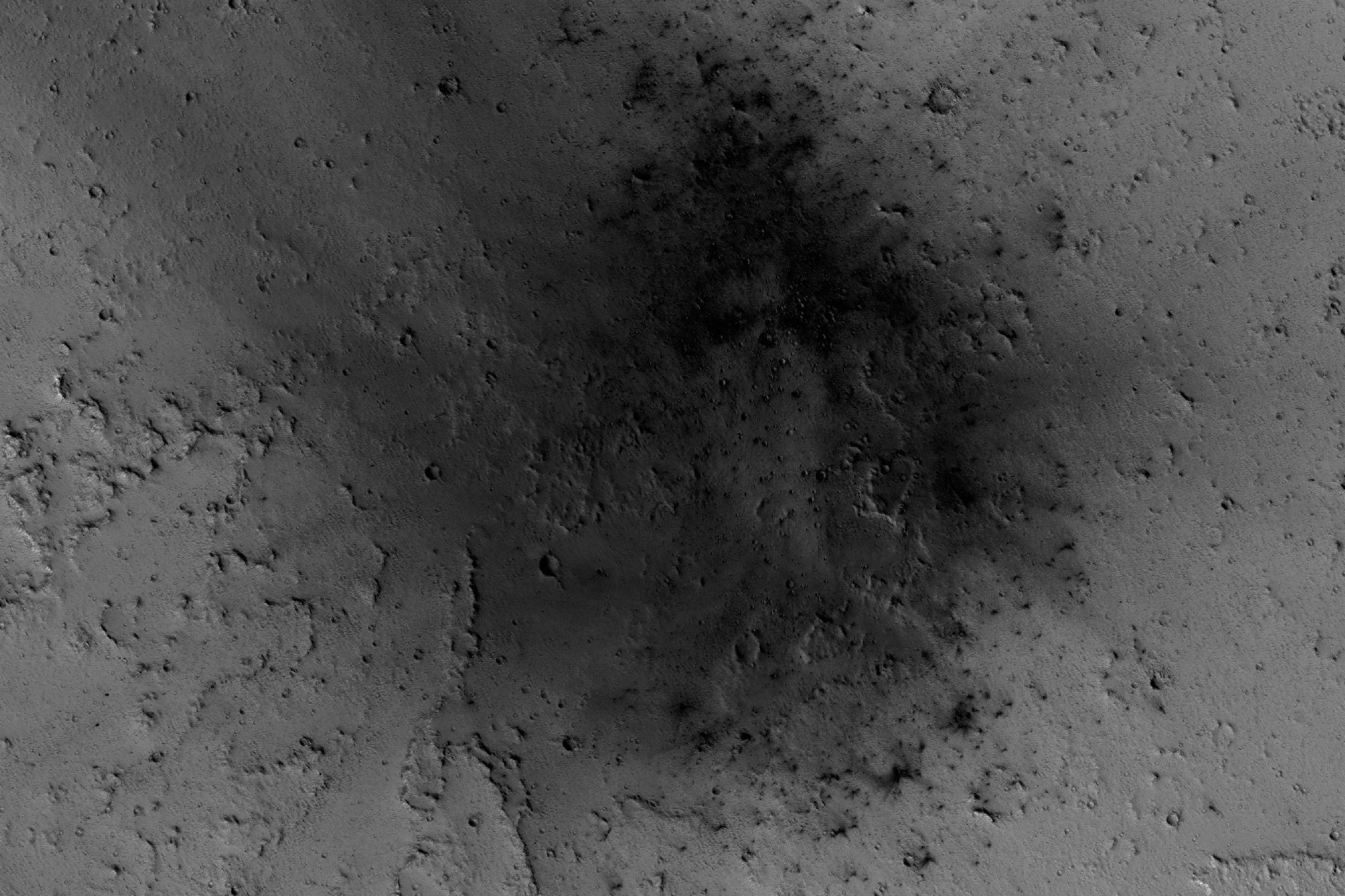
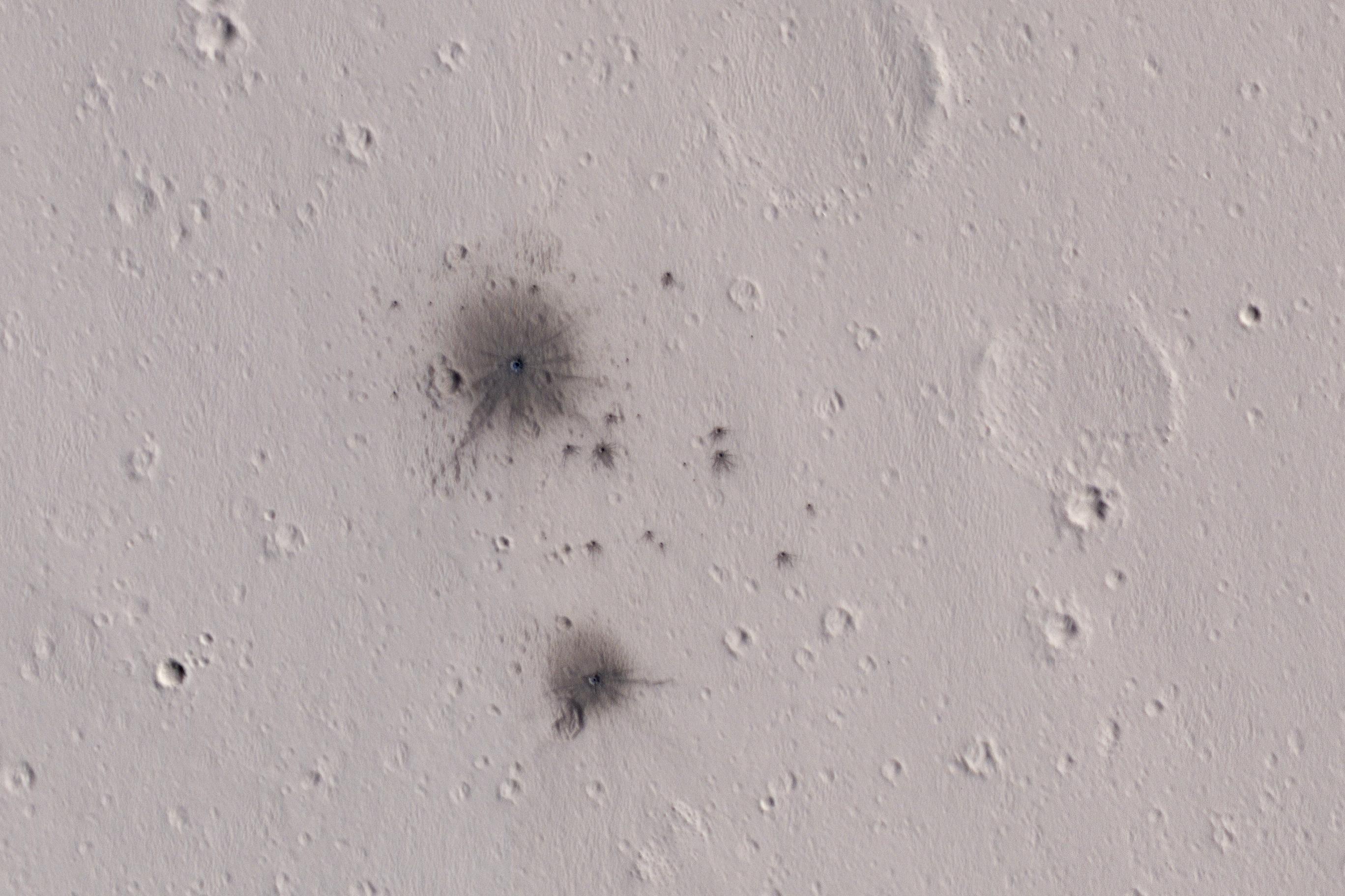
-
PIA11176:
-
A Recent Cluster of Impacts
Full Resolution:
TIFF
(11.27 MB)
JPEG
(583.1 kB)
|
|
|
2017-02-03 |
Mars
|
Mars Reconnaissance Orbiter (MRO)
|
HiRISE
|
4500x3000x3 |
|
-
PIA11178:
-
The Contrasting Colors of Crater Dunes and Gullies
Full Resolution:
TIFF
(40.52 MB)
JPEG
(2.41 MB)
|
|
|
2017-02-02 |
Mars
|
Mars Reconnaissance Orbiter (MRO)
|
HiRISE
|
4500x3000x3 |
|
-
PIA11179:
-
Hard Knocks in Tyrrhena Terra
Full Resolution:
TIFF
(40.52 MB)
JPEG
(2.694 MB)
|
|
|
2017-02-01 |
Mars
|
Mars Reconnaissance Orbiter (MRO)
|
HiRISE
|
4500x3000x3 |
|
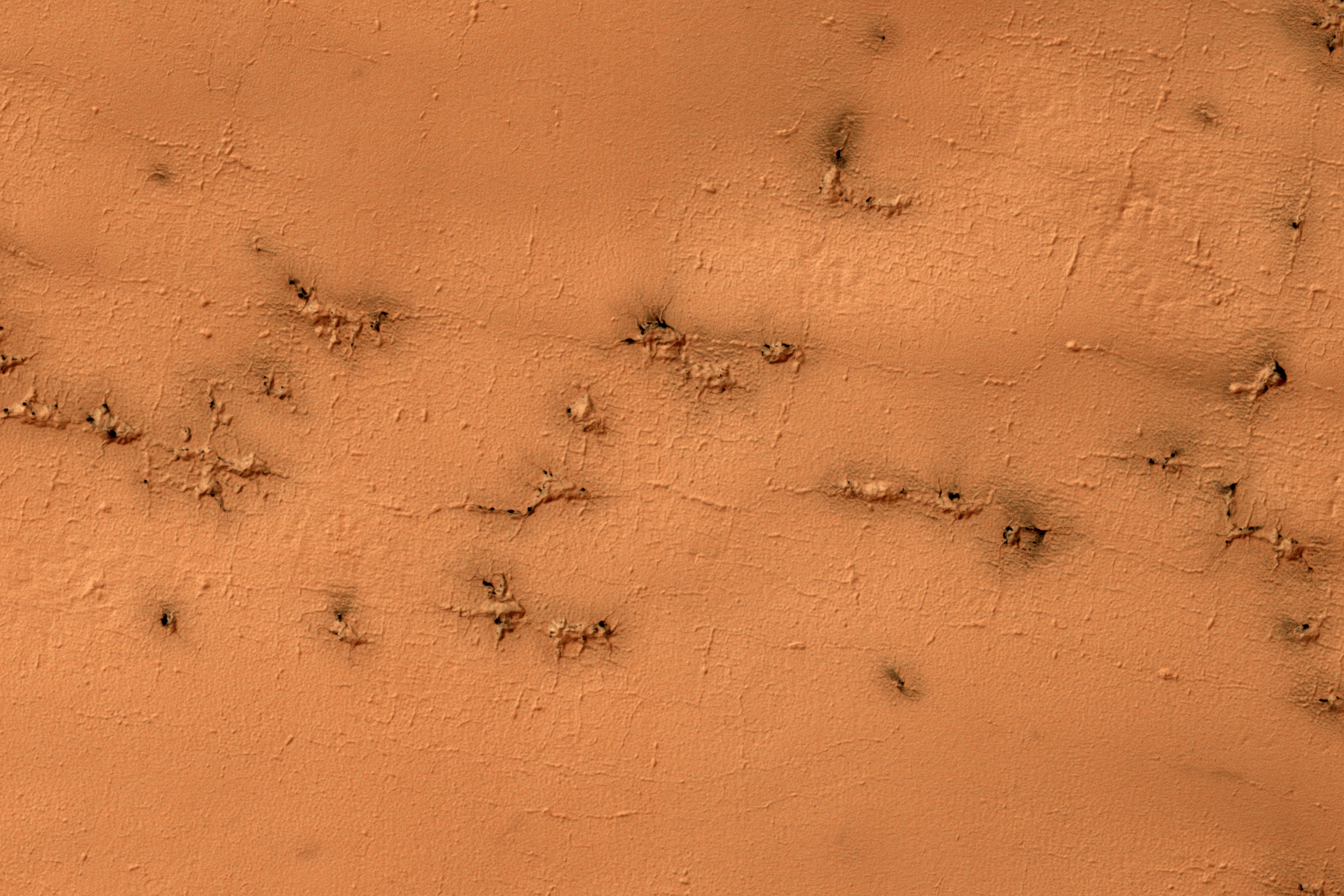
-
PIA11180:
-
Raining Rocks
Full Resolution:
TIFF
(40.52 MB)
JPEG
(2.174 MB)
|
|
|
2017-02-01 |
Mars
|
Mars Reconnaissance Orbiter (MRO)
|
HiRISE
|
2880x1800x3 |
|
-
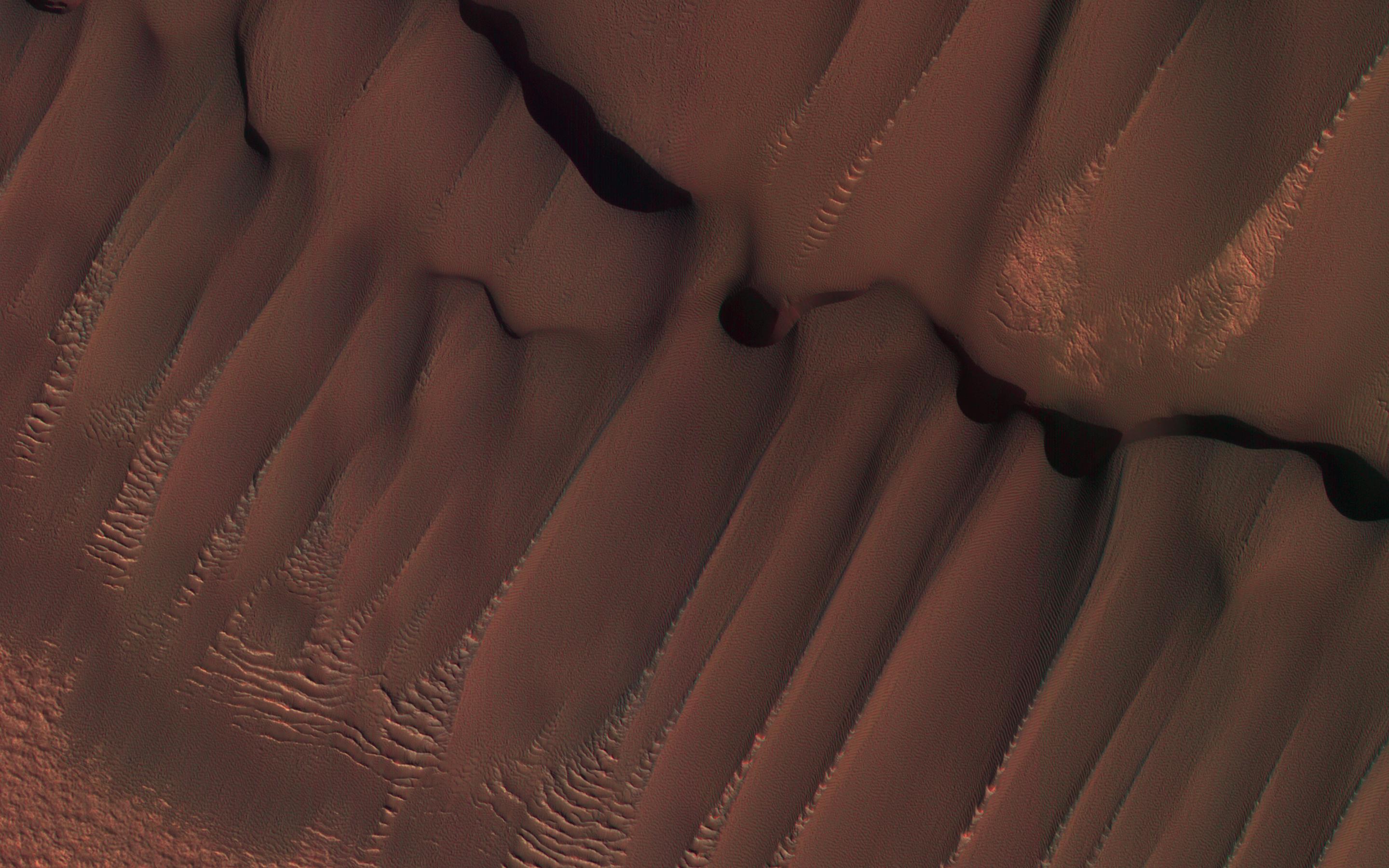
PIA11181:
-
Dunes in Northern Summer
Full Resolution:
TIFF
(14.91 MB)
JPEG
(580.3 kB)
|
|
|
2017-01-27 |
Mars
|
Mars Reconnaissance Orbiter (MRO)
|
HiRISE
|
4500x3000x3 |
|
-
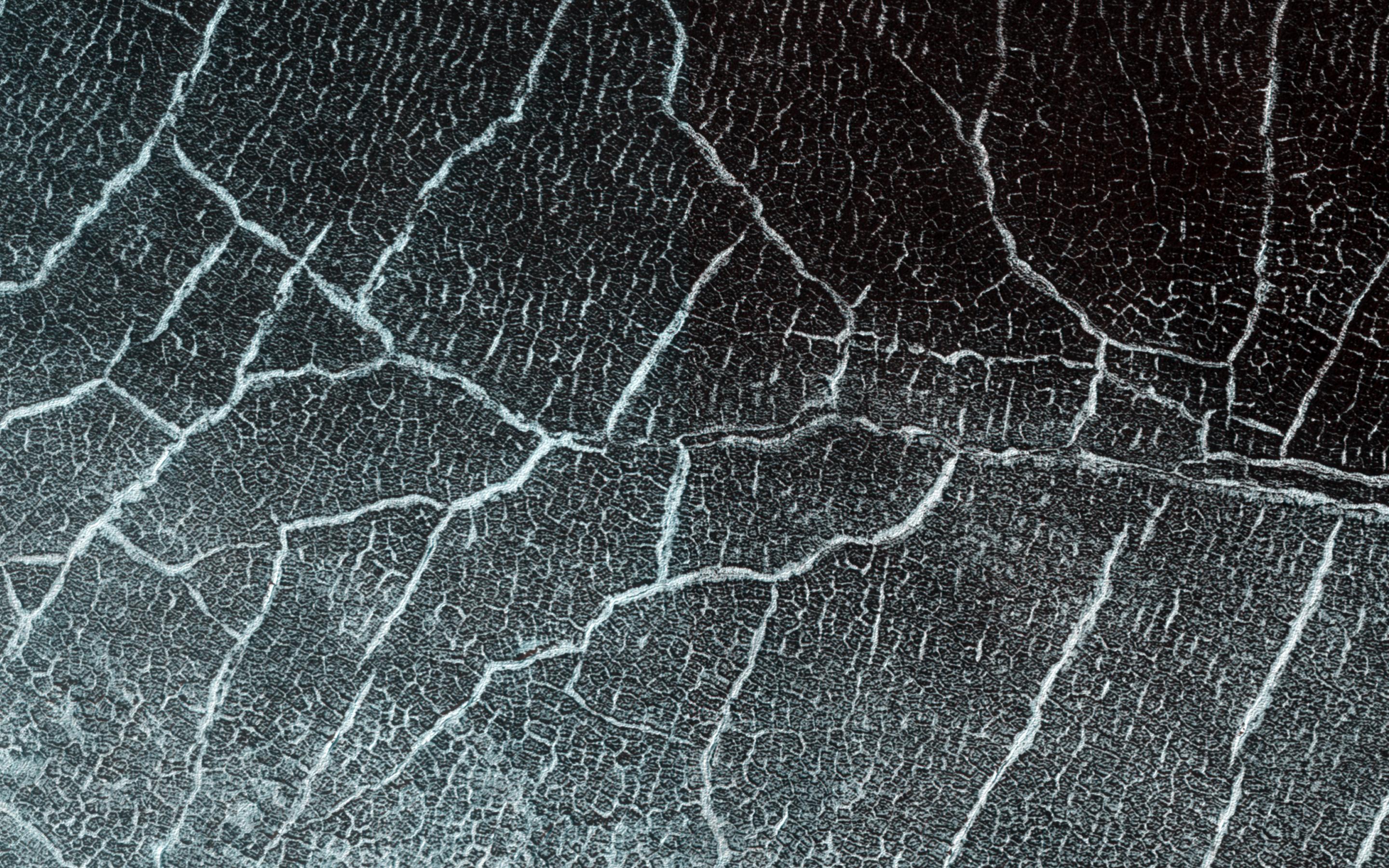
PIA11238:
-
Rectangles with Wiggly Sides
Full Resolution:
TIFF
(40.52 MB)
JPEG
(2.842 MB)
|
|
|
2017-01-26 |
Mars
|
Mars Reconnaissance Orbiter (MRO)
|
HiRISE
|
4500x3000x1 |
|
-
PIA11704:
-
Pits and Channels of Hebrus Valles
Full Resolution:
TIFF
(13.52 MB)
JPEG
(2.535 MB)
|
|
|
2017-01-25 |
Earth
|
Mars Reconnaissance Orbiter (MRO)
|
|
4608x3456x3 |

|
-
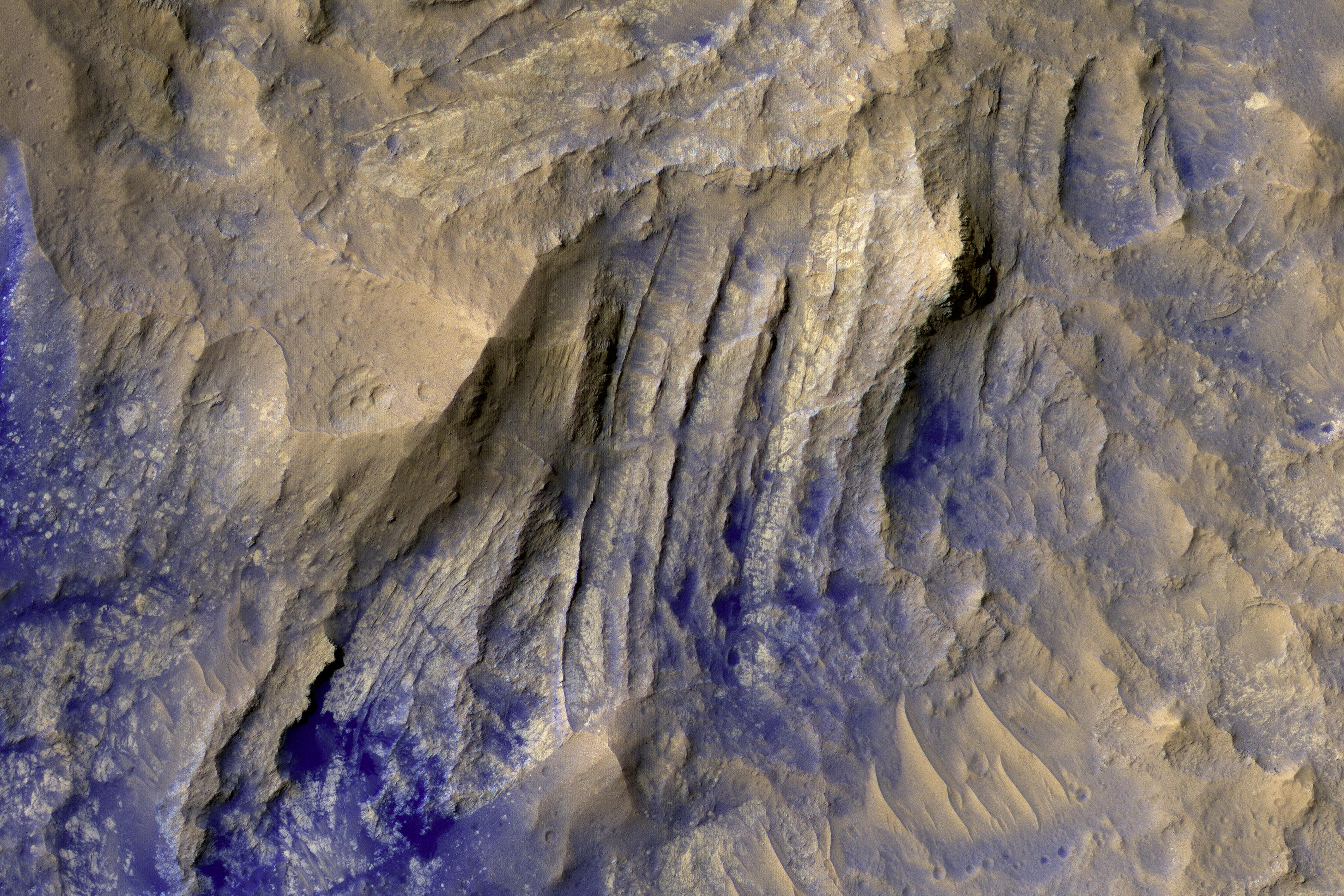
PIA21266:
-
'Wing' Dike of Hardened Lava in New Mexico
Full Resolution:
TIFF
(39.07 MB)
JPEG
(1.569 MB)
|
|
|
2017-01-25 |
Mars
|
Mars Reconnaissance Orbiter (MRO)
|
HiRISE
|
1062x1855x3 |
|
-
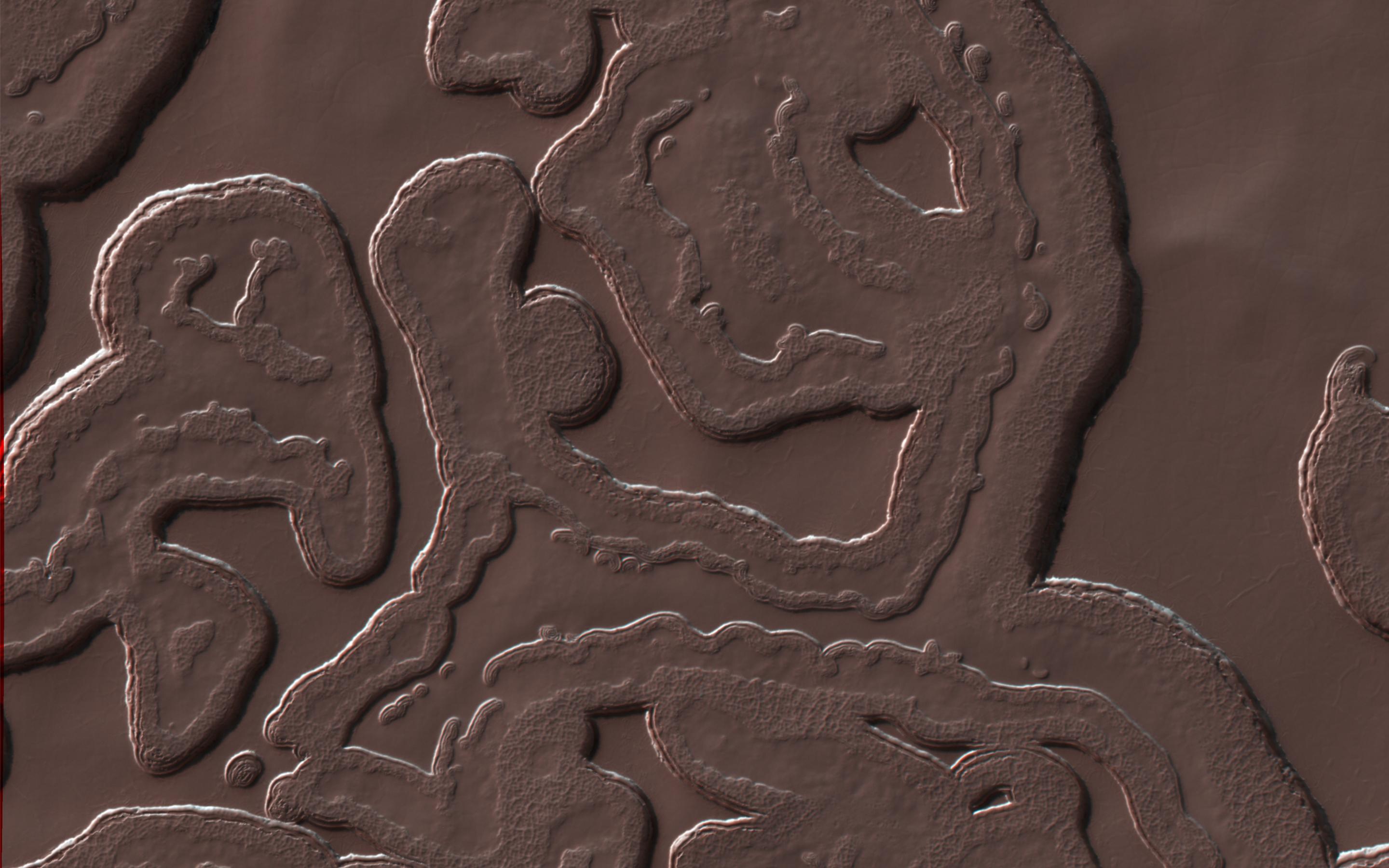
PIA21265:
-
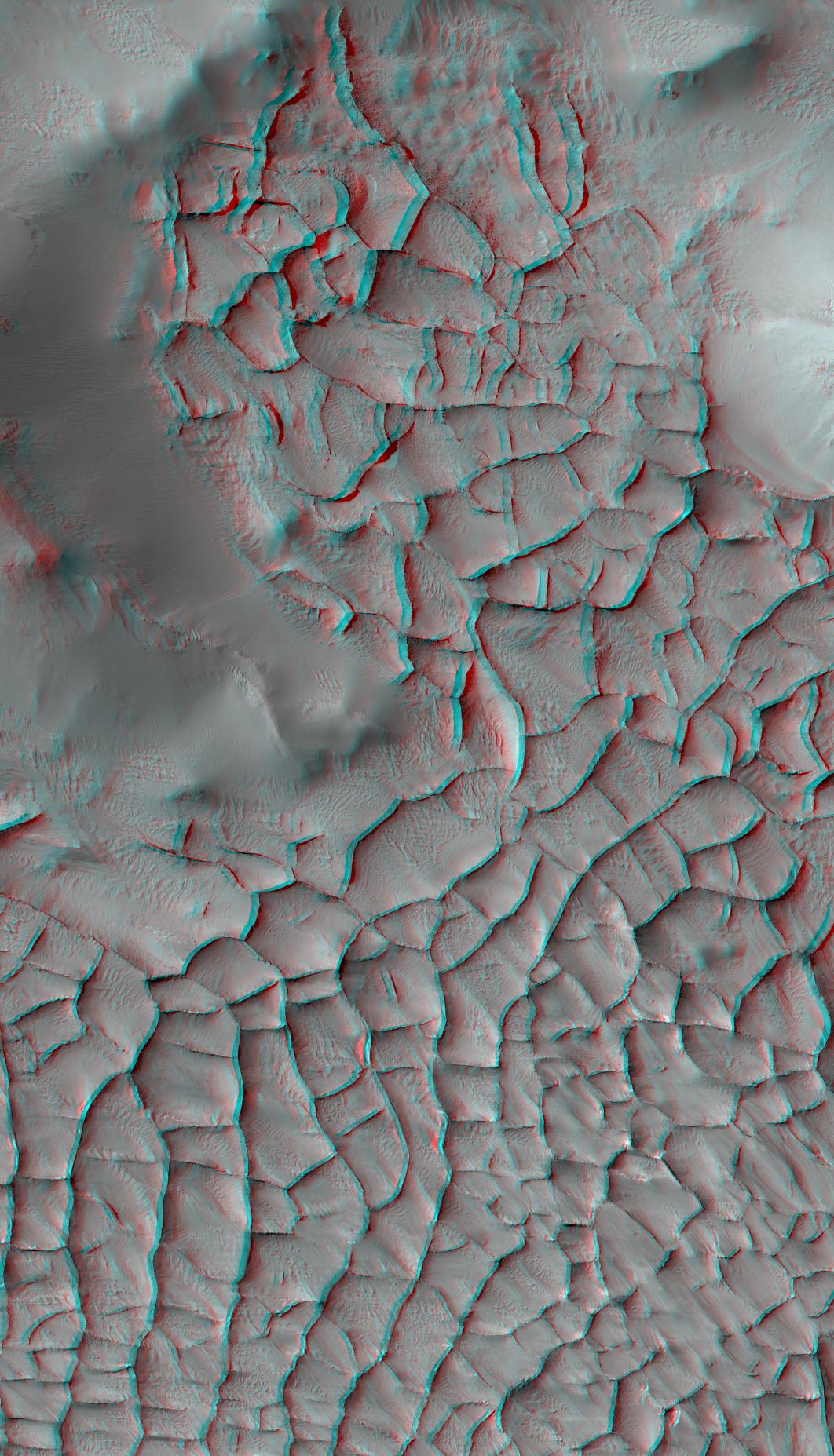
Blade-Like Martian Walls Outline Polygons (Stereo)
Full Resolution:
TIFF
(5.31 MB)
JPEG
(331.2 kB)
|
|
|
2017-01-25 |
Mars
|
Mars Reconnaissance Orbiter (MRO)
|
HiRISE
|
2159x1056x3 |
|
-
PIA21264:
-
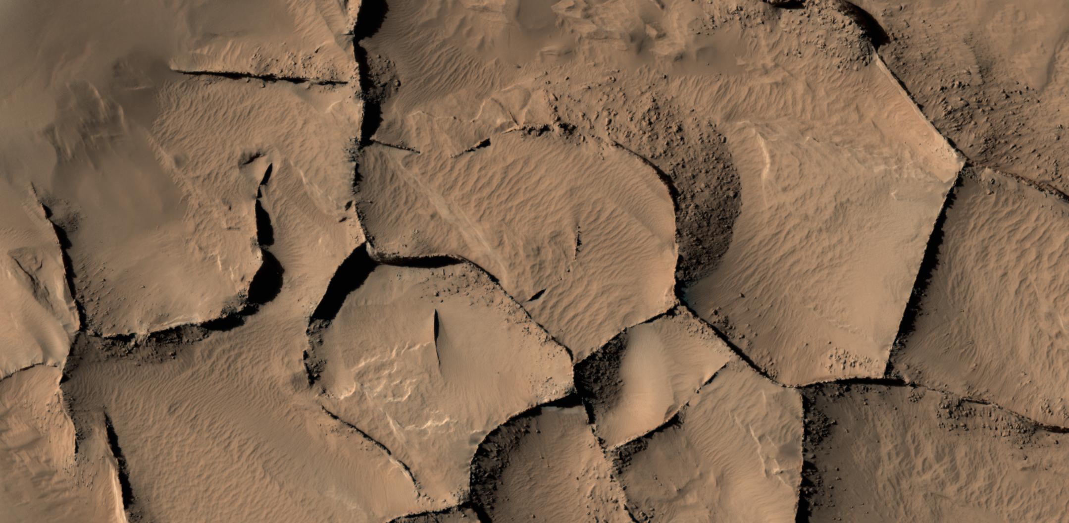
Blade-Like Martian Walls Outline Polygons
Full Resolution:
TIFF
(5.927 MB)
JPEG
(271.4 kB)
|
|
|
2017-01-25 |
Mars
|
Mars Reconnaissance Orbiter (MRO)
|
HiRISE
|
2880x1800x3 |
|
-
PIA11705:
-
Contact between Two Distinct Types of Bedrock Northwest of Hellas Planitia
Full Resolution:
TIFF
(15.56 MB)
JPEG
(998.8 kB)
|
|
|
2017-01-24 |
Mars
|
Mars Reconnaissance Orbiter (MRO)
|
HiRISE
|
4500x3000x3 |

|
-
PIA11706:
-
How Gas Carves Channels
Full Resolution:
TIFF
(40.52 MB)
JPEG
(2.754 MB)
|
|
|
2017-01-20 |
Mars
|
Mars Reconnaissance Orbiter (MRO)
|
HiRISE
|
4500x3000x3 |

|
-
PIA12178:
-
The Beauty of Layered Stratigraphy
Full Resolution:
TIFF
(40.52 MB)
JPEG
(2.705 MB)
|
|
|
2017-01-19 |
Mars
|
Mars Reconnaissance Orbiter (MRO)
|
HiRISE
|
4500x3000x3 |

|
-
PIA12289:
-
The Changing Dunes of Wirtz Crater
Full Resolution:
TIFF
(40.52 MB)
JPEG
(2.437 MB)
|
|
|
2017-01-18 |
Mars
|
Mars Reconnaissance Orbiter (MRO)
|
HiRISE
|
4500x3000x3 |
|
-
PIA12291:
-
Bedrock Exhumed from the Deep
Full Resolution:
TIFF
(38.2 MB)
JPEG
(2.161 MB)
|
|
|
2017-01-17 |
Mars
|
Mars Reconnaissance Orbiter (MRO)
|
HiRISE
|
4500x3000x3 |
|
-
PIA12328:
-
Crater with Exposed Layers
Full Resolution:
TIFF
(40.16 MB)
JPEG
(2.299 MB)
|
|
|
2017-01-13 |
Mars
|
Mars Reconnaissance Orbiter (MRO)
|
HiRISE
|
2880x1800x3 |
|
-
PIA12968:
-
Smooth and Fractured Deposits in Eridania Valleys
Full Resolution:
TIFF
(15.56 MB)
JPEG
(1.203 MB)
|
|
|
2017-01-12 |
Mars
|
Mars Reconnaissance Orbiter (MRO)
|
HiRISE
|
2880x1800x3 |
|
-
PIA13078:
-
Well-Preserved Impact Ejecta and Impact Melt-Rich Deposits in Terra Sabaea
Full Resolution:
TIFF
(15.02 MB)
JPEG
(785.4 kB)
|
|
|
2017-01-11 |
Mars
|
Mars Reconnaissance Orbiter (MRO)
|
HiRISE
|
2880x1800x3 |
|
-
PIA13151:
-
Wide, Branching Channels
Full Resolution:
TIFF
(15.56 MB)
JPEG
(1.306 MB)
|
|
|
2017-01-10 |
Mars
|
Mars Reconnaissance Orbiter (MRO)
|
HiRISE
|
2880x1800x1 |
|
-
PIA13181:
-
Muddy Ejecta Flow
Full Resolution:
TIFF
(5.191 MB)
JPEG
(1.387 MB)
|
|
|
2017-01-09 |
Mars
|
Mars Reconnaissance Orbiter (MRO)
|
HiRISE
|
2880x1800x3 |
|
-
PIA13485:
-
Eroded Scallops with Layers
Full Resolution:
TIFF
(15.56 MB)
JPEG
(1.153 MB)
|
|
|
2017-01-06 |
Earth
|
Mars Reconnaissance Orbiter (MRO)
|
HiRISE
|
657x358x3 |
|
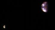
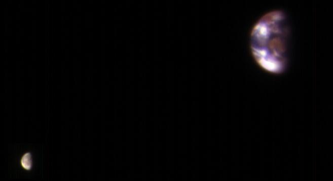
-
PIA21260:
-
Earth and Its Moon, as Seen From Mars
Full Resolution:
TIFF
(213.9 kB)
JPEG
(7.02 kB)
|
|
|
2017-01-05 |
Mars
|
Mars Reconnaissance Orbiter (MRO)
|
HiRISE
|
2880x1800x3 |
|
-
PIA15149:
-
Raised Bedrock in Terra Cimmeria
Full Resolution:
TIFF
(15.56 MB)
JPEG
(734 kB)
|
|
|
2017-01-03 |
Mars
|
Mars Reconnaissance Orbiter (MRO)
|
HiRISE
|
2880x1800x3 |
|
-
PIA14455:
-
Light-Toned Layering in a Labyrinthus Noctis Pit
Full Resolution:
TIFF
(15.56 MB)
JPEG
(1.026 MB)
|
|
|
2017-01-02 |
Mars
|
Mars Reconnaissance Orbiter (MRO)
|
HiRISE
|
2880x1800x3 |

|
-
PIA14454:
-
Hues in a Crater Slope
Full Resolution:
TIFF
(15.56 MB)
JPEG
(743.1 kB)
|
|
|
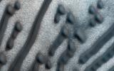
2016-12-21 |
Mars
|
Mars Reconnaissance Orbiter (MRO)
|
HiRISE
|
2880x1800x3 |
|
-
PIA14453:
-
Soffen Crater Floor
Full Resolution:
TIFF
(15.56 MB)
JPEG
(692.6 kB)
|
|
|
2016-12-21 |
Mars
|
Mars Reconnaissance Orbiter (MRO)
|
HiRISE
|
2880x1800x3 |
|
-
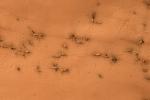
PIA14452:
-
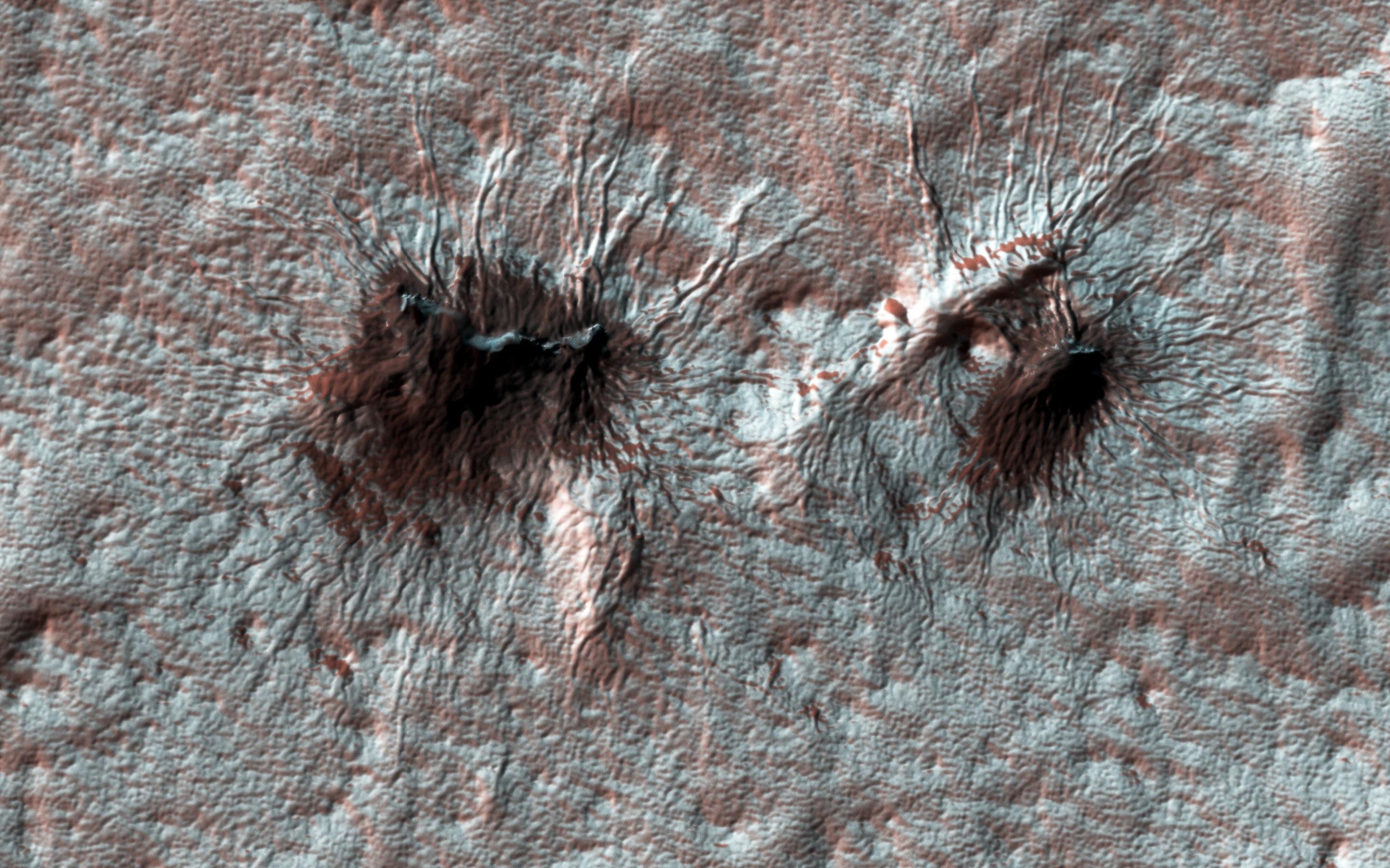
Spiders on Mounds
Full Resolution:
TIFF
(15.56 MB)
JPEG
(1.445 MB)
|
|
|
2016-12-21 |
Mars
|
Mars Reconnaissance Orbiter (MRO)
|
HiRISE
|
2880x1800x1 |
|
-
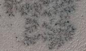
PIA14451:
-
Lace on Mars
Full Resolution:
TIFF
(5.191 MB)
JPEG
(1.415 MB)
|
|
|
2016-12-21 |
Mars
|
Mars Reconnaissance Orbiter (MRO)
|
HiRISE
|
2880x1800x3 |
|
-
PIA14450:
-
Secondary Craters
Full Resolution:
TIFF
(13.96 MB)
JPEG
(384.2 kB)
|
|
|
2016-12-20 |
Mars
|
Mars Reconnaissance Orbiter (MRO)
|
HiRISE
|
2110x1745x3 |
|
-
PIA21258:
-
Possible Development Stages of Martian 'Spiders'
Full Resolution:
TIFF
(5.708 MB)
JPEG
(557 kB)
|
|
|
2016-12-20 |
Mars
|
Mars Reconnaissance Orbiter (MRO)
|
HiRISE
|
369x302x1 |
|
-
PIA21257:
-
'Baby Spider': Growth of a Martian Trough Network
Full Resolution:
TIFF
(111.8 kB)
JPEG
(24.75 kB)
|
|
|
2016-12-14 |
Mars
|
Mars Reconnaissance Orbiter (MRO)
|
HiRISE
|
2880x1800x3 |

|
-
PIA21274:
-
Hematite-Rich Deposits in Capri Chasma
Full Resolution:
TIFF
(13.86 MB)
JPEG
(446.5 kB)
|
|
|
2016-12-14 |
Mars
|
Mars Reconnaissance Orbiter (MRO)
|
HiRISE
|
2880x1800x3 |
|
-
PIA21273:
-
Possible Layers on Floor of Suzhi Crater
Full Resolution:
TIFF
(15.56 MB)
JPEG
(998.8 kB)
|
|
|
2016-12-14 |
Mars
|
Mars Reconnaissance Orbiter (MRO)
|
HiRISE
|
2880x1800x1 |
|
-
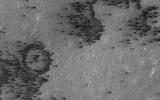
PIA21272:
-
Slope Streaks or RSL?
Full Resolution:
TIFF
(4.836 MB)
JPEG
(569.6 kB)
|
|
|
2016-12-14 |
Mars
|
Mars Reconnaissance Orbiter (MRO)
|
HiRISE
|
2880x1800x1 |
|
-
PIA21271:
-
Fans on Crater Rims
Full Resolution:
TIFF
(5.191 MB)
JPEG
(1.075 MB)
|
|
|
2016-12-13 |
Mars
|
Mars Reconnaissance Orbiter (MRO)
Mars Science Laboratory (MSL)
|
HiRISE
MAHLI
|
3300x2550x3 |
|
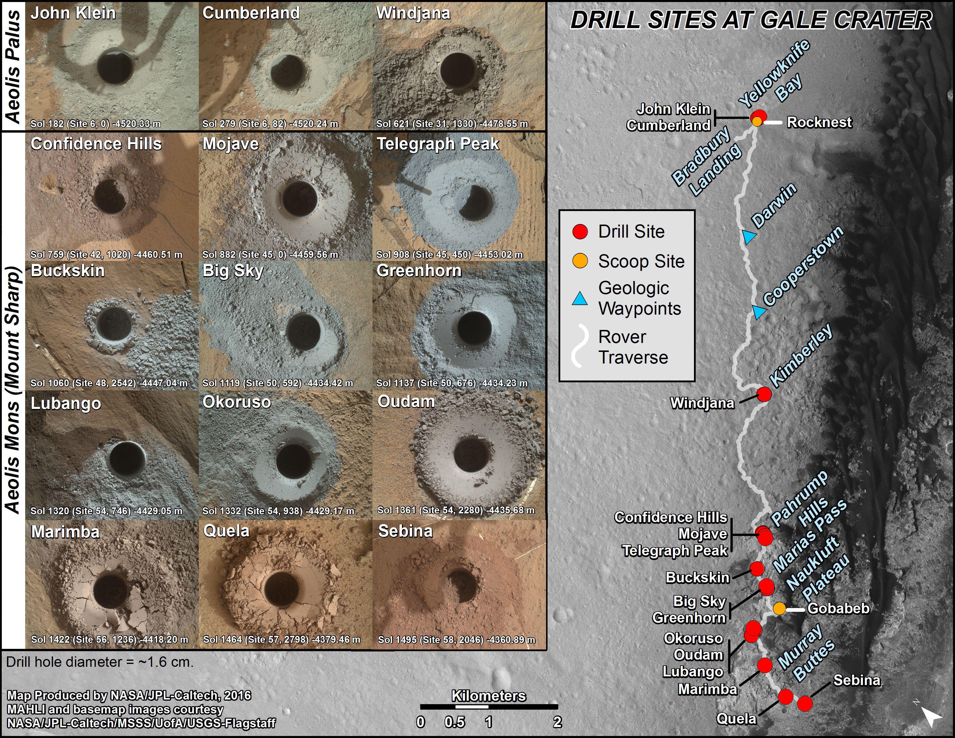
-
PIA21254:
-
Curiosity's Rock or Soil Sampling Sites on Mars, Through November 2016
Full Resolution:
TIFF
(21.14 MB)
JPEG
(2.213 MB)
|
|
|
2016-12-13 |
Mars
|
Mars Reconnaissance Orbiter (MRO)
Mars Science Laboratory (MSL)
|
ChemCam
HiRISE
|
2809x2025x3 |
|
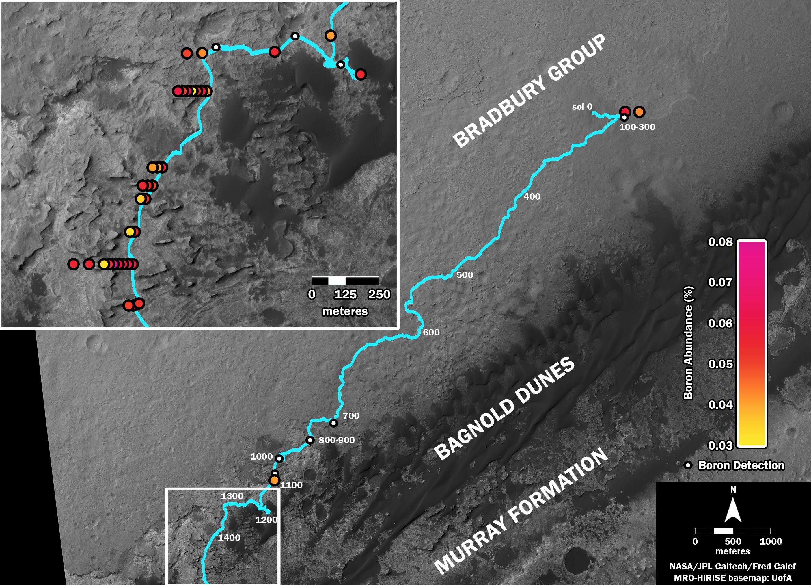
-
PIA21150:
-
Where's Boron? Mars Rover Detects It
Full Resolution:
TIFF
(7.738 MB)
JPEG
(838.4 kB)
|
|
|
2016-12-13 |
Mars
|
Mars Reconnaissance Orbiter (MRO)
Mars Science Laboratory (MSL)
|
HiRISE
|
1456x1125x3 |
|
-
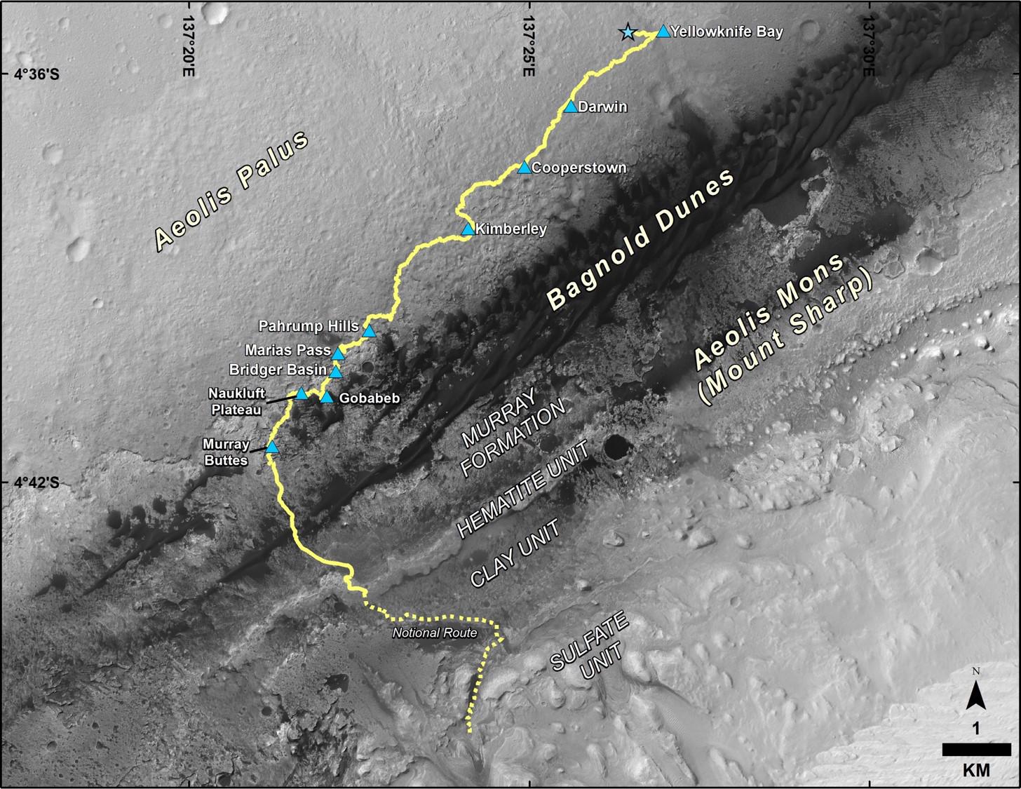
PIA21144:
-
Late 2016 Map of NASA's Curiosity Mars Rover Mission
Full Resolution:
TIFF
(2.946 MB)
JPEG
(288 kB)
|
|
|
2016-12-07 |
Mars
|
Mars Reconnaissance Orbiter (MRO)
|
HiRISE
|
2880x1800x3 |
|
-
PIA21217:
-
Colorful Bedrock Exposed in a Landslide Scarp
Full Resolution:
TIFF
(15.56 MB)
JPEG
(892.3 kB)
|
|
|
2016-12-07 |
Mars
|
Mars Reconnaissance Orbiter (MRO)
|
HiRISE
|
2880x1800x3 |
|
-
PIA21216:
-
The Coolest Landscape on Mars (or Earth)
Full Resolution:
TIFF
(10.51 MB)
JPEG
(375.8 kB)
|
|
|
2016-12-07 |
Mars
|
Mars Reconnaissance Orbiter (MRO)
|
HiRISE
|
2880x1800x3 |
|
-
PIA21215:
-
Cracks in a Crater's Ice
Full Resolution:
TIFF
(15.56 MB)
JPEG
(1.168 MB)
|
|
|
2016-12-07 |
Mars
|
Mars Reconnaissance Orbiter (MRO)
|
HiRISE
|
2880x1800x3 |
|
-
PIA21214:
-
Painting with Frost
Full Resolution:
TIFF
(15.56 MB)
JPEG
(806.3 kB)
|
|
|
2016-11-22 |
Mars
|
Mars Reconnaissance Orbiter (MRO)
|
Shallow Subsurface Radar (SHARAD)
|
596x286x3 |
|
-
PIA21138:
-
Location of Large Subsurface Water-Ice Deposit in Utopia Planitia, Mars
Full Resolution:
TIFF
(322.1 kB)
JPEG
(44.46 kB)
|
|
|
2016-11-22 |
Mars
|
Mars Reconnaissance Orbiter (MRO)
|
Shallow Subsurface Radar (SHARAD)
|
602x122x1 |

|
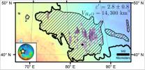
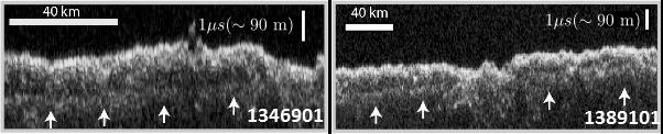
-
PIA21137:
Radargrams Indicating Ice-Rich Subsurface Deposit
Full Resolution:
TIFF
(73.74 kB)
JPEG
(21.33 kB)
|
|
|
2016-11-22 |
Mars
|
Mars Reconnaissance Orbiter (MRO)
|
HiRISE
|
640x398x1 |
|
-
PIA21136:
-
Scalloped Terrain Led to Finding of Buried Ice on Mars
Full Resolution:
TIFF
(255.2 kB)
JPEG
(57.89 kB)
|
|
|
2016-11-15 |
Mars
|
Mars Reconnaissance Orbiter (MRO)
|
HiRISE
|
763x968x3 |
|
-
PIA21135:
-
Schiaparelli Impact Site on Mars, Stereo
Full Resolution:
TIFF
(1.385 MB)
JPEG
(70.24 kB)
|
|
|
2016-11-09 |
Mars
|
Mars Reconnaissance Orbiter (MRO)
|
HiRISE
|
2048x1536x3 |
|
-
PIA21206:
-
A Glimpse into History
Full Resolution:
TIFF
(9.44 MB)
JPEG
(889.5 kB)
|
|
|
2016-11-09 |
Mars
|
Mars Reconnaissance Orbiter (MRO)
|
HiRISE
|
2048x1536x3 |
|
-
PIA21205:
-
Exposed Fractured Bedrock in the Central Pit of a Crater
Full Resolution:
TIFF
(9.44 MB)
JPEG
(711.7 kB)
|
|
|
2016-11-09 |
Mars
|
Mars Reconnaissance Orbiter (MRO)
|
HiRISE
|
2048x1536x3 |
|
-
PIA21204:
-
Rafted Rock
Full Resolution:
TIFF
(9.44 MB)
JPEG
(713.5 kB)
|
|
|
2016-11-09 |
Mars
|
Mars Reconnaissance Orbiter (MRO)
|
HiRISE
|
2048x1536x3 |
|
-
PIA21203:
-
Trundling Boulders
Full Resolution:
TIFF
(9.44 MB)
JPEG
(995.7 kB)
|
|
|
2016-11-03 |
Mars
|
Mars Reconnaissance Orbiter (MRO)
|
HiRISE
|
394x500x3 |

|
-
PIA21132:
-
Schiaparelli Impact Site on Mars, in Color
Full Resolution:
TIFF
(311.1 kB)
JPEG
(20.66 kB)
|
|
|
2016-10-27 |
Mars
|
Mars Reconnaissance Orbiter (MRO)
|
HiRISE
|
4875x5243x1 |

|
-
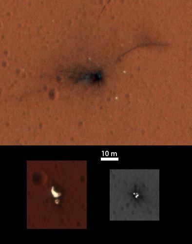
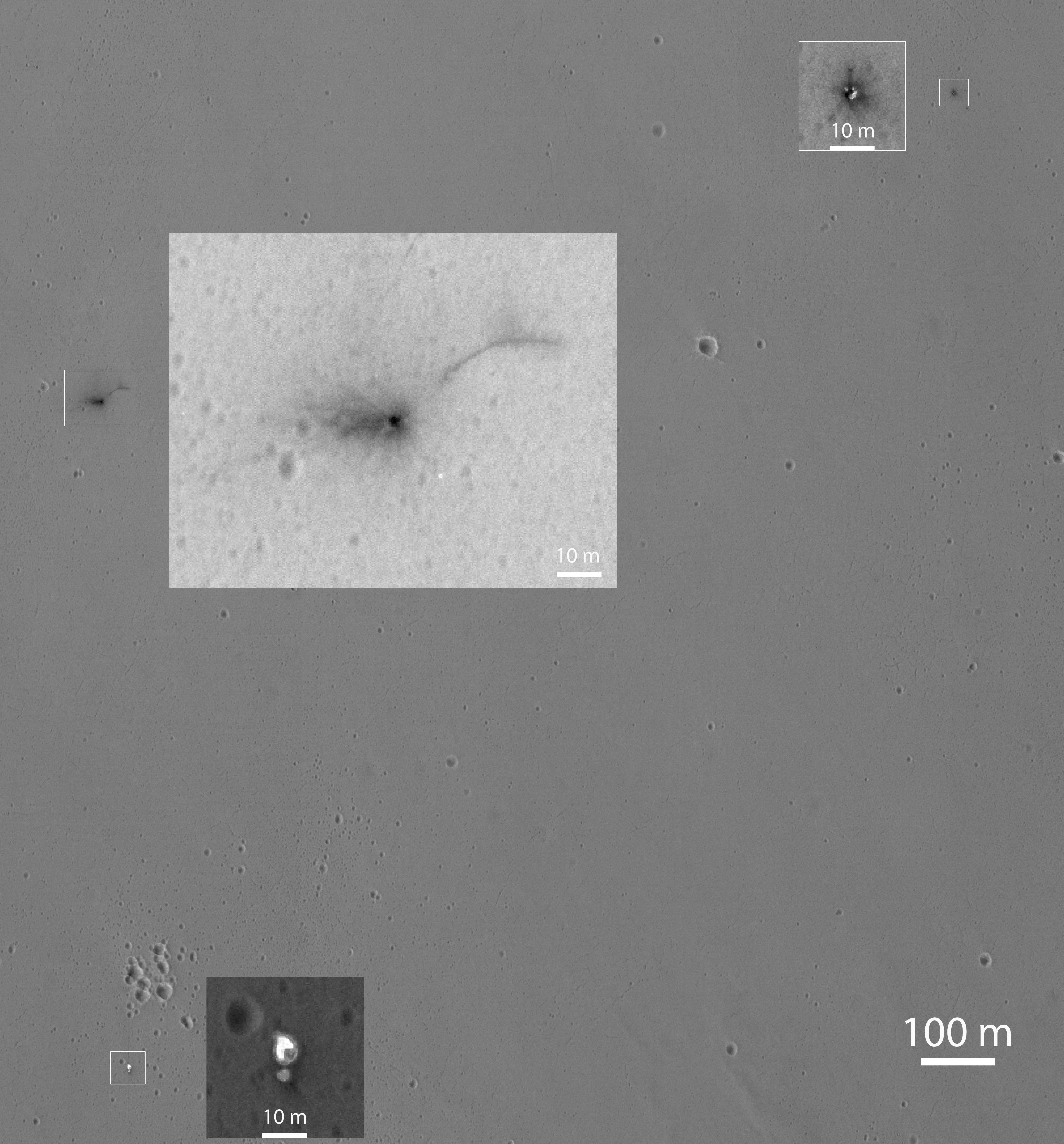
PIA21131:
-
Closer Look at Schiaparelli Impact Site on Mars
Full Resolution:
TIFF
(20.38 MB)
JPEG
(2.661 MB)
|
|
|
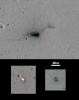
2016-10-21 |
Mars
|
Mars Reconnaissance Orbiter (MRO)
|
CTX
|
1400x788x1 |
|
-
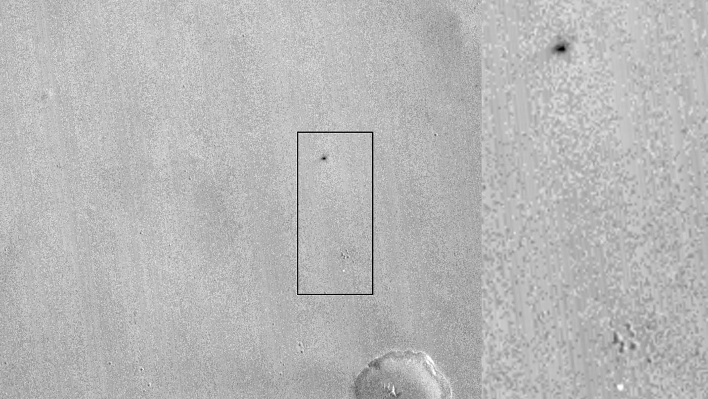
PIA21130:
-
Signs of Schiaparelli Test Lander Seen From Orbit
Full Resolution:
TIFF
(1.057 MB)
JPEG
(162.8 kB)
|
|
|
2016-10-20 |
Mars
|
Mars Reconnaissance Orbiter (MRO)
|
HiRISE
|
1359x804x3 |
|
-
PIA21126:
-
Martian 'Spiders' in Sharper Look, Thanks to Volunteers
Full Resolution:
TIFF
(3.218 MB)
JPEG
(232.4 kB)
|
|
|
2016-10-19 |
Mars
|
Mars Reconnaissance Orbiter (MRO)
|
HiRISE
|
2880x1800x1 |
|
-
PIA21113:
-
Lava That Once Flowed
Full Resolution:
TIFF
(5.191 MB)
JPEG
(1.387 MB)
|
|
|
2016-10-19 |
Mars
|
Mars Reconnaissance Orbiter (MRO)
|
HiRISE
|
2880x1800x3 |
|
-
PIA21112:
-
Wrinkle Ridges and Pit Craters
Full Resolution:
TIFF
(15.56 MB)
JPEG
(1.001 MB)
|
|
|
2016-10-19 |
Mars
|
Mars Reconnaissance Orbiter (MRO)
|
HiRISE
|
2880x1800x3 |
|
-
PIA21111:
-
Wind Carved Rock
Full Resolution:
TIFF
(15.56 MB)
JPEG
(873.1 kB)
|
|
|
2016-10-19 |
Mars
|
Mars Reconnaissance Orbiter (MRO)
|
HiRISE
|
2880x1800x1 |
|
-
PIA21110:
-
Spider Webs
Full Resolution:
TIFF
(5.191 MB)
JPEG
(1.679 MB)
|
|
|
2016-10-07 |
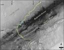
Mars
|
Mars Exploration Rover (MER)
Mars Reconnaissance Orbiter (MRO)
|
HiRISE
|
3200x4880x3 |

|
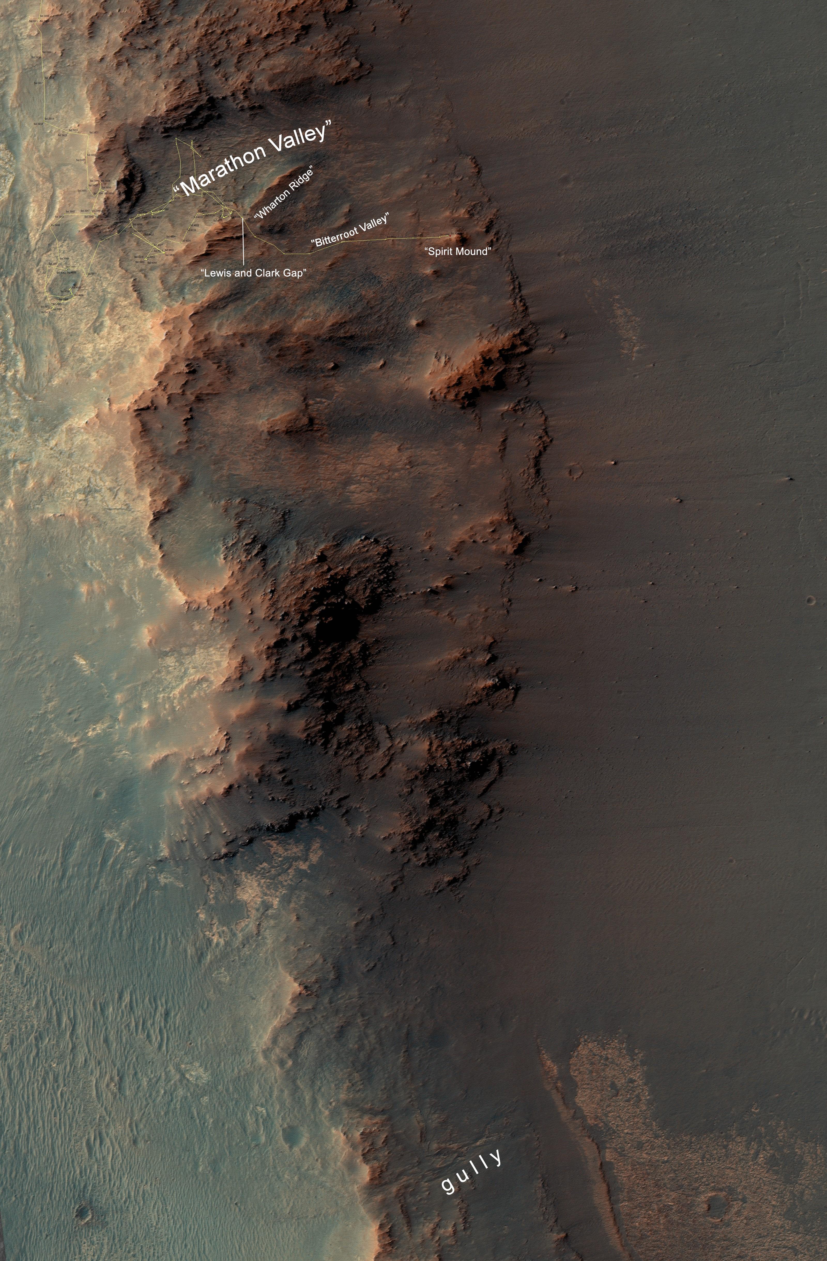
-
PIA20854:
-
From 'Marathon Valley' to Gully on Endeavour Rim
Full Resolution:
TIFF
(41.84 MB)
JPEG
(2.035 MB)
|
|
|
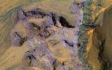
2016-10-05 |
Mars
|
Mars Reconnaissance Orbiter (MRO)
|
HiRISE
|
2880x1800x3 |
|
-
PIA21105:
-
On the Edge of the South Pole Layered Deposit
Full Resolution:
TIFF
(15.56 MB)
JPEG
(795.1 kB)
|
|
|
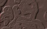
2016-10-05 |
Mars
|
Mars Reconnaissance Orbiter (MRO)
|
HiRISE
|
2880x1800x1 |

|
-
PIA21104:
-
A Long and Winding Channel in Tharsis
Full Resolution:
TIFF
(5.191 MB)
JPEG
(944.1 kB)
|
|
|
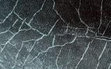
2016-10-05 |
Mars
|
Mars Reconnaissance Orbiter (MRO)
|
HiRISE
|
2880x1800x3 |

|
-
PIA21103:
-
A Transition from Depressed to Inverted Channels in Gorgonum Basin
Full Resolution:
TIFF
(15.56 MB)
JPEG
(896.6 kB)
|
|
|
2016-10-05 |
Mars
|
Mars Reconnaissance Orbiter (MRO)
|
HiRISE
|
2880x1800x3 |
|
-
PIA21102:
-
Deposits along the Northern Wall of Melas Chasma
Full Resolution:
TIFF
(15.56 MB)
JPEG
(1.168 MB)
|
|
|
2016-09-21 |
Mars
|
Mars Reconnaissance Orbiter (MRO)
|
HiRISE
|
2880x1800x1 |

|
-
PIA21066:
-
Intersecting Channels near Olympica Fossae
Full Resolution:
TIFF
(5.087 MB)
JPEG
(853.2 kB)
|
|
|
2016-09-21 |
Mars
|
Mars Reconnaissance Orbiter (MRO)
|
HiRISE
|
2880x1800x3 |
|
-
PIA21065:
-
What Lies Beneath: Surface Patterns of Glacier-Like Landforms
Full Resolution:
TIFF
(15.56 MB)
JPEG
(1.393 MB)
|
|
|
2016-09-21 |
Mars
|
Mars Reconnaissance Orbiter (MRO)
|
HiRISE
|
2880x1800x3 |
|
-
PIA21064:
-
The Wind-Scoured Lava Flows of Pavonis Mons
Full Resolution:
TIFF
(15.4 MB)
JPEG
(549.7 kB)
|
|
|
2016-09-21 |
Mars
|
Mars Reconnaissance Orbiter (MRO)
|
HiRISE
|
2880x1800x3 |
|
-
PIA21063:
-
River of Sand
Full Resolution:
TIFF
(15.56 MB)
JPEG
(972.4 kB)
|
|
|
2016-09-15 |
Mars
|
Mars Reconnaissance Orbiter (MRO)
|
CTX
|
1934x2471x1 |

|
-
PIA20837:
-
Outflow Stream from Relatively Recent Martian Lake
Full Resolution:
TIFF
(4.784 MB)
JPEG
(973.5 kB)
|
|
|
2016-09-08 |
Mars
|
Mars Reconnaissance Orbiter (MRO)
|
HiRISE
|
2880x1800x3 |
|
-
PIA21040:
-
A Human Bird's Eye View of Mars
Full Resolution:
TIFF
(15.56 MB)
JPEG
(986.1 kB)
|
|
|
2016-09-08 |
Mars
|
Mars Reconnaissance Orbiter (MRO)
|
HiRISE
|
2880x1800x1 |
|
-
PIA21039:
-
A Streamlined Form in Lethe Vallis
Full Resolution:
TIFF
(5.191 MB)
JPEG
(1.19 MB)
|
|
|
2016-09-08 |
Mars
|
Mars Reconnaissance Orbiter (MRO)
|
HiRISE
|
2880x1800x3 |
|
-
PIA21038:
-
Frosty Alcoves on Kaiser Crater Dunes
Full Resolution:
TIFF
(12.95 MB)
JPEG
(549.2 kB)
|
|
|
2016-09-08 |
Mars
|
Mars Reconnaissance Orbiter (MRO)
|
HiRISE
|
2880x1800x3 |
|
-
PIA21029:
-
The Color Wonderland of Mawrth Vallis
Full Resolution:
TIFF
(15.56 MB)
JPEG
(1.019 MB)
|
|
|
2016-08-24 |
Mars
|
Mars Reconnaissance Orbiter (MRO)
|
HiRISE
|
2880x1800x1 |
|
-
PIA21023:
-
Ancient Streamlined Islands of the Palos Outflow Channel
Full Resolution:
TIFF
(5.191 MB)
JPEG
(1.097 MB)
|
|
|
2016-08-24 |
Mars
|
Mars Reconnaissance Orbiter (MRO)
|
HiRISE
|
2880x1800x3 |
|
-
PIA21022:
-
North Polar Cap Layers and Ledges
Full Resolution:
TIFF
(15.56 MB)
JPEG
(1.169 MB)
|
|
|
2016-08-24 |
Mars
|
Mars Reconnaissance Orbiter (MRO)
|
HiRISE
|
2880x1800x3 |
|
-
PIA21021:
-
Small Expanded Craters in the Northern Lowlands
Full Resolution:
TIFF
(15.56 MB)
JPEG
(1.068 MB)
|
|
|
2016-07-29 |
Mars
|
Mars Reconnaissance Orbiter (MRO)
|
HiRISE
|
900x1080x3 |

|
-
PIA20763:
-
Adding Composition Data About Mars Gullies
Full Resolution:
TIFF
(2.43 MB)
JPEG
(137.9 kB)
|
|
|
2016-07-15 |
Mars
|
Mars Reconnaissance Orbiter (MRO)
|
HiRISE
|
2880x1800x1 |
|
-
PIA20815:
-
A Meandering Channel on Hellas' Rim
Full Resolution:
TIFF
(5.191 MB)
JPEG
(1.547 MB)
|
|
|
2016-07-15 |
Mars
|
Mars Reconnaissance Orbiter (MRO)
|
HiRISE
|
2880x1800x3 |
|
-
PIA20814:
-
Colorful Bedrock in the Central Uplift of an Impact Crater
Full Resolution:
TIFF
(15.56 MB)
JPEG
(737.1 kB)
|
|
|
2016-07-15 |
Mars
|
Mars Reconnaissance Orbiter (MRO)
|
HiRISE
|
2880x1800x3 |

|
-
PIA20813:
-
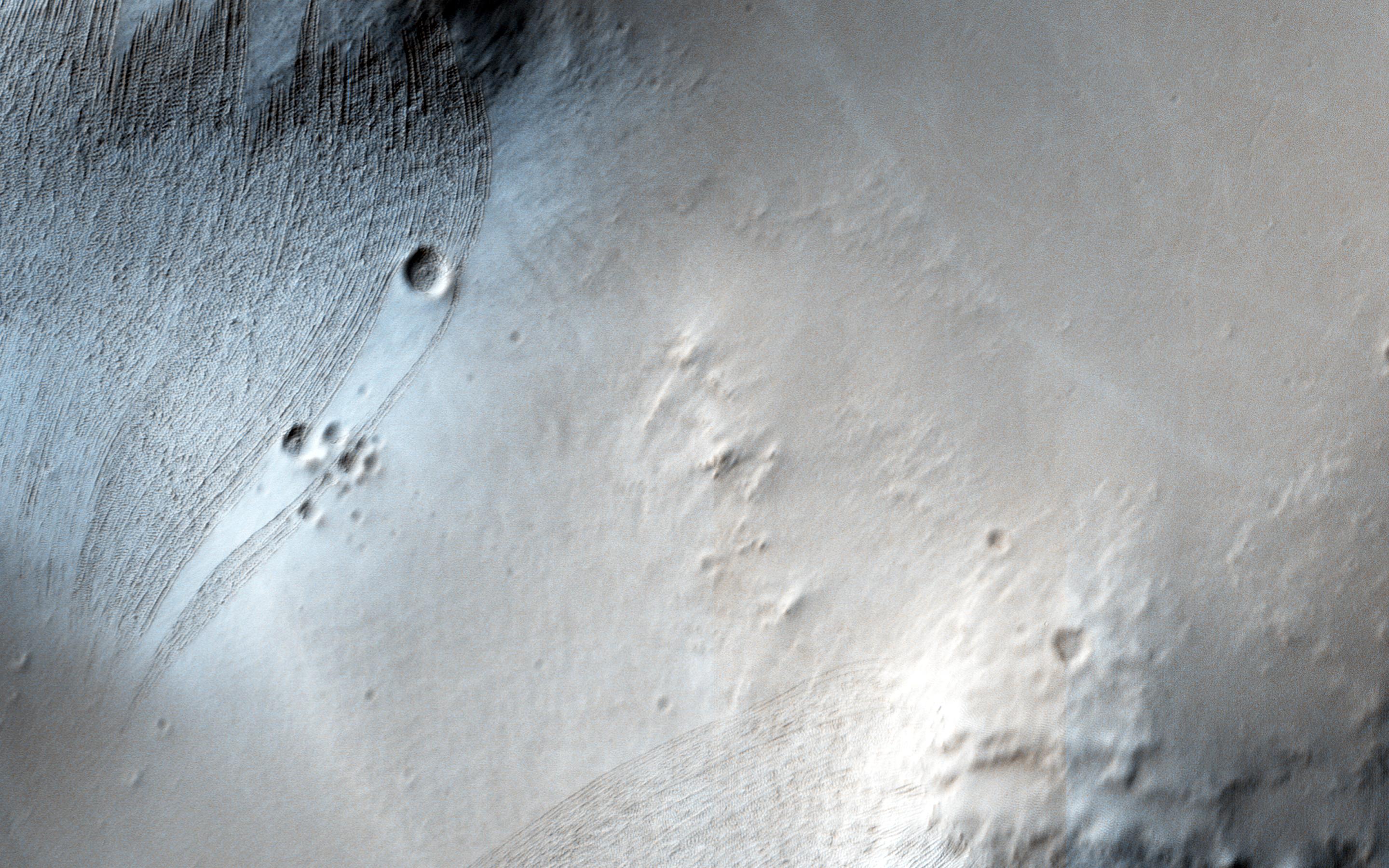
Faulting Mars
Full Resolution:
TIFF
(15.56 MB)
JPEG
(1.093 MB)
|
|
|
2016-07-15 |
Mars
|
Mars Reconnaissance Orbiter (MRO)
|
HiRISE
|
2880x1800x3 |
|
-
PIA20812:
-
Mesas and Pits
Full Resolution:
TIFF
(15.56 MB)
JPEG
(922 kB)
|
|
|
2016-07-15 |
Mars
|
Mars Reconnaissance Orbiter (MRO)
|
HiRISE
|
2880x1800x3 |
|
-
PIA20811:
-
Einstein and Mars
Full Resolution:
TIFF
(15.56 MB)
JPEG
(774.3 kB)
|
|
|
2016-07-15 |
Mars
|
Mars Reconnaissance Orbiter (MRO)
|
HiRISE
|
2880x1800x3 |
|
-
PIA20745:
-
Glorious Glacier
Full Resolution:
TIFF
(15.56 MB)
JPEG
(1.259 MB)
|
|
|
2016-07-15 |
Mars
|
Mars Reconnaissance Orbiter (MRO)
|
HiRISE
|
2880x1800x1 |
|
-
PIA20744:
-
Slope Instability
Full Resolution:
TIFF
(5.191 MB)
JPEG
(922.9 kB)
|
|
|
2016-07-15 |
Mars
|
Mars Reconnaissance Orbiter (MRO)
|
HiRISE
|
2880x1800x3 |
|
-
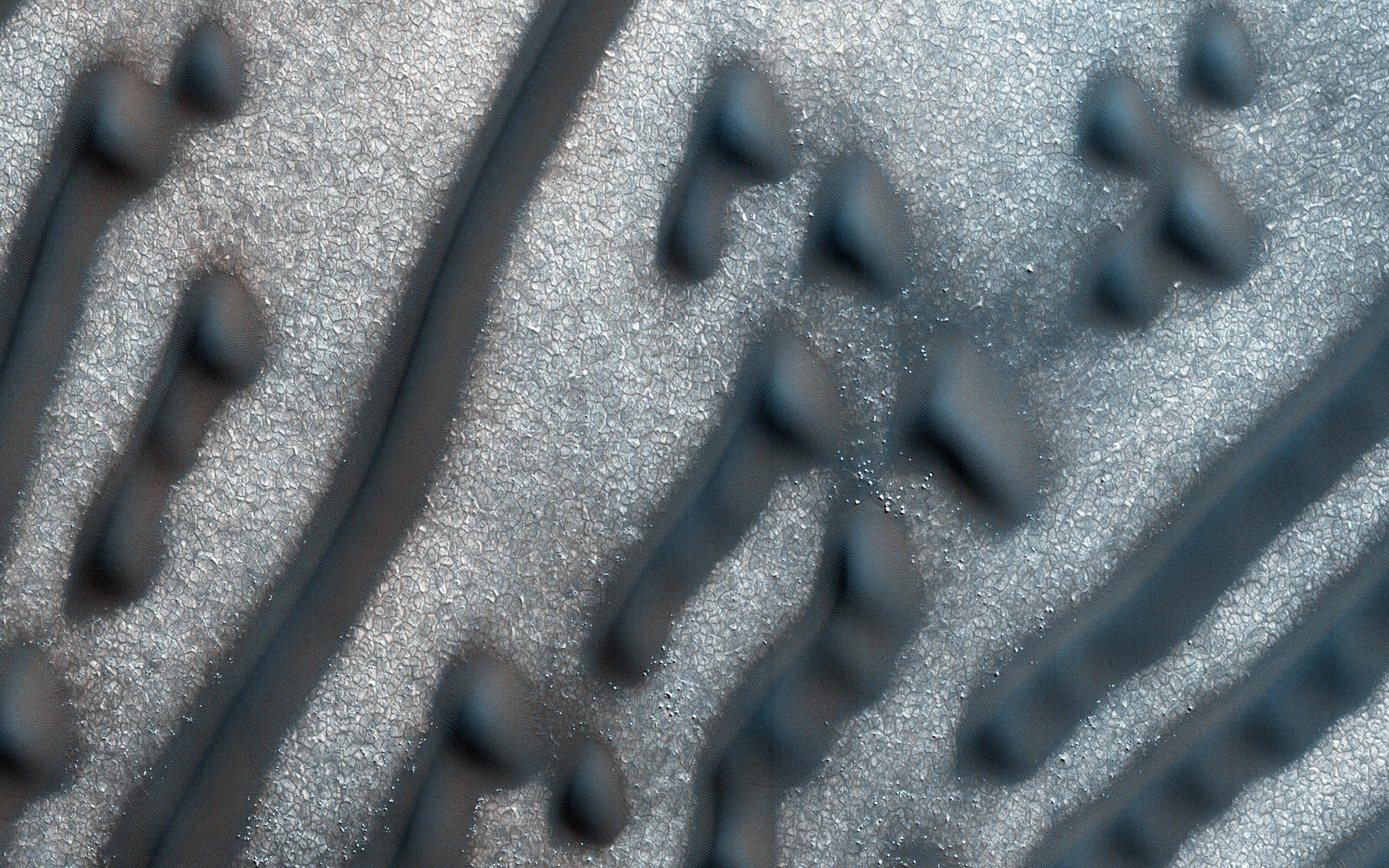
PIA20743:
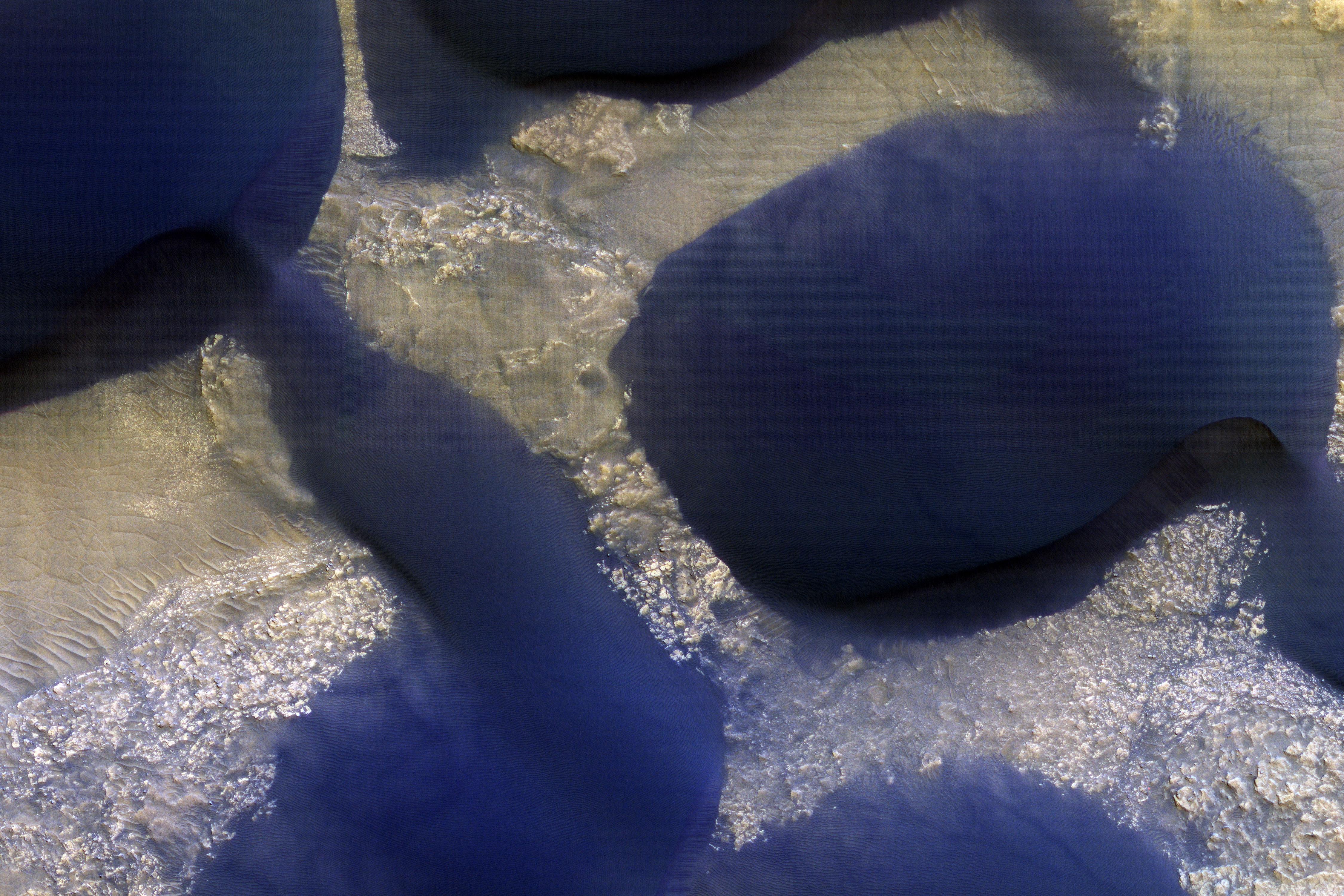
-
North Polar Gypsum Dunes in Olympia Undae
Full Resolution:
TIFF
(15.56 MB)
JPEG
(1.106 MB)
|
|
|
2016-07-08 |
Mars
|
Mars Reconnaissance Orbiter (MRO)
|
MCS
|
941x552x3 |

|
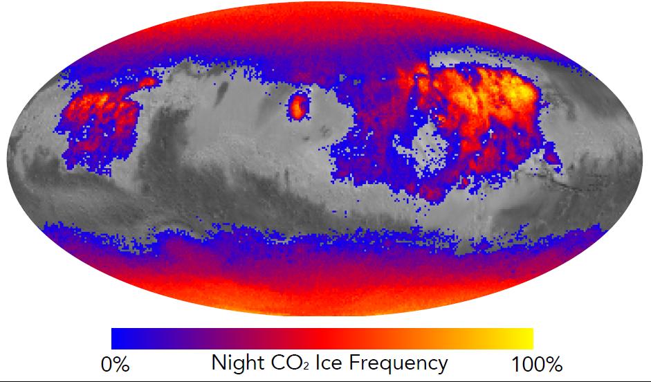
-
PIA20758:
-
Where on Mars Does Carbon Dioxide Frost Form Often?
Full Resolution:
TIFF
(620.9 kB)
JPEG
(77.94 kB)
|
|
|
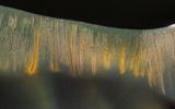
2016-07-07 |
Mars
|
Mars Reconnaissance Orbiter (MRO)
|
HiRISE
|
1581x1283x1 |
|
-
PIA20757:
-
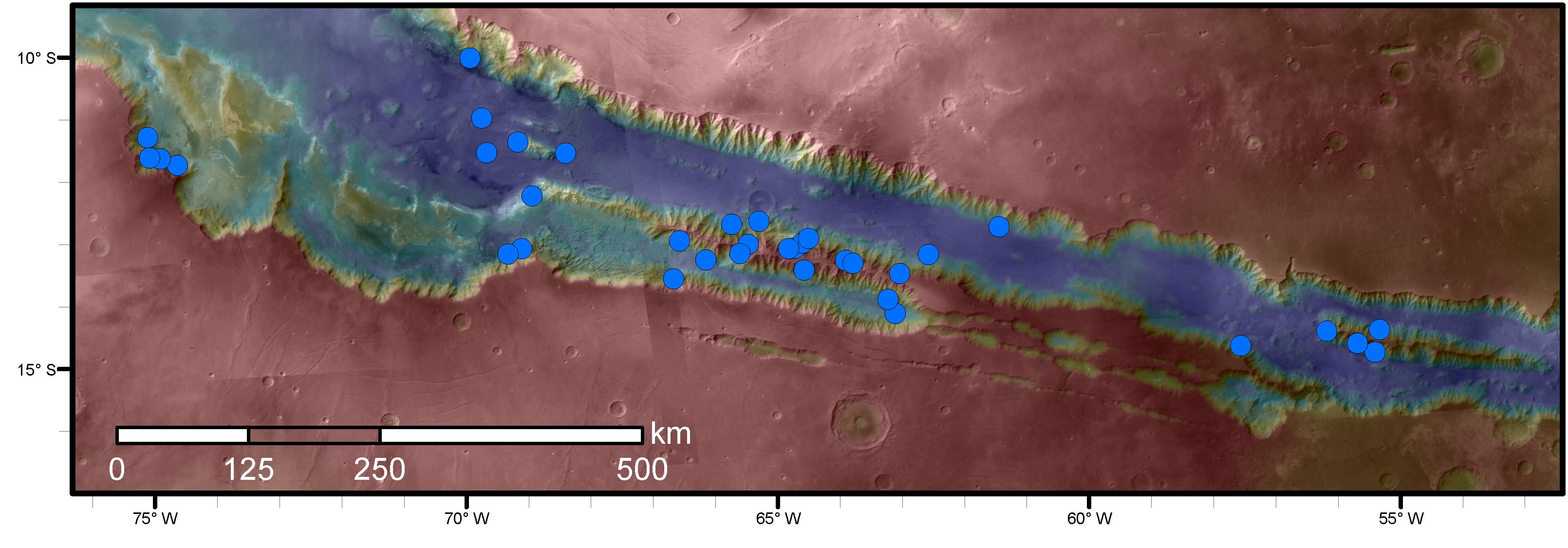
Numerous Seasonal 'Lineae' on Coprates Montes, Mars
Full Resolution:
TIFF
(1.915 MB)
JPEG
(217.1 kB)
|
|
|
2016-07-07 |
Mars
|
Mars Reconnaissance Orbiter (MRO)
|
HiRISE
|
3220x1125x3 |
|
-
PIA20756:
-
Sites with Seasonal Streaks on Slopes in Mars Canyons
Full Resolution:
TIFF
(6.927 MB)
JPEG
(320.1 kB)
|
|
|
2016-06-29 |
Mars
|
Mars Reconnaissance Orbiter (MRO)
|
HiRISE
|
2880x1800x3 |
|
-
PIA20740:
-
Dreaming of Graben in the Labyrinth of the Night
Full Resolution:
TIFF
(15.56 MB)
JPEG
(765.6 kB)
|
|
|
2016-06-29 |
Mars
|
Mars Reconnaissance Orbiter (MRO)
|
HiRISE
|
2880x1800x3 |
|
-
PIA20737:
-
Bedrock North of Terby Crater
Full Resolution:
TIFF
(15.56 MB)
JPEG
(775.2 kB)
|
|
|
2016-06-29 |
Mars
|
Mars Reconnaissance Orbiter (MRO)
|
HiRISE
|
2880x1800x3 |
|
-
PIA20736:
-
Glowing Gullies in Kaiser Crater Dunes
Full Resolution:
TIFF
(15.11 MB)
JPEG
(766.1 kB)
|
|
|
2016-06-29 |
Mars
|
Mars Reconnaissance Orbiter (MRO)
|
HiRISE
|
2880x1800x3 |
|
-
PIA20735:
-
Martian Morse Code
Full Resolution:
TIFF
(15.56 MB)
JPEG
(1.195 MB)
|
|
|
2016-06-22 |
Mars
|
Mars Reconnaissance Orbiter (MRO)
|
HiRISE
|
2880x1800x3 |
|
-
PIA20738:
-
Curiosity on the Naukluft Plateau
Full Resolution:
TIFF
(15.56 MB)
JPEG
(826.9 kB)
|
 Planetary Data System


