Your search criteria found 62 images
Feature Name
Go to PIAxxxxx:
Refine this list of images by:
Mission:
Spacecraft:
Instrument:
Click on an image for detailed information
Click on a column heading to sort in ascending or descending order
My
List
Addition DateSort Ascending Target Mission Instrument Size
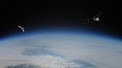
Add Image to Favorite List 2023-08-14 Earth Polar Radiant Energy in the Far-InfraRed Experiment (PREFIRE)
1920x1080x3
The PREFIRE mission will send two CubeSats – shown as an artist's concept against an image of Earth from orbit – into space to study how much heat the planet absorbs and emits from its polar regions, including the Arctic and Antarctica.
PIA25778:
PREFIRE Satellite Illustration
Full Resolution:     TIFF (3.12 MB)     JPEG (92.14 kB)
Add Image to Favorite List 2022-08-10 Earth 4456x5324x3
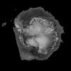
Changes in elevation of the Antarctic ice sheet from 1985 to 2021 are shown.
PIA24990:
The Antarctic Ice Sheet's Changing Height
Full Resolution:     TIFF (18.38 MB)     JPEG (1.304 MB)
Add Image to Favorite List 2018-10-16 Earth Terra
MISR
4200x5400x3
NASA's Terra spacecraft became one of a handful of NASA satellite ever to complete 100,000 orbits on October 6, 2018.
PIA22836:
MISR Records the View as NASA's Terra Satellite Passes Its 100,000th Orbit
Full Resolution:     TIFF (41.59 MB)     JPEG (1.508 MB)
Add Image to Favorite List 2017-07-14 Earth Suomi NPP
Terra
MODIS
VIIRS
1805x1350x1
This still from an animation shows the Larsen C Ice Shelf in West Antarctica calved one of the largest icebergs in history between July 10 and 12, 2017.
PIA21785:
Spawning of Massive Antarctic Iceberg Captured by NASA Animation Animation Icon
Full Resolution:     TIFF (1.693 MB)     JPEG (201.4 kB)
Add Image to Favorite List 2017-04-11 Earth Terra
MISR
2240x3584x3
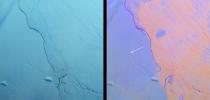
NASA's Terra spacecraft has spied a rift in Antarctica's Larsen C ice shelf, grown to 110 miles long, making it inevitable that an iceberg larger than Rhode Island will soon calve from the ice shelf.
PIA21581:
NASA's MISR Tracks Growth of Rift in the Larsen C Ice Shelf
Full Resolution:     TIFF (13.35 MB)     JPEG (776 kB)
Add Image to Favorite List 2017-01-06 Earth Mars Reconnaissance Orbiter (MRO)
HiRISE
657x358x3
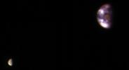
This composite image of Earth and its moon, as seen from Mars, combines the best Earth image with the best moon image from four sets of images acquired on Nov. 20, 2016, by NASA's Mars Reconnaissance Orbiter. Mars was about 127 million miles from Earth.
PIA21260:
Earth and Its Moon, as Seen From Mars
Full Resolution:     TIFF (213.9 kB)     JPEG (7.02 kB)
Add Image to Favorite List 2016-08-31 Earth Terra
MISR
1600x762x3
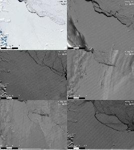
These images from NASA's Terra satellite shows a large crack in the Larsen C shelf that has grown by another 13 miles in the past six months. Larsen C is the fourth largest ice shelf in Antarctica.
PIA20894:
Growing Crack in Antarctica's Larsen C Ice Shelf Spotted by NASA's MISR
Full Resolution:     TIFF (3.173 MB)     JPEG (110.6 kB)
Add Image to Favorite List 2016-05-11 Earth Aqua
AIRS
914x569x3
Visualization of the formation and evolution of the Antarctic Vortex (ozone hole) over the South Pole from Sept. 1 to Dec. 4, 2014, created using data from NASA's Aqua spacecraft.
PIA20664:
Ozone Hole Formation Over South Pole Observed by NASA's AIRS Animation Icon
Full Resolution:     TIFF (1.122 MB)     JPEG (31.32 kB)
Add Image to Favorite List 2016-01-15 Earth Terra
ASTER
4224x4846x3
This image from NASA's Terra spacecraft shows Mount Erebus, the world's southernmost historically active volcano.
PIA20239:
Mt. Erebus, Antarctica
Full Resolution:     TIFF (39.98 MB)     JPEG (2.048 MB)
Add Image to Favorite List 2015-04-21 Earth SMAP
1669x1080x3
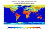
With its antenna now spinning at full speed, NASA's new Soil Moisture Active Passive (SMAP) observatory has successfully re-tested its science instruments and generated its first global maps, a key step to beginning routine science operations in 2015.
PIA18057:
NASA Soil Moisture Mission Produces First Global Radiometer Map
Full Resolution:     TIFF (5.41 MB)     JPEG (226.5 kB)
Add Image to Favorite List 2015-01-22 Earth SPIDER
673x379x3
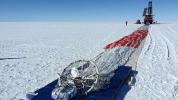
Prior to launch, the team laid out the parachute and hang lines in front of SPIDER, seen in the distance. The long-duration balloon that would carry SPIDER into the sky is attached to the end of the parachute shown here in the foreground.
PIA19177:
SPIDER Readied for Launch
Full Resolution:     TIFF (765.7 kB)     JPEG (54.71 kB)
Add Image to Favorite List 2013-11-15 Earth Terra
MISR
1943x976x3
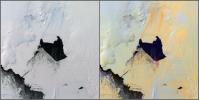
NASA's Terra satellite passed over the Pine Island Glacier in Antarctica around Oct. 27, 2013, just days before iceberg B-31 broke completely free. B-31 is finally moving away from the coast, with open water between the iceberg and the glacier.
PIA17694:
Pine Island Glacier, Antarctica, MISR Multi-angle Composite
Full Resolution:     TIFF (5.691 MB)     JPEG (178.7 kB)
Add Image to Favorite List 2013-10-09 Earth Juno
8500x4781x3
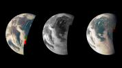
This trio of NASA's Junocam views of Earth was taken during Juno's close flyby on October 9, 2013.
PIA14447:
Earth Triptych from NASA's Juno Spacecraft
Full Resolution:     TIFF (122 MB)     JPEG (1.705 MB)
Add Image to Favorite List 2013-06-13 Earth Aqua
Terra
MODIS
MODIS
1659x1452x3
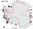
Rates of basal melt of Antarctic ice shelves (melting of the shelves from underneath) overlaid on a 2009 mosaic of Antarctica created from data from NASA's Terra and Aqua spacecraft.
PIA17284:
Rates of Basal Melt of Antarctic Ice Shelves
Full Resolution:     TIFF (7.23 MB)     JPEG (358.1 kB)
Add Image to Favorite List 2013-06-13 Earth 1984x1488x3
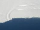
This photo shows the ice front of the ice shelf in front of Pine Island Glacier, a major glacier system of West Antarctica.
PIA17283:
Pine Island Glacier Ice Shelf
Full Resolution:     TIFF (8.86 MB)     JPEG (202.1 kB)
Add Image to Favorite List 2013-06-13 Earth 3264x2448x3
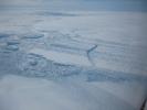
This photo, aken onboard a National Science Foundation/NASA chartered Twin Otter aircraft, shows the ice front of Dibble Ice Shelf, East Antarctica, a significant melt water producer from the Wilkes Land region, East Antarctica.
PIA17282:
Dibble Ice Shelf
Full Resolution:     TIFF (23.98 MB)     JPEG (800.2 kB)
Add Image to Favorite List 2013-06-13 Earth 3264x2448x3
This photo, taken onboard the Chilean Navy P3 aircraft, shows the ice front of Venable Ice Shelf, West Antarctica, in October 2008. It is an example of a small-size ice shelf that is a large melt water producer.
PIA17281:
Ice Front at Venable Ice Shelf
Full Resolution:     TIFF (23.98 MB)     JPEG (803.2 kB)
Add Image to Favorite List 2013-05-02 Earth Terra
ASTER
718x2376x3
This image from NASA's Terra spacecraft shows Macquarie Island which lies halfway between New Zealand and Antarctica, and is part of Tasmania.
PIA16980:
Macquarie Island, Australia
Full Resolution:     TIFF (5.12 MB)     JPEG (158.9 kB)
Add Image to Favorite List 2012-02-02 Earth GRACE
K-Band Ranging System
1058x720x3
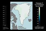
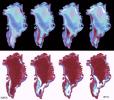
This frame from an animation based on data from NASA's Grace satellite shows dramatic changes in Greenland's ice mass from 2003 through 2011 revealing how much ice has been lost and gained each year.
PIA13955:
Ice Mass Loss on Greenland, 2003-2011 Animation Icon
Full Resolution:     TIFF (2.288 MB)     JPEG (78.67 kB)
Add Image to Favorite List 2011-11-15 Earth Terra
ASTER
2952x3479x3
This image from NASA's Terra spacecraft shows a massive crack across the Pine Island Glacier, a major ice stream that drains the West Antarctic Ice Sheet. Eventually, the crack will extend all the way across the glacier.
PIA15077:
NASA Spacecraft Images Massive Crack in Antarctica's Pine Island Glacier
Full Resolution:     TIFF (30.81 MB)     JPEG (1.266 MB)
Add Image to Favorite List 2011-08-18 Earth 455x256x3
This frame from an animation shows the motion of ice in Antarctica as measured by satellite data from various space agencies. The colors represent the speed of the ice flows in meters per year.
PIA14557:
Flow of Ice Across Antarctica Animation Icon
Full Resolution:     TIFF (350 kB)     JPEG (35.4 kB)
Add Image to Favorite List 2011-08-18 Earth 1192x1192x3
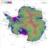
This image is the first complete map of the speed and direction of ice flow in Antartica. The thick black lines delineate major ice divides. Subglacial lakes in Antarctica's interior are also outlined in black.
PIA14556:
NASA Research Leads to First Complete Map of Antarctic Ice Flows
Full Resolution:     TIFF (4.268 MB)     JPEG (240.9 kB)
Add Image to Favorite List 2010-07-07 Earth GRACE
K-Band Ranging System
777x745x3
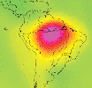
This image is from data taken by NASA's Gravity Recovery and Climate Experiment showing the Amazon basin in South America. The amount of water stored in the Amazon basin varies from month to month.
Animations are available at the Photojournal.
PIA13243:
Measuring Water Storage in the Amazon Animation Icon
Full Resolution:     TIFF (1.739 MB)     JPEG (51.9 kB)
Add Image to Favorite List 2009-11-02 Earth Terra
ASTER
3900x4331x3
The McMurdo Dry Valleys are a row of valleys west of McMurdo Sound, Antarctica. They are so named because of their extremely low humidity and lack of snow and ice cover. This image was acquired December 8, 2002 by NASA's Terra spacecraft.
PIA12461:
Dry Valleys, Antarctica
Full Resolution:     TIFF (50.67 MB)     JPEG (2.02 MB)
Add Image to Favorite List 2008-11-17 Earth Terra
ASTER
4070x8024x3
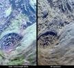
Byrd Glacier is a major glacier in Antarctica; it drains an extensive area of the polar plateau and flows eastward between the Britannia Range and the Churchill Mountains to discharge into the Ross Ice Shelf. This image is from NASA's Terra satellite.
PIA11419:
Byrd Glacier, Antarctica
Full Resolution:     TIFF (97.97 MB)     JPEG (7.07 MB)
Add Image to Favorite List 2006-06-06 Earth CloudSat
Cloud Profiling Radar (CPR)
1188x208x3
NASA's CloudSat satellite's image of a horizontal cross-section of a polar night storm near Antarctica.
PIA08518:
CloudSat Image of a Polar Night Storm Near Antarctica
Full Resolution:     TIFF (742.4 kB)     JPEG (30.42 kB)
Add Image to Favorite List 2005-04-13 Earth Terra
MISR
2037x1732x3
As it passed over Antarctica on December 16, 2004, NASA's Terra satellite captured this image showing a wavy pattern in a field of white.
PIA04377:
Waves on White: Ice or Clouds?
Full Resolution:     TIFF (10.6 MB)     JPEG (292.9 kB)
Add Image to Favorite List 2004-12-09 Earth Shuttle Radar Topography Mission (SRTM)
C-Band Radar
X-Band Radar
5200x4858x3
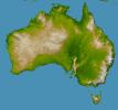
NASA's Shuttle Radar Topography Mission shows Australia, the world's smallest, flattest, and (after Antarctica) driest continent, but at 7.7 million square kilometers (3.0 million square miles) it is also the sixth largest country.
PIA06665:
Australia, Shaded Relief and Colored Height
Full Resolution:     TIFF (38.46 MB)     JPEG (3.481 MB)
Add Image to Favorite List 2003-12-04 Earth Terra
MISR
2895x3200x3
Within that narrow window during a solar eclipse where one on Earth can watch the Moon's shadow obscure more than 90% of the Sun, NASA's Terra spacecraft captured these views of the Antarctic surface during the total solar eclipse of November 23, 2003.
PIA04347:
Capturing the Motion of an Eclipse Shadow
Full Resolution:     TIFF (15.8 MB)     JPEG (452.3 kB)
Add Image to Favorite List 2003-11-12 Earth Terra
MISR
945x805x3
NASA's Terra spacecraft imaged Iceberg B-15A, the largest iceberg in the world (measuring about 11,000 square kilometers) when it broke away from Western Antarctica's Ross Ice Shelf in March 2000.
PIA04344:
Breakup of the World's Largest Iceberg
Full Resolution:     TIFF (2.286 MB)     JPEG (151 kB)
Add Image to Favorite List 2003-06-04 Earth Terra
MISR
1466x896x3
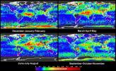
Global summaries of aerosol optical thickness from NASA's Terra spacecraft.
PIA04333:
Global and Seasonal Aerosol Distributions from MISR
Full Resolution:     TIFF (3.079 MB)     JPEG (530.4 kB)
Add Image to Favorite List 2003-06-02 Earth Aqua
AIRS
1437x921x3
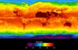
This image shows average temperatures in April, 2003, observed by AIRS at an infrared wavelength that senses either the Earth's surface or any intervening cloud.
PIA00427:
Global Average Brightness Temperature for April 2003
Full Resolution:     TIFF (2.867 MB)     JPEG (158.1 kB)
Add Image to Favorite List 2003-05-07 Earth Terra
MISR
2476x2291x3
The complex structure and beauty of polar clouds are highlighted by these images acquired by NASA's Terra spacecraft on April 23, 2003. These clouds occur at multiple altitudes and exhibit a noticeable cyclonic circulation over the Southern Indian Ocean,
PIA04329:
Multi-layer Clouds Over the South Indian Ocean
Full Resolution:     TIFF (17.04 MB)     JPEG (975 kB)
Add Image to Favorite List 2003-02-19 Earth Terra
MISR
1218x1896x3
These views from NASA's Terra spacecraft portray the Lutzow-Holm Bay region of Queen Maud Land, East Antarctica, on September 5, 2002.
PIA04319:
Lutzow-Holm Bay and the Shirase Glacier, Antarctica
Full Resolution:     TIFF (6.023 MB)     JPEG (290.1 kB)
Add Image to Favorite List 2003-01-13 Earth QuikScat
SeaWinds Scatterometer
2490x1050x3
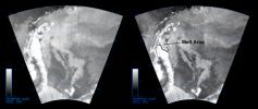
The SeaWinds instrument on NASA's Quick Scatterometer (QuikScat) spacecraft captured these near-real-time backscatter images of melting on the Larsen C ice shelf in Antarctica's Weddell Sea between October 27 (left) and October 29 (right).
PIA03894:
QuikScat Captures an Early Melt
Full Resolution:     TIFF (2.168 MB)     JPEG (289.1 kB)
Add Image to Favorite List 2002-11-20 Earth Terra
MISR
2207x1900x3
These views from NASA's Terra spacecraft illustrate ice surface textures and cloud-top heights over the Amery Ice Shelf/Lambert Glacier system in East Antarctica on October 25, 2002.
PIA03734:
Clouds and Ice of the Lambert-Amery System, East Antarctica
Full Resolution:     TIFF (10.41 MB)     JPEG (737.3 kB)
Add Image to Favorite List 2002-01-02 Earth Terra
MISR
1484x1159x3
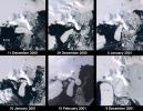
These images from NASA's Terra satellite documented iceberg movements and changes in sea ice between December 11, 2000 and December 9, 2001.
PIA03437:
Penguins in Peril
Full Resolution:     TIFF (4.34 MB)     JPEG (249.5 kB)
Add Image to Favorite List 2001-11-14 Earth Terra
MISR
822x432x3
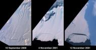
A large tabular iceberg (42 kilometers x 17 kilometers) broke off Pine Island Glacier, West Antarctica (75º S latitude, 102º W longitude) sometime between November 4 and 12, 2001, as seen by NASA's Terra satellite.
PIA03431:
Birth of a Large Iceberg in Pine Island Bay, Antarctica
Full Resolution:     TIFF (674.3 kB)     JPEG (43.08 kB)
Add Image to Favorite List 2001-10-22 Earth Terra
ASTER
2547x3222x1
Pine Island Glacier has undergone a steady loss of elevation with retreat of the grounding line in recent decades. NASA's Terra satellite acquired the scene on December 12, 2000.
PIA11095:
Pine Island Glacier, Antarctica
Full Resolution:     TIFF (8.215 MB)     JPEG (785.4 kB)
Add Image to Favorite List 2001-04-26 Earth 2001 Mars Odyssey
THEMIS
3000x1681x3
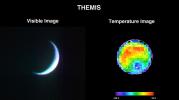
NASA's 2001 Mars Odyssey's Thermal Emission Imaging System (THEMIS) acquired these images of the Earth using its visible and infrared cameras as it left the Earth.
PIA00558:
2001 Mars Odyssey Images Earth (Visible and Infrared)
Full Resolution:     TIFF (2.994 MB)     JPEG (217.5 kB)
Add Image to Favorite List 2001-03-28 Earth Terra
MISR
2000x1315x3
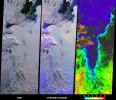
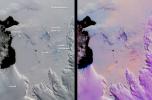
This pair of images from NASA's Terra satellite are of the Pine Island Glacier in western Antarctica, acquired on December 12, 2000 during Terra orbit 5246.
PIA02650:
Pine Island Glacier, Antarctica
Full Resolution:     TIFF (6.189 MB)     JPEG (308.3 kB)
Add Image to Favorite List 2001-01-03 Earth Terra
MISR
1476x1681x3
Two large icebergs, designated B-15A and C-16, captured by NASA's Terra satellite, are of the Ross Ice Shelf and Ross Sea in Antarctica, acquired on December 10, 2000 during Terra orbit 5220,.
PIA02639:
Icebergs in the Ross Sea, Antarctica
Full Resolution:     TIFF (5.694 MB)     JPEG (303.6 kB)
Add Image to Favorite List 2000-05-08 Earth QuikScat
SeaWinds Scatterometer
1452x1280x3
The frequent coverage provided by NASA's SeaWinds instrument on the QuikScat satellite in 1999 provided unprecedented capability to monitor daily and seasonal changes in the key melt zones of Greenland.
PIA02459:
SeaWinds - Greenland
Full Resolution:     TIFF (765.6 kB)     JPEG (205.7 kB)
Add Image to Favorite List 2000-05-08 Earth QuikScat
SeaWinds Scatterometer
2048x2048x3
The SeaWinds scatterometer on NASA's QuikScat satellite makes global radar measurements day and night, in clear sky and through clouds. Greenland and the polar ice cap are shown here on September 20, 1999.
PIA02458:
SeaWinds - Oceans, Land, Polar Regions
Full Resolution:     TIFF (934.2 kB)     JPEG (679.2 kB)
Add Image to Favorite List 2000-05-07 Earth QuikScat
SeaWinds Scatterometer
3296x4267x3
This image demonstrates the capability of the SeaWinds instrument on NASA's QuikScat satellite in monitoring both sea ice and ocean surface wind, thus helping to further our knowledge in wind-ice interaction and its effect on climate change.
PIA02456:
SeaWinds Wind-Ice Interaction
Full Resolution:     TIFF (1.974 MB)     JPEG (1.274 MB)
Add Image to Favorite List 1999-09-08 Earth QuikScat
SeaWinds Scatterometer
900x900x1
NASA's QuikScat satellite instrument kept an eye on an iceberg the size of Rhode Island, the first time this space technology had been used to track a potential threat to international shipping.
PIA02329:
SeaWinds Watches for Breakup of Giant Iceberg
Full Resolution:     TIFF (132.8 kB)     JPEG (49.24 kB)
Add Image to Favorite List 1999-08-09 Earth QuikScat
SeaWinds Scatterometer
1193x1193x3
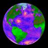
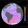
This image shows wind speeds and direction in the Atlantic Ocean on August 1, 1999, gathered by NASA's Seawinds radar instrument flying onboard NASA's QuikScat satellite.
PIA01347:
Atlantic Ocean Surface Winds from QuikScat
Full Resolution:     TIFF (1.065 MB)     JPEG (237.9 kB)
Add Image to Favorite List 1999-08-09 Earth QuikScat
SeaWinds Scatterometer
1193x1193x3
This image shows wind speeds and direction in the Pacific Ocean on August 1, 1999, gathered by NASA's Seawinds radar instrument flying onboard NASA's QuikScat satellite.
PIA01346:
Pacific Ocean Surface Winds from QuikScat
Full Resolution:     TIFF (1.208 MB)     JPEG (258.1 kB)
Add Image to Favorite List 1999-05-01 Earth Spaceborne Imaging Radar-C/X-Band Synthetic Aperture Radar
756x2688x3
This NASA Spaceborne Imaging Radar-C/X-band Synthetic Aperture Radar color composite shows a portion of the Weddell Sea, which is adjacent to the continent of Antarctica.
PIA01737:
Space Radar Image of Weddell Sea, Antarctica
Full Resolution:     TIFF (8.193 MB)     JPEG (1.143 MB)
Add Image to Favorite List 1999-04-15 Earth Spaceborne Imaging Radar-C/X-Band Synthetic Aperture Radar
3800x2300x3
Two radar images from NASA's Spaceborne Imaging Radar C/X-Band Synthetic Aperture Radar shows two large ocean circulation features, called eddies at the northernmost edge of the sea ice pack in the Weddell Sea, off Antarctica.
PIA01802:
Space Radar Image of Weddell Sea
Full Resolution:     TIFF (28.59 MB)     JPEG (1.717 MB)
Add Image to Favorite List 1999-04-15 Earth Spaceborne Imaging Radar-C/X-Band Synthetic Aperture Radar
3500x1436x3
This image from NASA's Spaceborne Imaging Radar-C/X-band Synthetic Aperture Radar is the first calibrated, multi-frequency, multi-polarization spaceborne radar image of the seasonal sea-ice cover in the Weddell Sea, Antarctica.
PIA01786:
Space Radar Image of Weddell Sea Ice
Full Resolution:     TIFF (19.79 MB)     JPEG (2.057 MB)
Add Image to Favorite List 1999-04-15 Earth Spaceborne Imaging Radar-C/X-Band Synthetic Aperture Radar
1550x2096x3
NASA's Spaceborne Imaging Radar-C/X-band Synthetic Aperture Radar instrument shows Chile's huge, remote Patagonia ice fields.
PIA01781:
Space Radar Image of San Rafael Glacier, Chile
Full Resolution:     TIFF (6.016 MB)     JPEG (908.4 kB)
Add Image to Favorite List 1997-09-10 Earth Galileo
Solid-State Imaging
452x439x3
This view of the Earth shows a wonderfully unique but physically impossible view of the southern hemisphere and Antarctica. While a spacecraft could find itself directly over the Earth's pole, roughly half of the image should be in darkness!
PIA00729:
South Polar Projection of Earth
Full Resolution:     TIFF (169.4 kB)     JPEG (29.01 kB)
Add Image to Favorite List 1997-09-10 Earth Galileo
Solid-State Imaging
1020x1128x3
Global images of Earth from NASA's Galileo orbiter on December 11, 1999. In each frame, the continent of Antarctica is visible at the bottom of the globe.
PIA00728:
Global Images of Earth
Full Resolution:     TIFF (2.169 MB)     JPEG (117.6 kB)
Add Image to Favorite List 1996-02-09 Earth Galileo
Solid-State Imaging
2450x2200x3
This color picture of Antarctica is one part of a mosaic of pictures covering the entire Antarctic continent taken during the hours following NASA's Galileo's historic first encounter with its home planet.
PIA00117:
Earth - Ross Ice Shelf, Antarctica
Full Resolution:     TIFF (7.234 MB)     JPEG (268.4 kB)
Add Image to Favorite List 1996-02-08 Earth Galileo
Solid-State Imaging
1083x1314x3
This color image of the Earth was taken by NASA's Galileo spacecraft on December 11 as it departed on its 3-year flight to Jupiter, about 2 1/2 days after the second Earth flyby.
PIA00232:
Earth - Departing Image by Galileo
Full Resolution:     TIFF (823.3 kB)     JPEG (64.79 kB)
Add Image to Favorite List 1996-02-08 Earth Galileo
Solid-State Imaging
800x800x3
This color image of the Earth was obtained by NASA's Galileo spacecraft on Dec. 11, 1990, when the spacecraft was about 1.5 million miles from the Earth.
PIA00122:
Earth - India and Australia
Full Resolution:     TIFF (534.7 kB)     JPEG (38.04 kB)
Add Image to Favorite List 1996-02-01 Earth Galileo
Solid-State Imaging
1378x458x3
This color picture of the limb of the Earth, looking north past Antarctica, is a mosaic of 11 images taken during a ten-minute period near 5:45 p.m. PST Dec. 8, 1990, by NASA's Galileo's imaging system.
PIA00116:
Earth - Antarctica Mosaic
Full Resolution:     TIFF (1.091 MB)     JPEG (41.89 kB)
Add Image to Favorite List 1996-01-29 Earth Galileo
Solid-State Imaging
1572x1580x3
Earth Moon conjuntion image created during the second flyby of NASA's Galileo's spacecraft. Brightly colored Earth contrasts strongly with the Moon.
PIA00134:
Earth - Moon Conjunction
Full Resolution:     TIFF (640.6 kB)     JPEG (53.53 kB)
Add Image to Favorite List 1996-01-29 Earth Galileo
Solid-State Imaging
800x800x3
This color image of the Earth was obtained by Galileo at about 6:10 a.m. Pacific Standard Time on Dec. 11, 1990, when the spacecraft was about 1.3 million miles from the planet during the first of two Earth flybys on its way to Jupiter.
PIA00114:
Earth - South America (First Frame of Earth Spin Movie) Animation Icon
Full Resolution:     TIFF (760.1 kB)     JPEG (50.21 kB)
Add Image to Favorite List 1996-01-29 Earth Galileo
Solid-State Imaging
800x800x3
This color image of the Earth was obtained by NASA's Galileo spacecraft in Dec. 1990, when the spacecraft was about 1.5 million miles from the Earth. Africa stretches from the center to the top of the picture with the Arabian Peninsula off to its right.
PIA00076:
Earth - Full Disk View of Africa
Full Resolution:     TIFF (506.5 kB)     JPEG (34.9 kB)
Add Image to Favorite List 1996-01-29 Earth Galileo
Solid-State Imaging
427x754x3
This color picture of the Ross Ice Shelf, Antarctica was taken NASA's Galileo camera about 6:20 p.m. PST on December 8, 1990.
PIA00074:
Antarctica - Ross Ice Shelf
Full Resolution:     TIFF (657.6 kB)     JPEG (28.73 kB)
Currently displaying images: 1 - 62 of 62