My
List |
Addition Date
|
Target
|
Mission
|
Instrument
|
Size
|

|
2015-04-30 |
Mars
|
Mars Exploration Rover (MER)
|
Panoramic Camera
|
6322x2492x3 |

|
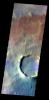
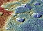
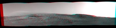
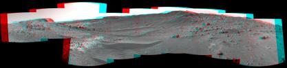
-
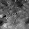
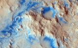
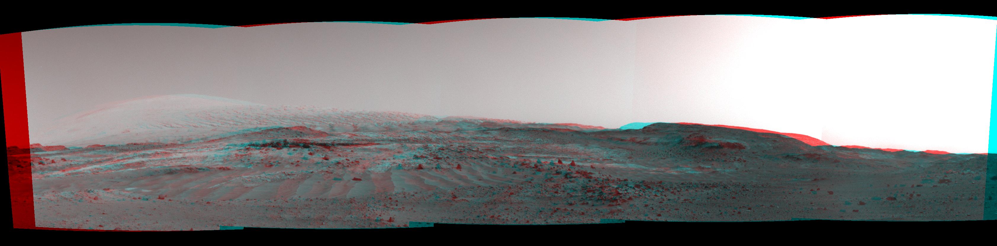
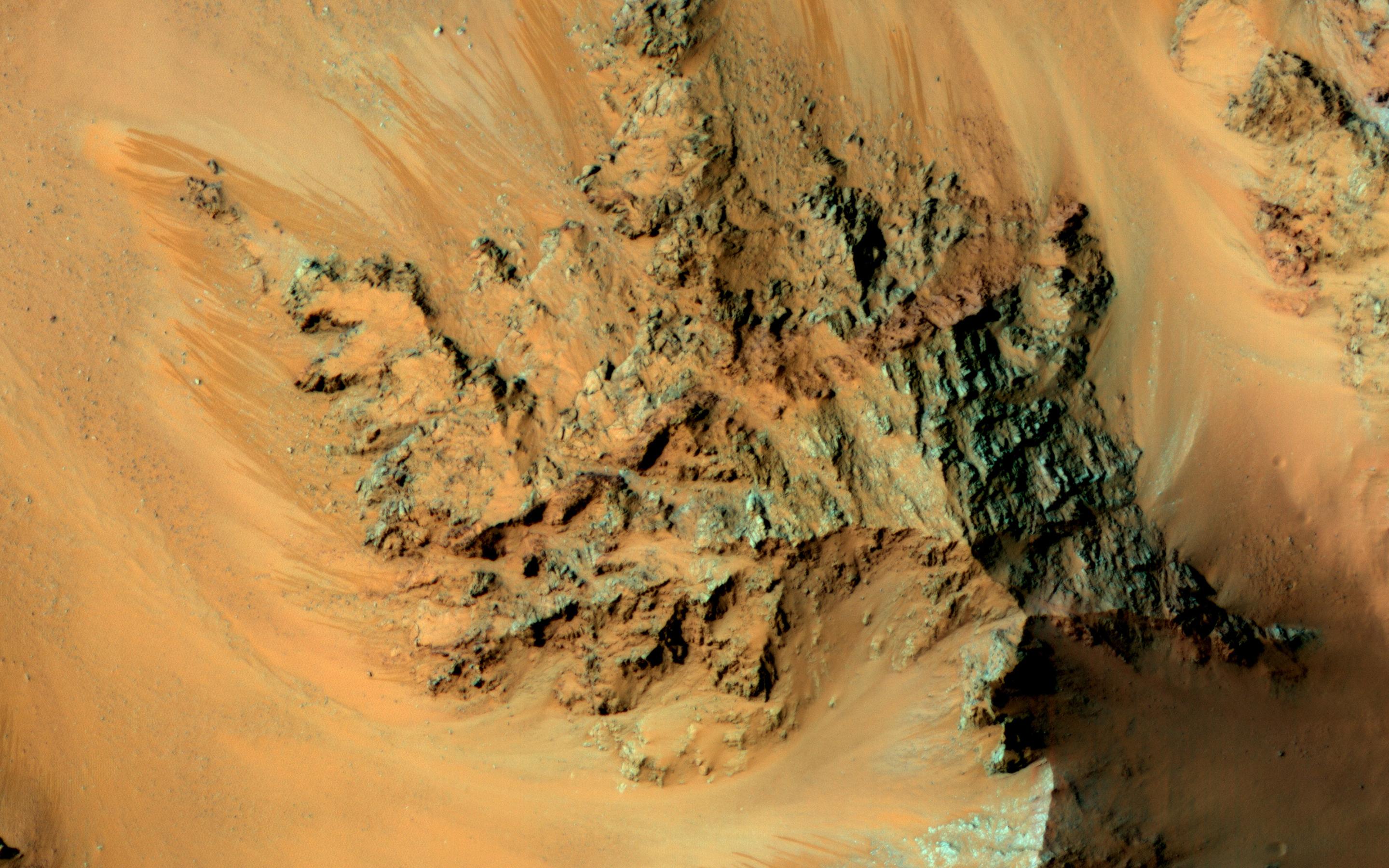
PIA19394:
-
Rock Spire in 'Spirit of St. Louis Crater' on Mars (False Color)
Full Resolution:
TIFF
(47.28 MB)
JPEG
(2.169 MB)
|
|
|
2015-04-30 |
Mars
|
Mars Exploration Rover (MER)
|
Panoramic Camera
|
6322x2492x3 |

|
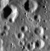
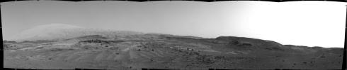
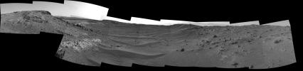
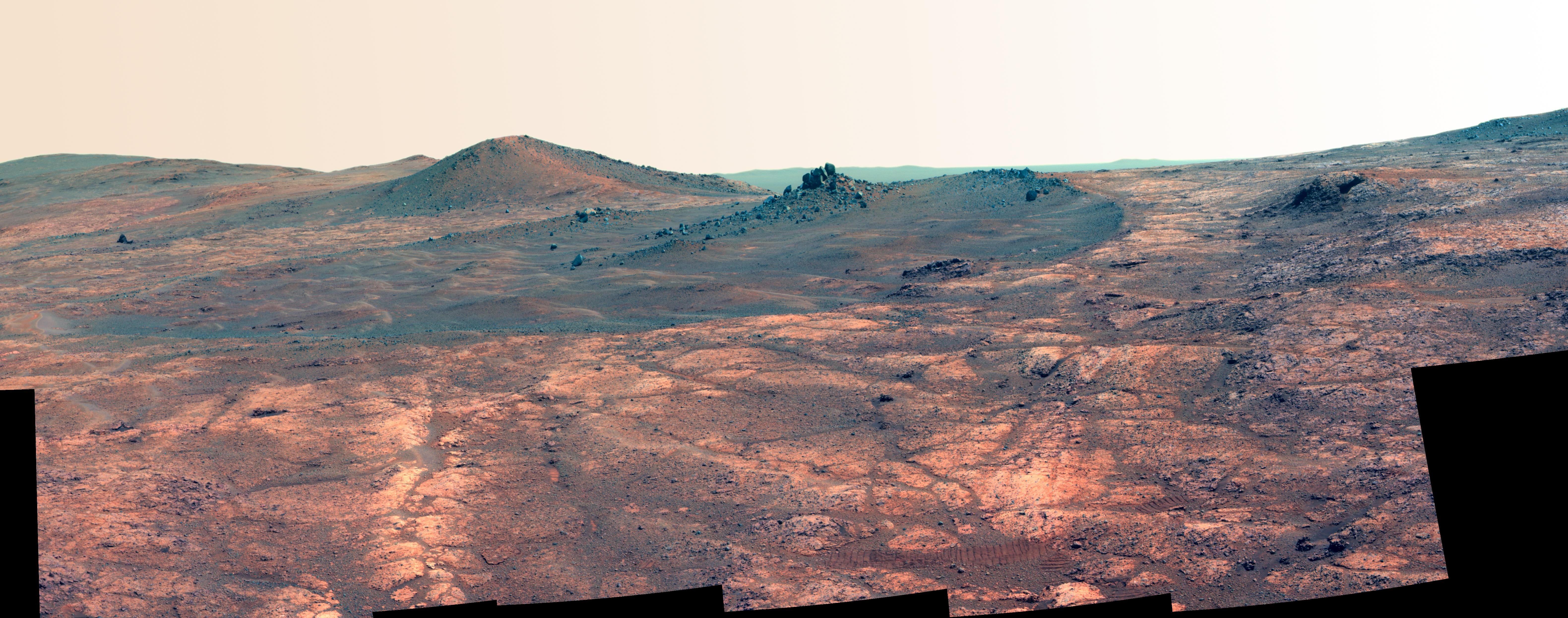
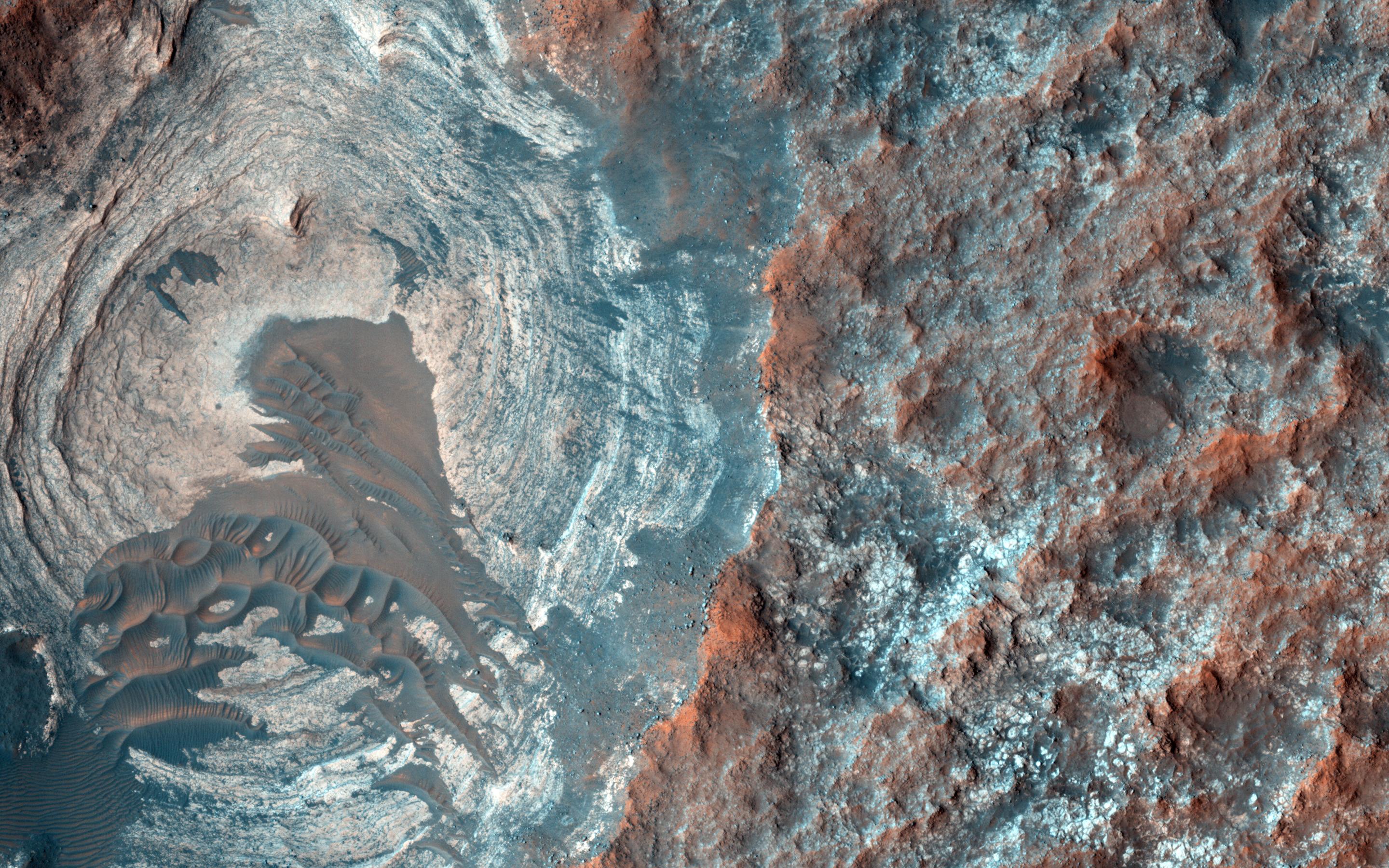
-
PIA19393:
-
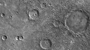
Rock Spire in 'Spirit of St. Louis Crater' on Mars
Full Resolution:
TIFF
(47.28 MB)
JPEG
(1.306 MB)
|
|
|
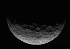
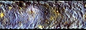
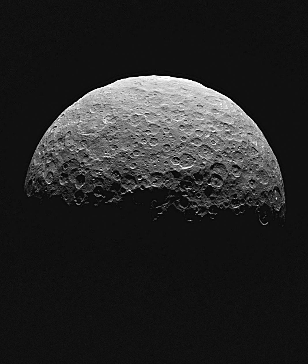
2015-04-30 |
Ceres
|
Dawn
|
Framing Camera
|
881x661x1 |

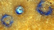
|
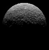
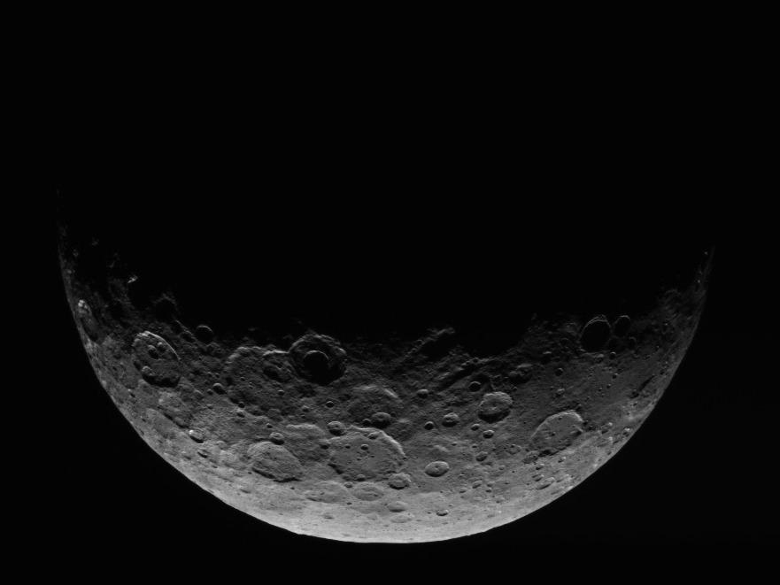
-
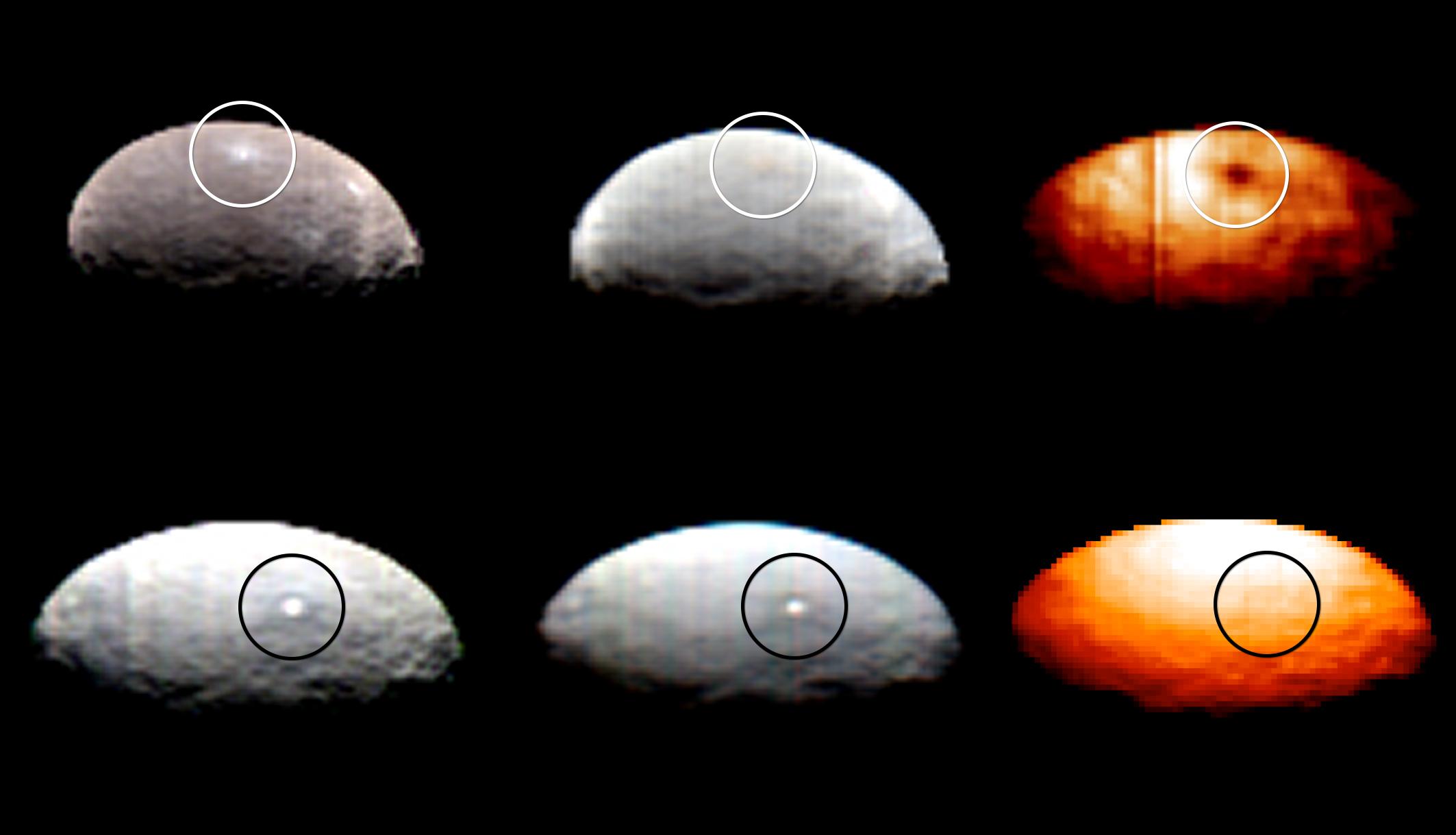
PIA19321:
-
Dawn RC3 Image 2
Full Resolution:
TIFF
(583.2 kB)
JPEG
(31.61 kB)
|
|
|
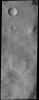
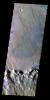
2015-04-30 |
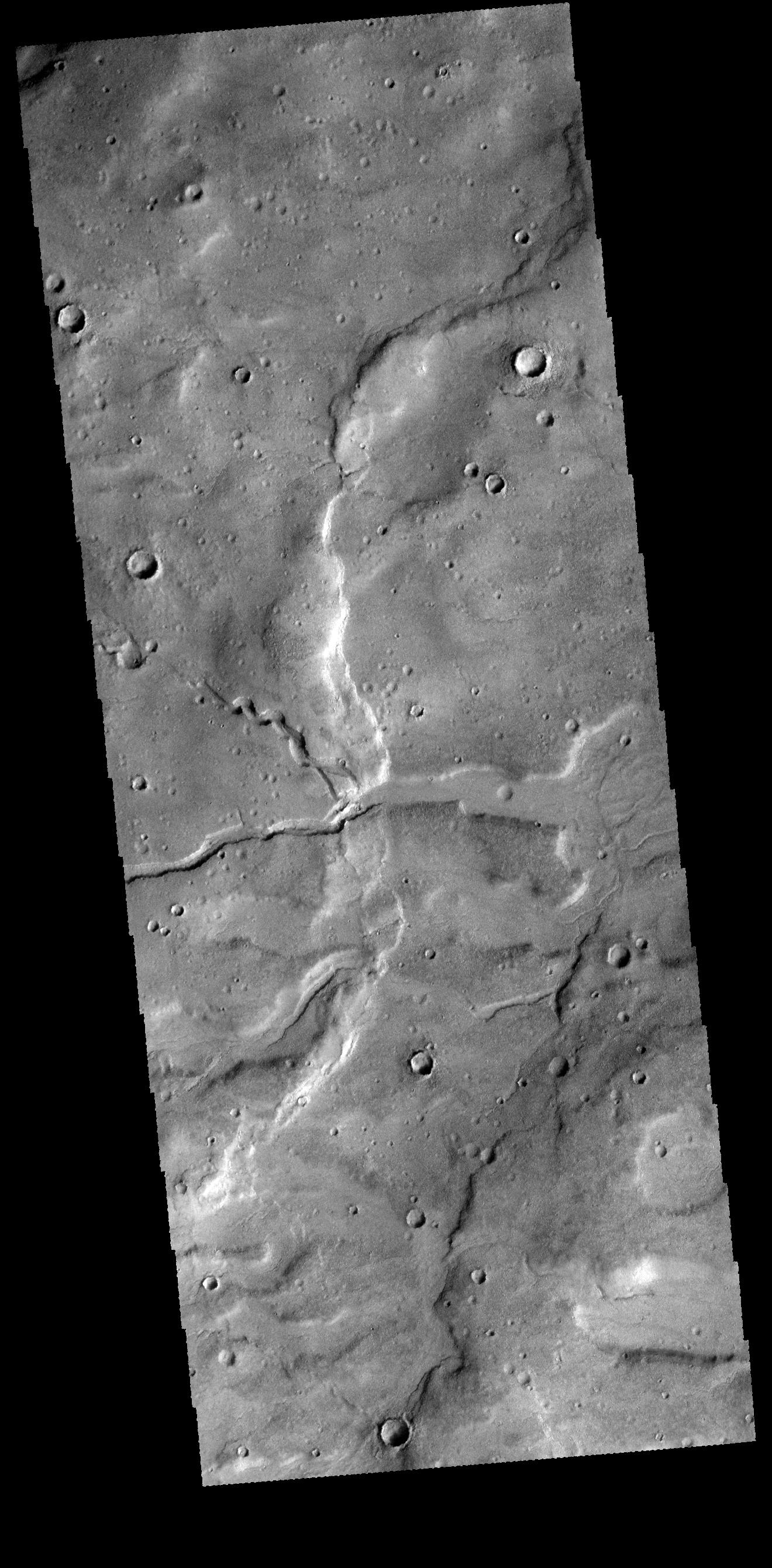
Mars
|
2001 Mars Odyssey
|
THEMIS
|
1333x2657x1 |

|
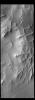
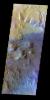
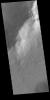
-
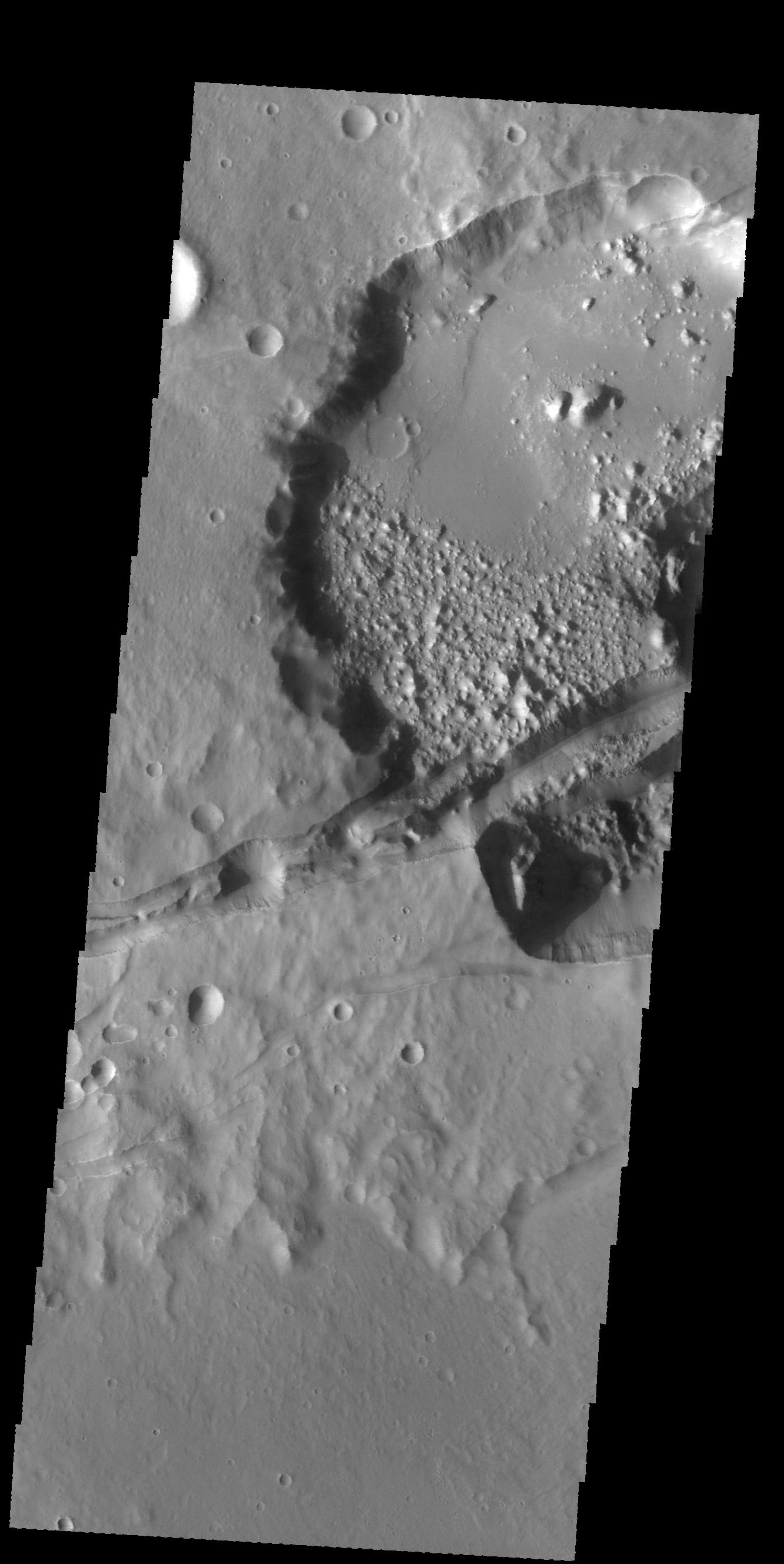
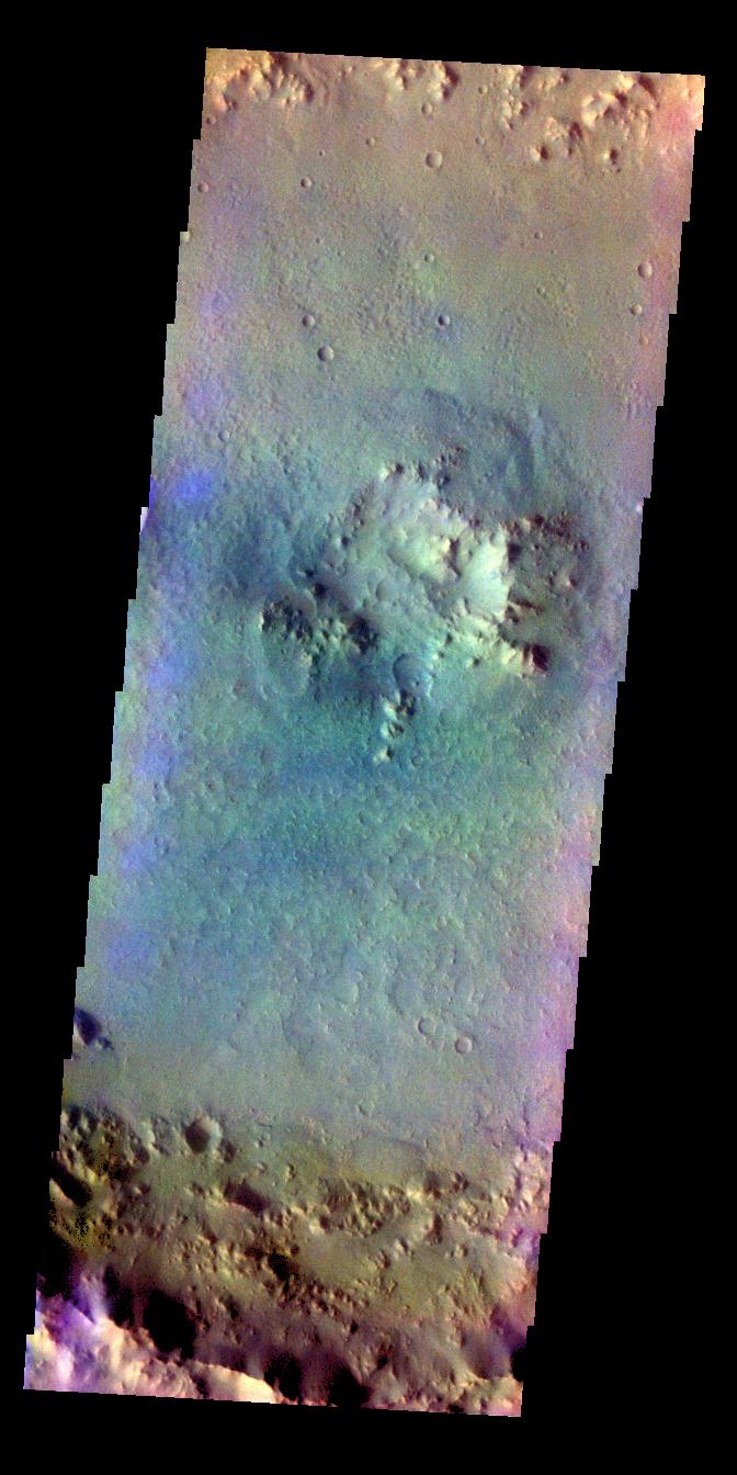
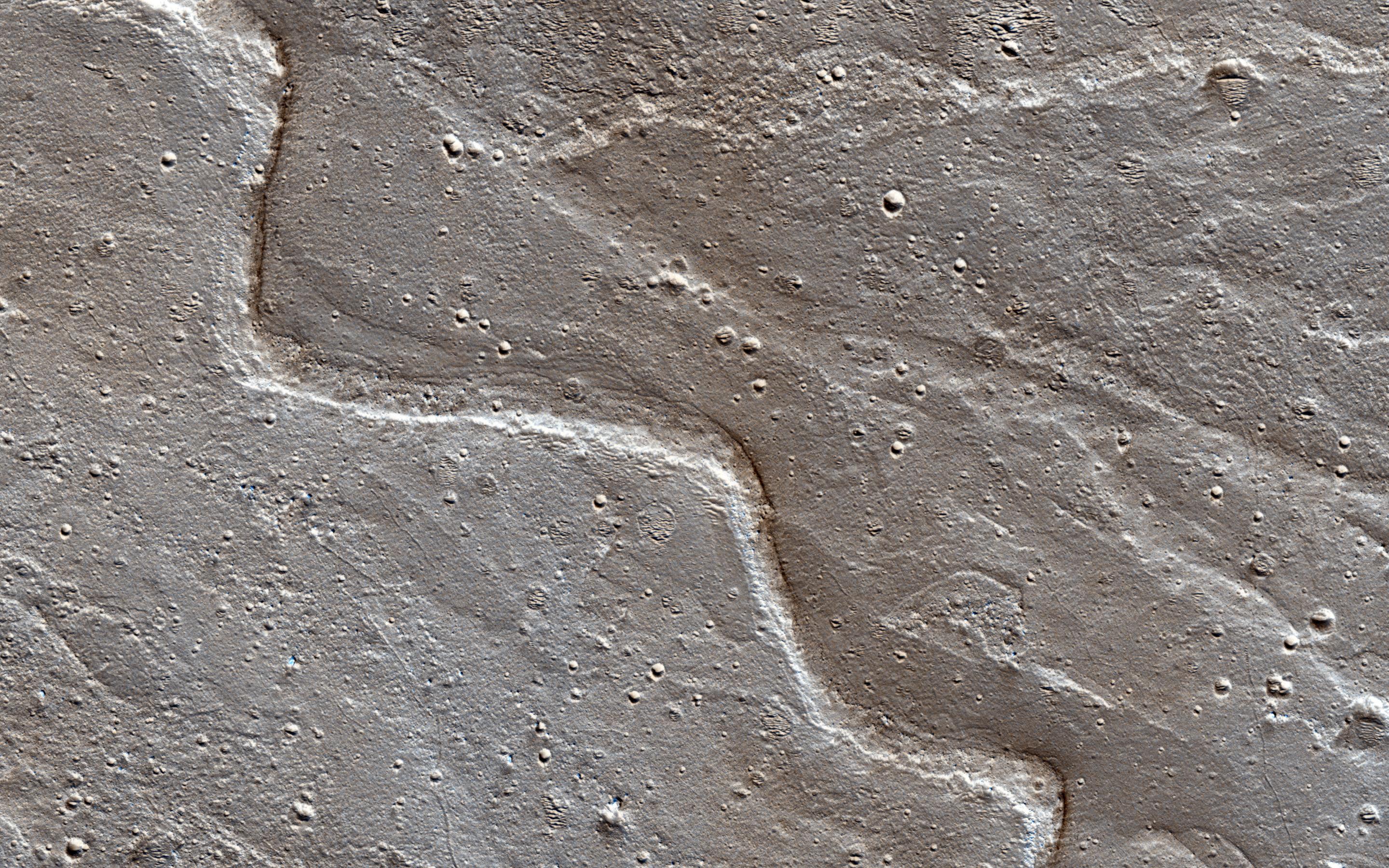
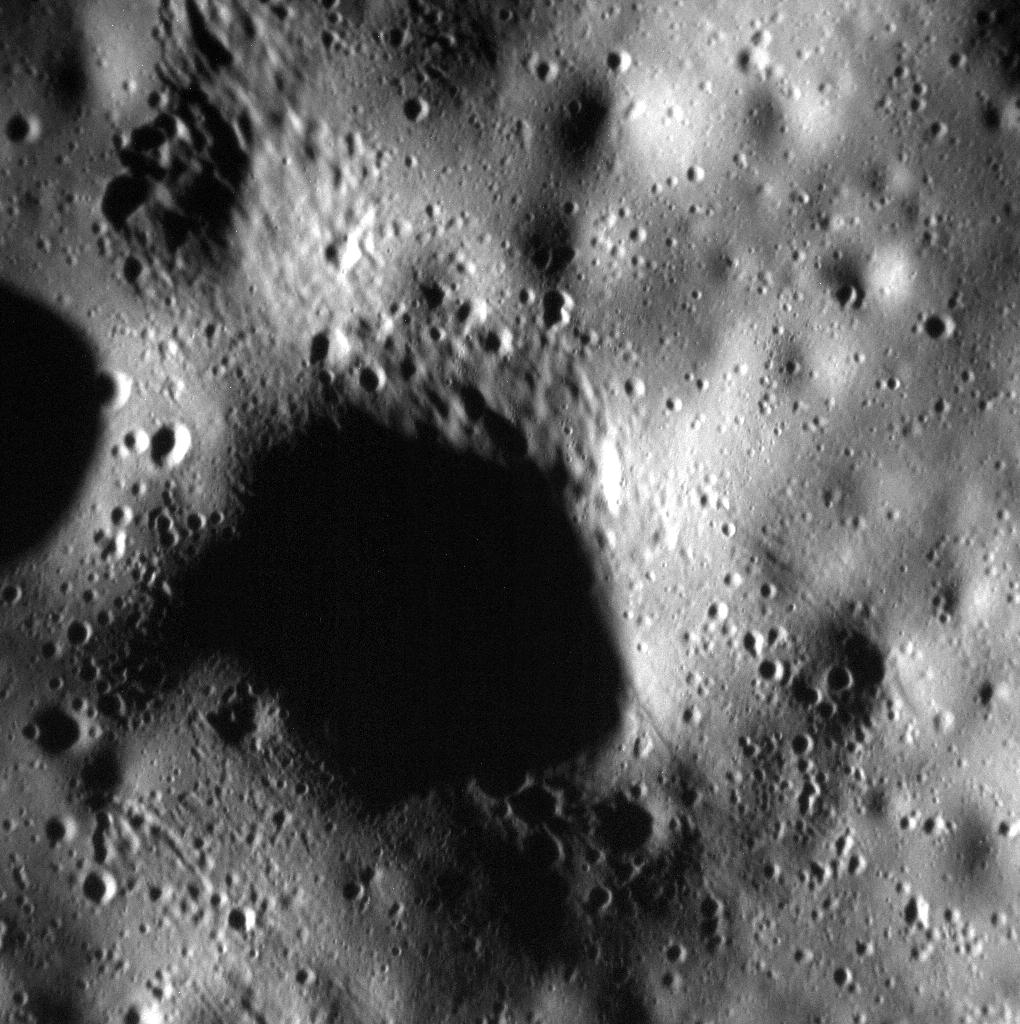
PIA19440:
-
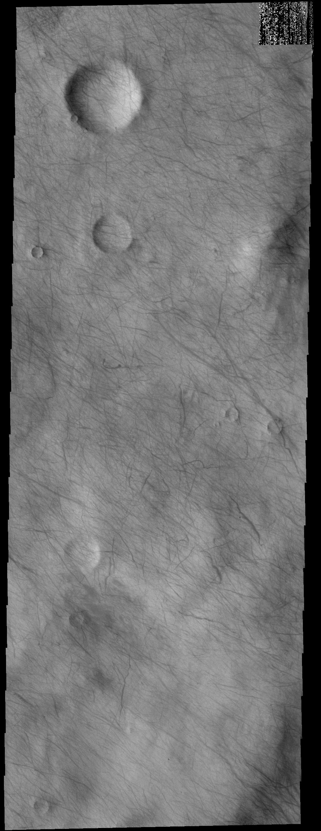
Sirenum Fossae
Full Resolution:
TIFF
(3.546 MB)
JPEG
(253.2 kB)
|
|
|
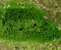
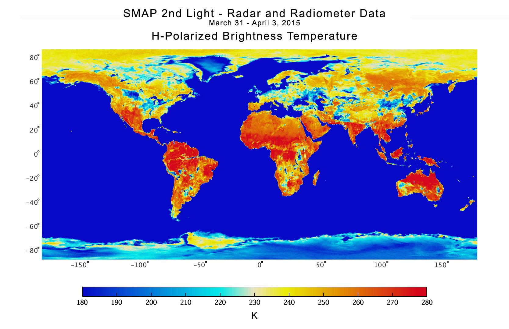
2015-04-29 |
Earth
|
SMAP
|
|
931x602x3 |
|
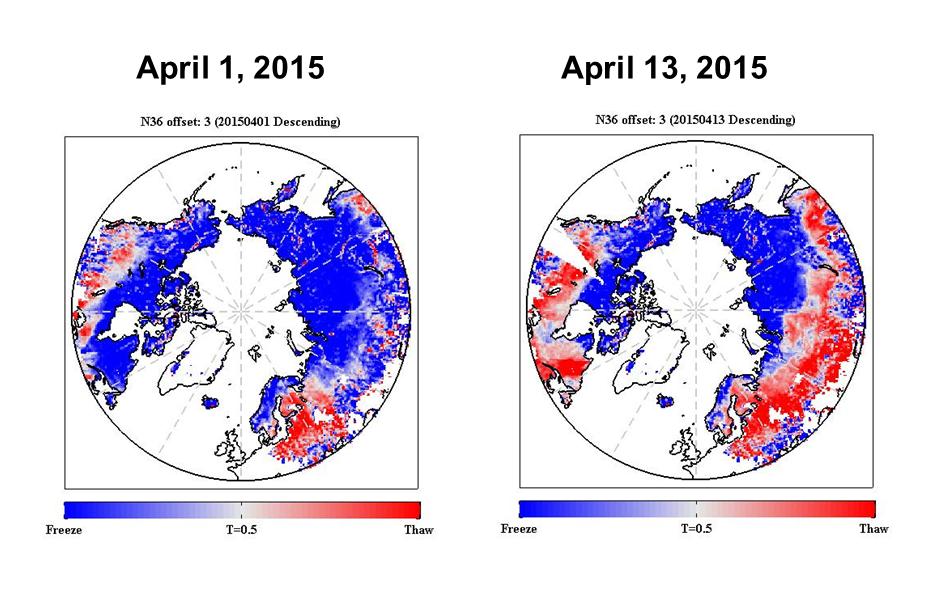
-
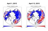
PIA11399:
-
NASA SMAP Images Show Progression of Spring Thaw in Northern Hemisphere
Full Resolution:
TIFF
(1.682 MB)
JPEG
(95.58 kB)
|
|
|
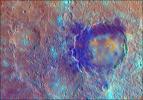
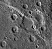
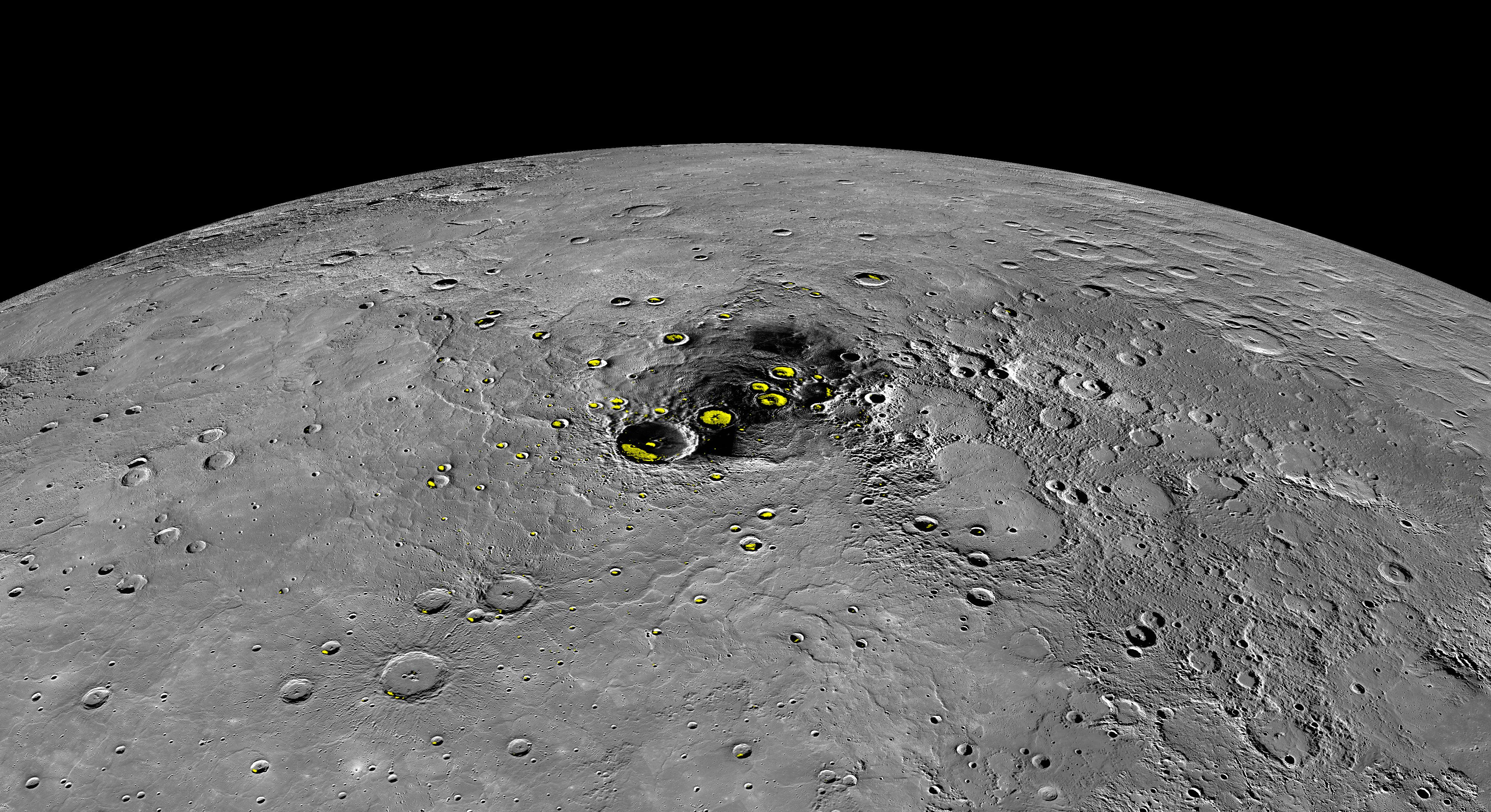
2015-04-29 |
Mercury
|
MESSENGER
|
Mercury Dual Imaging System (MDIS)
MLA
|
1846x826x3 |
|
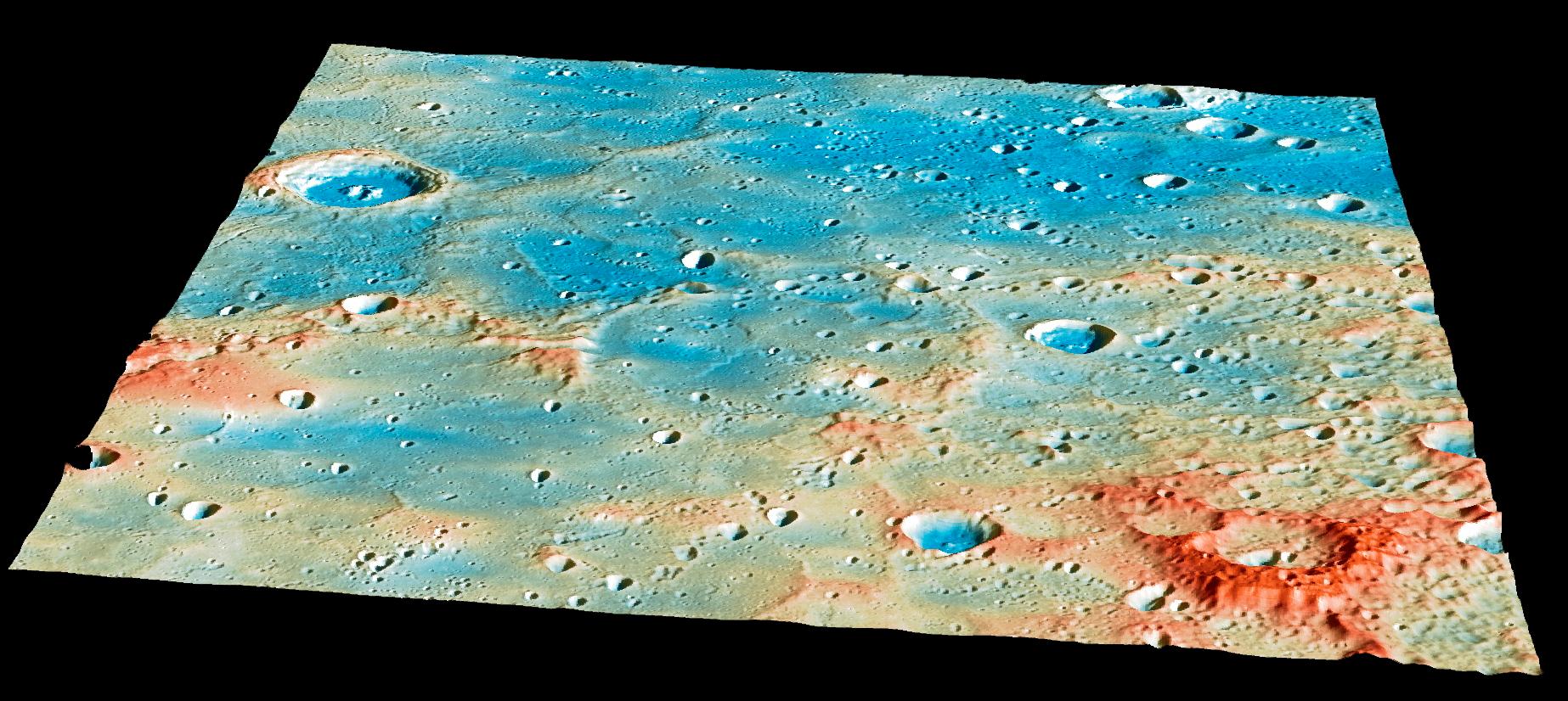
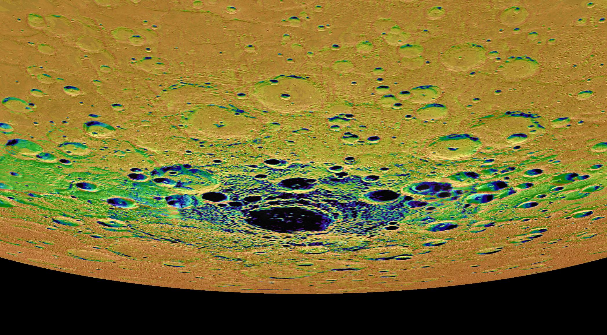
-
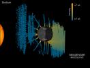
PIA19444:
-
Overview of the Impact Region
Full Resolution:
TIFF
(4.576 MB)
JPEG
(276.7 kB)
|
|
|
2015-04-29 |
Mercury
|
MESSENGER
|
Mercury Dual Imaging System (MDIS)
MLA
|
1262x1400x3 |
|
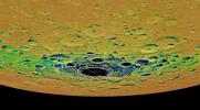
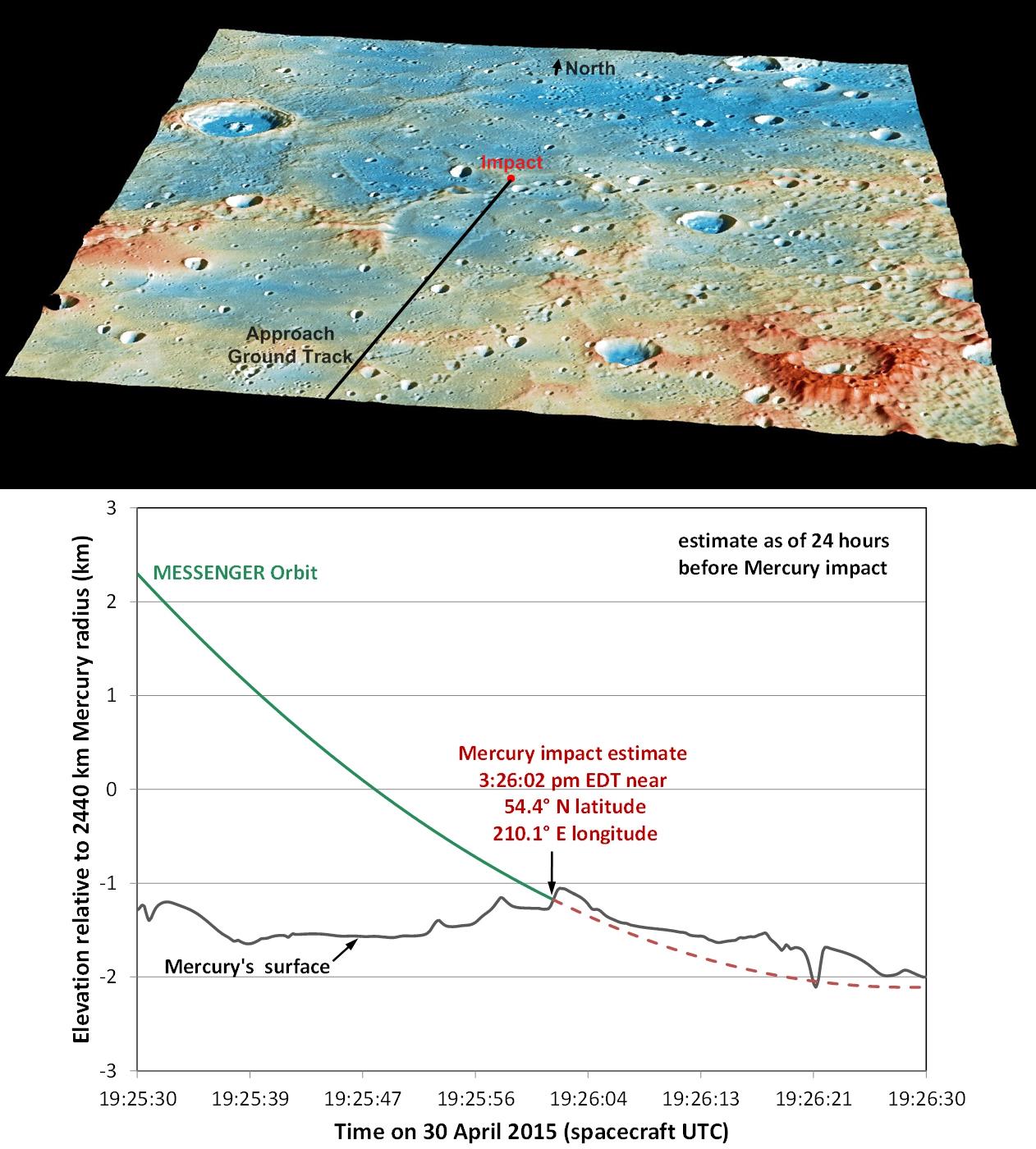
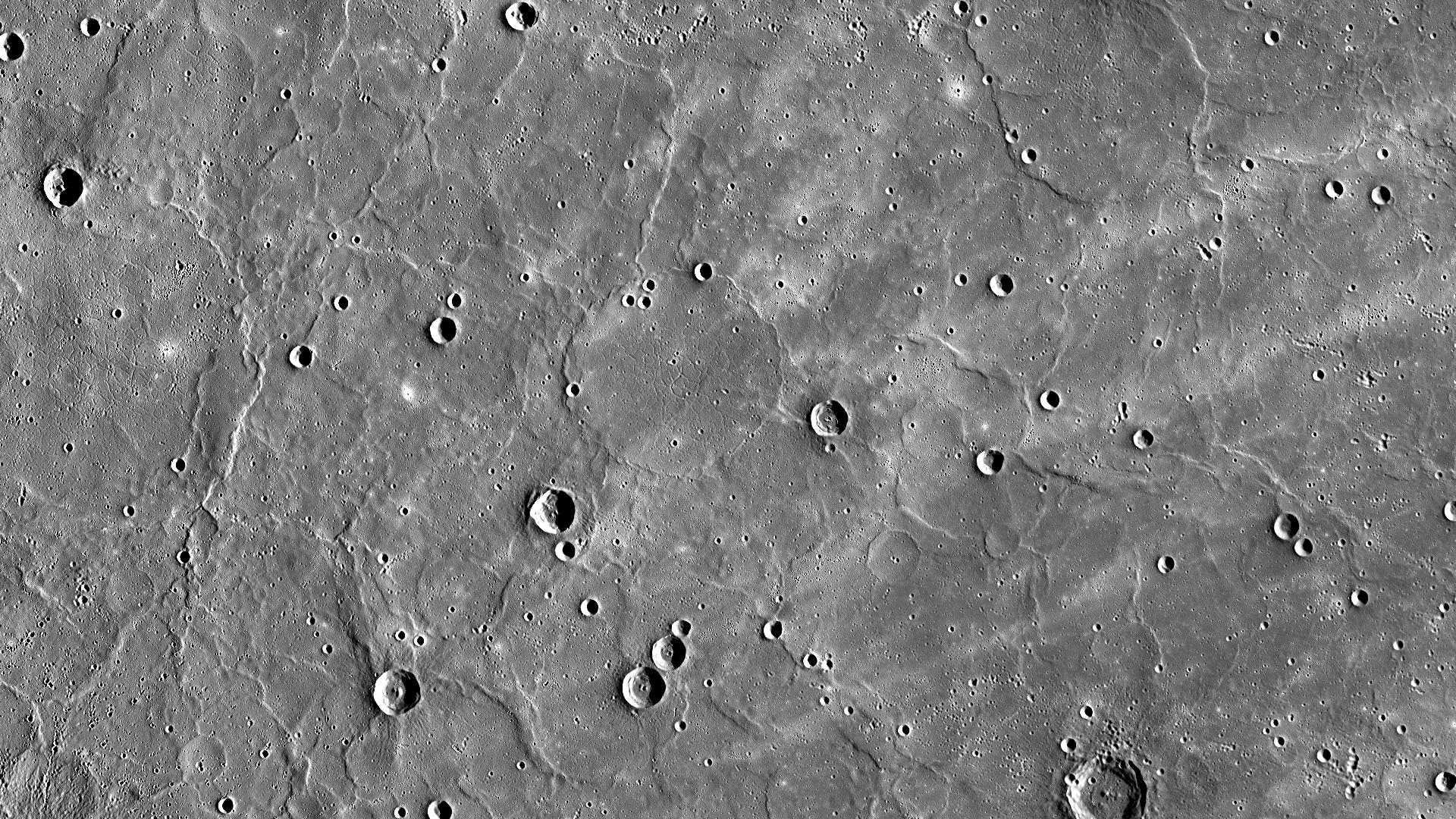
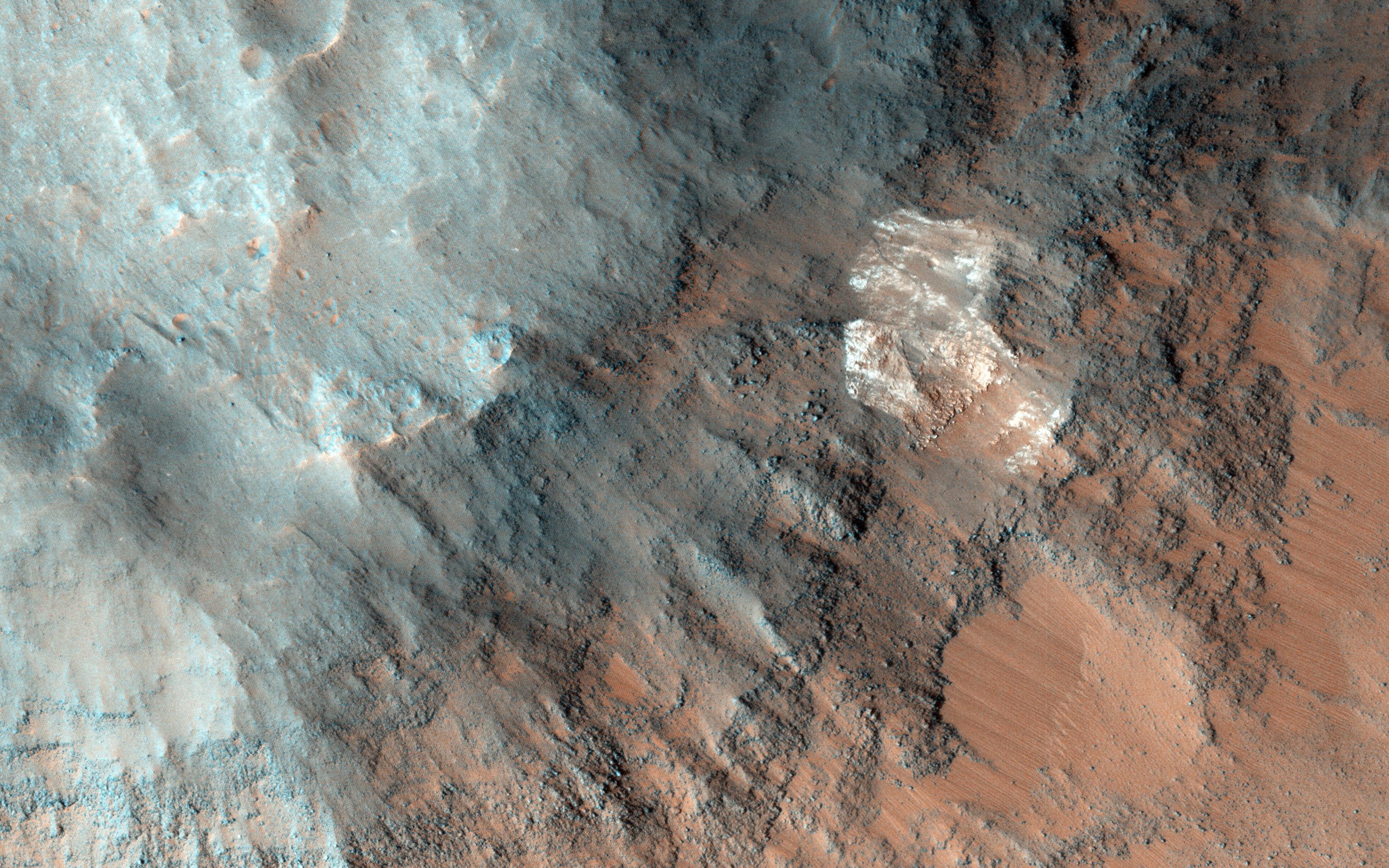
-
PIA19443:
-
Details of MESSENGER's Impact Location
Full Resolution:
TIFF
(5.302 MB)
JPEG
(218.3 kB)
|
|
|
2015-04-29 |
Mercury
|
MESSENGER
|
MDIS - Narrow Angle
|
508x512x1 |

|
-
PIA19442:
-
Tomorrow
Full Resolution:
TIFF
(260.6 kB)
JPEG
(53.02 kB)
|
|
|
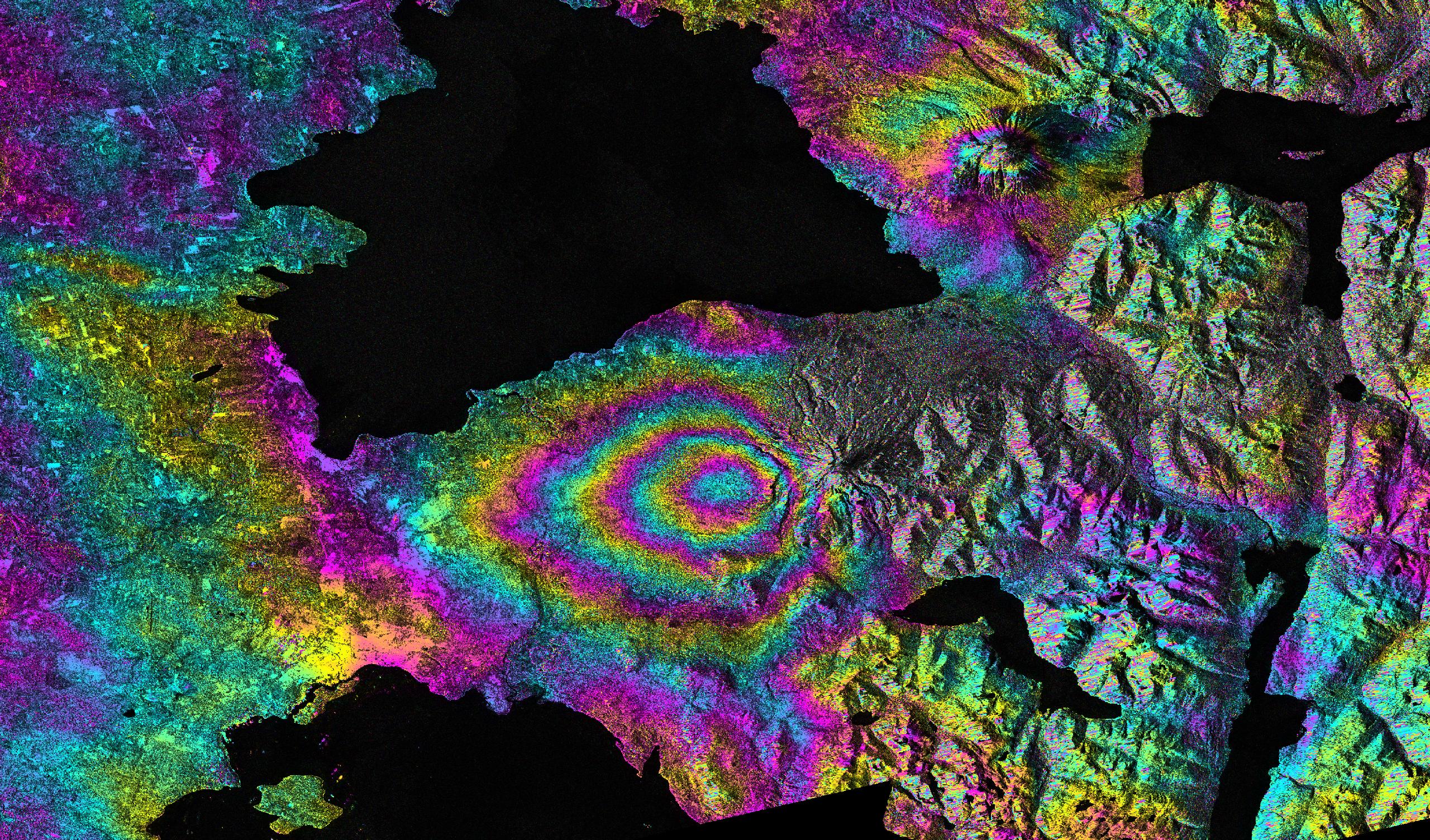
2015-04-29 |
Earth
|
|
C-SAR Sensor
|
2560x1504x3 |
|
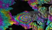
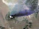
-
PIA11434:
-
Ground Deformation from Chilean Volcanic Eruption Shown by Satellite Radar Image
Full Resolution:
TIFF
(11.55 MB)
JPEG
(1.664 MB)
|
|
|
2015-04-29 |
Ceres
|
Dawn
|
Framing Camera
|
1024x1024x3 |
|
-
PIA19320:
-
Dawn RC3 Image 1 Anaglyph
Full Resolution:
TIFF
(3.147 MB)
JPEG
(44.53 kB)
|
|
|
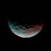
2015-04-29 |
Ceres
|
Dawn
|
Framing Camera
|
866x616x1 |
|
-
PIA19319:
-
Dawn RC3 Image 1
Full Resolution:
TIFF
(534.2 kB)
JPEG
(35.34 kB)
|
|
|
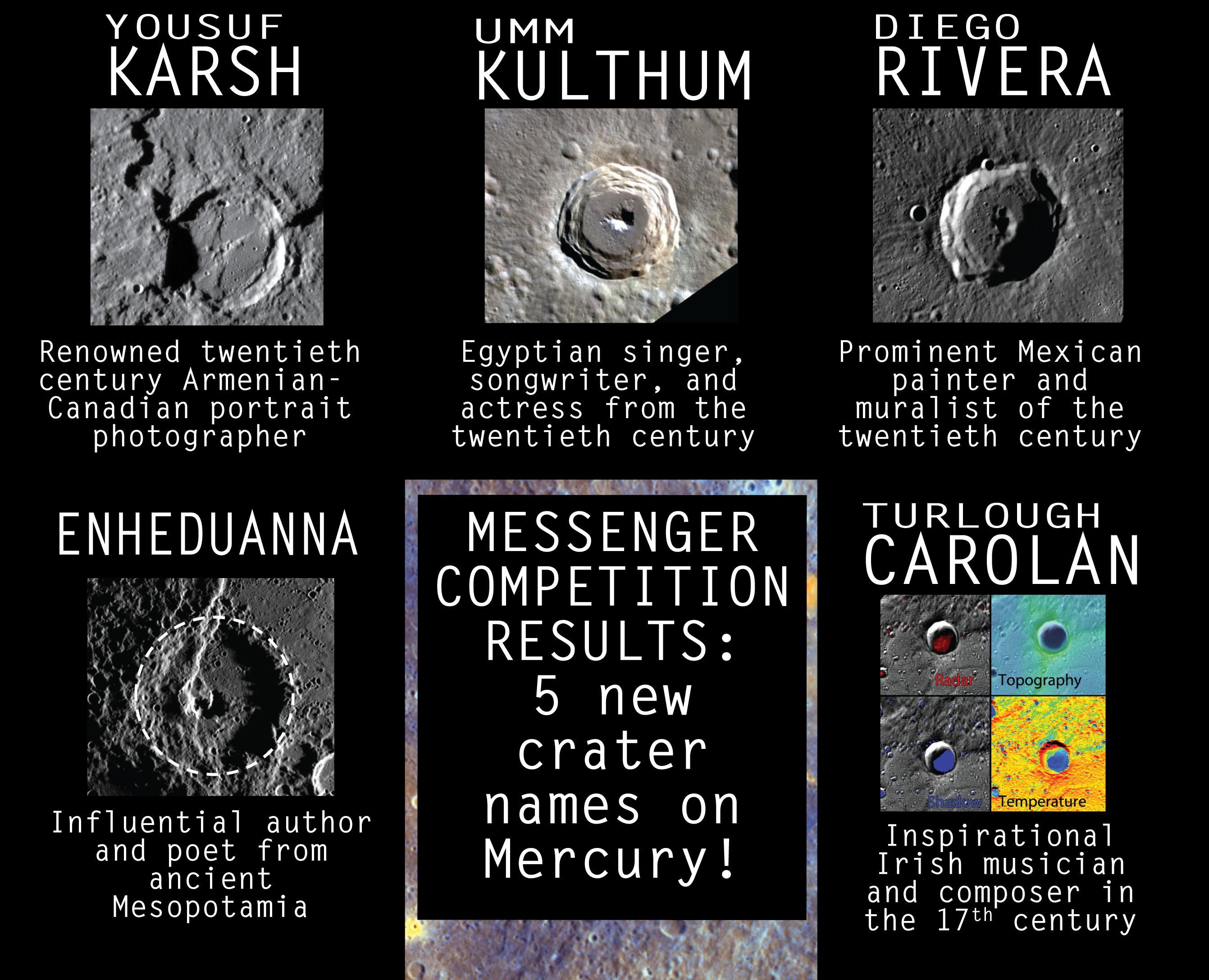
2015-04-29 |
Mercury
|
MESSENGER
|
|
2683x2175x3 |

|
-
PIA19439:
-
Five New Crater Names for Mercury
Full Resolution:
TIFF
(17.51 MB)
JPEG
(599.6 kB)
|
|
|
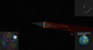
2015-04-29 |
|
NuSTAR
|
NuSTAR
|
2800x1575x3 |
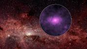
|
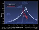
-
PIA19334:
-
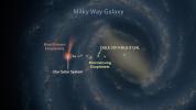
Extra X-rays at the Hub of Our Milky Way Galaxy
Full Resolution:
TIFF
(13.24 MB)
JPEG
(864.6 kB)
|
|
|
2015-04-29 |
Mars
|
2001 Mars Odyssey
|
THEMIS
|
1063x2749x1 |
|
-
PIA19437:
-
Dust Devil Tracks
Full Resolution:
TIFF
(2.926 MB)
JPEG
(342.7 kB)
|
|
|
2015-04-28 |
Mercury
|
MESSENGER
|
MDIS - Narrow Angle
|
1020x1024x1 |
|
-
PIA19438:
-
The Final Days
Full Resolution:
TIFF
(1.046 MB)
JPEG
(211.9 kB)
|
|
|
2015-04-28 |
Mars
|
2001 Mars Odyssey
|
THEMIS
|
666x1435x1 |

|
-
PIA19433:
-
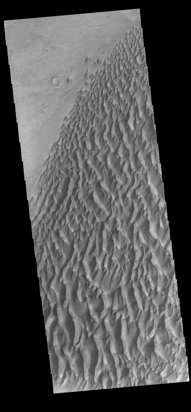
Proctor Crater Dunes
Full Resolution:
TIFF
(956.9 kB)
JPEG
(86.49 kB)
|
|
|
2015-04-27 |
Earth
|
Terra
|
ASTER
|
439x336x3 |
|
-
PIA19382:
-
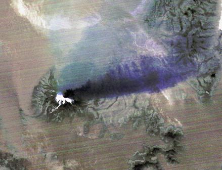
Chilean Volcanic Eruption Nighttime View
Full Resolution:
TIFF
(442.9 kB)
JPEG
(26.21 kB)
|
|
|
2015-04-27 |
Mercury
|
MESSENGER
|
MDIS - Narrow Angle
|
508x512x1 |
|
-
PIA19436:
-
The Days Dwindle Down to a Precious Few
Full Resolution:
TIFF
(260.6 kB)
JPEG
(42.79 kB)
|
|
|
2015-04-27 |
Mars
|
2001 Mars Odyssey
|
THEMIS
|
496x1403x1 |
|
-
PIA19432:
-
Angustus Laybrinthus
Full Resolution:
TIFF
(696.8 kB)
JPEG
(58.28 kB)
|
|
|
2015-04-27 |
S Rings
|
Cassini-Huygens
|
ISS - Narrow Angle
|
1020x1020x1 |
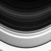
|
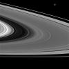
-
PIA18313:
-
Faint D Ring
Full Resolution:
TIFF
(1.042 MB)
JPEG
(88.75 kB)
|
|
|
2015-04-24 |
Mercury
|
MESSENGER
|
MDIS - Narrow Angle
|
508x512x1 |

|
-
PIA19434:
-
Delaying the Inevitable
Full Resolution:
TIFF
(260.6 kB)
JPEG
(32.58 kB)
|
|
|
2015-04-24 |
Earth
|
Terra
|
ASTER
|
3547x2896x3 |
|
-
PIA19435:
-
Turtle Mtns., ND
Full Resolution:
TIFF
(30.83 MB)
JPEG
(2.203 MB)
|
|
|
2015-04-24 |
Mars
|
2001 Mars Odyssey
|
THEMIS
|
672x1344x3 |

|
-
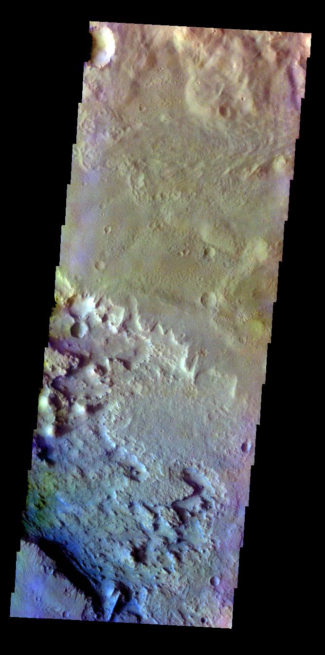
PIA19431:
-
Crater Floor - False Color
Full Resolution:
TIFF
(2.711 MB)
JPEG
(112.8 kB)
|
|
|
2015-04-23 |
Mars
|
2001 Mars Odyssey
|
THEMIS
|
666x1343x3 |
|
-
PIA19429:
-
Lava Flow - False Color
Full Resolution:
TIFF
(2.684 MB)
JPEG
(132.2 kB)
|
|
|
2015-04-22 |
Mercury
|
MESSENGER
|
MDIS - Narrow Angle
|
508x512x1 |
|
-
PIA19430:
-
If It Ain't Baroque, Don't Fix It
Full Resolution:
TIFF
(260.6 kB)
JPEG
(34.67 kB)
|
|
|
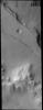
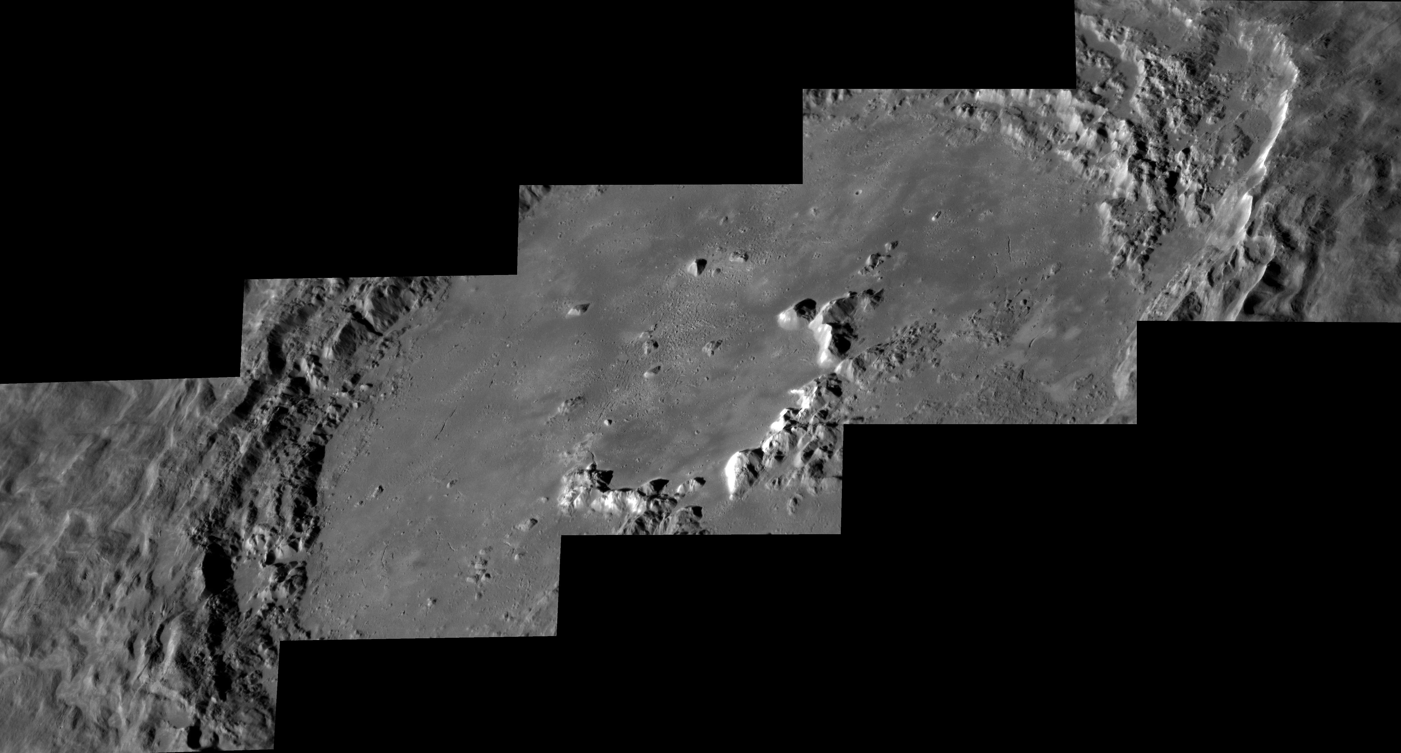
2015-04-22 |
Mars
|
Mars Reconnaissance Orbiter (MRO)
|
HiRISE
|
2880x1800x3 |
|
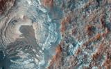
-
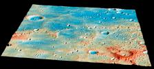
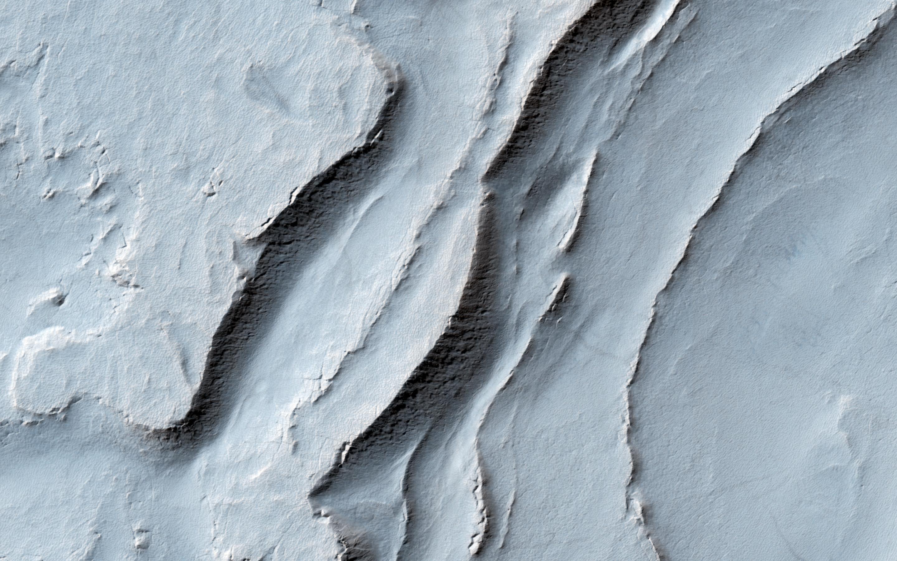
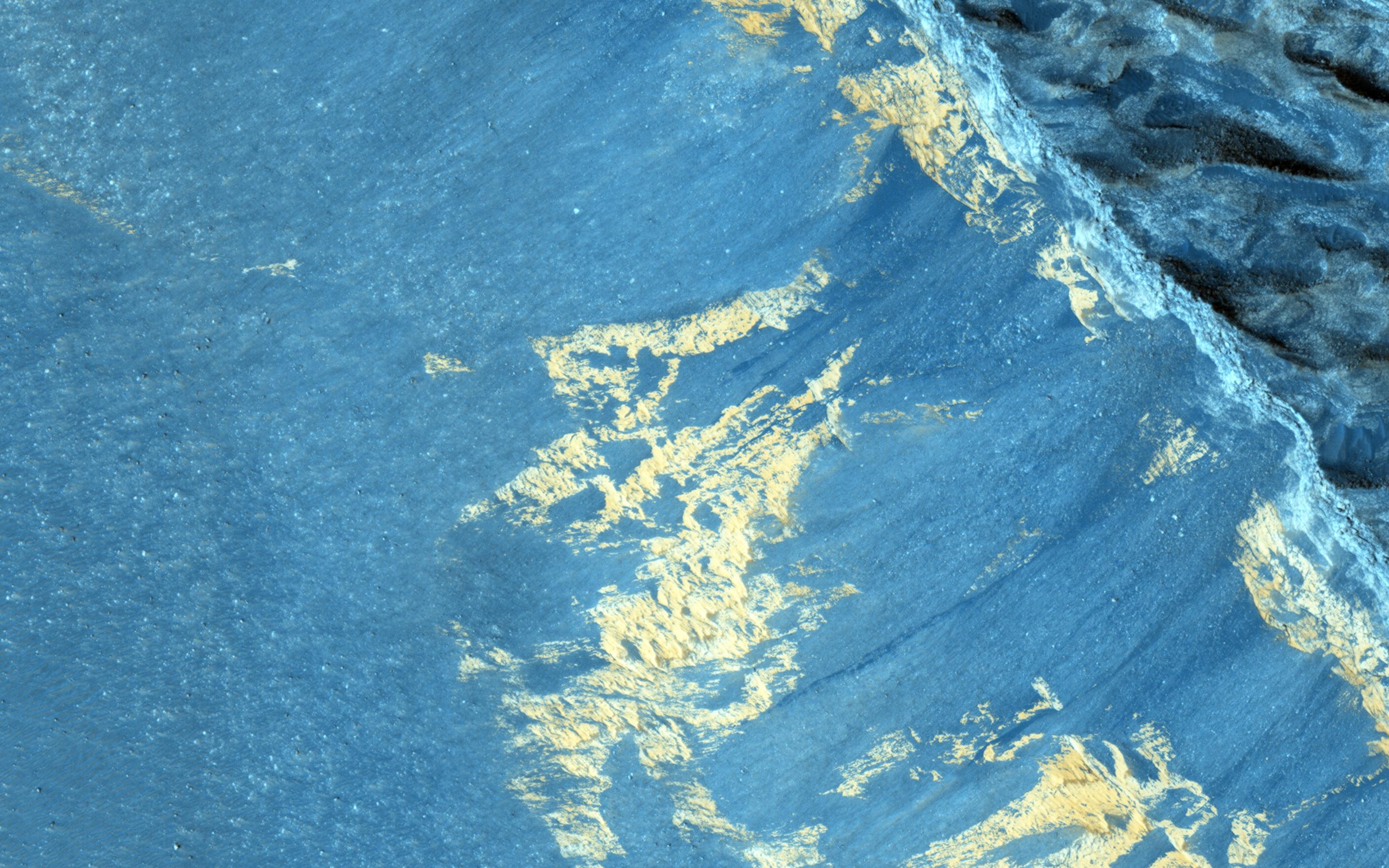
PIA19367:
-
Layering in Spallanzani Crater
Full Resolution:
TIFF
(15.56 MB)
JPEG
(720.8 kB)
|
|
|
2015-04-22 |
Mars
|
Mars Reconnaissance Orbiter (MRO)
|
HiRISE
|
2880x1800x3 |
|
-
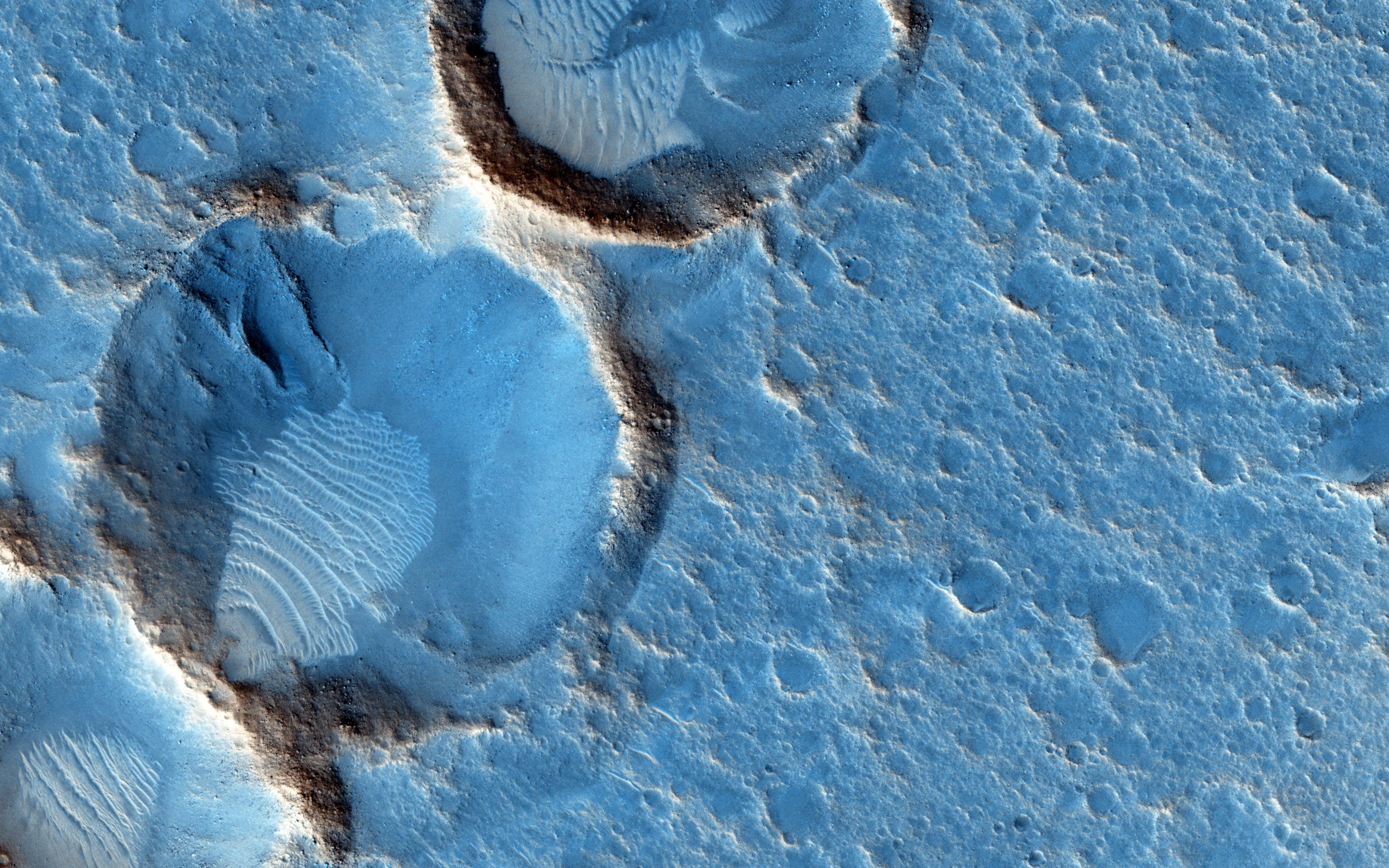
PIA19366:
-
Sinuous Ridge on the Orson Welles Bajada
Full Resolution:
TIFF
(15.56 MB)
JPEG
(1.264 MB)
|
|
|
2015-04-22 |
Mars
|
Mars Reconnaissance Orbiter (MRO)
|
HiRISE
|
2880x1800x3 |
|
-
PIA19365:
-
Embayment in Tectonized Fluvial Terrain
Full Resolution:
TIFF
(15.56 MB)
JPEG
(891.4 kB)
|
|
|
2015-04-22 |
Mars
|
Mars Reconnaissance Orbiter (MRO)
|
HiRISE
|
2880x1800x3 |
|
-
PIA19364:
-
Slope Monitoring in Aram Chaos
Full Resolution:
TIFF
(15.56 MB)
JPEG
(793.6 kB)
|
|
|
2015-04-22 |
Mars
|
Mars Reconnaissance Orbiter (MRO)
|
HiRISE
|
2880x1800x3 |

|
-
PIA19363:
-
Ares 3 Landing Site: The Martian Revisited
Full Resolution:
TIFF
(15.56 MB)
JPEG
(985.1 kB)
|
|
|
2015-04-22 |
Earth
|
|
|
1271x671x3 |
|
-
PIA19318:
-
Orbiting Rainbows Simulation
Full Resolution:
TIFF
(2.59 MB)
JPEG
(68.7 kB)
|
|
|
2015-04-22 |
Mercury
|
MESSENGER
|
MDIS - Narrow Angle
|
1020x1024x1 |
|
-
PIA19426:
-
Scrutinizing Secondaries
Full Resolution:
TIFF
(1.046 MB)
JPEG
(160.7 kB)
|
|
|
2015-04-22 |
Mars
|
Mars Reconnaissance Orbiter (MRO)
Mars Science Laboratory (MSL)
|
HiRISE
|
2286x1510x3 |
|
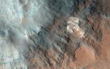
-
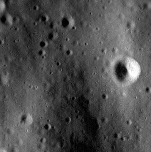
PIA19392:
-
Mars Orbiter Sees Curiosity Rover in 'Artist's Drive'
Full Resolution:
TIFF
(10.36 MB)
JPEG
(527.1 kB)
|
|
|
2015-04-22 |
Mars
|
2001 Mars Odyssey
|
THEMIS
|
668x1344x3 |
|
-
PIA19428:
-
Schaeberle Crater - False Color
Full Resolution:
TIFF
(2.694 MB)
JPEG
(115.3 kB)
|
|
|
2015-04-21 |
Earth
|
RapidScat
|
ISS-RapidScat
|
1064x706x3 |
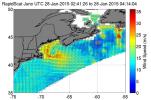
|
-
PIA18059:
-
NASA RapidScat Proving Valuable for Tropical Cyclones
Full Resolution:
TIFF
(2.255 MB)
JPEG
(187.4 kB)
|
|
|
2015-04-21 |
Mercury
|
MESSENGER
|
MDIS - Narrow Angle
|
1020x1024x1 |
|
-
PIA19425:
-
Goodbye, Hollows
Full Resolution:
TIFF
(1.046 MB)
JPEG
(130.5 kB)
|
|
|
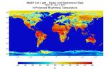
2015-04-21 |
Earth
|
SMAP
|
|
1187x882x3 |
|
-
PIA18058:
-
NASA Soil Moisture Mission Produces First Global Radar Map
Full Resolution:
TIFF
(3.142 MB)
JPEG
(201.2 kB)
|
|
|
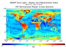
2015-04-21 |
Earth
|
SMAP
|
|
1669x1080x3 |
|
-
PIA18057:
-
NASA Soil Moisture Mission Produces First Global Radiometer Map
Full Resolution:
TIFF
(5.41 MB)
JPEG
(226.5 kB)
|
|
|
2015-04-21 |
Mars
|
2001 Mars Odyssey
|
THEMIS
|
669x1355x3 |
|
-
PIA19427:
-
Tikhov Crater - False Color
Full Resolution:
TIFF
(2.721 MB)
JPEG
(112.4 kB)
|
|
|
2015-04-20 |
Mercury
|
MESSENGER
|
MDIS - Narrow Angle
|
1020x1024x1 |
|
-
PIA19424:
-
The End Is Near
Full Resolution:
TIFF
(1.046 MB)
JPEG
(102.2 kB)
|
|
|
2015-04-20 |
Mars
|
2001 Mars Odyssey
|
THEMIS
|
673x1345x3 |
|
-
PIA19408:
-
Noachis Terra - False Color
Full Resolution:
TIFF
(2.717 MB)
JPEG
(83.49 kB)
|
|
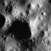
|
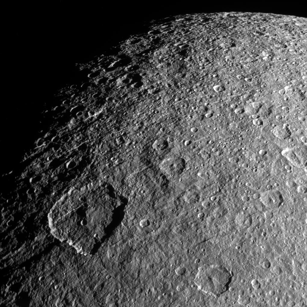
2015-04-20 |
Rhea
|
Cassini-Huygens
|
ISS - Narrow Angle
|
1020x1020x1 |

|
-
PIA18310:
-
Rhea in Relief
Full Resolution:
TIFF
(1.042 MB)
JPEG
(211.5 kB)
|
|
|
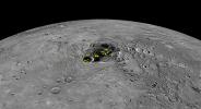
2015-04-20 |
Ceres
|
Dawn
|
Framing Camera
|
1068x1260x1 |
|
-
PIA19064:
-
Settling in at Ceres

Full Resolution:
TIFF
(1.347 MB)
JPEG
(118.1 kB)
|
|
|
2015-04-17 |
Mars
|
2001 Mars Odyssey
|
THEMIS
|
506x1412x1 |
|
-
PIA19407:
-
Cavi Angusti
Full Resolution:
TIFF
(715.4 kB)
JPEG
(69.72 kB)
|
|
|
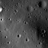
2015-04-16 |
Mars
|
Mars Science Laboratory (MSL)
|
Navigation Camera
|
3345x777x1 |

|
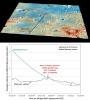
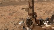
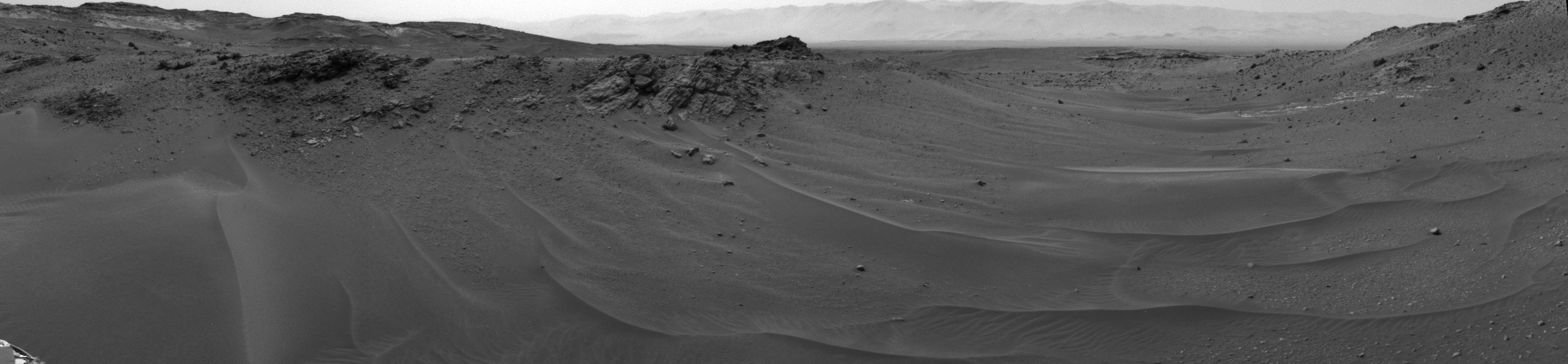
-
PIA19391:
Ten Kilometers and Counting, on Mars
Full Resolution:
TIFF
(2.602 MB)
JPEG
(261.5 kB)
|
|
|
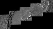
2015-04-16 |
Mars
|
Mars Science Laboratory (MSL)
|
HiRISE
|
3300x2550x3 |
|
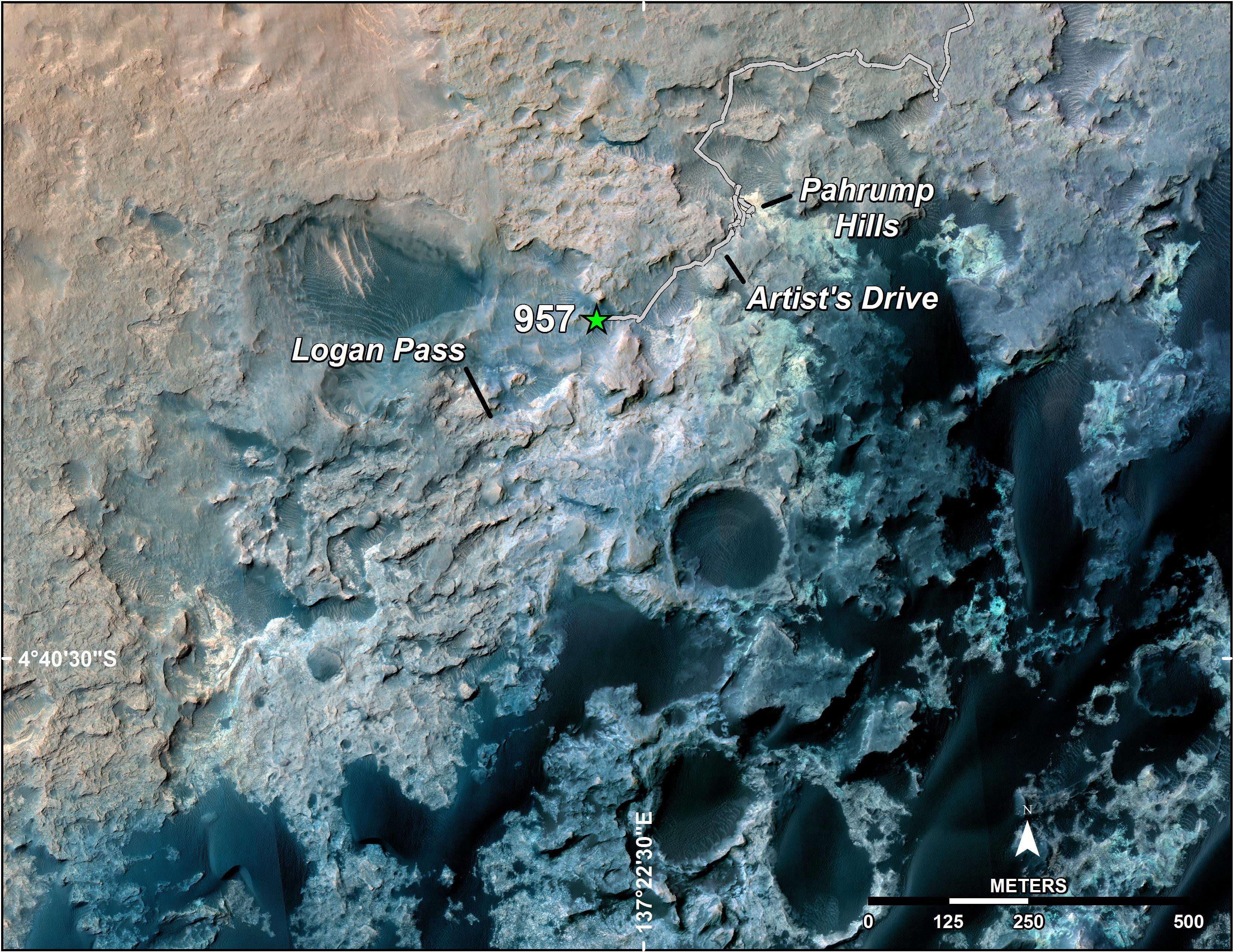
-
PIA19390:
-
Curiosity's Position After 10 Kilometers
Full Resolution:
TIFF
(25.26 MB)
JPEG
(1.777 MB)
|
|
|
2015-04-16 |
Ceres
|
Dawn
|
Framing Camera
|
1002x1035x1 |
|
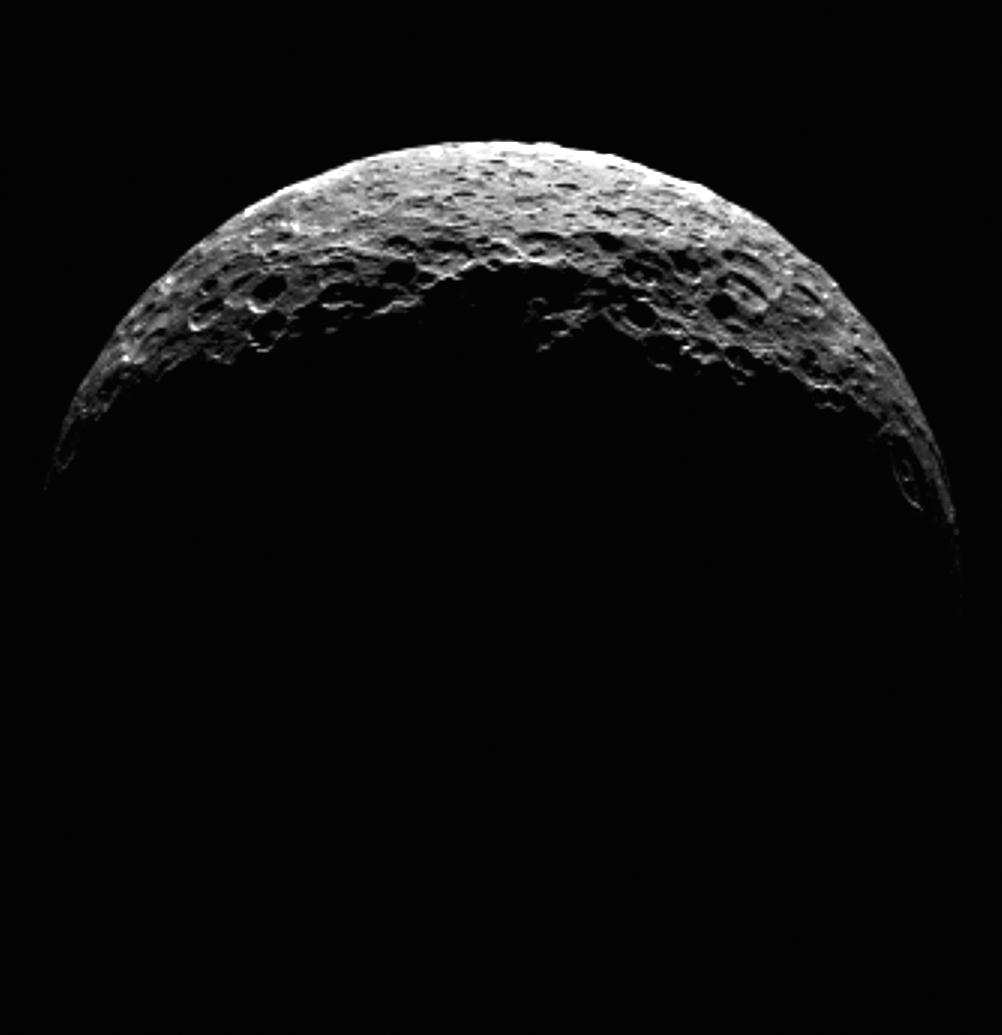
-
PIA19317:
-
Ceres' North Pole
Full Resolution:
TIFF
(1.038 MB)
JPEG
(34.76 kB)
|
|
|
2015-04-16 |
Mercury
|
MESSENGER
|
Mercury Dual Imaging System (MDIS)
|
3000x1242x1 |
|
-
PIA19423:
-
Awesome Abedin
Full Resolution:
TIFF
(3.731 MB)
JPEG
(356.1 kB)
|
|
|
2015-04-16 |
Mercury
|
MESSENGER
|
Mercury Dual Imaging System (MDIS)
MLA
|
1664x1206x3 |
|
-
PIA19422:
-
A Striking Perspective
Full Resolution:
TIFF
(6.023 MB)
JPEG
(382.6 kB)
|
|
|
2015-04-16 |
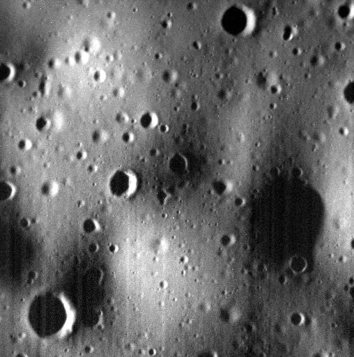
Mercury
|
MESSENGER
|
MDIS - Wide Angle
|
1920x1080x3 |
|
-
PIA19421:
-
Orange Is the New Blue
Full Resolution:
TIFF
(6.223 MB)
JPEG
(407.1 kB)
|
|
|
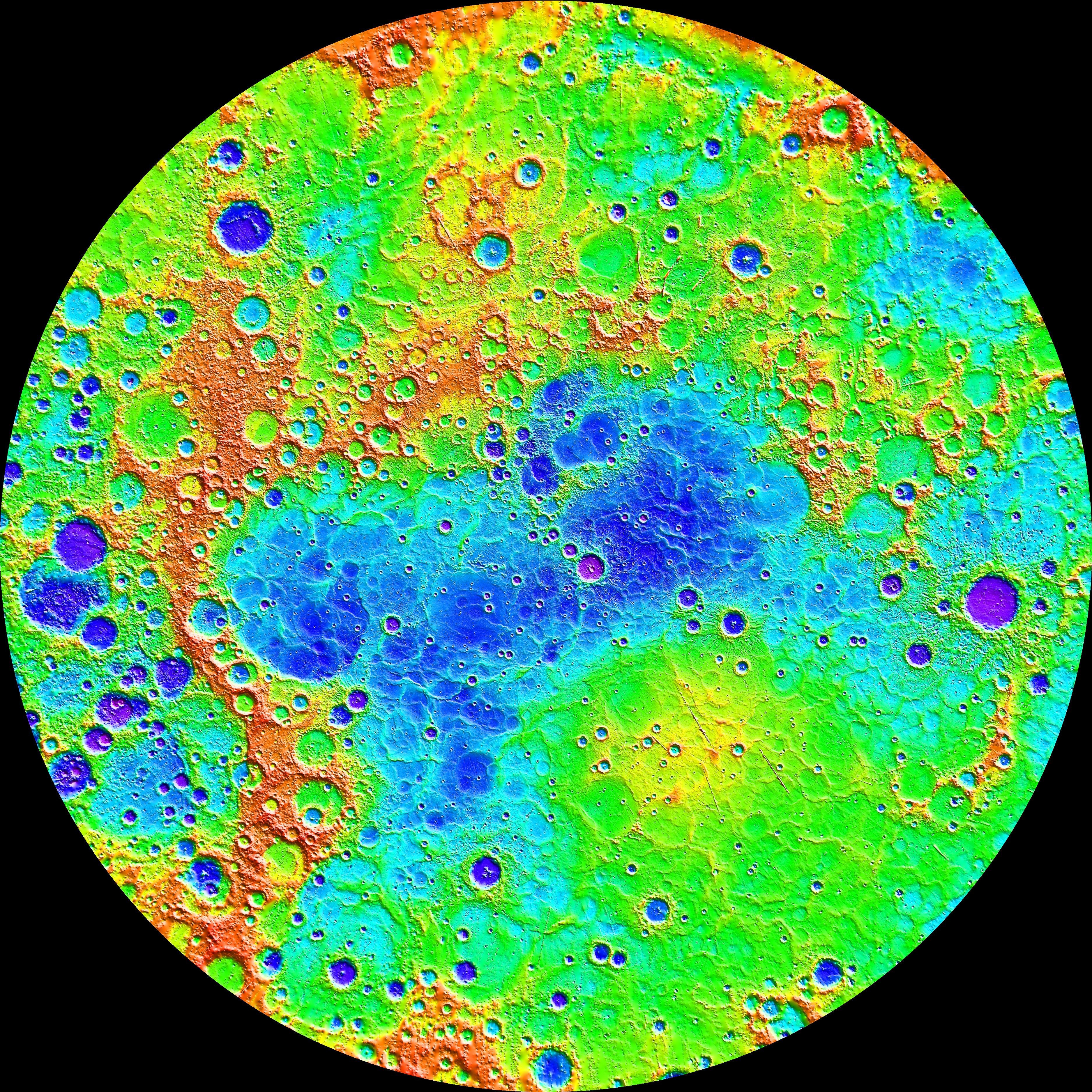
2015-04-16 |
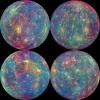
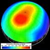
Mercury
|
MESSENGER
|
MLA
|
3750x3752x3 |
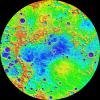
|
-
PIA19420:
-
The Ups and Downs of Mercury's Topography
Full Resolution:
TIFF
(42.23 MB)
JPEG
(3.656 MB)
|
|
|
2015-04-16 |
Mercury
|
MESSENGER
|
MASCS
|
2500x2500x3 |
|
-
PIA19419:
-
Unmasking the Secrets of Mercury
Full Resolution:
TIFF
(18.76 MB)
JPEG
(1.338 MB)
|
|
|
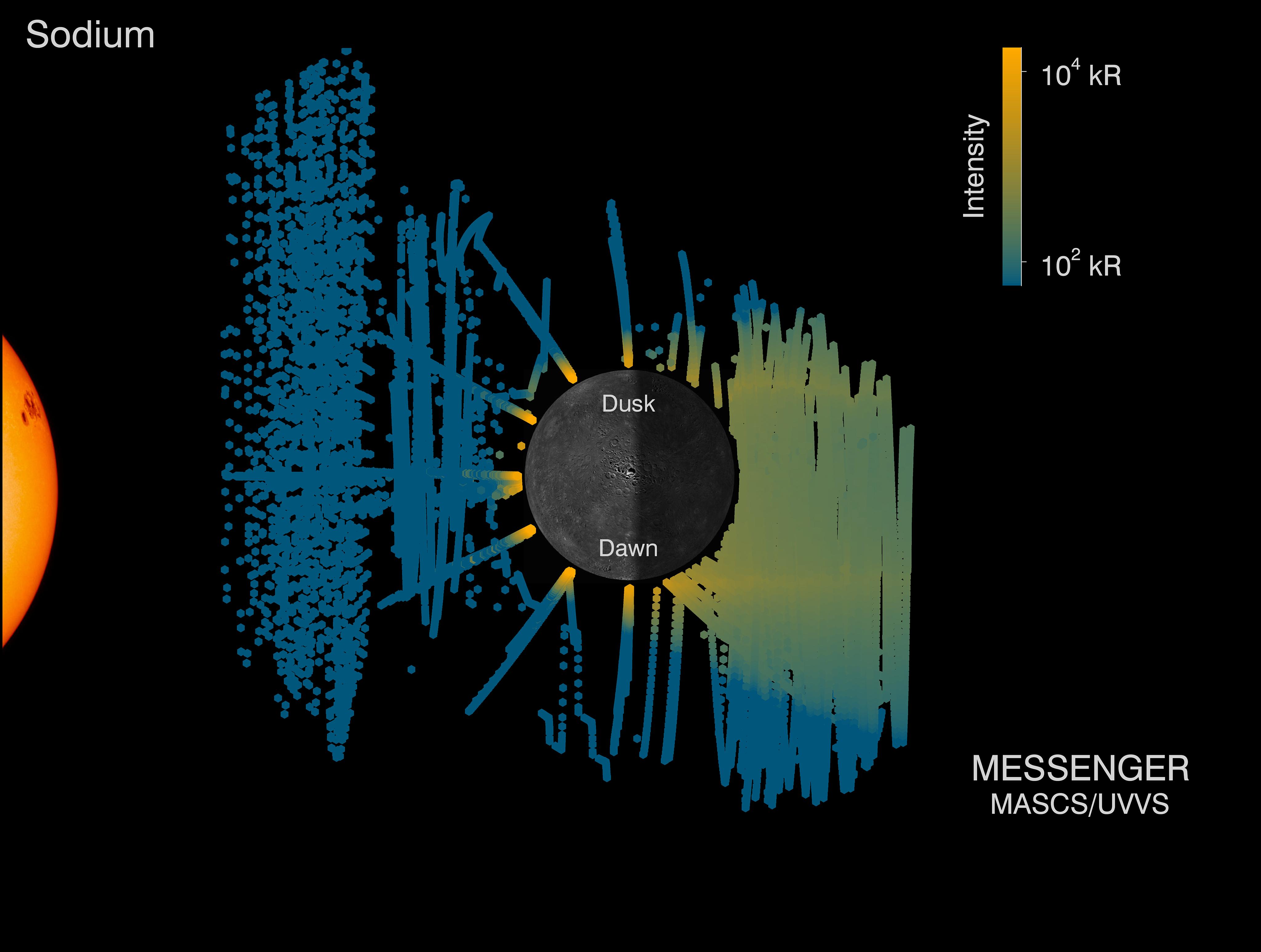
2015-04-16 |
Mercury
|
MESSENGER
|
MASCS
|
4096x3094x3 |
|
-
PIA19418:
-
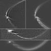
Mercury's Sodium Tail
Full Resolution:
TIFF
(38.03 MB)
JPEG
(531 kB)
|
|
|
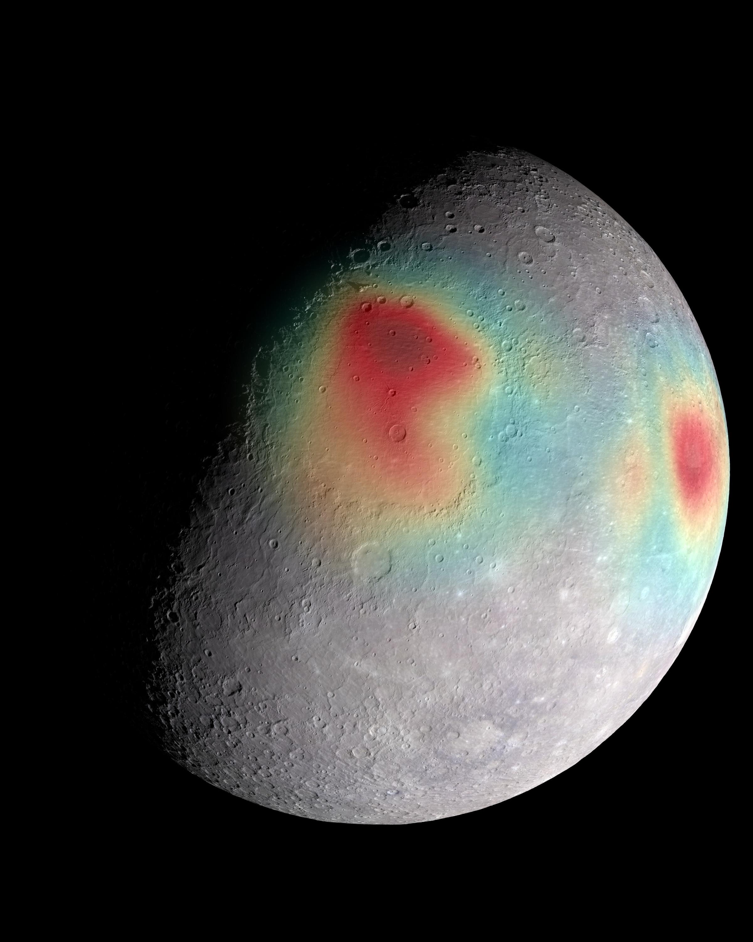
2015-04-16 |
Mercury
|
MESSENGER
|
X-Ray Spectrometer (XRS)
Mercury Dual Imaging System (MDIS)
|
1920x1440x3 |

|
-
PIA19417:
-
Showing Some Chemistry
Full Resolution:
TIFF
(8.298 MB)
JPEG
(165.8 kB)
|
|
|
2015-04-16 |
Mercury
|
MESSENGER
|
Mercury Dual Imaging System (MDIS)
|
2095x1156x3 |
|
-
PIA19416:
-
Shadows in the South
Full Resolution:
TIFF
(7.269 MB)
JPEG
(523.7 kB)
|
|
|
2015-04-16 |
Mercury
|
MESSENGER
|
Mercury Dual Imaging System (MDIS)
|
1920x1080x1 |

|
-
PIA19415:
-
Expansive Northern Volcanic Plains
Full Resolution:
TIFF
(2.076 MB)
JPEG
(705.6 kB)
|
|
|
2015-04-16 |
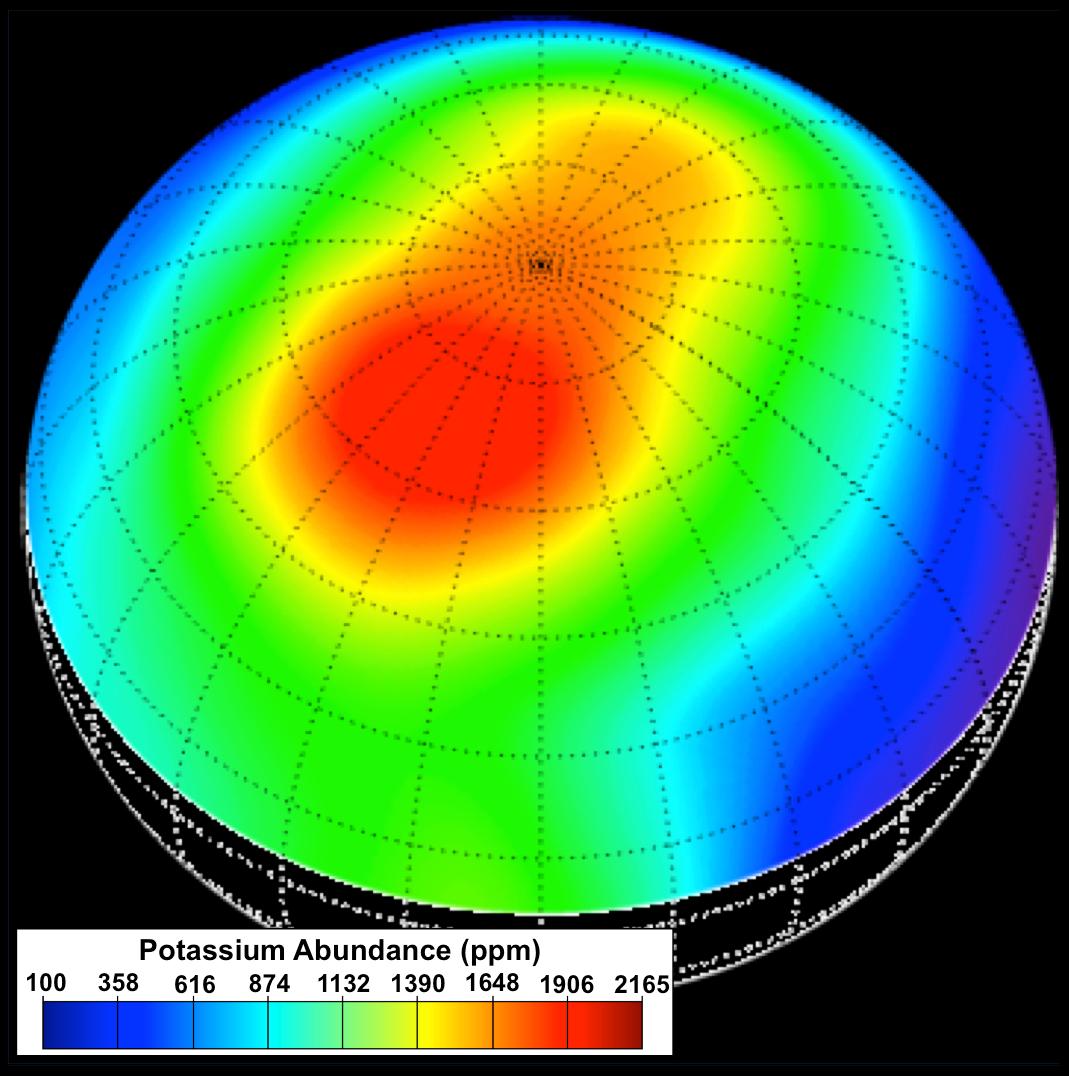
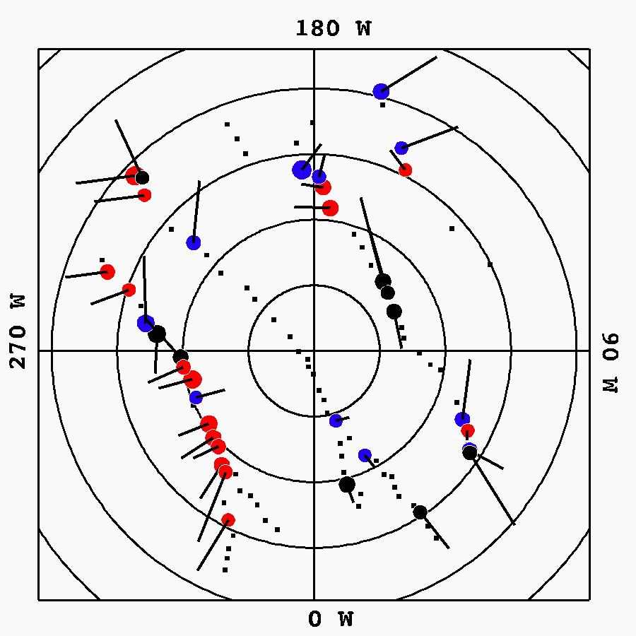
Mercury
|
MESSENGER
|
Gamma Ray Spectrometer
|
1069x1076x3 |
|
-
PIA19414:
-
Mapping Potassium
Full Resolution:
TIFF
(3.452 MB)
JPEG
(114.8 kB)
|
|
|
2015-04-16 |
Mercury
|
MESSENGER
|
Mercury Dual Imaging System (MDIS)
|
1979x887x3 |
|
-
PIA19413:
-
Wrinkles on Mercury
Full Resolution:
TIFF
(1.759 MB)
JPEG
(423.3 kB)
|
|
|
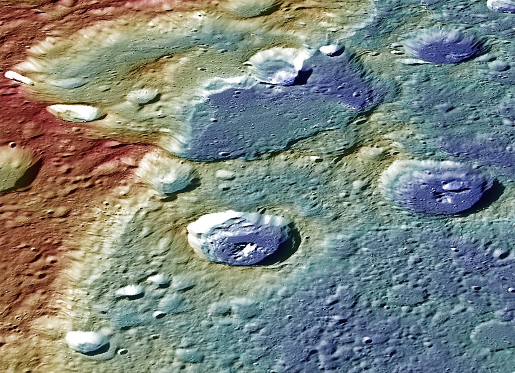
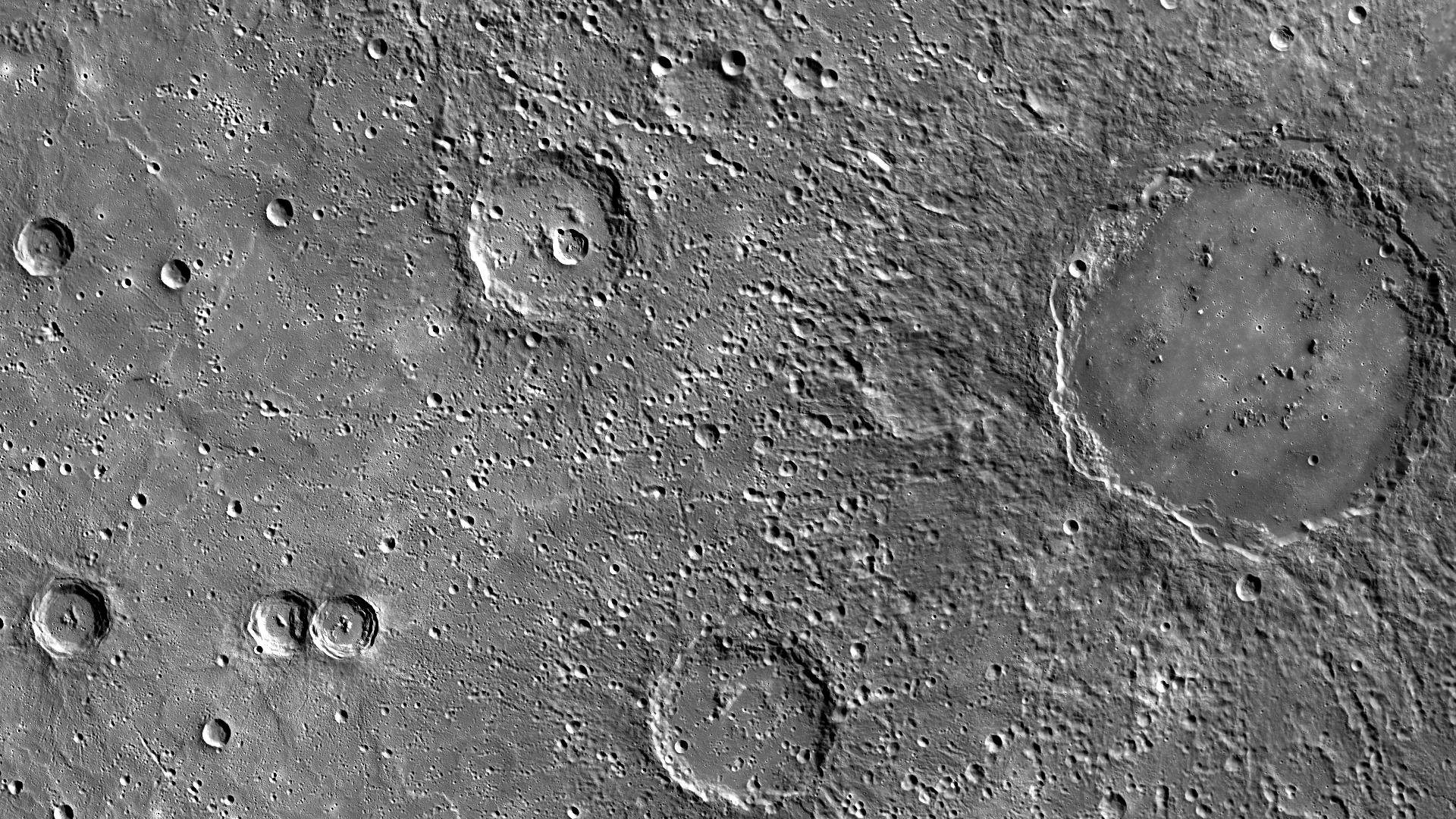
2015-04-16 |
Mercury
|
MESSENGER
|
Mercury Dual Imaging System (MDIS)
|
3005x2105x3 |
|
-
PIA19412:
-
Dramatic Darks of Derain
Full Resolution:
TIFF
(18.99 MB)
JPEG
(840.2 kB)
|
|
|
2015-04-16 |
Mercury
|
MESSENGER
|
Mercury Dual Imaging System (MDIS)
|
4000x2179x3 |
|
-
PIA19411:
-
Water Ice on Mercury
Full Resolution:
TIFF
(26.16 MB)
JPEG
(2.451 MB)
|
|
|
2015-04-16 |
Mercury
|
MESSENGER
|
Mercury Dual Imaging System (MDIS)
|
1920x1080x1 |
|
-
PIA19410:
-
The Architect and His Temple
Full Resolution:
TIFF
(2.076 MB)
JPEG
(436.9 kB)
|
|
|
2015-04-16 |
Mercury
|
MESSENGER
|
Mercury Dual Imaging System (MDIS)
|
2700x2200x1 |
|
-
PIA19409:
-
A Detailed Look at Raditladi Basin
Full Resolution:
TIFF
(5.946 MB)
JPEG
(1.054 MB)
|
|
|
2015-04-16 |
Mars
|
2001 Mars Odyssey
|
THEMIS
|
1320x2681x1 |

|
-
PIA19281:
-
Terra Cimmeria
Full Resolution:
TIFF
(3.543 MB)
JPEG
(465.4 kB)
|
|
|
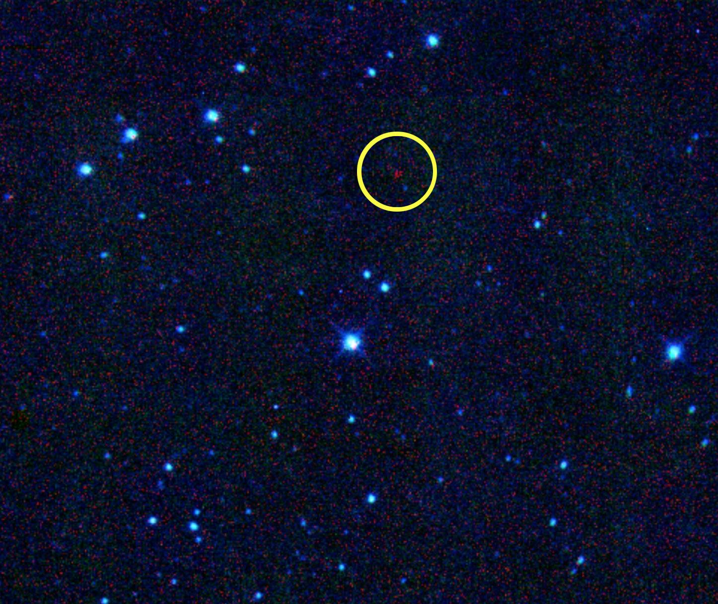
2015-04-15 |
Asteroid
|
NEOWISE
|
NEOWISE Telescope
|
1446x1216x3 |
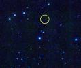
|
-
PIA19362:
-
Asteroid Named for Nobel Prize Winner Joins Historic Lineup
Full Resolution:
TIFF
(5.277 MB)
JPEG
(296.5 kB)
|
|
|
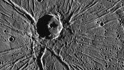
2015-04-15 |
Mercury
|
MESSENGER
|
Mercury Dual Imaging System (MDIS)
|
5637x3031x1 |
|
-
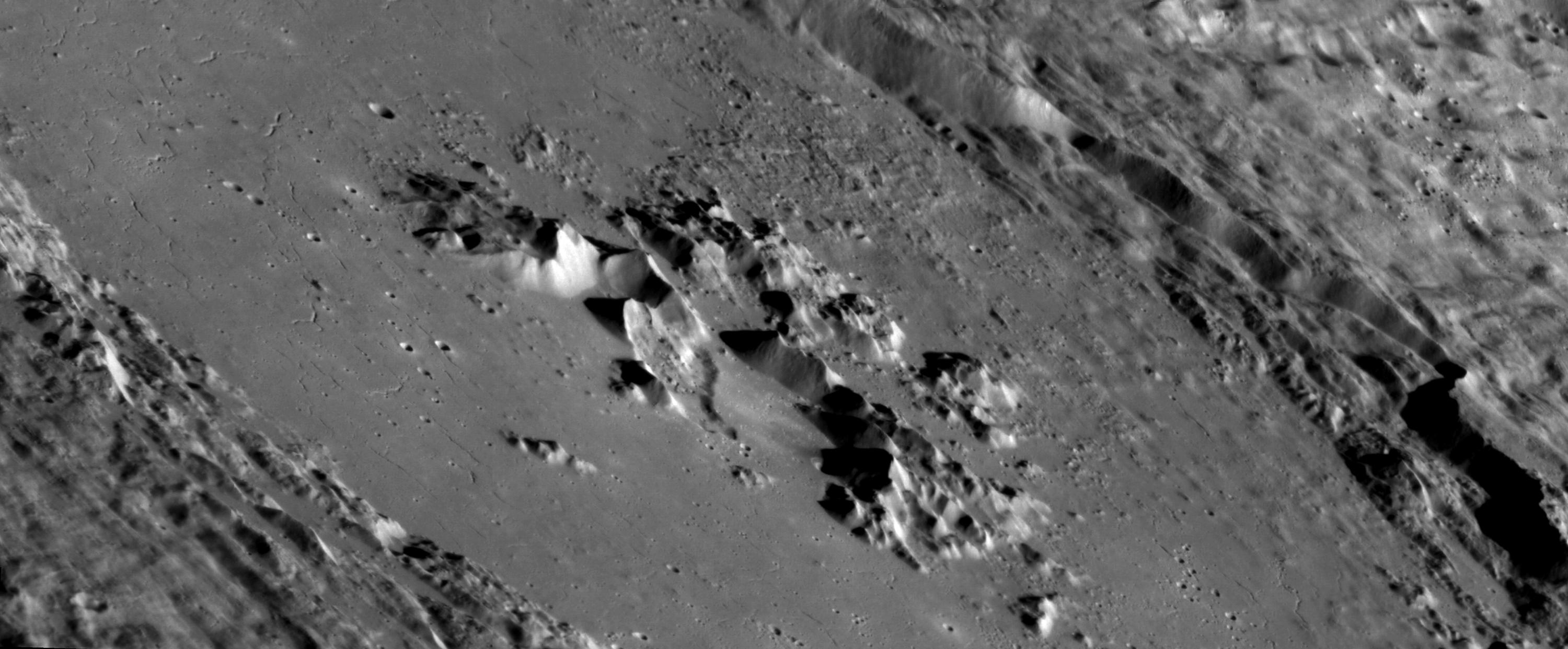
PIA19406:
-
Hokusai Spectacular!
Full Resolution:
TIFF
(17.11 MB)
JPEG
(1.133 MB)
|
|
|
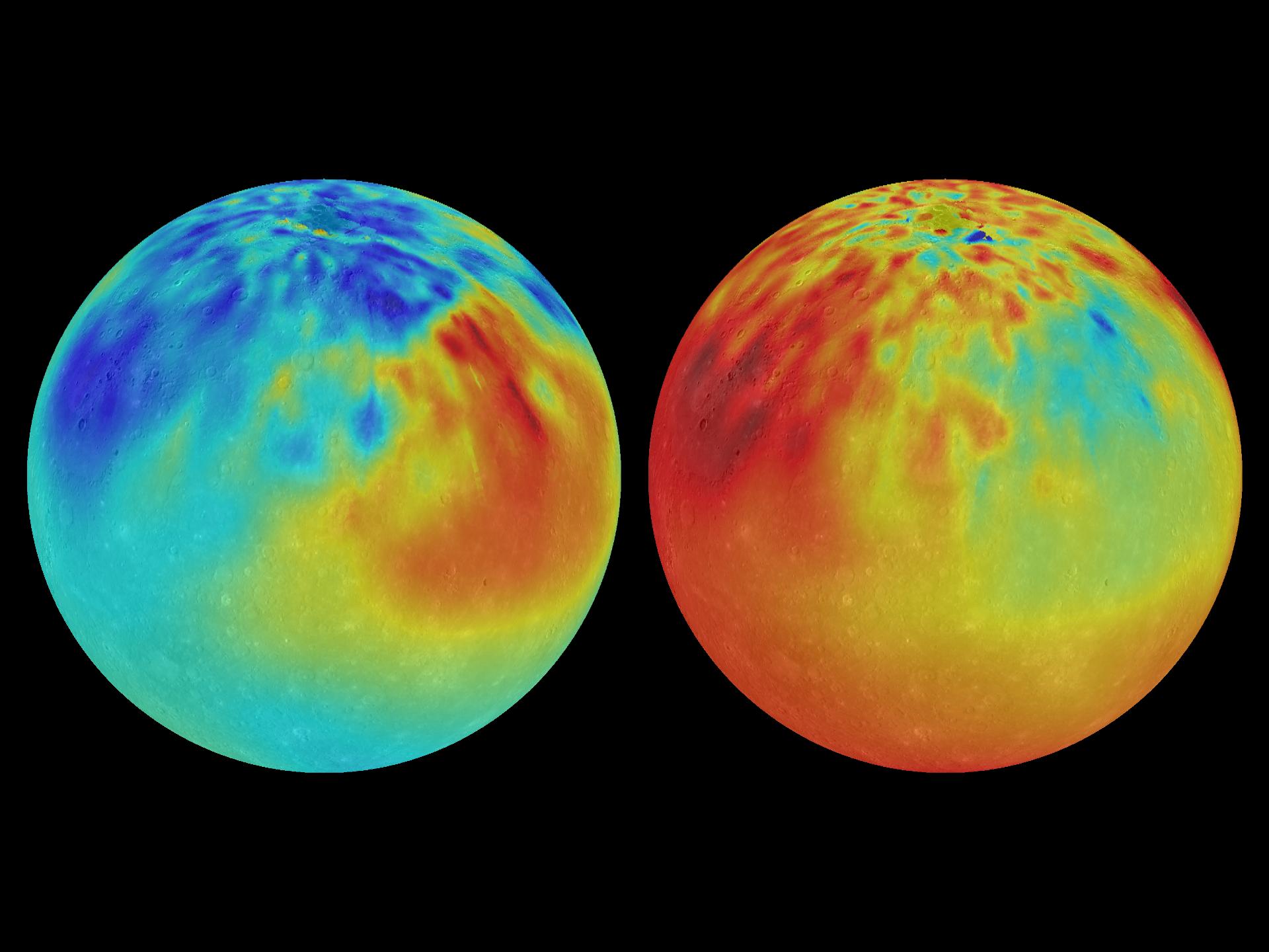
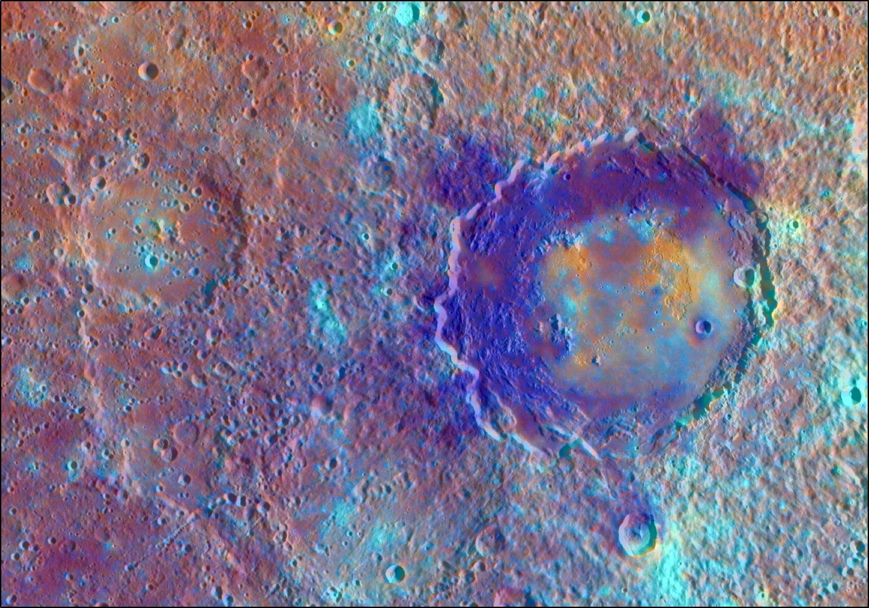
2015-04-15 |
Mercury
|
MESSENGER
|
Mercury Dual Imaging System (MDIS)
|
2400x3000x3 |

|
-
PIA19285:
-
Gravity Anomalies
Full Resolution:
TIFF
(21.61 MB)
JPEG
(487.7 kB)
|
|
|
2015-04-15 |
Mars
|
2001 Mars Odyssey
|
THEMIS
|
1053x2711x1 |
|
-
PIA19280:
-
Lyell Crater
Full Resolution:
TIFF
(2.858 MB)
JPEG
(204.3 kB)
|
|
|
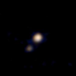
2015-04-14 |
Pluto
|
New Horizons
|
Ralph Color Imager
|
250x250x3 |
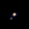
|
-
PIA09700:
-
First Pluto-Charon Color Image from New Horizons
Full Resolution:
TIFF
(187.8 kB)
JPEG
(2.147 kB)
|
|
|
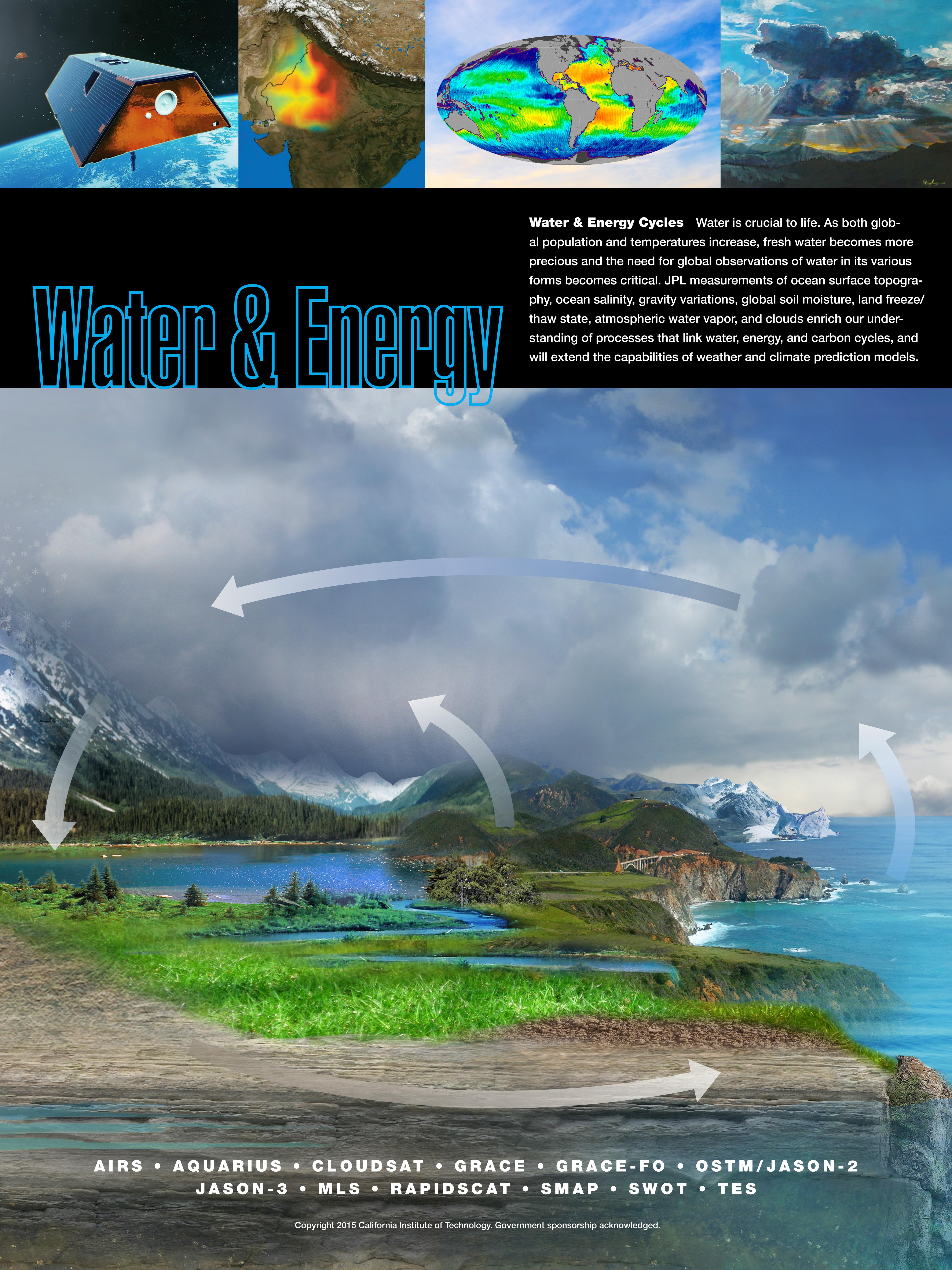
2015-04-14 |
Earth
|
|
|
4500x6000x3 |

|
-
PIA18056:
-
Water & Energy Cycles
Full Resolution:
TIFF
(81.05 MB)
JPEG
(2.646 MB)
|
|
|
2015-04-14 |
Earth
|
|
|
4500x6000x3 |
|
-
PIA18055:
-
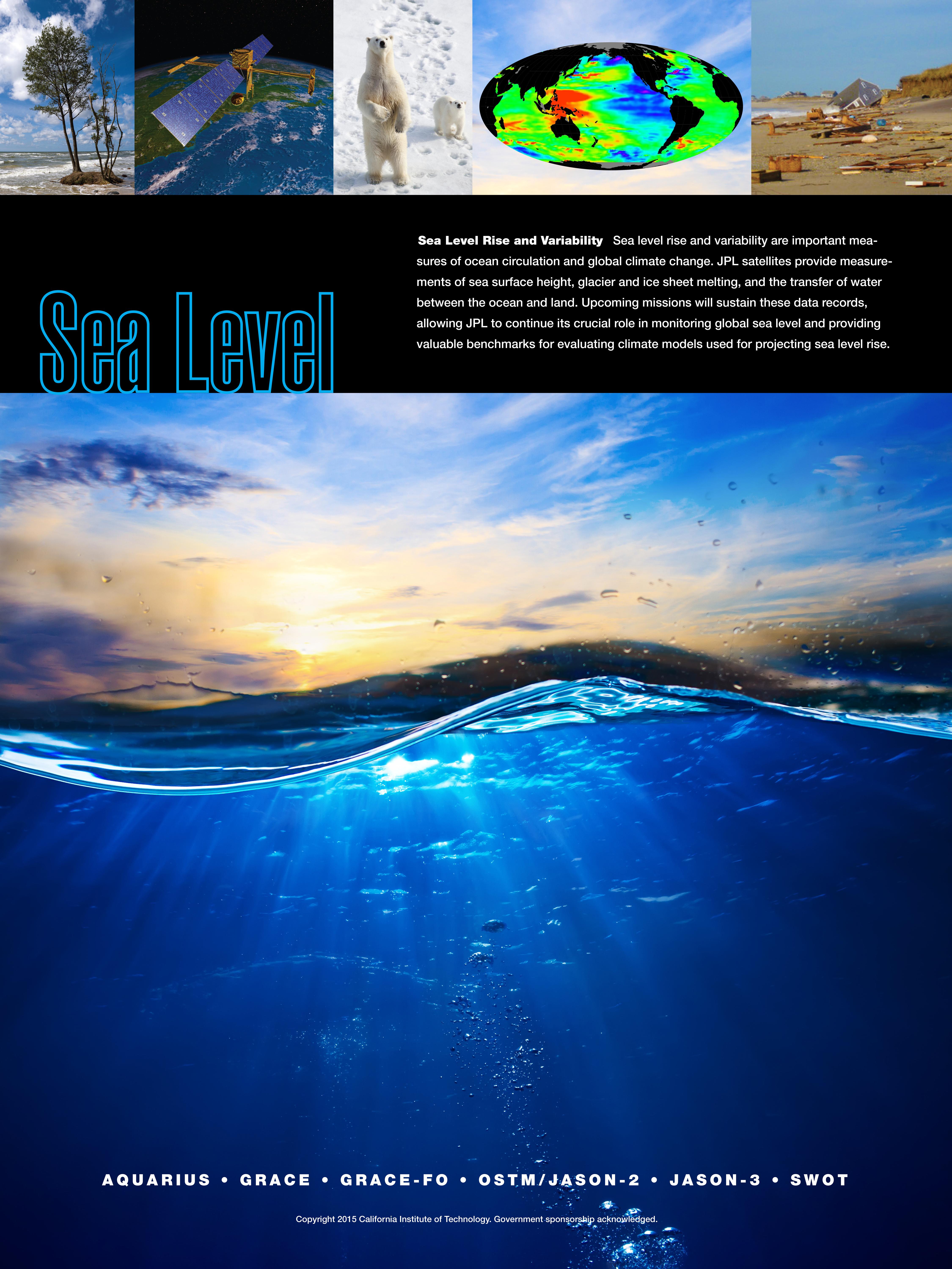
Sea Level Rise & Variability
Full Resolution:
TIFF
(81.05 MB)
JPEG
(1.722 MB)
|
|
|
2015-04-14 |
Earth
|
|
|
4500x6000x3 |

|
-
PIA18054:
-
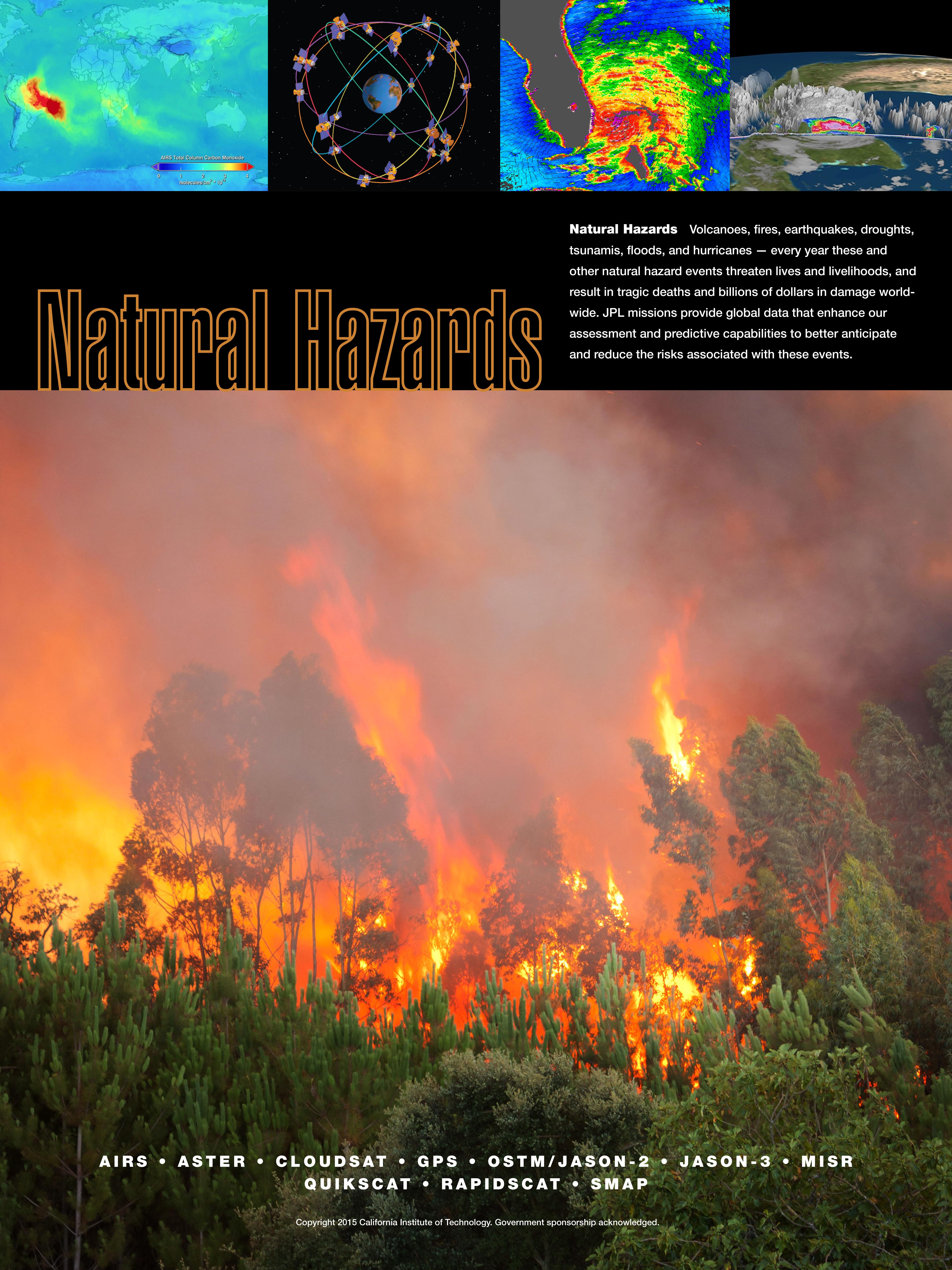
Natural Hazards
Full Resolution:
TIFF
(81.05 MB)
JPEG
(2.267 MB)
|
|
|
2015-04-14 |
Earth
|
|
|
4500x6000x3 |
|
-
PIA18053:
-
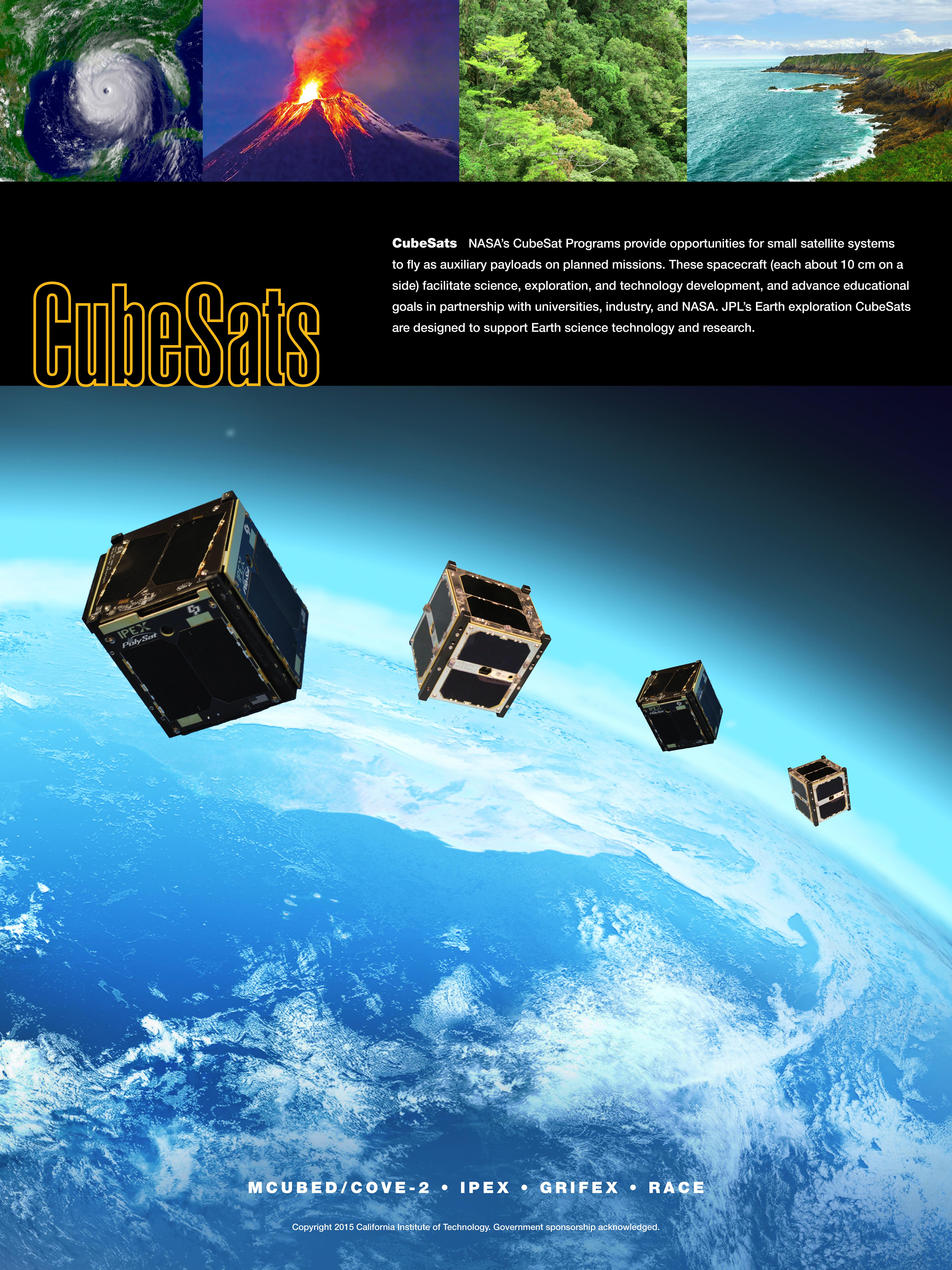
CubeSats
Full Resolution:
TIFF
(81.05 MB)
JPEG
(2.639 MB)
|
|
|
2015-04-14 |
Earth
|
|
|
4500x6000x3 |
|
-
PIA18052:
-
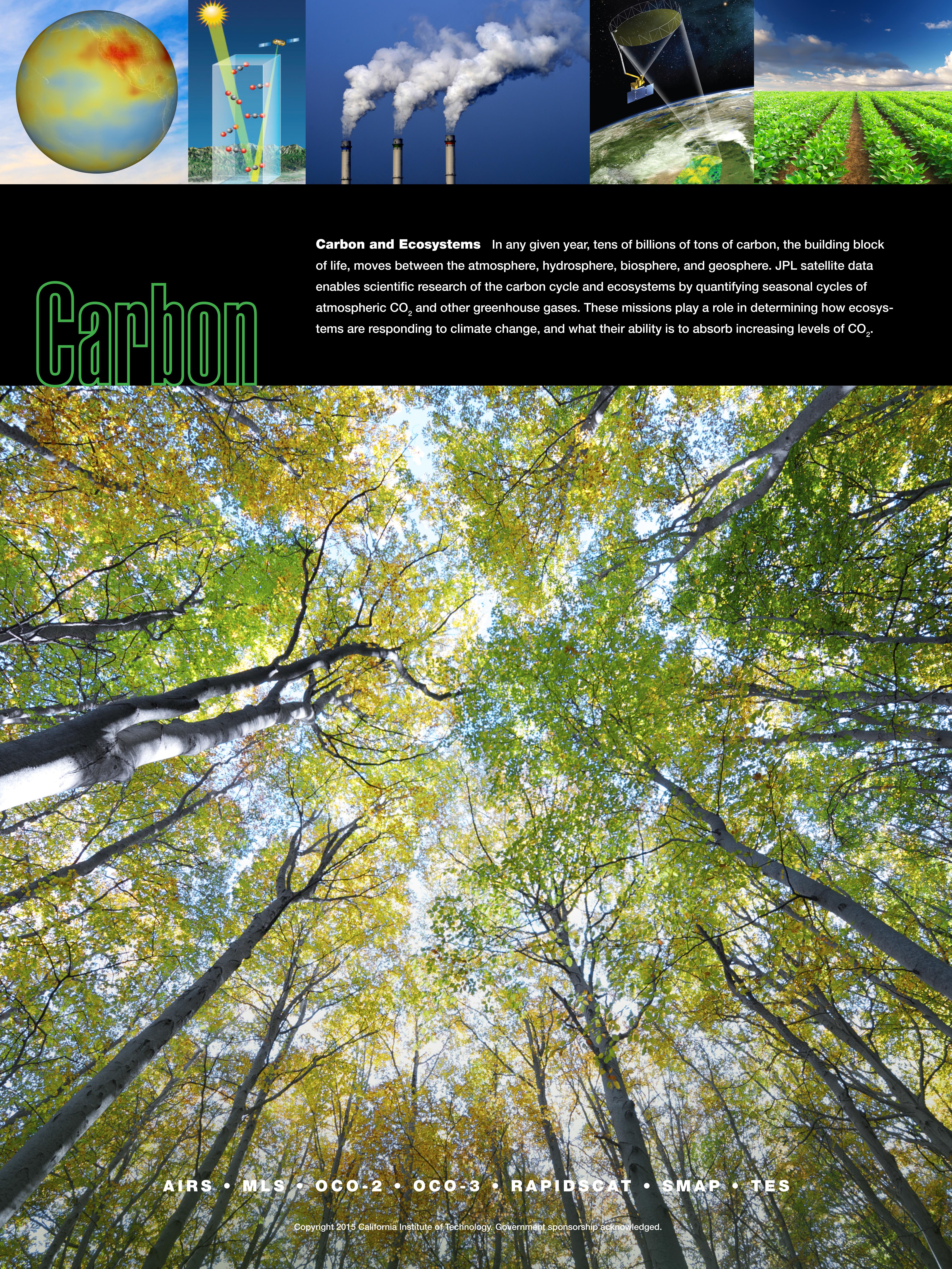
Carbon & Ecosystems
Full Resolution:
TIFF
(81.05 MB)
JPEG
(4.764 MB)
|
|
|
2015-04-14 |
Enceladus
|
Cassini-Huygens
|
|
900x900x3 |
|
-
PIA17192:
-
Tendril-producing Geysers on Enceladus' South Polar Terrain
Full Resolution:
TIFF
(2.431 MB)
JPEG
(93.24 kB)
|
|
|
2015-04-14 |
Enceladus
|
Cassini-Huygens
|
Imaging Science Subsystem
|
1024x1024x1 |
|
-
PIA17191:
-
Simulations of the Tendrils
Full Resolution:
TIFF
(1.05 MB)
JPEG
(214.8 kB)
|
|
|
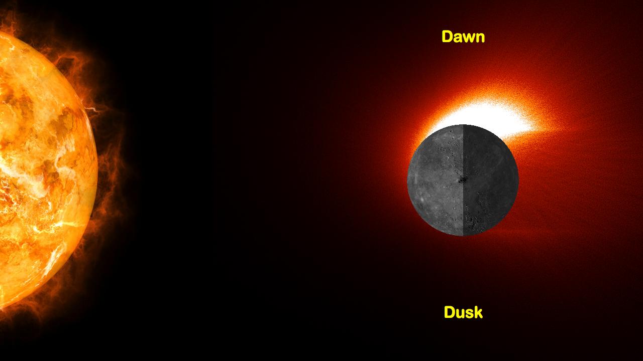
2015-04-14 |
Mercury
|
MESSENGER
|
MASCS
|
1280x720x3 |

|
-
PIA19284:
-
Mercury's Calcium Exosphere
Full Resolution:
TIFF
(2.766 MB)
JPEG
(63.36 kB)
|
|
|
2015-04-14 |
Mercury
|
MESSENGER
|
Mercury Dual Imaging System (MDIS)
|
1920x1080x1 |
|
-
PIA19283:
-
Regard Rustaveli
Full Resolution:
TIFF
(2.076 MB)
JPEG
(601.5 kB)
|
|
|
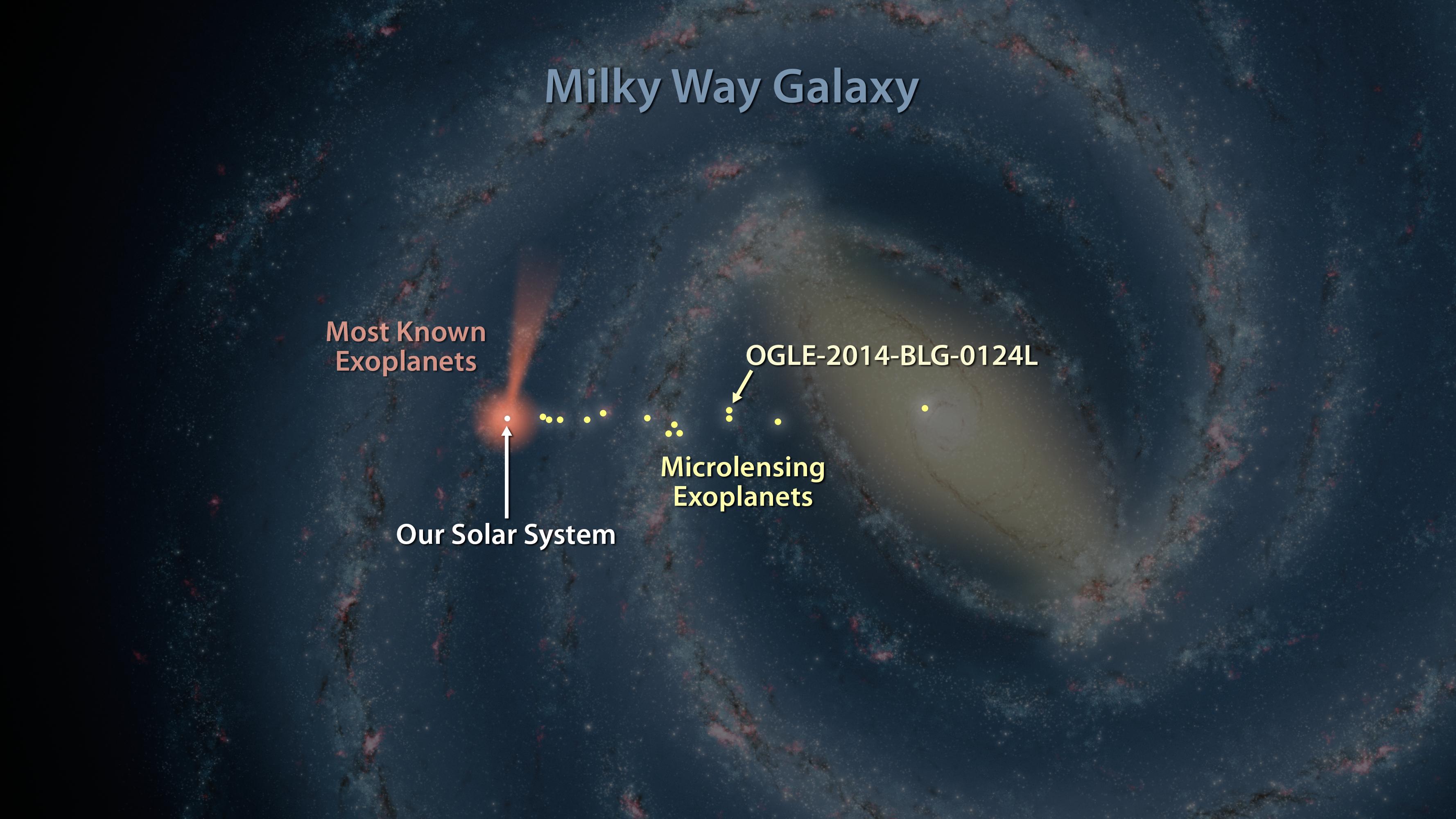
2015-04-14 |
|
Spitzer Space Telescope
|
|
3556x2000x3 |
|
-
PIA19333:
-
Map of Exoplanets Found in Our Galaxy (Artist's Concept)
Full Resolution:
TIFF
(21.34 MB)
JPEG
(500.1 kB)
|
|
|
2015-04-14 |
|
Spitzer Space Telescope
|
|
3840x2160x3 |
|
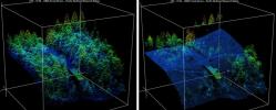
-
PIA19332:
-
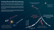
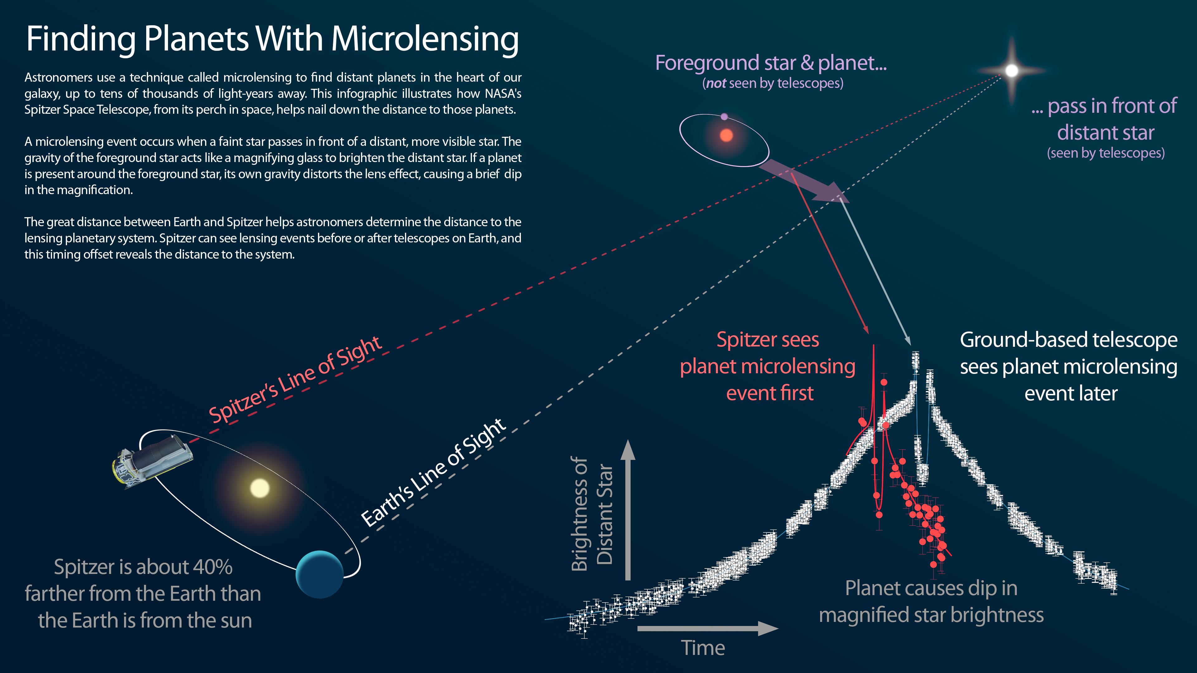
Infographic: Finding Planets With Microlensing
Full Resolution:
TIFF
(24.89 MB)
JPEG
(613.4 kB)
|
|
|
2015-04-14 |
|
Spitzer Space Telescope
|
|
3300x2550x3 |
|
-
PIA19331:
-
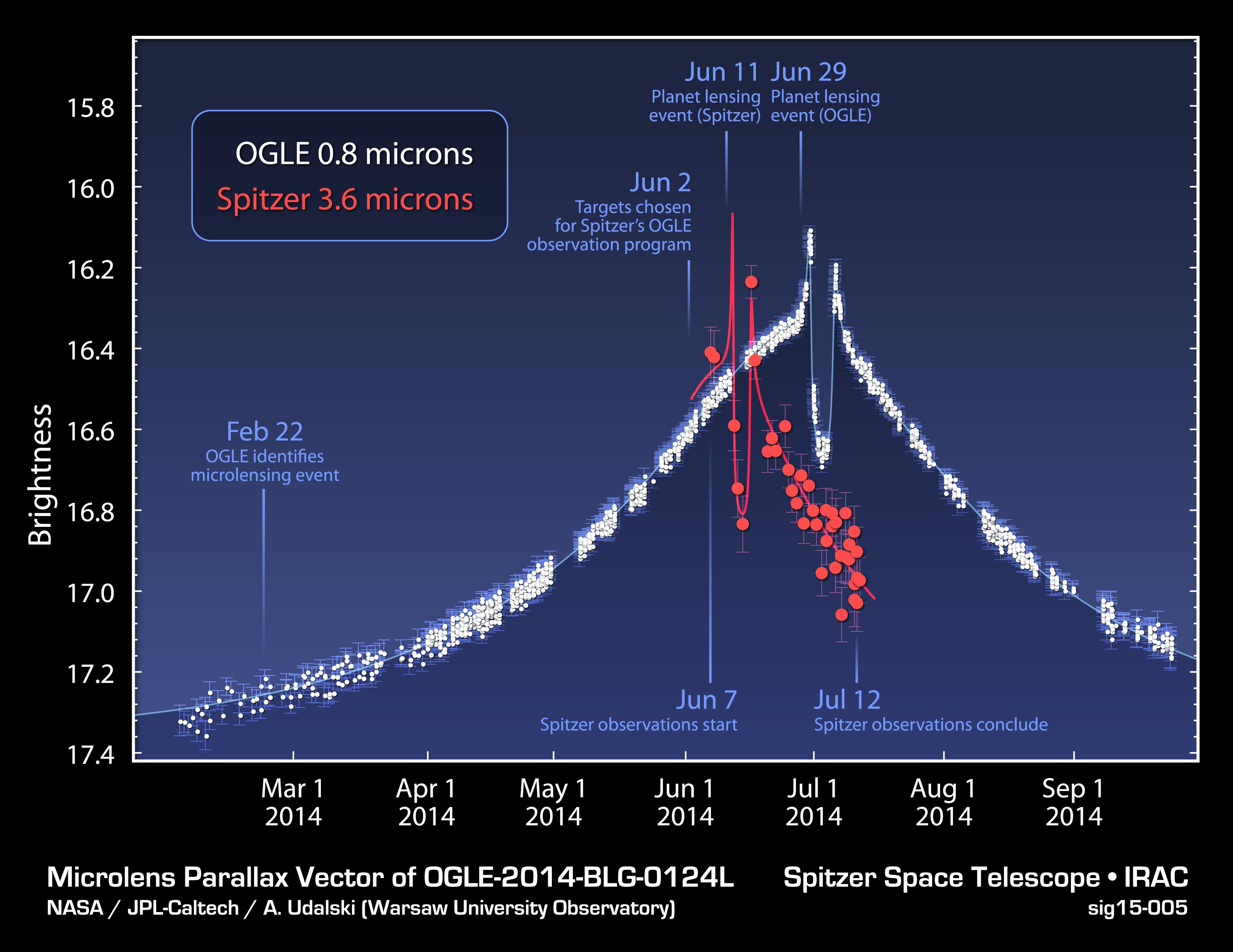
Time Delay in Microlensing Event
Full Resolution:
TIFF
(25.26 MB)
JPEG
(502.2 kB)
|
|
|
2015-04-14 |
Mars
|
2001 Mars Odyssey
|
THEMIS
|
1331x2681x1 |
|
-
PIA19278:
-
Debris Flow
Full Resolution:
TIFF
(3.572 MB)
JPEG
(196.5 kB)
|
|
|
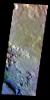
2015-04-13 |
Mercury
|
MESSENGER
|
Mercury Dual Imaging System (MDIS)
|
3456x1332x1 |

|
-
PIA19282:
-
Hyper Vent-ilating
Full Resolution:
TIFF
(4.609 MB)
JPEG
(281.6 kB)
|
|
|
2015-04-13 |
Mars
|
Mars Science Laboratory (MSL)
|
Navcam (MSL)
|
3368x832x3 |
|
-
PIA19387:
Scene From 'Artist's Drive' on Mars (Stereo)
Full Resolution:
TIFF
(8.41 MB)
JPEG
(231.6 kB)
|
|
|
2015-04-13 |
Mars
|
Mars Science Laboratory (MSL)
|
Navcam (MSL)
|
3356x685x1 |
|
-
PIA19386:
Scene From 'Artist's Drive' on Mars
Full Resolution:
TIFF
(2.302 MB)
JPEG
(234.8 kB)
|
|
|
2015-04-13 |
Mars
|
Mars Science Laboratory (MSL)
|
Navcam (MSL)
|
6246x1497x3 |
|
-
PIA19165:
Curiosity View Ahead Through 'Artist's Drive' (Stereo)
Full Resolution:
TIFF
(28.06 MB)
JPEG
(1.019 MB)
|
|
|
2015-04-13 |
Mars
|
Mars Science Laboratory (MSL)
|
Mastcam
|
1021x562x3 |
|
-
PIA19164:
-
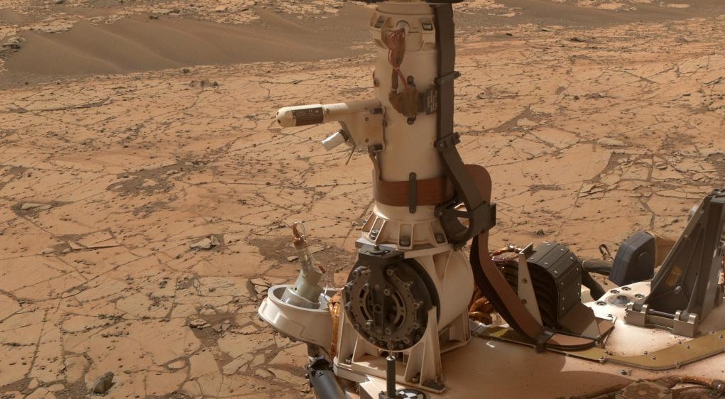
Mars Weather-Station Tools on Rover's Mast
Full Resolution:
TIFF
(1.722 MB)
JPEG
(104.9 kB)
|
|
|
2015-04-13 |
Mars
|
Mars Science Laboratory (MSL)
|
Navcam (MSL)
|
6225x1460x1 |
|
-
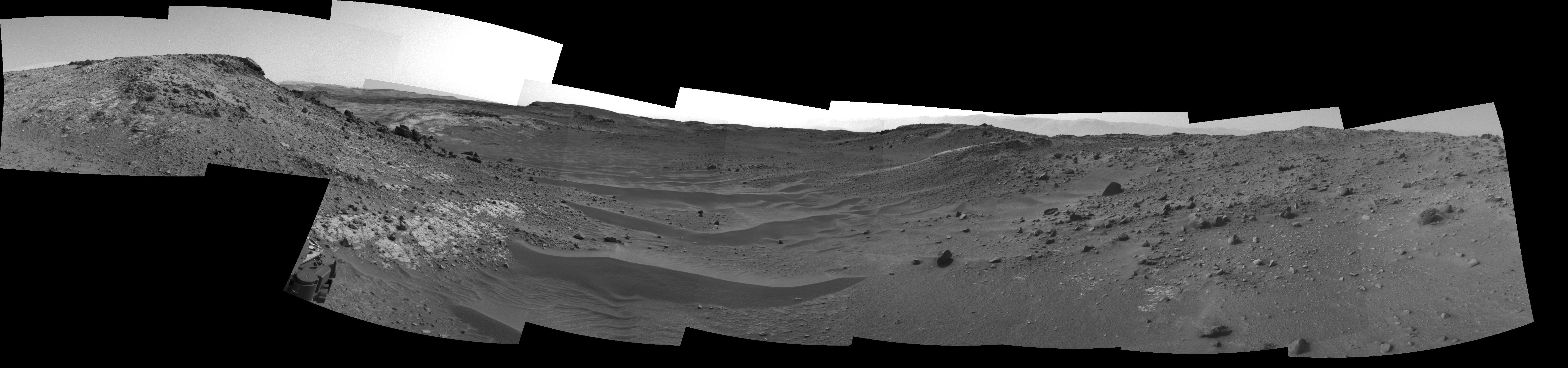
PIA19163:
Curiosity View Ahead Through 'Artist's Drive'
Full Resolution:
TIFF
(9.1 MB)
JPEG
(796.2 kB)
|
|
|
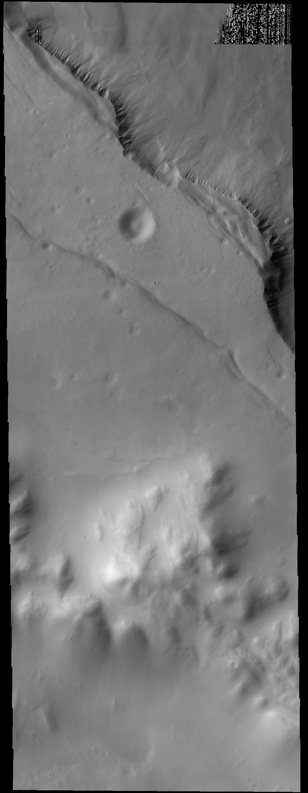
2015-04-13 |
Mars
|
2001 Mars Odyssey
|
THEMIS
|
677x1418x1 |
|
-
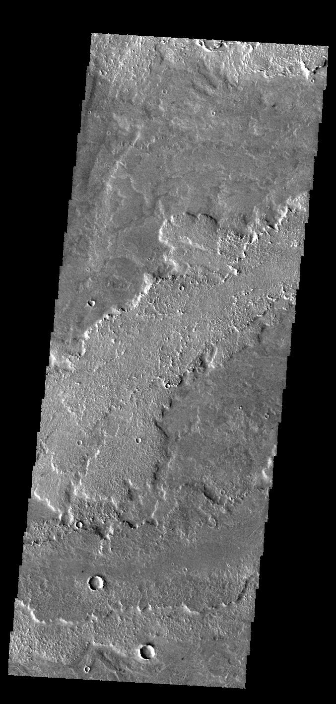
PIA19277:
-
Daedalia Planum
Full Resolution:
TIFF
(961.2 kB)
JPEG
(162.1 kB)
|
|
|
2015-04-13 |
Mimas
|
Cassini-Huygens
|
ISS - Narrow Angle
|
1024x1024x1 |
|
-
PIA18312:
-
Mimas by Saturnshine
Full Resolution:
TIFF
(1.05 MB)
JPEG
(65.93 kB)
|
|
|
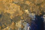
2015-04-13 |
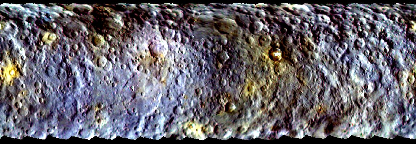
Ceres
|
Dawn
|
VIR
|
2126x1219x3 |

|
-
PIA19316:
-
Dawn VIR Images of Ceres
Full Resolution:
TIFF
(7.778 MB)
JPEG
(105.1 kB)
|
|
|
2015-04-13 |
Ceres
|
Dawn
|
|
1377x476x3 |
|
-
PIA19063:
-
Dawn's First Color Map of Ceres
Full Resolution:
TIFF
(1.967 MB)
JPEG
(175.4 kB)
|
|
|
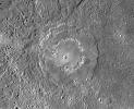
2015-04-10 |
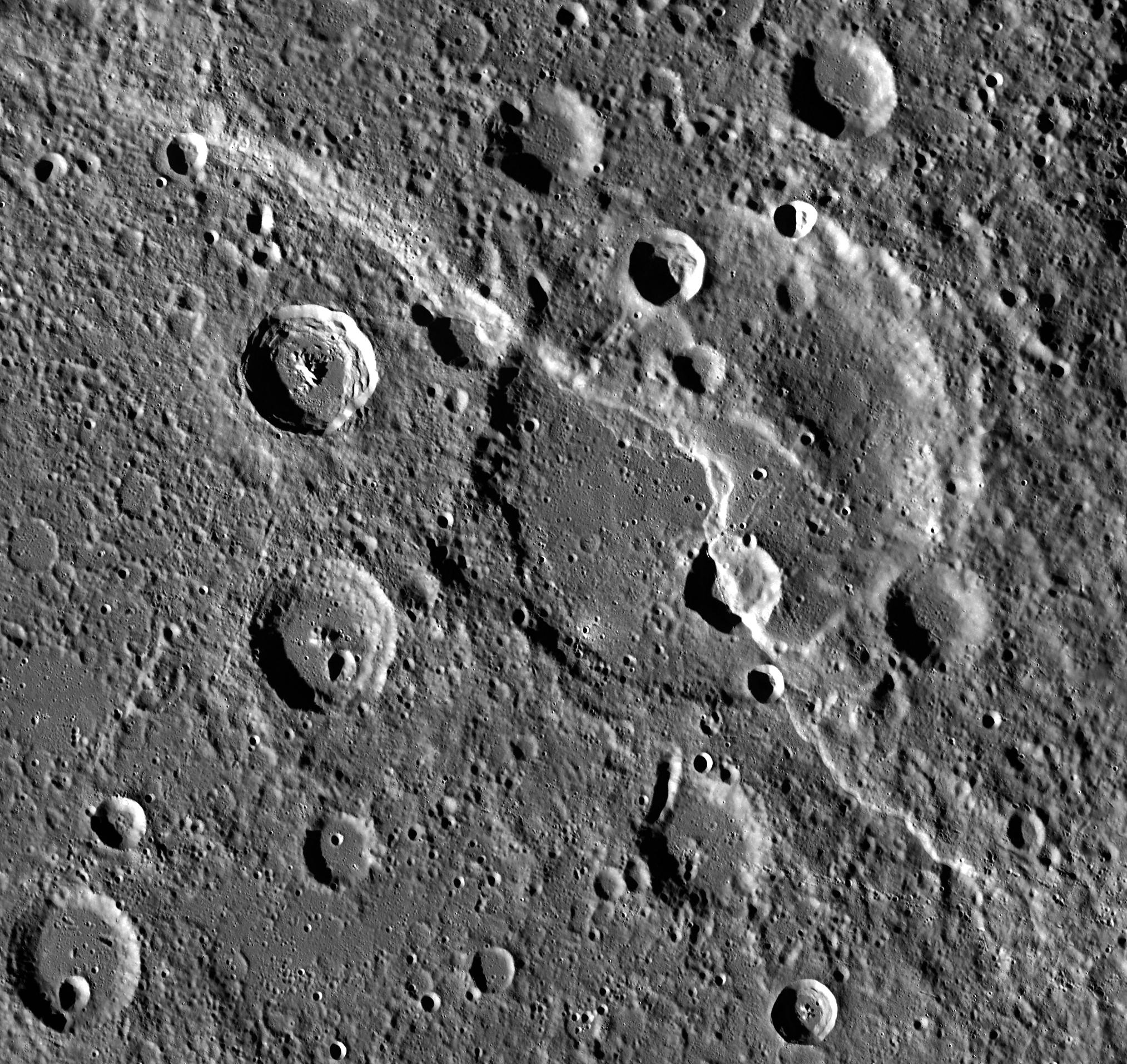
Mercury
|
MESSENGER
|
Mercury Dual Imaging System (MDIS)
|
2027x1914x1 |
|
-
PIA19279:
-
Carnegie Cuts a Crater
Full Resolution:
TIFF
(3.884 MB)
JPEG
(781.9 kB)
|
|
|
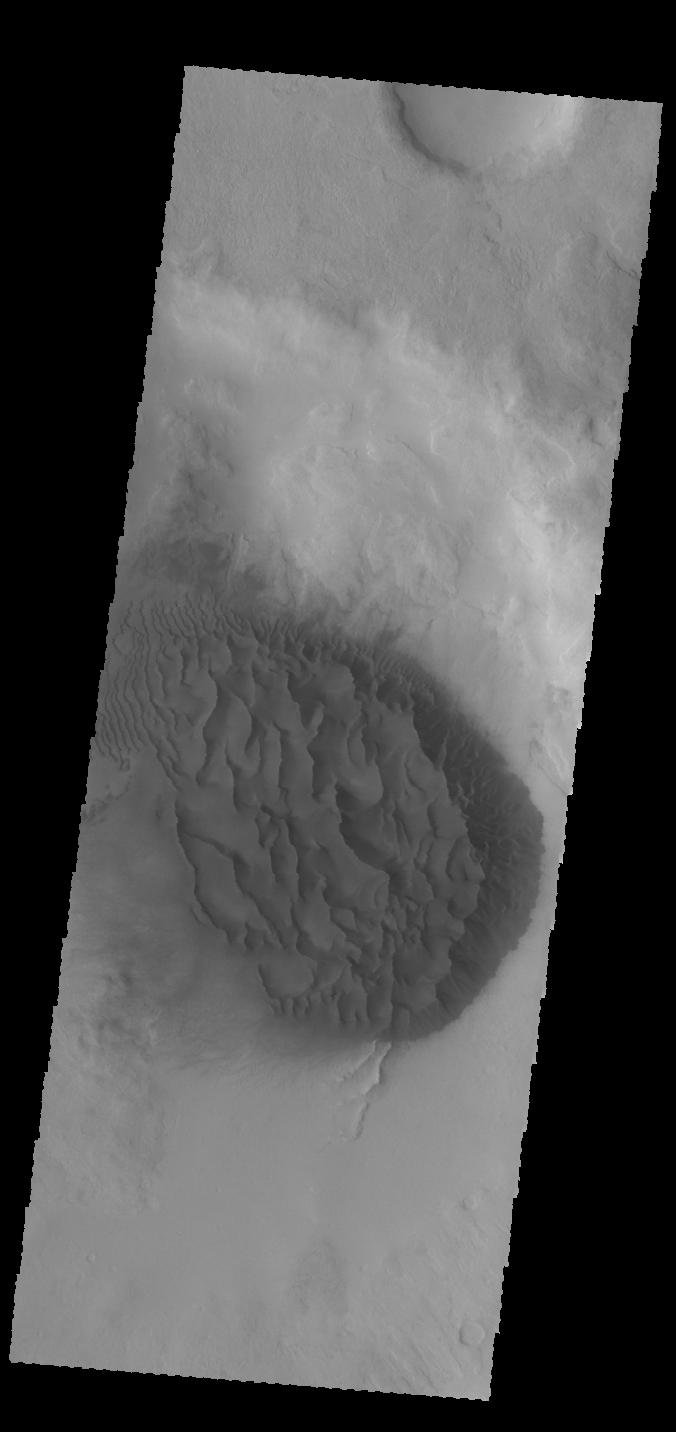
2015-04-10 |
Mars
|
2001 Mars Odyssey
|
THEMIS
|
676x1432x1 |

|
-
PIA19275:
-
Crater Dunes
Full Resolution:
TIFF
(969.2 kB)
JPEG
(51.99 kB)
|
|
|
2015-04-09 |
Earth
|
|
AVIRIS
|
1404x813x3 |
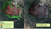
|
-
PIA19361:
-
NASA's AVIRIS Map shows Spectral Signature of 2013 Rim Fire
Full Resolution:
TIFF
(3.426 MB)
JPEG
(250.7 kB)
|
|
|
2015-04-09 |
Earth
|
|
LIDAR
|
1143x460x3 |
|
-
PIA19360:
-
Before-and-After LIDAR Images from 2014 King Fire in El Dorado National Forest
Full Resolution:
TIFF
(1.578 MB)
JPEG
(98.8 kB)
|
|
|
2015-04-09 |
Mars
|
2001 Mars Odyssey
|
THEMIS
|
682x1423x1 |
|
-
PIA19274:
-
Samara Valles
Full Resolution:
TIFF
(971.7 kB)
JPEG
(111.7 kB)
|
|
|
2015-04-08 |
Mars
|
Mars Reconnaissance Orbiter (MRO)
|
HiRISE
|
2880x1800x3 |

|
-
PIA19359:
-
Seasonal Flows in the Central Mountains of Hale Crater
Full Resolution:
TIFF
(15.56 MB)
JPEG
(688.5 kB)
|
|
|
2015-04-08 |
Mars
|
Mars Reconnaissance Orbiter (MRO)
|
HiRISE
|
2880x1800x3 |
|
-
PIA19358:
-
Layers and Dark Dunes
Full Resolution:
TIFF
(15.56 MB)
JPEG
(1.033 MB)
|
|
|
2015-04-08 |
Mars
|
Mars Reconnaissance Orbiter (MRO)
|
HiRISE
|
2880x1800x3 |
|
-
PIA19357:
-
What on Mars is a High Thermal-Inertia Surface?
Full Resolution:
TIFF
(15.56 MB)
JPEG
(1.055 MB)
|
|
|
2015-04-08 |
Mars
|
Mars Reconnaissance Orbiter (MRO)
|
HiRISE
|
2880x1800x3 |
|
-
PIA19356:
-
Sinuous Ridge Materials in Reuyl Crater
Full Resolution:
TIFF
(15.56 MB)
JPEG
(945 kB)
|
 Planetary Data System


