PDS logoPlanetary Data System
PDS Information
Find a Node - Use these links to navigate to any of the 8 publicly accessible PDS Nodes.

This bar indicates that you are within the PDS enterprise which includes 6 science discipline nodes and 2 support nodes which are overseen by the Project Management Office at NASA's Goddard Space Flight Center (GSFC). Each node is led by an expert in the subject discipline, supported by an advisory group of other practitioners of that discipline, and subject to selection and approval under a regular NASA Research Announcement.
Click here to return to the Photojournal Home Page Click here to view a list of Photojournal Image Galleries Photojournal_inner_header
Latest Images  |  Spacecraft & Technology  |  Animations  |  Space Images App  |  Feedback  |  Photojournal Search  

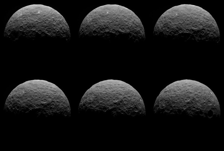
PIA19064: Settling in at Ceres
 Target Name:  Ceres
 Is a satellite of:  Sol (our sun)
 Mission:  Dawn
 Spacecraft:  Dawn
 Instrument:  Framing Camera
 Product Size:  1068 x 1260 pixels (w x h)
 Produced By:  JPL
 Full-Res TIFF:  PIA19064.tif (1.347 MB)
 Full-Res JPEG:  PIA19064.jpg (118.1 kB)

Click on image above for all movie download options

Original Caption Released with Image:

Click here for animation of PIA19064
Click on the image for the animation

This animated sequence of images from NASA's Dawn spacecraft shows northern terrain on the sunlit side of dwarf planet Ceres. Dawn took these images on April 14 and 15 from a vantage point 14,000 miles (22,000 kilometers) above Ceres' northern hemisphere. The spacecraft was settling into its first circular orbit, called RC3 (for "rotation characterization 3"), which it will begin on April 23.

The bright feature called "spot 5" by the Dawn science team -- actually two bright spots close together -- rotates into view at right in the last few frames.

Dawn has now finished delivering the images that have helped mission planners maneuver the spacecraft to its first science orbit and prepare for subsequent observations.

Image scale on Ceres is about 1.3 miles (2.1 kilometers) per pixel, compared to 1.9 miles (3.1 kilometers) per pixel in the optical navigation images taken on April 10 (see PIA19317). The sun-Ceres-spacecraft angle, or phase angle is 91 degrees here, compared to 131 degrees in the previous sequence.

A processed still image from this sequence is also available.

Dawn's mission is managed by JPL for NASA's Science Mission Directorate in Washington. Dawn is a project of the directorate's Discovery Program, managed by NASA's Marshall Space Flight Center in Huntsville, Alabama. UCLA is responsible for overall Dawn mission science. Orbital ATK, Inc., in Dulles, Virginia, designed and built the spacecraft. The German Aerospace Center, the Max Planck Institute for Solar System Research, the Italian Space Agency and the Italian National Astrophysical Institute are international partners on the mission team. For a complete list of acknowledgments, see http://dawn.jpl.nasa.gov/mission.

Image Credit:
NASA/JPL-Caltech/UCLA/MPS/DLR/IDA

Image Addition Date:
2015-04-20