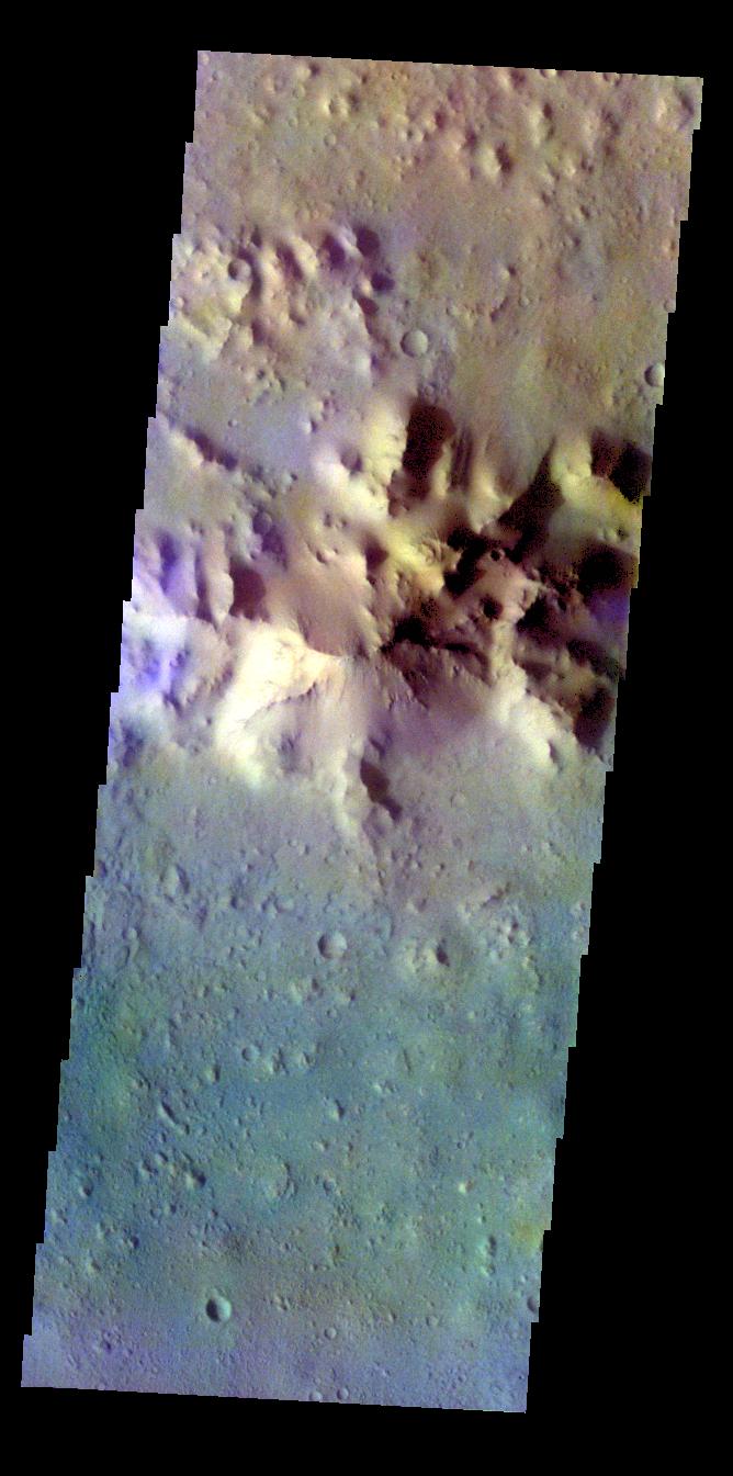
My
List |
Addition Date
|
Target
|
Mission
|
Instrument
|
Size
|

|
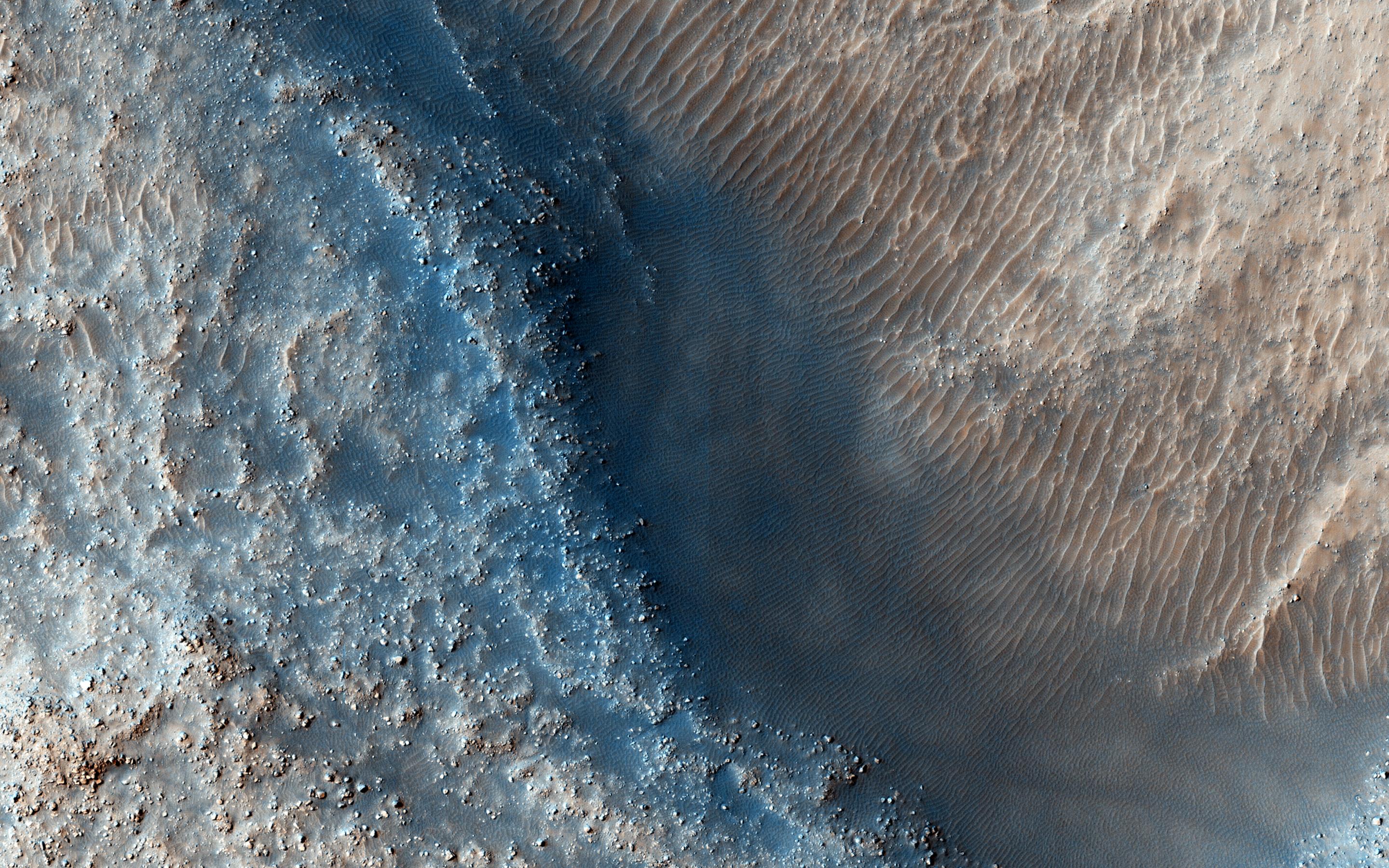
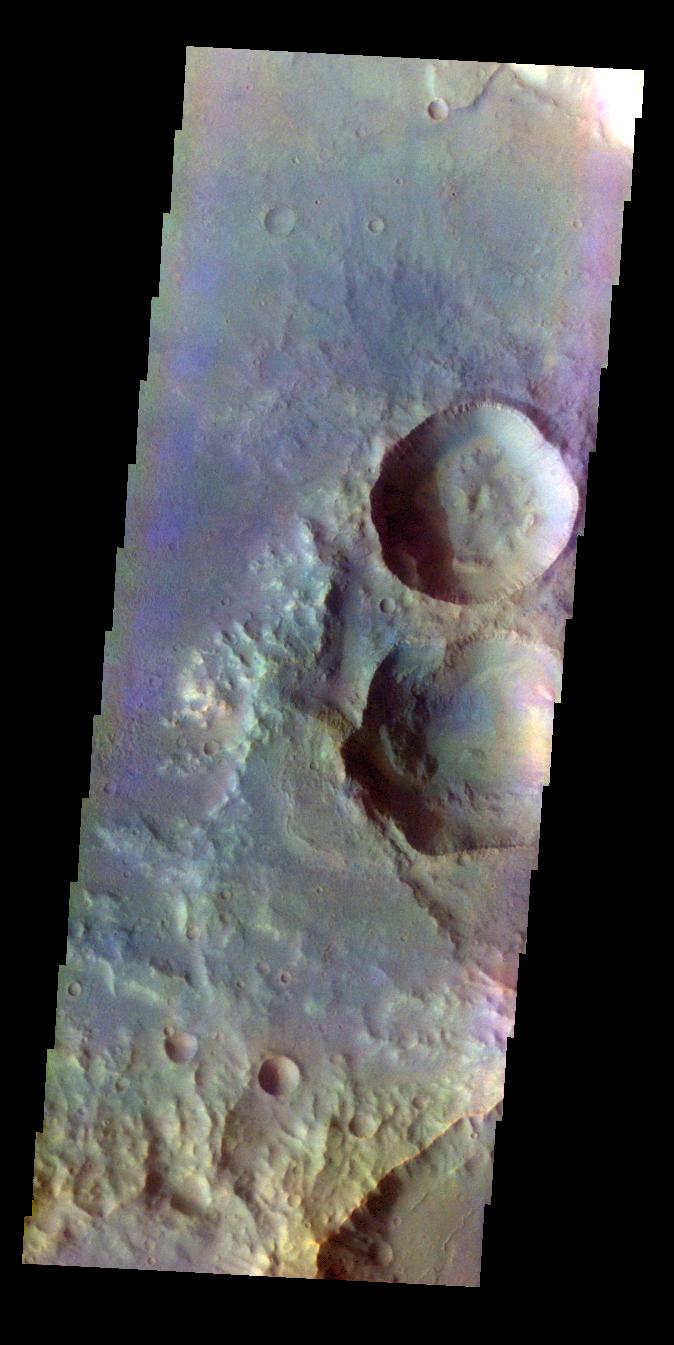
2015-06-03 |
Mars
|
Mars Reconnaissance Orbiter (MRO)
|
HiRISE
|
2880x1800x3 |
|
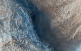
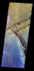
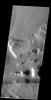
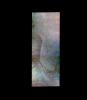
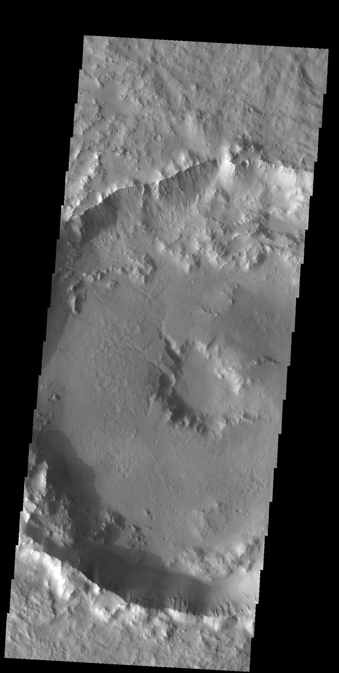
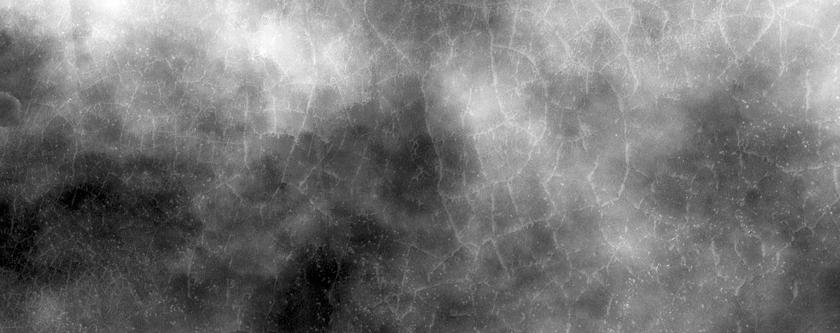
-
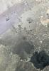
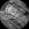
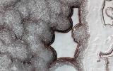
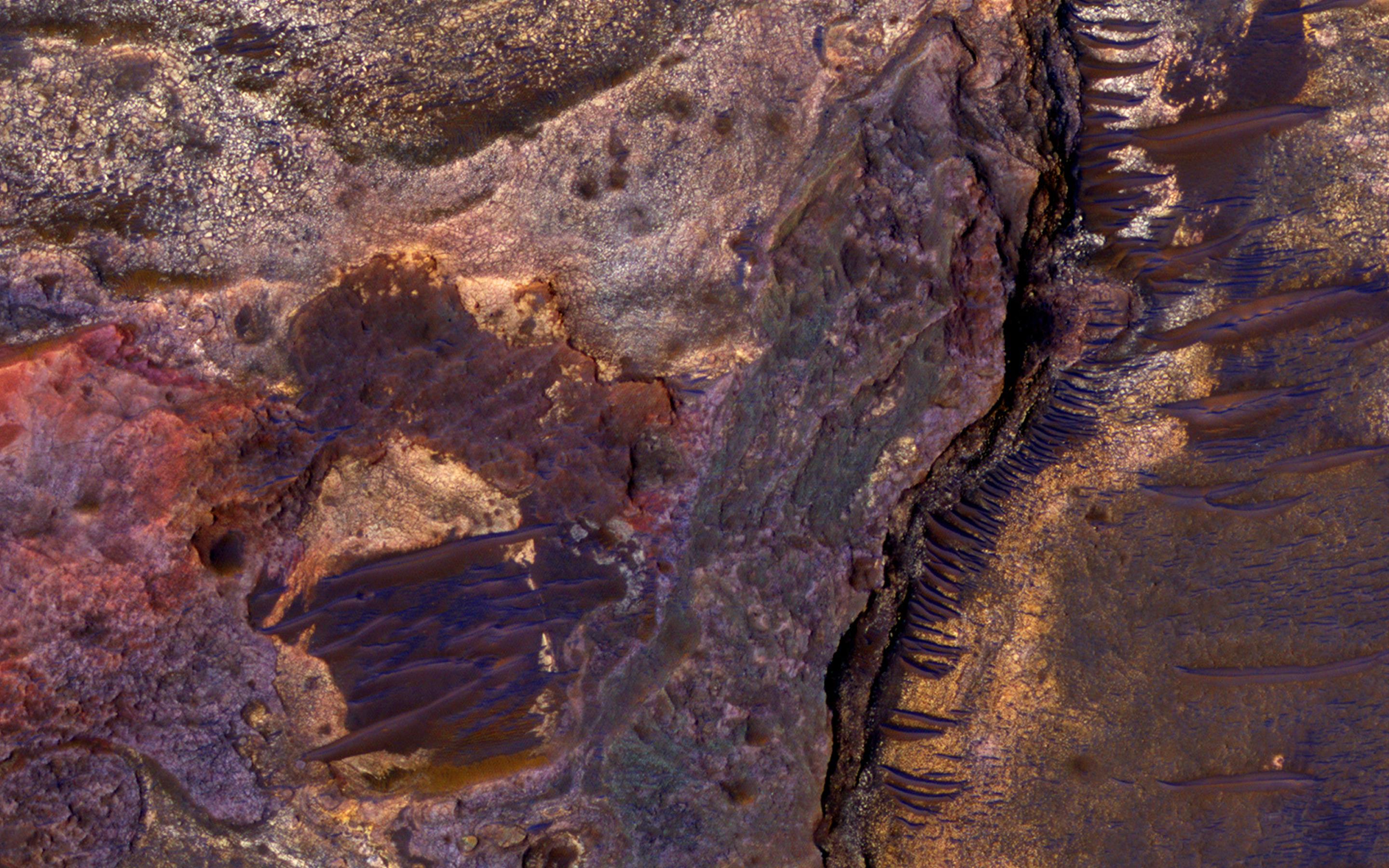
PIA11775:
-
Fill or Mantling Material in a Crater
Full Resolution:
TIFF
(15.56 MB)
JPEG
(1.086 MB)
|
|
|
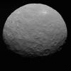
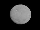
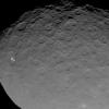
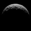
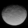
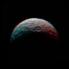
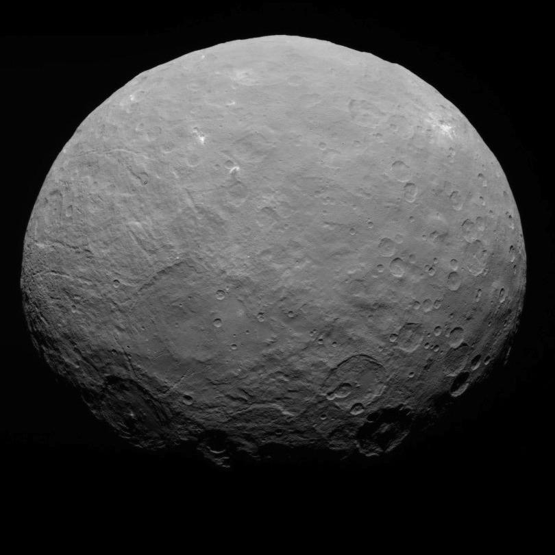
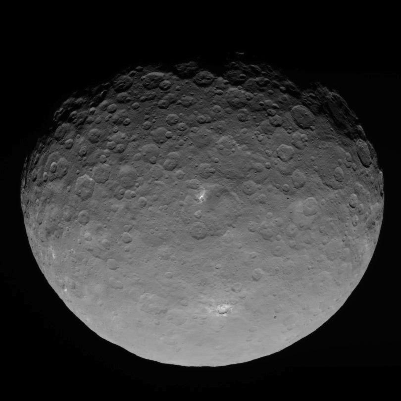
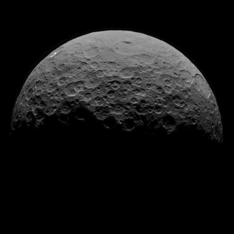
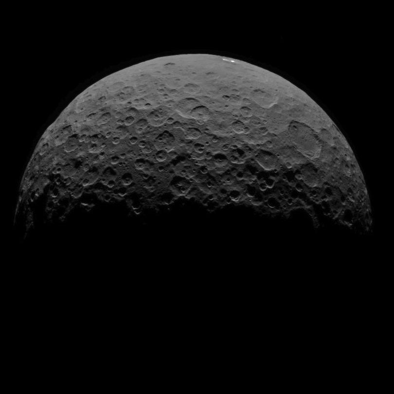
2015-06-03 |
Ceres
|
Dawn
|
Framing Camera
|
810x810x1 |

|
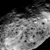
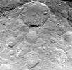
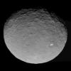
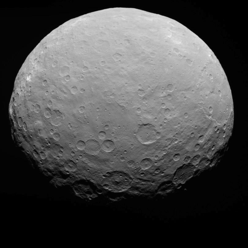
-
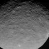
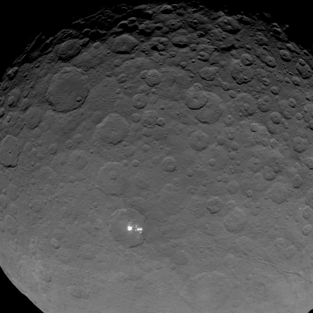
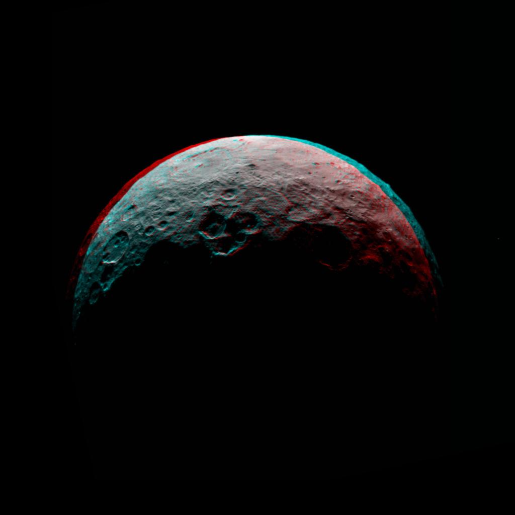
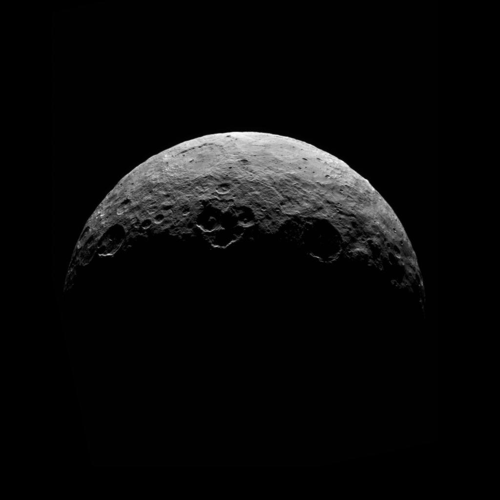
PIA19556:
-
Dawn RC3 Image 22
Full Resolution:
TIFF
(657 kB)
JPEG
(57.74 kB)
|
|
|
2015-06-03 |
Mars
|
2001 Mars Odyssey
|
THEMIS
|
1339x2655x1 |
|
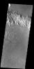
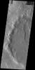
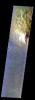
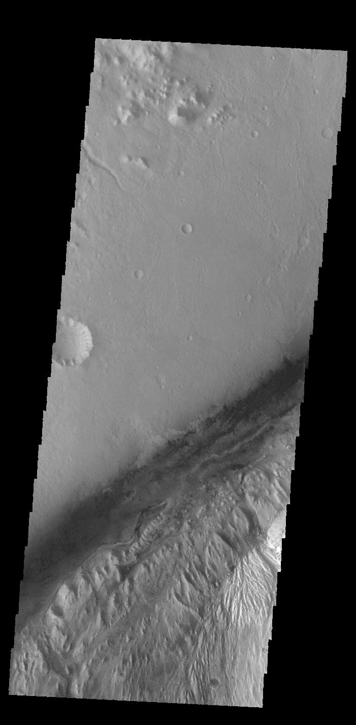
-
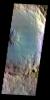
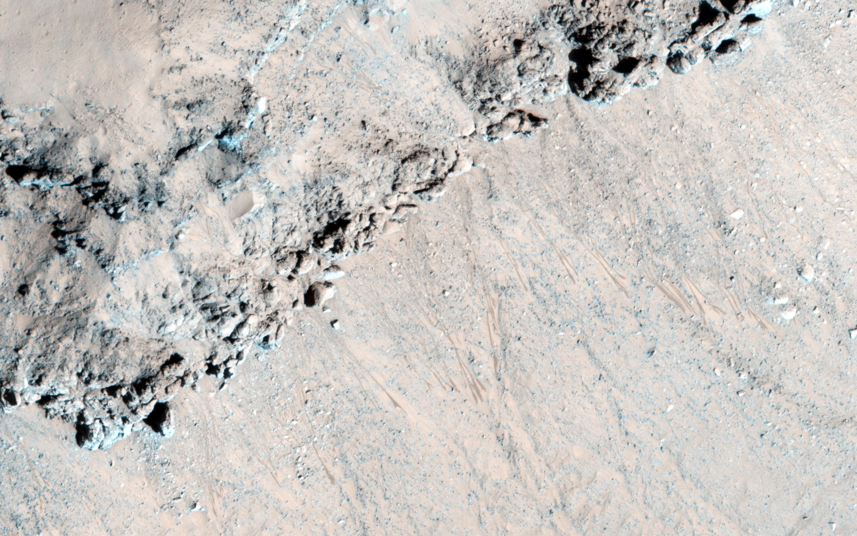
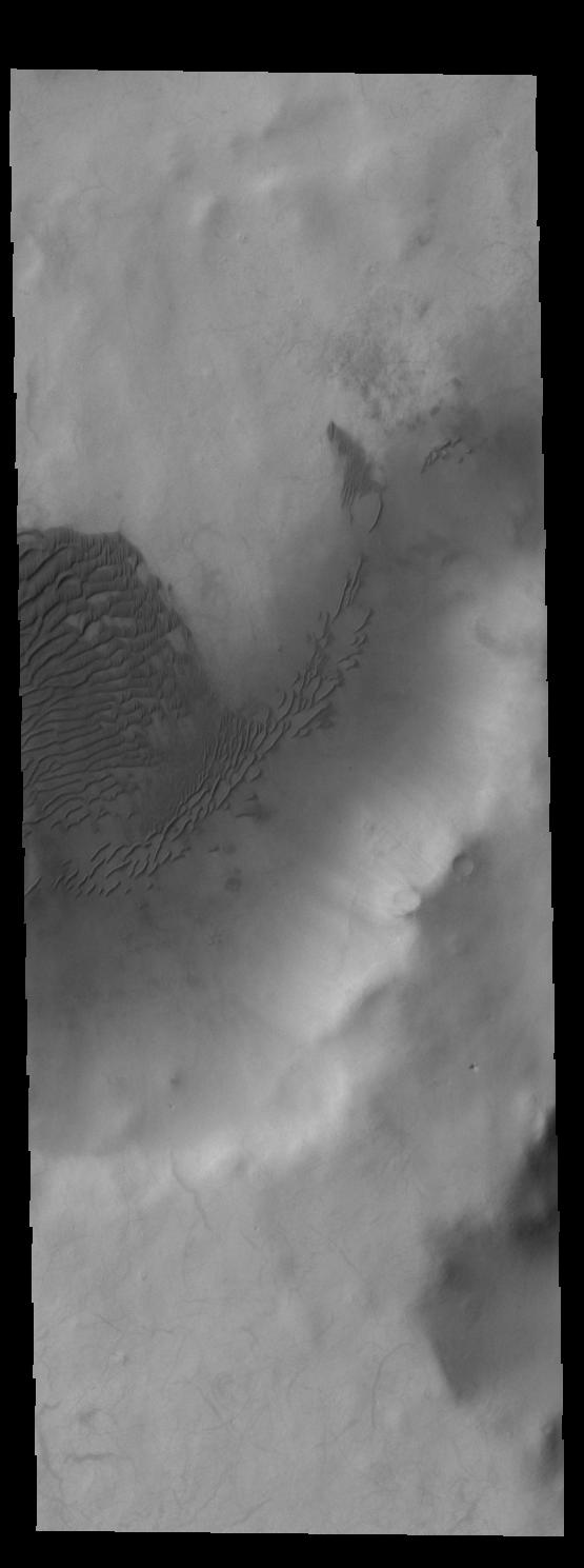
PIA19477:
-
Crater Dunes
Full Resolution:
TIFF
(3.559 MB)
JPEG
(429.4 kB)
|
|
|
2015-06-02 |
Earth
|
Terra
|
ASTER
|
2448x1380x3 |
|
-
PIA19681:
-
NASA Spacecraft Views Aftermath of Texas Floods
Full Resolution:
TIFF
(10.14 MB)
JPEG
(531.8 kB)
|
|
|
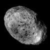
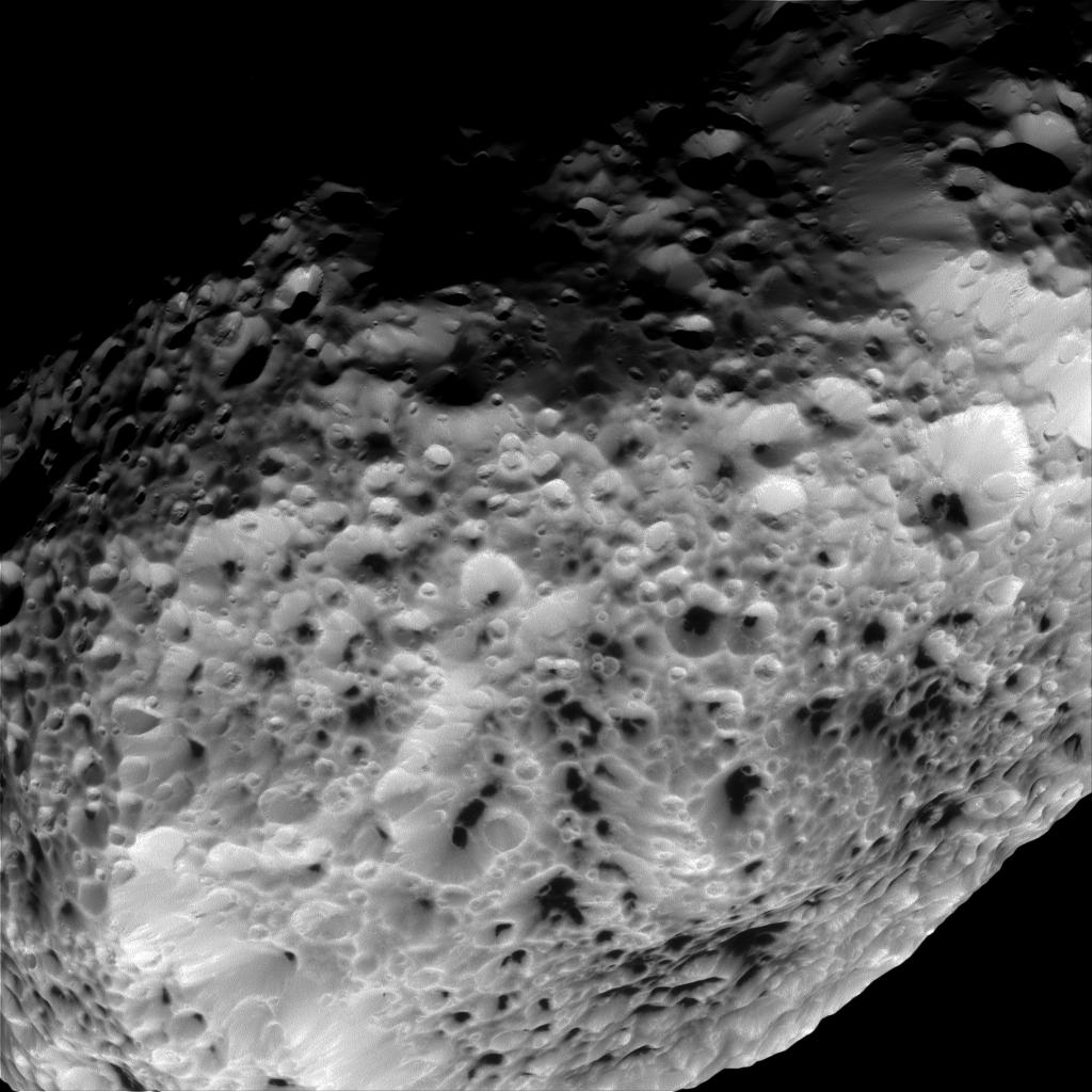
2015-06-02 |
Hyperion
|
Cassini-Huygens
|
ISS - Narrow Angle
|
1024x1024x1 |
|
-
PIA17194:
-
Spongy Surface
Full Resolution:
TIFF
(1.05 MB)
JPEG
(124.1 kB)
|
|
|
2015-06-02 |
Hyperion
|
Cassini-Huygens
|
ISS - Narrow Angle
|
1024x1024x1 |
|
-
PIA17193:
-
Farewell to Hyperion
Full Resolution:
TIFF
(1.05 MB)
JPEG
(83.19 kB)
|
|
|
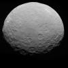
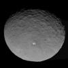
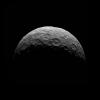
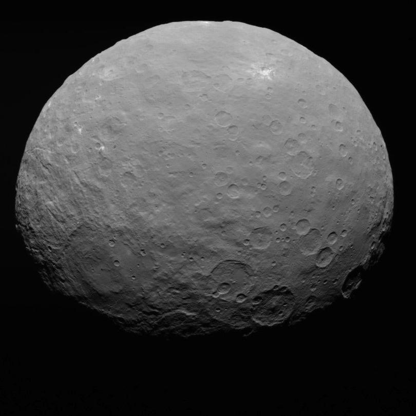
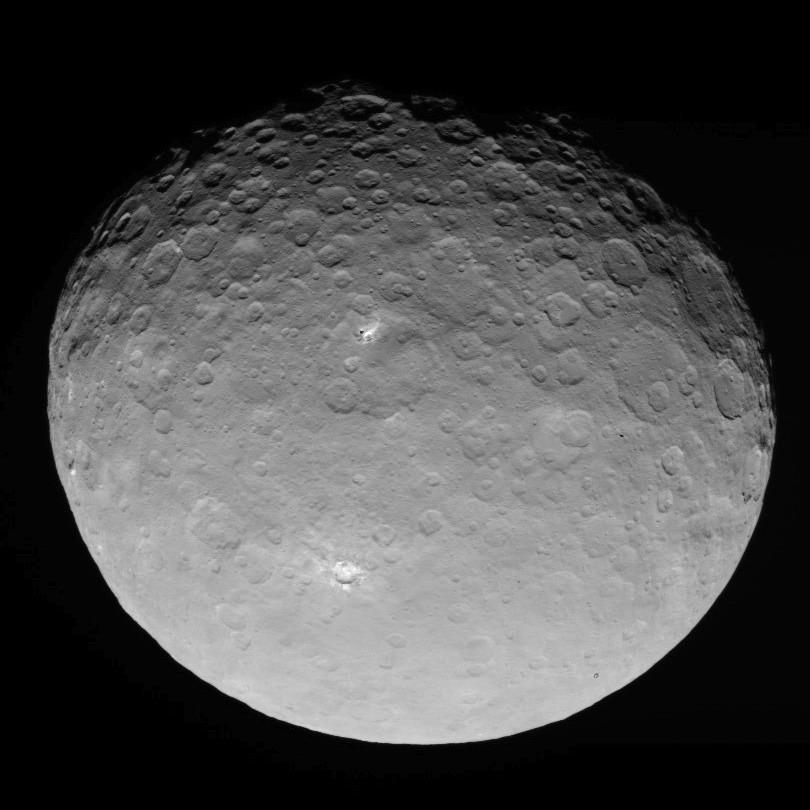
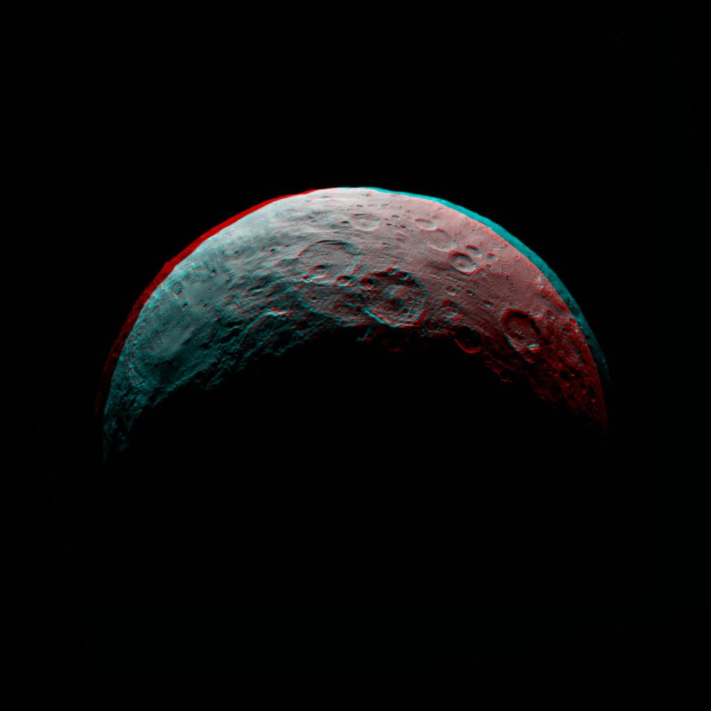
2015-06-02 |
Ceres
|
Dawn
|
Framing Camera
|
810x810x1 |
|
-
PIA19555:
-
Dawn RC3 Image 21
Full Resolution:
TIFF
(657 kB)
JPEG
(54.9 kB)
|
|
|
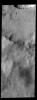
2015-06-02 |
Mars
|
2001 Mars Odyssey
|
THEMIS
|
1336x2654x1 |

|
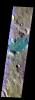
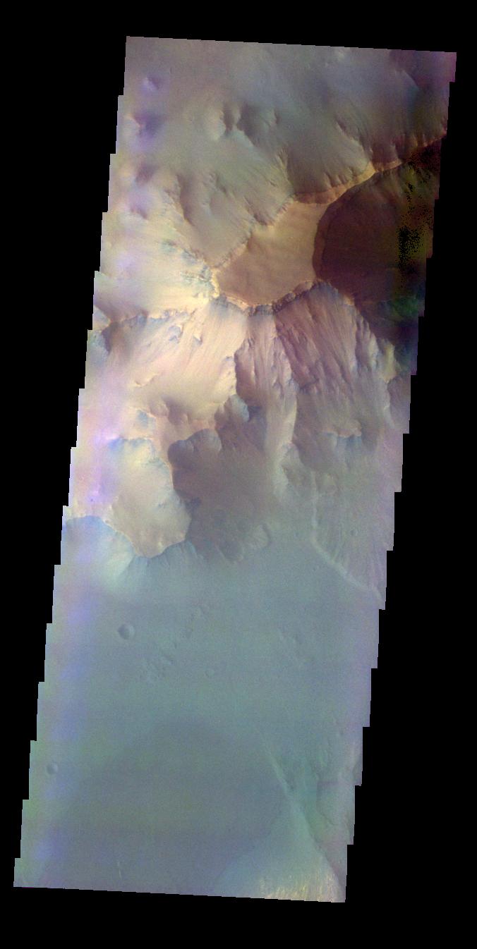
-
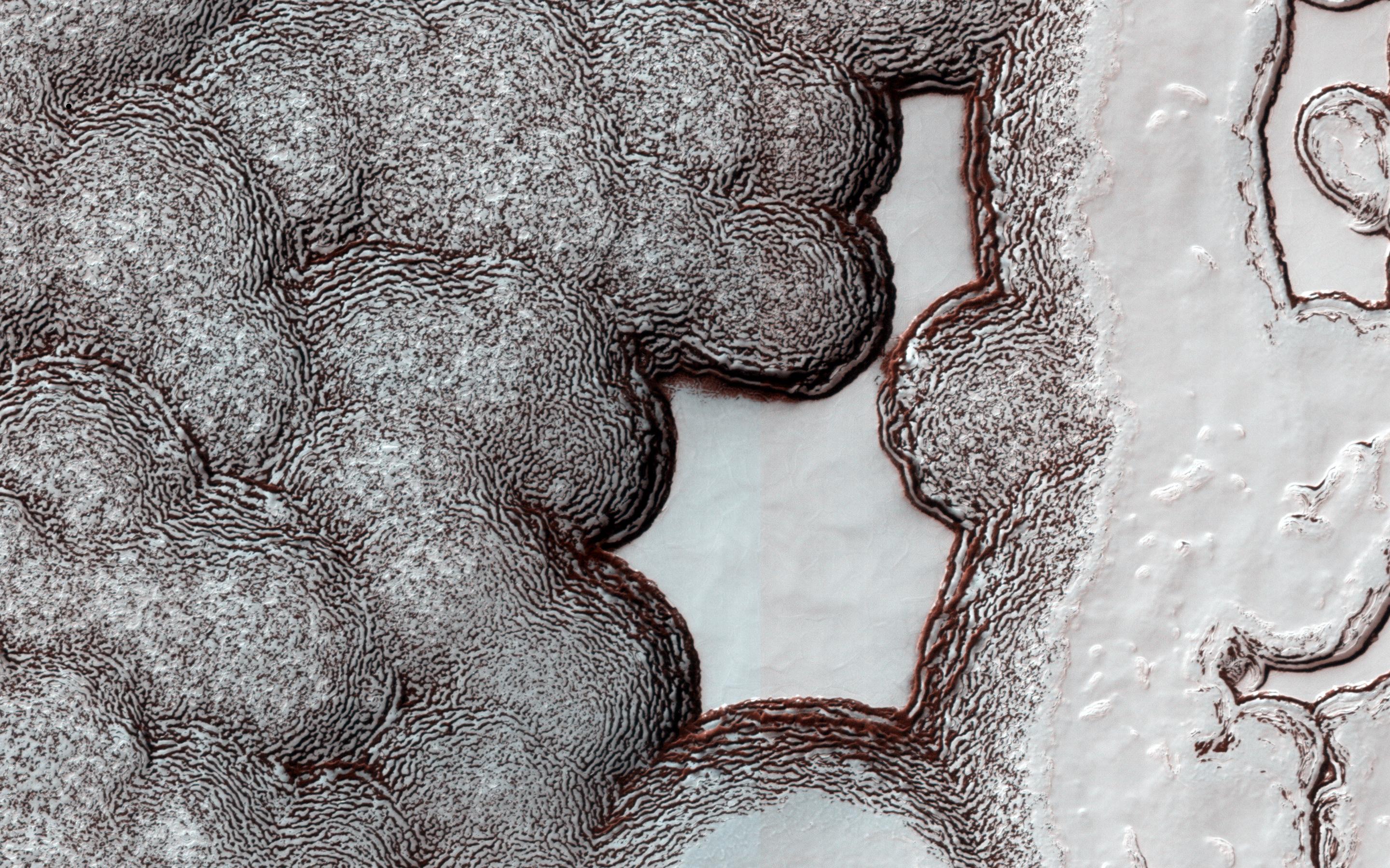
PIA19476:
-
Central Pit Crater
Full Resolution:
TIFF
(3.55 MB)
JPEG
(269.8 kB)
|
|
|
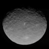
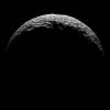
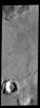
2015-06-01 |
Ceres
|
Dawn
|
Framing Camera
|
810x810x1 |
|
-
PIA19554:
-
Dawn RC3 Image 20
Full Resolution:
TIFF
(657 kB)
JPEG
(59.77 kB)
|
|
|
2015-06-01 |
Mars
|
2001 Mars Odyssey
|
THEMIS
|
701x1425x1 |

|
-
PIA19474:
-
Gale Crater
Full Resolution:
TIFF
(1 MB)
JPEG
(80.58 kB)
|
|
|
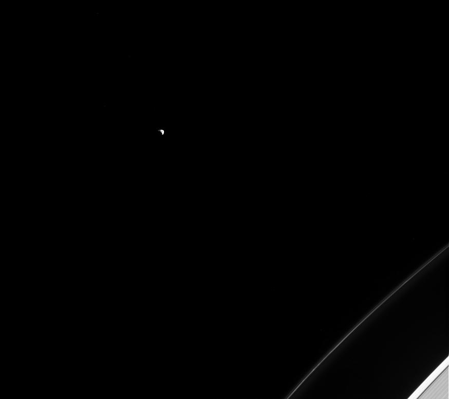
2015-06-01 |
Dione
|
Cassini-Huygens
|
ISS - Narrow Angle
|
1024x1024x1 |
|
-
PIA18319:
-
Dione Dwarfing Rhea

Full Resolution:
TIFF
(1.05 MB)
JPEG
(73.61 kB)
|
|
|
2015-05-29 |
Ceres
|
Dawn
|
Framing Camera
|
1600x1200x1 |
|
-
PIA19562:
-
Dawn RC3 Image 19
Full Resolution:
TIFF
(1.922 MB)
JPEG
(59.79 kB)
|
|
|
2015-05-29 |
Mars
|
2001 Mars Odyssey
|
THEMIS
|
676x1346x3 |
|
-
PIA19473:
-
Ganges Chasma - False Color
Full Resolution:
TIFF
(2.731 MB)
JPEG
(66.32 kB)
|
|
|
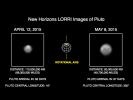
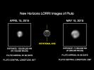
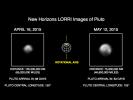
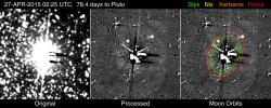
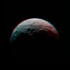
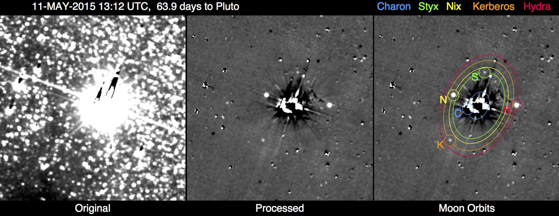
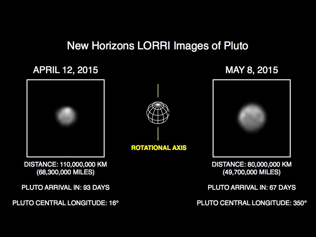
2015-05-28 |
Pluto
|
New Horizons
|
LORRI
|
1808x700x3 |
|
-
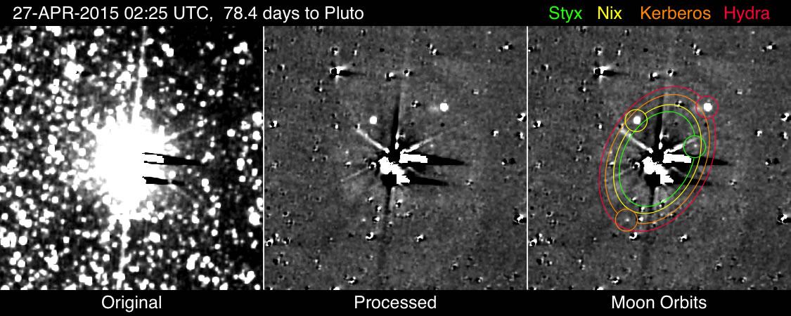
PIA17806:
-
So Far, All Clear: New Horizons Team Completes First Search for Pluto System Hazards
Full Resolution:
TIFF
(3.798 MB)
JPEG
(171.1 kB)
|
|
|
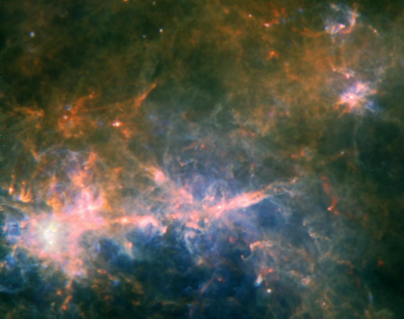
2015-05-28 |
|
Herschel Space Observatory
|
PACS
SPIRE
|
1323x1046x3 |

|
-
PIA19340:
-
Herschel's View of G49 Filament
Full Resolution:
TIFF
(4.153 MB)
JPEG
(95.89 kB)
|
|
|
2015-05-28 |
Ceres
|
Dawn
|
Framing Camera
|
810x810x1 |
|
-
PIA19553:
-
Dawn RC3 Image 18
Full Resolution:
TIFF
(657 kB)
JPEG
(54.8 kB)
|
|
|
2015-05-28 |
Mars
|
2001 Mars Odyssey
|
THEMIS
|
662x1345x3 |
|
-
PIA19472:
-
Sirenum Fossae - False Color
Full Resolution:
TIFF
(2.672 MB)
JPEG
(116.5 kB)
|
|
|
2015-05-28 |
Ceres
|
Dawn
|
Framing Camera
|
682x665x1 |
|
-
PIA19065:
-
Dawn View from OpNav9
Full Resolution:
TIFF
(454.2 kB)
JPEG
(103 kB)
|
|
|
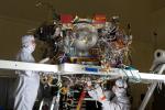
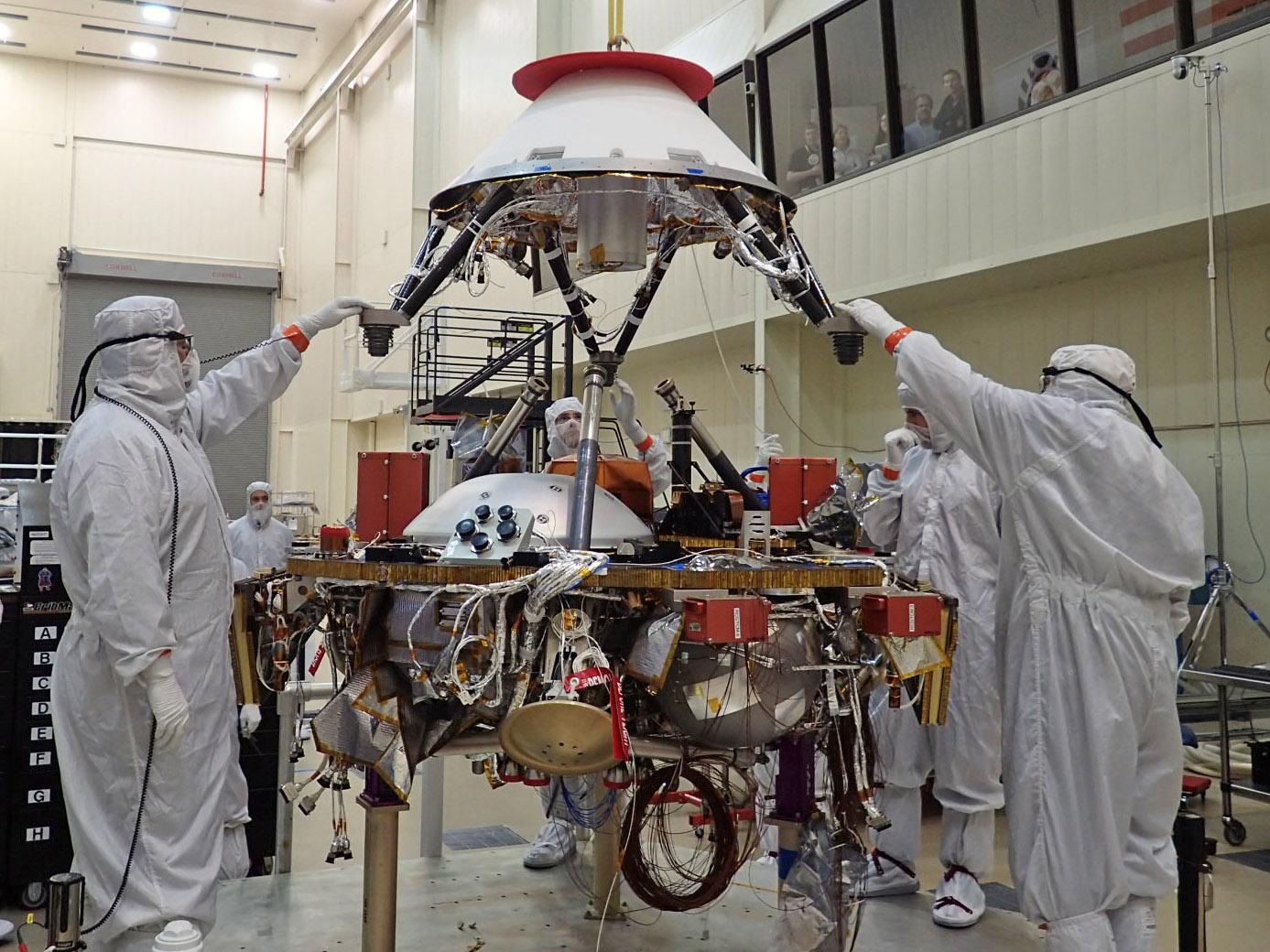
2015-05-27 |
|
InSight
|
|
1939x1454x3 |
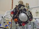
|
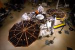
-
PIA19670:
-
Turning the InSight Lander's Science Deck
Full Resolution:
TIFF
(8.461 MB)
JPEG
(369.8 kB)
|
|
|
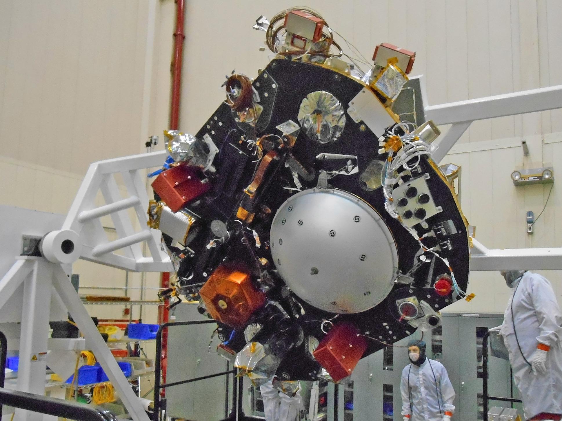
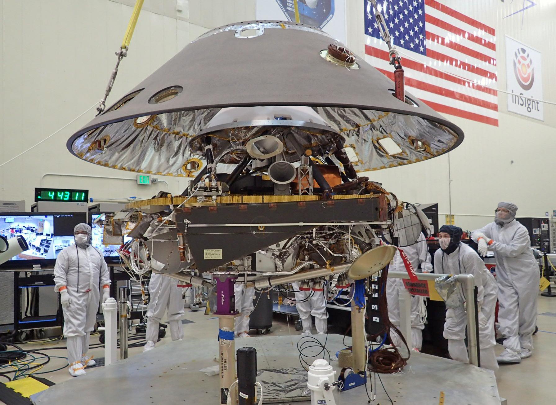
2015-05-27 |
|
InSight
|
|
1387x1040x3 |
|
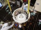
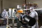
-
PIA19669:
-
Installing the InSight Spacecraft's Parachute Cone
Full Resolution:
TIFF
(4.329 MB)
JPEG
(236.6 kB)
|
|
|
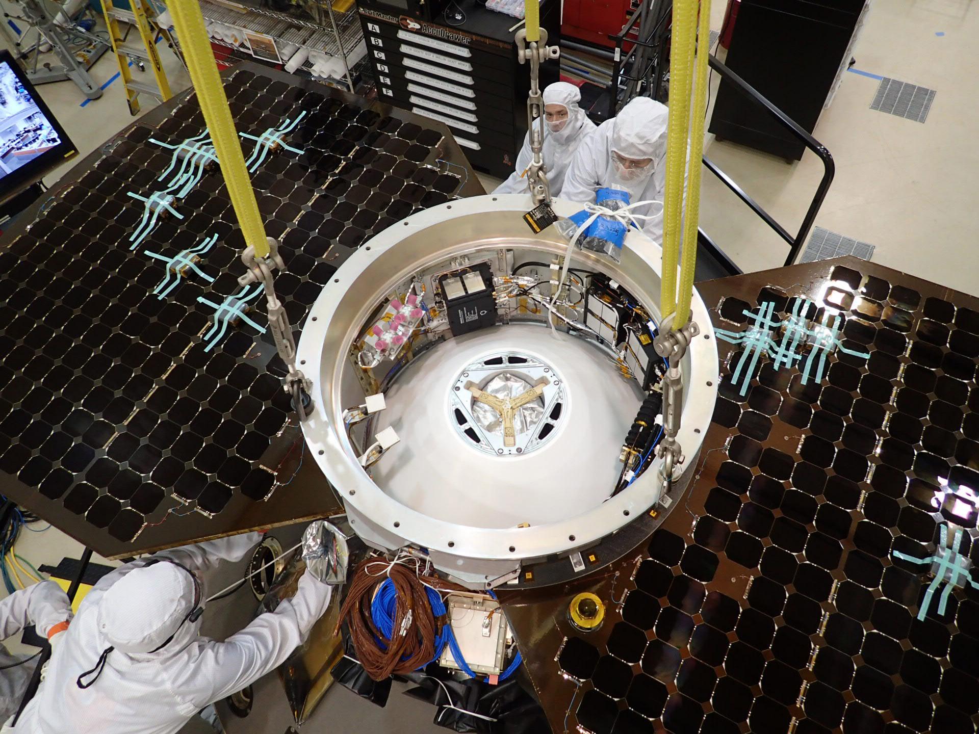
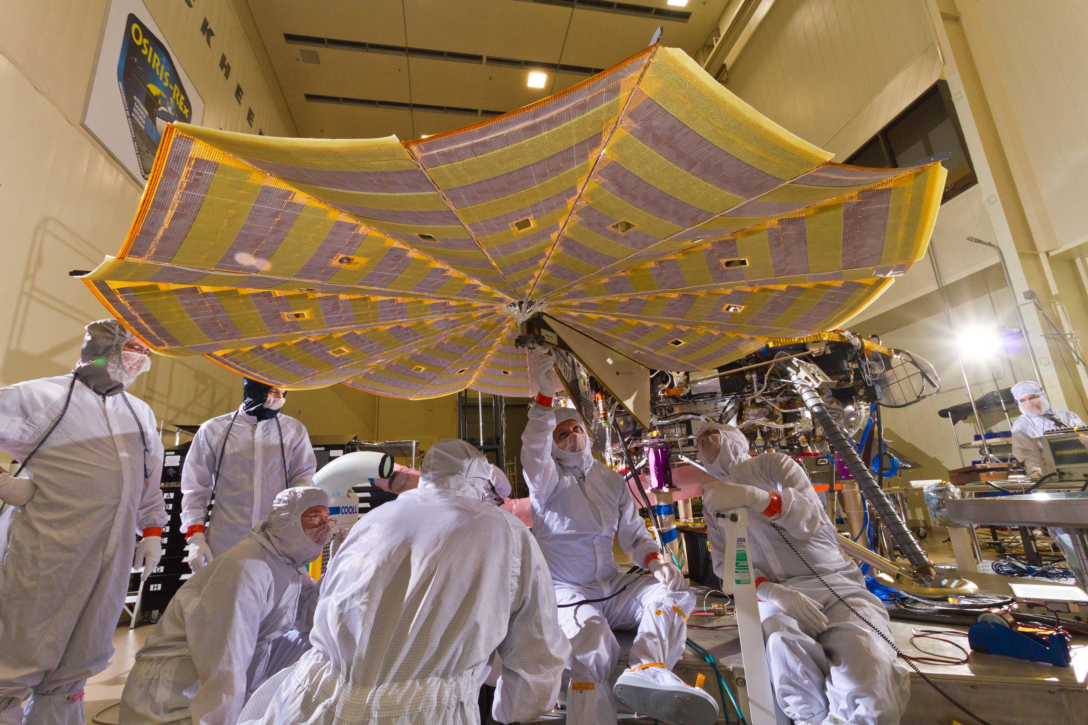
2015-05-27 |
|
InSight
|
|
1920x1440x3 |
|
-
PIA19668:
-
Top View of InSight's Cruise Stage
Full Resolution:
TIFF
(8.298 MB)
JPEG
(423.6 kB)
|
|
|
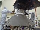
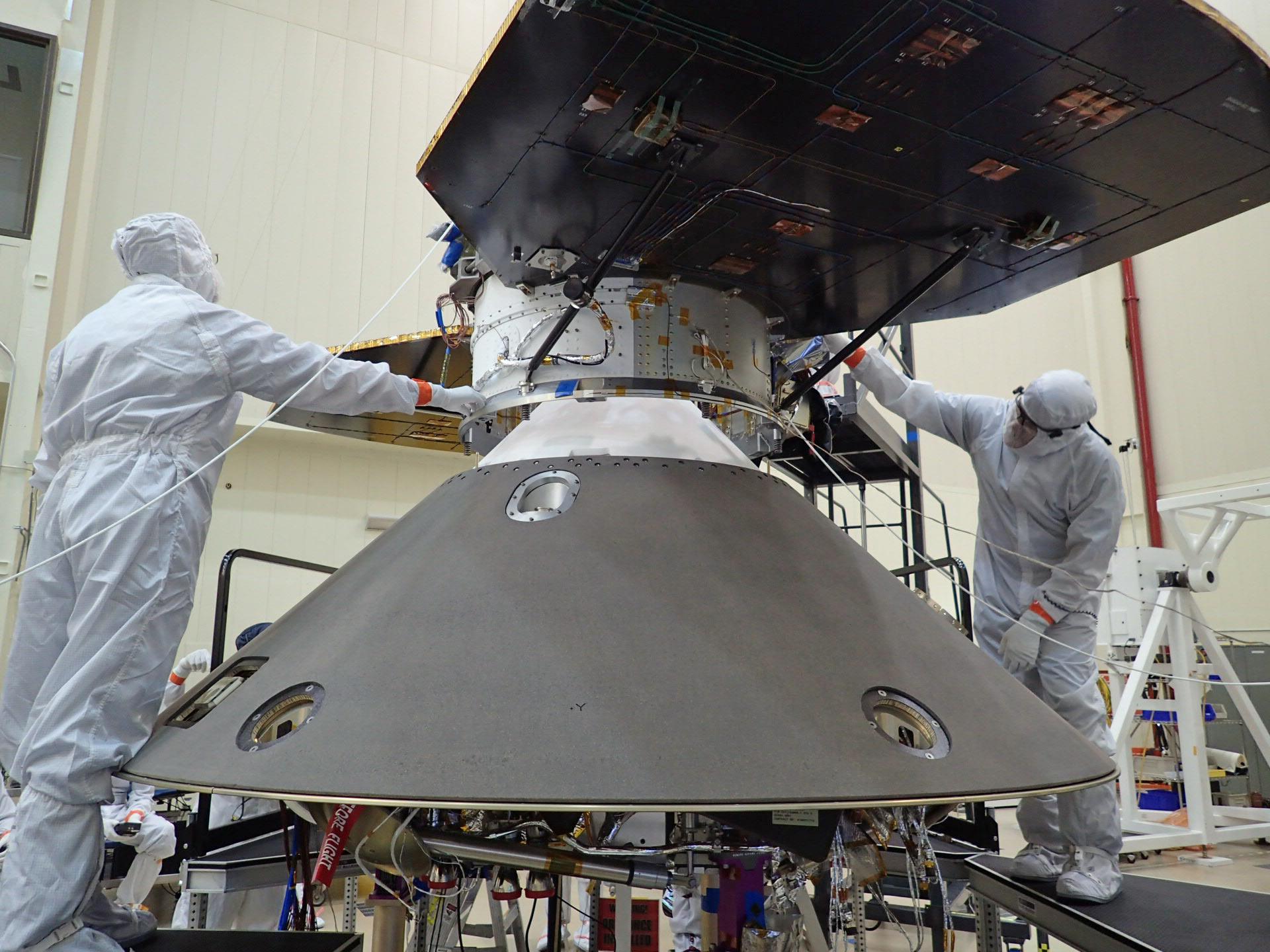
2015-05-27 |
|
InSight
|
|
1920x1440x3 |
|
-
PIA19667:
-
Lowering InSight's Cruise Stage onto Back Shell
Full Resolution:
TIFF
(8.298 MB)
JPEG
(322.9 kB)
|
|
|
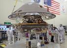
2015-05-27 |
|
InSight
|
|
1792x1307x3 |
|
-
PIA19666:
-
Lowering Back Shell onto Stowed InSight Lander
Full Resolution:
TIFF
(7.029 MB)
JPEG
(332.7 kB)
|
|
|
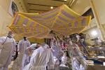
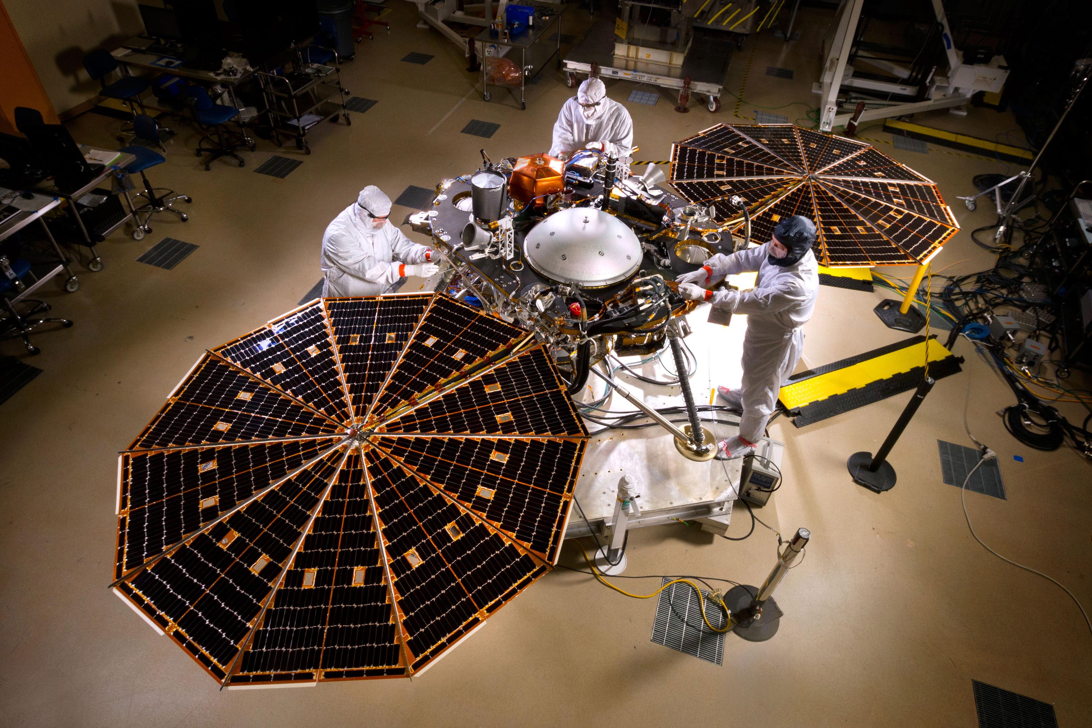
2015-05-27 |
|
InSight
|
|
3600x2400x3 |
|
-
PIA19665:
-
Solar-Array Deployment Test for InSight
Full Resolution:
TIFF
(25.93 MB)
JPEG
(1.227 MB)
|
|
|
2015-05-27 |
|
InSight
|
|
3600x2400x3 |
|
-
PIA19664:
-
InSight Lander in Mars-Surface Configuration
Full Resolution:
TIFF
(25.93 MB)
JPEG
(1.187 MB)
|
|
|
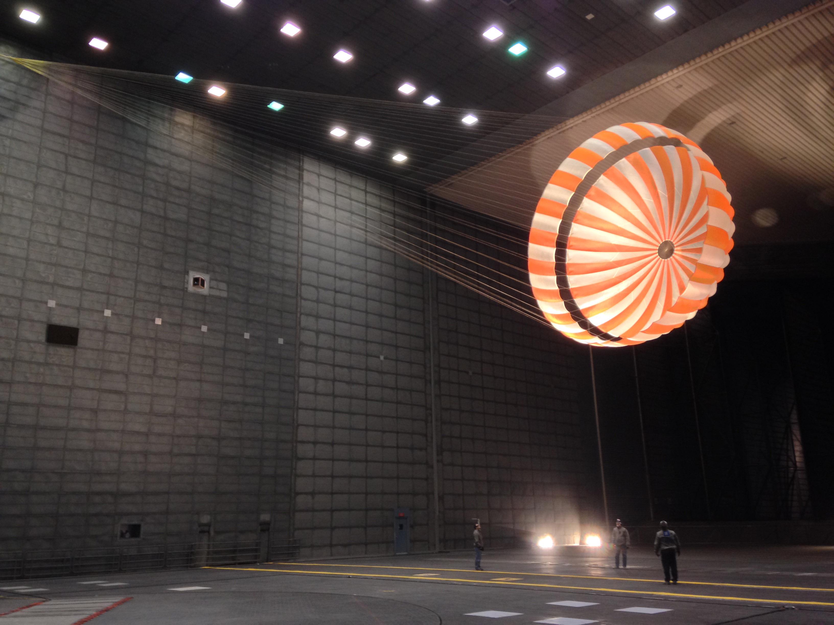
2015-05-27 |
|
InSight
|
|
3264x2448x3 |
|
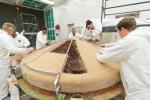
-
PIA19405:
-
Parachute Testing for NASA's InSight Mission
Full Resolution:
TIFF
(23.98 MB)
JPEG
(564.3 kB)
|
|
|
2015-05-27 |
|
InSight
|
|
3000x2000x3 |
|
-
PIA19404:
-
Heat Shield Construction for NASA's InSight Mission
Full Resolution:
TIFF
(18.01 MB)
JPEG
(668.1 kB)
|
|
|
2015-05-27 |
|
InSight
|
|
2000x1333x3 |
|
-
PIA19403:
-
InSight Cruise Stage and Lander in Assembly
Full Resolution:
TIFF
(8.001 MB)
JPEG
(362.9 kB)
|
|
|
2015-05-27 |
|
InSight
|
|
2000x1333x3 |
|
-
PIA19402:
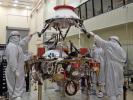
-
InSight Lander in Assembly
Full Resolution:
TIFF
(8.001 MB)
JPEG
(376.8 kB)
|
|
|
2015-05-27 |
Pluto
|
New Horizons
|
LORRI
|
1024x768x3 |
|
-
PIA17805:
-
More Detail as New Horizons Draws Closer
Full Resolution:
TIFF
(2.36 MB)
JPEG
(62.8 kB)
|
|
|
2015-05-27 |
Pluto
|
New Horizons
|
LORRI
|
1024x768x3 |
|
-
PIA17804:
-
More Detail as New Horizons Draws Closer
Full Resolution:
TIFF
(2.36 MB)
JPEG
(63.31 kB)
|
|
|
2015-05-27 |
Pluto
|
New Horizons
|
LORRI
|
1024x768x3 |
|
-
PIA17803:
-
More Detail as New Horizons Draws Closer
Full Resolution:
TIFF
(2.36 MB)
JPEG
(63.38 kB)
|
|
|
2015-05-27 |
Earth
|
Terra
|
ASTER
|
3108x4504x3 |
|
-
PIA19479:
-
Lava Field, Syria
Full Resolution:
TIFF
(42.01 MB)
JPEG
(3.043 MB)
|
|
|
2015-05-27 |
Ceres
|
Dawn
|
Framing Camera
|
810x810x1 |

|
-
PIA19552:
-
Dawn RC3 Image 17
Full Resolution:
TIFF
(657 kB)
JPEG
(42.39 kB)
|
|
|
2015-05-27 |
Mars
|
2001 Mars Odyssey
|
THEMIS
|
668x1345x3 |

|
-
PIA19471:
-
Crater - False Color
Full Resolution:
TIFF
(2.697 MB)
JPEG
(103.3 kB)
|
|
|
2015-05-26 |
Ceres
|
Dawn
|
Framing Camera
|
810x810x1 |

|
-
PIA19551:
-
Dawn RC3 Image 16
Full Resolution:
TIFF
(657 kB)
JPEG
(37.74 kB)
|
|
|
2015-05-26 |
Mars
|
2001 Mars Odyssey
|
THEMIS
|
674x1346x3 |
|
-
PIA19470:
-
Crater - False Color
Full Resolution:
TIFF
(2.723 MB)
JPEG
(91.94 kB)
|
|
|
2015-05-25 |
Mars
|
2001 Mars Odyssey
|
THEMIS
|
794x2249x3 |
|
-
PIA19469:
-
Channel - False Color
Full Resolution:
TIFF
(5.359 MB)
JPEG
(184.7 kB)
|
|
|
2015-05-25 |
Rhea
|
Cassini-Huygens
|
ISS - Narrow Angle
|
1020x1020x1 |
|
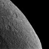
-
PIA18316:
-
Rhea's Horizon
Full Resolution:
TIFF
(1.042 MB)
JPEG
(146.4 kB)
|
|
|
2015-05-22 |
Mars
|
Mars Science Laboratory (MSL)
|
ChemCam
|
721x722x1 |
|
-
PIA19661:
-
Auto-Focused on Details in "Yellowjacket" on Mars
Full Resolution:
TIFF
(521.3 kB)
JPEG
(65.33 kB)
|
|
|
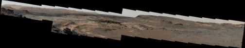
2015-05-22 |
Mars
|
Mars Science Laboratory (MSL)
|
Navcam (MSL)
|
954x588x1 |
|
-
PIA19663:
-
Rover's Reward for Climbing: Exposed Geological Contact
Full Resolution:
TIFF
(561.8 kB)
JPEG
(132.5 kB)
|
|
|
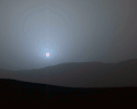
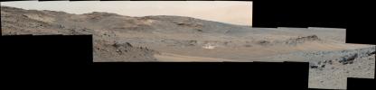
2015-05-22 |
Mars
|
Mars Science Laboratory (MSL)
|
Mastcam
|
7984x2383x3 |
|
-
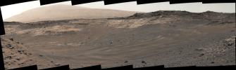
PIA19662:
-
Unfavorable Terrain for Crossing Near 'Logan Pass'
Full Resolution:
TIFF
(57.1 MB)
JPEG
(2.547 MB)
|
|
|
2015-05-22 |
Ceres
|
Dawn
|
Framing Camera
|
1024x1024x1 |
|
-
PIA19561:
-
Dawn OpNav8 Image 3
Full Resolution:
TIFF
(1.05 MB)
JPEG
(128.3 kB)
|
|
|
2015-05-22 |
Mars
|
2001 Mars Odyssey
|
THEMIS
|
1343x2647x1 |
|
-
PIA19468:
-
Mangala Fossae
Full Resolution:
TIFF
(3.559 MB)
JPEG
(275.4 kB)
|
|
|
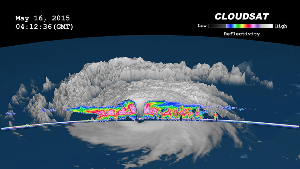
2015-05-22 |
Earth
|
CloudSat
|
MODIS
|
960x540x3 |
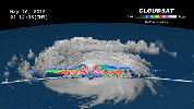
|
-
PIA19475:
-
NASA's CloudSat Peers Into the Eye of Powerful Typhoon Dolphin
Full Resolution:
TIFF
(1.556 MB)
JPEG
(61.88 kB)
|
|
|
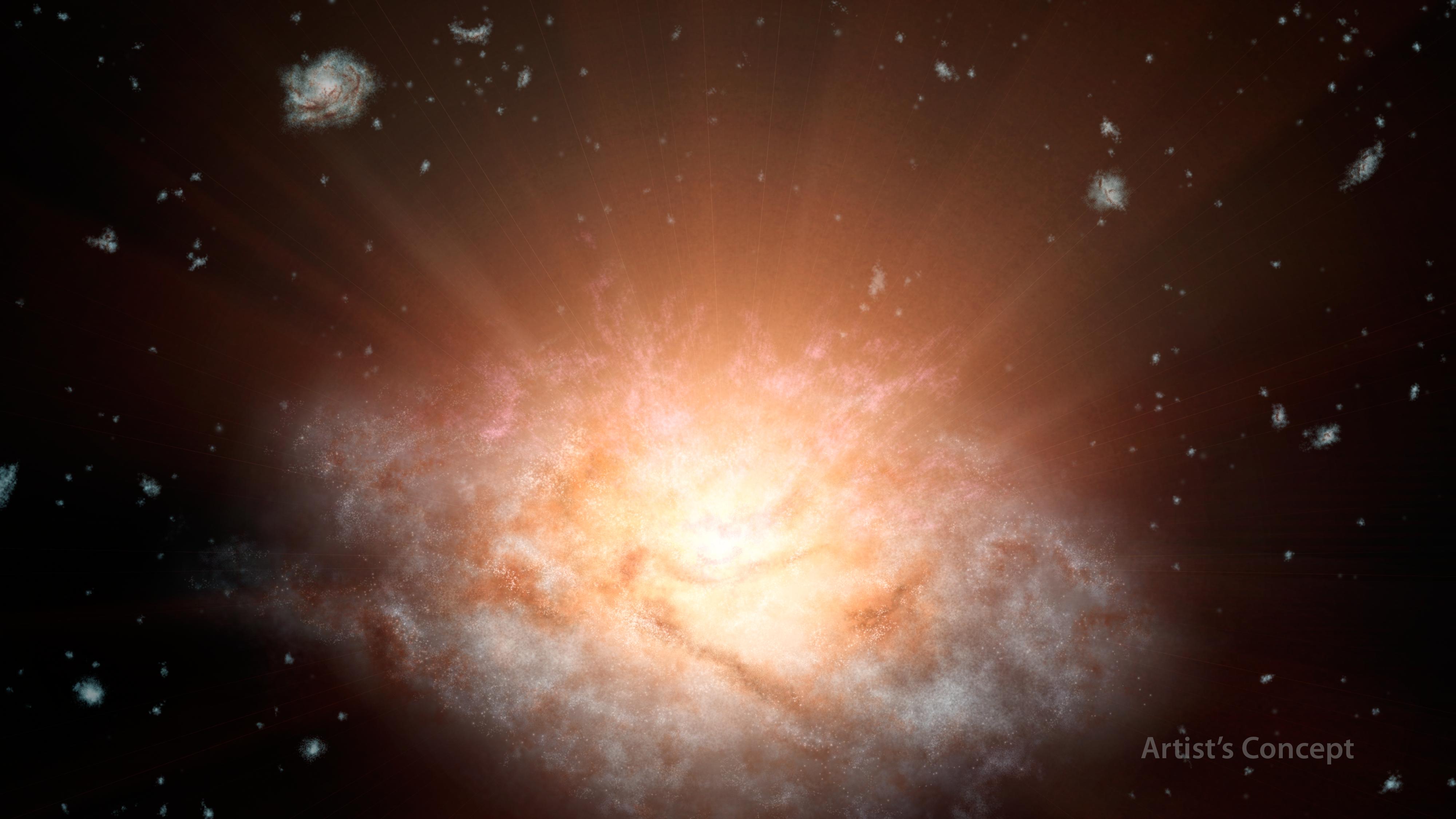
2015-05-21 |
|
Wide-field Infrared Survey Explorer (WISE)
|
|
4000x2250x3 |
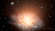
|
-
PIA19339:
-
Dusty 'Sunrise' at Core of Galaxy (Artist's Concept)
Full Resolution:
TIFF
(27.01 MB)
JPEG
(447.1 kB)
|
|
|
2015-05-21 |
Ceres
|
Dawn
|
Framing Camera
|
1024x1024x1 |
|
-
PIA19560:
-
Dawn OpNav8 Image 2
Full Resolution:
TIFF
(1.05 MB)
JPEG
(76.68 kB)
|
|
|
2015-05-21 |
Mars
|
2001 Mars Odyssey
|
THEMIS
|
672x1431x1 |
|
-
PIA19467:
-
Crater Dunes
Full Resolution:
TIFF
(962.8 kB)
JPEG
(63.91 kB)
|
|
|
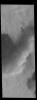
2015-05-20 |
Mars
|
Mars Reconnaissance Orbiter (MRO)
|
HiRISE
|
2880x1800x3 |
|
-
PIA18563:
-
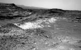
Alluvial Fans in Mojave Crater
Full Resolution:
TIFF
(15.56 MB)
JPEG
(898.5 kB)
|
|
|
2015-05-20 |
Mars
|
Mars Reconnaissance Orbiter (MRO)
|
HiRISE
|
2880x1800x3 |
|
-
PIA18562:
-
Sedimentary Rock Layers on a Crater Floor
Full Resolution:
TIFF
(15.56 MB)
JPEG
(773.6 kB)
|
|
|
2015-05-20 |
Mars
|
Mars Reconnaissance Orbiter (MRO)
|
HiRISE
|
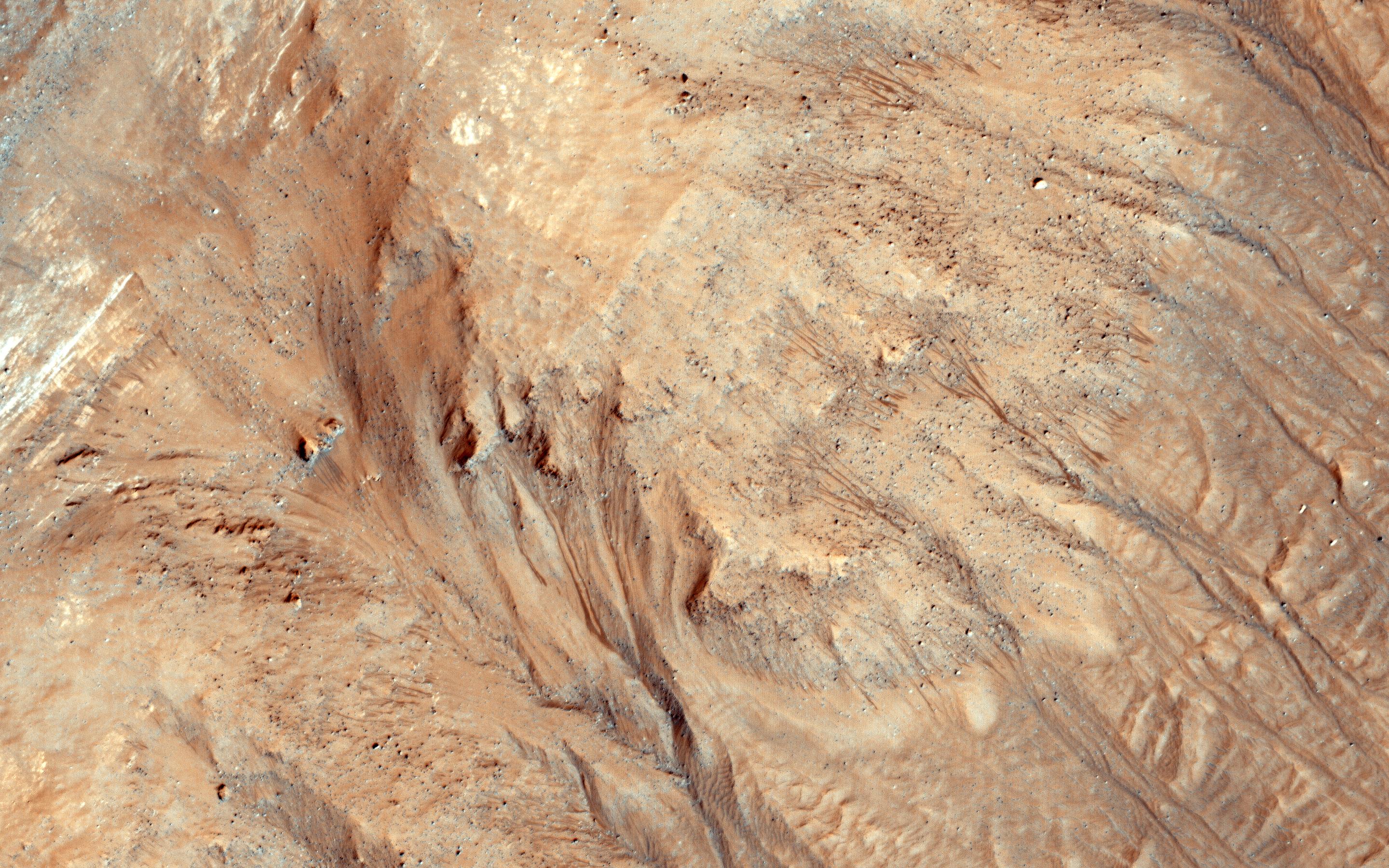
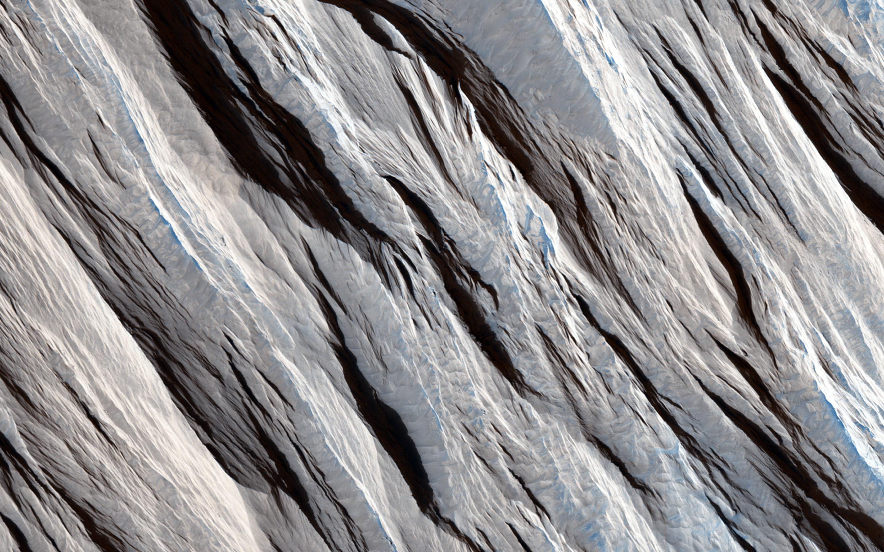
2880x1800x3 |
|
-
PIA18561:
-
Seasonal Flows in Asimov Crater
Full Resolution:
TIFF
(15.56 MB)
JPEG
(908.7 kB)
|
|
|
2015-05-20 |
Mars
|
Mars Reconnaissance Orbiter (MRO)
|
HiRISE
|
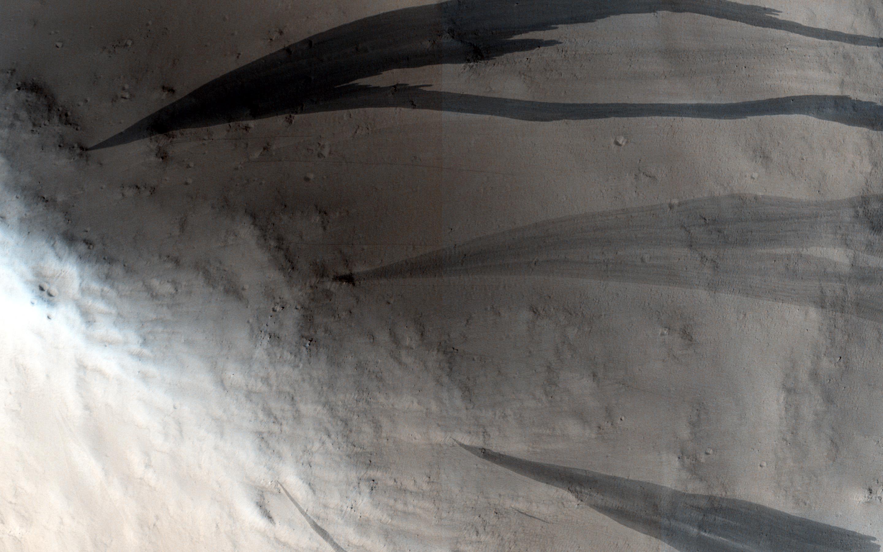
2880x1800x3 |
|
-
PIA18560:
-
Honey, I Shrunk the Mesas
Full Resolution:
TIFF
(15.56 MB)
JPEG
(1.017 MB)
|
|
|
2015-05-20 |
Ceres
|
Dawn
|
Framing Camera
|
1024x1024x1 |

|
-
PIA19559:
-
Dawn OpNav8 Image 1
Full Resolution:
TIFF
(1.05 MB)
JPEG
(86.76 kB)
|
|
|
2015-05-20 |
Mars
|
2001 Mars Odyssey
|
THEMIS
|
1329x2666x1 |
|
-
PIA19466:
-
Crater Rim Gullies
Full Resolution:
TIFF
(3.547 MB)
JPEG
(270.5 kB)
|
|
|
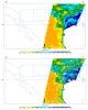
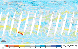
2015-05-19 |
Earth
|
SMAP
|
|
9105x11395x3 |
|
-
PIA19338:
-
Southern U.S. Soil Moisture Map
Full Resolution:
TIFF
(311.3 MB)
JPEG
(4.15 MB)
|
|
|
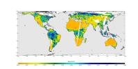
2015-05-19 |
Earth
|
SMAP
|
|
13492x6783x3 |
|
-
PIA19337:
-
High-Resolution Global Soil Moisture Map
Full Resolution:
TIFF
(274.6 MB)
JPEG
(5.137 MB)
|
|
|
2015-05-19 |
Ceres
|
Dawn
|
Framing Camera
|
810x810x1 |
|
-
PIA19550:
-
Dawn RC3 Image 15
Full Resolution:
TIFF
(657 kB)
JPEG
(29.3 kB)
|
|
|
2015-05-19 |
Mars
|
2001 Mars Odyssey
|
THEMIS
|
1324x2642x1 |

|
-
PIA19465:
-
Daedalia Planum
Full Resolution:
TIFF
(3.502 MB)
JPEG
(556.3 kB)
|
|
|
2015-05-18 |
Ceres
|
Dawn
|
Framing Camera
|
810x810x1 |
|
-
PIA19549:
-
Dawn RC3 Image 14
Full Resolution:
TIFF
(657 kB)
JPEG
(25.31 kB)
|
|
|
2015-05-18 |
Mars
|
2001 Mars Odyssey
|
THEMIS
|
535x1455x1 |
|
-
PIA19464:
-
Dust Devil Tracks
Full Resolution:
TIFF
(779.4 kB)
JPEG
(90.89 kB)
|
|
|
2015-05-18 |
Janus
|
Cassini-Huygens
|
ISS - Narrow Angle
|
874x778x1 |

|
-
PIA18315:
-
Janus Stands Alone
Full Resolution:
TIFF
(680.9 kB)
JPEG
(11.29 kB)
|
|
|
2015-05-15 |
Ceres
|
Dawn
|
Framing Camera
|
810x810x1 |

|
-
PIA19548:
-
Dawn RC3 Image 13
Full Resolution:
TIFF
(657 kB)
JPEG
(18.98 kB)
|
|
|
2015-05-15 |
Mars
|
2001 Mars Odyssey
|
THEMIS
|
1470x1683x3 |

|
-
PIA19462:
-
South Polar Layers - False Color
Full Resolution:
TIFF
(7.425 MB)
JPEG
(113.7 kB)
|
|
|
2015-05-14 |
Ceres
|
Dawn
|
Framing Camera
|
810x810x1 |
|
-
PIA19546:
-
Dawn RC3 Image 12
Full Resolution:
TIFF
(657 kB)
JPEG
(54.7 kB)
|
|
|
2015-05-14 |
Mars
|
2001 Mars Odyssey
|
THEMIS
|
1458x1678x3 |
|
-
PIA19461:
-
Southern Spring - False Color
Full Resolution:
TIFF
(7.342 MB)
JPEG
(201.4 kB)
|
|
|
2015-05-13 |
Earth
|
Terra
|
ASTER
|
710x623x3 |
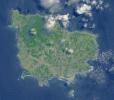
|
-
PIA19463:
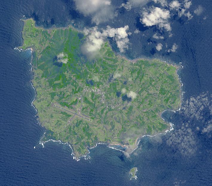
-
Norfolk Island, Australia
Full Resolution:
TIFF
(1.328 MB)
JPEG
(85.01 kB)
|
|
|
2015-05-13 |
Ceres
|
Dawn
|
Framing Camera
|
810x810x1 |
|
-
PIA19545:
-
Dawn RC3 Image 11
Full Resolution:
TIFF
(657 kB)
JPEG
(54.62 kB)
|
|
|
2015-05-13 |
Mars
|
2001 Mars Odyssey
|
THEMIS
|
788x2255x3 |
|
-
PIA19460:
-
Daedalia Planum - False Color
Full Resolution:
TIFF
(5.333 MB)
JPEG
(198.4 kB)
|
|
|
2015-05-12 |
Pluto
|
New Horizons
|
LORRI
|
1125x450x3 |
|
-
PIA11774:
-
That Makes Five
Full Resolution:
TIFF
(1.519 MB)
JPEG
(101.9 kB)
|
|
|
2015-05-12 |
Ceres
|
Dawn
|
Framing Camera
|
810x810x1 |

|
-
PIA19544:
-
Dawn RC3 Image 10
Full Resolution:
TIFF
(657 kB)
JPEG
(59.99 kB)
|
|
|
2015-05-12 |
Mars
|
2001 Mars Odyssey
|
THEMIS
|
786x2252x3 |
|
-
PIA19455:
-
Hadley Crater - False Color
Full Resolution:
TIFF
(5.312 MB)
JPEG
(158.3 kB)
|
|
|
2015-05-11 |
Earth
|
ARIA
|
PALSAR-2
|
822x1263x3 |
|
-
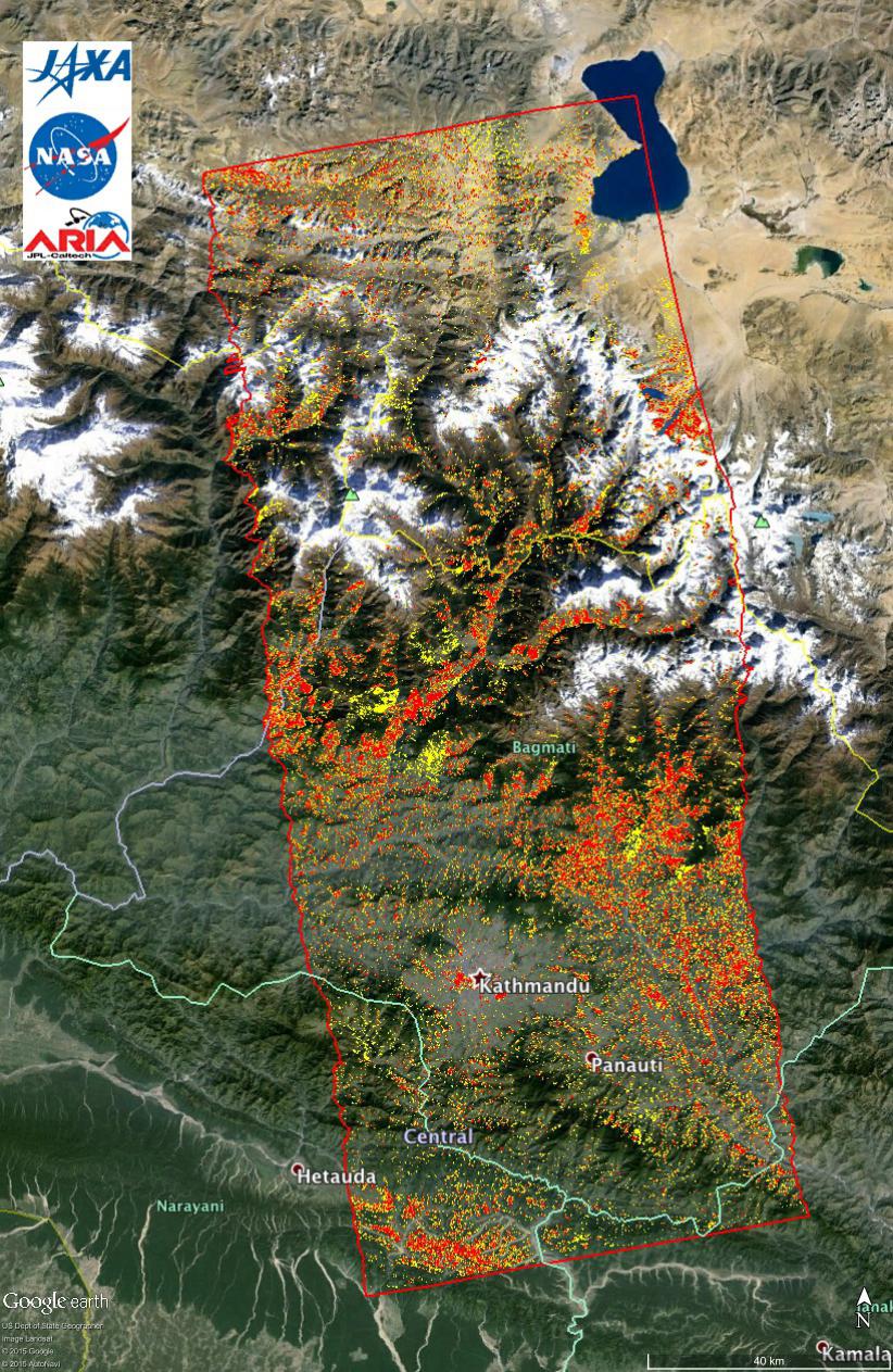
PIA14710:
-
New ALOS-2 Damage Map Assists 2015 Gorkha, Nepal Disaster Response
Full Resolution:
TIFF
(3.116 MB)
JPEG
(307.4 kB)
|
|
|
2015-05-11 |
Earth
|
LDSD
|
|
2222x1249x3 |
|
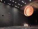
-
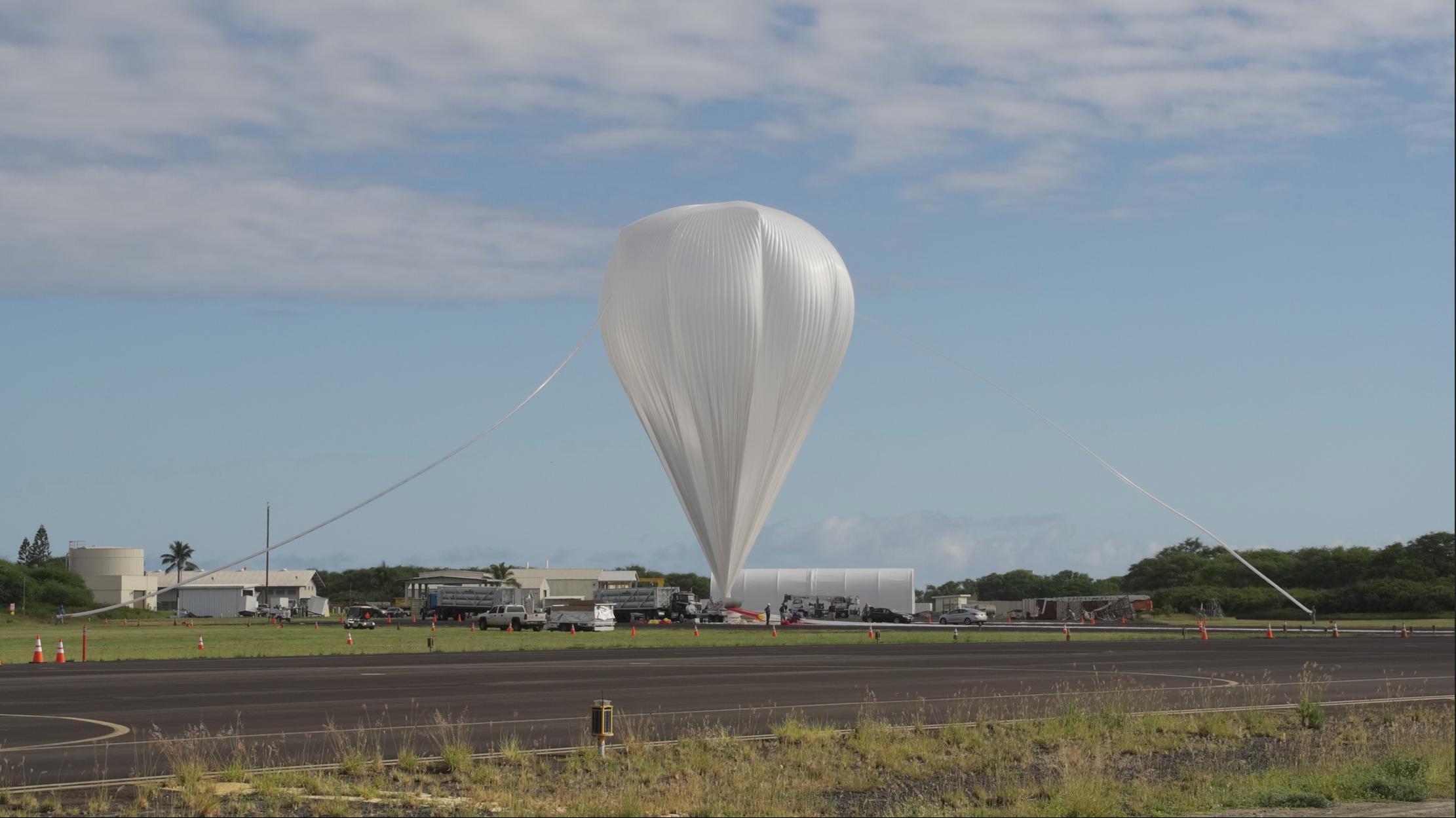
PIA17799:
-
The Saucer's Ride
Full Resolution:
TIFF
(8.329 MB)
JPEG
(195.1 kB)
|
|
|
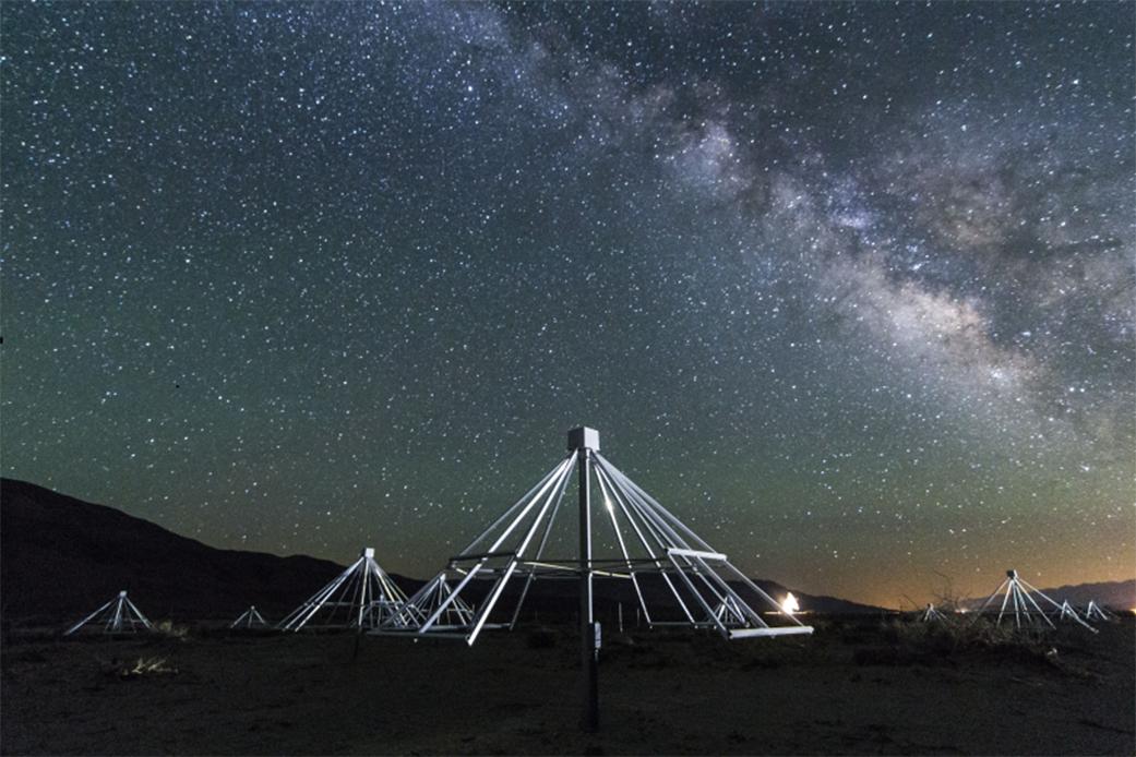
2015-05-11 |
Earth
|
|
|
1041x694x3 |
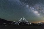
|
-
PIA19336:
-
Scanning the Radio Sky
Full Resolution:
TIFF
(2.168 MB)
JPEG
(107.6 kB)
|
|
|
2015-05-11 |
Ceres
|
Dawn
|
Framing Camera
|
810x810x1 |

|
-
PIA19543:
-
Dawn RC3 Image 9
Full Resolution:
TIFF
(657 kB)
JPEG
(55.78 kB)
|
|
|
2015-05-11 |
Mars
|
2001 Mars Odyssey
|
THEMIS
|
674x1345x3 |

|
-
PIA19454:
-
Terra Cimmeria - False Color
Full Resolution:
TIFF
(2.721 MB)
JPEG
(90.89 kB)
|
|
|
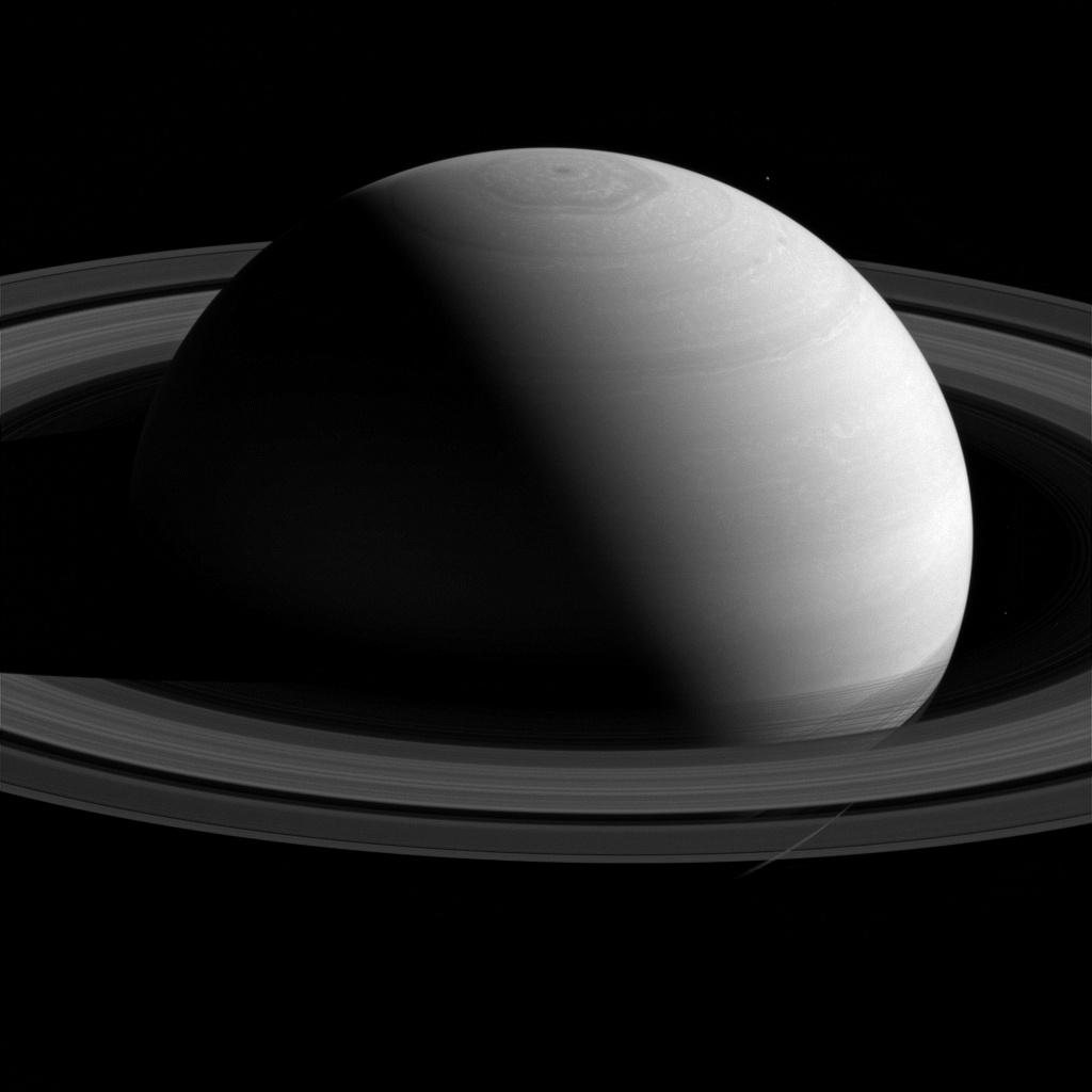
2015-05-11 |
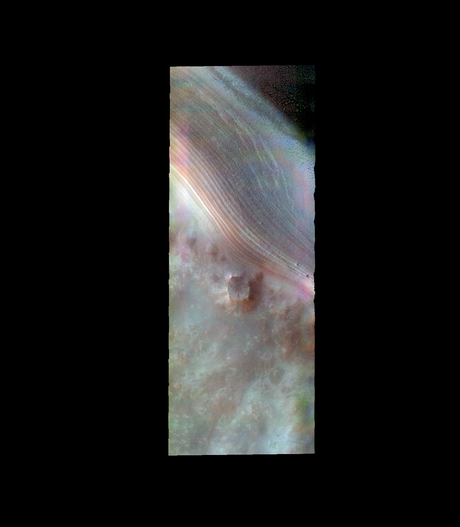
Saturn
|
Cassini-Huygens
|
ISS - Wide Angle
|
1024x1024x1 |

|
-
PIA18314:
-
Serene Saturn
Full Resolution:
TIFF
(1.05 MB)
JPEG
(40.69 kB)
|
|
|
2015-05-11 |
Ceres
|
Dawn
|
Framing Camera
|
774x665x1 |
|
-
PIA19547:
-
Ceres RC3 Animation
Full Resolution:
TIFF
(515.5 kB)
JPEG
(53.2 kB)
|
|
|
2015-05-08 |
Mars
|
Mars Science Laboratory (MSL)
|
Mastcam
|
1619x1154x3 |
|
-
PIA19401:
-
Sunset Sequence in Mars' Gale Crater (Animation)
Full Resolution:
TIFF
(5.607 MB)
JPEG
(64.18 kB)
|
|
|
2015-05-08 |
Mars
|
Mars Science Laboratory (MSL)
|
Mastcam
|
1344x1080x3 |
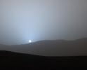
|
-
PIA19400:
-
Sunset in Mars' Gale Crater
Full Resolution:
TIFF
(4.356 MB)
JPEG
(47.63 kB)
|
|
|
2015-05-08 |
Mars
|
Mars Science Laboratory (MSL)
|
HiRISE
|
3300x2550x3 |

|
-
PIA19399:
-
Curiosity's Path to Some Spring 2015 Study Sites
Full Resolution:
TIFF
(25.26 MB)
JPEG
(1.318 MB)
|
|
|
2015-05-08 |
Mars
|
Mars Science Laboratory (MSL)
|
Mastcam
|
13066x3144x3 |
|
-
PIA19398:
Looking Toward Curiosity Study Areas, Spring 2015
Full Resolution:
TIFF
(123.3 MB)
JPEG
(3.421 MB)
|
|
|
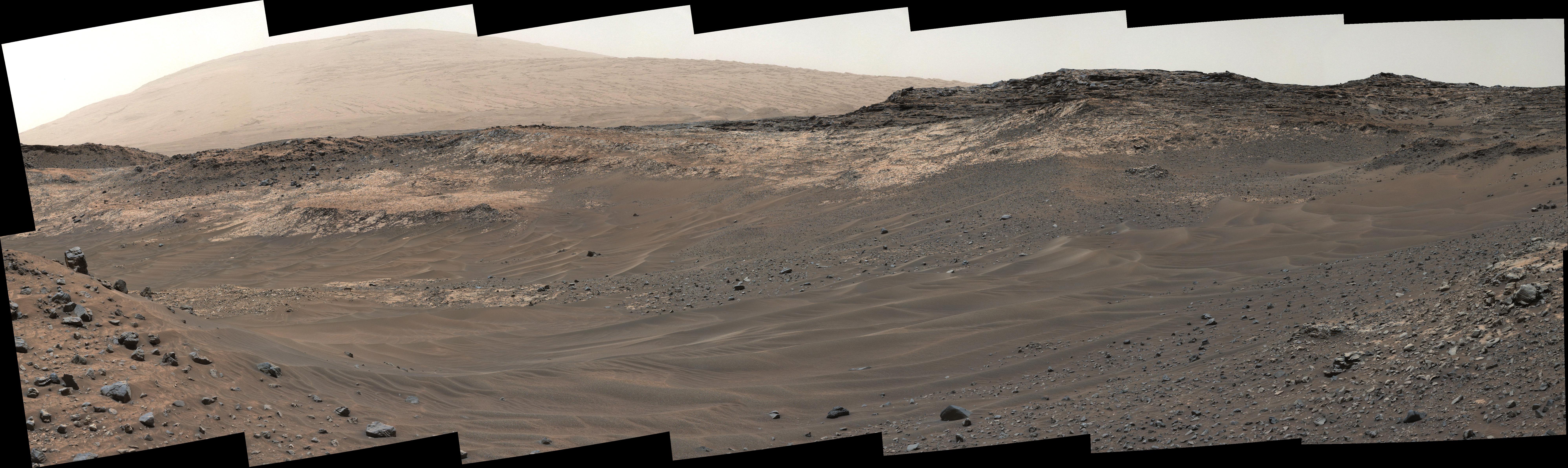
2015-05-08 |
Mars
|
Mars Science Laboratory (MSL)
|
Mastcam
|
19578x3893x3 |
|
-
PIA19397:
Diverse Terrain Types on Mount Sharp, Mars
Full Resolution:
TIFF
(228.7 MB)
JPEG
(6.143 MB)
|
|
|
2015-05-08 |
Ceres
|
Dawn
|
Framing Camera
|
810x810x1 |
|
-
PIA19542:
-
Dawn RC3 Image 8
Full Resolution:
TIFF
(657 kB)
JPEG
(57.34 kB)
|
|
|
2015-05-08 |
Mars
|
2001 Mars Odyssey
|
THEMIS
|
534x1453x1 |
|
-
PIA19453:
-
Dust Devil Tracks
Full Resolution:
TIFF
(776.9 kB)
JPEG
(85.18 kB)
|
|
|
2015-05-07 |
Earth
|
ARIA
|
PALSAR-2
|
1402x2048x3 |
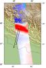
|
-
PIA14708:
-
Radar Shows Kathmandu Area Uplifted 5 Feet by Gorkha, Nepal Earthquake
Full Resolution:
TIFF
(8.617 MB)
JPEG
(460.9 kB)
|
|
|
2015-05-07 |
|
NuSTAR
|
NuSTAR
|
3000x1679x3 |

|
-
PIA19335:
-
Tracing Titanium's Escape
Full Resolution:
TIFF
(15.12 MB)
JPEG
(299.3 kB)
|
|
|
2015-05-07 |
Earth
|
Aqua
|
AIRS
|
737x467x3 |
|
-
PIA19385:
-
NASA's AIRS Instrument Tracks Transport of Sulfur Dioxide from Chilean Volcanic Eruption (Animation)
Full Resolution:
TIFF
(1.033 MB)
JPEG
(69.56 kB)
|
|
|
2015-05-07 |
Ceres
|
Dawn
|
Framing Camera
|
1024x1024x3 |
|
-
PIA19541:
-
Dawn RC3 Image 7 Anaglyph
Full Resolution:
TIFF
(3.147 MB)
JPEG
(42.07 kB)
|
|
|
2015-05-07 |
Ceres
|
Dawn
|
Framing Camera
|
1024x1024x1 |

|
-
PIA19540:
-
Dawn RC3 Image 7
Full Resolution:
TIFF
(1.05 MB)
JPEG
(38.58 kB)
|
|
|
2015-05-07 |
Mars
|
2001 Mars Odyssey
|
THEMIS
|
555x1489x1 |
|
-
PIA19452:
-
Crater Dunes
Full Resolution:
TIFF
(827.5 kB)
JPEG
(48.69 kB)
|
|
|
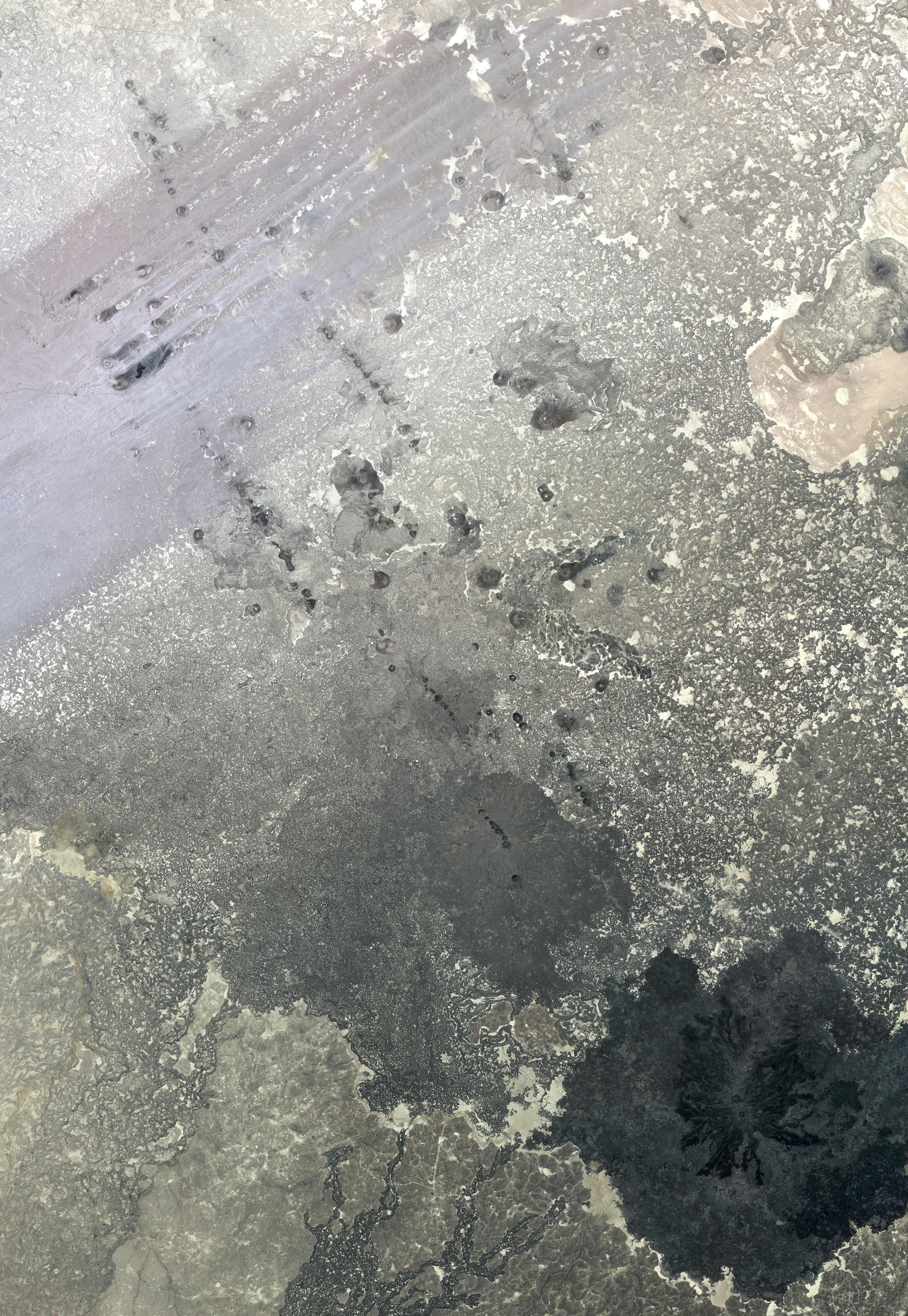
2015-05-06 |
Mars
|
Mars Reconnaissance Orbiter (MRO)
|
HiRISE
|
840x333x1 |

|
-
PIA19459:
-
Darn Dust!
Full Resolution:
TIFF
(280.2 kB)
JPEG
(41.45 kB)
|
|
|
2015-05-06 |
Mars
|
Mars Reconnaissance Orbiter (MRO)
|
HiRISE
|
2880x1800x3 |
|
-
PIA19458:
-
Warm-Season Flows in Cold-Season Ravines
Full Resolution:
TIFF
(15.56 MB)
JPEG
(1.068 MB)
|
|
|
2015-05-06 |
Mars
|
Mars Reconnaissance Orbiter (MRO)
|
HiRISE
|
2880x1800x3 |
|
-
PIA19457:
-
On the Beauty of Yardangs
Full Resolution:
TIFF
(15.56 MB)
JPEG
(764.5 kB)
|
|
|
2015-05-06 |
Mars
|
Mars Reconnaissance Orbiter (MRO)
|
HiRISE
|
2880x1800x3 |
|
-
PIA19456:
-
Slope Streaks on a Dusty Planet
Full Resolution:
TIFF
(15.56 MB)
JPEG
(534.2 kB)
|
|
|
2015-05-06 |
Earth
|
SMAP
|
|
2999x3006x3 |
|
-
PIA17798:
-
SMAP's Radiometer Captures Views of Global Soil Moisture
Full Resolution:
TIFF
(27.06 MB)
JPEG
(722.7 kB)
|
|
|
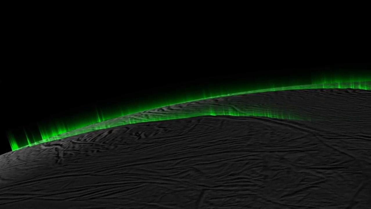
2015-05-06 |
Enceladus
|
Cassini-Huygens
|
Imaging Science Subsystem
|
2046x1022x3 |

|
-
PIA19061:
-
Enceladus Curtains: Comparing Data and Simulation
Full Resolution:
TIFF
(6.275 MB)
JPEG
(87.93 kB)
|
|
|
2015-05-06 |
Enceladus
|
Cassini-Huygens
|
Imaging Science Subsystem
|
1278x719x3 |
|
-
PIA19060:
-
Icy Curtain Eruptions on Enceladus Create an Illusion of Discrete Jets (Simulation)
Full Resolution:
TIFF
(2.758 MB)
JPEG
(54.03 kB)
|
|
|
2015-05-06 |
Ceres
|
Dawn
|
Framing Camera
|
1024x1024x3 |
|
-
PIA19539:
-
Dawn RC3 Image 6 Anaglyph
Full Resolution:
TIFF
(3.147 MB)
JPEG
(42.74 kB)
|
|
|
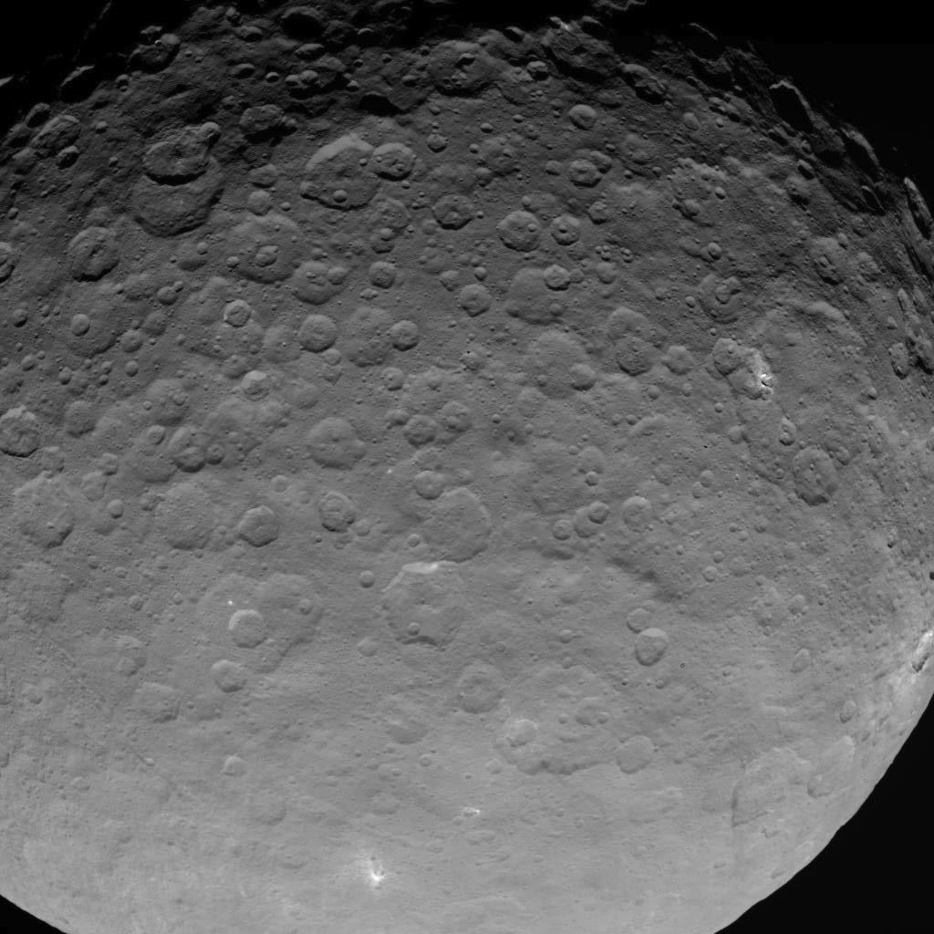
2015-05-06 |
Ceres
|
Dawn
|
Framing Camera
|
1024x1024x1 |
|
-
PIA19538:
-
Dawn RC3 Image 6
Full Resolution:
TIFF
(1.05 MB)
JPEG
(39.37 kB)
|
 Planetary Data System


