My
List |
Addition Date
|
Target
|
Mission
|
Instrument
|
Size
|

|
2023-12-19 |
Mars
|
Mars Reconnaissance Orbiter (MRO)
|
HiRISE
|
2880x1800x3 |
|
-
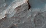
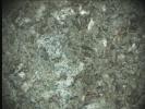
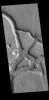
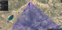
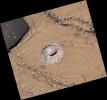
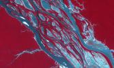
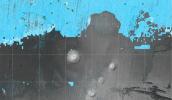
PIA25988:
-
A Sedimentary Fan in Southeast Gale Crater
Full Resolution:
TIFF
(14.65 MB)
JPEG
(871.3 kB)
|
|
|
2023-12-19 |
Mars
|
Mars Reconnaissance Orbiter (MRO)
|
HiRISE
|
2880x1800x3 |
|
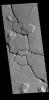
-
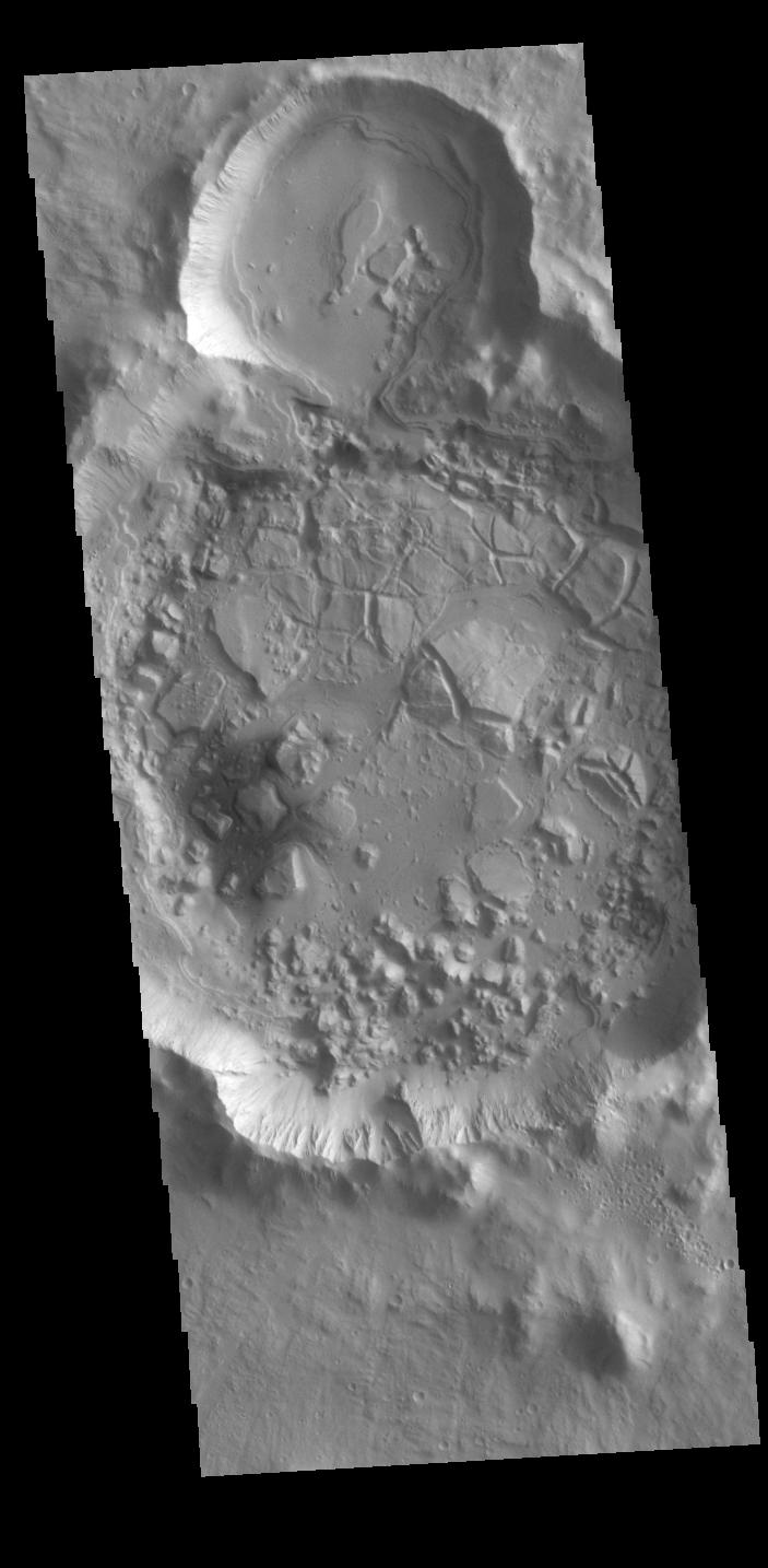
PIA25987:
-
Muddy Mounds
Full Resolution:
TIFF
(5.191 MB)
JPEG
(1.613 MB)
|
|
|
2023-12-19 |
Mars
|
2001 Mars Odyssey
|
THEMIS
|
611x2701x1 |

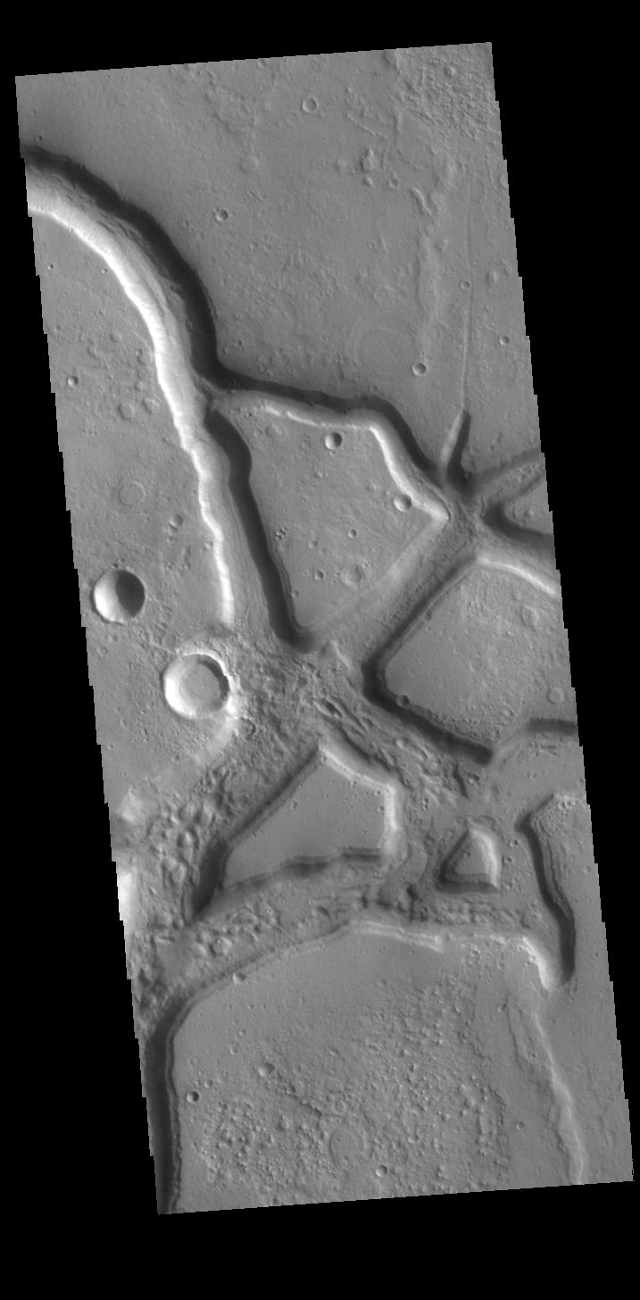
|
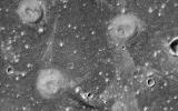
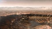
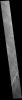
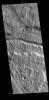
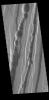
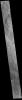
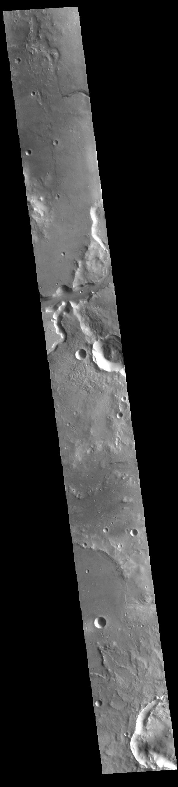
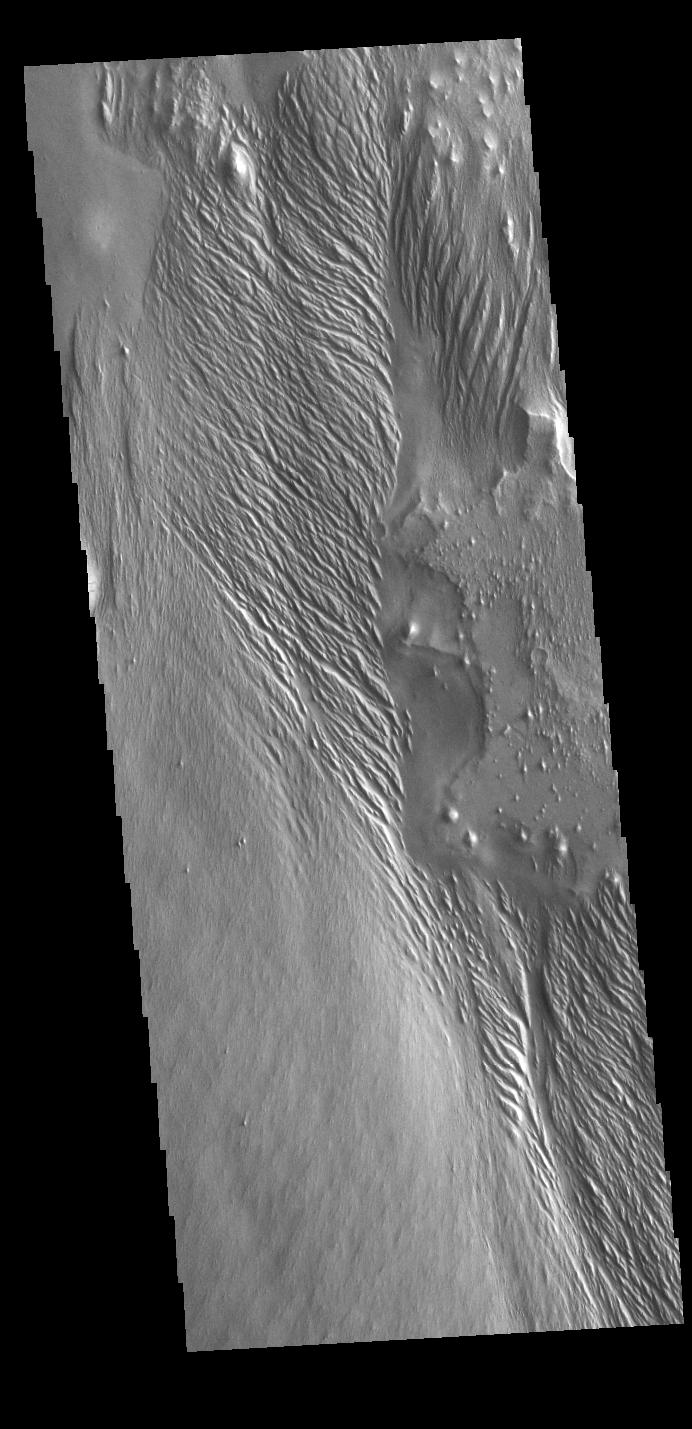
-
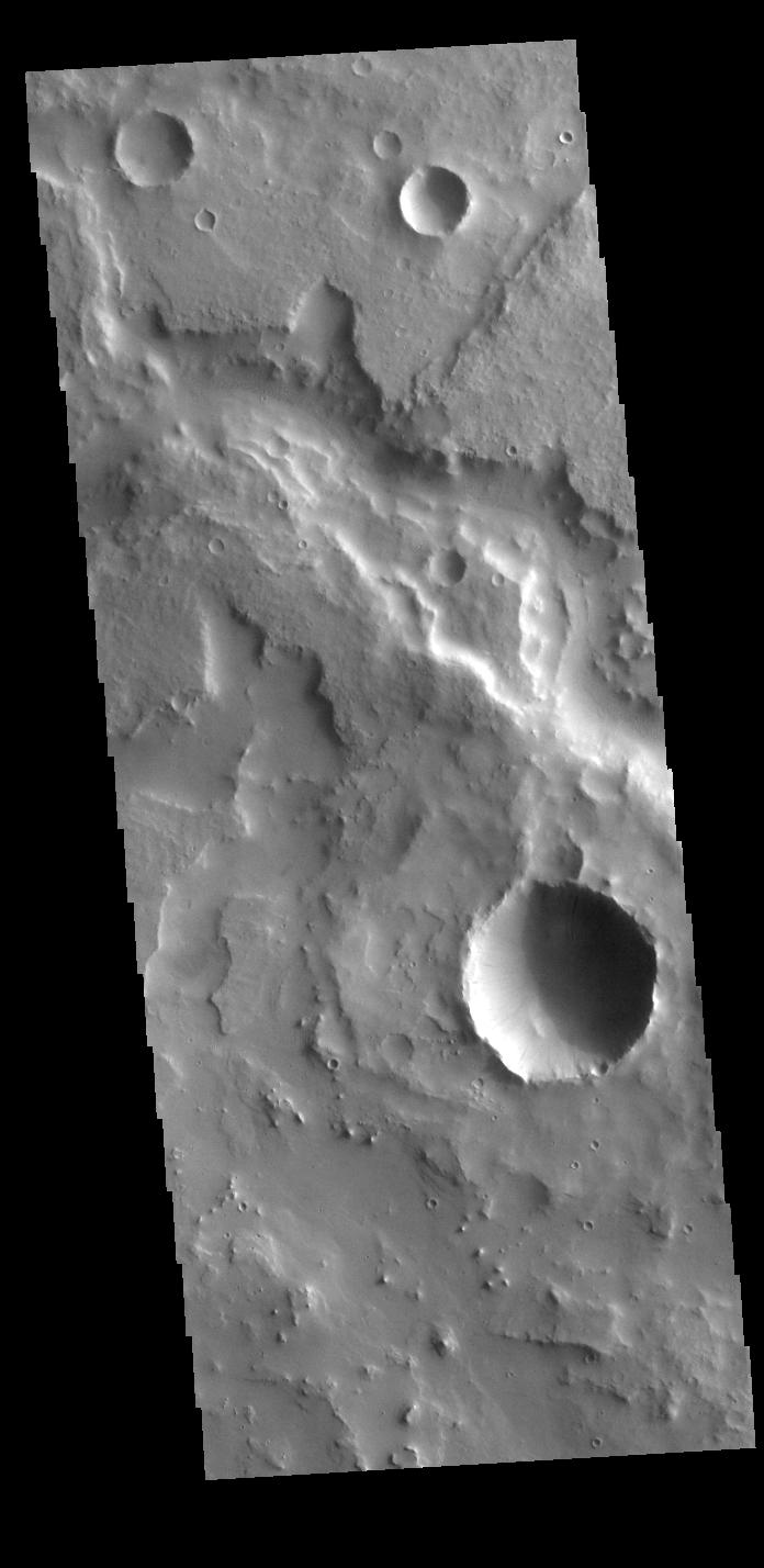
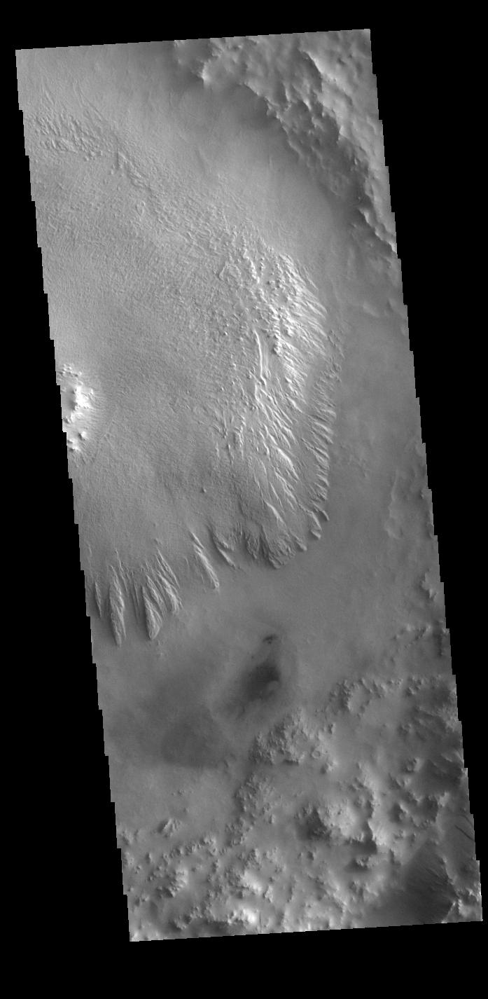
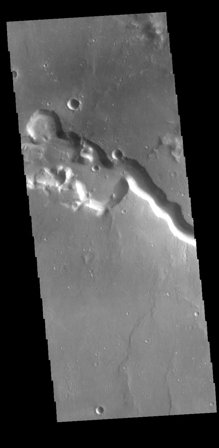
PIA26262:
-
Shalbatana Vallis
Full Resolution:
TIFF
(776.3 kB)
JPEG
(93.6 kB)
|
|
|
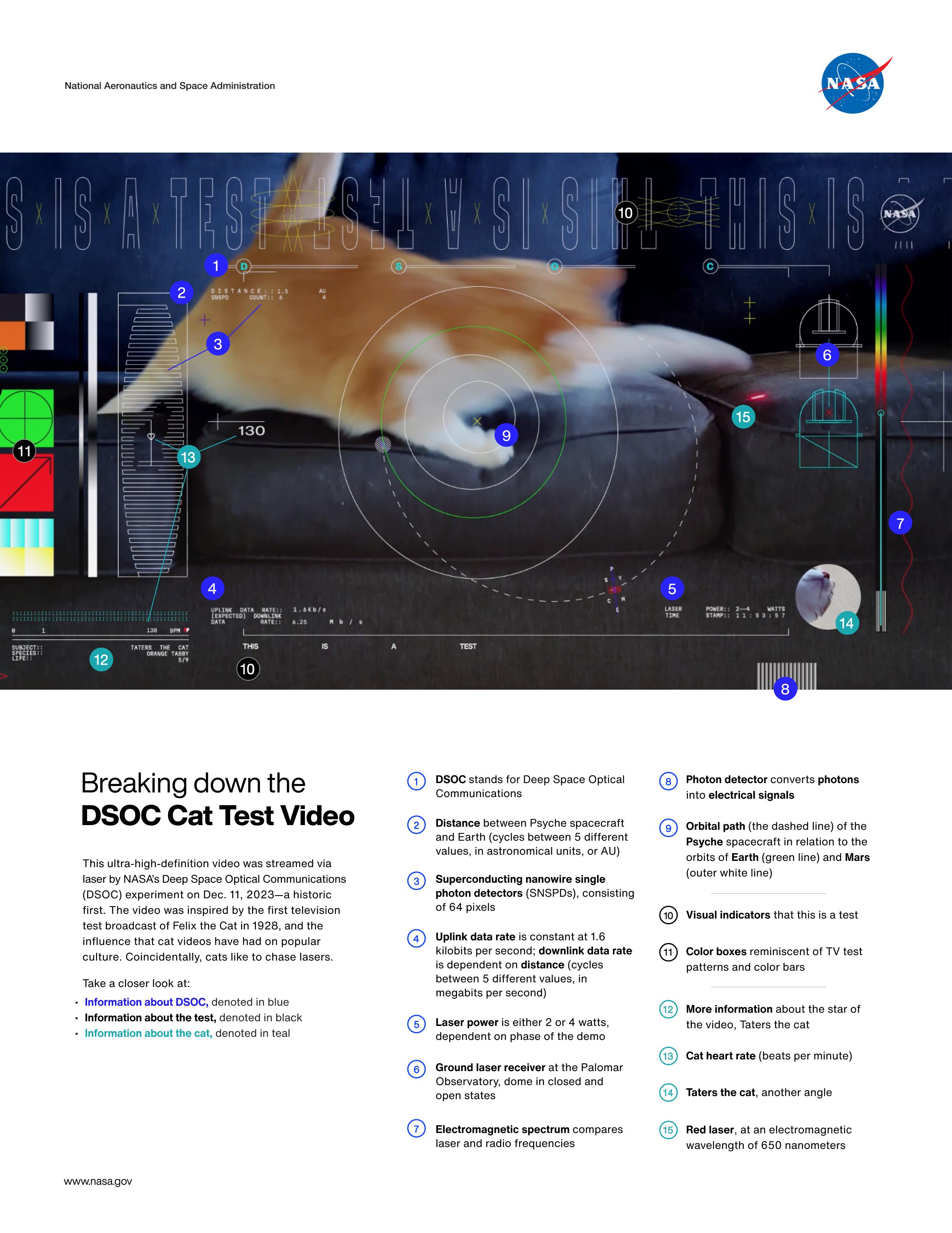
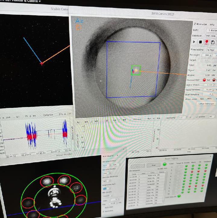
2023-12-18 |
|
Psyche
|
Deep Space Optical Communications (DSOC)
|
2448x3168x3 |

|
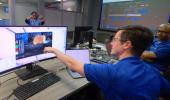
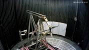
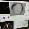
-
PIA26146:
-
Explaining the First Ultra-HD Video Sent From Deep Space via Laser
Full Resolution:
TIFF
(8.044 MB)
JPEG
(596.3 kB)
|
|
|
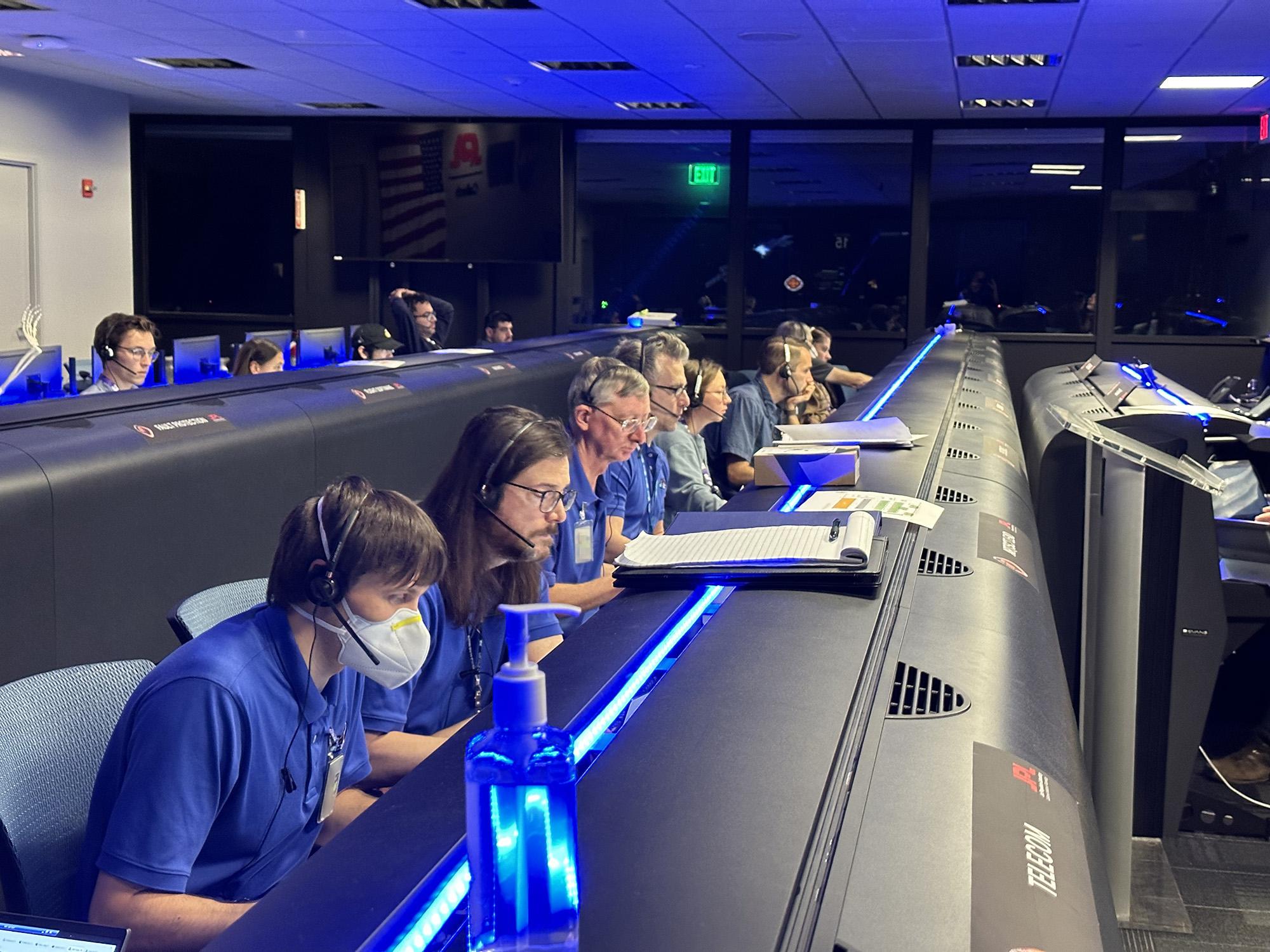
2023-12-18 |
|
Psyche
|
Deep Space Optical Communications (DSOC)
|
3122x1840x3 |
|
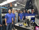
-
PIA26145:
-
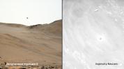
DSOC Team Members React to the First HD Streaming Video From Deep Space
Full Resolution:
TIFF
(15.14 MB)
JPEG
(508.9 kB)
|
|
|
2023-12-18 |
Mars
|
2001 Mars Odyssey
|
THEMIS
|
715x1446x1 |
|
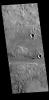
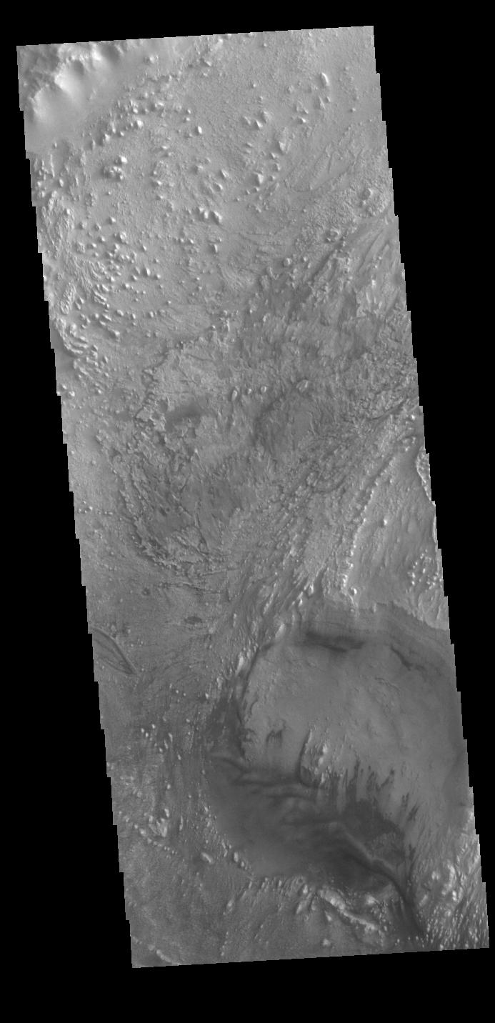
-
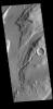
PIA26261:
-
Utopia Planitia Crater
Full Resolution:
TIFF
(712.4 kB)
JPEG
(103 kB)
|
|
|
2023-12-15 |
Mars
|
2001 Mars Odyssey
|
THEMIS
|
611x2702x1 |

|
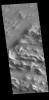
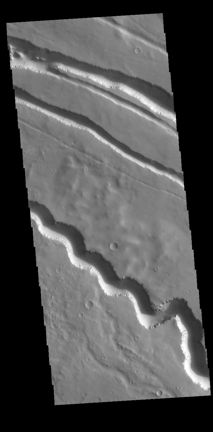
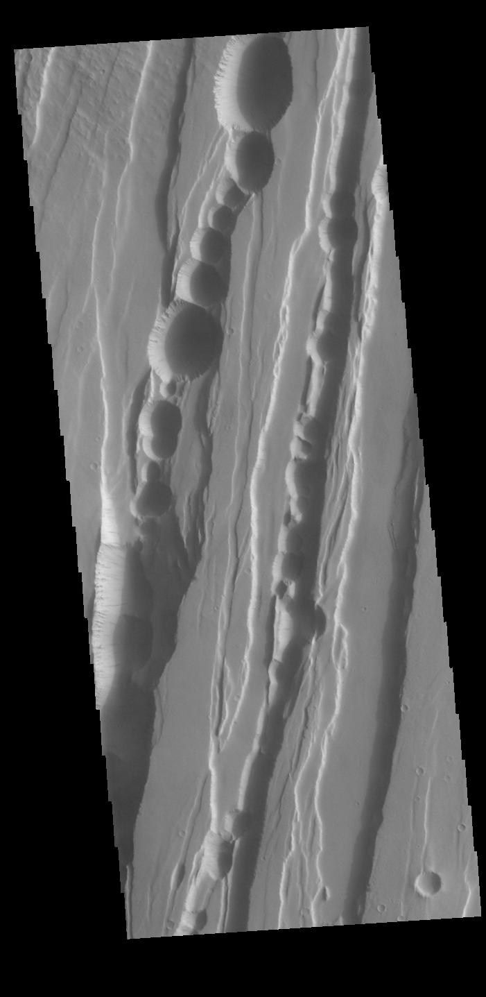
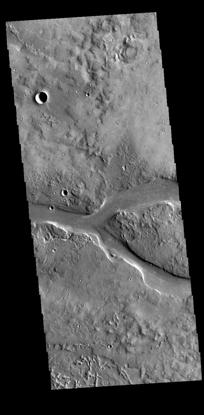
-
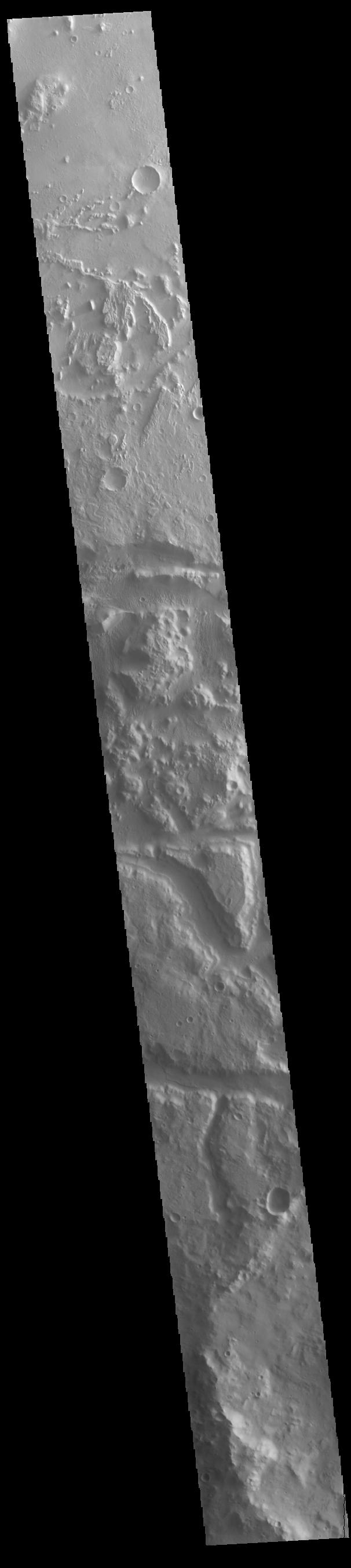
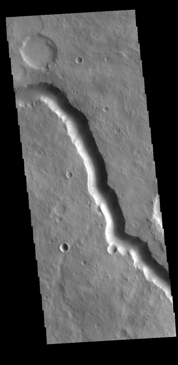
PIA26260:
-
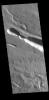
Bahram Vallis
Full Resolution:
TIFF
(798 kB)
JPEG
(101.6 kB)
|
|
|
2023-12-14 |
Earth
|
Terra
|
ASTER
|
1600x1900x3 |

|
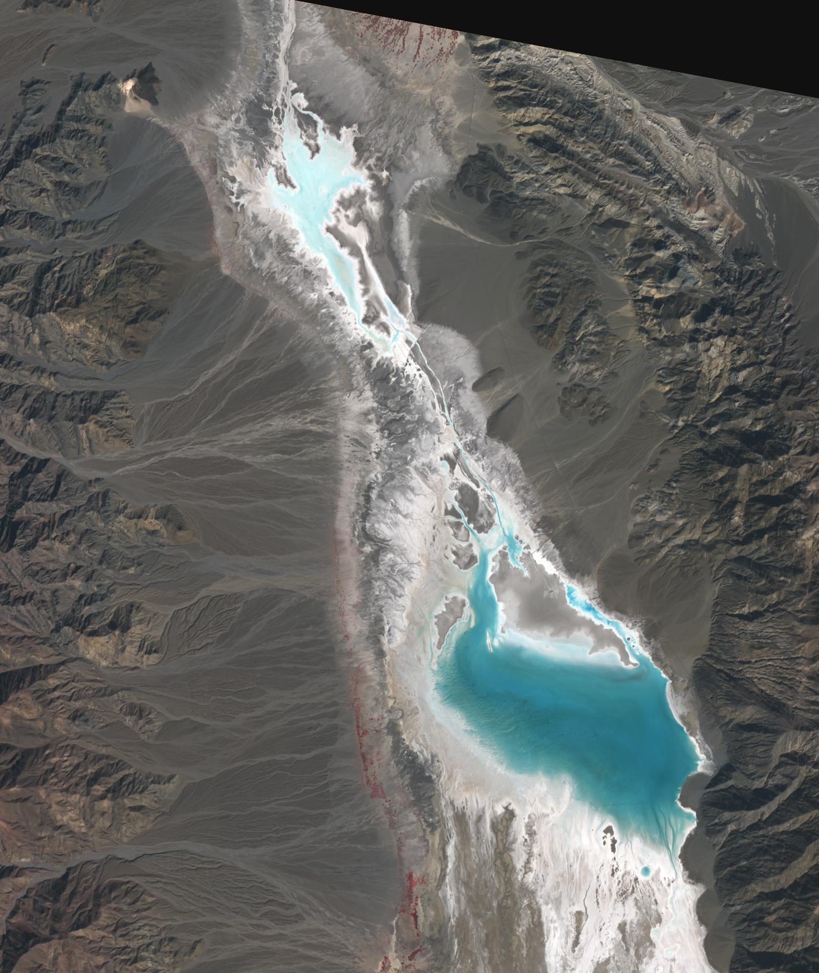
-
PIA26197:
-
Badwater, Death Valley
Full Resolution:
TIFF
(7.76 MB)
JPEG
(376.6 kB)
|
|
|
2023-12-14 |
Mars
|
2001 Mars Odyssey
|
THEMIS
|
716x1452x1 |

|
-
PIA26259:
-
Acidalia Planitia Crater
Full Resolution:
TIFF
(768.5 kB)
JPEG
(107.3 kB)
|
|
|
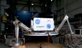
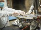
2023-12-13 |
|
Cooperative Autonomous Distributed Robotic Exploration (CADRE)
|
|
4370x2456x3 |
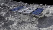
|
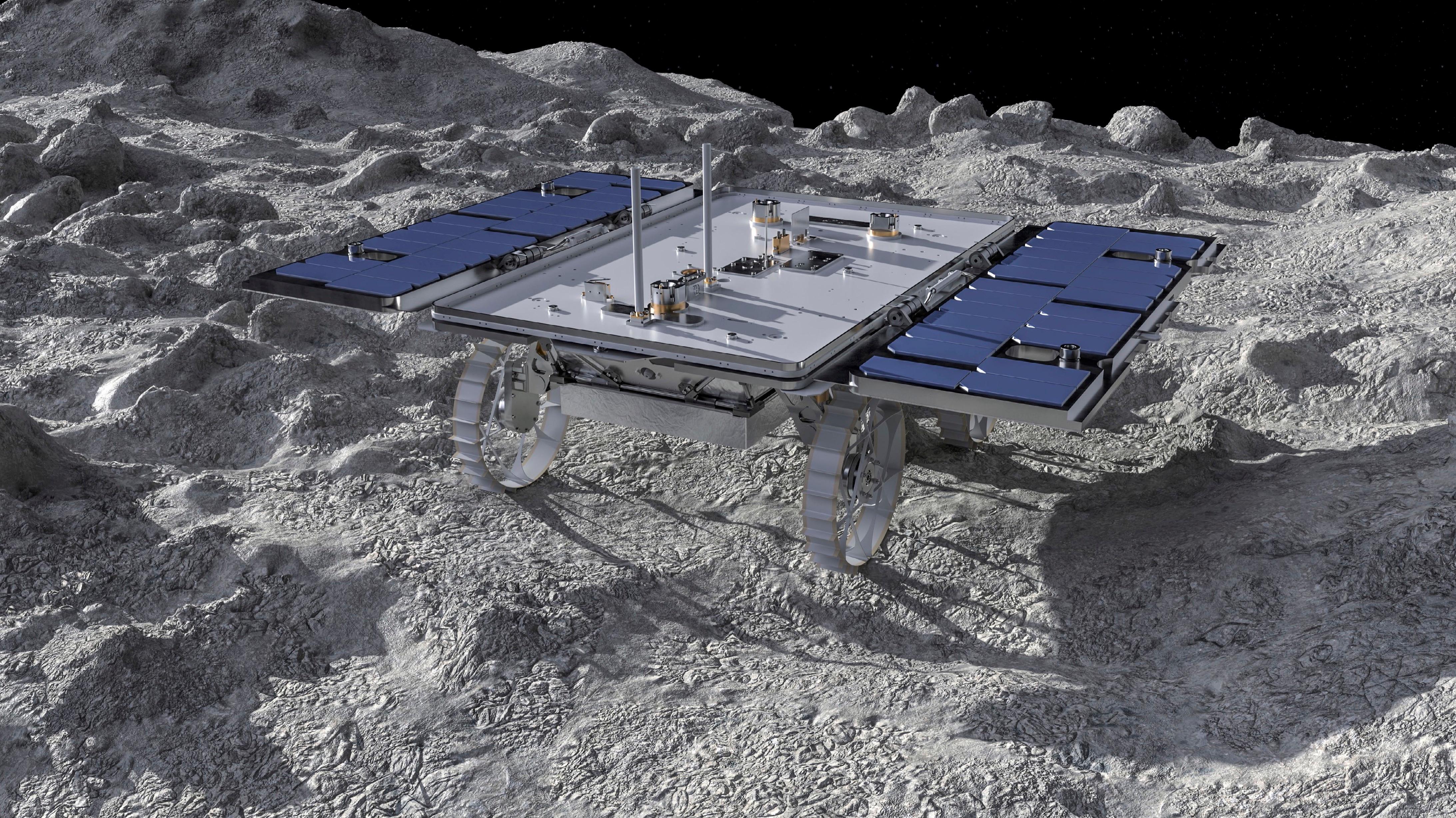
-
PIA26161:
-
CADRE Rover on the Moon (Artist's Concept)
Full Resolution:
TIFF
(25.37 MB)
JPEG
(2.259 MB)
|
|
|
2023-12-13 |
Mars
|
2001 Mars Odyssey
|
THEMIS
|
696x1428x1 |

|
-
PIA26258:
-
Naktong Vallis
Full Resolution:
TIFF
(706.8 kB)
JPEG
(78.9 kB)
|
|
|
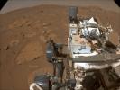
2023-12-12 |
Mars
|
Mars Reconnaissance Orbiter (MRO)
|
HiRISE
|
2311x1728x3 |
|
-
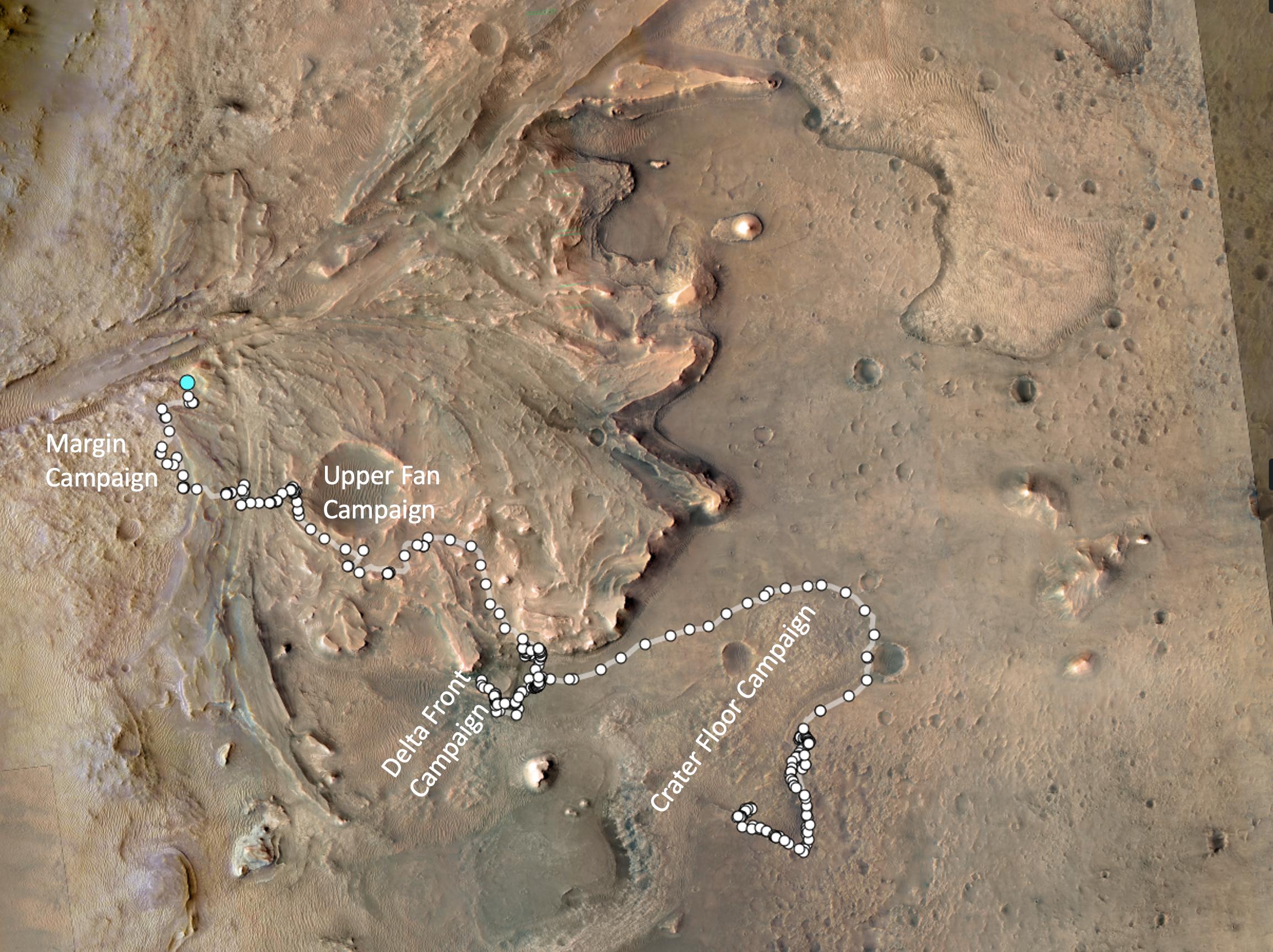
PIA26231:
-
1,000 Days of Perseverance
Full Resolution:
TIFF
(11.76 MB)
JPEG
(559.5 kB)
|
|
|
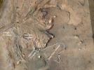
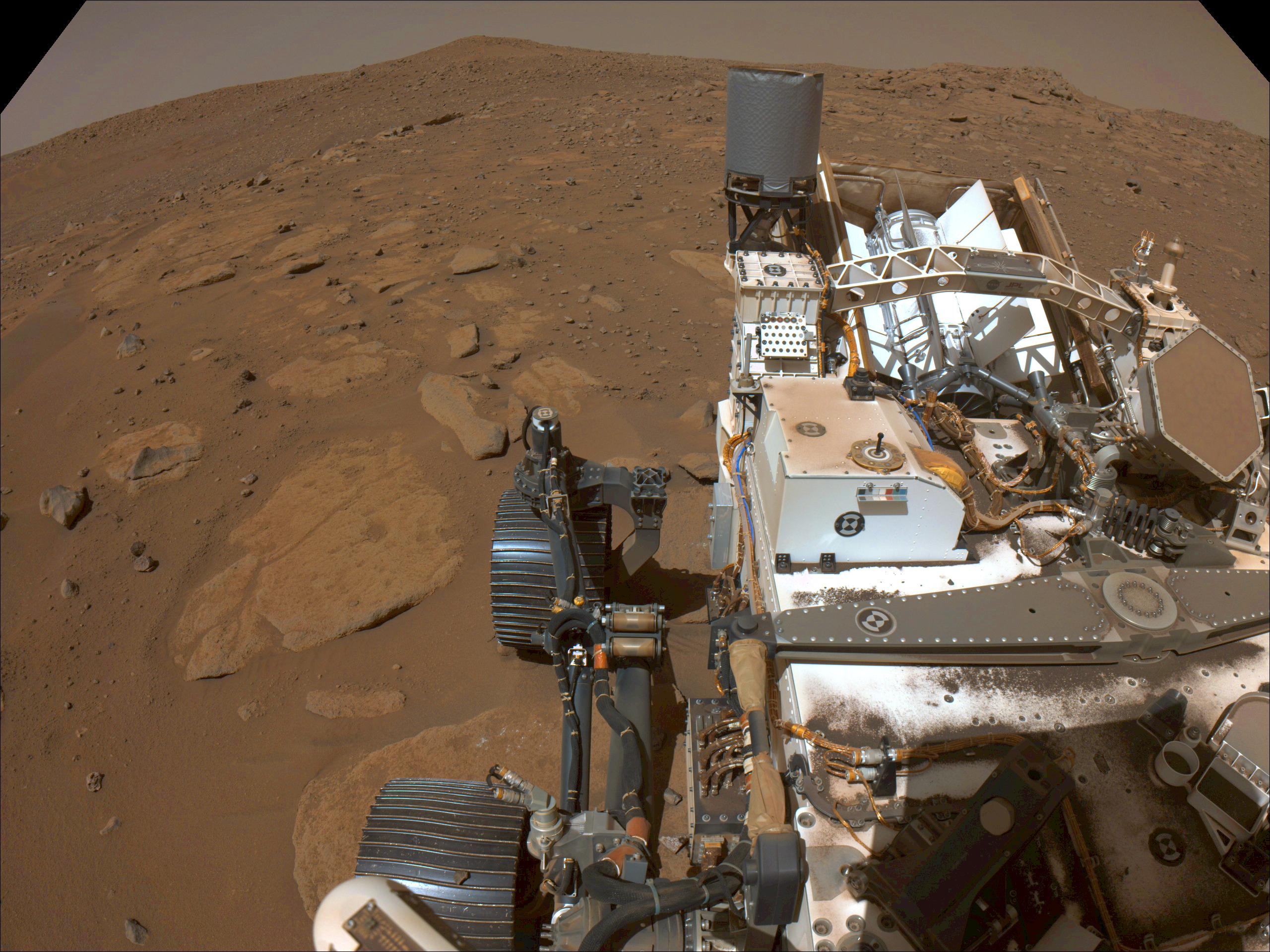
2023-12-12 |
Mars
|
Mars 2020 Rover
|
Scanning Habitable Environments with Raman & Luminescence for Organics and Chemicals (SHERLOC)
|
2968x1666x3 |

|
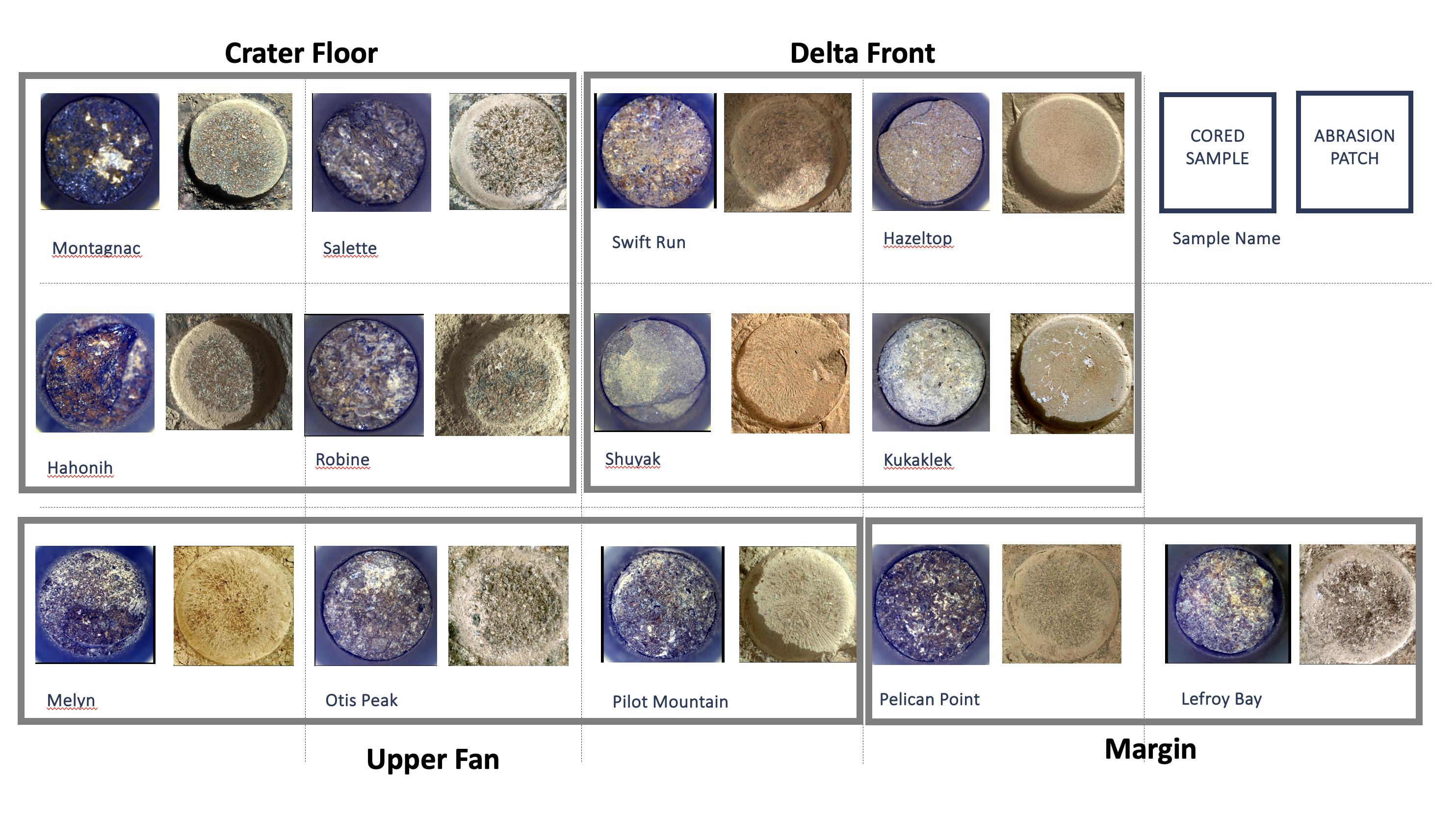
-
PIA26232:
-
Cored Samples Aboard Perseverance at Sol 1,000
Full Resolution:
TIFF
(6.238 MB)
JPEG
(632.2 kB)
|
|
|
2023-12-12 |
Mars
|
Mars 2020 Rover
|
Mastcam-Z
|
4447x1517x3 |
|
-
PIA26208:
-
Perseverance's Mastcam-Z Views Castell Henllys
Full Resolution:
TIFF
(15.59 MB)
JPEG
(996.7 kB)
|
|
|
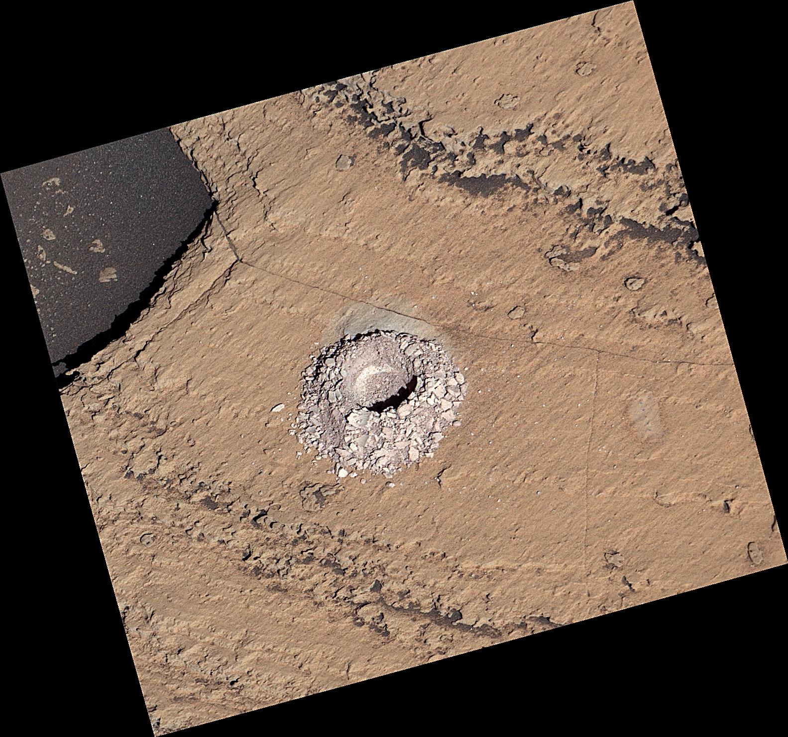
2023-12-12 |
Mars
|
Mars 2020 Rover
|
Planetary Instrument for X-ray Lithochemistry (PIXL)
|
3561x1996x3 |
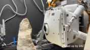
|
-
PIA26204:
-
How Perseverance's PIXL Gets Close to a Rock Target
Full Resolution:
TIFF
(15.19 MB)
JPEG
(423.4 kB)
|
|
|
2023-12-12 |
Mars
|
Mars 2020 Rover
|
Planetary Instrument for X-ray Lithochemistry (PIXL)
|
1252x1069x3 |

|
-
PIA26206:
-
PIXL Instrument on NASA's Perseverance Studies 'Ouzel Falls'
Full Resolution:
TIFF
(4.017 MB)
JPEG
(319.7 kB)
|
|
|
2023-12-12 |
Mars
|
Mars 2020 Rover
|
Planetary Instrument for X-ray Lithochemistry (PIXL)
|
1600x1200x3 |
|
-
PIA26205:
-
PIXL Instrument on NASA's Perseverance Studies 'Bills Bay'
Full Resolution:
TIFF
(5.762 MB)
JPEG
(331.5 kB)
|
|
|
2023-12-12 |
Mars
|
Mars 2020 Rover
|
|
1580x882x3 |
|
-
PIA26207:
-
Water Enters Jezero Crater Billions of Years Ago (Artist's Concept)
Full Resolution:
TIFF
(3.389 MB)
JPEG
(145.7 kB)
|
|
|
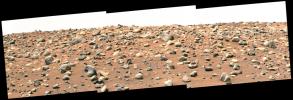
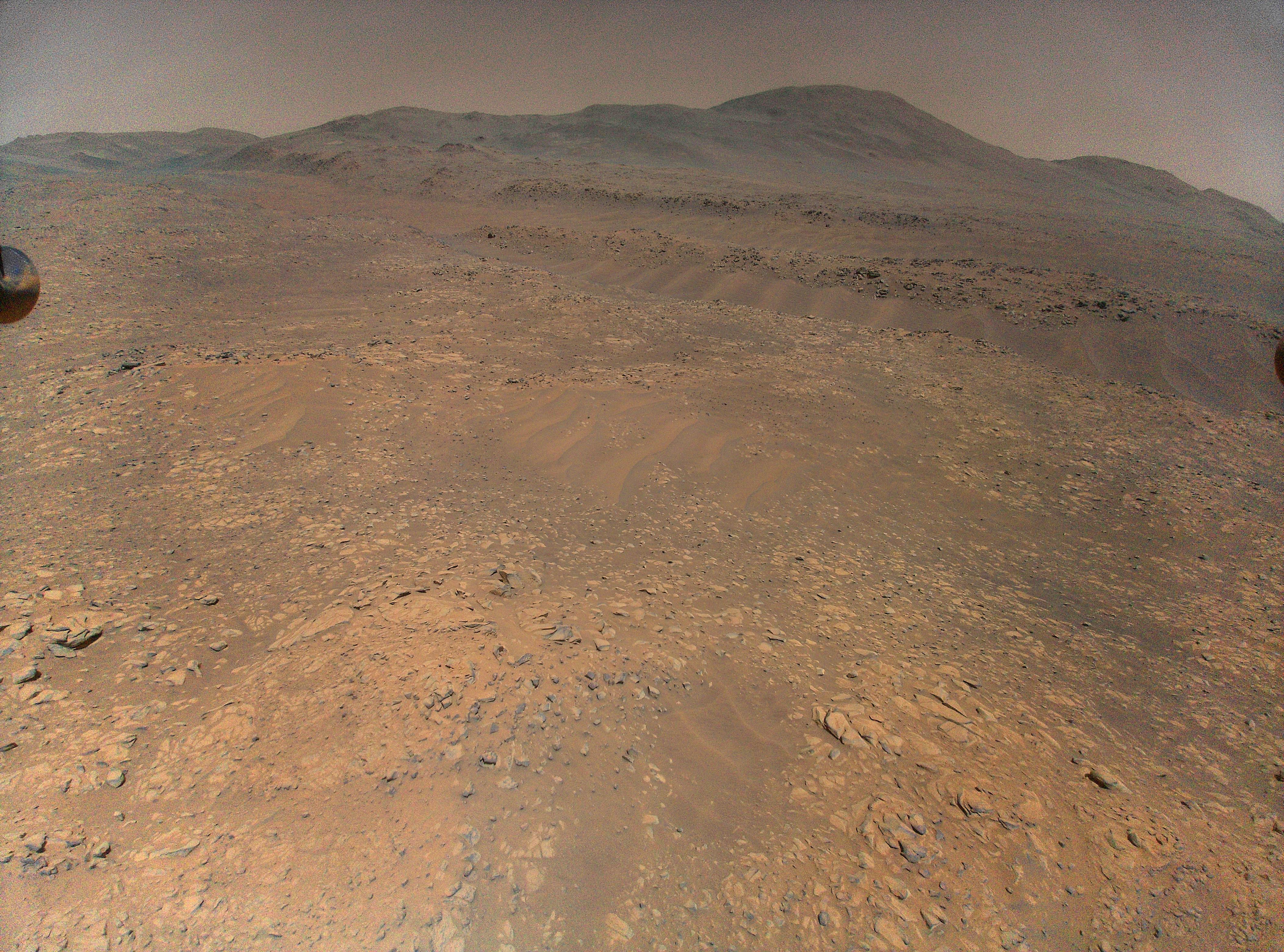
2023-12-12 |
Mars
|
Mars 2020 Rover
|
Mastcam-Z
|
9000x2425x3 |
|
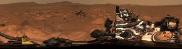
-
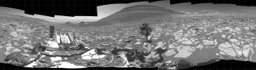
PIA26080:
Perseverance's 360-Degree View From 'Airey Hill'
Full Resolution:
TIFF
(48.29 MB)
JPEG
(2.638 MB)
|
|
|
2023-12-12 |
Mars
|
2001 Mars Odyssey
|
THEMIS
|
703x1434x1 |

|
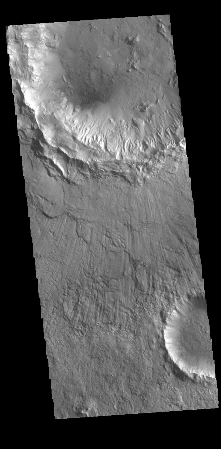
-
PIA26257:
-
Tartarus Colles Crater
Full Resolution:
TIFF
(735.6 kB)
JPEG
(87.64 kB)
|
|
|
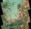
2023-12-11 |
Earth
|
Earth Surface Mineral Dust Source Investigation (EMIT)
|
EMIT
|
5836x2174x3 |
|
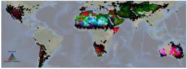
-
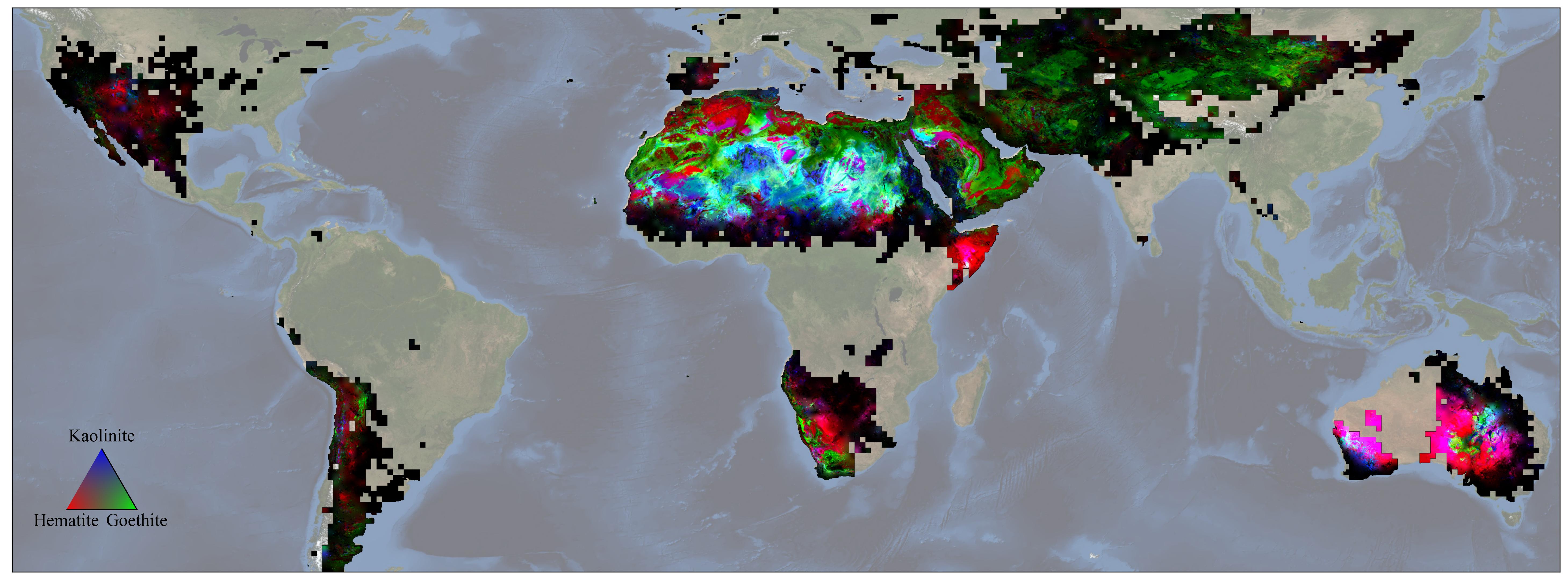
PIA26116:
-
NASA's EMIT Mission Produces Maps of Arid Region Surface Minerals
Full Resolution:
TIFF
(21.27 MB)
JPEG
(819.1 kB)
|
|
|
2023-12-11 |
Mars
|
2001 Mars Odyssey
|
THEMIS
|
616x2697x1 |
|
-
PIA26256:
-
Tantalus Fossae
Full Resolution:
TIFF
(803 kB)
JPEG
(104.5 kB)
|
|
|
2023-12-08 |
Mars
|
2001 Mars Odyssey
|
THEMIS
|
606x2707x1 |

|
-
PIA26255:
-
Wind Etching
Full Resolution:
TIFF
(771.8 kB)
JPEG
(95.81 kB)
|
|
|
2023-12-07 |
Mars
|
2001 Mars Odyssey
|
THEMIS
|
717x1459x1 |
|
-
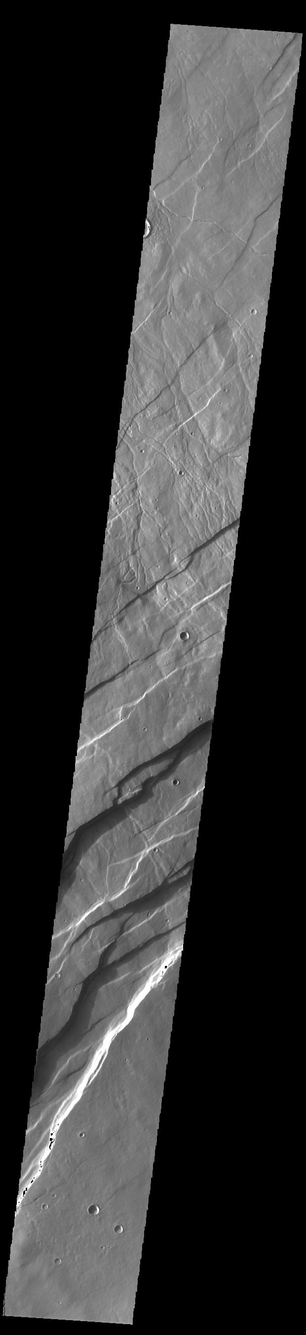
PIA26254:
-
Tempe Fossae
Full Resolution:
TIFF
(791.8 kB)
JPEG
(106.4 kB)
|
|
|
2023-12-06 |
Mars
|
2001 Mars Odyssey
|
THEMIS
|
697x1426x1 |

|
-
PIA26253:
-
Crater Floor Deposit
Full Resolution:
TIFF
(712.3 kB)
JPEG
(86.66 kB)
|
|
|
2023-12-05 |
Pan
|
Psyche
|
|
2967x1225x1 |

|
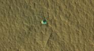
-
PIA25960:
-
First Images From NASA's Psyche
Full Resolution:
TIFF
(3.067 MB)
JPEG
(825.1 kB)
|
|
|
2023-12-05 |
Mars
|
2001 Mars Odyssey
|
THEMIS
|
707x1435x1 |
|
-
PIA26252:
-
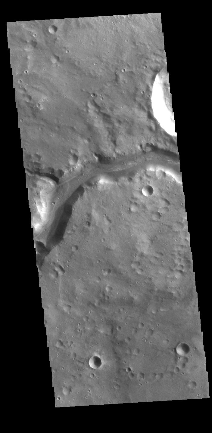
Jezero Crater Delta
Full Resolution:
TIFF
(747 kB)
JPEG
(93.36 kB)
|
|
|
2023-12-04 |
Mars
|
2001 Mars Odyssey
|
THEMIS
|
706x1442x1 |
|
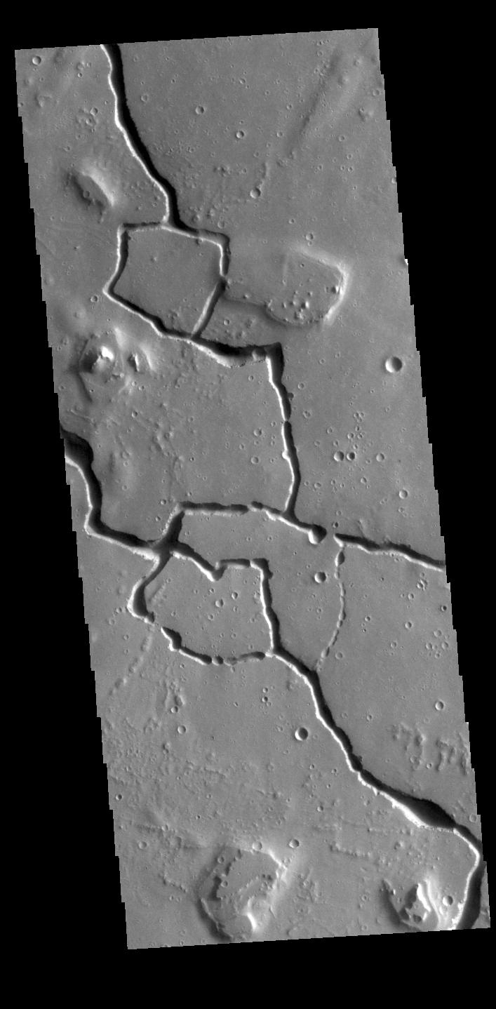
-
PIA26251:
-
Graben
Full Resolution:
TIFF
(776.6 kB)
JPEG
(118.2 kB)
|
|
|
2023-12-01 |
Mars
|
2001 Mars Odyssey
|
THEMIS
|
709x1441x1 |

|
-
PIA26230:
-
Odd Channel
Full Resolution:
TIFF
(736.9 kB)
JPEG
(106.9 kB)
|
|
|
2023-11-30 |
|
SunRISE
|
|
4720x4575x3 |
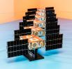
|
-
PIA25789:
-
Completed SunRISE SmallSats Pictured Together
Full Resolution:
TIFF
(48.32 MB)
JPEG
(1.967 MB)
|
|
|
2023-11-30 |
Mars
|
2001 Mars Odyssey
|
THEMIS
|
701x1433x1 |
|
-
PIA26229:
-
Labeatis Fossae
Full Resolution:
TIFF
(721.9 kB)
JPEG
(111.6 kB)
|
|
|
2023-11-29 |
Mars
|
2001 Mars Odyssey
|
THEMIS
|
704x1437x1 |
|
-
PIA26228:
-
Nili Fossae
Full Resolution:
TIFF
(700.3 kB)
JPEG
(73.57 kB)
|
|
|
2023-11-28 |
Mars
|
2001 Mars Odyssey
|
THEMIS
|
5000x1280x3 |
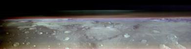
|
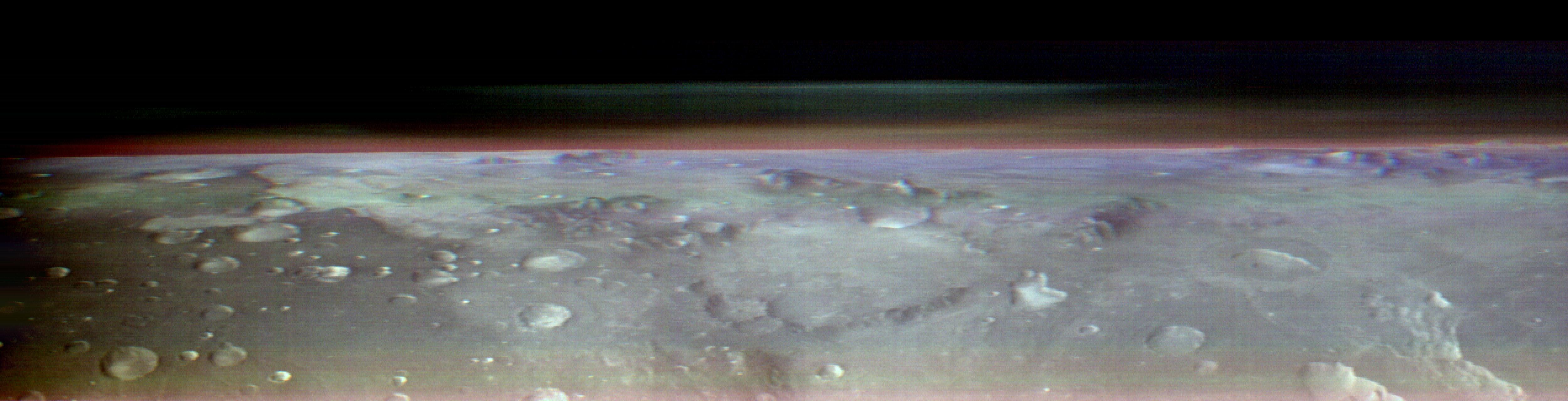
-
PIA26203:
Odyssey's THEMIS Views the Horizon of Mars
Full Resolution:
TIFF
(11.37 MB)
JPEG
(565.8 kB)
|
|
|
2023-11-28 |
Mars
|
2001 Mars Odyssey
|
THEMIS
|
712x1441x1 |

|
-
PIA26227:
-
Elysium Fossae
Full Resolution:
TIFF
(669.6 kB)
JPEG
(65.59 kB)
|
|
|
2023-11-27 |
Mars
|
2001 Mars Odyssey
|
THEMIS
|
717x1456x1 |
|
-
PIA26226:
-
Idaeus Fossae
Full Resolution:
TIFF
(740 kB)
JPEG
(89.87 kB)
|
|
|
2023-11-24 |
Mars
|
2001 Mars Odyssey
|
THEMIS
|
707x1438x1 |
|
-
PIA26225:
-
Hephaestus Fossae
Full Resolution:
TIFF
(713.3 kB)
JPEG
(93.75 kB)
|
|
|
2023-11-23 |
Mars
|
2001 Mars Odyssey
|
THEMIS
|
601x2708x1 |
|
-
PIA26224:
-
Oti Fossae
Full Resolution:
TIFF
(752 kB)
JPEG
(99.88 kB)
|
|
|
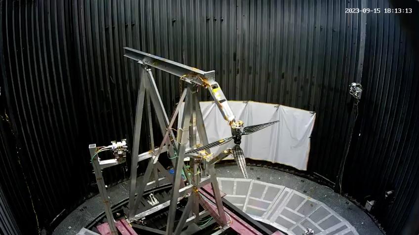
2023-11-22 |
|
Mars Helicopter
|
|
848x476x3 |
|
-
PIA26079:
-
Testing Next-Generation Mars Helicopter Rotors
Full Resolution:
TIFF
(1.022 MB)
JPEG
(67.35 kB)
|
|
|
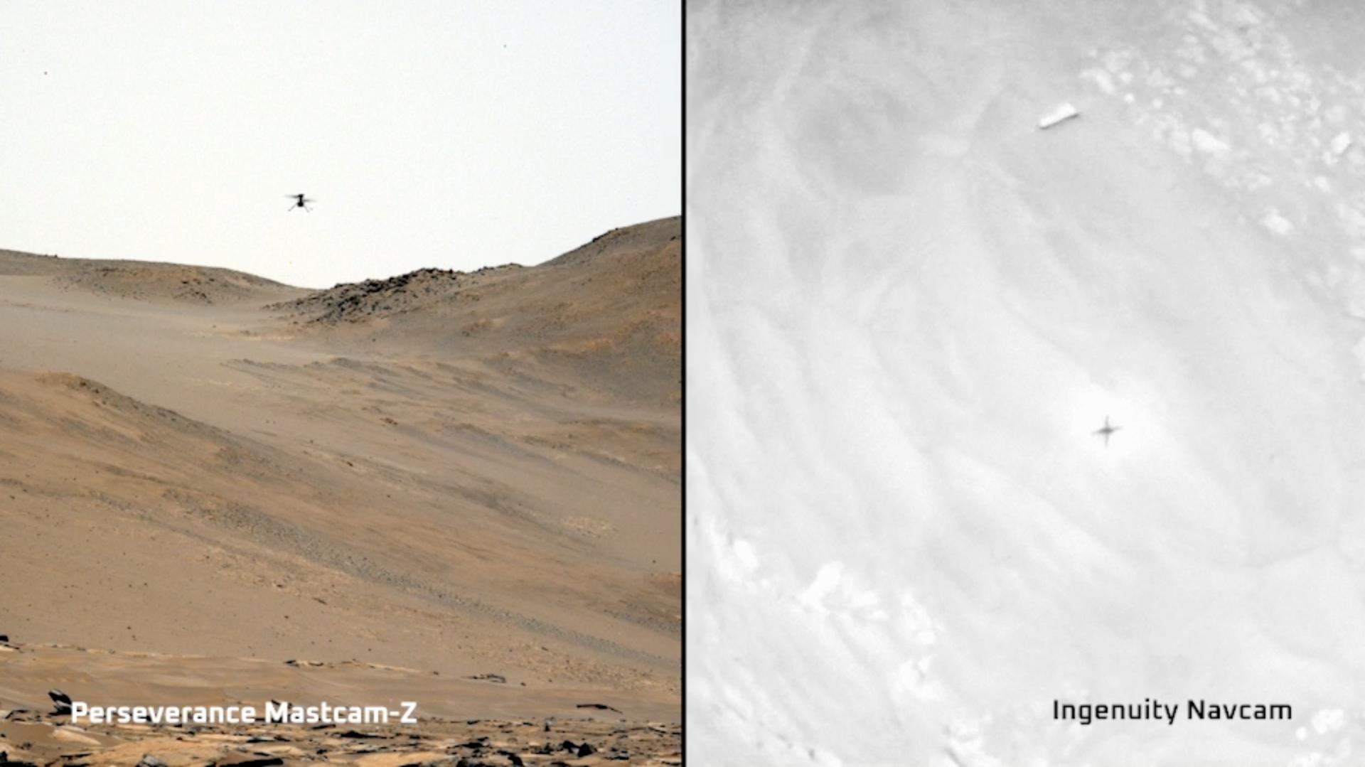
2023-11-22 |
Mars
|
Mars 2020 Rover
Mars Helicopter
|
Mastcam-Z
|
1920x1079x3 |
|
-
PIA26078:
-
Two Views of Ingenuity's 59th Flight
Full Resolution:
TIFF
(3.377 MB)
JPEG
(124.2 kB)
|
|
|
2023-11-22 |
Mars
|
2001 Mars Odyssey
|
THEMIS
|
708x1446x1 |
|
-
PIA26223:
-
Elysium Fossae
Full Resolution:
TIFF
(673.7 kB)
JPEG
(67.56 kB)
|
|
|
2023-11-21 |
Mars
|
2001 Mars Odyssey
|
THEMIS
|
600x2690x1 |
|
-
PIA26222:
-
Olympus Mons Flank
Full Resolution:
TIFF
(804.3 kB)
JPEG
(140.8 kB)
|
|
|
2023-11-20 |
Mars
|
2001 Mars Odyssey
|
THEMIS
|
607x2705x1 |
|
-
PIA26221:
-
Orson Welles Crater
Full Resolution:
TIFF
(765.3 kB)
JPEG
(93.05 kB)
|
|
|
2023-11-17 |
Earth
|
Earth Surface Mineral Dust Source Investigation (EMIT)
|
EMIT
|
3499x1700x3 |
|
-
PIA26113:
-
EMIT Identifying Methane Plumes Around the Globe
Full Resolution:
TIFF
(17.85 MB)
JPEG
(1.131 MB)
|
|
|
2023-11-17 |
Mars
|
2001 Mars Odyssey
|
THEMIS
|
704x1434x1 |
|
-
PIA26220:
-
Indus Vallis
Full Resolution:
TIFF
(762.9 kB)
JPEG
(105 kB)
|
|
|
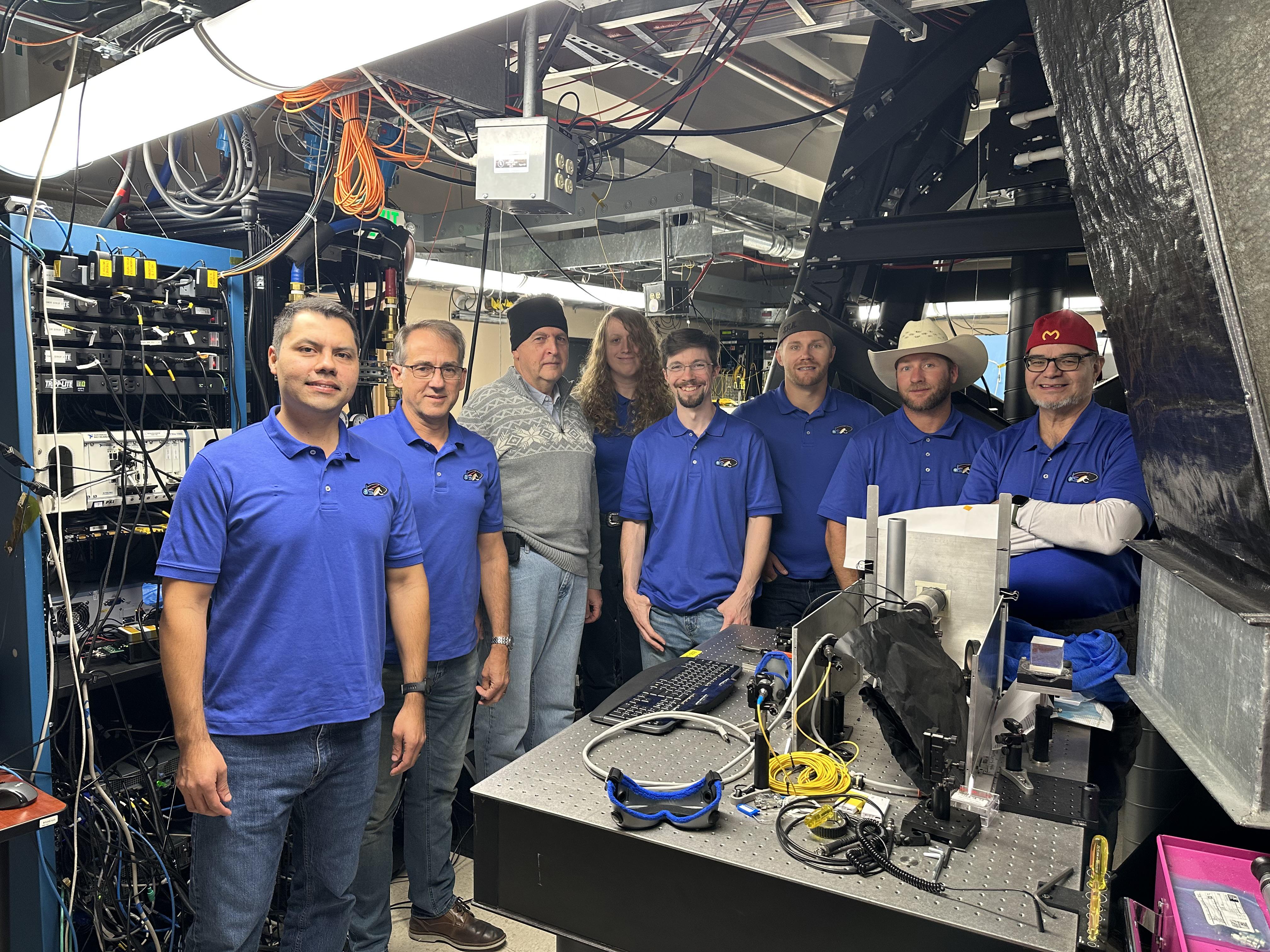
2023-11-16 |
|
Psyche
|
Deep Space Optical Communications (DSOC)
|
4032x3024x3 |
|
-
PIA26144:
-
The DSOC Ground Laser Transmitter Team After 'First Light'
Full Resolution:
TIFF
(34.67 MB)
JPEG
(1.96 MB)
|
|
|
2023-11-16 |
|
Psyche
|
Deep Space Optical Communications (DSOC)
|
2000x1500x3 |

|
-
PIA26143:
-
DSOC 'First Light' at JPL's Psyche Mission Support Area
Full Resolution:
TIFF
(8.736 MB)
JPEG
(359.8 kB)
|
|
|
2023-11-16 |
|
Psyche
|
Deep Space Optical Communications (DSOC)
|
720x723x3 |
|
-
PIA26142:
-
Confirmation of DSOC 'First Light' at JPL's Table Mountain
Full Resolution:
TIFF
(1.295 MB)
JPEG
(89.04 kB)
|
|
|
2023-11-16 |
Mars
|
2001 Mars Odyssey
|
THEMIS
|
602x2690x1 |
|
-
PIA26219:
-
Olympus Mons Flank
Full Resolution:
TIFF
(817.7 kB)
JPEG
(162.7 kB)
|
|
|
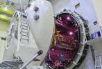
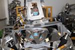
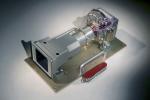
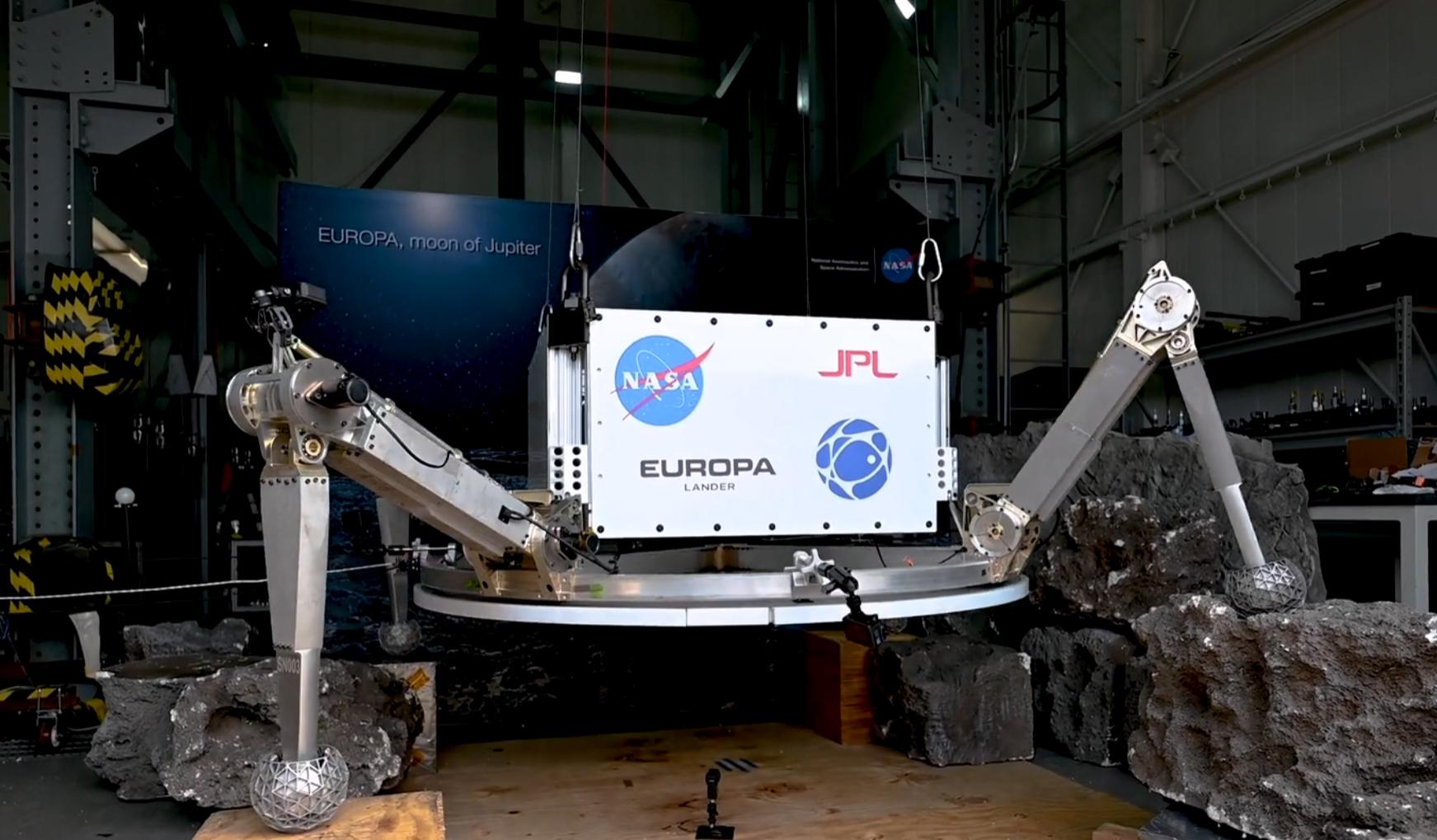
2023-11-15 |
Europa
|
Europa Lander
|
Landing System
|
1743x1019x3 |
|
-
PIA26010:
-
Testing Hardware for Potential Future Landing on Europa
Full Resolution:
TIFF
(3.768 MB)
JPEG
(185.6 kB)
|
|
|
2023-11-15 |
Mars
|
2001 Mars Odyssey
|
THEMIS
|
608x2700x1 |
|
-
PIA26218:
-
Ascraeus Mons Flank
Full Resolution:
TIFF
(772.9 kB)
JPEG
(105.8 kB)
|
|
|
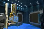
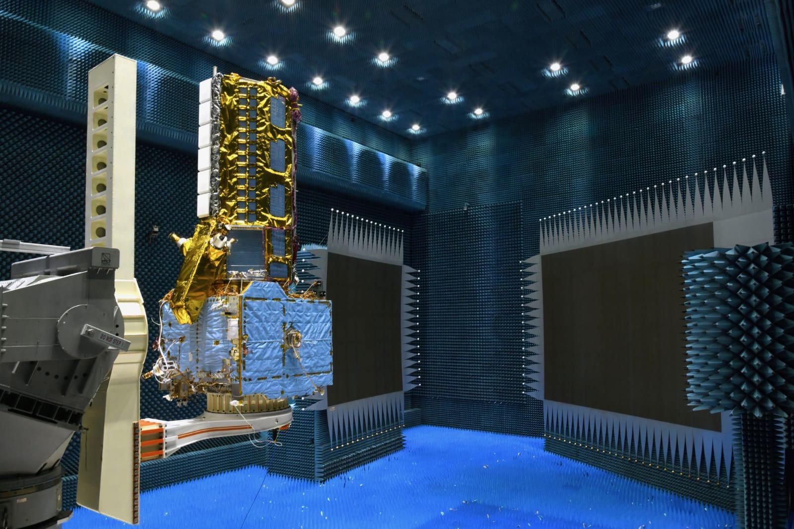
2023-11-14 |
|
NISAR
|
|
1600x1066x3 |
|
-
PIA26115:
-
NISAR Completes Trial in ISRO's Compact Antenna Test Facility
Full Resolution:
TIFF
(5.019 MB)
JPEG
(239.2 kB)
|
|
|
2023-11-14 |
|
NISAR
|
|
1665x1131x3 |
|
-
PIA26114:
-
NISAR Passes Thermal Vacuum Test in Indian Spacecraft Facility
Full Resolution:
TIFF
(5.618 MB)
JPEG
(253.6 kB)
|
|
|
2023-11-14 |
Mars
|
2001 Mars Odyssey
|
THEMIS
|
610x2710x1 |
|
-
PIA26217:
-
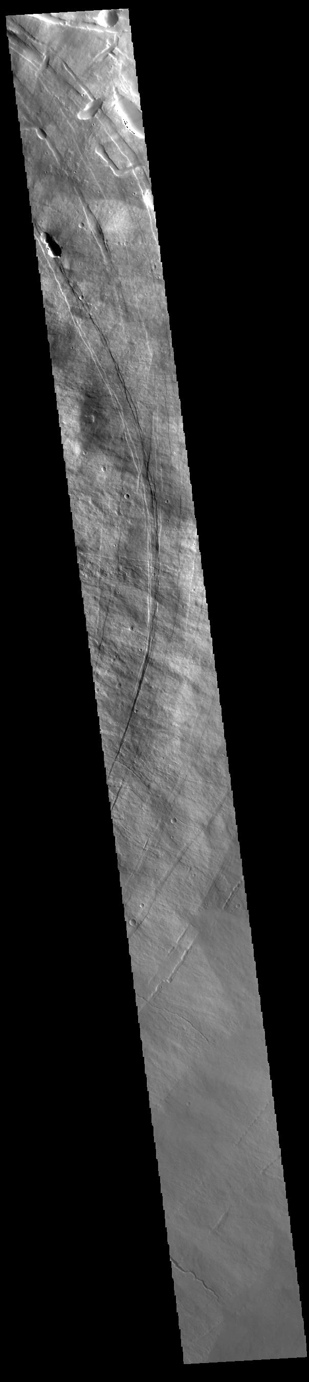
Shalbatana Vallis
Full Resolution:
TIFF
(721.1 kB)
JPEG
(68.87 kB)
|
|
|
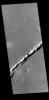
2023-11-13 |
Mars
|
2001 Mars Odyssey
|
THEMIS
|
698x1431x1 |
|
-
PIA26216:
-
Dark Slope Streaks
Full Resolution:
TIFF
(698.6 kB)
JPEG
(65.51 kB)
|
|
|
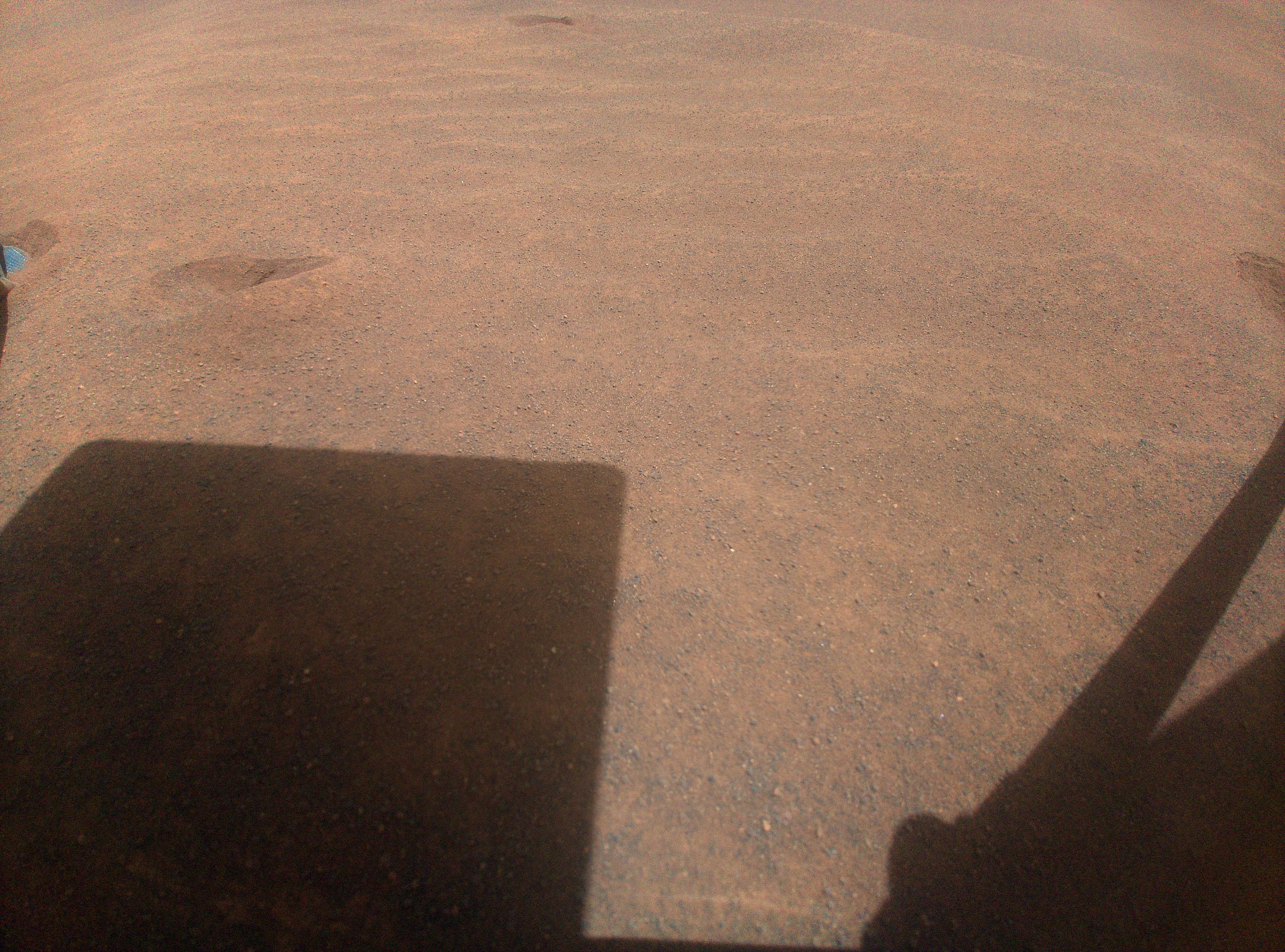
2023-11-10 |
Mars
|
Mars 2020 Rover
|
Navigation Camera (M2020)
|
2560x1920x3 |
|
-
PIA26202:
-
Perseverance's Parking Spot During Conjunction
Full Resolution:
TIFF
(14.75 MB)
JPEG
(620.3 kB)
|
|
|
2023-11-10 |
Mars
|
Mars Helicopter
|
|
4208x3120x3 |
|
-
PIA26201:
-
Ingenuity's Landing Spot During Mars Solar Conjunction
Full Resolution:
TIFF
(39.41 MB)
JPEG
(2.845 MB)
|
|
|
2023-11-10 |
Mars
|
Mars Helicopter
|
|
4208x3120x3 |
|
-
PIA26050:
-
Ingenuity's View of Sand Going Into Conjunction
Full Resolution:
TIFF
(39.41 MB)
JPEG
(2.59 MB)
|
|
|
2023-11-10 |
Mars
|
Mars Helicopter
|
|
4208x3120x3 |
|
-
PIA26049:
-
Ingenuity Views Its Footprints on Flight 66
Full Resolution:
TIFF
(39.41 MB)
JPEG
(2.814 MB)
|
|
|
2023-11-10 |
Mars
|
2001 Mars Odyssey
|
THEMIS
|
706x1442x1 |
|
-
PIA26215:
-
Lycus Sulci
Full Resolution:
TIFF
(775.9 kB)
JPEG
(102.4 kB)
|
|
|
2023-11-09 |
|
SPHEREx
|
|
2200x1649x3 |

|
-
PIA25788:
-
SPHEREx Detector Filters
Full Resolution:
TIFF
(6.425 MB)
JPEG
(209.9 kB)
|
|
|
2023-11-09 |
|
SPHEREx
|
|
8256x5504x3 |

|
-
PIA25787:
-
SPHEREx Telescope at JPL
Full Resolution:
TIFF
(81.03 MB)
JPEG
(4.342 MB)
|
|
|
2023-11-09 |
|
SPHEREx
|
|
8256x5504x3 |
|
-
PIA25786:
-
SPHEREx V-Groove Radiator
Full Resolution:
TIFF
(102.9 MB)
JPEG
(3.669 MB)
|
|
|
2023-11-09 |
|
SPHEREx
|
|
8256x5504x3 |

|
-
PIA25785:
-
SPHEREx Photon Shields Assembled
Full Resolution:
TIFF
(106.9 MB)
JPEG
(6.847 MB)
|
|
|
2023-11-09 |
|
SPHEREx
|
|
4032x2268x3 |
|
-
PIA25784:
-
SPHEREx Outer Photon Shield
Full Resolution:
TIFF
(17.22 MB)
JPEG
(648.8 kB)
|
|
|
2023-11-09 |
Jupiter
|
Juno
|
JunoCam
|
2525x1421x3 |
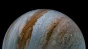
|
-
PIA26077:
-
NASA's Juno Mission Images Jupiter's Belts and Zones
Full Resolution:
TIFF
(6.966 MB)
JPEG
(195.1 kB)
|
|
|
2023-11-09 |
Jupiter
|
Juno
|
|
2496x1696x3 |
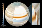
|
-
PIA26076:
-
Cylindrical Orientation of Jupiter's East-West Jet-Streams
Full Resolution:
TIFF
(6.274 MB)
JPEG
(239.5 kB)
|
|
|
2023-11-09 |
Mars
|
2001 Mars Odyssey
|
THEMIS
|
701x1437x1 |
|
-
PIA26214:
-
Tractus Catena
Full Resolution:
TIFF
(687.2 kB)
JPEG
(62.66 kB)
|
|
|
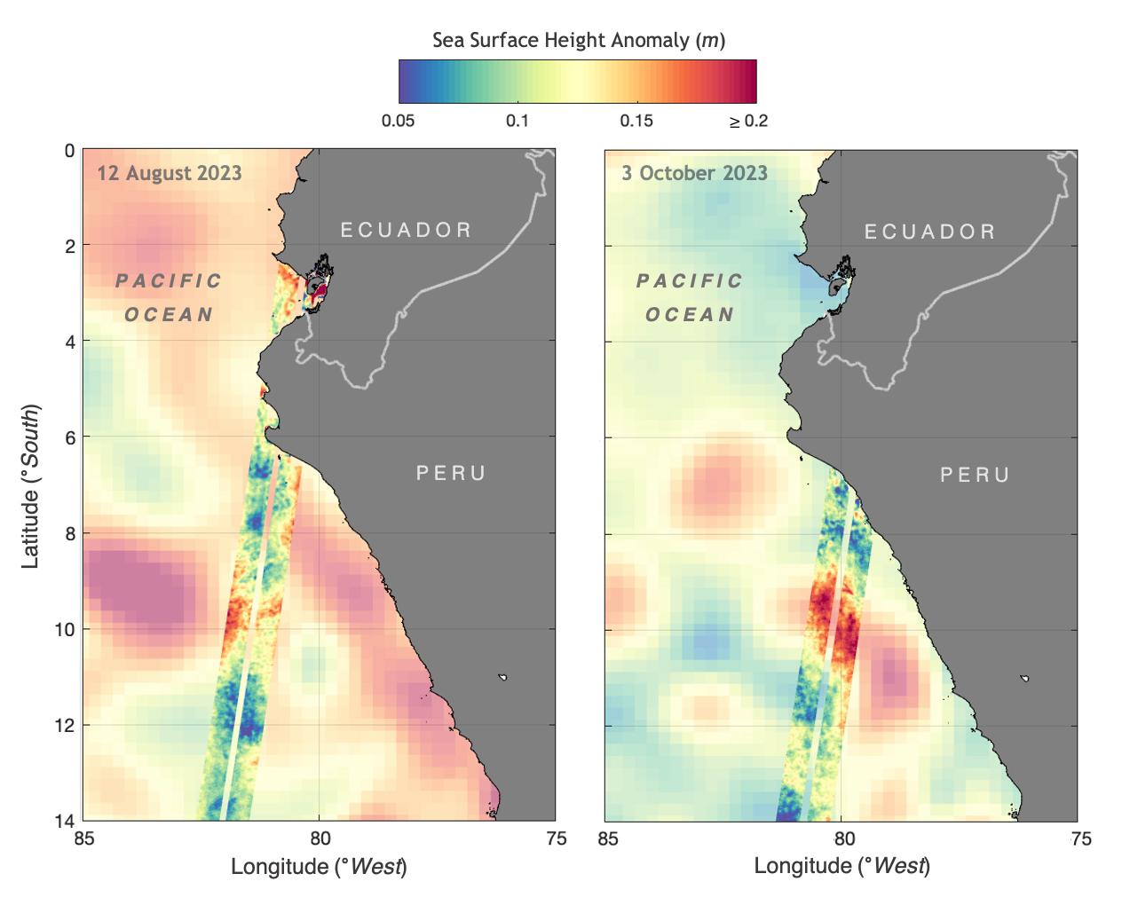
2023-11-08 |
Earth
|
SWOT
|
KaRIn
|
1264x1029x3 |
|
-
PIA26181:
-
SWOT Monitors El Niño off Peru
Full Resolution:
TIFF
(1.206 MB)
JPEG
(101.7 kB)
|
|
|
2023-11-08 |
Mars
|
2001 Mars Odyssey
|
THEMIS
|
602x2704x1 |
|
-
PIA26213:
-
Pavonis Mons
Full Resolution:
TIFF
(781.9 kB)
JPEG
(117.5 kB)
|
|
|
2023-11-07 |
Mars
|
2001 Mars Odyssey
|
THEMIS
|
709x1445x1 |
|
-
PIA26212:
-
Mareotis Fossae
Full Resolution:
TIFF
(742.2 kB)
JPEG
(89.1 kB)
|
|
|
2023-11-06 |
Mars
|
Mars Science Laboratory (MSL)
|
Mastcam
|
1583x1482x3 |
|
-
PIA26048:
-
Curiosity Views 'Sequoia' Using Its Mastcam
Full Resolution:
TIFF
(5.387 MB)
JPEG
(433.2 kB)
|
|
|
2023-11-06 |
Mars
|
Mars Science Laboratory (MSL)
|
Navcam (MSL)
|
7665x2111x1 |
|
-
PIA26047:
Curiosity's Navcams View the Area Around 'Sequoia'
Full Resolution:
TIFF
(12.18 MB)
JPEG
(1.953 MB)
|
|
|
2023-11-06 |
Mars
|
Mars Science Laboratory (MSL)
|
Mastcam
|
1504x1000x3 |
|
-
PIA26043:
-
Curiosity Mastcam Filter Wheel
Full Resolution:
TIFF
(3.852 MB)
JPEG
(134.8 kB)
|
|
|
2023-11-06 |
Mars
|
2001 Mars Odyssey
|
THEMIS
|
703x1436x1 |
|
-
PIA26211:
-
Bahram Vallis
Full Resolution:
TIFF
(652.9 kB)
JPEG
(70.3 kB)
|
|
|
2023-11-03 |
Earth
|
Terra
|
ASTER
|
3000x1800x3 |
|
-
PIA26196:
-
Amazon Drought
Full Resolution:
TIFF
(16.21 MB)
JPEG
(799.4 kB)
|
|
|
2023-11-03 |
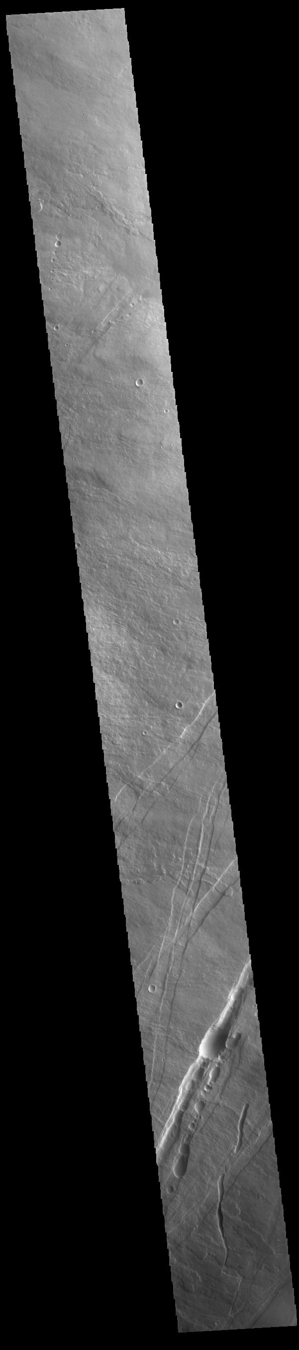
Mars
|
2001 Mars Odyssey
|
THEMIS
|
700x1431x1 |
|
-
PIA26195:
-
Scamander Vallis
Full Resolution:
TIFF
(691.6 kB)
JPEG
(77.51 kB)
|
|
|
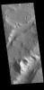
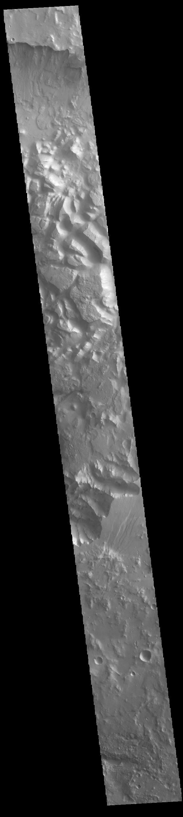
2023-11-02 |
Mars
|
2001 Mars Odyssey
|
THEMIS
|
620x2698x1 |

|
-
PIA26194:
-
Alba Fossae
Full Resolution:
TIFF
(804.8 kB)
JPEG
(106.3 kB)
|
|
|
2023-11-01 |
Mars
|
2001 Mars Odyssey
|
THEMIS
|
712x1448x1 |
|
-
PIA26193:
-
Granicus Valles
Full Resolution:
TIFF
(764.9 kB)
JPEG
(118.4 kB)
|
|
|
2023-10-31 |
Mars
|
2001 Mars Odyssey
|
THEMIS
|
704x1442x1 |
|
-
PIA26192:
-
Lycus Sulci
Full Resolution:
TIFF
(716.2 kB)
JPEG
(74.48 kB)
|
|
|
2023-10-30 |
Ganymede
|
Juno
|
JIRAM
|
6385x3119x3 |
|
-
PIA26075:
-
Ganymede Grooved Terrain as Seen by Juno's JIRAM
Full Resolution:
TIFF
(4.256 MB)
JPEG
(893.4 kB)
|
|
|
2023-10-30 |
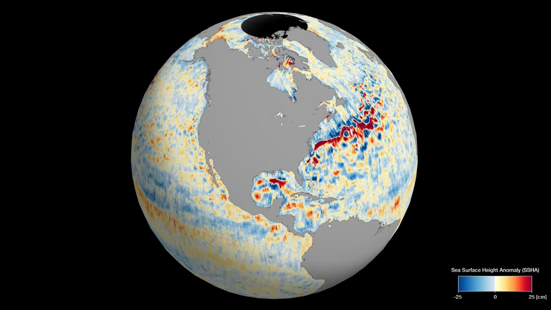
Earth
|
SWOT
|
KaRIn
|
1920x1080x3 |

|
-
PIA26100:
-
SWOT's Detailed View of Global Sea Level
Full Resolution:
TIFF
(2.393 MB)
JPEG
(137.4 kB)
|
|
|
2023-10-30 |
Mars
|
2001 Mars Odyssey
|
THEMIS
|
701x1439x1 |

|
-
PIA26191:
-
Olympica Fossae
Full Resolution:
TIFF
(706.8 kB)
JPEG
(103 kB)
|
|
|
2023-10-27 |
Earth
|
NISAR
|
|
973x913x3 |
|
-
PIA26111:
-
Composite of Brazil's 'Arc of Deforestation' Shows Imagery NISAR Will Produce
Full Resolution:
TIFF
(2.666 MB)
JPEG
(396.6 kB)
|
|
|
2023-10-27 |
Mars
|
2001 Mars Odyssey
|
THEMIS
|
604x2699x1 |
|
-
PIA26180:
-
Pavonis Mons
Full Resolution:
TIFF
(756.2 kB)
JPEG
(111.4 kB)
|
|
|
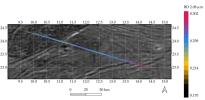
2023-10-26 |
Mars
|
|
|
2852x1169x3 |
|
-
PIA26046:
-
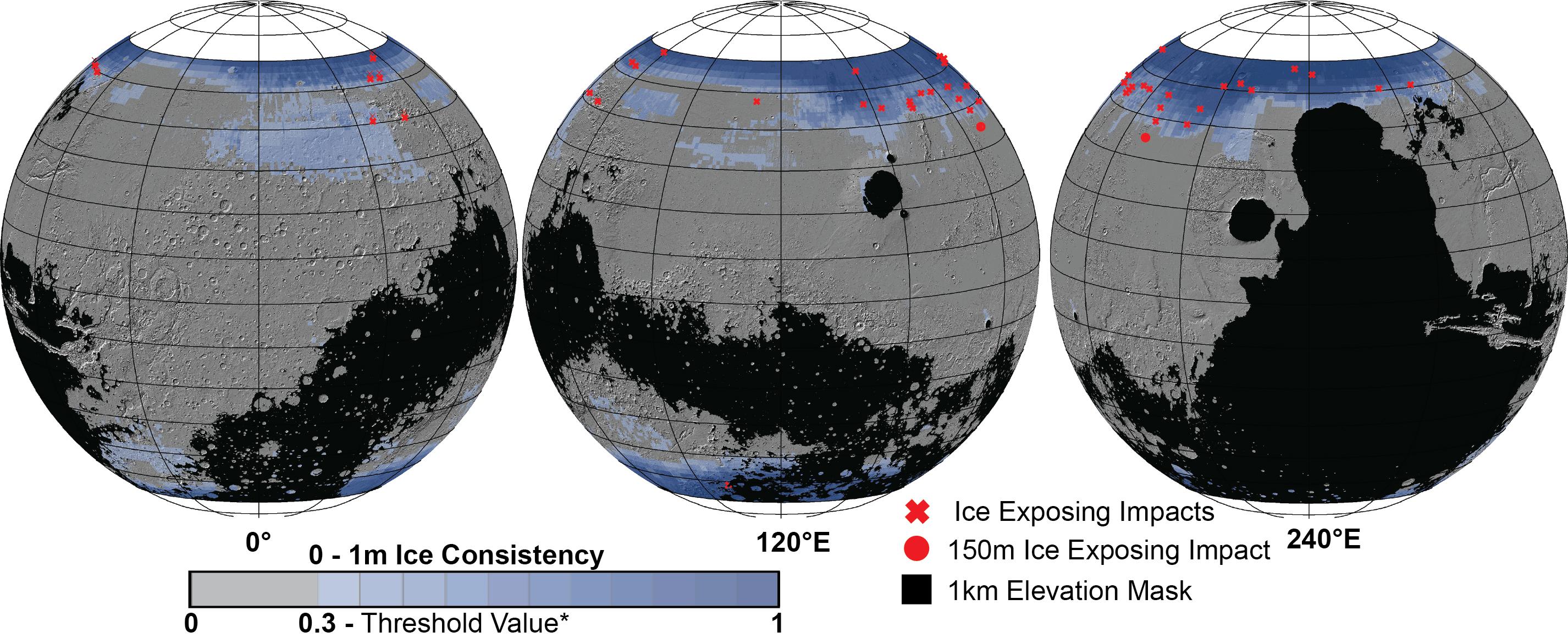
Distribution of Buried Ice on Mars
Full Resolution:
TIFF
(3.622 MB)
JPEG
(582.8 kB)
|
|
|
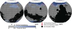
2023-10-26 |
Mars
|
|
|
2221x1288x3 |
|
-
PIA26045:
-
SWIM Map Shows Subsurface Water Ice on Mars
Full Resolution:
TIFF
(6.232 MB)
JPEG
(404 kB)
|
|
|
2023-10-26 |
Mars
|
Mars Reconnaissance Orbiter (MRO)
|
HiRISE
|
2105x1139x3 |
|
-
PIA26044:
-
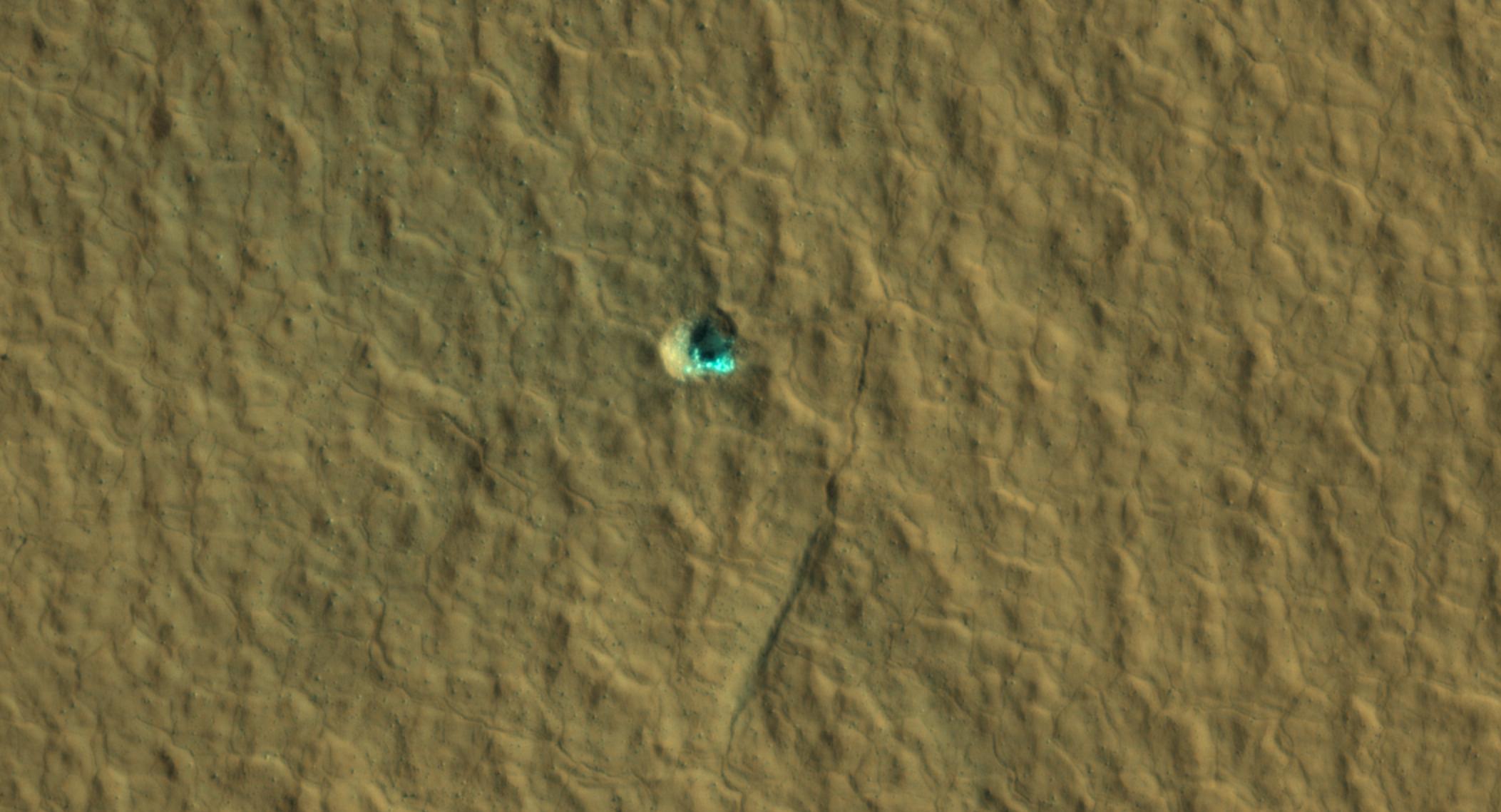
Ice-Exposing Impact Crater Surrounded by Polygon Terrain
Full Resolution:
TIFF
(5.674 MB)
JPEG
(206.9 kB)
|
|
|
2023-10-26 |
Mars
|
2001 Mars Odyssey
|
THEMIS
|
704x1439x1 |
|
-
PIA26179:
-
Bahram Vallis
Full Resolution:
TIFF
(701.3 kB)
JPEG
(85.28 kB)
|
|
|
2023-10-25 |
Jupiter
|
Juno
|
JunoCam
|
1462x2560x3 |

|
-
PIA25727:
-
Just in Time for Halloween, NASA's Juno Mission Spots Eerie "Face" on Jupiter
Full Resolution:
TIFF
(6.899 MB)
JPEG
(300.2 kB)
|
|
|
2023-10-25 |
Mars
|
2001 Mars Odyssey
|
THEMIS
|
607x2712x1 |
|
-
PIA26178:
-
Aeolis Planum
Full Resolution:
TIFF
(830.5 kB)
JPEG
(164.6 kB)
|
|
|
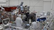
2023-10-24 |
|
Cooperative Autonomous Distributed Robotic Exploration (CADRE)
|
|
8272x6200x3 |

|
-
PIA25670:
-
CADRE Team Preps Flight Model for Thermal Testing
Full Resolution:
TIFF
(136.8 MB)
JPEG
(6.553 MB)
|
|
|
2023-10-24 |
|
Cooperative Autonomous Distributed Robotic Exploration (CADRE)
|
|
8272x6200x3 |
|
-
PIA25669:
-
CADRE Rover Getting Prepped for Testing
Full Resolution:
TIFF
(131.7 MB)
JPEG
(4.161 MB)
|
|
|
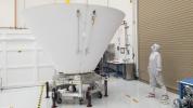
2023-10-24 |
Europa
|
Europa Clipper
|
|
3840x2160x3 |
|
-
PIA25959:
-
Closing of the Europa Clipper Vault
Full Resolution:
TIFF
(19.59 MB)
JPEG
(827.2 kB)
|
|
|
2023-10-24 |
Mars
|
2001 Mars Odyssey
|
THEMIS
|
692x1429x1 |
|
-
PIA26177:
-
Wind Etching
Full Resolution:
TIFF
(769.6 kB)
JPEG
(127.1 kB)
|
|
|
2023-10-23 |
Mars
|
2001 Mars Odyssey
|
THEMIS
|
701x1433x1 |
|
-
PIA26176:
-
Chryse Chaos
Full Resolution:
TIFF
(704.9 kB)
JPEG
(68.98 kB)
|
|
|
2023-10-20 |
Mars
|
2001 Mars Odyssey
|
THEMIS
|
693x1432x1 |

|
-
PIA26175:
-
Firsoff Crater
Full Resolution:
TIFF
(713.7 kB)
JPEG
(96.66 kB)
|
|
|
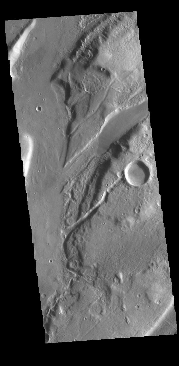
2023-10-19 |
Mars
|
2001 Mars Odyssey
|
THEMIS
|
709x1444x1 |

|
-
PIA26174:
-
Granicus Valles
Full Resolution:
TIFF
(783.5 kB)
JPEG
(122.1 kB)
|
|
|
2023-10-18 |
Earth
|
Sentinel-6/Jason-CS
|
|
1586x783x3 |
|
-
PIA26099:
-
Comparing Sea Level During El Niño Events
Full Resolution:
TIFF
(303.4 kB)
JPEG
(200.3 kB)
|
|
|
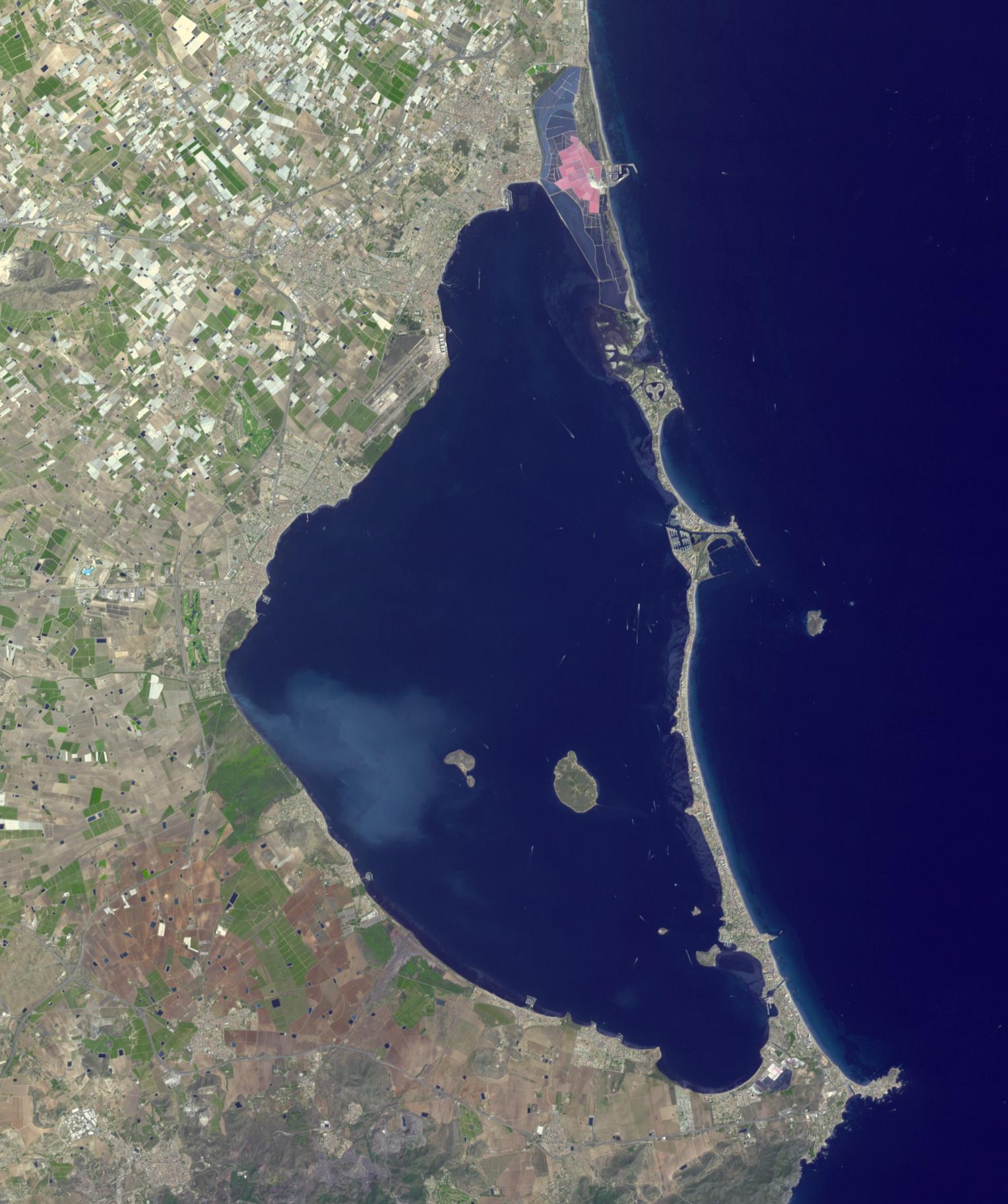
2023-10-18 |
Earth
|
Terra
|
ASTER
|
1528x1825x3 |
|
-
PIA26009:
-
Mar Menor, Spain
Full Resolution:
TIFF
(6.95 MB)
JPEG
(304.1 kB)
|
|
|
2023-10-18 |
Mars
|
2001 Mars Odyssey
|
THEMIS
|
699x1431x1 |
|
-
PIA26173:
-
Lycus Sulci
Full Resolution:
TIFF
(703.5 kB)
JPEG
(74.46 kB)
|
 Planetary Data System


