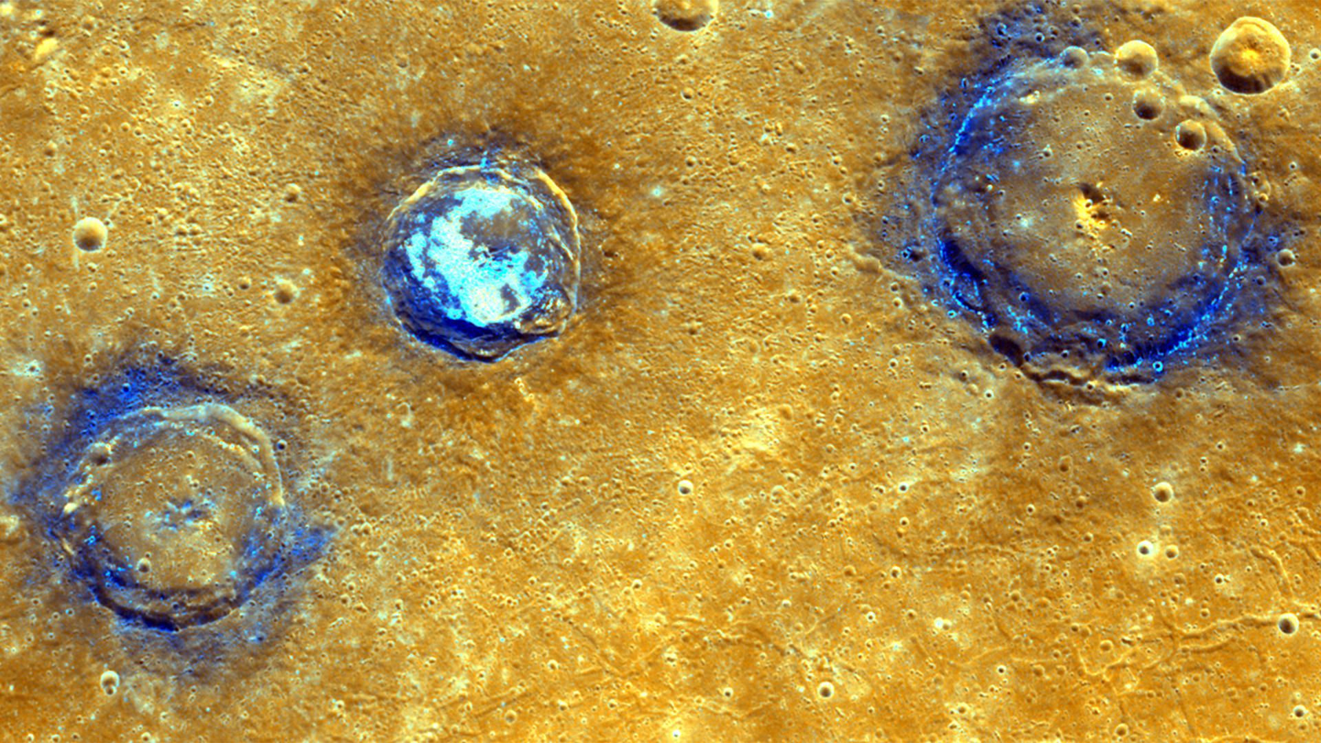
This enhanced color mosaic shows (from left to right) Munch (61 km/38 mi.), Sander (52 km/32 mi.), and Poe (81 km/50 mi.) craters, which lie in the northwest portion of the Caloris basin. The smooth volcanic plains that fill the Caloris basin appear orange in this image. All three craters are superposed on these volcanic plains and have excavated low-reflectance material, which appears blue in this image, from the subsurface. Hollows, typically associated with low-reflectance material, dot the rims of Munch and Poe and cover the floor of Sander.
These images were acquired as high-resolution targeted color observations. Targeted color observations are images of a small area on Mercury's surface at resolutions higher than the 1-kilometer/pixel 8-color base map. During MESSENGER's one-year primary mission, hundreds of targeted color observations were obtained. During MESSENGER's extended mission, high-resolution targeted color observations are more rare, as the 3-color base map is covering Mercury's northern hemisphere with the highest-resolution color images that are possible.
Date acquired: July 03, 2011, July 04, 2011
Image Mission Elapsed Time (MET): 218204186, 218204190, 218204194, 218246487, 218246491, 218246495
Image ID: 458397, 458398, 458399, 460433, 460434, 460435
Instrument: Wide Angle Camera (WAC) of the Mercury Dual Imaging System (MDIS)
Center Latitude: 42° N
Center Longitude: 154° E
Projection: Equirectangular
Resolution: 239 meters/pixel
Scale: Munch crater is approximately 61 km (38 mi.) in diameter
Incidence Angle: 43°, 42°
Emission Angle: 35°, 13°
Phase Angle: 79°, 55°
The MESSENGER spacecraft is the first ever to orbit the planet Mercury, and the spacecraft's seven scientific instruments and radio science investigation are unraveling the history and evolution of the Solar System's innermost planet. In the mission's more than four years of orbital operations, MESSENGER has acquired over 250,000 images and extensive other data sets. MESSENGER's highly successful orbital mission is about to come to an end, as the spacecraft runs out of propellant and the force of solar gravity causes it to impact the surface of Mercury in April 2015.
For information regarding the use of images, see the MESSENGER image use policy.
 Planetary Data System


