Your search criteria found
12748
images
Target is Mars (and available satellites)
Go to PIAxxxxx:
Refine this list of images by:
Target:
Deimos
Mars
Phobos
Mission:
2001 Mars Odyssey
Antarctic Meteorite Location and Mapping Project (AMLAMP)
Dawn
ExoMars
Hubble Space Telescope
InSight
MAVEN
Mariner Mars 1964 (Mariner 4)
Mariner Mars 1969 (Mariner 7)
Mariner Mars 1971 (Mariner 9)
Mars 2020
Mars 2020 Rover
Mars Atmosphere and Volatile Evolution MissioN (MAVEN)
Mars Climate Orbiter
Mars Cube One (MarCO)
Mars Exploration Rover (MER)
Mars Express (MEX)
Mars Global Surveyor (MGS)
Mars Helicopter
Mars Pathfinder (MPF)
Mars Reconnaissance Orbiter (MRO)
Mars Sample Return
Mars Sample Return (MSR)
Mars Science Laboratory (MSL)
Phoenix
Rosetta
Viking
Spacecraft:
2001 Mars Odyssey
Curiosity
Dawn
InSight Mars Lander
Ingenuity
MAVEN
MarCO-B
Mariner 4
Mariner 7
Mariner 9
Mars Climate Orbiter
Mars Express (MEX)
Mars Express (MEX) Orbiter
Mars Global Surveyor Orbiter
Mars Pathfinder Lander
Mars Pathfinder Rover
Mars Reconnaissance Orbiter (MRO)
Mars Sample Return
Mars Science Laboratory (MSL)
NASA's Mars Pathfinder Lander
Opportunity
Perseverance
Philae Lander
Phoenix Lander
Phoenix Mars Lander
Spirit
Viking Lander 1
Viking Lander 2
Viking Orbiter 1
Viking Orbiter 2
Instrument:
Alpha Particle X-ray Spectrometer
Alpha Particle X-ray Spectrometer (MSL)
Atmospheric Structure / Meteorology Instrument
CHIMRA
Camera 1
Camera 2
Chemistry & Mineralogy (CheMin)
Chemistry and Camera (ChemCam)
Comet Infrared and Visible Analyser (CIVA
Compact Reconnaissance Imaging Spectrometer for Mars (CRISM)
Context Camera (CTX)
Deep Space Network
Descent Image Motion Estimation System (DIMES)
Dynamic Albedo of Neutrons
Dynamic Albedo of Neutrons (DAN)
Gamma Ray Spectrometer - Neutron Spectrometer
Gamma Ray Spectrometer Suite
Hazard Avoidance Camera
Hazard Avoidance Camera (M2020)
Hazard Avoidance Camera (MSL)
Heat and Physical Properties Package (HP3)
High Resolution Imaging Science Experiment (HiRISE)
High Resolution Instrument (HRI)
High Resolution Stereo Camera
Imager for Mars Pathfinder
Imaging Ultraviolet Spectrograph
Imaging Ultraviolet Spectrograph (IUVS)
Instrument Context Camera (ICC)
Instrument Deployment Camera (IDC)
Lander Vision System Camera (LCAM)
Magnetometer
Mars Advanced Radar for Subsurface and Ionosphere Sounding (MARSIS)
Mars Advanced Radar for Subsurface and Ionospheric Sounding (MARSIS)
Mars Climate Sounder (MCS)
Mars Color Imager (MARCI)
Mars Descent Imager
Mars Environmental Dynamics Analyzer (MEDA)
Mars Hand Lens Imager (MAHLI)
Mars Horizon Sensor Assembly
Mars Orbiter Camera (MOC)
Mars Orbiter Laser Altimeter
Mars Radiation Experiment
Mastcam
Mastcam-Z
Microscopic Imager
Microscopy Electrochemistry and Conductivity Analyzer (MECA)
Miniature Thermal Emission Spectrometer
Moessbauer Spectrometer
Navigation Camera
Navigation Camera (M2020)
Navigation Camera (MSL)
Neutral Gas and Ion Mass Spectrometer
Neutron Spectrometer
Optical Microscope
Optical Navigation Camera
Panoramic Camera
Planetary Instrument for X-ray Lithochemistry (PIXL)
Radar System
Radiation Assessment Detector (RAD)
Radio Science Subsystem
Robotic Arm
Robotic Arm (MSL)
Robotic Arm Camera (RAC)
Rock Abrasion Tool (RAT)
Rover Cameras
Rover Environmental Monitoring Station (REMS)
Sample Analysis at Mars (SAM)
Scanning Habitable Environments with Raman & Luminescence for Organics and Chemicals (SHERLOC)
Seismic Experiment for Interior Structure (SEIS)
Shallow Subsurface Radar (SHARAD)
Stereo Imager (SSI)
SuperCam
Surface Stereo Imager (SSI)
Thermal Emission Imaging System
Thermal Emission Spectrometer
Thermal and Electrical Conductivity Probe
Thermal and Evolved Gas Analyzer
Trace Gas Orbiter
Visual Imaging Subsystem
Visual Imaging Subsystem - Camera A
Visual Imaging Subsystem - Camera B
Wide Field Planetary Camera 2
Click on an image for detailed information
Click on a column heading to sort in ascending or descending order
My
List
Addition Date
Target
Mission
Instrument
Size
2004-09-01
Mars
Mars Global Surveyor (MGS)
Mars Orbiter Camera (MOC)
836x2041x1
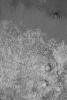
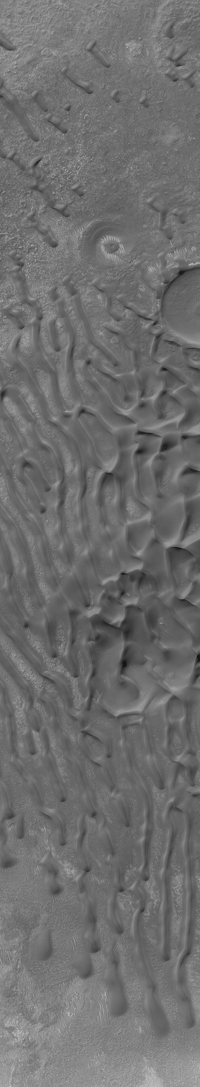
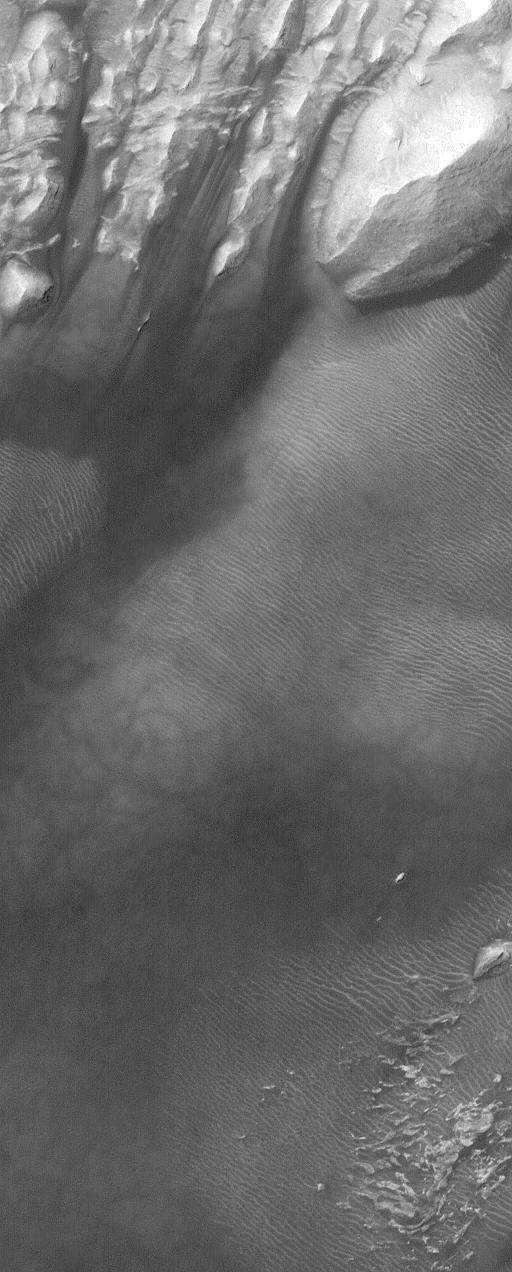
PIA06845:
Bamburg Dunes
Full Resolution:
TIFF
(1.109 MB)
JPEG
(149.6 kB)
2004-09-02
Mars
2001 Mars Odyssey
THEMIS
970x1365x1
PIA06848:
Olympia Undae
Full Resolution:
TIFF
(853.7 kB)
JPEG
(165.2 kB)
2004-09-02
Mars
Mars Global Surveyor (MGS)
Mars Orbiter Camera (MOC)
838x1843x1
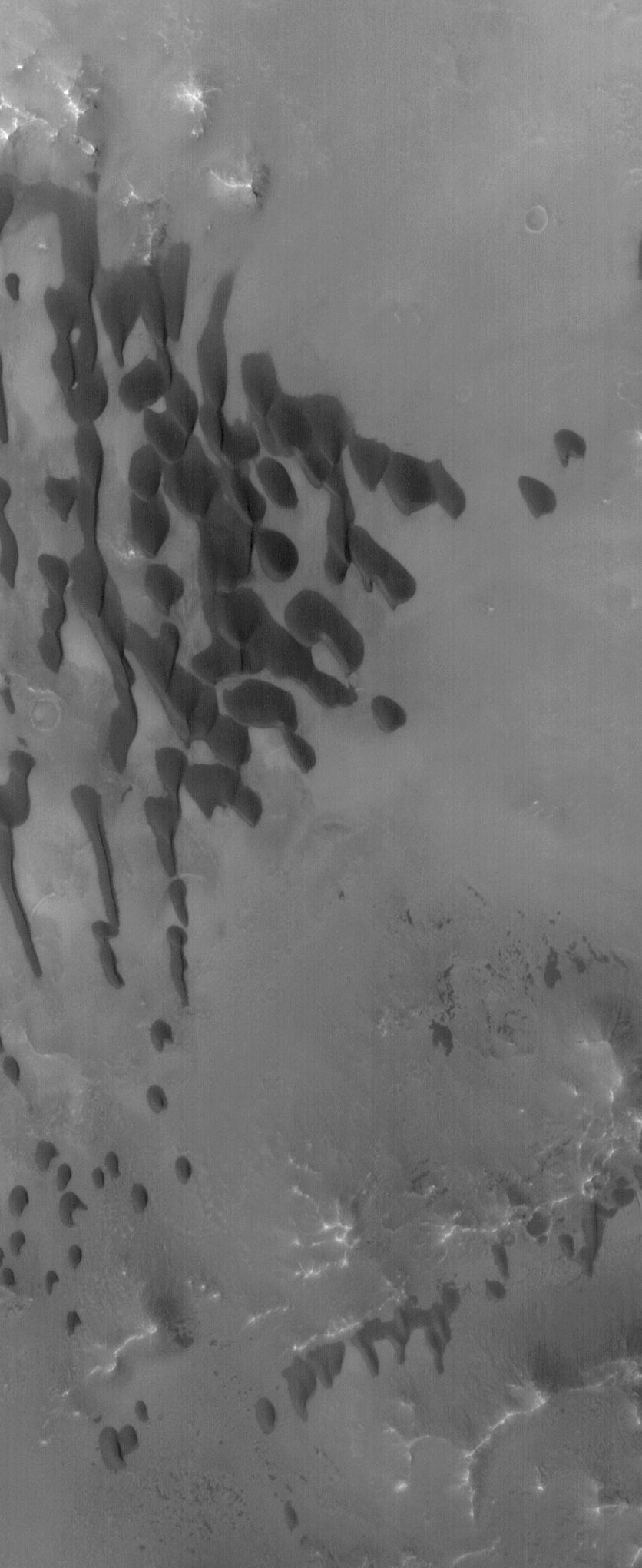
PIA06846:
Wind Streak Changes
Full Resolution:
TIFF
(1.467 MB)
JPEG
(235.7 kB)
2004-09-03
Mars
2001 Mars Odyssey
THEMIS
647x1282x1
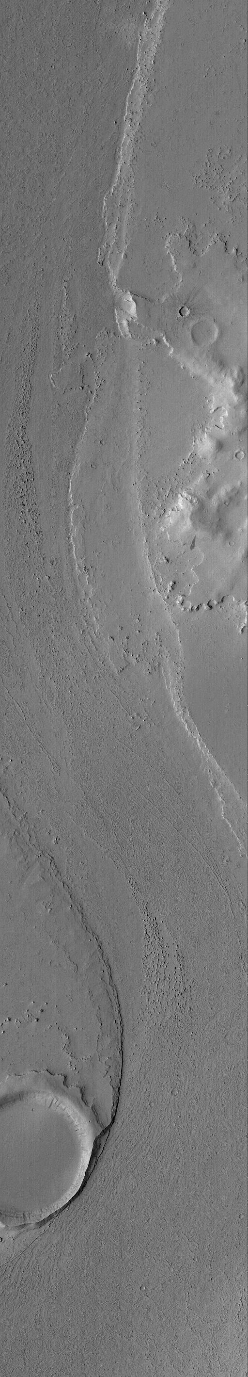
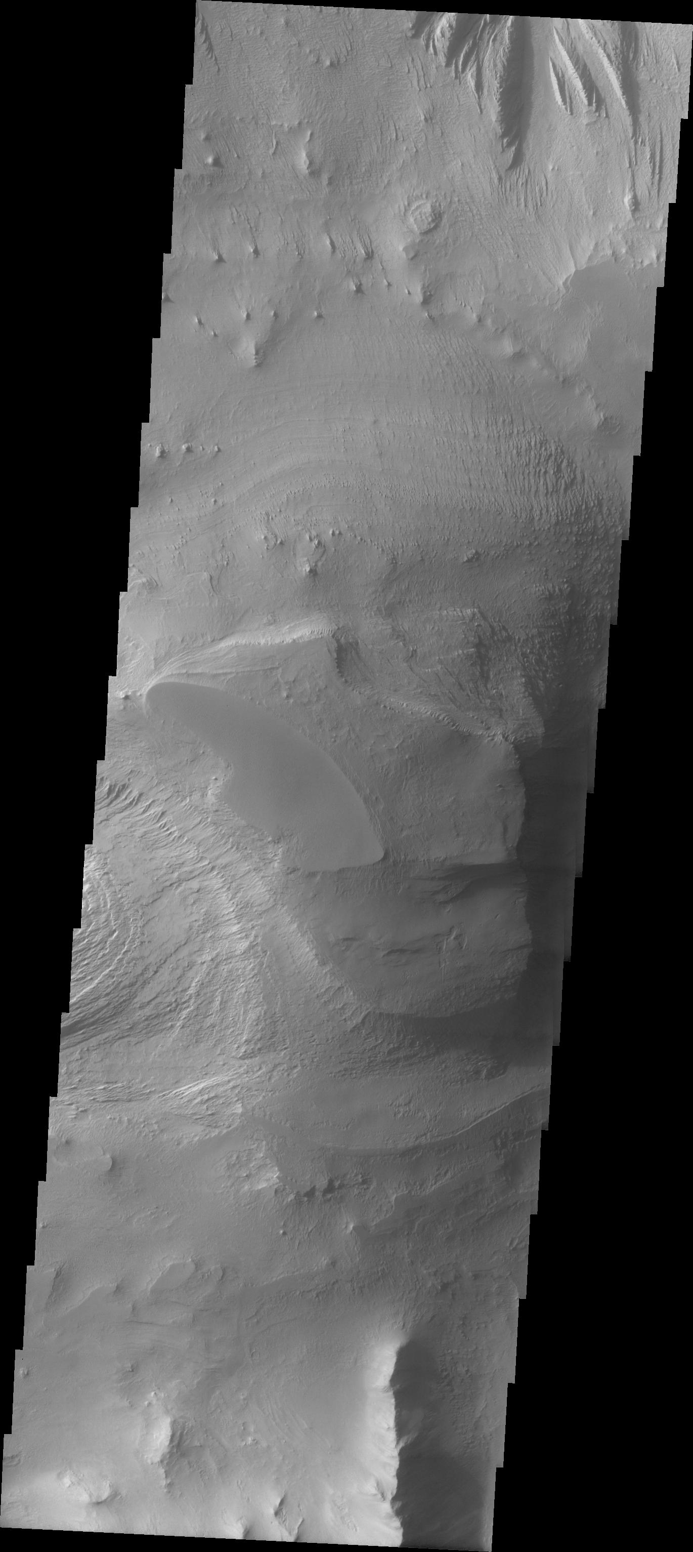
PIA06861:
Ius Chasma Landslide
Full Resolution:
TIFF
(604 kB)
JPEG
(75.86 kB)
2004-09-03
Mars
Mars Global Surveyor (MGS)
Mars Orbiter Camera (MOC)
608x1200x1
PIA06849:
Apollinaris, Gusev, and Spirit
Full Resolution:
TIFF
(547.4 kB)
JPEG
(57.35 kB)
2004-09-03
Mars
Mars Exploration Rover (MER)
Navigation Camera
7466x2568x1
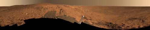
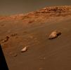
PIA06850:
Preparing for 'Lights Out' on Mars
Full Resolution:
TIFF
(10.01 MB)
JPEG
(1.578 MB)
2004-09-03
Mars
Mars Exploration Rover (MER)
Navigation Camera
7704x4853x3
PIA06851:
Preparing for 'Lights Out' on Mars (3-D)
Full Resolution:
TIFF
(38.69 MB)
JPEG
(2.209 MB)
2004-09-04
Mars
Mars Exploration Rover (MER)
Panoramic Camera
296x296x3
PIA06852:
Pebble Puzzle Solved
Full Resolution:
TIFF
(263.3 kB)
JPEG
(13.67 kB)
2004-09-04
Mars
Mars Global Surveyor (MGS)
Mars Orbiter Camera (MOC)
835x1253x1
PIA06855:
Cracked Plain, Buried Craters
Full Resolution:
TIFF
(1.048 MB)
JPEG
(314.9 kB)
2004-09-05
Mars
Mars Global Surveyor (MGS)
Mars Orbiter Camera (MOC)
672x3645x1
PIA06856:
Dunes in Noachis Terra
Full Resolution:
TIFF
(2.452 MB)
JPEG
(370.9 kB)
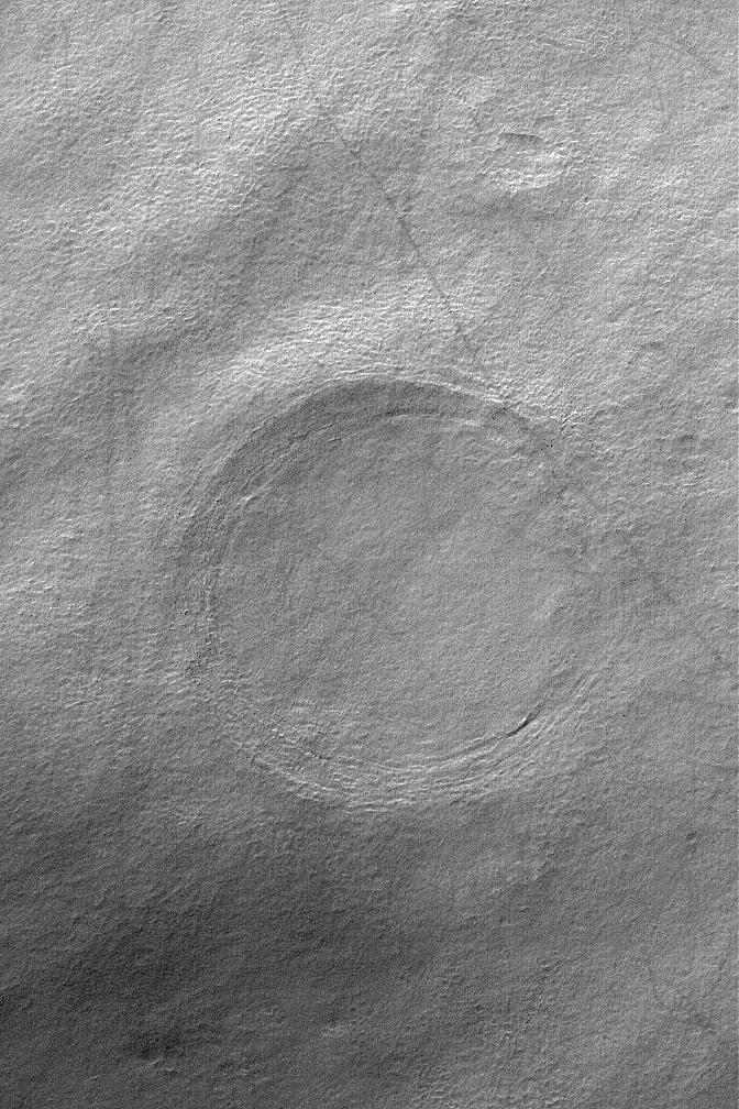
2004-09-06
Mars
Mars Global Surveyor (MGS)
Mars Orbiter Camera (MOC)
512x768x1
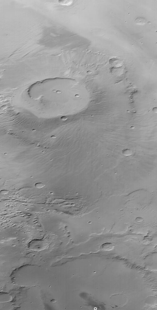
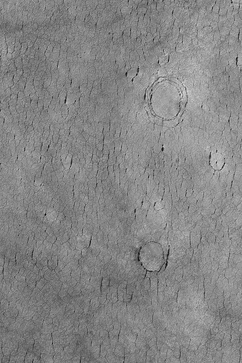
PIA06857:
Cerberus Fossae Pits
Full Resolution:
TIFF
(393.8 kB)
JPEG
(87.1 kB)
2004-09-07
Mars
Mars Global Surveyor (MGS)
Mars Orbiter Camera (MOC)
683x1024x1
PIA06858:
North Polar Cap
Full Resolution:
TIFF
(700.4 kB)
JPEG
(223.5 kB)
2004-09-07
Mars
2001 Mars Odyssey
THEMIS
647x1282x1
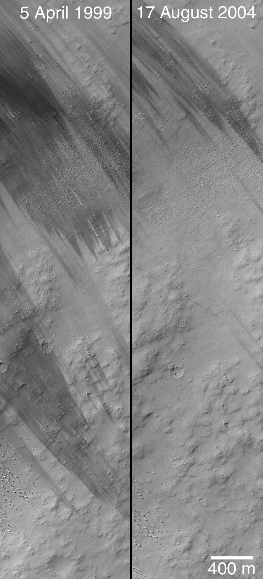
PIA06862:
Ius Chasma Debris
Full Resolution:
TIFF
(672.1 kB)
JPEG
(102.2 kB)
2004-09-08
Mars
Mars Global Surveyor (MGS)
Mars Orbiter Camera (MOC)
640x960x1
PIA06859:
September Dust Devil
Full Resolution:
TIFF
(615.3 kB)
JPEG
(167.6 kB)
2004-09-08
Mars
2001 Mars Odyssey
THEMIS
1355x3066x1
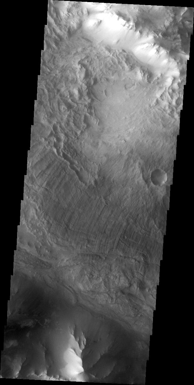
PIA06863:
Ius Chasma Ridge
Full Resolution:
TIFF
(2.767 MB)
JPEG
(249.8 kB)
2004-09-09
Mars
2001 Mars Odyssey
THEMIS
677x1346x3
PIA06864:
Ius Chasma In False Color
Full Resolution:
TIFF
(1.964 MB)
JPEG
(66.85 kB)
2004-09-09
Mars
Mars Global Surveyor (MGS)
Mars Orbiter Camera (MOC)
836x1254x1
PIA06860:
Northeast Arabia Terra
Full Resolution:
TIFF
(1.05 MB)
JPEG
(147.6 kB)
2004-09-10
Mars
Mars Global Surveyor (MGS)
Mars Orbiter Camera (MOC)
627x2864x1
PIA05940:
Zephyria Channel System
Full Resolution:
TIFF
(1.798 MB)
JPEG
(394 kB)
2004-09-10
Mars
2001 Mars Odyssey
THEMIS
1358x3061x1
PIA05953:
Old Landslide In Ius Chasma
Full Resolution:
TIFF
(2.537 MB)
JPEG
(208.5 kB)
2004-09-11
Mars
Mars Exploration Rover (MER)
Mars Global Surveyor (MGS)
Mars Orbiter Camera (MOC)
Panorama Camera
872x814x3
PIA06865:
'Endurance Crater' Overview
Full Resolution:
TIFF
(870.7 kB)
JPEG
(66.8 kB)
2004-09-11
Mars
Mars Global Surveyor (MGS)
Mars Orbiter Camera (MOC)
672x1008x1
PIA05941:
Sedimentary Rocks of 8�N, 7�W
Full Resolution:
TIFF
(671.8 kB)
JPEG
(110.7 kB)
2004-09-12
Mars
Mars Global Surveyor (MGS)
Mars Orbiter Camera (MOC)
240x240x181
PIA05942:
Mars Global Surveyor: 7 Years in Orbit!
Full Resolution:
2004-09-13
Mars
Mars Global Surveyor (MGS)
Mars Orbiter Camera (MOC)
601x1087x1
PIA05943:
Exhuming Craters
Full Resolution:
TIFF
(654.2 kB)
JPEG
(134.8 kB)
2004-09-13
Mars
2001 Mars Odyssey
THEMIS
1371x3062x1
PIA05954:
Ius Chasma Ridge
Full Resolution:
TIFF
(2.958 MB)
JPEG
(303.8 kB)
2004-09-14
Mars
Mars Global Surveyor (MGS)
Mars Orbiter Camera (MOC)
512x2839x1
PIA05944:
Marte Vallis Channel
Full Resolution:
TIFF
(1.455 MB)
JPEG
(280.2 kB)
2004-09-14
Mars
2001 Mars Odyssey
THEMIS
1362x3058x1
PIA05955:
Hebes Chasma
Full Resolution:
TIFF
(2.691 MB)
JPEG
(276.7 kB)
2004-09-15
Mars
Mars Global Surveyor (MGS)
Mars Orbiter Camera (MOC)
672x1008x1
PIA05945:
Wind Streaks Near Schiaparelli
Full Resolution:
TIFF
(678.3 kB)
JPEG
(117.4 kB)
2004-09-15
Mars
2001 Mars Odyssey
THEMIS
1368x3059x1
PIA05956:
Ophir Chasma Dunes
Full Resolution:
TIFF
(3.196 MB)
JPEG
(437 kB)
2004-09-16
Mars
Mars Global Surveyor (MGS)
Mars Orbiter Camera (MOC)
1343x2015x1
PIA05946:
Carbon Dioxide Mesas
Full Resolution:
TIFF
(2.709 MB)
JPEG
(432.6 kB)
2004-09-16
Mars
2001 Mars Odyssey
THEMIS
1674x5232x1
PIA05957:
Hebes Chasma Mosaic
Full Resolution:
TIFF
(5.154 MB)
JPEG
(501.1 kB)
2004-09-16
Mars
Mars Exploration Rover (MER)
Navigation Camera
7688x1022x1
PIA06866:
'Endurance' Untouched
Full Resolution:
TIFF
(6.327 MB)
JPEG
(1.094 MB)
2004-09-16
Mars
Mars Exploration Rover (MER)
Navigation Camera
7753x1193x3
PIA06867:
'Endurance' Untouched (3-D)
Full Resolution:
TIFF
(18.05 MB)
JPEG
(1.233 MB)
2004-09-16
Mars
Mars Exploration Rover (MER)
Navigation Camera
4153x4153x1
PIA06868:
'Endurance' Untouched (polar)
Full Resolution:
TIFF
(8.791 MB)
JPEG
(1.407 MB)
2004-09-16
Mars
Mars Exploration Rover (MER)
Navigation Camera
4000x4000x1
PIA06869:
'Endurance' Untouched (vertical)
Full Resolution:
TIFF
(10.95 MB)
JPEG
(1.154 MB)
2004-09-17
Mars
Mars Global Surveyor (MGS)
Mars Orbiter Camera (MOC)
512x768x1
PIA05947:
West Arabian Yardangs
Full Resolution:
TIFF
(393.8 kB)
JPEG
(78.09 kB)
2004-09-17
Mars
2001 Mars Odyssey
THEMIS
1368x3230x1
PIA05958:
Candor Chasma Rim
Full Resolution:
TIFF
(2.571 MB)
JPEG
(216.2 kB)
2004-09-17
Mars
Mars Exploration Rover (MER)
Navigation Camera
7466x1007x1
PIA06870:
Spirit's View from 'Engineering Flats'
Full Resolution:
TIFF
(6.267 MB)
JPEG
(1.026 MB)
2004-09-18
Mars
Mars Global Surveyor (MGS)
Mars Orbiter Camera (MOC)
672x1008x1
PIA05948:
Apollinaris Patera Erosion
Full Resolution:
TIFF
(678.3 kB)
JPEG
(169.2 kB)
2004-09-19
Mars
Mars Global Surveyor (MGS)
Mars Orbiter Camera (MOC)
836x1254x1
PIA05949:
Hale Central Peak
Full Resolution:
TIFF
(991.5 kB)
JPEG
(111.5 kB)
2004-09-20
Mars
Mars Global Surveyor (MGS)
Mars Orbiter Camera (MOC)
672x1008x1
PIA05950:
Troughs and Flows
Full Resolution:
TIFF
(678.3 kB)
JPEG
(128.1 kB)
2004-09-20
Mars
2001 Mars Odyssey
THEMIS
1355x3065x1
PIA05959:
Inter-Chasma Hills
Full Resolution:
TIFF
(2.532 MB)
JPEG
(208.5 kB)
2004-09-21
Mars
2001 Mars Odyssey
THEMIS
1368x3230x1
PIA06874:
Candor Chasma's Rim
Full Resolution:
TIFF
(2.792 MB)
JPEG
(290.7 kB)
2004-09-21
Mars
Mars Global Surveyor (MGS)
Mars Orbiter Camera (MOC)
512x768x1
PIA05951:
High Latitude Polygons
Full Resolution:
TIFF
(393.8 kB)
JPEG
(100 kB)
2004-09-21
Mars
Mars Exploration Rover (MER)
Descent Image Motion Estimation System (DIMES)
Navigation Camera
1054x701x3
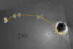
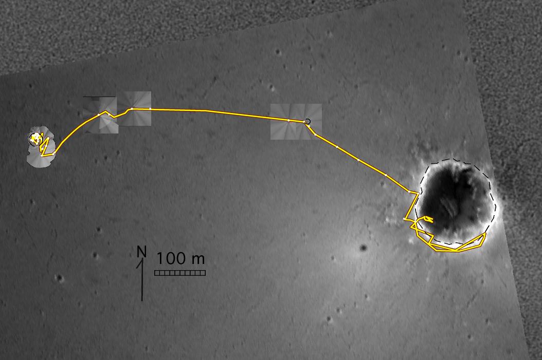
PIA06871:
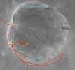
Opportunity's Travels During its First 205 Martian Days
Full Resolution:
TIFF
(1.006 MB)
JPEG
(74.08 kB)
2004-09-21
Mars
Mars Global Surveyor (MGS)
Mars Exploration Rover (MER)
Mars Orbiter Camera (MOC)
Navigation Camera
1163x704x3
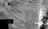
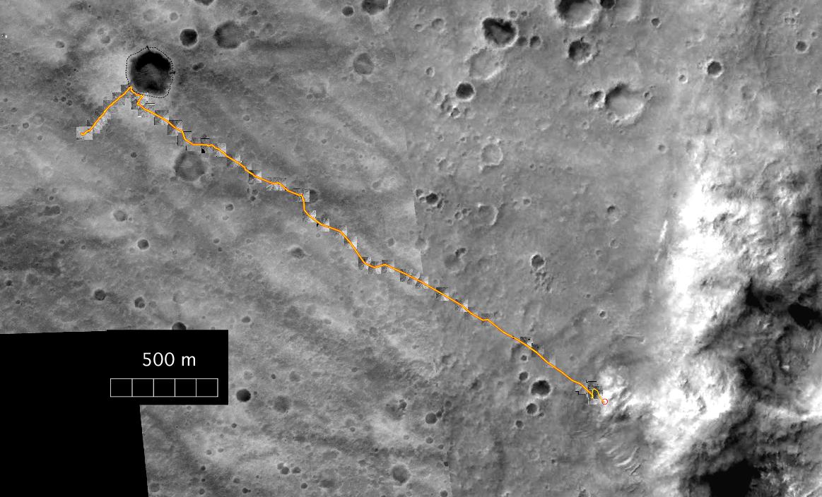
PIA06872:
Spirit's Travels During its First 238 Martian Days
Full Resolution:
TIFF
(1.16 MB)
JPEG
(123.9 kB)
2004-09-22
Mars
2001 Mars Odyssey
THEMIS
1407x3231x1
PIA06875:
Where Ophir Meets Candor
Full Resolution:
TIFF
(2.745 MB)
JPEG
(266.8 kB)
2004-09-22
Mars
Mars Global Surveyor (MGS)
Mars Orbiter Camera (MOC)
831x1247x1
PIA05952:
Martian Dunes
Full Resolution:
TIFF
(1.01 MB)
JPEG
(181.6 kB)
2004-09-23
Mars
2001 Mars Odyssey
THEMIS
1383x3041x1
PIA06876:
Ophir Chasma Etched Rock
Full Resolution:
TIFF
(2.584 MB)
JPEG
(237.8 kB)
2004-09-23
Mars
Mars Global Surveyor (MGS)
Mars Orbiter Camera (MOC)
836x2755x1
PIA06877:
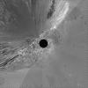
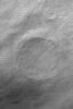
Impact Crater
Full Resolution:
TIFF
(2.306 MB)
JPEG
(396.4 kB)
2004-09-24
Mars
2001 Mars Odyssey
THEMIS
1361x3061x1
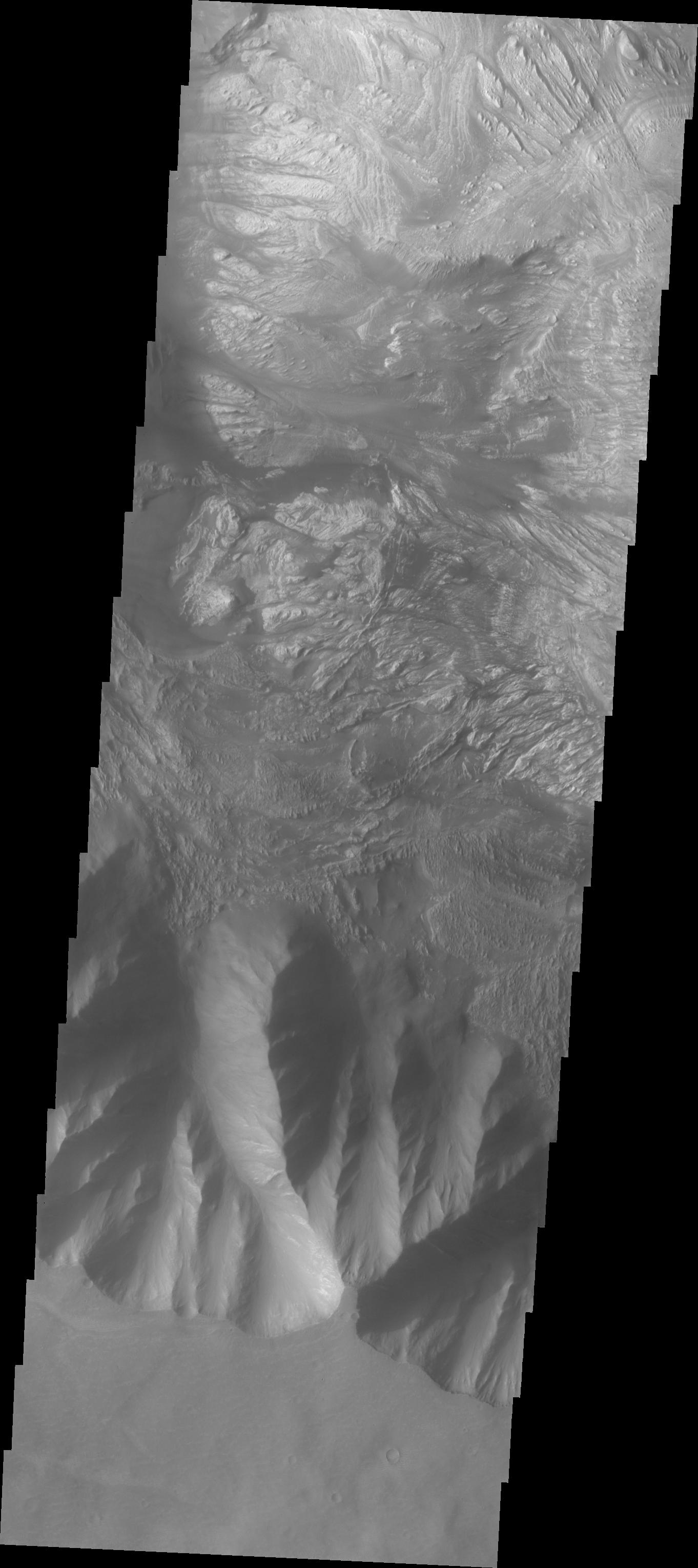
PIA06887:
Candor Chasma
Full Resolution:
TIFF
(2.976 MB)
JPEG
(340.7 kB)
2004-09-24
Mars
Mars Global Surveyor (MGS)
Mars Orbiter Camera (MOC)
1024x2143x1
PIA06883:
East Candor Rocks
Full Resolution:
TIFF
(2.197 MB)
JPEG
(389.9 kB)
2004-09-24
Mars
Mars Exploration Rover (MER)
Microscopic Imager
Moessbauer Spectrometer
1861x1868x1
PIA06881:
Sampling Martian Soil
Full Resolution:
TIFF
(2.888 MB)
JPEG
(553.5 kB)
2004-09-24
Mars
Mars Exploration Rover (MER)
Microscopic Imager
Moessbauer Spectrometer
2167x1861x3
PIA06882:
Sampling Martian Soil (3-D)
Full Resolution:
TIFF
(8.466 MB)
JPEG
(659 kB)
2004-09-25
Mars
Mars Global Surveyor (MGS)
Mars Orbiter Camera (MOC)
672x2084x1
PIA06884:
Valley Segment
Full Resolution:
TIFF
(1.402 MB)
JPEG
(324.6 kB)
2004-09-26
Mars
Mars Global Surveyor (MGS)
Mars Orbiter Camera (MOC)
375x693x1
PIA06885:
Lomonosov In Spring
Full Resolution:
TIFF
(191.9 kB)
JPEG
(18.12 kB)
2004-09-27
Mars
2001 Mars Odyssey
THEMIS
1369x3230x1
PIA06888:
Candor Chasma Plateau
Full Resolution:
TIFF
(2.95 MB)
JPEG
(331.6 kB)
2004-09-27
Mars
Mars Global Surveyor (MGS)
Mars Orbiter Camera (MOC)
6849x6280x1
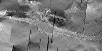
PIA06878:
Megaripples in Athabasca Vallis
Full Resolution:
TIFF
(37.82 MB)
JPEG
(8.193 MB)
2004-09-27
Mars
Mars Global Surveyor (MGS)
Mars Exploration Rover (MER)
Mars Orbiter Camera (MOC)
7083x8235x1
PIA06879:
Rover Tracks Seen from Orbit
Full Resolution:
TIFF
(50.34 MB)
JPEG
(11.11 MB)
2004-09-27
Mars
Mars Global Surveyor (MGS)
Mars Orbiter Camera (MOC)
320x240x3
PIA06880:
Rotating for Even Sharper Images
Full Resolution:
TIFF
(114.1 kB)
JPEG
(17.44 kB)
2004-09-28
Mars
2001 Mars Odyssey
THEMIS
1370x3066x1
PIA06889:
Layered Rock in Candor Chasma
Full Resolution:
TIFF
(2.936 MB)
JPEG
(311.5 kB)
2004-09-28
Mars
Mars Global Surveyor (MGS)
Mars Orbiter Camera (MOC)
512x2304x1
PIA06886:
Solar Conjunction Ends: Nirgal Vallis
Full Resolution:
TIFF
(1.181 MB)
JPEG
(201.4 kB)
2004-09-29
Mars
2001 Mars Odyssey
THEMIS
1353x3063x1
PIA06901:
Wind Etching in Candor Chasma
Full Resolution:
TIFF
(3.055 MB)
JPEG
(389.5 kB)
2004-09-29
Mars
Mars Global Surveyor (MGS)
Mars Orbiter Camera (MOC)
672x1008x1
PIA06895:
Buried Crater
Full Resolution:
TIFF
(678.3 kB)
JPEG
(195 kB)
2004-09-30
Mars
2001 Mars Odyssey
THEMIS
1351x3065x1
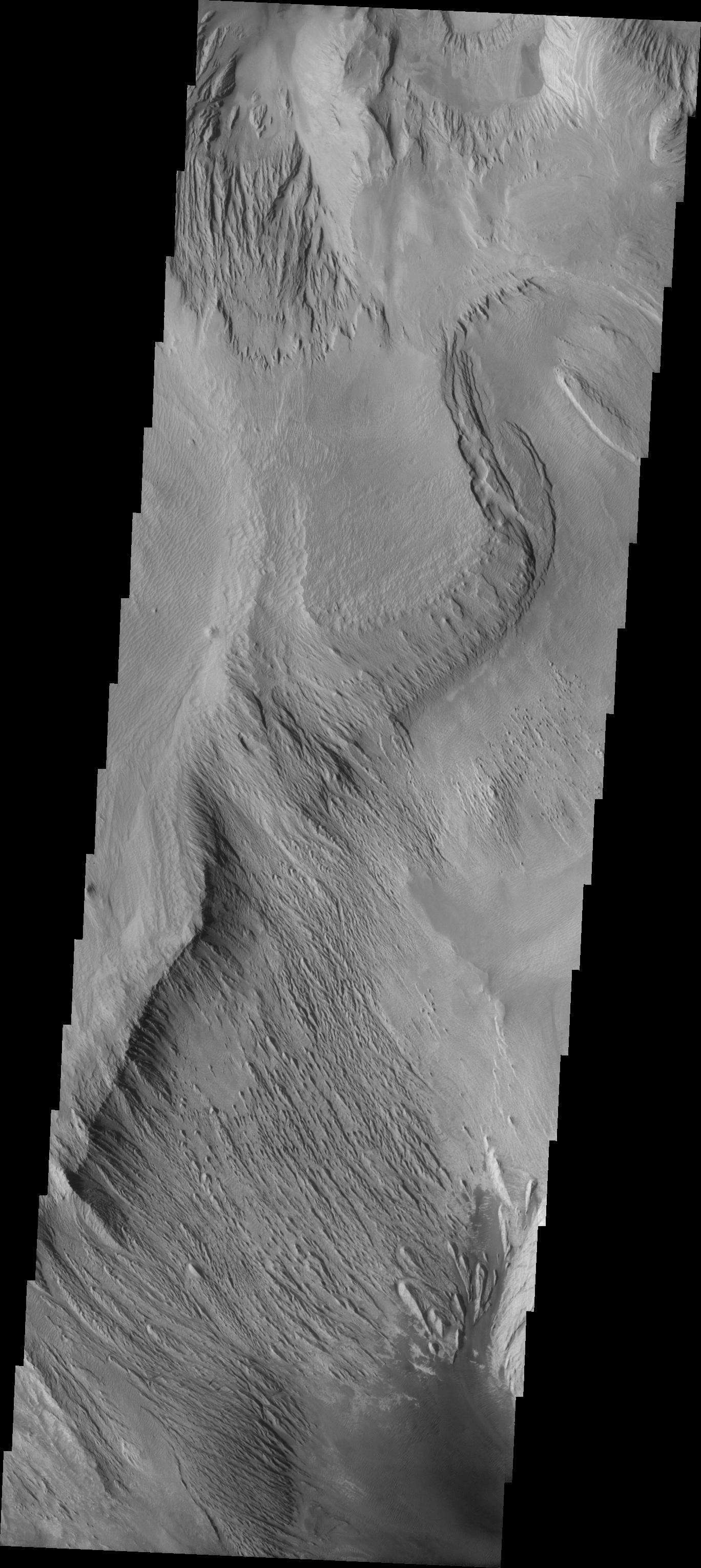
PIA06902:
Candor Chasma Landslide
Full Resolution:
TIFF
(2.88 MB)
JPEG
(300.1 kB)
2004-09-30
Mars
Mars Global Surveyor (MGS)
Mars Orbiter Camera (MOC)
727x400x1
PIA06896:
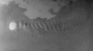
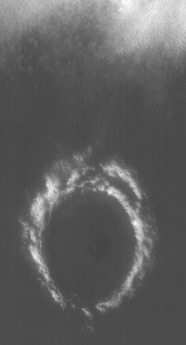
Wave Clouds off Korolev
Full Resolution:
TIFF
(236.9 kB)
JPEG
(15.1 kB)
2004-09-30
Mars
Mars Exploration Rover (MER)
Navigation Camera
4571x1900x1
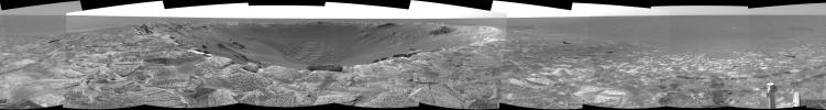
PIA06891:
Busy at the Bottom of 'Endurance Crater'
Full Resolution:
TIFF
(4.202 MB)
JPEG
(669.4 kB)
2004-09-30
Mars
Mars Exploration Rover (MER)
Navigation Camera
5205x5205x1
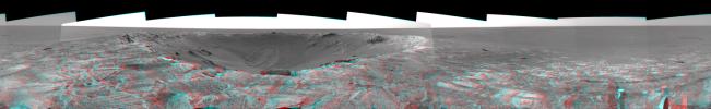
PIA06892:
Busy at the Bottom of 'Endurance Crater' (polar)
Full Resolution:
TIFF
(5.677 MB)
JPEG
(1.692 MB)
2004-09-30
Mars
Mars Exploration Rover (MER)
Navigation Camera
2000x2000x1
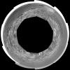
PIA06893:
Busy at the Bottom of 'Endurance Crater' (vertical)
Full Resolution:
TIFF
(1.742 MB)
JPEG
(283.5 kB)
2004-09-30
Mars
Mars Exploration Rover (MER)
Navigation Camera
1024x1024x1
PIA06894:
Layered Rock Ahead
Full Resolution:
TIFF
(962.5 kB)
JPEG
(142.5 kB)
2004-10-01
Mars
Mars Global Surveyor (MGS)
Mars Orbiter Camera (MOC)
512x1488x1
PIA06897:
Zephyria Outflow Features
Full Resolution:
TIFF
(762.8 kB)
JPEG
(187.6 kB)
2004-10-01
Mars
2001 Mars Odyssey
THEMIS
1353x3060x1
PIA06903:
Candor Chasma Landslides
Full Resolution:
TIFF
(2.75 MB)
JPEG
(253.8 kB)
2004-10-02
Mars
Mars Global Surveyor (MGS)
Mars Orbiter Camera (MOC)
836x1254x1
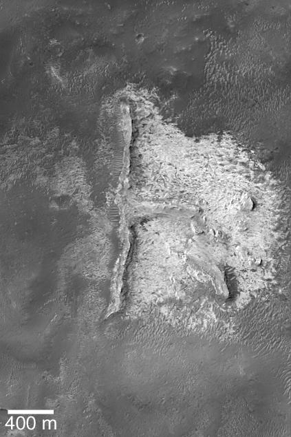
PIA06898:
Boulder Rings
Full Resolution:
TIFF
(1.05 MB)
JPEG
(292.5 kB)
2004-10-03
Mars
Mars Global Surveyor (MGS)
Mars Orbiter Camera (MOC)
3706x5559x1
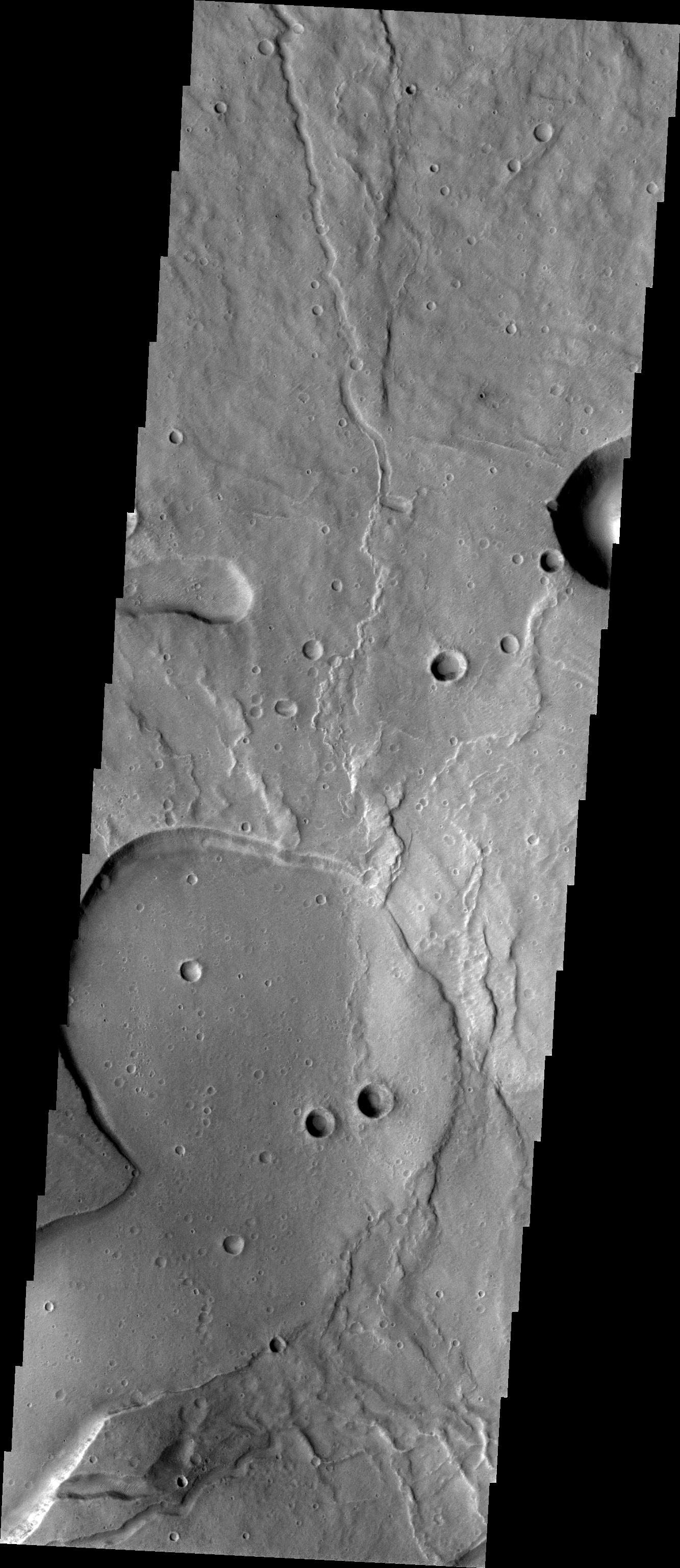
PIA06899:
Warrego Valles
Full Resolution:
TIFF
(16.37 MB)
JPEG
(2.462 MB)
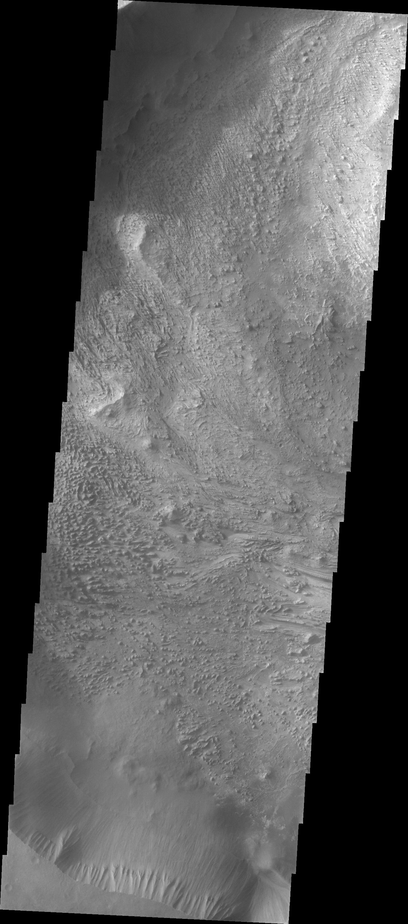
2004-10-04
Mars
2001 Mars Odyssey
THEMIS
1349x3067x1
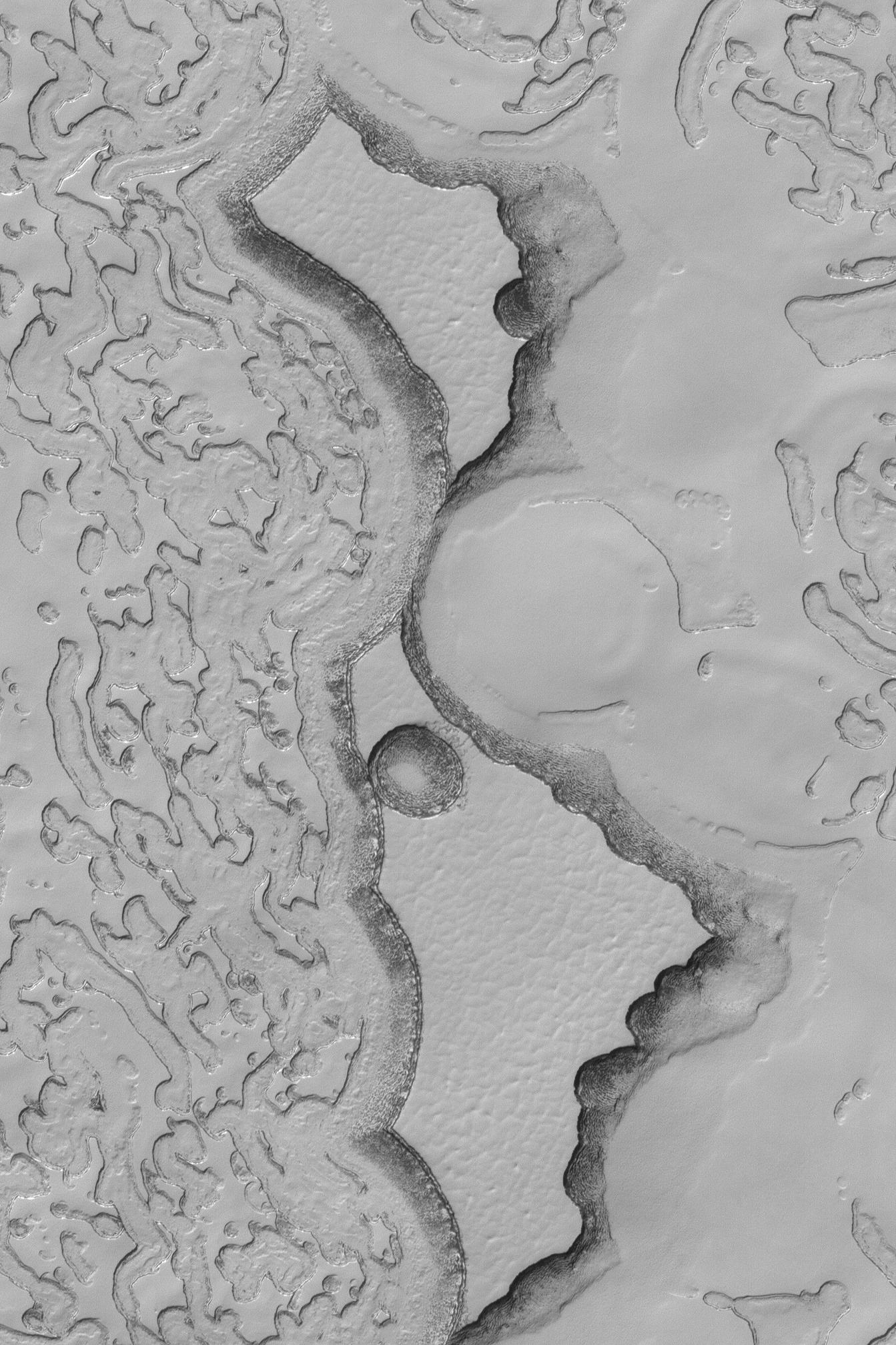
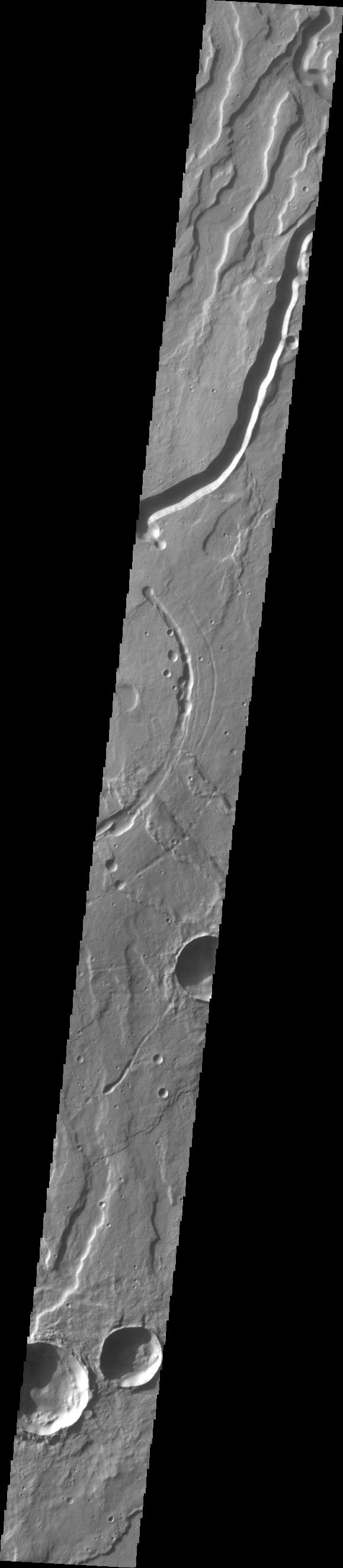
PIA06904:
Chaotic Candor Chasma
Full Resolution:
TIFF
(2.784 MB)
JPEG
(264.1 kB)
2004-10-04
Mars
Mars Global Surveyor (MGS)
Mars Orbiter Camera (MOC)
672x1429x1
PIA06900:
Craters in Fretted Terrain
Full Resolution:
TIFF
(961.5 kB)
JPEG
(317.4 kB)
2004-10-05
Mars
2001 Mars Odyssey
THEMIS
1361x3061x1
PIA06906:
Layered Candor Chasma
Full Resolution:
TIFF
(2.791 MB)
JPEG
(283 kB)
2004-10-05
Mars
Mars Global Surveyor (MGS)
Mars Orbiter Camera (MOC)
836x1254x1
PIA06905:
Dunes of Herschel
Full Resolution:
TIFF
(1.05 MB)
JPEG
(134.4 kB)
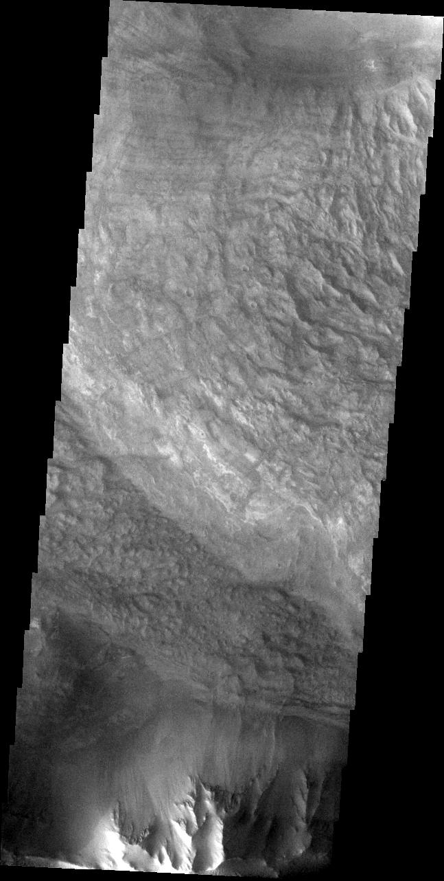
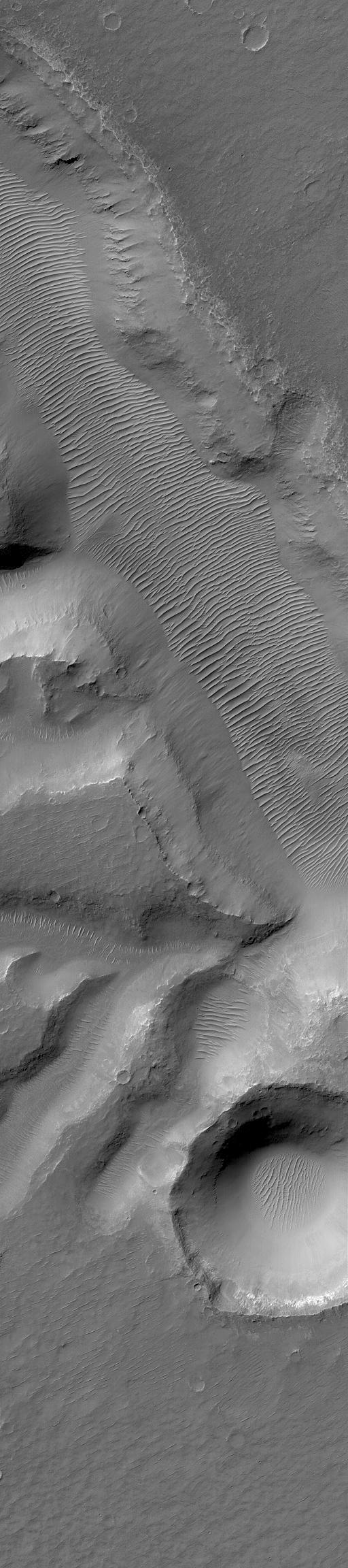
2004-10-06
Mars
2001 Mars Odyssey
1382x3226x1
PIA06911:
Candor Chasma
Full Resolution:
TIFF
(3.164 MB)
JPEG
(381.4 kB)
2004-10-06
Mars
Mars Global Surveyor (MGS)
Mars Orbiter Camera (MOC)
1488x2083x1
PIA06912:
Filled and Exhumed Crater
Full Resolution:
TIFF
(3.103 MB)
JPEG
(513.6 kB)
2004-10-07
Mars
Mars Global Surveyor (MGS)
Mars Orbiter Camera (MOC)
672x1008x1
PIA06913:
Rock Outcrops near Hellas
Full Resolution:
TIFF
(678.3 kB)
JPEG
(128.2 kB)
2004-10-07
Mars
2001 Mars Odyssey
THEMIS
1391x3237x1
PIA06924:
Candor Chasma
Full Resolution:
TIFF
(3.135 MB)
JPEG
(339 kB)
2004-10-07
Mars
Mars Exploration Rover (MER)
Panoramic Camera
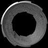
724x724x3
PIA06914:
Hole in 'Ebenezer'
Full Resolution:
TIFF
(1.472 MB)
JPEG
(64.48 kB)
2004-10-07
Mars
Mars Exploration Rover (MER)
Navigation Camera
7466x1089x1
PIA06915:
Spirit's View of 'Columbia Hills'
Full Resolution:
TIFF
(6.318 MB)
JPEG
(1.008 MB)
2004-10-07
Mars
Mars Exploration Rover (MER)
Panoramic Camera
512x512x3
PIA06916:
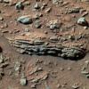
'Tetl' Rock
Full Resolution:
TIFF
(787.5 kB)
JPEG
(61.8 kB)
2004-10-07
Mars
Mars Exploration Rover (MER)
Panoramic Camera
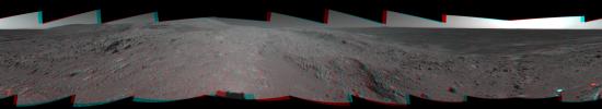
22348x4487x3
PIA06917:
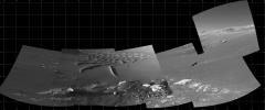
'Cahokia' Panorama
Full Resolution:
TIFF
(183.7 MB)
JPEG
(8.79 MB)
QTVR
(9.678 MB)
2004-10-07
Mars
Mars Exploration Rover (MER)
Panoramic Camera
1175x1130x3
PIA06918:
'Escher' Rock
Full Resolution:
TIFF
(3.988 MB)
JPEG
(224.5 kB)
2004-10-07
Mars
Mars Exploration Rover (MER)
Panoramic Camera
512x512x3
PIA06919:
'Earhart' Rock
Full Resolution:
TIFF
(787.5 kB)
JPEG
(50.61 kB)
2004-10-07
Mars
Mars Exploration Rover (MER)
Panoramic Camera
1689x1680x3
PIA06920:
'Wopmay' Rock
Full Resolution:
TIFF
(6.804 MB)
JPEG
(282.5 kB)
QTVR
(2.436 MB)
2004-10-08
Mars
Mars Exploration Rover (MER)
Navigation Camera
7704x1400x3
PIA06921:
Spirit's View of 'Columbia Hills' (3-D)
Full Resolution:
TIFF
(19.95 MB)
JPEG
(1.175 MB)
2004-10-08
Mars
Mars Exploration Rover (MER)
Navigation Camera
4149x4149x1
PIA06922:
Spirit's View of 'Columbia Hills' (polar)
Full Resolution:
TIFF
(8.683 MB)
JPEG
(1.262 MB)
2004-10-08
Mars
Mars Exploration Rover (MER)
Navigation Camera
4000x4000x1
PIA06923:
Spirit's View of 'Columbia Hills' (vertical)
Full Resolution:
TIFF
(12.58 MB)
JPEG
(1.573 MB)
2004-10-08
Mars
Mars Global Surveyor (MGS)
Mars Orbiter Camera (MOC)
836x1696x1
PIA06925:
Bedforms in Maja Valles
Full Resolution:
TIFF
(1.42 MB)
JPEG
(287.8 kB)
2004-10-08
Mars
2001 Mars Odyssey
THEMIS
7905x3953x1
PIA06926:
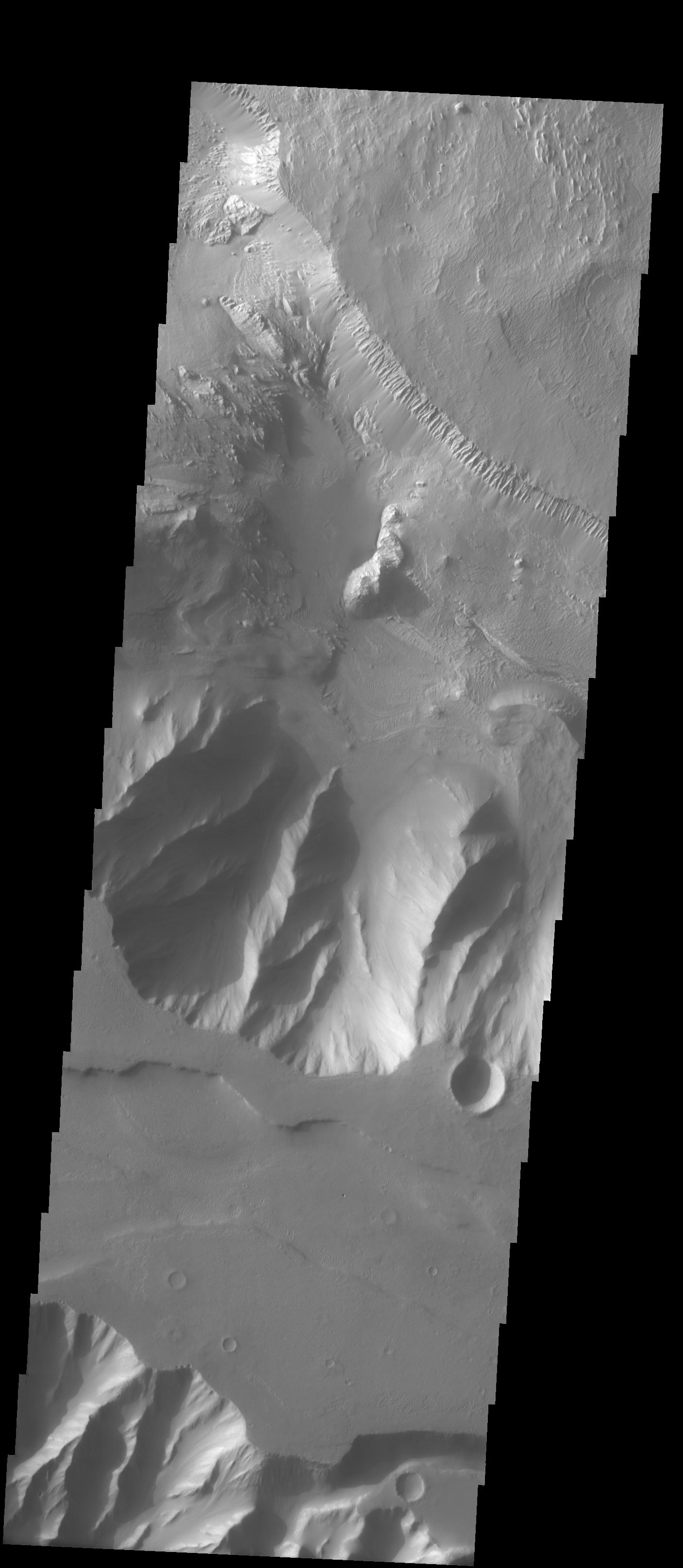
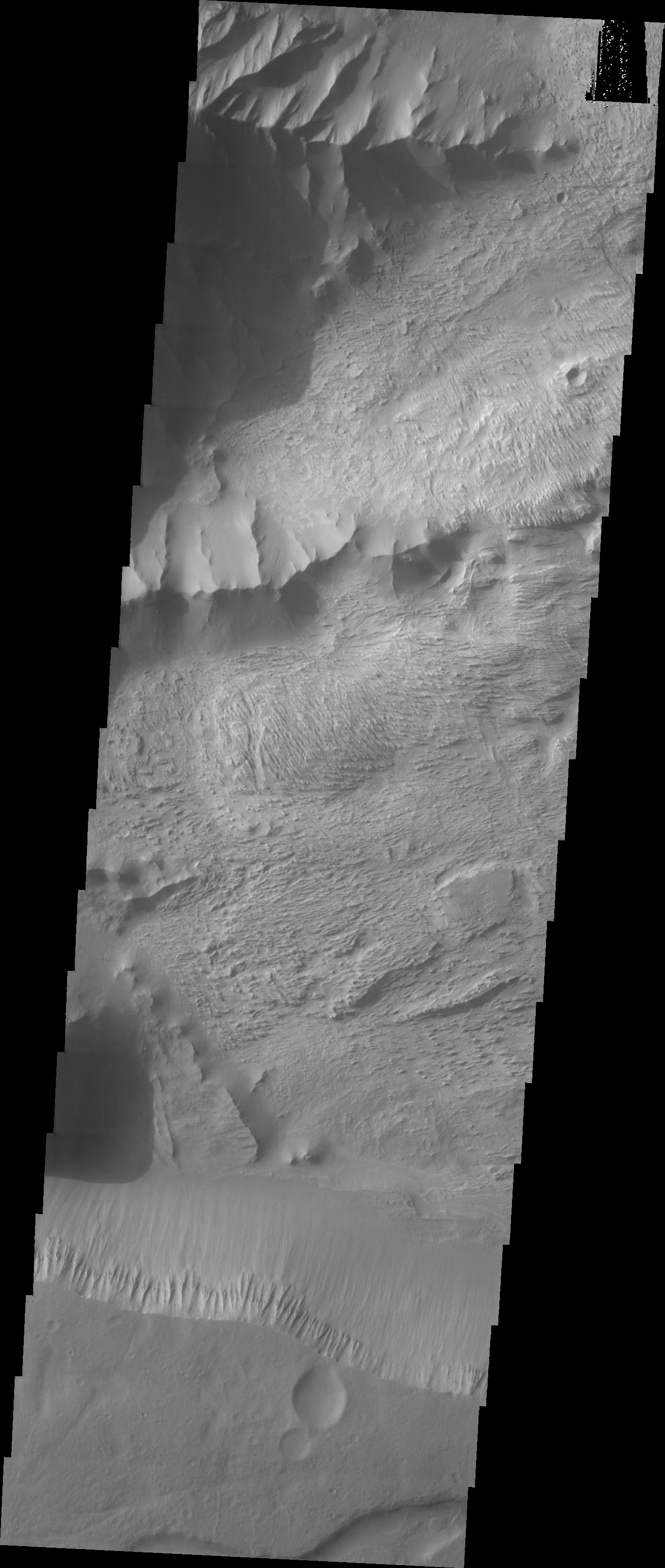
Valles Marineris Mosaic
Full Resolution:
TIFF
(31.28 MB)
JPEG
(6.256 MB)
2004-10-09
Mars
Mars Global Surveyor (MGS)
Mars Orbiter Camera (MOC)
2048x3072x1
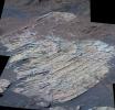
PIA06929:
Schiaparelli's Sedimentary Rocks
Full Resolution:
TIFF
(6.298 MB)
JPEG
(1.715 MB)
2004-10-10
Mars
Mars Global Surveyor (MGS)
Mars Orbiter Camera (MOC)
512x1272x1
PIA06930:
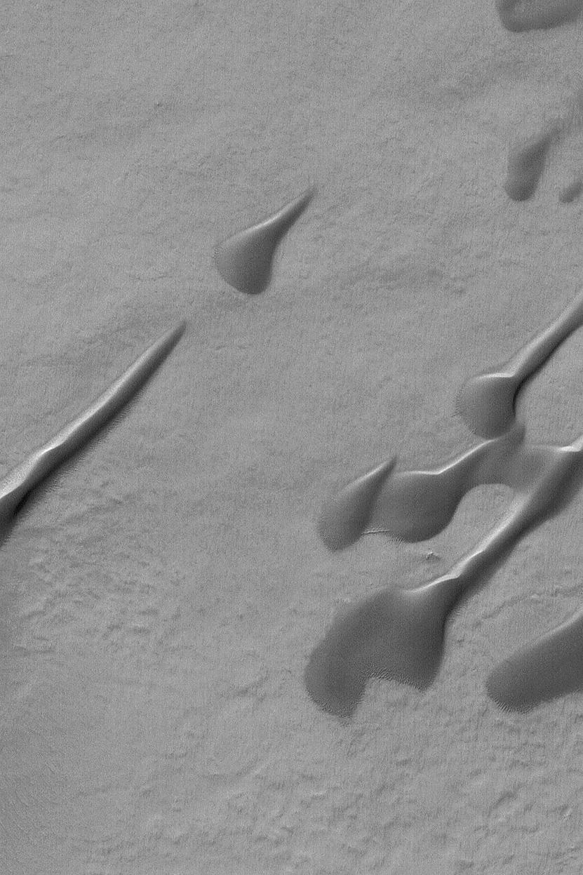
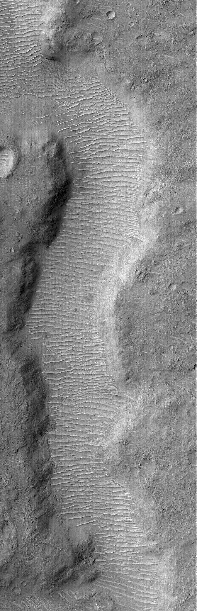
Rippled Dune
Full Resolution:
TIFF
(652.1 kB)
JPEG
(92.69 kB)
2004-10-11
Mars
Mars Global Surveyor (MGS)
Mars Orbiter Camera (MOC)
836x2029x1
PIA06931:
Cerberus Fossae Troughs
Full Resolution:
TIFF
(1.698 MB)
JPEG
(301.4 kB)
2004-10-11
Mars
2001 Mars Odyssey
THEMIS
1333x3073x1
PIA06933:
Tyrrhena Patera
Full Resolution:
TIFF
(3.119 MB)
JPEG
(433.2 kB)
2004-10-12
Mars
Mars Global Surveyor (MGS)
Mars Orbiter Camera (MOC)
423x635x1
PIA06932:
Mars Says "Hi"!
Full Resolution:
TIFF
(269.1 kB)
JPEG
(50.44 kB)
2004-10-12
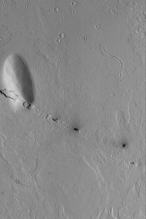
Mars
2001 Mars Odyssey
THEMIS
579x2649x1
PIA06934:
Tyrrhena Patera
Full Resolution:
TIFF
(732.1 kB)
JPEG
(101 kB)
2004-10-13
Mars
2001 Mars Odyssey
THEMIS
320x10768x1
PIA06945:
Tyrrhena Patera
Full Resolution:
TIFF
(3.449 MB)
JPEG
(463.4 kB)
1-100
101-200
201-300
301-400
401-500
501-600
601-700
701-800
801-900
901-1000
Currently displaying images:
2901 - 3000
of 12748


