- Original Caption Released with Image:
-
3 October 2004
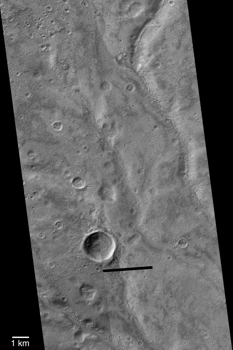
When viewed at 100 to 300 meters per pixel in old Mariner 9 and Viking orbiter images, Warrego Valles appears to be a grouping of intricately-carved networks of branching valleys. This region has often been used as the type example of martian valley networks, and key evidence that Mars may have once been warmer, wetter, and perhaps had precipitation in the form of rain or snow. However, when viewed at very high resolution (1.5 to 4.5 meters per pixel) with the Mars Global Surveyor (MGS) Mars Orbiter Camera (MOC), the Warrego valleys break down into a series of vaguely continuous (in other words, not necessarily connected to each other) troughs that have been covered and partially filled by a material that has eroded to form a very rough-textured surface. None of the original valley floor or wall features are visible because of this rough-textured mantle, and thus very little can be said regarding whether the valleys represent the results of persistent flow and precipitation runoff. Despite the MOC observations and the relatively unique nature of these valleys relative to other valley networks on Mars, the Warrego Valles continue to be used by many as an example of typical martian valley networks. The picture shown here is a mosaic of three MOC narrow angle images obtained in 1999 and 2004: M07-02071, R15-00492, and R15-02626. The dark bar near the bottom center is the location of a data drop, lost during transmission. The 1 km scale bar is approximately equal to 0.62 miles. Sunlight illuminates the images from the upper left, north is up, and the scene is located near 42.4°S, 93.5°W.
- Image Credit:
-
NASA/JPL/Malin Space Science Systems
Image Addition Date: -
2004-10-03
|