- Original Caption Released with Image:
-
6 September 2004
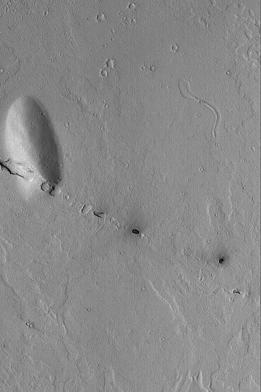
The Cerberus Fossae are a grouping of narrow troughs formed by extension and cracking of the martian crust in the region southeast of the Elysium volcanoes. This Mars Global Surveyor (MGS) Mars Orbiter Camera (MOC) image shows a small line of collapsed pits that follow the trend of the regional Cerberus Fossae troughs. These aligned pits show the location of a fault line that runs through the plains and cuts the low, rounded hill at the left, center of the image. This area is located near 7.5°N, 191.7°W. The image covers an area approximately 3 km (1.9 mi) across. Sunlight illuminates this scene from the lower left.
- Image Credit:
-
NASA/JPL/Malin Space Science Systems
Image Addition Date: -
2004-09-06
|
