Your search criteria found
12760
images
Target is Mars (and available satellites)
Go to PIAxxxxx:
Refine this list of images by:
Target:
Deimos
Mars
Phobos
Mission:
2001 Mars Odyssey
Antarctic Meteorite Location and Mapping Project (AMLAMP)
Dawn
ExoMars
Hubble Space Telescope
InSight
MAVEN
Mariner Mars 1964 (Mariner 4)
Mariner Mars 1969 (Mariner 7)
Mariner Mars 1971 (Mariner 9)
Mars 2020
Mars 2020 Rover
Mars Atmosphere and Volatile Evolution MissioN (MAVEN)
Mars Climate Orbiter
Mars Cube One (MarCO)
Mars Exploration Rover (MER)
Mars Express (MEX)
Mars Global Surveyor (MGS)
Mars Helicopter
Mars Pathfinder (MPF)
Mars Reconnaissance Orbiter (MRO)
Mars Sample Return
Mars Sample Return (MSR)
Mars Science Laboratory (MSL)
Phoenix
Rosetta
Viking
Spacecraft:
2001 Mars Odyssey
Curiosity
Dawn
InSight Mars Lander
Ingenuity
MAVEN
MarCO-B
Mariner 4
Mariner 7
Mariner 9
Mars Climate Orbiter
Mars Express (MEX)
Mars Express (MEX) Orbiter
Mars Global Surveyor Orbiter
Mars Pathfinder Lander
Mars Pathfinder Rover
Mars Reconnaissance Orbiter (MRO)
Mars Sample Return
Mars Science Laboratory (MSL)
NASA's Mars Pathfinder Lander
Opportunity
Perseverance
Philae Lander
Phoenix Lander
Phoenix Mars Lander
Spirit
Viking Lander 1
Viking Lander 2
Viking Orbiter 1
Viking Orbiter 2
Instrument:
Alpha Particle X-ray Spectrometer
Alpha Particle X-ray Spectrometer (MSL)
Atmospheric Structure / Meteorology Instrument
CHIMRA
Camera 1
Camera 2
Chemistry & Mineralogy (CheMin)
Chemistry and Camera (ChemCam)
Comet Infrared and Visible Analyser (CIVA
Compact Reconnaissance Imaging Spectrometer for Mars (CRISM)
Context Camera (CTX)
Deep Space Network
Descent Image Motion Estimation System (DIMES)
Dynamic Albedo of Neutrons
Dynamic Albedo of Neutrons (DAN)
Gamma Ray Spectrometer - Neutron Spectrometer
Gamma Ray Spectrometer Suite
Hazard Avoidance Camera
Hazard Avoidance Camera (M2020)
Hazard Avoidance Camera (MSL)
Heat and Physical Properties Package (HP3)
High Resolution Imaging Science Experiment (HiRISE)
High Resolution Instrument (HRI)
High Resolution Stereo Camera
Imager for Mars Pathfinder
Imaging Ultraviolet Spectrograph
Imaging Ultraviolet Spectrograph (IUVS)
Instrument Context Camera (ICC)
Instrument Deployment Camera (IDC)
Lander Vision System Camera (LCAM)
Magnetometer
Mars Advanced Radar for Subsurface and Ionosphere Sounding (MARSIS)
Mars Advanced Radar for Subsurface and Ionospheric Sounding (MARSIS)
Mars Climate Sounder (MCS)
Mars Color Imager (MARCI)
Mars Descent Imager
Mars Environmental Dynamics Analyzer (MEDA)
Mars Hand Lens Imager (MAHLI)
Mars Horizon Sensor Assembly
Mars Orbiter Camera (MOC)
Mars Orbiter Laser Altimeter
Mars Radiation Experiment
Mastcam
Mastcam-Z
Microscopic Imager
Microscopy Electrochemistry and Conductivity Analyzer (MECA)
Miniature Thermal Emission Spectrometer
Moessbauer Spectrometer
Navigation Camera
Navigation Camera (M2020)
Navigation Camera (MSL)
Neutral Gas and Ion Mass Spectrometer
Neutron Spectrometer
Optical Microscope
Optical Navigation Camera
Panoramic Camera
Planetary Instrument for X-ray Lithochemistry (PIXL)
Radar System
Radiation Assessment Detector (RAD)
Radio Science Subsystem
Robotic Arm
Robotic Arm (MSL)
Robotic Arm Camera (RAC)
Rock Abrasion Tool (RAT)
Rover Cameras
Rover Environmental Monitoring Station (REMS)
Sample Analysis at Mars (SAM)
Scanning Habitable Environments with Raman & Luminescence for Organics and Chemicals (SHERLOC)
Seismic Experiment for Interior Structure (SEIS)
Shallow Subsurface Radar (SHARAD)
Stereo Imager (SSI)
SuperCam
Surface Stereo Imager (SSI)
Thermal Emission Imaging System
Thermal Emission Spectrometer
Thermal and Electrical Conductivity Probe
Thermal and Evolved Gas Analyzer
Trace Gas Orbiter
Visual Imaging Subsystem
Visual Imaging Subsystem - Camera A
Visual Imaging Subsystem - Camera B
Wide Field Planetary Camera 2
Click on an image for detailed information
Click on a column heading to sort in ascending or descending order
My
List
Addition Date
Target
Mission
Instrument
Size
2017-11-28
Mars
Mars Reconnaissance Orbiter (MRO)
HiRISE
2880x1800x1
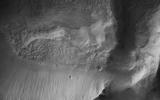
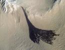
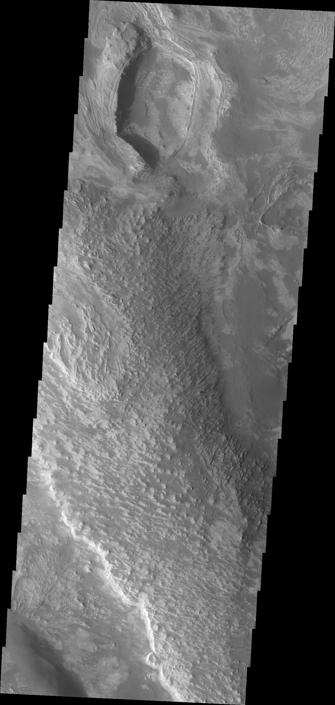
PIA22116:
A Collapsed Crater Rim
Full Resolution:
TIFF
(5.169 MB)
JPEG
(659.3 kB)
2017-11-28
Mars
Mars Reconnaissance Orbiter (MRO)
HiRISE
2880x1800x3
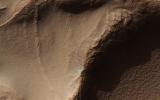
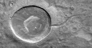
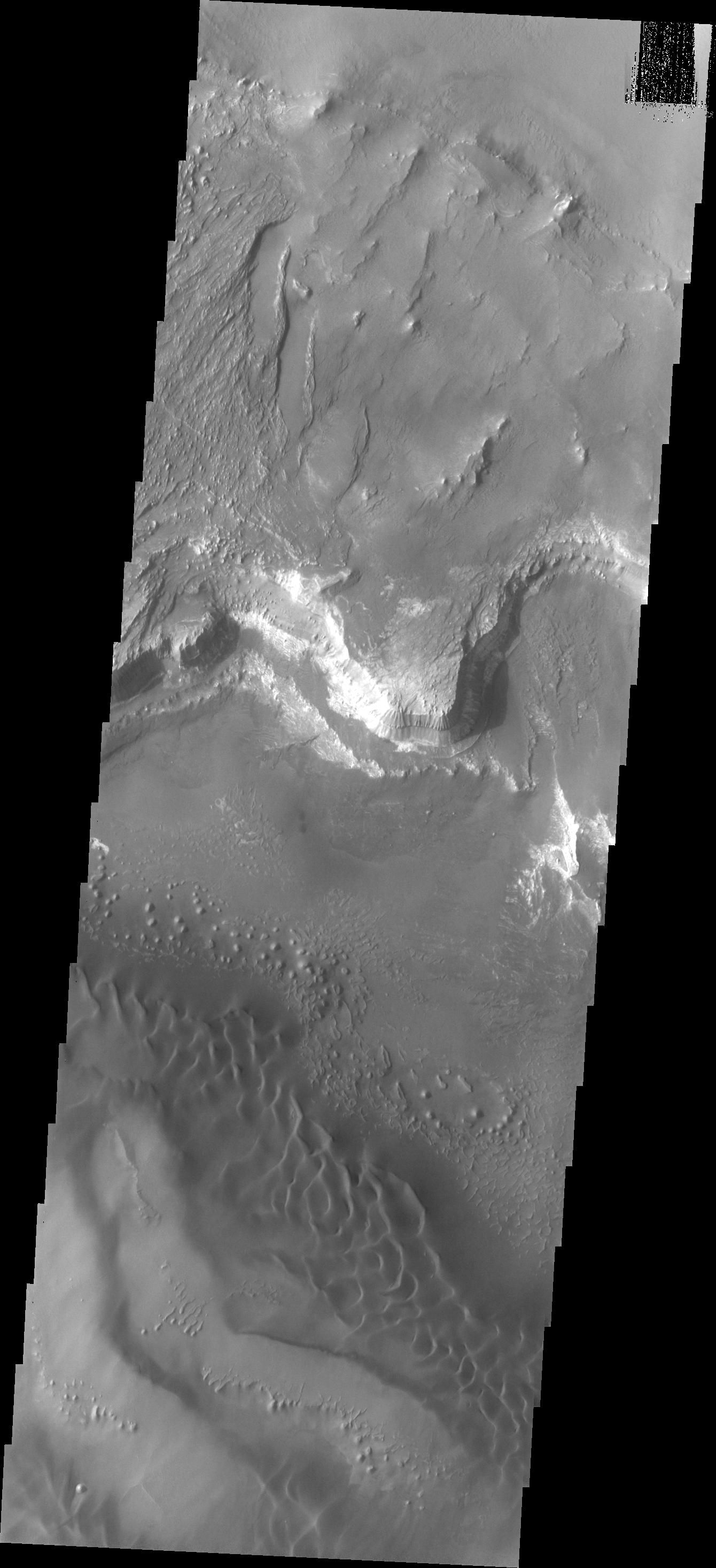
PIA22117:
An Inverted Crater West of Mawrth Vallis
Full Resolution:
TIFF
(14.9 MB)
JPEG
(717.3 kB)
2017-11-28
Mars
Mars Reconnaissance Orbiter (MRO)
HiRISE
2880x1800x3
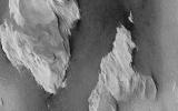
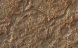
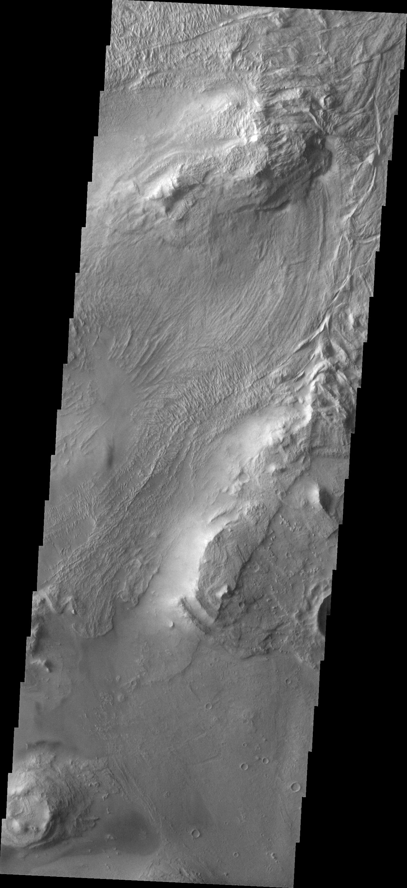
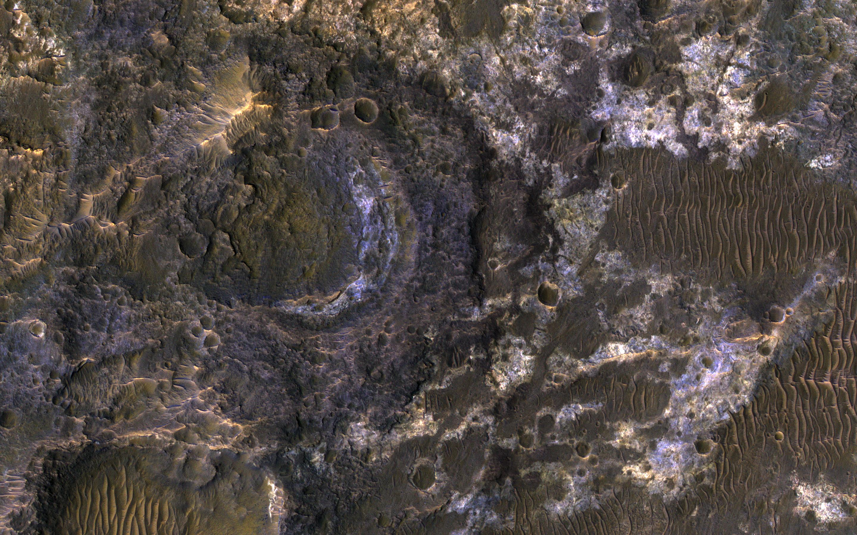
PIA22118:
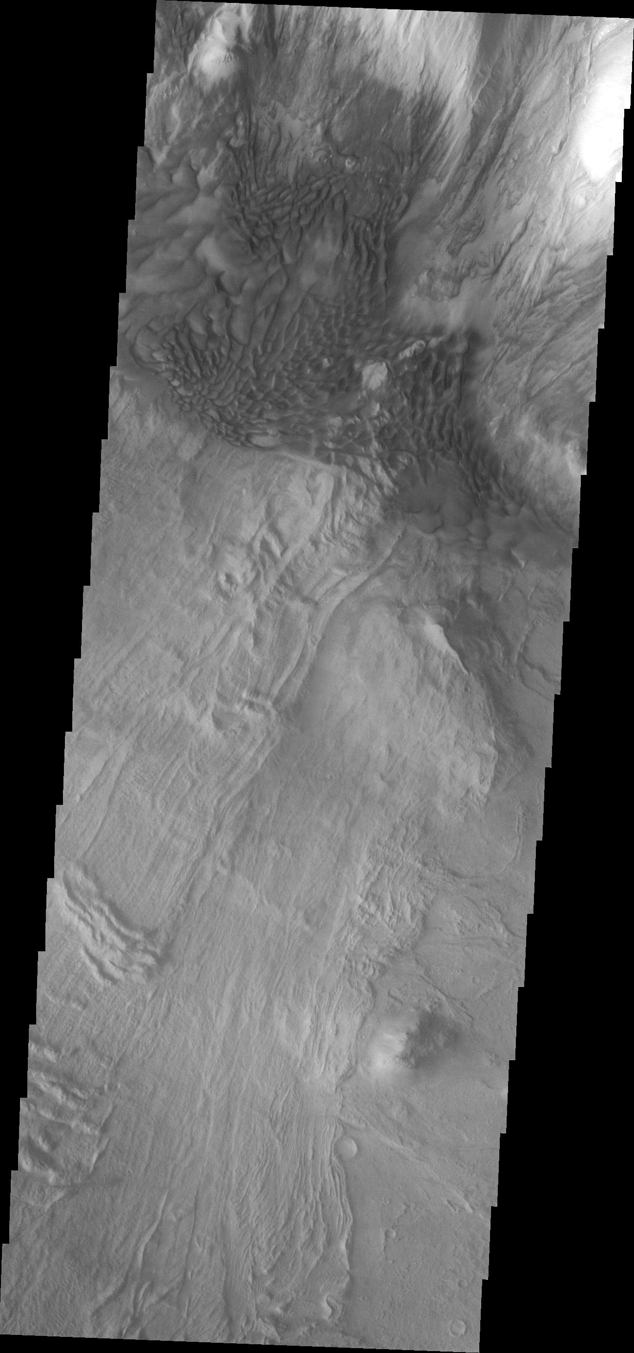
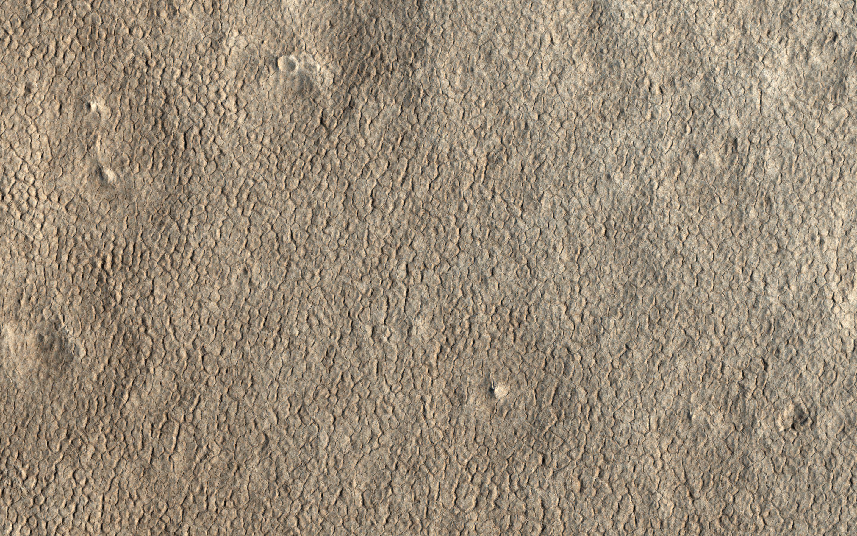
Honeycomb-Textured Landforms in Northwestern Hellas Planitia
Full Resolution:
TIFF
(13.17 MB)
JPEG
(673 kB)
2017-11-28
Mars
Mars Reconnaissance Orbiter (MRO)
HiRISE
2880x1800x1
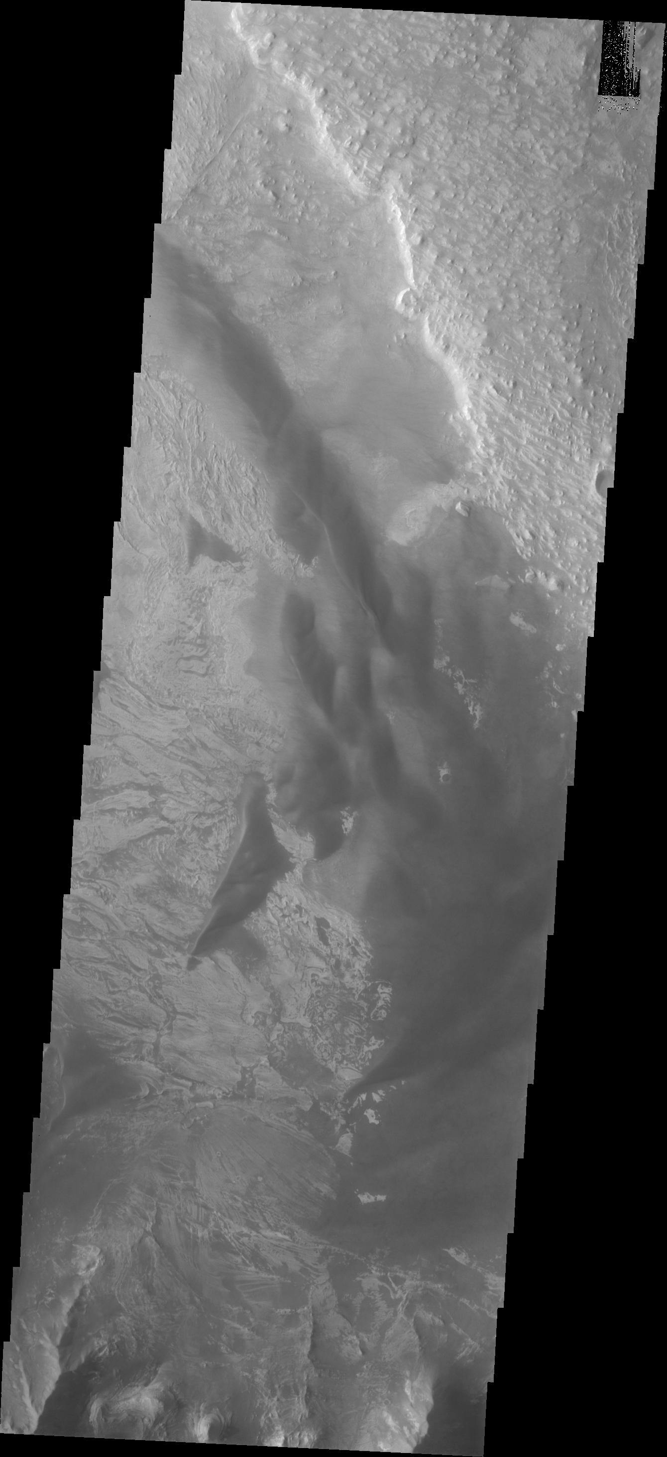
PIA22119:
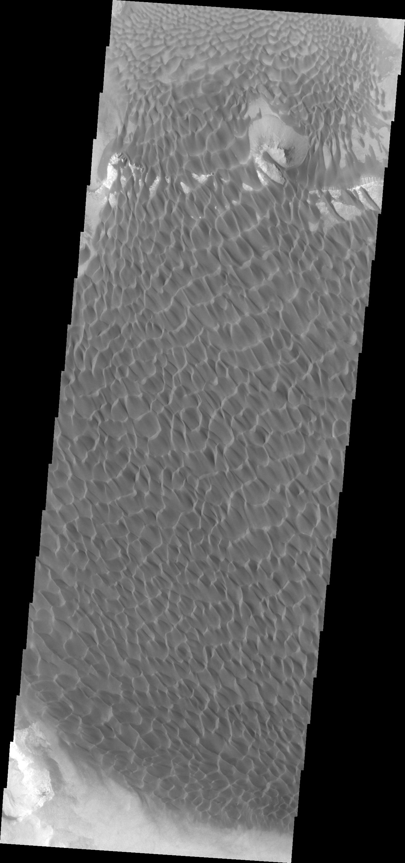
Yardangs: Nature's Weathervanes
Full Resolution:
TIFF
(5.191 MB)
JPEG
(935.1 kB)
2017-11-28
Mars
2001 Mars Odyssey
THEMIS
1395x3233x1
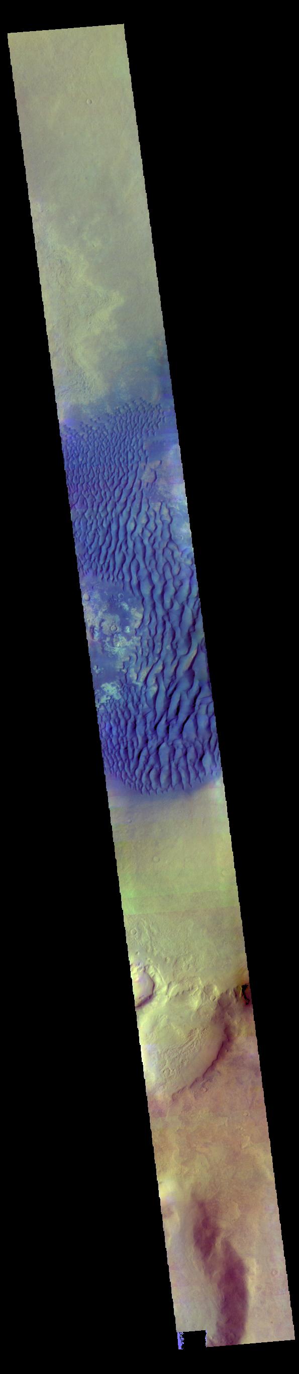
PIA22129:
Investigating Mars: Melas Chasma
Full Resolution:
TIFF
(3.129 MB)
JPEG
(347.7 kB)
2017-11-29
Mars
2001 Mars Odyssey
THEMIS
1322x2778x1
PIA22130:
Investigating Mars: Melas Chasma
Full Resolution:
TIFF
(2.818 MB)
JPEG
(347.9 kB)
2017-11-30
Mars
2001 Mars Odyssey
THEMIS
1340x2931x1
PIA22131:
Investigating Mars: Melas Chasma
Full Resolution:
TIFF
(2.702 MB)
JPEG
(296.1 kB)
2017-12-01
Mars
2001 Mars Odyssey
THEMIS
1344x2932x1
PIA22132:
Investigating Mars: Melas Chasma
Full Resolution:
TIFF
(3.018 MB)
JPEG
(393.8 kB)
2017-12-04
Mars
2001 Mars Odyssey
THEMIS
1340x2928x1
PIA22134:
Investigating Mars: Melas Chasma
Full Resolution:
TIFF
(2.578 MB)
JPEG
(252.2 kB)
2017-12-05
Mars
2001 Mars Odyssey
THEMIS
1361x3070x1
PIA22135:
Investigating Mars: Melas Chasma
Full Resolution:
TIFF
(3.01 MB)
JPEG
(389.5 kB)
2017-12-06
Mars
2001 Mars Odyssey
THEMIS
1341x2930x1
PIA22136:
Investigating Mars: Melas Chasma
Full Resolution:
TIFF
(2.46 MB)
JPEG
(232.7 kB)
2017-12-06
Mars
Mars Exploration Rover (MER)
Navigation Camera
2850x1065x1
PIA22071:
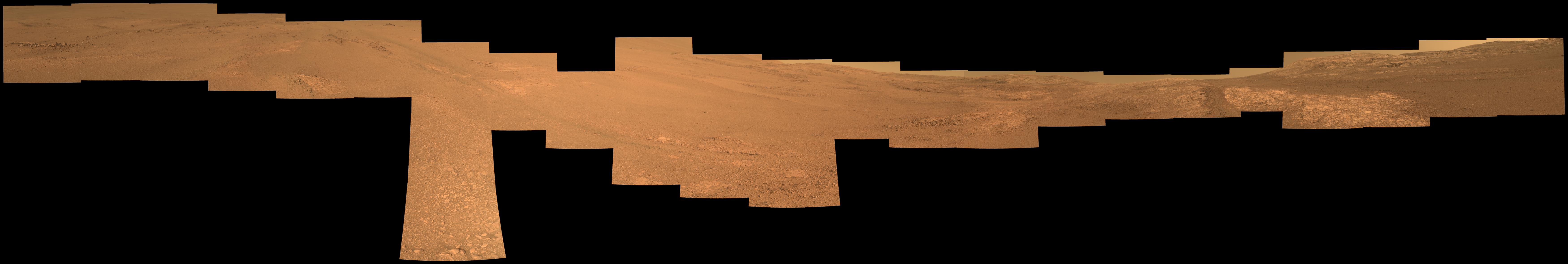
Opportunity's View Downhill Catches Martian Shadows
Full Resolution:
TIFF
(1.868 MB)
JPEG
(237 kB)
2017-12-06
Mars
Mars Exploration Rover (MER)
Panoramic Camera
6954x2516x3
PIA22072:
Wind's Marks in "Perseverance Valley" (Enhanced Color)
Full Resolution:
TIFF
(37.08 MB)
JPEG
(2.5 MB)
2017-12-06
Mars
Mars Exploration Rover (MER)
Panoramic Camera
10000x1685x3
PIA22073:
View From Within 'Perseverance Valley' on Mars (Enhanced Color)
Full Resolution:
TIFF
(19.75 MB)
JPEG
(1.541 MB)
2017-12-06
Mars
Mars Exploration Rover (MER)
Panoramic Camera
7000x1179x3
PIA22074:
View From Within 'Perseverance Valley' on Mars
Full Resolution:
TIFF
(6.909 MB)
JPEG
(493.4 kB)
2017-12-07
Mars
2001 Mars Odyssey
THEMIS
1299x2772x1
PIA22137:
Investigating Mars: Melas Chasma
Full Resolution:
TIFF
(2.723 MB)
JPEG
(308.2 kB)
2017-12-08
Mars
2001 Mars Odyssey
THEMIS
1321x2779x1
PIA22138:
Investigating Mars: Melas Chasma
Full Resolution:
TIFF
(2.749 MB)
JPEG
(313.1 kB)
2017-12-11
Mars
2001 Mars Odyssey
THEMIS
1319x2810x1
PIA22139:
Investigating Mars: Rabe Crater
Full Resolution:
TIFF
(2.483 MB)
JPEG
(247.5 kB)
2017-12-12
Mars
Mars Reconnaissance Orbiter (MRO)
HiRISE
2880x1800x1
PIA22124:
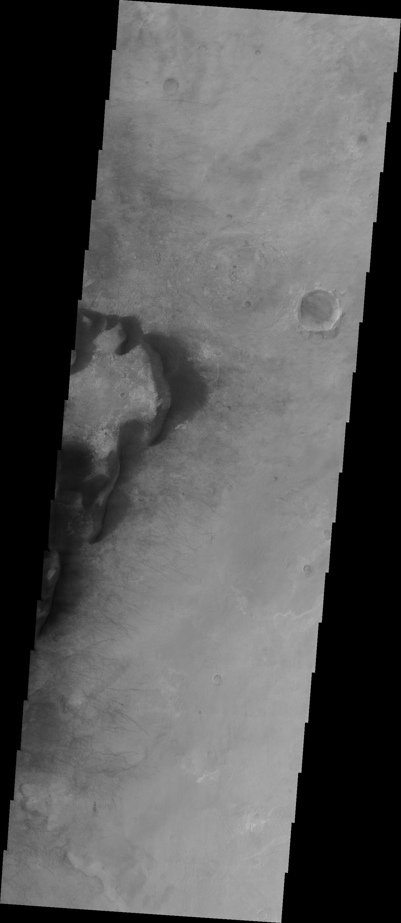
A Valley Near the Northern Lowlands
Full Resolution:
TIFF
(5.191 MB)
JPEG
(990 kB)
2017-12-12
Mars
Mars Reconnaissance Orbiter (MRO)
HiRISE
2880x1800x1
PIA22125:
Layered Ice Near the South Pole of Mars
Full Resolution:
TIFF
(5.191 MB)
JPEG
(987.7 kB)
2017-12-12
Mars
Mars Reconnaissance Orbiter (MRO)
HiRISE
2880x1800x3
PIA22186:
Depressions and Channels on the Floor of Lyot Crater
Full Resolution:
TIFF
(15.56 MB)
JPEG
(1.13 MB)
2017-12-12
Mars
Mars Reconnaissance Orbiter (MRO)
HiRISE
2880x1800x3
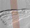
PIA22187:
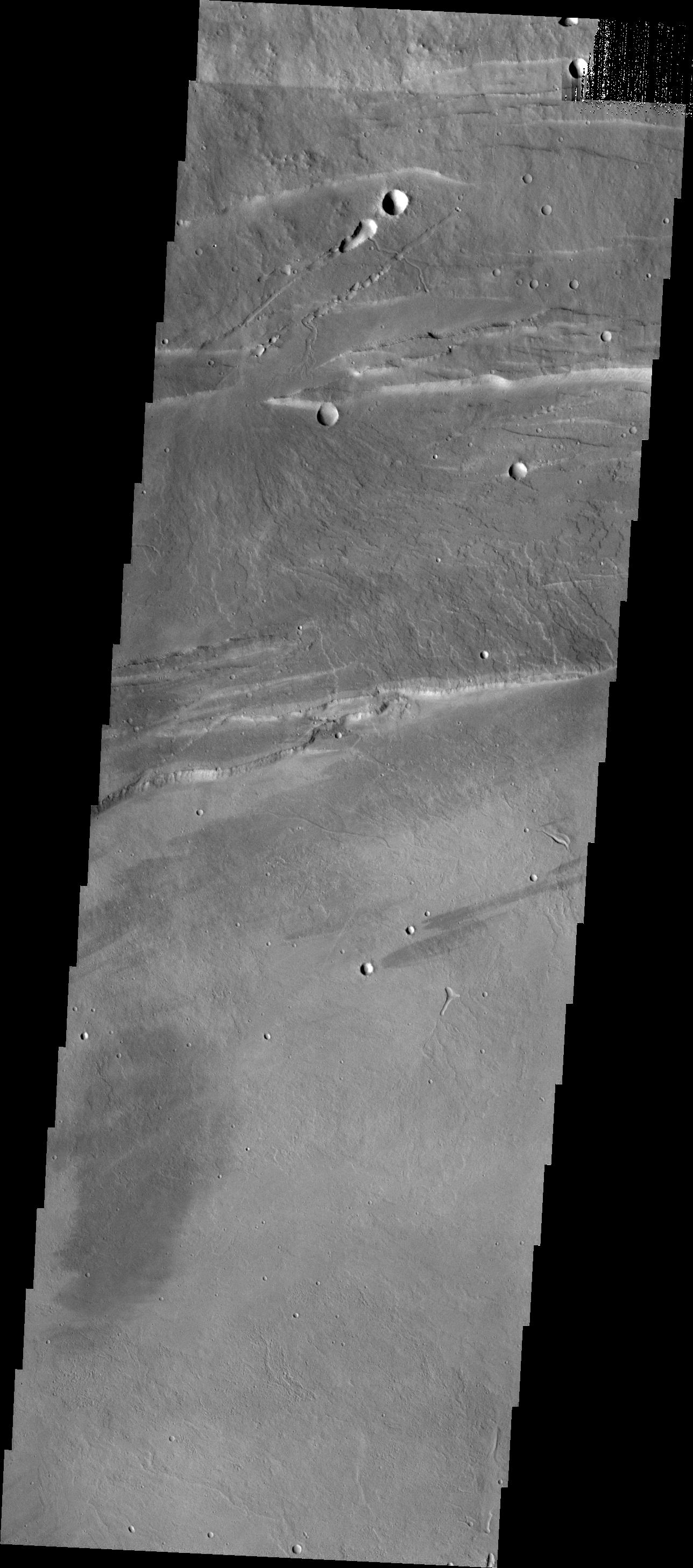
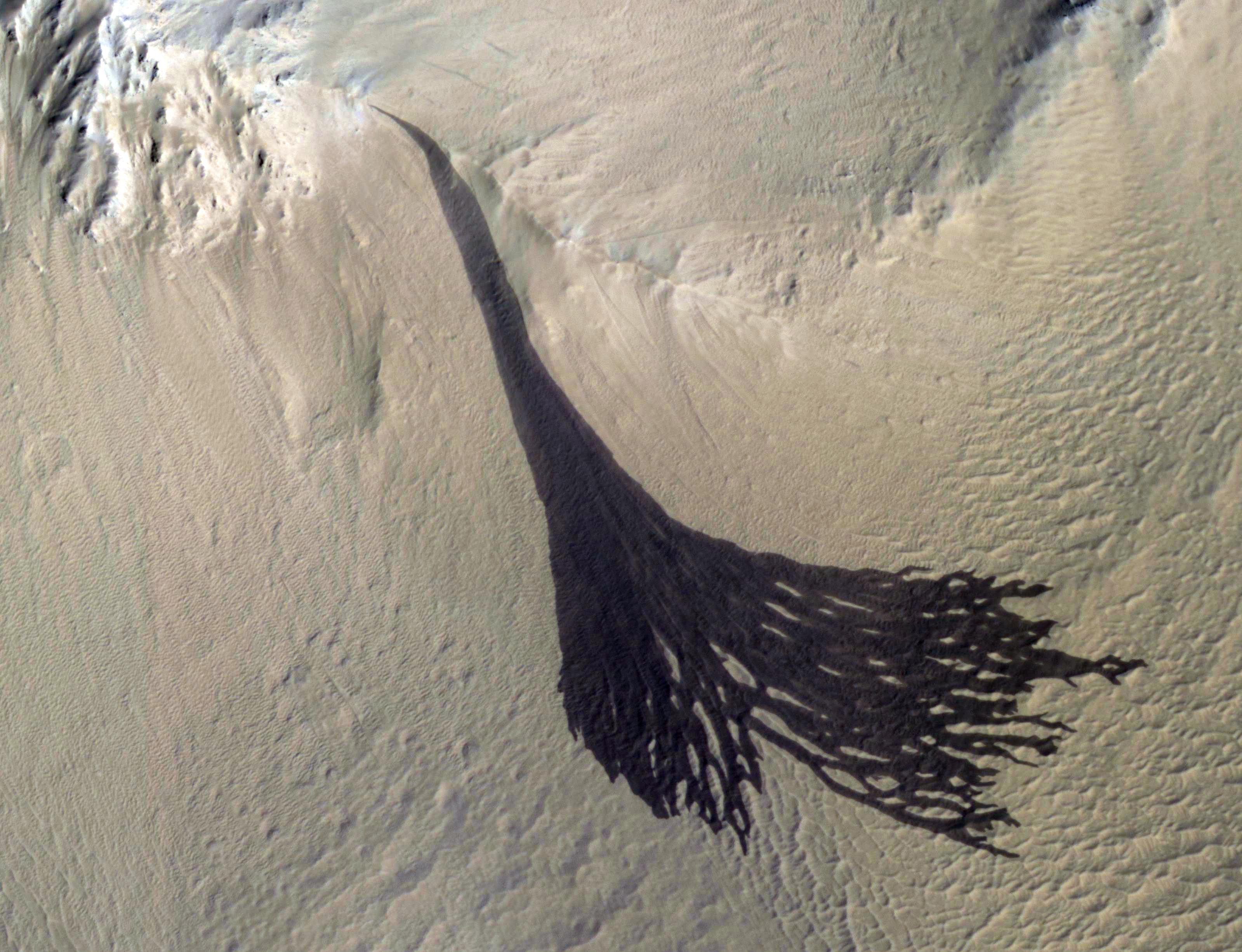
The Fault in Our Mars
Full Resolution:
TIFF
(15.56 MB)
JPEG
(616.1 kB)
2017-12-12
Mars
2001 Mars Odyssey
THEMIS
1659x2867x1
PIA22140:
Investigating Mars: Rabe Crater
Full Resolution:
TIFF
(3.017 MB)
JPEG
(263.4 kB)
2017-12-13
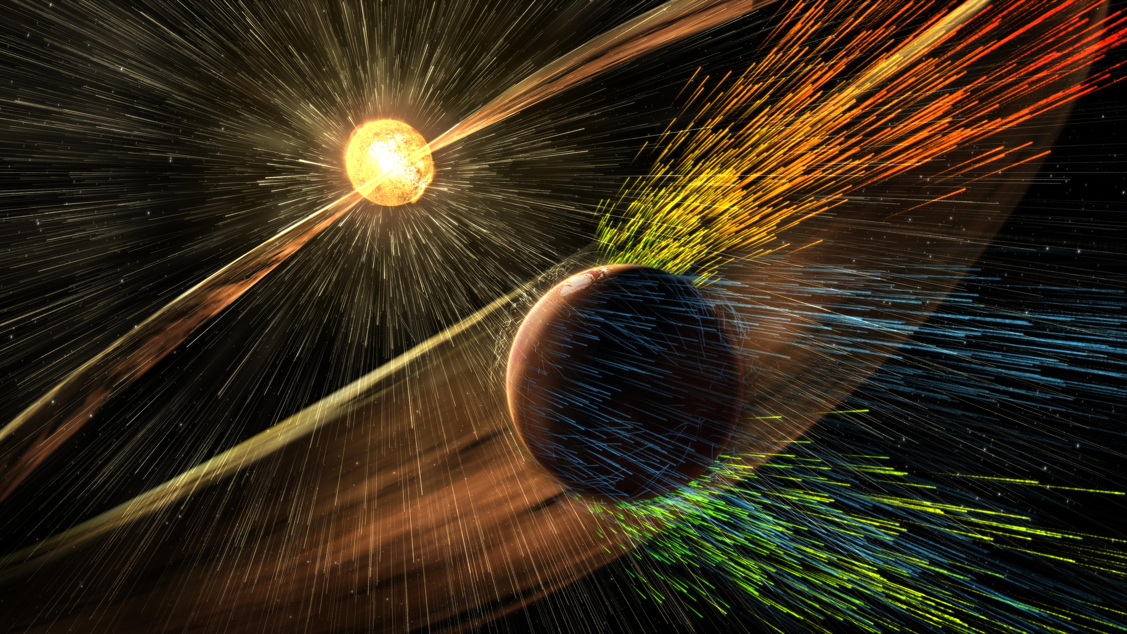
Mars
MAVEN
3840x2160x3
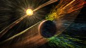
PIA22076:
Visualizing a Solar Storm's Effect on Mars Atmosphere (Illustration)
Full Resolution:
TIFF
(22.16 MB)
JPEG
(1.486 MB)
2017-12-13
Mars
2001 Mars Odyssey
THEMIS
1555x2870x1
PIA22141:
Investigating Mars: Rabe Crater
Full Resolution:
TIFF
(2.541 MB)
JPEG
(234.6 kB)
2017-12-14
Mars
2001 Mars Odyssey
THEMIS
692x1548x1
PIA22142:
Investigating Mars: Rabe Crater
Full Resolution:
TIFF
(715.2 kB)
JPEG
(74.12 kB)
2017-12-15
Mars
2001 Mars Odyssey
THEMIS
1331x2687x1
PIA22143:
Investigating Mars: Rabe Crater
Full Resolution:
TIFF
(2.148 MB)
JPEG
(224.1 kB)
2017-12-18
Mars
2001 Mars Odyssey
THEMIS
1334x2677x1
PIA22144:
Investigating Mars: Rabe Crater
Full Resolution:
TIFF
(2.508 MB)
JPEG
(310.1 kB)
2017-12-19
Mars
2001 Mars Odyssey
THEMIS
680x1548x3
PIA22145:
Investigating Mars: Rabe Crater
Full Resolution:
TIFF
(2.232 MB)
JPEG
(96.63 kB)
2017-12-20
Mars
2001 Mars Odyssey
THEMIS
680x1549x3
PIA22146:
Investigating Mars: Rabe Crater
Full Resolution:
TIFF
(2.151 MB)
JPEG
(98.65 kB)
2017-12-21
Mars
2001 Mars Odyssey
THEMIS
596x2730x3
PIA22147:
Investigating Mars: Rabe Crater
Full Resolution:
TIFF
(2.212 MB)
JPEG
(110.9 kB)
2017-12-22
Mars
2001 Mars Odyssey
THEMIS
673x1429x3
PIA22148:
Investigating Mars: Rabe Crater
Full Resolution:
TIFF
(1.997 MB)
JPEG
(113.8 kB)
2017-12-25
Mars
2001 Mars Odyssey
THEMIS
1318x3057x1
PIA22150:
Investigating Mars: Arsia Mons
Full Resolution:
TIFF
(2.74 MB)
JPEG
(290.4 kB)
2017-12-26
Mars
2001 Mars Odyssey
THEMIS
1308x3058x1
PIA22151:
Investigating Mars: Arsia Mons
Full Resolution:
TIFF
(2.697 MB)
JPEG
(249.5 kB)
2017-12-27
Mars
2001 Mars Odyssey
THEMIS
1336x3221x1
PIA22152:
Investigating Mars: Arsia Mons
Full Resolution:
TIFF
(2.709 MB)
JPEG
(256.2 kB)
2017-12-28
Mars
2001 Mars Odyssey
THEMIS
1288x2915x1
PIA22153:
Investigating Mars: Arsia Mons
Full Resolution:
TIFF
(2.682 MB)
JPEG
(377 kB)
2017-12-29
Mars
2001 Mars Odyssey
THEMIS
1294x2770x1
PIA22154:
Investigating Mars: Arsia Mons
Full Resolution:
TIFF
(2.927 MB)
JPEG
(503.7 kB)
2018-01-01
Mars
2001 Mars Odyssey
THEMIS
1275x2766x1
PIA22155:
Investigating Mars: Arsia Mons
Full Resolution:
TIFF
(2.296 MB)
JPEG
(235.4 kB)
2018-01-02
Mars
2001 Mars Odyssey
THEMIS
1297x2914x1
PIA22156:
Investigating Mars: Arsia Mons
Full Resolution:
TIFF
(3.069 MB)
JPEG
(526.7 kB)
2018-01-03
Mars
2001 Mars Odyssey
THEMIS
1290x2918x1
PIA22157:
Investigating Mars: Arsia Mons
Full Resolution:
TIFF
(2.604 MB)
JPEG
(333.3 kB)
2018-01-04
Mars
2001 Mars Odyssey
THEMIS
1142x2772x1
PIA22158:
Investigating Mars: Arsia Mons
Full Resolution:
TIFF
(2.148 MB)
JPEG
(224.6 kB)
2018-01-05
Mars
2001 Mars Odyssey
THEMIS
1295x2639x1
PIA22159:
Investigating Mars: Arsia Mons
Full Resolution:
TIFF
(2.301 MB)
JPEG
(275.2 kB)
2018-01-08
Mars
2001 Mars Odyssey
THEMIS
1368x3066x1
PIA22160:
Investigating Mars: Candor Chasma
Full Resolution:
TIFF
(3.157 MB)
JPEG
(432.9 kB)
2018-01-09
Mars
2001 Mars Odyssey
THEMIS
1390x3231x1
PIA22161:
Investigating Mars: Candor Chasma
Full Resolution:
TIFF
(3.339 MB)
JPEG
(435.3 kB)
2018-01-10
Mars
2001 Mars Odyssey
THEMIS
1357x3059x1
PIA22162:
Investigating Mars: Candor Chasma
Full Resolution:
TIFF
(2.774 MB)
JPEG
(260.9 kB)
2018-01-11
Mars
2001 Mars Odyssey
THEMIS
1352x3066x1
PIA22163:
Investigating Mars: Candor Chasma
Full Resolution:
TIFF
(2.799 MB)
JPEG
(266.5 kB)
2018-01-11
Mars
Mars Reconnaissance Orbiter (MRO)
HiRISE
1001x801x3
PIA22077:
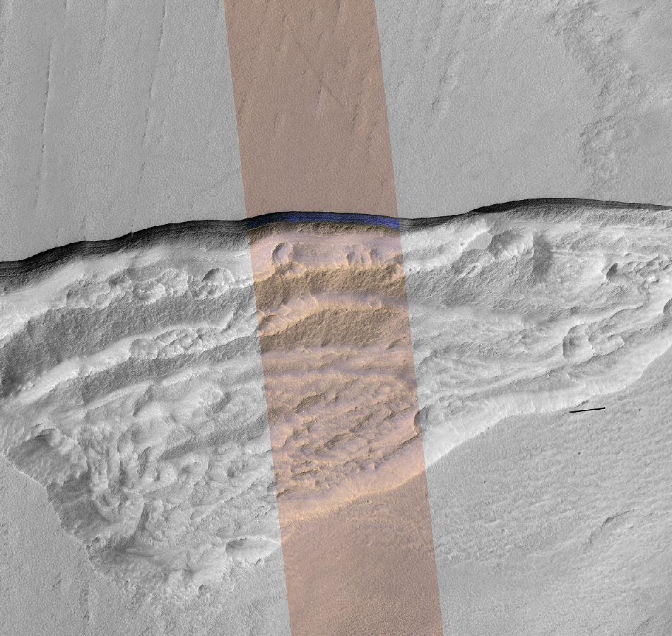
Underground Martian Ice Deposit Exposed at Scarp
Full Resolution:
TIFF
(2.406 MB)
JPEG
(146.9 kB)
2018-01-11
Mars
Mars Reconnaissance Orbiter (MRO)
HiRISE
951x900x3
PIA22078:
Pit Where a Scarp Exposes an Underground Deposit of Martian Ice
Full Resolution:
TIFF
(1.746 MB)
JPEG
(189.9 kB)
2018-01-12
Mars
2001 Mars Odyssey
THEMIS
1379x3232x1
PIA22165:
Investigating Mars: Candor Chasma
Full Resolution:
TIFF
(2.68 MB)
JPEG
(234.8 kB)
2018-01-15
Mars
2001 Mars Odyssey
THEMIS
1313x2769x1
PIA22166:
Investigating Mars: Candor Chasma
Full Resolution:
TIFF
(2.79 MB)
JPEG
(361.3 kB)
2018-01-16
Mars
2001 Mars Odyssey
THEMIS
1352x2926x1
PIA22167:
Investigating Mars: Candor Chasma
Full Resolution:
TIFF
(2.942 MB)
JPEG
(319.5 kB)
2018-01-17
Mars
2001 Mars Odyssey
THEMIS
1340x2930x1
PIA22168:
Investigating Mars: Candor Chasma
Full Resolution:
TIFF
(2.831 MB)
JPEG
(320.9 kB)
2018-01-18
Mars
2001 Mars Odyssey
THEMIS
1345x2929x1
PIA22169:
Investigating Mars: Candor Chasma
Full Resolution:
TIFF
(2.837 MB)
JPEG
(321.2 kB)
2018-01-19
Mars
2001 Mars Odyssey
THEMIS
1321x2777x1
PIA22170:
Investigating Mars: Candor Chasma
Full Resolution:
TIFF
(2.331 MB)
JPEG
(206.7 kB)
2018-01-22
Mars
2001 Mars Odyssey
THEMIS
711x1444x1
PIA22171:
Yuty Crater Ejecta
Full Resolution:
TIFF
(799.1 kB)
JPEG
(132.1 kB)
2018-01-23
Mars
Mars Reconnaissance Orbiter (MRO)
MCS
1595x1055x3
PIA22080:
Water Vapor Reaches Mars' Middle Atmosphere During Global Dust Storm
Full Resolution:
TIFF
(1.133 MB)
JPEG
(197.6 kB)
2018-01-23
Mars
2001 Mars Odyssey
THEMIS
1348x3100x1
PIA22172:
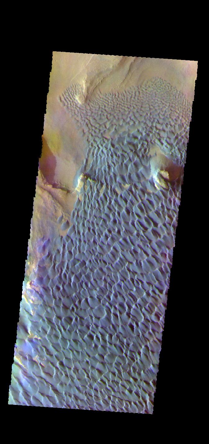
Investigating Mars: Kaiser Crater Dunes
Full Resolution:
TIFF
(2.611 MB)
JPEG
(217.3 kB)
2018-01-23
Mars
Mars Reconnaissance Orbiter (MRO)
HiRISE
2880x1800x3
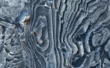
PIA22180:
Hexagons in Icy Terrain
Full Resolution:
TIFF
(15.56 MB)
JPEG
(1.438 MB)
2018-01-23
Mars
Mars Reconnaissance Orbiter (MRO)
HiRISE
2880x1800x3
PIA22181:
Dark Materials on Olympus Mons
Full Resolution:
TIFF
(15.56 MB)
JPEG
(976.8 kB)
2018-01-23
Mars
Mars Reconnaissance Orbiter (MRO)
HiRISE
2880x1800x3
PIA22182:
Eroded Layers in Shalbatana Valles
Full Resolution:
TIFF
(15.56 MB)
JPEG
(1.457 MB)
2018-01-23
Mars
Mars Reconnaissance Orbiter (MRO)
HiRISE
2880x1800x3
PIA22183:
Clays of Ladon Basin
Full Resolution:
TIFF
(15.56 MB)
JPEG
(933.3 kB)
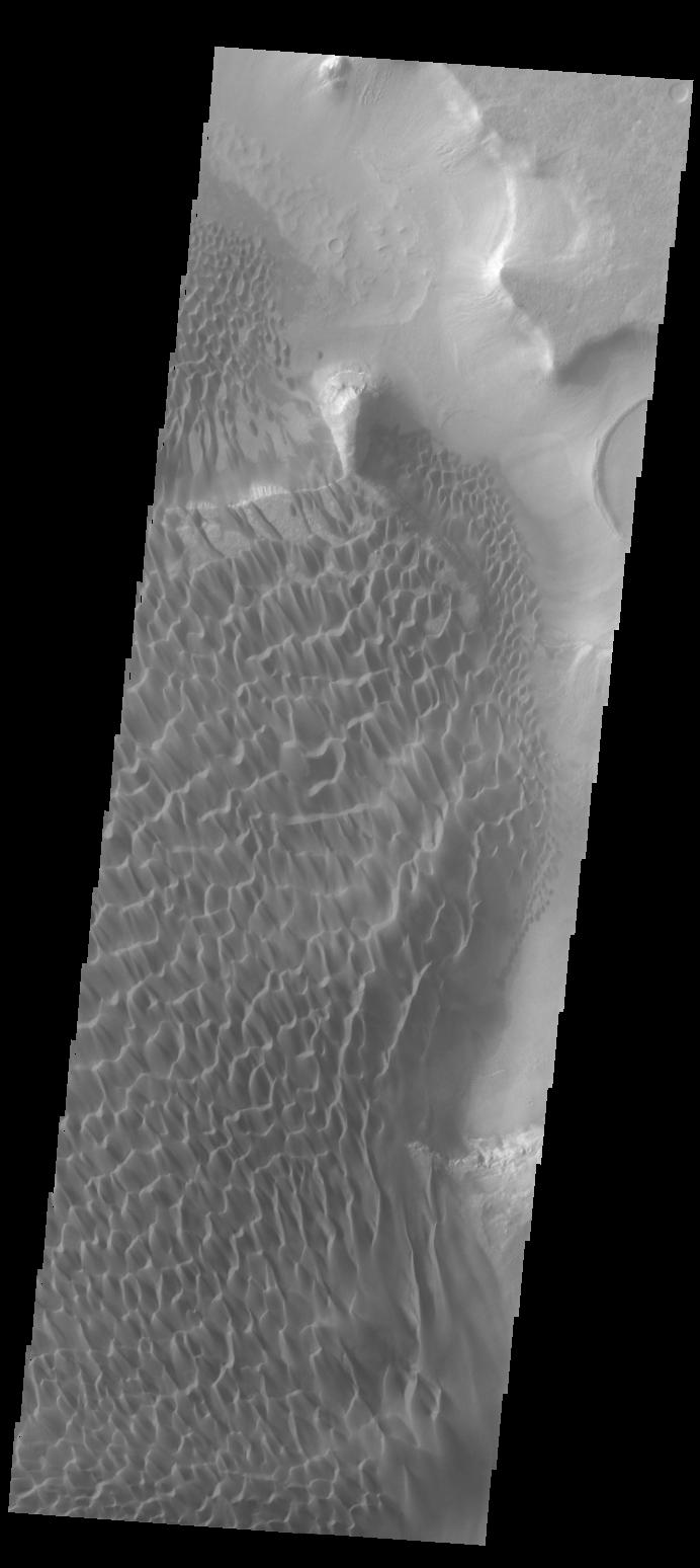
2018-01-24
Mars
2001 Mars Odyssey
THEMIS
1359x3103x1
PIA22173:
Investigating Mars: Kaiser Crater Dunes
Full Resolution:
TIFF
(2.832 MB)
JPEG
(295.2 kB)
2018-01-25
Mars
2001 Mars Odyssey
THEMIS
1404x3274x1
PIA22174:
Investigating Mars: Kaiser Crater Dunes
Full Resolution:
TIFF
(2.773 MB)
JPEG
(234.5 kB)
2018-01-25
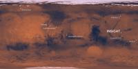
Mars
InSight
3600x1800x3
PIA22232:
InSight's Landing Site: Elysium Planitia
Full Resolution:
TIFF
(14.7 MB)
JPEG
(572.4 kB)
2018-01-26
Mars
2001 Mars Odyssey
THEMIS
1327x2964x1
PIA22175:
Investigating Mars: Kaiser Crater Dunes
Full Resolution:
TIFF
(2.894 MB)
JPEG
(326 kB)
2018-01-29
Mars
2001 Mars Odyssey
THEMIS
1343x2963x1
PIA22261:
Investigating Mars: Kaiser Crater Dunes
Full Resolution:
TIFF
(2.382 MB)
JPEG
(204.5 kB)
2018-01-30
Mars
2001 Mars Odyssey
THEMIS
1686x2899x1
PIA22262:
Investigating Mars: Kaiser Crater Dunes
Full Resolution:
TIFF
(3.101 MB)
JPEG
(327.9 kB)
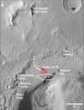
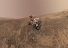
2018-01-30
Mars
Mars Science Laboratory (MSL)
2550x3300x3
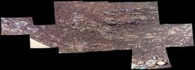
PIA22208:
Locator Map for Features in Curiosity Panorama
Full Resolution:
TIFF
(11.68 MB)
JPEG
(916.2 kB)
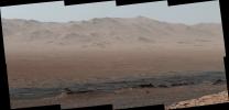
2018-01-30
Mars
Mars Science Laboratory (MSL)
Mastcam
4697x2263x3
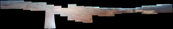
PIA22209:
Telephoto Vista from Ridge in Mars' Gale Crater
Full Resolution:
TIFF
(23.4 MB)
JPEG
(1.283 MB)
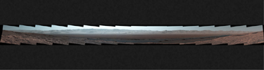
2018-01-30
Mars
Mars Science Laboratory (MSL)
Mastcam
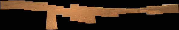
17478x1369x3
PIA22210:
Wide-Angle Panorama from Ridge in Mars' Gale Crater
Full Resolution:
TIFF
(48.73 MB)
JPEG
(2.447 MB)
2018-01-31
Mars
2001 Mars Odyssey
THEMIS
1555x2872x1
PIA22263:
Investigating Mars: Kaiser Crater Dunes
Full Resolution:
TIFF
(2.952 MB)
JPEG
(272.5 kB)
2018-01-31
Mars
Mars Science Laboratory (MSL)
MAHLI
14000x10000x3
PIA22207:
Mount Sharp 'Photobombs' Curiosity
Full Resolution:
TIFF
(337.3 MB)
JPEG
(12.27 MB)
2018-02-01
Mars
2001 Mars Odyssey
THEMIS
1323x2813x1
PIA22264:
Investigating Mars: Kaiser Crater Dunes
Full Resolution:
TIFF
(2.405 MB)
JPEG
(201.4 kB)
2018-02-02
Mars
2001 Mars Odyssey
THEMIS
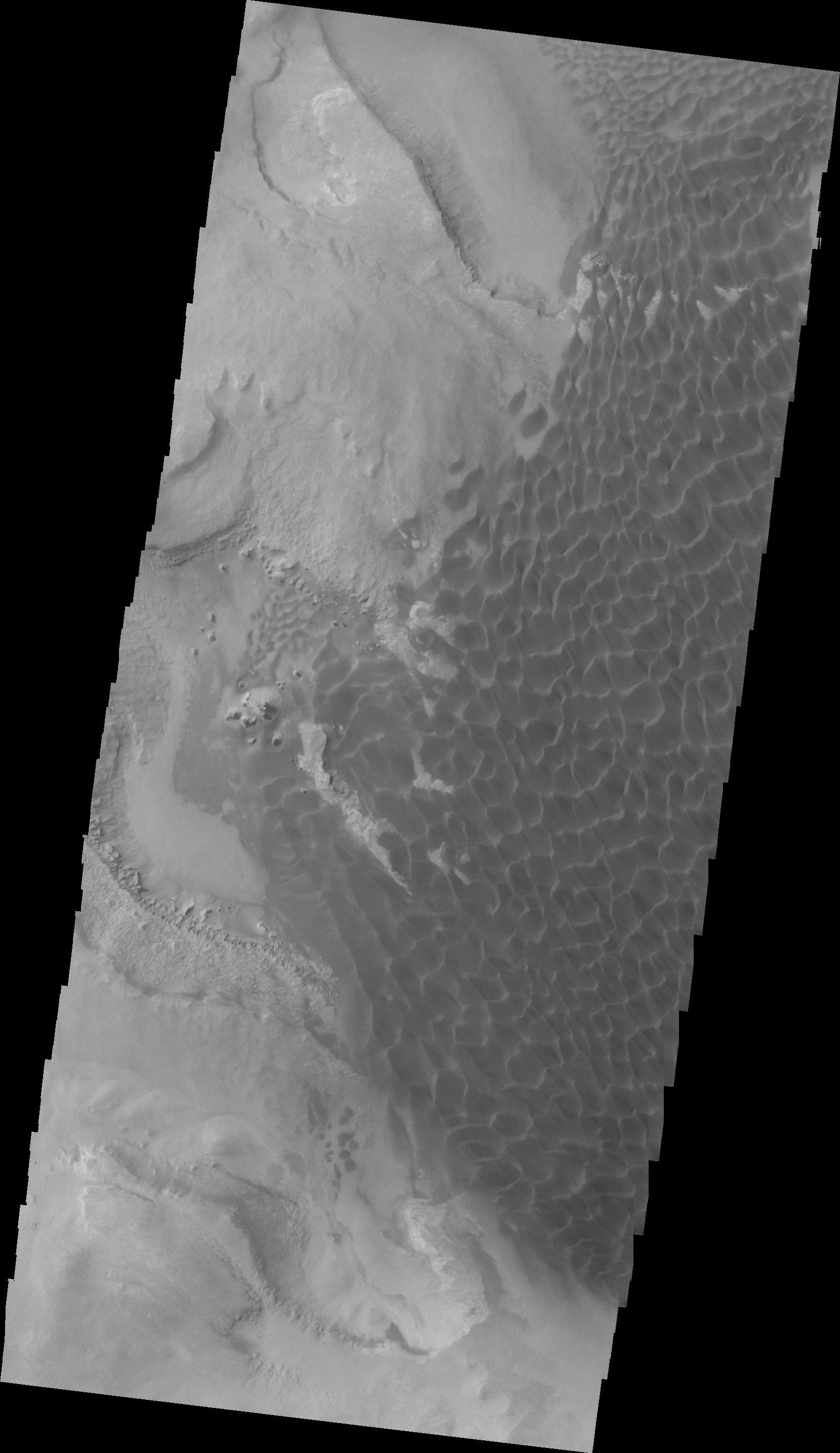
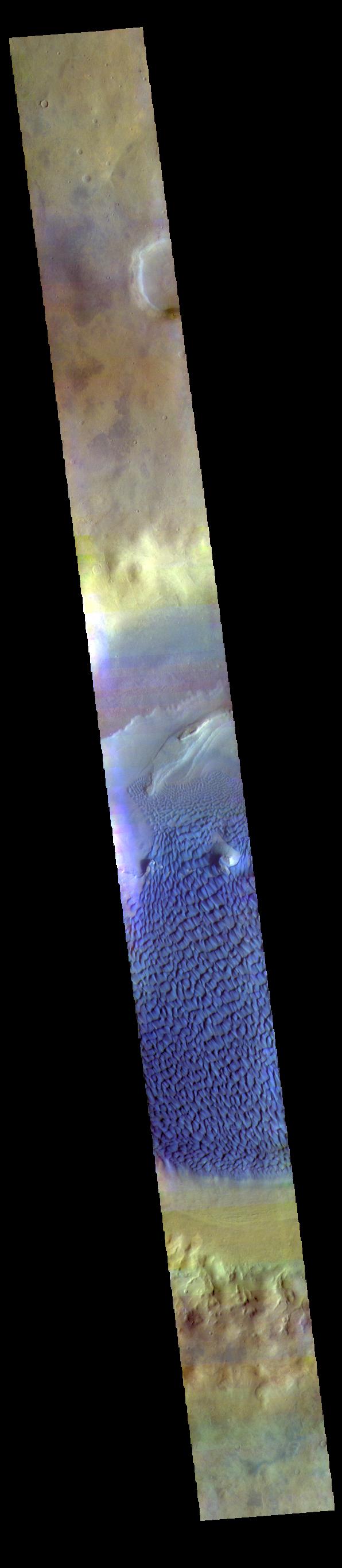
595x2735x3
PIA22265:
Investigating Mars: Kaiser Crater Dunes
Full Resolution:
TIFF
(2.15 MB)
JPEG
(102.9 kB)
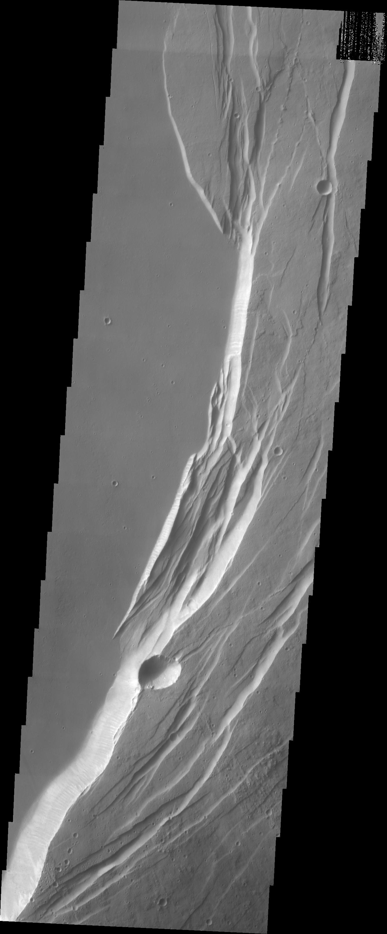
2018-02-05
Mars
2001 Mars Odyssey
THEMIS
1362x3063x1
PIA22267:
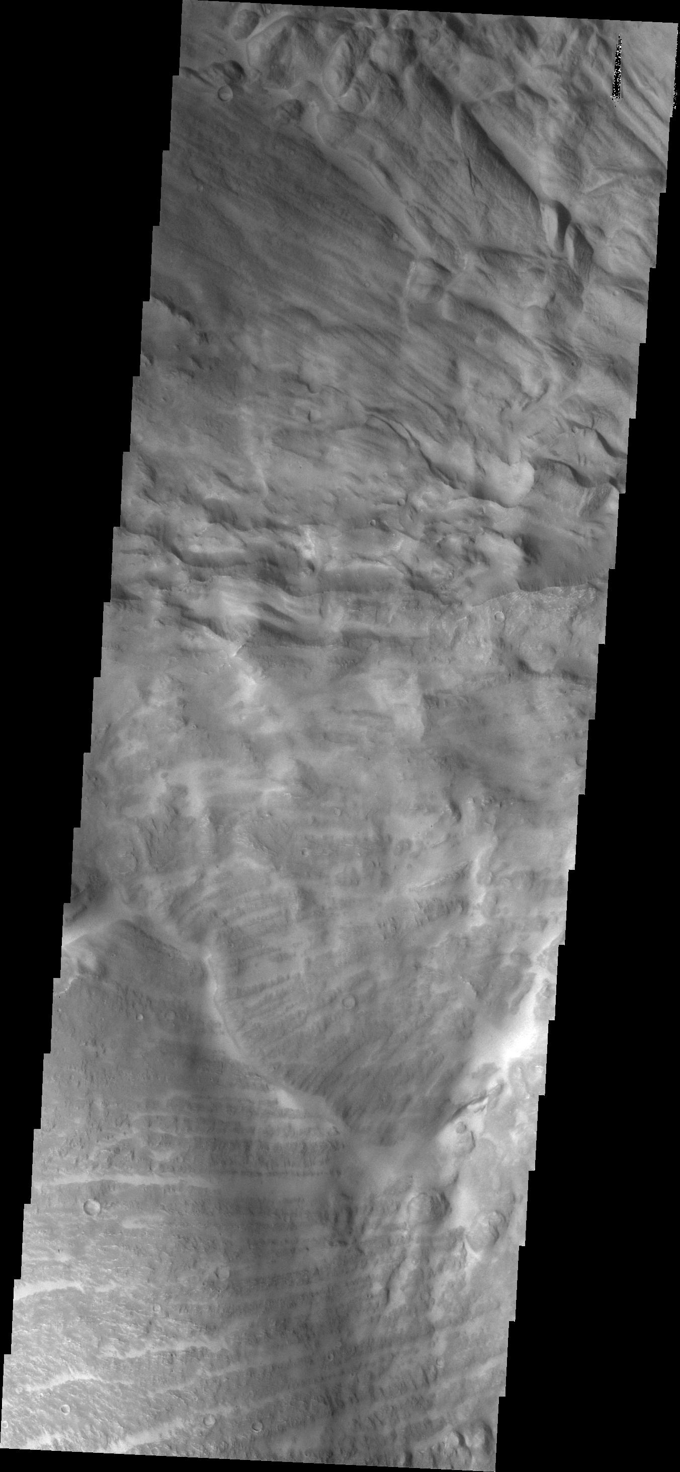
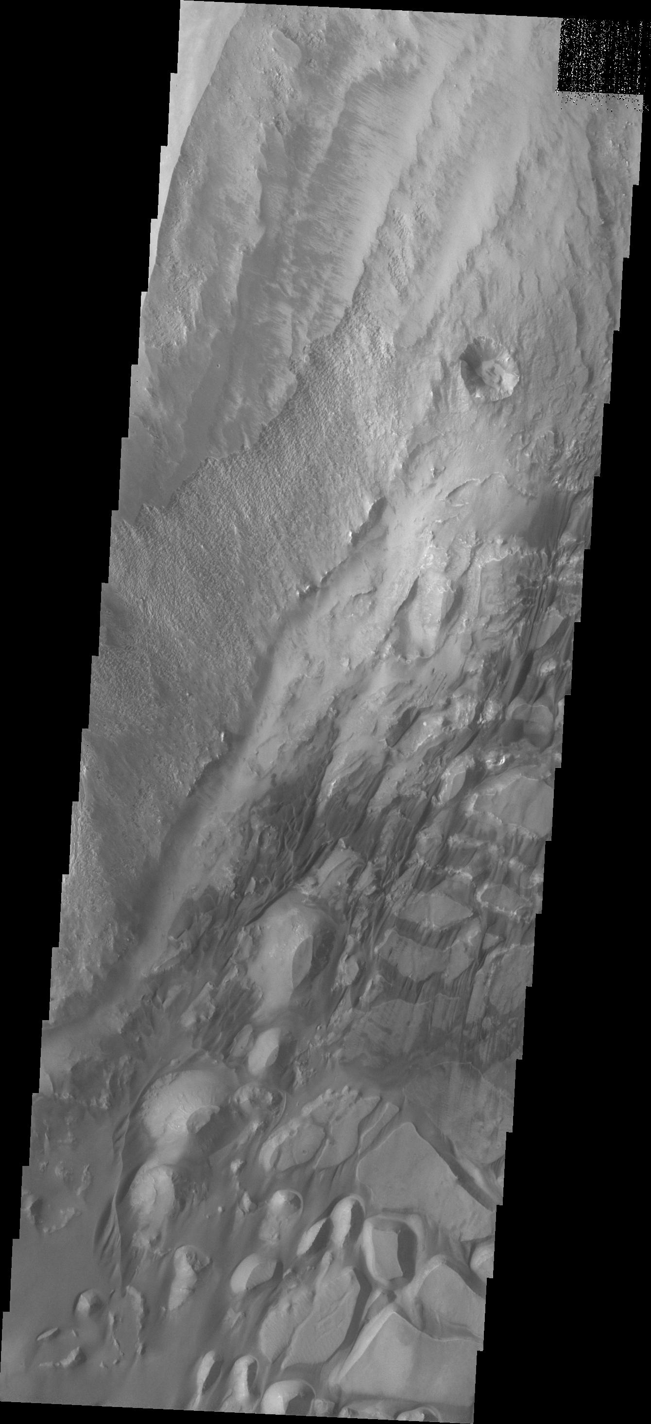
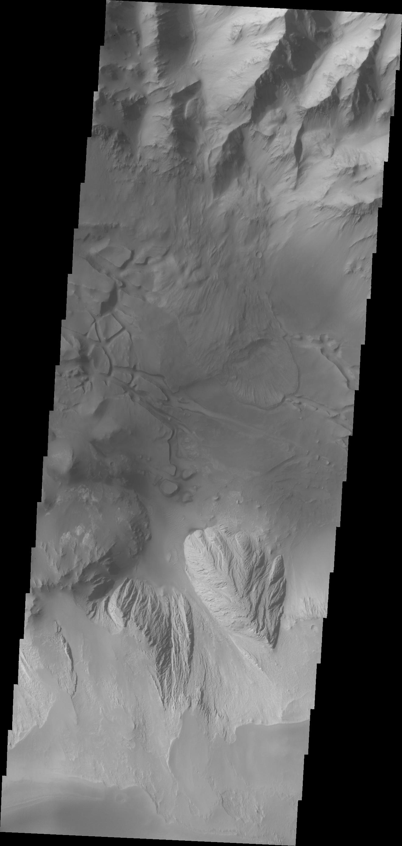
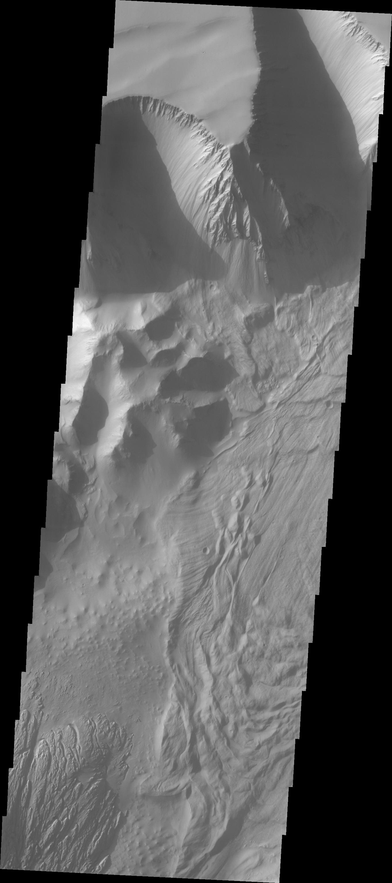
Investigating Mars: Tithonium Chasma
Full Resolution:
TIFF
(2.701 MB)
JPEG
(250.4 kB)
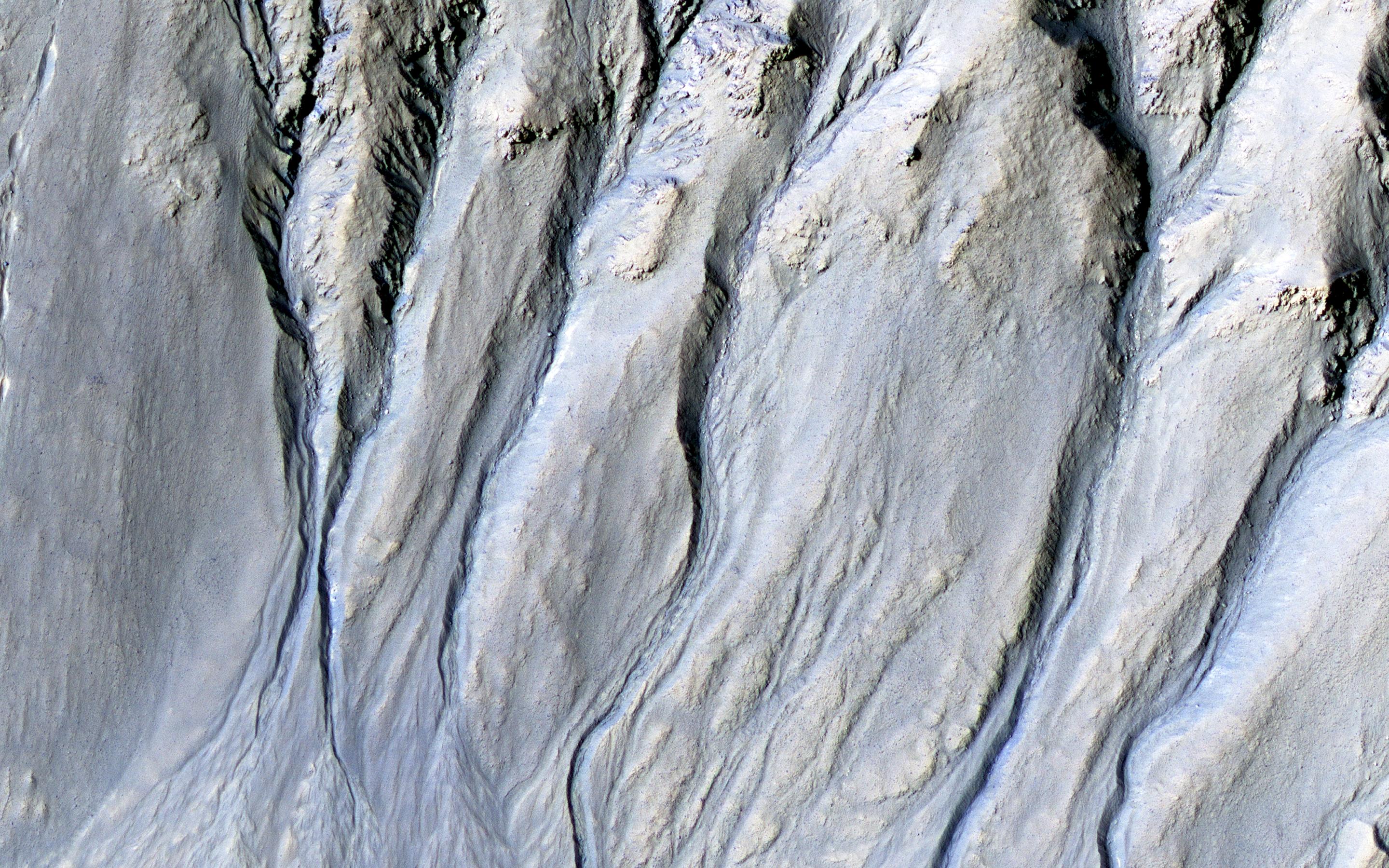
2018-02-05
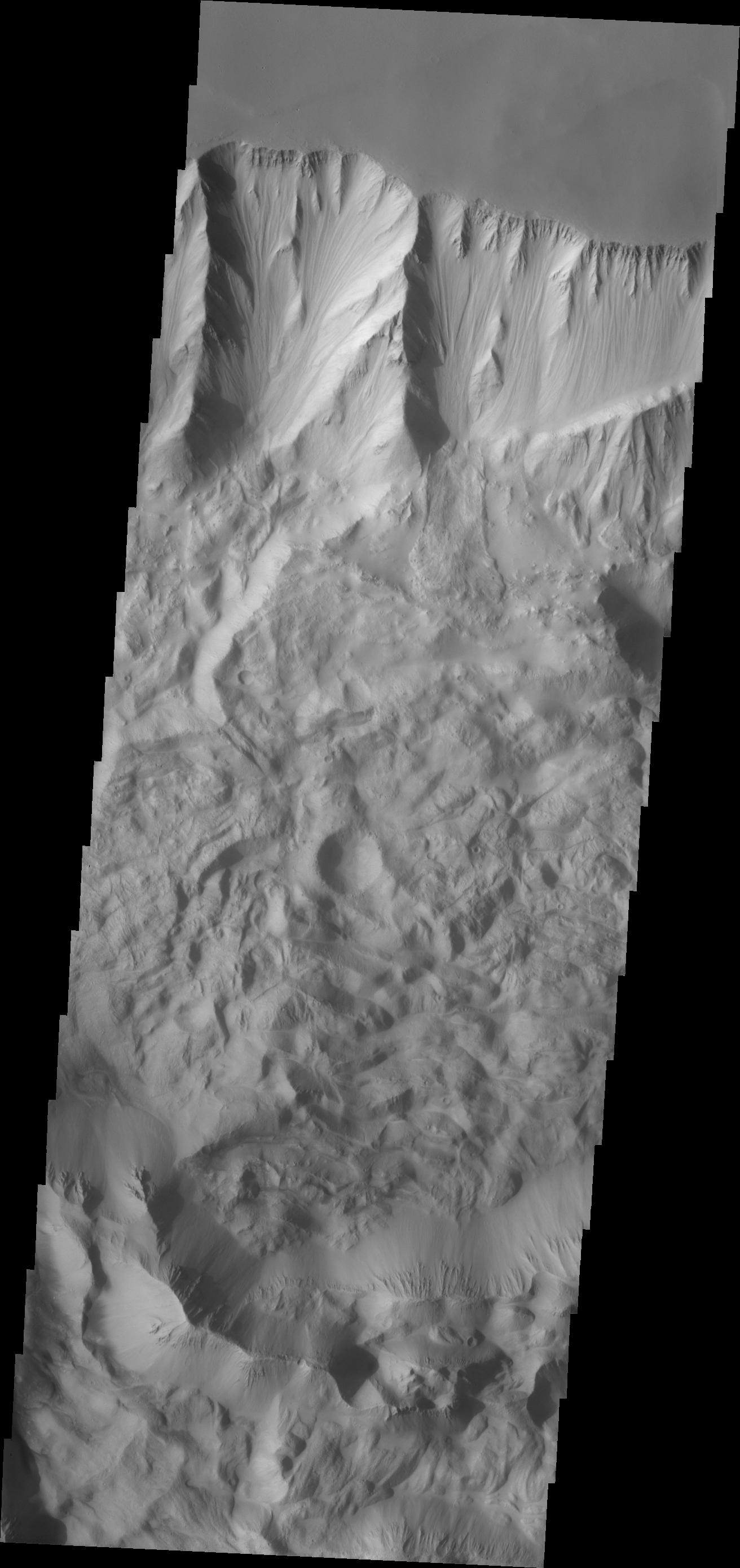
Mars
Mars Reconnaissance Orbiter (MRO)
HiRISE
2880x1800x3
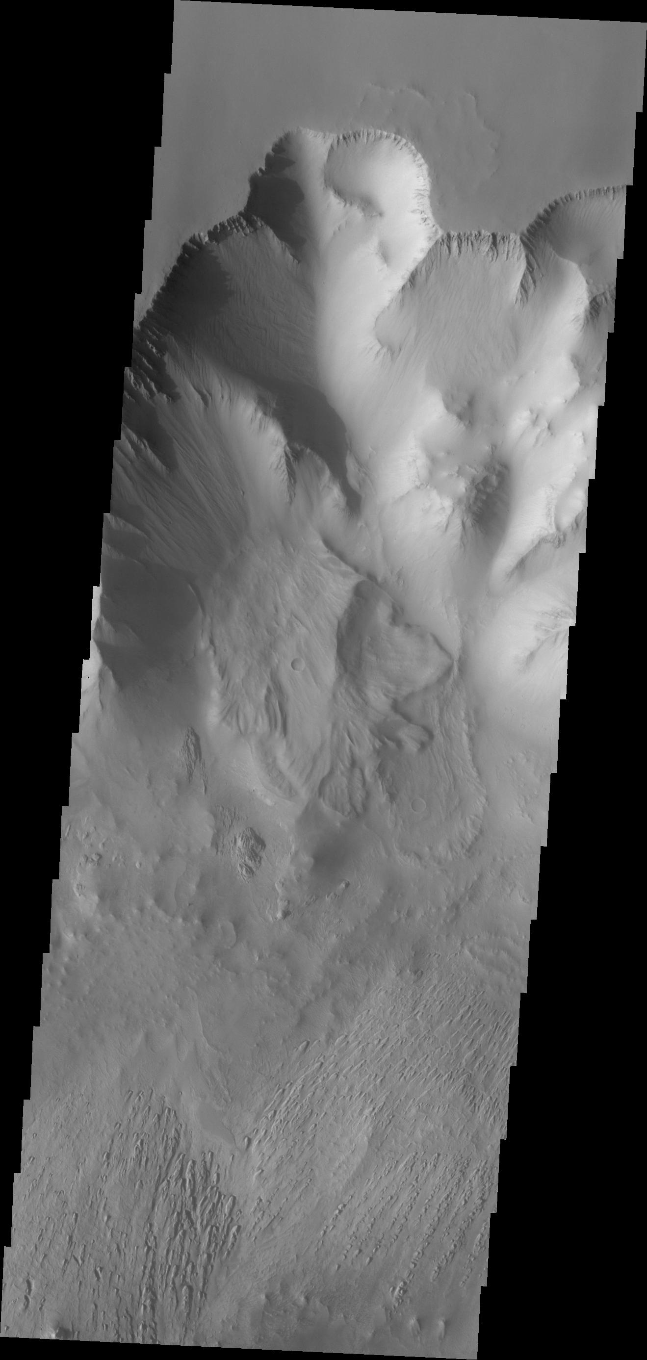
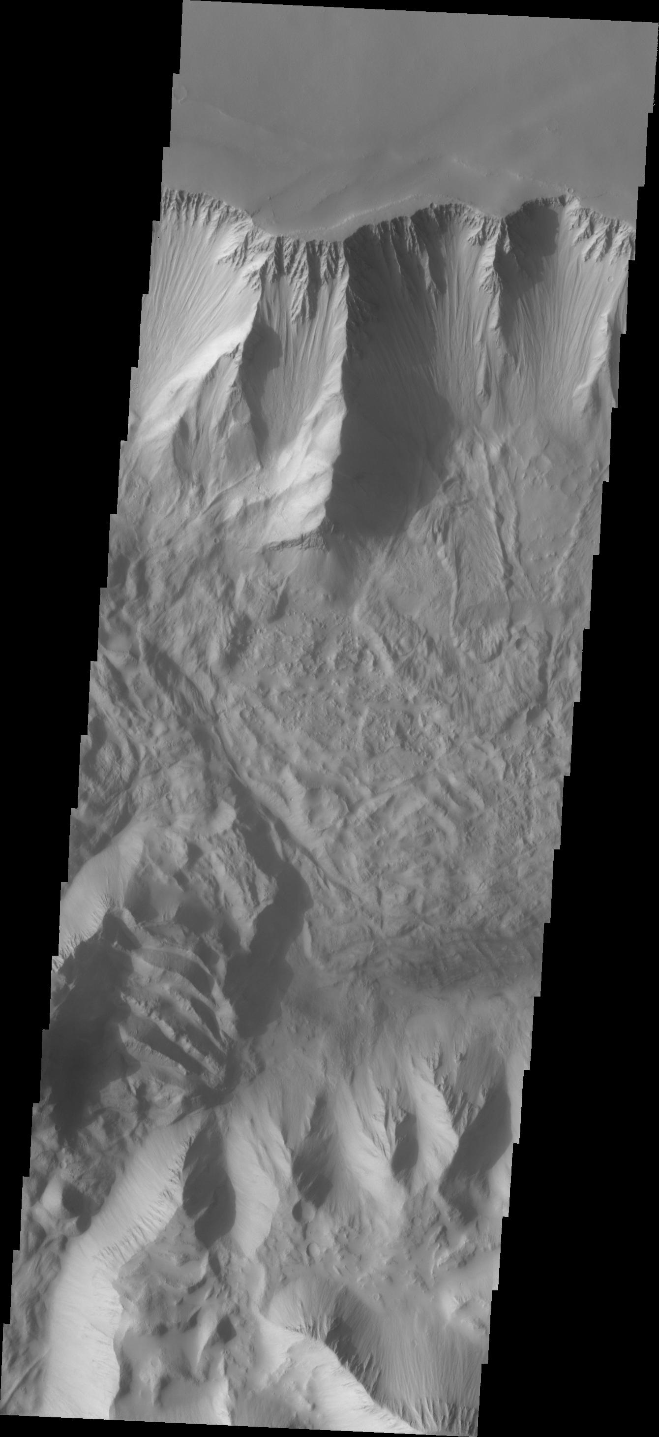
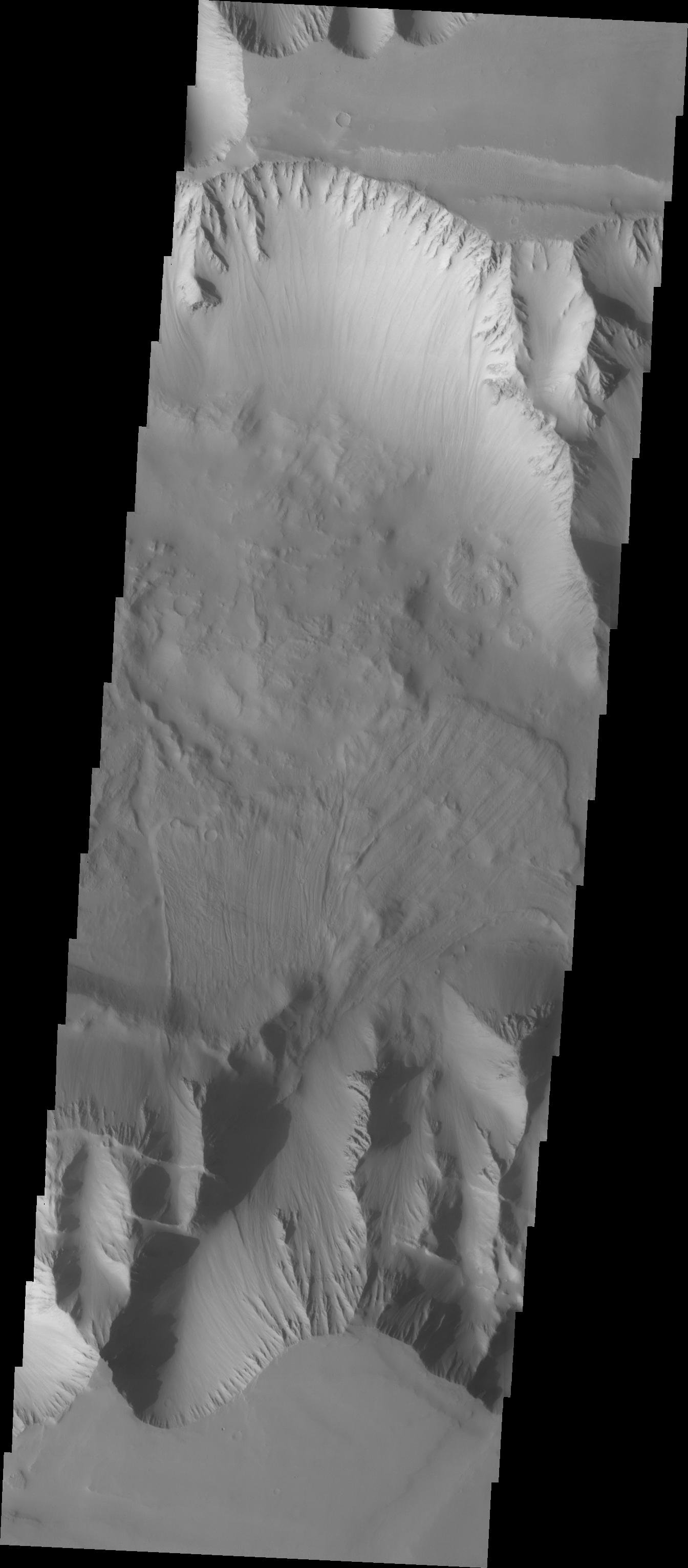
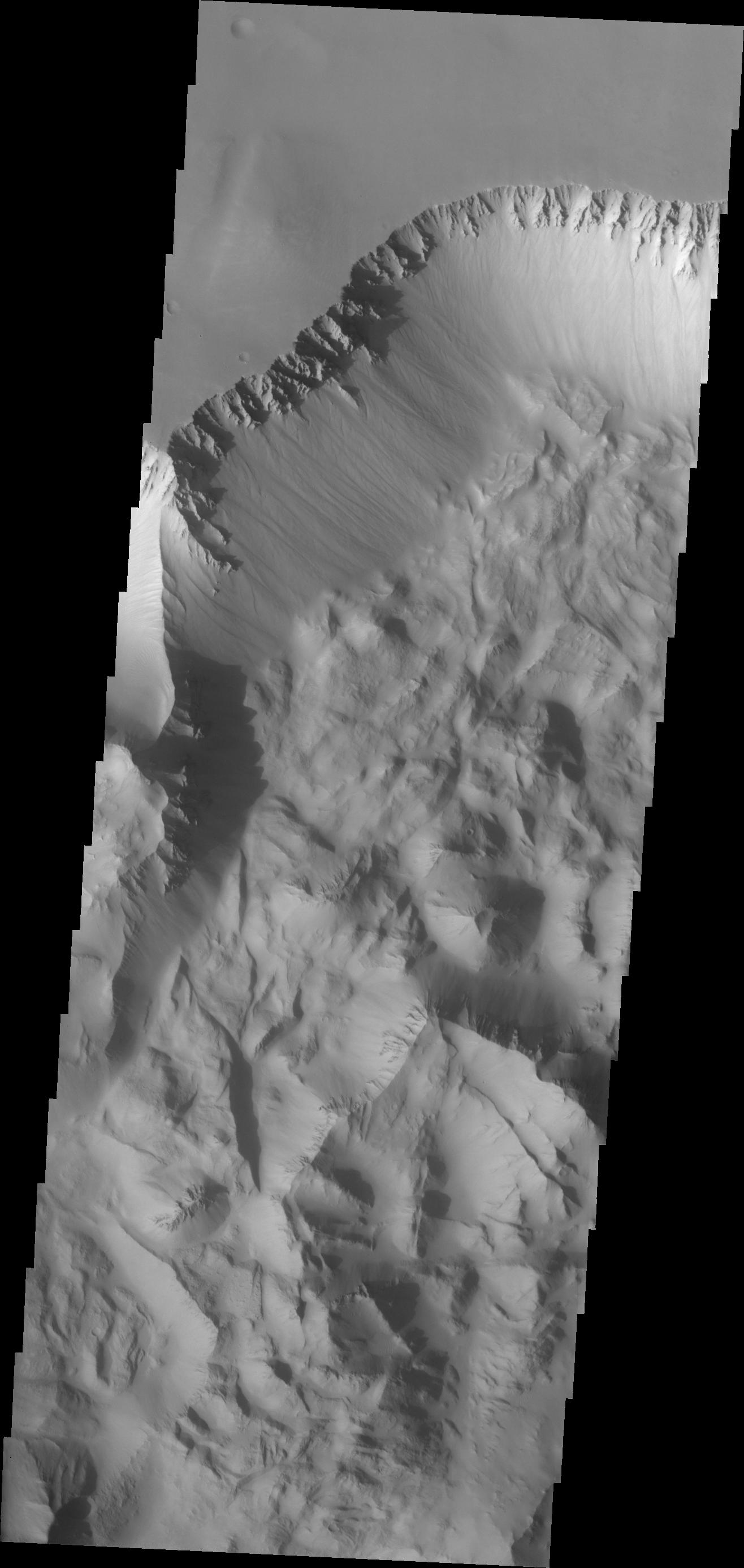
PIA22238:
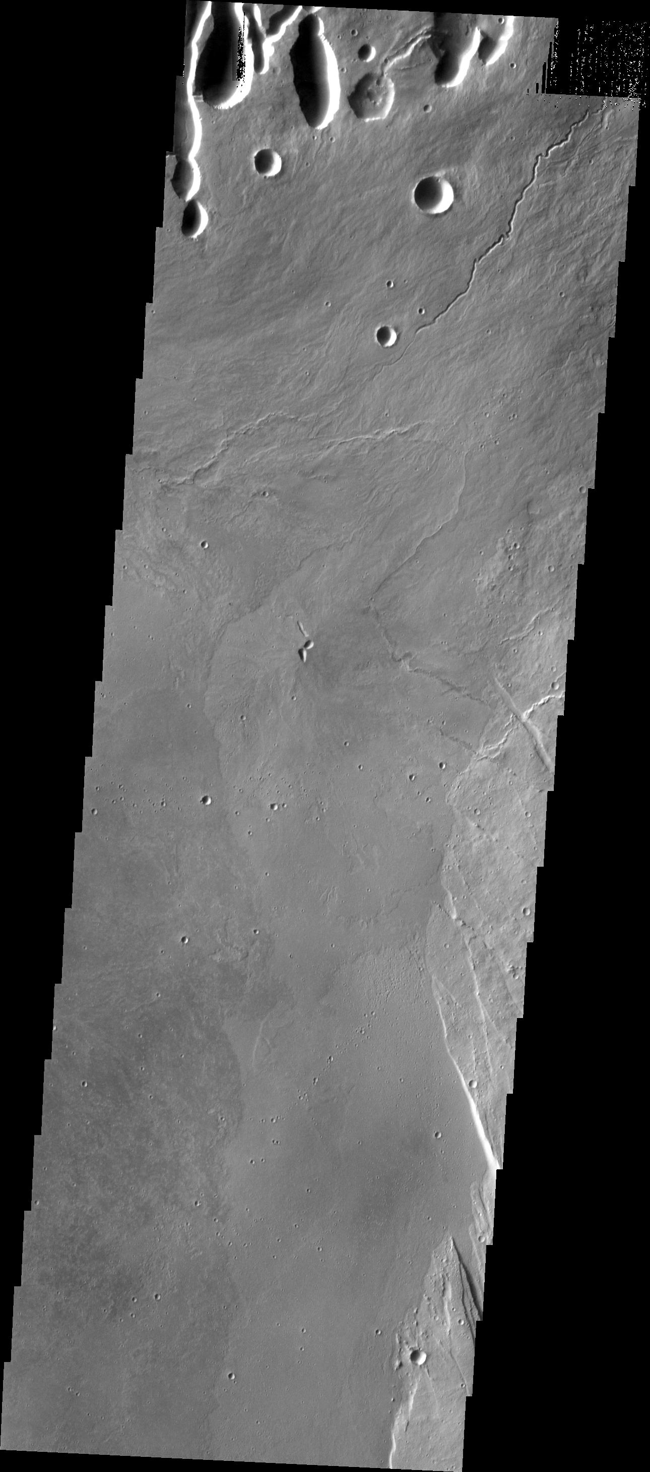
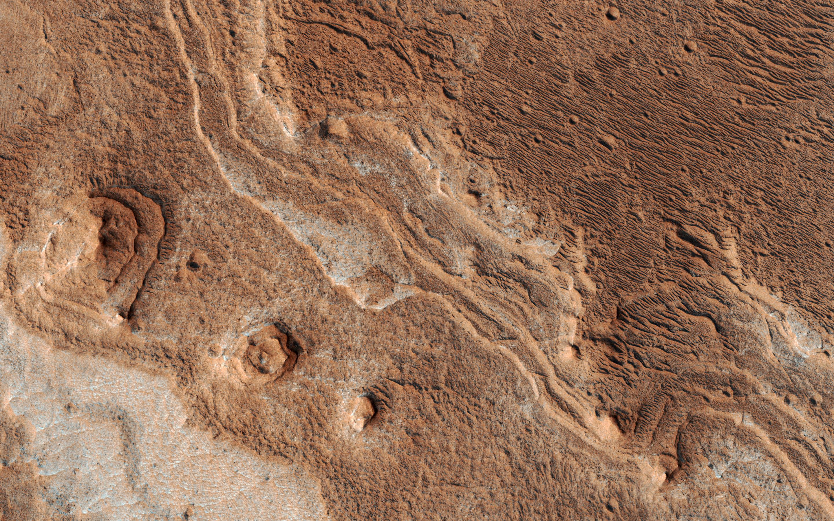
Geologic History Revealed in Valles Marineris
Full Resolution:
TIFF
(15.56 MB)
JPEG
(1.07 MB)
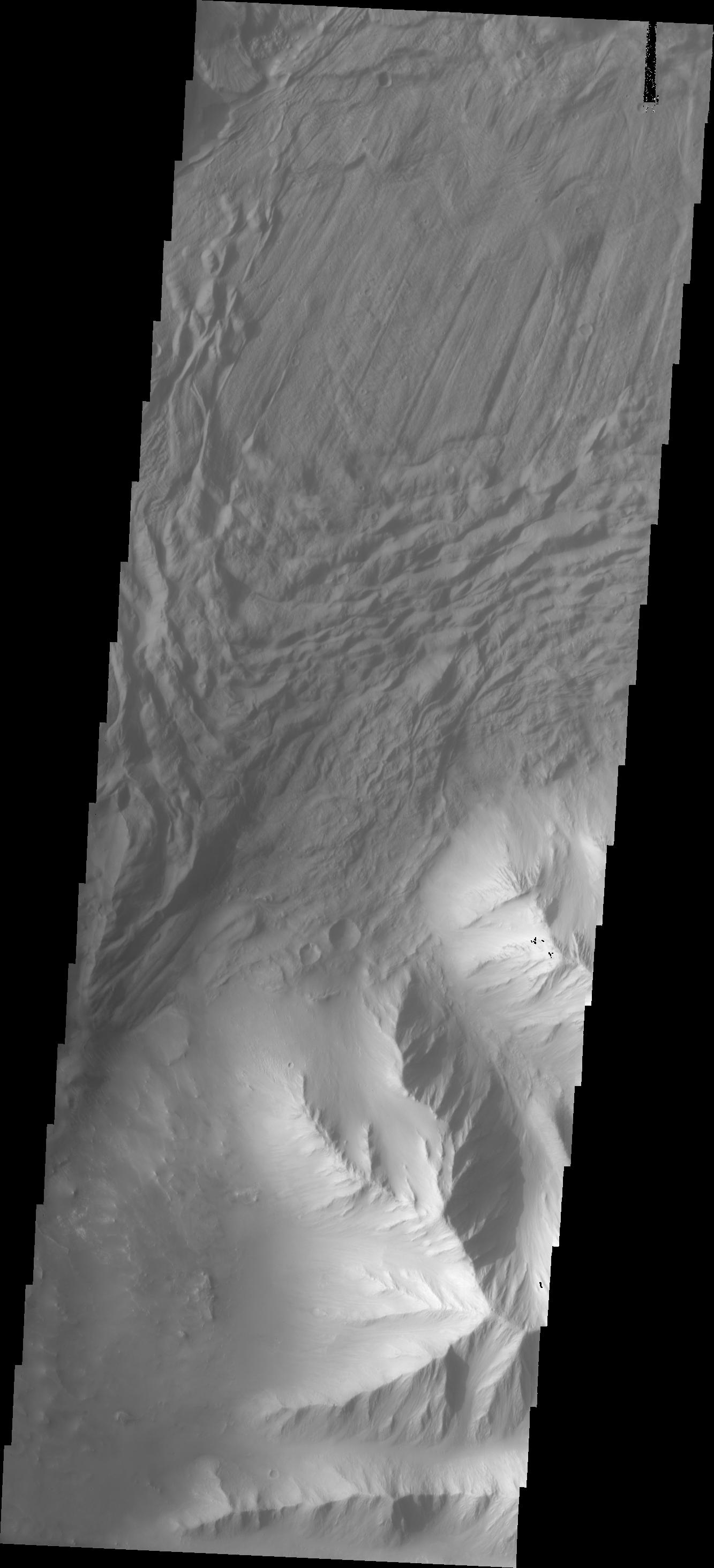
2018-02-05
Mars
Mars Reconnaissance Orbiter (MRO)
HiRISE
2880x1800x3
PIA22239:
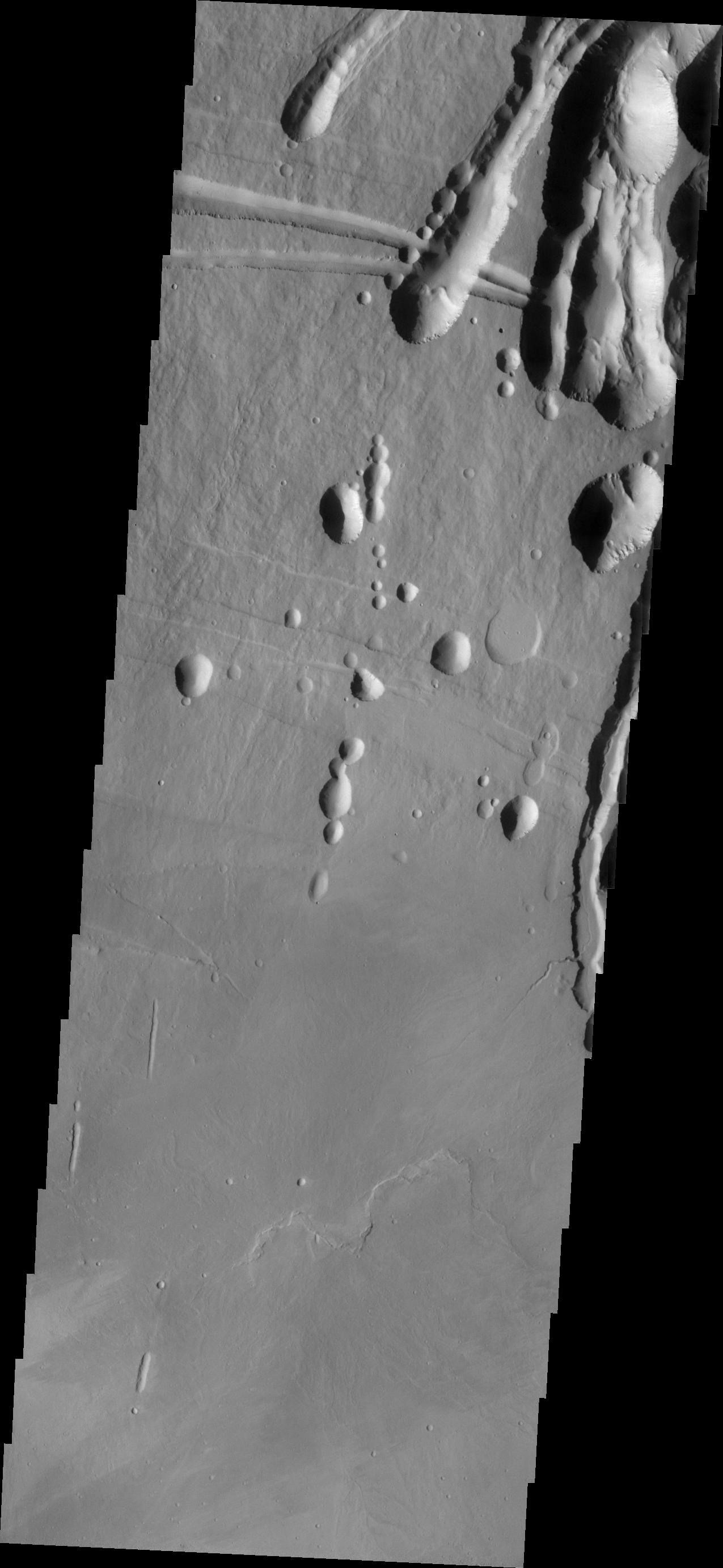
Gullies and Voids
Full Resolution:
TIFF
(15.56 MB)
JPEG
(1.07 MB)
2018-02-05
Mars
Mars Reconnaissance Orbiter (MRO)
HiRISE
3199x2452x3
PIA22240:
Splitting Slope Streaks
Full Resolution:
TIFF
(20.83 MB)
JPEG
(822.8 kB)
2018-02-05
Mars
Mars Reconnaissance Orbiter (MRO)
HiRISE
899x476x1
PIA22241:
Crater Tadpoles
Full Resolution:
TIFF
(428.6 kB)
JPEG
(147.2 kB)
2018-02-06
Mars
2001 Mars Odyssey
THEMIS
1362x3064x1
PIA22268:
Investigating Mars: Tithonium Chasma
Full Resolution:
TIFF
(2.699 MB)
JPEG
(250.3 kB)
2018-02-07
Mars
2001 Mars Odyssey
THEMIS
1390x3231x1
PIA22269:
Investigating Mars: Tithonium Chasma
Full Resolution:
TIFF
(2.842 MB)
JPEG
(286.1 kB)
2018-02-08
Mars
2001 Mars Odyssey
THEMIS
1376x3229x1
PIA22270:
Investigating Mars: Tithonium Chasma
Full Resolution:
TIFF
(2.678 MB)
JPEG
(240.7 kB)
2018-02-08
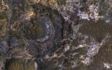
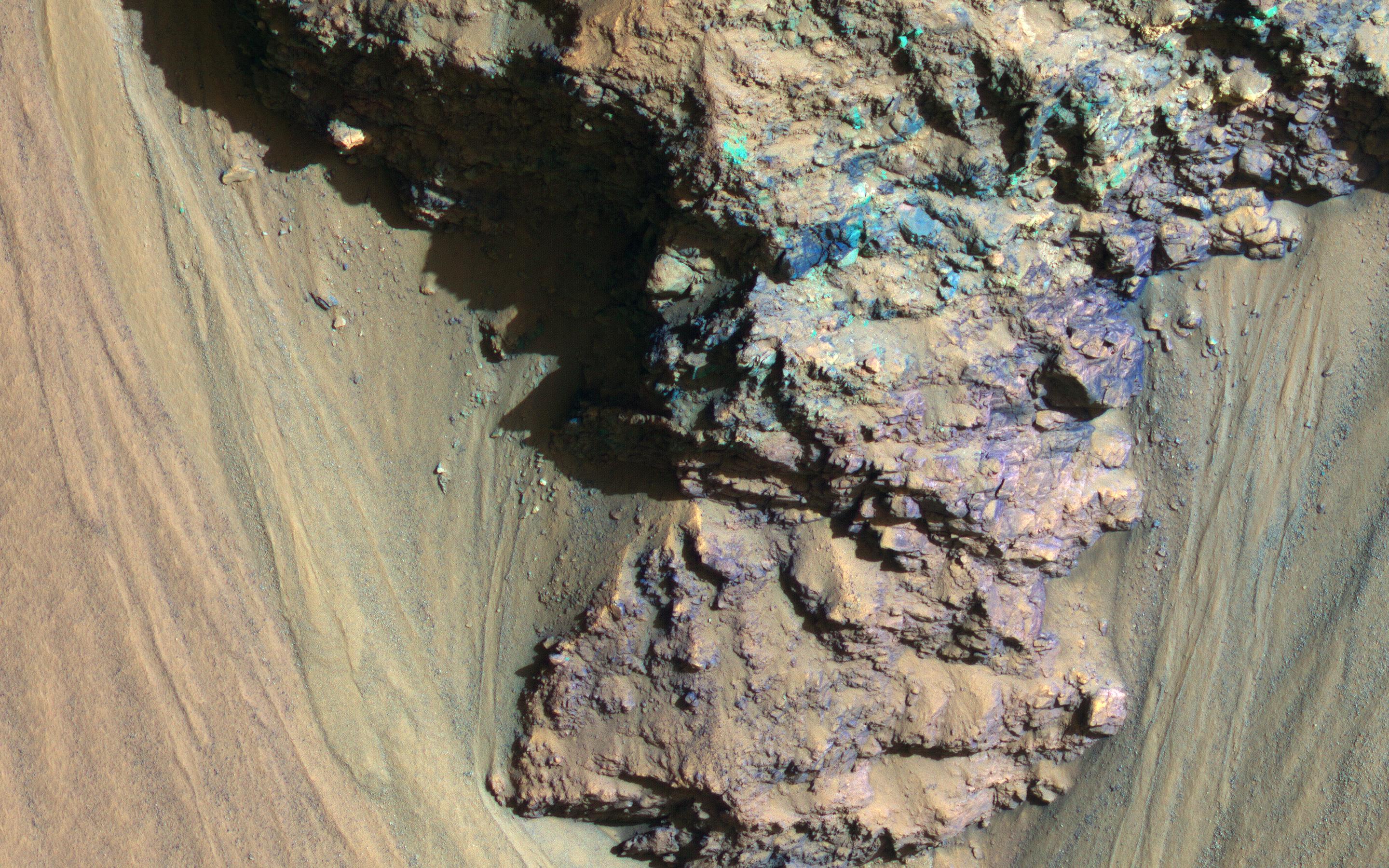
Mars
Mars Science Laboratory (MSL)
MAHLI
3273x2884x3
PIA22211:
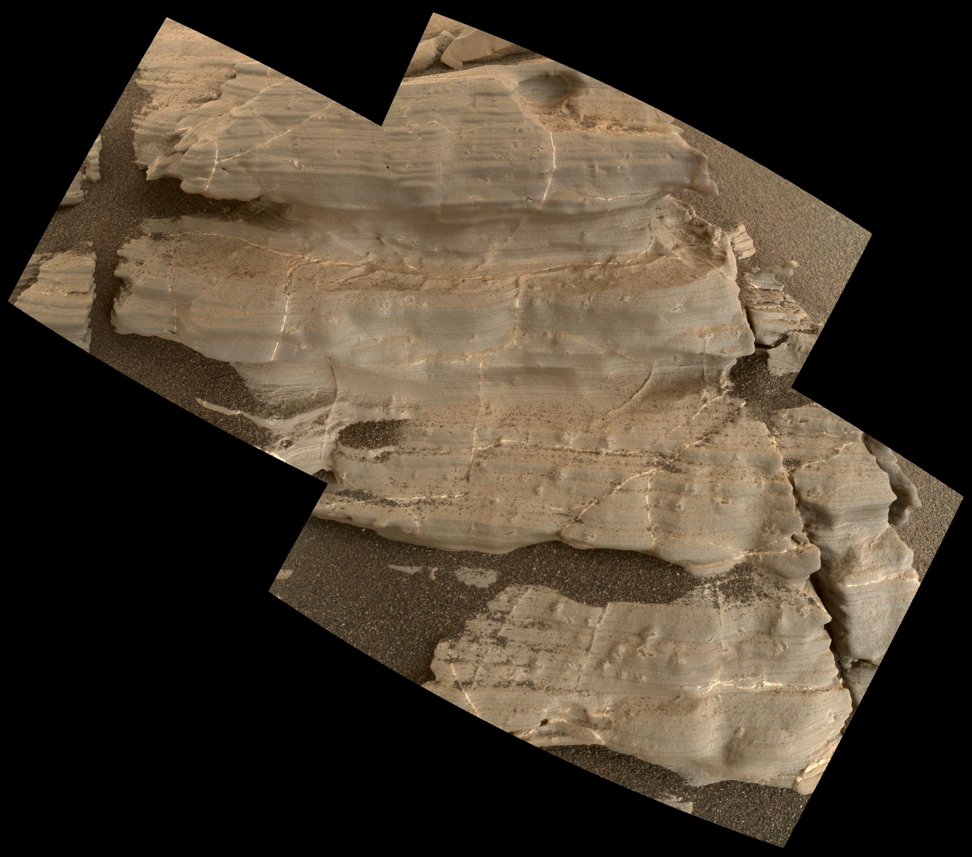
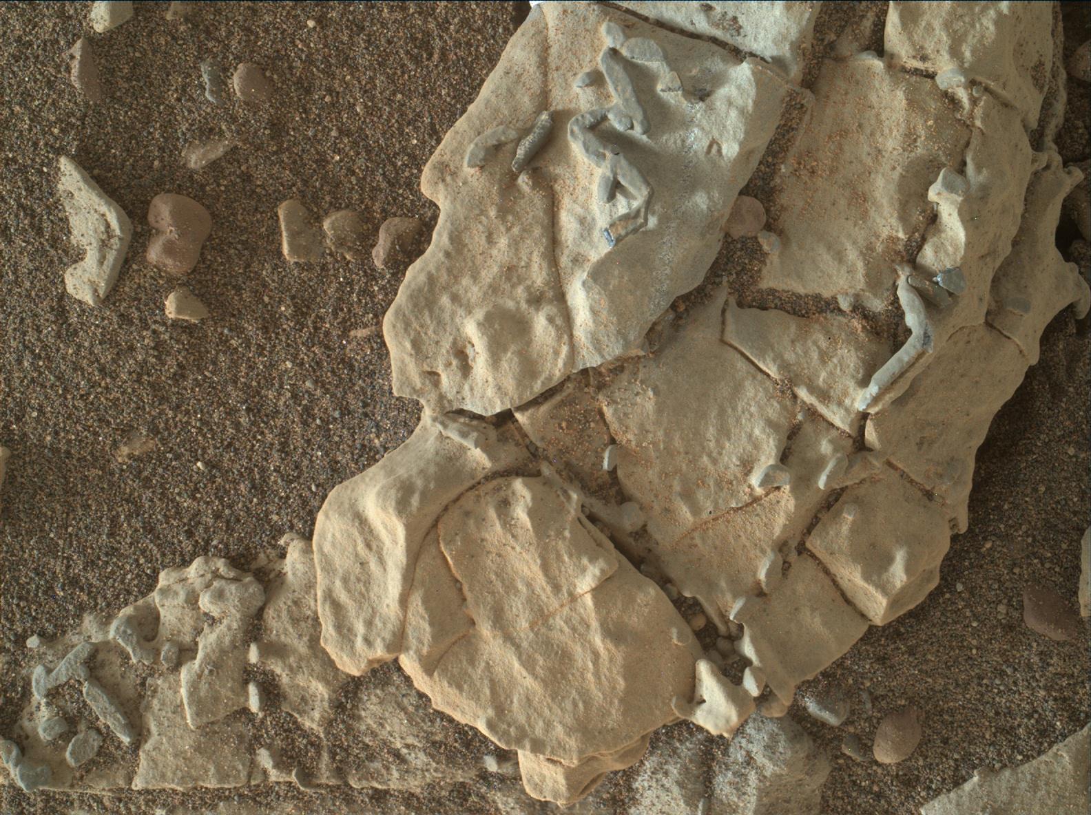
Crystal Shapes and Two-Toned Veins on Martian Ridge
Full Resolution:
TIFF
(15.51 MB)
JPEG
(809.6 kB)
2018-02-08
Mars
Mars Science Laboratory (MSL)
MAHLI
1451x1160x3
PIA22212:
Stereo View of Martian Rock Target 'Funzie'
Full Resolution:
TIFF
(5.052 MB)
JPEG
(241 kB)
2018-02-08
Mars
Mars Science Laboratory (MSL)
MAHLI
1584x1184x3
PIA22213:
Stick-Shape, Rice-Size Features on Martian Rock "Haroldswick"
Full Resolution:
TIFF
(5.628 MB)
JPEG
(361.3 kB)
2018-02-08
Mars
Mars Science Laboratory (MSL)
MAHLI
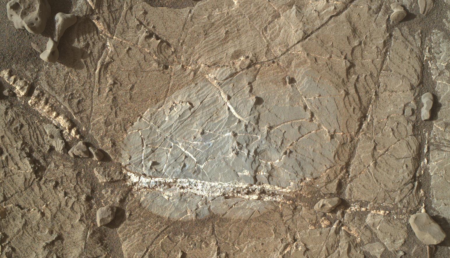
1544x887x3
PIA22214:
Brushed Vein in 'Rona' on 'Vera Rubin Ridge'
Full Resolution:
TIFF
(4.11 MB)
JPEG
(304.6 kB)
2018-02-09
Mars
2001 Mars Odyssey
THEMIS
1312x2776x1
PIA22271:
Investigating Mars: Tithonium Chasma
Full Resolution:
TIFF
(2.606 MB)
JPEG
(250.7 kB)
2018-02-09
Mars
Mars Reconnaissance Orbiter (MRO)
HiRISE
2810x1047x1
PIA22215:
Slight Blurring in Newer Image from Mars Orbiter
Full Resolution:
TIFF
(2.385 MB)
JPEG
(264 kB)
2018-02-12
Mars
2001 Mars Odyssey
THEMIS
1333x2928x1
PIA22272:
Investigating Mars: Tithonium Chasma
Full Resolution:
TIFF
(2.539 MB)
JPEG
(225.5 kB)
2018-02-13
Mars
2001 Mars Odyssey
THEMIS
1319x2773x1
PIA22273:
Investigating Mars: Tithonium Chasma
Full Resolution:
TIFF
(2.455 MB)
JPEG
(222.1 kB)
2018-02-14
Mars
2001 Mars Odyssey
THEMIS
1340x2920x1
PIA22274:
Investigating Mars: Tithonium Chasma
Full Resolution:
TIFF
(2.661 MB)
JPEG
(242.8 kB)
2018-02-15
Mars
2001 Mars Odyssey
THEMIS
705x1546x1
PIA22275:
Investigating Mars: Tithonium Chasma
Full Resolution:
TIFF
(764.3 kB)
JPEG
(78.49 kB)
2018-02-15
Mars
Mars Exploration Rover (MER)
HiRISE
3741x2519x3
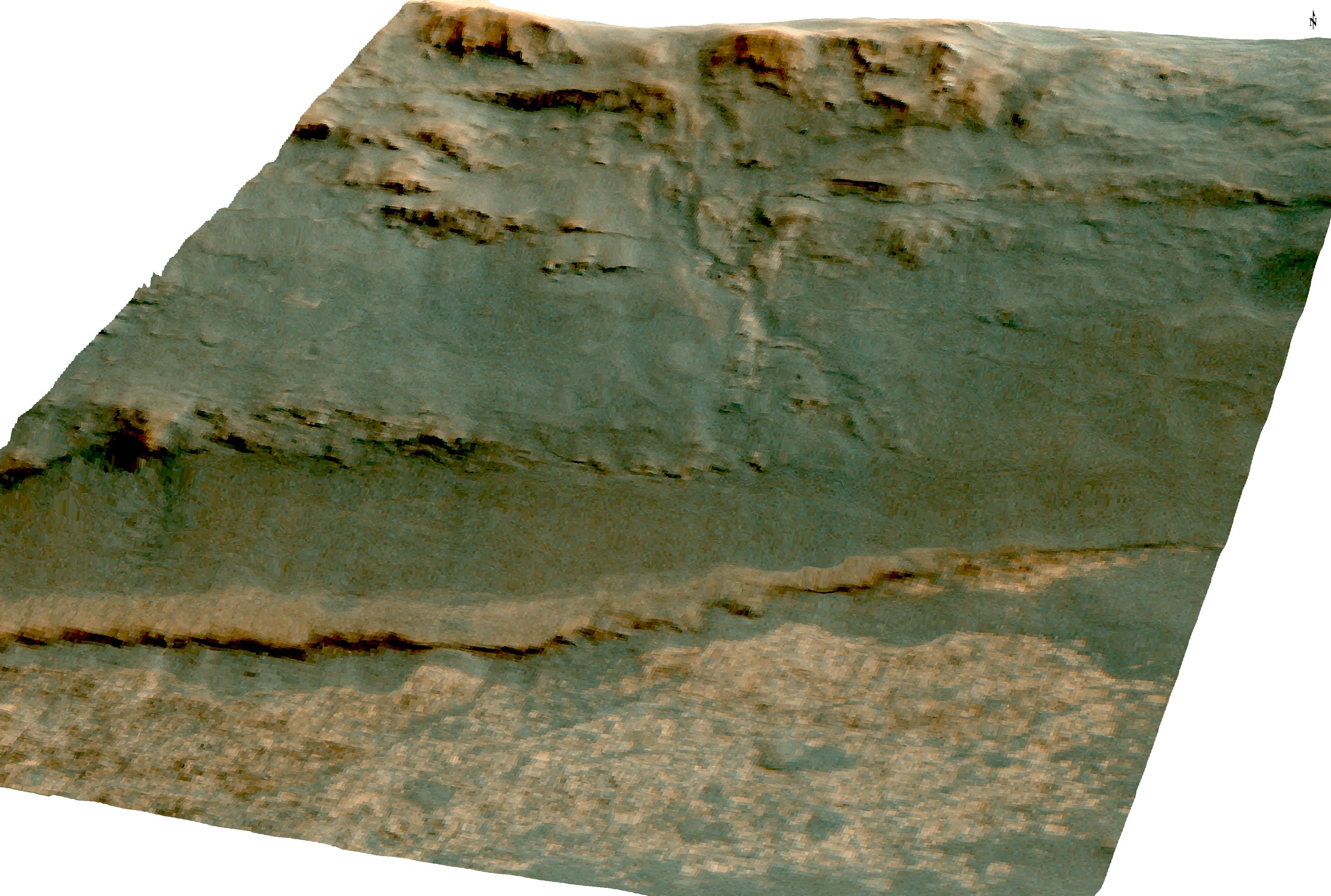
PIA22216:
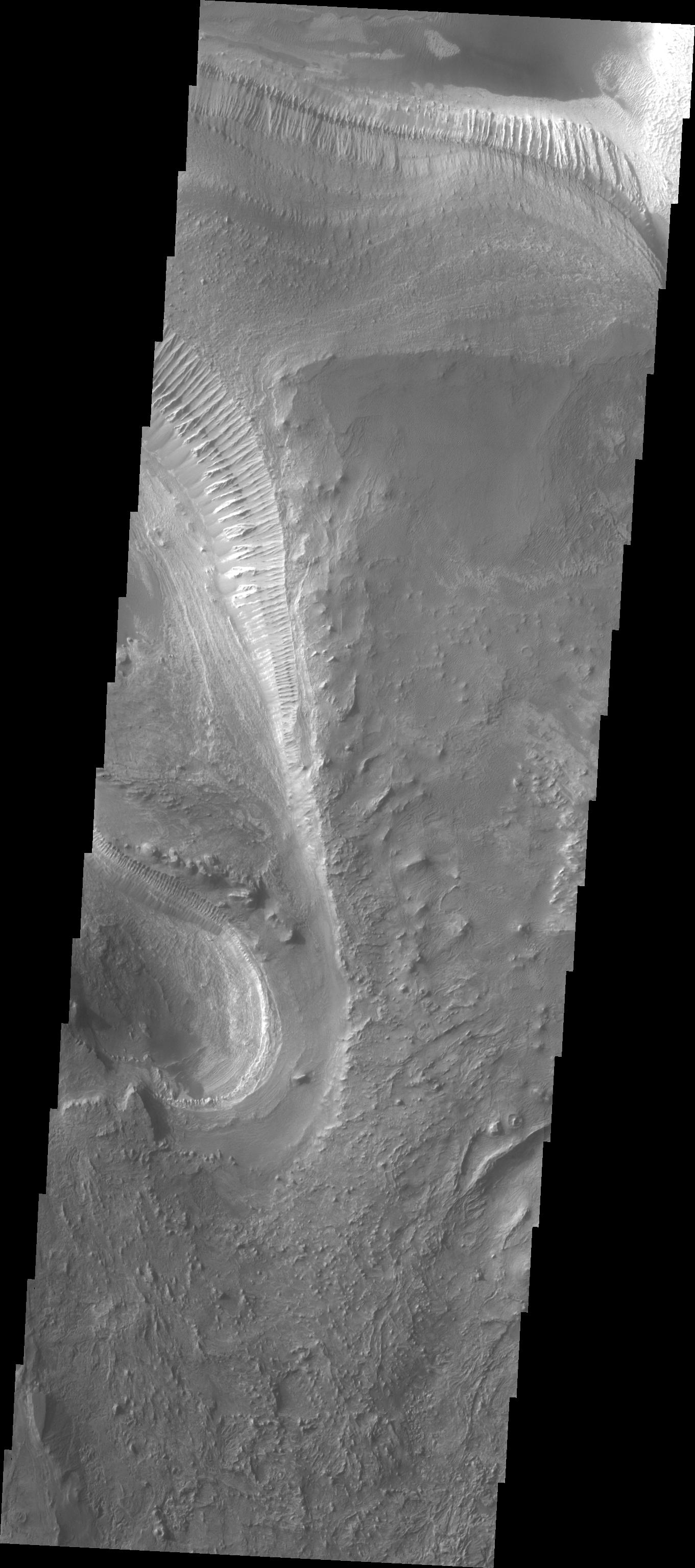
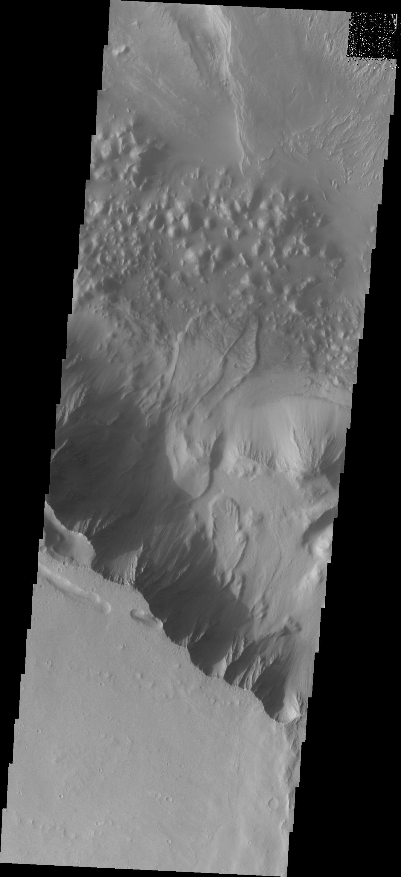
Martian 'Perseverance Valley' in Perspective (Vertical Exaggeration)
Full Resolution:
TIFF
(17.11 MB)
JPEG
(995.8 kB)
2018-02-15
Mars
Mars Exploration Rover (MER)
Navigation Camera
3741x1361x1
PIA22217:
Rock Stripes Pattern in Mars' 'Perseverance Valley'
Full Resolution:
TIFF
(3.633 MB)
JPEG
(601.9 kB)
2018-02-15
Mars
Mars Exploration Rover (MER)
Navigation Camera
3253x2519x1
PIA22218:
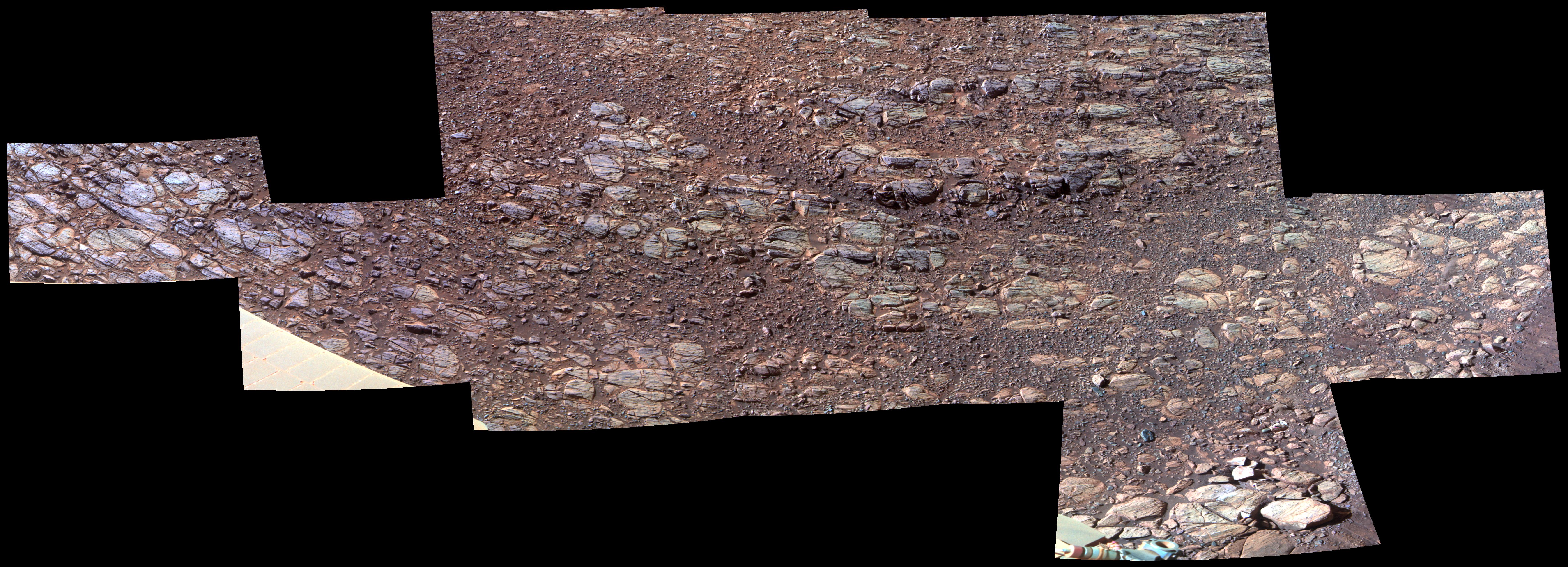
Opportunity Rover Views Ground Texture 'Perseverance Valley'
Full Resolution:
TIFF
(5.531 MB)
JPEG
(1.062 MB)
2018-02-16
Mars
2001 Mars Odyssey
THEMIS
1311x2775x1
PIA22276:
Investigating Mars: Tithonium Chasma
Full Resolution:
TIFF
(2.589 MB)
JPEG
(253.5 kB)
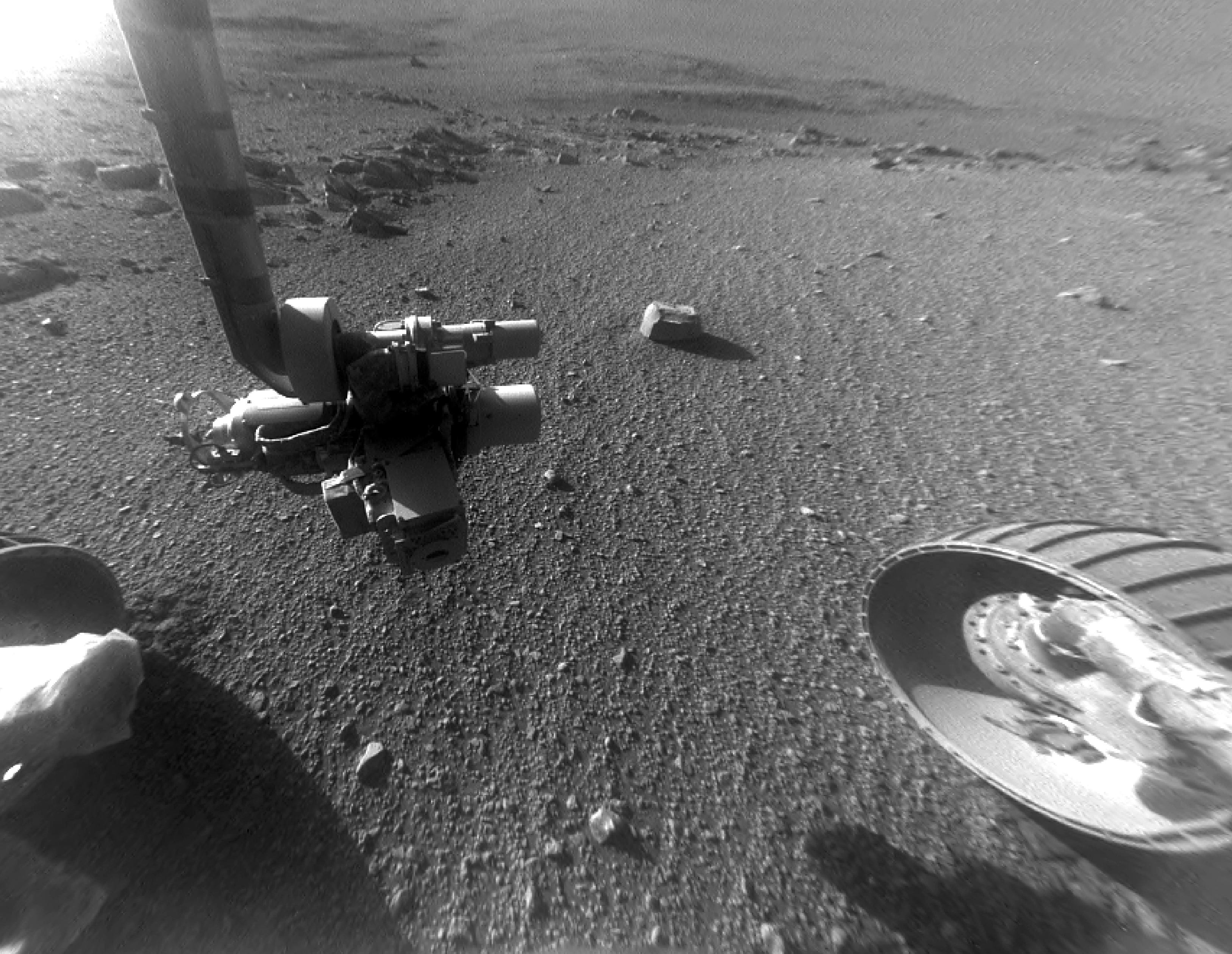
2018-02-16
Mars
Mars Exploration Rover (MER)
Panoramic Camera
1020x800x3
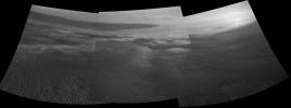
PIA22221:
New Day for Longest-Working Mars Rover
Full Resolution:
TIFF
(1.578 MB)
JPEG
(18.22 kB)
2018-02-19
Mars
2001 Mars Odyssey
THEMIS
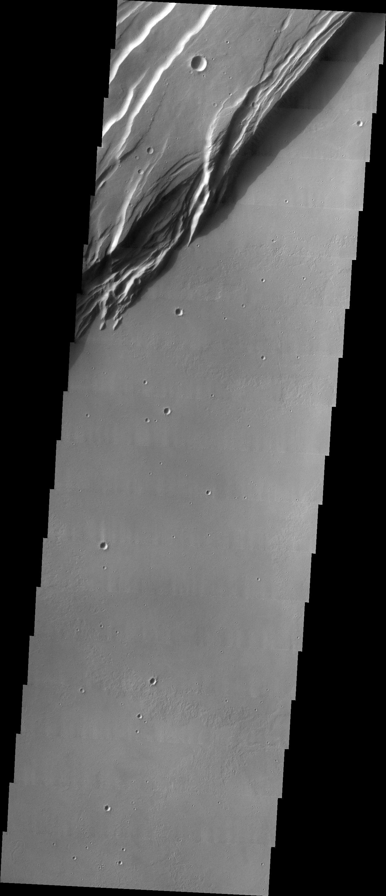
1344x3061x1
PIA22277:
Investigating Mars: Ius Chasma
Full Resolution:
TIFF
(2.531 MB)
JPEG
(206.4 kB)
2018-02-20
Mars
2001 Mars Odyssey
THEMIS
1316x2772x1
PIA22278:
Investigating Mars: Ius Chasma
Full Resolution:
TIFF
(2.497 MB)
JPEG
(216.3 kB)
2018-02-20
Mars
Mars Reconnaissance Orbiter (MRO)
Phoenix
HiRISE
1286x1269x3
PIA22223:
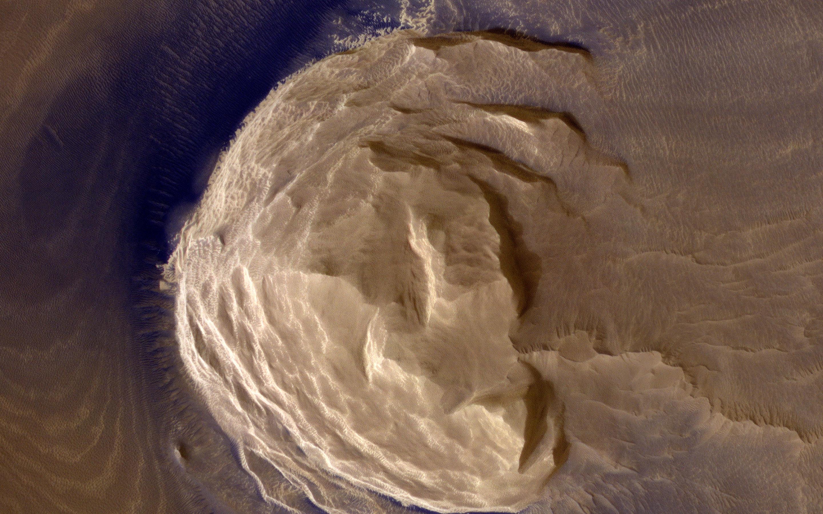
NASA's Phoenix Lander on Mars, Nearly a Decade Later
Full Resolution:
TIFF
(2.81 MB)
JPEG
(1.781 MB)
1-100
101-200
201-300
301-400
401-500
501-600
601-700
701-800
801-900
901-1000
Currently displaying images:
10201 - 10300
of 12760


