
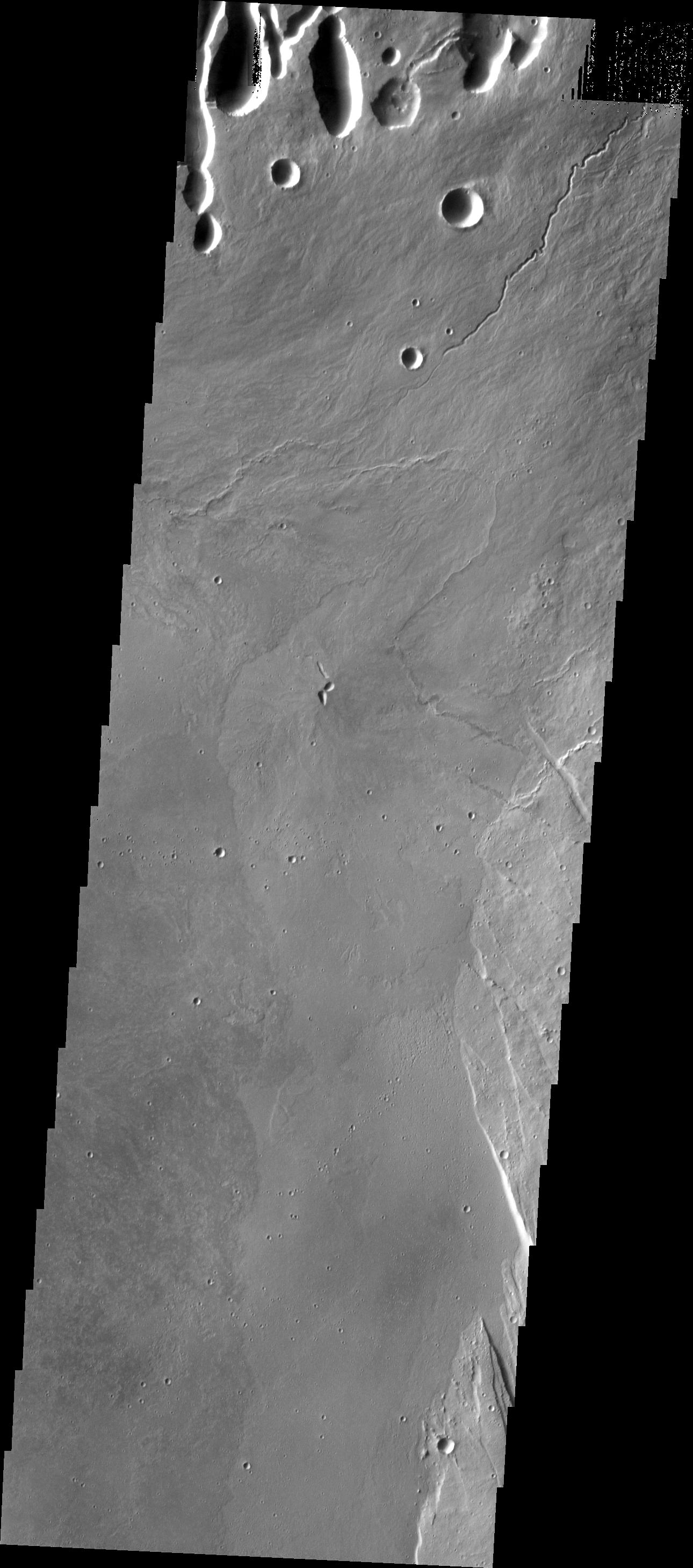
Context image This THEMIS image shows part of the caldera floor of Arsia Mons. It is not uncommon for calderas to have "flat" floors after the final explosive eruption the empties the subsurface magma chamber. There may still be some magma or superheated rock left after the collapse that will fill in part of the depression. Additionally, over time erosion will work to level the topography. Within Arsia Mons there was renewed activity that occurred within the caldera along the alignment of the NE/SW trend of the three large volcanoes. This ongoing, low volume actitivity is similar to the lava lake in Kilauea in Hawaii. Small flows are visible throughout this image. In the center of the image is a small "L" shaped feature. This is the summit vent for the volcanic flows around it. The flows have lapped up against the caldera wall, filling in faults left by the caldera formation and increasing the elevation of the surface in this region of the caldera.
Arsia Mons is the southernmost of the Tharsis volcanoes. It is 270 miles (450km) in diameter, almost 12 miles (20km) high, and the summit caldera is 72 miles (120km) wide. For comparison, the largest volcano on Earth is Mauna Loa. From its base on the sea floor, Mauna Loa measures only 6.3 miles high and 75 miles in diameter. A large volcanic crater known as a caldera is located at the summit of all of the Tharsis volcanoes. These calderas are produced by massive volcanic explosions and collapse. The Arsia Mons summit caldera is larger than many volcanoes on Earth.
The Odyssey spacecraft has spent over 15 years in orbit around Mars, circling the planet more than 69000 times. It holds the record for longest working spacecraft at Mars. THEMIS, the IR/VIS camera system, has collected data for the entire mission and provides images covering all seasons and lighting conditions. Over the years many features of interest have received repeated imaging, building up a suite of images covering the entire feature. From the deepest chasma to the tallest volcano, individual dunes inside craters and dune fields that encircle the north pole, channels carved by water and lava, and a variety of other feature, THEMIS has imaged them all. For the next several months the image of the day will focus on the Tharsis volcanoes, the various chasmata of Valles Marineris, and the major dunes fields. We hope you enjoy these images!
Orbit Number: 19874 Latitude: -8.57834 Longitude: 240.452 Instrument: VIS Captured: 2006-06-07 18:39
Please see the THEMIS Data Citation Note for details on crediting THEMIS images.
NASA's Jet Propulsion Laboratory manages the 2001 Mars Odyssey mission for NASA's Science Mission Directorate, Washington, D.C. The Thermal Emission Imaging System (THEMIS) was developed by Arizona State University, Tempe, in collaboration with Raytheon Santa Barbara Remote Sensing. The THEMIS investigation is led by Dr. Philip Christensen at Arizona State University. Lockheed Martin Astronautics, Denver, is the prime contractor for the Odyssey project, and developed and built the orbiter. Mission operations are conducted jointly from Lockheed Martin and from JPL, a division of the California Institute of Technology in Pasadena.
 Planetary Data System


