Your search criteria found 12767 images
Target is Mars (and available satellites)
Go to PIAxxxxx:
Refine this list of images by:
Target:
Mission:
Spacecraft:
Instrument:
Click on an image for detailed information
Click on a column heading to sort in ascending or descending order
My
List
Addition Date TargetSort Descending Mission Instrument Size
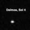
Add Image to Favorite List 1997-11-04 Deimos Mars Pathfinder (MPF)
Imager for Mars Pathfinder
384x384x1
Mars' outermost natural satellite, Deimos, is seen from the planet's surface in this Pathfinder image taken at night on Sol 4. This picture was acquired by NASA's Imager for Mars Pathfinder (IMP) camera. Sol 1 began on July 4, 1997.
PIA00996:
Deimos
Full Resolution:     TIFF (10.06 kB)     JPEG (5.841 kB)
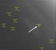
Add Image to Favorite List 2006-03-10 Deimos Mars Reconnaissance Orbiter (MRO)
Optical Navigation Camera
791x700x3
This image showing the position of the Martian moon Deimos against a 
background of stars is part of a successful technology demonstration 
completed by NASA's Mars Reconnaissance Orbiter before arrival at Mars
PIA02699:
Optical Navigation Demonstration Near Mars
Full Resolution:     TIFF (1.663 MB)     JPEG (71.03 kB)
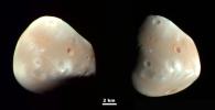
Add Image to Favorite List 2009-03-09 Deimos Mars Reconnaissance Orbiter (MRO)
HiRISE
1505x772x3
Martian Moon Deimos in High Resolution
PIA11826:
Martian Moon Deimos in High Resolution
Full Resolution:     TIFF (3.492 MB)     JPEG (48.06 kB)
Add Image to Favorite List 2018-02-22 Deimos 2001 Mars Odyssey
THEMIS
2292x3054x3
Colors in this image of the Martian moon Deimos indicate a range of surface temperatures detected by observing the moon on February 15, 2018, with NASA's 2001 Mars Odyssey orbiter.
PIA22250:
Mars Odyssey Observes Deimos
Full Resolution:     TIFF (1.008 MB)     JPEG (231 kB)
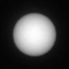
Add Image to Favorite List 2019-04-04 Deimos Mars Science Laboratory (MSL)
Mastcam
256x256x1
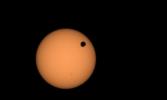
This series of images shows the Martian moon Deimos as it crossed in front of the Sun, as seen by NASA's Curiosity Mars rover on Sunday, March 17, 2019 (the 2,350th Martian day, or sol, of the mission).
PIA23134:
Curiosity Observes Deimos Eclipse: Sol 2350
Full Resolution:     TIFF (52.08 kB)     JPEG (3.197 kB)
Add Image to Favorite List 2024-03-05 Deimos Mars 2020 Rover
Mastcam-Z
1535x917x3
NASA's Perseverance Mars rover used its Mastcam-Z camera to capture the silhouette of Deimos, one of the two Martian moons, as it passed in front of the Sun on Jan. 19, 2024.
PIA26249:
Perseverance Views a Transit of Deimos
Full Resolution:     TIFF (667.5 kB)     JPEG (30.82 kB)
Add Image to Favorite List 1996-06-03 Mars Viking
Visual Imaging Subsystem - Camera A
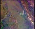
6736x6359x3
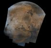
Mosaic composed of 102 Viking Orbiter images of Mars, covering nearly a full hemisphere of the planet (approximate latitude -55 to 60 degrees, longitude 30 to 130 degrees).
PIA00003:
Valles Marineris Hemisphere
Full Resolution:     TIFF (56.07 MB)     JPEG (3.032 MB)
Add Image to Favorite List 1996-06-03 Mars Viking
Visual Imaging Subsystem - Camera A
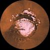
6496x6618x3
This mosaic is composed of about 100 red- and violet- filter Viking Orbiter images, digitally mosaiced in an orthographic projection at a scale of 1 km/pixel.
PIA00004:
Schiaparelli Hemisphere
Full Resolution:     TIFF (60.98 MB)     JPEG (3.383 MB)
Add Image to Favorite List 1996-06-03 Mars Viking
5114x2713x3
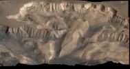
An oblique, color image of central Valles Marineris, Mars showing relief of Ophir and Candor Chasmata; view toward north. The photograph is a composite of Viking high-resolution images in black and white and low-resolution images in color.
PIA00005:
Oblique View of Valles Marineris
Full Resolution:     TIFF (26.69 MB)     JPEG (1.665 MB)
Add Image to Favorite List 1996-06-03 Mars Viking
4710x2915x3
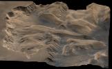
An oblique, color image of central Valles Marineris, Mars showing relief of Ophir and Candor Chasmata; view toward east. The photograph is a composite of Viking high-resolution images in black and white and low-resolution images in color.
PIA00006:
Oblique View with Altimetry of Valles Marineris
Full Resolution:     TIFF (23.9 MB)     JPEG (1.57 MB)
Add Image to Favorite List 1996-06-03 Mars Viking
Visual Imaging Subsystem - Camera A
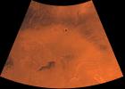
3302x2781x3
Shown here is an oblique view of the polar region, as seen with NASA's Viking 1 spacecraft orbiting Mars over latitude 39 degrees north.
PIA00009:
North Polar Ice Cap
Full Resolution:     TIFF (10.5 MB)     JPEG (952.7 kB)
Add Image to Favorite List 2018-04-02 Mars Mars Reconnaissance Orbiter (MRO)
HiRISE
2880x1800x3
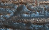
NASA's Mars Reconnaissance Orbiter shows bright ripples line the topography in this region, formed within a past climate. Dark dunes and sand streaks, composed of basaltic sand, have moved and filled lower areas, pushed by more recent winds.
PIA22346:
The Moving Sands of Lobo Vallis
Full Resolution:     TIFF (15.56 MB)     JPEG (1.261 MB)
Add Image to Favorite List 1998-06-03 Mars Viking
Visual Imaging Subsystem - Camera B
6218x6653x3
This mosaic is composed of 104 images from NASA's Viking Orbiter acquired on February 11, 1980. At that time, it was early northern summer on Mars.
PIA00091:
Cerberus Hemisphere
Full Resolution:     TIFF (52.21 MB)     JPEG (2.493 MB)
Add Image to Favorite List 1998-06-03 Mars Viking
Visual Imaging Subsystem - Camera B
6738x6502x3
This mosaic of Syrtis Major is composed of about 100 red- and violet- filter NASA Viking Orbiter images, digitally mosaiced in an orthographic projection at a scale of 1 km/pixel.
PIA00092:
Syrtis Major Hemisphere
Full Resolution:     TIFF (59 MB)     JPEG (3.397 MB)
Add Image to Favorite List 1996-12-15 Mars Viking
Camera 2
1089x512x1
Operation of the surface sampler in obtaining Martian soil for NASA's Viking 2's molecular analysis experiment. Dubbed 'Bonneville Salt Flats,' the exposure of thin crust appeared unique in contrast with surrounding materials.
PIA00145:
Surface Sampler Arm Acquiring Sample
Full Resolution:     TIFF (280.1 kB)     JPEG (138.5 kB)
Add Image to Favorite List 1998-06-04 Mars Viking
Visual Imaging Subsystem - Camera B
1040x934x3
Tharsis-centered volcanic and tectonic activity resulted in the formation of radial grabens of Memnonia Fossae, which cut materials of the ancient cratered highlands and relatively young, highland-embaying lava flows as seen by NASA's Viking Orbiter 2.
PIA00151:
Memnonia Fossae (Enhanced Color)
Full Resolution:     TIFF (3.299 MB)     JPEG (186 kB)
Add Image to Favorite List 1998-06-04 Mars Viking
Visual Imaging Subsystem - Camera A
2048x1700x3
Water ice mixed with dust form the residual north polar ice cap (brown color) in these images from NASA's Viking Orbiter 2.
PIA00152:
North Polar Cap Margin (natural color (top) and enhanced color (bottom))
Full Resolution:     TIFF (9.474 MB)     JPEG (467.8 kB)
Add Image to Favorite List 1998-06-04 Mars Viking
Visual Imaging Subsystem - Camera B
1024x880x3
A conspicuous fretted channel, Reull Valles, Mars which dissects wall deposits of the large Hellas impact basin, trends southeast towards the basin floor as seen by NASA's Viking Orbiter 2.
PIA00153:
Reull Valles (Enhanced Color)
Full Resolution:     TIFF (2.919 MB)     JPEG (151.9 kB)
Add Image to Favorite List 1998-06-04 Mars Viking
Visual Imaging Subsystem - Camera B
1100x820x3
Mars' Syria Planum-centered volcanism and tectonism produced fractures, narrow to broad grabens, large scarps, and broad fold and thrust ridges that deformed a basement complex captured by NASA's Viking Orbiter 2.
PIA00154:
Claritas Fossae (Enhanced Color)
Full Resolution:     TIFF (3.189 MB)     JPEG (208.5 kB)
Add Image to Favorite List 1998-06-04 Mars Viking
Visual Imaging Subsystem - Camera B
964x832x3
This picture from NASA's Viking Orbiter 2 shows areas of central Valles Marineris, Mars, including Candor Chasm (lower left), Ophir Chasm (lower right), and Hebes Chasm (upper right).
PIA00155:
West Candor Chasm (Enhanced Color)
Full Resolution:     TIFF (2.564 MB)     JPEG (139.3 kB)
Add Image to Favorite List 1998-06-04 Mars Viking
Visual Imaging Subsystem - Camera A
1015x840x3
This picture (centered at latitude 10 degrees S., longitude 74 degrees W.) shows much of Mars' Melas Chasm and a portion of Candor Chasm (upper right) in central Valles Marineris as seen by NASA's Viking Orbiter 2.
PIA00156:
Melas Chasm (Enhanced Color)
Full Resolution:     TIFF (2.795 MB)     JPEG (152.8 kB)
Add Image to Favorite List 1998-06-04 Mars Viking
Visual Imaging Subsystem - Camera A
6744x6744x3
Mars digital-image mosaic merged with color of the MC-1 quadrangle, Mare Boreum region of Mars. This image is from NASA's Viking Orbiter 1.
PIA00161:
MC-1 Mare Boreum Region
Full Resolution:     TIFF (61.16 MB)     JPEG (2.778 MB)
Add Image to Favorite List 1998-06-04 Mars Viking
Visual Imaging Subsystem - Camera A
6994x5029x3
Mars digital-image mosaic merged with color of the MC-2 quadrangle, Diacria region of Mars. This image is from NASA's Viking Orbiter 1.
PIA00162:
MC-2 Diacria Region
Full Resolution:     TIFF (43.55 MB)     JPEG (2.043 MB)
Add Image to Favorite List 1998-06-04 Mars Viking
Visual Imaging Subsystem - Camera A
6994x5029x3
Mars digital-image mosaic merged with color of the MC-3 quadrangle, Arcadia region of Mars. This image is from NASA's Viking Orbiter 1.
PIA00163:
MC-3 Arcadia Region
Full Resolution:     TIFF (43.81 MB)     JPEG (2.603 MB)
Add Image to Favorite List 1998-06-04 Mars Viking
Visual Imaging Subsystem - Camera A
6994x5029x3
Mars digital-image mosaic merged with color of the MC-4 quadrangle, Mare Acidalium region of Mars. This image is from NASA's Viking Orbiter 1.
PIA00164:
MC-4 Mare Acidalium Region
Full Resolution:     TIFF (47.56 MB)     JPEG (2.345 MB)
Add Image to Favorite List 1998-06-04 Mars Viking
Visual Imaging Subsystem - Camera A
6994x5029x3
Mars digital-image mosaic merged with color of the MC-5 quadrangle, Ismenius Lacus region of Mars. This image is from NASA's Viking Orbiter 1.
PIA00165:
MC-5 Ismenius Lacus Region
Full Resolution:     TIFF (48.93 MB)     JPEG (2.888 MB)
Add Image to Favorite List 1998-06-04 Mars Viking
Visual Imaging Subsystem - Camera A
6994x5029x3
Mars digital-image mosaic merged with color of the MC-6 quadrangle, Casius region of Mars. This image is from NASA's Viking Orbiter 1.
PIA00166:
MC-6 Casius Region
Full Resolution:     TIFF (46.22 MB)     JPEG (2.381 MB)
Add Image to Favorite List 1998-06-05 Mars Viking
Visual Imaging Subsystem - Camera A
6994x5029x3
Mars digital-image mosaic merged with color of the MC-7 quadrangle, Cebrenia region of Mars. This image is from NASA's Viking Orbiter 1.
PIA00167:
MC-7 Cebrenia Region
Full Resolution:     TIFF (42.2 MB)     JPEG (2.163 MB)
Add Image to Favorite List 1998-06-05 Mars Viking
Visual Imaging Subsystem - Camera A
7170x4991x3
Mars digital-image mosaic merged with color of the MC-8 quadrangle, Amazonis region of Mars. This image is from NASA's Viking Orbiter 1.
PIA00168:
MC-8 Amazonis Region
Full Resolution:     TIFF (60.79 MB)     JPEG (3.337 MB)
Add Image to Favorite List 1998-06-05 Mars Viking
Visual Imaging Subsystem - Camera A
7170x4991x3
Mars digital-image mosaic merged with color of the MC-9 quadrangle, Tharsis region of Mars. This image is from NASA's Viking Orbiter 1.
PIA00169:
Mc-9 Tharsis Region
Full Resolution:     TIFF (59.06 MB)     JPEG (3.17 MB)
Add Image to Favorite List 1998-06-05 Mars Viking
Visual Imaging Subsystem - Camera A
7170x4991x3
Mars digital-image mosaic merged with color of the MC-10 quadrangle, Lanae Palus region of Mars. This image is from NASA's Viking Orbiter 1.
PIA00170:
MC-10 Lanae Palus Region
Full Resolution:     TIFF (63.37 MB)     JPEG (2.725 MB)
Add Image to Favorite List 1998-06-05 Mars Viking
Visual Imaging Subsystem - Camera A
7170x4991x3
Mars digital-image mosaic merged with color of the MC-11 quadrangle, Oxia Palus region of Mars. This image is from NASA's Viking Orbiter 1.
PIA00171:
MC-11 Oxia Palus Region
Full Resolution:     TIFF (69.94 MB)     JPEG (3.219 MB)
Add Image to Favorite List 1998-06-05 Mars Viking
Visual Imaging Subsystem - Camera A
7170x4991x3
Mars digital-image mosaic merged with color of the MC-12 quadrangle, Arabia region of Mars. This image is from NASA's Viking Orbiter 1.
PIA00172:
MC-12 Arabia Region
Full Resolution:     TIFF (67.81 MB)     JPEG (3.671 MB)
Add Image to Favorite List 1998-06-05 Mars Viking
Visual Imaging Subsystem - Camera A
7170x4991x3
Mars digital-image mosaic merged with color of the MC-13 quadrangle, Syrtis Major region of Mars. This image is from NASA's Viking Orbiter 1.
PIA00173:
MC-13 Syrtis Major Region
Full Resolution:     TIFF (71.83 MB)     JPEG (3.374 MB)
Add Image to Favorite List 1998-06-05 Mars Viking
Visual Imaging Subsystem - Camera A
7170x4991x3
Mars digital-image mosaic merged with color of the MC-14 quadrangle, Amenthes region of Mars. This image is from NASA's Viking Orbiter 1.
PIA00174:
MC-14 Amenthes Region
Full Resolution:     TIFF (54.52 MB)     JPEG (2.893 MB)
Add Image to Favorite List 1998-06-05 Mars Viking
Visual Imaging Subsystem - Camera A
7170x4991x3
Mars digital-image mosaic merged with color of the MC-15 quadrangle, Elysium region of Mars. This image is from NASA's Viking Orbiter 1.
PIA00175:
MC-15 Elysium Region
Full Resolution:     TIFF (54.58 MB)     JPEG (3.002 MB)
Add Image to Favorite List 1998-06-05 Mars Viking
Visual Imaging Subsystem - Camera A
7170x4991x3
Mars digital-image mosaic merged with color of the MC-16 quadrangle, Memnonia region of Mars. This image is from NASA's Viking Orbiter 1.
PIA00176:
MC-16 Memnonia Region
Full Resolution:     TIFF (71.85 MB)     JPEG (4.668 MB)
Add Image to Favorite List 1998-06-05 Mars Viking
Visual Imaging Subsystem - Camera A
7170x4991x3
Mars digital-image mosaic merged with color of the MC-17 quadrangle, Phoenicis Lacus region of Mars. This image is from NASA's Viking Orbiter 1.
PIA00177:
MC-17 Phoenicis Region
Full Resolution:     TIFF (68.33 MB)     JPEG (3.962 MB)
Add Image to Favorite List 1998-06-05 Mars Viking
Visual Imaging Subsystem - Camera A
7170x4991x3
Mars digital-image mosaic merged with color of the MC-18 quadrangle, Coprates region of Mars. This image is from NASA's Viking Orbiter 1.
PIA00178:
MC-18 Coprates Region
Full Resolution:     TIFF (75.6 MB)     JPEG (3.965 MB)
Add Image to Favorite List 1998-06-05 Mars Viking
Visual Imaging Subsystem - Camera A
7170x4991x3
Mars digital-image mosaic merged with color of the MC-19 quadrangle, Margaritifer Sinus region of Mars. This image is from NASA's Viking Orbiter 1.
PIA00179:
MC-19 Margaritifer Sinus Region
Full Resolution:     TIFF (80.33 MB)     JPEG (4.576 MB)
Add Image to Favorite List 1998-06-05 Mars Viking
Visual Imaging Subsystem - Camera A
7170x4991x3
Mars digital-image mosaic merged with color of the MC-20 quadrangle, Sinus Sabeus region of Mars. This image is from NASA's Viking Orbiter 1.
PIA00180:
MC-20 Sinus Sabeus Region
Full Resolution:     TIFF (76.26 MB)     JPEG (4.345 MB)
Add Image to Favorite List 1998-06-05 Mars Viking
Visual Imaging Subsystem - Camera A
7170x4991x3
Mars digital-image mosaic merged with color of the MC-21 quadrangle, Iapygia region of Mars. This image is from NASA's Viking Orbiter 1.
PIA00181:
MC-21 Iapygia Region
Full Resolution:     TIFF (76.48 MB)     JPEG (3.901 MB)
Add Image to Favorite List 1998-06-05 Mars Viking
Visual Imaging Subsystem - Camera A
7170x4991x3
Mars digital-image mosaic merged with color of the MC-22 quadrangle, Mare Tyrrhenum region of Mars. This image is from NASA's Viking Orbiter 1.
PIA00182:
MC-22 Mare Tyrrhenum Region
Full Resolution:     TIFF (72.07 MB)     JPEG (4.105 MB)
Add Image to Favorite List 1998-06-05 Mars Viking
Visual Imaging Subsystem - Camera A
7170x4991x3
Mars digital-image mosaic merged with color of the MC-23 quadrangle, Aeolis region of Mars. This image is from NASA's Viking Orbiter 1.
PIA00183:
MC-23 Aeolis Region
Full Resolution:     TIFF (72.6 MB)     JPEG (4.476 MB)
Add Image to Favorite List 1998-06-05 Mars Viking
Visual Imaging Subsystem - Camera A
6994x5029x3
Mars digital-image mosaic merged with color of the MC-24 quadrangle, Phaethontis region of Mars. This image is from NASA's Viking Orbiter 1.
PIA00184:
MC-24 Phaethontis Region
Full Resolution:     TIFF (54.07 MB)     JPEG (3.143 MB)
Add Image to Favorite List 1998-06-05 Mars Viking
Visual Imaging Subsystem - Camera A
6994x5029x3
Mars digital-image mosaic merged with color of the MC-25 quadrangle, Thaumasia region of Mars. This image is from NASA's Viking Orbiter 1.
PIA00185:
MC-25 Thaumasia Region
Full Resolution:     TIFF (51.55 MB)     JPEG (2.802 MB)
Add Image to Favorite List 1998-06-05 Mars Viking
Visual Imaging Subsystem - Camera A
6994x5029x3
Mars digital-image mosaic merged with color of the MC-26 quadrangle, Argyre region of Mars. This image is from NASA's Viking Orbiter 1.
PIA00186:
MC-26 Argyre Region
Full Resolution:     TIFF (53.97 MB)     JPEG (3.602 MB)
Add Image to Favorite List 1998-06-05 Mars Viking
Visual Imaging Subsystem - Camera A
6994x5029x3
Mars digital-image mosaic merged with color of the MC-27 quadrangle, Noachis region of Mars. This image is from NASA's Viking Orbiter 1.
PIA00187:
MC-27 Noachis Region
Full Resolution:     TIFF (54.23 MB)     JPEG (3.644 MB)
Add Image to Favorite List 1998-06-05 Mars Viking
Visual Imaging Subsystem - Camera A
6994x5029x3
Mars digital-image mosaic merged with color of the MC-28 quadrangle, Hellas region of Mars. This image is from NASA's Viking Orbiter 1.
PIA00188:
MC-28 Hellas Region
Full Resolution:     TIFF (50.79 MB)     JPEG (3.486 MB)
Add Image to Favorite List 1998-06-05 Mars Viking
Visual Imaging Subsystem - Camera A
6994x5029x3
Mars digital-image mosaic merged with color of the MC-29 quadrangle, Eridania region of Mars. This image is from NASA's Viking Orbiter 1.
PIA00189:
MC-29 Eridania Region
Full Resolution:     TIFF (53.95 MB)     JPEG (4.072 MB)
Add Image to Favorite List 1998-06-08 Mars Viking
Visual Imaging Subsystem - Camera A
6744x6744x3
Mars digital-image mosaic merged with color of the MC-30 quadrangle, Mare Australe region of Mars. This image is from NASA's Viking Orbiter 1.
PIA00190:
MC-30 Mare Australe Region
Full Resolution:     TIFF (75.85 MB)     JPEG (3.79 MB)
Add Image to Favorite List 1998-06-08 Mars Viking
Visual Imaging Subsystem - Camera A
6787x6787x3
Heavily cratered highlands dominate this view from NASA's Viking Orbiter 1. Toward the lower right, a conspicuous light-colored circular depression marks the ancient large Hellas impact basin.
PIA00191:
Center is at Latitude 30 Degrees South., Longitude 330 Degrees
Full Resolution:     TIFF (66.74 MB)     JPEG (2.173 MB)
Add Image to Favorite List 1998-06-08 Mars Viking
Visual Imaging Subsystem - Camera A
6787x6787x3
The north polar residual ice cap, which is cut by spiral-patterned troughs, is located at the top in this view from NASA's Viking Orbiter 1.
PIA00192:
Center is at Latitude 30 Degrees North, Longitude 30 Degrees
Full Resolution:     TIFF (65.4 MB)     JPEG (2.107 MB)
Add Image to Favorite List 1998-06-08 Mars Viking
Visual Imaging Subsystem - Camera A
6398x6398x3
Both polar residual ice caps are seen at top and bottom. The central part is dominated by the four largest and youngest volcanoes on Mars--Olympus, Arsia, Pavonis, and Ascraeus Montes in this image from NASA's Viking Orbiter 1.
PIA00193:
Latitude 90 Degrees North to 90 Degrees South and Longitude 0 Degrees to 180 Degrees
Full Resolution:     TIFF (56.26 MB)     JPEG (1.782 MB)
Add Image to Favorite List 1998-06-08 Mars Viking
Visual Imaging Subsystem - Camera A
6398x6398x3
The north polar residual ice cap of the Planum Boreum region, which is cut by spiral-patterned troughs, is located at top of this image from NASA's Viking Orbiter 1.
PIA00194:
Latitude 90 Degrees North to 90 Degrees South and Longitude -180 Degrees to 0 Degrees
Full Resolution:     TIFF (54.49 MB)     JPEG (1.746 MB)
Add Image to Favorite List 1998-06-08 Mars Viking
Visual Imaging Subsystem - Camera A
6787x6787x3
The top half of Mars is dominated by the Tharsis Montes volcanoes, the large Alba Patera shield volcano, the dark Chryse basin, and a vast canyon system, Valles Marineris in this image from NASA's Viking Orbiter 1.
PIA00195:
Center is at Latitude 30 Degrees South, Longitude 90 Degrees
Full Resolution:     TIFF (63.07 MB)     JPEG (1.978 MB)
Add Image to Favorite List 1998-06-08 Mars Viking
Visual Imaging Subsystem - Camera A
6787x6787x3
The lowland plains of Elysium and Utopia Planitiae are separated from the darker heavily cratered highlands by a broad escarpment in this image from NASA's Viking Orbiter 1.
PIA00196:
Center is at Latitude 30 Degrees South, Longitude 210 Degrees
Full Resolution:     TIFF (60 MB)     JPEG (1.807 MB)
Add Image to Favorite List 1998-06-08 Mars Viking
Visual Imaging Subsystem - Camera A
6787x6787x3
NASA's Viking Orbiter 1 spies the north polar residual ice cap, which is cut by spiral-patterned troughs and surrounded by the dark lowland plains of Vastitas Borealis, Mars is located at the top.
PIA00197:
Center is at Latitude 30 Degrees North, Longitude 150 Degrees
Full Resolution:     TIFF (58.79 MB)     JPEG (1.74 MB)
Add Image to Favorite List 1998-06-08 Mars Viking
Visual Imaging Subsystem - Camera A
6787x6787x3
The north polar residual ice cap of the Planum Boreum region, which is cut by spiral-patterned troughs, is located at top of this image from NASA's Viking Orbiter 1.
PIA00198:
Center is at Latitude 30 Degrees North, Longitude 270 Degrees
Full Resolution:     TIFF (60.13 MB)     JPEG (1.88 MB)
Add Image to Favorite List 1998-06-08 Mars Viking
Visual Imaging Subsystem - Camera A
3650x4608x3
Part of Candor Chasm in Valles Marineris, Mars. Layered terrain is visible in the scene from NASA's Viking Orbiter 1., perhaps due to a huge ancient lake.
PIA00199:
Candor Chasm in Valles Marineris
Full Resolution:     TIFF (32.2 MB)     JPEG (1.083 MB)
Add Image to Favorite List 1996-08-09 Mars Antarctic Meteorite Location and Mapping Project (AMLAMP)
720x545x1
In the center of this electron microscope image of a small chip from a meteorite are several tiny structures that are possible microscopic fossils of primitive, bacteria-like organisms that may have lived on Mars more than 3.6 billion years ago.
PIA00283:
Mars Life? - Microscopic Structures
Full Resolution:     TIFF (295.6 kB)     JPEG (52.82 kB)
Add Image to Favorite List 1996-08-09 Mars Antarctic Meteorite Location and Mapping Project (AMLAMP)
712x484x1
This electron microscope image is a close-up of the center part of photo number S96-12301.
PIA00284:
Mars Life? - Microscopic Tube-like Structures
Full Resolution:     TIFF (273.4 kB)     JPEG (117.2 kB)
Add Image to Favorite List 1996-08-09 Mars Antarctic Meteorite Location and Mapping Project (AMLAMP)
720x493x1
This electron microscope image shows extremely tiny tubular structures that are possible microscopic fossils of bacteria-like organisms that may have lived on Mars more than 3.6 billion years ago.
PIA00285:
Mars Life? - Microscopic Tubular Structures
Full Resolution:     TIFF (283.5 kB)     JPEG (50.04 kB)
Add Image to Favorite List 1996-08-09 Mars Antarctic Meteorite Location and Mapping Project (AMLAMP)
491x718x1
This electron microscope image shows egg-shaped structures, some of which may be possible microscopic fossils of Martian origin as discussed by NASA research published in the Aug. 16, 1996.
PIA00286:
Mars Life? - Microscopic Egg-shaped Structures
Full Resolution:     TIFF (281.7 kB)     JPEG (43.96 kB)
Add Image to Favorite List 1996-08-09 Mars Antarctic Meteorite Location and Mapping Project (AMLAMP)
716x493x1
This electron microscope image shows tubular structures of likely Martian origin. These structures are very similar in size and shape to extremely tiny microfossils found in some Earth rocks.
PIA00287:
Mars Life? - Microscopic Tubular Structures
Full Resolution:     TIFF (306.3 kB)     JPEG (53.09 kB)
Add Image to Favorite List 1996-08-09 Mars Antarctic Meteorite Location and Mapping Project (AMLAMP)
718x497x1
This high-resolution scanning electron microscope image shows an unusual tube-like structural form that is less than 1/100th the width of a human hair in size found in meteorite ALH84001, a meteorite believed to be of Martian origin.
PIA00288:
Mars Life? - Microscopic Tube-like Structures
Full Resolution:     TIFF (371.6 kB)     JPEG (96.55 kB)
Add Image to Favorite List 1996-08-08 Mars Antarctic Meteorite Location and Mapping Project (AMLAMP)
722x564x3
This 4.5 billion-year-old rock, labeled meteorite ALH84001, is one of 10 rocks from Mars in which researchers have found organic carbon compounds that originated on Mars without involvement of life.
PIA00289:
Carbon Compounds from Mars Found Inside Meteorite ALH84001
Full Resolution:     TIFF (876.2 kB)     JPEG (57.73 kB)
Add Image to Favorite List 1996-08-08 Mars Antarctic Meteorite Location and Mapping Project (AMLAMP)
651x430x3
This photograph shows orange-colored carbonate mineral globules found in a meteorite, called ALH84001, believed to have once been a part of Mars.
PIA00290:
Mars Life? - Orange-colored Carbonate Mineral Globules
Full Resolution:     TIFF (529.3 kB)     JPEG (26.56 kB)
Add Image to Favorite List 1998-06-04 Mars Viking
4511x4172x3
Shown here is a digital mosaic of Olympus Mons, the largest known volcano in the Solar System, as seen by NASA's Viking Orbiter 1. Much of the plains surrounding the volcano are covered by the ridged and grooved 'aureole' of Olympus Mons.
PIA00300:
Olympus Mons
Full Resolution:     TIFF (41.13 MB)     JPEG (2.08 MB)
Add Image to Favorite List 1998-06-04 Mars Viking
Visual Imaging Subsystem - Camera B
3100x4400x3
This mosaic is composed of 18 images, acquired by NASA's Viking Orbiter on September 28, 1977, during revolution 407 of Viking Orbiter 2. The south pole is located just off the lower left edge of the polar cap.
PIA00301:
South Polar Residual Ice Cap
Full Resolution:     TIFF (18.16 MB)     JPEG (1.098 MB)
Add Image to Favorite List 1998-06-04 Mars Viking
Visual Imaging Subsystem - Camera B
1024x880x3
This image from NASA's Viking Orbiter 1 shows Reull Valles, a conspicuous southeast-trending fretted channel, dissects wall deposits of the large Hellas impact basin.
PIA00322:
Reull Valles in Approximately Natural Color
Full Resolution:     TIFF (2.235 MB)     JPEG (115.7 kB)
Add Image to Favorite List 1998-06-04 Mars Viking
Visual Imaging Subsystem - Camera B
964x832x3
This image from NASA's Viking Orbiter 2 of West Candor Chasm shows parts of central Valles Marineris, including Candor Chasm (lower left), Ophir Chasm (lower right), and Hebes Chasm (upper right).
PIA00336:
West Candor Chasm, Approximately Natural Color
Full Resolution:     TIFF (1.857 MB)     JPEG (107.1 kB)
Add Image to Favorite List 1998-06-04 Mars Viking
Visual Imaging Subsystem - Camera A
1015x840x3
This image from NASA's Viking Orbiter 2 of West Candor Chasm shows much of Melas Chasm and a portion of Candor Chasm (upper right) in central Valles Marineris.
PIA00337:
Melas Chasm, Approximately Natural Color
Full Resolution:     TIFF (2.288 MB)     JPEG (118.5 kB)
Add Image to Favorite List 1998-06-04 Mars Viking
Visual Imaging Subsystem - Camera B
1100x820x3
NASA's Viking Orbiter 2 shows Syria Planum-centered volcanism and tectonism produced fractures, narrow to broad grabens, large scarps, and broad fold and thrust ridges that deformed a basement complex.
PIA00338:
Claritas Fossae, Approximately Natural Color
Full Resolution:     TIFF (2.61 MB)     JPEG (173.4 kB)
Add Image to Favorite List 1998-06-04 Mars Viking
Visual Imaging Subsystem - Camera B
1040x934x3
NASA's Viking Orbiter 2 shows Tharsis-centered volcanic and tectonic activity resulted in the formation of radial grabens of Memnonia Fossae, which cut materials of the ancient cratered highlands and the relatively young, highland-embaying lava flows.
PIA00339:
Memnonia Fossae, Approximately Natural Color
Full Resolution:     TIFF (2.08 MB)     JPEG (146 kB)
Add Image to Favorite List 1997-01-08 Mars Viking
Camera 2
1187x512x1
NASA's Viking Lander 2 captured this image of rocks nearby a large impact crater. Most rocks appear to have vesicles, or small holes, in them.
PIA00363:
Soil Sample Site
Full Resolution:     TIFF (353.3 kB)     JPEG (143.2 kB)
Add Image to Favorite List 1997-01-08 Mars Viking
Camera 2
2131x512x1
The rocky Martian plain surrounding NASA's Viking 2 is seen in high resolution in this 85-degree panorama sweeping from north at the left to east at right during the Martian afternoon on Sept. 5, 1976.
PIA00364:
Rocky Martian Plain
Full Resolution:     TIFF (545.3 kB)     JPEG (214.1 kB)
Add Image to Favorite List 1996-12-12 Mars Viking
Camera 2
1439x512x1
This is the first photograph ever taken on the surface of the planet Mars. It was obtained by NASA's Viking 1 just minutes after the spacecraft landed successfully July 20, 1976.
PIA00381:
First Photograph Taken On Mars Surface
Full Resolution:     TIFF (327.7 kB)     JPEG (152.2 kB)
Add Image to Favorite List 1996-12-30 Mars Viking
Camera 2
1203x1074x1
First panoramic view by NASA's Viking 1 from the surface of Mars taken in 1976. Toward the right edge is an array of smooth fine-grained material which shows some hint of ripple structure and may be the beginning of a large dune field.
PIA00382:
First Panoramic View From The Surface Of Mars
Full Resolution:     TIFF (403.3 kB)     JPEG (165.7 kB)
Add Image to Favorite List 1996-12-30 Mars Viking
Camera 2
2497x512x1
First panoramic view by NASA's Viking 1 from the surface of Mars taken in 1976. Toward the right edge is an array of smooth fine-grained material which shows some hint of ripple structure and may be the beginning of a large dune field.
PIA00383:
First Panoramic View From The Surface Of Mars
Full Resolution:     TIFF (449.4 kB)     JPEG (167.8 kB)
Add Image to Favorite List 1996-12-12 Mars Viking
Camera 2
515x512x1
The patch of dark material toward the top of this picture taken by NASA's Viking 1 Lander is the debris kicked up by the impact of a protective cover ejected from the spacecraft.
PIA00384:
Debris Kicked Up By Impact of A Protective Cover from Viking Lander 1
Full Resolution:     TIFF (121.1 kB)     JPEG (44.41 kB)
Add Image to Favorite List 1996-12-12 Mars Viking
Camera 2
517x512x1
NASA's Viking 1 took this high-resolution on its third day on Mars. The photo shows numerous angular blocks ranging in size from a few centimeters to several meters.
PIA00385:
High Resolution Image From Viking Lander 1
Full Resolution:     TIFF (138.6 kB)     JPEG (67.02 kB)
Add Image to Favorite List 1996-12-12 Mars Viking
Camera 1
662x512x1
The letter 'B' or perhaps the figure '8' appears to have been etched into the Mars rock at the left edge of this picture taken by NASA's Viking 1 Lander. It is believed to be an illusion caused by weathering processes and the angle of the sun.
PIA00386:
Example of Weathering And Sun Angle
Full Resolution:     TIFF (147.1 kB)     JPEG (61.6 kB)
Add Image to Favorite List 1996-12-12 Mars Viking
Camera 1
490x512x1
This Mars view looks northeast from NASA's Viking 1 and completes the 360 panorama of the landing site. A layer of haze can be seen in the Martian sky. Large dark boulders dominate the scene.
PIA00387:
Northeast View from Viking Landing Site
Full Resolution:     TIFF (67.34 kB)     JPEG (28.35 kB)
Add Image to Favorite List 1996-12-12 Mars Viking
Camera 1
508x434x1
The flag of the United States stands on the surface of Mars. It is mounted on the housing of NASA's Viking 1's nuclear power system. Also seen are the U.S. Bicentennial symbol and a student-designed Viking emblem.
PIA00388:
The United States Flag Stands On The Surface Of Mars
Full Resolution:     TIFF (76.04 kB)     JPEG (32.89 kB)
Add Image to Favorite List 1996-12-12 Mars Viking
Camera 1
251x512x1
This image from NASA's Viking 1 shows the trench excavated by its surface sampler.
PIA00389:
Trench Excavated By Viking 1 Surface Sampler
Full Resolution:     TIFF (62.27 kB)     JPEG (34.45 kB)
Add Image to Favorite List 1996-12-12 Mars Viking
Camera 1
520x512x1
One of NASA's Viking 1's three feet, which should be visible in this view, lies buried beneath a cover of loose Martian soil.
PIA00390:
Viking Lander's Buried Footpad #3
Full Resolution:     TIFF (98.75 kB)     JPEG (41.22 kB)
Add Image to Favorite List 1996-12-30 Mars Viking
Camera 1
2501x512x1
Sand dunes and large rocks are revealed in this panorama picture of Mars, the first photograph taken by NASA's Viking 1's Camera 1 on July 23, 1976. The horizon is approximately 3 kilometers (2 miles) away.
PIA00391:
Sand Dunes And Large Rocks Revealed By Camera 1
Full Resolution:     TIFF (442.8 kB)     JPEG (166.7 kB)
Add Image to Favorite List 1996-12-12 Mars Viking
Camera 1
355x489x1
Those Martian weather reports, received here daily from more than 200 million miles away, start right here at NASA's Viking 1's meteorology instrument. Mounted atop the extended boom, the meteorology sensors face away from the spacecraft.
PIA00392:
The Meteorology Instrument on Viking Lander 1
Full Resolution:     TIFF (54.68 kB)     JPEG (22.76 kB)
Add Image to Favorite List 1996-12-30 Mars Viking
Camera 1
2490x512x1
This spectacular picture of the Martian landscape by NASA's Viking 1 Lander shows a dune field with features remarkably similar to many seen in the deserts of Earth.
PIA00393:
Martian Dune Field
Full Resolution:     TIFF (528 kB)     JPEG (245 kB)
Add Image to Favorite List 1996-12-12 Mars Viking
Camera 2
272x386x1
The dark bullseye pattern seen at the top of NASA's Viking 1's camera calibration chart indicates the presence of magnetic particles in the fine dust in the Martian atmosphere.
PIA00394:
Magnetic Particles Are Found In The Martian Atmosphere
Full Resolution:     TIFF (56.71 kB)     JPEG (8.668 kB)
Add Image to Favorite List 1996-12-12 Mars Viking
Camera 2
259x402x1
The collector head of NASA's Viking 1's surface sampler is full of Martian soil destined for the gas chromatograph mass spectrometer, the instrument which analyzes the surface material for the presence of organic molecules.
PIA00395:
The Collector Head Of Viking Lander 1's Surface Sampler
Full Resolution:     TIFF (17.72 kB)     JPEG (7.968 kB)
Add Image to Favorite List 1996-12-12 Mars Viking
Camera 1
1614x512x1
NASA's Viking 2's first picture on the surface of Mars was taken within minutes after the spacecraft touched down on Sept. 3, 1976. The scene reveals a wide variety of rocks littering a surface of fine-grained deposit.
PIA00396:
Viking Lander 2's First Picture On The Surface Of Mars
Full Resolution:     TIFF (448.6 kB)     JPEG (201.1 kB)
Add Image to Favorite List 1996-12-12 Mars Viking
Camera 1
728x512x1
This pair of pictures from NASA's Viking Lander 1 at Mars' Chryse Planitia shows the only unequivocal change in the Martian surface seen by either lander. A high boulder nicknamed 'Big Joe' is shown next to a small-scale slump feature.
PIA00397:
Boulder 'Big Joe' And Surface Changes On Mars
Full Resolution:     TIFF (197 kB)     JPEG (64.2 kB)
Add Image to Favorite List 1997-01-08 Mars Viking
Camera 2
439x512x1
Photographic evidence of the successful series of commands to NASA's Viking 1 lander on Mars that unlocked the surface sampler arm is seen in this picture.
PIA00398:
Surface Sampler Arm
Full Resolution:     TIFF (115.2 kB)     JPEG (52.46 kB)
Add Image to Favorite List 1997-01-08 Mars Viking
Camera 2
2622x512x1
This rocky panoramic scene is the second picture of the Martian surface that was taken by NASA's Viking Lander 2 shortly after touchdown on Sept. 3, 1976. The site is on a northern plain of Mars known as Utopia Planitia.
PIA00399:
Northern Plains Of Mars
Full Resolution:     TIFF (514.3 kB)     JPEG (190.6 kB)
Add Image to Favorite List 1998-06-08 Mars Viking
Visual Imaging Subsystem - Camera A
3352x3222x3
During its examination of Mars, NASA's Viking 1 spacecraft returned images of Valles Marineris, a huge canyon system 5,000 km long, up to 240 km wide, and 6.5 km deep. This view shows west Candor Chasm.
PIA00403:
West Candor Chasma
Full Resolution:     TIFF (23.46 MB)     JPEG (1.531 MB)
Add Image to Favorite List 1998-06-08 Mars Viking
Visual Imaging Subsystem - Camera B
6035x6580x3
This mosaic is comprised of images acquired in 1980 during late northern summer on Mars by NASA's Viking Orbiter 1. The bright yellow region at top is the Arabia region of Mars.
PIA00406:
Hellas Mosaic
Full Resolution:     TIFF (51.41 MB)     JPEG (1.67 MB)
Add Image to Favorite List 1998-06-08 Mars Viking
6787x6787x3
The north polar cap is visible in this projection at the top of the image from NASA's Viking Orbiter 1, the great equatorial canyon system (Valles Marineris) below center, and four huge Tharsis volcanoes (and several smaller ones) at left.
PIA00407:
Global Color Views of Mars
Full Resolution:     TIFF (78.92 MB)     JPEG (3.638 MB)
Add Image to Favorite List 1998-06-08 Mars Viking
7700x9203x3
The Tharsis region of Mars; north toward top. This scene shows the Tharsis bulge, a huge ridge covered by the 3 large aligned Tharsis Montes shield volcanoes (from lower l to r): Arsia, Pavonis, and Ascraeus Mons as seen by NASA's Viking spacecraft.
PIA00408:
Tharsis
Full Resolution:     TIFF (127.9 MB)     JPEG (7.091 MB)
 Current Set   Jump to a Following Set   Jump to a Following Set   Jump to a Following Set   Jump to a Following Set   Jump to a Following Set   Jump to a Following Set   Jump to a Following Set   Jump to a Following Set   Jump to a Following Set   Retrieve Next Set 
 1-100   101-200   201-300   301-400   401-500   501-600   601-700   701-800   801-900   901-1000 
Currently displaying images: 1 - 100 of 12767