- Original Caption Released with Image:
-
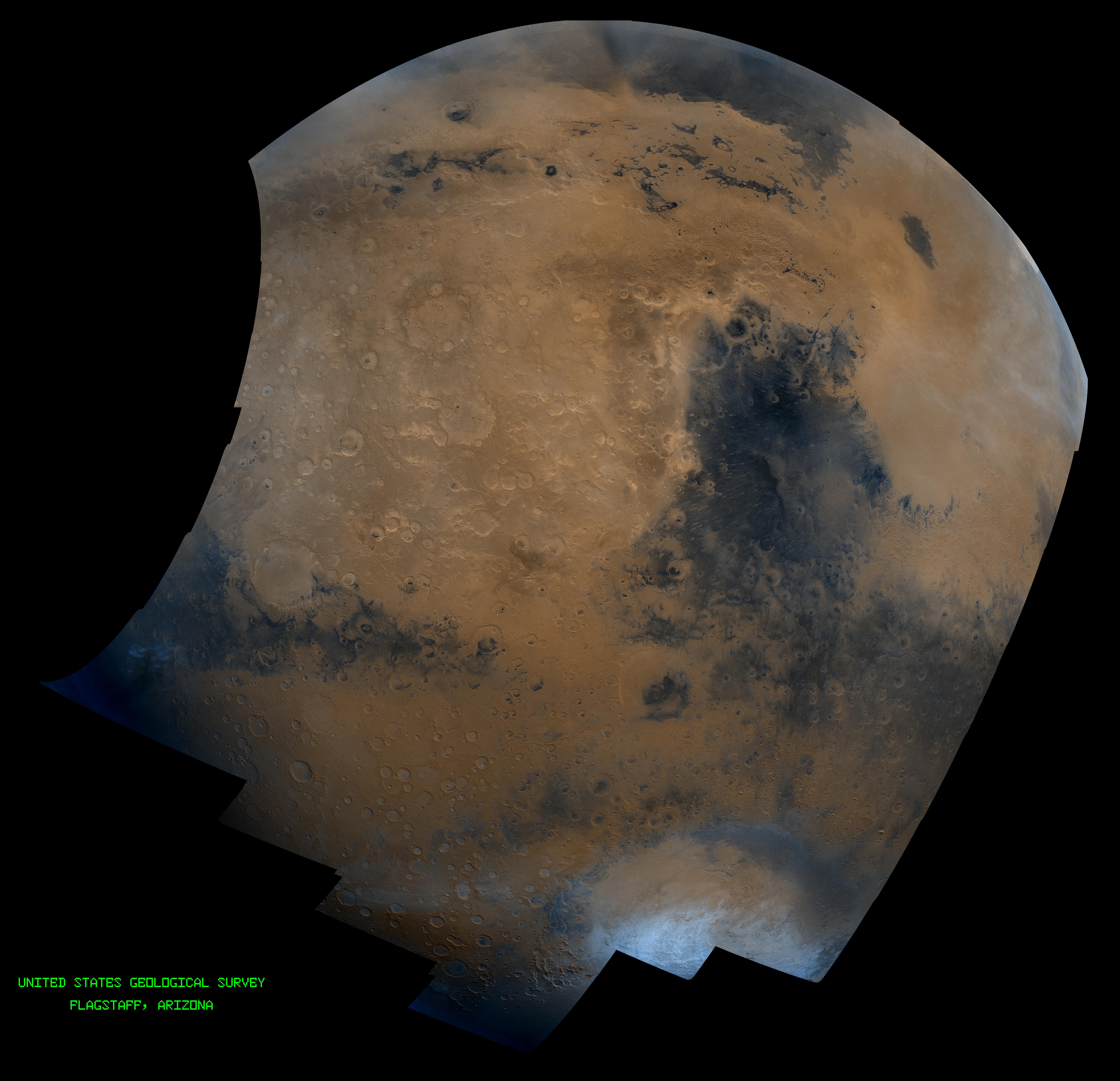
This mosaic is composed of about 100 red- and violet- filter Viking Orbiter images, digitally mosaiced in an orthographic projection at a scale of 1 km/pixel. The images were acquired in 1980 during early northern summer on Mars (Ls = 75 degrees). The center of this image is near latitude 0 degree, longitude 310 degree, and the limits of this mosaic are approximately latitude -60 to 60 degrees and longitude 260 to 350 degrees. The color variations have been enhanced by a factor of two, and the large-scale brightness variations (mostly due to sun-angle variations) have been normalized by large-scale filtering. The large circular area with a bright yellow color (in this rendition) located in the upper left area of the image is known as Arabia. The boundary between the ancient, heavily-cratered southern highlands and the younger northern plains occurs far to the north (latitude 40 degrees) on this side of the planet, just north of Arabia. The dark blue area to the right of Arabia, called Syrtis Major Planum, is a low-relief volcanic shield of probable basaltic composition. The bright yellow area to the right of Syrtis Major Isidis Planitia, an ancient impact basin. Bright white areas to the south, including the Hellas impact basin at lower right, are covered by carbon dioxide frost.
- Image Credit:
-
NASA/JPL/USGS
Image Addition Date: -
1998-06-03
|
