- Original Caption Released with Image:
-
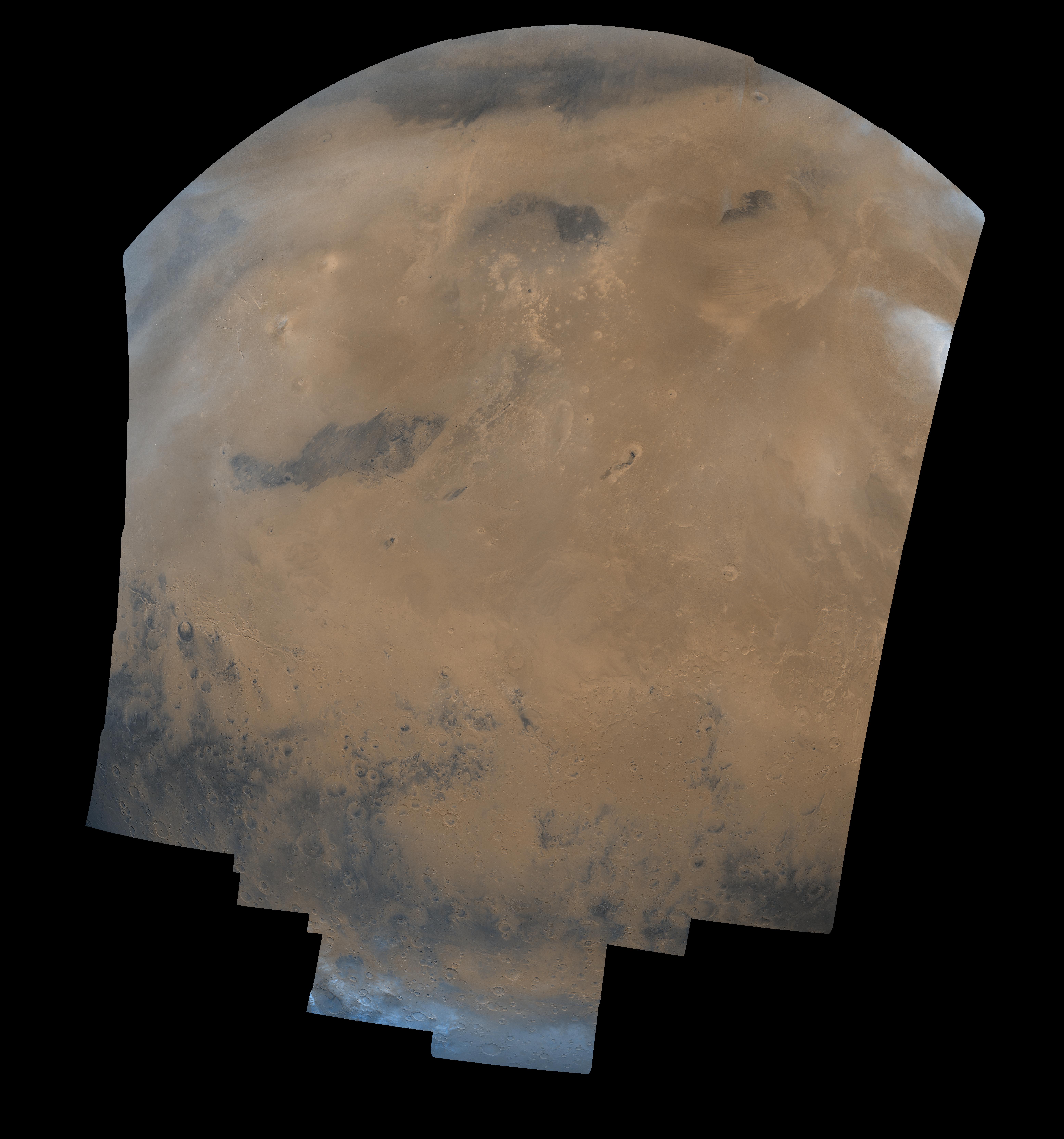
This mosaic is composed of 104 Viking Orbiter images acquired on February 11, 1980. At that time, it was early northern summer on Mars (Ls = 65 degrees). The center of the image is at latitude 3 degrees, longitude 185 degrees, and the latitude limits are approximately 60 degrees N. and S. This image is in an orthographic projection with a scale of 1 km/pixel. The color variations have been enhanced by a factor of 2, and the large-scale brightness variations (mostly due to sun-angle variations) have been normalized by large-scale filtering. A major geologic boundary extends across this mosaic, with the lower third of the image showing ancient cratered highlands; north of this boundary are the lowland northern plains. A series of poorly-indurated sedimentary deposits occur just north of the highland-lowland boundary; some workers believe that these are explosive volcanic deposits (ignimbrites) whereas others have postulated that they are paleo-polar deposits. Other prominent features in this image include the large dark area left of the image center (named Cerberus), and the Elysium volcanic region (bright yellowish area north of Cerberus). The crater 'Mie' is located near the top left, and has a dark spot near its center. The Viking 2 Lander is located about 400 km west of the center of this crater, or about 1 1/2 crater diameter left of the left edge of the crater. Thin white clouds are dispersed over the northern hemisphere, and the opaque cloud in the upper right overlies the Olympus Mons Aureole. The arcuate markings west of the Aureole are thought to be extended drifts of windblown material. The bright blue area at the bottom of the picture shows the extent of the seasonal carbon dioxide polar cap (these frosts are actually white).
- Image Credit:
-
NASA/JPL/USGS
Image Addition Date: -
1998-06-03
|
