My
List |
Addition Date
|
Target
|
Mission
|
Instrument
|
Size
|

|
2018-09-14 |
Earth
|
Terra
|
MISR
|
2493x4095x3 |
|
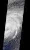
-
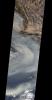
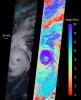
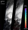
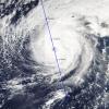
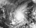
PIA22700:
-
Hurricane Florence as Viewed by NASA's MISR Instrument
Full Resolution:
TIFF
(11.96 MB)
JPEG
(506.9 kB)
|
|
|
2018-09-14 |
Earth
|
Terra
|
MISR
|
3966x1349x3 |

|
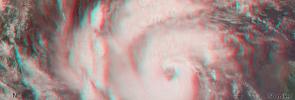
-
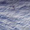
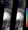
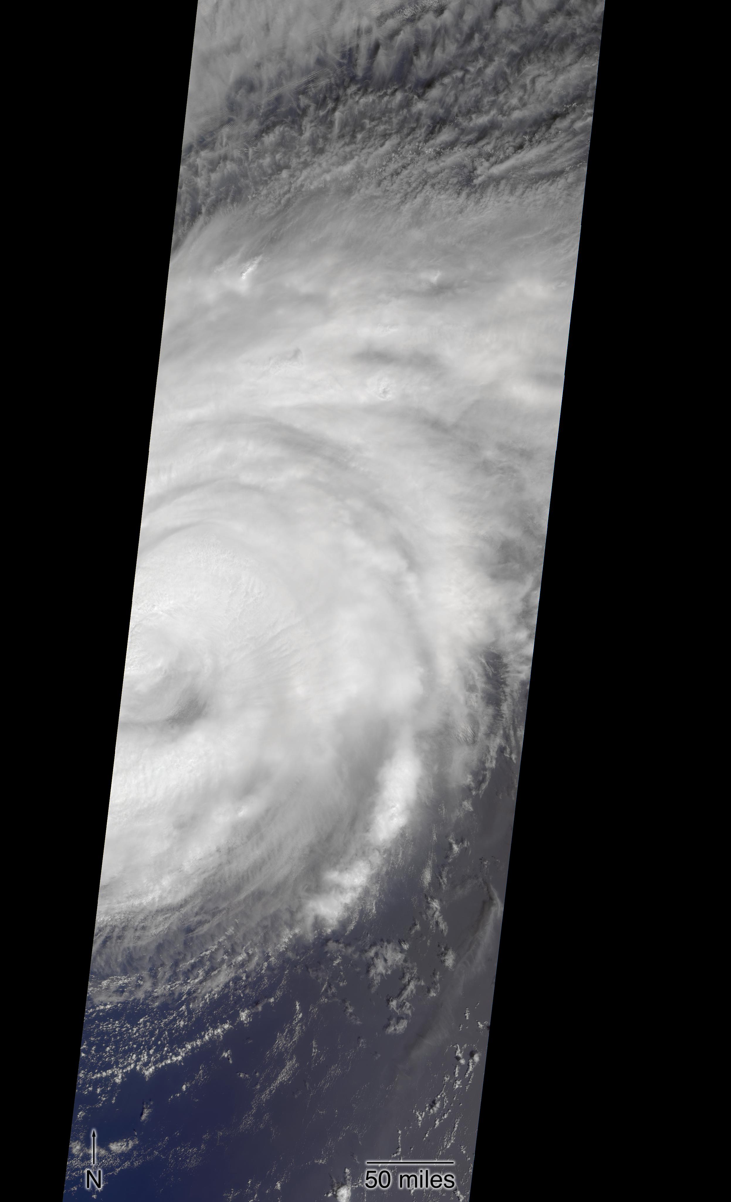
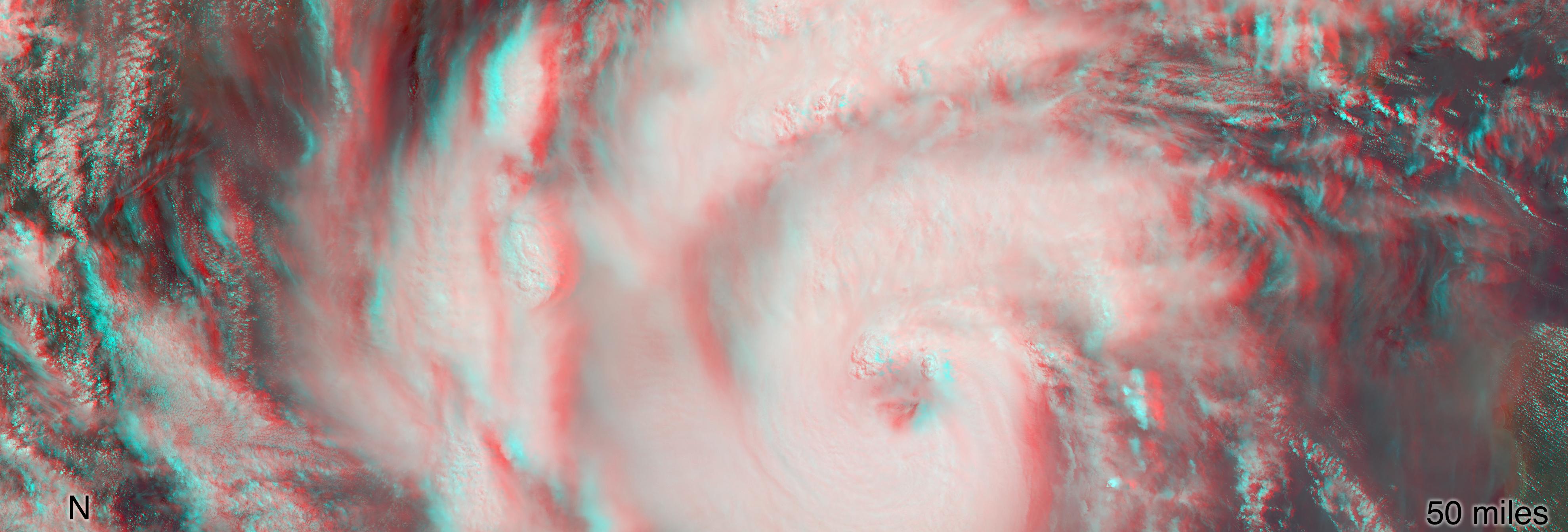
PIA22701:
-
NASA's MISR captures Hurricane Florence in 3D
Full Resolution:
TIFF
(14.61 MB)
JPEG
(386.3 kB)
|
|
|
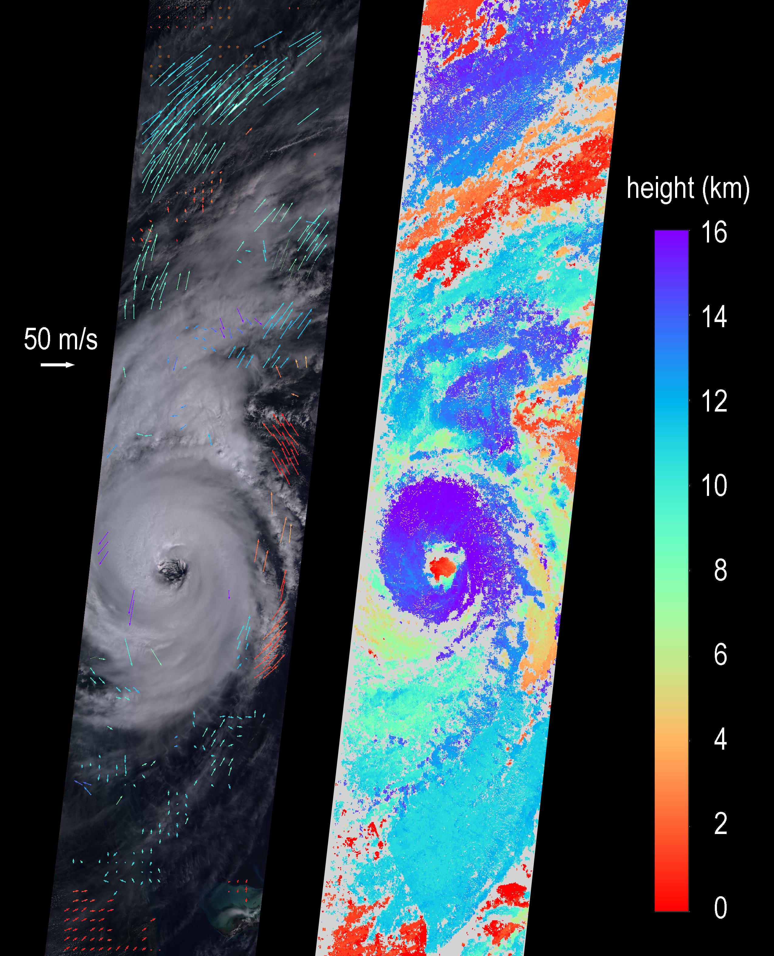
2018-10-10 |
Earth
|
Terra
|
MISR
|
6500x4726x3 |

|
-
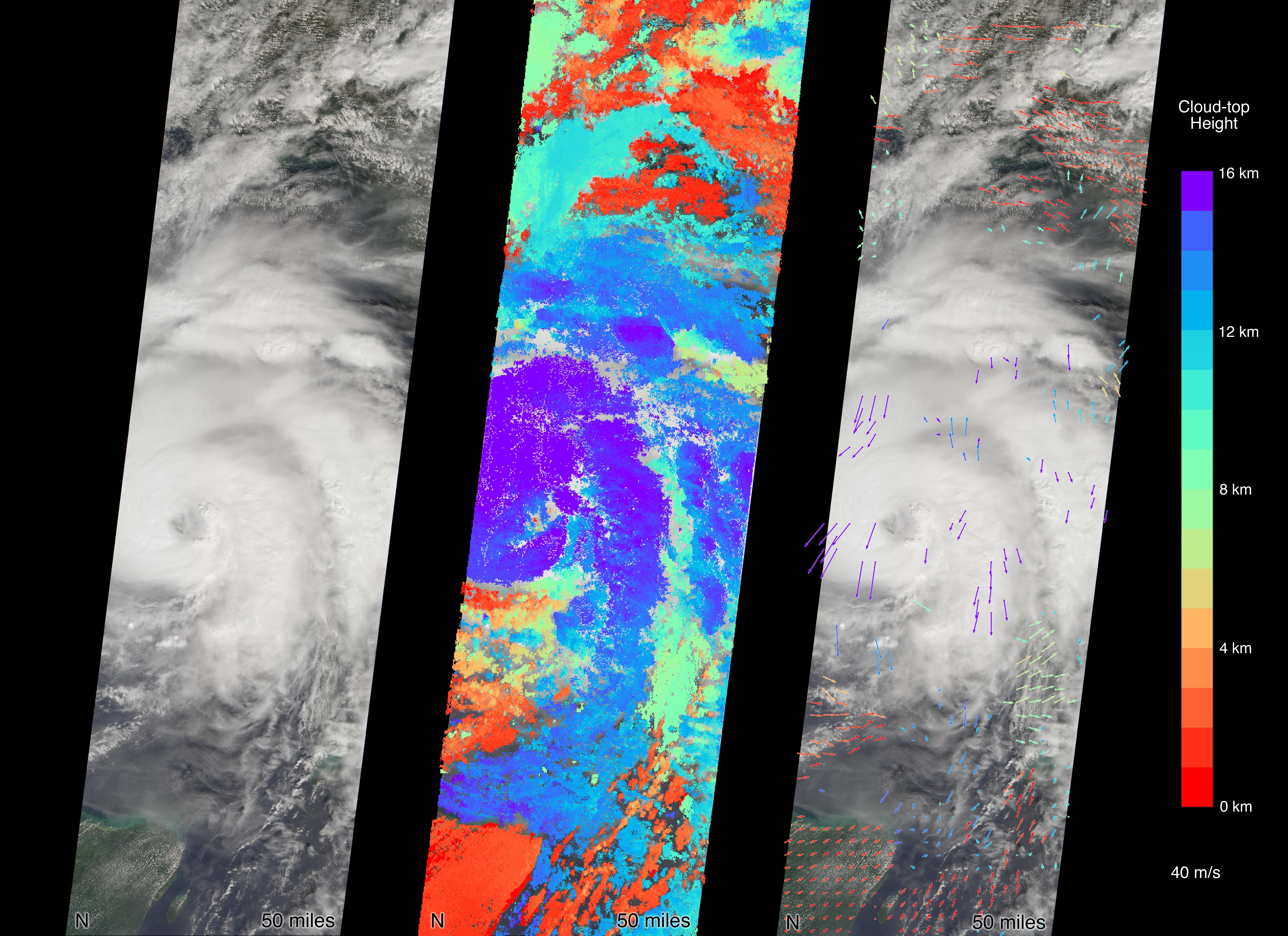
PIA22750:
-
MISR Captures Hurricane Michael Near Florida Panhandle
Full Resolution:
TIFF
(50.27 MB)
JPEG
(2.681 MB)
|
|
|
2018-10-10 |
Earth
|
Terra
|
MISR
|
3957x1343x3 |
|
-
PIA22748:
-
MISR Captures Hurricane Michael's Eye in 3D
Full Resolution:
TIFF
(15.95 MB)
JPEG
(502.6 kB)
|
|
|
2018-10-16 |
Earth
|
Terra
|
MISR
|
4200x5400x3 |
|
-
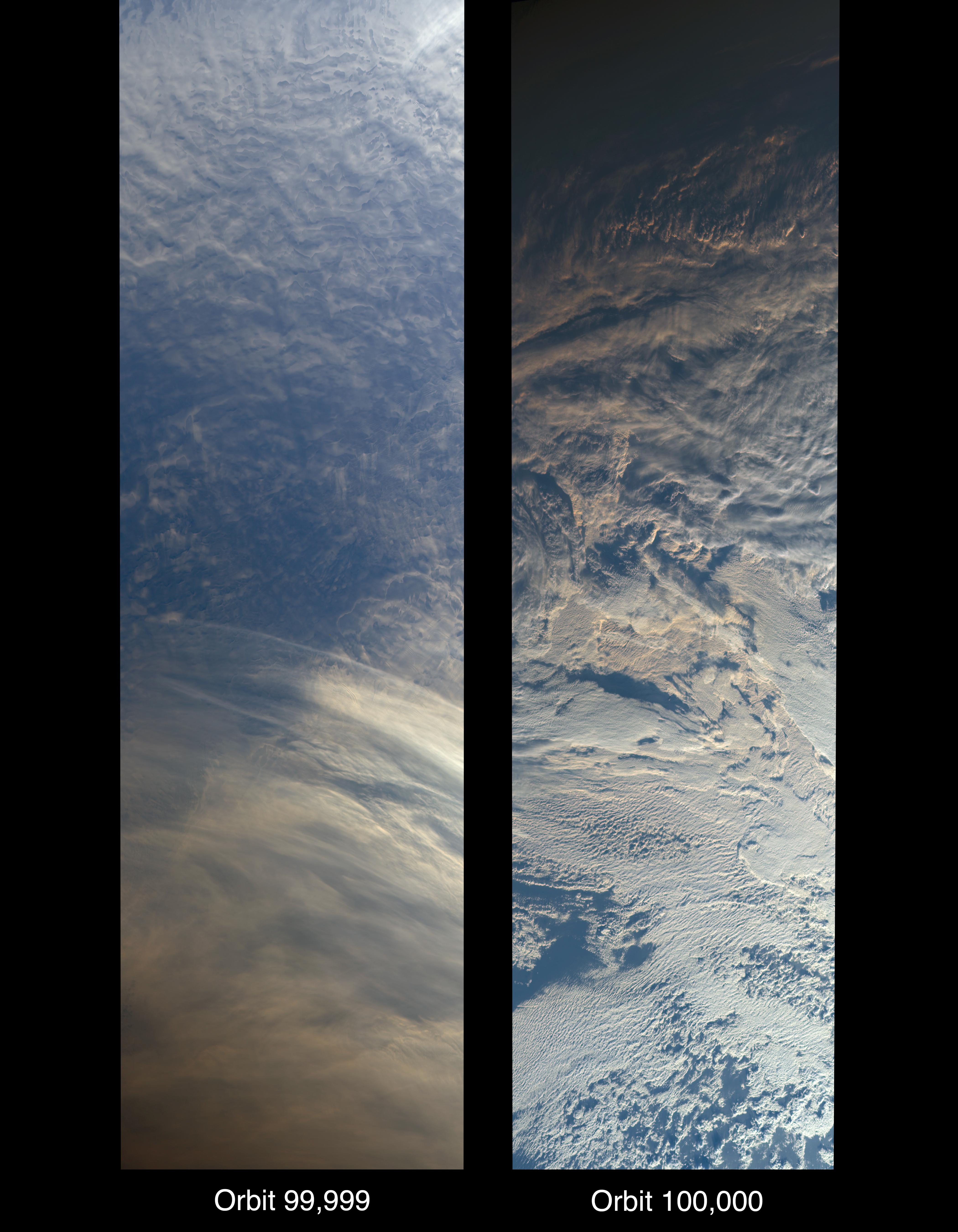
PIA22836:
-
MISR Records the View as NASA's Terra Satellite Passes Its 100,000th Orbit
Full Resolution:
TIFF
(41.59 MB)
JPEG
(1.508 MB)
|
|
|
2018-11-12 |
Earth
|
Terra
|
MISR
|
4499x1423x3 |
|
-
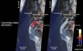
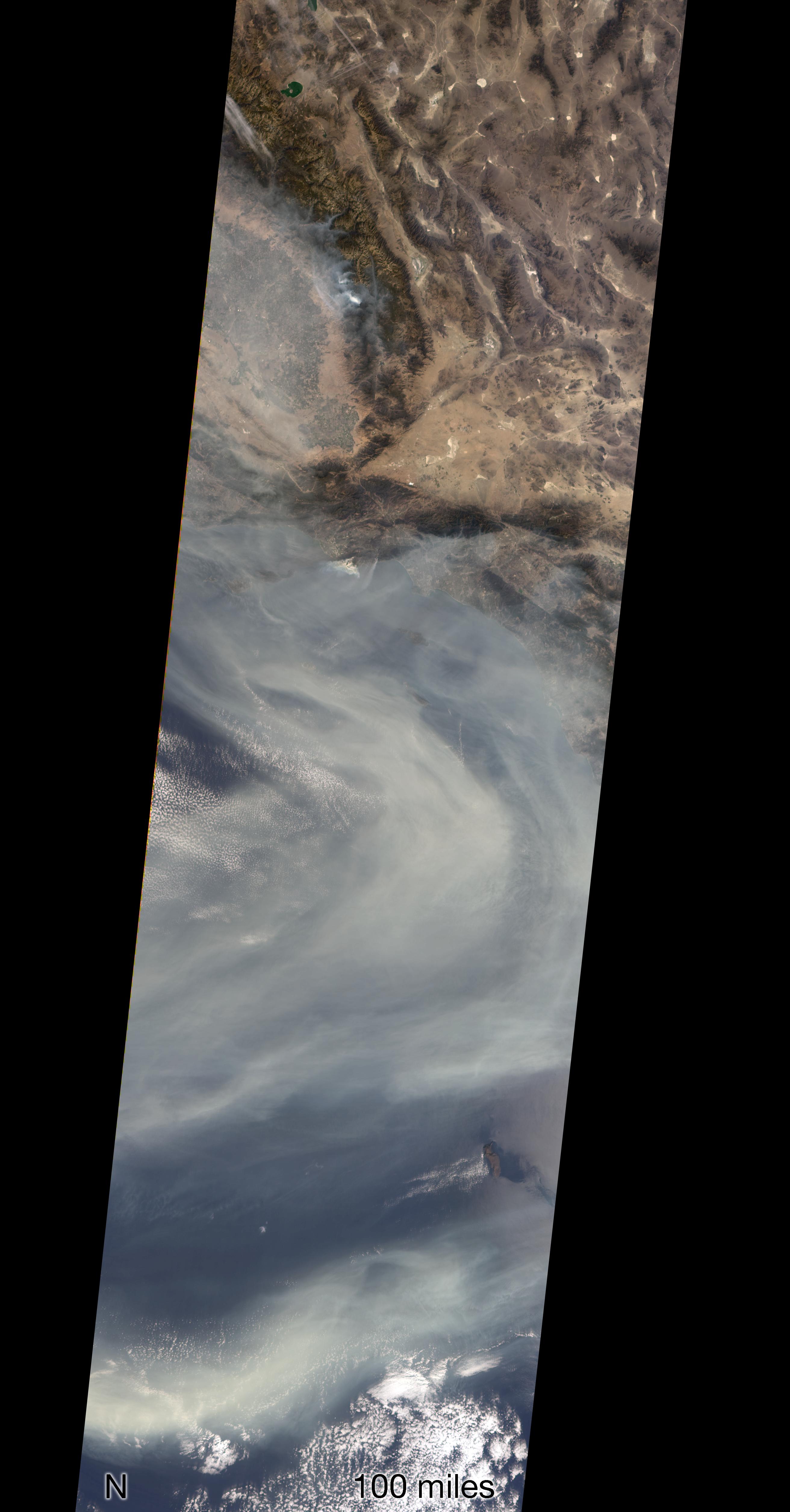
PIA22817:
-
NASA's MISR Captures 3D Image of Smoke from California's Woolsey Fire
Full Resolution:
TIFF
(17.19 MB)
JPEG
(574.8 kB)
|
|
|
2018-11-12 |
Earth
|
Terra
|
MISR
|
2624x5022x3 |
|
-
PIA22818:
-
NASA's MISR Sees California's Woolsey Fire From Space
Full Resolution:
TIFF
(19.09 MB)
JPEG
(766.6 kB)
|
|
|
2019-03-21 |
Earth
|
Terra
|
MISR
|
1830x1830x3 |
|
-
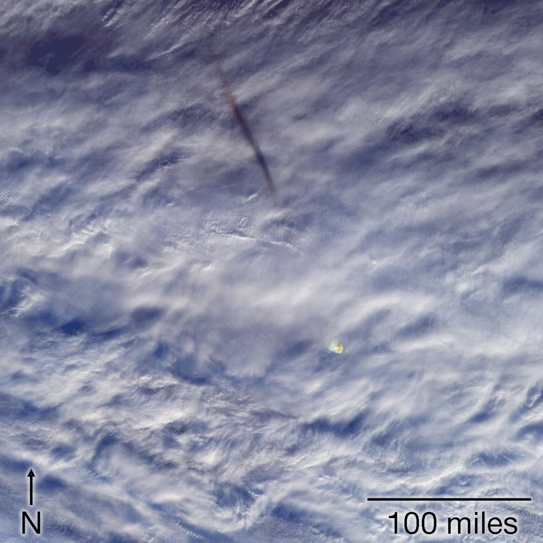
PIA22825:
-
MISR Images Fireball Over Bering Sea
Full Resolution:
TIFF
(10.05 MB)
JPEG
(369 kB)
|
|
|
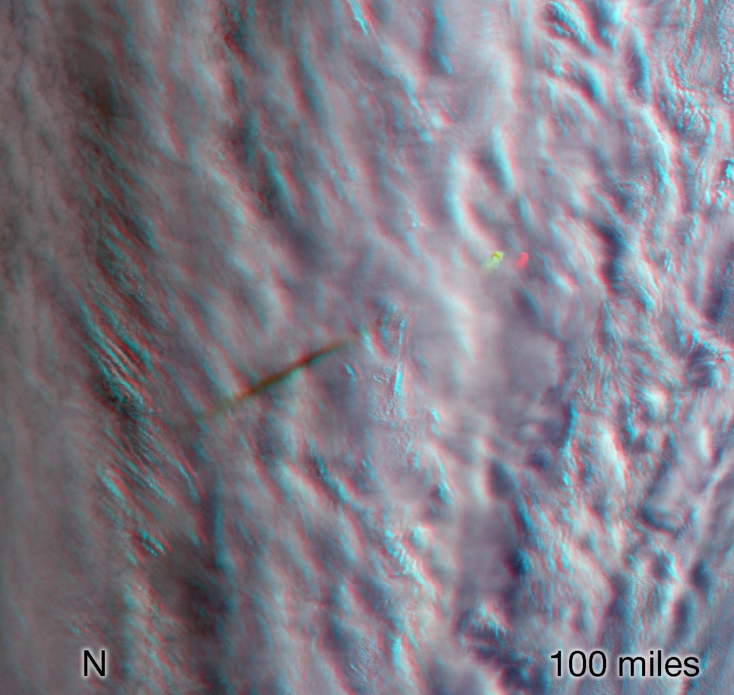
2019-03-21 |
Earth
|
Terra
|
MISR
|
1429x1354x3 |
|
-
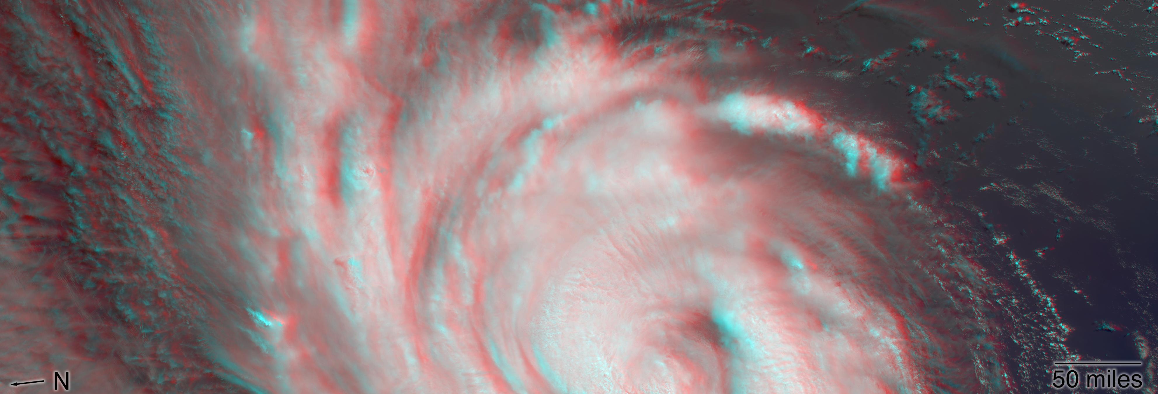
PIA23050:
-
MISR Images Fireball Over Bering Sea (Anaglyph)
Full Resolution:
TIFF
(5.807 MB)
JPEG
(178.9 kB)
|
|
|
2019-07-10 |
Earth
|
Terra
|
MISR
|
4200x3444x3 |
|
-
PIA23332:
-
MISR Where on Earth ...? MISR Mystery Image Quiz #31
Full Resolution:
TIFF
(33.45 MB)
JPEG
(962.9 kB)
|
|
|
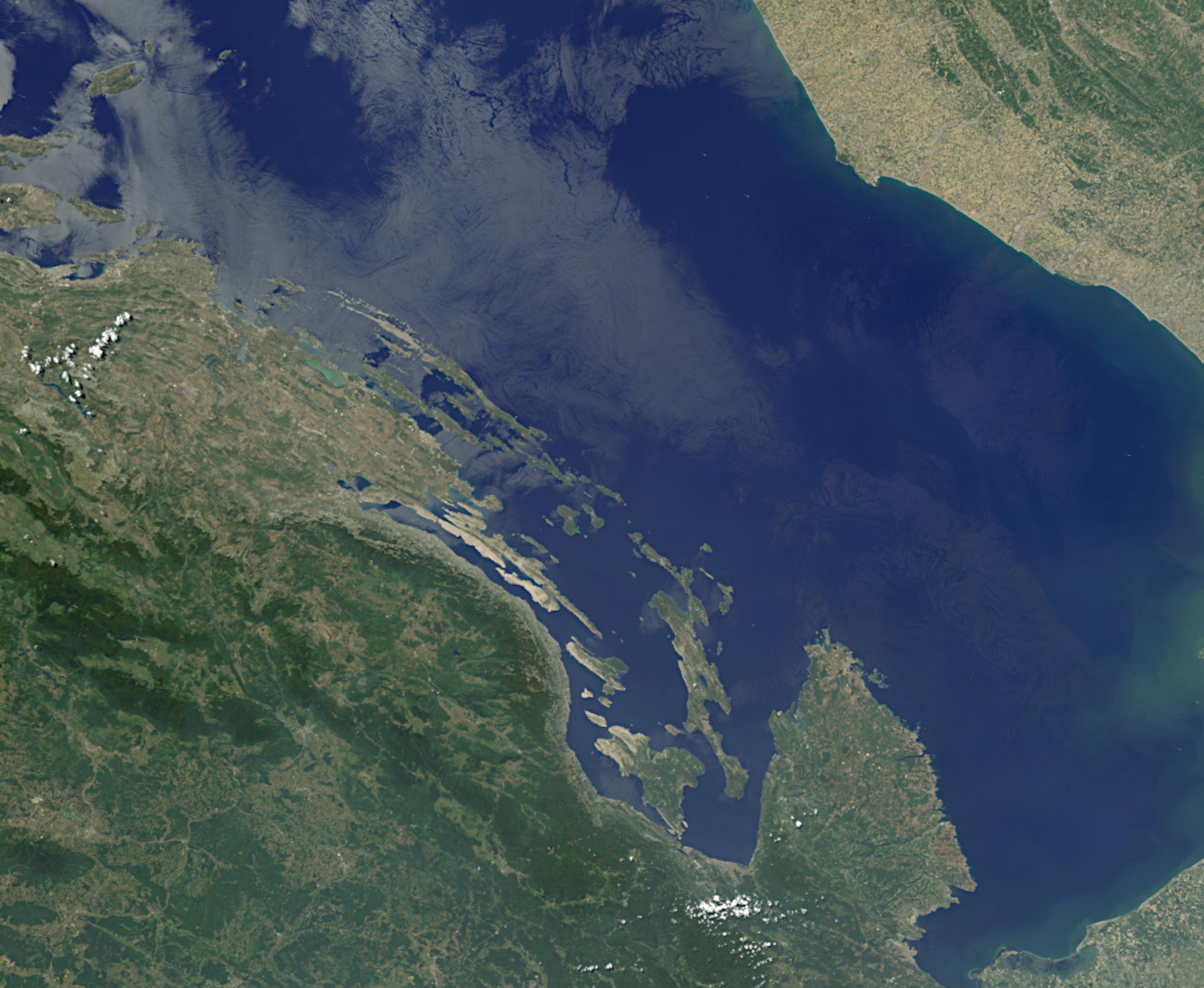
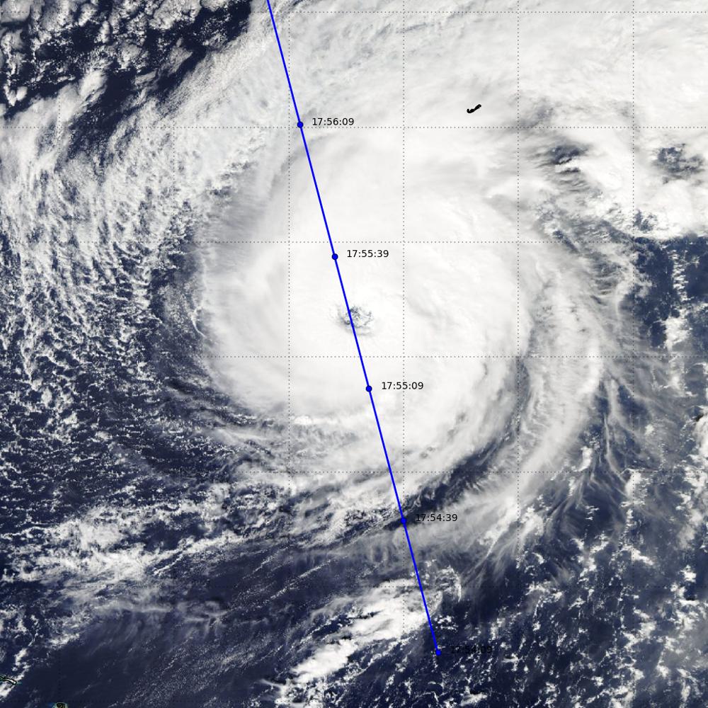
2019-09-10 |
Earth
|
Terra
|
MISR
|
2550x3150x3 |
|
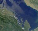
-
PIA23423:
-
NASA's MISR Observes Hurricane Dorian off the South Carolina Coast
Full Resolution:
TIFF
(12.86 MB)
JPEG
(1.031 MB)
|
|
|
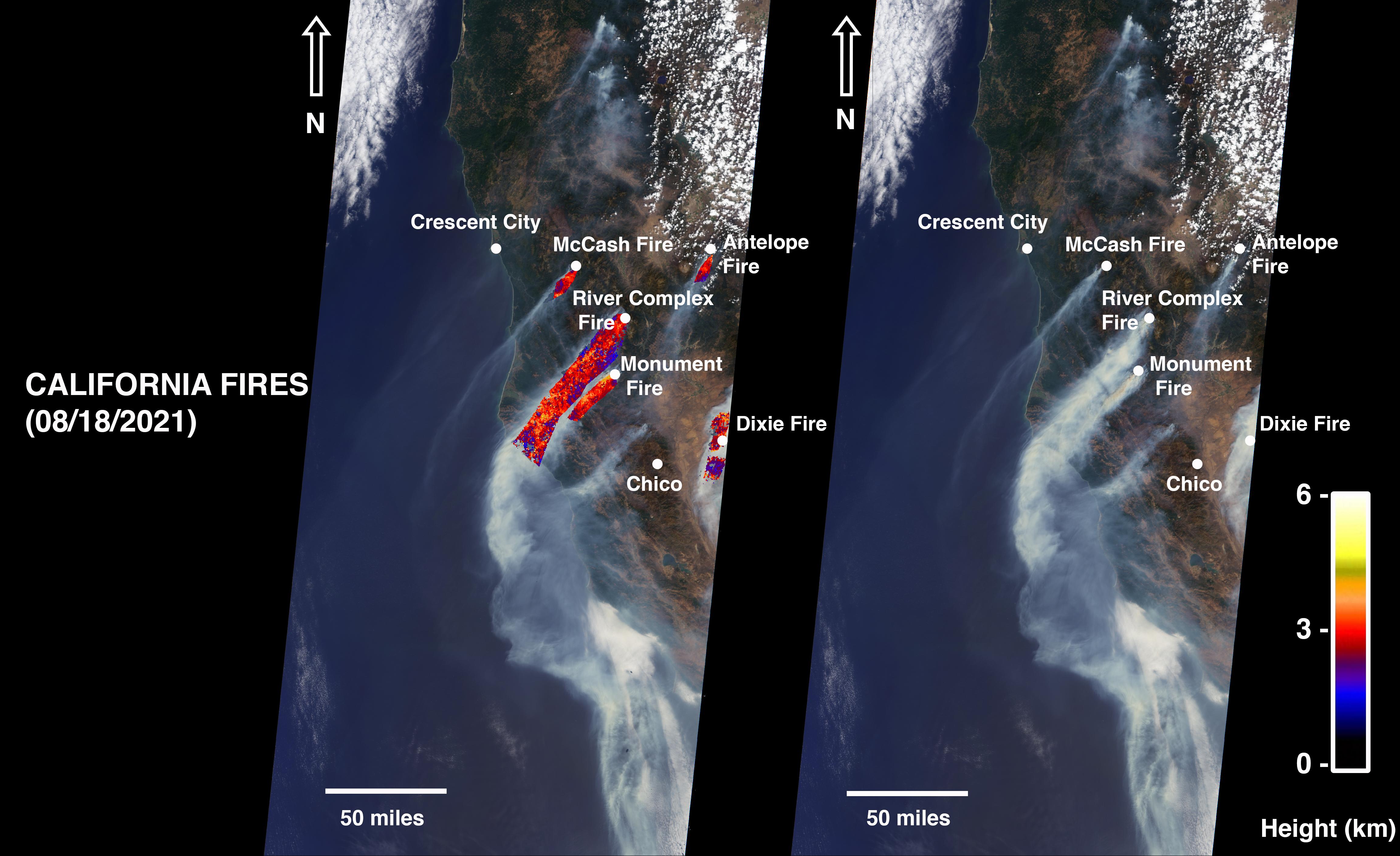
2021-08-24 |
Earth
|
Terra
|
MISR
|
4608x2817x3 |
|
-
PIA23698:
-
NASA's MISR Instrument Detects Smoke Plumes Over Northern California
Full Resolution:
TIFF
(19.55 MB)
JPEG
(940.7 kB)
|
|
|
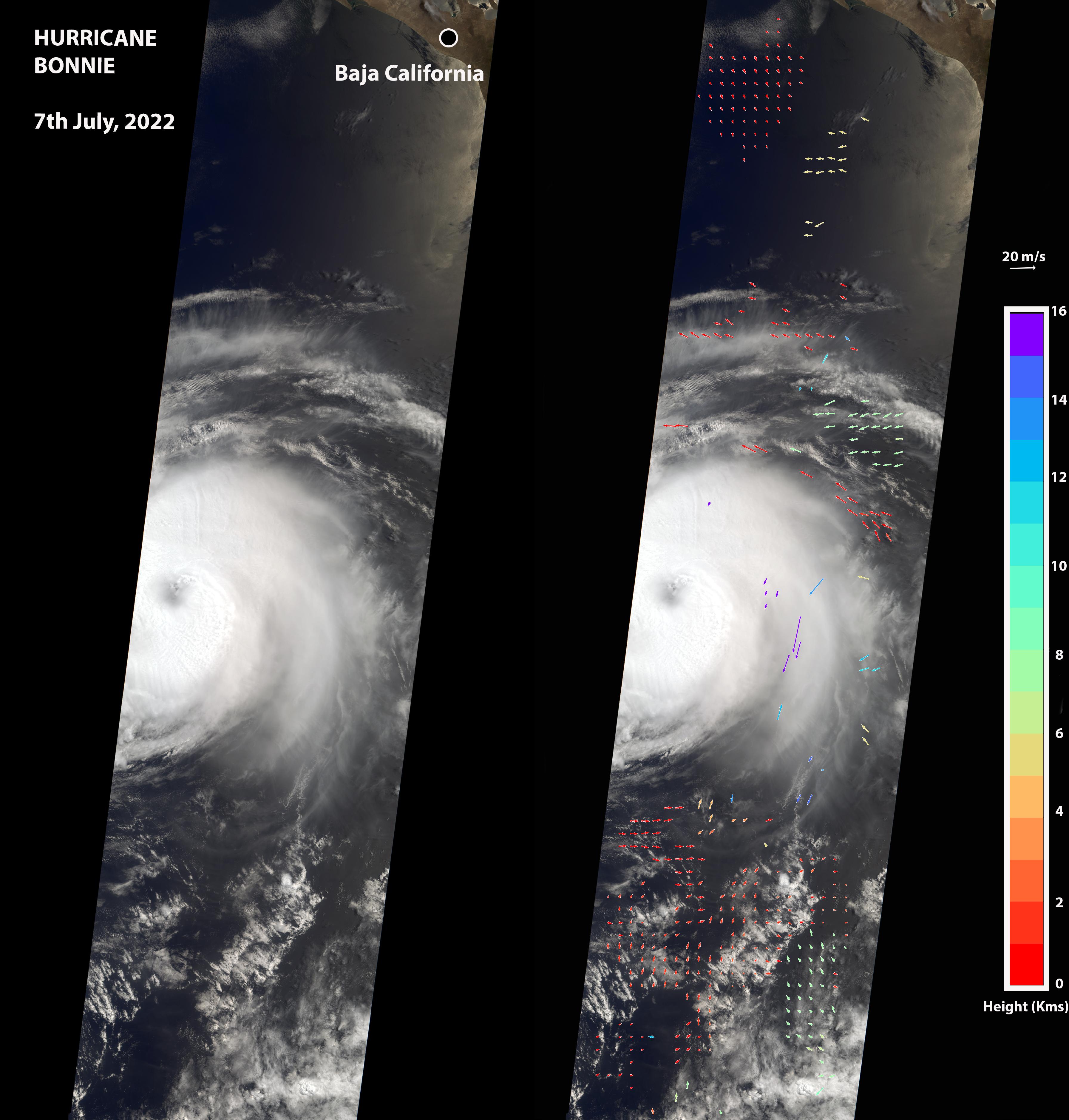
2022-07-08 |
Earth
|
Terra
|
MISR
|
3584x3754x3 |
|
-
PIA24906:
-
NASA's MISR Captures Hurricane Bonnie
Full Resolution:
TIFF
(16.61 MB)
JPEG
(877 kB)
|
|
|
2022-07-26 |
Earth
|
Terra
|
MISR
|
3500x1029x3 |
|
-
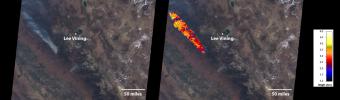
PIA24907:
-
MISR Images Oak Fire Near Yosemite
Full Resolution:
TIFF
(7.635 MB)
JPEG
(379.1 kB)
|
|
|
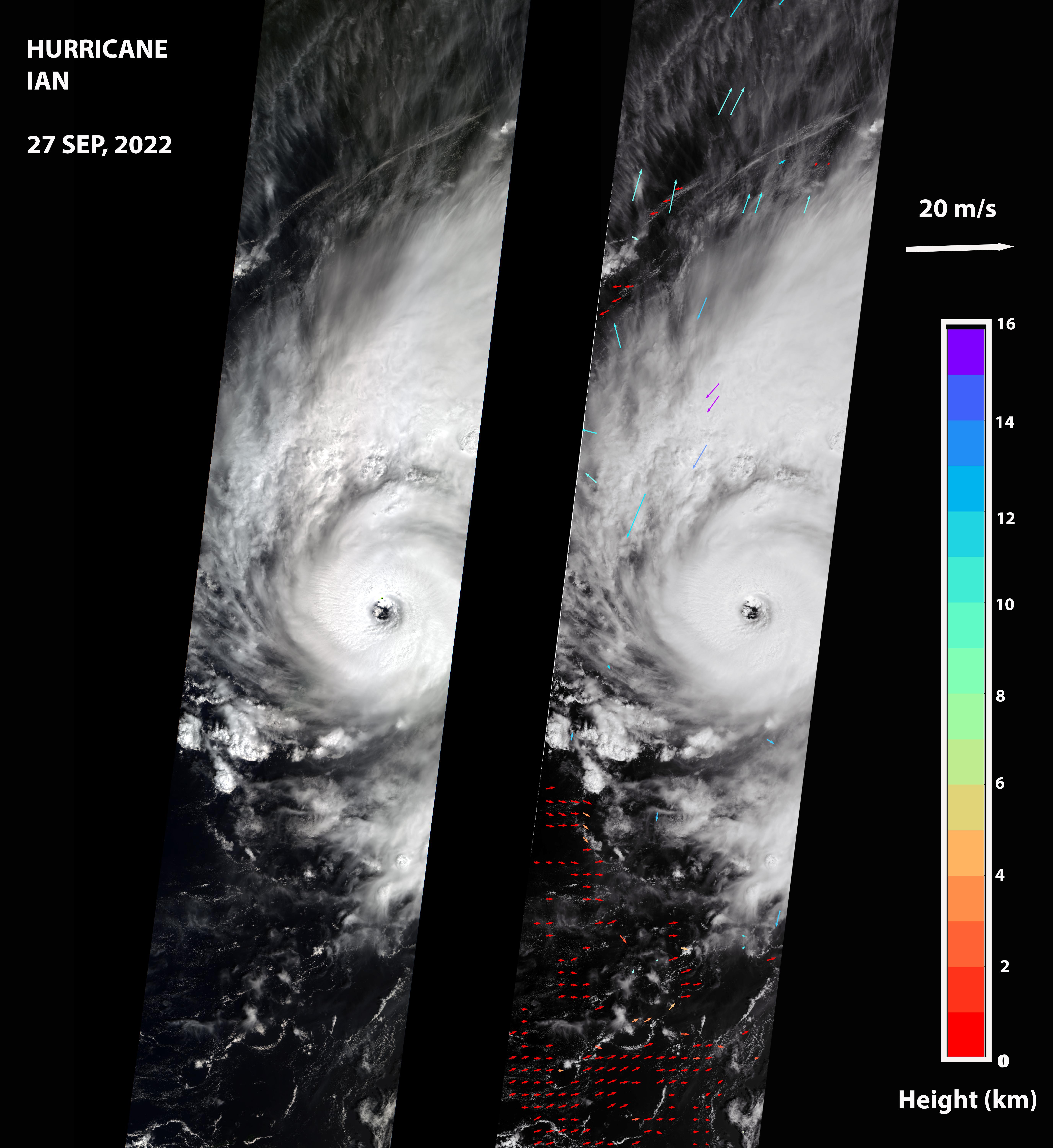
2022-09-30 |
Earth
|
Terra
|
MISR
|
5504x6001x3 |
|
-
PIA24909:
-
MISR Captures Hurricane Ian
Full Resolution:
TIFF
(34.94 MB)
JPEG
(1.738 MB)
|
|
|
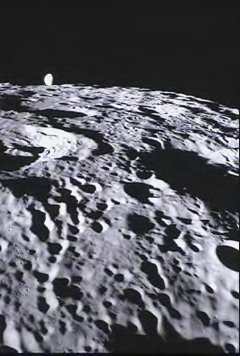
2012-03-22 |
Moon
|
GRAIL
|
MoonKAM
|
486x720x3 |
|
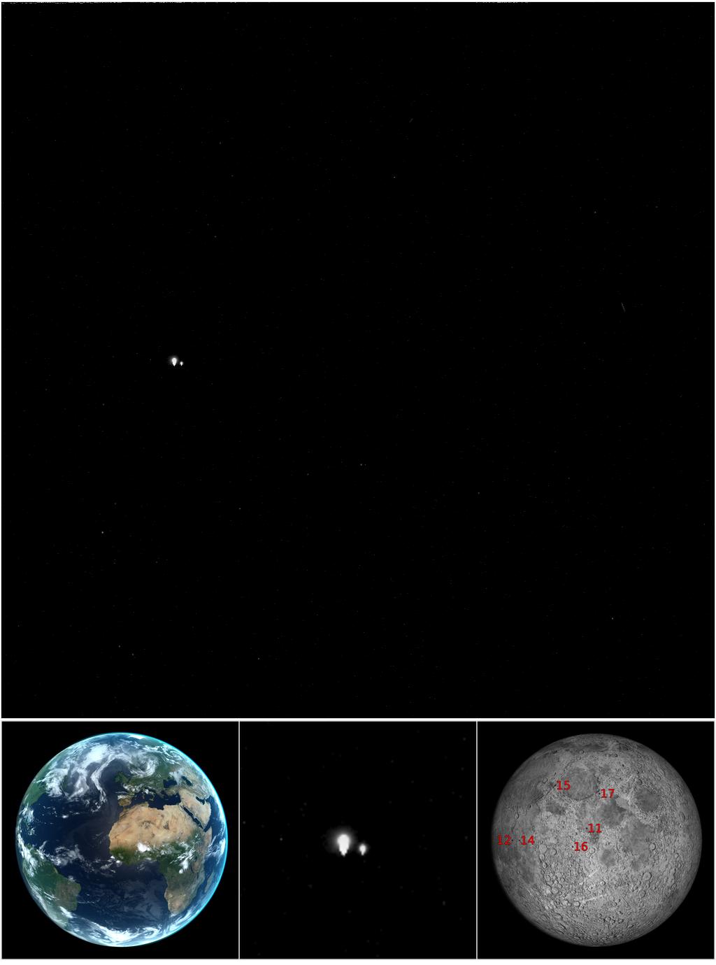
-
PIA15514:
-
MoonKAM Looks Homeward
Full Resolution:
TIFF
(1.051 MB)
JPEG
(59.59 kB)
|
|
|
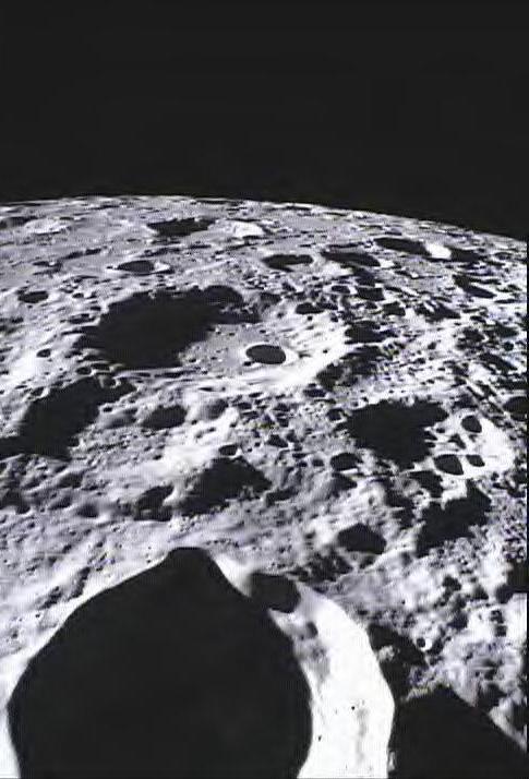
2012-03-22 |
Moon
|
GRAIL
|
MoonKAM
|
485x714x3 |
|
-
PIA15515:
-
Far Side of Moon Imaged by MoonKAM
Full Resolution:
TIFF
(1.04 MB)
JPEG
(59.81 kB)
|
|
|
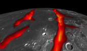
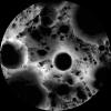
2012-12-05 |
Moon
|
GRAIL
|
MoonKAM
|
364x480x1 |
|
-
PIA16620:
-
Mare Orientale Flyover

Full Resolution:
TIFF
(175.1 kB)
JPEG
(35.44 kB)
|
|
|
2009-09-24 |
Moon
|
Cassini-Huygens
Chandrayaan-1
|
Moon Mineralogy Mapper
VIMS
|
1410x1120x3 |
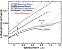
|
-
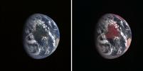
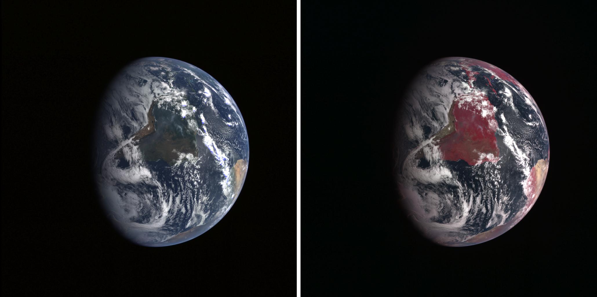
PIA12227:
-
Cassini and Chandrayaan-1 Agree
Full Resolution:
TIFF
(4.747 MB)
JPEG
(159.6 kB)
|
|
|
2008-12-17 |
Moon
|
Chandrayaan-1
|
Moon Mineralogy Mapper
|
631x635x3 |
|
-
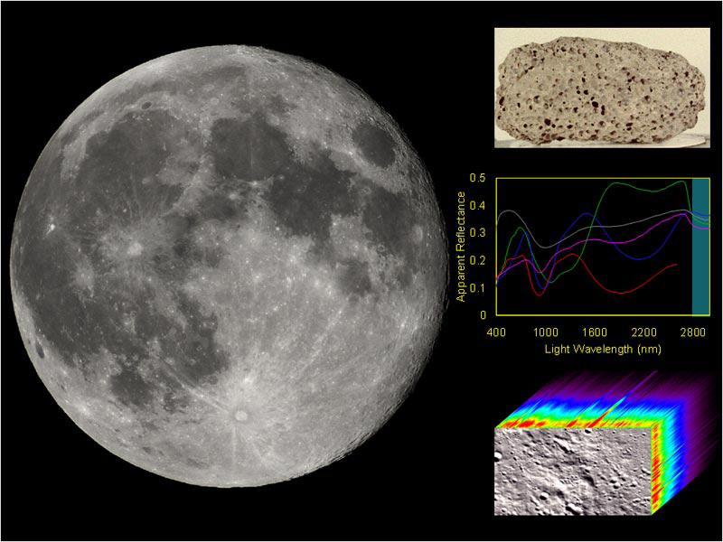
PIA11727:
-
NASA's Moon Mineralogy Mapper
Full Resolution:
TIFF
(1.204 MB)
JPEG
(65.59 kB)
|
|
|
2009-08-03 |
Moon
|
Chandrayaan-1
|
Moon Mineralogy Mapper
|
1709x669x3 |

|
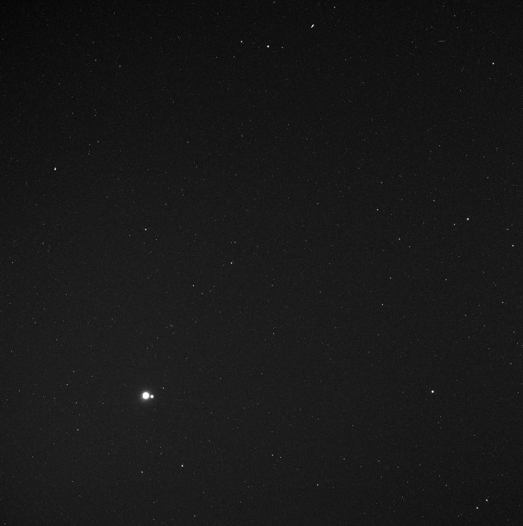
-
PIA12158:
-
Moon Mapper Looks Homeward
Full Resolution:
TIFF
(3.436 MB)
JPEG
(43.77 kB)
|
|
|
2009-09-24 |
Moon
|
Chandrayaan-1
|
Moon Mineralogy Mapper
|
1260x780x3 |

|
-
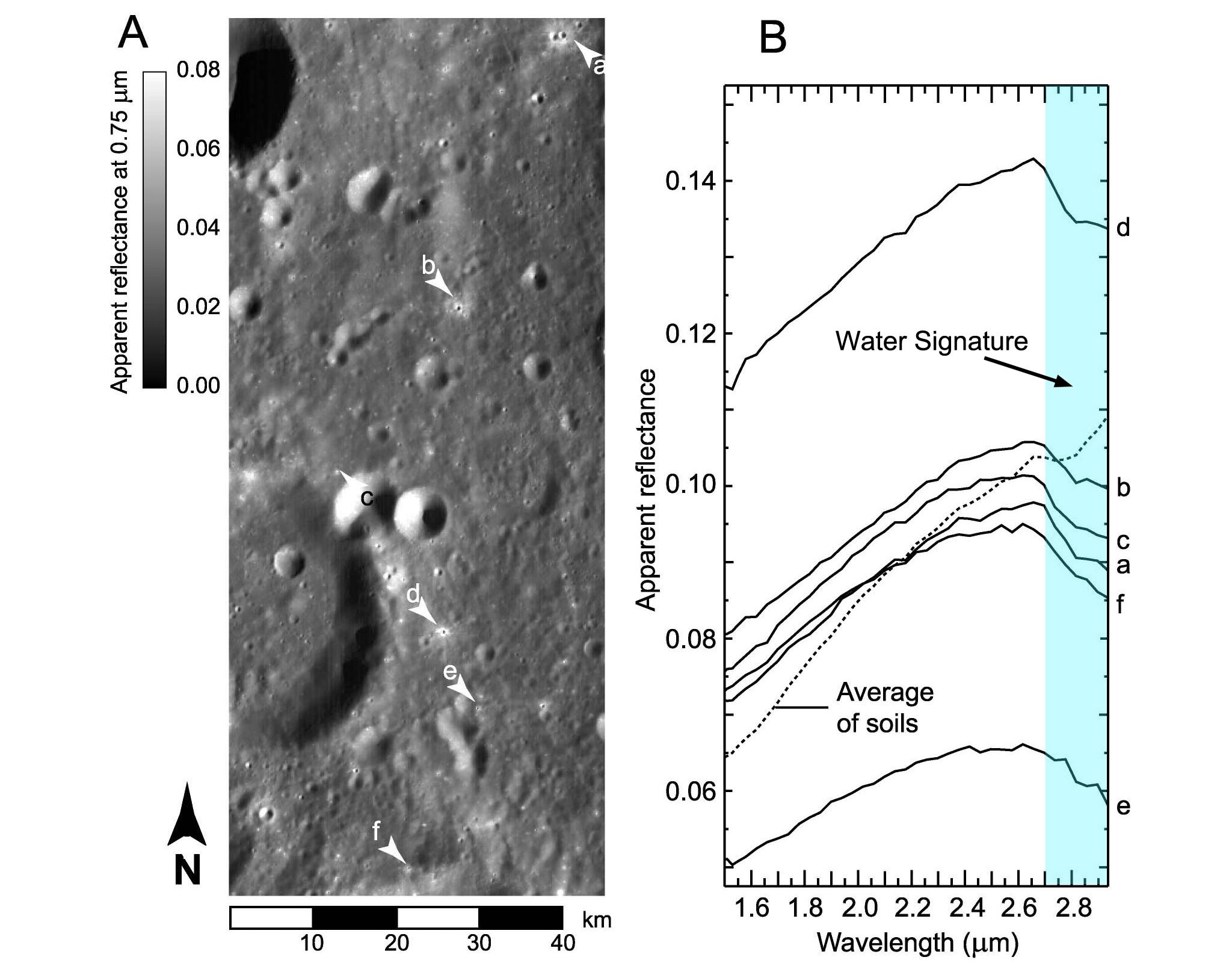
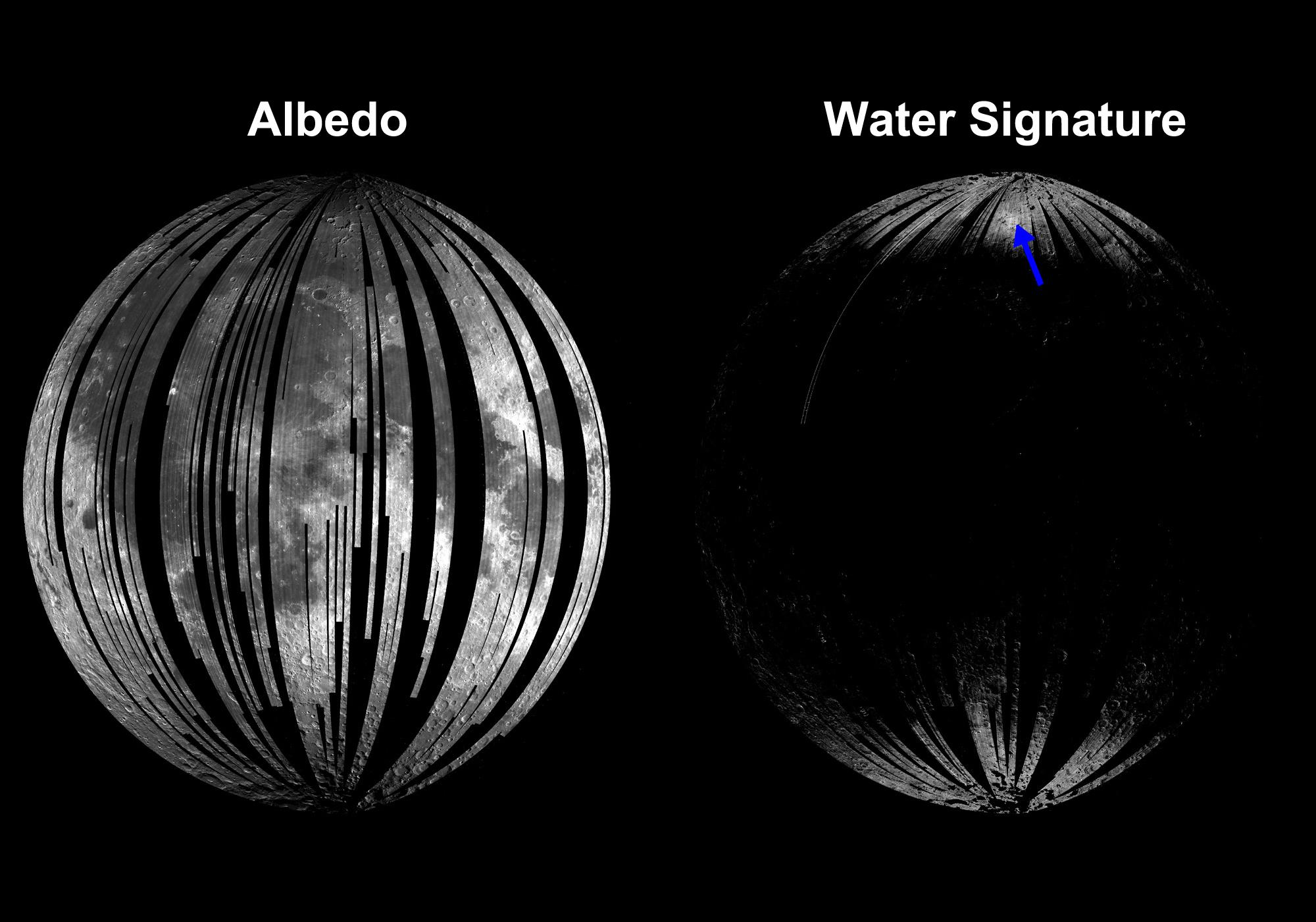
PIA12225:
-
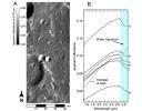
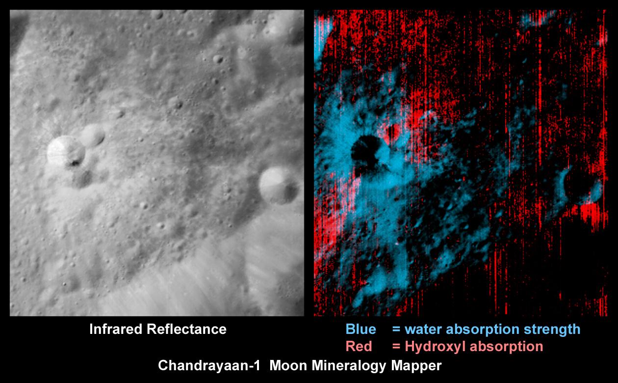
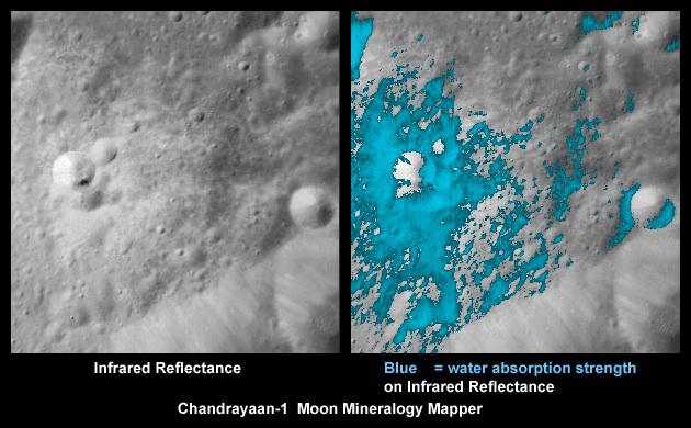
Rays of Water and Hydroxyl
Full Resolution:
TIFF
(2.952 MB)
JPEG
(133.4 kB)
|
|
|
2009-09-24 |
Moon
|
Chandrayaan-1
|
Moon Mineralogy Mapper
|
630x390x3 |

|
-
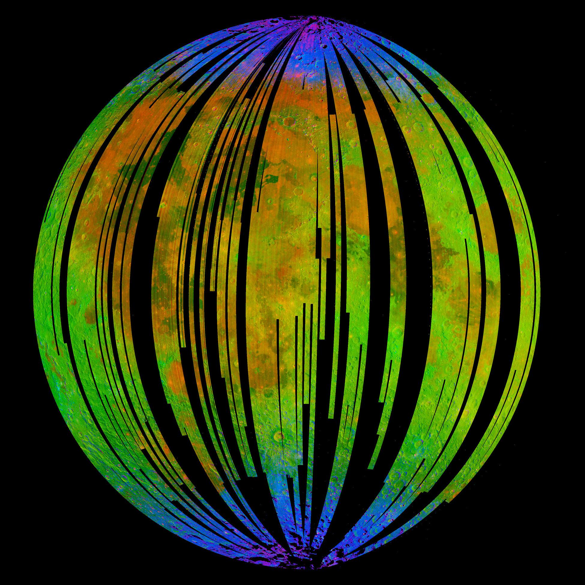
PIA12226:
-
Water Around a Fresh Crater
Full Resolution:
TIFF
(738.1 kB)
JPEG
(47.87 kB)
|
|
|
2009-09-24 |
Moon
|
Chandrayaan-1
|
Moon Mineralogy Mapper
|
800x601x3 |
|
-
PIA12229:
-
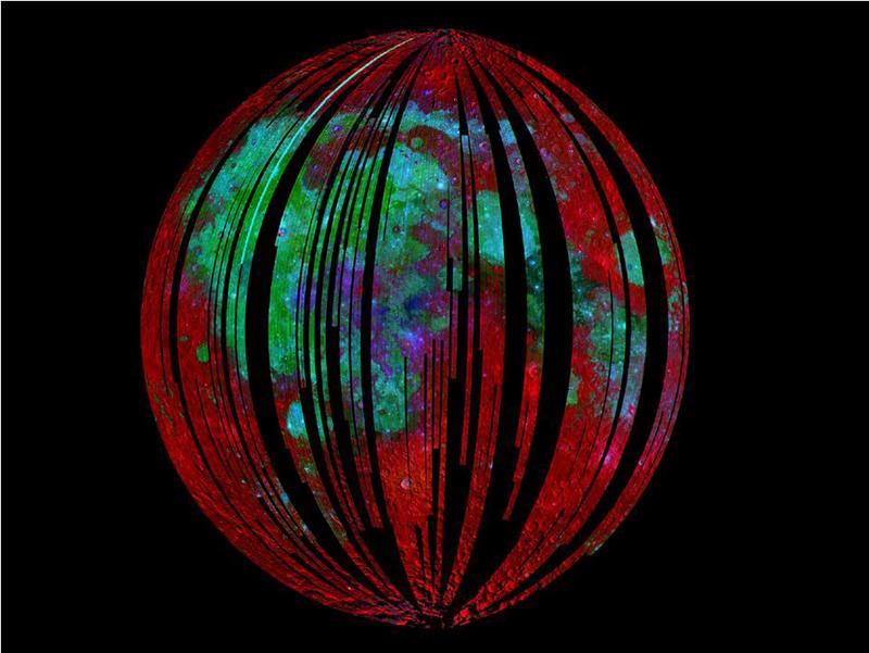
Mineral Mapping the Moon
Full Resolution:
TIFF
(1.444 MB)
JPEG
(59.63 kB)
|
|
|
2009-09-24 |
Moon
|
Chandrayaan-1
|
Moon Mineralogy Mapper
|
800x627x3 |
|
-
PIA12230:
-
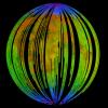
Colorful Cubes of Light
Full Resolution:
TIFF
(1.507 MB)
JPEG
(101.1 kB)
|
|
|
2009-09-24 |
Moon
|
Chandrayaan-1
|
Moon Mineralogy Mapper
|
800x600x3 |

|
-
PIA12232:
-
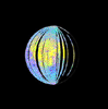
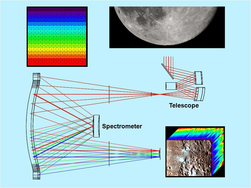
Dispersing Light through the Moon Mineralogy Mapper
Full Resolution:
TIFF
(1.442 MB)
JPEG
(77.51 kB)
|
|
|
2009-09-24 |
Moon
|
Chandrayaan-1
|
Moon Mineralogy Mapper
|
800x600x3 |

|
-
PIA12233:
-
Mapping the Moon, Point by Point
Full Resolution:
TIFF
(1.442 MB)
JPEG
(72.78 kB)
|
|
|
2009-09-24 |
Moon
|
Chandrayaan-1
|
Moon Mineralogy Mapper
|
2048x1600x3 |
|
-
PIA12234:
-
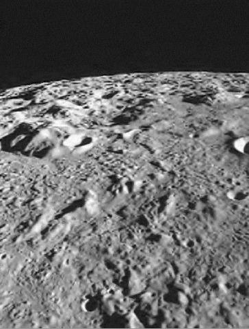
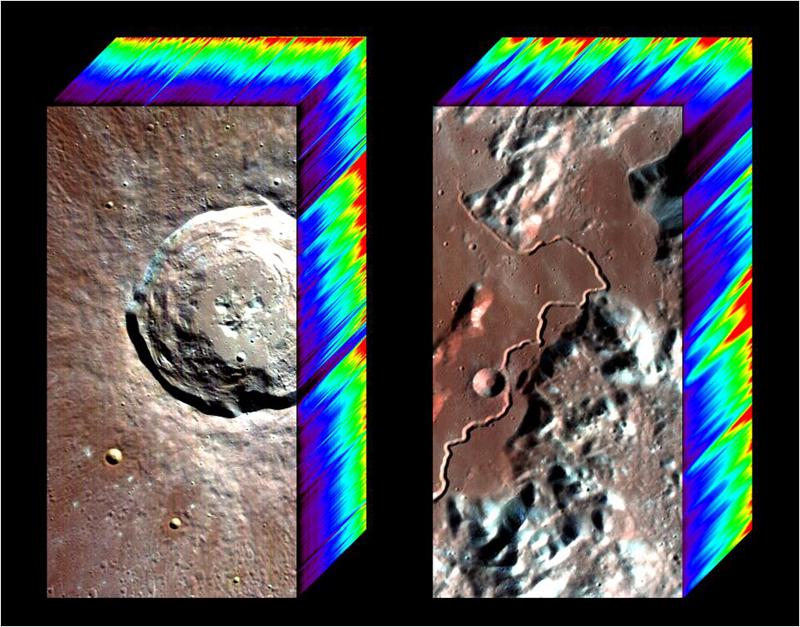
Craters and the Tell-Tale Signatures
Full Resolution:
TIFF
(9.843 MB)
JPEG
(252.4 kB)
|
|
|
2009-09-24 |
Moon
|
Chandrayaan-1
|
Moon Mineralogy Mapper
|
2000x1400x3 |
|
-
PIA12235:
-
Nearside of the Moon
Full Resolution:
TIFF
(8.411 MB)
JPEG
(250.2 kB)
|
|
|
2009-09-24 |
Moon
|
Chandrayaan-1
|
Moon Mineralogy Mapper
|
1950x1950x3 |
|
-
PIA12237:
-
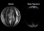
Water Detected at High Latitudes
Full Resolution:
TIFF
(11.42 MB)
JPEG
(559.2 kB)
|
|
|
2009-09-24 |
Moon
|
Chandrayaan-1
|
Moon Mineralogy Mapper
|
492x496x3 |
|
-
PIA12238:
-
Invisible Colors of the Moon
Full Resolution:
TIFF
(733.1 kB)
JPEG
(19.21 kB)
|
|
|
2016-10-14 |
Earth
|
Aqua
|
MODIS
VIIRS
|
1000x1000x3 |
|
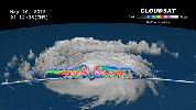
-
PIA21098:
-
NASA's CloudSat Looks Hurricane Nicole in the Eye
Full Resolution:
TIFF
(2.794 MB)
JPEG
(195.4 kB)
|
|
|
2015-05-22 |
Earth
|
CloudSat
|
MODIS
|
960x540x3 |
|
-
PIA19475:
-
NASA's CloudSat Peers Into the Eye of Powerful Typhoon Dolphin
Full Resolution:
TIFF
(1.556 MB)
JPEG
(61.88 kB)
|
|
|
2019-03-21 |
Earth
|
Terra
|
MODIS
|
3289x2252x3 |
|
-
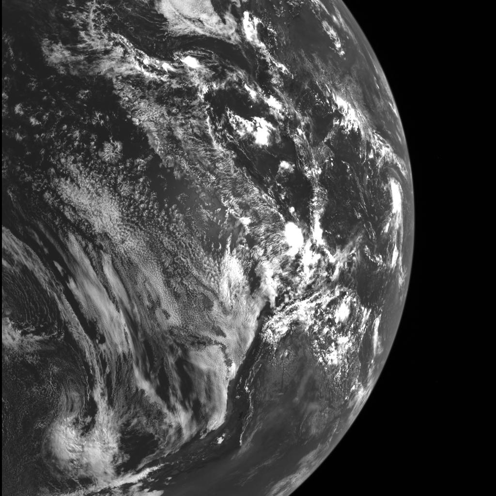
PIA23141:
-
MODIS Images Fireball over Bering Sea
Full Resolution:
TIFF
(16.58 MB)
JPEG
(853.1 kB)
|
|
|
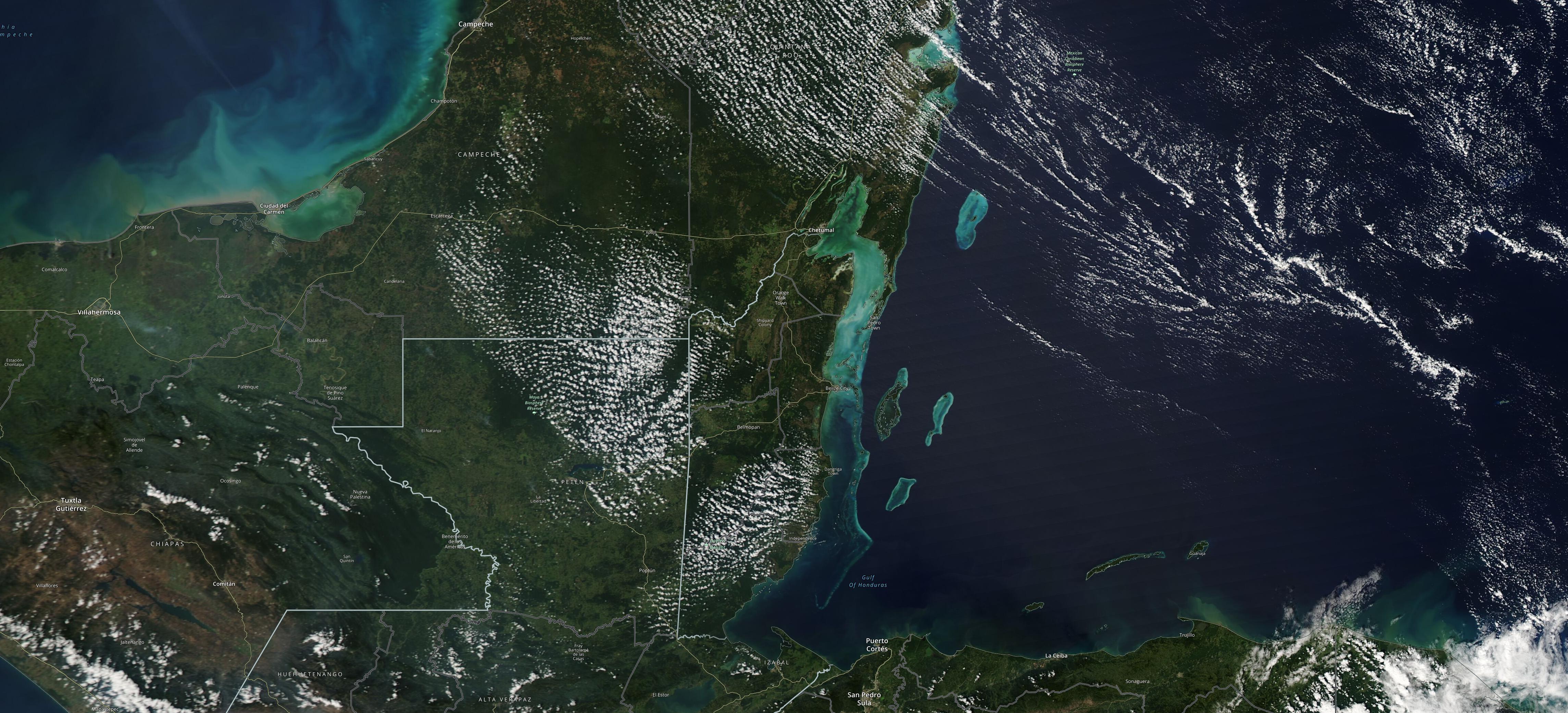
2023-04-05 |
Earth
|
MODIS
|
MODIS
|
4579x2083x3 |
|
-
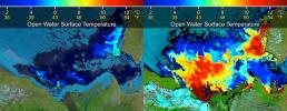
PIA25861:
-
Study Uses MODIS Data to Determine Belize Coral Reef Risk
Full Resolution:
TIFF
(22.51 MB)
JPEG
(1.357 MB)
|
|
|
2023-04-05 |
Earth
|
MODIS
|
MODIS
|
2550x3300x3 |
|
-
PIA25862:
-
Map Shows Belizean Protected Areas Assessed for Risk
Full Resolution:
TIFF
(13.96 MB)
JPEG
(683.8 kB)
|
|
|
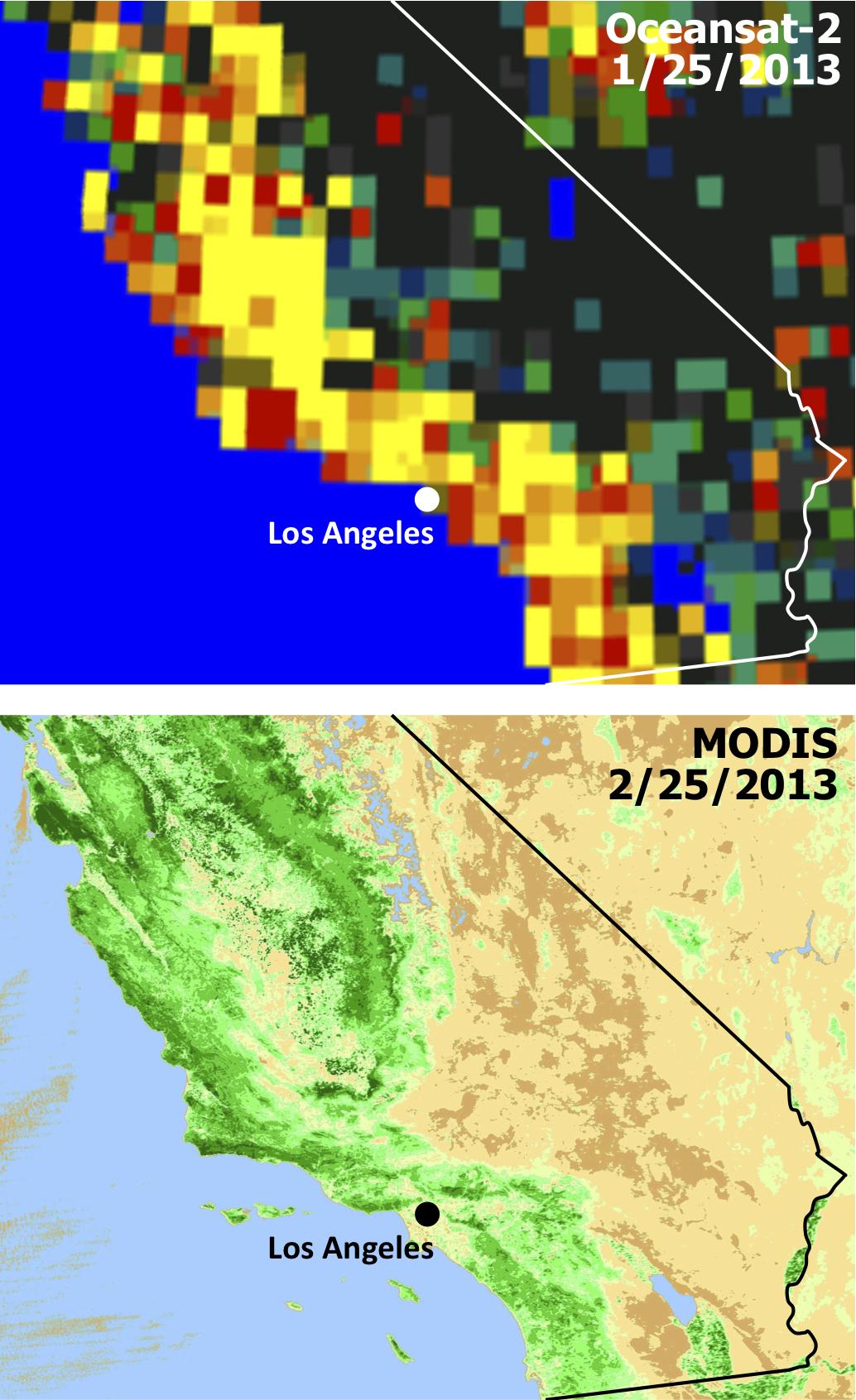
2013-05-13 |
Earth
|
Aqua
OSCAT
|
MODIS
OSCAT Scatterometer
|
1034x1692x3 |
|
-
PIA17052:
-
Satellites See Double Jeopardy for Socal Fire Season
Full Resolution:
TIFF
(5.251 MB)
JPEG
(212.1 kB)
|
|
|
2013-06-13 |
Earth
|
Aqua
Terra
|
MODIS
MODIS
|
1659x1452x3 |
|
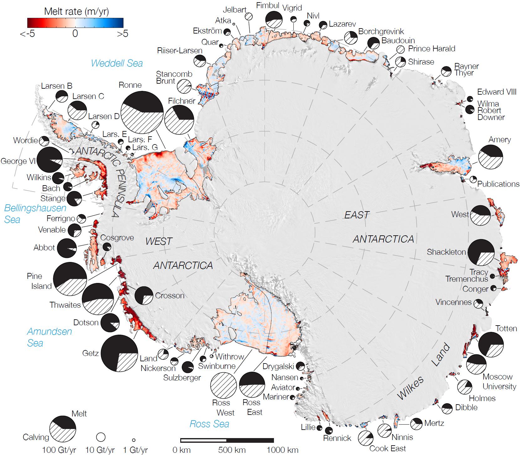
-
PIA17284:
-
Rates of Basal Melt of Antarctic Ice Shelves
Full Resolution:
TIFF
(7.23 MB)
JPEG
(358.1 kB)
|
|
|
2017-07-14 |
Earth
|
Suomi NPP
Terra
|
MODIS
VIIRS
|
1805x1350x1 |
|
-
PIA21785:
-
Spawning of Massive Antarctic Iceberg Captured by NASA Animation
Full Resolution:
TIFF
(1.693 MB)
JPEG
(201.4 kB)
|
|
|
2010-04-16 |
Earth
|
Terra
|
MODIS
|
3780x2328x3 |
|
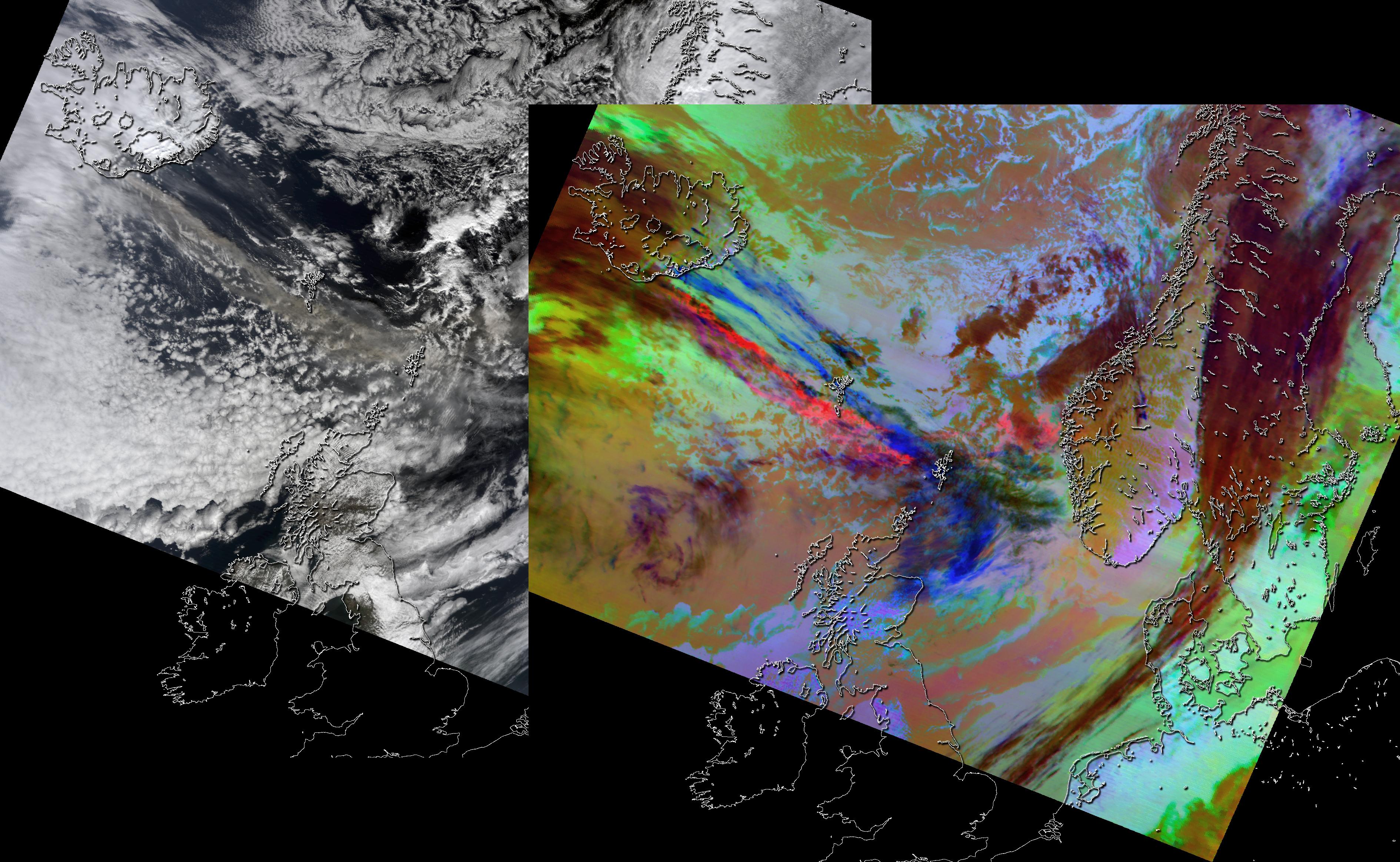
-
PIA13046:
-
NASA Satellite Images Provide Insights Into Iceland Volcanic Plume
Full Resolution:
TIFF
(26.4 MB)
JPEG
(1.262 MB)
|
|
|
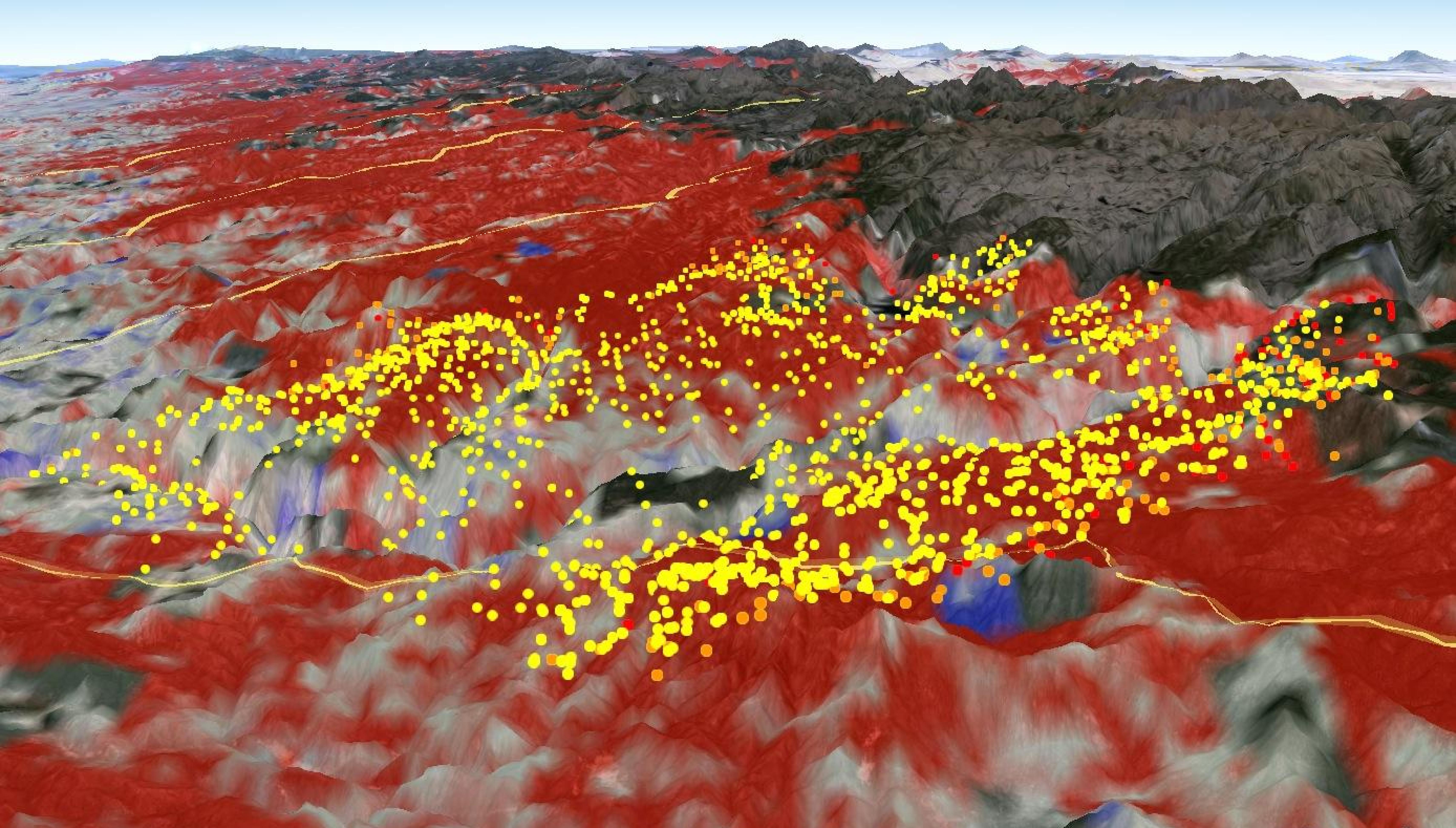
2014-03-05 |
Earth
|
Terra
|
MODIS
|
2410x935x3 |
|
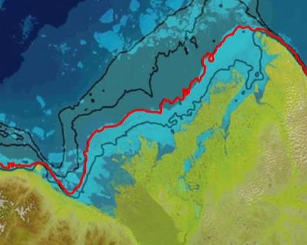
-
PIA18034:
-
Warm Rivers Play Role in Arctic Sea Ice Melt
Full Resolution:
TIFF
(6.763 MB)
JPEG
(430.9 kB)
|
|
|
2014-03-05 |
Earth
|
Terra
|
MODIS
|
436x348x3 |
|
-
PIA18035:
-
Warm Rivers Play Role in Arctic Sea Ice Melt (Animation)
Full Resolution:
TIFF
(455.6 kB)
JPEG
(23.57 kB)
|
|
|
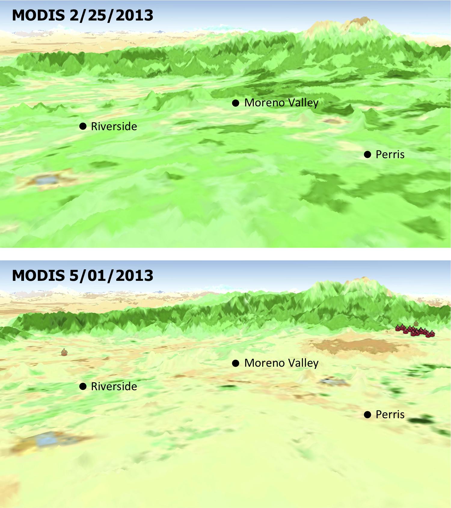
2013-05-13 |
Earth
|
Aqua
|
MODIS
|
1500x1686x3 |
|
-
PIA17053:
-
MODIS Satellite See Double Jeopardy for Socal Fire Season
Full Resolution:
TIFF
(7.59 MB)
JPEG
(220.7 kB)
|
|
|
2014-05-29 |
Earth
|
Aqua
|
MODIS
|
7091x5556x1 |
|
-
PIA18097:
-
Hurricane Amanda
Full Resolution:
TIFF
(39.44 MB)
JPEG
(4.125 MB)
|
|
|
2014-09-02 |
Earth
|
Aqua
|
MODIS
|
6843x3890x3 |
|
-
PIA18795:
-
2013 Yosemite Fire Assessed by NASA Satellite Data
Full Resolution:
TIFF
(79.89 MB)
JPEG
(2.397 MB)
|
|
|
2001-08-29 |
Earth
|
Terra
|
MISR
|
983x1250x3 |
|
-
PIA03420:
-
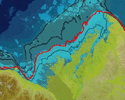
Nile River Fluctuations Near Khartoum, Sudan
Full Resolution:
TIFF
(3.15 MB)
JPEG
(165.1 kB)
|
|
|
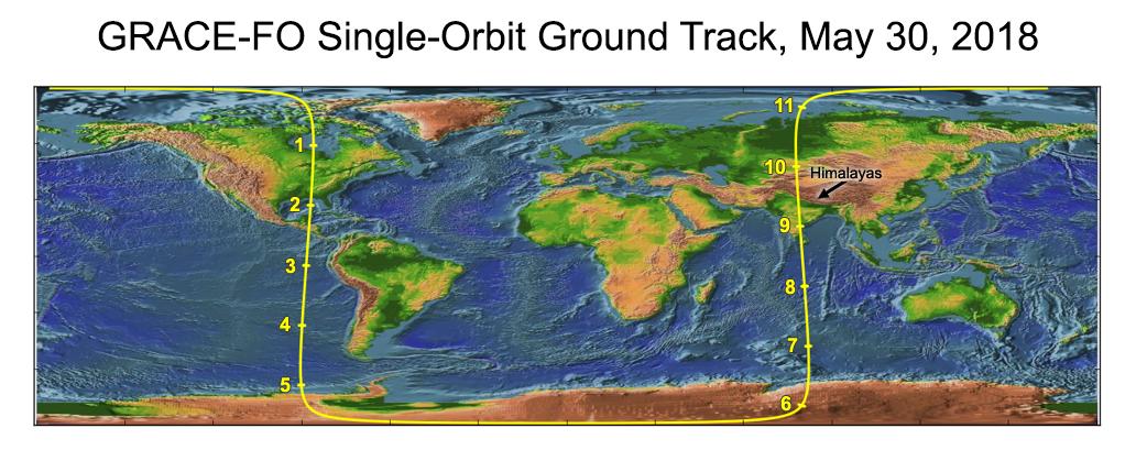
2018-06-11 |
Earth
|
GRACE-FO
|
Microwave Ranging Instrument
|
1032x409x3 |

|
-
PIA22507:
-
Recently Launched Twin Satellites Create 'The Himalaya Plot'
Full Resolution:
TIFF
(1.074 MB)
JPEG
(92.2 kB)
|
|
|
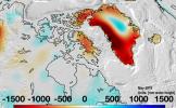
2019-08-20 |
Earth
|
GRACE-FO
|
Microwave Ranging Instrument
|
2457x1513x3 |

|
-
PIA22840:
-
Changes in Mass, North America
Full Resolution:
TIFF
(6.842 MB)
JPEG
(582.4 kB)
|
|
|
2019-08-20 |
Earth
|
GRACE-FO
|
Microwave Ranging Instrument
|
2454x1516x3 |
|
-
PIA23340:
-
Changes in Mass, Greenland
Full Resolution:
TIFF
(6.486 MB)
JPEG
(458.8 kB)
|
|
|
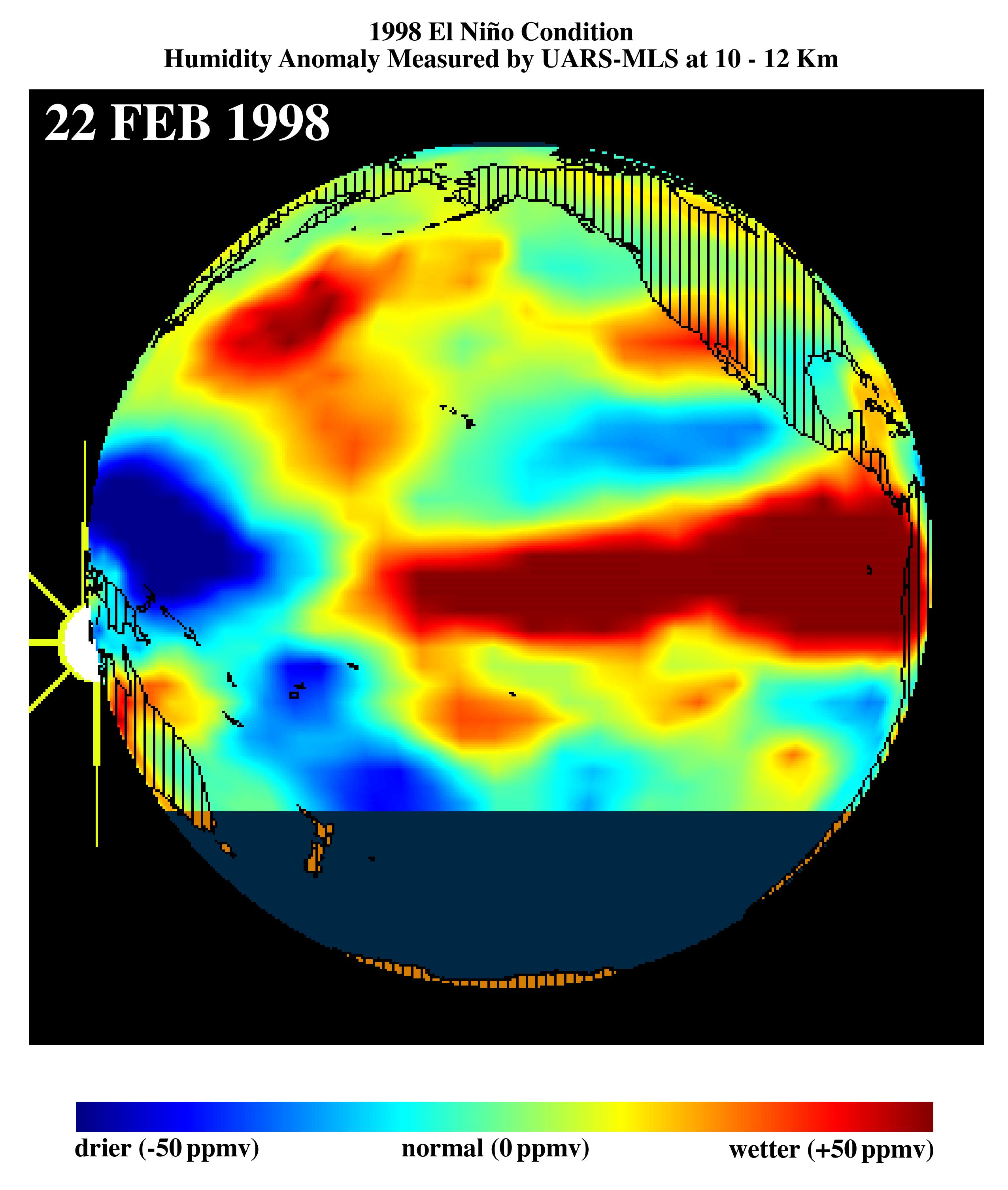
1998-03-16 |
Earth
|
Terra
|
MLS
|
2550x3009x3 |
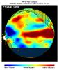
|
-
PIA00823:
-
TOPEX/El Niño Watch - El Niño Moisture in the Atmosphere, February 22, 1998
Full Resolution:
TIFF
(3.85 MB)
JPEG
(515.6 kB)
|
|
|
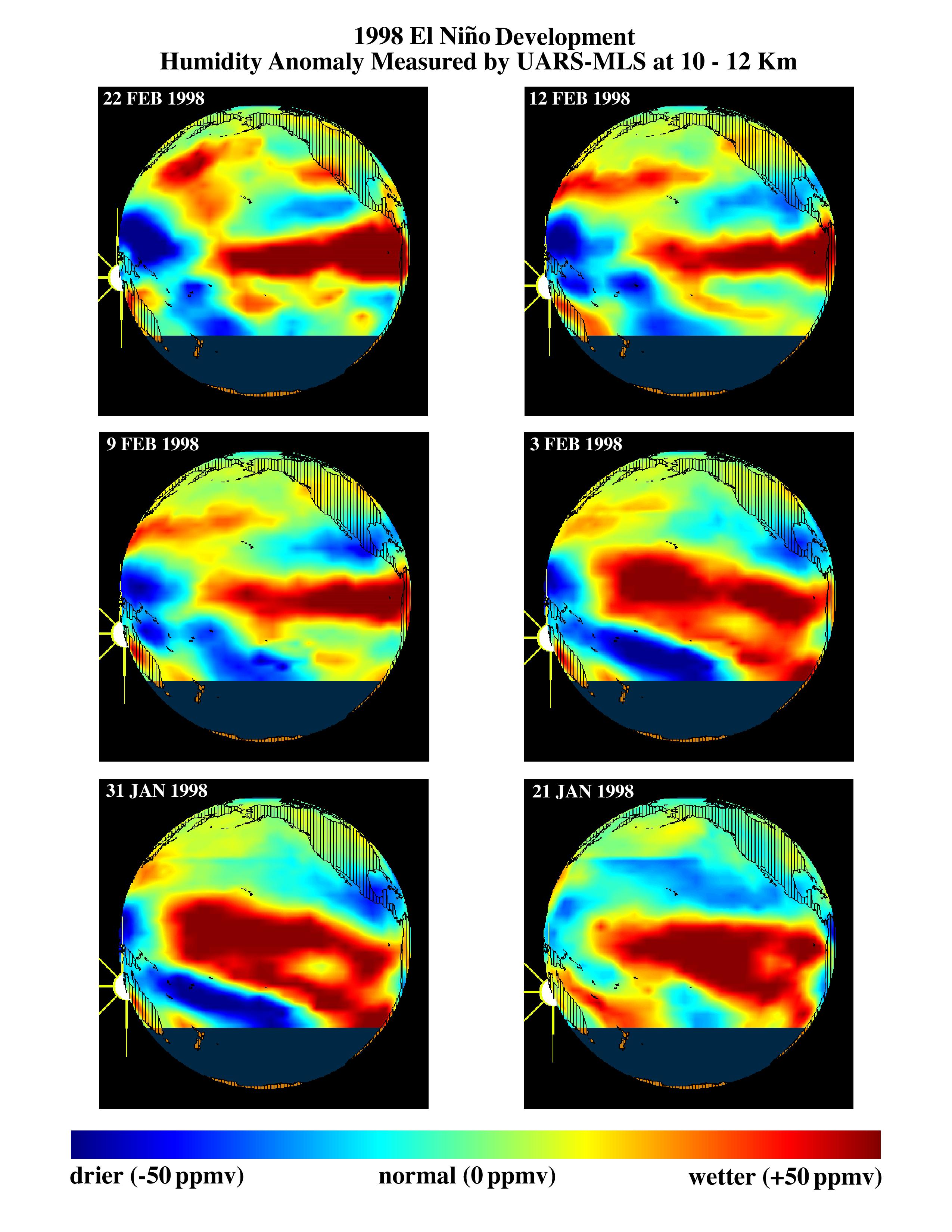
1998-03-26 |
Earth
|
Terra
|
MLS
|
2550x3300x3 |
|
-
PIA00824:
-
TOPEX/El Niño Watch - El Niño Moisture in the Atmosphere, January and February, 1998
Full Resolution:
TIFF
(3.821 MB)
JPEG
(655.2 kB)
|
|
|
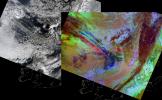
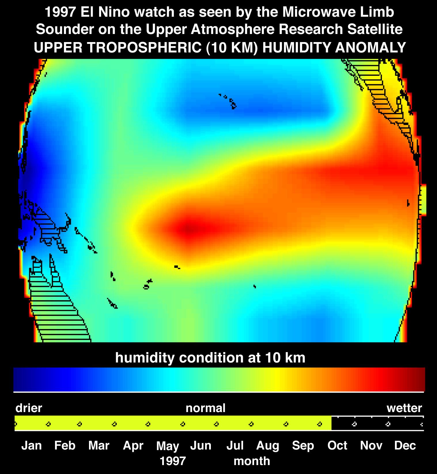
1997-10-30 |
Earth
|
Terra
|
MLS
|
1517x1645x3 |
|
-
PIA01052:
-
Microwave Limb Sounder/El Niño Watch - Water Vapor Measurement, October, 1997
Full Resolution:
TIFF
(2.984 MB)
JPEG
(225.4 kB)
|
|
|
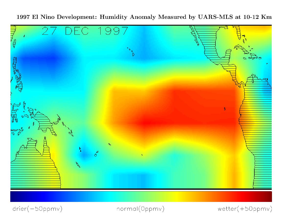
1998-03-14 |
Earth
|
Terra
|
MLS
|
1152x900x3 |
|
-
PIA01165:
-
Microwave Limb Sounder/El Niño Watch - December, 1997
Full Resolution:
TIFF
(891.4 kB)
JPEG
(120.4 kB)
|
|
|
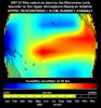
1998-03-14 |
Earth
|
Terra
|
MLS
|
695x900x3 |
|
-
PIA01166:
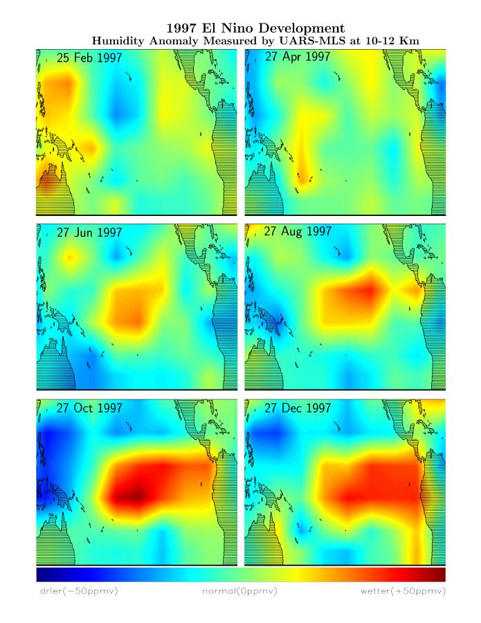
-
Microwave Limb Sounder/El Niño Watch - February thru December, 1997
Full Resolution:
TIFF
(933.4 kB)
JPEG
(94.24 kB)
|
|
|
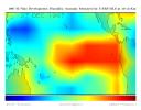
1998-07-03 |
Earth
|
Advanced Earth Observing Satellite (ADEOS)
|
MLS
|
1152x849x3 |
|
-
PIA01452:
-
Microwave Limb Sounder/El Niño Watch - 1997 Research Data Reveal Clues about El Niño's Influence
Full Resolution:
TIFF
(1.189 MB)
JPEG
(234.5 kB)
|
|
|
2005-06-02 |
Earth
|
Aura
|
MLS
|
1013x939x3 |
|
-
PIA07994:
-
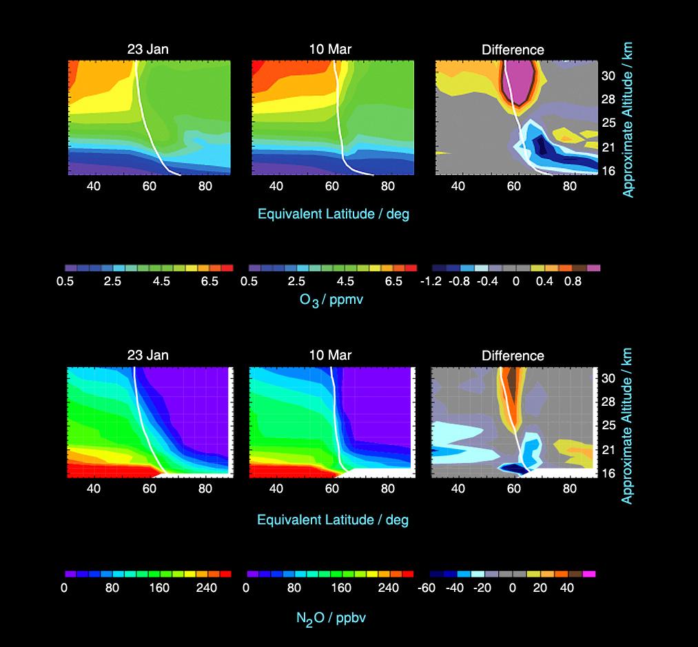
Microwave Limb Sounder Measurements Depicting the Relationship Between Nitrous Oxide Levels and Ozone Loss, 2004-2005 Arctic Winter
Full Resolution:
TIFF
(2.858 MB)
JPEG
(93.72 kB)
|
|
|
2005-06-02 |
Earth
|
Aura
|
MLS
|
642x335x3 |
|
-
PIA07252:
-
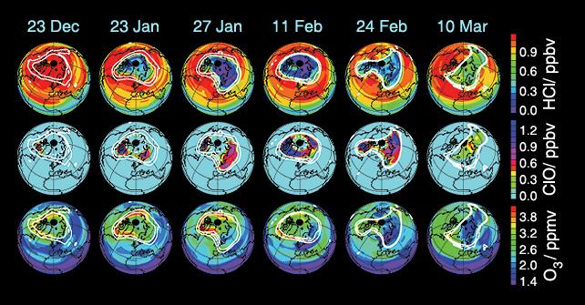
Aura's Microwave Limb Sounder Estimates of Ozone Loss, 2004/2005 Arctic Winter
Full Resolution:
TIFF
(646.1 kB)
JPEG
(65.28 kB)
|
|
|
2005-06-02 |
Earth
|
Aura
|
MLS
|
720x540x3 |
|
-
PIA07255:
-
Aura Microwave Limb Sounder Animation Illustrating the Interaction Between
Temperatures and Chemicals Involved in Ozone Destruction, 2004-2005 Arctic Winter
Full Resolution:
TIFF
(1.168 MB)
JPEG
(60.91 kB)
|
|
|
2010-03-16 |
Earth
|
Aura
|
MLS
|
760x760x3 |
|
-
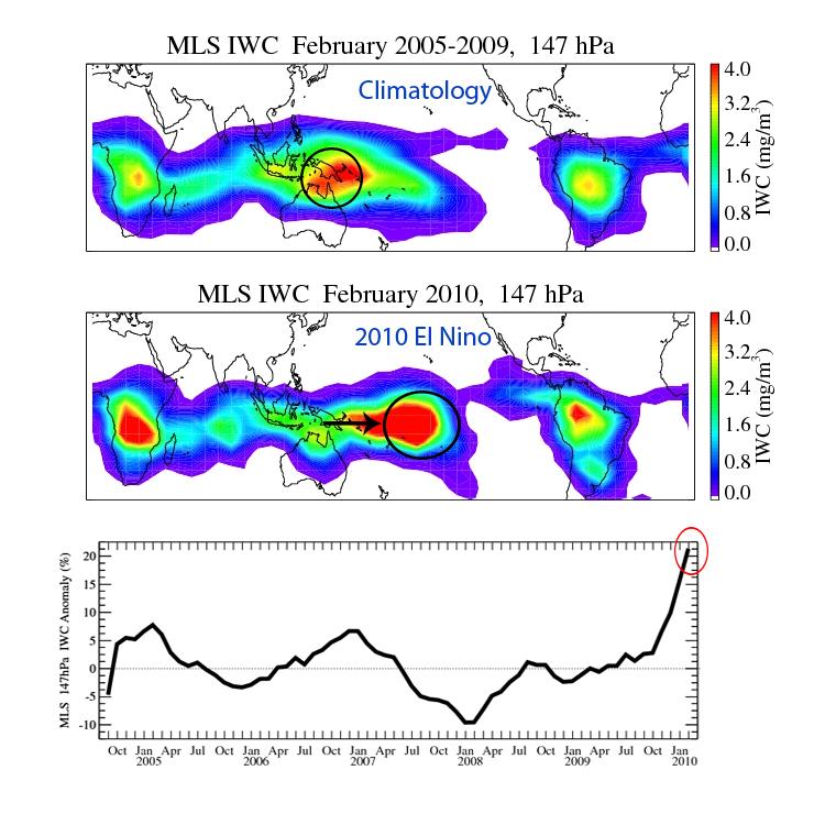
PIA12961:
-
NASA's Aura Sees El Niño's Effects on the Atmosphere
Full Resolution:
TIFF
(1.735 MB)
JPEG
(91.76 kB)
|
|
|
2011-10-02 |
Earth
|
Aura
|
MLS
|
708x312x3 |
|
-
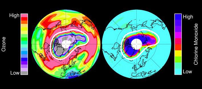
PIA14824:
-
Unprecedented Arctic Ozone Loss in 2011
Full Resolution:
TIFF
(663.8 kB)
JPEG
(44.02 kB)
|
|
|
2005-08-02 |
Earth
|
MESSENGER
|
MDIS - Wide Angle
|
507x507x3 |

|
-
PIA10120:
-
Earth Departure Movie
Full Resolution:
TIFF
(772.2 kB)
JPEG
(16.44 kB)
|
|
|
2005-08-02 |
Earth
|
MESSENGER
|
MDIS - Wide Angle
|
4500x2238x3 |
|
-
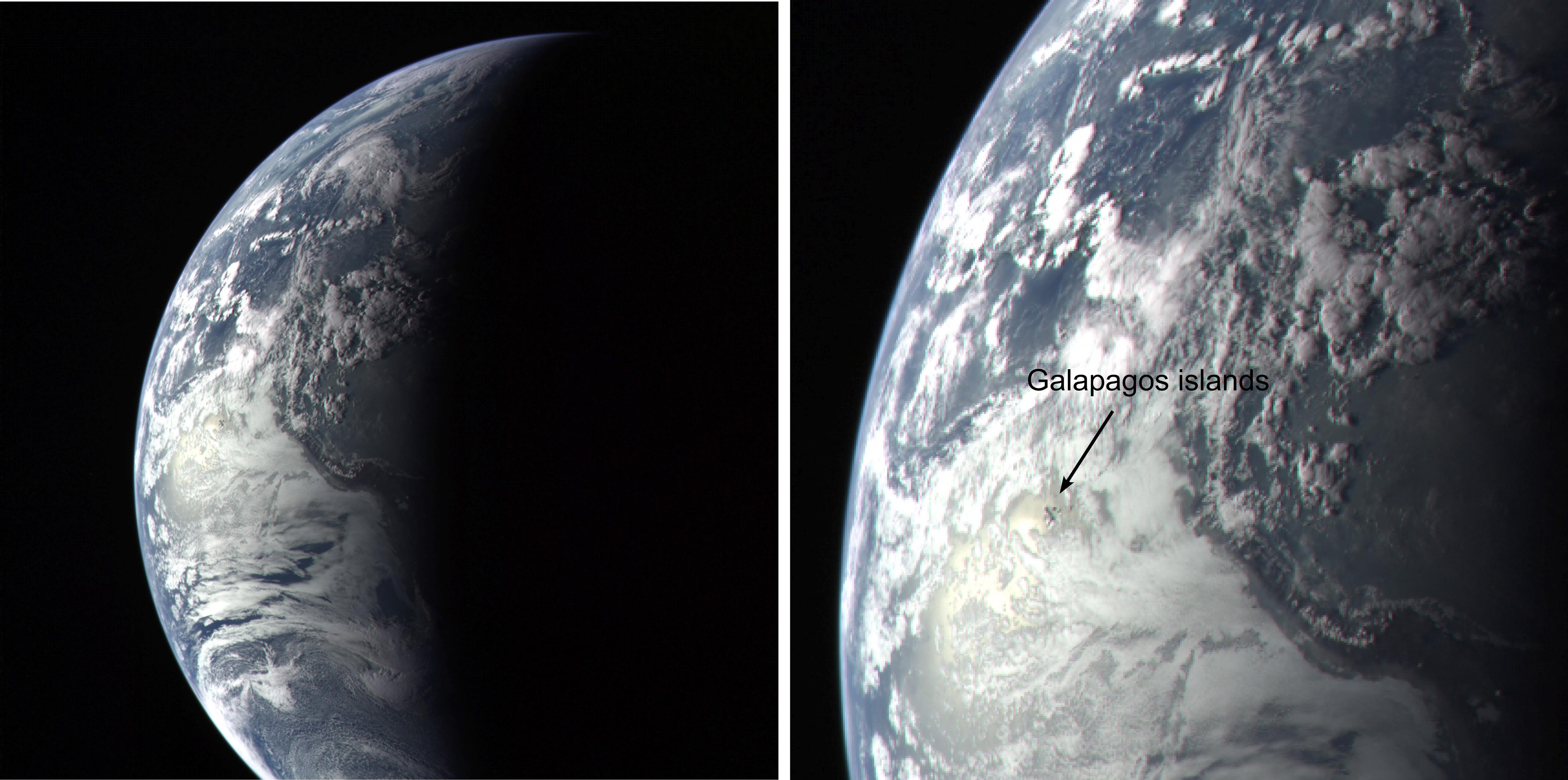
PIA10121:
-
Galapagos Islands Image
Full Resolution:
TIFF
(30.21 MB)
JPEG
(771.1 kB)
|
|
|
2005-08-02 |
Earth
|
MESSENGER
|
MDIS - Wide Angle
|
2060x1024x3 |
|
-
PIA10122:
-
Twins Image
Full Resolution:
TIFF
(6.337 MB)
JPEG
(151.9 kB)
|
|
|
2010-08-17 |
Earth
|
MESSENGER
|
MDIS - Wide Angle
|
1018x1024x1 |
|
-
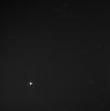
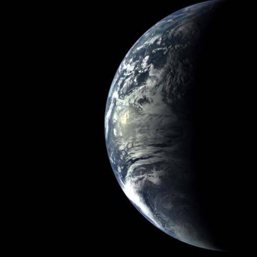
PIA13474:
-
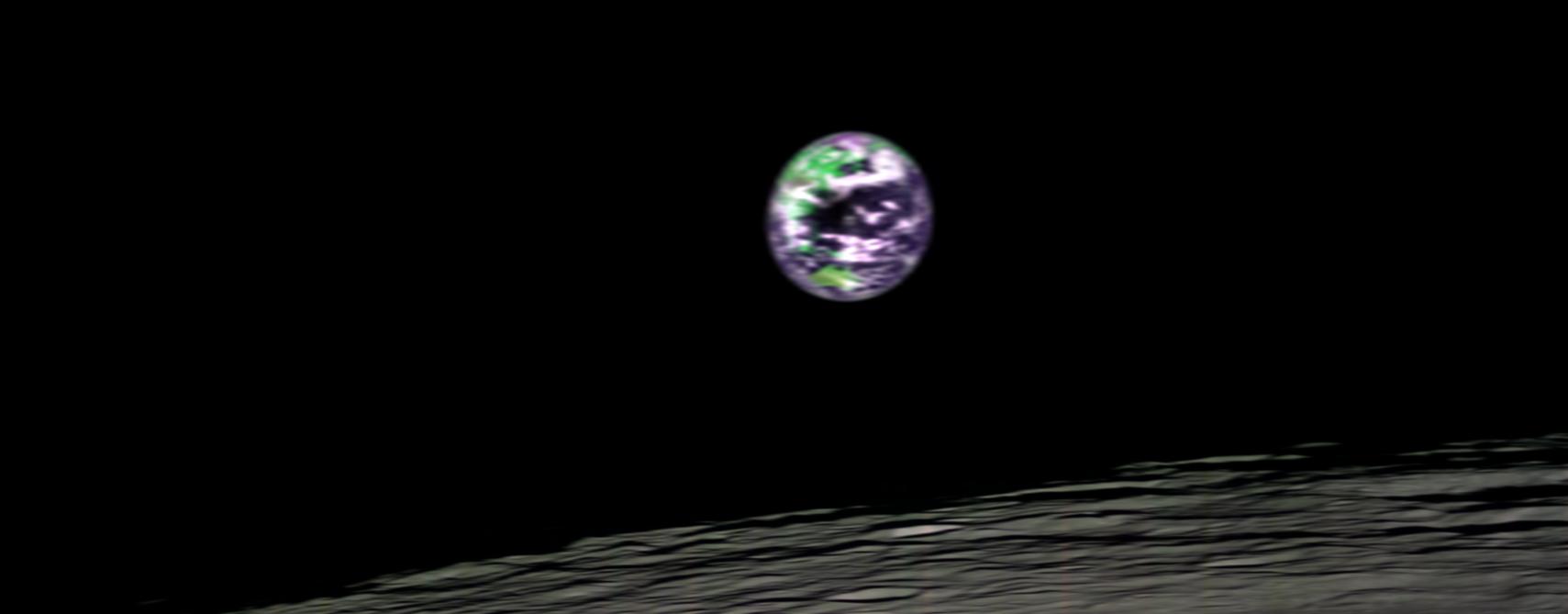
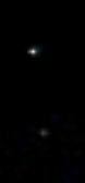
Earth and Moon from 114 Million Miles
Full Resolution:
TIFF
(1.044 MB)
JPEG
(95.17 kB)
|
|
|
2013-07-22 |
Earth
|
MESSENGER
|
MDIS - Wide Angle
|
1024x1380x3 |
|
-
PIA17388:
-
Looking Back at Us
Full Resolution:
TIFF
(4.241 MB)
JPEG
(77.1 kB)
|
|
|
2013-10-18 |
Earth
|
MESSENGER
|
MDIS - Wide Angle
|
1024x1024x1 |
|
-
PIA17540:
-
Home
Full Resolution:
TIFF
(1.05 MB)
JPEG
(167.9 kB)
|
|
|
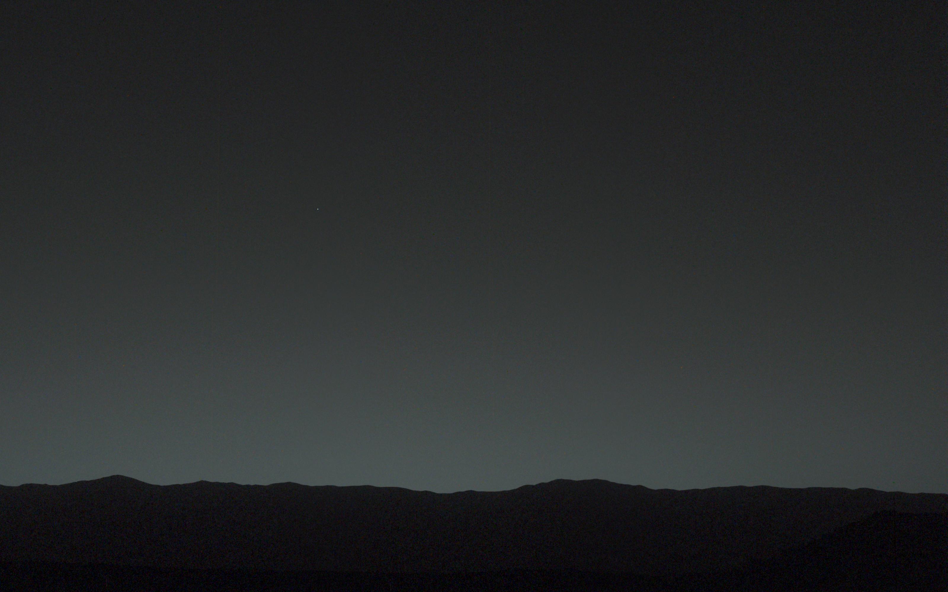
2014-02-06 |
Earth
|
Mars Science Laboratory (MSL)
|
Mastcam
|
78x168x3 |
|
-
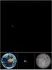
PIA17935:
-
Curiosity Mars Rover's First Image of Earth and Earth's Moon
Full Resolution:
TIFF
(39.55 kB)
JPEG
(1.009 kB)
|
|
|
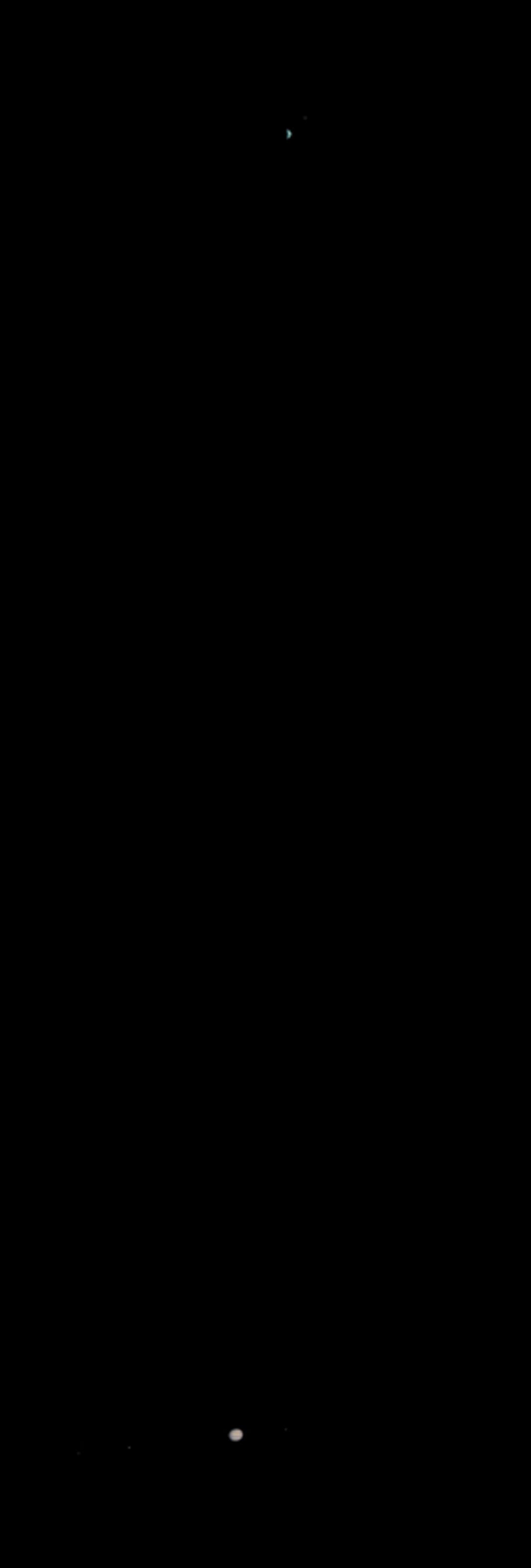
2014-02-06 |
Earth
|
Mars Science Laboratory (MSL)
|
Mastcam
|
3200x2000x3 |
|
-
PIA17936:
-
Bright 'Evening Star' Seen from Mars is Earth
Full Resolution:
TIFF
(19.21 MB)
JPEG
(389.6 kB)
|
|
|
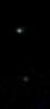
2003-05-22 |
Earth
|
Mars Global Surveyor (MGS)
|
Mars Orbiter Camera (MOC)
|
1068x3151x3 |

|
-
PIA04530:
-
Earth and Jupiter as viewed from Mars
Full Resolution:
TIFF
(325.7 kB)
JPEG
(53.78 kB)
|
|
|
2003-05-22 |
Earth
|
Mars Global Surveyor (MGS)
|
Mars Orbiter Camera (MOC)
|
961x961x3 |
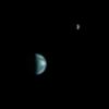
|
-
PIA04531:
-
Earth and Moon as viewed from Mars
Full Resolution:
TIFF
(197.6 kB)
JPEG
(17.52 kB)
|
|
|
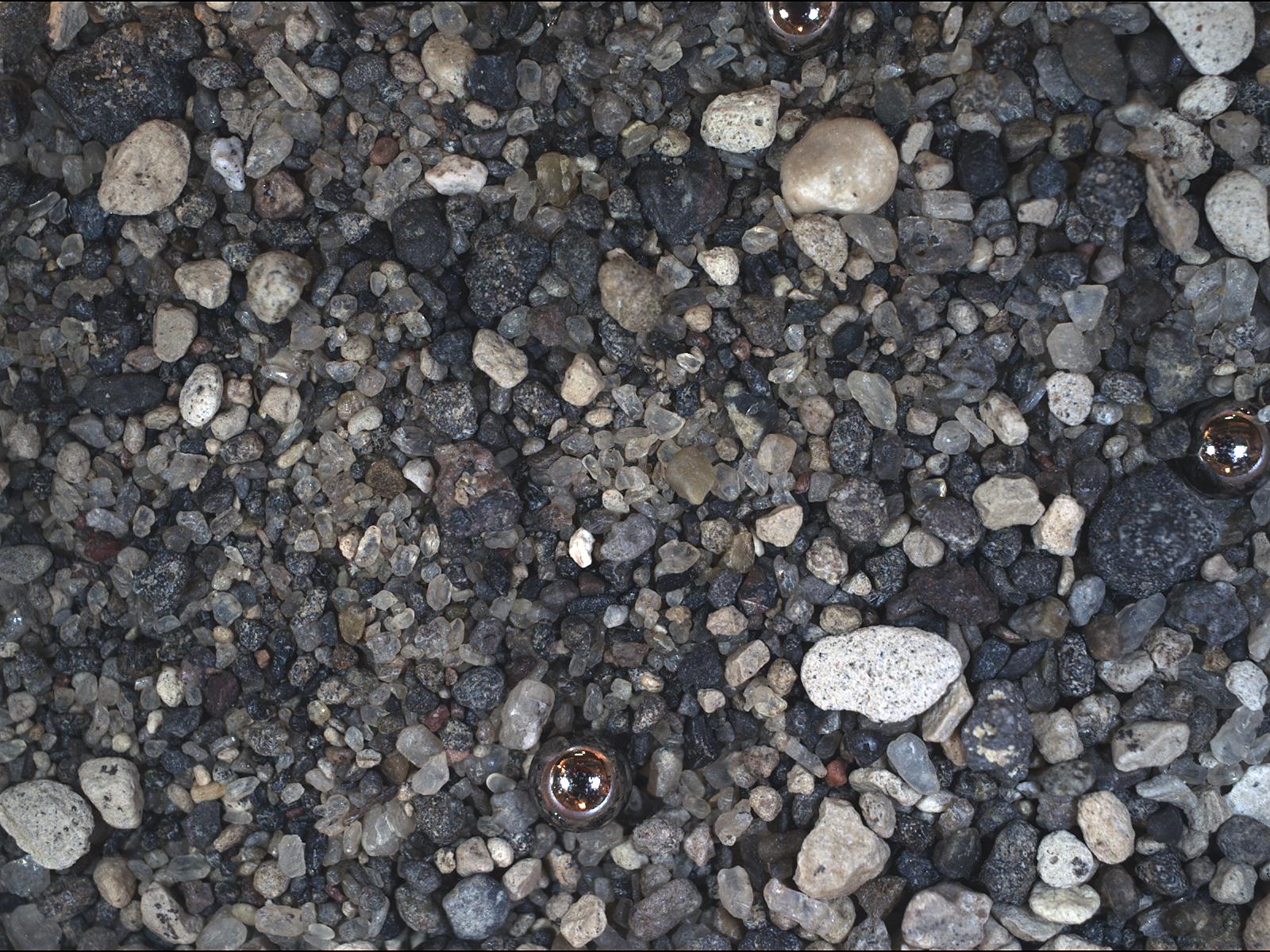
2010-11-16 |
Earth
|
Mars Science Laboratory (MSL)
|
MAHLI
|
1600x1200x3 |
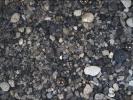
|
-
PIA13582:
-
Test Image of Earth Sand by Mars Camera
Full Resolution:
TIFF
(5.77 MB)
JPEG
(412.8 kB)
|
|
|
2010-11-16 |
Earth
|
Mars Science Laboratory (MSL)
|
MAHLI
|
1188x1566x3 |
|
-
PIA13583:
-
Test Image of Earth Rocks by Mars Camera
Full Resolution:
TIFF
(5.588 MB)
JPEG
(281.2 kB)
|
|
|
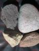
2010-11-16 |
Earth
|
Mars Science Laboratory (MSL)
|
MAHLI
|
1190x1580x3 |
|
-
PIA13584:
-
Test Close-Up of Earth Cobble by Mars Camera
Full Resolution:
TIFF
(5.647 MB)
JPEG
(306.6 kB)
|
|
|
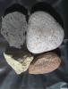
2010-11-16 |
Earth
|
Mars Science Laboratory (MSL)
|
MAHLI
|
1007x1305x3 |
|
-
PIA13585:
-
Test Image of Earth Rocks by Mars Camera (Stereo)
Full Resolution:
TIFF
(3.948 MB)
JPEG
(263.3 kB)
|
|
|
2005-08-22 |
Earth
|
Mars Reconnaissance Orbiter (MRO)
|
MARCI
|
85x75x3 |
|
-
PIA04159:
-
Calibration Image of Earth by Mars Color Imager
Full Resolution:
TIFF
(19.39 kB)
JPEG
(870)
|
|
|
2005-08-22 |
Earth
|
Mars Reconnaissance Orbiter (MRO)
|
MARCI
|
700x80x1 |

|
-
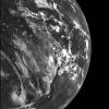
PIA04160:
Calibration View of Earth and the Moon by Mars Color Imager
Full Resolution:
TIFF
(56.29 kB)
JPEG
(1.314 kB)
|
|
|
2014-10-01 |
Moon
|
GRAIL
Lunar Reconnaissance Orbiter (LRO)
|
Lunar Reconnaissance Orbiter Camera (WAC)
Lunar Orbit Laser Altimeter
|
1546x905x3 |
|
-
PIA18821:
-
On the West Coast of the Ocean of Storms (Artist's Concept)
Full Resolution:
TIFF
(4.199 MB)
JPEG
(116.7 kB)
|
|
|
2009-07-13 |
Moon
|
Lunar Reconnaissance Orbiter (LRO)
|
Lunar Reconnaissance Orbiter Camera (WAC)
|
1000x1000x1 |
|
-
PIA12888:
-
Mapping the Moon with the Wide Angle Camera
Full Resolution:
TIFF
(1.001 MB)
JPEG
(147.6 kB)
|
|
|
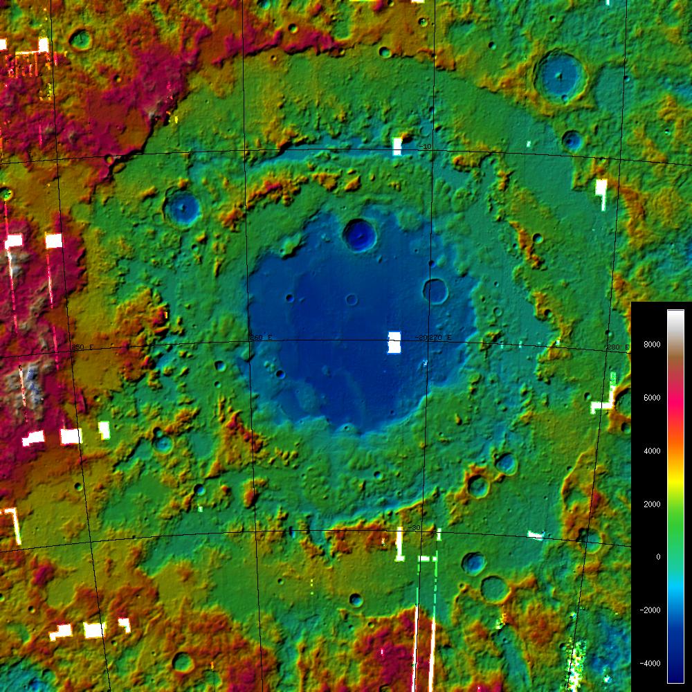
2010-01-20 |
Moon
|
Lunar Reconnaissance Orbiter (LRO)
|
Lunar Reconnaissance Orbiter Camera (WAC)
|
1000x1000x3 |

|
-
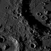
PIA12943:
-
A Digital Terrain Model of the Orientale Basin
Full Resolution:
TIFF
(3.004 MB)
JPEG
(208.8 kB)
|
|
|
2010-02-02 |
Moon
|
Lunar Reconnaissance Orbiter (LRO)
|
Lunar Reconnaissance Orbiter Camera (WAC)
|
795x795x3 |

|
-
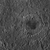
PIA12948:
-
Plato Crater
Full Resolution:
TIFF
(1.898 MB)
JPEG
(114.7 kB)
|
|
|
2010-06-09 |
Moon
|
Lunar Reconnaissance Orbiter (LRO)
|
Lunar Reconnaissance Orbiter Camera (WAC)
|
1024x853x3 |
|
-
PIA13194:
-
Hunting for Ancient Lunar Impact Basins
Full Resolution:
TIFF
(876.1 kB)
JPEG
(83.22 kB)
|
|
|
2010-06-17 |
Moon
|
Lunar Reconnaissance Orbiter (LRO)
|
Lunar Reconnaissance Orbiter Camera (WAC)
|
1400x1400x1 |
|
-
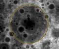
PIA13225:
-
Orientale Basin
Full Resolution:
TIFF
(1.962 MB)
JPEG
(622.2 kB)
|
|
|
2010-09-08 |
Moon
|
Lunar Reconnaissance Orbiter (LRO)
|
Lunar Reconnaissance Orbiter Camera (WAC)
|
940x940x1 |
|
-
PIA13516:
-
Moon seen from the East
Full Resolution:
TIFF
(884.8 kB)
JPEG
(171 kB)
|
|
|
2010-09-10 |
Moon
|
Lunar Reconnaissance Orbiter (LRO)
|
Lunar Reconnaissance Orbiter Camera (WAC)
|
800x800x3 |
|
-
PIA13517:
-
Color of the Moon
Full Resolution:
TIFF
(1.922 MB)
JPEG
(101.7 kB)
|
|
|
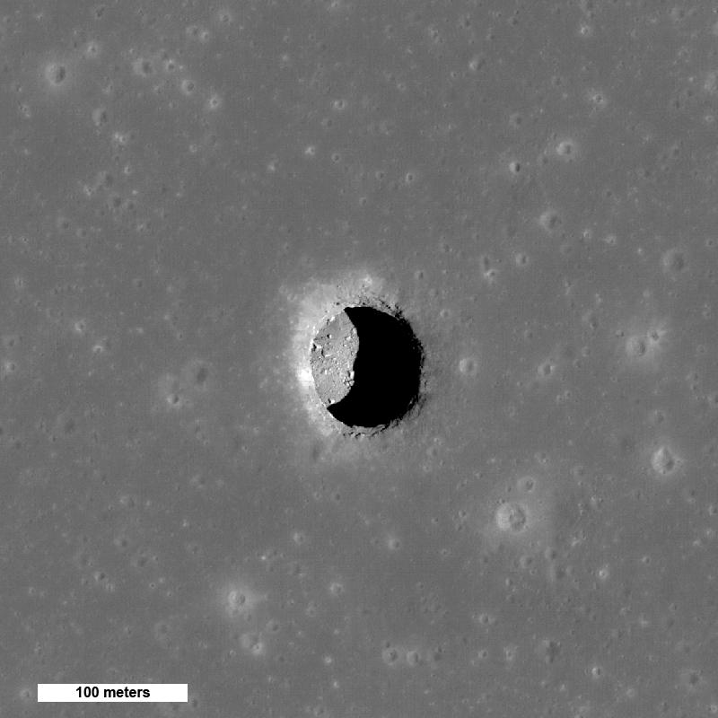
2010-09-14 |
Moon
|
Lunar Reconnaissance Orbiter (LRO)
|
Lunar Reconnaissance Orbiter Camera (WAC)
|
800x800x1 |

|
-
PIA13518:
-
New Views of Lunar Pits
Full Resolution:
TIFF
(640.9 kB)
JPEG
(52.85 kB)
|
|
|
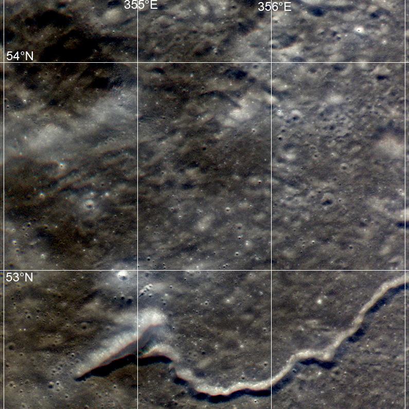
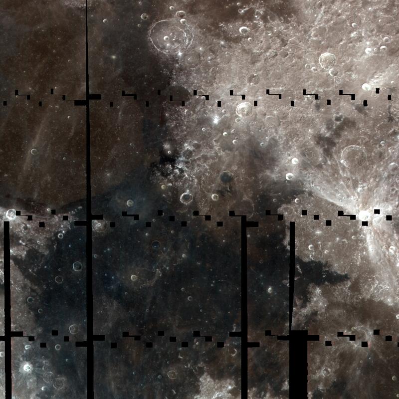
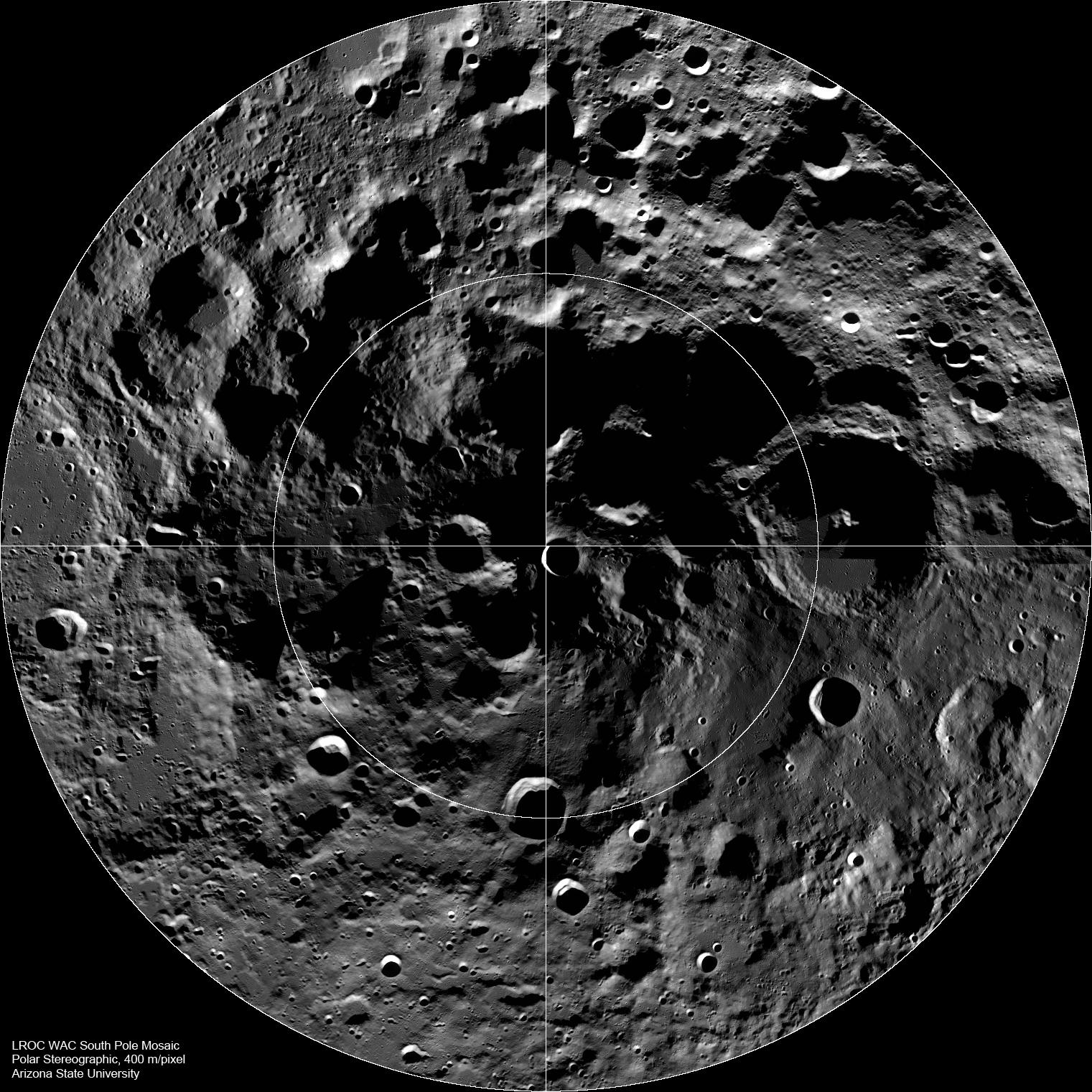
2010-09-27 |
Moon
|
Lunar Reconnaissance Orbiter (LRO)
|
Lunar Reconnaissance Orbiter Camera (WAC)
|
1521x1521x1 |
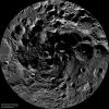
|
-
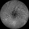
PIA13523:
-
The Lunar South Pole
Full Resolution:
TIFF
(2.316 MB)
JPEG
(420.8 kB)
|
|
|
2010-10-05 |
Moon
|
Lunar Reconnaissance Orbiter (LRO)
|
Lunar Reconnaissance Orbiter Camera (WAC)
|
1521x1521x1 |
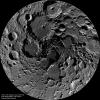
|
-
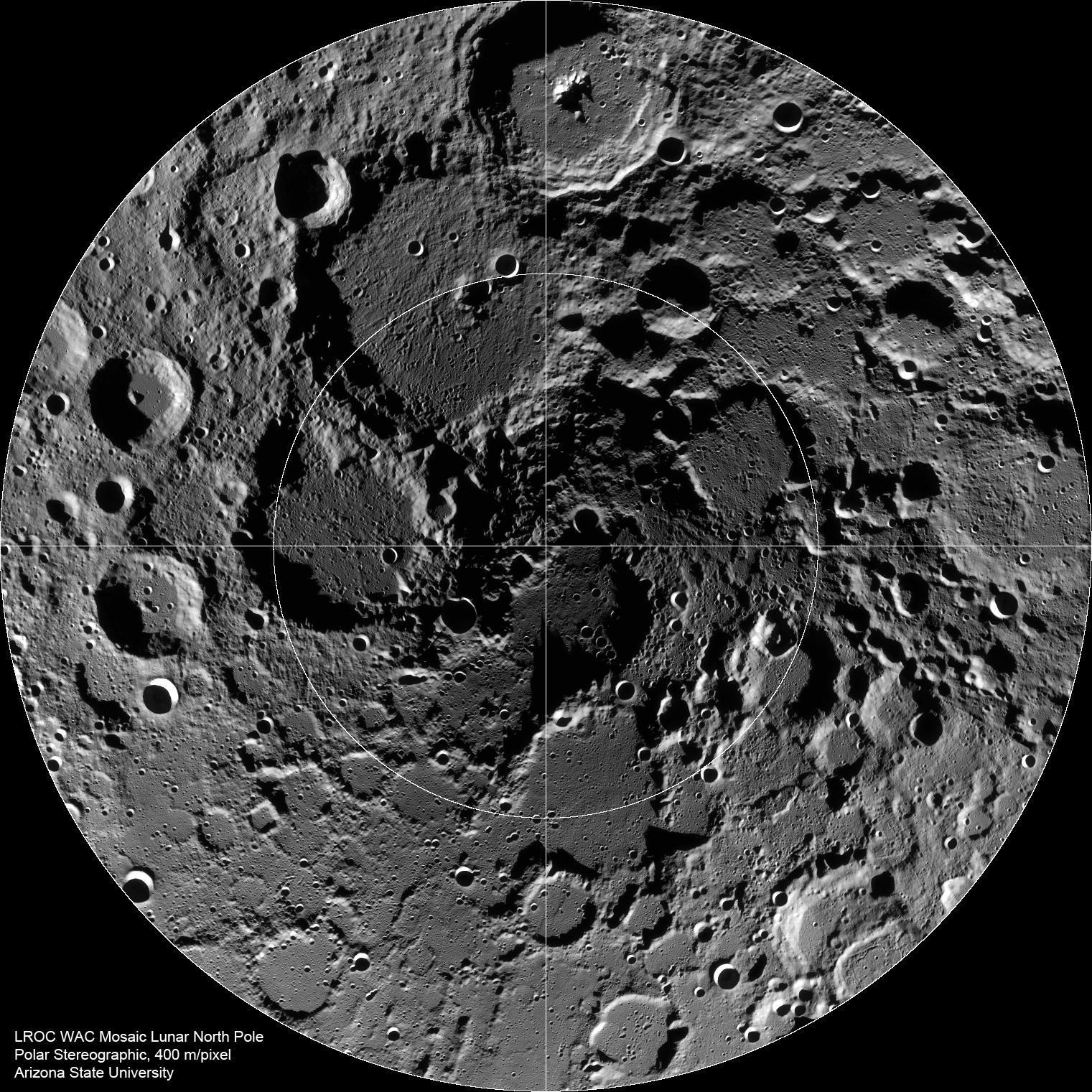
PIA13528:
-
The Lunar North Pole
Full Resolution:
TIFF
(2.316 MB)
JPEG
(528.4 kB)
|
|
|
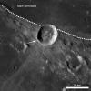
2010-10-15 |
Moon
|
Lunar Reconnaissance Orbiter (LRO)
|
Lunar Reconnaissance Orbiter Camera (WAC)
|
1540x1540x3 |

|
-
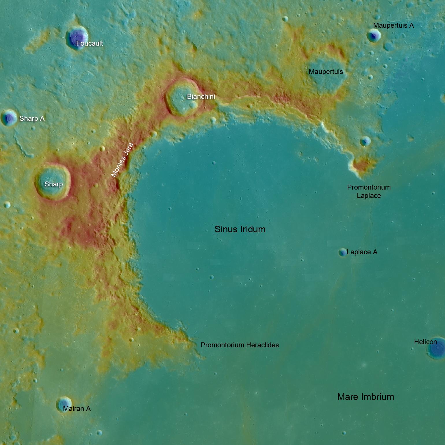
PIA13619:
-
Sinus Iridum
Full Resolution:
TIFF
(7.127 MB)
JPEG
(217.5 kB)
|
|
|
2010-10-27 |
Moon
|
Lunar Reconnaissance Orbiter (LRO)
|
Lunar Reconnaissance Orbiter Camera (WAC)
|
1200x1200x1 |
|
-
PIA13644:
-
Small Crater at the Southern Rim of Menelaus
Full Resolution:
TIFF
(1.442 MB)
JPEG
(170.9 kB)
|
|
|
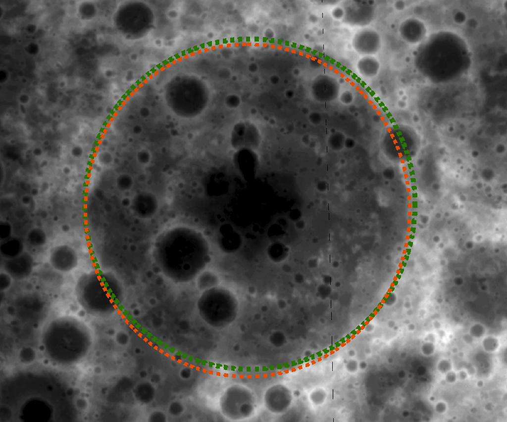
2010-12-01 |
Moon
|
Lunar Reconnaissance Orbiter (LRO)
|
Lunar Reconnaissance Orbiter Camera (WAC)
|
1200x1200x1 |

|
-
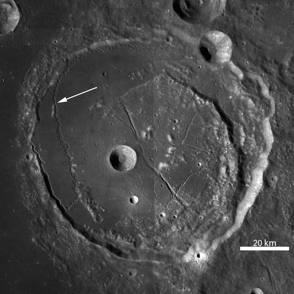
PIA13687:
-
Rimae Posidonius
Full Resolution:
TIFF
(1.442 MB)
JPEG
(201.1 kB)
|
|
|
2010-12-02 |
Moon
|
Lunar Reconnaissance Orbiter (LRO)
|
Lunar Reconnaissance Orbiter Camera (WAC)
|
1500x1500x1 |

|
-
PIA13688:
-
Secrets of Schröteri
Full Resolution:
TIFF
(2.253 MB)
JPEG
(340.7 kB)
|
|
|
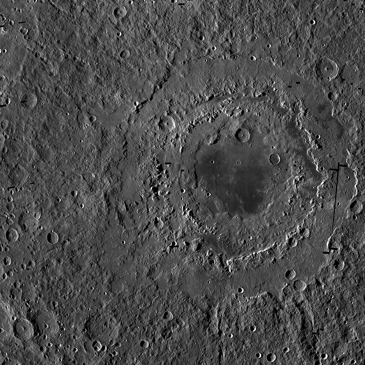
2010-12-03 |
Moon
|
Lunar Reconnaissance Orbiter (LRO)
|
Lunar Reconnaissance Orbiter Camera (WAC)
|
1000x1000x1 |

|
-
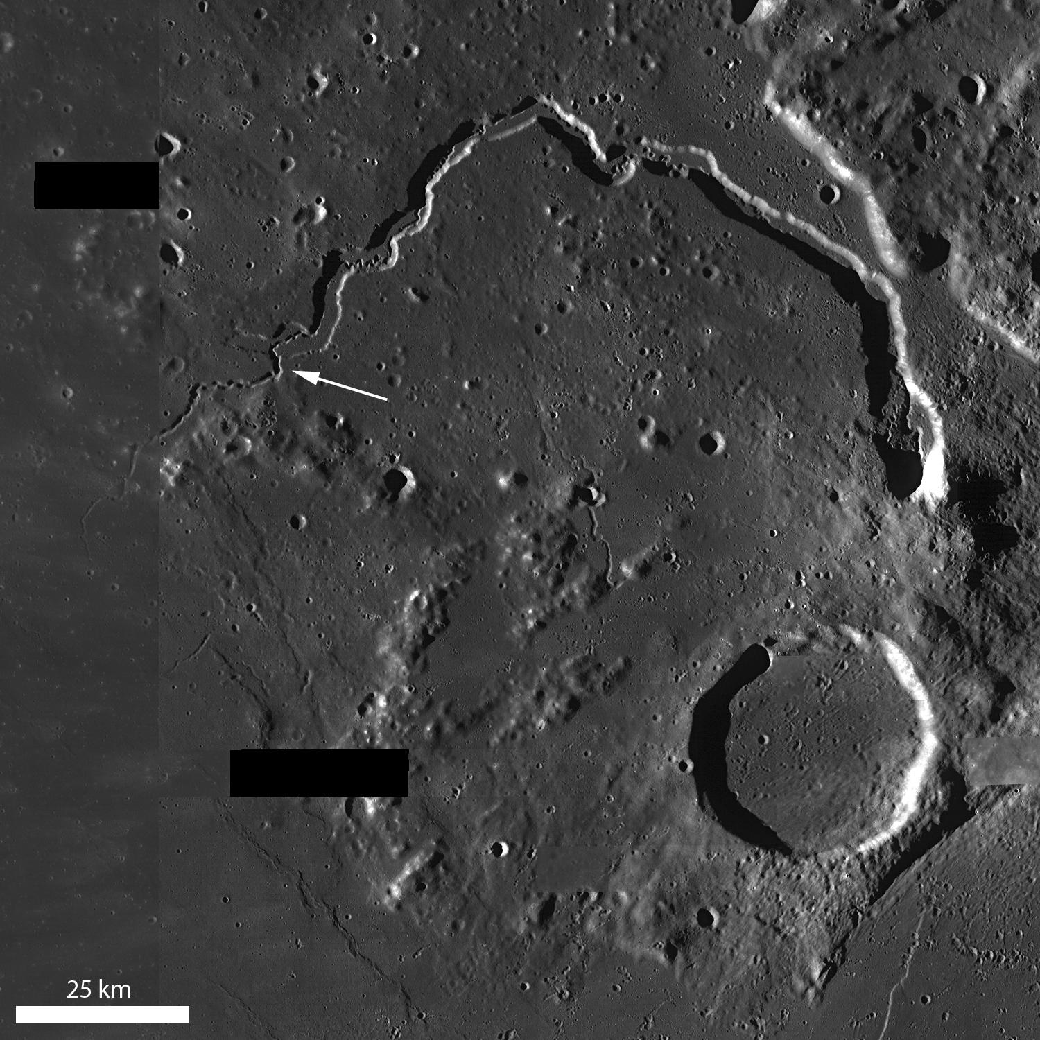
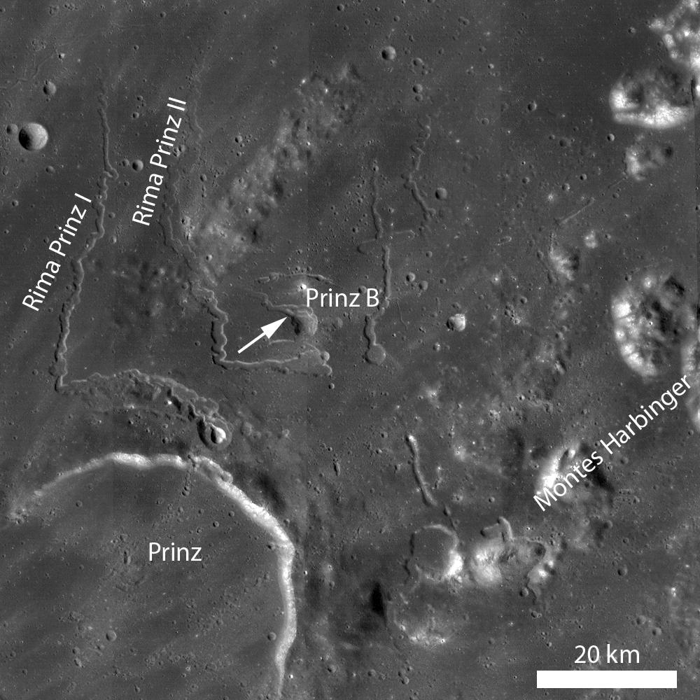
PIA13689:
-
Rilles as far as the eye can see in Prinz
Full Resolution:
TIFF
(1.001 MB)
JPEG
(148.6 kB)
|
|
|
2010-12-15 |
Moon
|
Lunar Reconnaissance Orbiter (LRO)
|
Lunar Reconnaissance Orbiter Camera (WAC)
|
1214x1214x1 |
|
-
PIA13720:
-
South Pole Illumination Map
Full Resolution:
TIFF
(1.476 MB)
JPEG
(98.72 kB)
|
|
|
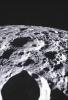
2011-01-29 |
Moon
|
Lunar Reconnaissance Orbiter (LRO)
|
Lunar Reconnaissance Orbiter Camera (WAC)
|
1890x1890x1 |

|
-
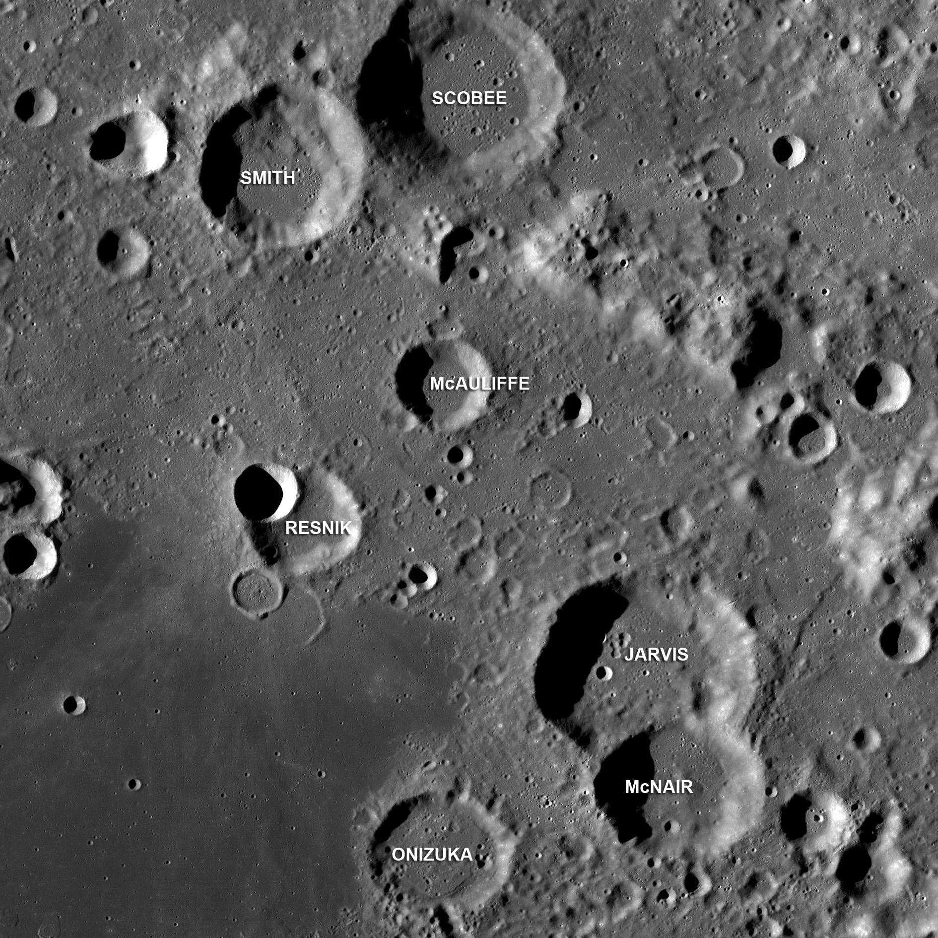
PIA13998:
-
Challenger Astronauts Memorialized on the Moon
Full Resolution:
TIFF
(3.576 MB)
JPEG
(575.1 kB)
|
|
|
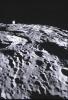
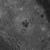
2011-02-04 |
Moon
|
Lunar Reconnaissance Orbiter (LRO)
|
Lunar Reconnaissance Orbiter Camera (WAC)
|
1318x1127x1 |

|
-
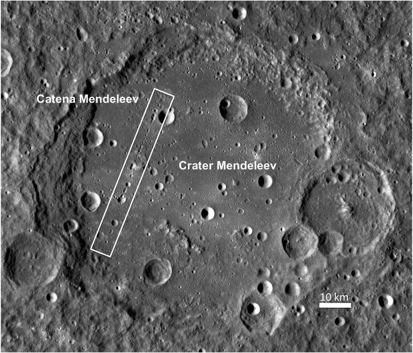
PIA14002:
-
Crater Mendeleev
Full Resolution:
TIFF
(1.487 MB)
JPEG
(271.1 kB)
|
|
|
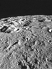
2011-02-21 |
Moon
|
Lunar Reconnaissance Orbiter (LRO)
|
Lunar Reconnaissance Orbiter Camera (WAC)
|
1400x1400x1 |
|
-
PIA14011:
-
Nearside Spectacular
Full Resolution:
TIFF
(1.962 MB)
JPEG
(385.1 kB)
|
|
|
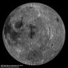
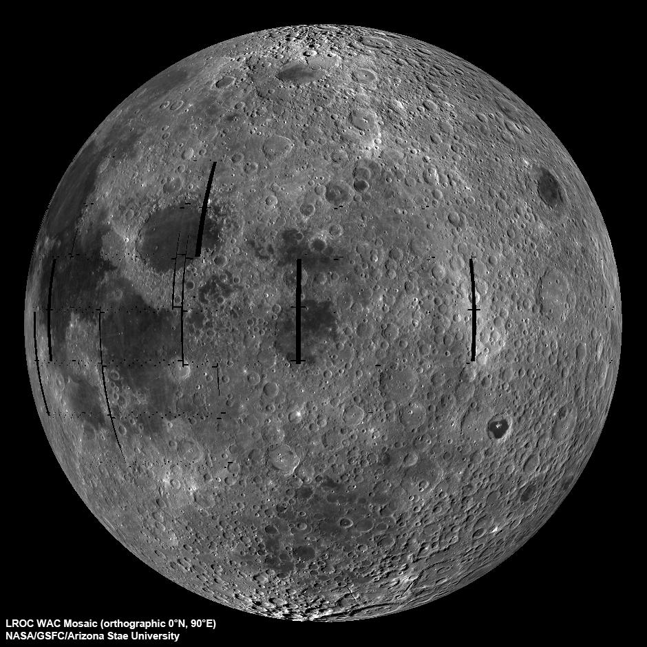
2011-03-08 |
Moon
|
Lunar Reconnaissance Orbiter (LRO)
|
Lunar Reconnaissance Orbiter Camera (WAC)
|
1000x1000x1 |

|
-
PIA14018:
-
Boulder in Recht Crater
Full Resolution:
TIFF
(1.001 MB)
JPEG
(127.7 kB)
|
|
|
2011-03-11 |
Moon
|
Lunar Reconnaissance Orbiter (LRO)
|
Lunar Reconnaissance Orbiter Camera (WAC)
|
1600x1600x1 |

|
-
PIA14021:
-
Farside! And All the Way Around
Full Resolution:
TIFF
(2.563 MB)
JPEG
(778.5 kB)
|
|
|
2011-03-15 |
Moon
|
Lunar Reconnaissance Orbiter (LRO)
|
Lunar Reconnaissance Orbiter Camera (WAC)
|
1600x1600x1 |
|
-
PIA14023:
-
LROC PDS Release Number 5
Full Resolution:
TIFF
(2.563 MB)
JPEG
(611.8 kB)
|
|
|
2011-03-16 |
Moon
|
Lunar Reconnaissance Orbiter (LRO)
|
Lunar Reconnaissance Orbiter Camera (WAC)
|
1242x1242x1 |
|
-
PIA14024:
-
North Pole Mosaics
Full Resolution:
TIFF
(1.544 MB)
JPEG
(344.3 kB)
|
 Planetary Data System


