On July 24, 2022, the Multi-angle Imaging SpectroRadiometer (MISR) instrument aboard NASA's Terra satellite captured data on a smoke plume from the Oak Fire burning near Yosemite National Park in California. As of July 26, the Oak Fire had scorched more than 18,000 acres (7,284 hectares) and was 26% contained, with thousands of residents under evacuation orders. Hot, dry air, along with vegetation parched from years of drought, fueled the fire's rapid spread.
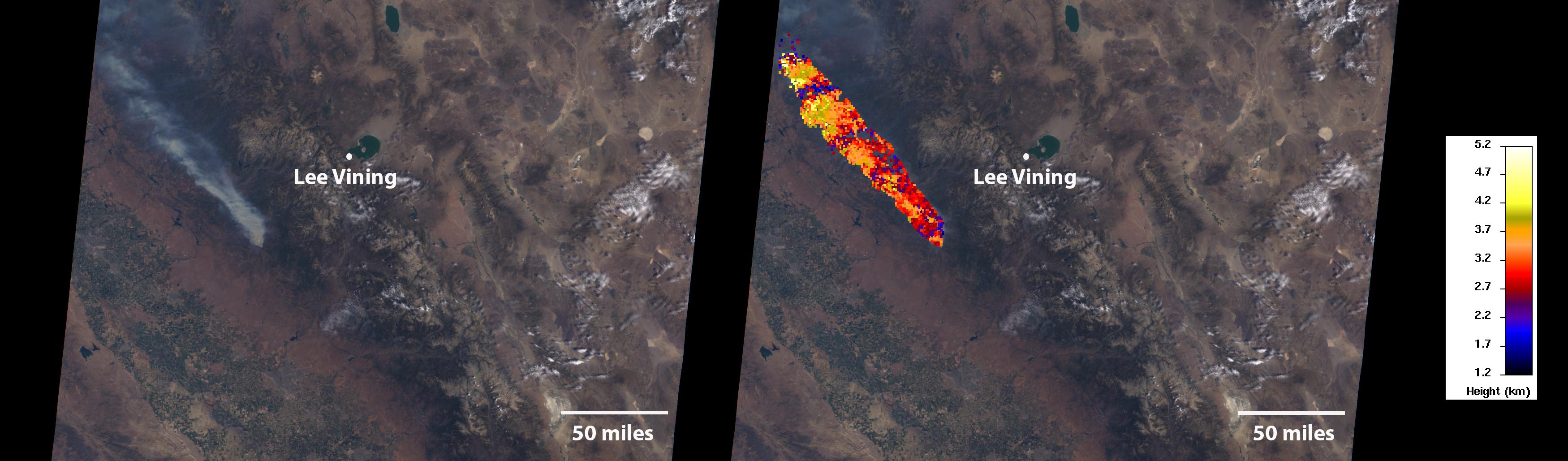
The MISR instrument contains nine cameras that view Earth at different angles. The left panel in the image above shows an image captured by MISR's nadir (downward-pointing) camera of a smoke plume from the fire. Although the fire was burning near Yosemite at the time, it wasn't a threat to the national park. The panel on the right indicates the height of various parts of the plume as measured by several of MISR's cameras. Yellow areas are higher than the red and blue regions in the smoke plume. The height of the plume top near the active fire was about 17,060 feet (5,200 meters), or roughly 3 miles (nearly 5 kilometers).
In general, higher-altitude plumes transport smoke greater distances from the source, impacting communities downwind. On the day the images were captured, unhealthy-to-hazardous air quality was reported in the area around Lake Tahoe and Truckee, about 125 miles (200 kilometers) north of the fire.
MISR researchers calculate smoke plume height using the publicly available MISR INteractive eXplorer (MINX) software tool. A global database of fire plumes observed by MISR is available here.
MISR was built and is managed by NASA's Jet Propulsion Laboratory in Southern California for the agency's Science Mission Directorate in Washington. The Terra spacecraft is managed by NASA's Goddard Space Flight Center in Greenbelt, Maryland. The MISR data was obtained from the NASA Langley Research Center Atmospheric Science Data Center in Hampton, Virginia. JPL is a division of Caltech in Pasadena.
 Planetary Data System


