Your search criteria found 12730 images
Target is Mars
Go to PIAxxxxx:
Refine this list of images by:
Target:
Mission:
Spacecraft:
Instrument:
Click on an image for detailed information
Click on a column heading to sort in ascending or descending order
My
List
Addition Date Target Mission InstrumentSort Ascending Size
Add Image to Favorite List 1998-05-05 Mars Hubble Space Telescope
WFPC2
400x200x3
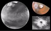
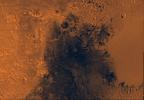
Though a dusty haze fills the giant Hellas impact basin south of the dark fin-shaped feature Syrtis Major, the dust appears to be localized within Hellas in this 1997 image from NASA's Hubble Space Telescope.
PIA01243:
Hubble Watches the Red Planet as Mars Global Surveyor Begins Aerobraking
Full Resolution:     TIFF (116.9 kB)     JPEG (7.111 kB)
Add Image to Favorite List 1998-05-02 Mars Hubble Space Telescope
WFPC2
2400x3000x3
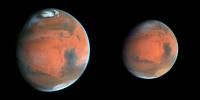
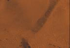
NASA's Hubble Space Telescope images near Ares Vallis, Mars, taken on June 27, 1997 (left) and July 9, 1997 (right), document the dissipation of a large dust storm during the 12 days separating the two observations.
PIA01244:
Decay of a Martian Dust Storm
Full Resolution:     TIFF (11.14 MB)     JPEG (411 kB)
Add Image to Favorite List 1998-05-02 Mars Hubble Space Telescope
WFPC2
2400x3000x3
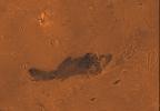
NASA's Hubble Space Telescope images of Mars, taken on June 27, 1997, reveal a significant dust storm which fills much of the Valles Marineris canyon system and extends into Xanthe Terra.
PIA01245:
Hubble's Look at Mars Shows Canyon Dust Storm, Cloudy Conditions for Pathfinder Landing
Full Resolution:     TIFF (9.466 MB)     JPEG (377.4 kB)
Add Image to Favorite List 1998-05-02 Mars Hubble Space Telescope
WFPC2
3000x2400x3
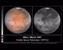
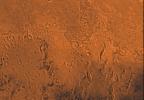
These color and black and white pictures of Mars were taken by NASA's Hubble Space Telescope just two weeks after Earth made its closest approach to the Red Planet during the 1997 opposition.
PIA01246:
Comparison View of Mars Cloud Cover
Full Resolution:     TIFF (6.831 MB)     JPEG (373.6 kB)
Add Image to Favorite List 1998-05-02 Mars Hubble Space Telescope
WFPC2
3000x2250x3
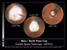
These images, which seem to have been taken while NASA's Hubble Space Telescope was looking directly down on the Martian North Pole, were actually created by assembling mosaics of three sets of images taken by HST 1996 and in 1997.
PIA01247:
Seasonal Changes in Mars' North Polar Ice Cap
Full Resolution:     TIFF (6.358 MB)     JPEG (308.6 kB)
Add Image to Favorite List 1998-05-02 Mars Hubble Space Telescope
WFPC2
2400x3000x3
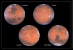
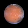
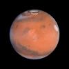
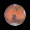
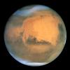
Four faces of Mars as seen on March 30, 1997 are presented in this montage of NASA Hubble Space Telescope images. Proceeding in the order upper-left, upper-right, lower-left, lower-right, Mars has rotated about ninety degrees.
PIA01248:
Four Views of Mars in Northern Summer
Full Resolution:     TIFF (11.49 MB)     JPEG (413.8 kB)
Add Image to Favorite List 1998-05-02 Mars Hubble Space Telescope
WFPC2
335x335x3
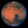
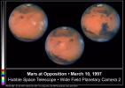
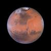
The sharpest view of Mars ever taken from Earth was obtained by the recently refurbished NASA Hubble Space Telescope. This stunning portrait was taken with the HST Wide Field Planetary Camera-2 on March 10, 1997.
PIA01249:
Hubble's Sharpest View Of Mars
Full Resolution:     TIFF (184.1 kB)     JPEG (10.13 kB)
Add Image to Favorite List 1998-05-02 Mars Hubble Space Telescope
WFPC2
2850x2025x3
Pictures of the planet Mars taken with the recently refurbished NASA Hubble Space Telescope will provide the most detailed global view of the red planet ever obtained from Earth. The images were taken by HST's Wide Field Planetary Camera-2.
PIA01250:
Hubble Captures A Full Rotation Of Mars
Full Resolution:     TIFF (6.68 MB)     JPEG (337.5 kB)
Add Image to Favorite List 1998-05-02 Mars Hubble Space Telescope
WFPC2
2061x2701x3
Two NASA Hubble Space Telescope images of Mars, taken about a month apart on September 18 and October 15, 1996, reveal a state-sized dust storm churning near the edge of the Martian north polar cap.
PIA01251:
Springtime Dust Storm Swirls at Martian North Pole
Full Resolution:     TIFF (6.992 MB)     JPEG (317.1 kB)
Add Image to Favorite List 1998-05-02 Mars Hubble Space Telescope
WFPC2
800x525x3
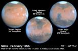
These NASA Hubble Space Telescope views provide the most detailed complete global coverage of the red planet Mars ever seen from Earth. The pictures were taken on February 25, 1995, when Mars was at a distance of 65 million miles.
PIA01252:
Mars At Opposition
Full Resolution:     TIFF (690.9 kB)     JPEG (45.74 kB)
Add Image to Favorite List 1998-05-02 Mars Hubble Space Telescope
WFPC2
800x800x3
This NASA Hubble Space Telescope view of the planet Mars was, at the time it was taken, the clearest picture ever taken from Earth, surpassed only by close-up shots sent back by visiting space probes. The picture was taken on February 25, 1995.
PIA01253:
Springtime on Mars: Hubble's Best View of the Red Planet
Full Resolution:     TIFF (927.6 kB)     JPEG (30.76 kB)
Add Image to Favorite List 1999-05-21 Mars Hubble Space Telescope
WFPC2
3000x1850x3
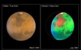
NASA Hubble Space Telescope images of Mars taken in visible and infrared light detail a rich geologic history and provide further evidence for water-bearing minerals on the planet's surface.
PIA01543:
Martian Colors Provide Clues About Martian Water
Full Resolution:     TIFF (5.11 MB)     JPEG (230.4 kB)
Add Image to Favorite List 1999-05-21 Mars Hubble Space Telescope
WFPC2
2827x1723x3
Here is the discovery image (left) from NASA's Hubble Space Telescope of the Martian polar storm as seen in blue light (410 nm). The storm is located near 65 deg.
PIA01545:
Hubble Views Colossal Polar Cyclone on Mars
Full Resolution:     TIFF (5.289 MB)     JPEG (246.7 kB)
Add Image to Favorite List 1999-08-23 Mars Hubble Space Telescope
WFPC2
3001x2070x3
Taking advantage of Mars's closest approach to Earth in eight years, astronomers using NASA's Hubble Space Telescope have taken the space-based observatory's sharpest views yet of the Red Planet.
PIA01587:
A Closer Hubble Encounter With Mars - 4 Views
Full Resolution:     TIFF (7.258 MB)     JPEG (270.4 kB)
Add Image to Favorite List 1999-08-23 Mars Hubble Space Telescope
WFPC2
900x450x3
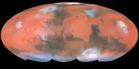
Taking advantage of Mars's closest approach to Earth in eight years, astronomers using NASA's Hubble Space Telescope have taken the space-based observatory's sharpest views yet of the Red Planet.
PIA01588:
A Closer Hubble Encounter With Mars - Global View
Full Resolution:     TIFF (894 kB)     JPEG (33.76 kB)
Add Image to Favorite List 1999-08-23 Mars Hubble Space Telescope
WFPC2
800x800x3
Taking advantage of Mars's closest approach to Earth in eight years, astronomers using NASA's Hubble Space Telescope have taken the space-based observatory's sharpest views yet of the Red Planet.
PIA01589:
A Closer Hubble Encounter With Mars - Pathfinder Landing Site
Full Resolution:     TIFF (833.5 kB)     JPEG (30.84 kB)
Add Image to Favorite List 1999-08-23 Mars Hubble Space Telescope
WFPC2
800x800x3
Astronomers using NASA's Hubble Space Telescope took this view of Mars taking advantage of the space-based observatory's close approach to Mars, centering on the region known as Tharsis, home of the largest volcanoes in the solar system.
PIA01590:
A Closer Hubble Encounter With Mars - Tharsis
Full Resolution:     TIFF (783.2 kB)     JPEG (26.36 kB)
Add Image to Favorite List 1999-08-23 Mars Hubble Space Telescope
WFPC2
800x800x3
Taking advantage of Mars's closest approach to Earth in eight years, astronomers using NASA's Hubble Space Telescope have taken the space-based observatory's sharpest views yet of the Red Planet.
PIA01591:
A Closer Hubble Encounter With Mars - Elysium
Full Resolution:     TIFF (743.6 kB)     JPEG (26.86 kB)
Add Image to Favorite List 1999-08-23 Mars Hubble Space Telescope
WFPC2
800x800x3
Taking advantage of Mars's closest approach to Earth in eight years, astronomers using NASA's Hubble Space Telescope have taken the space-based observatory's sharpest views yet of the Red Planet.
PIA01592:
A Closer Hubble Encounter With Mars - Syrtis Major
Full Resolution:     TIFF (767.3 kB)     JPEG (28.49 kB)
Add Image to Favorite List 2001-07-21 Mars Hubble Space Telescope
WFPC2
500x500x3
Frosty white water ice clouds and swirling orange dust storms above a vivid rusty landscape reveal Mars as a dynamic planet in this sharpest view ever obtained by an Earth-based telescope. Image taken by NASA's Earth-orbiting Hubble Space Telescope.
PIA03154:
Hubble Captures Best View of Mars Ever Obtained from Earth
Full Resolution:     TIFF (463.3 kB)     JPEG (17.85 kB)
Add Image to Favorite List 2001-10-13 Mars Hubble Space Telescope
WFPC2
2826x1677x3
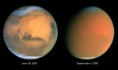
Two dramatically different faces of our Red Planet neighbor appear in these comparison images from NASA's Hubble Space Telescope, showing how a global dust storm engulfed Mars with the onset of Martian spring in the Southern Hemisphere.
PIA03173:
Scientists Track "Perfect Storm" on Mars
Full Resolution:     TIFF (7.452 MB)     JPEG (168.7 kB)
Add Image to Favorite List 2014-10-23 Mars Hubble Space Telescope
WFPC2
1167x876x3
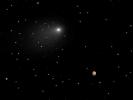
This synthesized composite of NASA Hubble Space Telescope images captures the positions of comet Siding Spring and Mars in a never-before-seen close passage of a comet by the Red Planet.
PIA17802:
Close Encounters: Comet Siding Spring Seen Next to Mars (Synthesized Image)
Full Resolution:     TIFF (3.068 MB)     JPEG (43.77 kB)
Add Image to Favorite List 1998-06-03 Mars Viking
Visual Imaging Subsystem - Camera B
6218x6653x3
This mosaic is composed of 104 images from NASA's Viking Orbiter acquired on February 11, 1980. At that time, it was early northern summer on Mars.
PIA00091:
Cerberus Hemisphere
Full Resolution:     TIFF (52.21 MB)     JPEG (2.493 MB)
Add Image to Favorite List 1998-06-03 Mars Viking
Visual Imaging Subsystem - Camera B
6738x6502x3
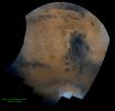
This mosaic of Syrtis Major is composed of about 100 red- and violet- filter NASA Viking Orbiter images, digitally mosaiced in an orthographic projection at a scale of 1 km/pixel.
PIA00092:
Syrtis Major Hemisphere
Full Resolution:     TIFF (59 MB)     JPEG (3.397 MB)
Add Image to Favorite List 1998-06-04 Mars Viking
Visual Imaging Subsystem - Camera B
1040x934x3
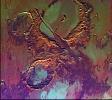
Tharsis-centered volcanic and tectonic activity resulted in the formation of radial grabens of Memnonia Fossae, which cut materials of the ancient cratered highlands and relatively young, highland-embaying lava flows as seen by NASA's Viking Orbiter 2.
PIA00151:
Memnonia Fossae (Enhanced Color)
Full Resolution:     TIFF (3.299 MB)     JPEG (186 kB)
Add Image to Favorite List 1998-06-04 Mars Viking
Visual Imaging Subsystem - Camera B
1024x880x3
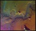
A conspicuous fretted channel, Reull Valles, Mars which dissects wall deposits of the large Hellas impact basin, trends southeast towards the basin floor as seen by NASA's Viking Orbiter 2.
PIA00153:
Reull Valles (Enhanced Color)
Full Resolution:     TIFF (2.919 MB)     JPEG (151.9 kB)
Add Image to Favorite List 1998-06-04 Mars Viking
Visual Imaging Subsystem - Camera B
1100x820x3
Mars' Syria Planum-centered volcanism and tectonism produced fractures, narrow to broad grabens, large scarps, and broad fold and thrust ridges that deformed a basement complex captured by NASA's Viking Orbiter 2.
PIA00154:
Claritas Fossae (Enhanced Color)
Full Resolution:     TIFF (3.189 MB)     JPEG (208.5 kB)
Add Image to Favorite List 1998-06-04 Mars Viking
Visual Imaging Subsystem - Camera B
964x832x3
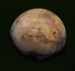
This picture from NASA's Viking Orbiter 2 shows areas of central Valles Marineris, Mars, including Candor Chasm (lower left), Ophir Chasm (lower right), and Hebes Chasm (upper right).
PIA00155:
West Candor Chasm (Enhanced Color)
Full Resolution:     TIFF (2.564 MB)     JPEG (139.3 kB)
Add Image to Favorite List 1998-06-04 Mars Viking
Visual Imaging Subsystem - Camera B
3100x4400x3
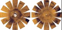
This mosaic is composed of 18 images, acquired by NASA's Viking Orbiter on September 28, 1977, during revolution 407 of Viking Orbiter 2. The south pole is located just off the lower left edge of the polar cap.
PIA00301:
South Polar Residual Ice Cap
Full Resolution:     TIFF (18.16 MB)     JPEG (1.098 MB)
Add Image to Favorite List 1998-06-04 Mars Viking
Visual Imaging Subsystem - Camera B
1024x880x3
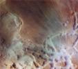
This image from NASA's Viking Orbiter 1 shows Reull Valles, a conspicuous southeast-trending fretted channel, dissects wall deposits of the large Hellas impact basin.
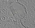
PIA00322:
Reull Valles in Approximately Natural Color
Full Resolution:     TIFF (2.235 MB)     JPEG (115.7 kB)
Add Image to Favorite List 1998-06-04 Mars Viking
Visual Imaging Subsystem - Camera B
964x832x3
This image from NASA's Viking Orbiter 2 of West Candor Chasm shows parts of central Valles Marineris, including Candor Chasm (lower left), Ophir Chasm (lower right), and Hebes Chasm (upper right).
PIA00336:
West Candor Chasm, Approximately Natural Color
Full Resolution:     TIFF (1.857 MB)     JPEG (107.1 kB)
Add Image to Favorite List 1998-06-04 Mars Viking
Visual Imaging Subsystem - Camera B
1100x820x3
NASA's Viking Orbiter 2 shows Syria Planum-centered volcanism and tectonism produced fractures, narrow to broad grabens, large scarps, and broad fold and thrust ridges that deformed a basement complex.
PIA00338:
Claritas Fossae, Approximately Natural Color
Full Resolution:     TIFF (2.61 MB)     JPEG (173.4 kB)
Add Image to Favorite List 1998-06-04 Mars Viking
Visual Imaging Subsystem - Camera B
1040x934x3
NASA's Viking Orbiter 2 shows Tharsis-centered volcanic and tectonic activity resulted in the formation of radial grabens of Memnonia Fossae, which cut materials of the ancient cratered highlands and the relatively young, highland-embaying lava flows.
PIA00339:
Memnonia Fossae, Approximately Natural Color
Full Resolution:     TIFF (2.08 MB)     JPEG (146 kB)
Add Image to Favorite List 1998-06-08 Mars Viking
Visual Imaging Subsystem - Camera B
6035x6580x3
This mosaic is comprised of images acquired in 1980 during late northern summer on Mars by NASA's Viking Orbiter 1. The bright yellow region at top is the Arabia region of Mars.
PIA00406:
Hellas Mosaic
Full Resolution:     TIFF (51.41 MB)     JPEG (1.67 MB)
Add Image to Favorite List 1998-06-08 Mars Viking
Visual Imaging Subsystem - Camera B
5367x5053x3
This view from NASA's Viking Orbiter 1 shows east Candor Chasma, one of the connected valleys of Valles Marineris. The Viking 1 craft landed on Mars in July of 1976.
PIA00424:
East Candor Chasma
Full Resolution:     TIFF (45.85 MB)     JPEG (2.932 MB)
Add Image to Favorite List 1996-06-03 Mars Viking
Visual Imaging Subsystem - Camera A
6736x6359x3
Mosaic composed of 102 Viking Orbiter images of Mars, covering nearly a full hemisphere of the planet (approximate latitude -55 to 60 degrees, longitude 30 to 130 degrees).
PIA00003:
Valles Marineris Hemisphere
Full Resolution:     TIFF (56.07 MB)     JPEG (3.032 MB)
Add Image to Favorite List 1996-06-03 Mars Viking
Visual Imaging Subsystem - Camera A
6496x6618x3
This mosaic is composed of about 100 red- and violet- filter Viking Orbiter images, digitally mosaiced in an orthographic projection at a scale of 1 km/pixel.
PIA00004:
Schiaparelli Hemisphere
Full Resolution:     TIFF (60.98 MB)     JPEG (3.383 MB)
Add Image to Favorite List 1996-06-03 Mars Viking
Visual Imaging Subsystem - Camera A
3302x2781x3
Shown here is an oblique view of the polar region, as seen with NASA's Viking 1 spacecraft orbiting Mars over latitude 39 degrees north.
PIA00009:
North Polar Ice Cap
Full Resolution:     TIFF (10.5 MB)     JPEG (952.7 kB)
Add Image to Favorite List 1998-06-04 Mars Viking
Visual Imaging Subsystem - Camera A
2048x1700x3
Water ice mixed with dust form the residual north polar ice cap (brown color) in these images from NASA's Viking Orbiter 2.
PIA00152:
North Polar Cap Margin (natural color (top) and enhanced color (bottom))
Full Resolution:     TIFF (9.474 MB)     JPEG (467.8 kB)
Add Image to Favorite List 1998-06-04 Mars Viking
Visual Imaging Subsystem - Camera A
1015x840x3
This picture (centered at latitude 10 degrees S., longitude 74 degrees W.) shows much of Mars' Melas Chasm and a portion of Candor Chasm (upper right) in central Valles Marineris as seen by NASA's Viking Orbiter 2.
PIA00156:
Melas Chasm (Enhanced Color)
Full Resolution:     TIFF (2.795 MB)     JPEG (152.8 kB)
Add Image to Favorite List 1998-06-04 Mars Viking
Visual Imaging Subsystem - Camera A
6744x6744x3
Mars digital-image mosaic merged with color of the MC-1 quadrangle, Mare Boreum region of Mars. This image is from NASA's Viking Orbiter 1.
PIA00161:
MC-1 Mare Boreum Region
Full Resolution:     TIFF (61.16 MB)     JPEG (2.778 MB)
Add Image to Favorite List 1998-06-04 Mars Viking
Visual Imaging Subsystem - Camera A
6994x5029x3
Mars digital-image mosaic merged with color of the MC-2 quadrangle, Diacria region of Mars. This image is from NASA's Viking Orbiter 1.
PIA00162:
MC-2 Diacria Region
Full Resolution:     TIFF (43.55 MB)     JPEG (2.043 MB)
Add Image to Favorite List 1998-06-04 Mars Viking
Visual Imaging Subsystem - Camera A
6994x5029x3
Mars digital-image mosaic merged with color of the MC-3 quadrangle, Arcadia region of Mars. This image is from NASA's Viking Orbiter 1.
PIA00163:
MC-3 Arcadia Region
Full Resolution:     TIFF (43.81 MB)     JPEG (2.603 MB)
Add Image to Favorite List 1998-06-04 Mars Viking
Visual Imaging Subsystem - Camera A
6994x5029x3
Mars digital-image mosaic merged with color of the MC-4 quadrangle, Mare Acidalium region of Mars. This image is from NASA's Viking Orbiter 1.
PIA00164:
MC-4 Mare Acidalium Region
Full Resolution:     TIFF (47.56 MB)     JPEG (2.345 MB)
Add Image to Favorite List 1998-06-04 Mars Viking
Visual Imaging Subsystem - Camera A
6994x5029x3
Mars digital-image mosaic merged with color of the MC-5 quadrangle, Ismenius Lacus region of Mars. This image is from NASA's Viking Orbiter 1.
PIA00165:
MC-5 Ismenius Lacus Region
Full Resolution:     TIFF (48.93 MB)     JPEG (2.888 MB)
Add Image to Favorite List 1998-06-04 Mars Viking
Visual Imaging Subsystem - Camera A
6994x5029x3
Mars digital-image mosaic merged with color of the MC-6 quadrangle, Casius region of Mars. This image is from NASA's Viking Orbiter 1.
PIA00166:
MC-6 Casius Region
Full Resolution:     TIFF (46.22 MB)     JPEG (2.381 MB)
Add Image to Favorite List 1998-06-05 Mars Viking
Visual Imaging Subsystem - Camera A
6994x5029x3
Mars digital-image mosaic merged with color of the MC-7 quadrangle, Cebrenia region of Mars. This image is from NASA's Viking Orbiter 1.
PIA00167:
MC-7 Cebrenia Region
Full Resolution:     TIFF (42.2 MB)     JPEG (2.163 MB)
Add Image to Favorite List 1998-06-05 Mars Viking
Visual Imaging Subsystem - Camera A
7170x4991x3
Mars digital-image mosaic merged with color of the MC-8 quadrangle, Amazonis region of Mars. This image is from NASA's Viking Orbiter 1.
PIA00168:
MC-8 Amazonis Region
Full Resolution:     TIFF (60.79 MB)     JPEG (3.337 MB)
Add Image to Favorite List 1998-06-05 Mars Viking
Visual Imaging Subsystem - Camera A
7170x4991x3
Mars digital-image mosaic merged with color of the MC-9 quadrangle, Tharsis region of Mars. This image is from NASA's Viking Orbiter 1.
PIA00169:
Mc-9 Tharsis Region
Full Resolution:     TIFF (59.06 MB)     JPEG (3.17 MB)
Add Image to Favorite List 1998-06-05 Mars Viking
Visual Imaging Subsystem - Camera A
7170x4991x3
Mars digital-image mosaic merged with color of the MC-10 quadrangle, Lanae Palus region of Mars. This image is from NASA's Viking Orbiter 1.
PIA00170:
MC-10 Lanae Palus Region
Full Resolution:     TIFF (63.37 MB)     JPEG (2.725 MB)
Add Image to Favorite List 1998-06-05 Mars Viking
Visual Imaging Subsystem - Camera A
7170x4991x3
Mars digital-image mosaic merged with color of the MC-11 quadrangle, Oxia Palus region of Mars. This image is from NASA's Viking Orbiter 1.
PIA00171:
MC-11 Oxia Palus Region
Full Resolution:     TIFF (69.94 MB)     JPEG (3.219 MB)
Add Image to Favorite List 1998-06-05 Mars Viking
Visual Imaging Subsystem - Camera A
7170x4991x3
Mars digital-image mosaic merged with color of the MC-12 quadrangle, Arabia region of Mars. This image is from NASA's Viking Orbiter 1.
PIA00172:
MC-12 Arabia Region
Full Resolution:     TIFF (67.81 MB)     JPEG (3.671 MB)
Add Image to Favorite List 1998-06-05 Mars Viking
Visual Imaging Subsystem - Camera A
7170x4991x3
Mars digital-image mosaic merged with color of the MC-13 quadrangle, Syrtis Major region of Mars. This image is from NASA's Viking Orbiter 1.
PIA00173:
MC-13 Syrtis Major Region
Full Resolution:     TIFF (71.83 MB)     JPEG (3.374 MB)
Add Image to Favorite List 1998-06-05 Mars Viking
Visual Imaging Subsystem - Camera A
7170x4991x3
Mars digital-image mosaic merged with color of the MC-14 quadrangle, Amenthes region of Mars. This image is from NASA's Viking Orbiter 1.
PIA00174:
MC-14 Amenthes Region
Full Resolution:     TIFF (54.52 MB)     JPEG (2.893 MB)
Add Image to Favorite List 1998-06-05 Mars Viking
Visual Imaging Subsystem - Camera A
7170x4991x3
Mars digital-image mosaic merged with color of the MC-15 quadrangle, Elysium region of Mars. This image is from NASA's Viking Orbiter 1.
PIA00175:
MC-15 Elysium Region
Full Resolution:     TIFF (54.58 MB)     JPEG (3.002 MB)
Add Image to Favorite List 1998-06-05 Mars Viking
Visual Imaging Subsystem - Camera A
7170x4991x3
Mars digital-image mosaic merged with color of the MC-16 quadrangle, Memnonia region of Mars. This image is from NASA's Viking Orbiter 1.
PIA00176:
MC-16 Memnonia Region
Full Resolution:     TIFF (71.85 MB)     JPEG (4.668 MB)
Add Image to Favorite List 1998-06-05 Mars Viking
Visual Imaging Subsystem - Camera A
7170x4991x3
Mars digital-image mosaic merged with color of the MC-17 quadrangle, Phoenicis Lacus region of Mars. This image is from NASA's Viking Orbiter 1.
PIA00177:
MC-17 Phoenicis Region
Full Resolution:     TIFF (68.33 MB)     JPEG (3.962 MB)
Add Image to Favorite List 1998-06-05 Mars Viking
Visual Imaging Subsystem - Camera A
7170x4991x3
Mars digital-image mosaic merged with color of the MC-18 quadrangle, Coprates region of Mars. This image is from NASA's Viking Orbiter 1.
PIA00178:
MC-18 Coprates Region
Full Resolution:     TIFF (75.6 MB)     JPEG (3.965 MB)
Add Image to Favorite List 1998-06-05 Mars Viking
Visual Imaging Subsystem - Camera A
7170x4991x3
Mars digital-image mosaic merged with color of the MC-19 quadrangle, Margaritifer Sinus region of Mars. This image is from NASA's Viking Orbiter 1.
PIA00179:
MC-19 Margaritifer Sinus Region
Full Resolution:     TIFF (80.33 MB)     JPEG (4.576 MB)
Add Image to Favorite List 1998-06-05 Mars Viking
Visual Imaging Subsystem - Camera A
7170x4991x3
Mars digital-image mosaic merged with color of the MC-20 quadrangle, Sinus Sabeus region of Mars. This image is from NASA's Viking Orbiter 1.
PIA00180:
MC-20 Sinus Sabeus Region
Full Resolution:     TIFF (76.26 MB)     JPEG (4.345 MB)
Add Image to Favorite List 1998-06-05 Mars Viking
Visual Imaging Subsystem - Camera A
7170x4991x3
Mars digital-image mosaic merged with color of the MC-21 quadrangle, Iapygia region of Mars. This image is from NASA's Viking Orbiter 1.
PIA00181:
MC-21 Iapygia Region
Full Resolution:     TIFF (76.48 MB)     JPEG (3.901 MB)
Add Image to Favorite List 1998-06-05 Mars Viking
Visual Imaging Subsystem - Camera A
7170x4991x3
Mars digital-image mosaic merged with color of the MC-22 quadrangle, Mare Tyrrhenum region of Mars. This image is from NASA's Viking Orbiter 1.
PIA00182:
MC-22 Mare Tyrrhenum Region
Full Resolution:     TIFF (72.07 MB)     JPEG (4.105 MB)
Add Image to Favorite List 1998-06-05 Mars Viking
Visual Imaging Subsystem - Camera A
7170x4991x3
Mars digital-image mosaic merged with color of the MC-23 quadrangle, Aeolis region of Mars. This image is from NASA's Viking Orbiter 1.
PIA00183:
MC-23 Aeolis Region
Full Resolution:     TIFF (72.6 MB)     JPEG (4.476 MB)
Add Image to Favorite List 1998-06-05 Mars Viking
Visual Imaging Subsystem - Camera A
6994x5029x3
Mars digital-image mosaic merged with color of the MC-24 quadrangle, Phaethontis region of Mars. This image is from NASA's Viking Orbiter 1.
PIA00184:
MC-24 Phaethontis Region
Full Resolution:     TIFF (54.07 MB)     JPEG (3.143 MB)
Add Image to Favorite List 1998-06-05 Mars Viking
Visual Imaging Subsystem - Camera A
6994x5029x3
Mars digital-image mosaic merged with color of the MC-25 quadrangle, Thaumasia region of Mars. This image is from NASA's Viking Orbiter 1.
PIA00185:
MC-25 Thaumasia Region
Full Resolution:     TIFF (51.55 MB)     JPEG (2.802 MB)
Add Image to Favorite List 1998-06-05 Mars Viking
Visual Imaging Subsystem - Camera A
6994x5029x3
Mars digital-image mosaic merged with color of the MC-26 quadrangle, Argyre region of Mars. This image is from NASA's Viking Orbiter 1.
PIA00186:
MC-26 Argyre Region
Full Resolution:     TIFF (53.97 MB)     JPEG (3.602 MB)
Add Image to Favorite List 1998-06-05 Mars Viking
Visual Imaging Subsystem - Camera A
6994x5029x3
Mars digital-image mosaic merged with color of the MC-27 quadrangle, Noachis region of Mars. This image is from NASA's Viking Orbiter 1.
PIA00187:
MC-27 Noachis Region
Full Resolution:     TIFF (54.23 MB)     JPEG (3.644 MB)
Add Image to Favorite List 1998-06-05 Mars Viking
Visual Imaging Subsystem - Camera A
6994x5029x3
Mars digital-image mosaic merged with color of the MC-28 quadrangle, Hellas region of Mars. This image is from NASA's Viking Orbiter 1.
PIA00188:
MC-28 Hellas Region
Full Resolution:     TIFF (50.79 MB)     JPEG (3.486 MB)
Add Image to Favorite List 1998-06-05 Mars Viking
Visual Imaging Subsystem - Camera A
6994x5029x3
Mars digital-image mosaic merged with color of the MC-29 quadrangle, Eridania region of Mars. This image is from NASA's Viking Orbiter 1.
PIA00189:
MC-29 Eridania Region
Full Resolution:     TIFF (53.95 MB)     JPEG (4.072 MB)
Add Image to Favorite List 1998-06-08 Mars Viking
Visual Imaging Subsystem - Camera A
6744x6744x3
Mars digital-image mosaic merged with color of the MC-30 quadrangle, Mare Australe region of Mars. This image is from NASA's Viking Orbiter 1.
PIA00190:
MC-30 Mare Australe Region
Full Resolution:     TIFF (75.85 MB)     JPEG (3.79 MB)
Add Image to Favorite List 1998-06-08 Mars Viking
Visual Imaging Subsystem - Camera A
6787x6787x3
Heavily cratered highlands dominate this view from NASA's Viking Orbiter 1. Toward the lower right, a conspicuous light-colored circular depression marks the ancient large Hellas impact basin.
PIA00191:
Center is at Latitude 30 Degrees South., Longitude 330 Degrees
Full Resolution:     TIFF (66.74 MB)     JPEG (2.173 MB)
Add Image to Favorite List 1998-06-08 Mars Viking
Visual Imaging Subsystem - Camera A
6787x6787x3
The north polar residual ice cap, which is cut by spiral-patterned troughs, is located at the top in this view from NASA's Viking Orbiter 1.
PIA00192:
Center is at Latitude 30 Degrees North, Longitude 30 Degrees
Full Resolution:     TIFF (65.4 MB)     JPEG (2.107 MB)
Add Image to Favorite List 1998-06-08 Mars Viking
Visual Imaging Subsystem - Camera A
6398x6398x3
Both polar residual ice caps are seen at top and bottom. The central part is dominated by the four largest and youngest volcanoes on Mars--Olympus, Arsia, Pavonis, and Ascraeus Montes in this image from NASA's Viking Orbiter 1.
PIA00193:
Latitude 90 Degrees North to 90 Degrees South and Longitude 0 Degrees to 180 Degrees
Full Resolution:     TIFF (56.26 MB)     JPEG (1.782 MB)
Add Image to Favorite List 1998-06-08 Mars Viking
Visual Imaging Subsystem - Camera A
6398x6398x3
The north polar residual ice cap of the Planum Boreum region, which is cut by spiral-patterned troughs, is located at top of this image from NASA's Viking Orbiter 1.
PIA00194:
Latitude 90 Degrees North to 90 Degrees South and Longitude -180 Degrees to 0 Degrees
Full Resolution:     TIFF (54.49 MB)     JPEG (1.746 MB)
Add Image to Favorite List 1998-06-08 Mars Viking
Visual Imaging Subsystem - Camera A
6787x6787x3
The top half of Mars is dominated by the Tharsis Montes volcanoes, the large Alba Patera shield volcano, the dark Chryse basin, and a vast canyon system, Valles Marineris in this image from NASA's Viking Orbiter 1.
PIA00195:
Center is at Latitude 30 Degrees South, Longitude 90 Degrees
Full Resolution:     TIFF (63.07 MB)     JPEG (1.978 MB)
Add Image to Favorite List 1998-06-08 Mars Viking
Visual Imaging Subsystem - Camera A
6787x6787x3
The lowland plains of Elysium and Utopia Planitiae are separated from the darker heavily cratered highlands by a broad escarpment in this image from NASA's Viking Orbiter 1.
PIA00196:
Center is at Latitude 30 Degrees South, Longitude 210 Degrees
Full Resolution:     TIFF (60 MB)     JPEG (1.807 MB)
Add Image to Favorite List 1998-06-08 Mars Viking
Visual Imaging Subsystem - Camera A
6787x6787x3
NASA's Viking Orbiter 1 spies the north polar residual ice cap, which is cut by spiral-patterned troughs and surrounded by the dark lowland plains of Vastitas Borealis, Mars is located at the top.
PIA00197:
Center is at Latitude 30 Degrees North, Longitude 150 Degrees
Full Resolution:     TIFF (58.79 MB)     JPEG (1.74 MB)
Add Image to Favorite List 1998-06-08 Mars Viking
Visual Imaging Subsystem - Camera A
6787x6787x3
The north polar residual ice cap of the Planum Boreum region, which is cut by spiral-patterned troughs, is located at top of this image from NASA's Viking Orbiter 1.
PIA00198:
Center is at Latitude 30 Degrees North, Longitude 270 Degrees
Full Resolution:     TIFF (60.13 MB)     JPEG (1.88 MB)
Add Image to Favorite List 1998-06-08 Mars Viking
Visual Imaging Subsystem - Camera A
3650x4608x3
Part of Candor Chasm in Valles Marineris, Mars. Layered terrain is visible in the scene from NASA's Viking Orbiter 1., perhaps due to a huge ancient lake.
PIA00199:
Candor Chasm in Valles Marineris
Full Resolution:     TIFF (32.2 MB)     JPEG (1.083 MB)
Add Image to Favorite List 1998-06-04 Mars Viking
Visual Imaging Subsystem - Camera A
1015x840x3
This image from NASA's Viking Orbiter 2 of West Candor Chasm shows much of Melas Chasm and a portion of Candor Chasm (upper right) in central Valles Marineris.
PIA00337:
Melas Chasm, Approximately Natural Color
Full Resolution:     TIFF (2.288 MB)     JPEG (118.5 kB)
Add Image to Favorite List 1998-06-08 Mars Viking
Visual Imaging Subsystem - Camera A
3352x3222x3
During its examination of Mars, NASA's Viking 1 spacecraft returned images of Valles Marineris, a huge canyon system 5,000 km long, up to 240 km wide, and 6.5 km deep. This view shows west Candor Chasm.
PIA00403:
West Candor Chasma
Full Resolution:     TIFF (23.46 MB)     JPEG (1.531 MB)
Add Image to Favorite List 1998-04-02 Mars Viking
Visual Imaging Subsystem - Camera A
640x472x1
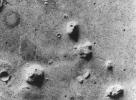
NASA's Viking 1 Orbiter spacecraft photographed this region in the northern latitudes of Mars on July 25, 1976 while searching for a landing site for the Viking 2 Lander.
PIA01141:
Geologic 'Face on Mars' Formation
Full Resolution:     TIFF (316.9 kB)     JPEG (60.68 kB)
Add Image to Favorite List 2000-11-10 Mars Viking
Visual Imaging Subsystem - Camera A
11649x5721x3
This image from NASA's Viking Orbiter 1 shows the northern hemisphere of Mars is shown on the left, and the southern hemisphere on the right.
PIA02992:
Mars Digital Image Mosaic Globe
Full Resolution:     TIFF (120 MB)     JPEG (8.664 MB)
Add Image to Favorite List 2003-02-05 Mars Viking
Visual Imaging Subsystem - Camera A
2024x1919x3
This mosaic of Mars is a compilation of images captured by NASA's Viking Orbiter 1. The center of the scene shows the entire Valles Marineris canyon system, over 3,000 km long and up to 8 km deep, extending from Noctis Labyrinthus.
PIA04304:
The Target
Full Resolution:     TIFF (7.489 MB)     JPEG (237 kB)
Add Image to Favorite List 2001-02-21 Mars Viking
Visual Imaging Subsystem
5072x4499x3
NASA's Viking Orbiter 1 captured the sun rising over Noctis Labyrinthus (the labyrinth of the night), bright clouds of water ice can be observed in and around the tributary canyons of this high plateau region of Mars.
PIA03213:
Noctis Labyrinthus
Full Resolution:     TIFF (81.9 MB)     JPEG (4.397 MB)
Add Image to Favorite List 2003-04-11 Mars Viking
Visual Imaging Subsystem
5334x4267x3
Gusev Crater, the designated landing site for the first Mars Exploration Rover mission was seen here in its geological context from NASA Viking Orbiter 1.
PIA04274:
Gusev Crater
Full Resolution:     TIFF (30.59 MB)     JPEG (2.162 MB)
Add Image to Favorite List 2003-04-11 Mars Viking
Visual Imaging Subsystem
8530x4267x3
Meridiani Planum, the designated landing site for the second Mars Exploration Rover mission was seen here in its geological context from NASA Viking Orbiter 1.
PIA04275:
Meridiani Planum
Full Resolution:     TIFF (49.08 MB)     JPEG (3.939 MB)
Add Image to Favorite List 2016-11-29 Mars ExoMars
Trace Gas Orbiter
1789x1304x3
A NASA radio aboard ESA's Trace Gas Orbiter, succeeded in its first test of receiving data transmitted from NASA Mars rovers. This graphic depicts the geometry of Opportunity transmitting data to the orbiter, using the UHF band of radio wavelengths.
PIA21139:
Strengthening the Mars Telecommunications Network
Full Resolution:     TIFF (1.27 MB)     JPEG (91.46 kB)
Add Image to Favorite List 1997-09-24 Mars Mars Global Surveyor (MGS)
Thermal Emission Spectrometer
554x553x3
This image shows the temperature of the martian surface measured by NASA's Mars Global Surveyor Thermal Emission Spectrometer instrument. On September 15, 3 hours and 48 minutes after the spacecrafts third close approach to the planet.
PIA00937:
MGS Thermal Emission Spectrometer Image
Full Resolution:     TIFF (90.26 kB)     JPEG (80.87 kB)
Add Image to Favorite List 1997-11-10 Mars Mars Global Surveyor (MGS)
Thermal Emission Spectrometer
1409x1091x3
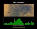
An abundance of pyroxene at Syrtis Major on Mars is seen in this image from NASA's Mars Global Surveyor.
PIA01017:
Pyroxene at Syrtis Major
Full Resolution:     TIFF (1.821 MB)     JPEG (127.5 kB)
Add Image to Favorite List 1997-11-10 Mars Mars Global Surveyor (MGS)
Thermal Emission Spectrometer
1872x1224x3
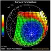
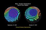
The surface temperature at Mars' south polar region is seen in this image from NASA's Mars Global Surveyor.
PIA01018:
Mars - Surface Temperature South Polar Region
Full Resolution:     TIFF (2.253 MB)     JPEG (360.5 kB)
Add Image to Favorite List 1997-11-10 Mars Mars Global Surveyor (MGS)
Thermal Emission Spectrometer
1400x1000x3
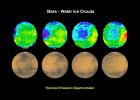
Water ice clouds on Mars are seen in this image from NASA's Mars Global Surveyor.
PIA01019:
Mars - Water Ice Clouds
Full Resolution:     TIFF (1.695 MB)     JPEG (147.2 kB)
Add Image to Favorite List 1997-11-10 Mars Mars Global Surveyor (MGS)
Thermal Emission Spectrometer
524x424x3
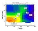
Temperatures on Mars detected by the Thermal Emission Spectrometer are seen in this image from NASA's Mars Global Surveyor.
PIA01020:
MGS/TES Temperatures
Full Resolution:     TIFF (17.04 kB)     JPEG (32.43 kB)
Add Image to Favorite List 1999-01-07 Mars Mars Global Surveyor (MGS)
Thermal Emission Spectrometer
2967x2382x3
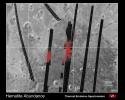
This image shows the concentration of hematite measured NASA's Mars Global Surveyor. The abundance of hematite is shown in red, with increasing brightness indicating increasing hematite abundance.
PIA01339:
Hematite Abundance on Martian Surface
Full Resolution:     TIFF (2.506 MB)     JPEG (846.8 kB)
Add Image to Favorite List 1999-01-07 Mars Mars Global Surveyor (MGS)
Thermal Emission Spectrometer
2183x3033x3
Observations by NASA's Mars Global Surveyor covering one half martian year allow scientists to follow the development of the northern winter polar vortex. This high speed west wind builds up from fall to maximum strength in winter.
PIA01340:
Measurements of the Martian Winds for Three Seasons
Full Resolution:     TIFF (1.057 MB)     JPEG (602.2 kB)
Add Image to Favorite List 1999-05-06 Mars Mars Global Surveyor (MGS)
Thermal Emission Spectrometer
2362x1667x3
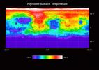
This image shows the nighttime temperature of the Martian surface as measured by the Thermal Emission Spectrometer (TES) instrument onboard NASA's Mars Global Surveyor.
PIA02014:
Temperature of the Martian Surface
Full Resolution:     TIFF (1.195 MB)     JPEG (434.8 kB)
Add Image to Favorite List 1999-05-06 Mars Mars Global Surveyor (MGS)
Thermal Emission Spectrometer
300x300x3
This image shows the nighttime temperatures measured by the Thermal Emission Spectrometer (TES) instrument onboard NASA's Mars Global Surveyor wrapped on to a globe.
PIA02015:
Martian Temperatures Measured by the Thermal Emission Spectrometer (TES). Pathfinder Landing Aite View
Full Resolution:     TIFF (32.88 kB)     JPEG (23.63 kB)
Add Image to Favorite List 1999-05-06 Mars Mars Global Surveyor (MGS)
Thermal Emission Spectrometer
300x300x3
This image shows the nighttime temperatures measured by the Thermal Emission Spectrometer (TES) instrument onboard NASA's Mars Global Surveyor wrapped on to a globe.
PIA02016:
Martian Temperatures Measured by the Thermal Emission Spectrometer (TES). Isidis Planitia View
Full Resolution:     TIFF (30.37 kB)     JPEG (23.21 kB)
Add Image to Favorite List 1999-06-23 Mars Mars Global Surveyor (MGS)
Thermal Emission Spectrometer
2700x1760x3
NASA's Mars Global Surveyor shows spectral characteristics that indicate the occurrence of relatively-coarsely crystalline hematite over a large area near 0° latitude and 0° longitude on Mars.
PIA02056:
Hematite Map (TES)
Full Resolution:     TIFF (1.342 MB)     JPEG (592.3 kB)
Add Image to Favorite List 1999-06-23 Mars Mars Global Surveyor (MGS)
Thermal Emission Spectrometer
1836x2376x3
NASA's Mars Global Surveyor shows the seasonal change of the south polar ice cap on Mars over a four-month period mapped by color-coding the variation in 25-micron wavelength brightness temperatures.
PIA02057:
South Polar Cap Thermal Retreat (TES)
Full Resolution:     TIFF (901.7 kB)     JPEG (397.6 kB)
 Current Set   Jump to a Following Set   Jump to a Following Set   Jump to a Following Set   Jump to a Following Set   Jump to a Following Set   Jump to a Following Set   Jump to a Following Set   Jump to a Following Set   Jump to a Following Set   Retrieve Next Set 
 1-100   101-200   201-300   301-400   401-500   501-600   601-700   701-800   801-900   901-1000 
Currently displaying images: 1 - 100 of 12730