My
List |
Addition Date
|
Target
|
Mission
|
Instrument
|
Size
|

|
2018-02-12 |
Earth
|
UAVSAR
|
L-Band UAVSAR
|
1738x1853x3 |
|
-
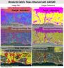
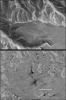
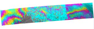
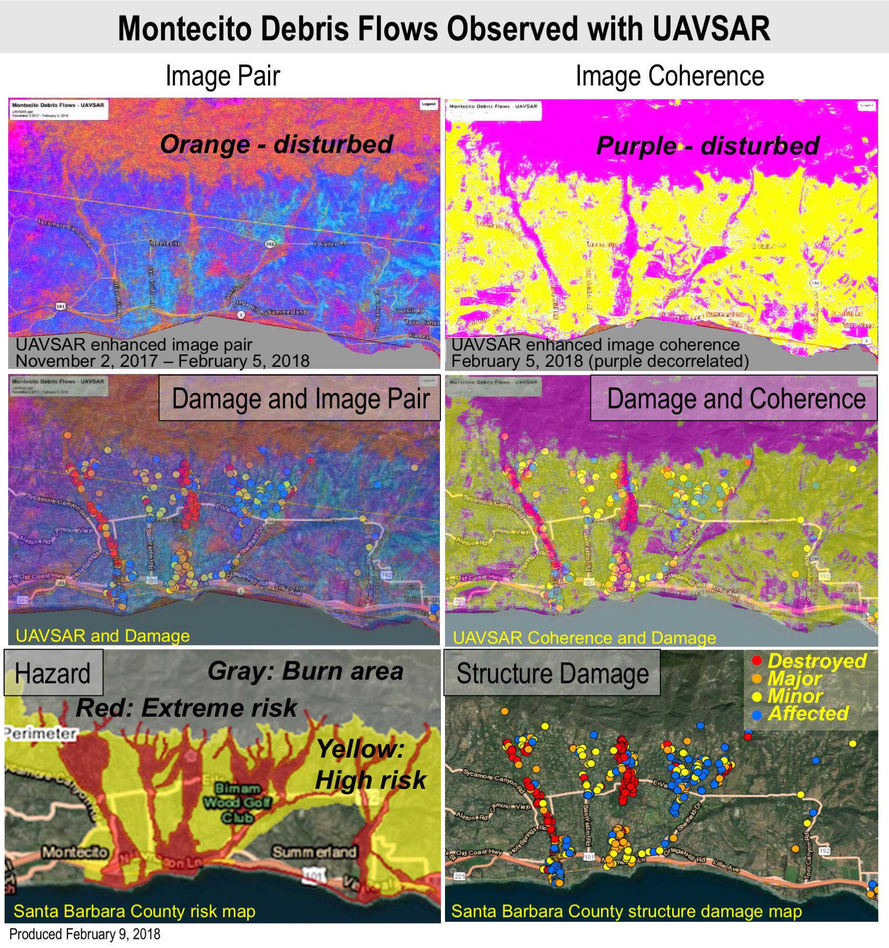
PIA22243:
-
Effects of Deadly California Debris Flows Seen in Before/After Images from NASA's UAVSAR
Full Resolution:
TIFF
(8.922 MB)
JPEG
(598.4 kB)
|
|
|
2016-02-05 |
Earth
|
UAVSAR
|
L-Band UAVSAR
|
1800x2344x1 |
|
-
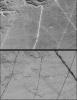
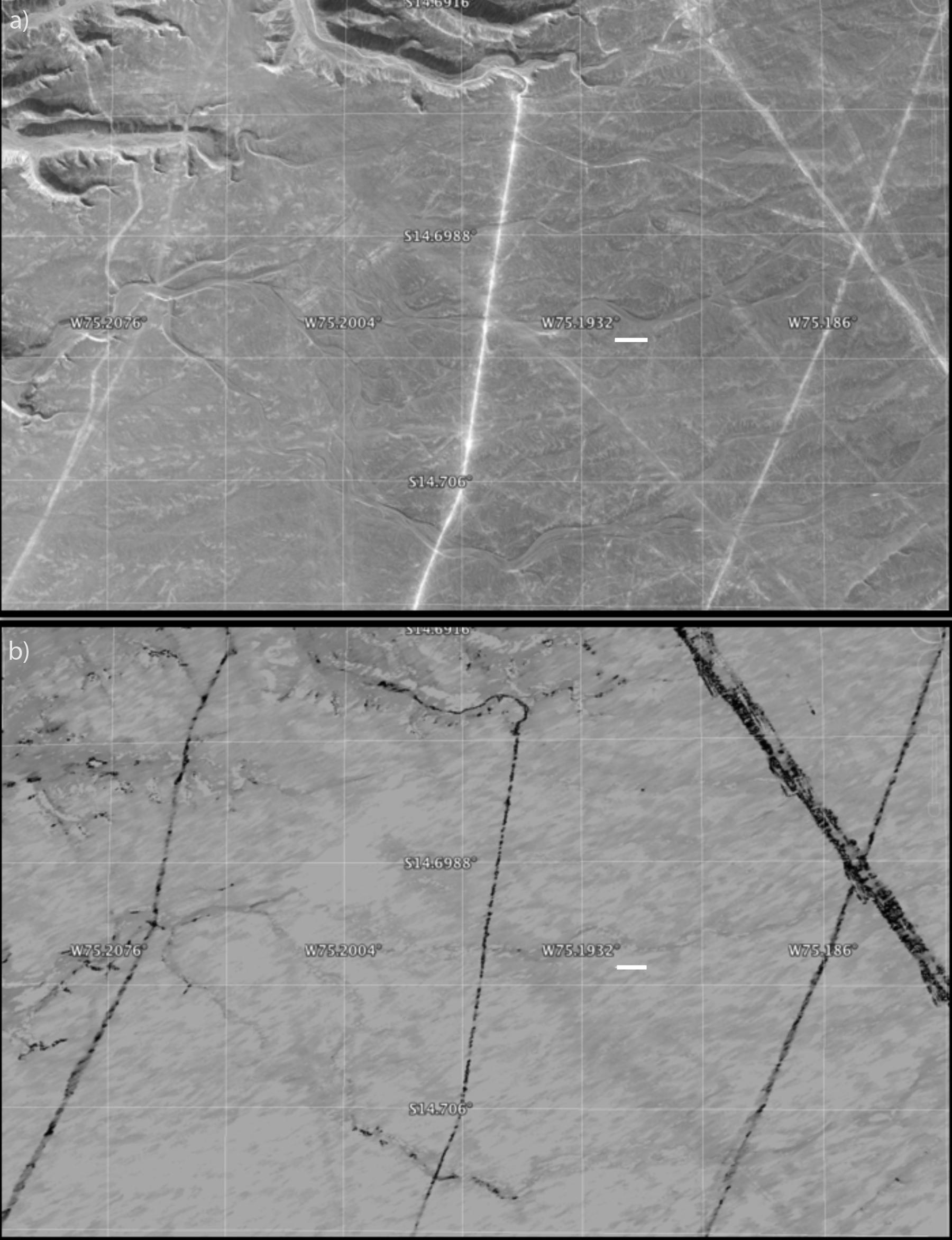
PIA20378:
-
Disturbance on Dirt Roads Crossing Peru's Nasca World Heritage Site seen by NASA's UAVSAR
Full Resolution:
TIFF
(3.03 MB)
JPEG
(327.7 kB)
|
|
|
2016-02-05 |
Earth
|
UAVSAR
|
L-Band UAVSAR
|
1800x882x1 |
|
-
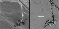
PIA20377:
-
Disturbance at Peru's Nasca World Heritage Site seen by NASA's UAVSAR
Full Resolution:
TIFF
(1.158 MB)
JPEG
(112.2 kB)
|
|
|
2016-02-05 |
Earth
|
UAVSAR
|
L-Band UAVSAR
|
1041x1043x1 |
|
-
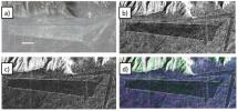
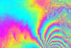
PIA20376:
-
Peruvian Geometric Geoglyphs Detected by NASA's UAVSAR
Full Resolution:
TIFF
(3.339 MB)
JPEG
(226.5 kB)
|
|
|
2016-01-27 |
Earth
|
UAVSAR
|
L-Band UAVSAR
|
1800x2721x1 |
|
-
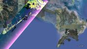
PIA20367:
-
NASA Radar Brings a New View of World Heritage Site
Full Resolution:
TIFF
(3.714 MB)
JPEG
(332.4 kB)
|
|
|
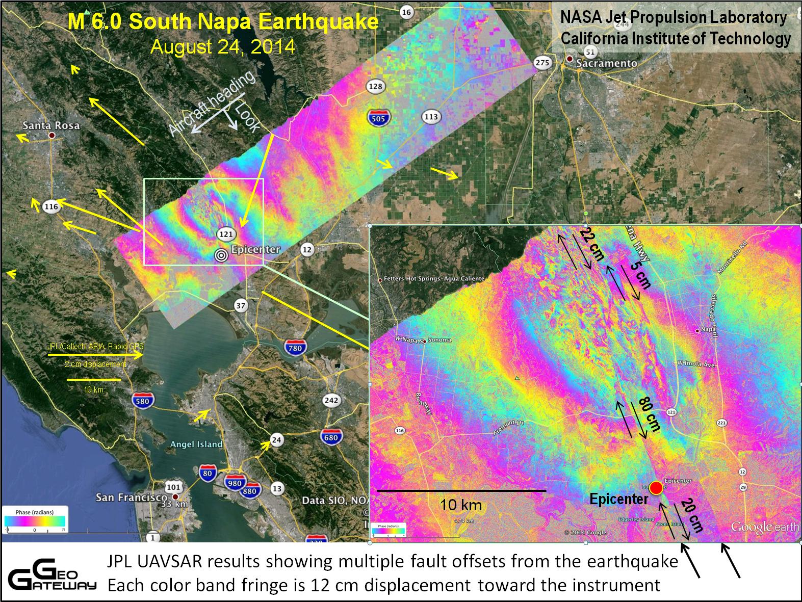
2014-09-04 |
Earth
|
UAVSAR
|
L-Band UAVSAR
|
1573x1181x3 |
|
-
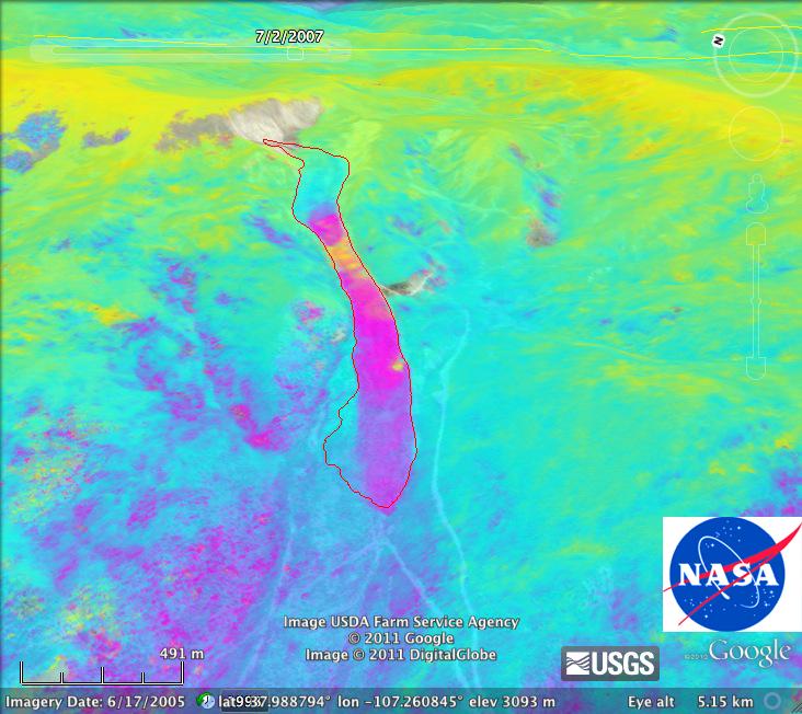
PIA18801:
-
NASA's UAVSAR Studies Ground Deformation from Napa California Quake
Full Resolution:
TIFF
(5.575 MB)
JPEG
(472.8 kB)
|
|
|
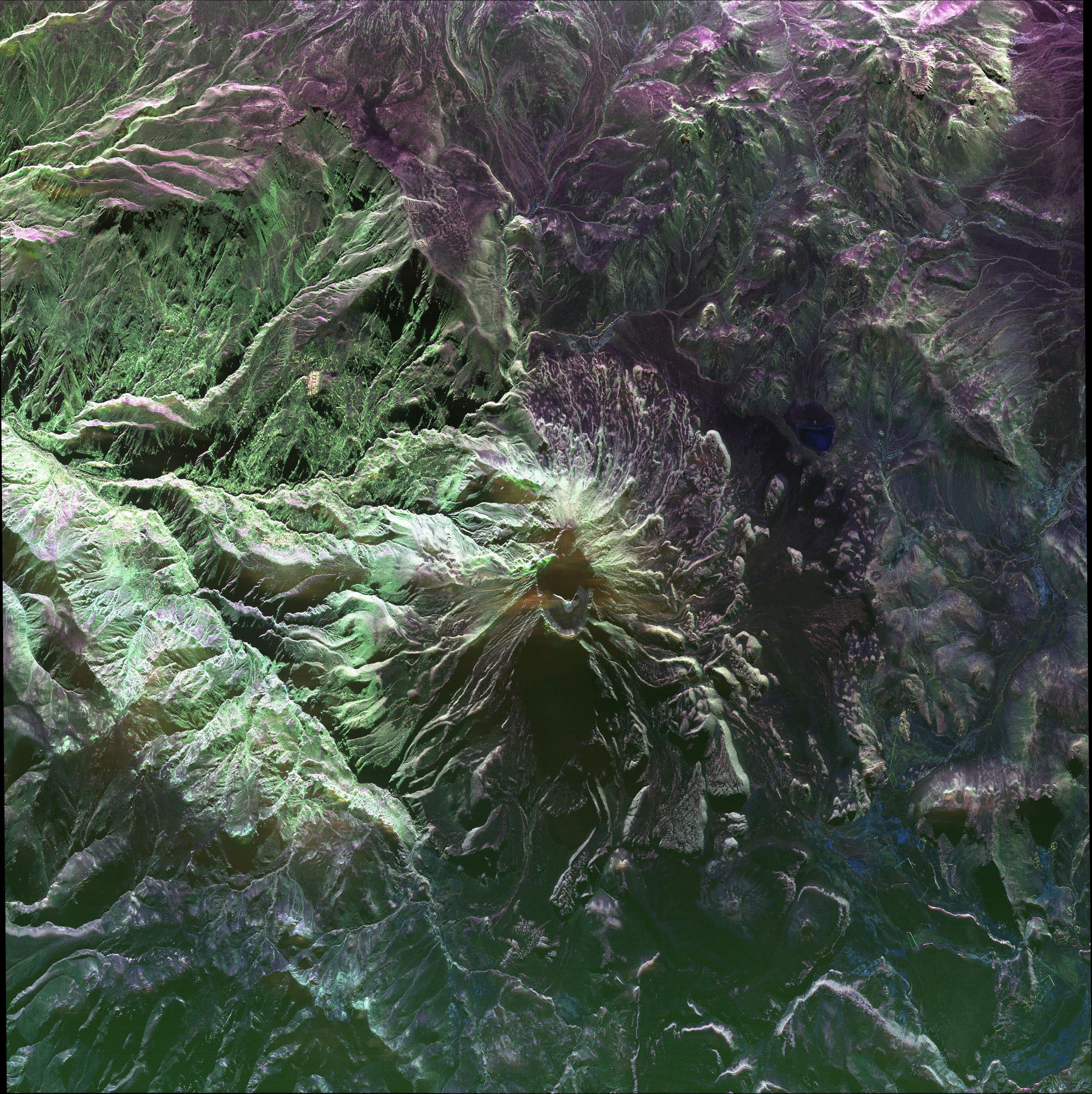
2014-05-27 |
Earth
|
UAVSAR
|
L-Band UAVSAR
|
3238x3244x3 |
|
-
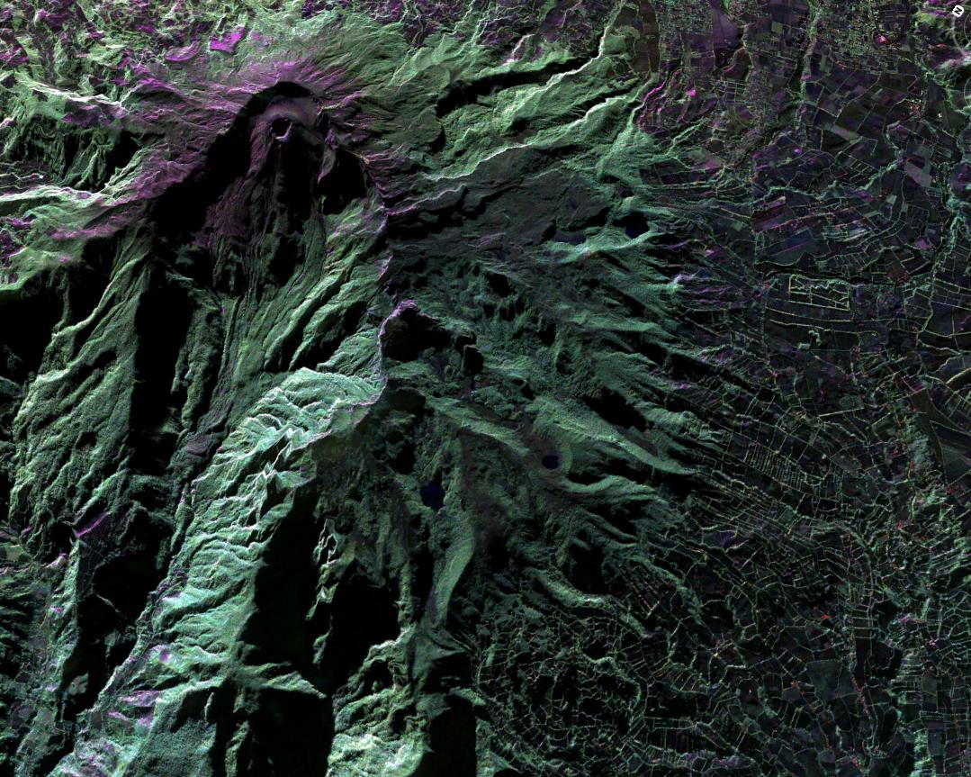
PIA18049:
-
UAVSAR image of Ubinas Volcano
Full Resolution:
TIFF
(31.53 MB)
JPEG
(2.65 MB)
|
|
|
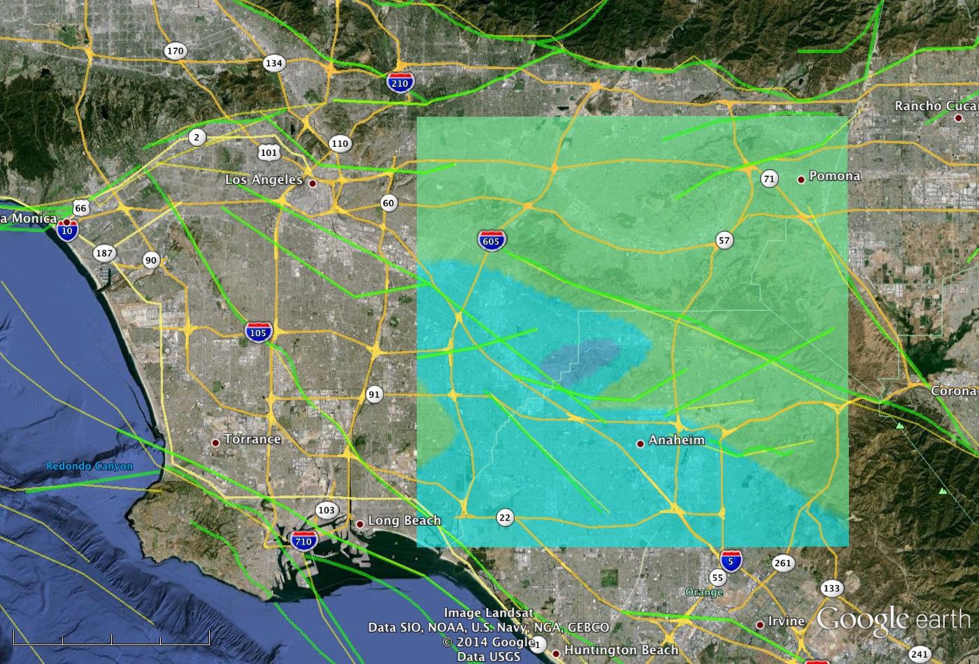
2014-03-31 |
Earth
|
UAVSAR
|
L-Band UAVSAR
|
1400x950x3 |

|
-
PIA18041:
-
NASA Model Provides 3-D Look at L.A.-area 5.1 Quake
Full Resolution:
TIFF
(3.992 MB)
JPEG
(303.4 kB)
|
|
|
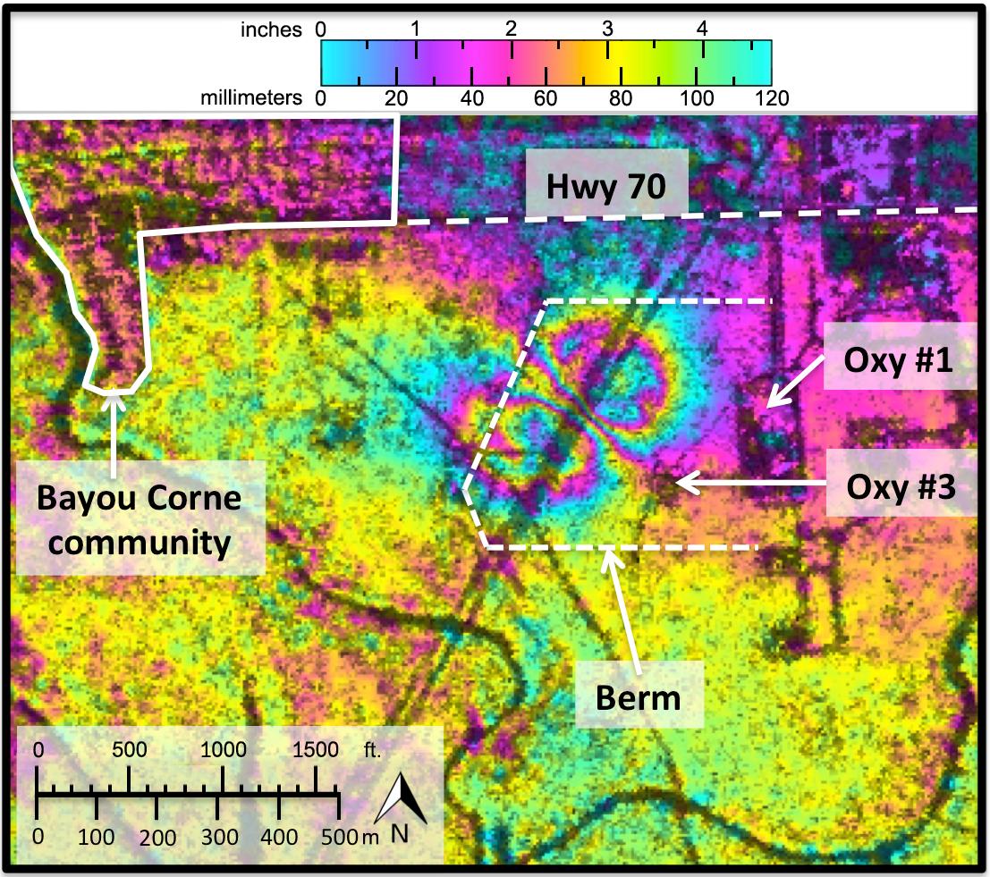
2014-03-06 |
Earth
|
UAVSAR
|
L-Band UAVSAR
|
1107x981x3 |
|
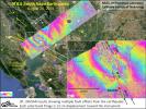
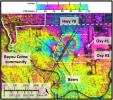
-
PIA18040:
-
NASA Radar Demonstrates Ability to Foresee Sinkholes
Full Resolution:
TIFF
(3.259 MB)
JPEG
(246.1 kB)
|
|
|
2014-01-28 |
Earth
|
UAVSAR
|
|
5184x3456x3 |
|
-
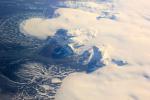
PIA17924:
-
NASA Radar Maps the Winter Pace of Iceland's Glaciers
Full Resolution:
TIFF
(53.78 MB)
JPEG
(1.748 MB)
|
|
|
2013-04-03 |
Earth
|
UAVSAR
|
L-Band UAVSAR
|
1079x863x3 |
|
-
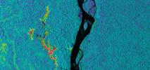
PIA16943:
-
UAVSAR Acquires False-Color Image of Galeras Volcano, Colombia
Full Resolution:
TIFF
(2.795 MB)
JPEG
(230.9 kB)
|
|
|
2013-04-03 |
Earth
|
UAVSAR
|
L-Band UAVSAR
|
2806x1314x3 |
|
-
PIA16942:
-
NASA Sends Unmanned Aircraft To Study Volcanoes and Wetlands
Full Resolution:
TIFF
(11.07 MB)
JPEG
(1.742 MB)
|
|
|
2012-08-15 |
Earth
|
UAVSAR
|
L-Band UAVSAR
|
732x652x3 |
|
-
PIA16059:
-
NASA's UAVSAR Images Colorado's Slumgullion Landslide
Full Resolution:
TIFF
(1.432 MB)
JPEG
(78.48 kB)
|
|
|
2011-03-04 |
Earth
|
UAVSAR
|
L-Band UAVSAR
|
20528x6304x3 |
|
-
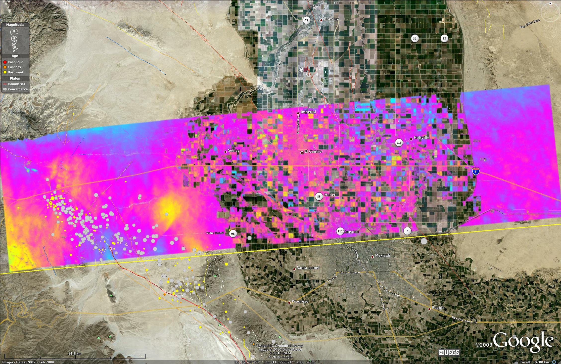
PIA13902:
-
NASA Radar Captures Earth Deformation from 2010 Baja Calif. Quake
Full Resolution:
TIFF
(388.2 MB)
JPEG
(20.55 MB)
|
|
|
2010-08-04 |
Earth
|
UAVSAR
|
L-Band UAVSAR
|
2256x1464x3 |

|
-
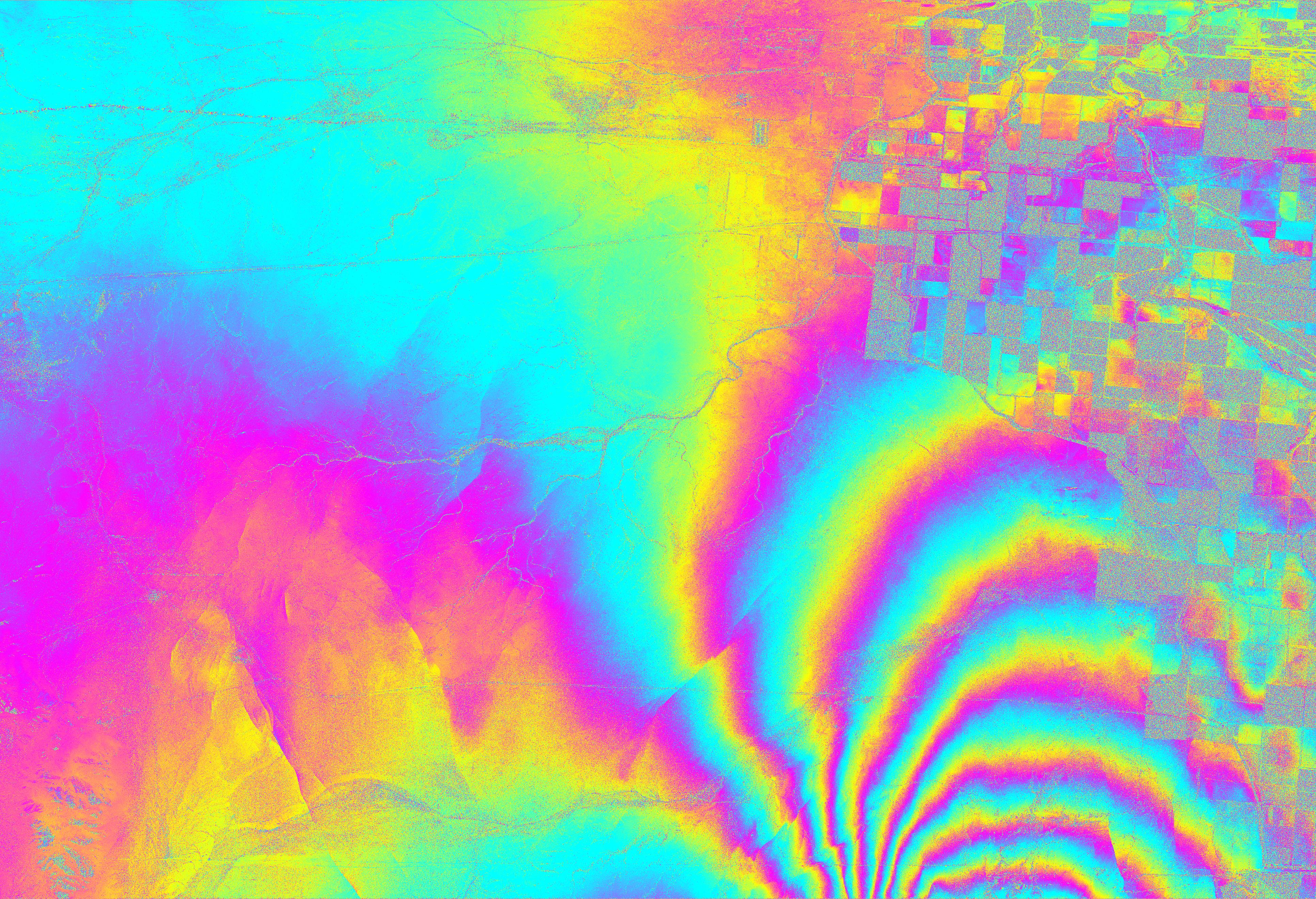
PIA13314:
-
NASA Radar Images Show Continued Deformation from Mexico Quake
Full Resolution:
TIFF
(9.92 MB)
JPEG
(645.9 kB)
|
|
|
2010-07-01 |
Earth
|
UAVSAR
|
L-Band UAVSAR
|
1280x720x3 |
|
-
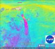
PIA13233:
-
UAVSAR Maps the Gulf Coast Oil Spill
Full Resolution:
TIFF
(2.768 MB)
JPEG
(116.7 kB)
|
|
|
2010-06-23 |
Earth
|
UAVSAR
|
L-Band UAVSAR
|
3864x2640x3 |
|
-
PIA13380:
-
NASA Radar Images Show How Mexico Quake Deformed Earth
Full Resolution:
TIFF
(30.6 MB)
JPEG
(3.349 MB)
|
|
|
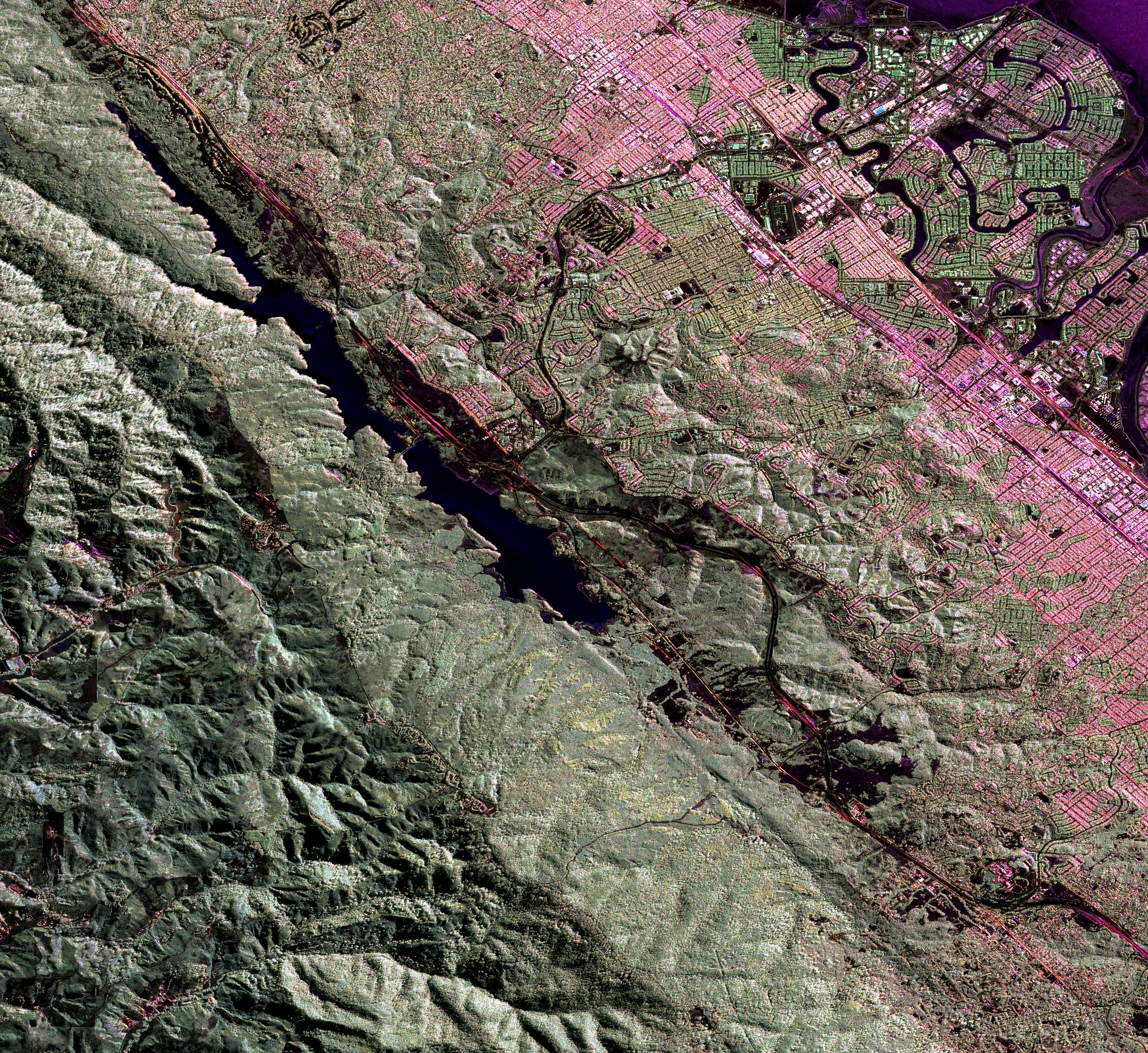
2010-02-02 |
Earth
|
UAVSAR
|
L-Band UAVSAR
|
6662x5139x3 |
|
-
PIA12503:
-
NASA Airborne Radar Captures Its First Images of Post-Quake Haiti
Full Resolution:
TIFF
(102.7 MB)
JPEG
(6.338 MB)
|
|
|
2009-09-01 |
Earth
|
UAVSAR
|
L-Band UAVSAR
|
3544x2458x3 |
|
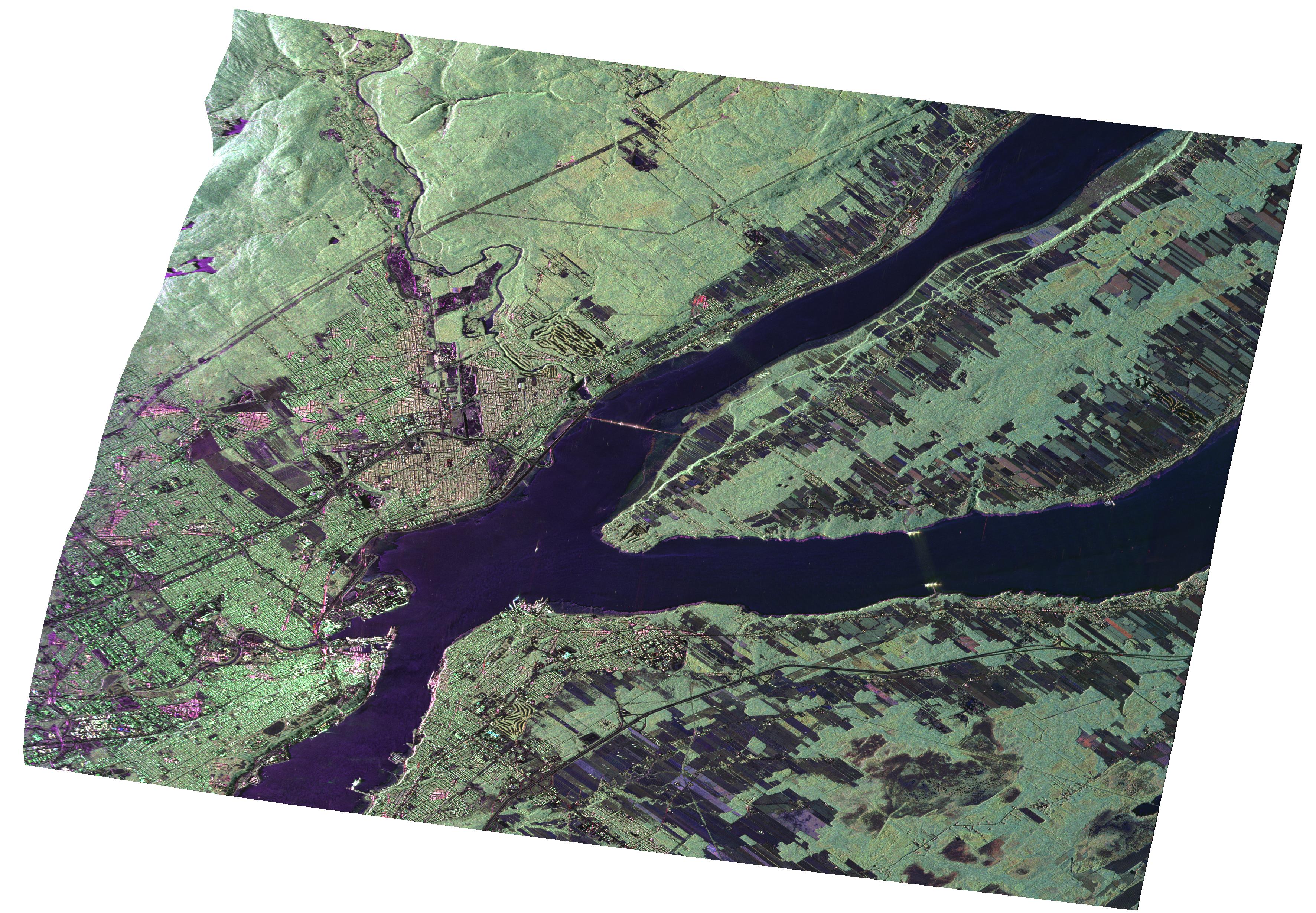
-
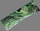
PIA12189:
-
UAVSAR Radar Imagery of Boreal Forests Around Quebec City, Canada
Full Resolution:
TIFF
(26.13 MB)
JPEG
(1.734 MB)
|
|
|
2009-06-18 |
Earth
|
UAVSAR
|
L-Band UAVSAR
|
2984x2737x3 |
|
-
PIA12075:
-
Scientists Search for a Pulse in Skies Above Earthquake Country
Full Resolution:
TIFF
(24.5 MB)
JPEG
(3.571 MB)
|
 Planetary Data System


