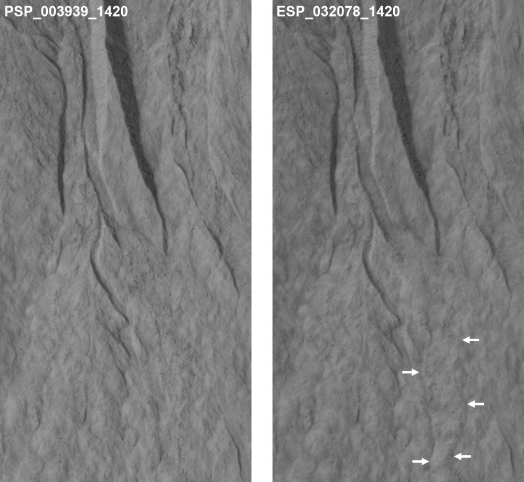
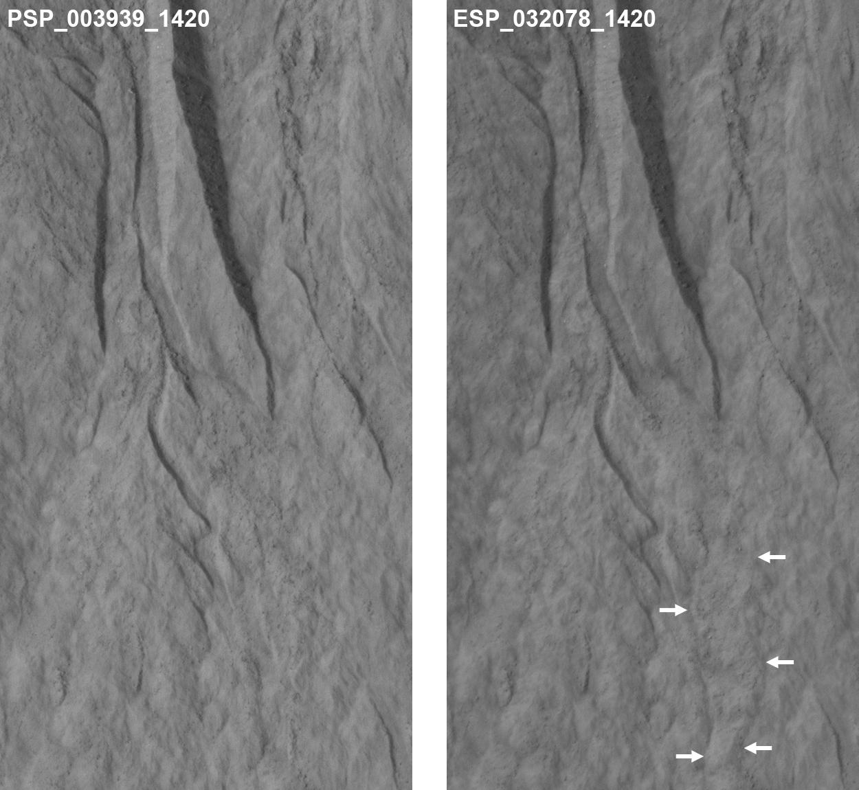
This pair of images covers one of the hundreds of sites on Mars where researchers have repeatedly used the High Resolution Imaging Science Experiment (HiRISE) camera on NASA's Mars Reconnaissance Orbiter to study changes in gullies on slopes. Changes such as the ones visible in deposits near the lower end of this gully occur during winter and early spring on Mars, suggesting involvement of carbon-dioxide ice rather than liquid water.
The pair seen here shows the downhill portion of a gully that has been imaged several times. At left is the initial image and at right is one of the most recent views of the site. A lobate, rubbly flow (noted by the arrows) has been deposited near the mouth of the channel between the times of the two images. Further up the slope, the channel system has been modified by both erosion and deposition. Other images of the site pin down the timing of the changes more precisely, but it is easier to see the changes between these two views because the lighting is similar.
The area covered in these images is 164 yards (150 meters) wide. The location is on a crater rim at 37.7 degrees south latitude, 192.9 degrees east longitude.
Changes have now been visible in many gullies on Mars, and they show that these landforms are evolving rapidly. The timing of the changes is often in winter or early spring, suggesting that they are caused by the carbon-dioxide frost that forms in and around most gullies every year. Another example is shown at PIA17958.
The "before" image at left is a portion of May 30, 2007, HiRISE observation. The "after" image is part of a May 31, 2013, observation. Other image products from those observations are available at http://hirise.lpl.arizona.edu/ESP_032078_1420 and http://hirise.lpl.arizona.edu/ PSP_003939_1420.
HiRISE is one of six instruments on NASA's Mars Reconnaissance Orbiter. The University of Arizona, Tucson, operates HiRISE, which was built by Ball Aerospace & Technologies Corp., Boulder, Colo. NASA's Jet Propulsion Laboratory, a division of the California Institute of Technology in Pasadena, manages the Mars Reconnaissance Orbiter Project for NASA's Science Mission Directorate, Washington.