
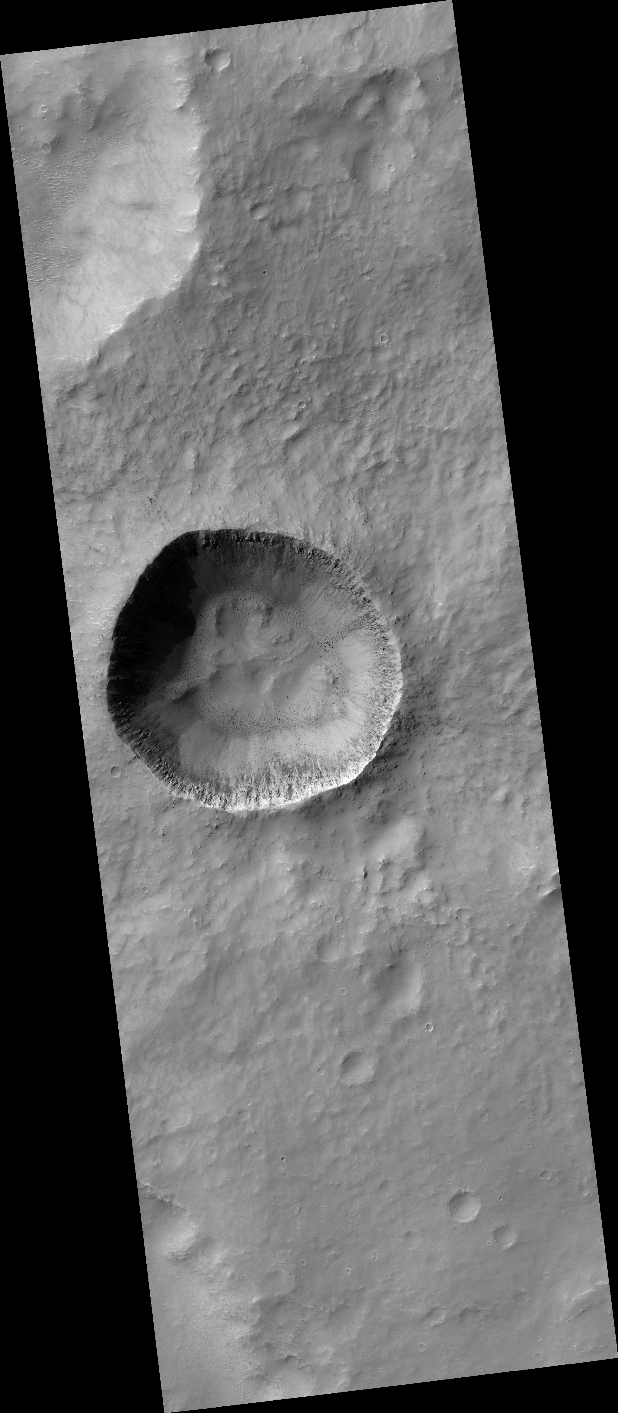
Map Projected Browse Image
Click on the image for larger versionAlthough gullies are most common in the middle latitudes of Mars, they are also found in equatorial regions. This image shows a 3-kilometer-wide impact crater with gullies all along the steep inner slopes.
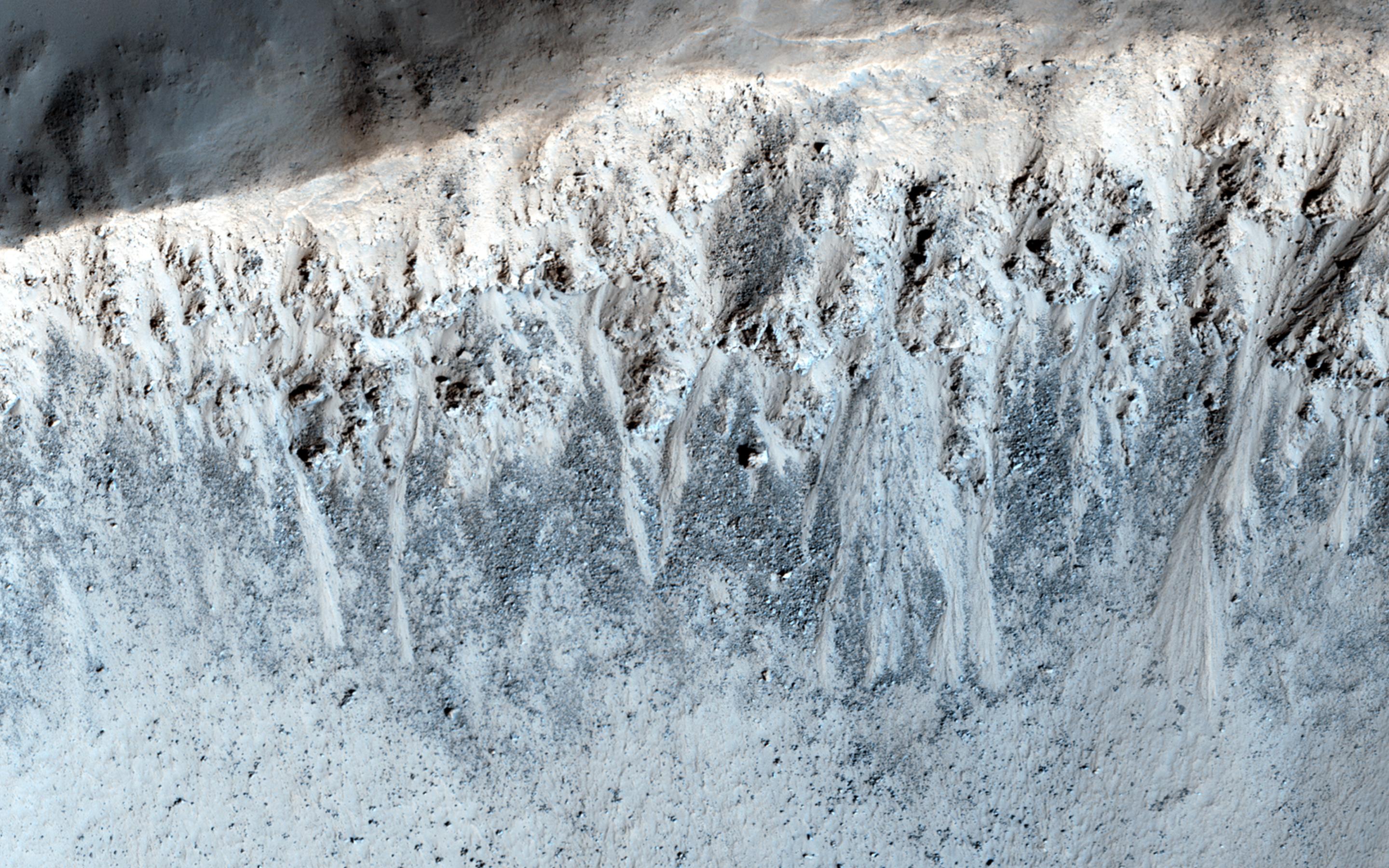
An enhanced-color cutout better distinguishes the gully deposits from the surrounding boulder fields. These slopes are very steep, so a fluid like water is not required to explain gully formation.
HiRISE is one of six instruments on NASA's Mars Reconnaissance Orbiter. The University of Arizona, Tucson, operates the orbiter's HiRISE camera, which was built by Ball Aerospace & Technologies Corp., Boulder, Colo. NASA's Jet Propulsion Laboratory, a division of the California Institute of Technology in Pasadena, manages the Mars Reconnaissance Orbiter Project for the NASA Science Mission Directorate, Washington.
