Your search criteria found 1727 images
Mission
Go to PIAxxxxx:
Refine this list of images by:
Target:
Spacecraft:
Instrument:
Click on an image for detailed information
Click on a column heading to sort in ascending or descending order
My
List
Addition DateSort Ascending Target Mission Instrument Size
Add Image to Favorite List 2024-11-18 Mars Mars Reconnaissance Orbiter (MRO)
HiRISE
7488x3813x1
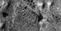
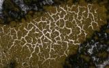
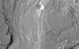
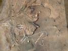
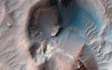
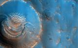
Scientists think that ancient groundwater formed this weblike pattern of ridges, called boxwork, that were captured by NASA's Mars Reconnaissance Orbiter on Dec. 10, 2006.
PIA26306:
HiRISE Views Mount Sharp's Boxwork
Full Resolution:     TIFF (14.1 MB)     JPEG (2.659 MB)
Add Image to Favorite List 2024-10-10 Mars Mars Reconnaissance Orbiter (MRO)
HiRISE
1998x1223x1
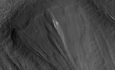
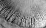
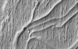
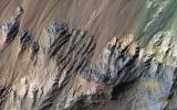
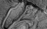
The white material seen within this gully is believed to be dusty water ice in a Martian region called Dao Vallis, captured by NASA's Mars Reconnaissance Orbiter (MRO).
PIA26408:
Dusty Water Ice in Mars' Dao Vallis
Full Resolution:     TIFF (2.361 MB)     JPEG (310.2 kB)
Add Image to Favorite List 2024-10-10 Mars Mars Reconnaissance Orbiter (MRO)
HiRISE
3232x4333x3
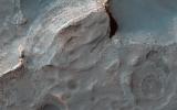
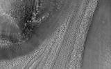
This image from NASA's Mars Reconnaissance Orbiter (MRO) shows white material believed to be dusty water ice lining the edges of Martian gullies in a region named Terra Sirenum.
PIA26407:
Dusty Water Ice in Mars' Terra Sirenum
Full Resolution:     TIFF (41.04 MB)     JPEG (1.397 MB)
Add Image to Favorite List 2024-08-27 Mars Mars Reconnaissance Orbiter (MRO)
HiRISE
2653x2464x3
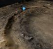
This view of the western edge of Mars' Jezero Crater shows the steep crater rim. A blue icon shows Perseverance's general location as of Aug. 14, 2024. The rover began its ascent of the crater rim on Aug. 27, 2024.
PIA26402:
Perseverance's Location at the Base of Jezero Crater's Rim
Full Resolution:     TIFF (16.77 MB)     JPEG (874.2 kB)
Add Image to Favorite List 2024-08-14 Mars Mars Reconnaissance Orbiter (MRO)
HiRISE
1129x929x3
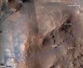
This map shows the route NASA's Perseverance Mars rover will take (in blue) as it climbs the western rim of Jezero Crater.
PIA26374:
Perseverance's Climb to 'Witch Hazel Hill'
Full Resolution:     TIFF (3.148 MB)     JPEG (155.5 kB)
Add Image to Favorite List 2024-06-13 Mars Mars Reconnaissance Orbiter (MRO)
HiRISE
1627x757x3
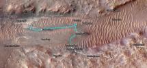
This map shows Perseverance's path between Jan. 21 and June 11, 2024. White dots indicate where the rover stopped after completing a traverse beside Neretva Vallis river channel. The pale blue line indicates the rover's route inside the channel.
PIA26334:
Perseverance's Path to 'Bright Angel' in Mars' Jezero Crater
Full Resolution:     TIFF (3.696 MB)     JPEG (286.5 kB)
Add Image to Favorite List 2024-04-29 Mars Mars Reconnaissance Orbiter (MRO)
HiRISE
2880x1800x3
This image acquired on March 16, 2024 by NASA's Mars Reconnaissance Orbiter shows a field of sand dunes in the Martian springtime while the seasonal carbon dioxide frost is sublimating into the air.
PIA26330:
Defrosting Dunes
Full Resolution:     TIFF (15.56 MB)     JPEG (896.1 kB)
Add Image to Favorite List 2024-04-29 Mars Mars Reconnaissance Orbiter (MRO)
HiRISE
2880x1800x3
This image acquired on February 14, 2024 by NASA's Mars Reconnaissance Orbiter shows a relatively fresh crater with gullies.
PIA26329:
Gullies in the Depths of Hellas
Full Resolution:     TIFF (5.191 MB)     JPEG (1.187 MB)
Add Image to Favorite List 2024-04-29 Mars Mars Reconnaissance Orbiter (MRO)
HiRISE
2880x1800x3
This image acquired on March 9, 2024 by NASA's Mars Reconnaissance Orbiter shows terrain of two distinct ages. The slopes and hilltops here are made up of rough rocky outcrop, while the valley floors are filled with smooth materials with fewer craters.
PIA26328:
Sediment Ponds in Tithonium Chasma
Full Resolution:     TIFF (8.125 MB)     JPEG (1.106 MB)
Add Image to Favorite List 2024-04-29 Mars Mars Reconnaissance Orbiter (MRO)
HiRISE
2880x1800x3
This image acquired on March 18, 2024 by NASA's Mars Reconnaissance Orbiter shows bright materials, likely to be sediments rich in the hydrated sulfates, covered by a thin deposit of dark material, perhaps sand.
PIA26327:
Hydrated Sulfates in Melas Chasma
Full Resolution:     TIFF (8.101 MB)     JPEG (1.07 MB)
Add Image to Favorite List 2024-03-29 Mars Mars Reconnaissance Orbiter (MRO)
HiRISE
7003x4603x3
The steep path NASA's Curiosity Mars rover took to reach Gediz Vallis channel is indicated in yellow in this visualization made with orbital data.
PIA26241:
Curiosity's Route to Gediz Vallis Channel (Rendering)
Full Resolution:     TIFF (96.74 MB)     JPEG (5.638 MB)
Add Image to Favorite List 2024-03-26 Mars Mars Reconnaissance Orbiter (MRO)
HiRISE
2880x1800x3
This image acquired on February 16, 2024 by NASA's Mars Reconnaissance Orbiter shows secondary impact craters around 20 kilometers from the primary impact.
PIA26324:
Searching for Distant Secondary Craters
Full Resolution:     TIFF (15.56 MB)     JPEG (1.134 MB)
Add Image to Favorite List 2024-03-26 Mars Mars Reconnaissance Orbiter (MRO)
HiRISE
2880x1800x3
This image acquired on January 17, 2024 by NASA's Mars Reconnaissance Orbiter shows many craters in the mid-latitudes of Mars are partially filled with deposits that have been interpreted to be ice-rich.
PIA26323:
A Song of Ice and Tectonics
Full Resolution:     TIFF (15.56 MB)     JPEG (638.8 kB)
Add Image to Favorite List 2024-03-26 Mars Mars Reconnaissance Orbiter (MRO)
HiRISE
2880x1800x3
This image acquired on January 15, 2024 by NASA's Mars Reconnaissance Orbiter shows multiple dark spots corresponding to numerous new craters.
PIA26322:
Mars Atmosphere Fights Back!
Full Resolution:     TIFF (13.22 MB)     JPEG (711.7 kB)
Add Image to Favorite List 2024-03-26 Mars Mars Reconnaissance Orbiter (MRO)
HiRISE
2880x1800x3
This image acquired on January 30, 2012 by NASA's Mars Reconnaissance Orbiter shows a 13-meter (43 feet) diameter crater in Arcadia Planitia where ice was exposed both in the crater interior and ejecta.
PIA26321:
Mars Mysteries: Unveiling the Icy Craters
Full Resolution:     TIFF (12.88 MB)     JPEG (730.7 kB)
Add Image to Favorite List 2024-02-29 Mars Mars Reconnaissance Orbiter (MRO)
HiRISE
1013x804x3
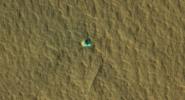
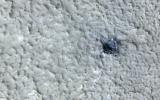
NASA's Curiosity Mars rover appears as a dark speck in this image captured from directly overhead by the agency's Mars Reconnaissance Orbiter, or MRO.
PIA26245:
HiRISE Spots Curiosity Driving Toward Upper Gediz Vallis
Full Resolution:     TIFF (2.444 MB)     JPEG (132.2 kB)
Add Image to Favorite List 2024-01-31 Mars Mars Reconnaissance Orbiter (MRO)
HiRISE
2880x1800x3
This image acquired on October 21, 2023 by NASA's Mars Reconnaissance Orbiter shows a relatively large (280-meter diameter) circular structure that is most likely a relaxed impact crater.
PIA23700:
An Impact Structure in Brain Terrain
Full Resolution:     TIFF (5.191 MB)     JPEG (1.202 MB)
Add Image to Favorite List 2024-01-31 Mars Mars Reconnaissance Orbiter (MRO)
HiRISE
2880x1800x3
This image acquired on September 26, 2023 by NASA's Mars Reconnaissance Orbiter shows terrain north of Elysium Planitia and Athabasca Valles.
PIA23427:
Dark Craters
Full Resolution:     TIFF (8.086 MB)     JPEG (1.31 MB)
Add Image to Favorite List 2024-01-31 Mars Mars Reconnaissance Orbiter (MRO)
HiRISE
2880x1800x3
This image acquired on September 23, 2023 by NASA's Mars Reconnaissance Orbiter shows a crater located in Acidalia Planitia. It is in an area of elongated mounds and hosts a variety of gully forms on its interior slopes.
PIA23145:
Gullies in Acidalia Planitia
Full Resolution:     TIFF (5.027 MB)     JPEG (592.7 kB)
Add Image to Favorite List 2024-01-31 Mars Mars Reconnaissance Orbiter (MRO)
HiRISE
2880x1800x3
This image acquired on August 27, 2023 by NASA's Mars Reconnaissance Orbiter shows ridges in Aeolis Planum which tell a story of ancient rivers and a Mars very different to that of today.
PIA22822:
Flowing Rivers on Ancient Mars
Full Resolution:     TIFF (5.191 MB)     JPEG (1.053 MB)
Add Image to Favorite List 2023-12-19 Mars Mars Reconnaissance Orbiter (MRO)
HiRISE
2880x1800x3
This image acquired on September 14, 2023 by NASA's Mars Reconnaissance Orbiter shows large, streamlined features and grooves that have been carved by enormous water volumes into the floor of Granicus.
PIA25990:
Fluvial Landforms in Granicus Valles
Full Resolution:     TIFF (5.191 MB)     JPEG (1.418 MB)
Add Image to Favorite List 2023-12-19 Mars Mars Reconnaissance Orbiter (MRO)
HiRISE
2880x1800x3
This image acquired on July 3, 2023 by NASA's Mars Reconnaissance Orbiter shows multiple processes, which may have occurred billions of years apart, reflected in this HiRISE image of Aeolis Planum.
PIA25989:
Curving Ridges in Aeolis Planum
Full Resolution:     TIFF (5.191 MB)     JPEG (1.096 MB)
Add Image to Favorite List 2023-12-19 Mars Mars Reconnaissance Orbiter (MRO)
HiRISE
2880x1800x3
This image acquired on July 28, 2023 by NASA's Mars Reconnaissance Orbiter shows a fan of sedimentary rock on the southeast area of Gale Crater's floor.
PIA25988:
A Sedimentary Fan in Southeast Gale Crater
Full Resolution:     TIFF (14.65 MB)     JPEG (871.3 kB)
Add Image to Favorite List 2023-12-19 Mars Mars Reconnaissance Orbiter (MRO)
HiRISE
2880x1800x3
This image acquired on August 23, 2023 by NASA's Mars Reconnaissance Orbiter shows the northern lowlands of Mars stippled with mounds in this location.
PIA25987:
Muddy Mounds
Full Resolution:     TIFF (5.191 MB)     JPEG (1.613 MB)
Add Image to Favorite List 2023-12-12 Mars Mars Reconnaissance Orbiter (MRO)
HiRISE
2311x1728x3
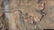
The path taken by NASA's Perseverance Mars rover during the first 1,000 sols of its mission at Jezero Crater is annotated on this overhead view taken by the HiRISE camera aboard the agency's Mars Reconnaissance Orbiter.
PIA26231:
1,000 Days of Perseverance
Full Resolution:     TIFF (11.76 MB)     JPEG (559.5 kB)
Add Image to Favorite List 2023-10-26 Mars Mars Reconnaissance Orbiter (MRO)
HiRISE
2105x1139x3
The ice-exposing impact crater at the center of this image is an example of what scientists look for when mapping places where future astronauts should land on Mars.
PIA26044:
Ice-Exposing Impact Crater Surrounded by Polygon Terrain
Full Resolution:     TIFF (5.674 MB)     JPEG (206.9 kB)
Add Image to Favorite List 2023-08-18 Mars Mars Reconnaissance Orbiter (MRO)
HiRISE
2880x1800x3
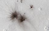
This image acquired on July 11, 2023 by NASA's Mars Reconnaissance Orbiter shows the southern wall of Coprates Chasma, in the equatorial canyon system of Valles Marineris.
PIA25985:
Diverse Minerals in Coprates Chasma
Full Resolution:     TIFF (15.56 MB)     JPEG (1.077 MB)
Add Image to Favorite List 2023-08-18 Mars Mars Reconnaissance Orbiter (MRO)
HiRISE
2880x1800x3
This image acquired on April 9, 2023 by NASA's Mars Reconnaissance Orbiter shows that while surface ice deposits are mostly limited to the polar caps, patterns of slow, viscous flow abound in many non-polar regions of Mars.
PIA25984:
Icy Flows
Full Resolution:     TIFF (8.293 MB)     JPEG (1.169 MB)
Add Image to Favorite List 2023-08-18 Mars Mars Reconnaissance Orbiter (MRO)
HiRISE
2880x1800x3
This image acquired on May 23, 2023 by NASA's Mars Reconnaissance Orbiter shows the transition from a regular channel to an inverted channel in Arabia Terra.
PIA25983:
From Low to High Channels
Full Resolution:     TIFF (8.253 MB)     JPEG (1.275 MB)
Add Image to Favorite List 2023-08-18 Mars Mars Reconnaissance Orbiter (MRO)
HiRISE
2880x1800x3
This image acquired on May 24, 2023 by NASA's Mars Reconnaissance Orbiter shows many of the Valles Marineris canyons, called chasmata, have kilometer-high, light-toned layered mounds made up of sulfate materials.
PIA25982:
Light-Toned Materials along the Floor and Walls of Ius Chasma
Full Resolution:     TIFF (15.56 MB)     JPEG (815.6 kB)
Add Image to Favorite List 2023-08-03 Mars Mars Reconnaissance Orbiter (MRO)
HiRISE
3840x2160x3
This map shows the route NASA's Curiosity Mars rover took from May into July, 2023 to complete the most difficult climb of the mission.
PIA26017:
A Map of Curiosity's Difficult Climb
Full Resolution:     TIFF (24.89 MB)     JPEG (2.072 MB)
Add Image to Favorite List 2023-05-12 Mars Mars Reconnaissance Orbiter (MRO)
HiRISE
2880x1800x3
This image acquired on March 16, 2023 by NASA's Mars Reconnaissance Orbiter shows a group of curved ridges in an area called Lycus Sulci, which is located near the Olympus Mons volcano.
PIA25950:
Ridges in Lycus Sulci
Full Resolution:     TIFF (8.276 MB)     JPEG (1.154 MB)
Add Image to Favorite List 2023-05-12 Mars Mars Reconnaissance Orbiter (MRO)
HiRISE
2880x1800x3
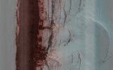
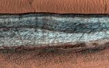
This image acquired on Febuary 15, 2023 by NASA's Mars Reconnaissance Orbiter shows a cliff face broken up into jagged blocks. Debris piles at the base of the cliff show where these blocks have fallen out.
PIA25949:
Icy Cliffs at the Martian North Pole
Full Resolution:     TIFF (14.8 MB)     JPEG (471.5 kB)
Add Image to Favorite List 2023-05-12 Mars Mars Reconnaissance Orbiter (MRO)
HiRISE
2880x1800x3
This image acquired on January 3, 2023 by NASA's Mars Reconnaissance Orbiter shows a classic example of platy-ridged lava. Scientists think that this is the same as a lava type called rubbly pahoehoe on Earth.
PIA25948:
Complicated Lava Cooling
Full Resolution:     TIFF (15.56 MB)     JPEG (1.473 MB)
Add Image to Favorite List 2023-05-12 Mars Mars Reconnaissance Orbiter (MRO)
HiRISE
2880x1800x3
This image acquired on February 14, 2023 by NASA's Mars Reconnaissance Orbiter shows an example of material having flowed downhill between two ridges.
PIA25947:
Glacier-like Features on Mars
Full Resolution:     TIFF (8.111 MB)     JPEG (1.232 MB)
Add Image to Favorite List 2023-04-13 Mars Mars Reconnaissance Orbiter (MRO)
HiRISE
2880x1800x3
This image acquired on January 2, 2023 by NASA's Mars Reconnaissance Orbiter shows expanded craters with an unusually bumpy texture in the outer apron where sublimation occurred.
PIA25900:
Bumpy, Expanded Craters
Full Resolution:     TIFF (15.56 MB)     JPEG (1.522 MB)
Add Image to Favorite List 2023-04-13 Mars Mars Reconnaissance Orbiter (MRO)
HiRISE
2880x1800x3
This image acquired on December 29, 2022 by NASA's Mars Reconnaissance Orbiter shows Hellespontus Montes, a rugged mountain range located on the western rim of one of the largest impact basins in the Solar System: Hellas Basin.
PIA25899:
Waxing and Waning Winds
Full Resolution:     TIFF (15.56 MB)     JPEG (921.6 kB)
Add Image to Favorite List 2023-04-13 Mars Mars Reconnaissance Orbiter (MRO)
HiRISE
2880x1800x3
This image acquired on December 31, 2022 by NASA's Mars Reconnaissance Orbiter shows Utopia Planitia, a vast plain in the Northern Hemisphere of Mars.
PIA25898:
Candidate Mud Volcanoes in Utopia Planitia
Full Resolution:     TIFF (15.56 MB)     JPEG (1.001 MB)
Add Image to Favorite List 2023-04-13 Mars Mars Reconnaissance Orbiter (MRO)
HiRISE
2880x1800x3
This image acquired on December 27, 2022 by NASA's Mars Reconnaissance Orbiter shows a small crater that appears to be partly-filled by deposits that have flowed into, and around it.
PIA25897:
Looking at the Crater Half Full
Full Resolution:     TIFF (15.56 MB)     JPEG (644.2 kB)
Add Image to Favorite List 2023-03-03 Mars Mars Reconnaissance Orbiter (MRO)
HiRISE
2880x1800x3
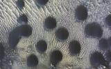
This image acquired on November 22, 2022 by NASA's Mars Reconnaissance Orbiter shows dunes that are almost perfectly circular, which is unusual.
PIA25795:
Circular Sand Dunes
Full Resolution:     TIFF (15.56 MB)     JPEG (1.184 MB)
Add Image to Favorite List 2023-03-03 Mars Mars Reconnaissance Orbiter (MRO)
HiRISE
2880x1800x3
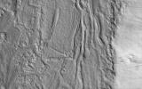
This image acquired on November 21, 2022 by NASA's Mars Reconnaissance Orbiter suggest this is a glacial (ice-rich) flow, but the surface is broken into plates like many lava flows on Mars.
PIA25794:
Glacial (Ice) or Lava Flow?
Full Resolution:     TIFF (8.207 MB)     JPEG (1.221 MB)
Add Image to Favorite List 2023-03-03 Mars Mars Reconnaissance Orbiter (MRO)
HiRISE
2880x1800x3
This image acquired on November 21, 2022 by NASA's Mars Reconnaissance Orbiter shows a crater floor at high southern latitude with many boulders ranging from 1 to 10 meters in diameter.
PIA25793:
Boulder Patterns
Full Resolution:     TIFF (15.56 MB)     JPEG (1.108 MB)
Add Image to Favorite List 2023-03-03 Mars Mars Reconnaissance Orbiter (MRO)
HiRISE
2880x1800x3
This image acquired on November 22, 2022 by NASA's Mars Reconnaissance Orbiter shows mass wasting activity within a very steep (more than 60 degrees) scarp.
PIA25792:
A Look at a Steep North Polar Scarp
Full Resolution:     TIFF (15.56 MB)     JPEG (1.187 MB)
Add Image to Favorite List 2023-01-31 Mars Mars Reconnaissance Orbiter (MRO)
HiRISE
2880x1800x3
This image acquired on November 28, 2022 by NASA's Mars Reconnaissance Orbiter shows impact disturbed dust over an area more than two kilometers wide, large enough to be visible in MARCI daily global images.
PIA25710:
A New Impact Event
Full Resolution:     TIFF (15.56 MB)     JPEG (756.2 kB)
Add Image to Favorite List 2023-01-31 Mars Mars Reconnaissance Orbiter (MRO)
HiRISE
2880x1800x3
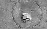
This image acquired on December 12, 2022 by NASA's Mars Reconnaissance Orbiter shows a feature that looks a bit like a bear's face.
PIA25709:
A Bear on Mars?
Full Resolution:     TIFF (8.108 MB)     JPEG (1.166 MB)
Add Image to Favorite List 2023-01-31 Mars Mars Reconnaissance Orbiter (MRO)
HiRISE
2880x1800x3
This image acquired on October 4, 2022 by NASA's Mars Reconnaissance Orbiter shows gullies located in the Southern Highlands just east of Gorgonum Chaos.
PIA25708:
Gully Activity in Triolet Crater
Full Resolution:     TIFF (15.56 MB)     JPEG (1.701 MB)
Add Image to Favorite List 2023-01-31 Mars Mars Reconnaissance Orbiter (MRO)
HiRISE
2880x1800x3
This image acquired on October 24, 2022 by NASA's Mars Reconnaissance Orbiter shows Harmakhis Vallis, an approximately 800-kilometer long outflow channel located in eastern Hellas.
PIA25707:
Going with the Flow
Full Resolution:     TIFF (15.56 MB)     JPEG (1.074 MB)
Add Image to Favorite List 2022-12-22 Mars Mars Reconnaissance Orbiter (MRO)
HiRISE
2880x1800x3
This image acquired on October 23, 2022 by NASA's Mars Reconnaissance Orbiter shows a dune field, located along the western margin of Hellas Planitia, the floor of a giant depression in the Southern Hemisphere of Mars.
PIA25704:
Dunes in Hellas
Full Resolution:     TIFF (15.56 MB)     JPEG (1.105 MB)
Add Image to Favorite List 2022-12-22 Mars Mars Reconnaissance Orbiter (MRO)
HiRISE
2880x1800x3
This image acquired on October 23, 2022 by NASA's Mars Reconnaissance Orbiter shows the northern plains of Arabia Terra, with craters that contain curious deposits with mysterious shapes and distribution.
PIA25703:
Mysterious Crater Deposits
Full Resolution:     TIFF (15.56 MB)     JPEG (1.316 MB)
Add Image to Favorite List 2022-12-22 Mars Mars Reconnaissance Orbiter (MRO)
HiRISE
2880x1800x3
This image acquired on October 1, 2022 by NASA's Mars Reconnaissance Orbiter shows small channels formed on the floor of the much larger Kasei Valles, one of the largest outflow channels on Mars.
PIA25702:
Channels on a Streamlined Island of Kasei Vallis
Full Resolution:     TIFF (8.258 MB)     JPEG (1.326 MB)
Add Image to Favorite List 2022-12-22 Mars Mars Reconnaissance Orbiter (MRO)
HiRISE
2880x1800x3
This image acquired on August 29, 2022 by NASA's Mars Reconnaissance Orbiter shows two cross-cutting depressions that may have been formed by the collapse of weak terrain along pre-existing faults.
PIA25701:
Tectonic, Volcanic and Fluvial Activity?
Full Resolution:     TIFF (7.58 MB)     JPEG (893.2 kB)
Add Image to Favorite List 2022-10-27 Mars Mars Reconnaissance Orbiter (MRO)
CTX
3351x3083x1
This meteoroid impact crater on Mars was captured using the black-and-white Context Camera aboard NASA's Mars Reconnaissance Orbiter (MRO).
PIA25587:
Context Camera Views a Mars Impact Crater in Tempe Terra
Full Resolution:     TIFF (8.751 MB)     JPEG (1.998 MB)
Add Image to Favorite List 2022-10-27 Mars Mars Reconnaissance Orbiter (MRO)
HiRISE
1200x674x3
This animation depicts a flyover of a meteoroid impact crater on Mars that's surrounded by boulder-size chunks of ice. The animation was created using data from the HiRISE camera aboard NASA's Mars Reconnaissance Orbiter.
PIA25586:
Flyover of Mars Impact Using HiRISE Data (Animation)
Full Resolution:     TIFF (2.057 MB)     JPEG (69.31 kB)
Add Image to Favorite List 2022-10-27 Mars Mars Reconnaissance Orbiter (MRO)
MARCI
1920x1080x1
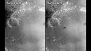
The Mars Color Imager (MARCI) camera aboard NASA's Mars Reconnaissance Orbiter (MRO) captured this before-and-after comparison of a region of Mars called Amazonis Planitia, which was struck by a meteoroid on Dec. 24, 2021.
PIA25585:
MARCI Views a Mars Impact Crater in Amazonis Planitia
Full Resolution:     TIFF (1.693 MB)     JPEG (156.5 kB)
Add Image to Favorite List 2022-10-27 Mars Mars Reconnaissance Orbiter (MRO)
CTX
5448x3523x1
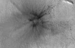
This meteoroid impact crater on Mars was discovered using the black-and-white Context Camera aboard NASA's Mars Reconnaissance Orbiter. The Context Camera took these before-and-after images of the impact in a region of Mars called Amazonis Planitia.
PIA25584:
Context Camera Views an Impact Crater in Amazonis Planitia
Full Resolution:     TIFF (19.22 MB)     JPEG (5.28 MB)
Add Image to Favorite List 2022-10-27 Mars Mars Reconnaissance Orbiter (MRO)
HiRISE
1920x1080x3
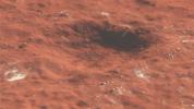
Boulder-size blocks of water ice can be seen around the rim of an impact crater on Mars. The crater was formed Dec. 24, 2021, by a meteoroid strike in the Amazonis Planitia region.
PIA25583:
HiRISE Views a Mars Impact Crater Surrounded by Water Ice
Full Resolution:     TIFF (4.226 MB)     JPEG (341.2 kB)
Add Image to Favorite List 2022-10-24 Mars Mars Reconnaissance Orbiter (MRO)
HiRISE
2880x1800x3
This image acquired on August 14, 2022 by NASA's Mars Reconnaissance Orbiter shows a curious depression with zig-zag walls on the north rim of Secchi Crater.
PIA25559:
The Tale of a Retreating Scarp
Full Resolution:     TIFF (15.56 MB)     JPEG (1.087 MB)
Add Image to Favorite List 2022-10-24 Mars Mars Reconnaissance Orbiter (MRO)
HiRISE
2880x1800x3
This image acquired on August 24, 2022 by NASA's Mars Reconnaissance Orbiter shows a large lava flow passed through the Athabasca Valles region of Mars long ago.
PIA25558:
In the Wake of Ancient Lava Flows
Full Resolution:     TIFF (15.56 MB)     JPEG (1.204 MB)
Add Image to Favorite List 2022-10-24 Mars Mars Reconnaissance Orbiter (MRO)
HiRISE
2880x1800x3
This image acquired on July 8, 2022 by NASA's Mars Reconnaissance Orbiter shows what appears to be a slightly expanded crater in a field of scalloped depressions. It's possible that it will evolve over time to look more like the scallops.
PIA25557:
A Crater in Scalloped Terrain
Full Resolution:     TIFF (15.56 MB)     JPEG (1.619 MB)
Add Image to Favorite List 2022-10-24 Mars Mars Reconnaissance Orbiter (MRO)
HiRISE
2880x1800x3
This image acquired on May 18, 2012 by NASA's Mars Reconnaissance Orbiter shows Echus Chaos, a region of low hills located between Lunae Planum and Echus Palus.
PIA25556:
Slipping and Sliding in Echus Chaos
Full Resolution:     TIFF (15.56 MB)     JPEG (757.9 kB)
Add Image to Favorite List 2022-10-07 Mars Mars Reconnaissance Orbiter (MRO)
MARCI
3094x1669x3
The beige clouds seen in this global map of Mars are a continent-size dust storm captured on Sept. 29, 2022, by the Mars Color Imager camera aboard NASA's Mars Reconnaissance Orbiter.
PIA25412:
Mars Dust Storm in Relation to InSight, Curiosity and Perseverance
Full Resolution:     TIFF (9.951 MB)     JPEG (452.4 kB)
Add Image to Favorite List 2022-09-30 Mars Mars Reconnaissance Orbiter (MRO)
HiRISE
2880x1800x3
This image acquired on August 28, 2022 by NASA's Mars Reconnaissance Orbiter shows several shallow gully channels with associated debris aprons emanating from a buried layer on the interior of a crater wall.
PIA25554:
Gullies and Boulder Tracks
Full Resolution:     TIFF (15.08 MB)     JPEG (973.4 kB)
Add Image to Favorite List 2022-09-30 Mars Mars Reconnaissance Orbiter (MRO)
HiRISE
2880x1800x3
This image acquired on July 14, 2022 by NASA's Mars Reconnaissance Orbiter shows an area in the South Polar cap.
PIA25553:
The Ever-Changing Swiss Cheese of Mars
Full Resolution:     TIFF (11.74 MB)     JPEG (557 kB)
Add Image to Favorite List 2022-09-30 Mars Mars Reconnaissance Orbiter (MRO)
HiRISE
2880x1800x3
This image acquired on July 22, 2022 by NASA's Mars Reconnaissance Orbiter shows sand dunes moving across the landscape. Winter frost covers the colder, north-facing half of each dune.
PIA25552:
Frosted Dunes in the Depths of Winter
Full Resolution:     TIFF (15.56 MB)     JPEG (1.164 MB)
Add Image to Favorite List 2022-09-30 Mars Mars Reconnaissance Orbiter (MRO)
HiRISE
2880x1800x3
This image acquired on November 13, 2020 by NASA's Mars Reconnaissance Orbiter shows an area where the flowing water may have stripped away some of the rocks and soils at the bottom of the valley, leaving behind the ridge-like formations.
PIA25551:
Landforms in Ares Vallis
Full Resolution:     TIFF (8.47 MB)     JPEG (1.733 MB)
Add Image to Favorite List 2022-09-19 Mars Mars Reconnaissance Orbiter (MRO)
HiRISE
4047x2956x3
NASA's Mars Reconnaissance Orbiter captured this image of a meteoroid impact that was first detected by the agency's InSight lander using its seismometer. This crater was formed on Aug. 30, 2021.
PIA25411:
InSight-Detected Impact in August 2021
Full Resolution:     TIFF (35.9 MB)     JPEG (1.611 MB)
Add Image to Favorite List 2022-09-19 Mars Mars Reconnaissance Orbiter (MRO)
HiRISE
2675x3147x3
NASA's Mars Reconnaissance Orbiter captured this image of a meteoroid impact that was later associated with a seismic event detected by the agency's InSight lander using its seismometer. This crater was formed on May 27, 2020.
PIA25410:
InSight-Detected Impact in May 2020
Full Resolution:     TIFF (25.26 MB)     JPEG (1.547 MB)
Add Image to Favorite List 2022-09-19 Mars Mars Reconnaissance Orbiter (MRO)
HiRISE
4047x3466x3
NASA's Mars Reconnaissance Orbiter captured this image of a meteoroid impact that was first detected by the agency's InSight lander using its seismometer. This crater was formed on Feb. 18, 2021.
PIA25409:
InSight-Detected Impact in February 2021
Full Resolution:     TIFF (40.22 MB)     JPEG (844.9 kB)
Add Image to Favorite List 2022-09-19 Mars Mars Reconnaissance Orbiter (MRO)
HiRISE
4994x3341x3
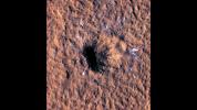
These craters were formed by a September 5, 2021, meteoroid impact on Mars, the first to be detected by NASA's InSight.
PIA25408:
InSight Detects an Impact for the First Time
Full Resolution:     TIFF (50.08 MB)     JPEG (2.9 MB)
Add Image to Favorite List 2022-09-15 Mars Mars Reconnaissance Orbiter (MRO)
CRISM
HiRISE
1920x1080x3
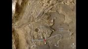
This annotated image highlights potential routes that NASA's Perseverance team is considering in September 2022 for the rover to drive.
PIA25244:
Potential Driving Routes for NASA's Perseverance Rover
Full Resolution:     TIFF (6.223 MB)     JPEG (406.8 kB)
Add Image to Favorite List 2022-09-15 Mars Mars Reconnaissance Orbiter (MRO)
HiRISE
1920x1080x3
NASA's Perseverance rover has been investigating rocks at the front of the delta in Mars' Jezero Crater along the path indicated in this annotated image taken by the agency's Mars Reconnaissance Orbiter (MRO).
PIA24923:
Perseverance Exploring the Front of the Delta
Full Resolution:     TIFF (6.111 MB)     JPEG (355.5 kB)
Add Image to Favorite List 2022-09-15 Mars Mars Reconnaissance Orbiter (MRO)
CRISM
HiRISE
1920x1080x3
The route of NASA's Perseverance Mars rover is shown in this annotated image composed of overhead views from the agency's Mars Reconnaissance Orbiter (MRO).
PIA24922:
Perseverance's Route to the Delta
Full Resolution:     TIFF (5.008 MB)     JPEG (256 kB)
Add Image to Favorite List 2022-08-31 Mars Mars Reconnaissance Orbiter (MRO)
HiRISE
2880x1800x3
This image acquired on July 20, 2022 by NASA's Mars Reconnaissance Orbiter shows a cliff that cuts through the terrain and gives us a glimpse of the buried icy material.
PIA25505:
Cliffs of Ice
Full Resolution:     TIFF (15.56 MB)     JPEG (1.189 MB)
Add Image to Favorite List 2022-08-31 Mars Mars Reconnaissance Orbiter (MRO)
HiRISE
2880x1800x3
This image acquired on May 29, 2022 by NASA's Mars Reconnaissance Orbiter shows (part of) a 6-kilometer crater located on the northern slope of Bond Crater.
PIA25504:
On Bond Crater's Northern Slope
Full Resolution:     TIFF (15.56 MB)     JPEG (1.058 MB)
Add Image to Favorite List 2022-08-31 Mars Mars Reconnaissance Orbiter (MRO)
HiRISE
2880x1800x3
This image acquired on June 5, 2022 by NASA's Mars Reconnaissance Orbiter shows two overlapping impact craters.
PIA25503:
Colorful Rocks Exposed in a Fresh Impact Crater
Full Resolution:     TIFF (15.56 MB)     JPEG (920.2 kB)
Add Image to Favorite List 2022-08-31 Mars Mars Reconnaissance Orbiter (MRO)
HiRISE
2880x1800x3
This image acquired on June 8, 2022 by NASA's Mars Reconnaissance Orbiter shows channels cutting through the ancient rim of Savich Crater.
PIA25502:
Channels to the North of Savich Crater
Full Resolution:     TIFF (15.56 MB)     JPEG (1.392 MB)
Add Image to Favorite List 2022-07-22 Mars Mars Reconnaissance Orbiter (MRO)
HiRISE
2880x1800x3
This image acquired on December 13, 2017 by NASA's Mars Reconnaissance Orbiter shows a variety of wind-related features near the center of Gamboa Crater. Larger sand dunes form sinuous crests and individual domes.
PIA25450:
Piles of Sand with Different Sizes and Colors
Full Resolution:     TIFF (15.56 MB)     JPEG (963.2 kB)
Add Image to Favorite List 2022-07-22 Mars Mars Reconnaissance Orbiter (MRO)
HiRISE
2880x1800x3
This image acquired on December 13, 2017 by NASA's Mars Reconnaissance Orbiter shows mega-ripples collecting along the flanks of the dark sand dunes near the North Polar deposits.
PIA25449:
Marvelous Martian Mega-Ripples
Full Resolution:     TIFF (15.56 MB)     JPEG (1.219 MB)
Add Image to Favorite List 2022-07-22 Mars Mars Reconnaissance Orbiter (MRO)
HiRISE
2880x1800x3
This image acquired on March 28, 2022 by NASA's Mars Reconnaissance Orbiter shows a ridge standing prominently in this scene, left behind as the surroundings were eroded, perhaps marking inverted erosion of an ancient fluvial channel.
PIA25448:
Ridges in Cydonia Mensae
Full Resolution:     TIFF (15.56 MB)     JPEG (890 kB)
Add Image to Favorite List 2022-07-22 Mars Mars Reconnaissance Orbiter (MRO)
HiRISE
2880x1800x3
This image acquired on March 12, 2022 by NASA's Mars Reconnaissance Orbiter shows a crater that punched through the surface of Mars, revealing multiple layers formed previously below the surface.
PIA25447:
What Happened When?
Full Resolution:     TIFF (7.735 MB)     JPEG (707.1 kB)
Add Image to Favorite List 2022-06-27 Mars Mars Reconnaissance Orbiter (MRO)
HiRISE
2880x1800x3
This image acquired on May 10, 2022 by NASA's Mars Reconnaissance Orbiter shows fluvial channels that cut through the ejecta from Jones Crater, indicating relatively younger water activity in the region.
PIA25360:
Young Fluvial Channels in Margaritifer Terra
Full Resolution:     TIFF (8.422 MB)     JPEG (1.514 MB)
Add Image to Favorite List 2022-06-27 Mars Mars Reconnaissance Orbiter (MRO)
HiRISE
2880x1800x3
This image acquired on May 24, 2022 by NASA's Mars Reconnaissance Orbiter shows Hebrus Valles, a complex set of channels in the northern lowlands of Mars just to the west of the Elysium volcanic region.
PIA25359:
Flooded Impact Craters in Hebrus Valles
Full Resolution:     TIFF (15.56 MB)     JPEG (1.326 MB)
Add Image to Favorite List 2022-06-27 Mars Mars Reconnaissance Orbiter (MRO)
HiRISE
2880x1800x3
This image acquired on May 11, 2022 by NASA's Mars Reconnaissance Orbiter shows a 280-kilometer diameter crater center that has experienced a long history of water activity.
PIA25358:
A Complex Geologic History of Aram Chaos
Full Resolution:     TIFF (15.56 MB)     JPEG (812.7 kB)
Add Image to Favorite List 2022-06-27 Mars Mars Reconnaissance Orbiter (MRO)
HiRISE
2880x1800x3
This image acquired on March 30, 2022 by NASA's Mars Reconnaissance Orbiter shows how water ice frozen in the soil splits the ground into polygons.
PIA25357:
Spring Fans and Polygons
Full Resolution:     TIFF (15.56 MB)     JPEG (1.199 MB)
Add Image to Favorite List 2022-06-23 Mars Mars Reconnaissance Orbiter (MRO)
CRISM
1600x900x3
Seen are six views of the Nili Fossae region of Mars captured by the Compact Reconnaissance Imaging Spectrometer for Mars, or CRISM, one of the instruments aboard NASA's Mars Reconnaissance Orbiter.
PIA25364:
Six Views of Nili Fossae, as Seen by MRO's CRISM
Full Resolution:     TIFF (4.022 MB)     JPEG (329.6 kB)
Add Image to Favorite List 2022-06-23 Mars Mars Reconnaissance Orbiter (MRO)
CRISM
5204x2919x3
This near-global map was captured by NASA's Mars Reconnaissance Orbiter using its Compact Reconnaissance Imaging Spectrometer for Mars, or CRISM.
PIA25363:
One of CRISM's Final Maps of Mars
Full Resolution:     TIFF (27.48 MB)     JPEG (3.126 MB)
Add Image to Favorite List 2022-05-26 Mars Mars Reconnaissance Orbiter (MRO)
HiRISE
2880x1800x3
This image acquired on January 22, 2022 by NASA's Mars Reconnaissance Orbiter shows some steep slopes with good exposures of the bedrock layers, revealing diverse color and textures.
PIA25354:
Sedimentary Rocks inside Terby Crater
Full Resolution:     TIFF (15.56 MB)     JPEG (900.4 kB)
Add Image to Favorite List 2022-05-26 Mars Mars Reconnaissance Orbiter (MRO)
HiRISE
2880x1800x3
This image acquired on January 20, 2022 by NASA's Mars Reconnaissance Orbiter shows rapid albedo (brightness) changes at this time of year (late northern summer) on the Martian polar cap.
PIA25353:
Rapid Changes on the North Polar Cap
Full Resolution:     TIFF (15.56 MB)     JPEG (1.285 MB)
Add Image to Favorite List 2022-05-26 Mars Mars Reconnaissance Orbiter (MRO)
HiRISE
2880x1800x3
This image acquired on January 16, 2022 by NASA's Mars Reconnaissance Orbiter shows massive deposits of sediments rich in hydrated sulfates in central Valles Marineris.
PIA25352:
Cliffs of Crumbling, Layered Sediments
Full Resolution:     TIFF (15.28 MB)     JPEG (707.7 kB)
Add Image to Favorite List 2022-05-26 Mars Mars Reconnaissance Orbiter (MRO)
HiRISE
2880x1800x3
This image acquired on January 15, 2022 by NASA's Mars Reconnaissance Orbiter shows dune fields across Mars with good views of the bedrock structures and colors.
PIA25351:
Dunes in Meridiani Planum
Full Resolution:     TIFF (15.56 MB)     JPEG (1.227 MB)
Add Image to Favorite List 2022-05-05 Mars Mars Reconnaissance Orbiter (MRO)
HiRISE
1600x1200x3
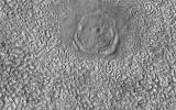
These dark streaks, also known as slope streaks, resulted from dust avalanches on Mars. The HiRISE camera aboard NASA's Mars Reconnaissance Orbiter captured them on Dec. 26, 2017.
PIA25235:
HiRISE Spots Slope Streaks Fanning Out on Mars
Full Resolution:     TIFF (5.762 MB)     JPEG (288.7 kB)
Add Image to Favorite List 2022-05-05 Mars Mars Reconnaissance Orbiter (MRO)
HiRISE
1600x1200x3
These dark streaks, also known as slope streaks, resulted from dust avalanches in an area of Mars called Acheron Fossae. The HiRISE camera aboard NASA's Mars Reconnaissance Orbiter captured them on Dec. 3, 2006.
PIA25234:
HiRISE Spots Slope Streaks on Mars in Acheron Fossae
Full Resolution:     TIFF (5.762 MB)     JPEG (302.6 kB)
Add Image to Favorite List 2022-04-29 Mars Mars Reconnaissance Orbiter (MRO)
HiRISE
2880x1800x3
This image acquired on January 30, 2022 by NASA's Mars Reconnaissance Orbiter shows an impact crater that has been seen in images dating back 50 years to the Mariner 9 mission.
PIA25310:
Slow Changes at an Old Impact Crater
Full Resolution:     TIFF (15.56 MB)     JPEG (954.6 kB)
Add Image to Favorite List 2022-04-29 Mars Mars Reconnaissance Orbiter (MRO)
HiRISE
2880x1800x3
This image acquired on January 22, 2022 by NASA's Mars Reconnaissance Orbiter shows pristine-looking gullies in equatorial Valles Marineris.
PIA25309:
Recent Gullies in Equatorial Valles Marineris
Full Resolution:     TIFF (15.56 MB)     JPEG (1.108 MB)
Add Image to Favorite List 2022-04-29 Mars Mars Reconnaissance Orbiter (MRO)
HiRISE
2880x1800x3
This image acquired on February 8, 2022 by NASA's Mars Reconnaissance Orbiter shows central Valles Marineris, filled with sediments rich in hydrated sulfates.
PIA25308:
Layered Sediments in Valles Marineris
Full Resolution:     TIFF (15.56 MB)     JPEG (845.8 kB)
Add Image to Favorite List 2022-04-29 Mars Mars Reconnaissance Orbiter (MRO)
HiRISE
2880x1800x3
This image acquired on January 30, 2022 by NASA's Mars Reconnaissance Orbiter shows an odd-shaped hole in Noachis Terra, clearly an impact crater.
PIA25307:
A Fresh Impact Crater with an Odd Shape
Full Resolution:     TIFF (8.344 MB)     JPEG (1.047 MB)
Add Image to Favorite List 2022-04-05 Mars Mars Reconnaissance Orbiter (MRO)
HiRISE
2048x1192x3
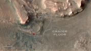
This annotated overhead image from the HiRISE camera aboard NASA's Mars Reconnaissance Orbiter (MRO) depicts three options for the agency's Mars Ingenuity Helicopter to take on flights out of the Séítah region.
PIA25029:
Mars Helicopter Route Options out of Séítah
Full Resolution:     TIFF (7.326 MB)     JPEG (393.1 kB)
Add Image to Favorite List 2022-03-31 Mars Mars Reconnaissance Orbiter (MRO)
HiRISE
1920x1080x1
NASA's Perseverance Mars rover and Ingenuity helicopter were spotted on the surface of the Red Planet in this black-and-white image captured February 26, 2022.
PIA25174:
MRO's HiRISE Spots Perseverance and Ingenuity
Full Resolution:     TIFF (1.931 MB)     JPEG (270.9 kB)
Add Image to Favorite List 2022-03-18 Mars Mars Reconnaissance Orbiter (MRO)
HiRISE
2880x1800x3
This image acquired on January 4, 2022 by NASA's Mars Reconnaissance Orbiter, shows a crater near 37 degrees south latitude. The south-facing slope has patchy bright frost, blue in enhanced color.
PIA25190:
Cool as Ice
Full Resolution:     TIFF (15.56 MB)     JPEG (895.6 kB)
Add Image to Favorite List 2022-03-18 Mars Mars Reconnaissance Orbiter (MRO)
HiRISE
2880x1800x1
This image acquired on November 26, 2021 by NASA's Mars Reconnaissance Orbiter, shows a slump, a mass of loosely consolidated material or a rock layer that moves a short distance down a slope.
PIA25189:
A Large New Slump in Eos Chasma
Full Resolution:     TIFF (4.895 MB)     JPEG (711.5 kB)
 Current Set   Jump to a Following Set   Jump to a Following Set   Jump to a Following Set   Jump to a Following Set   Jump to a Following Set   Jump to a Following Set   Jump to a Following Set   Jump to a Following Set   Jump to a Following Set   Retrieve Next Set 
 1-100   101-200   201-300   301-400   401-500   501-600   601-700   701-800   801-900   901-1000 
Currently displaying images: 1 - 100 of 1727