My
List |
Addition Date
|
Target
|
Mission
|
Instrument
|
Size
|

|
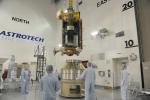
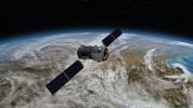
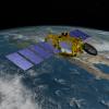
2025-07-03 |
Earth
|
NISAR
|
|
1800x1275x3 |
|
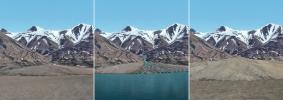
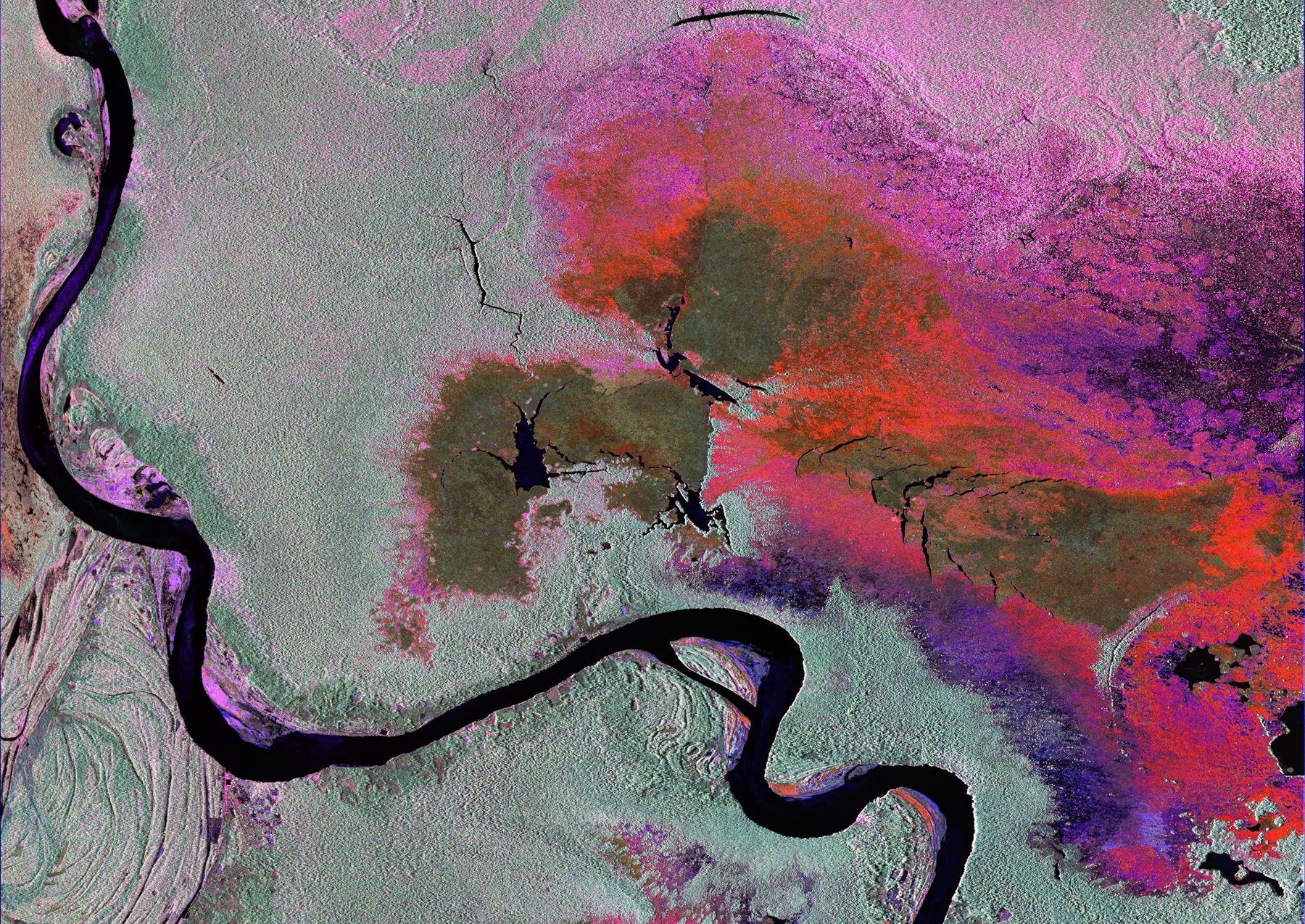
-
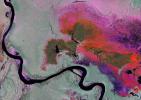
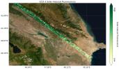
PIA26112:
-
Radar Image of Amazonian Flooding Similar to Future NISAR Imagery
Full Resolution:
TIFF
(6.888 MB)
JPEG
(808.4 kB)
|
|
|
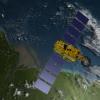
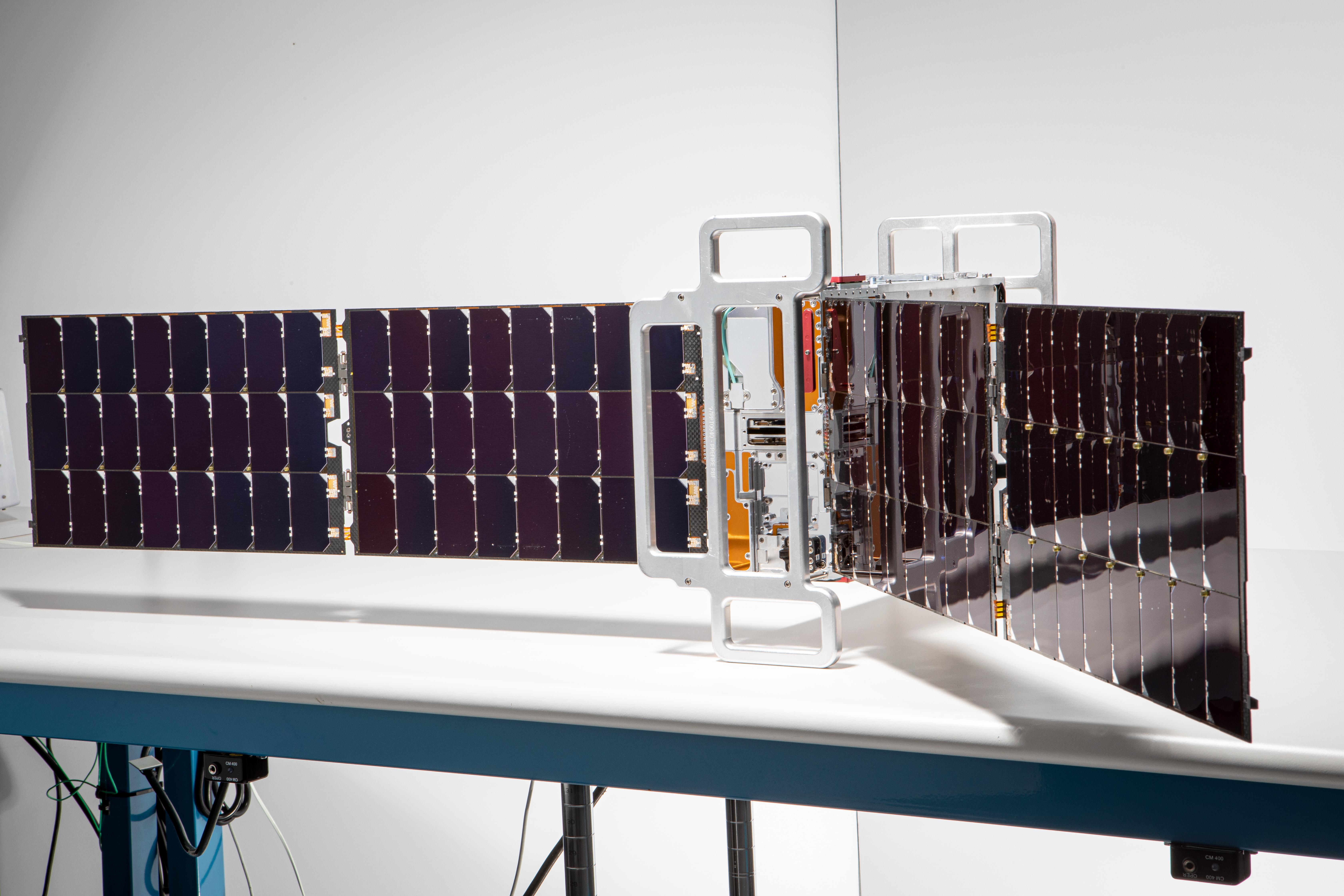
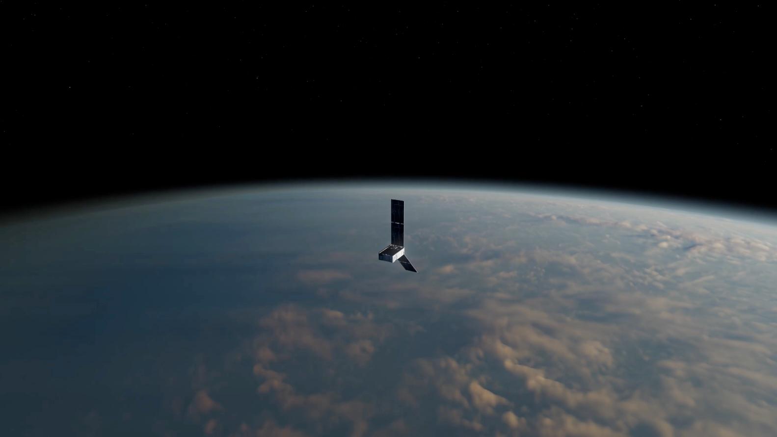
2024-05-21 |
Earth
|
Polar Radiant Energy in the Far-InfraRed Experiment (PREFIRE)
|
|
6720x4480x3 |

|
-
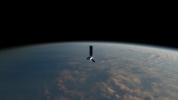
PIA26186:
-
PREFIRE CubeSat Image
Full Resolution:
TIFF
(56.6 MB)
JPEG
(2.543 MB)
|
|
|
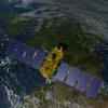
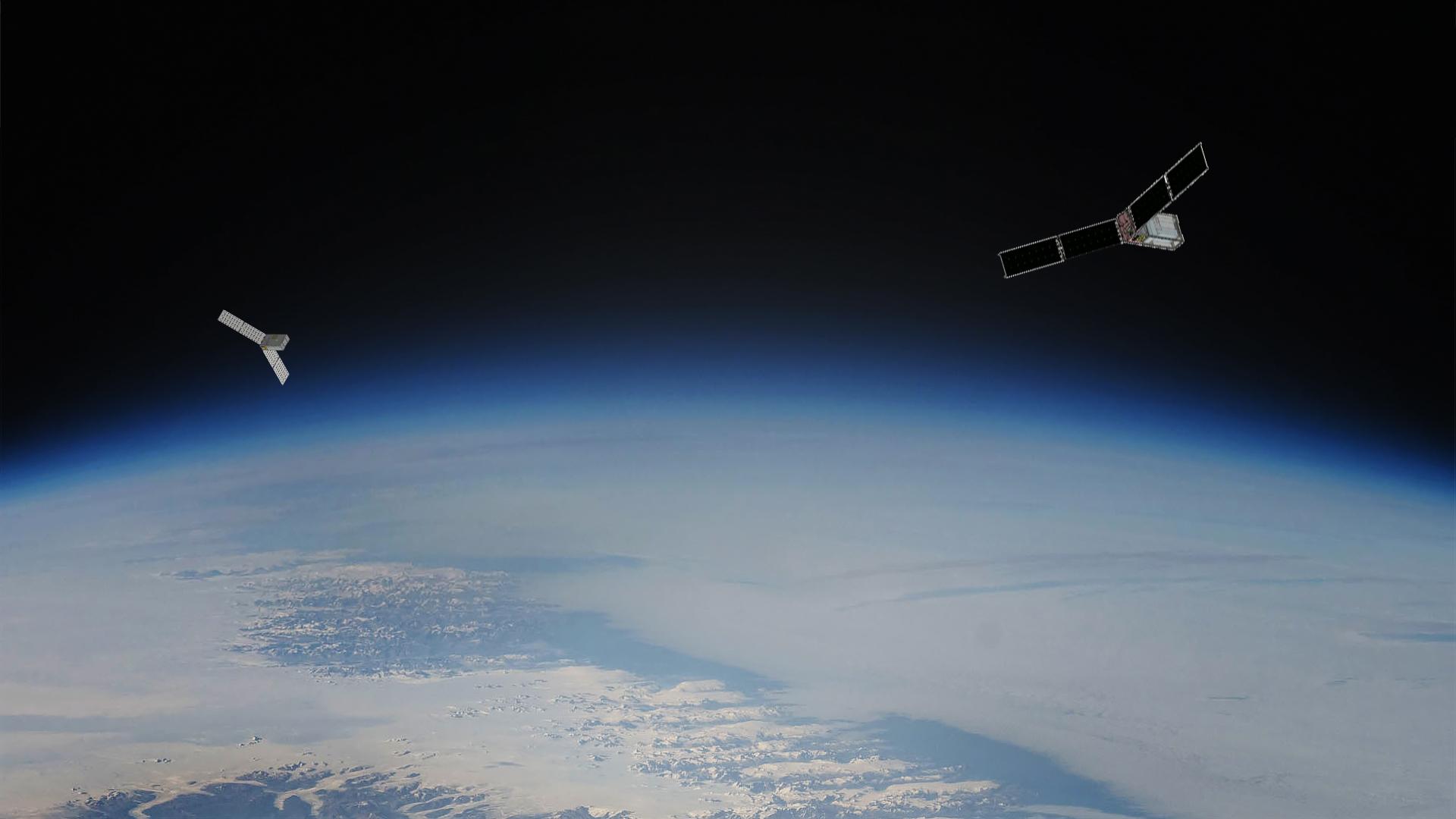
2024-05-15 |
Earth
|
Polar Radiant Energy in the Far-InfraRed Experiment (PREFIRE)
|
|
1583x891x3 |
|
-
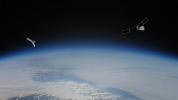
PIA26185:
-
PREFIRE CubeSat in Earth Orbit (Artist's Concept)
Full Resolution:
TIFF
(1.666 MB)
JPEG
(47.7 kB)
|
|
|
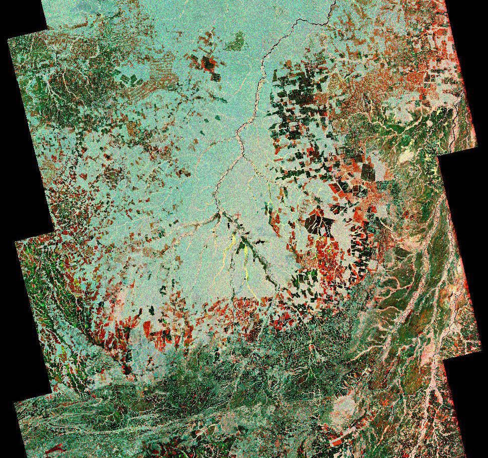
2023-10-27 |
Earth
|
NISAR
|
|
973x913x3 |
|
-
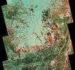
PIA26111:
-
Composite of Brazil's 'Arc of Deforestation' Shows Imagery NISAR Will Produce
Full Resolution:
TIFF
(2.666 MB)
JPEG
(396.6 kB)
|
|
|
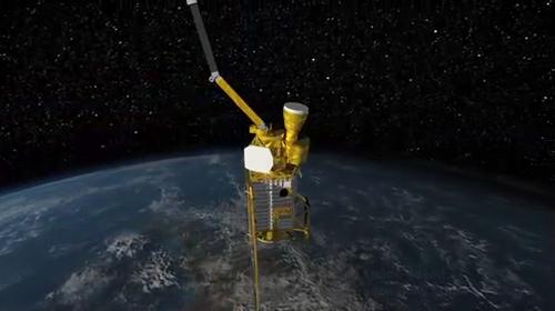
2023-08-14 |
Earth
|
Polar Radiant Energy in the Far-InfraRed Experiment (PREFIRE)
|
|
1920x1080x3 |
|
-
PIA25778:
-
PREFIRE Satellite Illustration
Full Resolution:
TIFF
(3.12 MB)
JPEG
(92.14 kB)
|
|
|
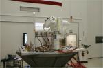
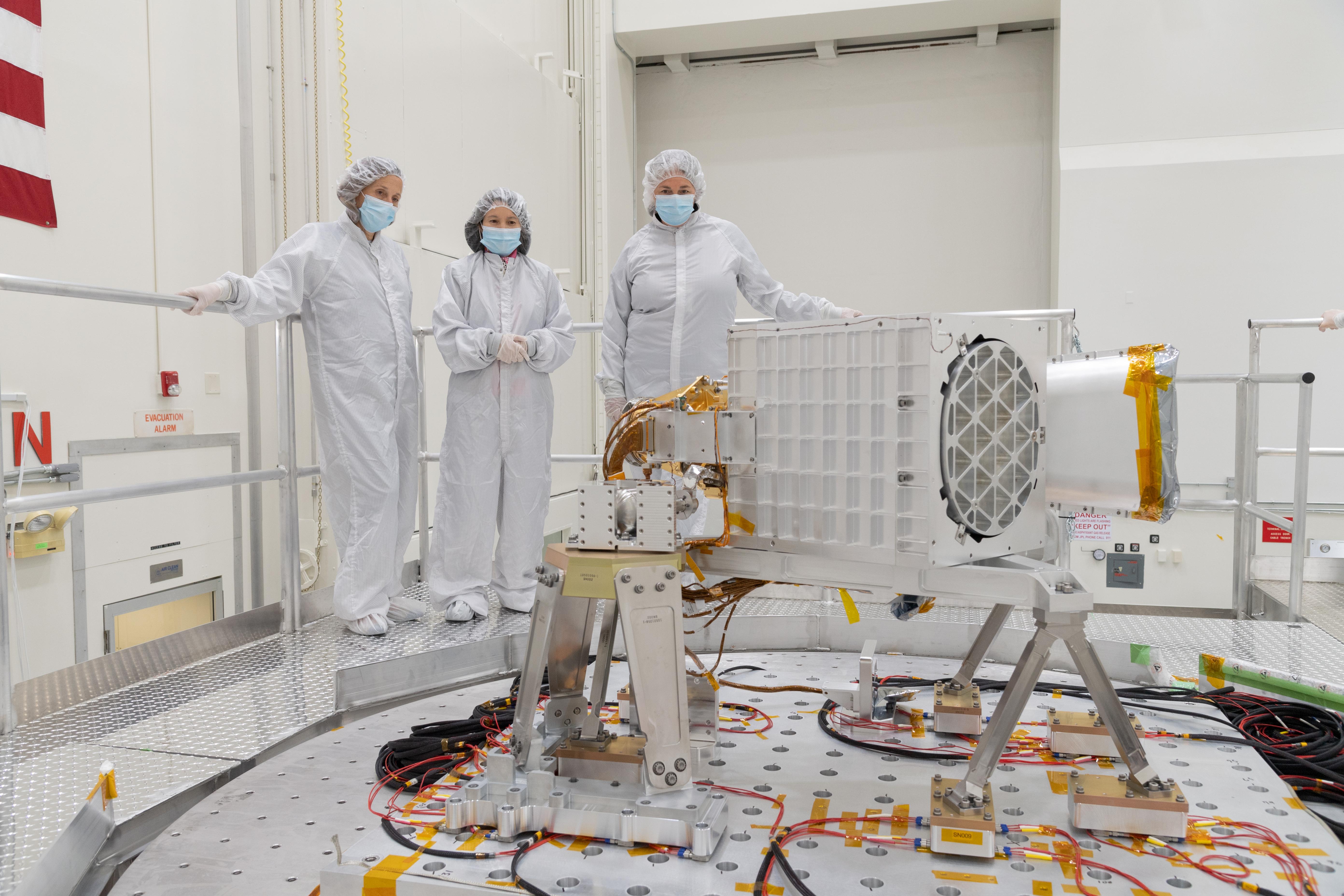
2022-06-01 |
Earth
|
Earth Surface Mineral Dust Source Investigation (EMIT)
|
EMIT
|
5568x3712x3 |

|
-
PIA25150:
-
EMIT Put to the Test at JPL
Full Resolution:
TIFF
(43.37 MB)
JPEG
(1.852 MB)
|
|
|
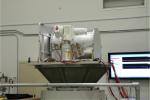
2022-05-12 |
Earth
|
Earth Surface Mineral Dust Source Investigation (EMIT)
|
EMIT
|
1230x922x3 |
|
-
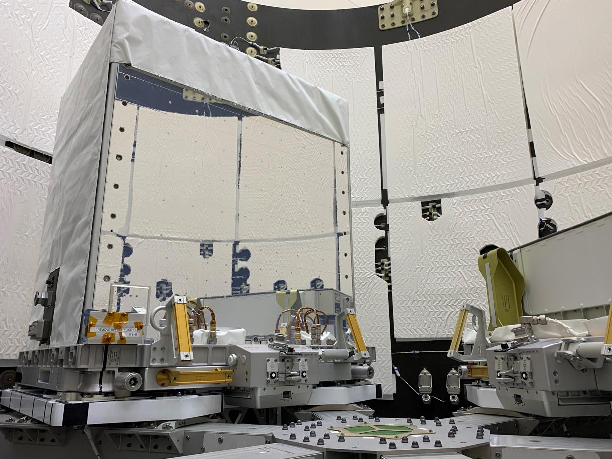
PIA25149:
-
EMIT Inside SpaceX Falcon 9 Trunk Ahead of Transport
Full Resolution:
TIFF
(2.82 MB)
JPEG
(178.1 kB)
|
|
|
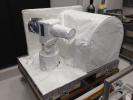
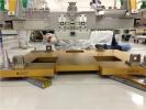
2022-05-12 |
Earth
|
Earth Surface Mineral Dust Source Investigation (EMIT)
|
EMIT
|
4000x3000x3 |
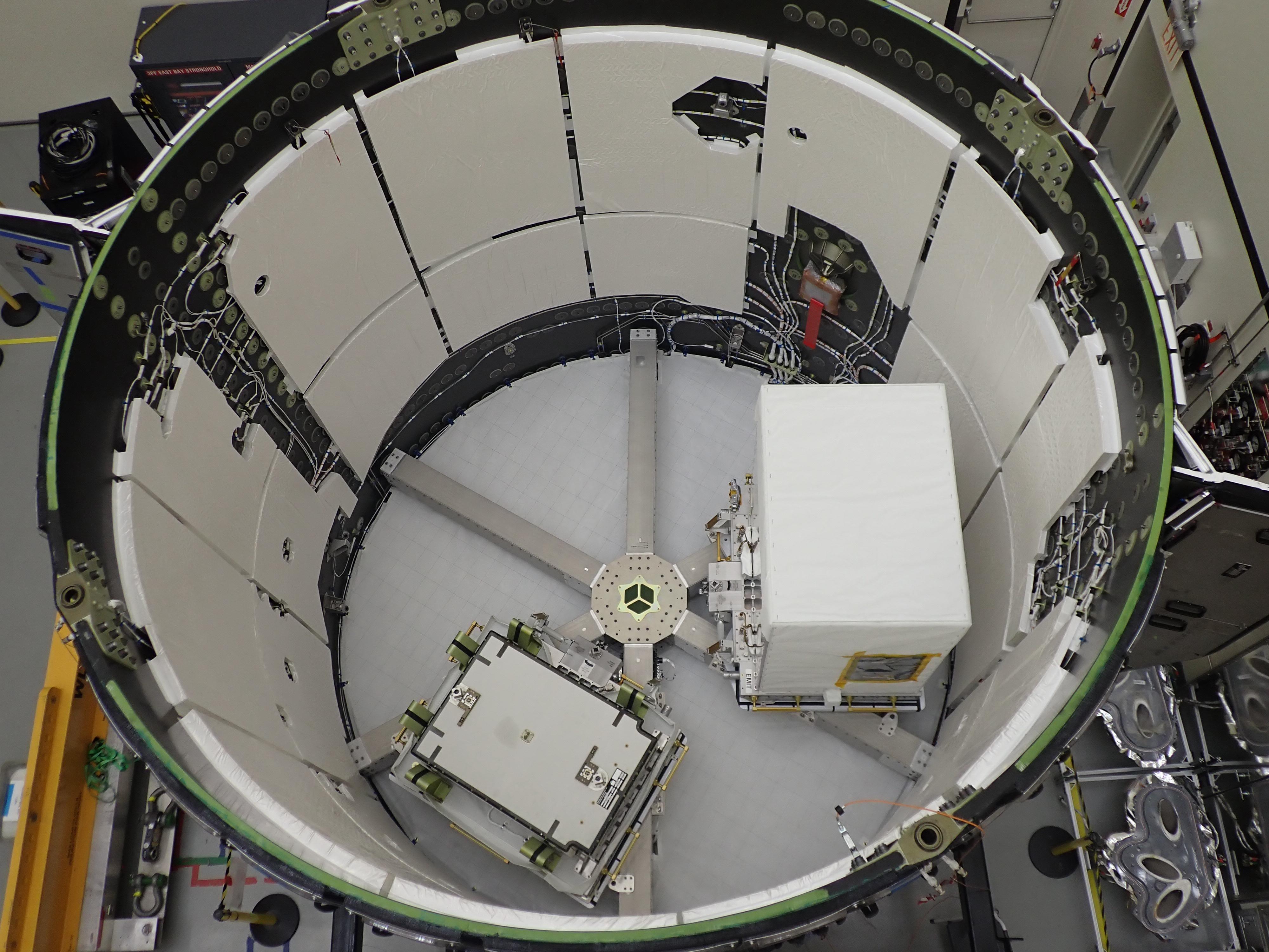
|
-
PIA25148:
-
EMIT Loaded Into SpaceX Falcon 9 Trunk Before Transport
Full Resolution:
TIFF
(28.26 MB)
JPEG
(1.117 MB)
|
|
|
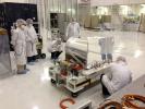
2022-05-02 |
Earth
|
Earth Surface Mineral Dust Source Investigation (EMIT)
|
EMIT
|
7955x5303x3 |
|
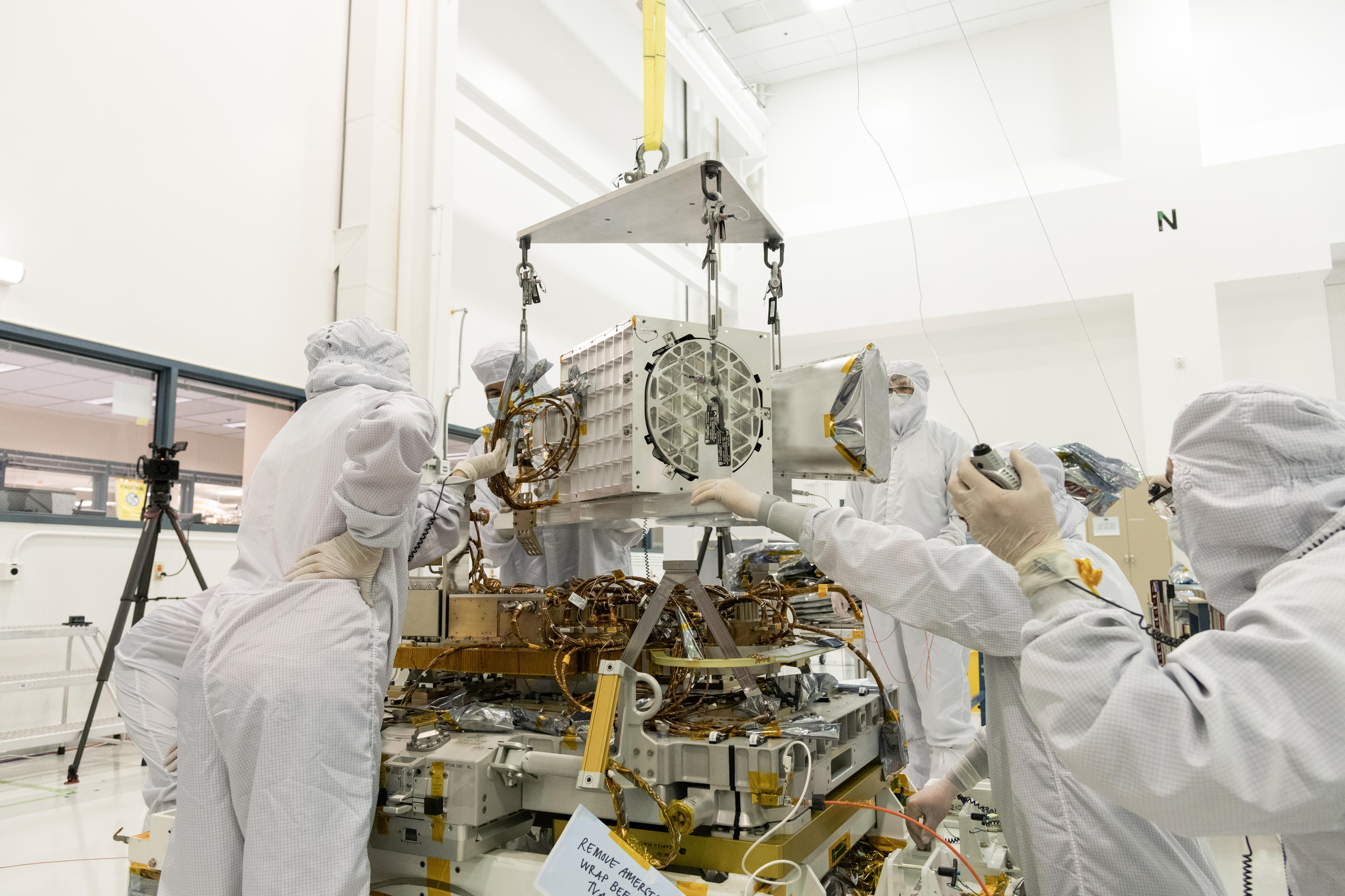
-
PIA25146:
-
EMIT's Components Come Together at JPL
Full Resolution:
TIFF
(89.44 MB)
JPEG
(5.066 MB)
|
|
|
2022-01-27 |
Earth
|
Global Differential Global Positioning System (GDGPS)
|
|
3600x3000x3 |
|
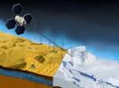
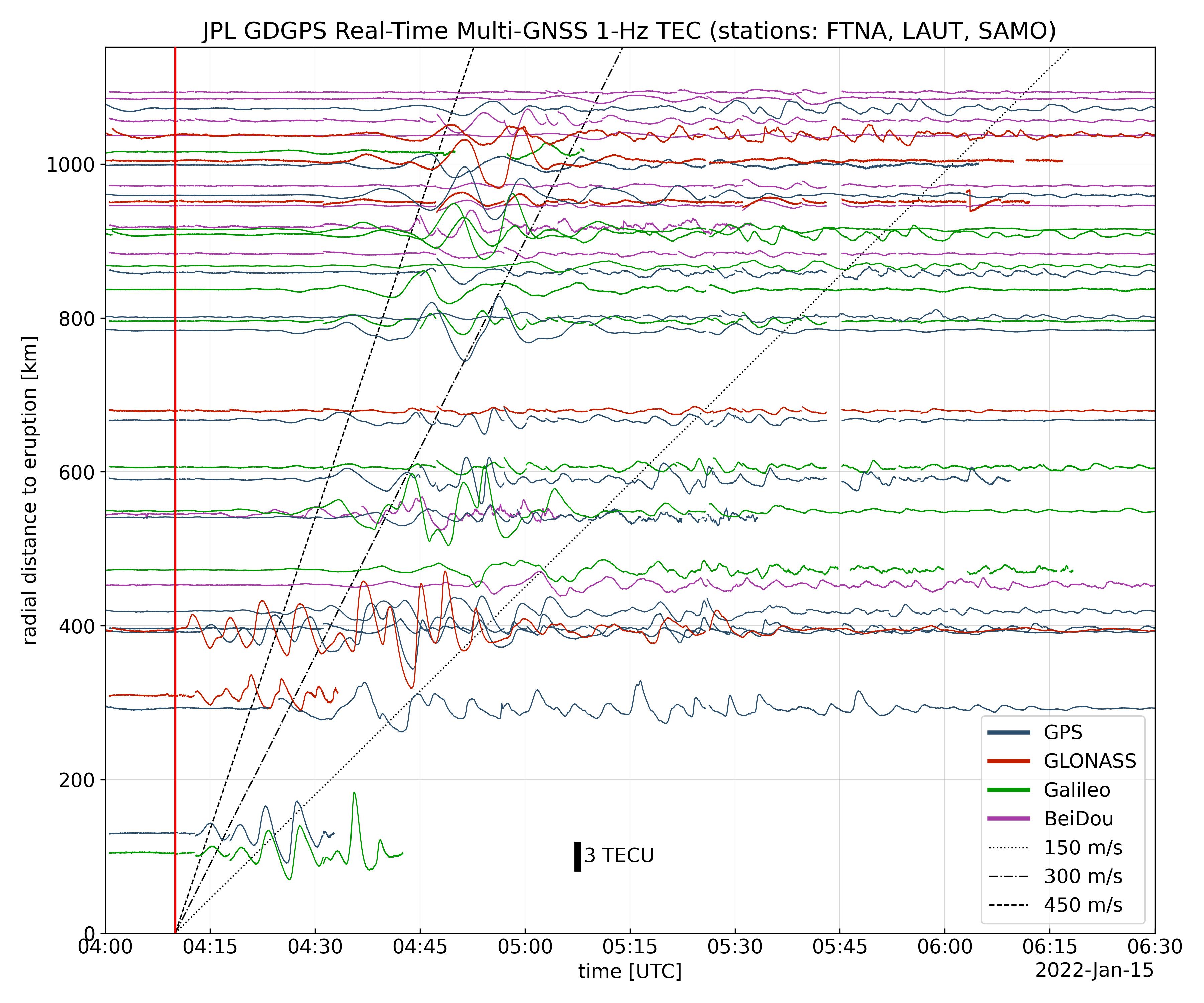
-
PIA24905:
-
Tonga Eruption Atmospheric Wave
Full Resolution:
TIFF
(3.165 MB)
JPEG
(1.025 MB)
|
|
|
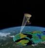
2021-06-21 |
Earth
|
Sentinel-6/Jason-CS
|
|
1536x1024x3 |
|
-
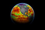
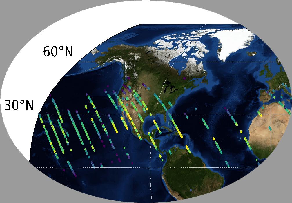
PIA24533:
-
Sentinel-6 Michael Freilich Sea Surface Height
Full Resolution:
TIFF
(1.492 MB)
JPEG
(78.4 kB)
|
|
|
2020-12-10 |
Earth
|
Sentinel-6/Jason-CS
|
|
1216x900x3 |
|
-
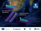
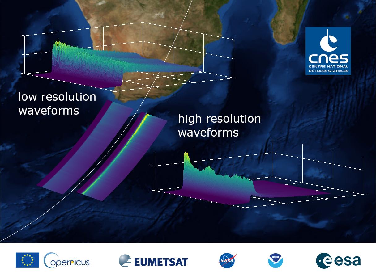
PIA24136:
-
Sentinel-6 Michael Freilich First Light Waveform
Full Resolution:
TIFF
(2.221 MB)
JPEG
(121.2 kB)
|
|
|
2020-12-10 |
Earth
|
Sentinel-6/Jason-CS
|
|
2600x1849x3 |
|
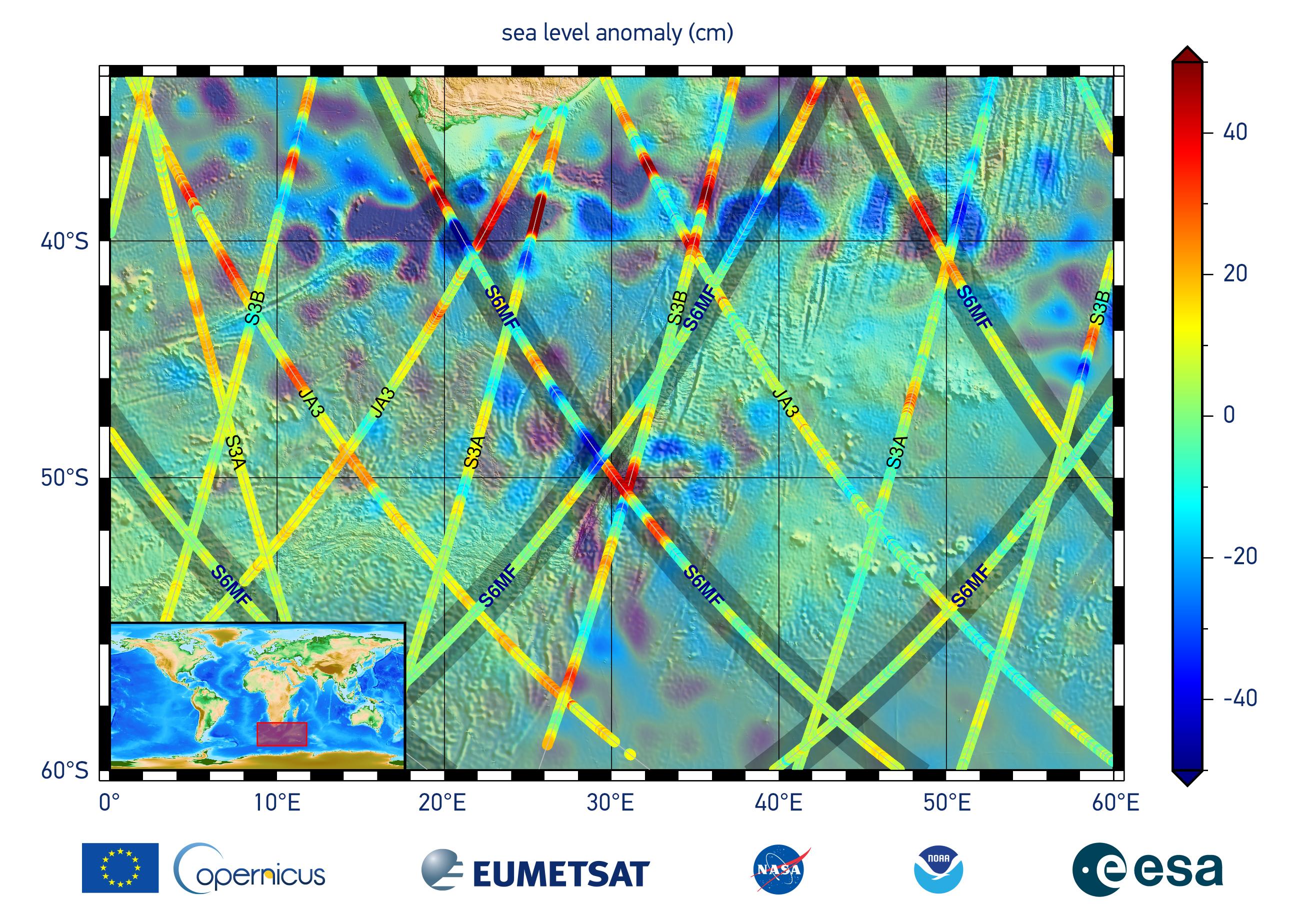
-
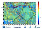
PIA24135:
-
Sentinel-6 Michael Freilich First Light Sea Level
Full Resolution:
TIFF
(10.71 MB)
JPEG
(704.9 kB)
|
|
|
2020-09-23 |
Earth
|
|
|
8000x5955x3 |
|
-
PIA23790:
-
OASIS Study Project (Illustration)
Full Resolution:
TIFF
(104.1 MB)
JPEG
(4.095 MB)
|
|
|
2019-07-12 |
Earth
|
Orbiting Carbon Observatory (OCO-3)
|
OCO-3
|
1440x841x3 |
|
-
PIA23353:
-
OCO-3's First Solar-Induced Fluorescence Measurements
Full Resolution:
TIFF
(3.003 MB)
JPEG
(203.5 kB)
|
|
|
2019-07-12 |
Earth
|
Orbiting Carbon Observatory (OCO-3)
|
OCO-3
|
1007x701x3 |

|
-
PIA23352:
-
OCO-3's First CO2 Measurements
Full Resolution:
TIFF
(1.255 MB)
JPEG
(99.61 kB)
|
|
|
2018-09-25 |
Earth
|
CubeSat
|
|
1280x434x3 |

|
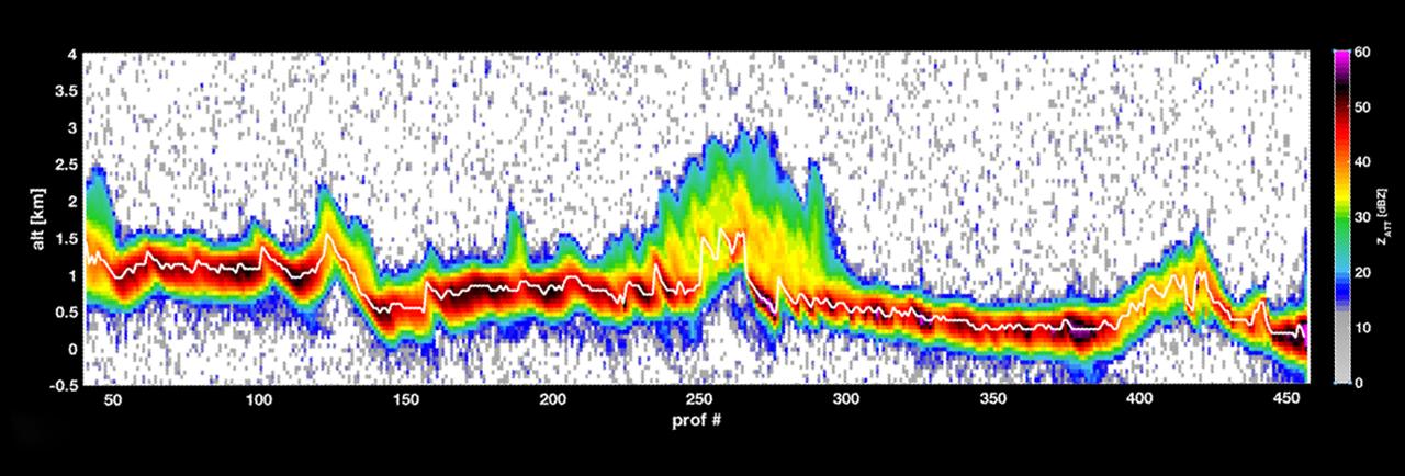
-
PIA22654:
-
RainCube Collects First Storm Data
Full Resolution:
TIFF
(759.9 kB)
JPEG
(106.9 kB)
|
|
|
2018-09-25 |
Earth
|
CubeSat
|
|
478x318x3 |
|
-
PIA22653:
-
Mini Mission RainCube is Sent into Earth Orbit
Full Resolution:
TIFF
(330.8 kB)
JPEG
(210.5 kB)
|
|
|
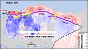
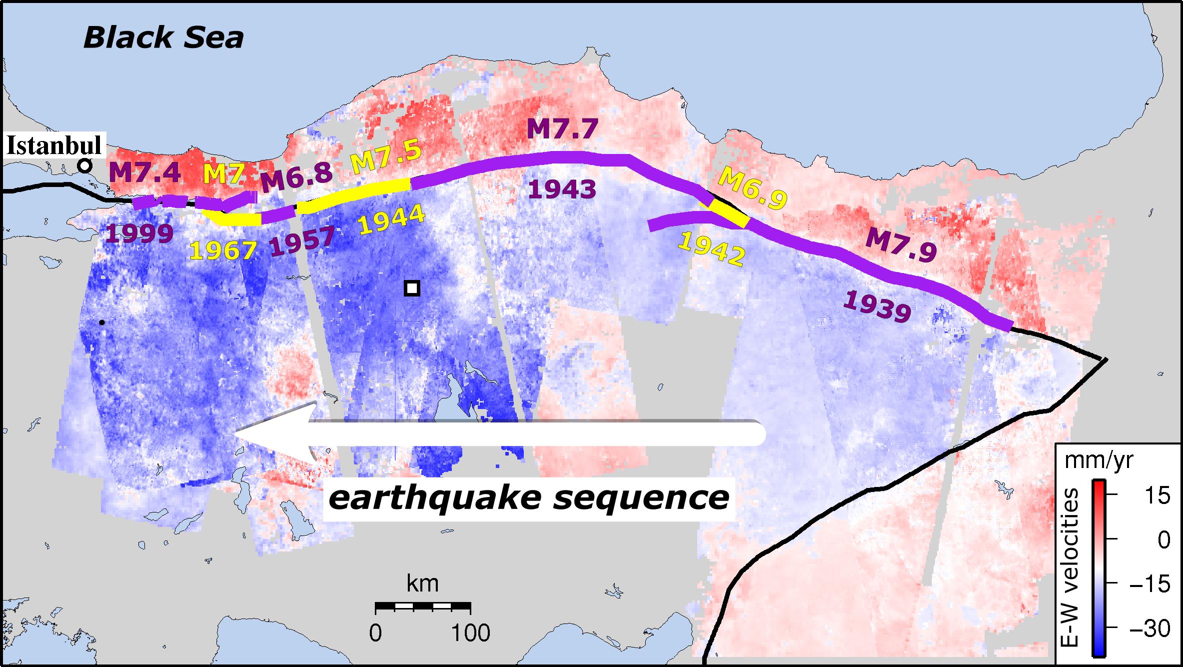
2018-04-12 |
Earth
|
ENVISAT
|
|
2367x1334x3 |
|
-
PIA22412:
-
Turkish Fault Reveals Seismic Steadiness
Full Resolution:
TIFF
(2.429 MB)
JPEG
(417.2 kB)
|
|
|
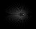
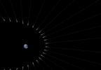
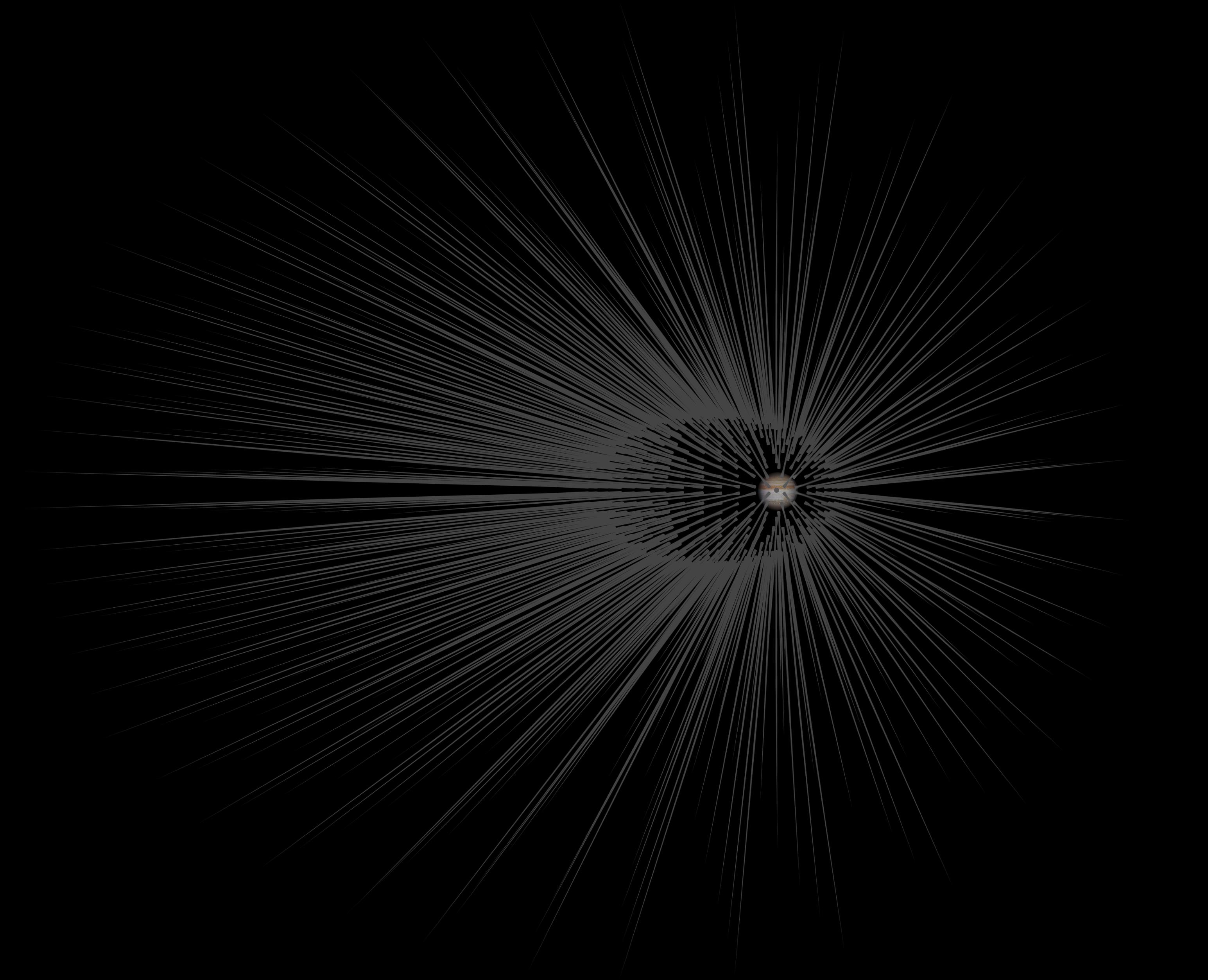
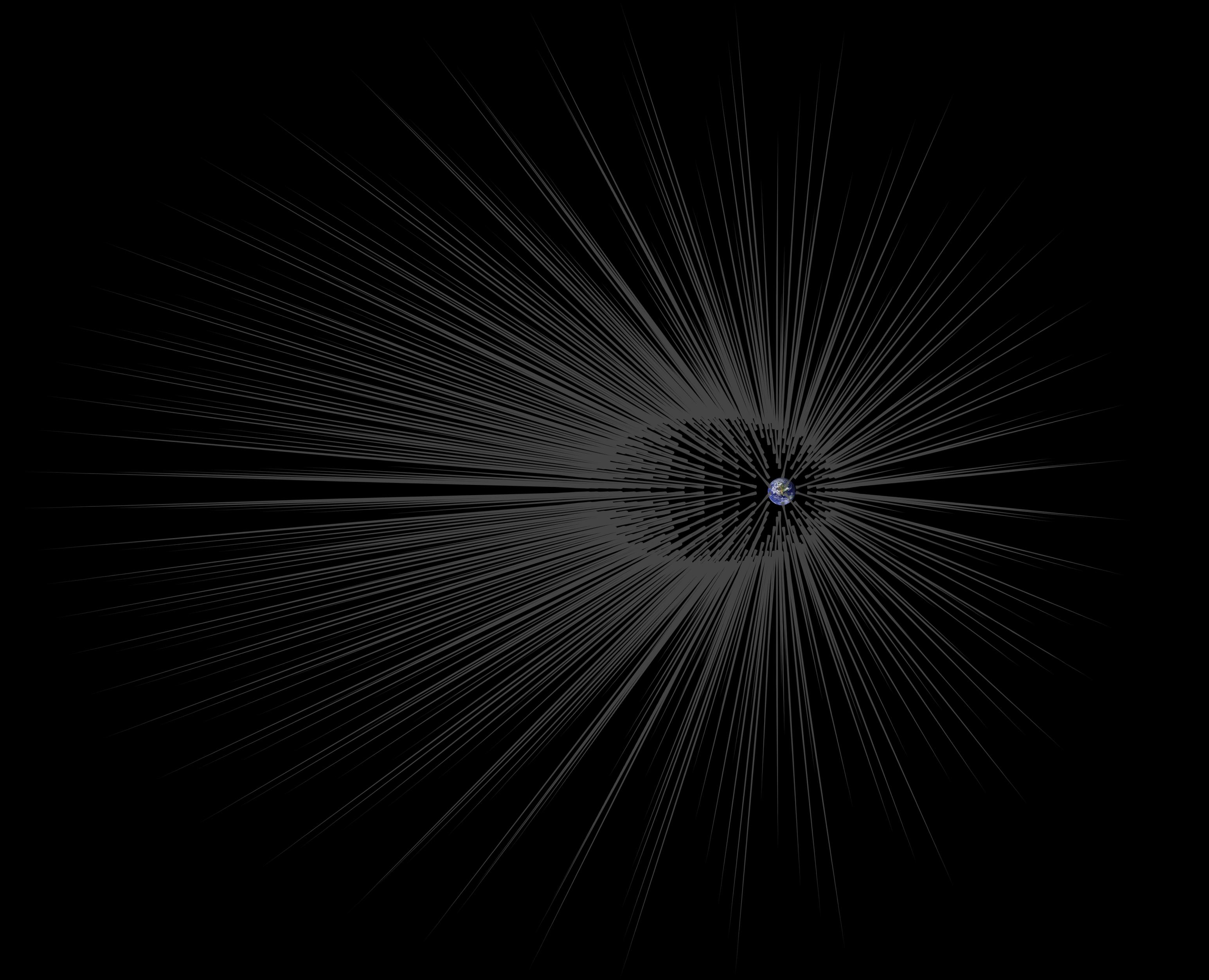
2015-11-23 |
Earth
|
|
|
3090x2506x3 |
|
-
PIA20178:
-
Dark Matter 'Hairs' Around Jupiter
Full Resolution:
TIFF
(1.95 MB)
JPEG
(549.1 kB)
|
|
|
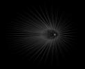
2015-11-23 |
Earth
|
|
|
2550x1769x3 |
|
-
PIA20177:
-
Dark Matter 'Hairs' Around Earth -- Close-up
Full Resolution:
TIFF
(432.9 kB)
JPEG
(129.3 kB)
|
|
|
2015-11-23 |
Earth
|
|
|
3090x2506x3 |
|
-
PIA20176:
-
Dark Matter 'Hairs' Around Earth
Full Resolution:
TIFF
(1.94 MB)
JPEG
(549.7 kB)
|
|
|
2015-06-11 |
Earth
|
LDSD
|
|
4747x3391x3 |
|
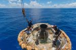
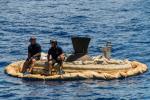
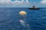
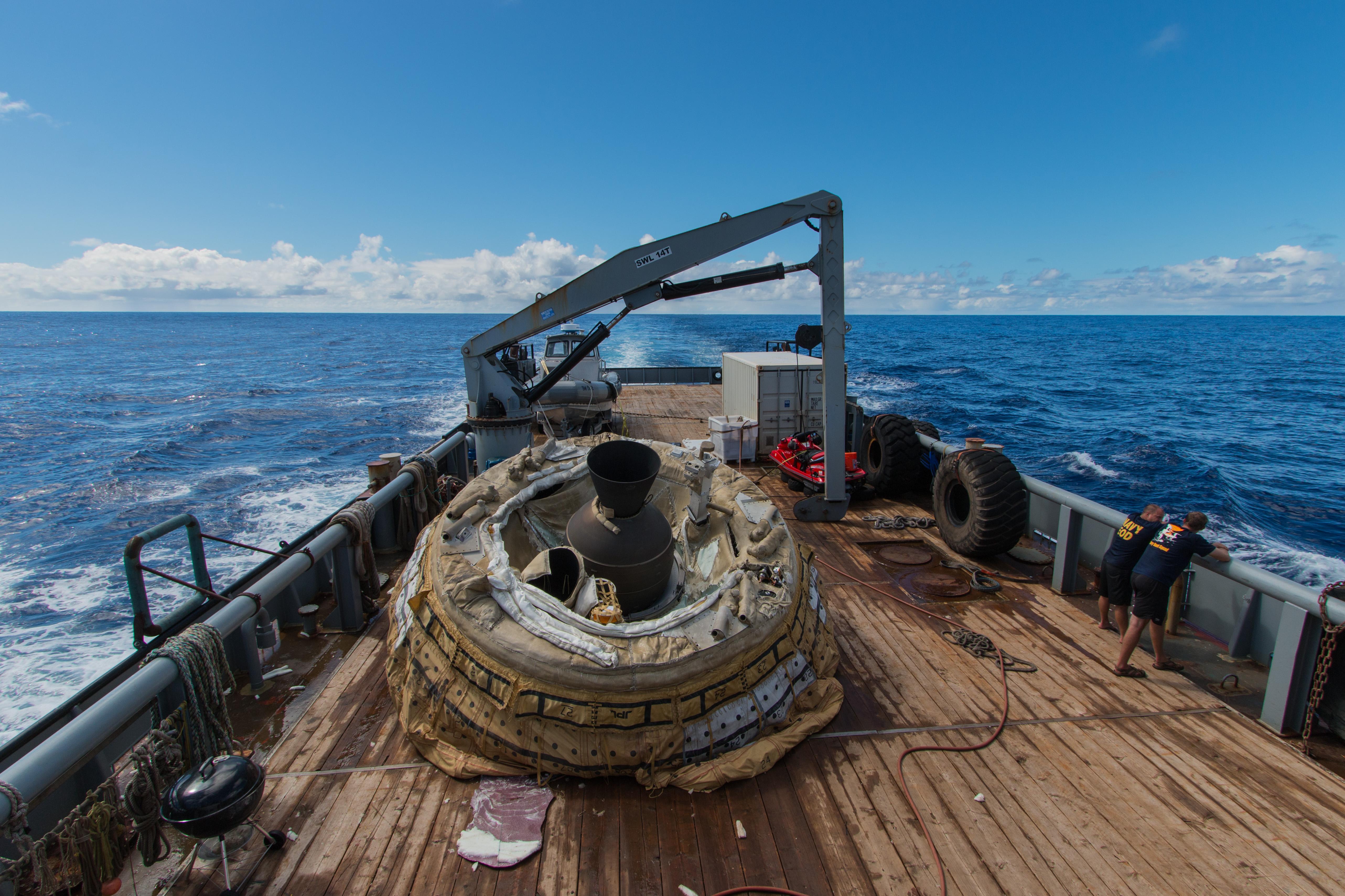
-
PIA19684:
-
Saucer Shoal: LDSD Recovery off Kauai
Full Resolution:
TIFF
(48.32 MB)
JPEG
(2.184 MB)
|
|
|
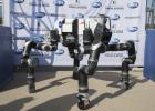
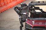
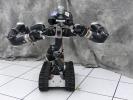
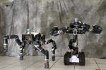
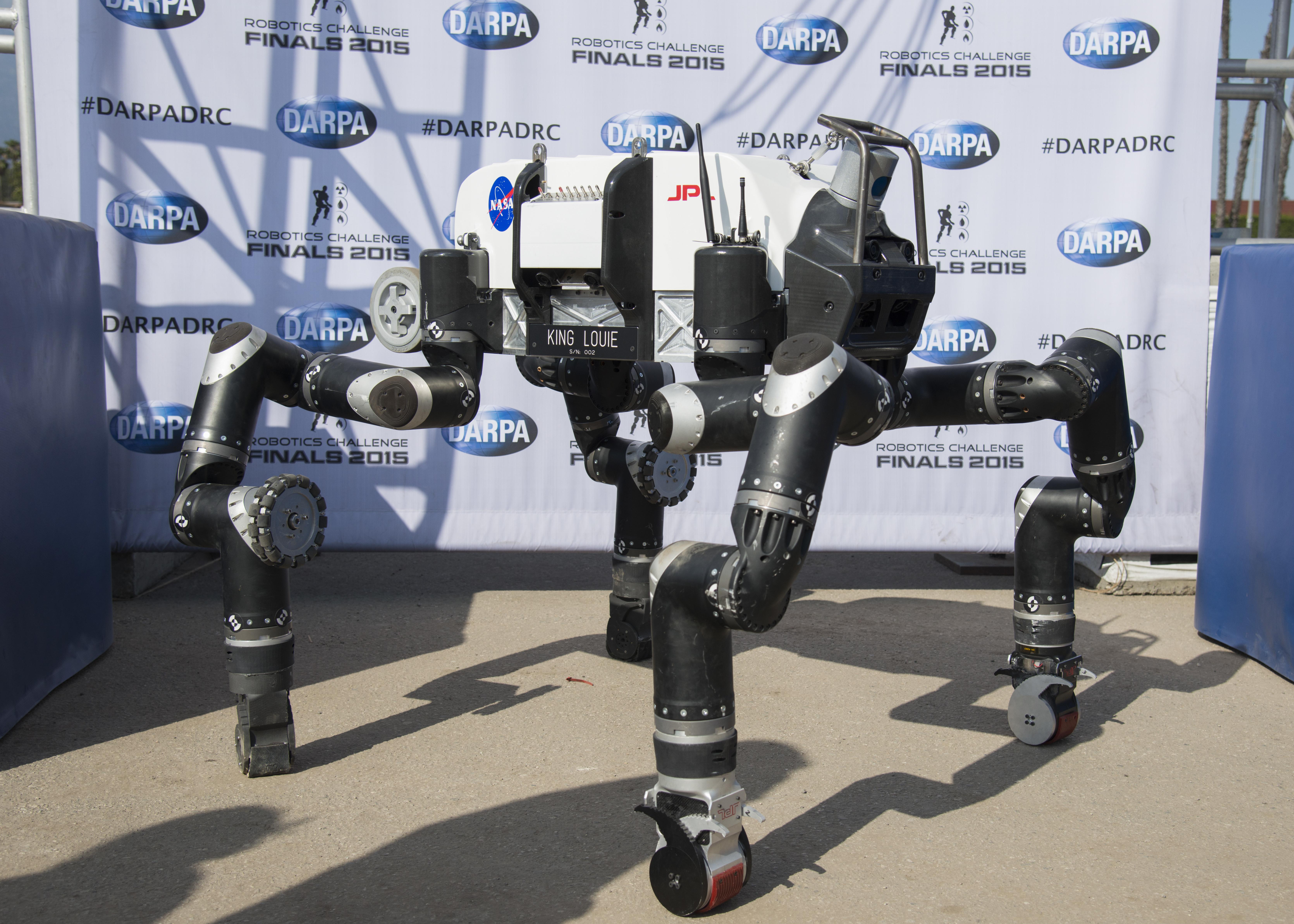
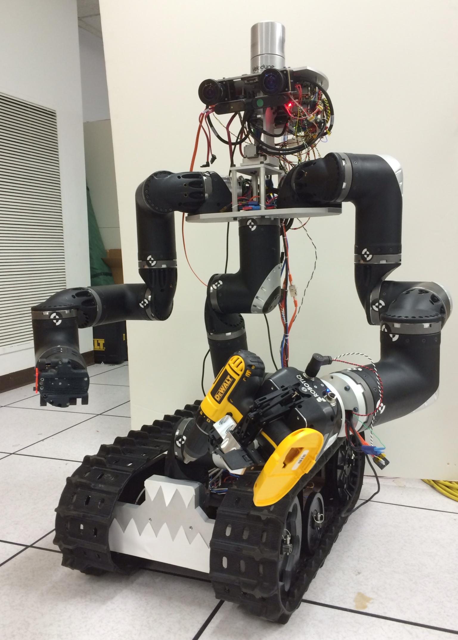
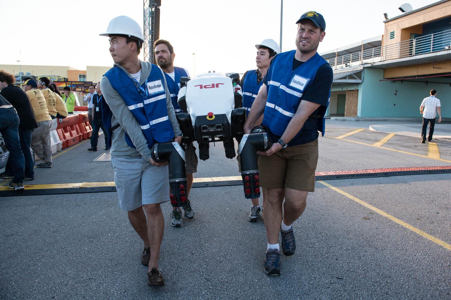
2015-06-09 |
Earth
|
|
RoboSimian
|
2771x1979x3 |
|
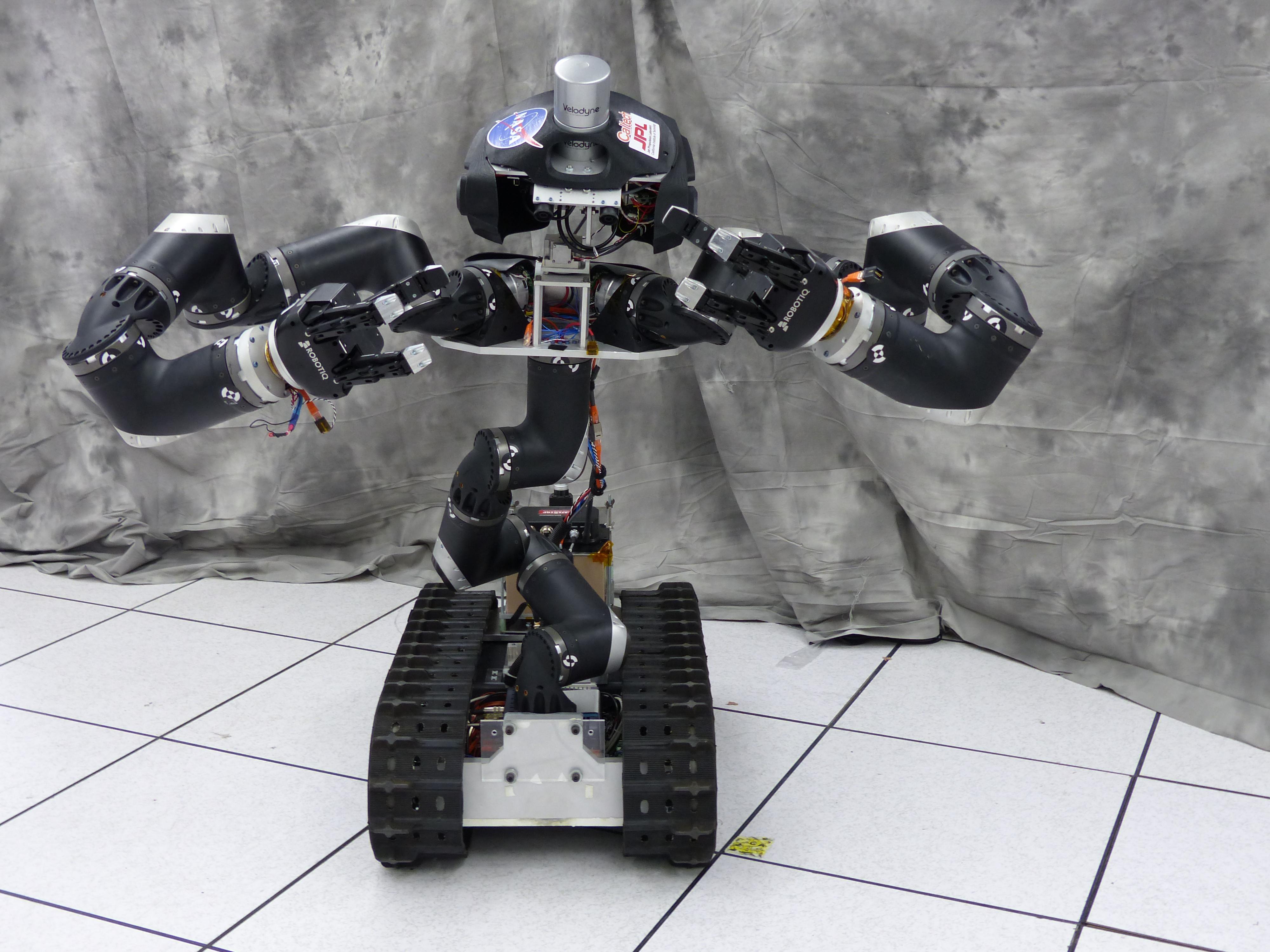
-
PIA19329:
-
Team RoboSimian
Full Resolution:
TIFF
(16.46 MB)
JPEG
(704.6 kB)
|
|
|
2015-06-09 |
Earth
|
|
RoboSimian
|
6681x4772x3 |
|
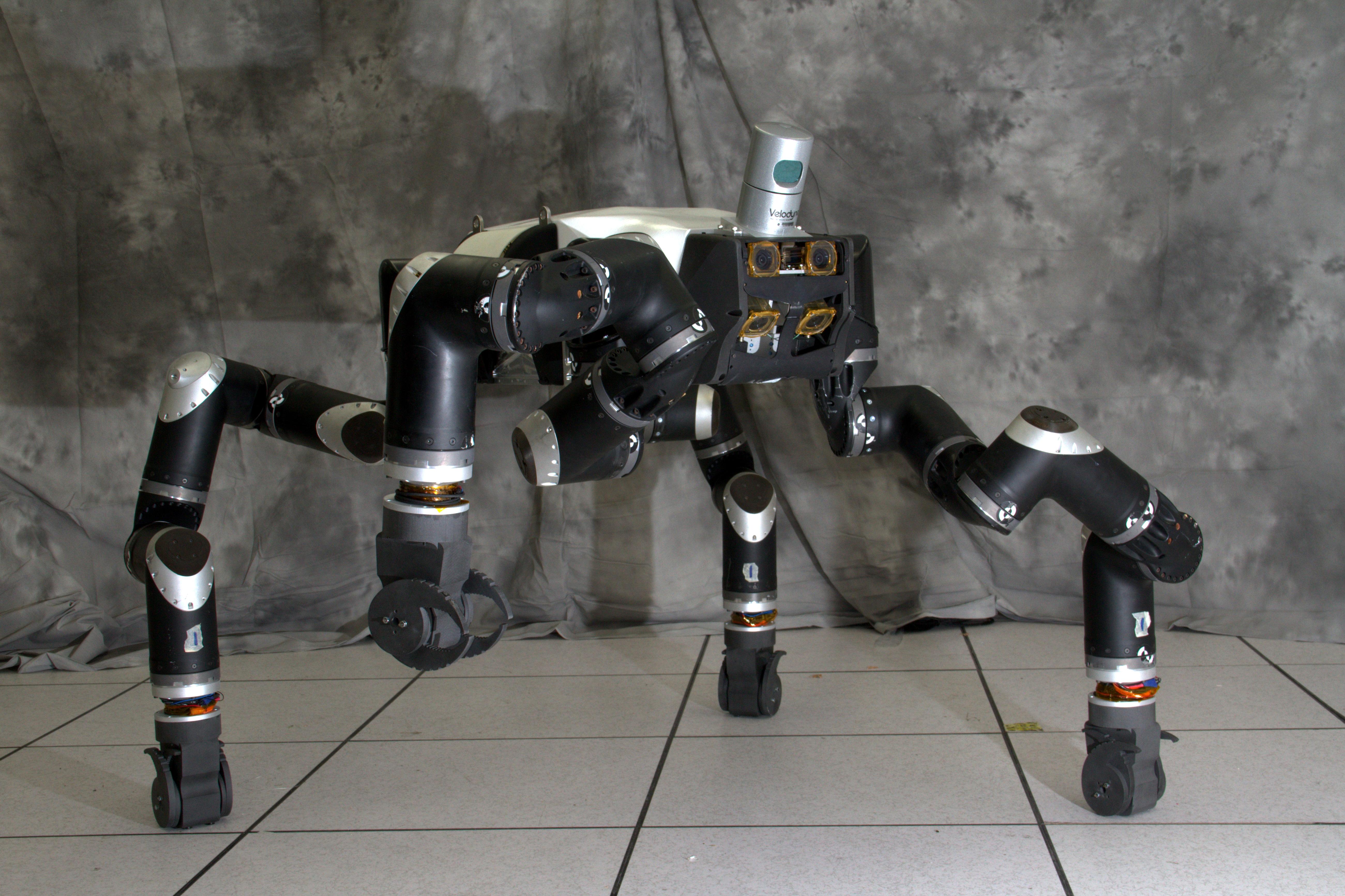
-
PIA19328:
-
RoboSimian at DARPA Robotics Challenge
Full Resolution:
TIFF
(95.68 MB)
JPEG
(2.553 MB)
|
|
|
2015-06-09 |
Earth
|
|
RoboSimian
|
7360x4912x3 |
|
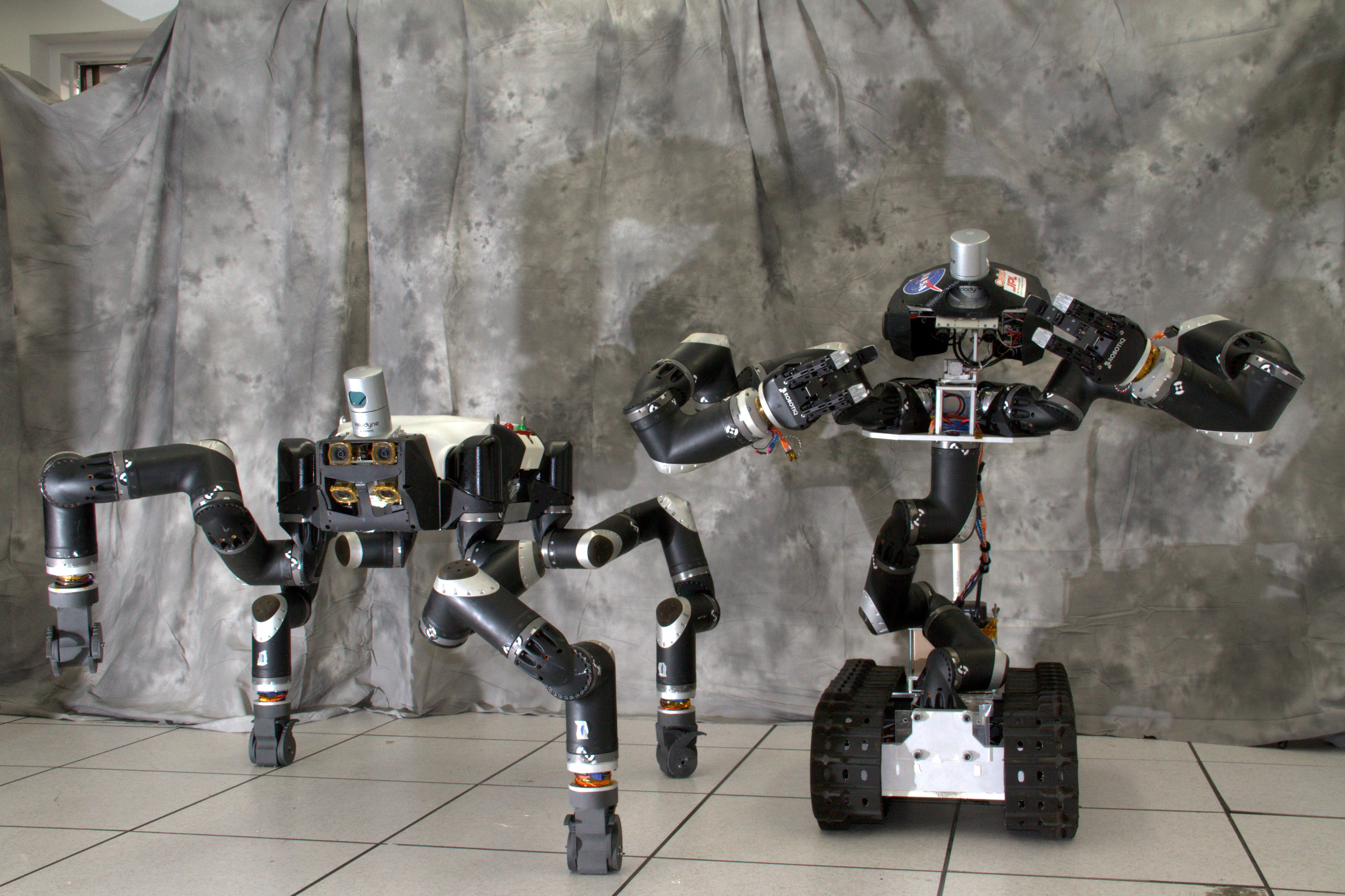
-
PIA19327:
-
Meeting RoboSimian
Full Resolution:
TIFF
(108.5 MB)
JPEG
(1.894 MB)
|
|
|
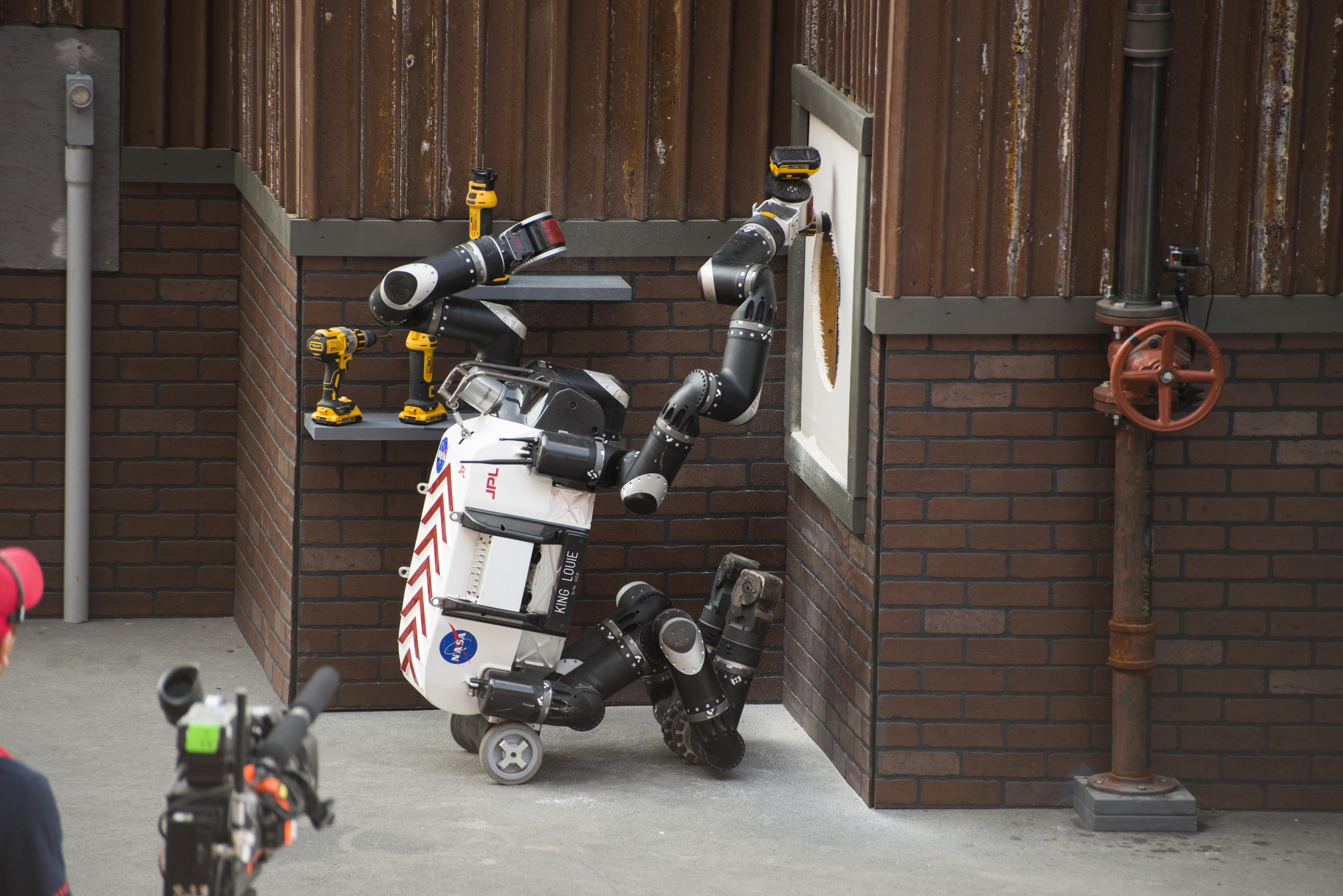
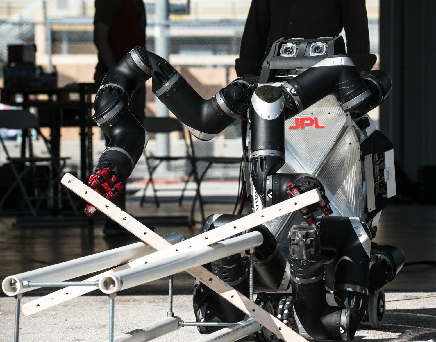
2015-06-09 |
Earth
|
|
RoboSimian
|
7360x4912x3 |
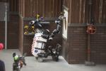
|
-
PIA19326:
-
RoboSimian Cuts Hole in Wall
Full Resolution:
TIFF
(108.5 MB)
JPEG
(3.953 MB)
|
|
|
2015-06-09 |
Earth
|
|
RoboSimian
|
5476x3911x3 |
|
-
PIA19325:
-
RoboSimian Driving
Full Resolution:
TIFF
(64.28 MB)
JPEG
(1.673 MB)
|
|
|
2015-06-09 |
Earth
|
|
RoboSimian
|
7360x4912x3 |
|
-
PIA19324:
-
RoboSimian Exits Vehicle
Full Resolution:
TIFF
(108.5 MB)
JPEG
(2.586 MB)
|
|
|
2015-06-09 |
Earth
|
LDSD
|
|
1600x900x3 |
|
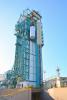
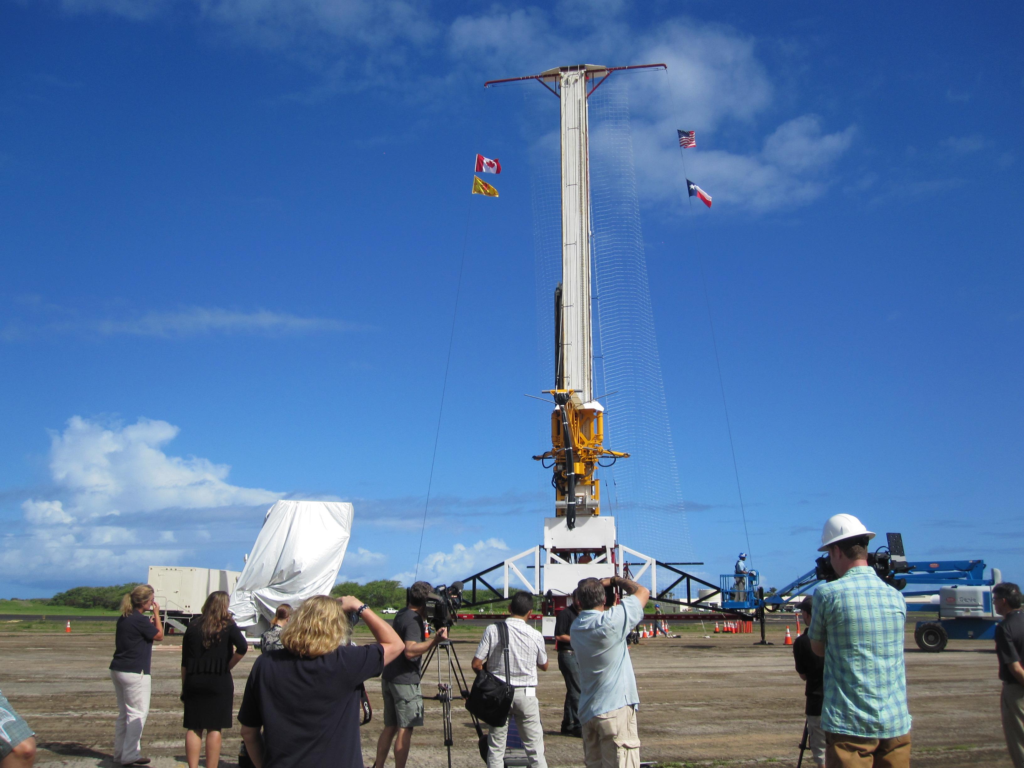
-
PIA19683:
-
LDSD Test Vehicle Attached to Launch Tower
Full Resolution:
TIFF
(4.322 MB)
JPEG
(210.1 kB)
|
|
|
2015-06-05 |
Earth
|
LDSD
|
|
1600x900x3 |

|
-
PIA19343:
-
LDSD on the Launch Tower
Full Resolution:
TIFF
(4.322 MB)
JPEG
(106 kB)
|
|
|
2015-06-05 |
Earth
|
LDSD
|
|
1600x900x3 |
|
-
PIA19342:
-
LDSD Ready for Launch
Full Resolution:
TIFF
(4.322 MB)
JPEG
(174.1 kB)
|
|
|
2015-05-11 |
Earth
|
LDSD
|
|
2222x1249x3 |
|
-
PIA17799:
-
The Saucer's Ride
Full Resolution:
TIFF
(8.329 MB)
JPEG
(195.1 kB)
|
|
|
2015-04-22 |
Earth
|
|
|
1271x671x3 |
|
-
PIA19318:
-
Orbiting Rainbows Simulation
Full Resolution:
TIFF
(2.59 MB)
JPEG
(68.7 kB)
|
|
|
2015-03-31 |
Earth
|
Mars Science Laboratory (MSL)
|
SAM
|
1019x702x3 |

|
-
PIA19149:
-
Preparation for Analytical Measurements on Mars
Full Resolution:
TIFF
(2.147 MB)
JPEG
(119.6 kB)
|
|
|
2015-03-11 |
Earth
|
|
RoboSimian
|
5400x7200x3 |
|
-
PIA19315:
-
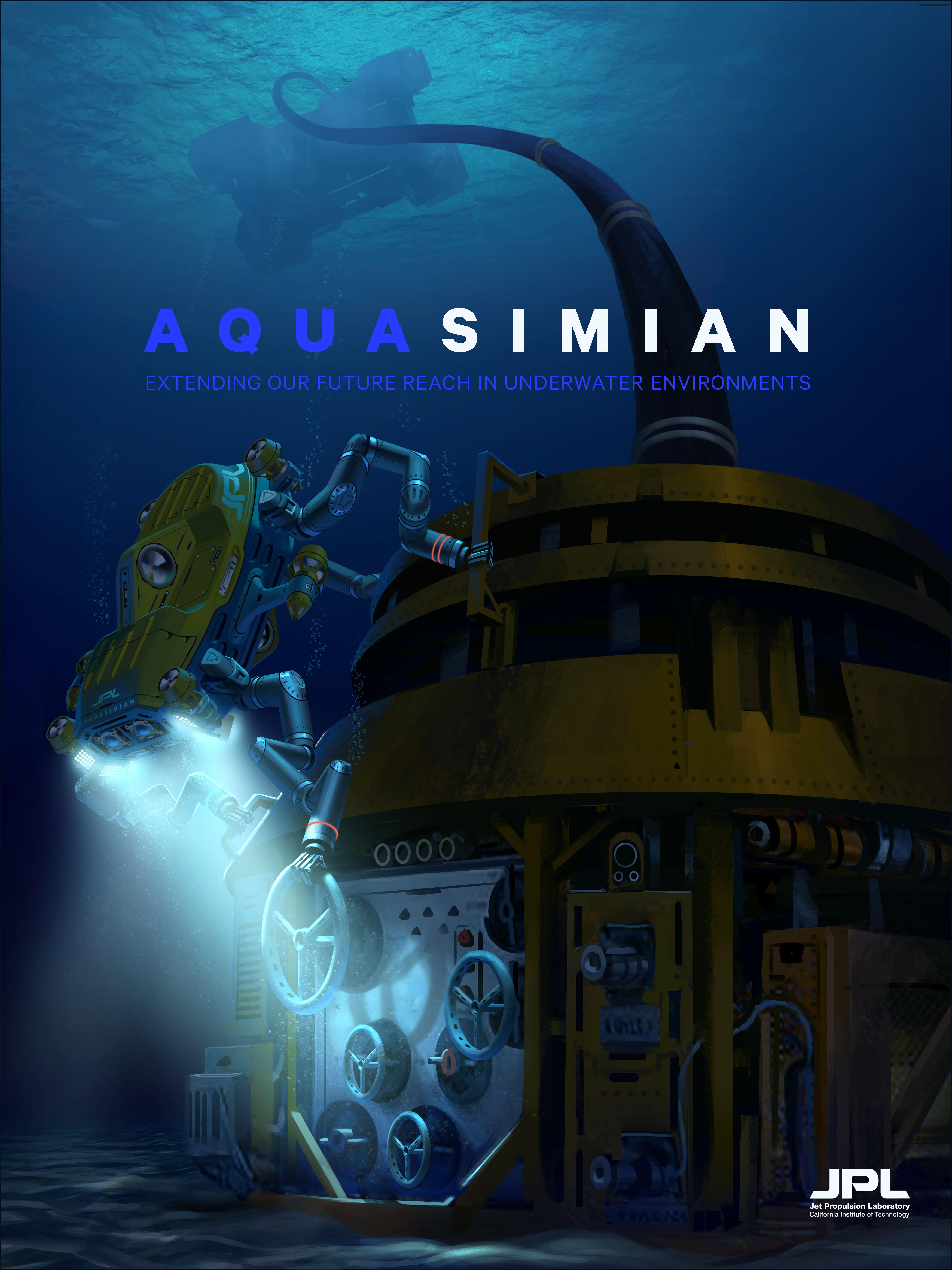
AquaSimian Poster (Artist's Concept)
Full Resolution:
TIFF
(116.7 MB)
JPEG
(1.592 MB)
|
|
|
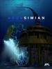
2015-03-11 |
Earth
|
|
RoboSimian
|
7200x5400x3 |
|
-
PIA19314:
-
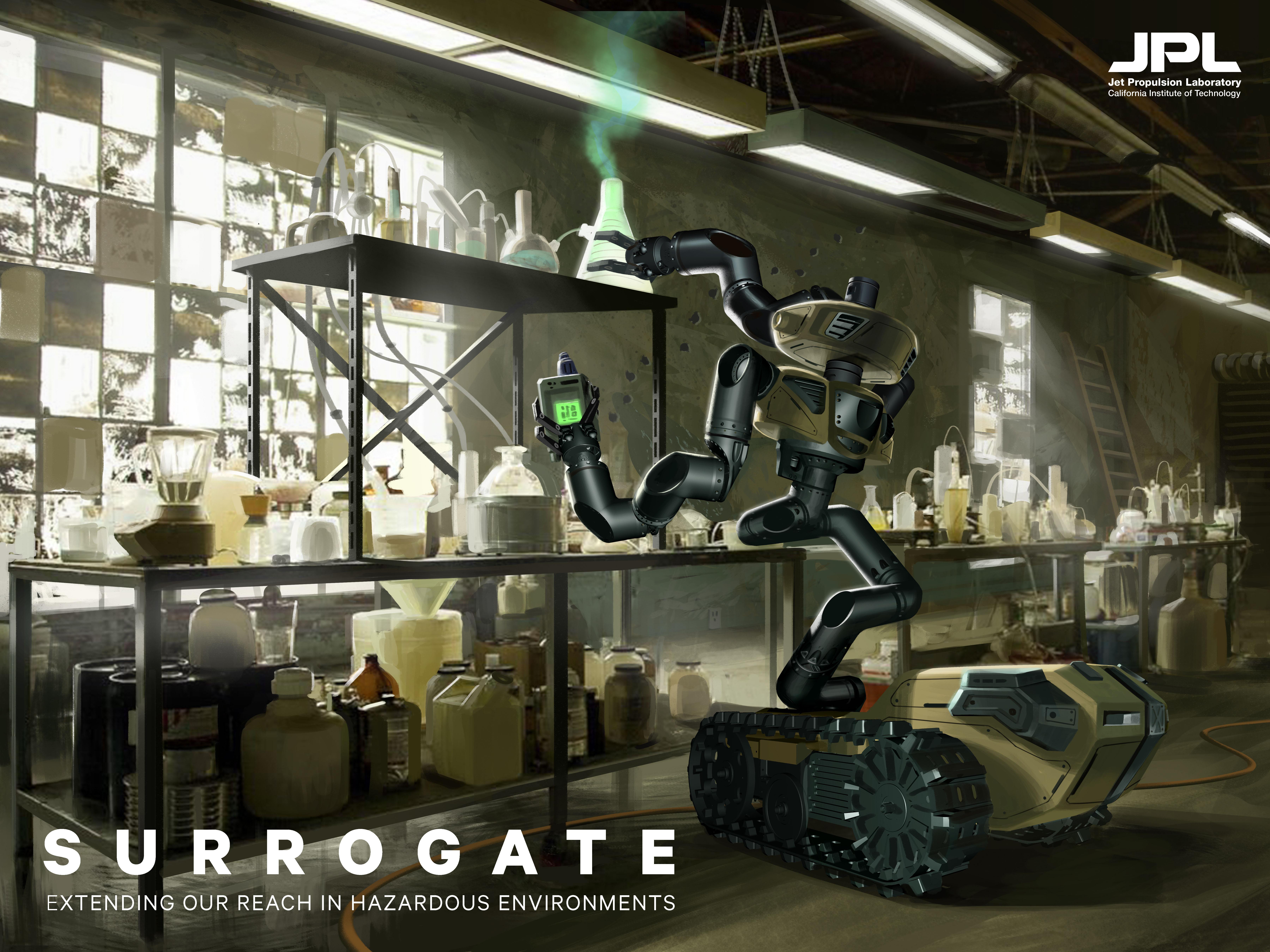
Surrogate Poster (Artist's Concept)
Full Resolution:
TIFF
(116.7 MB)
JPEG
(2.257 MB)
|
|
|
2015-03-11 |
Earth
|
|
RoboSimian
|
5400x7200x3 |
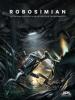
|
-
PIA19313:
-
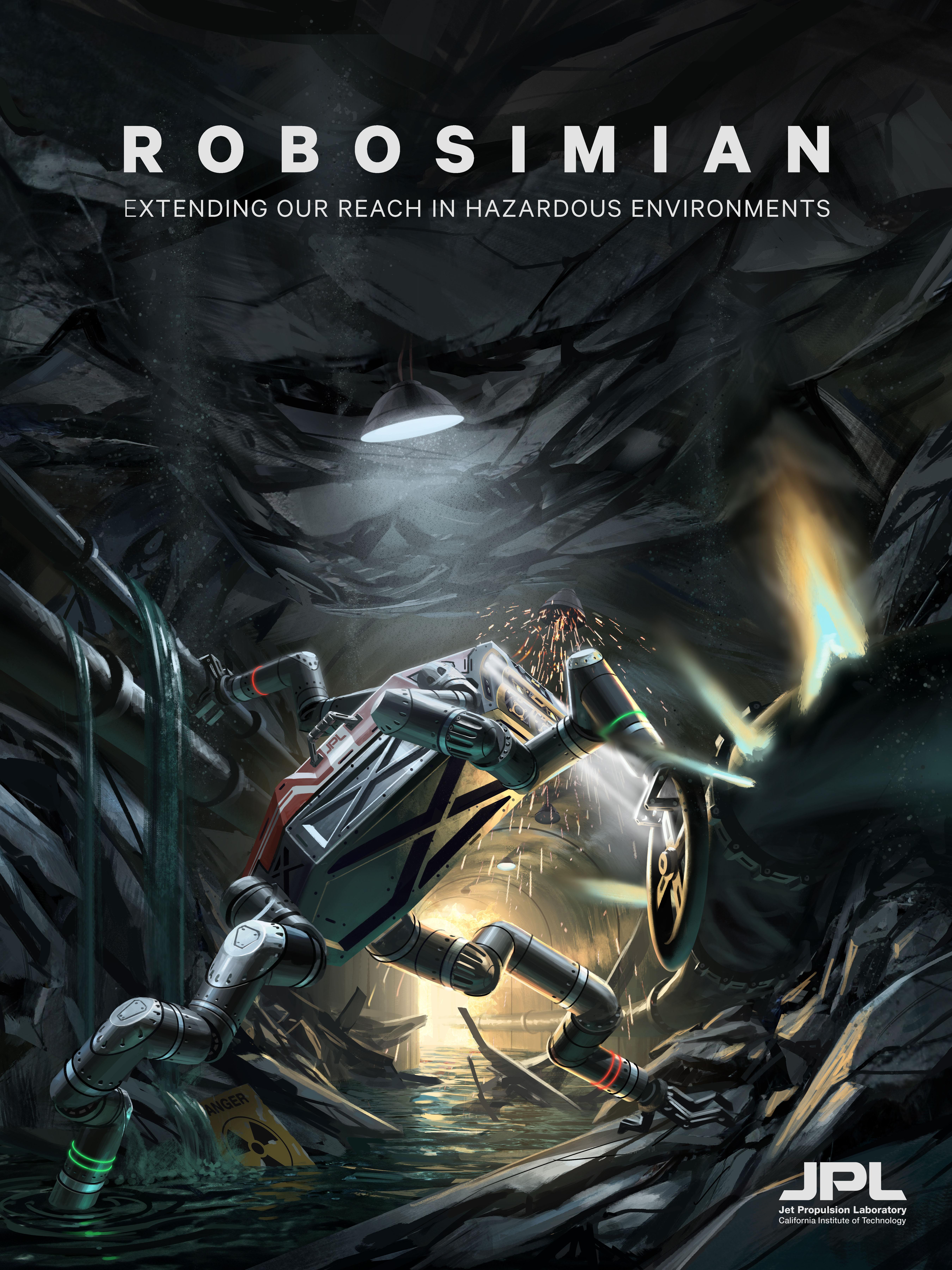
RoboSimian 'Disaster Relief' Poster (Artist's Concept)
Full Resolution:
TIFF
(116.7 MB)
JPEG
(2.643 MB)
|
|
|
2015-01-21 |
Earth
|
SMAP
|
|
3000x2000x3 |
|
-
PIA19137:
-
Sunset at Vandenberg
Full Resolution:
TIFF
(18.01 MB)
JPEG
(416.5 kB)
|
|
|
2015-01-21 |
Earth
|
SMAP
|
|
2000x3000x3 |
|
-
PIA19136:
-
Going Up
Full Resolution:
TIFF
(18.01 MB)
JPEG
(642.8 kB)
|
|
|
2015-01-21 |
Earth
|
SMAP
|
|
2815x1850x3 |

|
-
PIA19135:
-
Satellite in a Can
Full Resolution:
TIFF
(15.63 MB)
JPEG
(447.9 kB)
|
|
|
2015-01-21 |
Earth
|
SMAP
|
|
2002x3000x3 |
|
-
PIA19134:
-
SMAP Gets Ready to Move
Full Resolution:
TIFF
(18.02 MB)
JPEG
(486.2 kB)
|
|
|
2015-01-21 |
Earth
|
SMAP
|
|
8192x8784x3 |
|
-
PIA19133:
-
Soil Moisture Active Passive Satellite
Full Resolution:
TIFF
(215.9 MB)
JPEG
(2.761 MB)
|
|
|
2015-01-20 |
Earth
|
SMAP
|
|
3000x1996x3 |
|
-
PIA19132:
-
NASA's SMAP is Readied for Launch
Full Resolution:
TIFF
(17.97 MB)
JPEG
(637.1 kB)
|
|
|
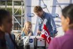
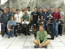
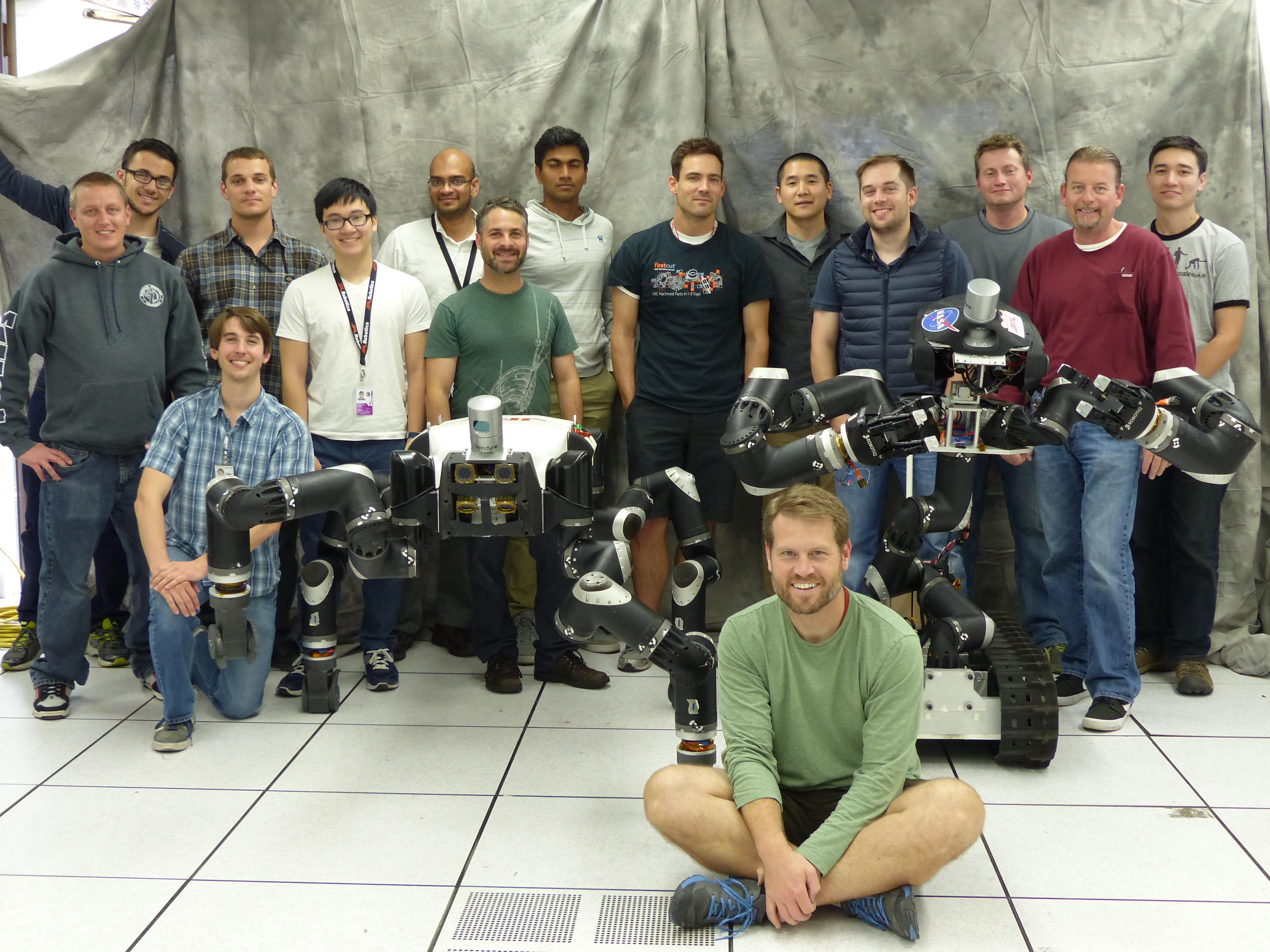
2014-12-09 |
Earth
|
|
RoboSimian
|
4000x3000x3 |
|
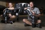
-
PIA18793:
-
The JPL Team Behind RoboSimian and Surrogate
Full Resolution:
TIFF
(36.01 MB)
JPEG
(1.193 MB)
|
|
|
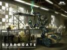
2014-12-09 |
Earth
|
|
RoboSimian
|
4000x3000x3 |
|
-
PIA18792:
-
JPL's Surrogate Robot
Full Resolution:
TIFF
(36.01 MB)
JPEG
(936.9 kB)
|
|
|
2014-12-09 |
Earth
|
|
RoboSimian
|
5202x3465x3 |
|
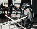
-
PIA18791:
-
RoboSimian Gets Ready for Competition
Full Resolution:
TIFF
(54.1 MB)
JPEG
(1.615 MB)
|
|
|
2014-12-09 |
Earth
|
|
RoboSimian
|
5202x3465x3 |
|
-
PIA18790:
-
JPL's RoboSimian and Surrogate Robots
Full Resolution:
TIFF
(54.1 MB)
JPEG
(2.003 MB)
|
|
|
2014-12-08 |
Earth
|
Mars Science Laboratory (MSL)
|
|
5271x1865x3 |
|
-
PIA19078:
-
Sediment Accumulation in Dry and Wet Periods
Full Resolution:
TIFF
(29.51 MB)
JPEG
(1.212 MB)
|
|
|
2014-08-21 |
Earth
|
|
|
1537x2148x3 |
|
-
PIA18667:
-
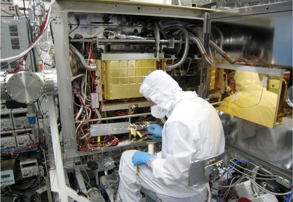
Surrogate Robot
Full Resolution:
TIFF
(9.908 MB)
JPEG
(273.9 kB)
|
|
|
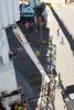
2014-08-08 |
Earth
|
LDSD
|
|
959x540x3 |
|
-
PIA18644:
-
Firing the Saucer

Full Resolution:
TIFF
(520.2 kB)
JPEG
(91.48 kB)
|
|
|
2014-08-08 |
Earth
|
LDSD
|
|
2324x2156x3 |
|
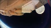
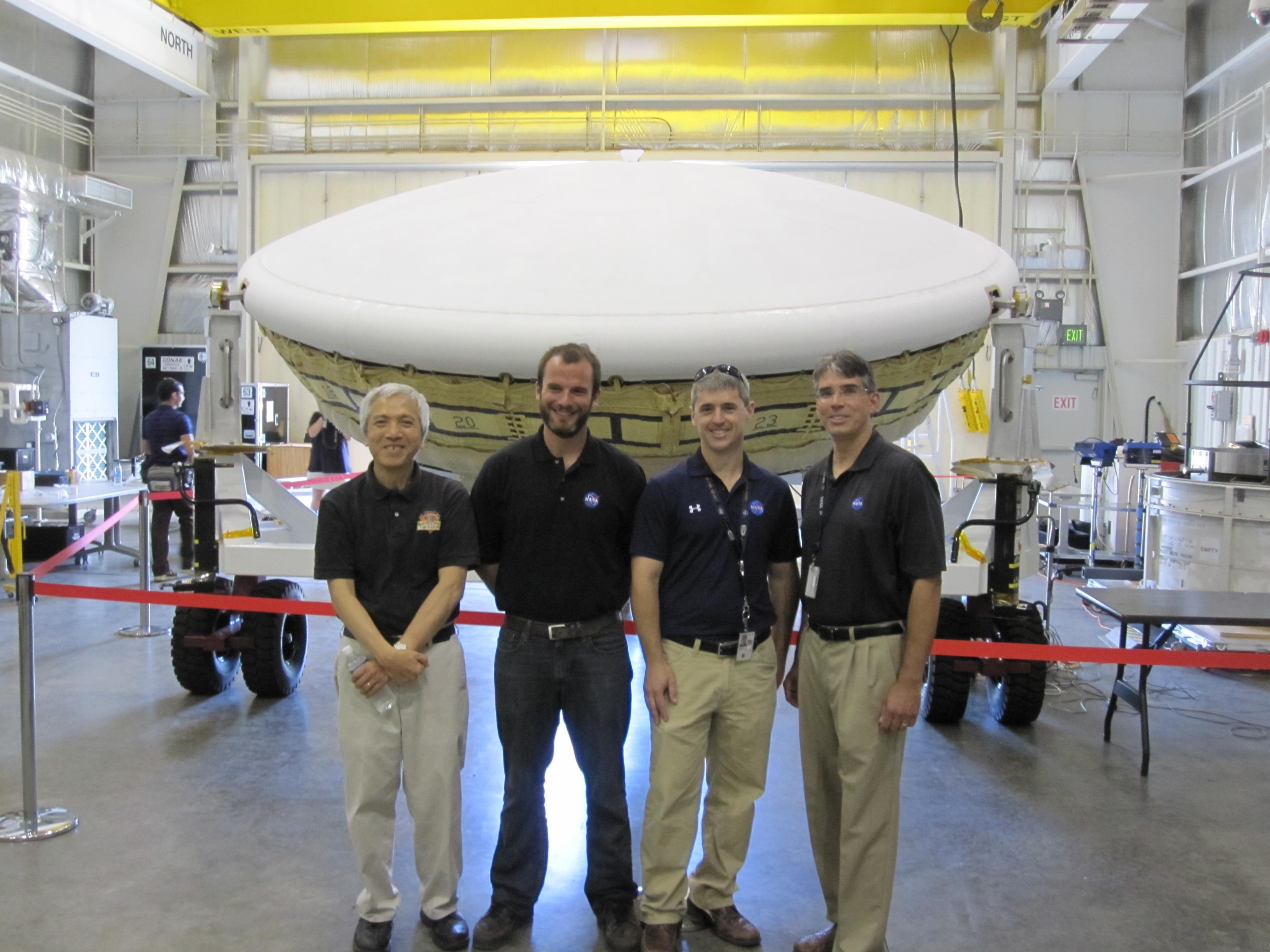
-
PIA18466:
-
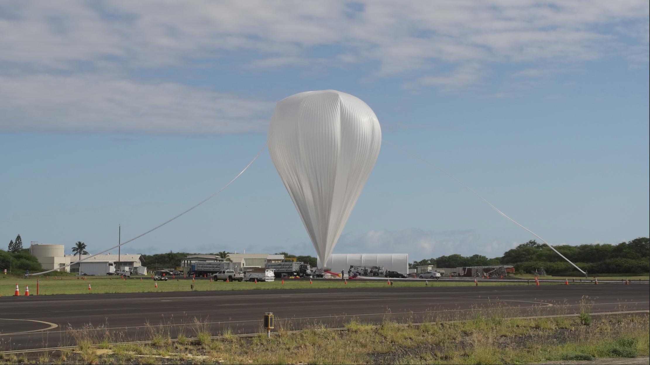
A Balloon's Job Well Done: LDSD in Flight
Full Resolution:
TIFF
(15.04 MB)
JPEG
(355.6 kB)
|
|
|
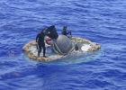
2014-08-08 |
Earth
|
LDSD
|
|
4859x3239x3 |
|
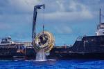
-
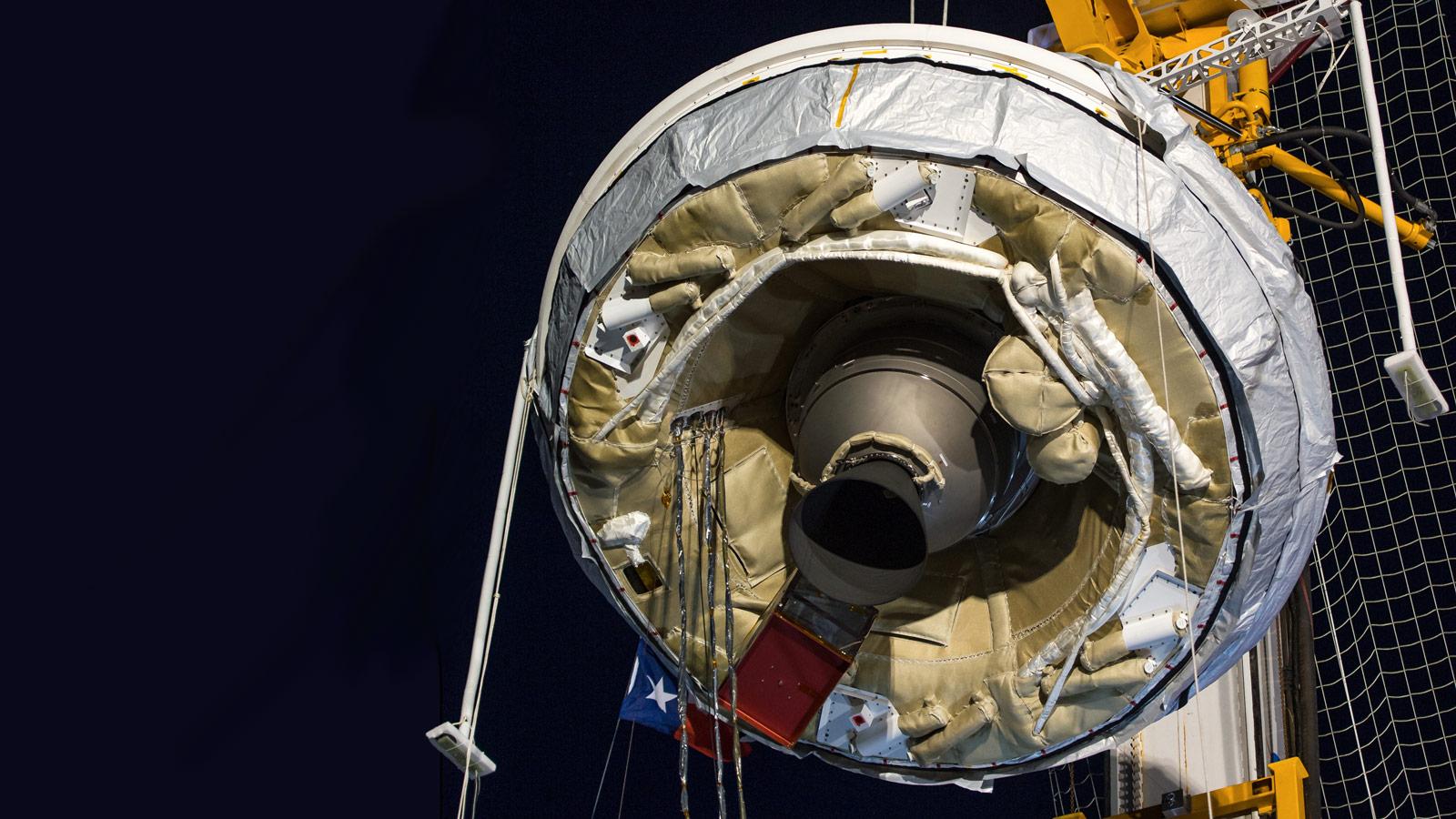
PIA18465:
-
Fishing LDSD out of the Water
Full Resolution:
TIFF
(47.24 MB)
JPEG
(2.073 MB)
|
|
|
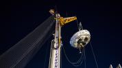
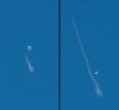
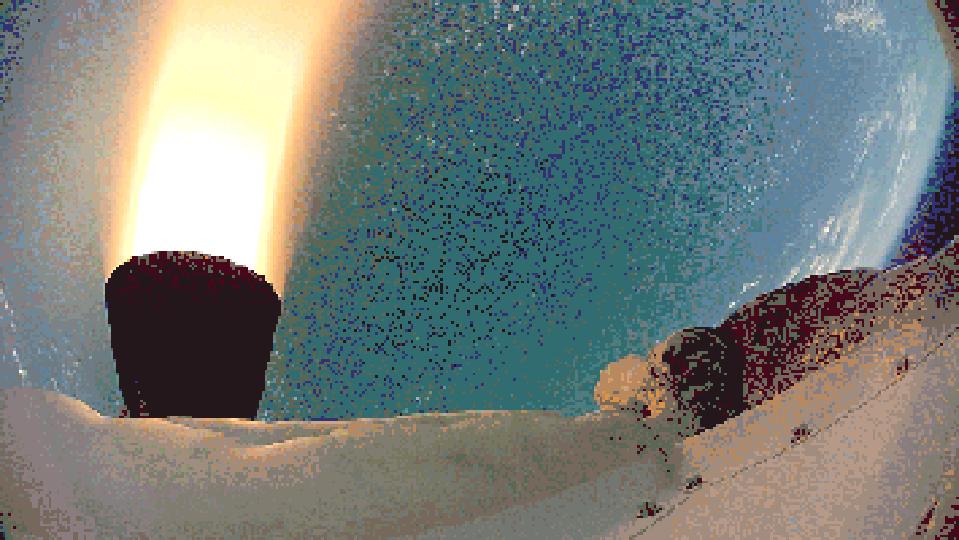
2014-08-08 |
Earth
|
LDSD
|
|
1280x720x3 |
|
-
PIA18464:
-
Departing Saucer Snaps Balloon
Full Resolution:
TIFF
(2.766 MB)
JPEG
(78.75 kB)
|
|
|
2014-08-08 |
Earth
|
LDSD
|
|
732x549x3 |
|
-
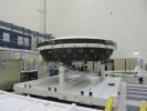
PIA18426:
-
LDSD Flight Test Vehicle 2 in Cleanroom
Full Resolution:
TIFF
(1.206 MB)
JPEG
(47.49 kB)
|
|
|
2014-08-08 |
Earth
|
LDSD
|
|
4850x3223x3 |
|
-
PIA18425:
-
LDSD Chute Beneath the Surface
Full Resolution:
TIFF
(46.92 MB)
JPEG
(2.298 MB)
|
|
|
2014-08-08 |
Earth
|
LDSD
|
|
3010x1698x3 |
|
-
PIA18424:
-
LDSD Chute
Full Resolution:
TIFF
(15.34 MB)
JPEG
(298.7 kB)
|
|
|
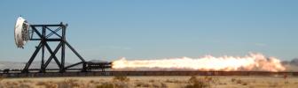
2014-07-28 |
Earth
|
|
|
752x564x3 |

|
-
PIA18570:
-
Laser Printing of Gradient Metals
Full Resolution:
TIFF
(1.273 MB)
JPEG
(44.08 kB)
|
|
|
2014-07-28 |
Earth
|
|
|
3717x3583x3 |
|
-
PIA18569:
-
Mirror Mount
Full Resolution:
TIFF
(39.97 MB)
JPEG
(553.3 kB)
|
|
|
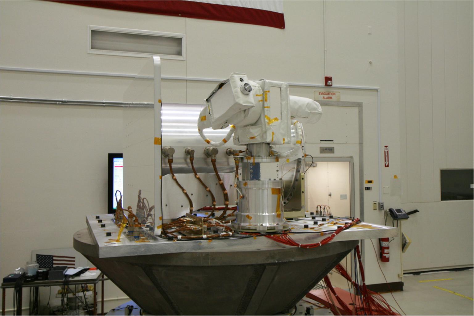
2014-07-24 |
Earth
|
|
|
3888x2592x3 |
|
-
PIA18651:
-
OPALS Thermal Vacuum Testing
Full Resolution:
TIFF
(30.24 MB)
JPEG
(750.2 kB)
|
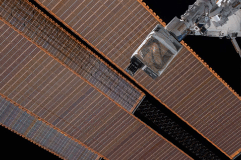
|
|
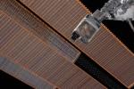
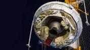
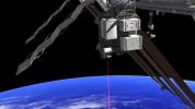
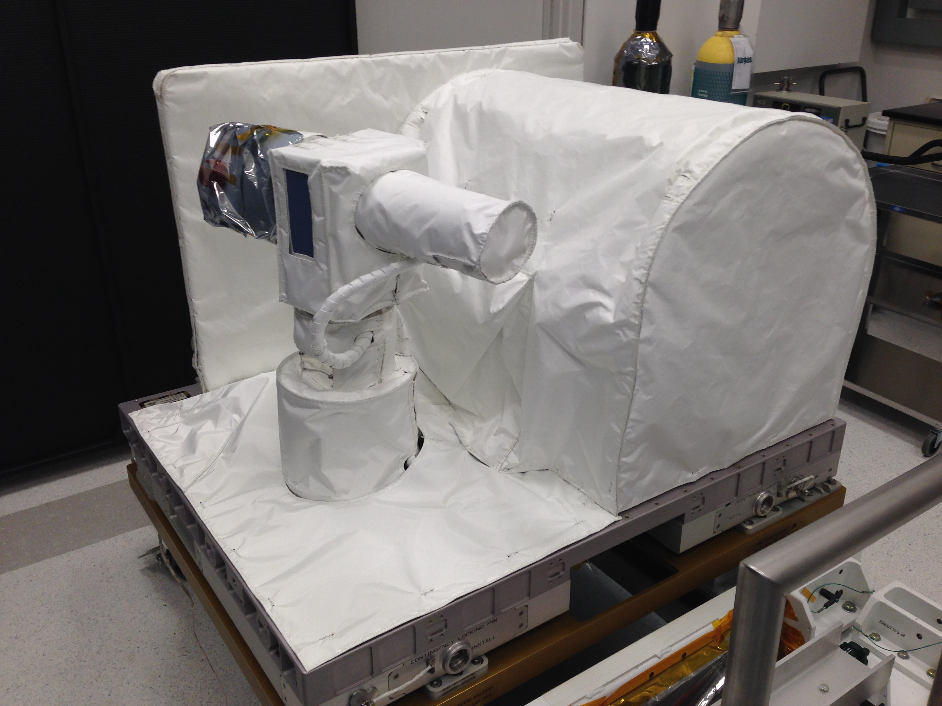
2014-07-24 |
Earth
|
ISS
|
OPALS
|
2501x2831x3 |
|
-
PIA18650:
-
OPALS Preparation
Full Resolution:
TIFF
(21.25 MB)
JPEG
(654.7 kB)
|
|
|
2014-07-24 |
Earth
|
ISS
|
OPALS
|
4288x2848x3 |
|
-
PIA18579:
-
OPALS Final Testing
Full Resolution:
TIFF
(36.66 MB)
JPEG
(969.4 kB)
|
|
|
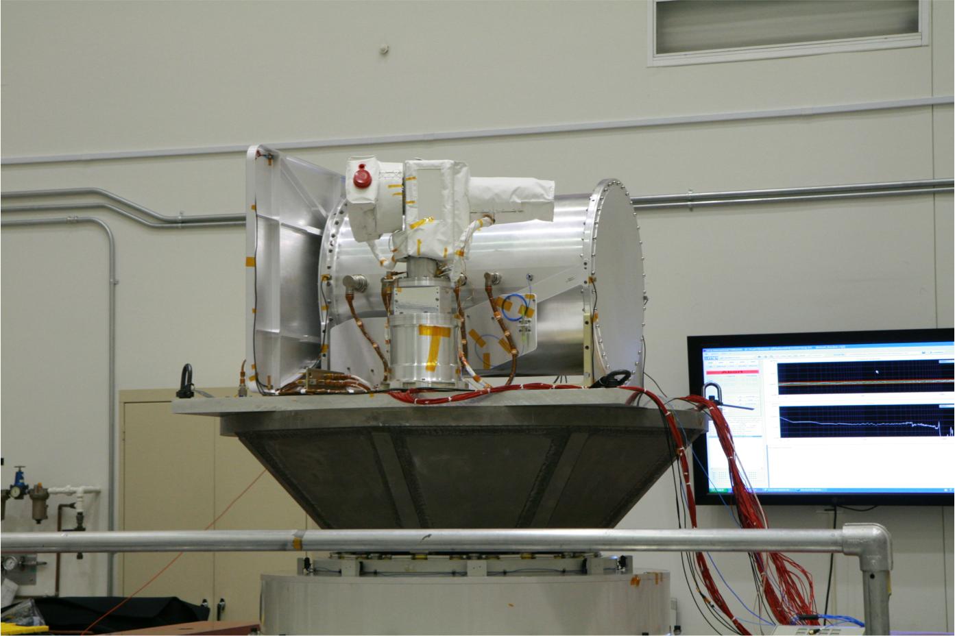
2014-07-24 |
Earth
|
ISS
|
OPALS
|
3264x2448x3 |
|
-
PIA18578:
-
OPALS Thermal Blankets
Full Resolution:
TIFF
(23.98 MB)
JPEG
(531 kB)
|
|
|
2014-07-24 |
Earth
|
ISS
|
OPALS
|
735x489x3 |
|
-
PIA18577:
-
OPALS Main Telescope
Full Resolution:
TIFF
(1.079 MB)
JPEG
(42.53 kB)
|
|
|
2014-07-24 |
Earth
|
ISS
|
OPALS
|
1537x1024x3 |
|
-
PIA18576:
-
OPALS Vibration Testing
Full Resolution:
TIFF
(4.724 MB)
JPEG
(129.8 kB)
|
|
|
2014-07-24 |
Earth
|
ISS
|
OPALS
|
1393x928x3 |
|
-
PIA18575:
-
OPALS Vibration Testing
Full Resolution:
TIFF
(3.88 MB)
JPEG
(111.7 kB)
|
|
|
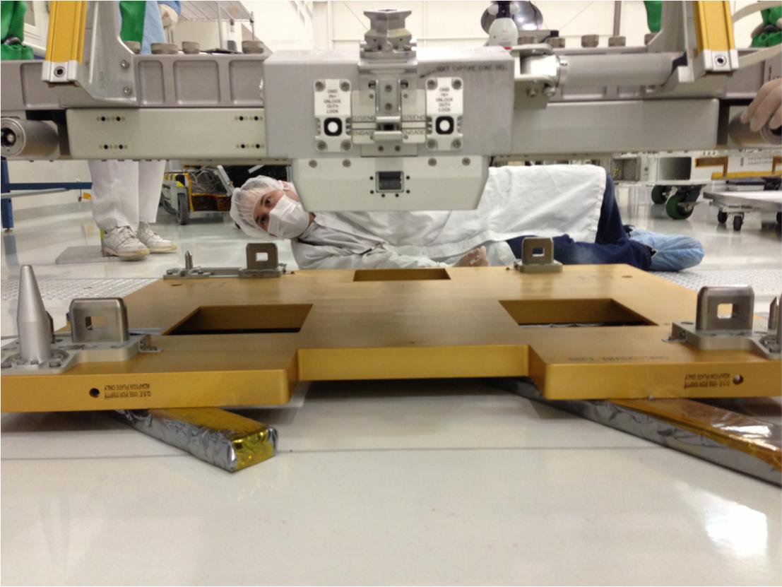
2014-07-24 |
Earth
|
ISS
|
OPALS
|
1107x831x3 |
|
-
PIA18574:
-
OPALS Fit Check
Full Resolution:
TIFF
(2.761 MB)
JPEG
(91.79 kB)
|
|
|
2014-07-24 |
Earth
|
ISS
|
OPALS
|
3264x2448x3 |
|
-
PIA18573:
-
OPALS Final Inspection
Full Resolution:
TIFF
(23.98 MB)
JPEG
(703.6 kB)
|
|
|
2014-07-24 |
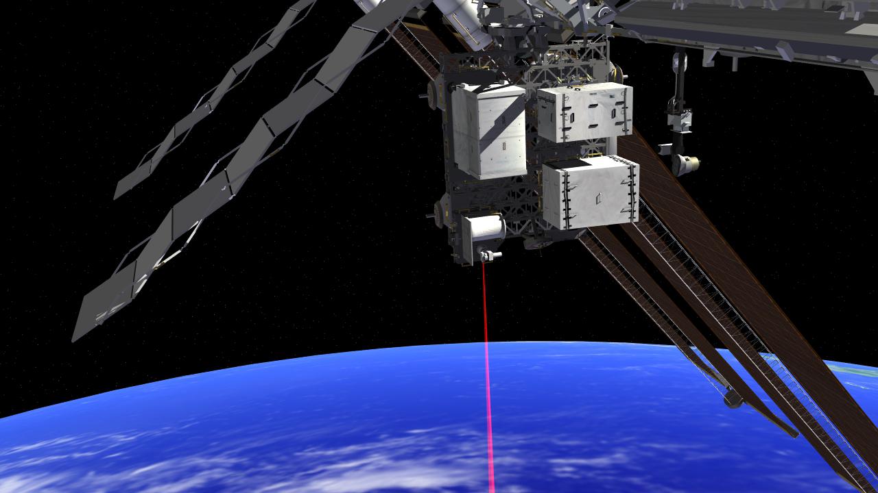
Earth
|
ISS
|
OPALS
|
1280x720x3 |
|
-
PIA18572:
-
OPALS on the ISS (Artist's Concept)
Full Resolution:
TIFF
(2.766 MB)
JPEG
(91.88 kB)
|
|
|
2014-07-24 |
Earth
|
ISS
|
OPALS
|
3168x4752x3 |
|
-
PIA18571:
-
OPALS Installation
Full Resolution:
TIFF
(45.18 MB)
JPEG
(1.115 MB)
|
|
|
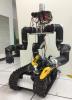
2014-07-16 |
Earth
|
|
RoboSimian
|
1500x1001x3 |

|
-
PIA18568:
-
Carrying RoboSimian
Full Resolution:
TIFF
(4.506 MB)
JPEG
(246 kB)
|
|
|
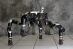
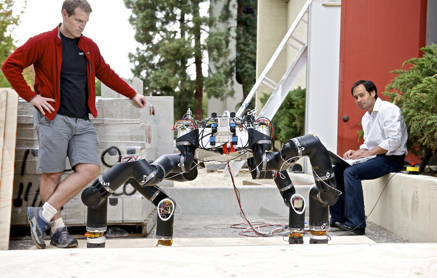
2014-07-16 |
Earth
|
|
RoboSimian
|
1500x956x3 |

|
-
PIA18567:
-
RoboSimian's Inner Workings
Full Resolution:
TIFF
(4.304 MB)
JPEG
(209 kB)
|
|
|
2014-07-16 |
Earth
|
|
RoboSimian
|
2000x1335x3 |
|
-
PIA18566:
-
RoboSimian and Friends
Full Resolution:
TIFF
(8.013 MB)
JPEG
(257.5 kB)
|
|
|
2014-07-16 |
Earth
|
|
RoboSimian
|
1500x1177x3 |
|
-
PIA18565:
-
RoboSimian Competes
Full Resolution:
TIFF
(5.299 MB)
JPEG
(196.5 kB)
|
|
|
2014-07-01 |
Earth
|
LDSD
|
|
5472x3648x3 |
|
-
PIA18522:
-
Mach 4 to Pacific
Full Resolution:
TIFF
(59.91 MB)
JPEG
(2.426 MB)
|
|
|
2014-06-30 |
Earth
|
OCO-2
|
OCO-2
|
2232x1643x3 |
|
-
PIA18458:
-
Key Events in the Launch of NASA's Orbiting Carbon Observatory-2
Full Resolution:
TIFF
(11.01 MB)
JPEG
(244.5 kB)
|
|
|
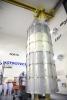
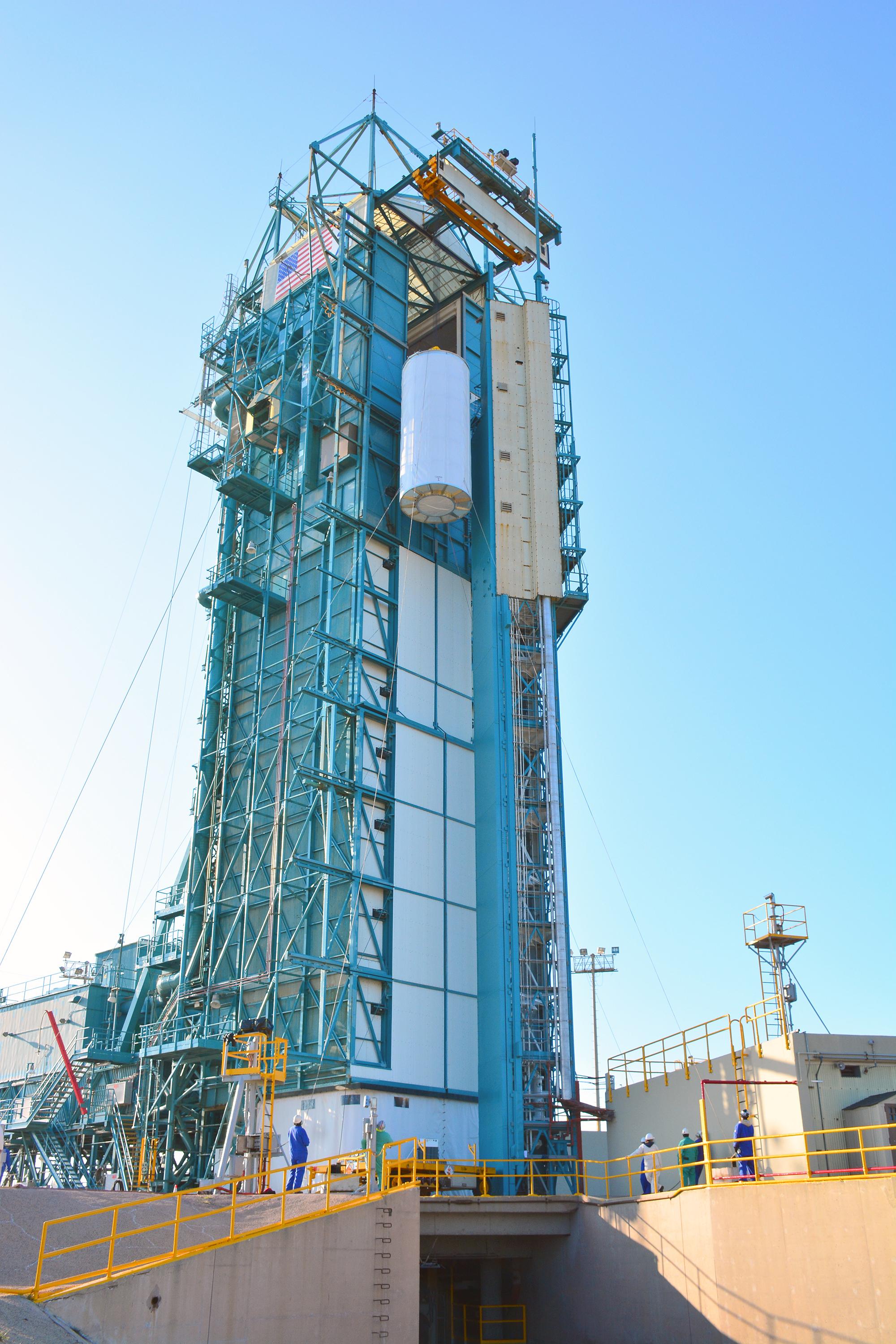
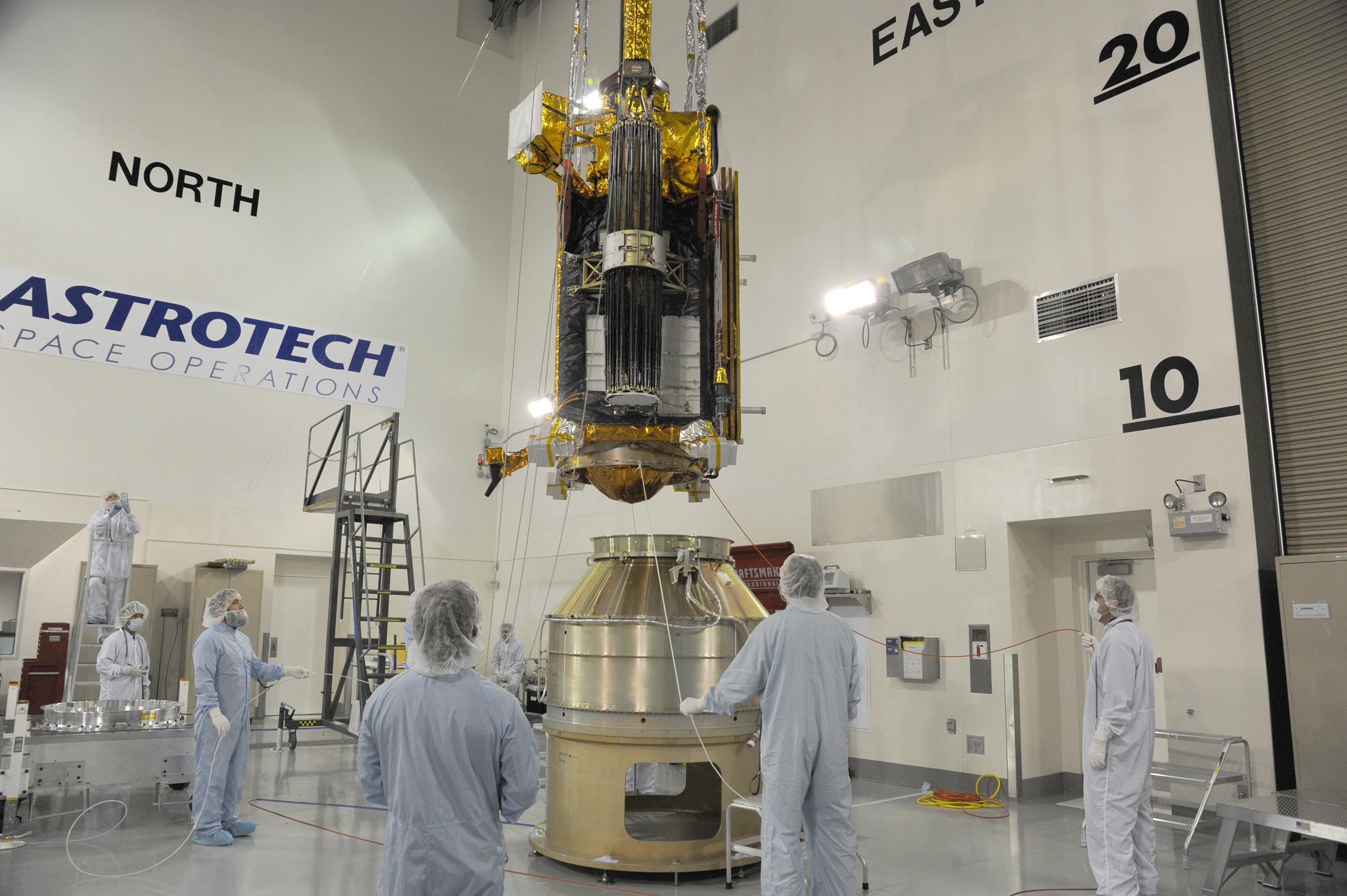
2014-06-30 |
Earth
|
OCO-2
|
OCO-2
|
4928x3280x3 |
|
-
PIA18457:
-
Orbiting Carbon Observatory-2 Ready to Blast Off
Full Resolution:
TIFF
(48.52 MB)
JPEG
(1.025 MB)
|
|
|
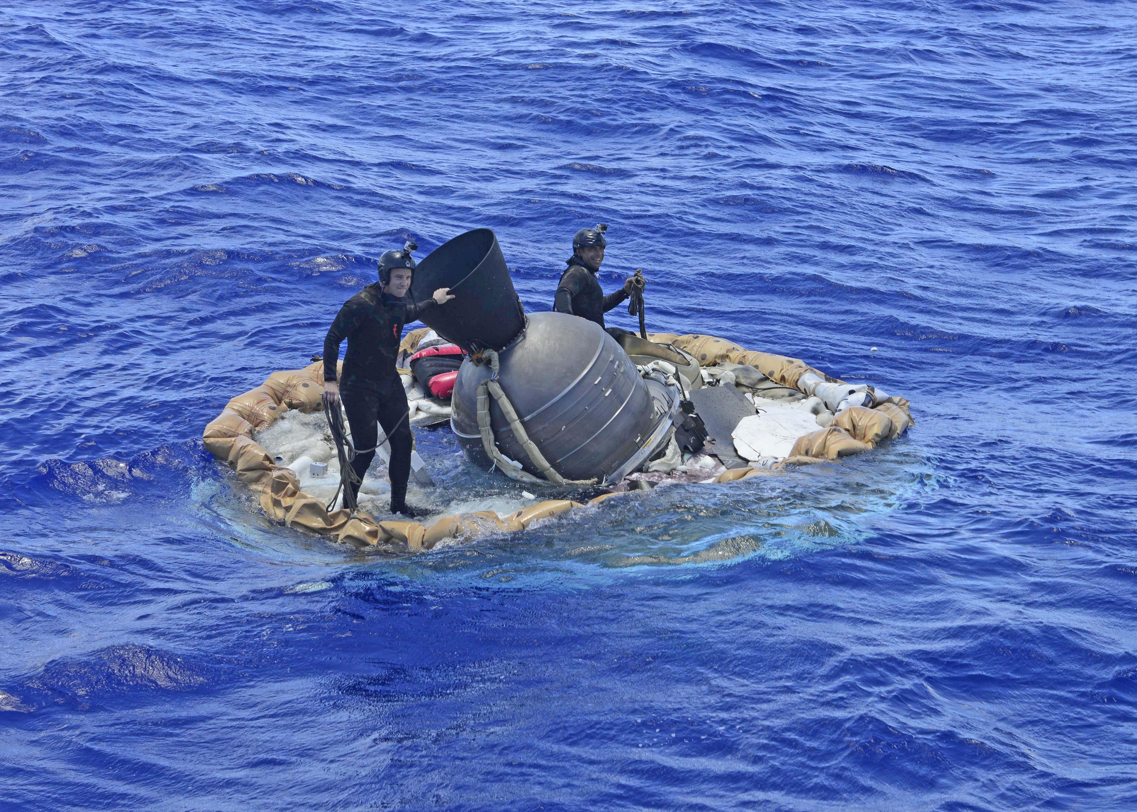
2014-06-29 |
Earth
|
LDSD
|
|
5392x3595x3 |
|
-
PIA18521:
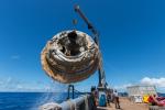
-
Saucer Out of the Drink
Full Resolution:
TIFF
(58.18 MB)
JPEG
(1.783 MB)
|
|
|
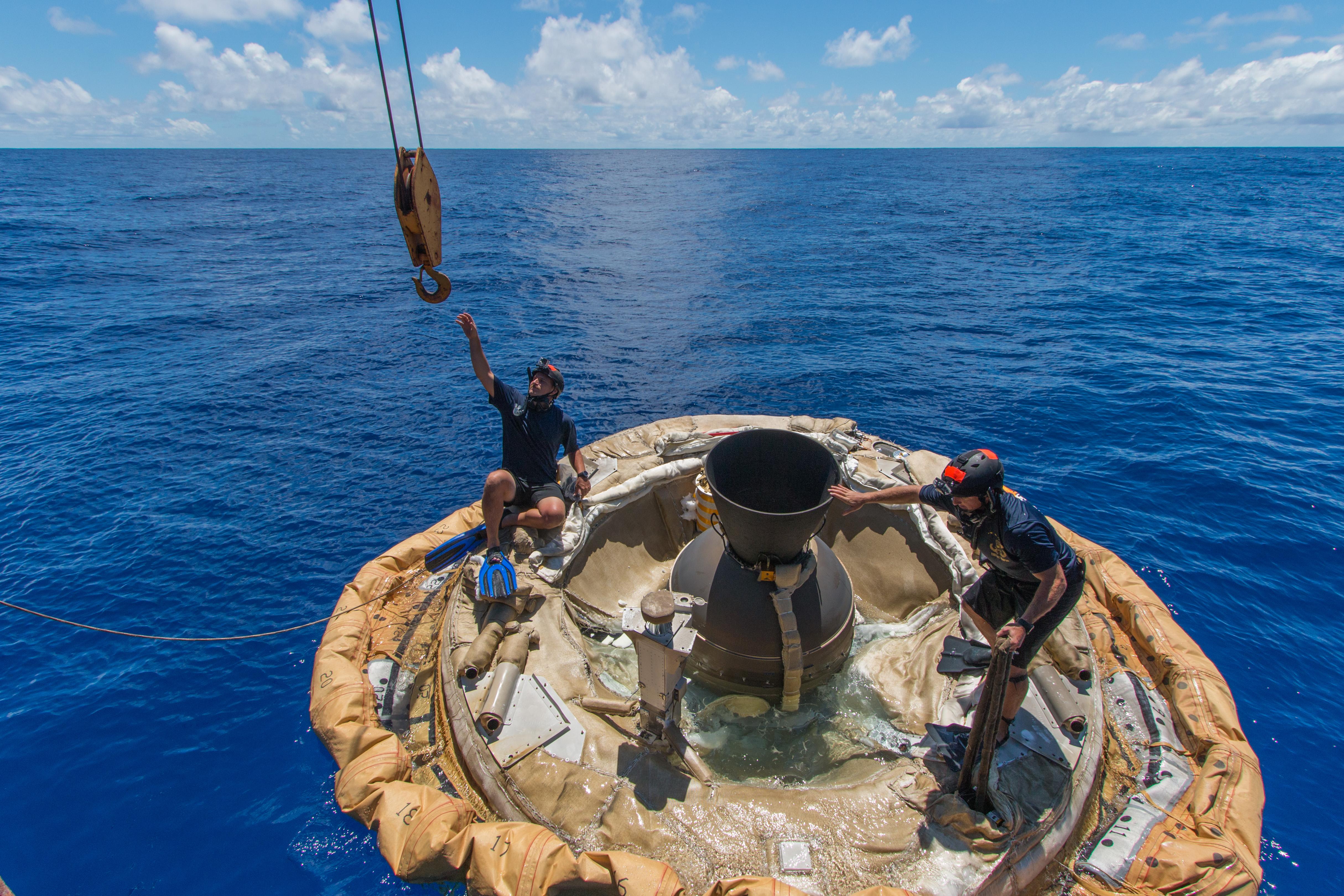
2014-06-29 |
Earth
|
LDSD
|
|
5441x3627x3 |
|
-
PIA18520:
-
Saturday Afternoon Swim
Full Resolution:
TIFF
(59.23 MB)
JPEG
(2.405 MB)
|
|
|
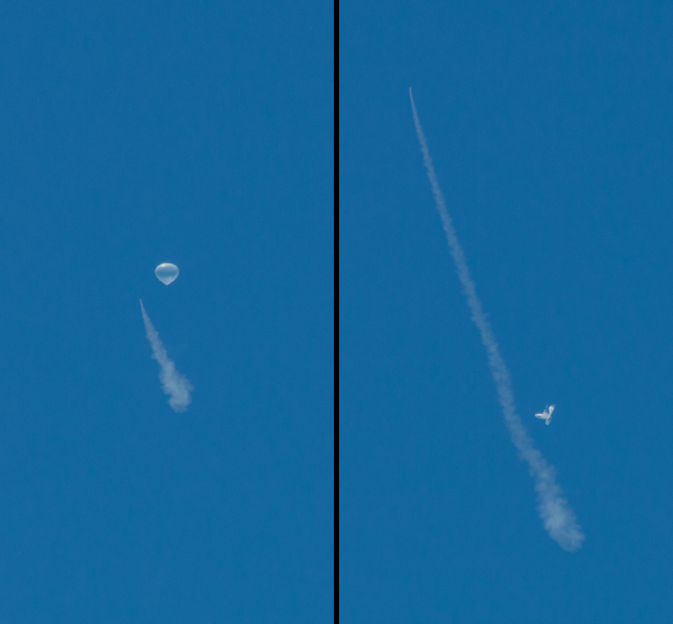
2014-06-29 |
Earth
|
LDSD
|
|
1543x2004x3 |

|
-
PIA18519:
-
First Seconds of LDSD Test
Full Resolution:
TIFF
(9.28 MB)
JPEG
(153.2 kB)
|
|
|
2014-06-29 |
Earth
|
LDSD
|
|
5130x3420x3 |

|
-
PIA18518:
-
LDSD Saucer Aboard
Full Resolution:
TIFF
(52.66 MB)
JPEG
(1.849 MB)
|
|
|
2014-06-29 |
Earth
|
LDSD
|
|
4901x3257x3 |
|
-
PIA18517:
-
Test Vehicle Gets a Lift
Full Resolution:
TIFF
(47.91 MB)
JPEG
(913.9 kB)
|
|
|
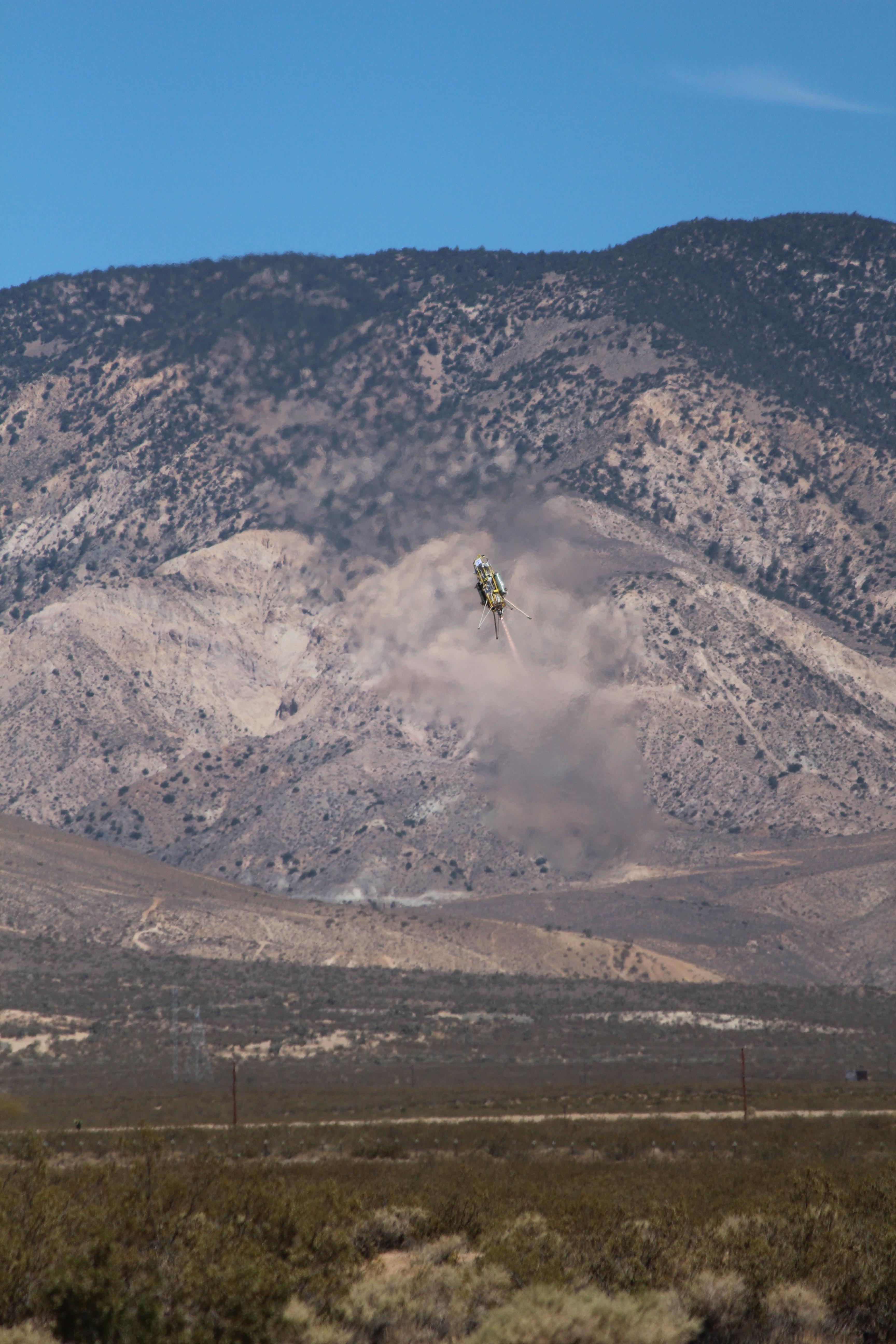
2014-06-06 |
Earth
|
LDSD
|
|
1280x720x3 |
|
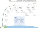
-
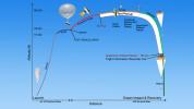
PIA18451:
-
Timeline of Events for Planetary Landing Test
Full Resolution:
TIFF
(2.766 MB)
JPEG
(63.51 kB)
|
|
|
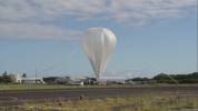
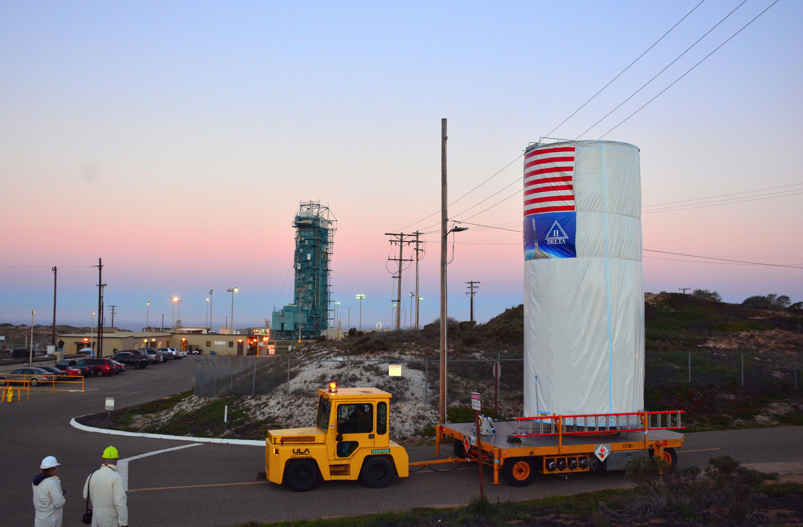
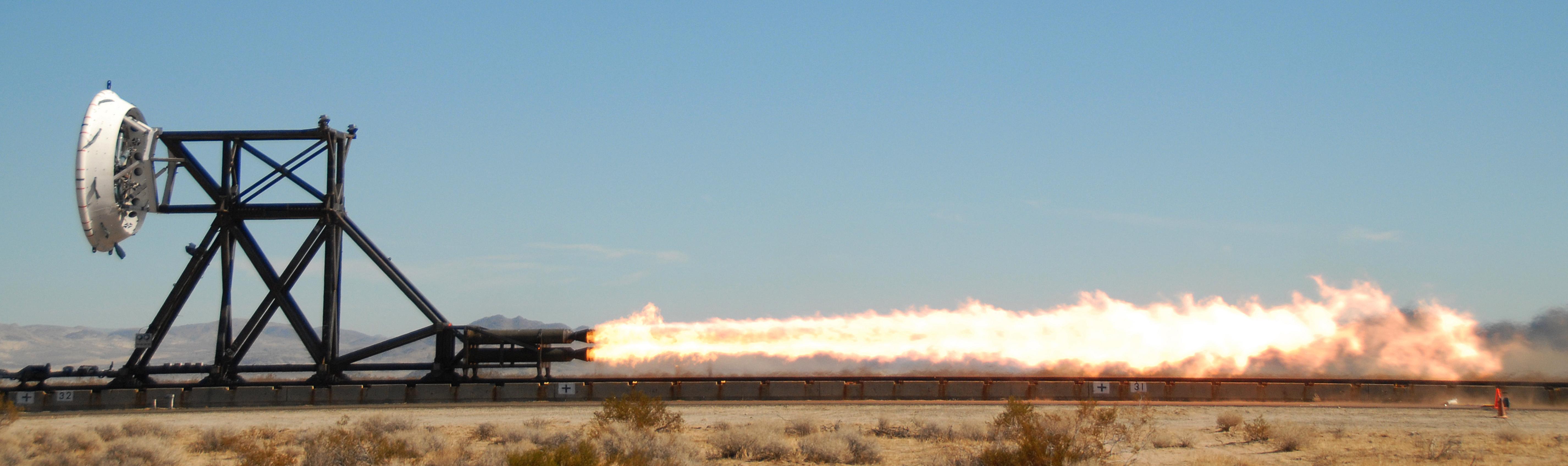
2014-06-04 |
Earth
|
LDSD
|
|
3264x2448x3 |

|
-
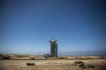
PIA18450:
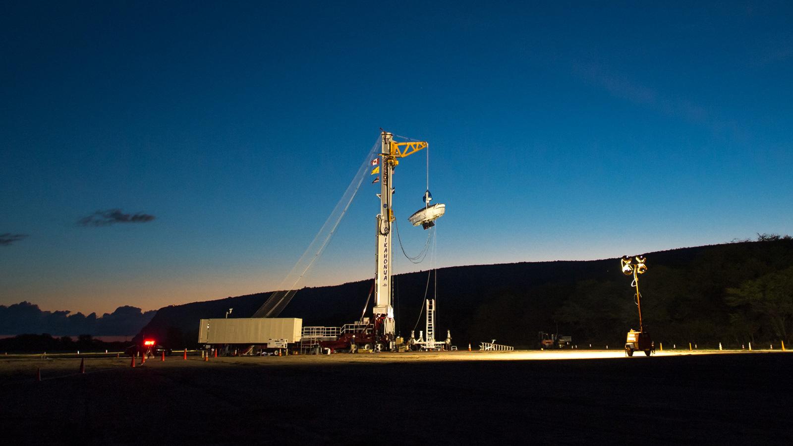
-
Launch Tower for LDSD
Full Resolution:
TIFF
(23.98 MB)
JPEG
(658.3 kB)
|
|
|
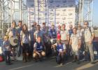
2014-06-04 |
Earth
|
LDSD
|
|
3264x2448x3 |
|
-
PIA18019:
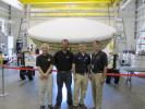
-
LDSD Team in Hawaii
Full Resolution:
TIFF
(23.98 MB)
JPEG
(634.1 kB)
|
|
|
2014-01-22 |
Earth
|
OCO-2
|
OCO-2
|
2560x1440x3 |
|
-
PIA17896:
-
NASA's Orbiting Carbon Observatory (OCO-2) (Artist Concept)
Full Resolution:
TIFF
(11.06 MB)
JPEG
(335.3 kB)
|
|
|
2013-07-08 |
Earth
|
CSIRO Parkes Observatory
|
Parks Telescope
|
3220x2225x3 |

|
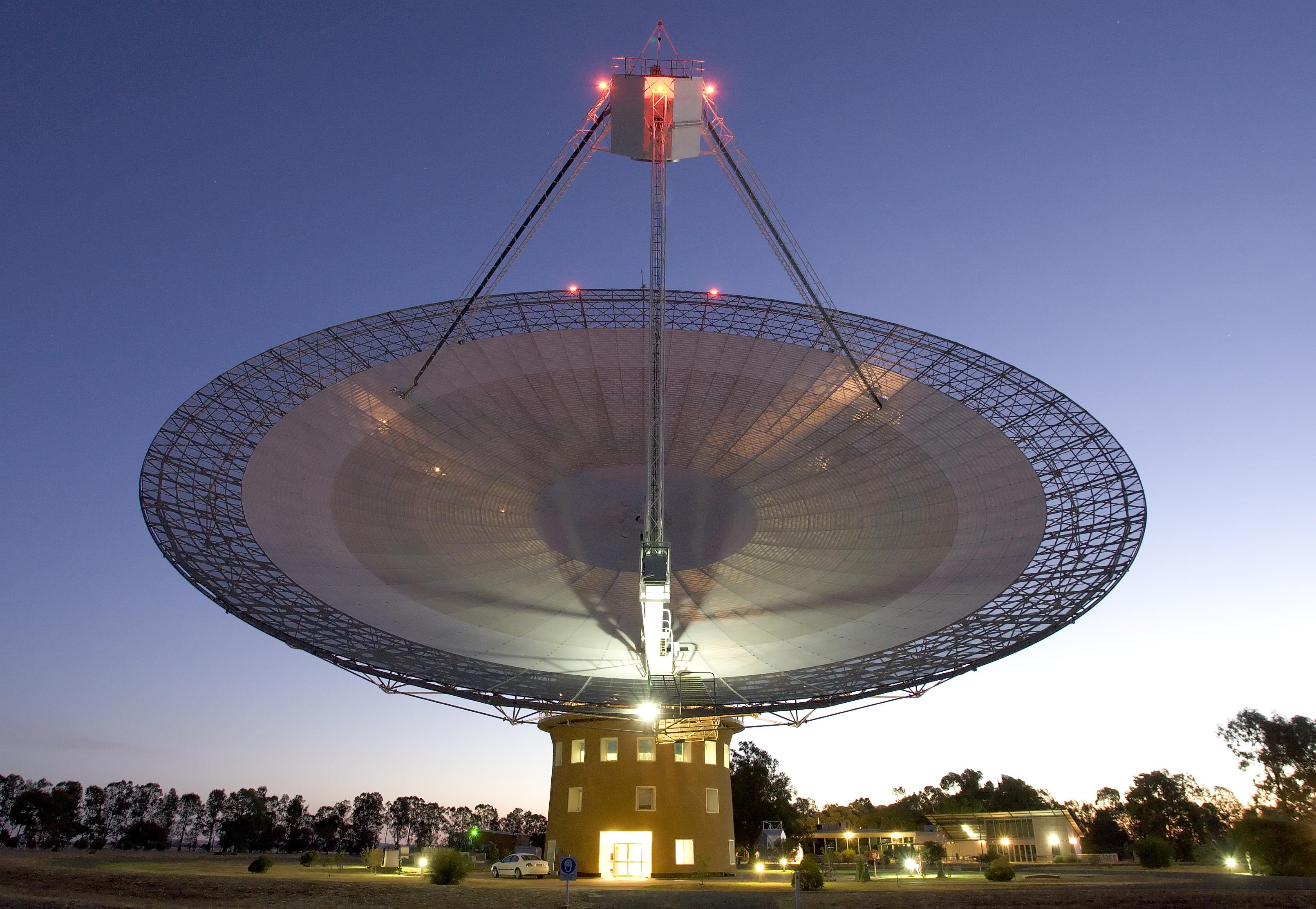
-
PIA17248:
-
Parkes Telescope
Full Resolution:
TIFF
(21.5 MB)
JPEG
(882.5 kB)
|
|
|
2013-06-13 |
Earth
|
GRACE
|
K-Band Ranging System
|
2168x2430x3 |
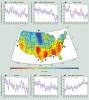
|
-
PIA16840:
-
GRACE Measures Groundwater Changes Across the U.S.
Full Resolution:
TIFF
(15.81 MB)
JPEG
(518.9 kB)
|
|
|
2013-05-23 |
Earth
|
Jason-3
|
|
8192x8192x3 |
|
-
PIA14441:
-
Artist's Concept of U.S.-European Jason-3 Ocean Altimetry Satellite over the Amazon
Full Resolution:
TIFF
(201.4 MB)
JPEG
(3.898 MB)
|
|
|
2013-05-23 |
Earth
|
Jason-3
|
|
8192x8192x3 |
|
-
PIA14440:
-
Artist's Concept of U.S.-European Jason-3 Ocean Altimetry Satellite over France
Full Resolution:
TIFF
(201.4 MB)
JPEG
(4.08 MB)
|
|
|
2013-05-23 |
Earth
|
Jason-3
|
|
8192x8192x3 |
|
-
PIA14439:
-
Artist's Concept of U.S.-European Jason-3 Ocean Altimetry Satellite over California
Full Resolution:
TIFF
(201.4 MB)
JPEG
(4.259 MB)
|
|
|
2013-03-20 |
Mars
|
|
|
726x400x3 |
|
-
PIA16811:
-
Geometry of Mars Solar Conjunction
Full Resolution:
TIFF
(871.7 kB)
JPEG
(12.1 kB)
|
|
|
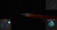
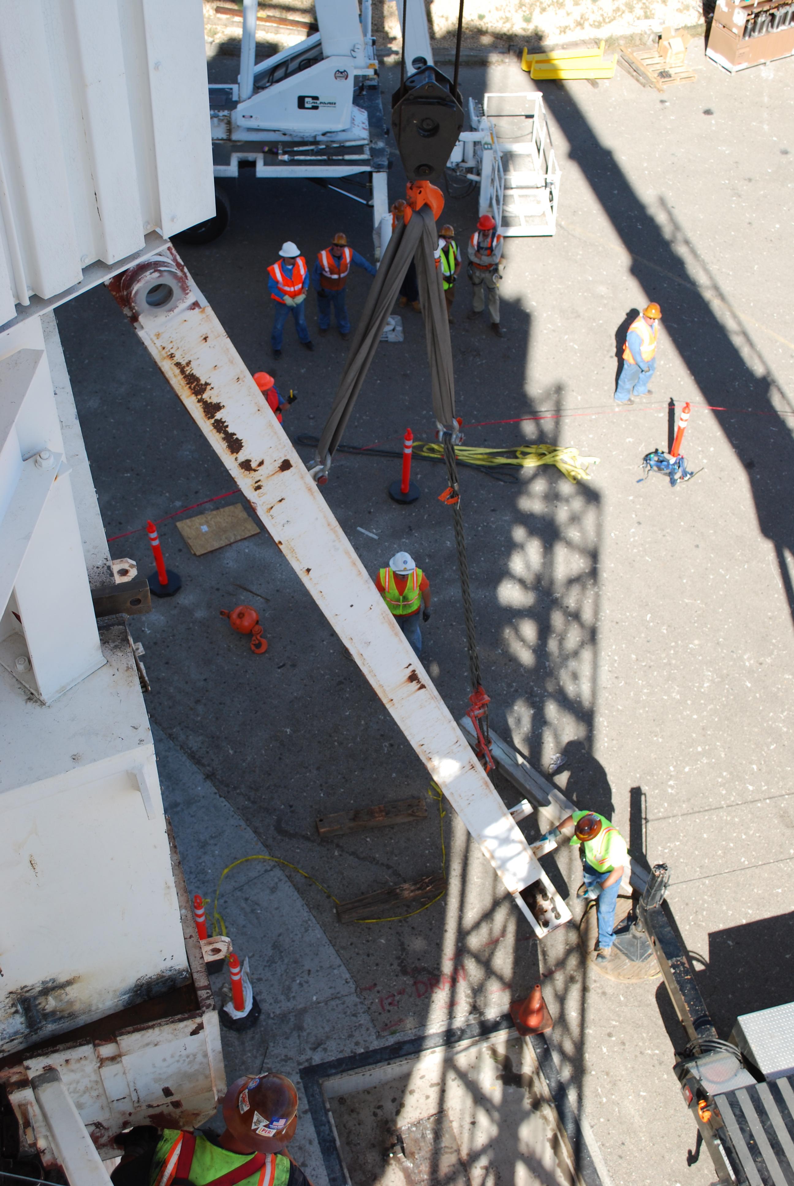
2012-09-13 |
Earth
|
ADAPT
|
|
3456x5184x3 |
|
-
PIA16119:
-
ADAPT Rocket Test
Full Resolution:
TIFF
(53.77 MB)
JPEG
(1.477 MB)
|
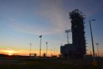
|
|
2012-06-08 |
Earth
|
LDSD
|
|
5704x1697x3 |
|
-
PIA15798:
-
NASA Tests Future Mars Landing Technology
Full Resolution:
TIFF
(29.04 MB)
JPEG
(641 kB)
|
|
|
2011-07-12 |
Earth
|
SMAP
|
|
500x280x3 |
|
-
PIA14392:
-
SMAP Flys over Earth (Artist Concept)
Full Resolution:
TIFF
(420.7 kB)
JPEG
(18.16 kB)
|
|
|
2010-11-16 |
Earth
|
Mars Science Laboratory (MSL)
|
MAHLI
|
1007x1305x3 |
|
-
PIA13585:
-
Test Image of Earth Rocks by Mars Camera (Stereo)
Full Resolution:
TIFF
(3.948 MB)
JPEG
(263.3 kB)
|
|
|
2010-11-16 |
Earth
|
Mars Science Laboratory (MSL)
|
MAHLI
|
1190x1580x3 |
|
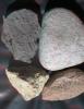
-
PIA13584:
-
Test Close-Up of Earth Cobble by Mars Camera
Full Resolution:
TIFF
(5.647 MB)
JPEG
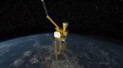
(306.6 kB)
|
|
|
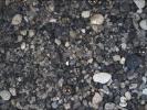
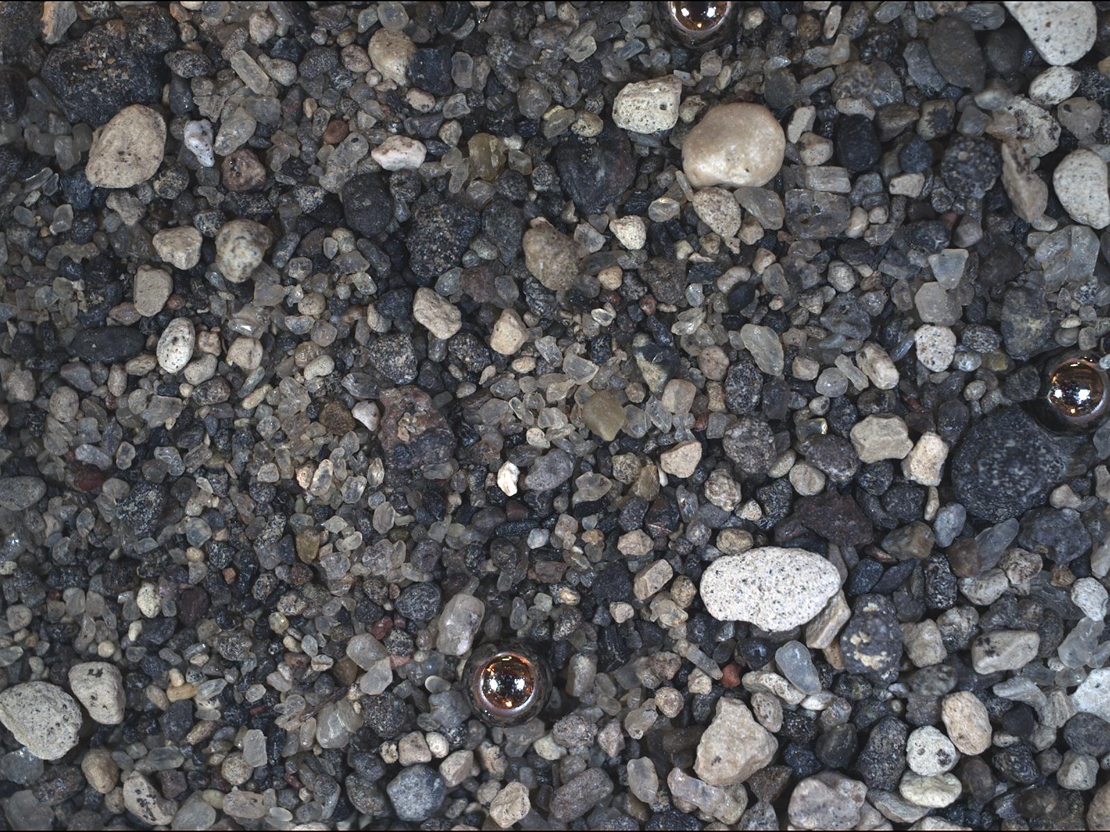
2010-11-16 |
Earth
|
Mars Science Laboratory (MSL)
|
MAHLI
|
1188x1566x3 |
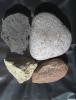
|
-
PIA13583:
-
Test Image of Earth Rocks by Mars Camera
Full Resolution:
TIFF
(5.588 MB)
JPEG
(281.2 kB)
|
|
|
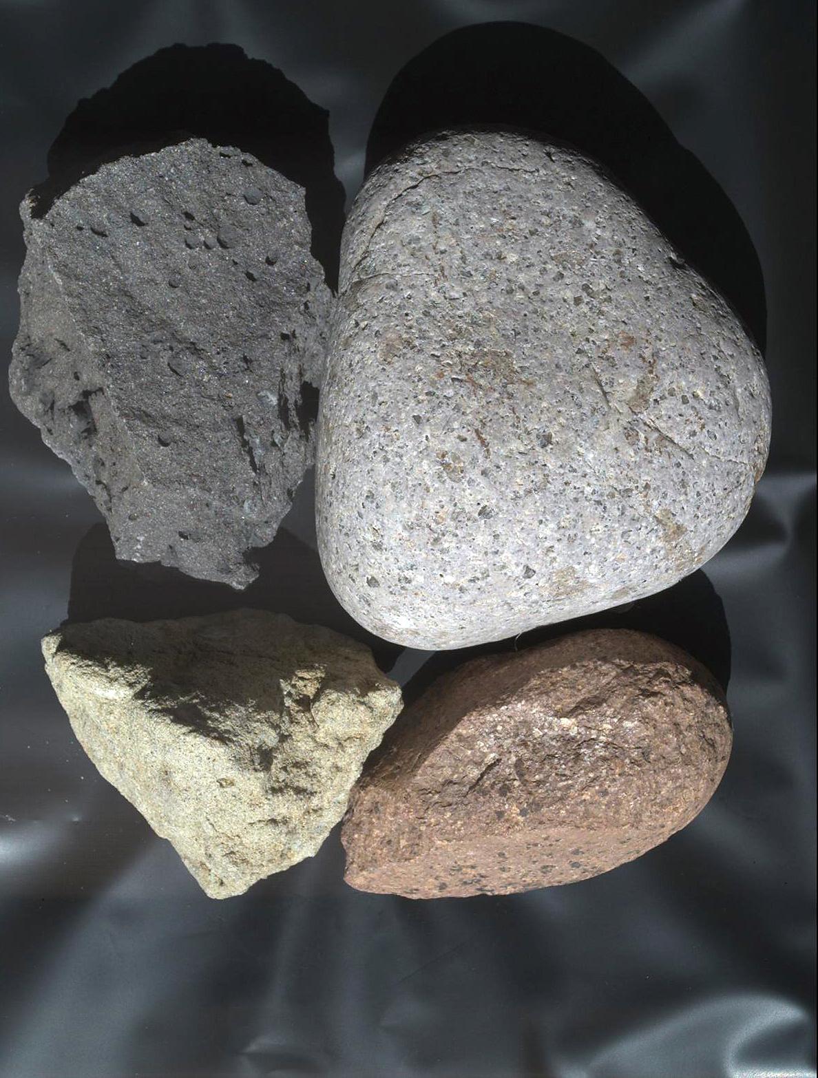
2010-11-16 |
Earth
|
Mars Science Laboratory (MSL)
|
MAHLI
|
1600x1200x3 |
|
-
PIA13582:
-
Test Image of Earth Sand by Mars Camera
Full Resolution:
TIFF
(5.77 MB)
JPEG
(412.8 kB)
|
|
|
2010-11-03 |
Earth
|
Goldstone Deep Space Network (DSN)
|
Deep Space Station 14
|
2592x3872x3 |
|
-
PIA13560:
-
Mars Antenna Gets Legs
Full Resolution:
TIFF
(30.14 MB)
JPEG
(834.8 kB)
|
 Planetary Data System


