Your search criteria found
499
images
Feature Name
Go to PIAxxxxx:
Refine this list of images by:
Target:
Asteroid
Callisto
Cassiopeia A
Ceres
Earth
Enceladus
Europa
Globular cluster M22
Hubble -V
Iapetus
Jupiter
M33
M82 Galaxy
Mars
Mercury
Mimas
Moon
Neptune
Phobos
Pluto
Polydeuces
S Rings
Saturn
Titan
Uranus
Mission:
2001 Mars Odyssey
Aqua
Aquarius
Cassini-Huygens
Dawn
ECOsystem Spaceborne Thermal Radiometer Experiment on Space Station (ECOSTRESS)
ENVISAT
Earth Observing System (EOS)
Europa Clipper
GRACE-FO
Galaxy Evolution Explorer (GALEX)
Galileo
Hubble Space Telescope
InSight
Jason-3
Juno
Lunar Reconnaissance Orbiter (LRO)
MESSENGER
Mars 2020 Project
Mars 2020 Rover
Mars Cube One (MarCO)
Mars Exploration Rover (MER)
Mars Global Surveyor (MGS)
Mars Helicopter
Mars Pathfinder (MPF)
Mars Reconnaissance Orbiter (MRO)
Mars Science Laboratory (MSL)
NISAR
New Horizons
OSTM/Jason-2
Psyche
QuikScat
RadarSat
Shuttle Radar Topography Mission (SRTM)
Spaceborne Imaging Radar-C/X-Band Synthetic Aperture Radar
Surface Water and Ocean Topography (SWOT)
Terra
Two Micron All Sky Survey (2MASS)
Wide-field Infrared Survey Explorer (WISE)
Spacecraft:
2001 Mars Odyssey
Aqua
Aquarius/SAC-D
Cassini Orbiter
Curiosity
Dawn
ER-2
Europa Clipper
GALEX Orbiter
Galileo Orbiter
InSight Mars Lander
Ingenuity
International Space Station (ISS)
Jason-3
Juno
Lunar Reconnaissance Orbiter (LRO)
MESSENGER
MarCO-B
Mars 2020 Rover
Mars Global Surveyor Orbiter
Mars Pathfinder Lander
Mars Reconnaissance Orbiter (MRO)
NISAR
New Horizons
New Horizons Spacecraft
OSTM/Jason-2
Opportunity
Perseverance
Psyche
QuikScat Satellite
RadarSat
SWOT
Space Shuttle
Space Shuttle Endeavour
Spirit
Terra
Instrument:
Airborne Visible/Infrared Imaging Spectrometer
Altimeter
Aquarius
Atmospheric Infrared Sounder (AIRS)
C-Band Interferometric Radar
Cold Operable Lunar Deployable Arm (COLDArm)
Compact Reconnaissance Imaging Spectrometer for Mars (CRISM)
Context Camera (CTX)
Deep Space Network
Europa Imaging System - Narrow Angle
Europa Imaging System - Wide Angle
Framing Camera
GALEX Telescope
Heat and Physical Properties Package (HP3)
High Resolution Imaging Science Experiment (HiRISE)
Imager for Mars Pathfinder
Imaging Science Subsystem - Narrow Angle
Imaging Science Subsystem - Wide Angle
Instrument Context Camera (ICC)
Instrument Deployment Camera (IDC)
KaRIn
L-Band Radar
Long Range Reconnaissance Imager (LORRI)
Lunar Reconnaissance Orbiter Camera (NAC)
Mars Climate Sounder (MCS)
Mars Color Imager (MARCI)
Mars Orbiter Camera (MOC)
Mars Orbiter Laser Altimeter
Mastcam
Mercury Atmospheric and Surface Composition Spectrometer (MASCS)
Mercury Dual Imaging System - Narrow Angle
Mercury Dual Imaging System - Wide Angle
Microscopic Imager
Moderate Resolution Imaging Spectroradiometer (MODIS)
Moderate Resolution Imaging Spectroradiometer (MODIS) Terra
Moessbauer Spectrometer
Multi-angle Imaging SpectroRadiometer (MISR)
Multispectral Visible Imaging Camera (MVIC)
Navigation Camera
Near Infrared Mapping Spectrometer
Panoramic Camera
Radar Mapper
Radar System
SeaWinds Scatterometer
Seismic Experiment for Interior Structure (SEIS)
Solid-State Imaging
Thermal Emission Imaging System
Two Micron All Sky Survey (2MASS)
Wide Field Planetary Camera 2
X-Band Radar
Click on an image for detailed information
Click on a column heading to sort in ascending or descending order
My
List
Addition Date
Target
Mission
Instrument
Size
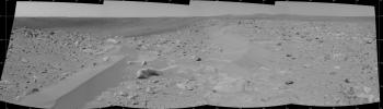
2004-03-15
Mars
Mars Exploration Rover (MER)
Panoramic Camera
13062x3538x3
PIA05570:
"Bonneville in Color"
Full Resolution:
TIFF
(97.61 MB)
JPEG
(3.907 MB)
2004-03-16
Mars
Mars Exploration Rover (MER)
Navigation Camera
3404x973x1
PIA05573:
Drifts of Dust or Something Else?
Full Resolution:
TIFF
(2.53 MB)
JPEG
(341.9 kB)
2004-05-10
Mars
Mars Exploration Rover (MER)
Panoramic Camera
2922x964x1
PIA05875:
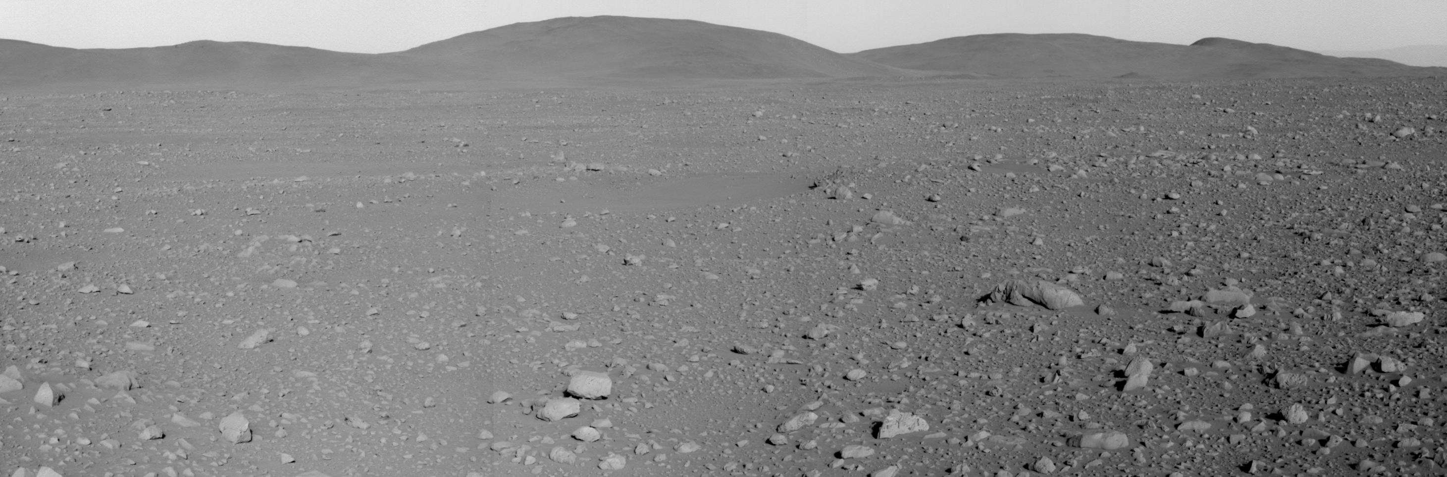
A Closer Look at the 'Columbia Hills'
Full Resolution:
TIFF
(2.556 MB)
JPEG
(348.7 kB)
2004-06-25
Mars
Mars Exploration Rover (MER)
Microscopic Imager
1024x1024x1
PIA06312:
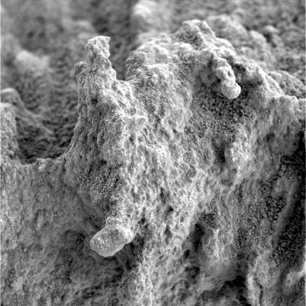
A 'Pot of Gold' Rich with Nuggets
Full Resolution:
TIFF
(1.05 MB)
JPEG
(202.6 kB)
2004-06-25
Mars
Mars Exploration Rover (MER)
Microscopic Imager
1024x1024x1
PIA06313:
A 'Pot of Gold' Rich with Nuggets (Sol 163)
Full Resolution:
TIFF
(1.05 MB)
JPEG
(136.2 kB)
2004-06-25
Mars
Mars Exploration Rover (MER)
Moessbauer Spectrometer
2076x1603x3
PIA06314:
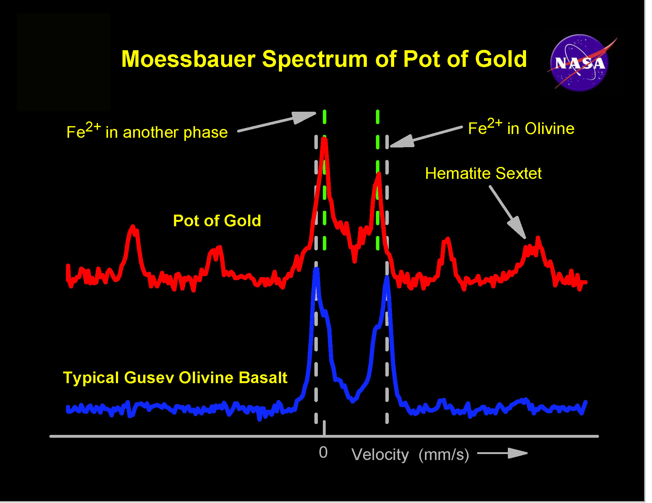
Spirit, Too, Finds Hematite
Full Resolution:
TIFF
(9.991 MB)
JPEG
(363.1 kB)
2004-06-25
Mars
Mars Exploration Rover (MER)
Microscopic Imager
1024x1024x1
PIA06320:
A 'Pot of Gold' Rich with Nuggets (Sol 163-2)
Full Resolution:
TIFF
(1.05 MB)
JPEG
(146.1 kB)
2000-09-07
Mars
Mars Global Surveyor (MGS)
MOLA
524x462x1
PIA02803:
Major Martian Volcanoes from MOLA - Alba Patera
Full Resolution:
TIFF
(239.9 kB)
JPEG
(52.87 kB)
2000-10-16
Mars
Mars Global Surveyor (MGS)
Mars Orbiter Camera (MOC)
672x2603x1
PIA02813:
Groovy Terrain in Mangala Valles
Full Resolution:
TIFF
(1.84 MB)
JPEG
(368 kB)
2003-10-22
Mars
Mars Global Surveyor (MGS)
Mars Orbiter Camera (MOC)
836x1254x1
PIA04807:
Impact Crater
Full Resolution:
TIFF
(1.05 MB)
JPEG
(169.8 kB)
2005-09-20
Mars
Mars Global Surveyor (MGS)
Mars Orbiter Camera (MOC)
10413x9194x1
PIA04296:
Scarp at Head of Chasma Boreale
Full Resolution:
TIFF
(95.74 MB)
JPEG
(5.089 MB)
2005-10-17
Mars
Mars Global Surveyor (MGS)
Mars Orbiter Camera (MOC)
604x604x1
PIA03044:
Mars Polar Lander NOT Found
Full Resolution:
TIFF
(365.4 kB)
JPEG
(40.91 kB)
2006-01-15
Mars
Mars Global Surveyor (MGS)
Mars Orbiter Camera (MOC)
672x1096x1
PIA03673:
South Polar Terrain
Full Resolution:
TIFF
(737.5 kB)
JPEG
(191.3 kB)
2022-04-27
Mars
Mars Helicopter
2322x2165x3
PIA25217:
Rover Landing Gear Seen From the Air by Mars Helicopter
Full Resolution:
TIFF
(15.09 MB)
JPEG
(837.6 kB)
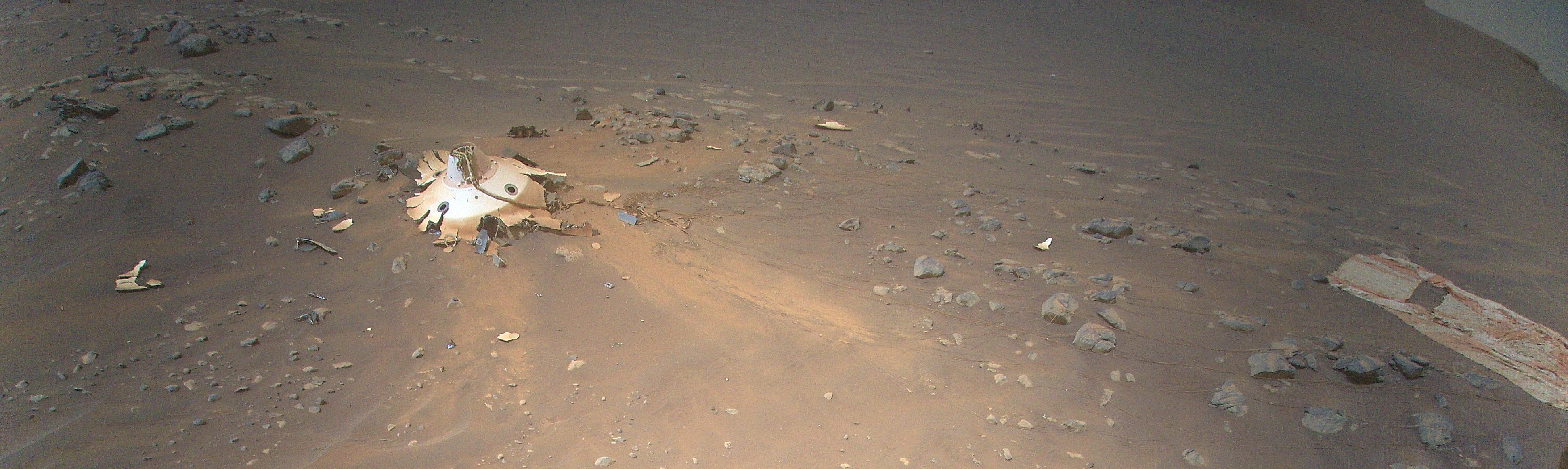
2022-04-27
Mars
Mars Helicopter
3884x1161x3
PIA25218:
Debris Field for Perseverance Landing Gear Seen from Mars Helicopter
Full Resolution:
TIFF
(13.31 MB)
JPEG
(709.4 kB)
2022-04-27
Mars
Mars Helicopter
3099x2263x3
PIA25219:
Rover's Backshell Seen From the Air
Full Resolution:
TIFF
(20.68 MB)
JPEG
(1.009 MB)
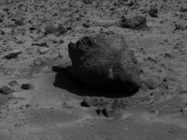
1997-07-07
Mars
Mars Pathfinder (MPF)
Imager for Mars Pathfinder
640x480x1
PIA00639:
"Yogi" the Rock
Full Resolution:
TIFF
(254.7 kB)
JPEG
(41 kB)
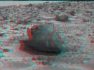
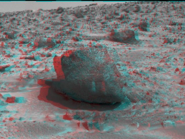
1997-07-13
Mars
Mars Pathfinder (MPF)
Imager for Mars Pathfinder
640x480x3
PIA00688:
'Yogi' the Rock - 3-D
Full Resolution:
TIFF
(812.5 kB)
JPEG
(52.49 kB)
2010-02-17
Mars
Mars Reconnaissance Orbiter (MRO)
HiRISE
1676x1519x1
PIA12840:
Terrain Model of Mars' Mojave Crater
Full Resolution:
TIFF
(2.549 MB)
JPEG
(380.7 kB)
2007-01-24
Mars
Mars Reconnaissance Orbiter (MRO)
HiRISE
2048x6486x1
PIA09571:
Mojave Crater Floor and Central Uplift
Full Resolution:
TIFF
(13.3 MB)
JPEG
(1.059 MB)
2007-02-21
Mars
Mars Reconnaissance Orbiter (MRO)
HiRISE
2048x4091x1
PIA09605:
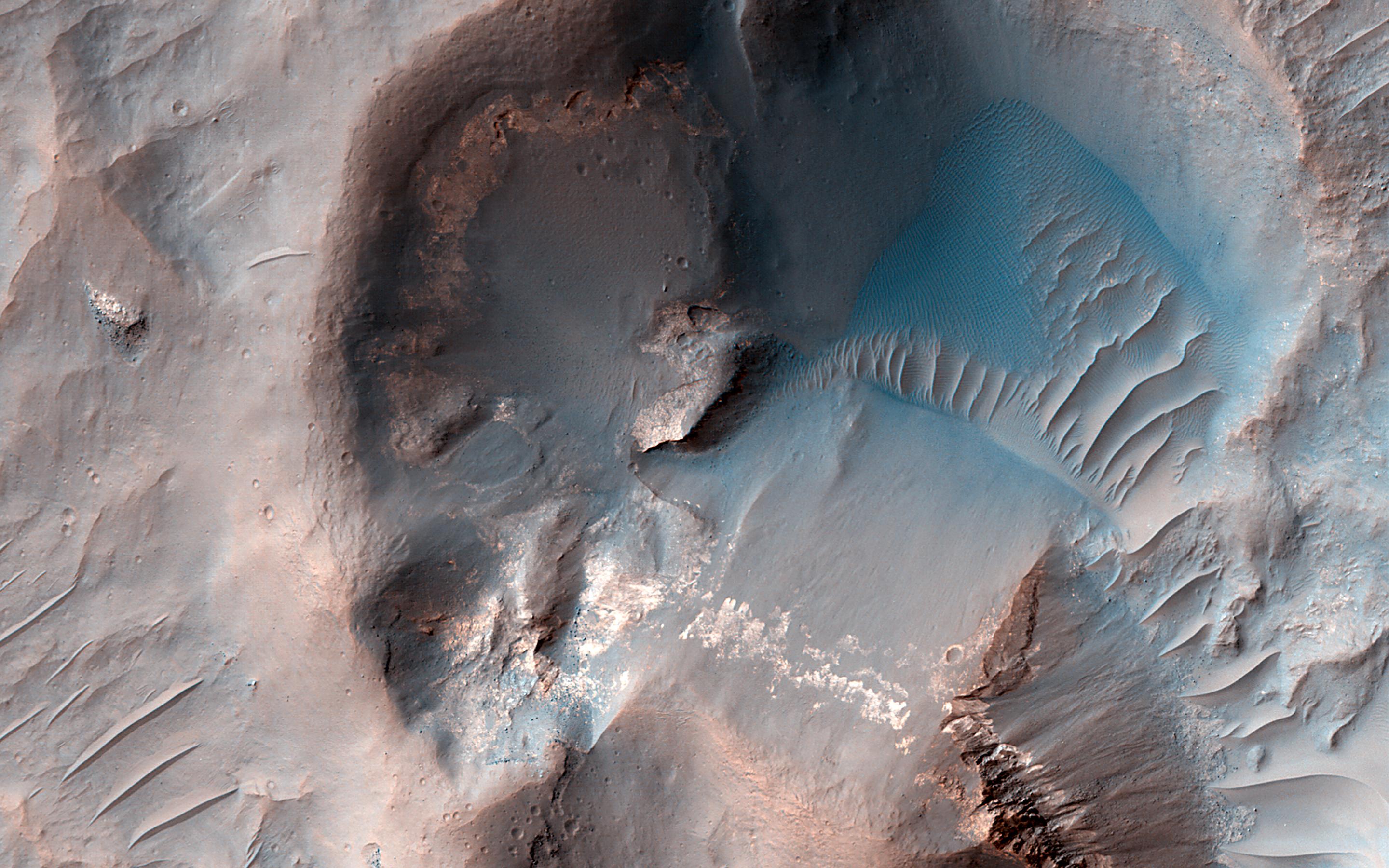
Floor of Ius Chasma
Full Resolution:
TIFF
(8.387 MB)
JPEG
(955 kB)
2007-03-21
Mars
Mars Reconnaissance Orbiter (MRO)
HiRISE
2048x7518x1
PIA09631:
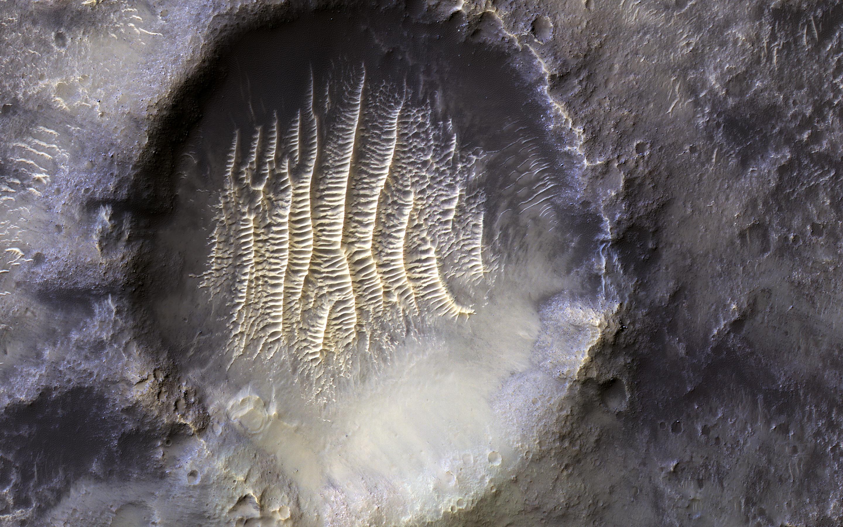
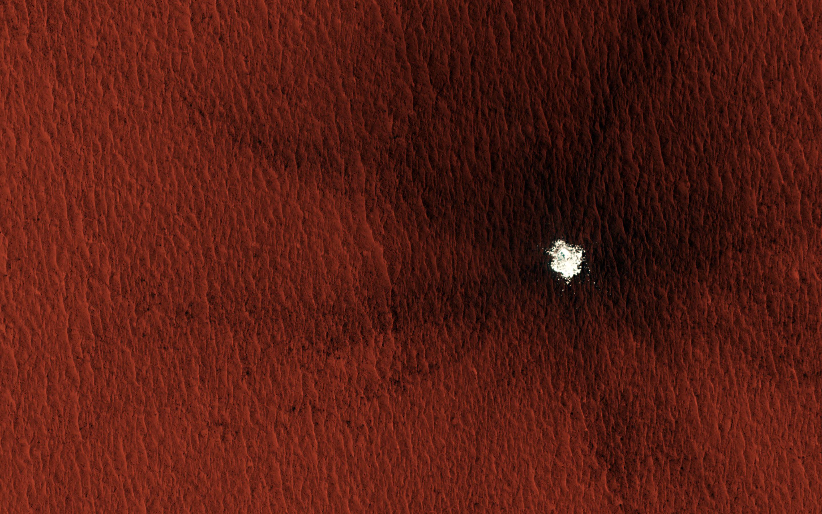
Sand Dune Field in Richardson Crater
Full Resolution:
TIFF
(15.41 MB)
JPEG
(670.8 kB)
2007-03-21
Mars
Mars Reconnaissance Orbiter (MRO)
HiRISE
2048x2773x1
PIA09633:
Light Outcrop on Crater Floor
Full Resolution:
TIFF
(5.685 MB)
JPEG
(820.4 kB)
2007-04-11
Mars
Mars Reconnaissance Orbiter (MRO)
HiRISE
2048x4613x1
PIA09655:
Interior Layered Deposits in Juventae Chasma
Full Resolution:
TIFF
(9.457 MB)
JPEG
(807.4 kB)
2007-12-11
Mars
Mars Reconnaissance Orbiter (MRO)
HiRISE
2315x1380x1
PIA10135:
'Low-flying' View of Terrain in Candor Chasma
Full Resolution:
TIFF
(3.199 MB)
JPEG
(572 kB)
2008-06-24
Mars
Mars Reconnaissance Orbiter (MRO)
CRISM
1312x1795x3
PIA10947:
Oudemans Crater
Full Resolution:
TIFF
(7.073 MB)
JPEG
(217.1 kB)
2010-04-29
Mars
Mars Reconnaissance Orbiter (MRO)
HiRISE
2560x1920x3
PIA13077:
Floor of Ius Chasma
Full Resolution:
TIFF
(14.76 MB)
JPEG
(862.9 kB)
2010-07-13
Mars
Mars Reconnaissance Orbiter (MRO)
HiRISE
2560x1920x3
PIA13266:
Light Outcrop on Crater Floor
Full Resolution:
TIFF
(14.76 MB)
JPEG
(649.9 kB)
2010-07-13
Mars
Mars Reconnaissance Orbiter (MRO)
HiRISE
2560x1920x3
PIA13268:
Sand Dune Field in Richardson Crater
Full Resolution:
TIFF
(14.76 MB)
JPEG
(773.4 kB)
2012-01-25
Mars
Mars Reconnaissance Orbiter (MRO)
HiRISE
2023x2008x3
PIA15283:
Dunes in Noachis Terra Region of Mars
Full Resolution:
TIFF
(12.2 MB)
JPEG
(593 kB)
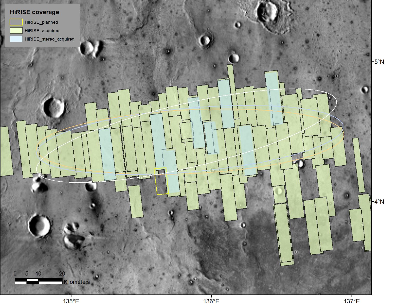
2013-05-15
Mars
Mars Reconnaissance Orbiter (MRO)
HiRISE
2880x1800x3
PIA17729:
A Possible Landing Site for NASA's InSight Mission
Full Resolution:
TIFF
(15.56 MB)
JPEG
(1.028 MB)
2013-05-29
Mars
Mars Reconnaissance Orbiter (MRO)
HiRISE
2880x1800x3
PIA17736:
Valleys in Tyrrhena Terra
Full Resolution:
TIFF
(15.56 MB)
JPEG
(949.2 kB)
2014-01-15
Mars
Mars Reconnaissance Orbiter (MRO)
HiRISE
2560x1920x3
PIA17876:
Fissure near Cerberus Fossae with Tectonic Morphologies
Full Resolution:
TIFF
(14.75 MB)
JPEG
(741.1 kB)
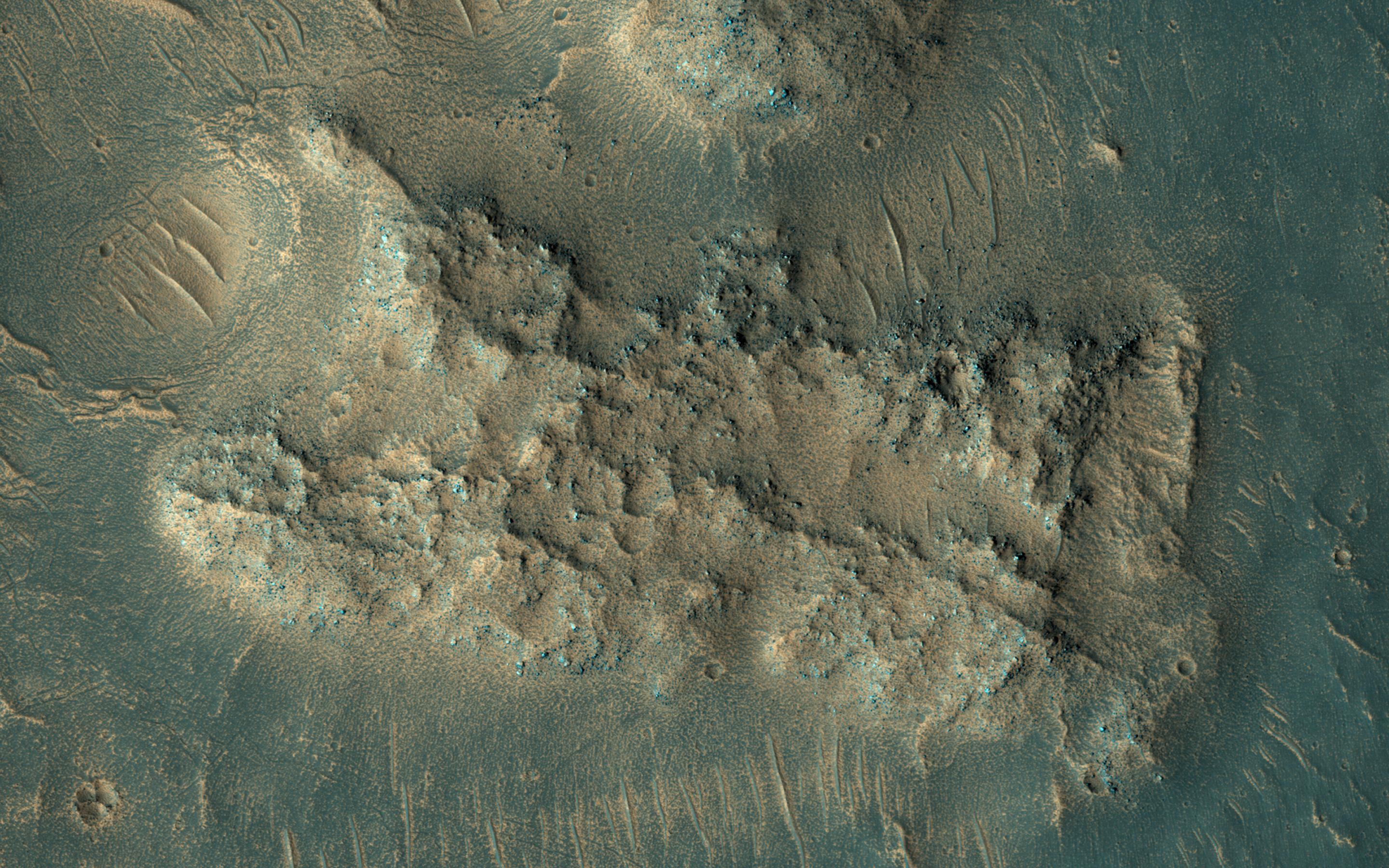
2014-08-27
Mars
Mars Reconnaissance Orbiter (MRO)
HiRISE
2880x1800x3
PIA18776:
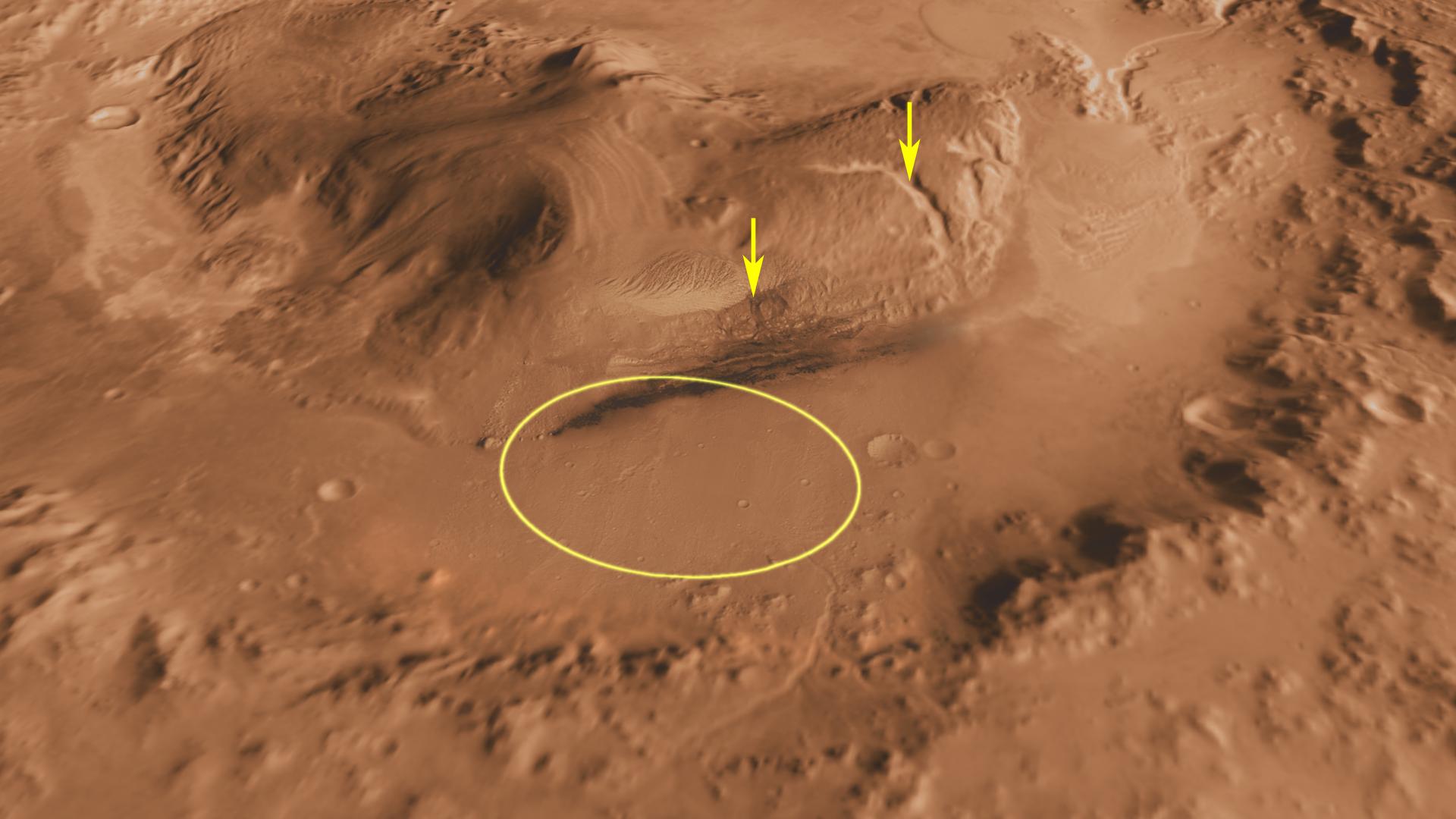
A New Impact Crater Near NASA's InSight Landing Region
Full Resolution:
TIFF
(15.56 MB)
JPEG
(1.268 MB)
2015-07-15
Mars
Mars Reconnaissance Orbiter (MRO)
HiRISE
2880x1800x3
PIA19855:
Sedimentary Deposits within Ius Chasma
Full Resolution:
TIFF
(15.56 MB)
JPEG
(1.057 MB)
2015-10-05
Mars
Mars Reconnaissance Orbiter (MRO)
HiRISE
1280x640x3
PIA19913:
The Ares 3 Landing Site: Where Science Fact Meets Fiction
Full Resolution:
TIFF
(2.459 MB)
JPEG
(139.8 kB)
2017-03-29
Mars
Mars Reconnaissance Orbiter (MRO)
HiRISE
1650x1275x3
PIA21489:
Advance Inspection of NASA's Next Mars Landing Site
Full Resolution:
TIFF
(2.287 MB)
JPEG
(273.9 kB)
2018-07-23
Mars
Mars Reconnaissance Orbiter (MRO)
HiRISE
2880x1800x3
PIA22586:
This is Not the Hydrothermal Deposit You're Looking For
Full Resolution:
TIFF
(15.56 MB)
JPEG
(965.6 kB)
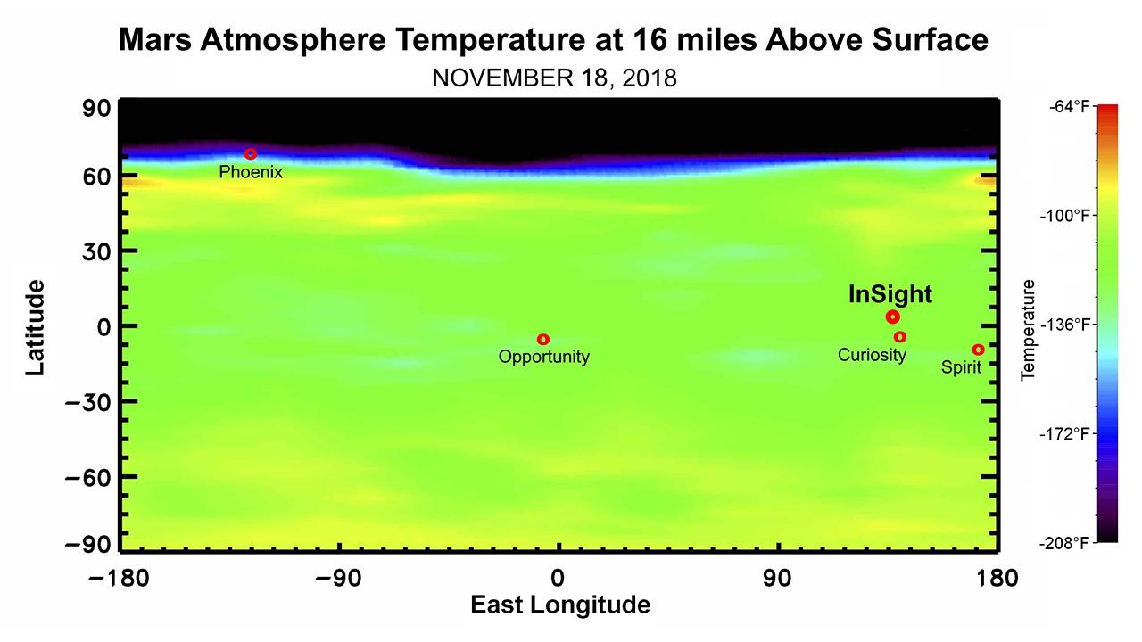
2018-11-21
Mars
Mars Reconnaissance Orbiter (MRO)
MCS
1280x720x3
PIA22570:
Martian Weather Forecast for InSight Landing
Full Resolution:
TIFF
(739 kB)
JPEG
(75.77 kB)
2018-12-07
Mars
Mars Reconnaissance Orbiter (MRO)
HiRISE
1204x595x3
PIA22927:
Of Wind and Dust Devils on Mars
Full Resolution:
TIFF
(1.201 MB)
JPEG
(197 kB)
2018-12-11
Mars
Mars Reconnaissance Orbiter (MRO)
HiRISE
2880x1800x3
PIA22898:
The Eastern Slope of Asimov Crater's Central Pit
Full Resolution:
TIFF
(15.56 MB)
JPEG
(1.327 MB)
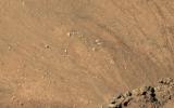
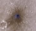
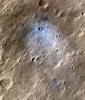
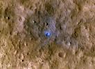
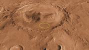
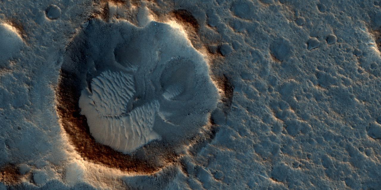
2019-02-11
Mars
Mars Reconnaissance Orbiter (MRO)
HiRISE
969x777x3
PIA23043:
InSight Seismometer's Wind and Thermal Shield Seen from Space
Full Resolution:
TIFF
(2.26 MB)
JPEG
(190.4 kB)
2019-09-05
Mars
Mars Reconnaissance Orbiter (MRO)
HiRISE
2880x1800x3
PIA23454:
Layers in Danielson Crater
Full Resolution:
TIFF
(15.56 MB)
JPEG
(771.5 kB)
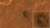
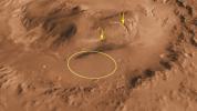
2019-10-16
Mars
Mars Reconnaissance Orbiter (MRO)
HiRISE
1600x899x3
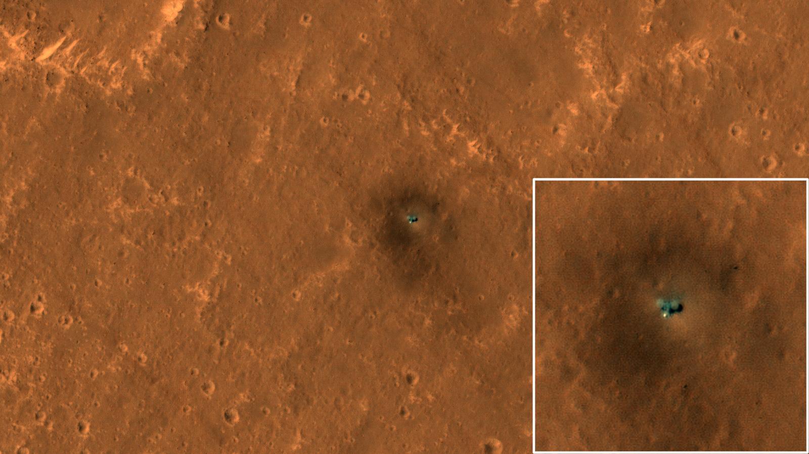
PIA23376:
The Best View of InSight
Full Resolution:
TIFF
(3.819 MB)
JPEG
(177.6 kB)
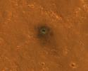
2021-02-26
Mars
Mars Reconnaissance Orbiter (MRO)
HiRISE
2880x1800x3
PIA24463:
South Polar Cap Terrain
Full Resolution:
TIFF
(13.67 MB)
JPEG
(626.3 kB)
2021-02-26
Mars
Mars Reconnaissance Orbiter (MRO)
HiRISE
2880x1800x3
PIA24465:
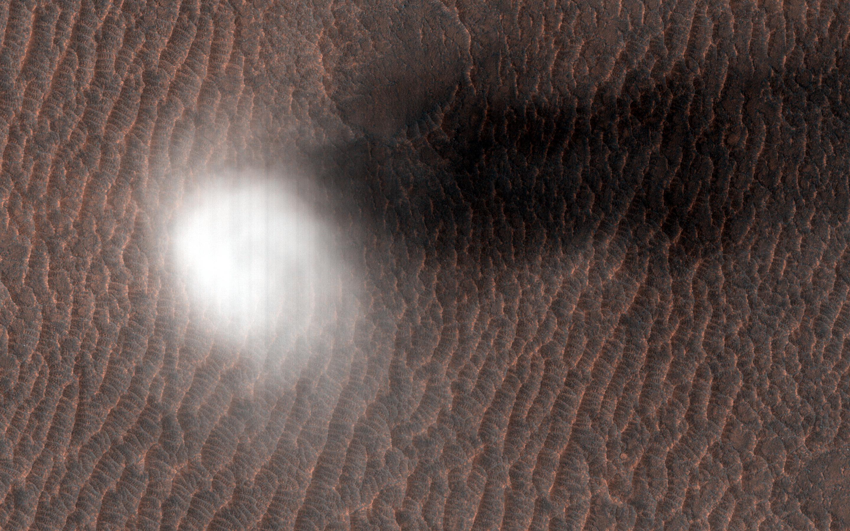
A Dust Devil is Born
Full Resolution:
TIFF
(15.56 MB)
JPEG
(807 kB)
2022-01-21
Mars
Mars Reconnaissance Orbiter (MRO)
HiRISE
2880x1800x3
PIA25090:
A Greenwich Observatory on Mars
Full Resolution:
TIFF
(15.56 MB)
JPEG
(812.2 kB)
2022-09-19
Mars
Mars Reconnaissance Orbiter (MRO)
HiRISE
4994x3341x3
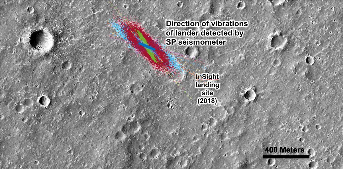
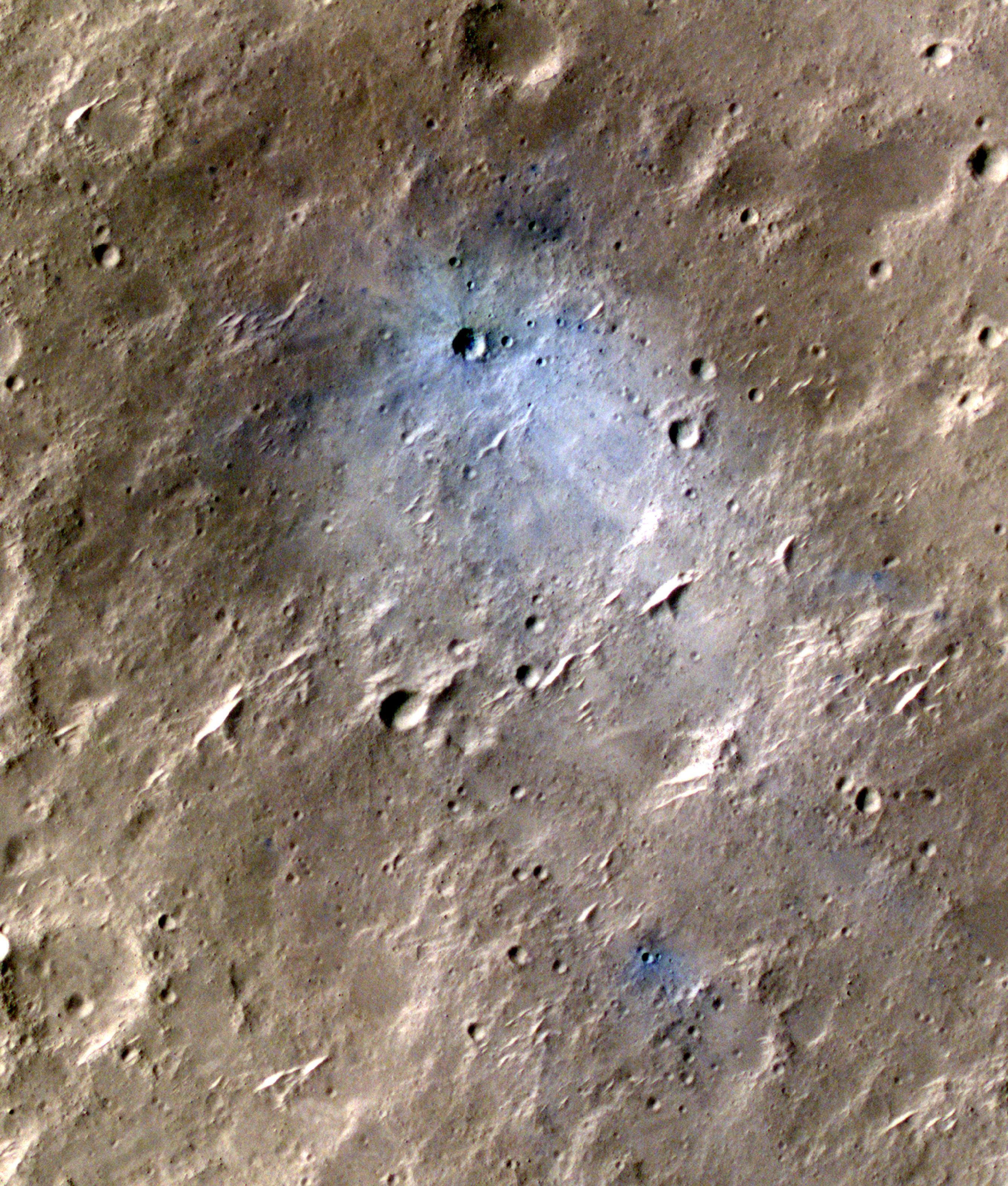
PIA25408:
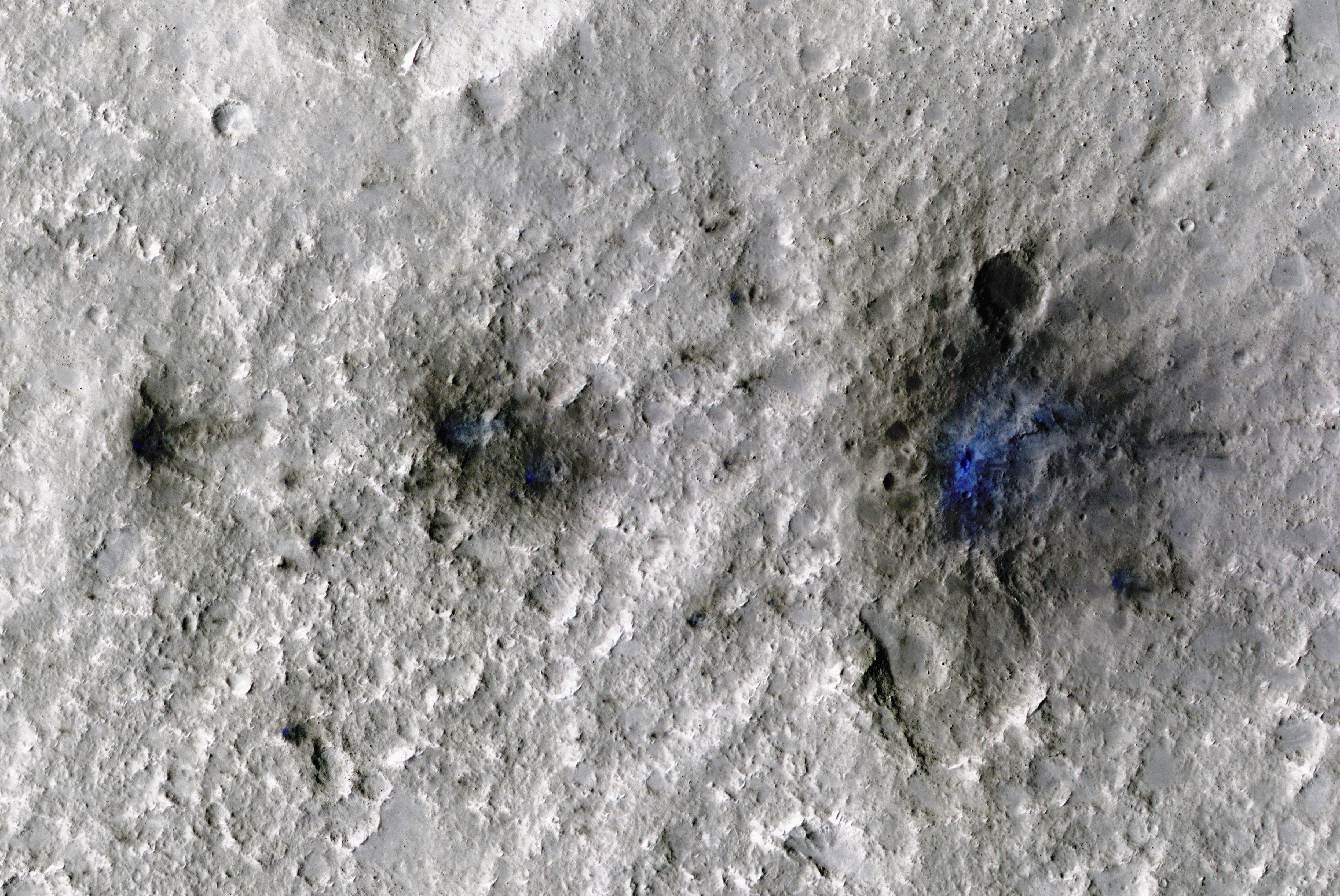
InSight Detects an Impact for the First Time
Full Resolution:
TIFF
(50.08 MB)
JPEG
(2.9 MB)
2022-09-19
Mars
Mars Reconnaissance Orbiter (MRO)
HiRISE
4047x3466x3
PIA25409:
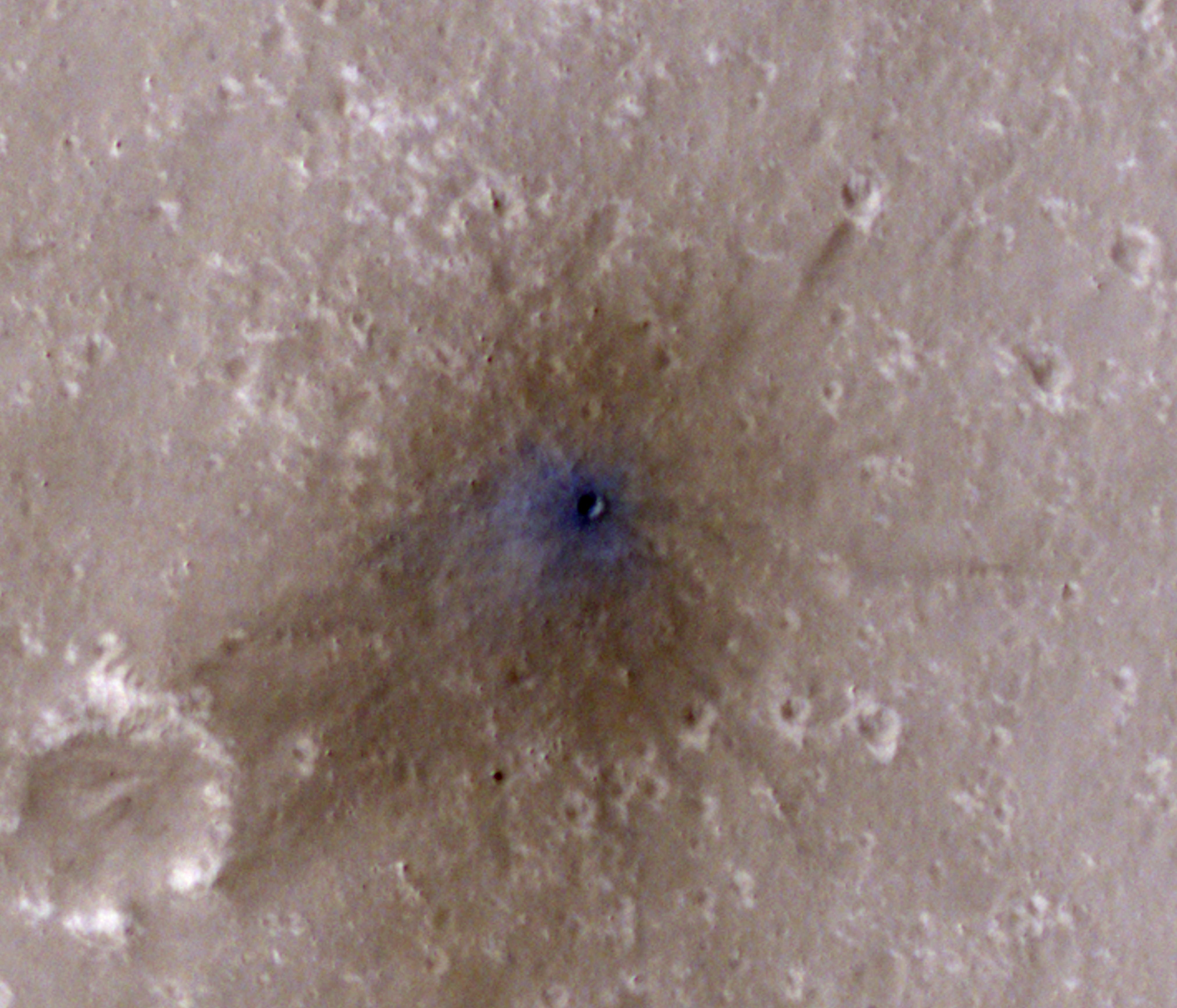
InSight-Detected Impact in February 2021
Full Resolution:
TIFF
(40.22 MB)
JPEG
(844.9 kB)
2022-09-19
Mars
Mars Reconnaissance Orbiter (MRO)
HiRISE
2675x3147x3
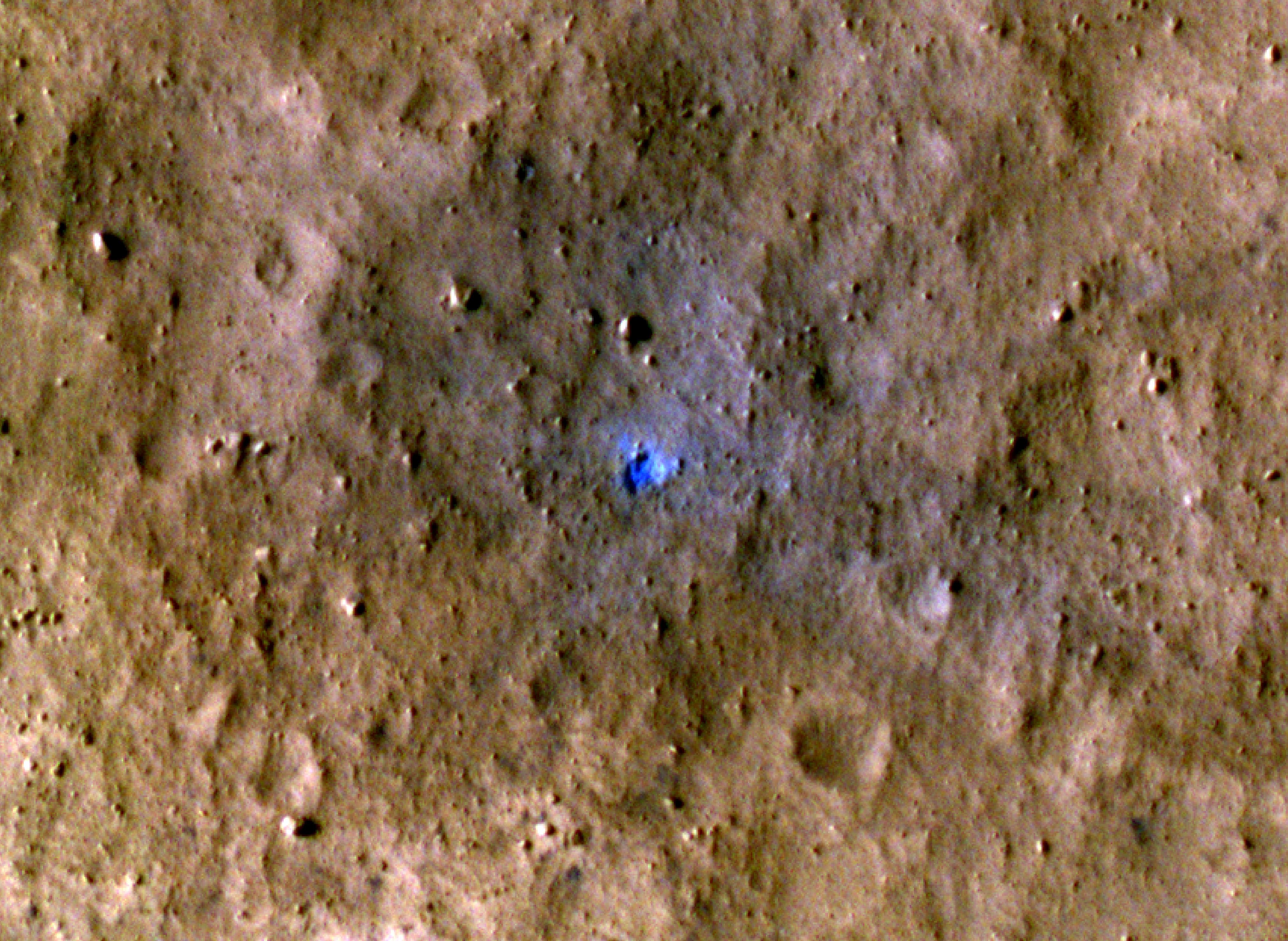
PIA25410:
InSight-Detected Impact in May 2020
Full Resolution:
TIFF
(25.26 MB)
JPEG
(1.547 MB)
2022-09-19
Mars
Mars Reconnaissance Orbiter (MRO)
HiRISE
4047x2956x3
PIA25411:
InSight-Detected Impact in August 2021
Full Resolution:
TIFF
(35.9 MB)
JPEG
(1.611 MB)
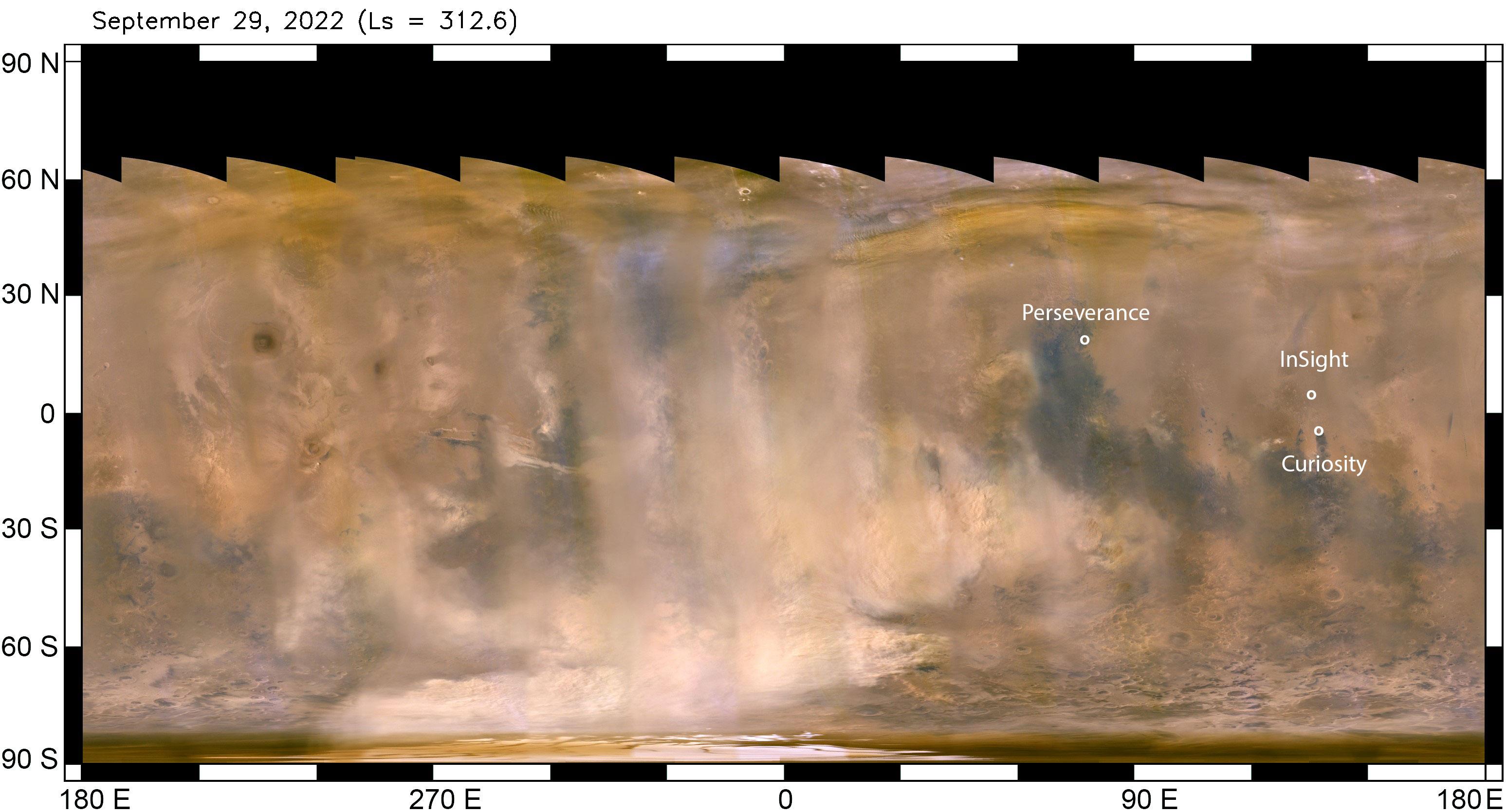
2022-10-07
Mars
Mars Reconnaissance Orbiter (MRO)
MARCI
3094x1669x3
PIA25412:
Mars Dust Storm in Relation to InSight, Curiosity and Perseverance
Full Resolution:
TIFF
(9.951 MB)
JPEG
(452.4 kB)
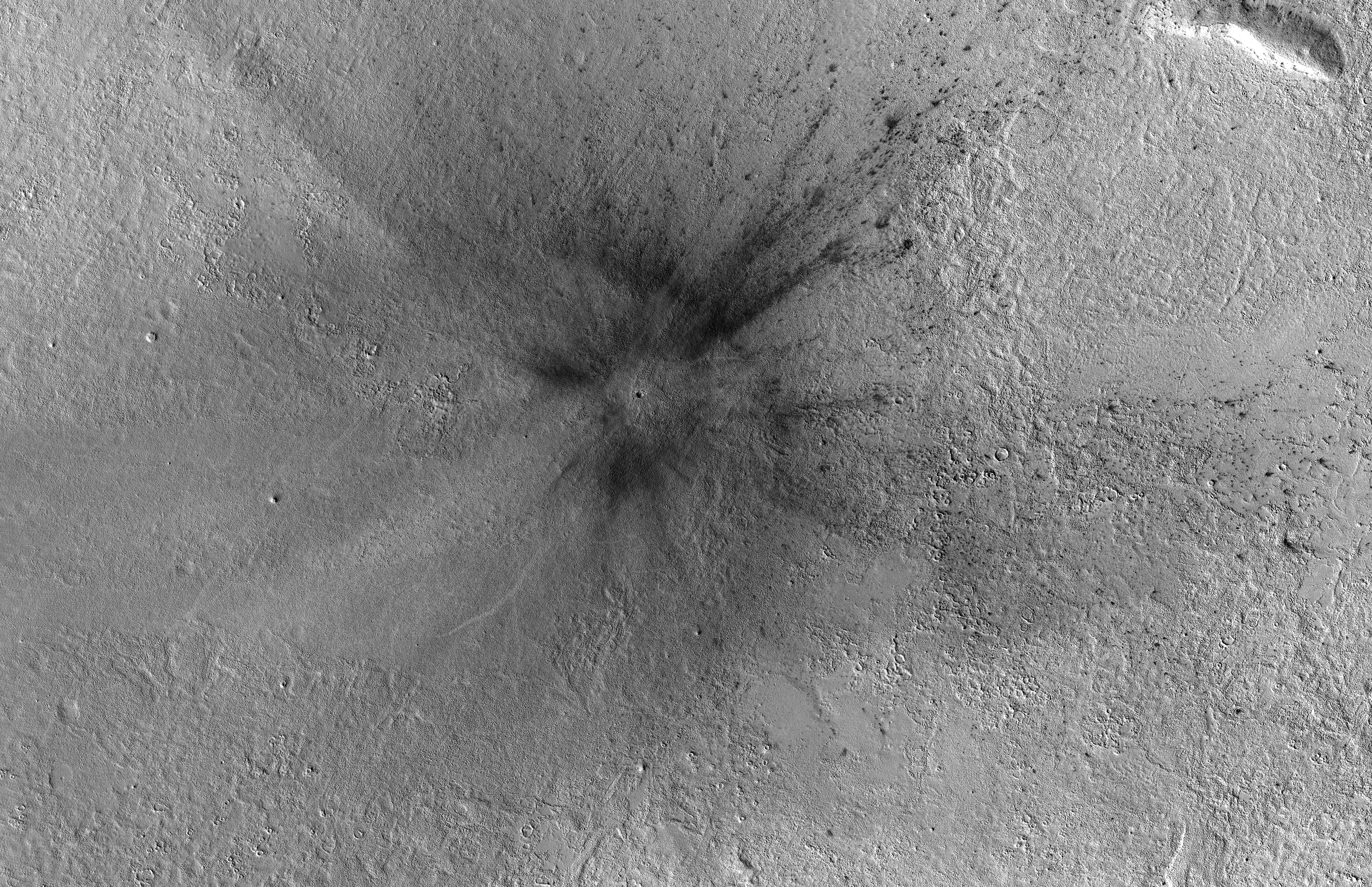
2022-10-27
Mars
Mars Reconnaissance Orbiter (MRO)
CTX
5448x3523x1
PIA25584:
Context Camera Views an Impact Crater in Amazonis Planitia
Full Resolution:
TIFF
(19.22 MB)
JPEG
(5.28 MB)
2023-04-13
Mars
Mars Reconnaissance Orbiter (MRO)
HiRISE
2880x1800x3
PIA25897:
Looking at the Crater Half Full
Full Resolution:
TIFF
(15.56 MB)
JPEG
(644.2 kB)
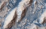
2023-12-19
Mars
Mars Reconnaissance Orbiter (MRO)
HiRISE
2880x1800x3
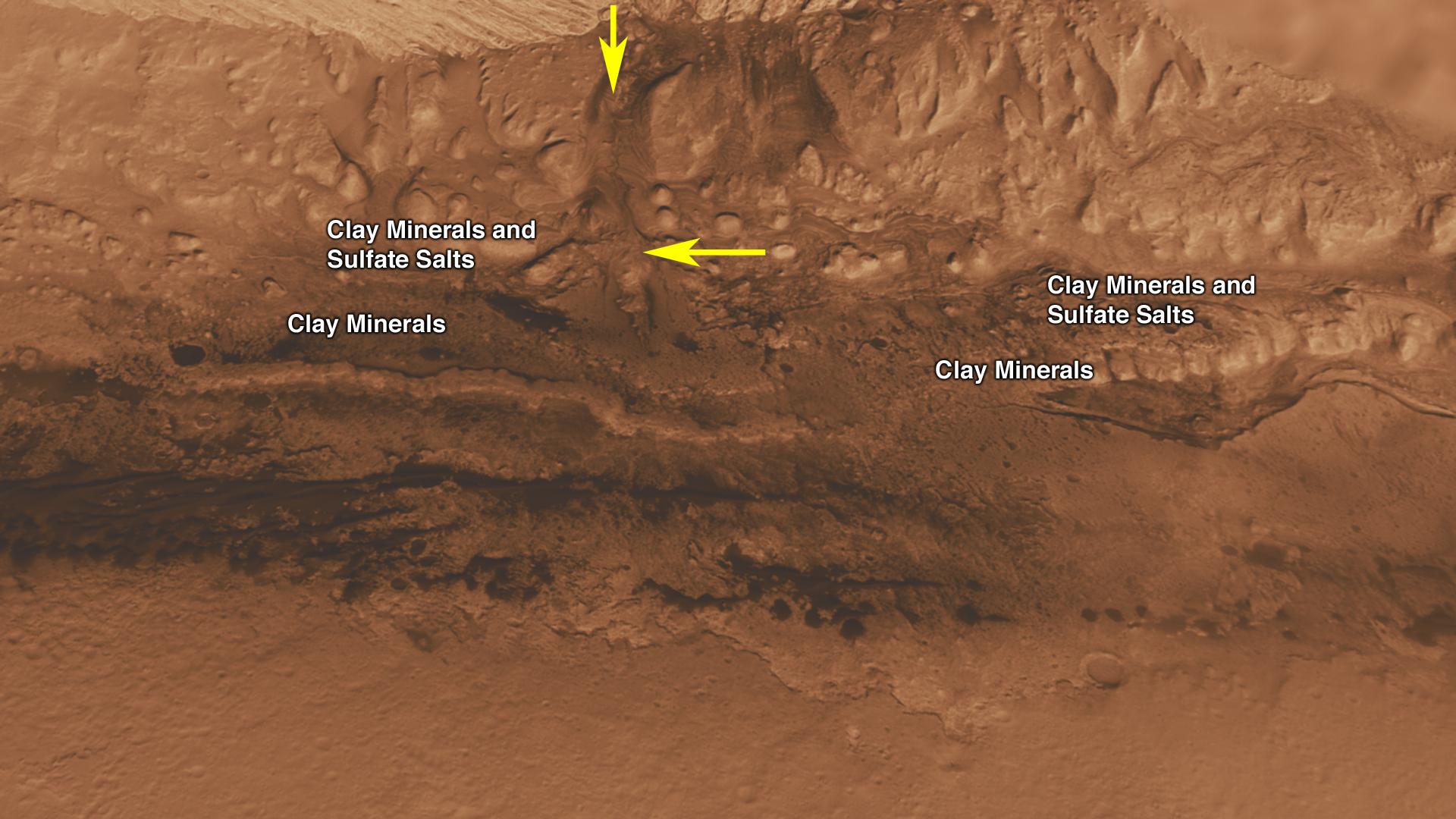
PIA25987:
Muddy Mounds
Full Resolution:
TIFF
(5.191 MB)
JPEG
(1.613 MB)
2024-03-26
Mars
Mars Reconnaissance Orbiter (MRO)
HiRISE
2880x1800x3
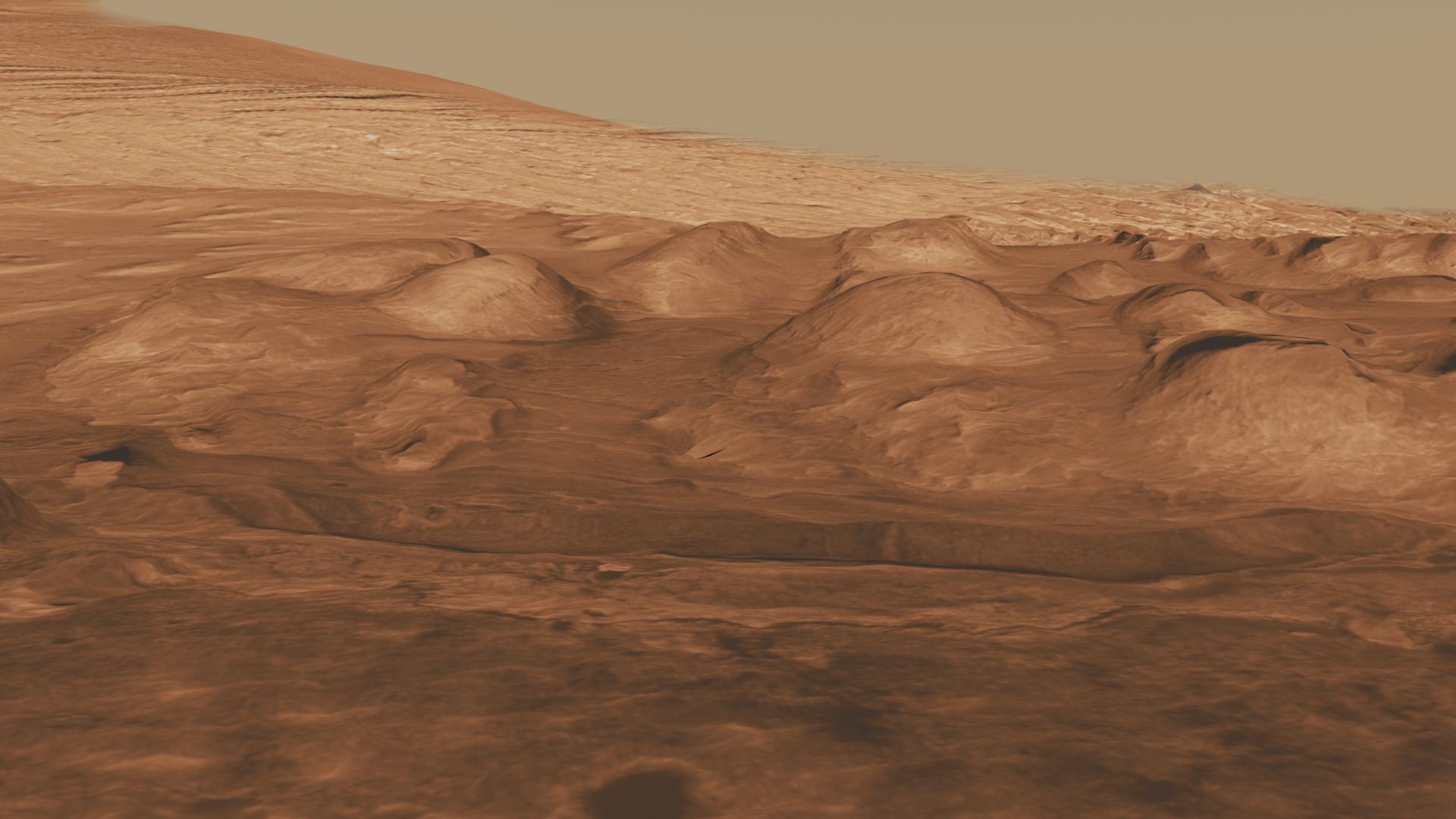
PIA26321:
Mars Mysteries: Unveiling the Icy Craters
Full Resolution:
TIFF
(12.88 MB)
JPEG
(730.7 kB)
2024-03-26
Mars
Mars Reconnaissance Orbiter (MRO)
HiRISE
2880x1800x3
PIA26324:
Searching for Distant Secondary Craters
Full Resolution:
TIFF
(15.56 MB)
JPEG
(1.134 MB)
2011-07-22
Mars
Mars Science Laboratory (MSL)
MOLA
THEMIS
1920x1080x3
PIA14294:
Context of Curiosity Landing Site in Gale Crater
Full Resolution:
TIFF
(6.23 MB)
JPEG
(199 kB)
2011-07-22
Mars
Mars Science Laboratory (MSL)
MOLA
THEMIS
1920x1080x3
PIA14295:
Canyons on Mountain Inside Gale Crater
Full Resolution:
TIFF
(6.23 MB)
JPEG
(153.3 kB)
2011-07-22
Mars
Mars Science Laboratory (MSL)
HiRISE
1920x1080x3
PIA14296:
Lower Portion of Mound Inside Gale Crater
Full Resolution:
TIFF
(6.23 MB)
JPEG
(219.5 kB)
2011-07-22
Mars
Mars Science Laboratory (MSL)
HiRISE
1920x1080x3
PIA14297:
Rock Layers in Lower Mound in Gale Crater
Full Resolution:
TIFF
(6.23 MB)
JPEG
(157.1 kB)
2011-07-22
Mars
Mars Science Laboratory (MSL)
HiRISE
1920x1080x3
PIA14298:
Rock Types in Gale Crater
Full Resolution:
TIFF
(6.23 MB)
JPEG
(221.8 kB)
2012-08-12
Mars
Mars Science Laboratory (MSL)
Mastcam
1449x1089x3
PIA16052:
Wall of Gale Crater
Full Resolution:
TIFF
(4.736 MB)
JPEG
(89.12 kB)
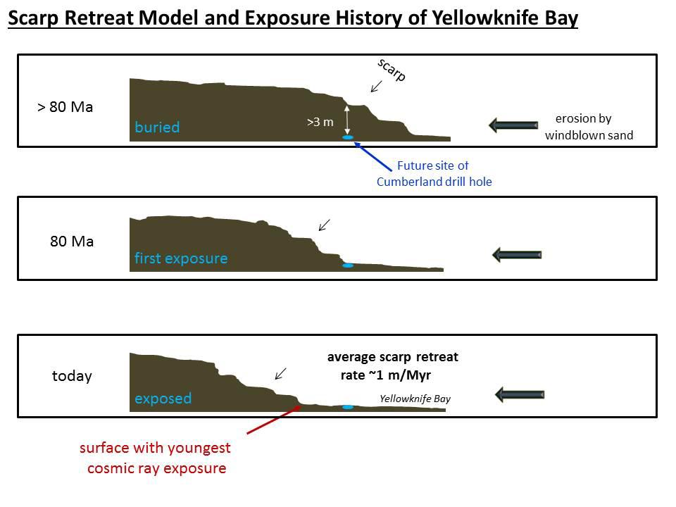
2013-12-09
Mars
Mars Science Laboratory (MSL)
960x720x3
PIA17604:
Scarp Retreat Model and Exposure History of 'Yellowknife Bay'
Full Resolution:
TIFF
(2.075 MB)
JPEG
(64.41 kB)
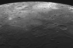
2008-01-16
Mercury
MESSENGER
MDIS - Narrow Angle
1016x1024x1
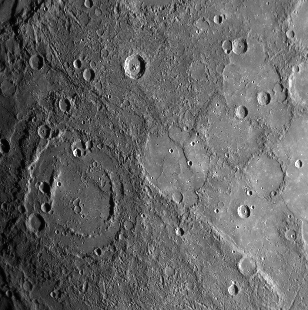
PIA10173:
Mercury's Cratered Surface
Full Resolution:
TIFF
(1.042 MB)
JPEG
(171.9 kB)
2008-01-17
Mercury
MESSENGER
MDIS - Narrow Angle
1016x1024x1
PIA10177:
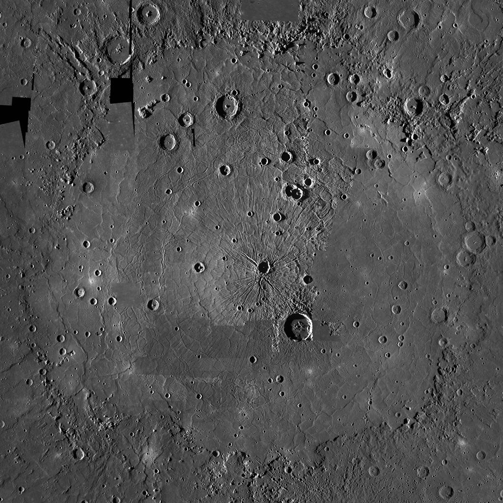
MESSENGER Reveals Mercury's Geological History
Full Resolution:
TIFF
(1.042 MB)
JPEG
(211.5 kB)
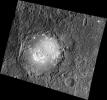
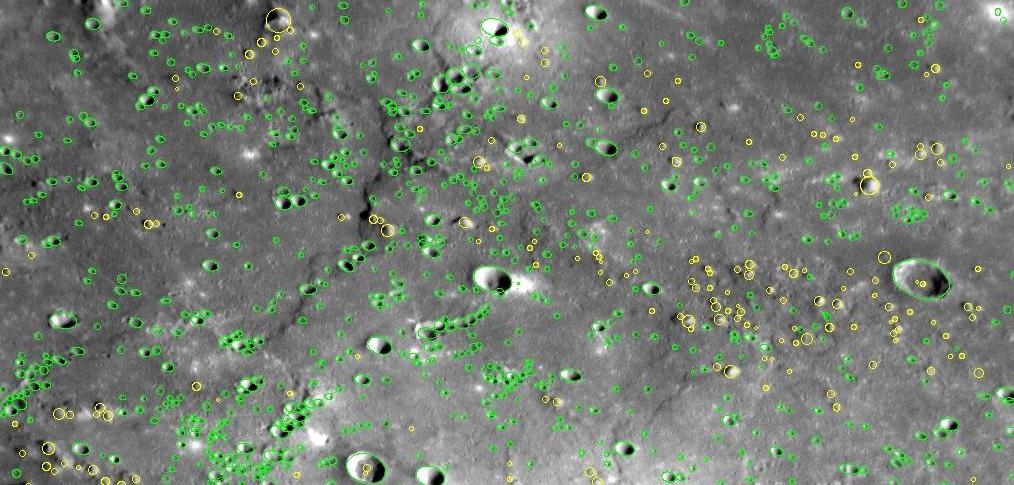
2008-01-24
Mercury
MESSENGER
MDIS - Narrow Angle
1014x485x3
PIA10191:
Counting Mercury's Craters
Full Resolution:
TIFF
(1.478 MB)
JPEG
(108.4 kB)
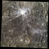
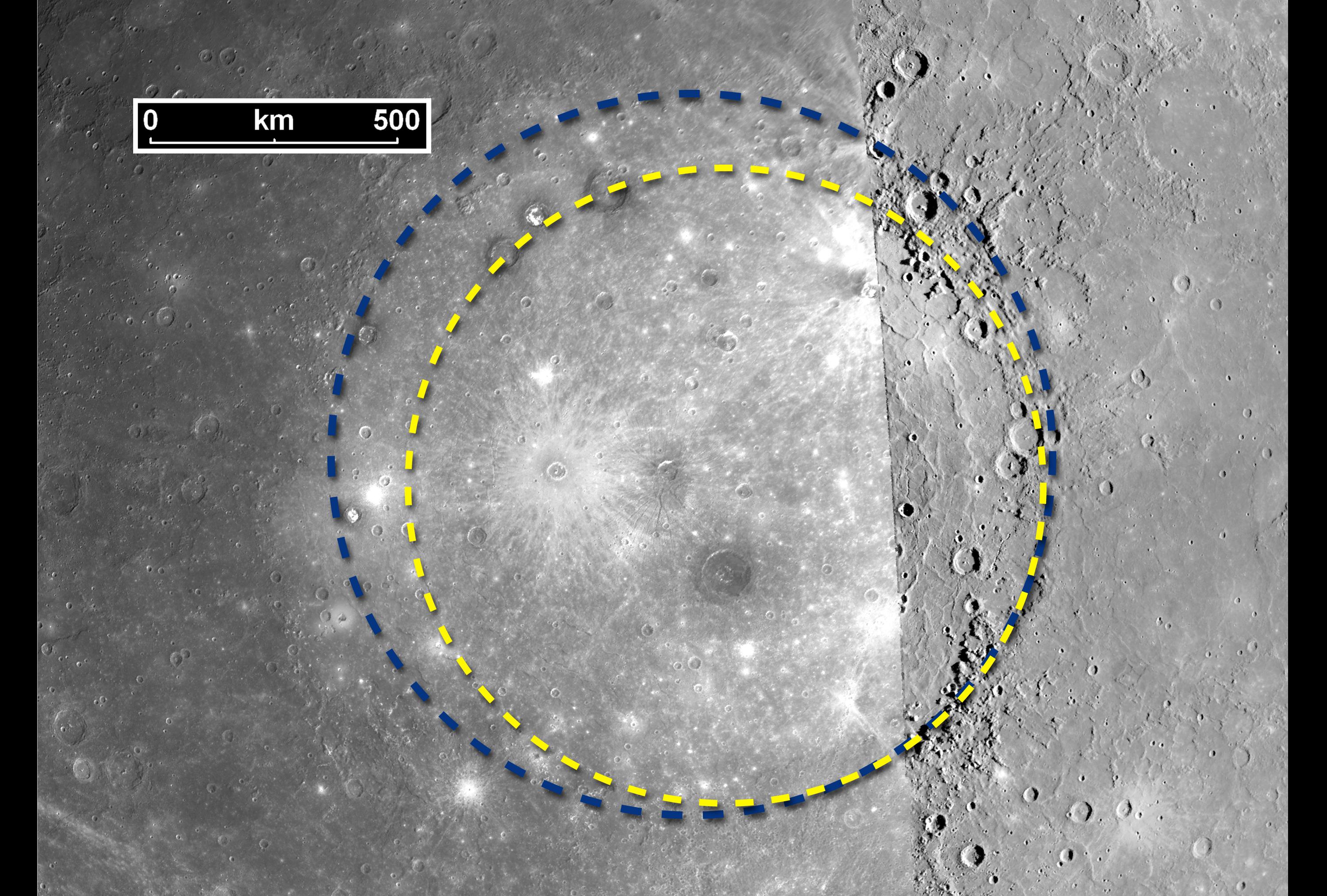
2008-01-30
Mercury
MESSENGER
MDIS - Narrow Angle
3000x2025x3
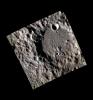
PIA10383:
The Great Caloris Basin on Mercury
Full Resolution:
TIFF
(18.23 MB)
JPEG
(839.7 kB)
2008-02-27
Mercury
MESSENGER
MDIS - Narrow Angle
1018x1024x1
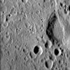
PIA10603:
Craters in Caloris
Full Resolution:
TIFF
(1.044 MB)
JPEG
(120 kB)
2008-03-27
Mercury
MESSENGER
MDIS - Narrow Angle
1018x1024x1
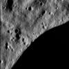
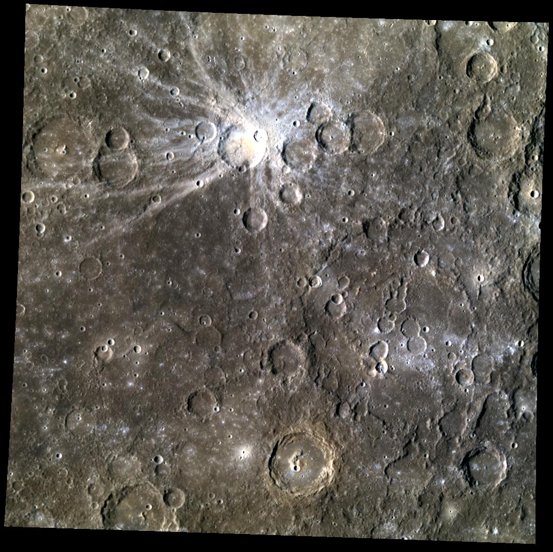
PIA10607:
Appreciating Mozart in a New Light
Full Resolution:
TIFF
(1.044 MB)
JPEG
(167 kB)
2008-06-03
Mercury
MESSENGER
MDIS - Narrow Angle
1018x1024x1
PIA10934:
Voil�! Mercury's Atget
Full Resolution:
TIFF
(1.044 MB)
JPEG
(149.4 kB)
2008-07-07
Mercury
MESSENGER
MDIS - Narrow Angle
2312x1664x1
PIA10938:
Mercury's Craters from a New Perspective
Full Resolution:
TIFF
(3.852 MB)
JPEG
(466.9 kB)
2008-08-06
Mercury
MESSENGER
MDIS - Narrow Angle
MDIS - Wide Angle
850x1280x3
PIA11024:
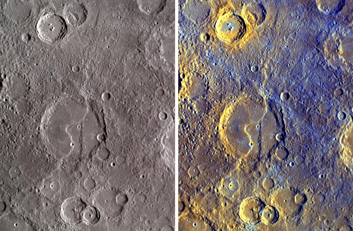
A Closer Look at Albedo and Color Variations on Mercury
Full Resolution:
TIFF
(3.268 MB)
JPEG
(178.2 kB)
2008-10-06
Mercury
MESSENGER
MDIS - Narrow Angle
1018x1024x1
PIA11244:
Exploring Mercury's Newly Seen Surface and Waiting for More
Full Resolution:
TIFF
(1.044 MB)
JPEG
(26.13 kB)
2008-10-14
Mercury
MESSENGER
MDIS - Wide Angle
1218x800x3
PIA11365:
Exposing Mercury's Colors
Full Resolution:
TIFF
(2.927 MB)
JPEG
(239.5 kB)
2008-10-29
Mercury
MESSENGER
MASCS
720x1300x3
PIA11402:
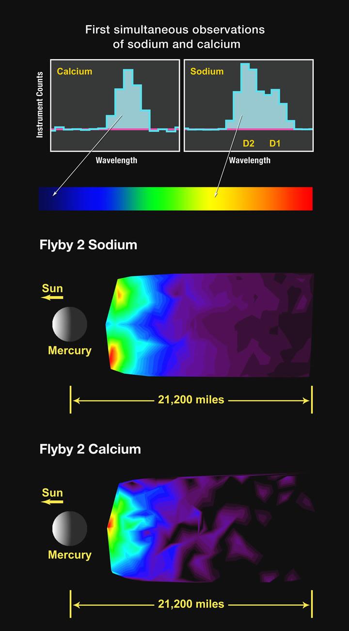
First Simultaneous Measurements of Sodium and Calcium in Mercury's Exosphere
Full Resolution:
TIFF
(2.812 MB)
JPEG
(67.72 kB)
2008-10-30
Mercury
MESSENGER
MDIS - Wide Angle
577x389x3
PIA11411:
A Close-Up View of Mercury's Colors
Full Resolution:
TIFF
(674.4 kB)
JPEG
(55 kB)
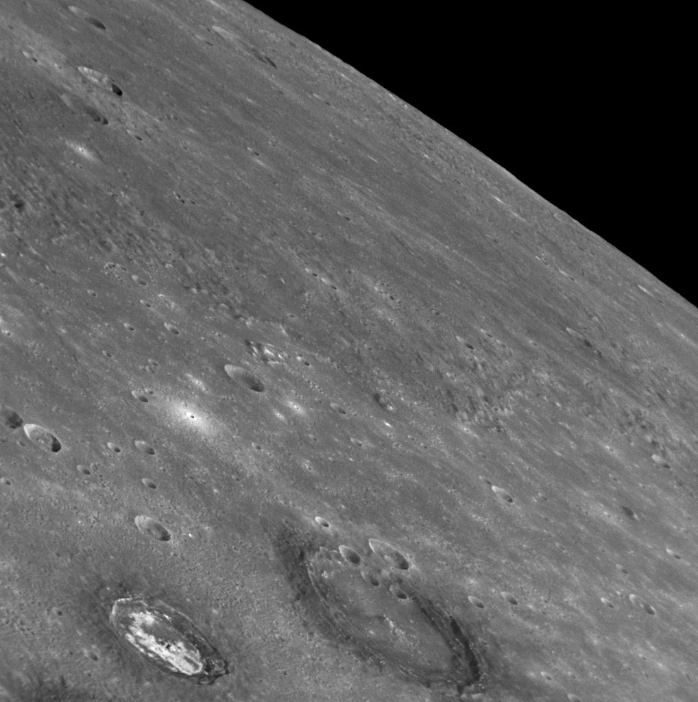
2009-01-20
Mercury
MESSENGER
MDIS - Narrow Angle
3000x1980x1
PIA11773:
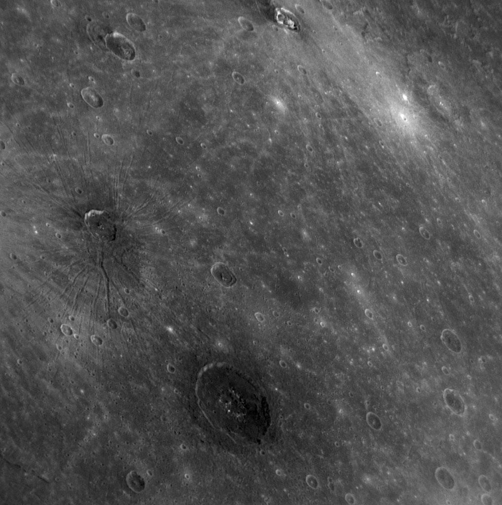
Volcanism on Mercury
Full Resolution:
TIFF
(5.948 MB)
JPEG
(534.4 kB)
2010-10-12
Mercury
MESSENGER
MDIS - Narrow Angle
1920x1080x1
PIA13488:
Dark Doings at Derain
Full Resolution:
TIFF
(2.076 MB)
JPEG
(220.9 kB)
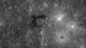
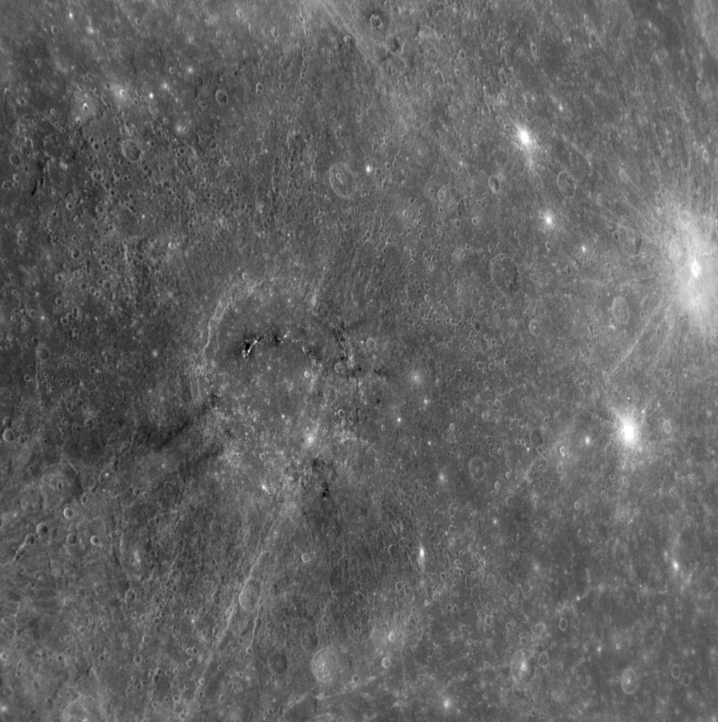
2012-04-24
Mercury
MESSENGER
MDIS - Narrow Angle
1024x1024x1
PIA15615:
Counting Caloris
Full Resolution:
TIFF
(1.05 MB)
JPEG
(259.5 kB)
2012-06-21
Mercury
MESSENGER
MDIS - Wide Angle
1075x1074x3
PIA16341:
Painting Mercury
Full Resolution:
TIFF
(3.465 MB)
JPEG
(218.6 kB)
2012-12-19
Mercury
MESSENGER
MDIS - Narrow Angle
1020x1024x1
PIA16661:
A Nursery for Hollows?
Full Resolution:
TIFF
(1.046 MB)
JPEG
(126.8 kB)
2013-05-20
Mercury
MESSENGER
MDIS - Wide Angle
1442x1354x1
PIA17058:
Lermontov's Legacy
Full Resolution:
TIFF
(1.955 MB)
JPEG
(233.5 kB)
2013-08-27
Mercury
MESSENGER
MDIS - Wide Angle
698x752x3
PIA17419:
Mercury, a Planetary Punching Bag
Full Resolution:
TIFF
(1.575 MB)
JPEG
(61.98 kB)
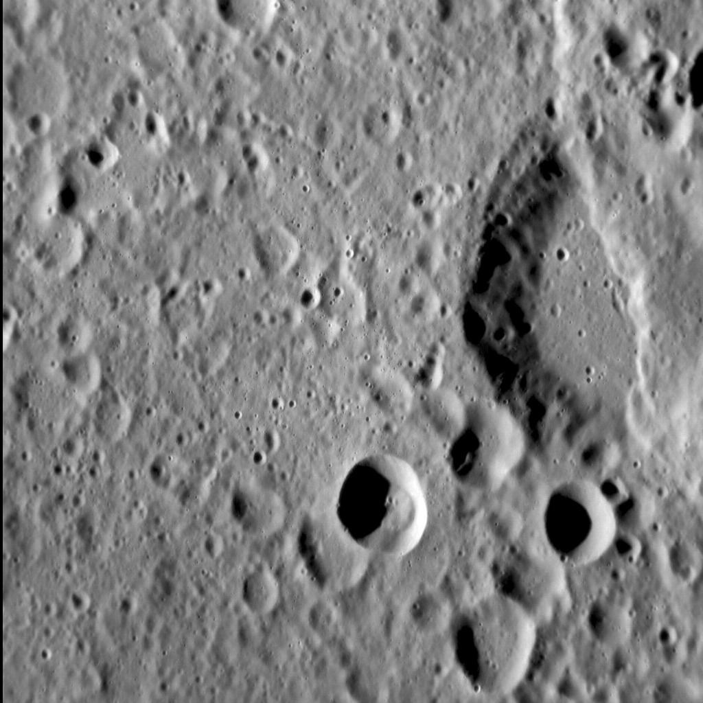
2013-09-23
Mercury
MESSENGER
MDIS - Narrow Angle
1372x1377x1
PIA17502:
In a Different Light
Full Resolution:
TIFF
(1.892 MB)
JPEG
(206.5 kB)
2013-10-17
Mercury
MESSENGER
MDIS - Narrow Angle
1024x1024x1
PIA17531:
Shortened Surfaces
Full Resolution:
TIFF
(1.05 MB)
JPEG
(120.5 kB)
2014-12-05
Mercury
MESSENGER
MDIS - Narrow Angle
1024x1024x3
PIA18974:
Edge of Darkness
Full Resolution:
TIFF
(1.05 MB)
JPEG
(151.5 kB)
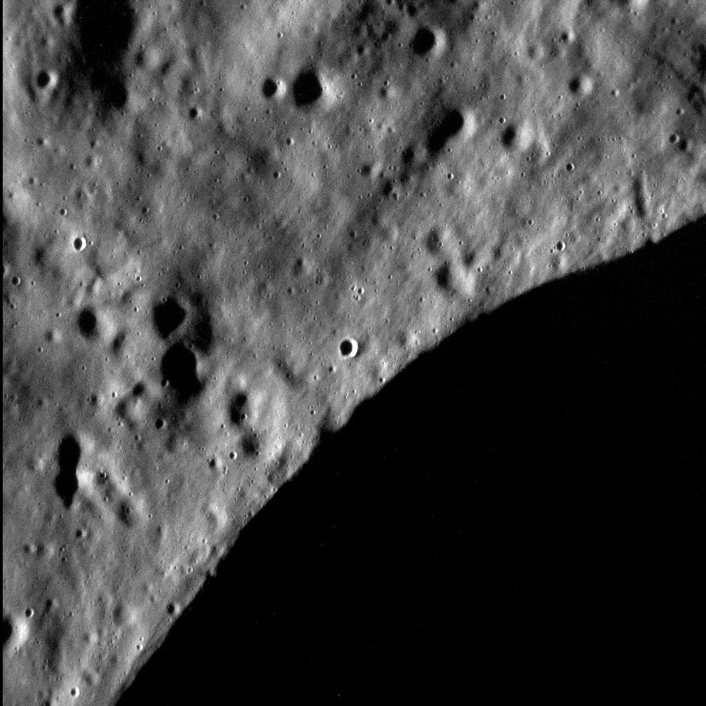
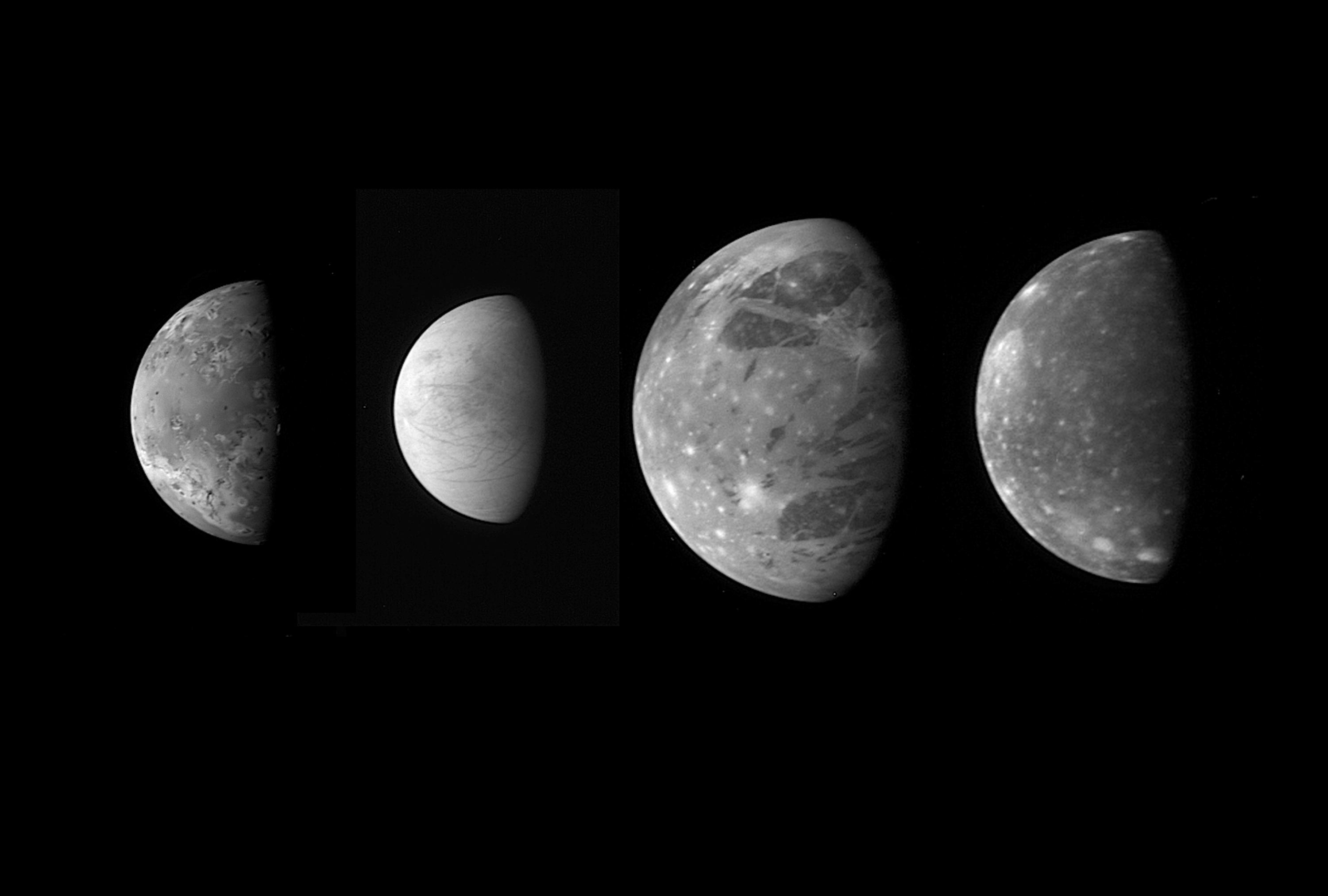
2007-05-01
Jupiter
New Horizons
LORRI
3000x2025x1
PIA09352:
Jupiter's Moons: Family Portrait
Full Resolution:
TIFF
(6.083 MB)
JPEG
(180.2 kB)
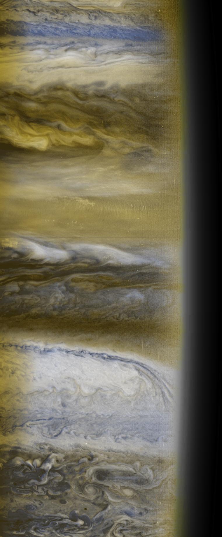
2007-10-09
Jupiter
New Horizons
MVIC
761x1843x3
PIA10098:
Atmospheric Structure
Full Resolution:
TIFF
(4.213 MB)
JPEG
(147.7 kB)
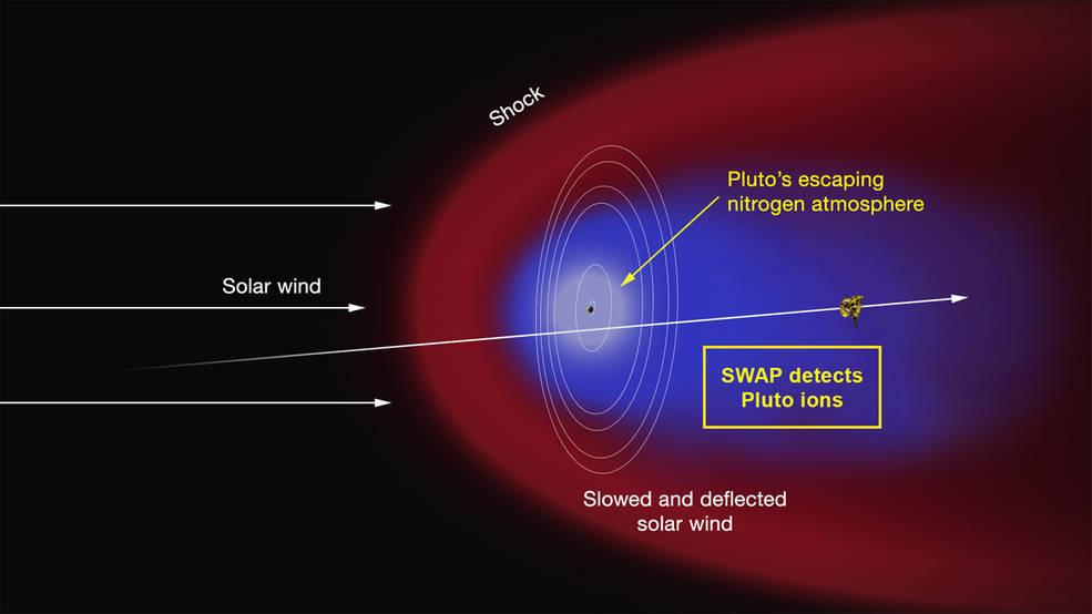
2015-07-17
Pluto
New Horizons
985x554x3
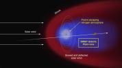
PIA19719:
Artist's Concept of the Interaction of the Solar Wind
Full Resolution:
TIFF
(1.638 MB)
JPEG
(35.58 kB)
2023-10-27
Earth
NISAR
973x913x3
PIA26111:
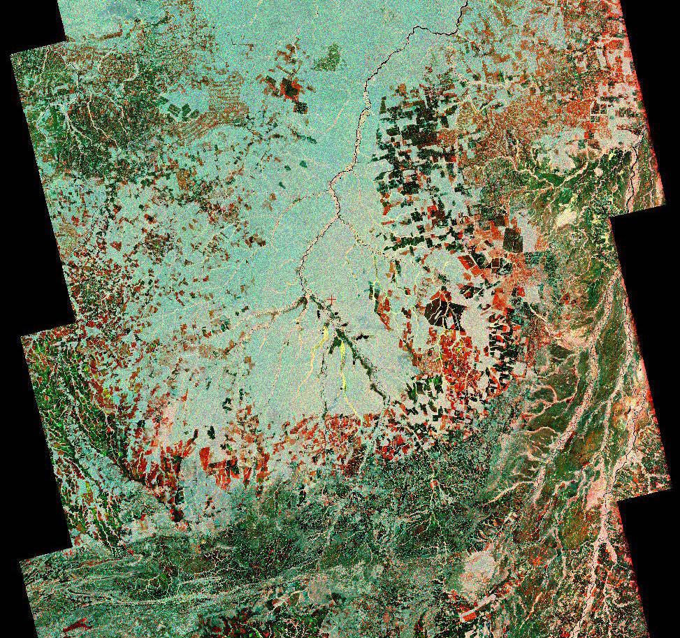
Composite of Brazil's 'Arc of Deforestation' Shows Imagery NISAR Will Produce
Full Resolution:
TIFF
(2.666 MB)
JPEG
(396.6 kB)
2023-10-27
Earth
NISAR
1800x1275x3
PIA26112:
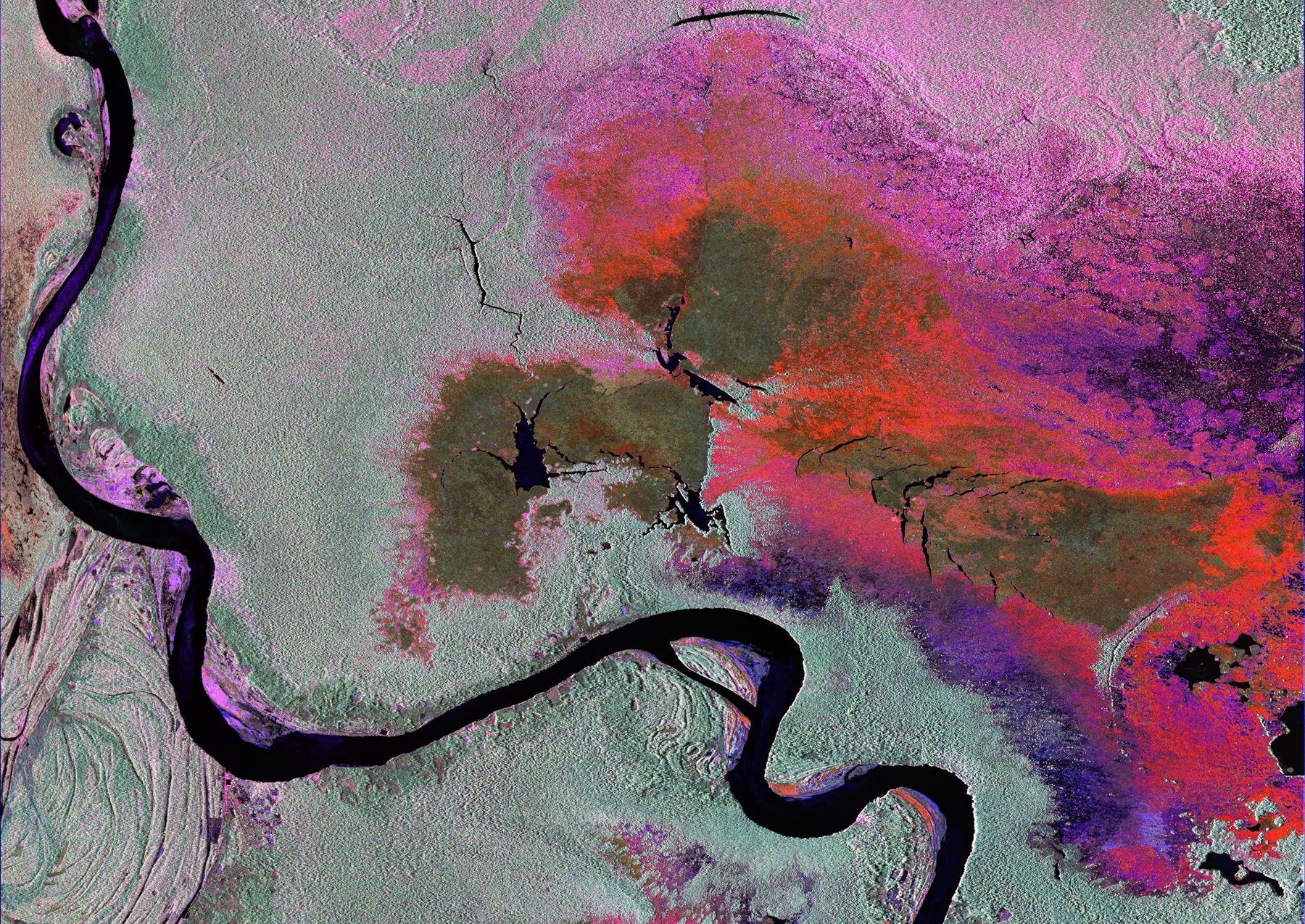
Radar Image of Amazonian Flooding Similar to Future NISAR Imagery
Full Resolution:
TIFF
(6.888 MB)
JPEG
(808.4 kB)
2024-02-20
NISAR
3840x2160x3
PIA26285:
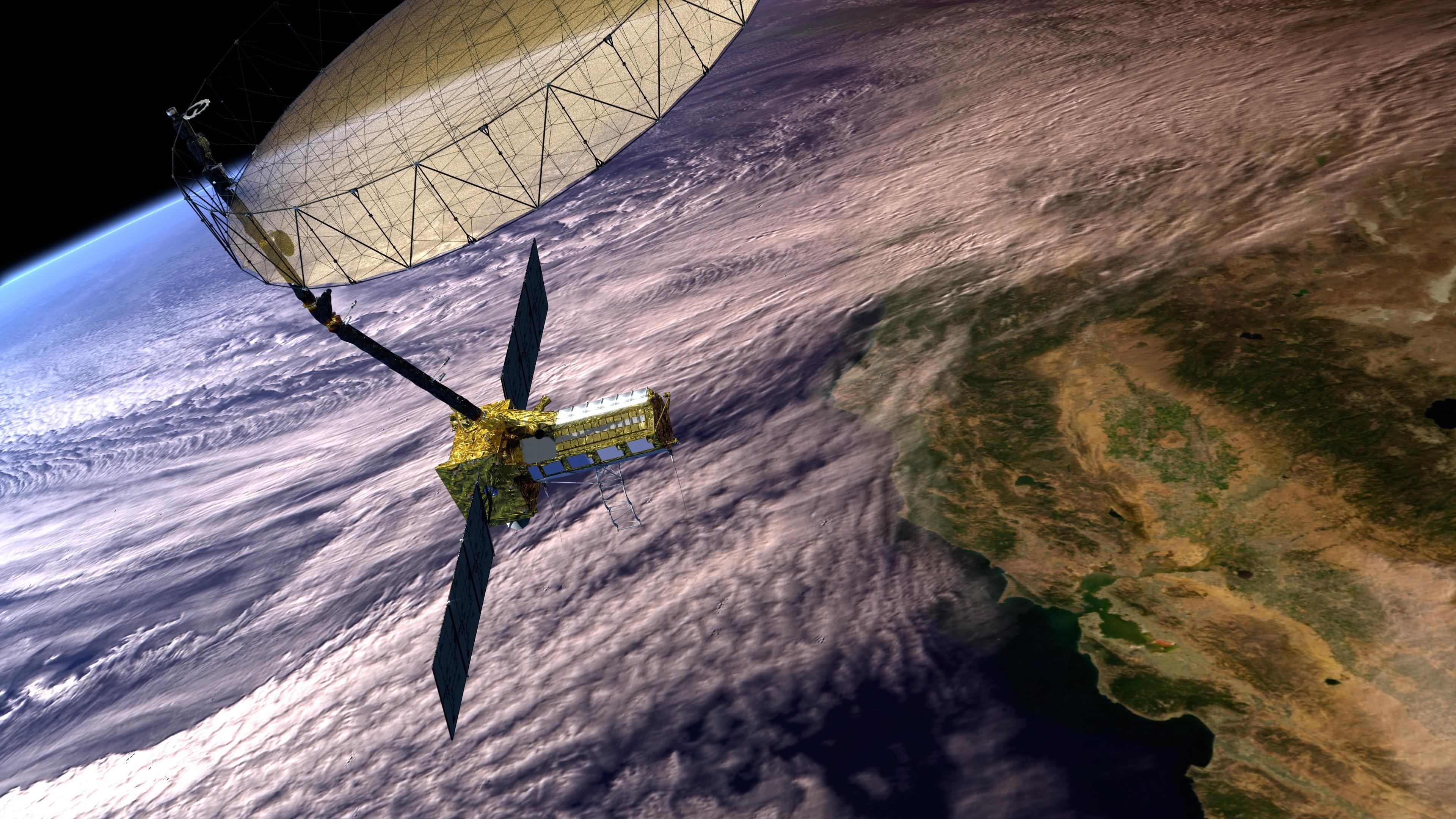
NISAR Satellite in Earth Orbit (Artist's Concept)
Full Resolution:
TIFF
(24.89 MB)
JPEG
(1.18 MB)
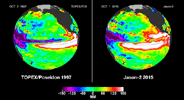
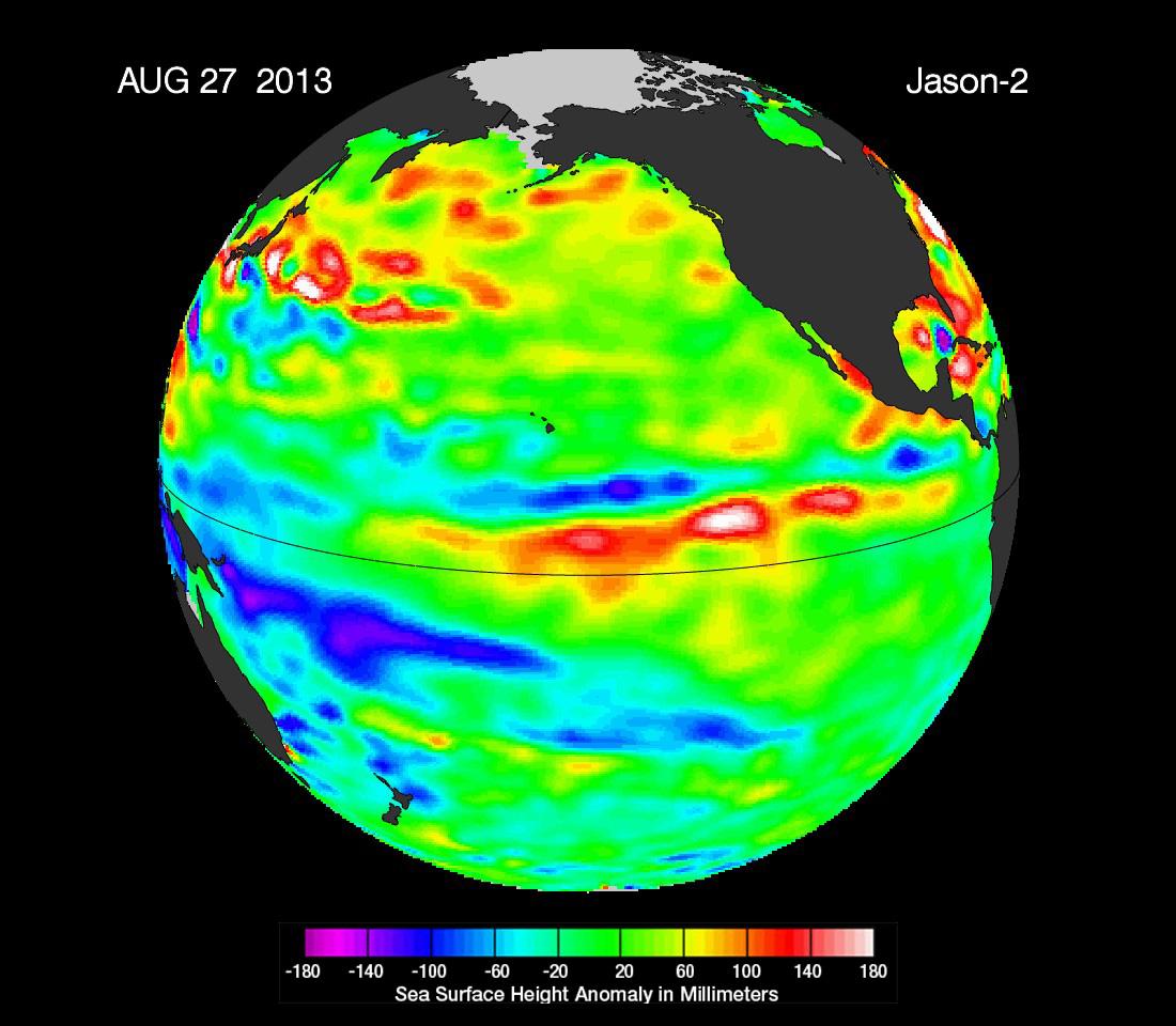
2013-02-07
Earth
OSTM/Jason-2
Altimeter
1100x880x3
PIA16787:
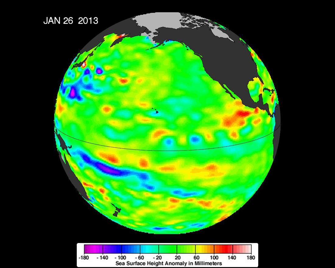
Pacific Locked in 'La Nada' Limbo
Full Resolution:
TIFF
(2.905 MB)
JPEG
(93.08 kB)
2013-09-09
Earth
OSTM/Jason-2
Altimeter
1100x960x3
PIA17454:
'La Nada' Climate Pattern Lingers in the Pacific
Full Resolution:
TIFF
(3.169 MB)
JPEG
(108.7 kB)
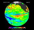
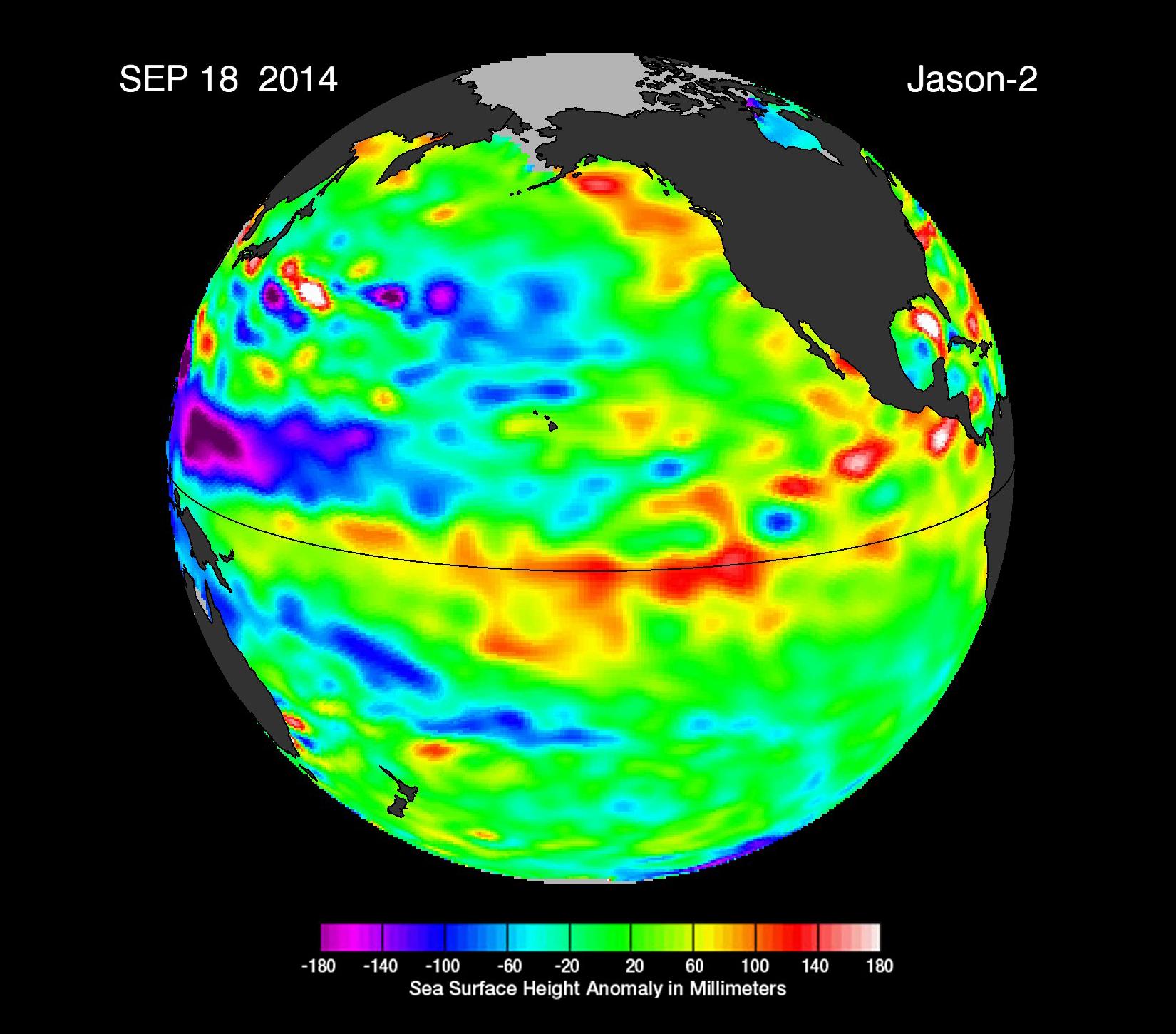
2014-09-22
Earth
OSTM/Jason-2
Altimeter
1650x1450x3
PIA17809:
The Fickle El Niño of 2014
Full Resolution:
TIFF
(7.181 MB)
JPEG
(203.9 kB)
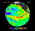
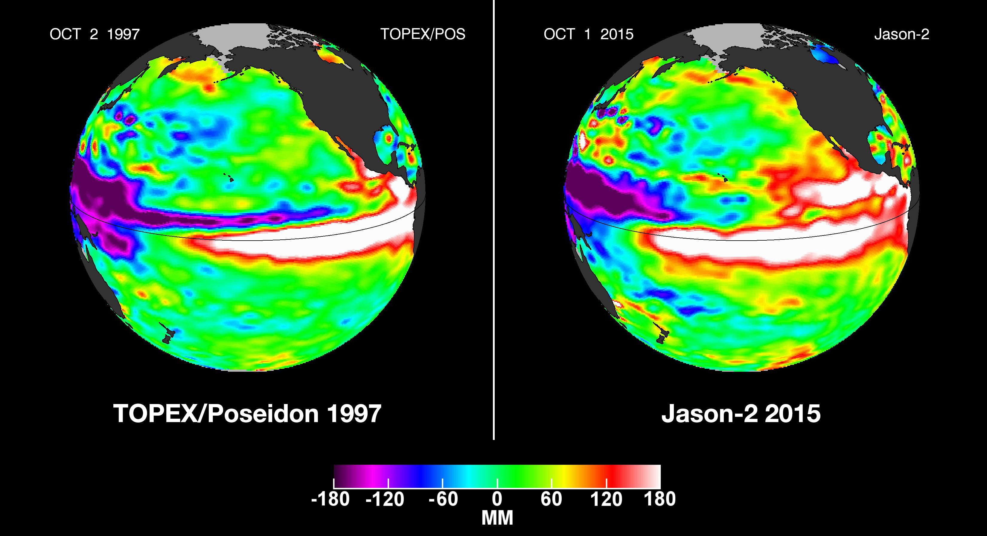
2015-10-19
Earth
OSTM/Jason-2
Altimeter
3300x1791x3
PIA20009:
NASA Studying 2015 El Ni�o Event as Never Before
Full Resolution:
TIFF
(6.183 MB)
JPEG
(459.8 kB)
2020-07-07
Asteroid
Psyche
1600x900x3
PIA23876:
A Metal-Rich World (Artist's Concept)
Full Resolution:
TIFF
(2.866 MB)
JPEG
(239.1 kB)
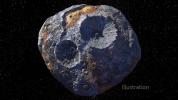
2021-03-29
Asteroid
Psyche
10800x10800x3
PIA24471:
Asteroid Psyche (Illustration)
Full Resolution:
TIFF
(133.9 MB)
JPEG
(8.736 MB)
2021-03-29
Asteroid
Psyche
10800x10800x3
PIA24472:
Asteroid Psyche (Illustration)
Full Resolution:
TIFF
(134.6 MB)
JPEG
(8.453 MB)
1-100
101-200
201-300
301-400
401-500
Currently displaying images:
301 - 400
of 499


