My
List |
Addition Date
|
Target
|
Mission
|
Instrument
|
Size
|

|
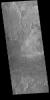
2022-09-30 |
Mars
|
Mars Reconnaissance Orbiter (MRO)
|
HiRISE
|
2880x1800x3 |
|
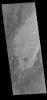
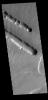
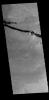
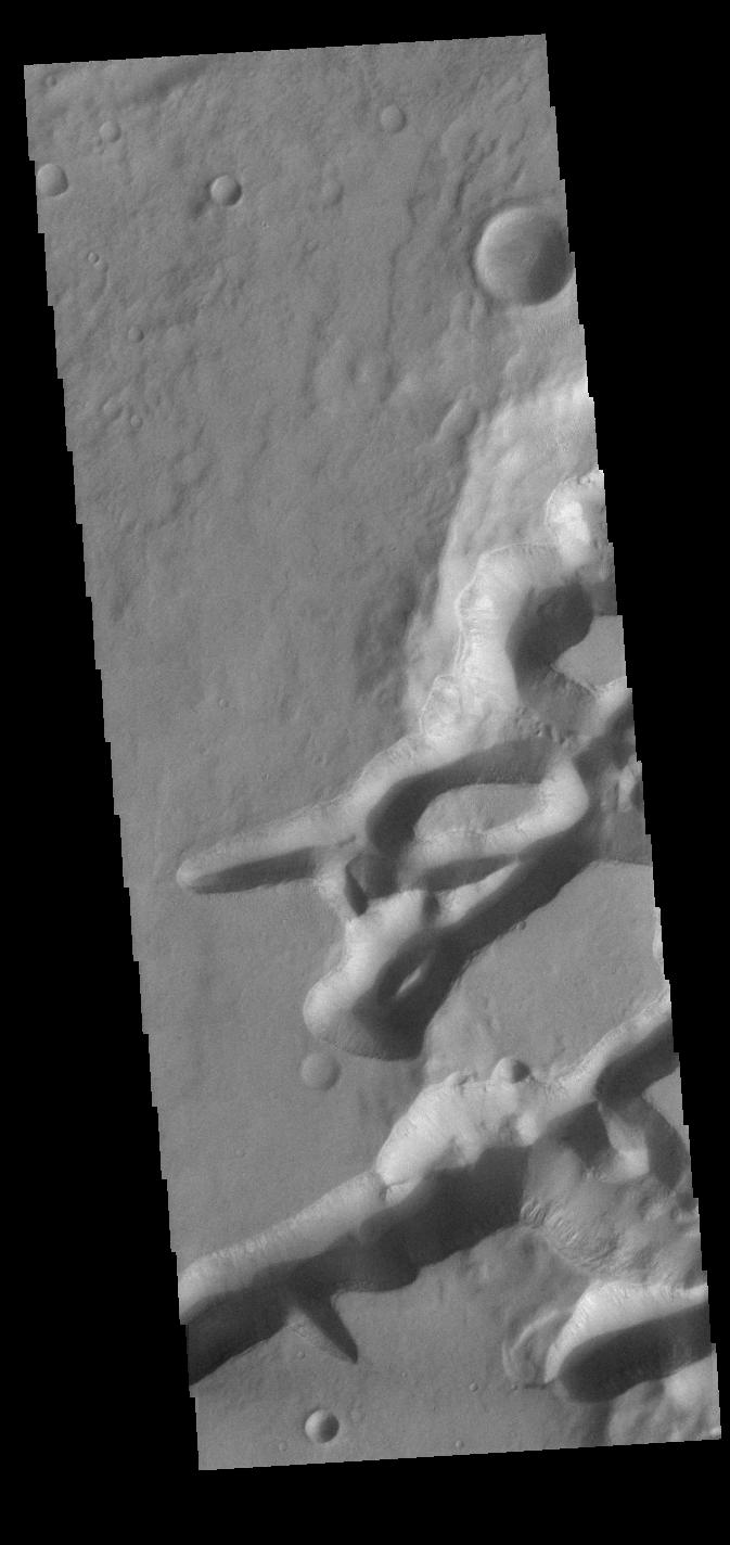
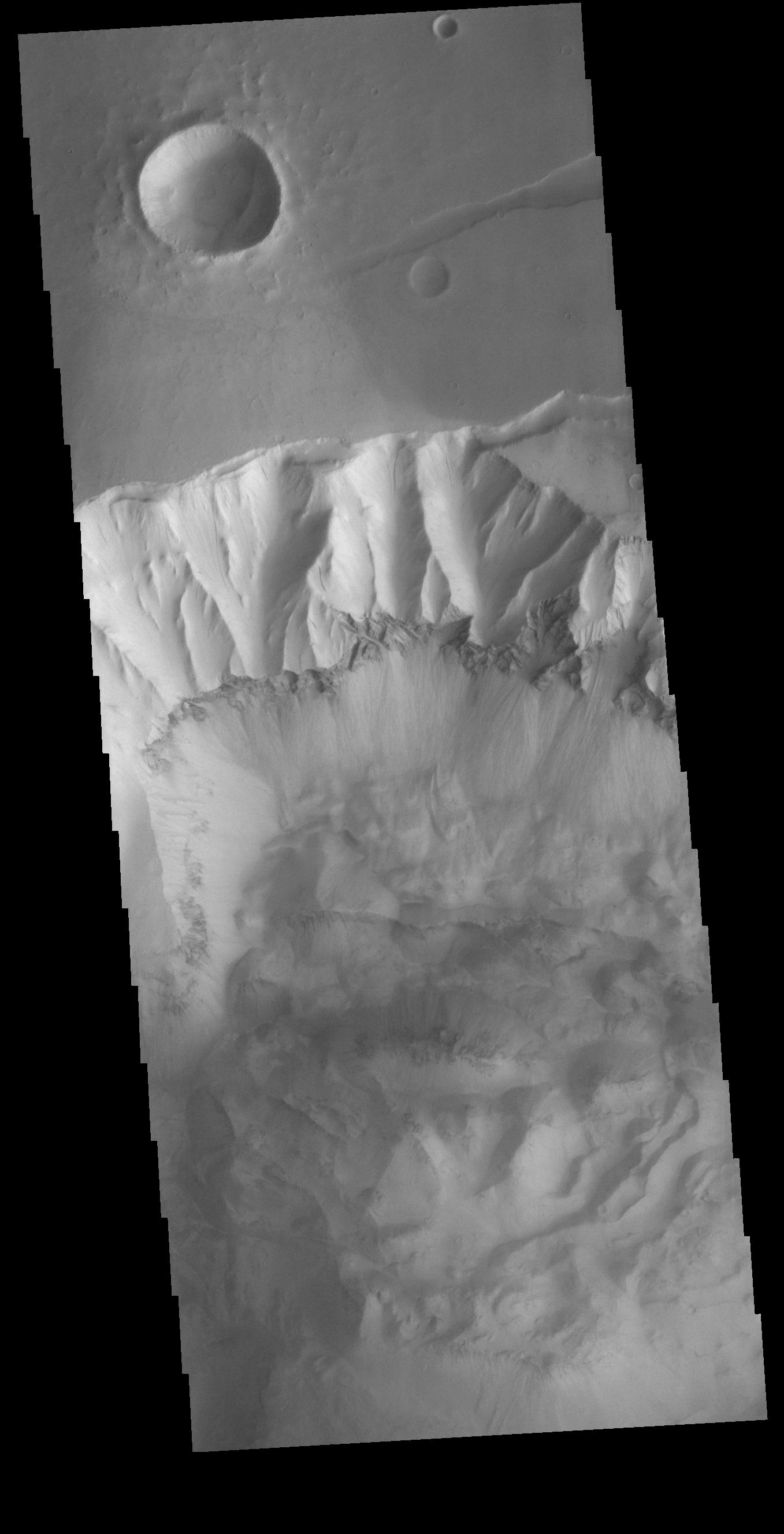
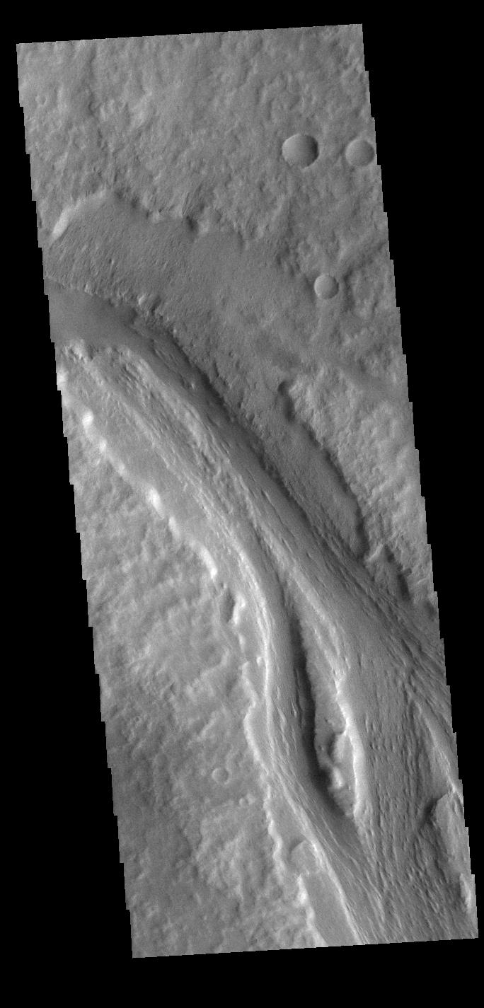
-
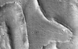
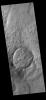
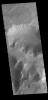
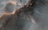
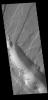
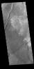
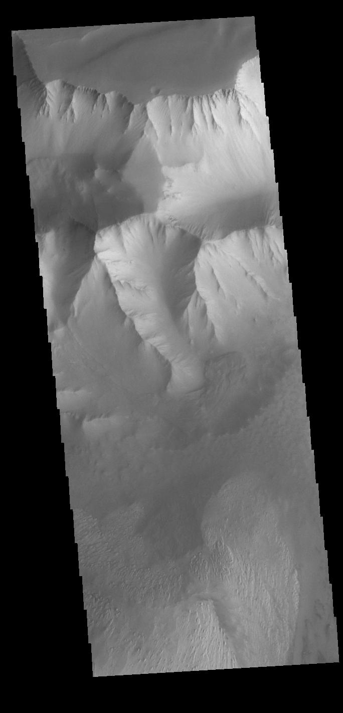
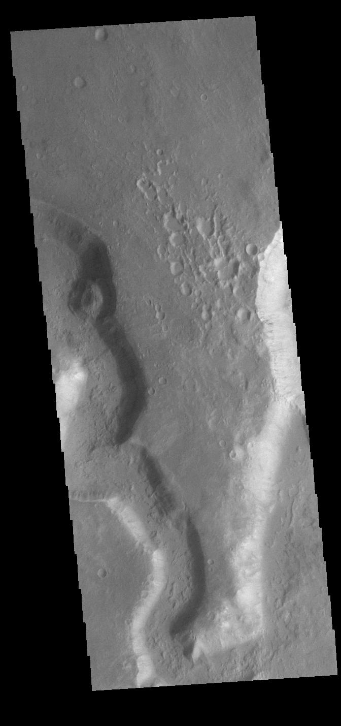
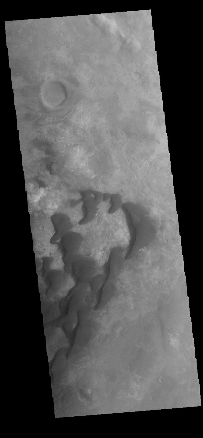
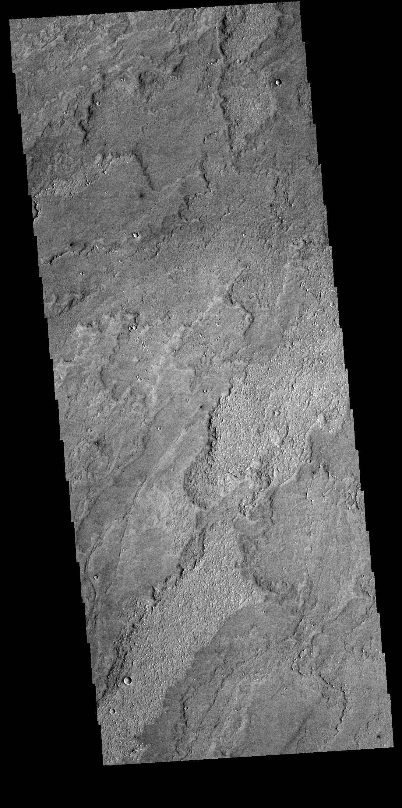
PIA25551:
-
Landforms in Ares Vallis
Full Resolution:
TIFF
(8.47 MB)
JPEG
(1.733 MB)
|
|
|
2022-09-30 |
Mars
|
2001 Mars Odyssey
|
THEMIS
|
602x2700x1 |

|
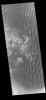
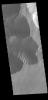
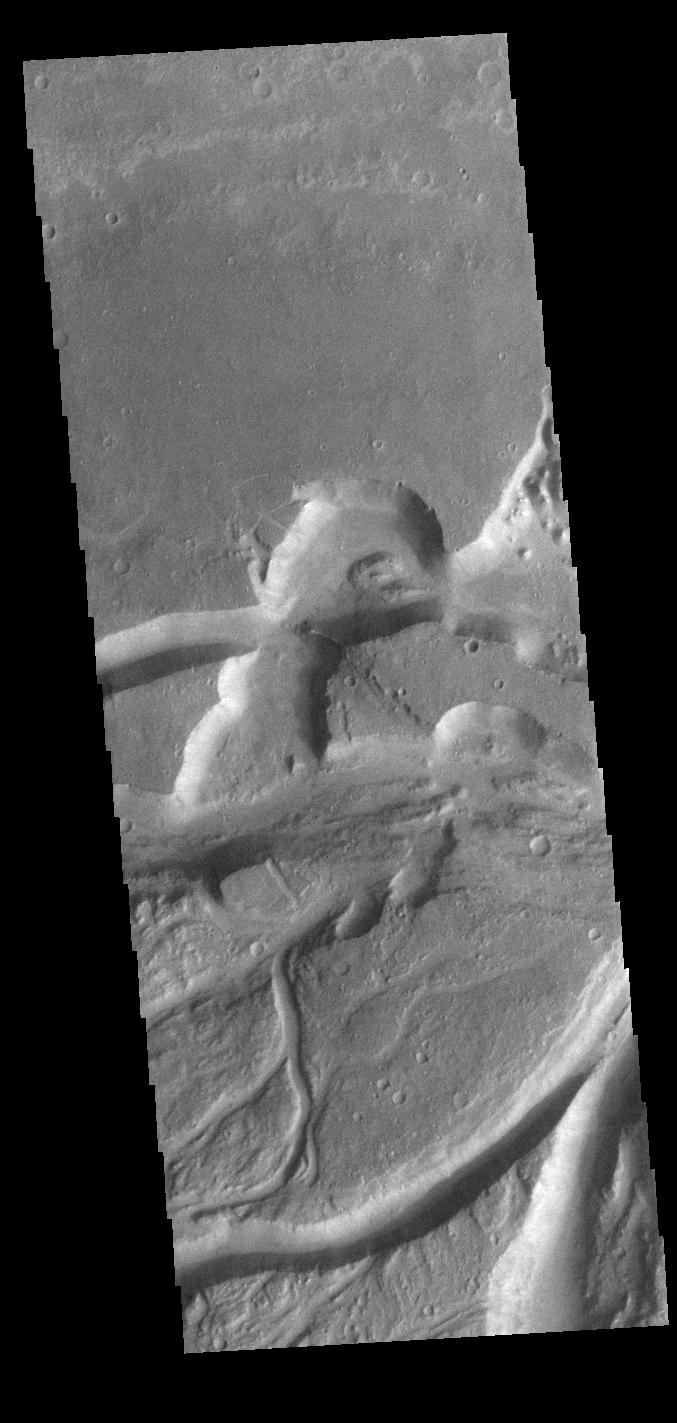
-
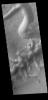
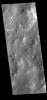
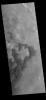
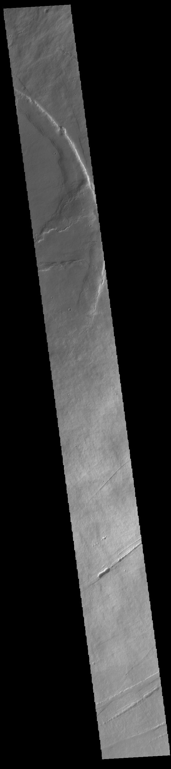
PIA25540:
-
Pavonis Mons
Full Resolution:
TIFF
(697.1 kB)
JPEG
(79.62 kB)
|
|
|
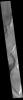
2022-09-29 |
Mars
|
2001 Mars Odyssey
|
THEMIS
|
685x1423x1 |
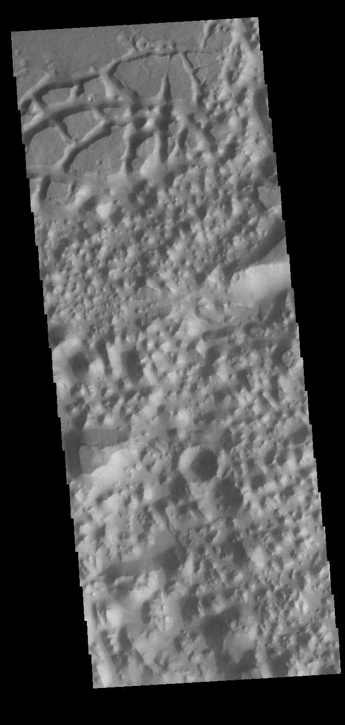
|
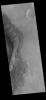
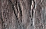
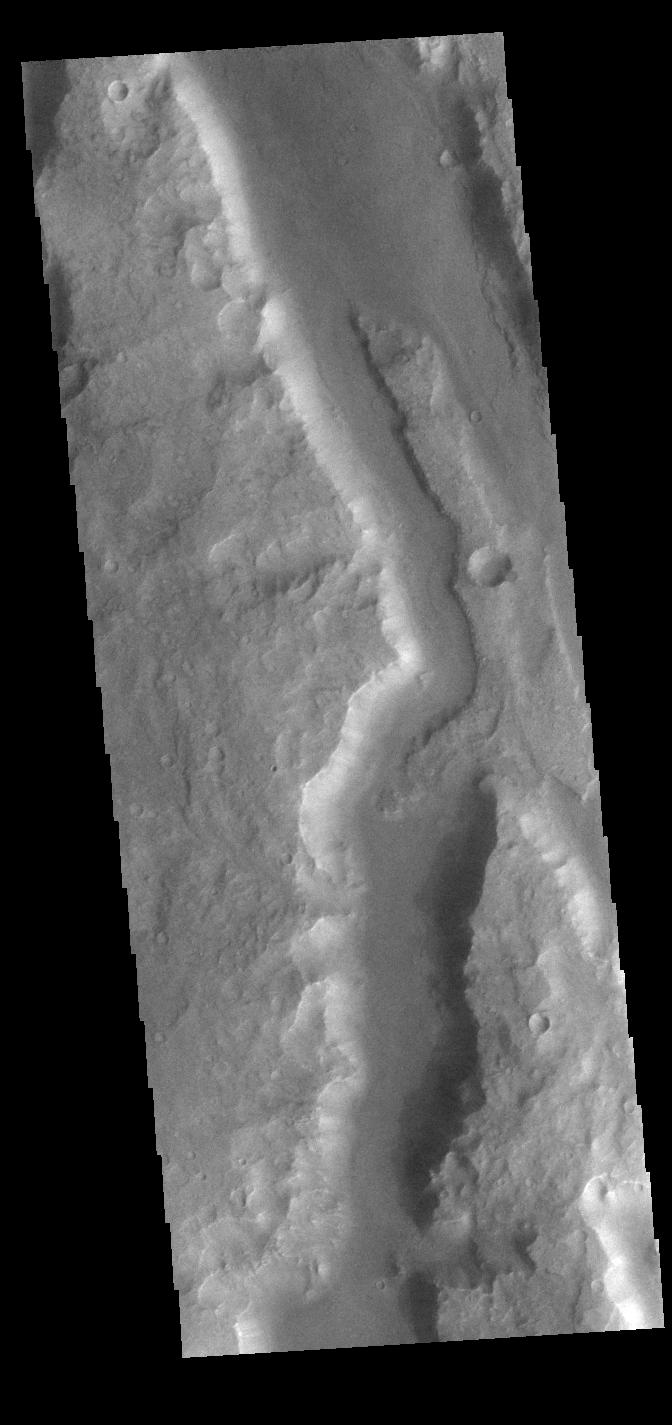
-
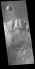
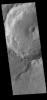
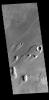
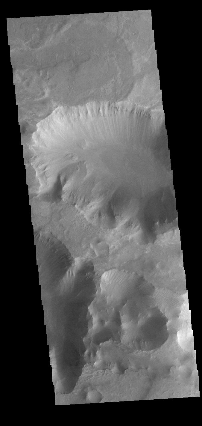
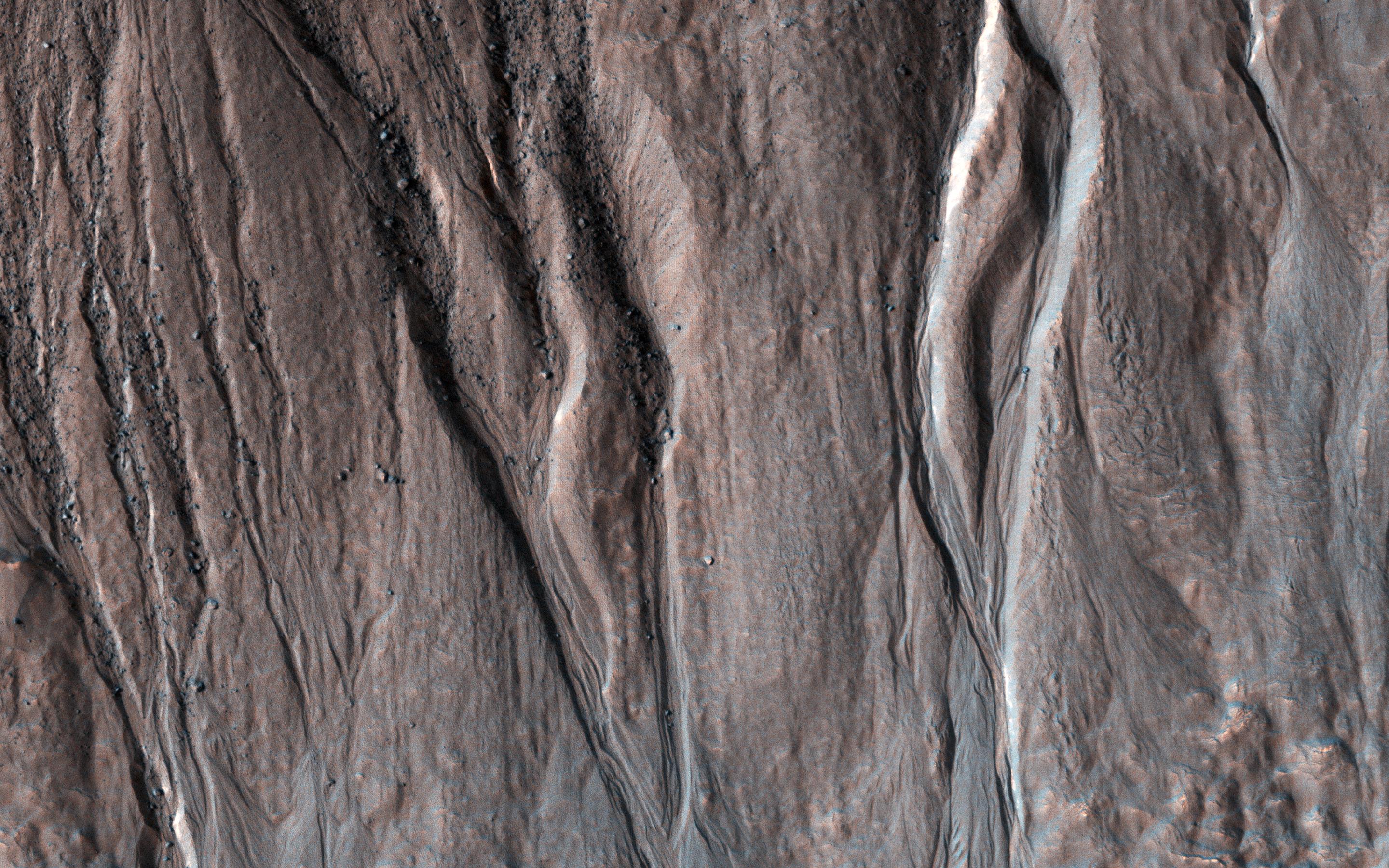
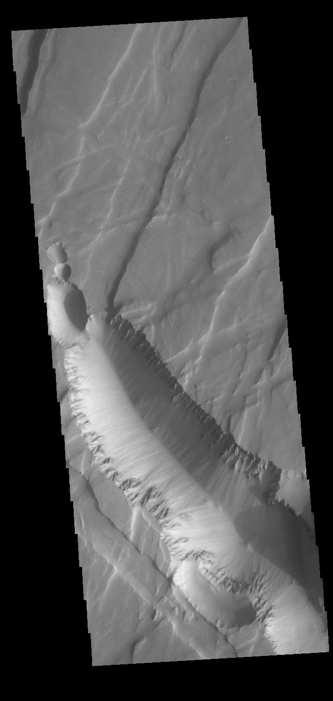
PIA25539:
-
Echus Chasma Mega-gully
Full Resolution:
TIFF
(707.8 kB)
JPEG
(73.95 kB)
|
|
|
2022-09-28 |
Earth
|
COWVR
|
COWVR
TEMPEST
|
1564x1527x3 |
|
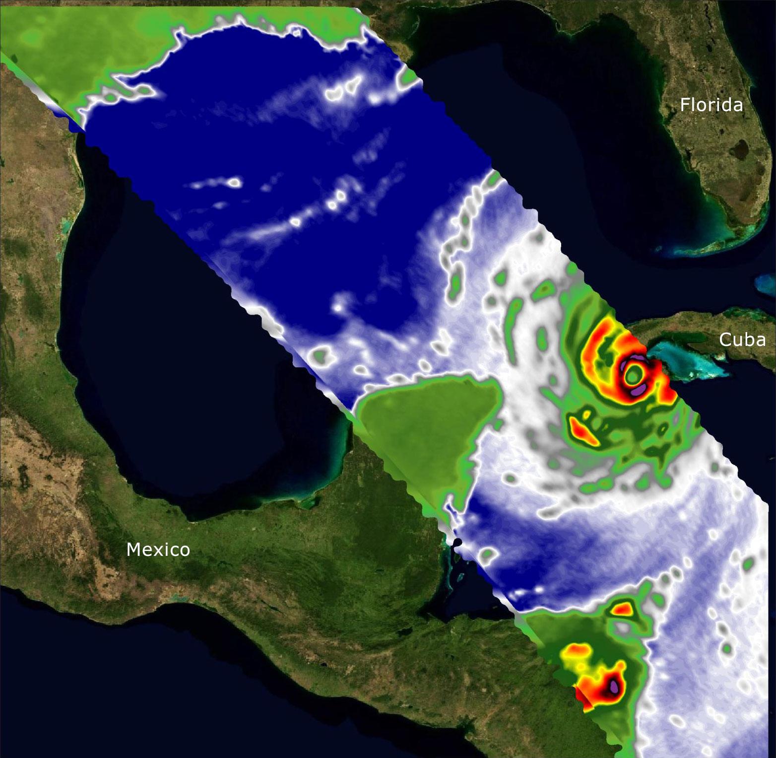
-
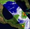
PIA25425:
-
COWVR and TEMPEST Image Hurricane Ian
Full Resolution:
TIFF
(5.736 MB)
JPEG
(250.1 kB)
|
|
|
2022-09-28 |
Earth
|
Aqua
|
AIRS
|
900x695x3 |
|
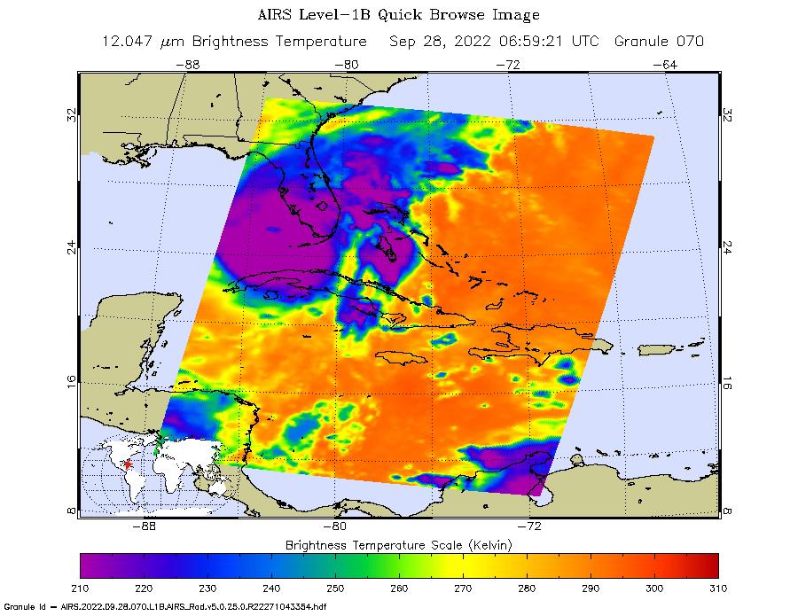
-
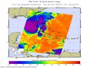
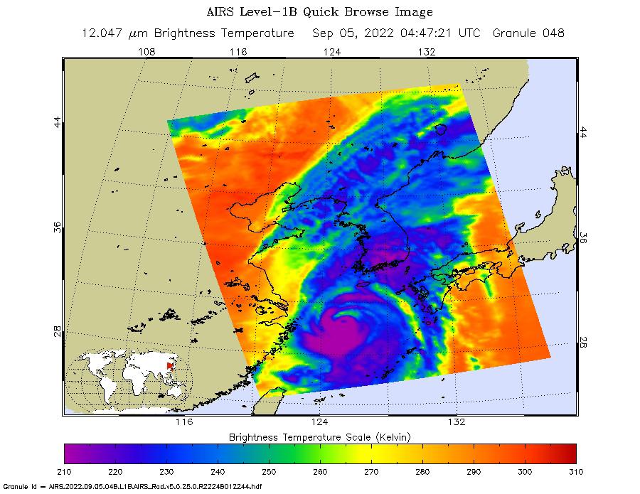
PIA24908:
-
Hurricane Ian Captured in Infrared by AIRS
Full Resolution:
TIFF
(808.6 kB)
JPEG
(116 kB)
|
|
|
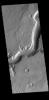
2022-09-28 |
Mars
|
2001 Mars Odyssey
|
THEMIS
|
672x1425x1 |

|
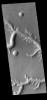
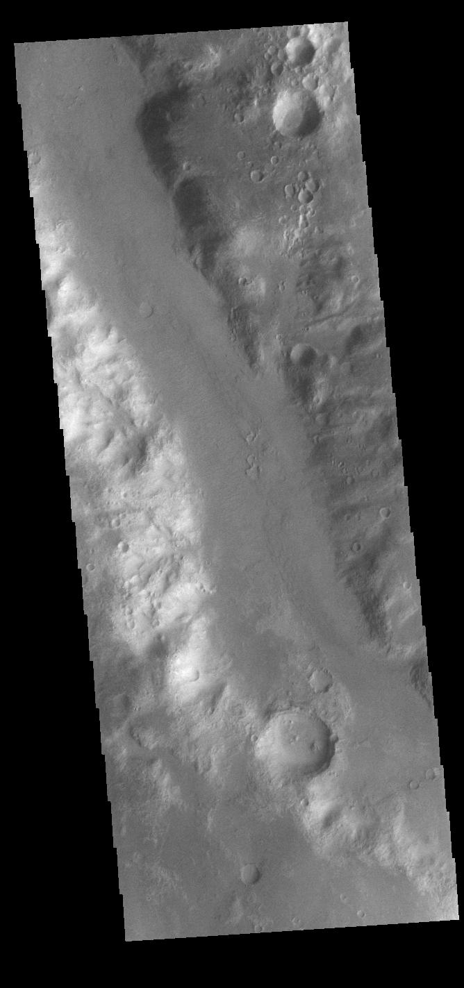
-
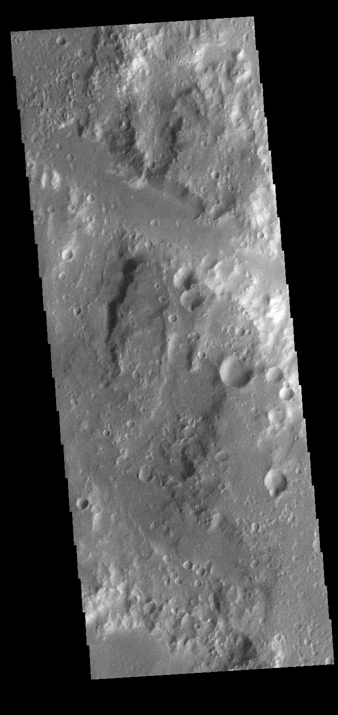
PIA25538:
-
Ma'adim Vallis
Full Resolution:
TIFF
(720.4 kB)
JPEG
(85.45 kB)
|
|
|
2022-09-27 |
Mars
|
2001 Mars Odyssey
|
THEMIS
|
665x1428x1 |

|
-
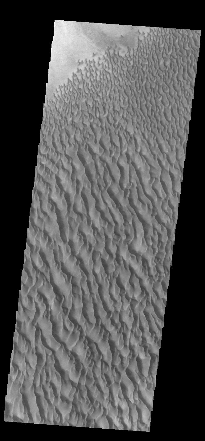
PIA25537:
-
Proctor Crater Dunes
Full Resolution:
TIFF
(721.9 kB)
JPEG
(95.31 kB)
|
|
|
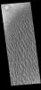
2022-09-26 |
Mars
|
2001 Mars Odyssey
|
THEMIS
|
668x1423x1 |

|
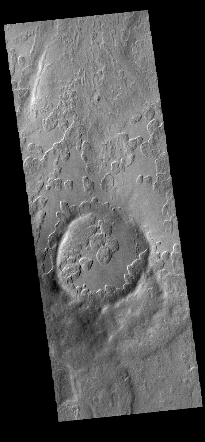
-
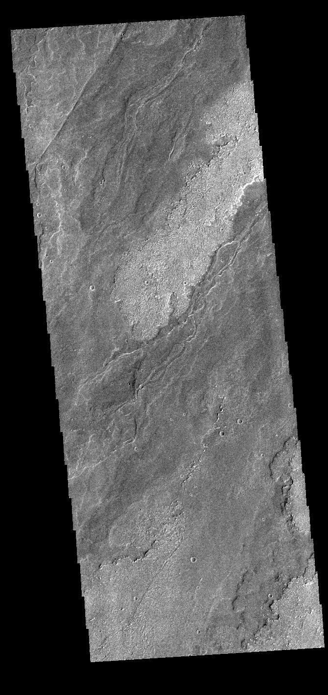
PIA25536:
-
Uzboi Vallis
Full Resolution:
TIFF
(702.9 kB)
JPEG
(81.92 kB)
|
|
|
2022-09-23 |
Mars
|
2001 Mars Odyssey
|
THEMIS
|
669x1439x1 |
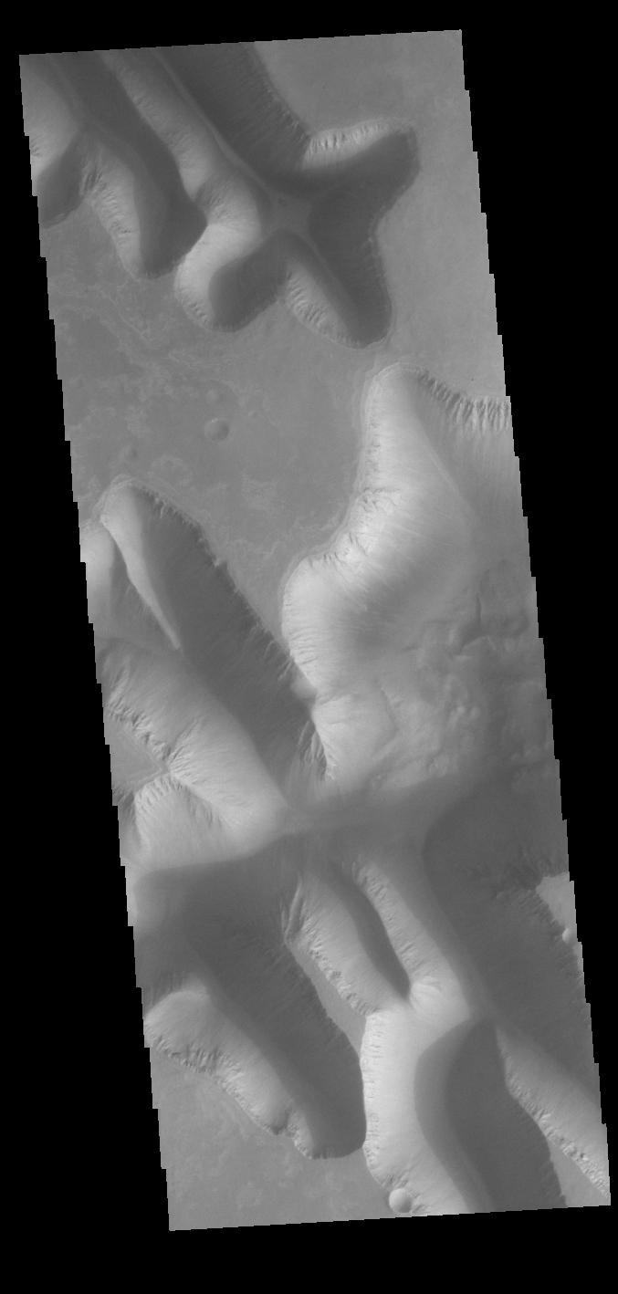
|
-
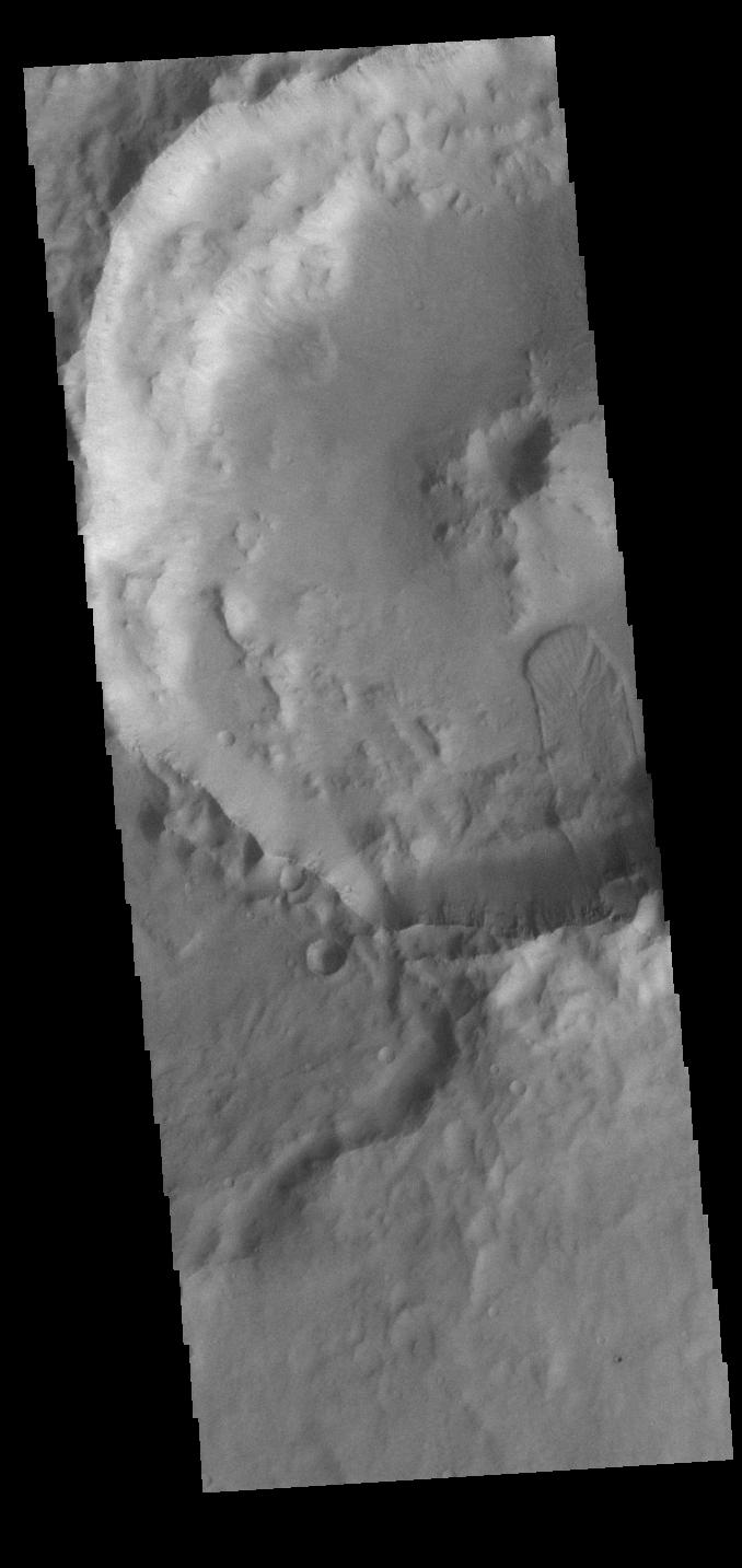
PIA25535:
-
Peneus Patera
Full Resolution:
TIFF
(735.9 kB)
JPEG
(129 kB)
|
|
|
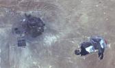
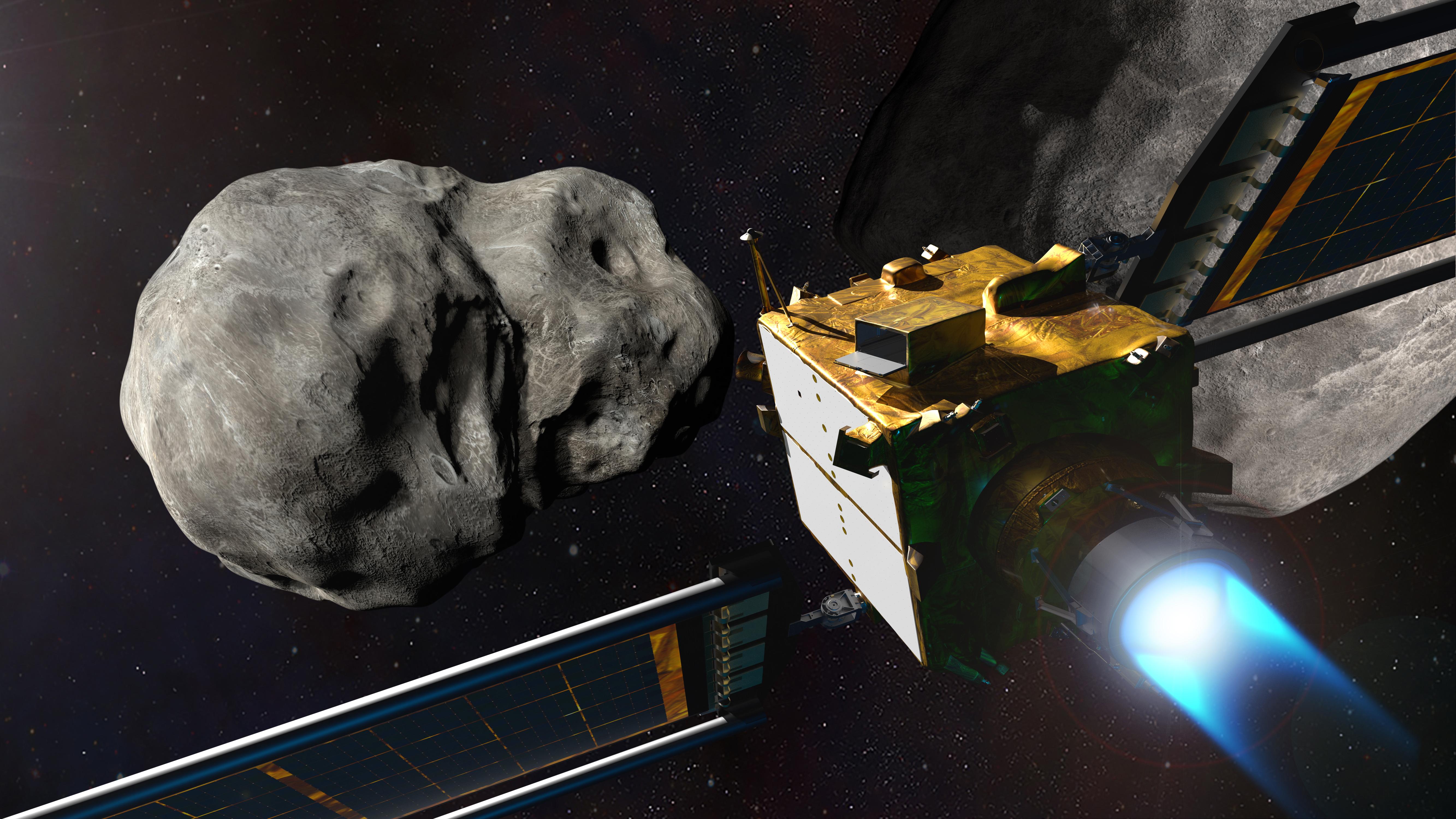
2022-09-22 |
Asteroid
|
Double Asteroid Redirection Test (DART)
|
|
5333x3000x3 |

|
-
PIA25329:
-
NASA's DART at the Didymos System
Full Resolution:
TIFF
(34.68 MB)
JPEG
(1.268 MB)
|
|
|
2022-09-22 |
Mars
|
2001 Mars Odyssey
|
THEMIS
|
660x1432x1 |
|
-
PIA25534:
-
Kaiser Crater Dunes
Full Resolution:
TIFF
(675.7 kB)
JPEG
(73.79 kB)
|
|
|
2022-09-21 |
Mars
|
2001 Mars Odyssey
|
THEMIS
|
673x1424x1 |

|
-
PIA25533:
-
Mangala Fossae
Full Resolution:
TIFF
(674.8 kB)
JPEG
(74.47 kB)
|
|
|
2022-09-20 |
Mars
|
2001 Mars Odyssey
|
THEMIS
|
677x1423x1 |

|
-
PIA25532:
-
Osuga Valles
Full Resolution:
TIFF
(724.6 kB)
JPEG
(100.5 kB)
|
|
|
2022-09-19 |
Mars
|
2001 Mars Odyssey
|
THEMIS
|
668x1437x1 |
|
-
PIA25531:
-
Russell Crater Dunes
Full Resolution:
TIFF
(658.4 kB)
JPEG
(63.66 kB)
|
|
|
2022-09-19 |
Mars
|
Mars Reconnaissance Orbiter (MRO)
|
HiRISE
|
4047x2956x3 |
|
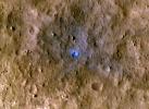
-
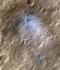
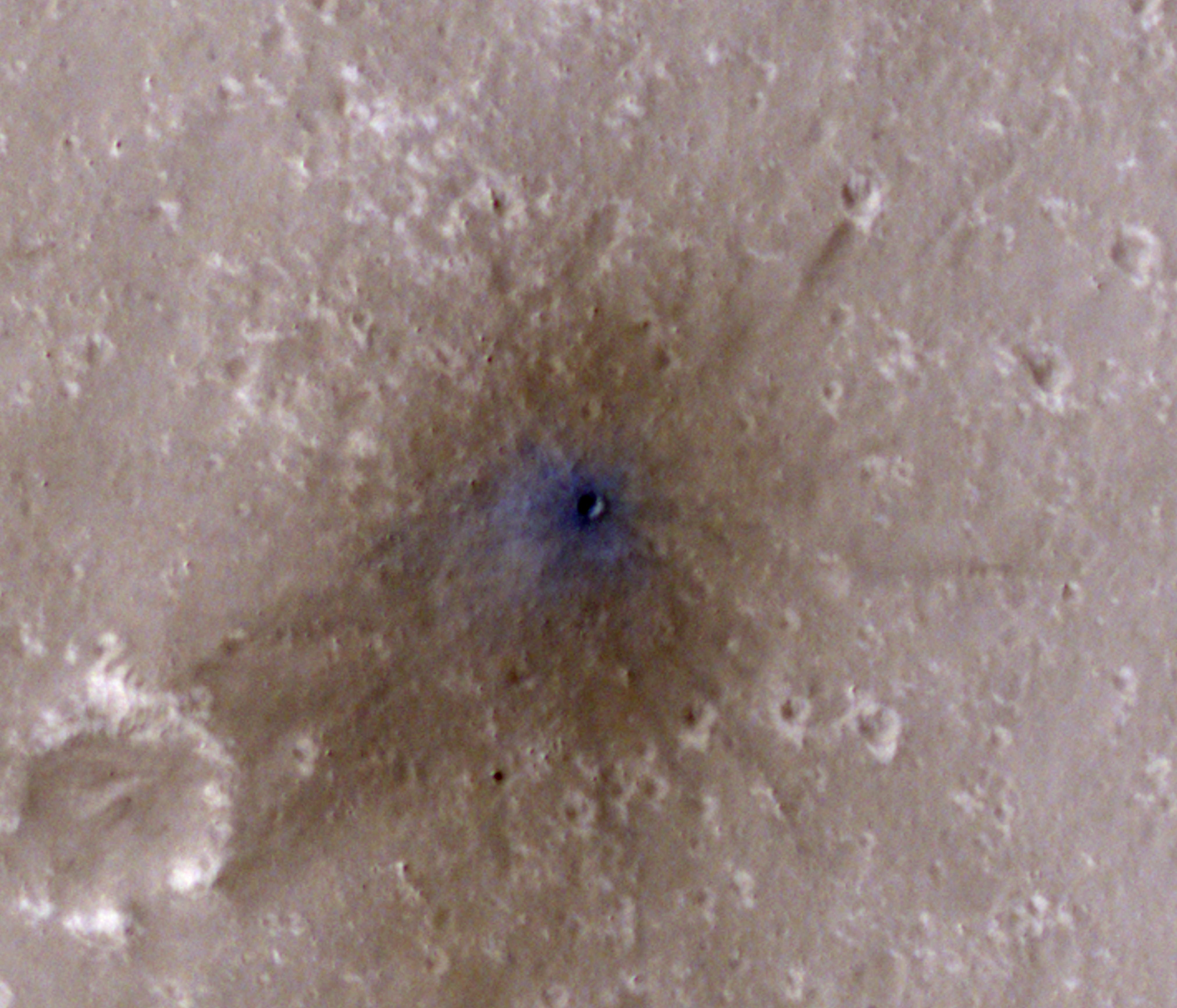
PIA25411:
-
InSight-Detected Impact in August 2021
Full Resolution:
TIFF
(35.9 MB)
JPEG
(1.611 MB)
|
|
|
2022-09-19 |
Mars
|
Mars Reconnaissance Orbiter (MRO)
|
HiRISE
|
2675x3147x3 |
|
-
PIA25410:
-
InSight-Detected Impact in May 2020
Full Resolution:
TIFF
(25.26 MB)
JPEG
(1.547 MB)
|
|
|
2022-09-19 |
Mars
|
Mars Reconnaissance Orbiter (MRO)
|
HiRISE
|
4047x3466x3 |
|
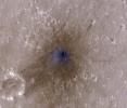
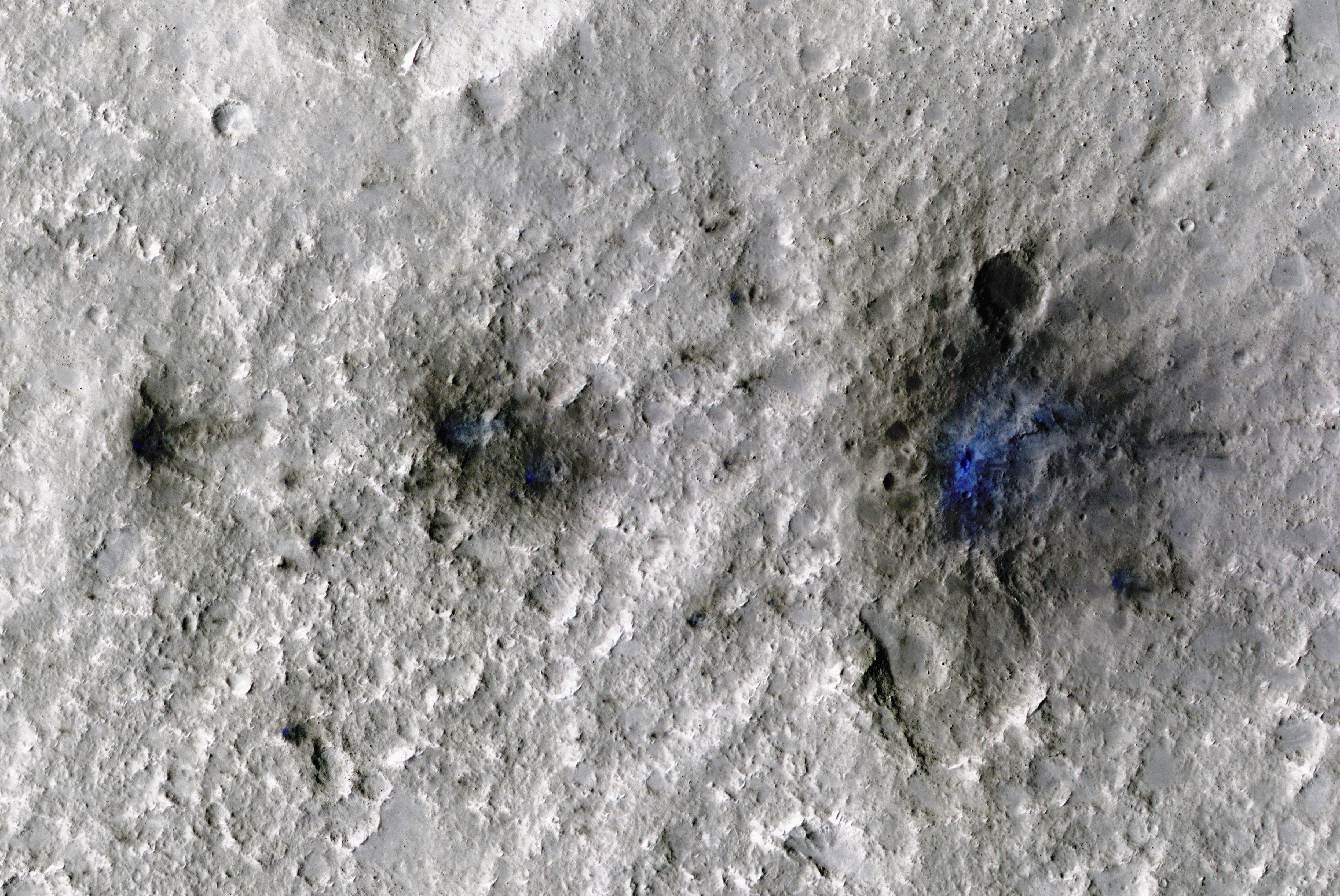
-
PIA25409:
-
InSight-Detected Impact in February 2021
Full Resolution:
TIFF
(40.22 MB)
JPEG
(844.9 kB)
|
|
|
2022-09-19 |
Mars
|
Mars Reconnaissance Orbiter (MRO)
|
HiRISE
|
4994x3341x3 |
|
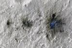
-
PIA25408:
-
InSight Detects an Impact for the First Time
Full Resolution:
TIFF
(50.08 MB)
JPEG
(2.9 MB)
|
|
|
2022-09-16 |
Mars
|
2001 Mars Odyssey
|
THEMIS
|
1331x2661x1 |
|
-
PIA25520:
-
Eberswalde Crater Delta
Full Resolution:
TIFF
(2.787 MB)
JPEG
(480 kB)
|
|
|
2022-09-15 |
Mars
|
2001 Mars Odyssey
|
THEMIS
|
678x1422x1 |
|
-
PIA25519:
-
Melas Chasma Cliffs
Full Resolution:
TIFF
(648.5 kB)
JPEG
(50.85 kB)
|
|
|
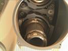
2022-09-15 |
Mars
|
Mars 2020 Rover
|
Scanning Habitable Environments with Raman & Luminescence for Organics and Chemicals (SHERLOC)
|
1252x936x3 |
|
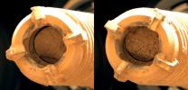
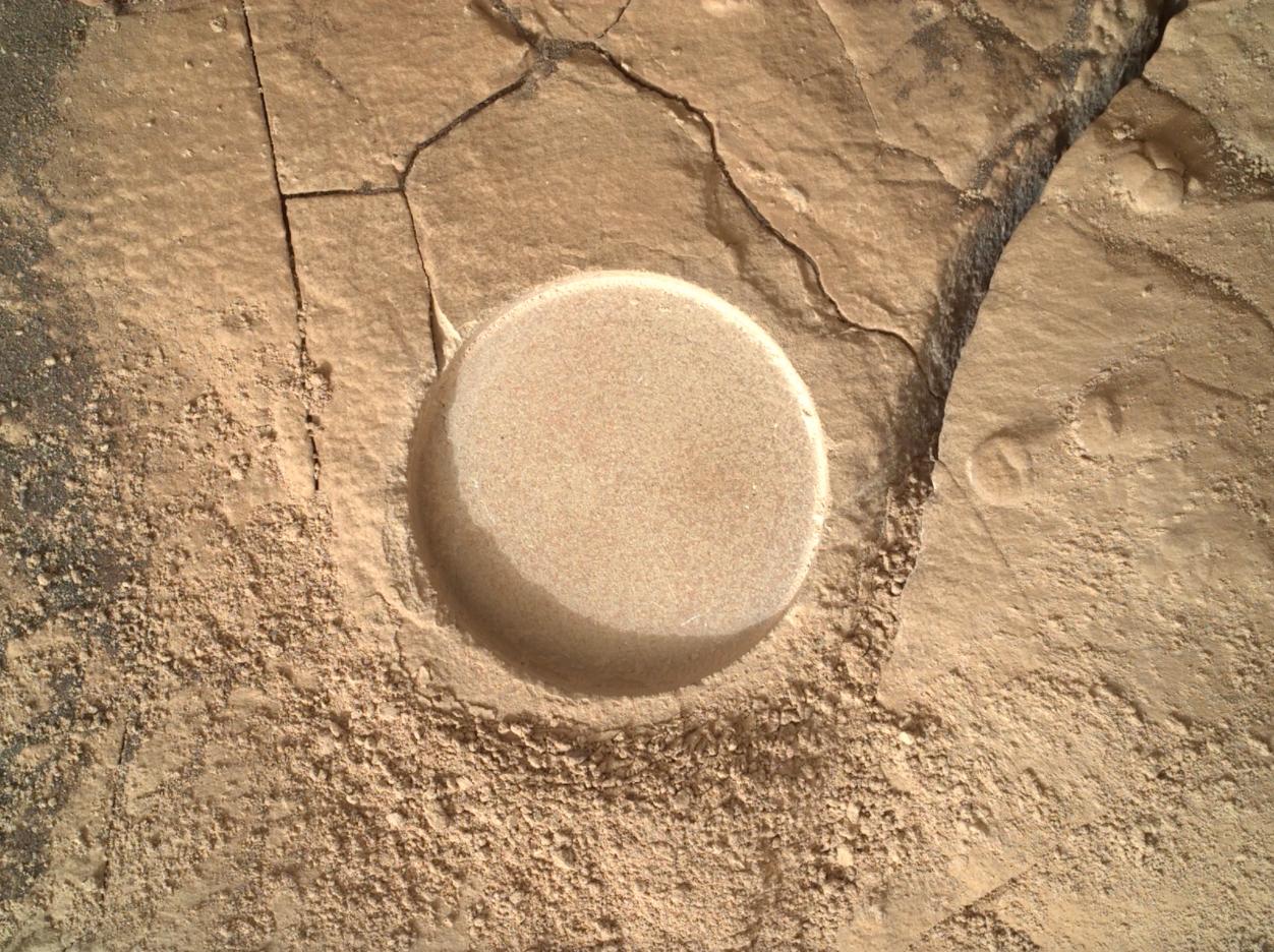
-
PIA25246:
-
Zooming in on Perseverance Rover's Wildcat Ridge Abrasion Patch
Full Resolution:
TIFF
(3.517 MB)
JPEG
(259.4 kB)
|
|
|
2022-09-15 |
Mars
|
Mars 2020 Rover
|
Scanning Habitable Environments with Raman & Luminescence for Organics and Chemicals (SHERLOC)
|
1920x1080x3 |

|
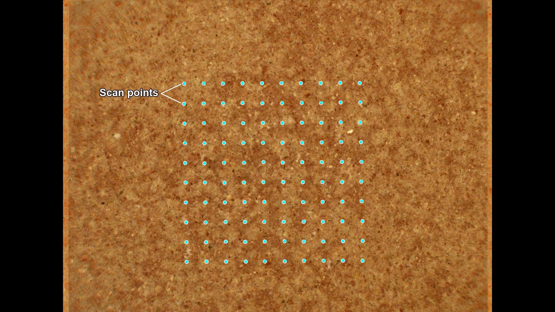
-
PIA25245:
-
How SHERLOC Analyzes a Rock Target
Full Resolution:
TIFF
(5.365 MB)
JPEG
(283.3 kB)
|
|
|
2022-09-15 |
Mars
|
Mars Reconnaissance Orbiter (MRO)
|
CRISM
HiRISE
|
1920x1080x3 |
|
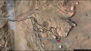
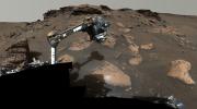
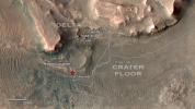
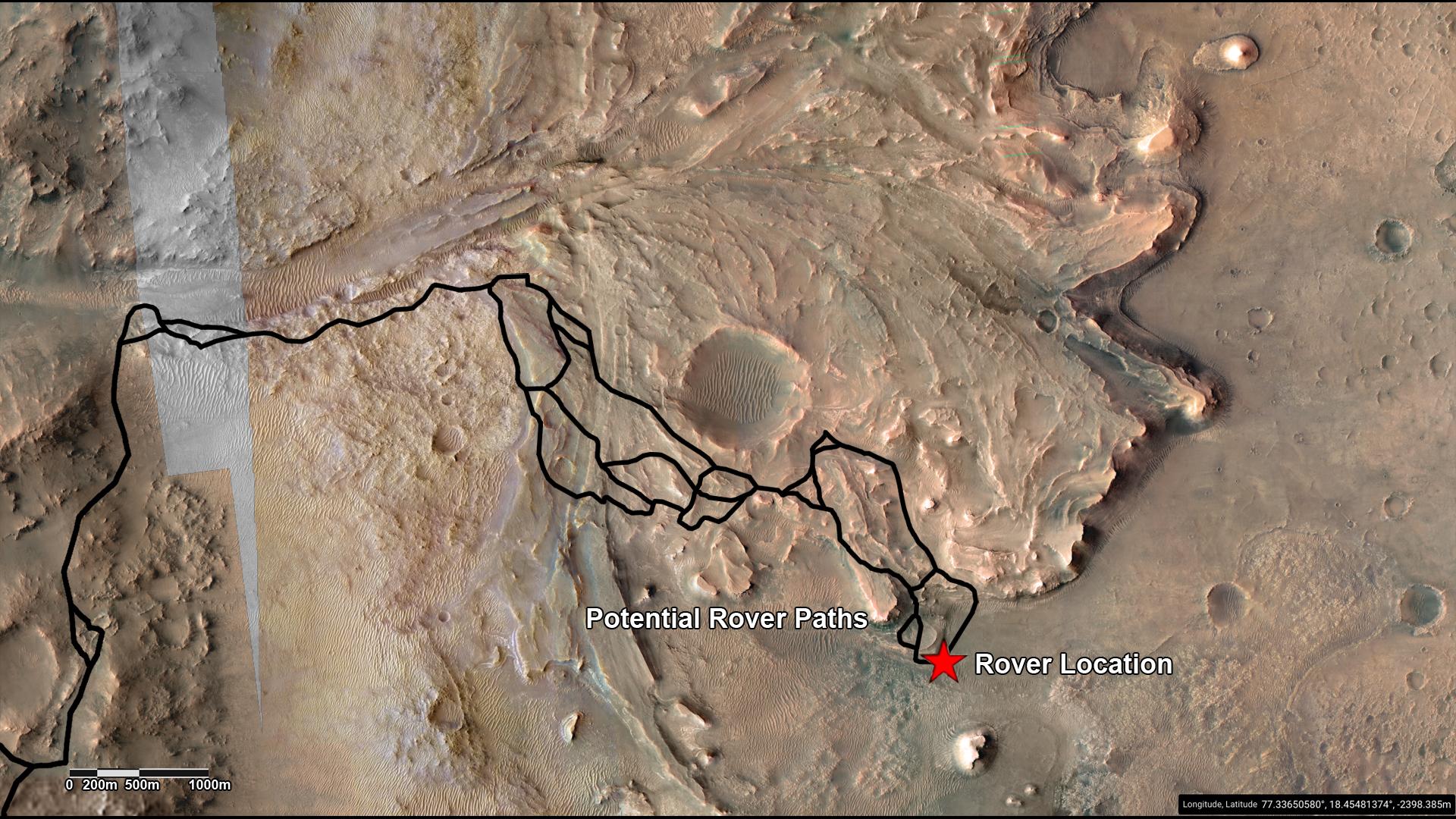
-
PIA25244:
-
Potential Driving Routes for NASA's Perseverance Rover
Full Resolution:
TIFF
(6.223 MB)
JPEG
(406.8 kB)
|
|
|
2022-09-15 |
Mars
|
Mars 2020 Rover
|
Navigation Camera (M2020)
|
1620x1080x3 |
|
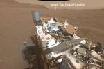
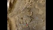
-
PIA25243:
-
Perseverance's View of Possible Future Sample Cache Depot Site
Full Resolution:
TIFF
(5.251 MB)
JPEG
(217.7 kB)
|
|
|
2022-09-15 |
Mars
|
Mars 2020 Rover
|
Mastcam-Z
|
964x463x3 |
|
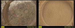
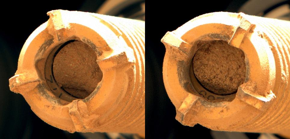
-
PIA24929:
-
Perseverance Rock Cores From Wildcat Ridge
Full Resolution:
TIFF
(1.302 MB)
JPEG
(63.69 kB)
|
|
|
2022-09-15 |
Mars
|
Mars 2020 Rover
|
Mastcam-Z
|
3225x2631x3 |

|
-
PIA24928:
-
Sample Collection and Rock Analysis at Wildcat Ridge
Full Resolution:
TIFF
(17.01 MB)
JPEG
(1.04 MB)
|
|
|
2022-09-15 |
Mars
|
Mars 2020 Rover
|
Mastcam-Z
|
844x412x3 |

|
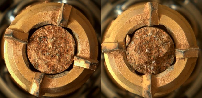
-
PIA24927:
-
Rock Cores From Skinner Ridge
Full Resolution:
TIFF
(1.044 MB)
JPEG
(61.1 kB)
|
|
|
2022-09-15 |
Mars
|
Mars 2020 Rover
|
Scanning Habitable Environments with Raman & Luminescence for Organics and Chemicals (SHERLOC)
|
1962x752x3 |
|
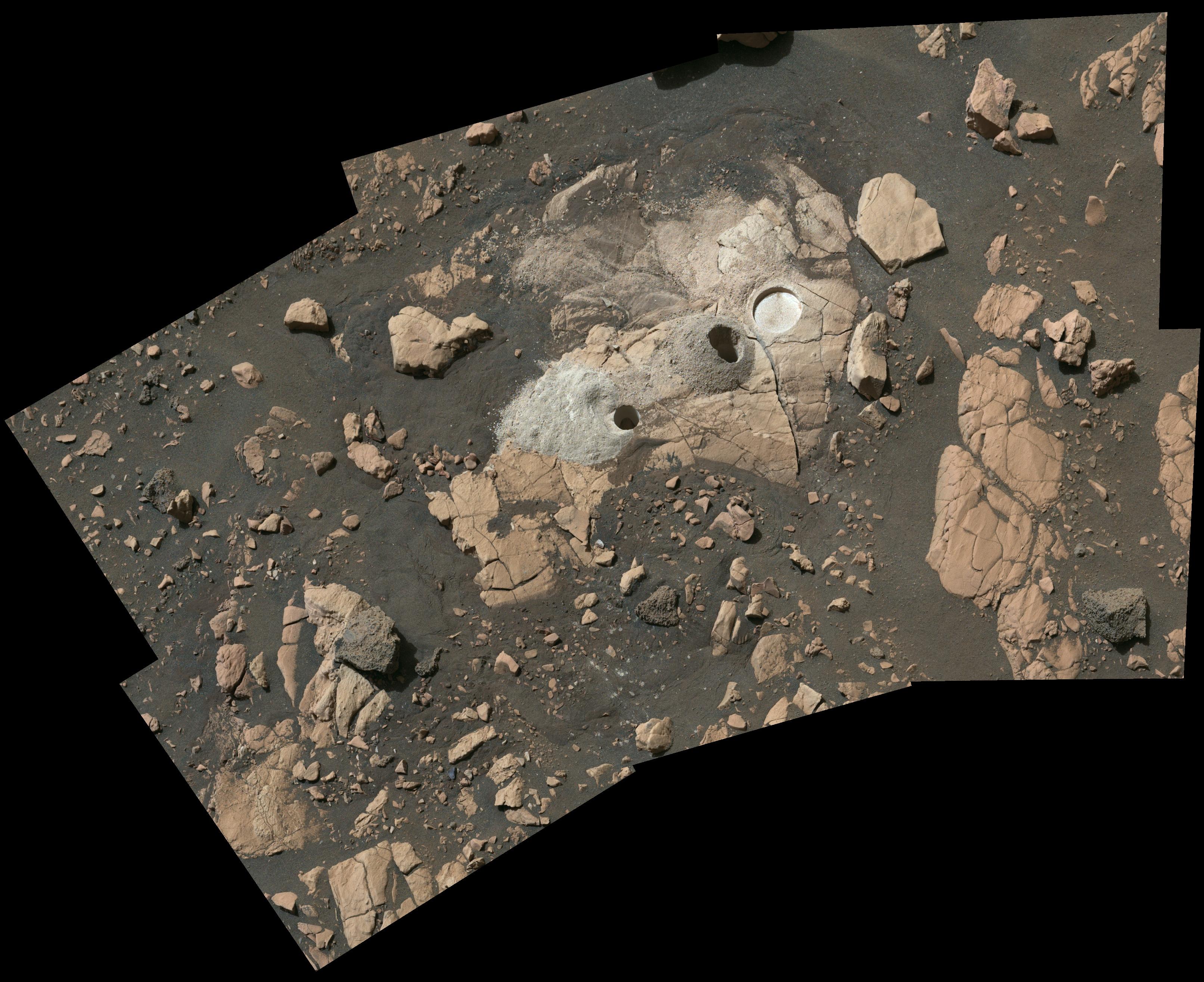
-
PIA24926:
-
2 Abrasion Patches From Perseverance at Jezero Delta
Full Resolution:
TIFF
(4.01 MB)
JPEG
(209 kB)
|
|
|
2022-09-15 |
Mars
|
Mars 2020 Rover
|
Mastcam-Z
|
13235x7349x3 |
|
-
PIA24925:
-
Perseverance Workspace at Skinner Ridge
Full Resolution:
TIFF
(201.6 MB)
JPEG
(8.688 MB)
|
|
|
2022-09-15 |
Mars
|
Mars 2020 Rover
|
Mastcam-Z
|
15261x8765x3 |
|
-
PIA24924:
-
2 Perseverance Sampling Locations in Jezero's Delta
Full Resolution:
TIFF
(292.2 MB)
JPEG
(17.42 MB)
|
|
|
2022-09-15 |
Mars
|
Mars Reconnaissance Orbiter (MRO)
|
HiRISE
|
1920x1080x3 |
|
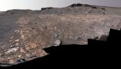
-
PIA24923:
-
Perseverance Exploring the Front of the Delta
Full Resolution:
TIFF
(6.111 MB)
JPEG
(355.5 kB)
|
|
|
2022-09-15 |
Mars
|
Mars Reconnaissance Orbiter (MRO)
|
CRISM
HiRISE
|
1920x1080x3 |
|
-
PIA24922:
-
Perseverance's Route to the Delta
Full Resolution:
TIFF
(5.008 MB)
JPEG
(256 kB)
|
|
|
2022-09-14 |
Mars
|
Mars 2020 Rover
|
Mastcam-Z
|
29163x8182x3 |
|
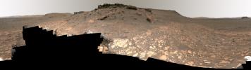
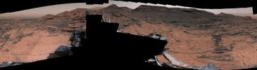
-
PIA24921:
Detailed Panorama of Mars' Jezero Crater Delta
Full Resolution:
TIFF
(457.2 MB)
JPEG
(26.18 MB)
|
|
|
2022-09-14 |
Mars
|
2001 Mars Odyssey
|
THEMIS
|
670x1416x1 |
|
-
PIA25518:
-
Tithonium Chasma
Full Resolution:
TIFF
(756.8 kB)
JPEG
(182 kB)
|
|
|
2022-09-13 |
Mars
|
2001 Mars Odyssey
|
THEMIS
|
684x1422x1 |

|
-
PIA25517:
-
Tithonium Chasma
Full Resolution:
TIFF
(637.4 kB)
JPEG
(57.82 kB)
|
|
|
2022-09-12 |
Mars
|
2001 Mars Odyssey
|
THEMIS
|
675x1421x1 |
|
-
PIA25516:
-
Coprates Chasma
Full Resolution:
TIFF
(690.8 kB)
JPEG
(73.97 kB)
|
|
|
2022-09-09 |
Mars
|
2001 Mars Odyssey
|
THEMIS
|
676x1428x1 |

|
-
PIA25515:
-
Ladon Valles Tributary
Full Resolution:
TIFF
(739.3 kB)
JPEG
(106 kB)
|
|
|
2022-09-08 |
Earth
|
Aqua
|
AIRS
|
900x695x3 |
|
-
PIA25521:
-
AIRS Images Typhoon Hinnamnor Ahead of Landfall
Full Resolution:
TIFF
(825.3 kB)
JPEG
(112.9 kB)
|
|
|
2022-09-08 |
Mars
|
2001 Mars Odyssey
|
THEMIS
|
1357x2653x1 |
|
-
PIA25514:
-
Ophir Chasma
Full Resolution:
TIFF
(2.338 MB)
JPEG
(208.8 kB)
|
|
|
2022-09-07 |
Mars
|
2001 Mars Odyssey
|
THEMIS
|
679x1428x1 |

|
-
PIA25513:
-
Chaos
Full Resolution:
TIFF
(736.1 kB)
JPEG
(92.16 kB)
|
|
|
2022-09-06 |
Mars
|
2001 Mars Odyssey
|
THEMIS
|
677x1418x1 |

|
-
PIA25512:
-
Louros Valles
Full Resolution:
TIFF
(634.1 kB)
JPEG
(52 kB)
|
|
|
2022-09-05 |
Mars
|
2001 Mars Odyssey
|
THEMIS
|
671x1433x1 |
|
-
PIA25511:
-
Nirgal Vallis
Full Resolution:
TIFF
(695.1 kB)
JPEG
(91.41 kB)
|
|
|
2022-09-02 |
Mars
|
2001 Mars Odyssey
|
THEMIS
|
669x1416x1 |
|
-
PIA25510:
-
Daedalia Planum
Full Resolution:
TIFF
(749.5 kB)
JPEG
(156.4 kB)
|
|
|
2022-09-01 |
Mars
|
2001 Mars Odyssey
|
THEMIS
|
682x1418x1 |
|
-
PIA25509:
-
Ophir Chasma
Full Resolution:
TIFF
(588.2 kB)
JPEG
(50.92 kB)
|
|
|
2022-08-31 |
Mars
|
Mars Reconnaissance Orbiter (MRO)
|
HiRISE
|
2880x1800x3 |

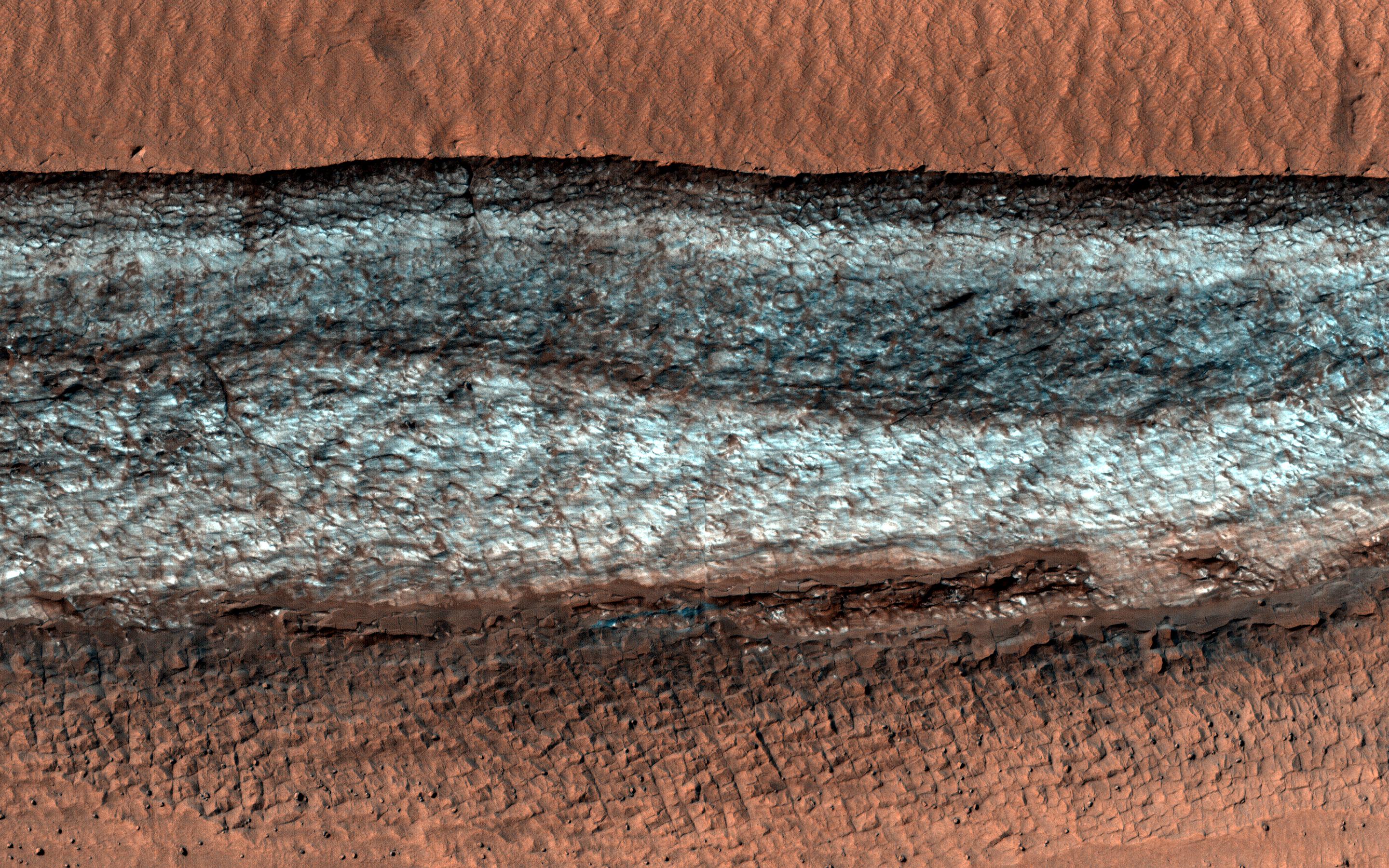
|
-
PIA25505:
-
Cliffs of Ice
Full Resolution:
TIFF
(15.56 MB)
JPEG
(1.189 MB)
|
|
|
2022-08-31 |
Mars
|
Mars Reconnaissance Orbiter (MRO)
|
HiRISE
|
2880x1800x3 |
|
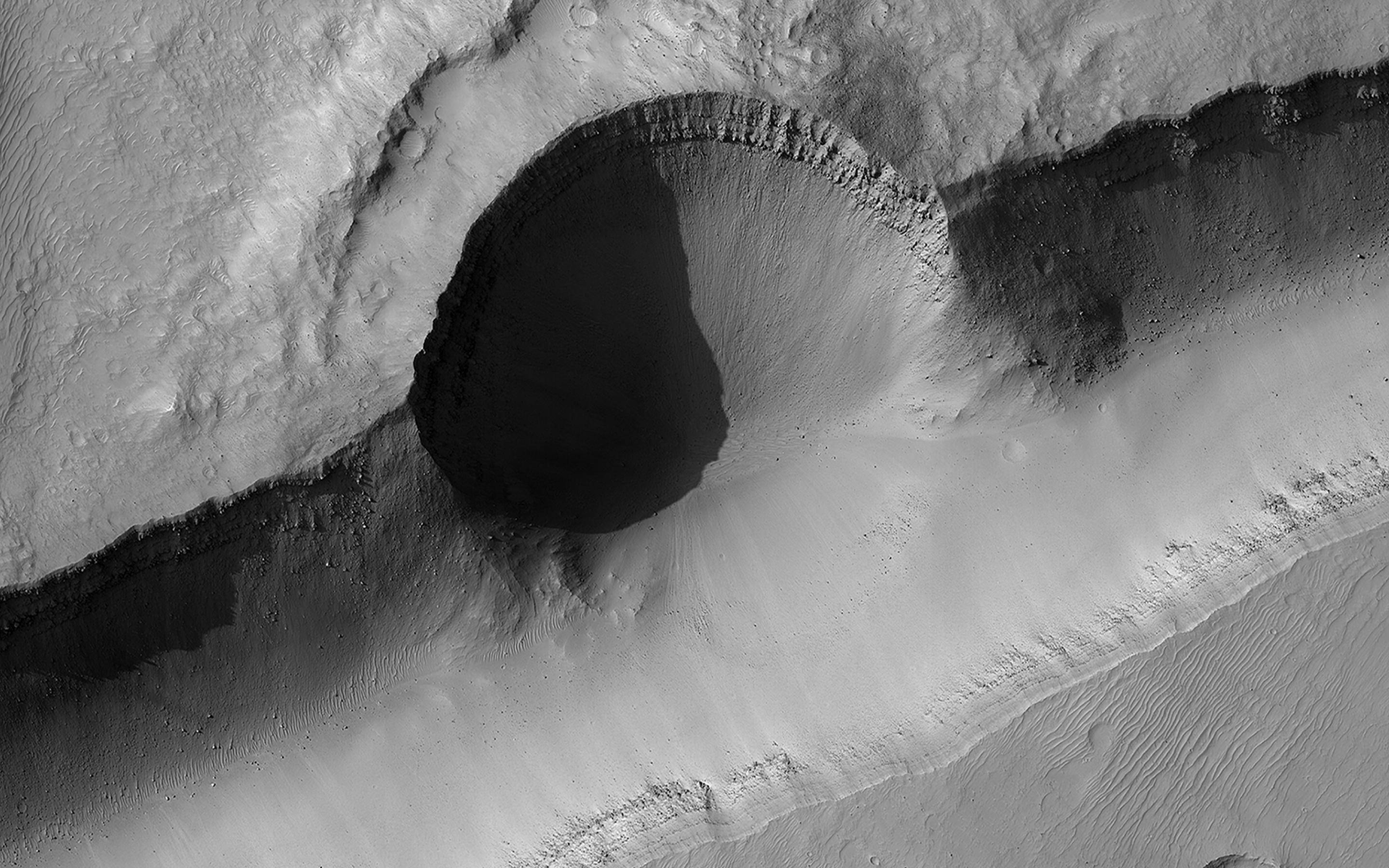
-
PIA25504:
-
On Bond Crater's Northern Slope
Full Resolution:
TIFF
(15.56 MB)
JPEG
(1.058 MB)
|
|
|
2022-08-31 |
Mars
|
Mars Reconnaissance Orbiter (MRO)
|
HiRISE
|
2880x1800x3 |
|
-
PIA25503:
-
Colorful Rocks Exposed in a Fresh Impact Crater
Full Resolution:
TIFF
(15.56 MB)
JPEG
(920.2 kB)
|
|
|
2022-08-31 |
Mars
|
Mars Reconnaissance Orbiter (MRO)
|
HiRISE
|
2880x1800x3 |
|
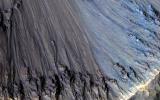
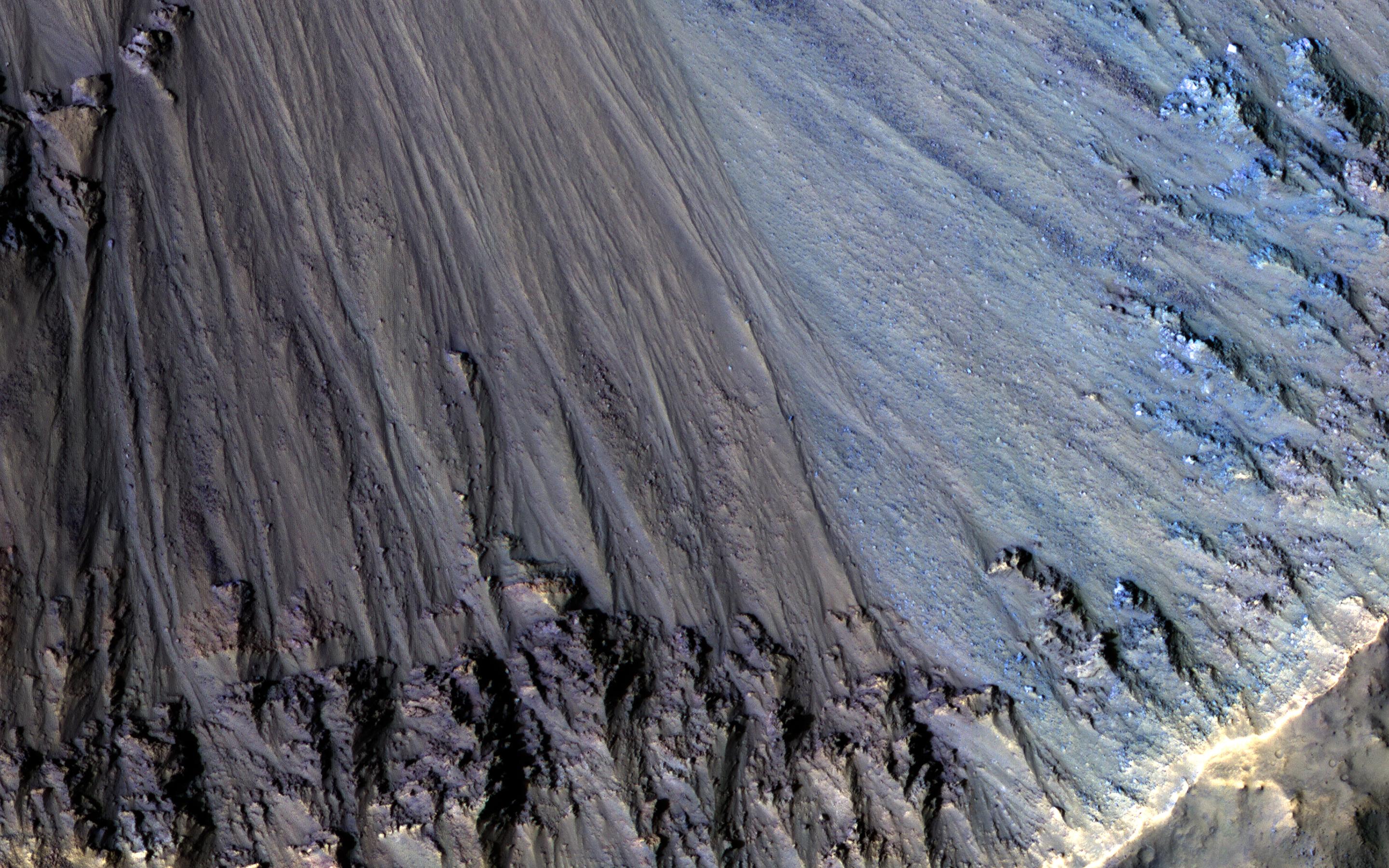
-
PIA25502:
-
Channels to the North of Savich Crater
Full Resolution:
TIFF
(15.56 MB)
JPEG
(1.392 MB)
|
|
|
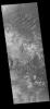
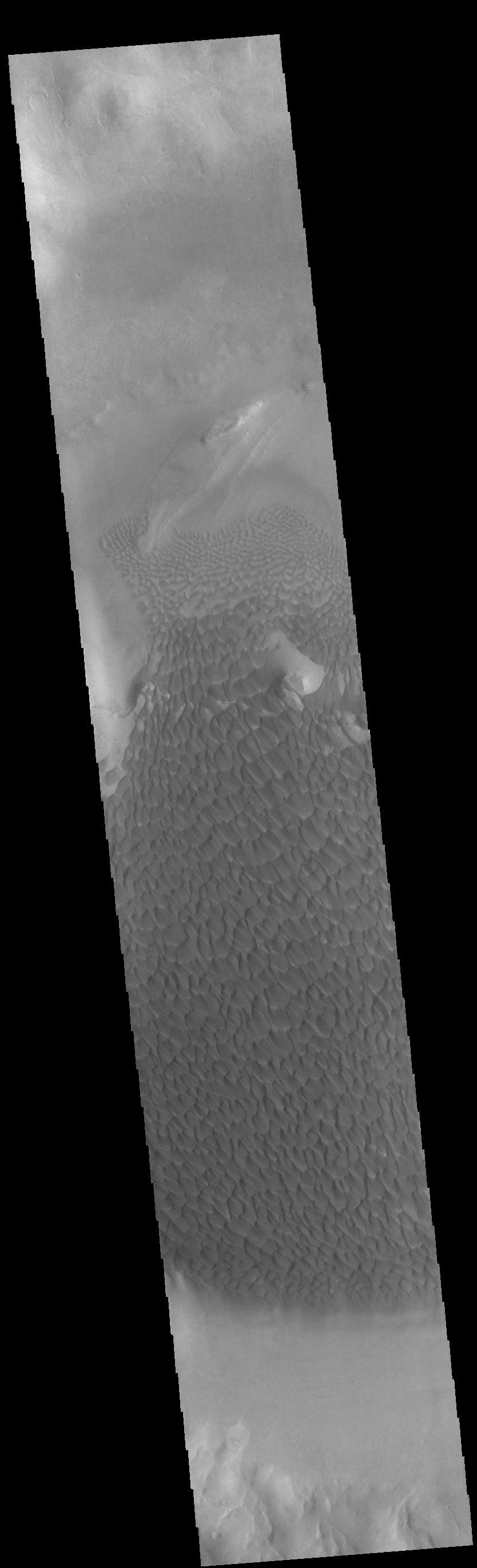
2022-08-31 |
Mars
|
2001 Mars Odyssey
|
THEMIS
|
664x1422x1 |
|
-
PIA25508:
-
Channels
Full Resolution:
TIFF
(707.2 kB)
JPEG
(98.91 kB)
|
|
|
2022-08-30 |
Jupiter
|
Juno
|
JunoCam
|
1638x2900x3 |
|
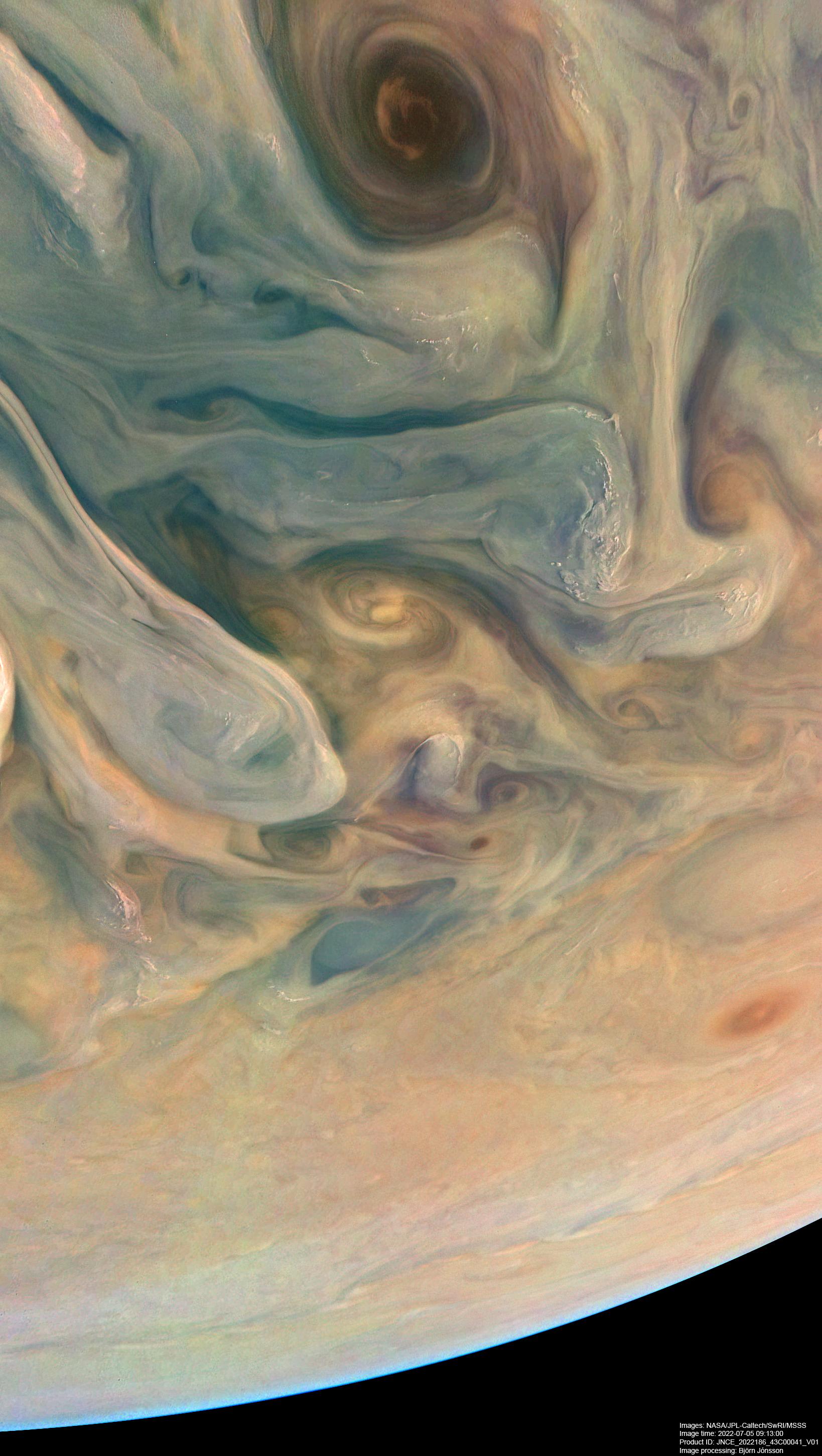
-
PIA25018:
-
NASA's Juno Mission Reveals Jupiter's Complex Colors
Full Resolution:
TIFF
(14.26 MB)
JPEG
(429.3 kB)
|
|
|
2022-08-30 |
Mars
|
2001 Mars Odyssey
|
THEMIS
|
672x1429x1 |
|
-
PIA25507:
-
Uzboi and Nirgal Valles
Full Resolution:
TIFF
(685.9 kB)
JPEG
(76.52 kB)
|
|
|
2022-08-29 |
Mars
|
2001 Mars Odyssey
|
THEMIS
|
673x1415x1 |
|
-
PIA25506:
-
Claritas Fossae
Full Resolution:
TIFF
(626.2 kB)
JPEG
(57.32 kB)
|
|
|
2022-08-26 |
Mars
|
2001 Mars Odyssey
|
THEMIS
|
672x1423x1 |
|
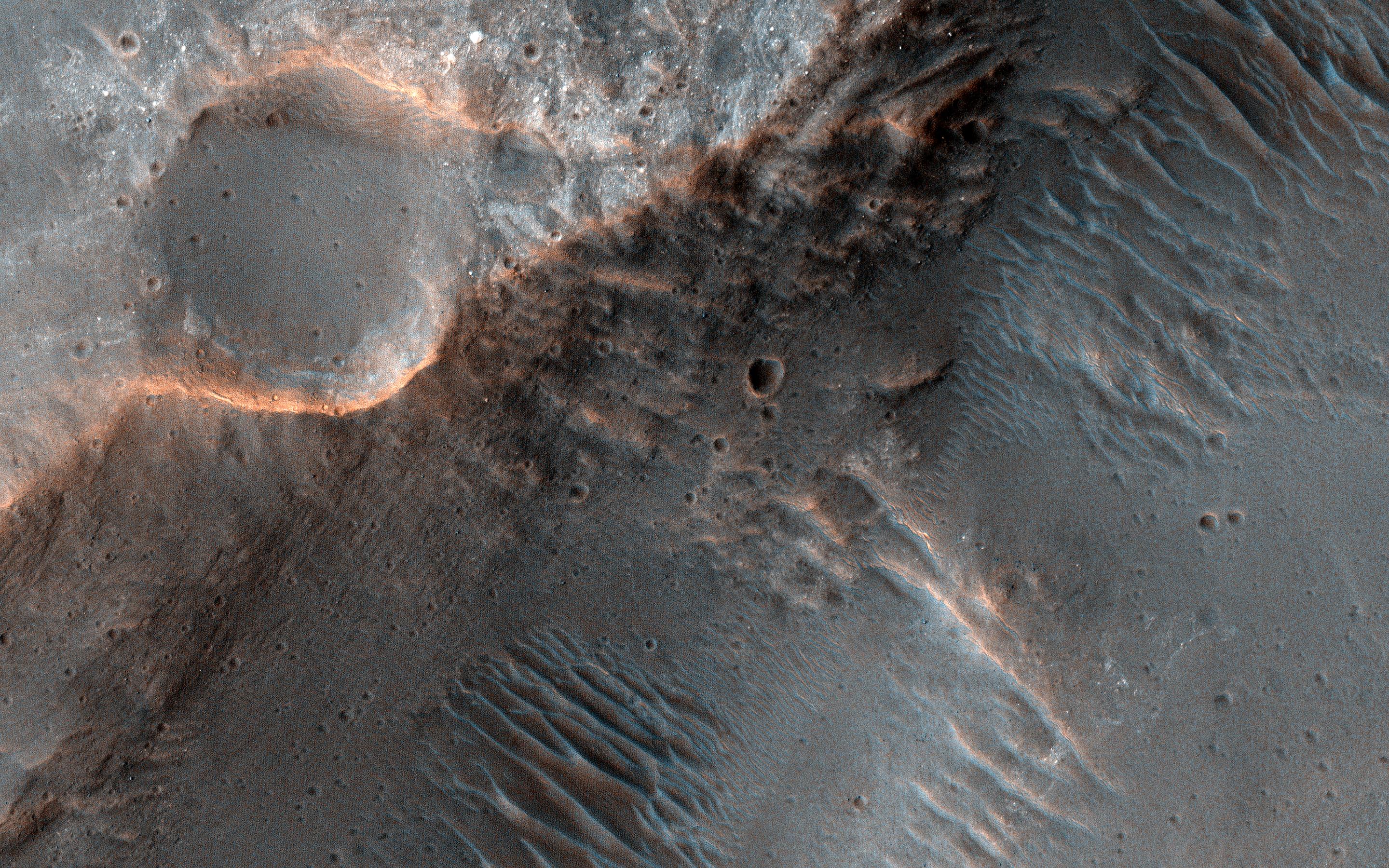
-
PIA25480:
-
Going Nowhere
Full Resolution:
TIFF
(740.6 kB)
JPEG
(111.6 kB)
|
|
|
2022-08-25 |
Mars
|
2001 Mars Odyssey
|
THEMIS
|
670x1419x1 |

|
-
PIA25479:
-
Daedalia Planum
Full Resolution:
TIFF
(758.4 kB)
JPEG
(180 kB)
|
|
|
2022-08-24 |
Mars
|
2001 Mars Odyssey
|
THEMIS
|
678x1433x1 |
|
-
PIA25478:
-
Terra Cimmeria Crater Landslide
Full Resolution:
TIFF
(695 kB)
JPEG
(71.14 kB)
|
|
|
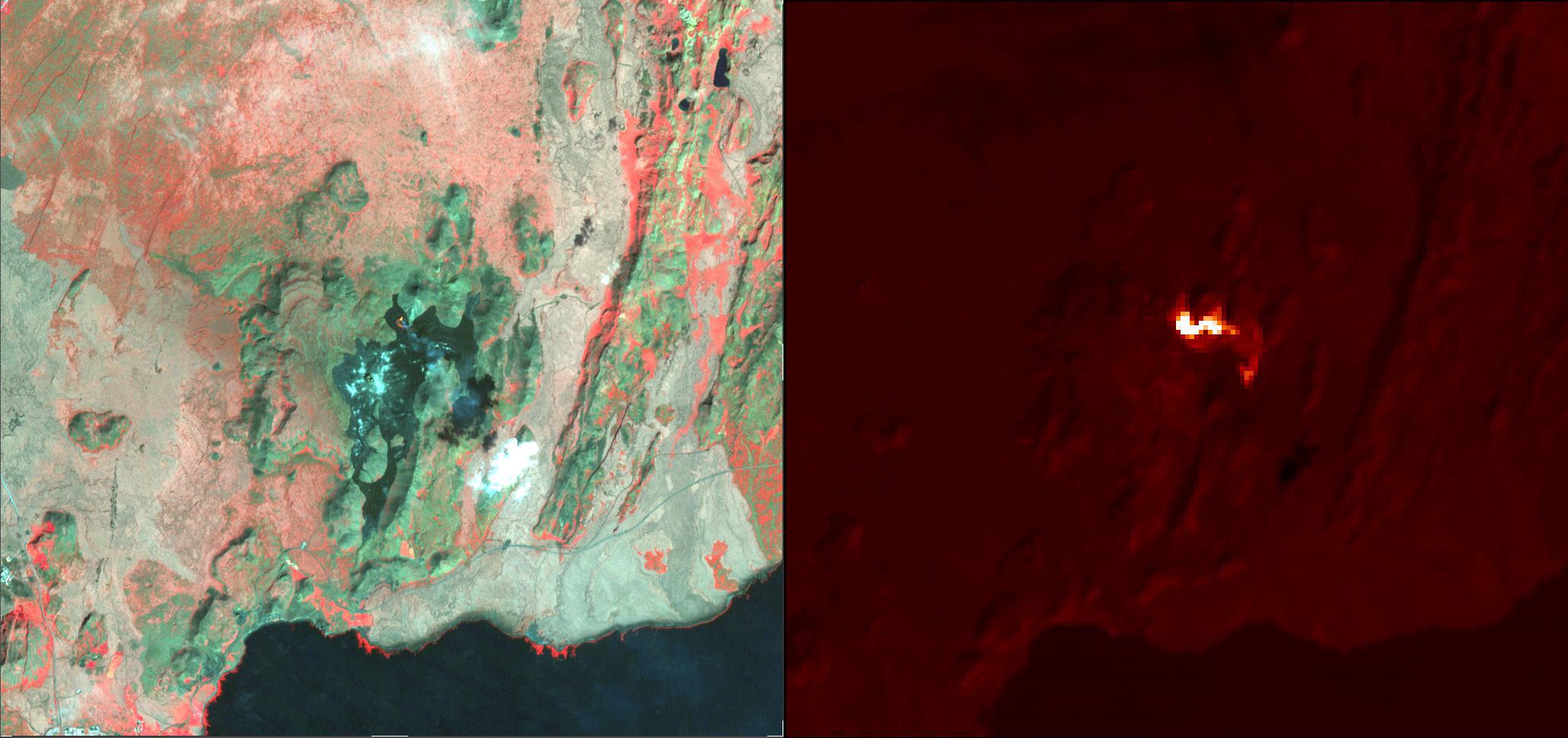
2022-08-23 |
Earth
|
Terra
|
ASTER
|
2064x971x3 |

|
-
PIA25501:
-
Fagradalsfjall Volcano, Iceland
Full Resolution:
TIFF
(4.702 MB)
JPEG
(214.2 kB)
|
|
|
2022-08-23 |
Earth
|
Terra
|
ASTER
|
1986x3125x3 |
|
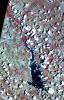
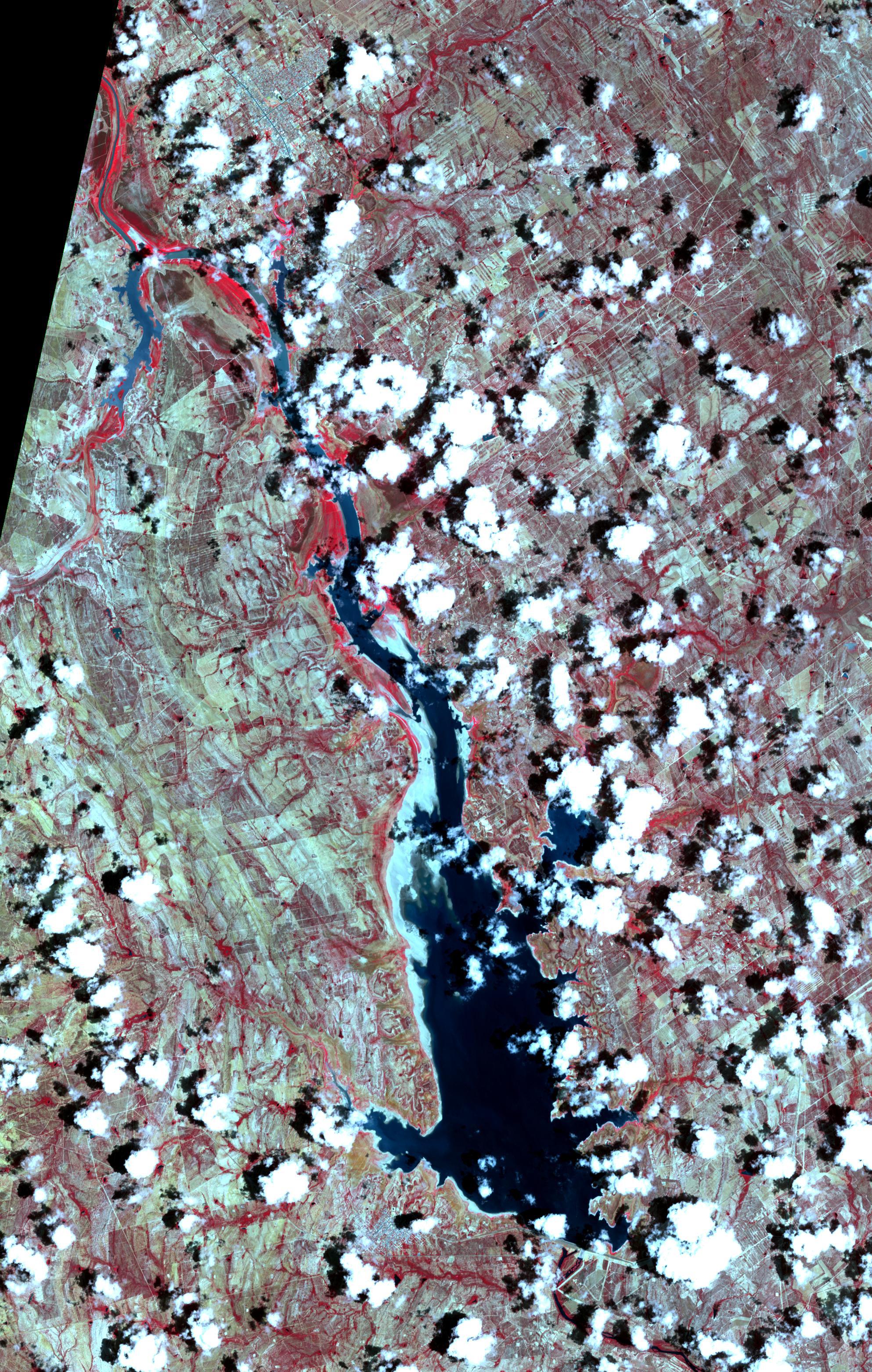
-
PIA25446:
-
Falcon International Reservoir, US-Mexico - 2022
Full Resolution:
TIFF
(18.63 MB)
JPEG
(1.45 MB)
|
|
|
2022-08-23 |
Mars
|
2001 Mars Odyssey
|
THEMIS
|
669x1424x1 |

|
-
PIA25477:
-
Sirenum Fossae
Full Resolution:
TIFF
(696.7 kB)
JPEG
(88.61 kB)
|
|
|
2022-08-22 |
Mars
|
2001 Mars Odyssey
|
THEMIS
|
601x2687x1 |
|
-
PIA25476:
-
Olympus Mons
Full Resolution:
TIFF
(730.7 kB)
JPEG
(98.37 kB)
|
|
|
2022-08-19 |
Mars
|
Mars 2020 Rover
|
Scanning Habitable Environments with Raman & Luminescence for Organics and Chemicals (SHERLOC)
|
1584x1184x3 |
|
-
PIA25327:
-
Perseverance Coring Bit
Full Resolution:
TIFF
(5.323 MB)
JPEG
(141 kB)
|
|
|
2022-08-19 |
Mars
|
2001 Mars Odyssey
|
THEMIS
|
661x1432x1 |
|
-
PIA25475:
-
Proctor Crater Dunes
Full Resolution:
TIFF
(723.6 kB)
JPEG
(94.03 kB)
|
|
|
2022-08-18 |
Mars
|
2001 Mars Odyssey
|
THEMIS
|
604x2713x1 |
|
-
PIA25474:
-
Terra Cimmeria Crater
Full Resolution:
TIFF
(788.7 kB)
JPEG
(108.7 kB)
|
|
|
2022-08-17 |
Mars
|
2001 Mars Odyssey
|
THEMIS
|
684x1425x1 |

|
-
PIA25473:
-
Labou Vallis
Full Resolution:
TIFF
(741.4 kB)
JPEG
(100.7 kB)
|
|
|
2022-08-16 |
Mars
|
2001 Mars Odyssey
|
THEMIS
|
678x1417x1 |
|
-
PIA25472:
-
Pavonis Fossae
Full Resolution:
TIFF
(659.4 kB)
JPEG
(80.14 kB)
|
|
|
2022-08-15 |
Mars
|
2001 Mars Odyssey
|
THEMIS
|
660x1432x1 |
|
-
PIA25471:
-
Kaiser Crater Dunes
Full Resolution:
TIFF
(694.6 kB)
JPEG
(83.1 kB)
|
|
|
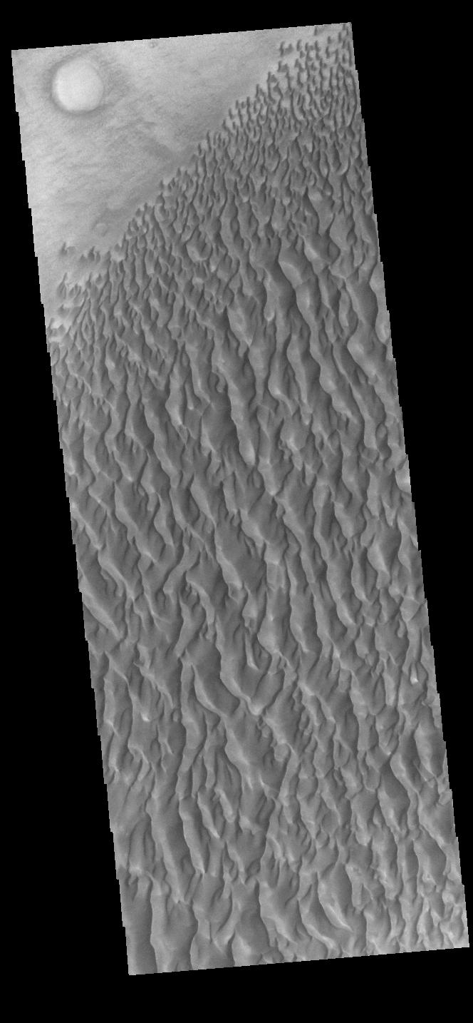
2022-08-12 |
Mars
|
2001 Mars Odyssey
|
THEMIS
|
834x2742x1 |

|
-
PIA25470:
-
Rabe Crater Dunes
Full Resolution:
TIFF
(1.266 MB)
JPEG
(131.5 kB)
|
|
|
2022-08-11 |
Mars
|
2001 Mars Odyssey
|
THEMIS
|
664x1434x1 |
|
-
PIA25469:
-
Proctor Crater Dunes
Full Resolution:
TIFF
(725.9 kB)
JPEG
(92.8 kB)
|
|
|
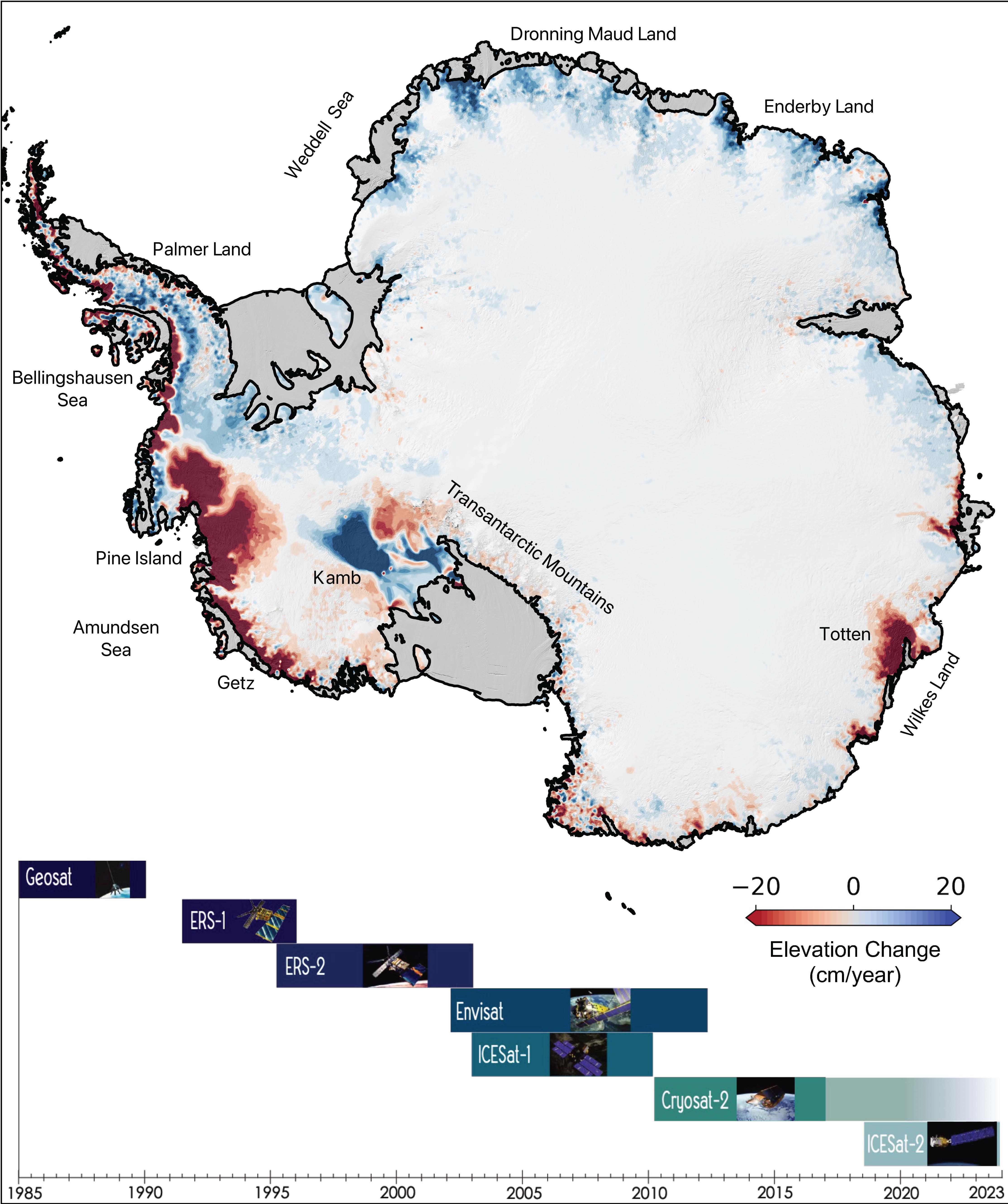
2022-08-10 |
Earth
|
|
|
4456x5324x3 |
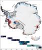
|
-
PIA24990:
-
The Antarctic Ice Sheet's Changing Height
Full Resolution:
TIFF
(18.38 MB)
JPEG
(1.304 MB)
|
|
|
2022-08-10 |
Mars
|
2001 Mars Odyssey
|
THEMIS
|
695x1429x1 |
|
-
PIA25468:
-
Nili Patera Dunes
Full Resolution:
TIFF
(751.9 kB)
JPEG
(113.4 kB)
|
|
|
2022-08-09 |
Mars
|
2001 Mars Odyssey
|
THEMIS
|
664x1435x1 |
|
-
PIA25467:
-
Kaiser Crater Dunes
Full Resolution:
TIFF
(668.8 kB)
JPEG
(62.02 kB)
|
|
|
2022-08-08 |
Mars
|
2001 Mars Odyssey
|
THEMIS
|
699x1431x1 |
|
-
PIA25466:
-
Athabasca Valles
Full Resolution:
TIFF
(733.7 kB)
JPEG
(112 kB)
|
|
|
2022-08-05 |
Mars
|
Mars Science Laboratory (MSL)
|
Mastcam
|
29163x8000x3 |
|
-
PIA25407:
Curiosity's 360-Degree Panorama of Avanavero Drill Site
Full Resolution:
TIFF
(495.9 MB)
JPEG
(38.13 MB)
|
|
|
2022-08-05 |
Mars
|
2001 Mars Odyssey
|
THEMIS
|
700x1433x1 |
|
-
PIA25465:
-
Cerberus Fossae
Full Resolution:
TIFF
(716 kB)
JPEG
(89.27 kB)
|
|
|
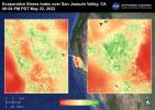
2022-08-04 |
Earth
|
ECOSTRESS
|
|
3507x2480x3 |
|
-
PIA25488:
-
Evapotranspiration over Central Valley
Full Resolution:
TIFF
(24.59 MB)
JPEG
(1.422 MB)
|
|
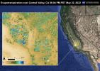
|
2022-08-04 |
Earth
|
ECOSTRESS
|
|
3507x2480x3 |
|
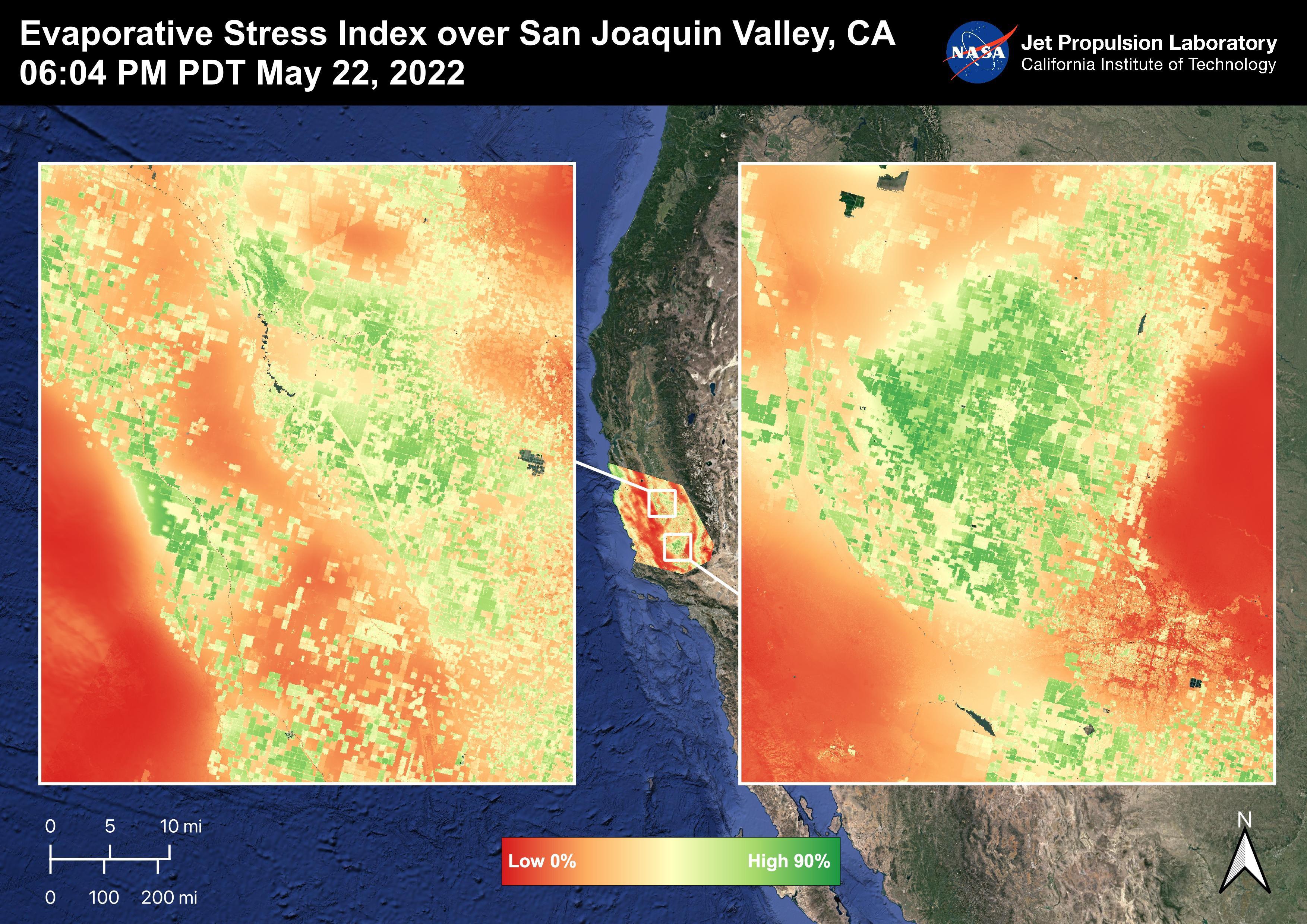
-
PIA25487:
-
Evaporative Stress Index over San Joaquin Valley
Full Resolution:
TIFF
(24.55 MB)
JPEG
(1.344 MB)
|
|
|
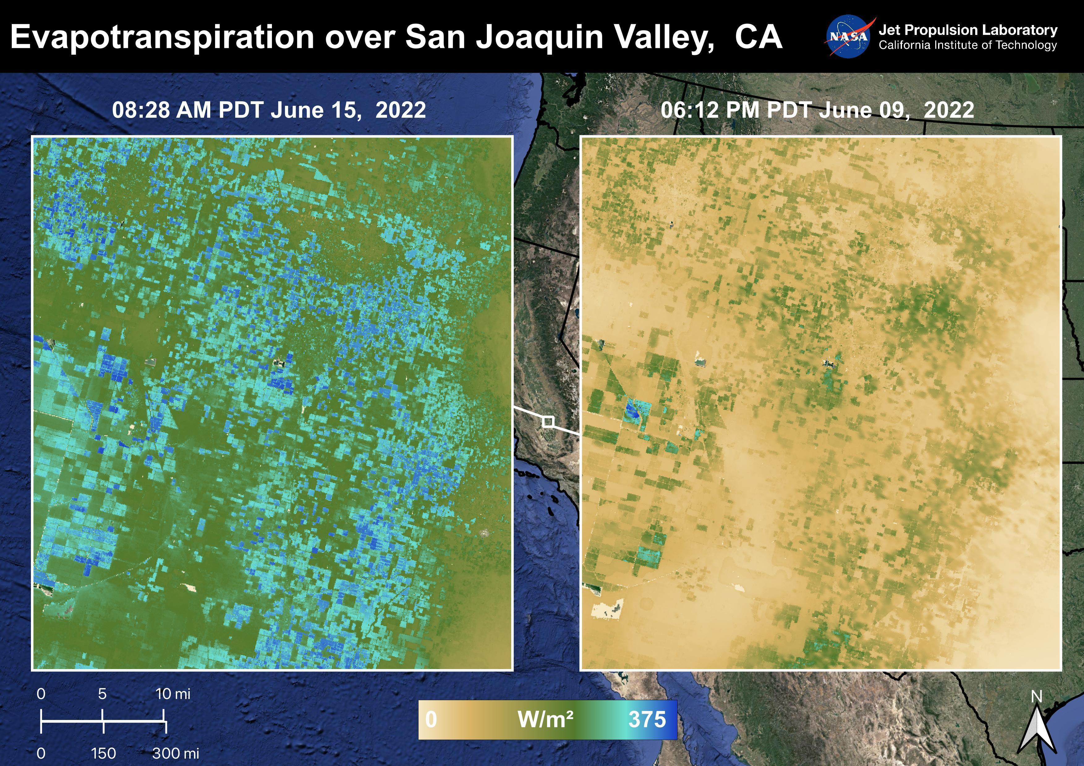
2022-08-04 |
Earth
|
ECOSTRESS
|
|
3507x2480x3 |

|
-
PIA25486:
-
Evapotranspiration over San Joaquin Valley
Full Resolution:
TIFF
(24.07 MB)
JPEG
(1.347 MB)
|
|
|
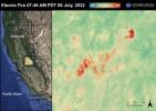
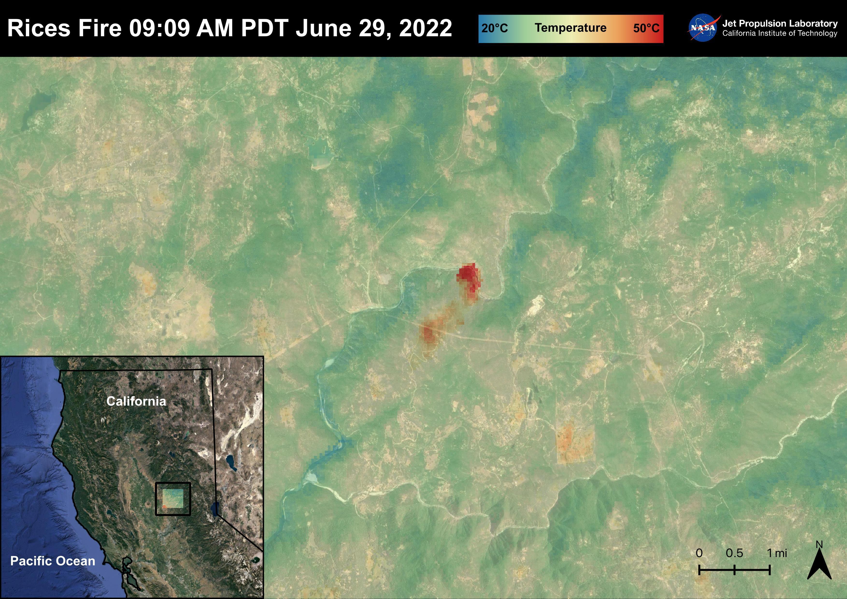
2022-08-04 |
Earth
|
ECOSTRESS
|
|
3507x2480x3 |
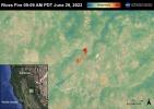
|
-
PIA25485:
-
The Rices Fire
Full Resolution:
TIFF
(23.34 MB)
JPEG
(1.067 MB)
|
|
|
2022-08-04 |
Earth
|
ECOSTRESS
|
|
3507x2480x3 |
|
-
PIA25484:
-
The Electra Fire
Full Resolution:
TIFF
(23.43 MB)
JPEG
(1.034 MB)
|
|
|
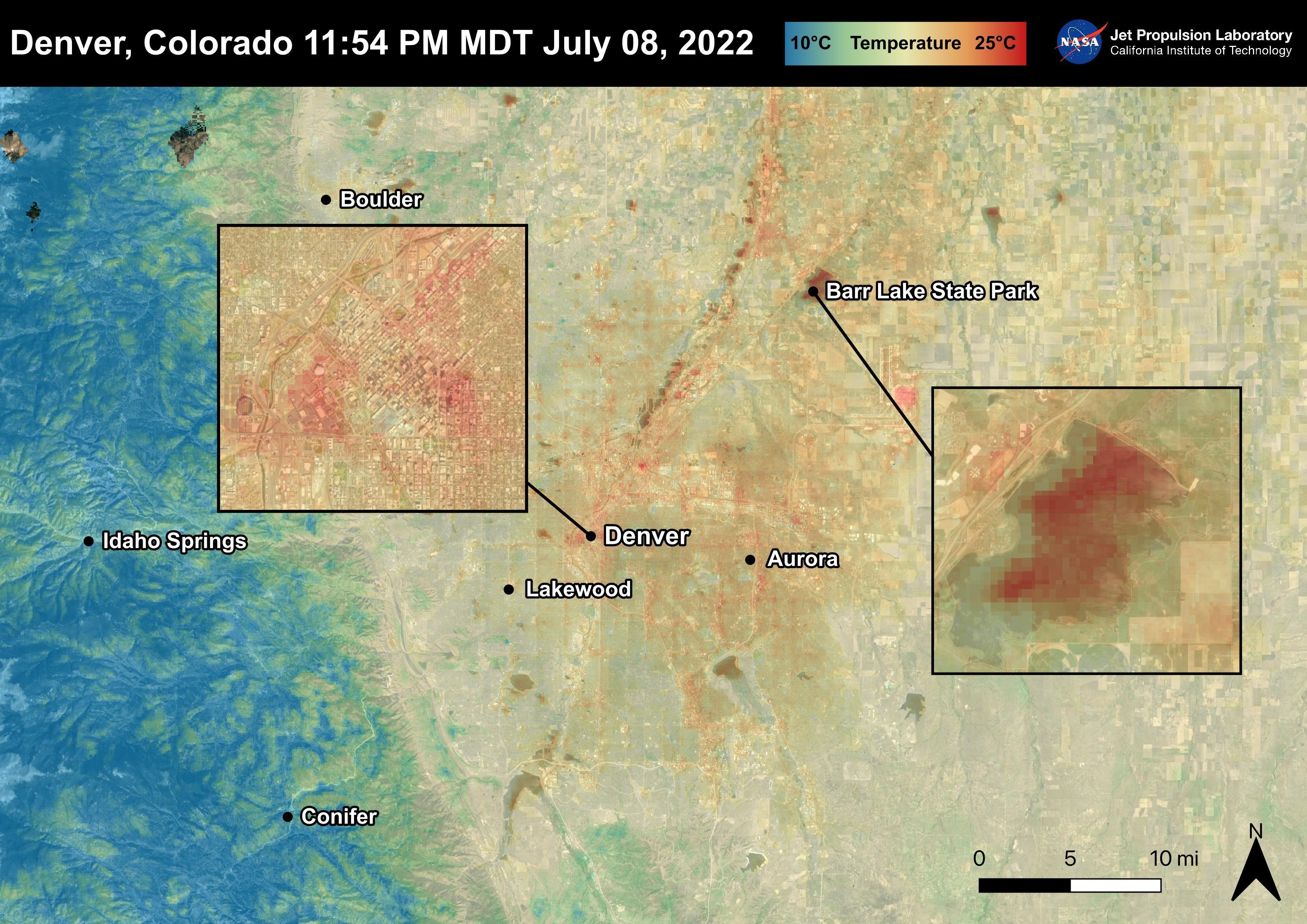
2022-08-04 |
Earth
|
ECOSTRESS
|
|
3507x2480x3 |
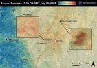
|
-
PIA25483:
-
Denver, CO
Full Resolution:
TIFF
(25.33 MB)
JPEG
(1.18 MB)
|
|
|
2022-08-04 |
Earth
|
ECOSTRESS
|
|
3507x2480x3 |
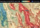
|
-
PIA25482:
-
Death Valley, CA
Full Resolution:
TIFF
(26.1 MB)
JPEG
(1.367 MB)
|
|
|
2022-08-04 |
Earth
|
ECOSTRESS
|
|
3507x2480x3 |
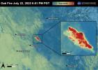
|
-
PIA25481:
-
The Oak Fire
Full Resolution:
TIFF
(21.67 MB)
JPEG
(865 kB)
|
|
|
2022-08-04 |
Mars
|
2001 Mars Odyssey
|
THEMIS
|
1322x2651x1 |
|
-
PIA25464:
-
Dadalia Planum
Full Resolution:
TIFF
(2.742 MB)
JPEG
(569.7 kB)
|
|
|
2022-08-03 |
Mars
|
2001 Mars Odyssey
|
THEMIS
|
616x2702x1 |
|
-
PIA25463:
-
Mamers Valles
Full Resolution:
TIFF
(793.7 kB)
JPEG
(92.94 kB)
|
|
|
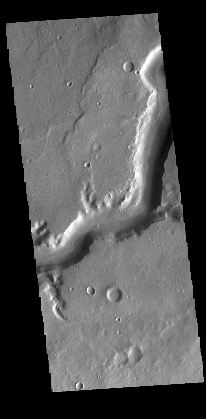
2022-08-02 |
Mars
|
2001 Mars Odyssey
|
THEMIS
|
616x2700x1 |

|
-
PIA25462:
-
Arabia Terra Channels
Full Resolution:
TIFF
(805.9 kB)
JPEG
(100.4 kB)
|
|
|
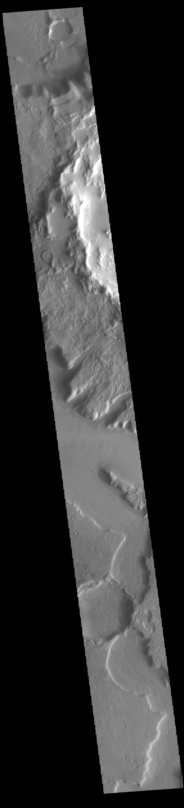
2022-08-01 |
Mars
|
2001 Mars Odyssey
|
THEMIS
|
713x1447x1 |
|
-
PIA25461:
-
Mamers Valles
Full Resolution:
TIFF
(729.3 kB)
JPEG
(90.96 kB)
|
|
|
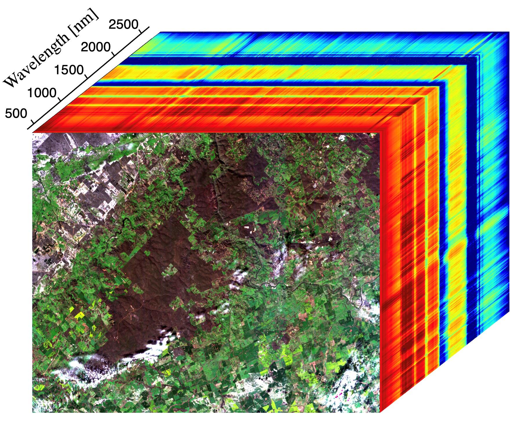
2022-07-29 |
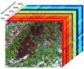
Earth
|
Earth Surface Mineral Dust Source Investigation (EMIT)
|
EMIT
|
1774x1458x3 |
|
-
PIA24529:
-
EMIT Instrument's First Light
Full Resolution:
TIFF
(7.334 MB)
JPEG
(508.6 kB)
|
|
|
2022-07-29 |
Mars
|
2001 Mars Odyssey
|
THEMIS
|
611x2706x1 |
|
-
PIA25460:
-
Nanedi Valles
Full Resolution:
TIFF
(821.6 kB)
JPEG
(126.2 kB)
|
|
|
2022-07-28 |
Earth
|
Terra
|
ASTER
|
2533x1508x3 |
|
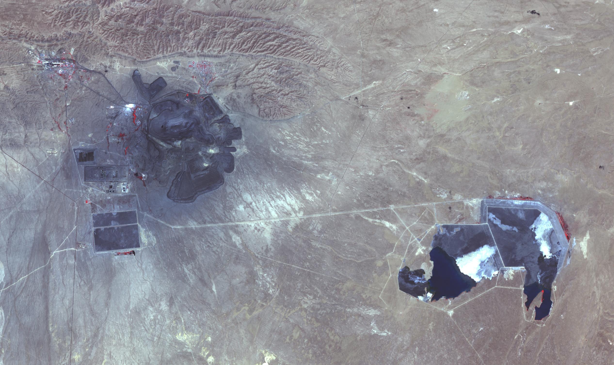
-
PIA25445:
-
Muruntau Mine, Uzbekistan
Full Resolution:
TIFF
(10.17 MB)
JPEG
(502.4 kB)
|
|
|
2022-07-28 |
Mars
|
2001 Mars Odyssey
|
THEMIS
|
607x2708x1 |
|
-
PIA25459:
-
Ius and Tithonium Chasmata
Full Resolution:
TIFF
(692.4 kB)
JPEG
(73.18 kB)
|
|
|
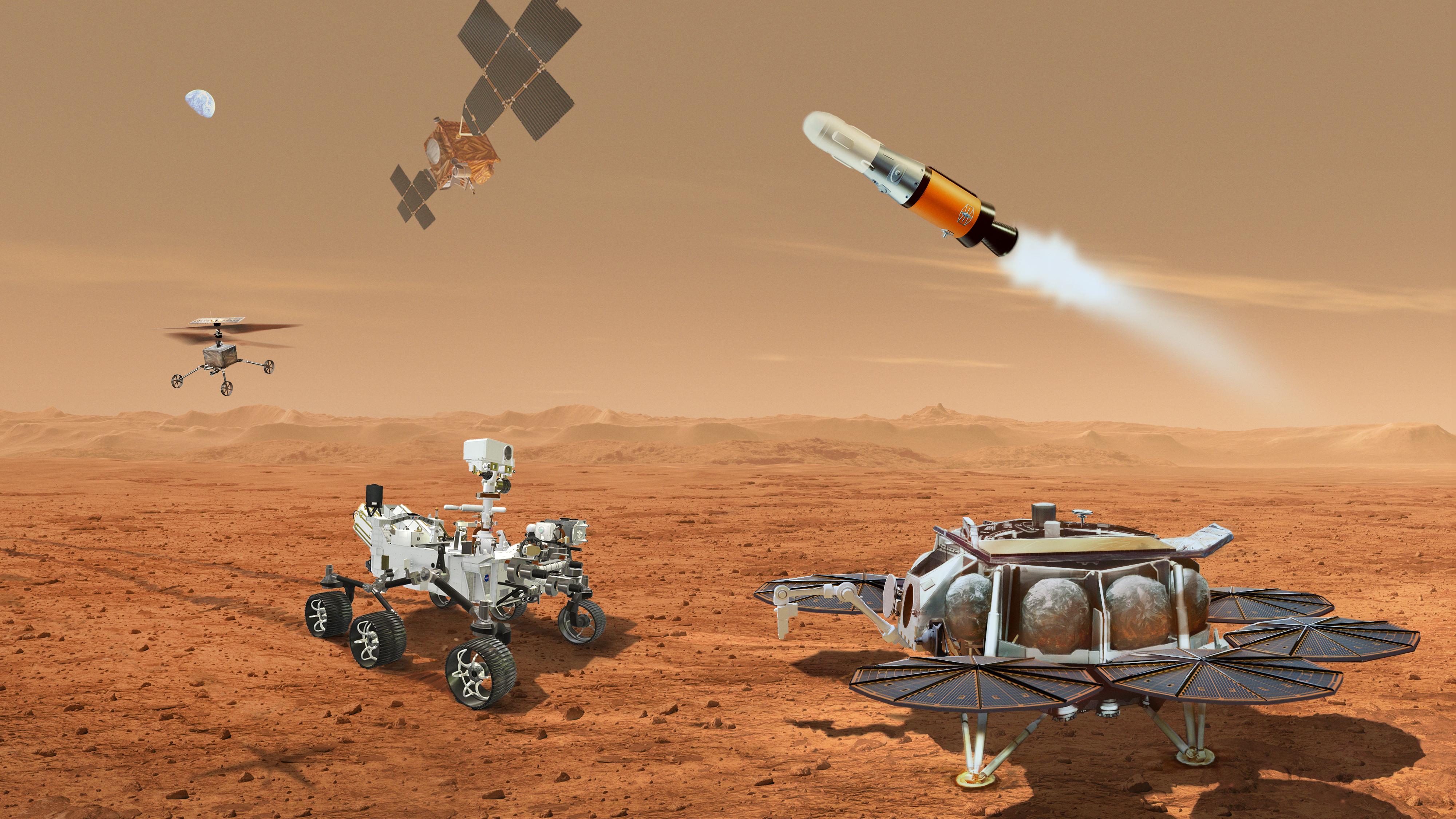
2022-07-27 |
Mars
|
Mars Sample Return (MSR)
|
|
4000x2250x3 |
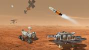
|
-
PIA25326:
-
Mars Sample Return Concept Illustration
Full Resolution:
TIFF
(26.57 MB)
JPEG
(1.091 MB)
|
|
|
2022-07-27 |
Mars
|
2001 Mars Odyssey
|
THEMIS
|
1318x2678x1 |
|
-
PIA25458:
-
Rabe Crater Dunes
Full Resolution:
TIFF
(2.175 MB)
JPEG
(211.6 kB)
|
|
|
2022-07-26 |
Earth
|
Terra
|
MISR
|
3500x1029x3 |
|
-
PIA24907:
-
MISR Images Oak Fire Near Yosemite
Full Resolution:
TIFF
(7.635 MB)
JPEG
(379.1 kB)
|
|
|
2022-07-26 |
Jupiter
|
Juno
|
JunoCam
|
2077x3568x3 |
|
-
PIA25017:
-
NASA's Juno Mission Spies Vortices Near Jupiter's North Pole
Full Resolution:
TIFF
(21.48 MB)
JPEG
(717.5 kB)
|
|
|
2022-07-26 |
Mars
|
2001 Mars Odyssey
|
THEMIS
|
1370x2644x1 |
|
-
PIA25457:
-
Meridiani Planum
Full Resolution:
TIFF
(2.614 MB)
JPEG
(346.6 kB)
|
|
|
2022-07-25 |
Mars
|
2001 Mars Odyssey
|
THEMIS
|
1320x2655x1 |

|
-
PIA25456:
-
Daedalia Planum
Full Resolution:
TIFF
(2.796 MB)
JPEG
(593 kB)
|
|
|
2022-07-22 |
Earth
|
ECOSTRESS
|
|
3507x2480x3 |
|
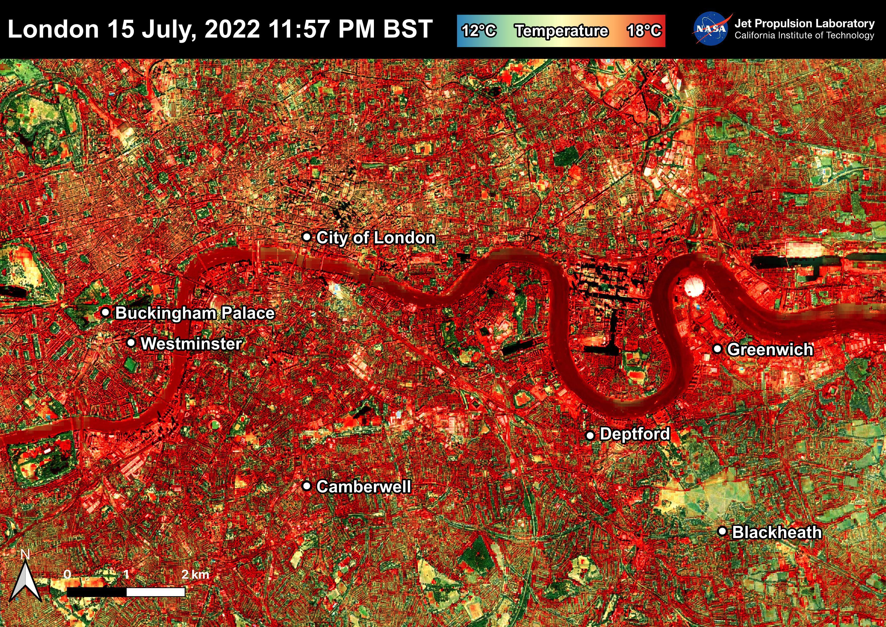
-
PIA25423:
-
NASA's ECOSTRESS Shows Overnight Heat in London
Full Resolution:
TIFF
(26.1 MB)
JPEG
(2.721 MB)
|
|
|
2022-07-22 |
Mars
|
Mars Reconnaissance Orbiter (MRO)
|
HiRISE
|
2880x1800x3 |
|
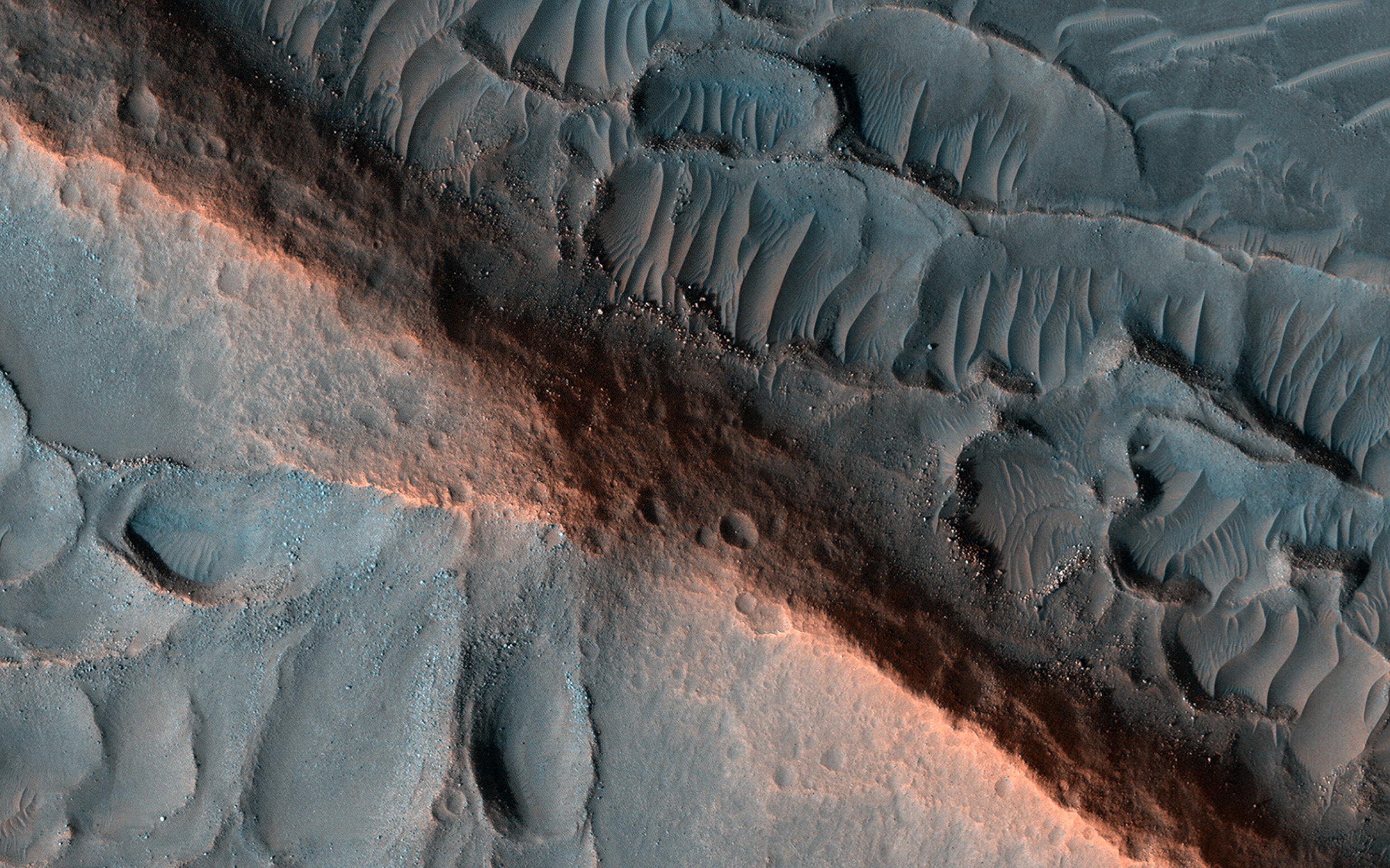
-
PIA25450:
-
Piles of Sand with Different Sizes and Colors
Full Resolution:
TIFF
(15.56 MB)
JPEG
(963.2 kB)
|
|
|
2022-07-22 |
Mars
|
Mars Reconnaissance Orbiter (MRO)
|
HiRISE
|
2880x1800x3 |
|
-
PIA25449:
-
Marvelous Martian Mega-Ripples
Full Resolution:
TIFF
(15.56 MB)
JPEG
(1.219 MB)
|
|
|
2022-07-22 |
Mars
|
Mars Reconnaissance Orbiter (MRO)
|
HiRISE
|
2880x1800x3 |
|
-
PIA25448:
-
Ridges in Cydonia Mensae
Full Resolution:
TIFF
(15.56 MB)
JPEG
(890 kB)
|
|
|
2022-07-22 |
Mars
|
Mars Reconnaissance Orbiter (MRO)
|
HiRISE
|
2880x1800x3 |

|
-
PIA25447:
-
What Happened When?
Full Resolution:
TIFF
(7.735 MB)
JPEG
(707.1 kB)
|
 Planetary Data System


