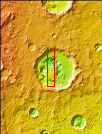
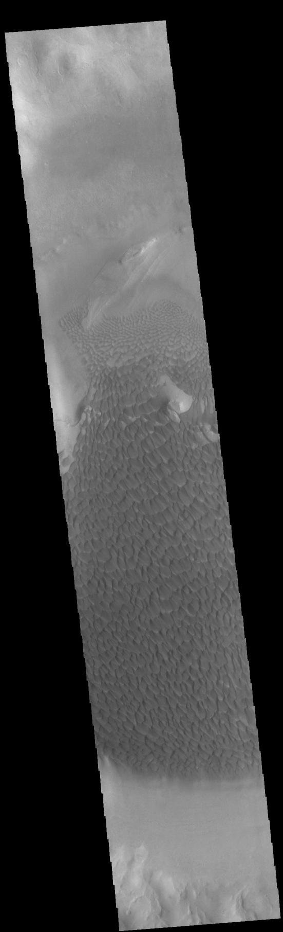
Context imageToday's VIS image shows part of the floor of Rabe Crater. Located in Noachis Terra, Rabe Crater is 108 km (67 miles) across. Dunes cover the majority of this image of Rabe Crater. As the dunes are created by wind action the forms of the dunes record the wind direction. Dunes will have a long low angle component and a short high angle side. The steep side is called the slip face. The wind blows up the long side of the dune. In this VIS image the slip faces are illuminated more than the longer side. In this part of the crater the winds were generally moving from the lower right corner of the image towards the upper left.
Craters of similar size as Rabe Crater often have flat floors. Rabe Crater has some areas of flat floor, but also has a large complex pit occupying a substantial part of the floor. The interior fill of the crater is thought to be layered sediments created by wind and or water action. The pit is eroded into this material. The eroded materials appear to have stayed within the crater forming a large sand sheet with surface dune forms as well as individual dunes where the crater floor is visible. Several other craters in this region have complex floors with pits.
Orbit Number: 90256 Latitude: -43.5412 Longitude: 34.6619 Instrument: VIS Captured: 2022-04-19 23:24
Please see the THEMIS Data Citation Note for details on crediting THEMIS images.
NASA's Jet Propulsion Laboratory manages the 2001 Mars Odyssey mission for NASA's Science Mission Directorate, Washington, D.C. The Thermal Emission Imaging System (THEMIS) was developed by Arizona State University, Tempe, in collaboration with Raytheon Santa Barbara Remote Sensing. The THEMIS investigation is led by Dr. Philip Christensen at Arizona State University. Lockheed Martin Astronautics, Denver, is the prime contractor for the Odyssey project, and developed and built the orbiter. Mission operations are conducted jointly from Lockheed Martin and from JPL, a division of the California Institute of Technology in Pasadena.
 Planetary Data System


