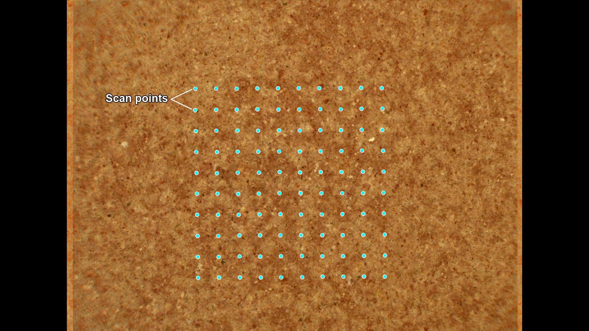
This annotated image from NASA's Perseverance Mars rover shows how its SHERLOC (Scanning Habitable Environments with Raman and Luminescence for Organics and Minerals) instrument investigates a rock surface. After an area has been ground down by the abrasion tool on the rover's arm, SHERLOC fires its laser in a grid pattern, shown here with blue dots.
This scan area is roughly the size of a pencil eraser. SHERLOC's laser allows scientists to see how light interacts with the rock surface and reveals different components in the rock, including chemicals, minerals, and organic matter.
The image was created by combining two SHERLOC images: one from the Wide Angle Topographic Sensor for Operations and eNgineering (WATSON) camera, and one from the Autofocus and Context Imager (ACI) camera. Those images were taken at a location called "Wildcat Ridge" on July 22, 2022, the 505th Martian day, or sol, of the mission.
The image color has been enhanced to increase contrast so different rock components are easier to distinguish.
A key objective for Perseverance's mission on Mars is astrobiology, including the search for signs of ancient microbial life. The rover will characterize the planet's geology and past climate, pave the way for human exploration of the Red Planet, and be the first mission to collect and cache Martian rock and regolith (broken rock and dust).
Subsequent NASA missions, in cooperation with ESA (European Space Agency), would send spacecraft to Mars to collect these sealed samples from the surface and return them to Earth for in-depth analysis.
The Mars 2020 Perseverance mission is part of NASA's Moon to Mars exploration approach, which includes Artemis missions to the Moon that will help prepare for human exploration of the Red Planet.
NASA's Jet Propulsion Laboratory, which is managed for the agency by Caltech in Pasadena, California, built and manages operations of the Perseverance rover. WATSON and ACI were built by Malin Space Science Systems (MSSS) in San Diego and are operated jointly by MSSS and JPL.
For more about Perseverance: mars.nasa.gov/mars2020/
 Planetary Data System


