Your search criteria found 19636 images
Target is Sun
Go to PIAxxxxx:
Refine this list of images by:
Target:
Mission:
Spacecraft:
Instrument:
Click on an image for detailed information
Click on a column heading to sort in ascending or descending order
My
List
Addition Date Target Mission Instrument SizeSort Ascending
Add Image to Favorite List 2024-04-26 Earth Terra
ASTER
2441x1468x3
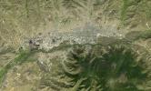
NASA's Terra spacecraft shows Ulaanbaatar, the capital of Mongolia and home to over half the country's population of about 3 million people.
PIA26289:
Ulaanbaatar, Mongolia
Full Resolution:     TIFF (10.75 MB)     JPEG (854.9 kB)
Add Image to Favorite List 2024-04-26 Earth 1440x810x3
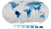
A NASA-led study combined stream-gauge measurements with computer models of 3 million river segments to create a global picture of how much water Earth's rivers hold. It estimated that the Amazon basin contains about 38% of the world's river water.
PIA26119:
Global Accounting of Earth's River Storage and Flow
Full Resolution:     TIFF (1.377 MB)     JPEG (104.8 kB)
Add Image to Favorite List 2024-04-18 Jupiter Juno
JunoCam
1734x623x3
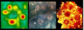
This composite shows views of Jupiter's northern polar cyclones in three different wavelengths of light – microwave, visible, and ultraviolet – as captured by NASA's Juno mission.
PIA26295:
NASA's Juno Catches 3 Waves of Jupiter's Polar Cyclones
Full Resolution:     TIFF (3.145 MB)     JPEG (179 kB)
Add Image to Favorite List 2024-04-17 Mars Mars Helicopter
8256x5504x3
The Ingenuity team celebrates during their final shift working on NASA's Ingenuity Mars Helicopter at the agency's Jet Propulsion Laboratory on April 16, 2024.
PIA26319:
Ingenuity Team's Final Shift
Full Resolution:     TIFF (132.5 MB)     JPEG (8.841 MB)
Add Image to Favorite List 2024-04-17 Mars Mars Helicopter
8256x5504x3
Ingenuity team lead Josh Anderson celebrates with Perseverance rover deputy project manager Steve Lee during the final shift for engineers working on NASA's Ingenuity Mars Helicopter at the agency's Jet Propulsion Laboratory on April 16, 2024.
PIA26317:
Ingenuity Fist Bump
Full Resolution:     TIFF (118.6 MB)     JPEG (8.06 MB)
Add Image to Favorite List 2024-04-17 Mars Mars Helicopter
8256x5504x3
Teddy Tzanetos, project manager for NASA's Ingenuity Mars Helicopter, addresses members of the team during their final shift at the agency's Jet Propulsion Laboratory on April 16, 2024.
PIA26316:
Ingenuity Project Manager Says Goodbye
Full Resolution:     TIFF (99.36 MB)     JPEG (6.555 MB)
Add Image to Favorite List 2024-04-17 Mars Mars Helicopter
8256x5504x3
Ingenuity team lead Josh Anderson and project manager Teddy Tzanetos react during the final shift for engineers working on NASA's Ingenuity Mars Helicopter at the agency's Jet Propulsion Laboratory on April 16, 2024.
PIA26315:
Ingenuity Team Lead All Smiles
Full Resolution:     TIFF (126.8 MB)     JPEG (8.698 MB)
Add Image to Favorite List 2024-04-16 Mars Mars Helicopter
8256x5504x3
Engineers working on NASA's Ingenuity together monitored a transmission from the history-making helicopter in a JPL control room on April 16, 2024.
PIA26318:
Mars Helicopter Team Witnesses Final Downlink
Full Resolution:     TIFF (119 MB)     JPEG (8.659 MB)
Add Image to Favorite List 2024-04-15 Earth SWOT
KaRIn
1440x1090x3
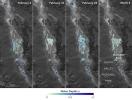
Water depths in Death Valley's temporary lake ranged between about 3 feet (or 1 meter, shown in dark blue) to less than 1.5 feet (0.5 meters, light yellow) from February through early March.
PIA26184:
SWOT Death Valley Lake Depth
Full Resolution:     TIFF (2.295 MB)     JPEG (265.3 kB)
Add Image to Favorite List 2024-04-03 Mars Mars 2020 Rover
Hazard Avoidance Camera (M2020)
838x517x3
The 21st rock core captured by NASA's Perseverance has a composition that would make it good at trapping and preserving signs of microbial life, if any was once present. The sample was cored from Bunsen Peak on March 11, 2024.
PIA26314:
Perseverance Cores 'Bunsen Peak'
Full Resolution:     TIFF (825.3 kB)     JPEG (51.66 kB)
Add Image to Favorite List 2024-04-03 Mars Mars 2020 Rover
1100x1100x3
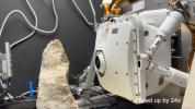
Perseverance's CacheCam captured this image of the rover's latest cored sample – taken from an intriguing rock called Bunsen Peak – on March 11, 2024.
PIA26313:
Perseverance's 'Bunsen Peak' Sample
Full Resolution:     TIFF (3.631 MB)     JPEG (261.1 kB)
Add Image to Favorite List 2024-04-03 Mars Mars 2020 Rover
Mastcam-Z
4524x3334x3
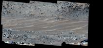
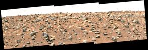
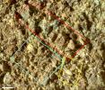
This mosaic shows a rock called Bunsen Peak where NASA's Perseverance Mars rover extracted its 21st rock core and abraded a circular patch to investigate the rock's composition.
PIA26312:
Perseverance's View of 'Bunsen Peak'
Full Resolution:     TIFF (27.75 MB)     JPEG (1.119 MB)
Add Image to Favorite List 2024-03-29 Mars Mars Helicopter
4000x2250x3
This map shows the locations of NASA's Perseverance rover (white star) and Ingenuity Mars Helicopter (cyan star) on Dec. 19, 2023.
PIA26311:
Rover, Helicopter Locations in Jezero Crater
Full Resolution:     TIFF (27.01 MB)     JPEG (1.883 MB)
Add Image to Favorite List 2024-03-29 Mars Mars Helicopter
628x469x3
This animation shows a simulation of the response of NASA's Ingenuity Mars Helicopter to the Sys-ID process. Sys-ID is a method for understanding the behavior of a system by studying how specific inputs impact the motion of the vehicle.
PIA26240:
Animation of Mars Helicopter Flight Test
Full Resolution:     TIFF (104.3 kB)     JPEG (9.195 kB)
Add Image to Favorite List 2024-03-29 Mars Mars Science Laboratory (MSL)
Navcam (MSL)
5759x5759x1
NASA's Curiosity Mars rover captured this selfie using its left black-and-white navigation camera on Feb. 3, 2024. The selfie is made up of 36 individual images that were stitched together after being sent back to Earth.
PIA26310:
Curiosity Takes a Navcam Selfie
Full Resolution:     TIFF (18.79 MB)     JPEG (2.288 MB)
Add Image to Favorite List 2024-03-29 Mars Mars Science Laboratory (MSL)
Navcam (MSL)
3432x1503x1
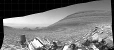
NASA's Curiosity Mars rover captured this panorama using its left black-and-white navigation camera on Feb. 1, 2024. The panorama is made up of 10 images that were stitched together after being sent back to Earth.
PIA26247:
Curiosity Looks Back Down the Slope
Full Resolution:     TIFF (3.619 MB)     JPEG (569.4 kB)
Add Image to Favorite List 2024-03-29 Mars Mars Science Laboratory (MSL)
Navcam (MSL)
7696x2774x1
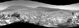
After arriving at Gediz Vallis channel, NASA's Curiosity Mars rover captured this 360-degree panorama using one of its black-and-white navigation cameras on Feb. 3, 2024.
PIA26246:
Curiosity Arrives at Gediz Vallis Channel
Full Resolution:     TIFF (14.07 MB)     JPEG (2.033 MB)
Add Image to Favorite List 2024-03-29 Mars Mars Reconnaissance Orbiter (MRO)
HiRISE
7003x4603x3
The steep path NASA's Curiosity Mars rover took to reach Gediz Vallis channel is indicated in yellow in this visualization made with orbital data.
PIA26241:
Curiosity's Route to Gediz Vallis Channel (Rendering)
Full Resolution:     TIFF (96.74 MB)     JPEG (5.638 MB)
Add Image to Favorite List 2024-03-29 Earth Terra
ASTER
800x600x3
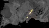
NASA's Terra spacecraft shows the March 16, 2024, volcanic eruption in Iceland's Reykjanes Peninsula.
PIA26288:
March 2024 Iceland Eruption
Full Resolution:     TIFF (958.1 kB)     JPEG (31.88 kB)
Add Image to Favorite List 2024-03-26 Earth Terra
ASTER
1639x1333x3
NASA's Terra spacecraft shows some of the tallest star dunes (or pyramid dunes), over 100 meters high, located in the Erg Chebbi sand sea in southeast Morocco.
PIA26287:
Star Dunes, Morocco
Full Resolution:     TIFF (6.557 MB)     JPEG (367.1 kB)
Add Image to Favorite List 2024-03-26 Mars Mars Reconnaissance Orbiter (MRO)
HiRISE
2880x1800x3
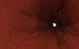
This image acquired on February 16, 2024 by NASA's Mars Reconnaissance Orbiter shows secondary impact craters around 20 kilometers from the primary impact.
PIA26324:
Searching for Distant Secondary Craters
Full Resolution:     TIFF (15.56 MB)     JPEG (1.134 MB)
Add Image to Favorite List 2024-03-26 Mars Mars Reconnaissance Orbiter (MRO)
HiRISE
2880x1800x3
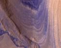
This image acquired on January 17, 2024 by NASA's Mars Reconnaissance Orbiter shows many craters in the mid-latitudes of Mars are partially filled with deposits that have been interpreted to be ice-rich.
PIA26323:
A Song of Ice and Tectonics
Full Resolution:     TIFF (15.56 MB)     JPEG (638.8 kB)
Add Image to Favorite List 2024-03-26 Mars Mars Reconnaissance Orbiter (MRO)
HiRISE
2880x1800x3
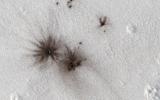
This image acquired on January 15, 2024 by NASA's Mars Reconnaissance Orbiter shows multiple dark spots corresponding to numerous new craters.
PIA26322:
Mars Atmosphere Fights Back!
Full Resolution:     TIFF (13.22 MB)     JPEG (711.7 kB)
Add Image to Favorite List 2024-03-26 Mars Mars Reconnaissance Orbiter (MRO)
HiRISE
2880x1800x3
This image acquired on January 30, 2012 by NASA's Mars Reconnaissance Orbiter shows a 13-meter (43 feet) diameter crater in Arcadia Planitia where ice was exposed both in the crater interior and ejecta.
PIA26321:
Mars Mysteries: Unveiling the Icy Craters
Full Resolution:     TIFF (12.88 MB)     JPEG (730.7 kB)
Add Image to Favorite List 2024-03-21 Earth TOPEX/Poseidon
Sentinel-6 Michael Freilich
3300x2550x3
This graph shows global mean sea level (in blue) since 1993. The solid red line indicates the trajectory of this increase, which more than doubled over the past three decades. The dotted red line projects future sea level rise.
PIA26183:
2023 Sea Level Rise Update
Full Resolution:     TIFF (5.199 MB)     JPEG (459.8 kB)
Add Image to Favorite List 2024-03-21 Earth Terra
ASTER
1578x1514x3
NASA's Terra spacecraft shows the small town of Orce in the heart of the high plateau of Grenada in southern Spain.
PIA26286:
Orce, Spain
Full Resolution:     TIFF (7.17 MB)     JPEG (425.4 kB)
Add Image to Favorite List 2024-03-05 Mercury Mars 2020 Rover
Mastcam-Z
200x296x3
NASA's Perseverance Mars rover used its Mastcam-Z camera to capture Mercury – seen as a tiny speck – passing in front of the Sun on Oct. 28, 2023.
PIA26250:
Perseverance Views a Transit of Mercury
Full Resolution:     TIFF (98.58 kB)     JPEG (5.215 kB)
Add Image to Favorite List 2024-03-05 Earth SWOT
KaRIn
1440x1090x3
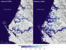
This image shows SWOT satellite data for water surface height in part of Mendocino County, Northern California, on Jan. 15, 2024, before several atmospheric rivers arrived, and on Feb. 4, after the first storms.
PIA26182:
California Coastal Flooding Captured in SWOT Data
Full Resolution:     TIFF (2.527 MB)     JPEG (255.1 kB)
Add Image to Favorite List 2024-02-29 Mars Mars Reconnaissance Orbiter (MRO)
HiRISE
1013x804x3
NASA's Curiosity Mars rover appears as a dark speck in this image captured from directly overhead by the agency's Mars Reconnaissance Orbiter, or MRO.
PIA26245:
HiRISE Spots Curiosity Driving Toward Upper Gediz Vallis
Full Resolution:     TIFF (2.444 MB)     JPEG (132.2 kB)
Add Image to Favorite List 2024-02-27 Earth Terra
ASTER
546x575x3
NASA's Terra spacecraft shows Smith Island, located in the Gulf of California, just off the eastern shore of Mexico's Baja Peninsula.
PIA26284:
Smith Island, Gulf of California
Full Resolution:     TIFF (393.5 kB)     JPEG (29.75 kB)
Add Image to Favorite List 2024-02-27 Mars Mars Helicopter
640x480x1
NASA's Ingenuity Mars Helicopter captured this video showing the shadows of its rotor blades turning on Feb. 11, 2024. Engineers planned the video to get more information about damage that was sustained during the helicopter's 72nd flight on Jan. 18, 2024
PIA26244:
Ingenuity's Navcam Reveals a Missing Rotor Blade
Full Resolution:     TIFF (176.6 kB)     JPEG (36.83 kB)
Add Image to Favorite List 2024-02-27 Mars Mars 2020 Rover
SuperCam
7371x2284x3
The Remote Microscopic Imager (RMI) camera aboard NASA's Perseverance Mars rover took these images of the Ingenuity Mars Helicopter and one of its rotor blades on Feb. 24, 2024.
PIA26238:
SuperCam's RMI Spots Ingenuity's Broken Rotor
Full Resolution:     TIFF (23.33 MB)     JPEG (897.8 kB)
Add Image to Favorite List 2024-02-27 Mars Mars 2020 Rover
Mastcam-Z
24346x5500x3
This natural-color mosaic showing NASA's Ingenuity Mars Helicopter at Valinor Hills was acquired by the agency's Perseverance Mars rover on Feb. 21, 2024. The helicopter sits just left of center, a speck-like figure amid a field of sand ripples.
PIA26237:
Ingenuity at 'Valinor Hills'
Full Resolution:     TIFF (257.5 MB)     JPEG (11.04 MB)
Add Image to Favorite List 2024-02-26 Asteroid Deep Space Network (DSN)
Deep Space Network
3410x2222x1
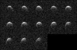
The day before asteroid 2008 OS7 made its close approach with Earth on Feb. 2, 2024, this series of images was captured by the powerful 230-foot (70-meter) Goldstone Solar System Radar antenna near Barstow, California.
PIA26149:
NASA's Planetary Radar Images Slow-Spinning Asteroid 2008 OS7
Full Resolution:     TIFF (1.567 MB)     JPEG (725.4 kB)
Add Image to Favorite List 2024-02-15 Earth Terra
ASTER
2016x1184x3
NASA's Terra spacecraft shows volcanic activity near the town of Grindavik, Iceland on January 14, 2024.
PIA26283:
Grindavik, Iceland Eruption
Full Resolution:     TIFF (3.026 MB)     JPEG (243.4 kB)
Add Image to Favorite List 2024-02-06 Mars Mars 2020 Rover
Mastcam-Z
5044x2383x3
NASA's Perseverance Mars rover captured this mosaic showing the Ingenuity Mars Helicopter at its final airfield on Feb. 4, 2024. The helicopter damaged its rotor blades during landing on its 72nd flight on Jan. 18, 2024.
PIA26236:
Perseverance Spots Ingenuity at Its Final Airfield
Full Resolution:     TIFF (27.36 MB)     JPEG (1.847 MB)
Add Image to Favorite List 2024-01-31 Mars Mars Reconnaissance Orbiter (MRO)
HiRISE
2880x1800x3
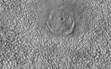
This image acquired on October 21, 2023 by NASA's Mars Reconnaissance Orbiter shows a relatively large (280-meter diameter) circular structure that is most likely a relaxed impact crater.
PIA23700:
An Impact Structure in Brain Terrain
Full Resolution:     TIFF (5.191 MB)     JPEG (1.202 MB)
Add Image to Favorite List 2024-01-31 Mars Mars Reconnaissance Orbiter (MRO)
HiRISE
2880x1800x3
This image acquired on September 26, 2023 by NASA's Mars Reconnaissance Orbiter shows terrain north of Elysium Planitia and Athabasca Valles.
PIA23427:
Dark Craters
Full Resolution:     TIFF (8.086 MB)     JPEG (1.31 MB)
Add Image to Favorite List 2024-01-31 Mars Mars Reconnaissance Orbiter (MRO)
HiRISE
2880x1800x3
This image acquired on September 23, 2023 by NASA's Mars Reconnaissance Orbiter shows a crater located in Acidalia Planitia. It is in an area of elongated mounds and hosts a variety of gully forms on its interior slopes.
PIA23145:
Gullies in Acidalia Planitia
Full Resolution:     TIFF (5.027 MB)     JPEG (592.7 kB)
Add Image to Favorite List 2024-01-31 Mars Mars Reconnaissance Orbiter (MRO)
HiRISE
2880x1800x3
This image acquired on August 27, 2023 by NASA's Mars Reconnaissance Orbiter shows ridges in Aeolis Planum which tell a story of ancient rivers and a Mars very different to that of today.
PIA22822:
Flowing Rivers on Ancient Mars
Full Resolution:     TIFF (5.191 MB)     JPEG (1.053 MB)
Add Image to Favorite List 2024-01-29 Earth Terra
ASTER
2700x3500x3
NASA's Terra spacecraft shows Rupganj, Bangladesh, one of the top 3 fastest growing cities in the world between 2000 and 2020. The population increased from 76,000 to 482,000.
PIA26282:
Rupganj, Bangladesh
Full Resolution:     TIFF (28.36 MB)     JPEG (2.267 MB)
Add Image to Favorite List 2024-01-25 Mars Mars Helicopter
4208x3120x3
NASA's After its 72nd flight on Jan. 18, 2024, NASA's Ingenuity Mars Helicopter captured this color image showing the shadow of one of its rotor blades, which was damaged during touchdown.
PIA26243:
Ingenuity Spots the Shadow of Its Damaged Rotor Blade
Full Resolution:     TIFF (39.41 MB)     JPEG (2.898 MB)
Add Image to Favorite List 2024-01-25 Mars Mars Helicopter
4208x3120x3
NASA's Ingenuity Mars Helicopter captured this view of sand ripples during its 70th flight, on Dec. 22, 2023. The smooth terrain proved difficult for the helicopter's navigation system to track, resulting in a rough landing.
PIA26242:
Ingenuity's View of Sand Ripples During Flight 70
Full Resolution:     TIFF (39.41 MB)     JPEG (2.716 MB)
Add Image to Favorite List 2024-01-17 Earth Landsat
1440x1100x3
Zachariae Isstrom, a glacier in northeast Greenland, retreated significantly between 1999 and 2022. A recent study found that it lost 176 billion tons (160 billion metric tons) of ice from 1985 to 2022.
PIA26118:
Retreat of Greenland's Zachariae Isstrom Glacier
Full Resolution:     TIFF (4.298 MB)     JPEG (315.8 kB)
Add Image to Favorite List 2024-01-17 Earth Landsat
1440x960x3
Jakobshavn Isbrae, a glacier on Greenland's western coast, retreated significantly between 1985 and 2022, losing about 97 billion tons (88 billion metric tons) of ice.
PIA26117:
Retreat of Greenland's Jakobshavn Isbrae Glacier
Full Resolution:     TIFF (4.134 MB)     JPEG (231.5 kB)
Add Image to Favorite List 2024-01-11 Earth Terra
ASTER
1348x1320x3
NASA's Terra spacecraft shows the Rinjani Caldera in Indonesia.
PIA26281:
Rinjani Caldera, Indonesia
Full Resolution:     TIFF (5.34 MB)     JPEG (286.4 kB)
Add Image to Favorite List 2024-01-08 Mars Mars Science Laboratory (MSL)
Hazcam (MSL)
1024x1024x1
NASA's Curiosity rover used its front and rear black-and-white Hazcams to capture 12 hours of a Martian day. The rover's shadow is visible on the surface in these images taken by the front Hazcam.
PIA26209:
Curiosity's Hazcams Capture a Day on Mars
Full Resolution:     TIFF (979 kB)     JPEG (106.3 kB)
Add Image to Favorite List 2023-12-29 Mars 2001 Mars Odyssey
THEMIS
728x1462x1
This image from NASA's Mars Odyssey shows part of the floor of Lyot Crater, including a large field of sand dunes on the crater floor.
PIA26270:
Lyot Crater Dunes
Full Resolution:     TIFF (738.1 kB)     JPEG (74 kB)
Add Image to Favorite List 2023-12-28 Mars 2001 Mars Odyssey
THEMIS
607x2710x1
This image from NASA's Mars Odyssey shows the central part of Tithonium Chasma.
PIA26269:
Tithonium Chasma
Full Resolution:     TIFF (673.4 kB)     JPEG (70.68 kB)
Add Image to Favorite List 2023-12-27 Mars 2001 Mars Odyssey
THEMIS
696x1431x1
This image from NASA's Mars Odyssey shows a portion of Shalbatana Vallis.
PIA26268:
Shalbatana Vallis
Full Resolution:     TIFF (666.8 kB)     JPEG (67.16 kB)
Add Image to Favorite List 2023-12-26 Mars 2001 Mars Odyssey
THEMIS
716x1457x1
This image from NASA's Mars Odyssey shows a portion of Ismeniae Fossae.
PIA26267:
Ismeniae Fossae
Full Resolution:     TIFF (769 kB)     JPEG (96.7 kB)
Add Image to Favorite List 2023-12-25 Mars 2001 Mars Odyssey
THEMIS
700x1431x1
This image from NASA's Mars Odyssey shows a section of Cerberus Fossae.
PIA26266:
Cerberus Fossae
Full Resolution:     TIFF (661.6 kB)     JPEG (63.16 kB)
Add Image to Favorite List 2023-12-22 Mars 2001 Mars Odyssey
THEMIS
609x2711x1
This image from NASA's Mars Odyssey shows a region of wind etched materials near the margin of Lucus Planum.
PIA26265:
Wind Erosion
Full Resolution:     TIFF (776.3 kB)     JPEG (106.5 kB)
Add Image to Favorite List 2023-12-21 Mars 2001 Mars Odyssey
THEMIS
703x1438x1
This image from NASA's Mars Odyssey shows Olympica Fossae, a complex channel located on the volcanic plains between Alba Mons and Olympus Mons.
PIA26264:
Olympica Fossae
Full Resolution:     TIFF (755.9 kB)     JPEG (132.3 kB)
Add Image to Favorite List 2023-12-20 Mars Mars Helicopter
1921x1027x3
This image shows a test flight of a full-scale prototype of the Ingenuity Mars Helicopter.
PIA26233:
First Controlled Flight of Mars Helicopter Prototype
Full Resolution:     TIFF (5.486 MB)     JPEG (261 kB)
Add Image to Favorite List 2023-12-20 Mars 2001 Mars Odyssey
THEMIS
604x2709x1
This image from NASA's Mars Odyssey shows Candor Chasma, one of the largest canyons that make up Valles Marineris.
PIA26263:
Eastern Candor Chasma
Full Resolution:     TIFF (672.1 kB)     JPEG (69.37 kB)
Add Image to Favorite List 2023-12-19 Mars Mars Reconnaissance Orbiter (MRO)
HiRISE
2880x1800x3
This image acquired on September 14, 2023 by NASA's Mars Reconnaissance Orbiter shows large, streamlined features and grooves that have been carved by enormous water volumes into the floor of Granicus.
PIA25990:
Fluvial Landforms in Granicus Valles
Full Resolution:     TIFF (5.191 MB)     JPEG (1.418 MB)
Add Image to Favorite List 2023-12-19 Mars Mars Reconnaissance Orbiter (MRO)
HiRISE
2880x1800x3
This image acquired on July 3, 2023 by NASA's Mars Reconnaissance Orbiter shows multiple processes, which may have occurred billions of years apart, reflected in this HiRISE image of Aeolis Planum.
PIA25989:
Curving Ridges in Aeolis Planum
Full Resolution:     TIFF (5.191 MB)     JPEG (1.096 MB)
Add Image to Favorite List 2023-12-19 Mars Mars Reconnaissance Orbiter (MRO)
HiRISE
2880x1800x3
This image acquired on July 28, 2023 by NASA's Mars Reconnaissance Orbiter shows a fan of sedimentary rock on the southeast area of Gale Crater's floor.
PIA25988:
A Sedimentary Fan in Southeast Gale Crater
Full Resolution:     TIFF (14.65 MB)     JPEG (871.3 kB)
Add Image to Favorite List 2023-12-19 Mars Mars Reconnaissance Orbiter (MRO)
HiRISE
2880x1800x3
This image acquired on August 23, 2023 by NASA's Mars Reconnaissance Orbiter shows the northern lowlands of Mars stippled with mounds in this location.
PIA25987:
Muddy Mounds
Full Resolution:     TIFF (5.191 MB)     JPEG (1.613 MB)
Add Image to Favorite List 2023-12-19 Mars 2001 Mars Odyssey
THEMIS
611x2701x1
This image from NASA's Mars Odyssey shows a small section of Shalbatana Vallis.
PIA26262:
Shalbatana Vallis
Full Resolution:     TIFF (776.3 kB)     JPEG (93.6 kB)
Add Image to Favorite List 2023-12-18 Mars 2001 Mars Odyssey
THEMIS
715x1446x1
This image from NASA's Mars Odyssey shows an unnamed crater in Utopia Planitia, with an indentation in the crater rim at the middle of the crater.
PIA26261:
Utopia Planitia Crater
Full Resolution:     TIFF (712.4 kB)     JPEG (103 kB)
Add Image to Favorite List 2023-12-15 Mars 2001 Mars Odyssey
THEMIS
611x2702x1
This image from NASA's Mars Odyssey shows a section of Bahram Vallis.
PIA26260:
Bahram Vallis
Full Resolution:     TIFF (798 kB)     JPEG (101.6 kB)
Add Image to Favorite List 2023-12-14 Earth Terra
ASTER
1600x1900x3
NASA's Terra spacecraft shows Badwater Basin in Death Valley, California, after Hurricane Hilary (August, 2023) dropped a year's worth of rain in a single day.
PIA26197:
Badwater, Death Valley
Full Resolution:     TIFF (7.76 MB)     JPEG (376.6 kB)
Add Image to Favorite List 2023-12-14 Mars 2001 Mars Odyssey
THEMIS
716x1452x1
This image from NASA's Mars Odyssey shows an unnamed crater in southern Acidalia Planitia.
PIA26259:
Acidalia Planitia Crater
Full Resolution:     TIFF (768.5 kB)     JPEG (107.3 kB)
Add Image to Favorite List 2023-12-13 Mars 2001 Mars Odyssey
THEMIS
696x1428x1
This image from NASA's Mars Odyssey shows a section of Naktong Vallis.
PIA26258:
Naktong Vallis
Full Resolution:     TIFF (706.8 kB)     JPEG (78.9 kB)
Add Image to Favorite List 2023-12-12 Mars Mars Reconnaissance Orbiter (MRO)
HiRISE
2311x1728x3
The path taken by NASA's Perseverance Mars rover during the first 1,000 sols of its mission at Jezero Crater is annotated on this overhead view taken by the HiRISE camera aboard the agency's Mars Reconnaissance Orbiter.
PIA26231:
1,000 Days of Perseverance
Full Resolution:     TIFF (11.76 MB)     JPEG (559.5 kB)
Add Image to Favorite List 2023-12-12 Mars Mars 2020 Rover
Scanning Habitable Environments with Raman & Luminescence for Organics and Chemicals (SHERLOC)
2968x1666x3
Shown here is an annotated representation of the 13 sample tubes containing rock-core samples that are being carried aboard NASA's Perseverance rover as of Dec. 12, 2023.
PIA26232:
Cored Samples Aboard Perseverance at Sol 1,000
Full Resolution:     TIFF (6.238 MB)     JPEG (632.2 kB)
Add Image to Favorite List 2023-12-12 Mars Mars 2020 Rover
Mastcam-Z
4447x1517x3
NASA's Perseverance Mars rover captured this mosaic of a location nicknamed Castell Henllys using its Mastcam-Z camera on April 13, 2023.
PIA26208:
Perseverance's Mastcam-Z Views Castell Henllys
Full Resolution:     TIFF (15.59 MB)     JPEG (996.7 kB)
Add Image to Favorite List 2023-12-12 Mars Mars 2020 Rover
Planetary Instrument for X-ray Lithochemistry (PIXL)
3561x1996x3
This time-lapse video uses an engineering model of one of the instruments aboard NASA's Perseverance Mars rover to show how the instrument evaluates safe placement against a rock.
PIA26204:
How Perseverance's PIXL Gets Close to a Rock Target
Full Resolution:     TIFF (15.19 MB)     JPEG (423.4 kB)
Add Image to Favorite List 2023-12-12 Mars Mars 2020 Rover
Planetary Instrument for X-ray Lithochemistry (PIXL)
1252x1069x3
PIXL, one of the instruments aboard NASA's Perseverance Mars rover, analyzed the chemical makeup of an area of abraded rock dubbed Ouzel Falls, finding it rich in minerals containing phosphate.
PIA26206:
PIXL Instrument on NASA's Perseverance Studies 'Ouzel Falls'
Full Resolution:     TIFF (4.017 MB)     JPEG (319.7 kB)
Add Image to Favorite List 2023-12-12 Mars Mars 2020 Rover
Planetary Instrument for X-ray Lithochemistry (PIXL)
1600x1200x3
Analyzing this abraded rock patch dubbed Bills Bay, the PIXL instrument on NASA's Perseverance Mars rover found it rich in carbonates (purple) and silica (green), both of which are good at preserving signs of ancient life.
PIA26205:
PIXL Instrument on NASA's Perseverance Studies 'Bills Bay'
Full Resolution:     TIFF (5.762 MB)     JPEG (331.5 kB)
Add Image to Favorite List 2023-12-12 Mars Mars 2020 Rover
1580x882x3
This animated artist's concept depicts water breaking through the rim of Mars' Jezero Crater, which NASA's Perseverance rover is now exploring. Water entered the crater billions of years ago, forming a lake before the Red Planet dried up.
PIA26207:
Water Enters Jezero Crater Billions of Years Ago (Artist's Concept)
Full Resolution:     TIFF (3.389 MB)     JPEG (145.7 kB)
Add Image to Favorite List 2023-12-12 Mars Mars 2020 Rover
Mastcam-Z
9000x2425x3
This 360-degree mosaic from the Airey Hill location inside Jezero Crater was generated using 993 individual images taken by the Perseverance Mars rover's Mastcam-Z from Nov. 3-6, 2023.
PIA26080:
Perseverance's 360-Degree View From 'Airey Hill'
Full Resolution:     TIFF (48.29 MB)     JPEG (2.638 MB)
Add Image to Favorite List 2023-12-12 Mars 2001 Mars Odyssey
THEMIS
703x1434x1
This image from NASA's Mars Odyssey shows an unnamed crater in Tartarus Colles.
PIA26257:
Tartarus Colles Crater
Full Resolution:     TIFF (735.6 kB)     JPEG (87.64 kB)
Add Image to Favorite List 2023-12-11 Earth Earth Surface Mineral Dust Source Investigation (EMIT)
EMIT
5836x2174x3
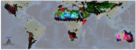
NASA's EMIT produced its first global maps of hematite, goethite, and kaolinite in Earth's dry regions using data from the year ending November 2023.
PIA26116:
NASA's EMIT Mission Produces Maps of Arid Region Surface Minerals
Full Resolution:     TIFF (21.27 MB)     JPEG (819.1 kB)
Add Image to Favorite List 2023-12-11 Mars 2001 Mars Odyssey
THEMIS
616x2697x1
This image from NASA's Mars Odyssey shows a portion of Tantalus Fossae.
PIA26256:
Tantalus Fossae
Full Resolution:     TIFF (803 kB)     JPEG (104.5 kB)
Add Image to Favorite List 2023-12-08 Mars 2001 Mars Odyssey
THEMIS
606x2707x1
This image from NASA's Mars Odyssey shows the boundary between Elysium Planitia and Terra Cimmeria.
PIA26255:
Wind Etching
Full Resolution:     TIFF (771.8 kB)     JPEG (95.81 kB)
Add Image to Favorite List 2023-12-07 Mars 2001 Mars Odyssey
THEMIS
717x1459x1
This image from NASA's Mars Odyssey shows a small portion of Tempe Fossae.
PIA26254:
Tempe Fossae
Full Resolution:     TIFF (791.8 kB)     JPEG (106.4 kB)
Add Image to Favorite List 2023-12-06 Mars 2001 Mars Odyssey
THEMIS
697x1426x1
This image from NASA's Mars Odyssey shows a portion of the floor of an unnamed crater in Arabia Terra.
PIA26253:
Crater Floor Deposit
Full Resolution:     TIFF (712.3 kB)     JPEG (86.66 kB)
Add Image to Favorite List 2023-12-05 Mars 2001 Mars Odyssey
THEMIS
707x1435x1
This image from NASA's Mars Odyssey shows the Jezero Crater delta deposit.
PIA26252:
Jezero Crater Delta
Full Resolution:     TIFF (747 kB)     JPEG (93.36 kB)
Add Image to Favorite List 2023-12-04 Mars 2001 Mars Odyssey
THEMIS
706x1442x1
This image from NASA's Mars Odyssey shows linear features which are tectonic graben.
PIA26251:
Graben
Full Resolution:     TIFF (776.6 kB)     JPEG (118.2 kB)
Add Image to Favorite List 2023-12-01 Mars 2001 Mars Odyssey
THEMIS
709x1441x1
This image from NASA's Mars Odyssey shows an unusual channel feature, located south of Tooting Crater near Lycus Sulci.
PIA26230:
Odd Channel
Full Resolution:     TIFF (736.9 kB)     JPEG (106.9 kB)
Add Image to Favorite List 2023-11-30 Mars 2001 Mars Odyssey
THEMIS
701x1433x1
This image from NASA's Mars Odyssey shows a linear feature, part of Labeatis Fossae.
PIA26229:
Labeatis Fossae
Full Resolution:     TIFF (721.9 kB)     JPEG (111.6 kB)
Add Image to Favorite List 2023-11-29 Mars 2001 Mars Odyssey
THEMIS
704x1437x1
This image from NASA's Mars Odyssey shows linear depressions, part of Nili Fossae.
PIA26228:
Nili Fossae
Full Resolution:     TIFF (700.3 kB)     JPEG (73.57 kB)
Add Image to Favorite List 2023-11-28 Mars 2001 Mars Odyssey
THEMIS
5000x1280x3
This unusual view of the horizon of Mars was captured by NASA's Odyssey orbiter using its THEMIS camera, in an operation that took engineers three months to plan.
PIA26203:
Odyssey's THEMIS Views the Horizon of Mars
Full Resolution:     TIFF (11.37 MB)     JPEG (565.8 kB)
Add Image to Favorite List 2023-11-28 Mars 2001 Mars Odyssey
THEMIS
712x1441x1
This image from NASA's Mars Odyssey shows a section of the many channel forms found radial to the Elysium Mons volcanic complex.
PIA26227:
Elysium Fossae
Full Resolution:     TIFF (669.6 kB)     JPEG (65.59 kB)
Add Image to Favorite List 2023-11-27 Mars 2001 Mars Odyssey
THEMIS
717x1456x1
This image from NASA's Mars Odyssey shows linear depressions, part of Idaeus Fossae.
PIA26226:
Idaeus Fossae
Full Resolution:     TIFF (740 kB)     JPEG (89.87 kB)
Add Image to Favorite List 2023-11-24 Mars 2001 Mars Odyssey
THEMIS
707x1438x1
This image from NASA's Mars Odyssey shows part of Hephaestus Fossae. Hephaestus Fossae is a complex channel system in Utopia Planitia near Elysium Mons.
PIA26225:
Hephaestus Fossae
Full Resolution:     TIFF (713.3 kB)     JPEG (93.75 kB)
Add Image to Favorite List 2023-11-23 Mars 2001 Mars Odyssey
THEMIS
601x2708x1
This image from NASA's Mars Odyssey shows linear features called Oti Fossae. Oti Fossae is located on the eastern flank of Arsia Mons and aligns with the regional northeast/southwest trend of the major Tharsis volcanoes.
PIA26224:
Oti Fossae
Full Resolution:     TIFF (752 kB)     JPEG (99.88 kB)
Add Image to Favorite List 2023-11-22 Mars Mars 2020 Rover
Mars Helicopter
Mastcam-Z
1920x1079x3
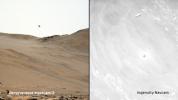
This image shows two perspectives of the 59th flight of NASA's Ingenuity Mars Helicopter. The image on the left was captured by the Mastcam-Z on NASA's Perseverance Mars rover; the black-and-white image on the right was taken by Ingenuity.
PIA26078:
Two Views of Ingenuity's 59th Flight
Full Resolution:     TIFF (3.377 MB)     JPEG (124.2 kB)
Add Image to Favorite List 2023-11-22 Mars 2001 Mars Odyssey
THEMIS
708x1446x1
This image from NASA's Mars Odyssey shows a section of one of the many channel forms found radial to the Elysium Mons volcanic complex.
PIA26223:
Elysium Fossae
Full Resolution:     TIFF (673.7 kB)     JPEG (67.56 kB)
Add Image to Favorite List 2023-11-21 Mars 2001 Mars Odyssey
THEMIS
600x2690x1
This image from NASA's Mars Odyssey shows the upper flank of Olympus Mons.
PIA26222:
Olympus Mons Flank
Full Resolution:     TIFF (804.3 kB)     JPEG (140.8 kB)
Add Image to Favorite List 2023-11-20 Mars 2001 Mars Odyssey
THEMIS
607x2705x1
This image from NASA's Mars Odyssey shows part of the floor of Orson Welles Crater.
PIA26221:
Orson Welles Crater
Full Resolution:     TIFF (765.3 kB)     JPEG (93.05 kB)
Add Image to Favorite List 2023-11-17 Earth Earth Surface Mineral Dust Source Investigation (EMIT)
EMIT
3499x1700x3
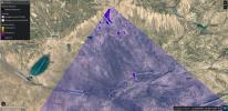
EMIT identified a cluster of 12 methane plumes within a 150-square-mile (400-square-kilometer) area of southern Uzbekistan on Sept. 1, 2022. The instrument captured the cluster within a single shot, called a scene by researchers.
PIA26113:
EMIT Identifying Methane Plumes Around the Globe
Full Resolution:     TIFF (17.85 MB)     JPEG (1.131 MB)
Add Image to Favorite List 2023-11-17 Mars 2001 Mars Odyssey
THEMIS
704x1434x1
This image from NASA's Mars Odyssey shows part of Indus Vallis, located in northern Terra Sabaea. The channel system is over 300 km (186 miles) long.
PIA26220:
Indus Vallis
Full Resolution:     TIFF (762.9 kB)     JPEG (105 kB)
Add Image to Favorite List 2023-11-16 Mars 2001 Mars Odyssey
THEMIS
602x2690x1
This image from NASA's Mars Odyssey shows the upper flank of Olympus Mons. Olympus Mons is the largest volcano in the solar system.
PIA26219:
Olympus Mons Flank
Full Resolution:     TIFF (817.7 kB)     JPEG (162.7 kB)
Add Image to Favorite List 2023-11-15 Mars 2001 Mars Odyssey
THEMIS
608x2700x1
This image from NASA's Mars Odyssey shows a cross section of the eastern flank of Ascraeus Mons.
PIA26218:
Ascraeus Mons Flank
Full Resolution:     TIFF (772.9 kB)     JPEG (105.8 kB)
Add Image to Favorite List 2023-11-14 Mars 2001 Mars Odyssey
THEMIS
610x2710x1
This image from NASA's Mars Odyssey shows a portion of Shalbatana Vallis.
PIA26217:
Shalbatana Vallis
Full Resolution:     TIFF (721.1 kB)     JPEG (68.87 kB)
Add Image to Favorite List 2023-11-13 Mars 2001 Mars Odyssey
THEMIS
698x1431x1
This image from NASA's Mars Odyssey shows dark streaks marking the inner rim of this unnamed crater in Terra Sabaea.
PIA26216:
Dark Slope Streaks
Full Resolution:     TIFF (698.6 kB)     JPEG (65.51 kB)
 Current Set   Jump to a Following Set   Jump to a Following Set   Jump to a Following Set   Jump to a Following Set   Jump to a Following Set   Jump to a Following Set   Jump to a Following Set   Jump to a Following Set   Jump to a Following Set   Retrieve Next Set 
 1-100   101-200   201-300   301-400   401-500   501-600   601-700   701-800   801-900   901-1000 
Currently displaying images: 1 - 100 of 19636