Your search criteria found
12760
images
Target is Mars (and available satellites)
Go to PIAxxxxx:
Refine this list of images by:
Target:
Deimos
Mars
Phobos
Mission:
2001 Mars Odyssey
Antarctic Meteorite Location and Mapping Project (AMLAMP)
Dawn
ExoMars
Hubble Space Telescope
InSight
MAVEN
Mariner Mars 1964 (Mariner 4)
Mariner Mars 1969 (Mariner 7)
Mariner Mars 1971 (Mariner 9)
Mars 2020
Mars 2020 Rover
Mars Atmosphere and Volatile Evolution MissioN (MAVEN)
Mars Climate Orbiter
Mars Cube One (MarCO)
Mars Exploration Rover (MER)
Mars Express (MEX)
Mars Global Surveyor (MGS)
Mars Helicopter
Mars Pathfinder (MPF)
Mars Reconnaissance Orbiter (MRO)
Mars Sample Return
Mars Sample Return (MSR)
Mars Science Laboratory (MSL)
Phoenix
Rosetta
Viking
Spacecraft:
2001 Mars Odyssey
Curiosity
Dawn
InSight Mars Lander
Ingenuity
MAVEN
MarCO-B
Mariner 4
Mariner 7
Mariner 9
Mars Climate Orbiter
Mars Express (MEX)
Mars Express (MEX) Orbiter
Mars Global Surveyor Orbiter
Mars Pathfinder Lander
Mars Pathfinder Rover
Mars Reconnaissance Orbiter (MRO)
Mars Sample Return
Mars Science Laboratory (MSL)
NASA's Mars Pathfinder Lander
Opportunity
Perseverance
Philae Lander
Phoenix Lander
Phoenix Mars Lander
Spirit
Viking Lander 1
Viking Lander 2
Viking Orbiter 1
Viking Orbiter 2
Instrument:
Alpha Particle X-ray Spectrometer
Alpha Particle X-ray Spectrometer (MSL)
Atmospheric Structure / Meteorology Instrument
CHIMRA
Camera 1
Camera 2
Chemistry & Mineralogy (CheMin)
Chemistry and Camera (ChemCam)
Comet Infrared and Visible Analyser (CIVA
Compact Reconnaissance Imaging Spectrometer for Mars (CRISM)
Context Camera (CTX)
Deep Space Network
Descent Image Motion Estimation System (DIMES)
Dynamic Albedo of Neutrons
Dynamic Albedo of Neutrons (DAN)
Gamma Ray Spectrometer - Neutron Spectrometer
Gamma Ray Spectrometer Suite
Hazard Avoidance Camera
Hazard Avoidance Camera (M2020)
Hazard Avoidance Camera (MSL)
Heat and Physical Properties Package (HP3)
High Resolution Imaging Science Experiment (HiRISE)
High Resolution Instrument (HRI)
High Resolution Stereo Camera
Imager for Mars Pathfinder
Imaging Ultraviolet Spectrograph
Imaging Ultraviolet Spectrograph (IUVS)
Instrument Context Camera (ICC)
Instrument Deployment Camera (IDC)
Lander Vision System Camera (LCAM)
Magnetometer
Mars Advanced Radar for Subsurface and Ionosphere Sounding (MARSIS)
Mars Advanced Radar for Subsurface and Ionospheric Sounding (MARSIS)
Mars Climate Sounder (MCS)
Mars Color Imager (MARCI)
Mars Descent Imager
Mars Environmental Dynamics Analyzer (MEDA)
Mars Hand Lens Imager (MAHLI)
Mars Horizon Sensor Assembly
Mars Orbiter Camera (MOC)
Mars Orbiter Laser Altimeter
Mars Radiation Experiment
Mastcam
Mastcam-Z
Microscopic Imager
Microscopy Electrochemistry and Conductivity Analyzer (MECA)
Miniature Thermal Emission Spectrometer
Moessbauer Spectrometer
Navigation Camera
Navigation Camera (M2020)
Navigation Camera (MSL)
Neutral Gas and Ion Mass Spectrometer
Neutron Spectrometer
Optical Microscope
Optical Navigation Camera
Panoramic Camera
Planetary Instrument for X-ray Lithochemistry (PIXL)
Radar System
Radiation Assessment Detector (RAD)
Radio Science Subsystem
Robotic Arm
Robotic Arm (MSL)
Robotic Arm Camera (RAC)
Rock Abrasion Tool (RAT)
Rover Cameras
Rover Environmental Monitoring Station (REMS)
Sample Analysis at Mars (SAM)
Scanning Habitable Environments with Raman & Luminescence for Organics and Chemicals (SHERLOC)
Seismic Experiment for Interior Structure (SEIS)
Shallow Subsurface Radar (SHARAD)
Stereo Imager (SSI)
SuperCam
Surface Stereo Imager (SSI)
Thermal Emission Imaging System
Thermal Emission Spectrometer
Thermal and Electrical Conductivity Probe
Thermal and Evolved Gas Analyzer
Trace Gas Orbiter
Visual Imaging Subsystem
Visual Imaging Subsystem - Camera A
Visual Imaging Subsystem - Camera B
Wide Field Planetary Camera 2
Click on an image for detailed information
Click on a column heading to sort in ascending or descending order
My
List
Addition Date
Target
Mission
Instrument
Size
2014-01-29
Mars
Mars Science Laboratory (MSL)
DAN
1502x934x1
PIA17762:
Russian Hydrogen-Checking Instrument on Curiosity Fires 2 Millionth Pulse
Full Resolution:
TIFF
(1.405 MB)
JPEG
(52.56 kB)
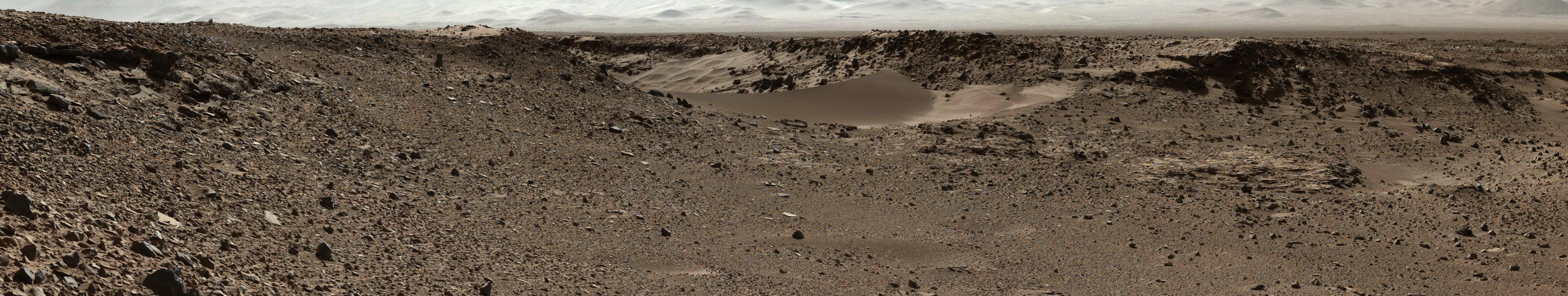
2014-01-29
Mars
Mars Science Laboratory (MSL)
Navcam (MSL)
7696x1717x1
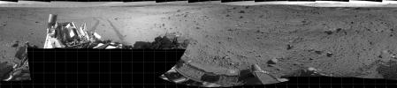
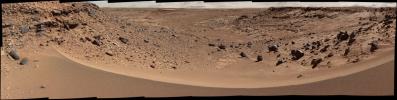
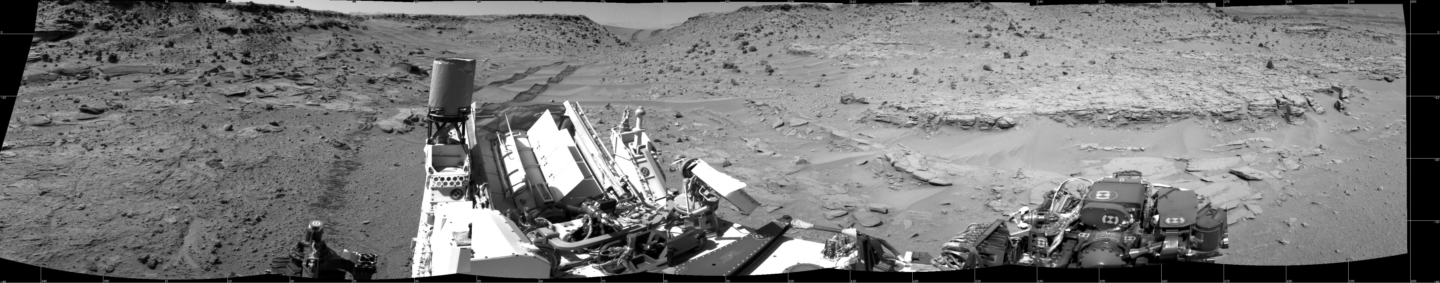
PIA17763:
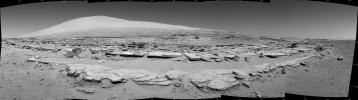
Full-Circle Vista During Curiosity's Approach to 'Dingo Gap'
Full Resolution:
TIFF
(13.23 MB)
JPEG
(1.852 MB)
2014-01-29
Mars
Mars Science Laboratory (MSL)
Navcam (MSL)
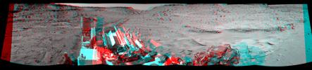
7733x2357x3
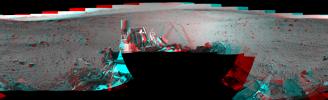
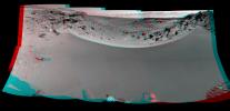
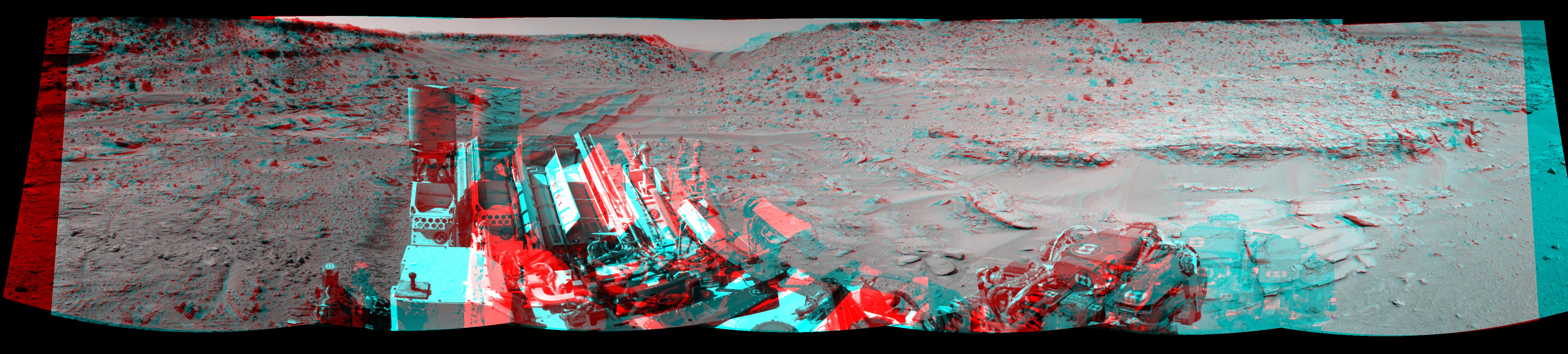
PIA17764:
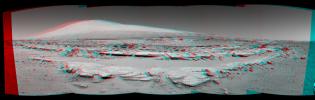
Full-Circle Vista During Curiosity's Approach to 'Dingo Gap' (Stereo)
Full Resolution:
TIFF
(54.7 MB)
JPEG
(2.399 MB)
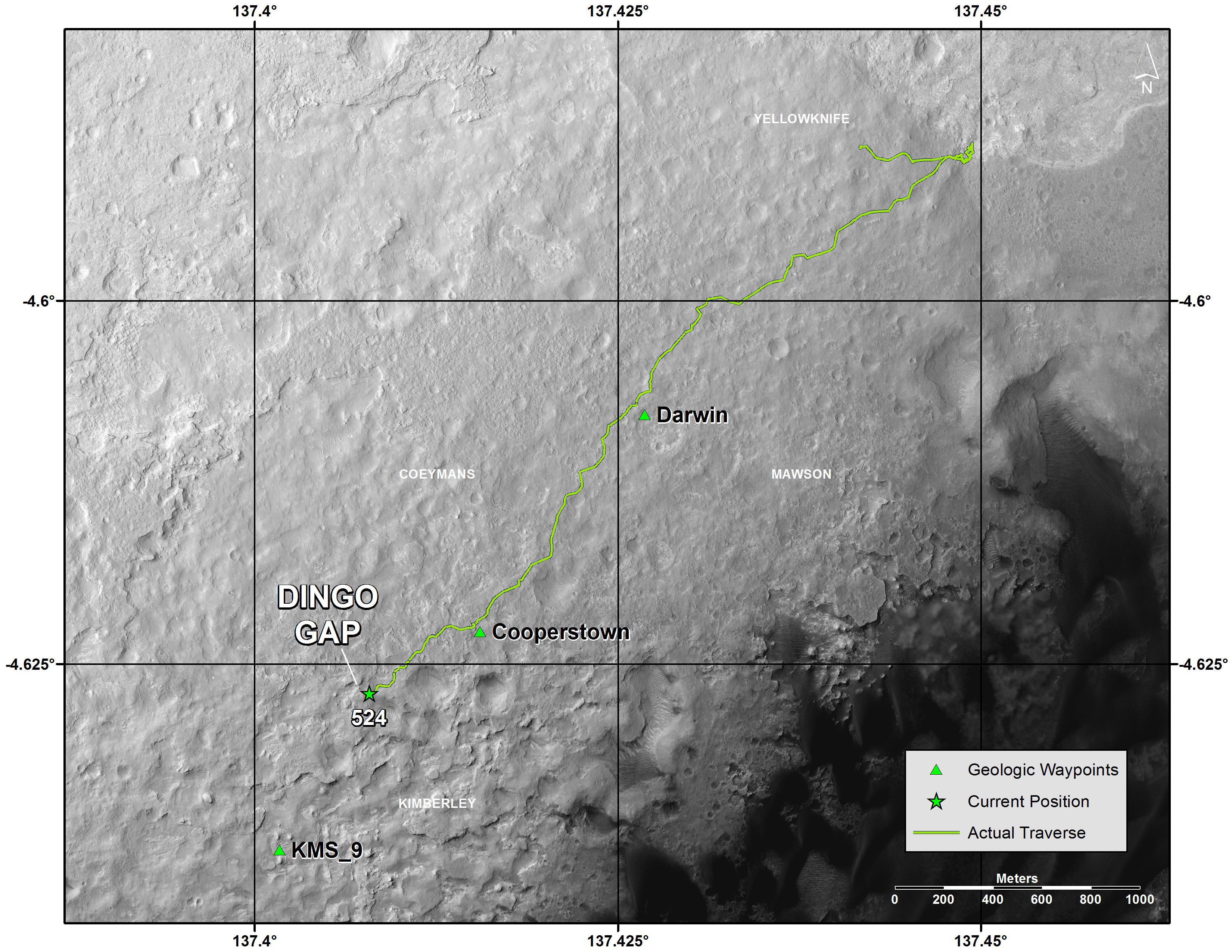
2014-01-29
Mars
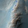
Mars Reconnaissance Orbiter (MRO)
Mars Science Laboratory (MSL)
HiRISE
3300x2550x3
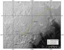
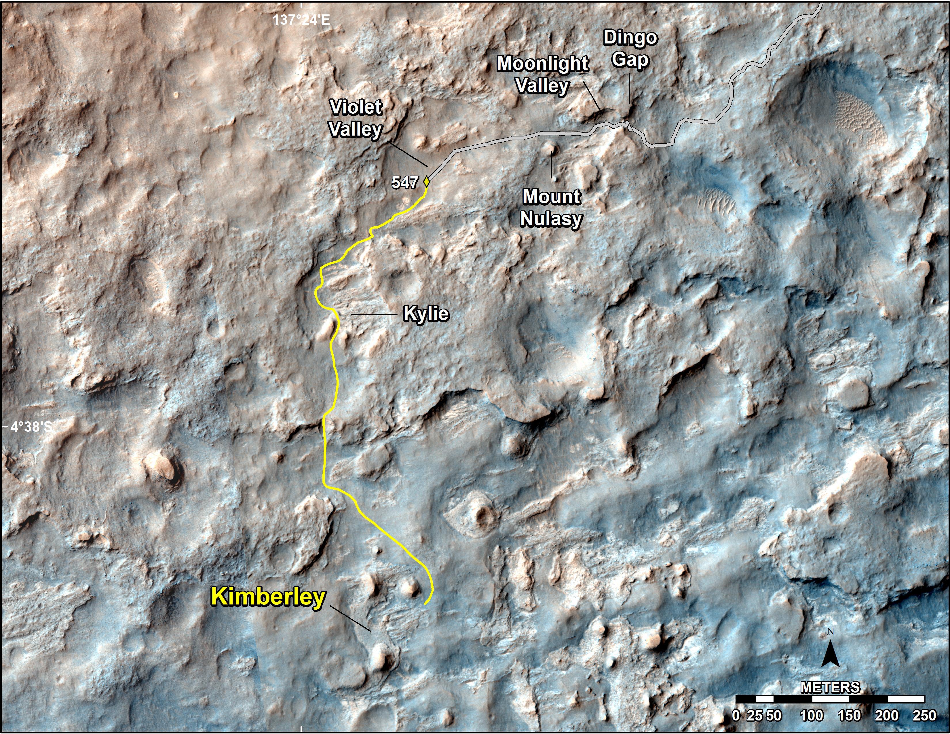
PIA17765:
Traverse Map for Mars Rover Curiosity as of Jan. 26, 2014
Full Resolution:
TIFF
(25.26 MB)
JPEG
(1.211 MB)
2014-01-29
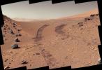
Mars
Mars Science Laboratory (MSL)
Mastcam
5544x1047x3
PIA17766:
Curiosity Mars Rover Approaches 'Dingo Gap,' Mastcam View
Full Resolution:
TIFF
(17.42 MB)
JPEG
(1.284 MB)
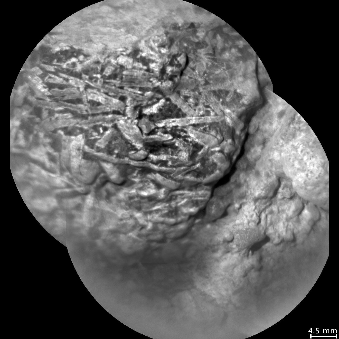
2014-01-29
Mars
Mars Science Laboratory (MSL)
ChemCam
1320x1320x1
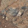
PIA17767:
Crystal-Laden Martian Rock Examined by Curiosity's Laser Instrument
Full Resolution:
TIFF
(1.744 MB)
JPEG
(145.7 kB)
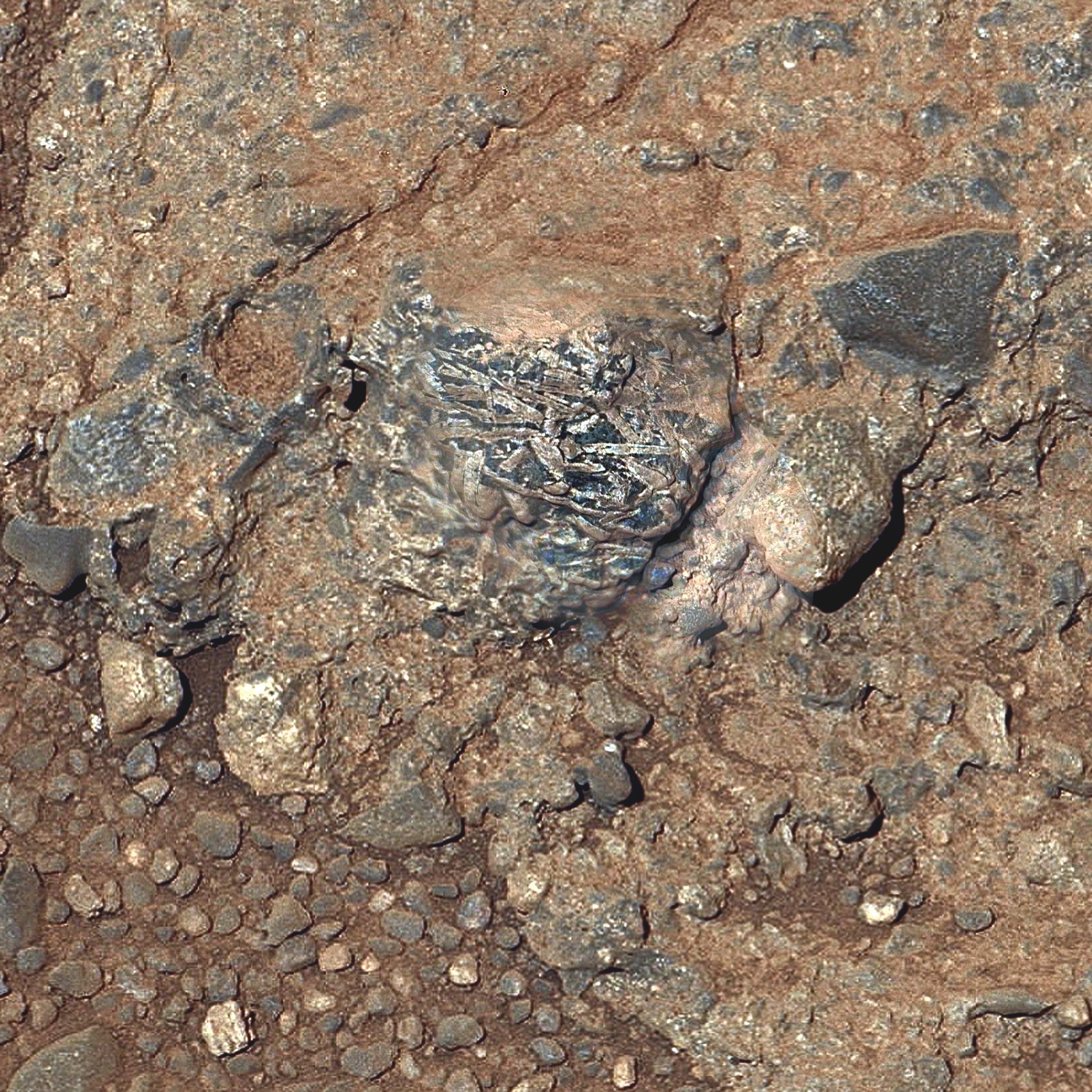
2014-01-29
Mars
Mars Science Laboratory (MSL)
ChemCam
Mastcam
3272x3272x3
PIA17768:
Martian Rock 'Harrison' in Color, Showing Crystals
Full Resolution:
TIFF
(32.13 MB)
JPEG
(1.484 MB)
2014-01-30
Mars
2001 Mars Odyssey
THEMIS
1404x2925x1
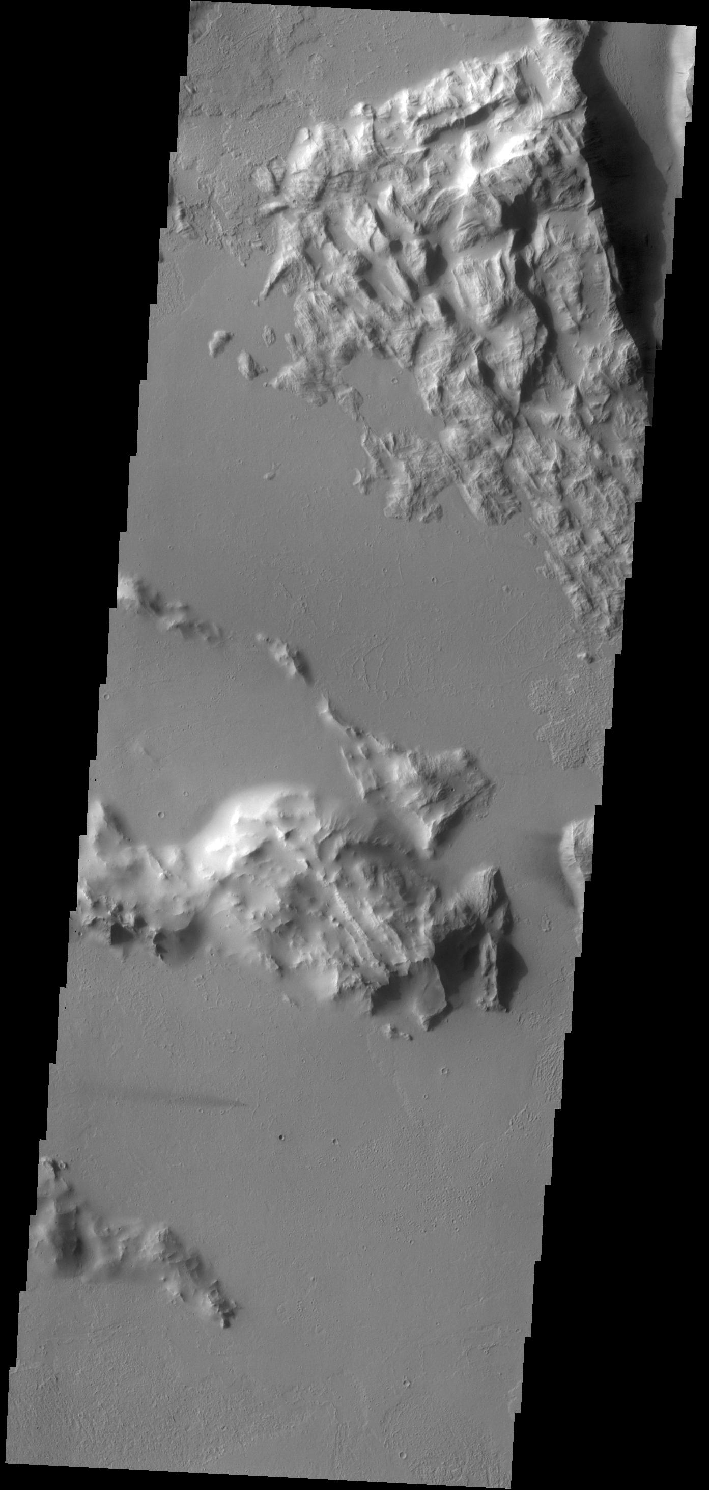
PIA17892:
Ascraeus Mons
Full Resolution:
TIFF
(4.112 MB)
JPEG
(333.4 kB)
2014-01-31
Mars
2001 Mars Odyssey
THEMIS
1373x2929x1
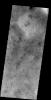
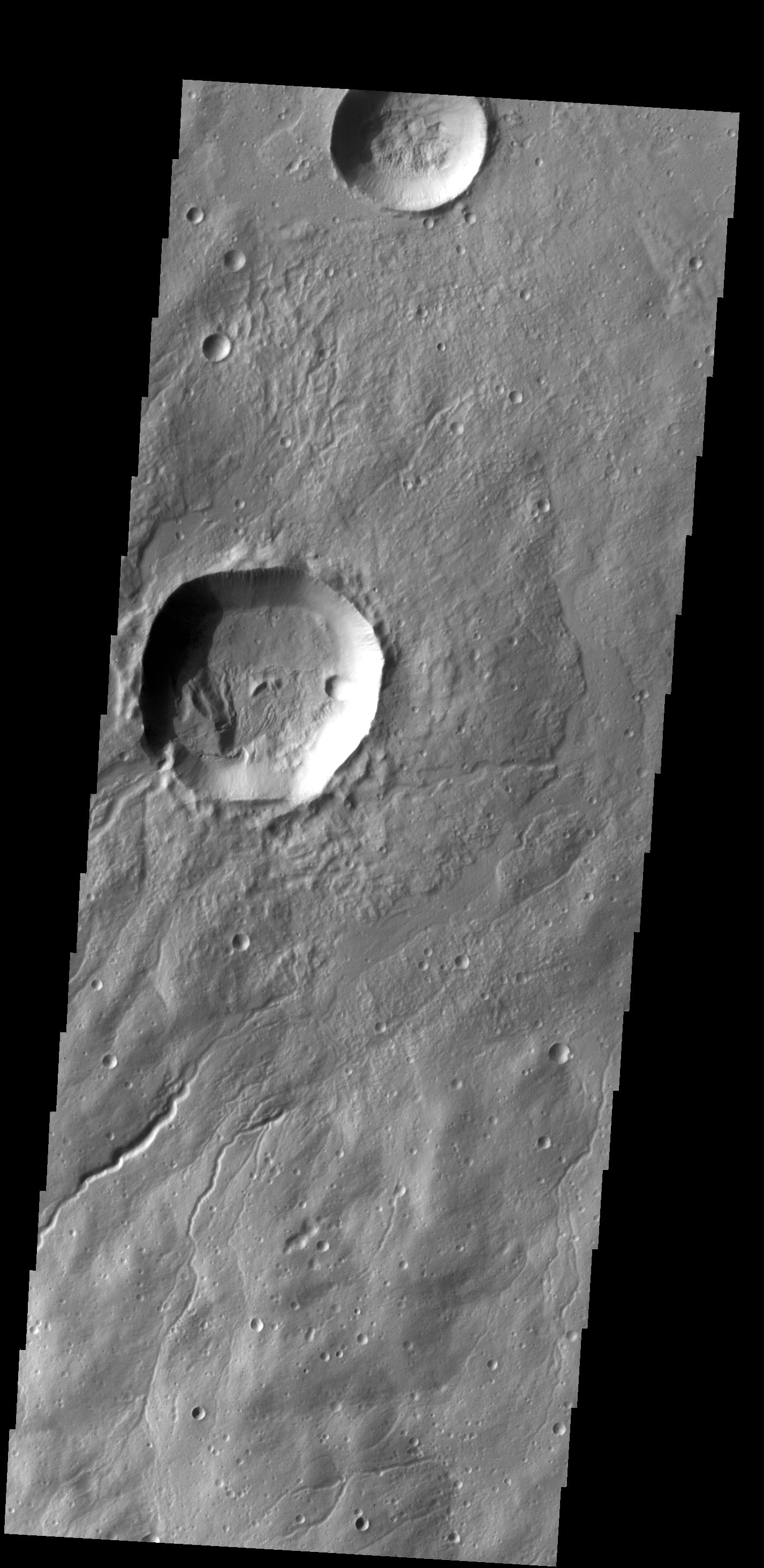
PIA17893:
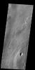
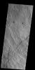
Windstreaks
Full Resolution:
TIFF
(4.026 MB)
JPEG
(405.6 kB)
2014-01-31
Mars
Mars Science Laboratory (MSL)
Navcam (MSL)
4127x1993x3
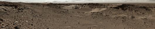
PIA17769:
Curiosity's View Past Dune at 'Dingo Gap' (Stereo)
Full Resolution:
TIFF
(24.69 MB)
JPEG
(1.066 MB)
2014-01-31
Mars
Mars Science Laboratory (MSL)
Navcam (MSL)
4075x1439x1
PIA17930:
Curiosity's View Past Dune at 'Dingo Gap'
Full Resolution:
TIFF
(5.87 MB)
JPEG
(876.4 kB)
2014-02-03
Mars
2001 Mars Odyssey
THEMIS
1411x2924x1
PIA17894:
Olympus Mons
Full Resolution:
TIFF
(4.131 MB)
JPEG
(597.4 kB)
2014-02-03
Mars
Mars Science Laboratory (MSL)
Mastcam
9074x2287x3
PIA17931:
Martian Valley May Be Curiosity's Route
Full Resolution:
TIFF
(62.28 MB)
JPEG
(4.277 MB)
2014-02-04
Mars
2001 Mars Odyssey
THEMIS
1404x2923x1
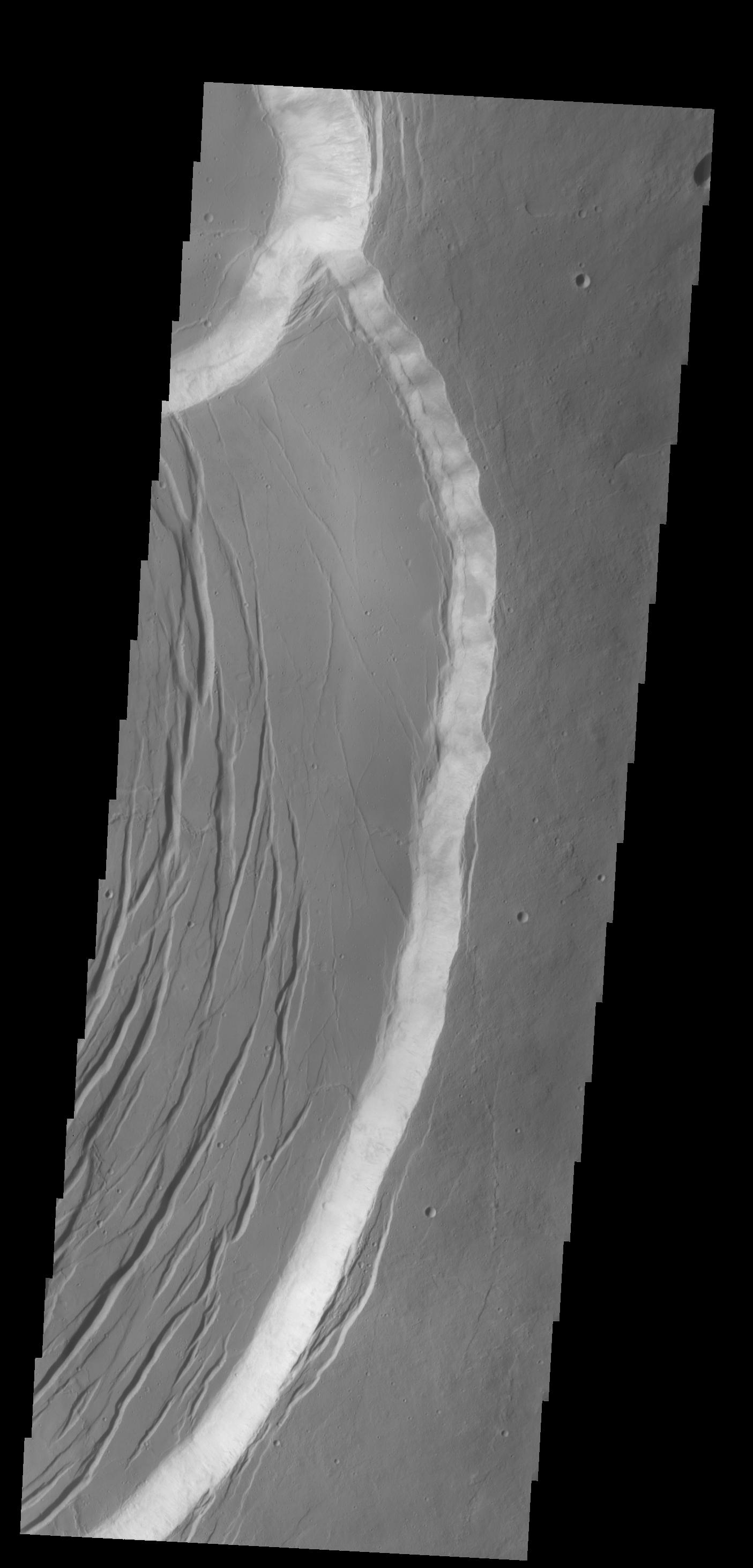
PIA17895:
Olympus Mons Escarpment
Full Resolution:
TIFF
(4.109 MB)
JPEG
(253.1 kB)
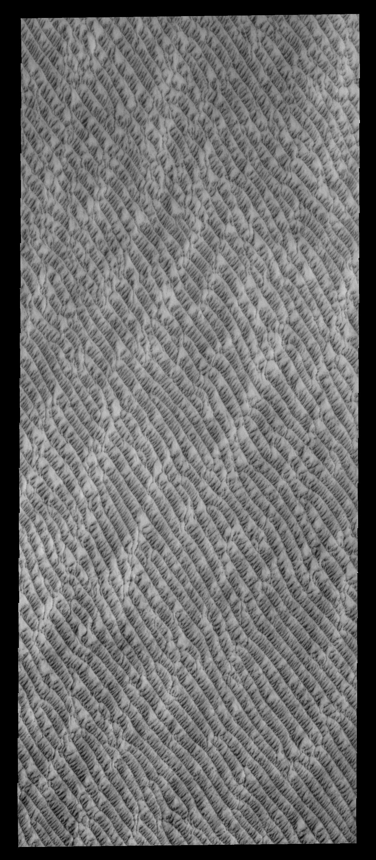
2014-02-05
Mars
Mars Reconnaissance Orbiter (MRO)
HiRISE
2880x1800x3
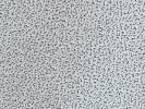
PIA17984:
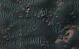
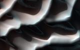
Squiggly Sand Dunes
Full Resolution:
TIFF
(15.56 MB)
JPEG
(923.9 kB)
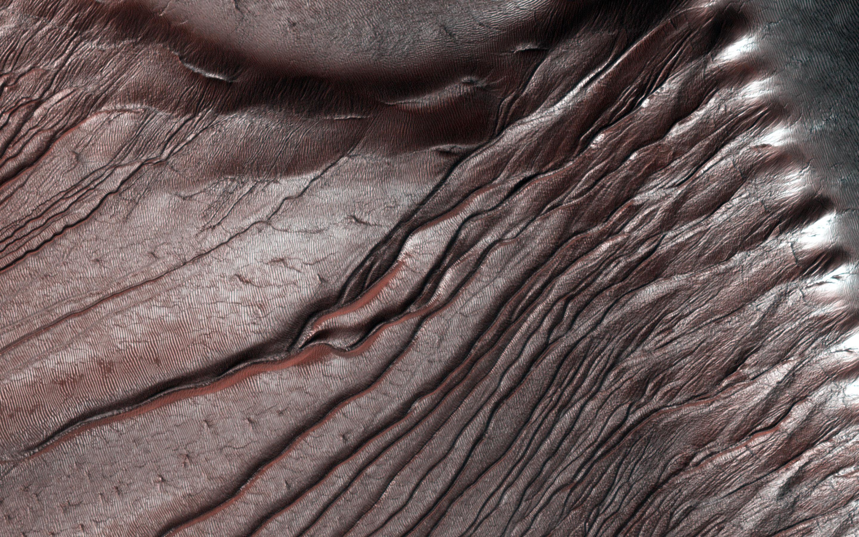
2014-02-05
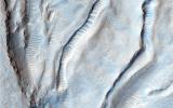
Mars
Mars Reconnaissance Orbiter (MRO)
HiRISE
2880x1800x3
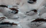
PIA17985:
Channels in Phlegra Montes
Full Resolution:
TIFF
(15.56 MB)
JPEG
(977.8 kB)
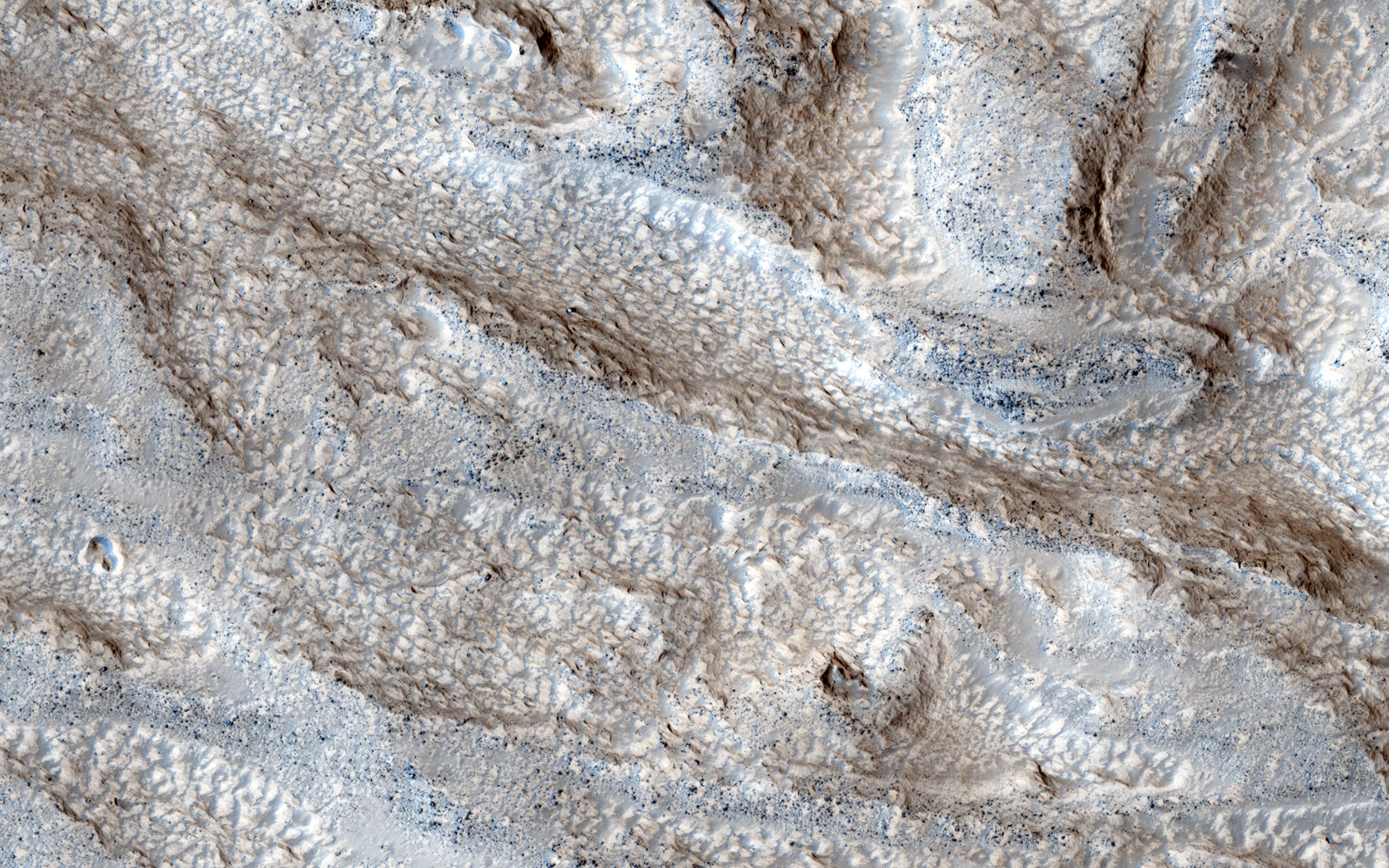
2014-02-05
Mars
Mars Reconnaissance Orbiter (MRO)
HiRISE
2880x1800x3
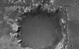
PIA17986:
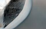
Fall Frost Accumulation on Russell Crater Dunes
Full Resolution:
TIFF
(15.56 MB)
JPEG
(962.1 kB)
2014-02-05
Mars
2001 Mars Odyssey
THEMIS
1411x2923x1
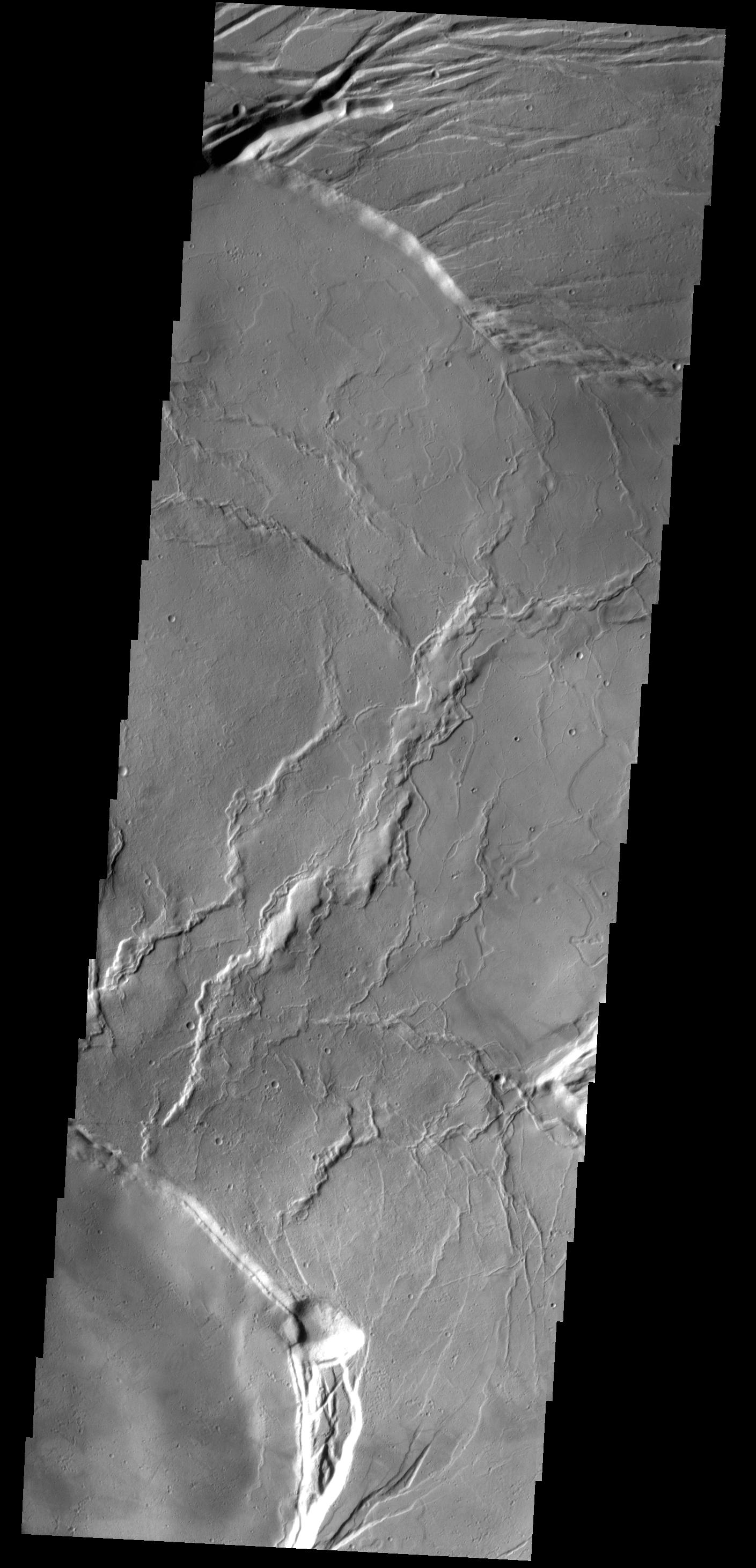
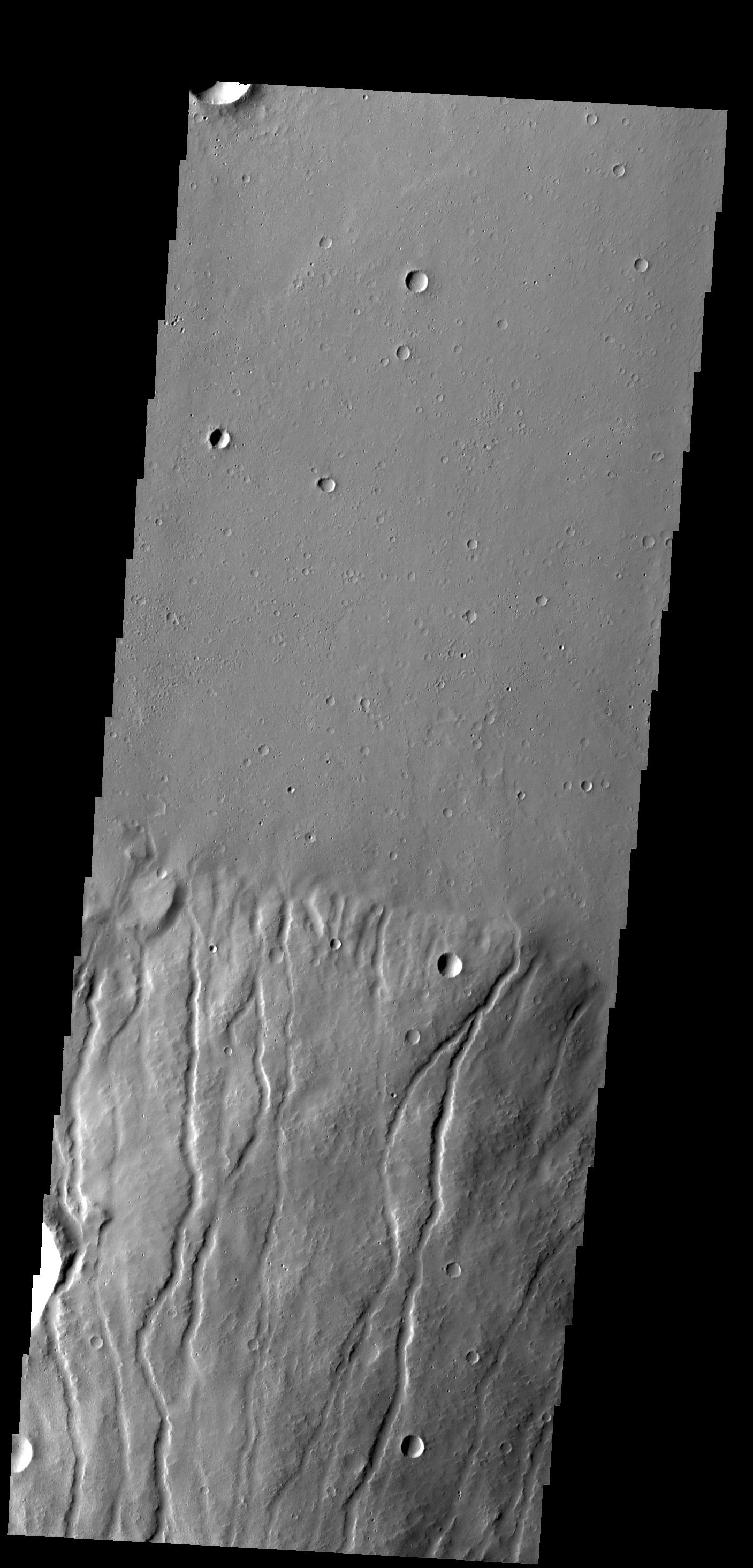
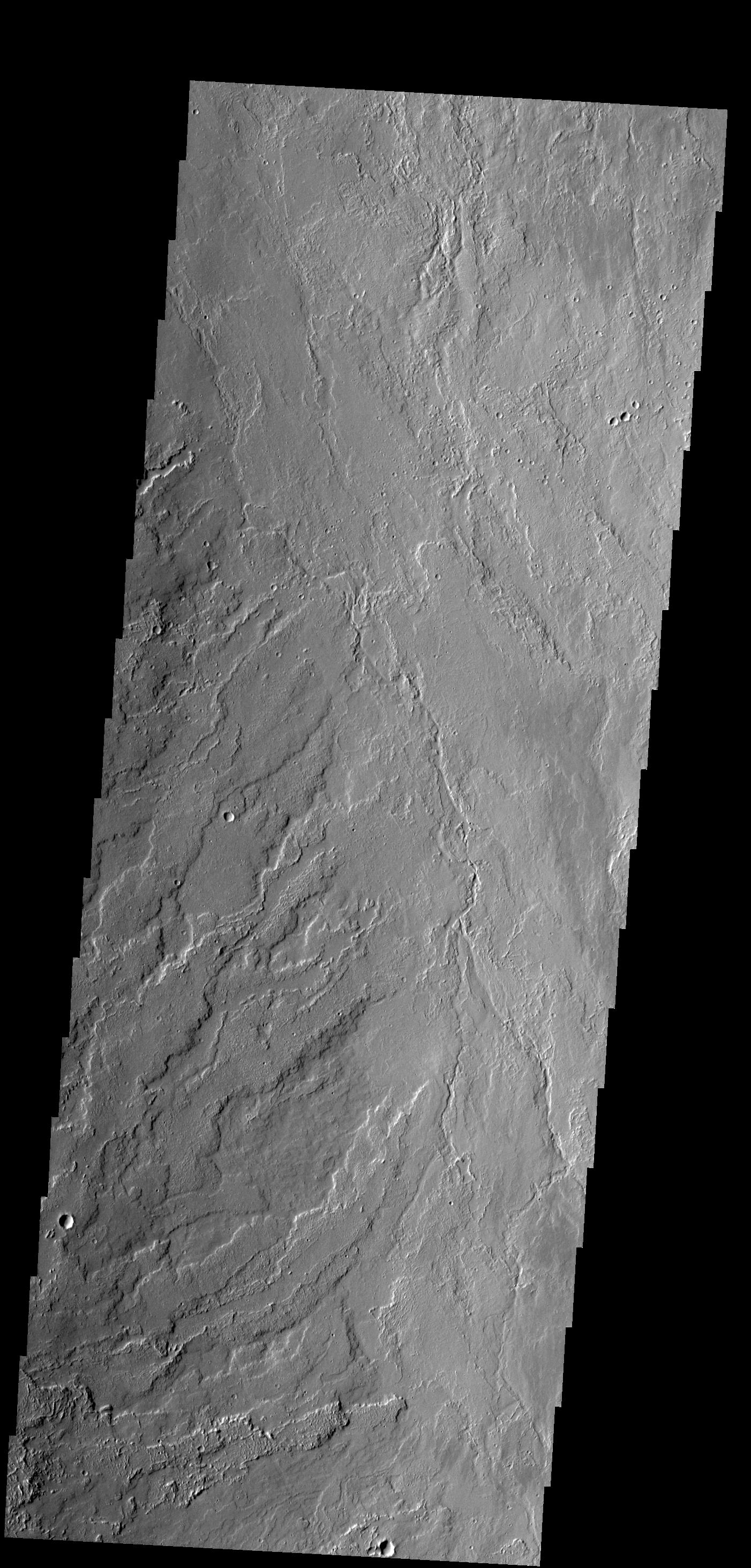
PIA17960:
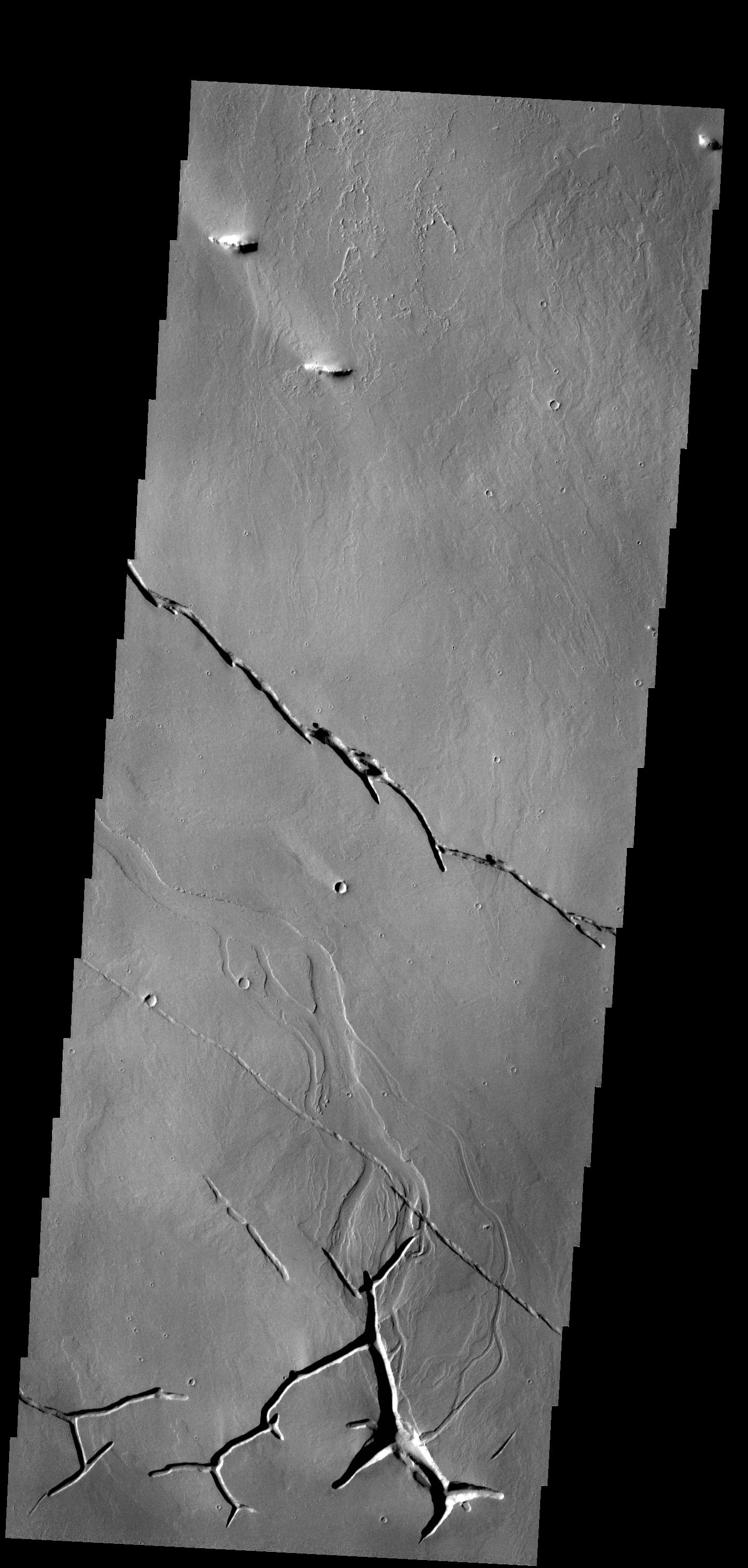
Tharsis Lava Flows
Full Resolution:
TIFF
(4.129 MB)
JPEG
(637.8 kB)
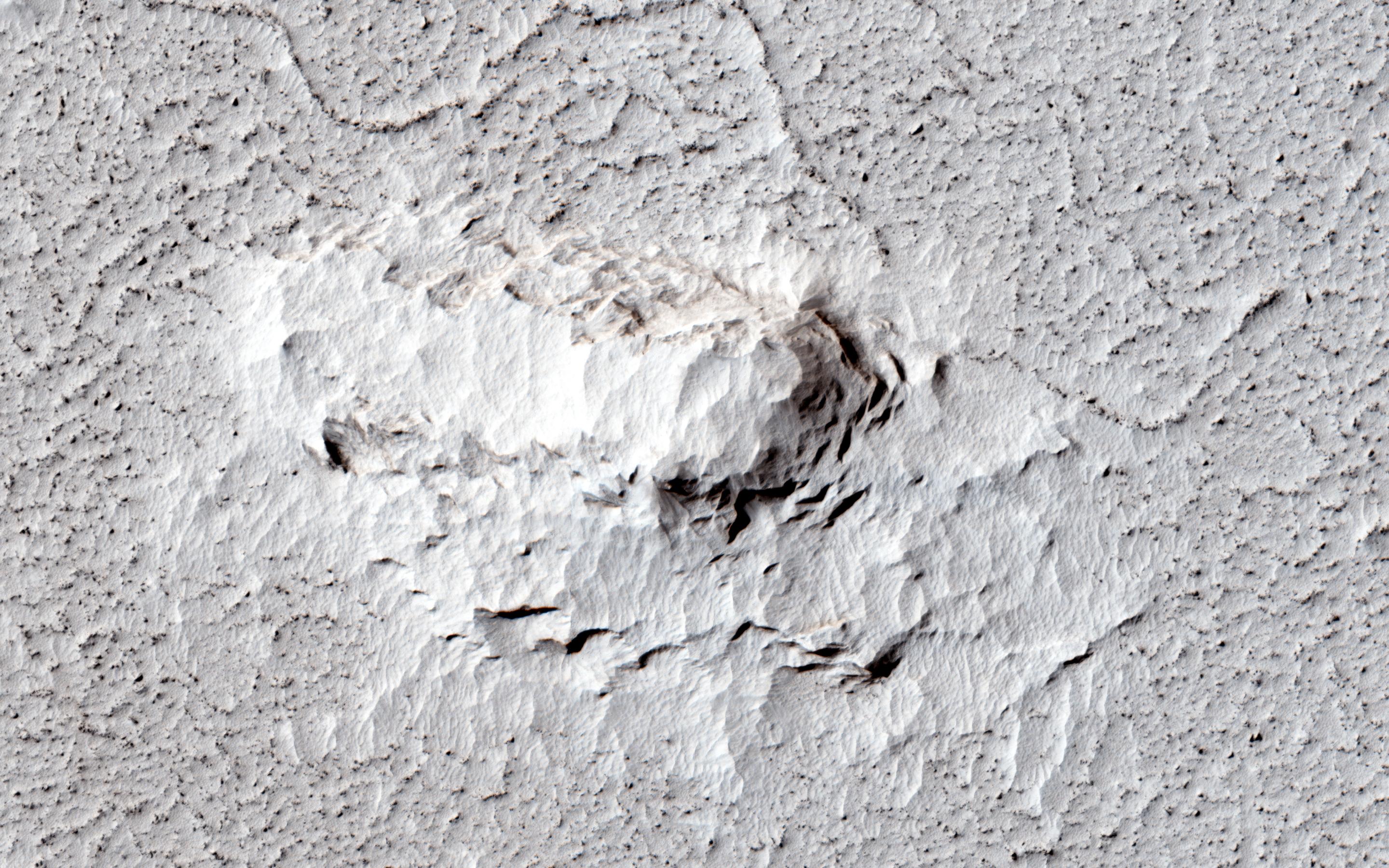
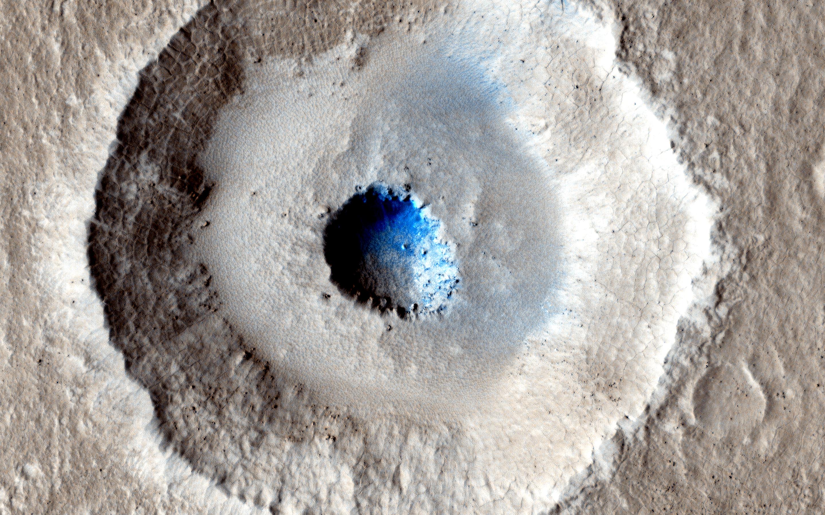
2014-02-05
Mars
Mars Reconnaissance Orbiter (MRO)
HiRISE
1024x768x3
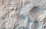
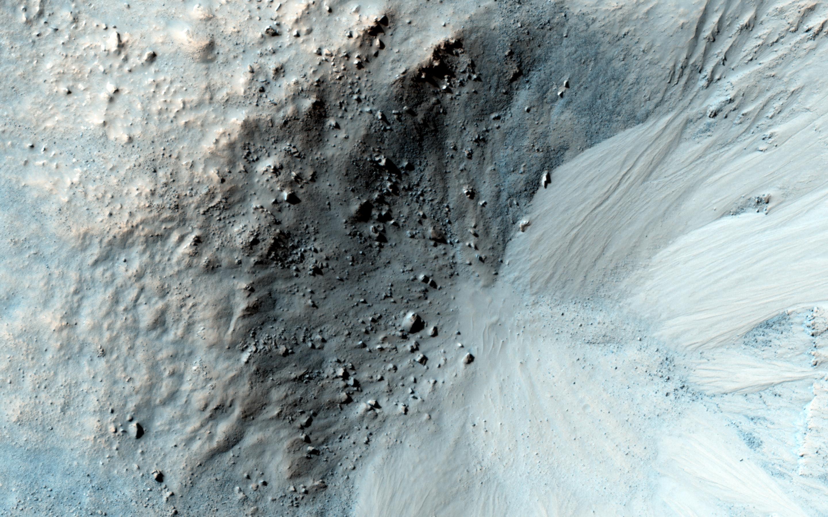
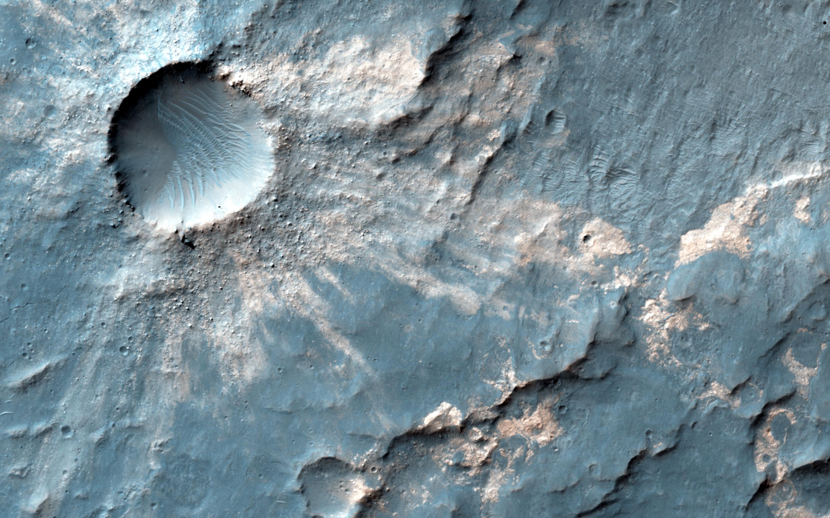
PIA17932:
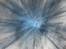
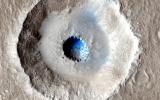
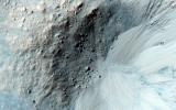
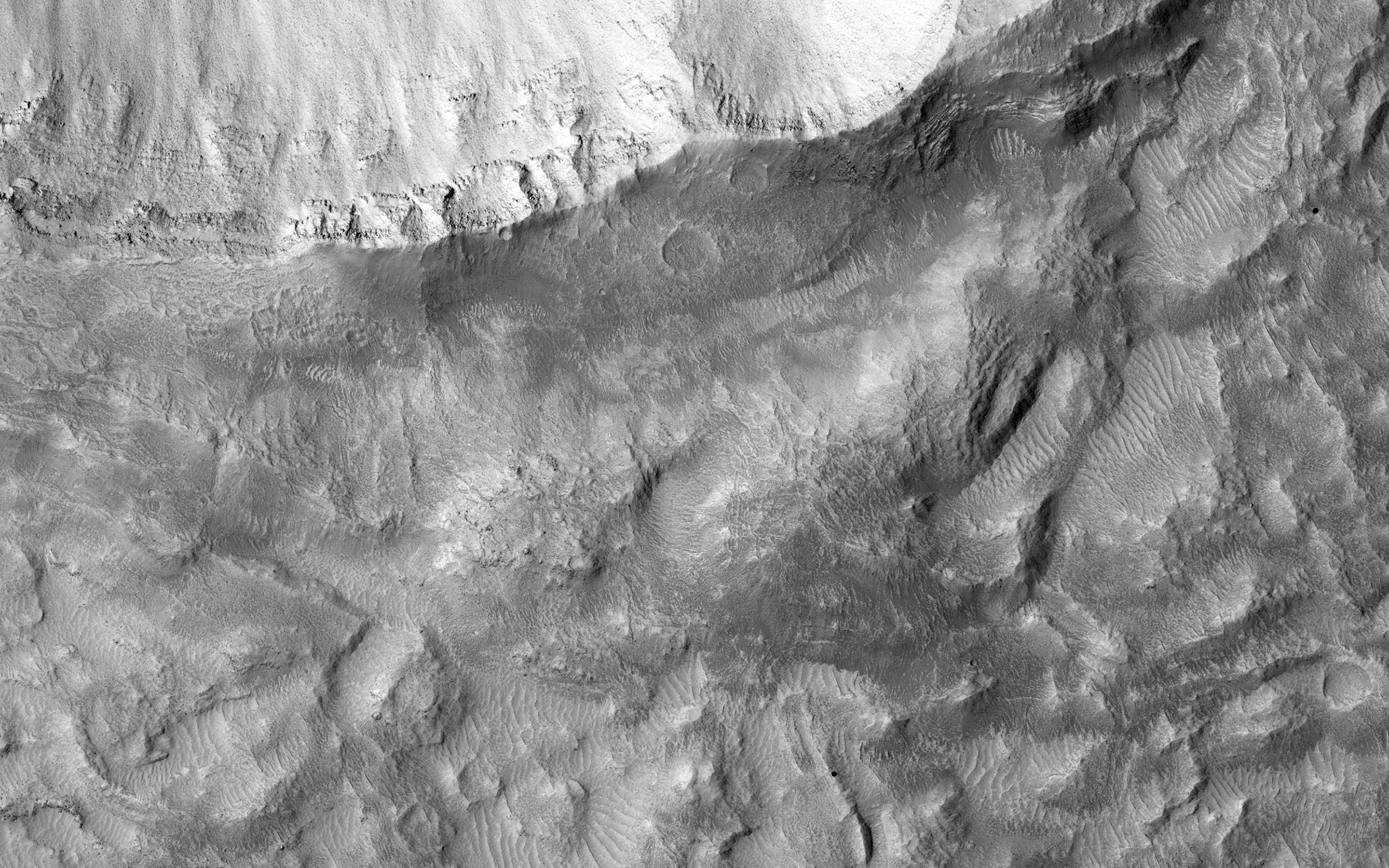
A Spectacular New Martian Impact Crater
Full Resolution:
TIFF
(2.36 MB)
JPEG
(200.7 kB)
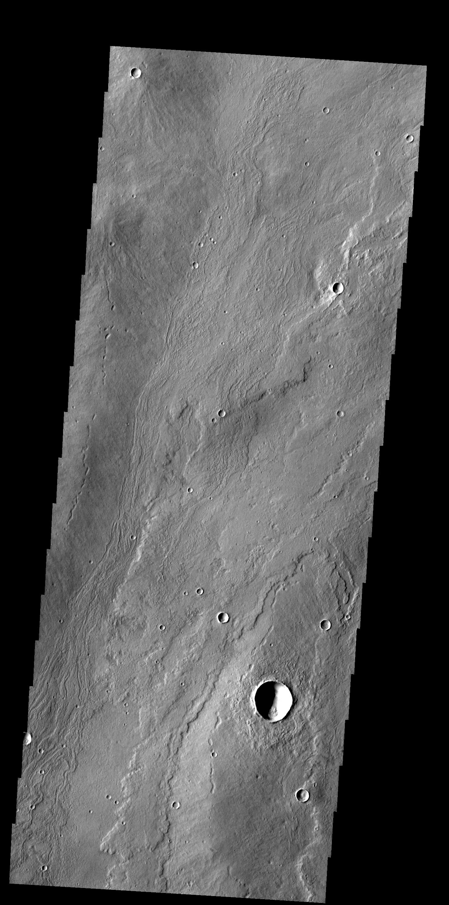
2014-02-06
Mars
2001 Mars Odyssey
THEMIS
1453x2928x1
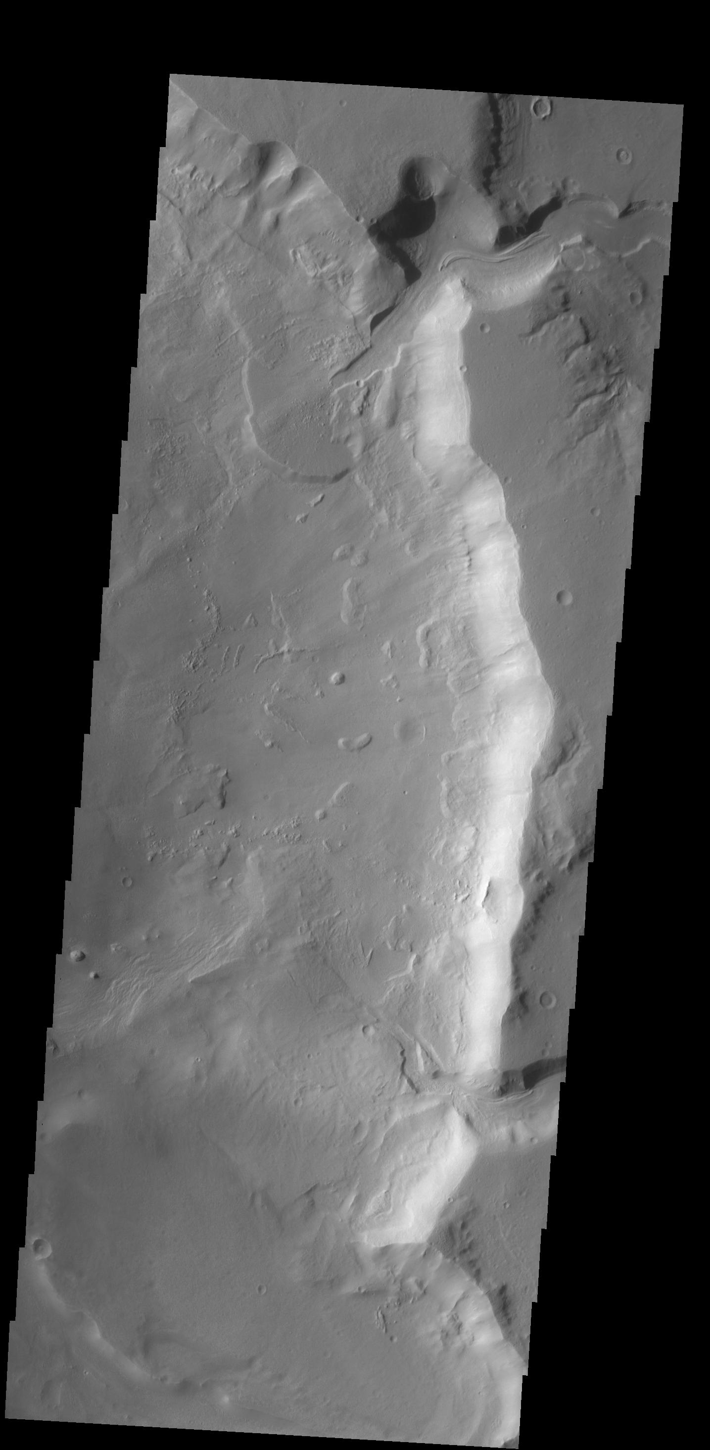
PIA17961:
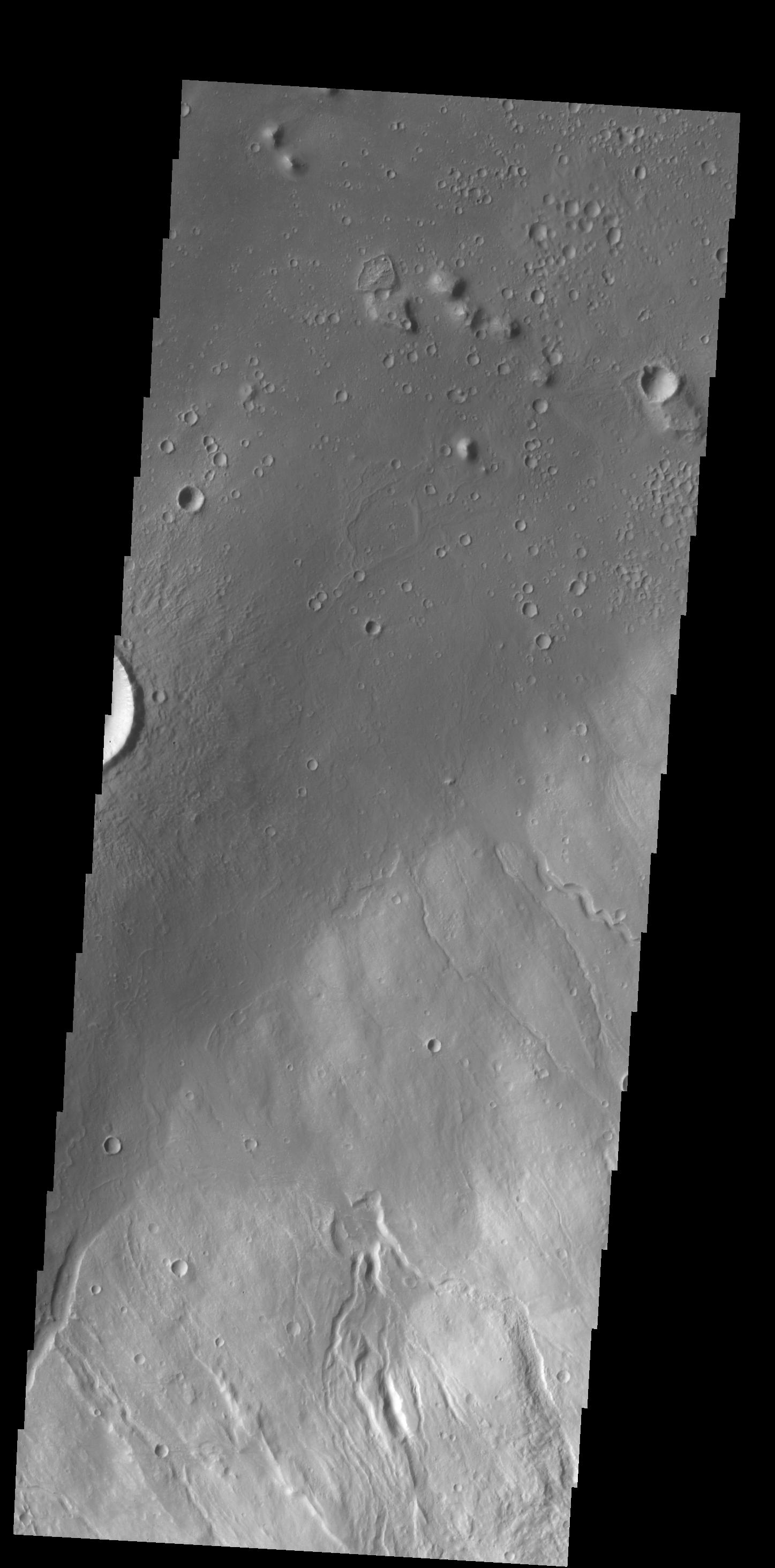
Alba Mons Flows
Full Resolution:
TIFF
(4.259 MB)
JPEG
(517.2 kB)
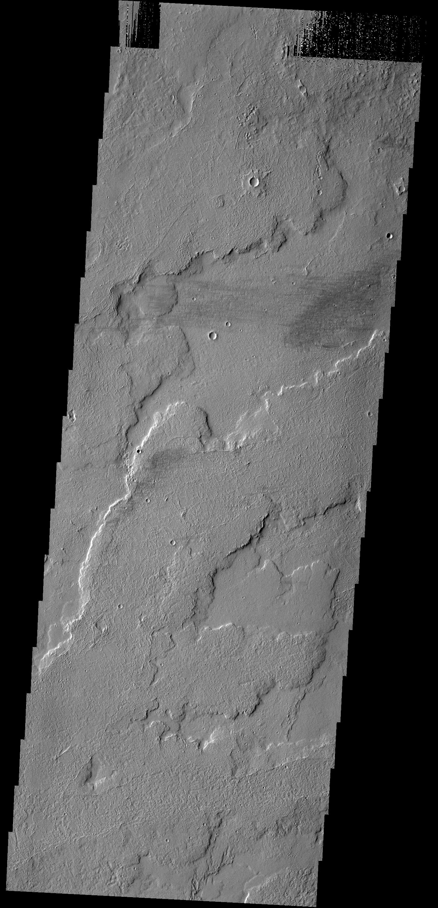
2014-02-07
Mars
2001 Mars Odyssey
THEMIS
1389x2922x1
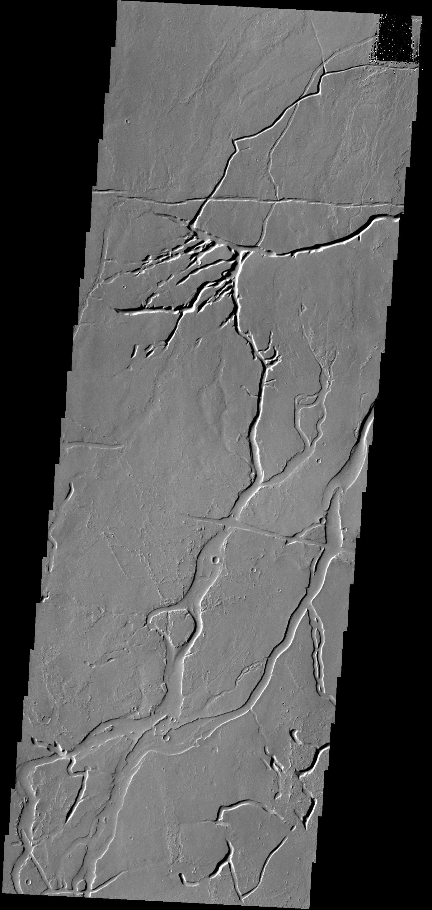
PIA17962:
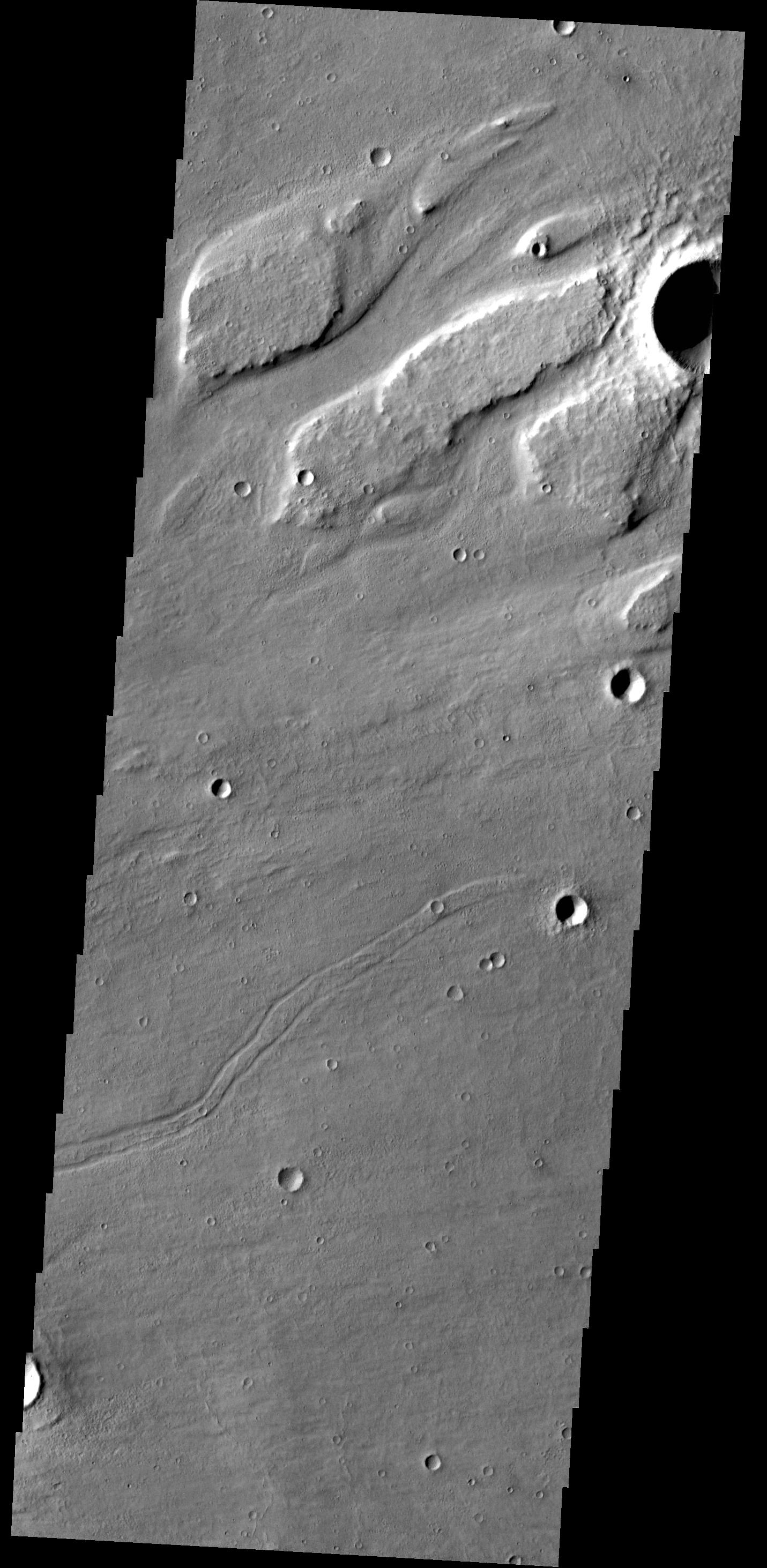
Athabasca Valles
Full Resolution:
TIFF
(4.064 MB)
JPEG
(312.1 kB)
2014-02-10
Mars
2001 Mars Odyssey
THEMIS
1404x2921x1
PIA17963:
Changing Winds
Full Resolution:
TIFF
(4.106 MB)
JPEG
(371.3 kB)
2014-02-10
Mars
Mars Reconnaissance Orbiter (MRO)
HiRISE
1943x2512x3
PIA17933:
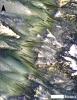
Warm-Season Flows on Martian Slope
Full Resolution:
TIFF
(14.65 MB)
JPEG
(614.7 kB)
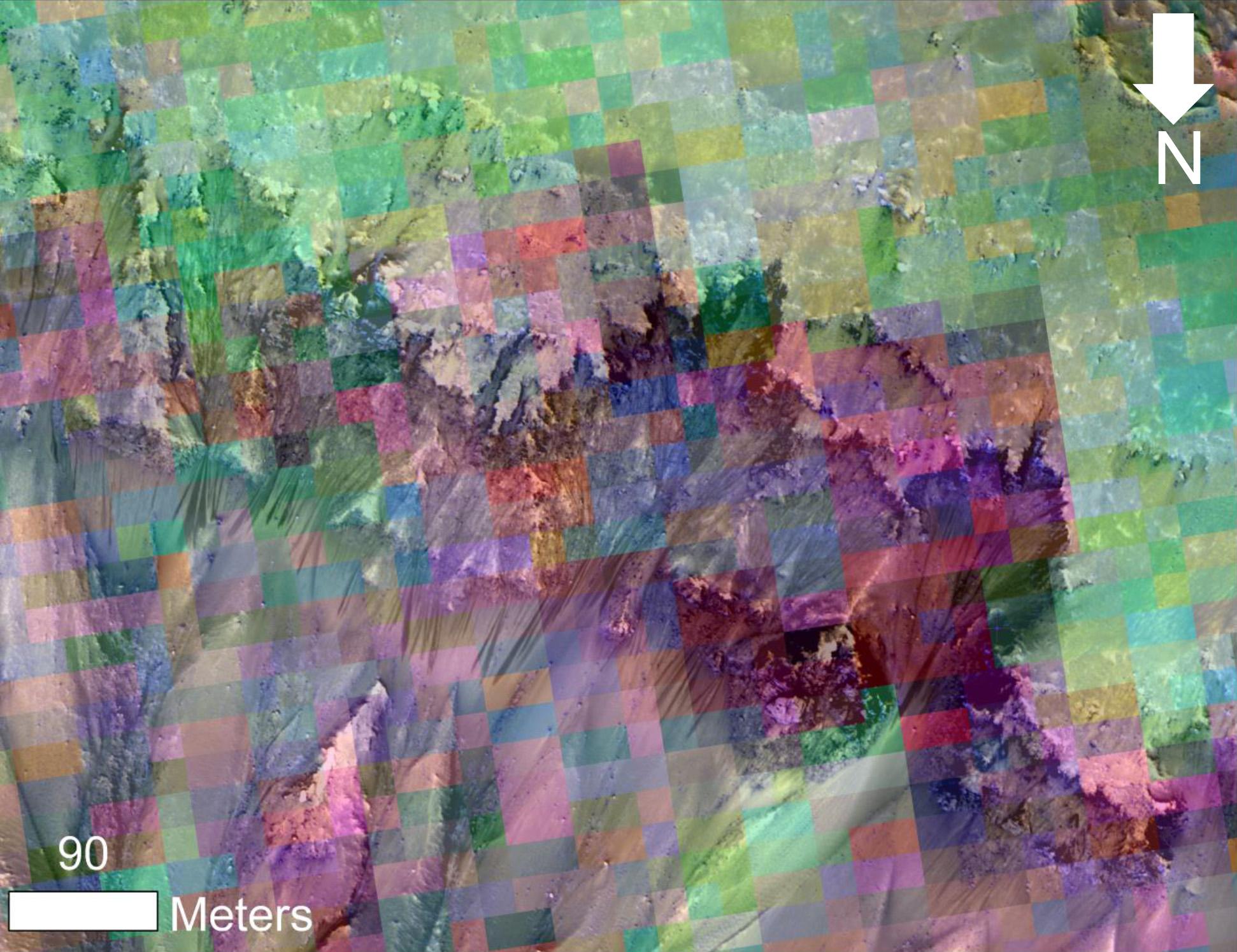
2014-02-10
Mars
Mars Reconnaissance Orbiter (MRO)
HiRISE
1942x1495x3
PIA17934:
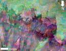
Color-Coded Clues to Composition Superimposed on Martian Seasonal-Flow Image
Full Resolution:
TIFF
(8.713 MB)
JPEG
(345.8 kB)
2014-02-11
Mars
2001 Mars Odyssey
THEMIS
1548x2952x1
PIA17964:
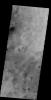
Dust Devil Tracks
Full Resolution:
TIFF
(4.575 MB)
JPEG
(599.1 kB)
2014-02-11
Mars
Mars Science Laboratory (MSL)
Hazcam (MSL)
1024x1024x1
PIA17938:
Movie of Curiosity's View Backwards While Crossing Dune
Full Resolution:
TIFF
(1.05 MB)
JPEG
(122 kB)
2014-02-11
Mars
Mars Science Laboratory (MSL)
Hazcam (MSL)
1024x1024x1
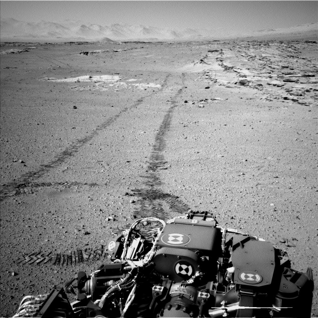
PIA17939:
Curiosity Making Headway West of 'Dingo Gap'
Full Resolution:
TIFF
(1.05 MB)
JPEG
(165.9 kB)
2014-02-12
Mars
2001 Mars Odyssey
THEMIS
1500x2950x1
PIA17965:
More Dust Devils
Full Resolution:
TIFF
(4.43 MB)
JPEG
(415.1 kB)
2014-02-12
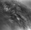
Mars
Viking
669x650x1
PIA17940:
Martian Morning Clouds Seen by Viking Orbiter 1 in 1976
Full Resolution:
TIFF
(435.5 kB)
JPEG
(45.81 kB)
2014-02-13
Mars
Mars Reconnaissance Orbiter (MRO)
HiRISE
2880x1800x3
PIA17980:
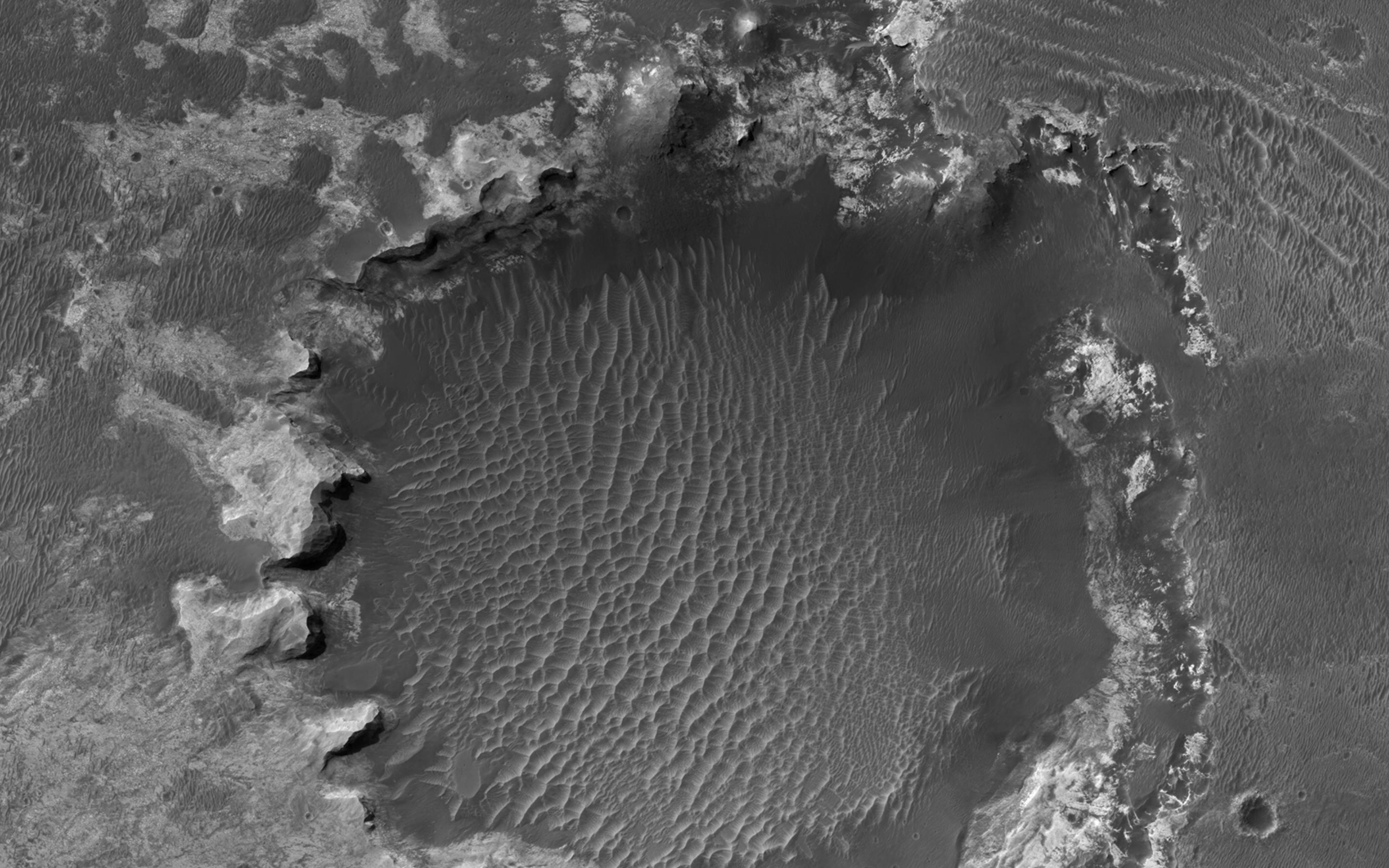
Bright Sediments on the Floor of Ladon Basin
Full Resolution:
TIFF
(15.56 MB)
JPEG
(742.8 kB)
2014-02-13
Mars
Mars Reconnaissance Orbiter (MRO)
HiRISE
2880x1800x3
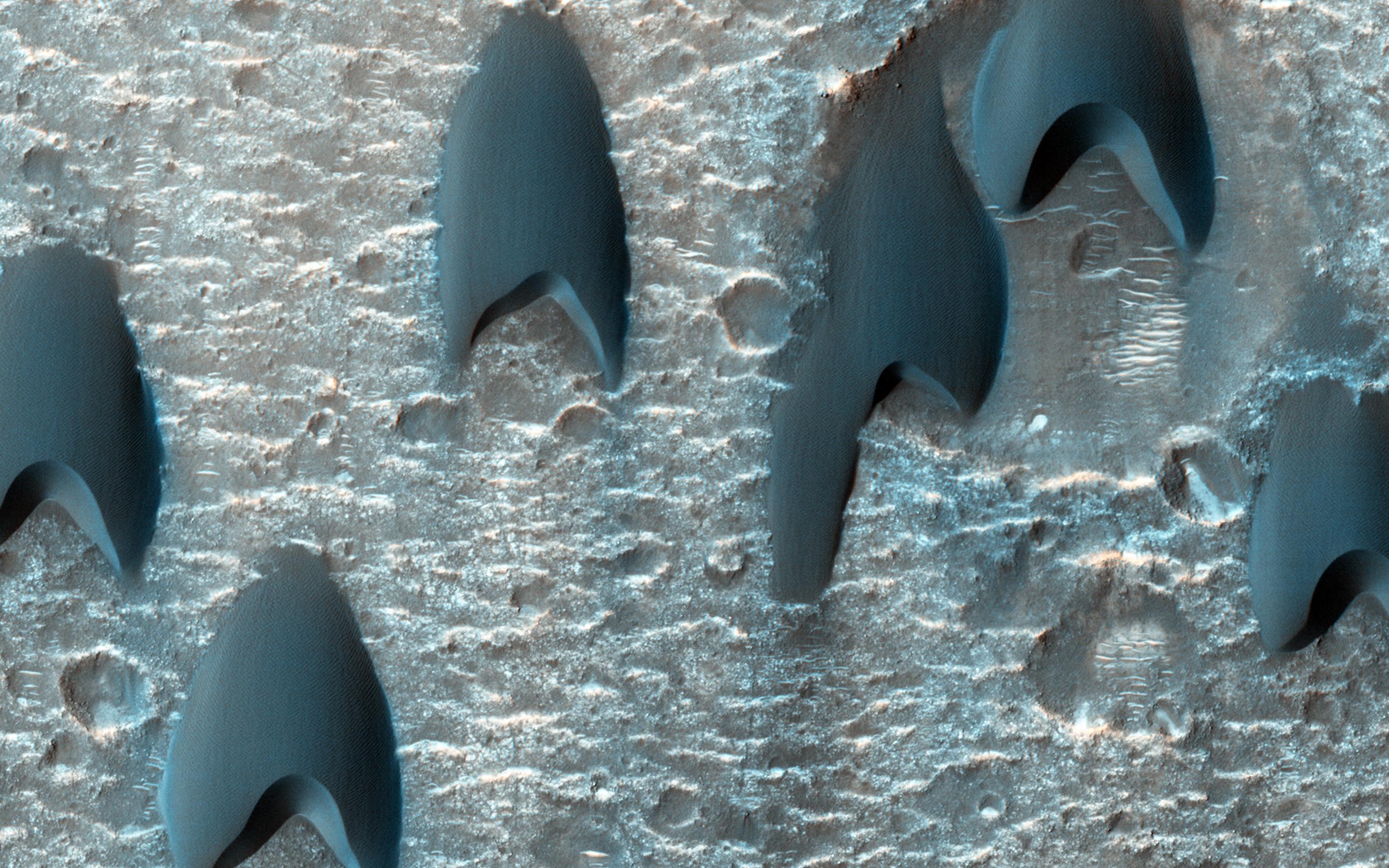
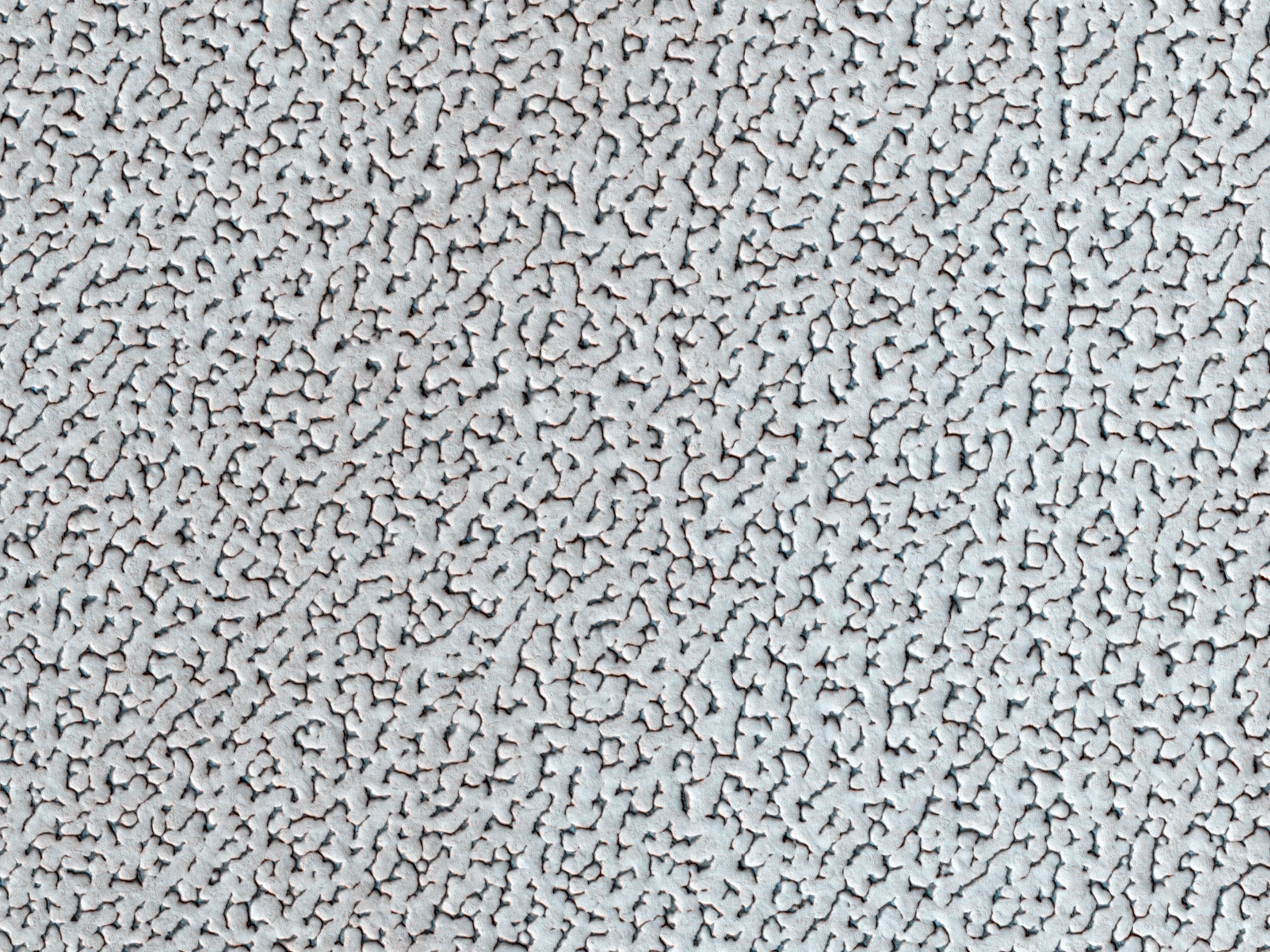
PIA17981:
Dunes Flying in Formation
Full Resolution:
TIFF
(15.56 MB)
JPEG
(797.8 kB)
2014-02-13
Mars
Mars Reconnaissance Orbiter (MRO)
HiRISE
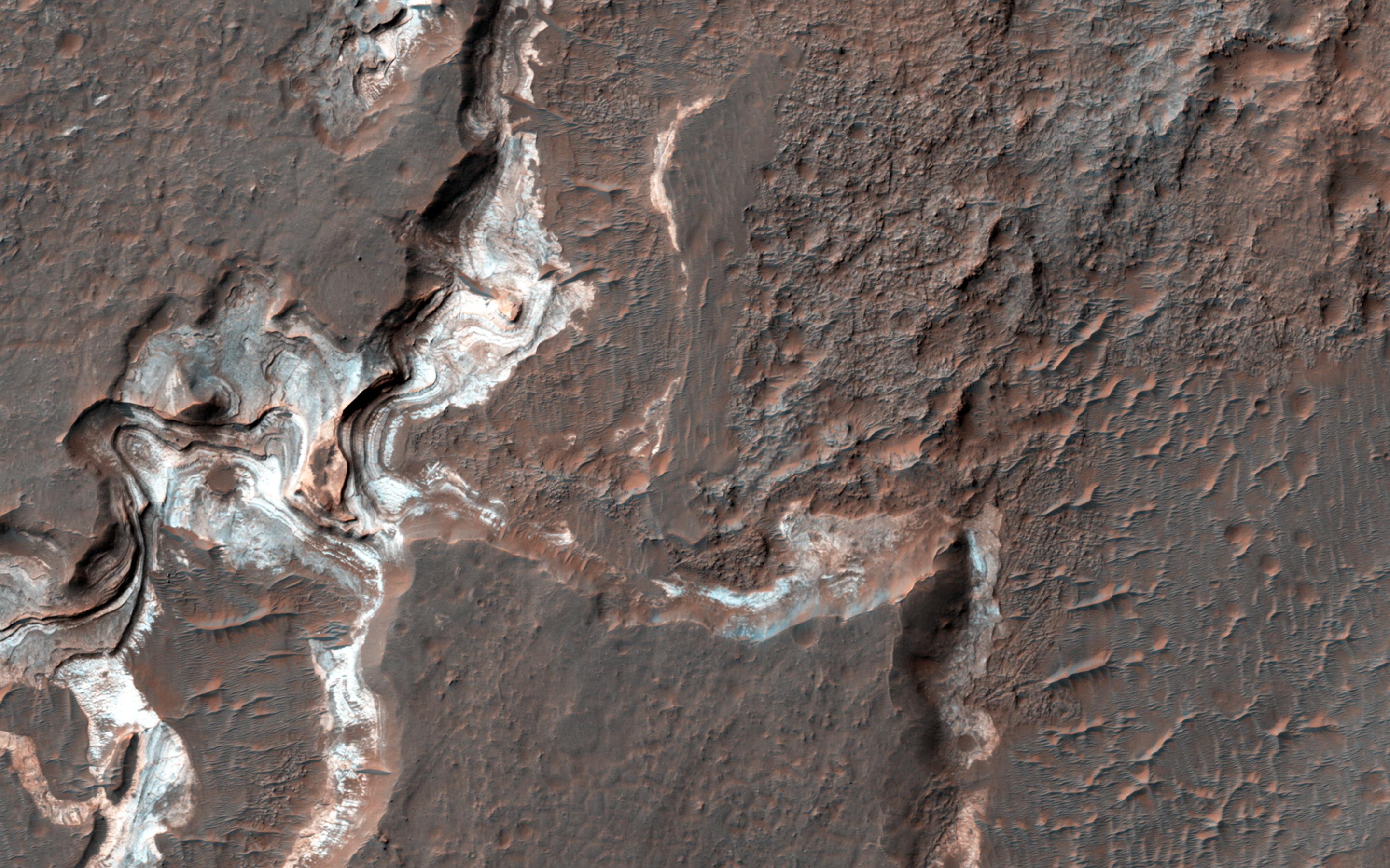
2880x1800x3
PIA17982:
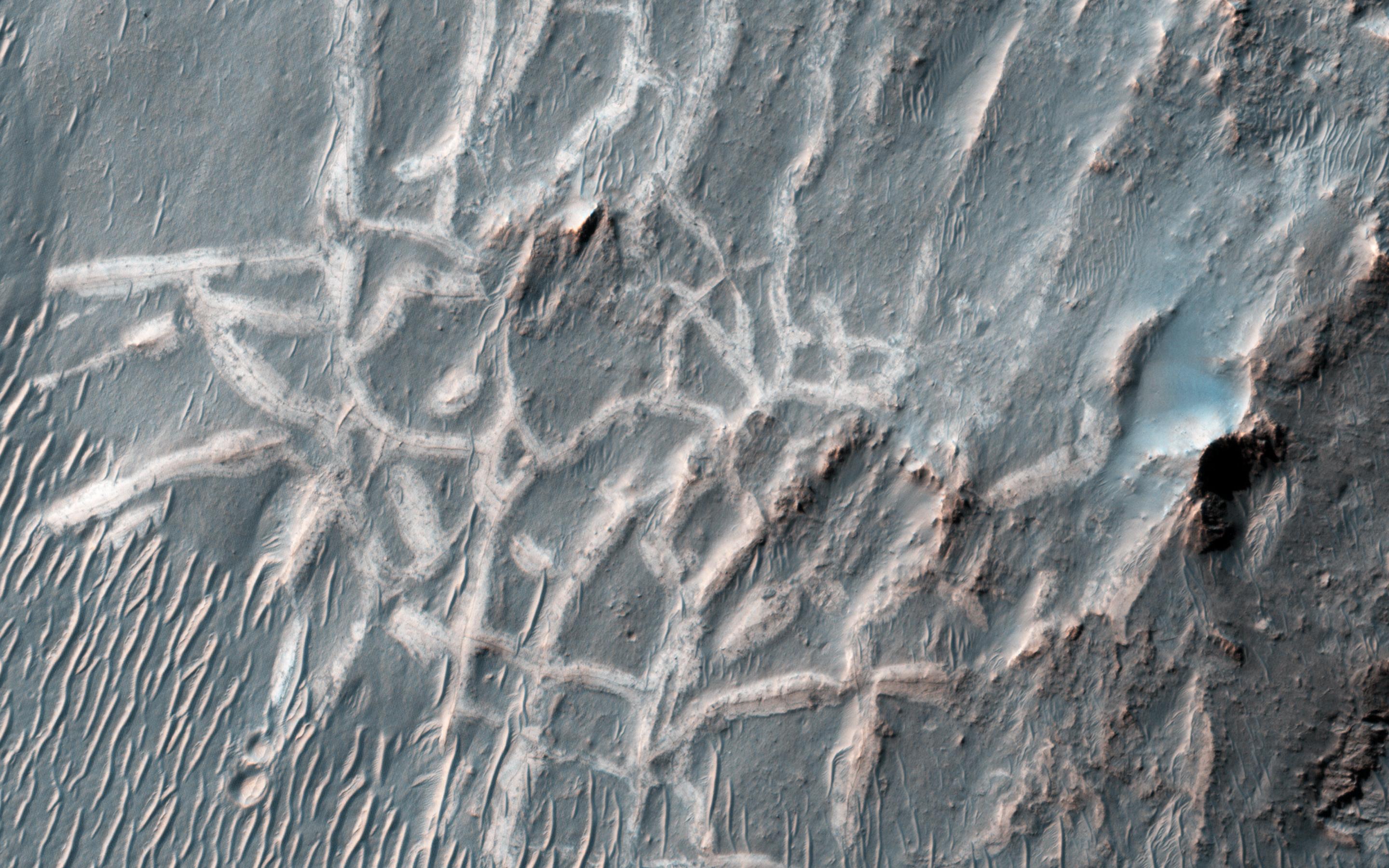
Which Came First, the Yardang or the Platy Flow?
Full Resolution:
TIFF
(15.56 MB)
JPEG
(895.9 kB)
2014-02-13
Mars
Mars Reconnaissance Orbiter (MRO)
HiRISE
2880x1800x3
PIA17983:
Viewing Dingo Gap
Full Resolution:
TIFF
(15.56 MB)
JPEG
(893.3 kB)
2014-02-13
Mars
2001 Mars Odyssey
THEMIS
1505x2950x1
PIA17966:
More Dust Devils
Full Resolution:
TIFF
(4.445 MB)
JPEG
(467.3 kB)
2014-02-14
Mars
Mars Exploration Rover (MER)
Panoramic Camera
1020x1020x3
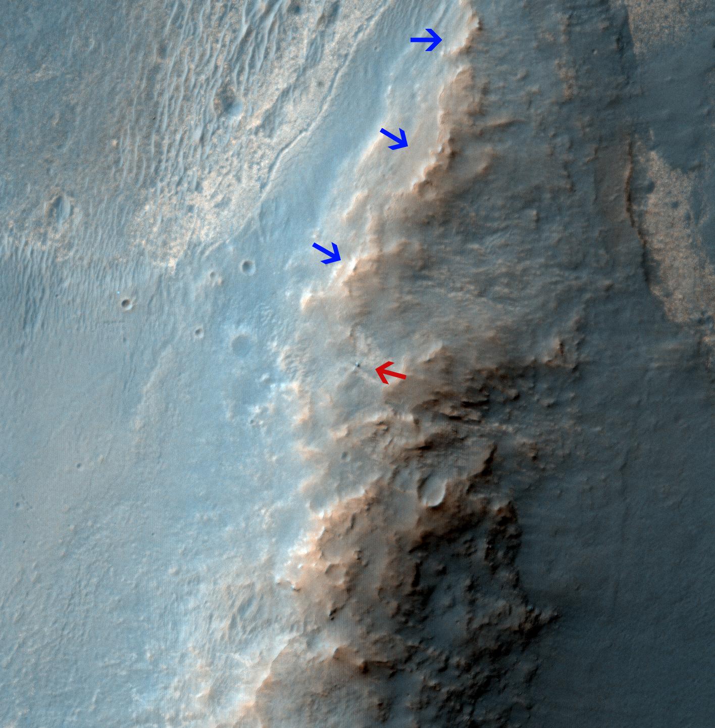
PIA17942:
Where Martian 'Jelly Doughnut' Rock Came From
Full Resolution:
TIFF
(3.122 MB)
JPEG
(222.7 kB)
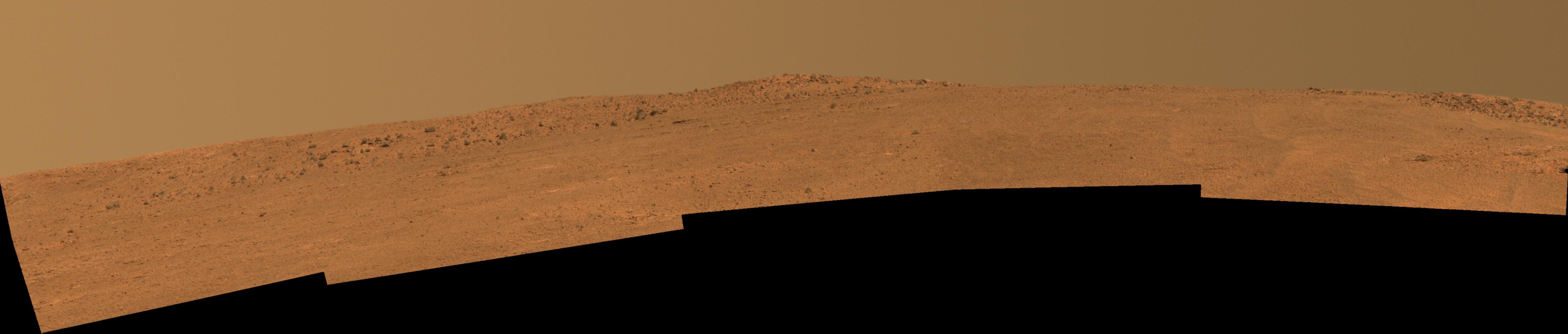
2014-02-14
Mars
Mars Exploration Rover (MER)
Panoramic Camera
4383x934x3
PIA17943:
Opportunity's Southward View of 'McClure-Beverlin Escarpment' on Mars
Full Resolution:
TIFF
(12.29 MB)
JPEG
(260.7 kB)
2014-02-14
Mars
2001 Mars Odyssey
THEMIS
1236x2827x1
PIA17967:
North Polar Dunes
Full Resolution:
TIFF
(3.498 MB)
JPEG
(515.2 kB)
2014-02-17
Mars
2001 Mars Odyssey
THEMIS
1397x2925x1
PIA17968:
Ascraeus Mons Summits
Full Resolution:
TIFF
(4.091 MB)
JPEG
(258.7 kB)
2014-02-18
Mars
2001 Mars Odyssey
THEMIS
1405x2924x1
PIA17969:
Olympus Mons Summit
Full Resolution:
TIFF
(4.113 MB)
JPEG
(223 kB)
2014-02-19
Mars
2001 Mars Odyssey
THEMIS
1409x2924x1
PIA18021:
Olympus Mons Summit
Full Resolution:
TIFF
(4.125 MB)
JPEG
(357.5 kB)
2014-02-19
Mars
Mars Exploration Rover (MER)
Mars Reconnaissance Orbiter (MRO)
HiRISE
1416x1441x3
PIA17941:
Opportunity Rover on 'Murray Ridge' Seen From Orbit
Full Resolution:
TIFF
(6.124 MB)
JPEG
(282.8 kB)
2014-02-19
Mars
Mars Science Laboratory (MSL)
Mastcam
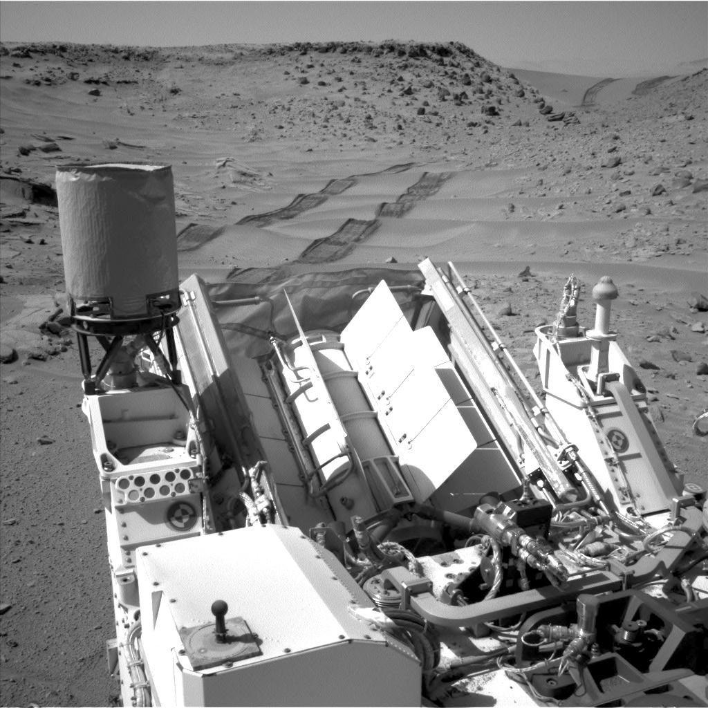
4890x3361x3
PIA17944:
Curiosity's Color View of Martian Dune After Crossing It
Full Resolution:
TIFF
(49.33 MB)
JPEG
(2.485 MB)
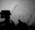
2014-02-19
Mars
Mars Science Laboratory (MSL)
Navcam (MSL)
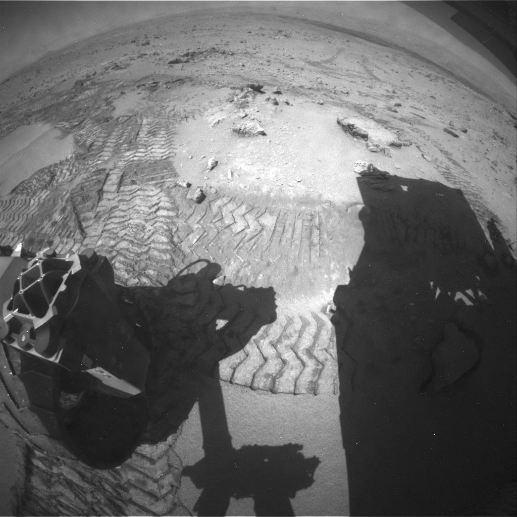
1011x868x1
PIA17945:
Curiosity Mars Rover's Shadow After Long Backward Drive
Full Resolution:
TIFF
(878.6 kB)
JPEG
(175 kB)
2014-02-19
Mars
Mars Science Laboratory (MSL)
3300x2550x3
PIA17946:
Map of Recent and Planned Driving by Curiosity as of Feb. 18, 2014
Full Resolution:
TIFF
(25.26 MB)
JPEG
(1.704 MB)
2014-02-20
Mars
2001 Mars Odyssey
THEMIS
1449x2930x1
PIA18022:
Arabia Terra
Full Resolution:
TIFF
(4.25 MB)
JPEG
(276.7 kB)
2014-02-21
Mars
2001 Mars Odyssey
THEMIS
1417x2925x1
PIA18023:
Arabia Terra
Full Resolution:
TIFF
(4.15 MB)
JPEG
(439.3 kB)
2014-02-22
Mars
Mars Reconnaissance Orbiter (MRO)
HiRISE
2880x1800x3
PIA17926:
Oxus Patera Collapse Feature
Full Resolution:
TIFF
(15.56 MB)
JPEG
(676.7 kB)
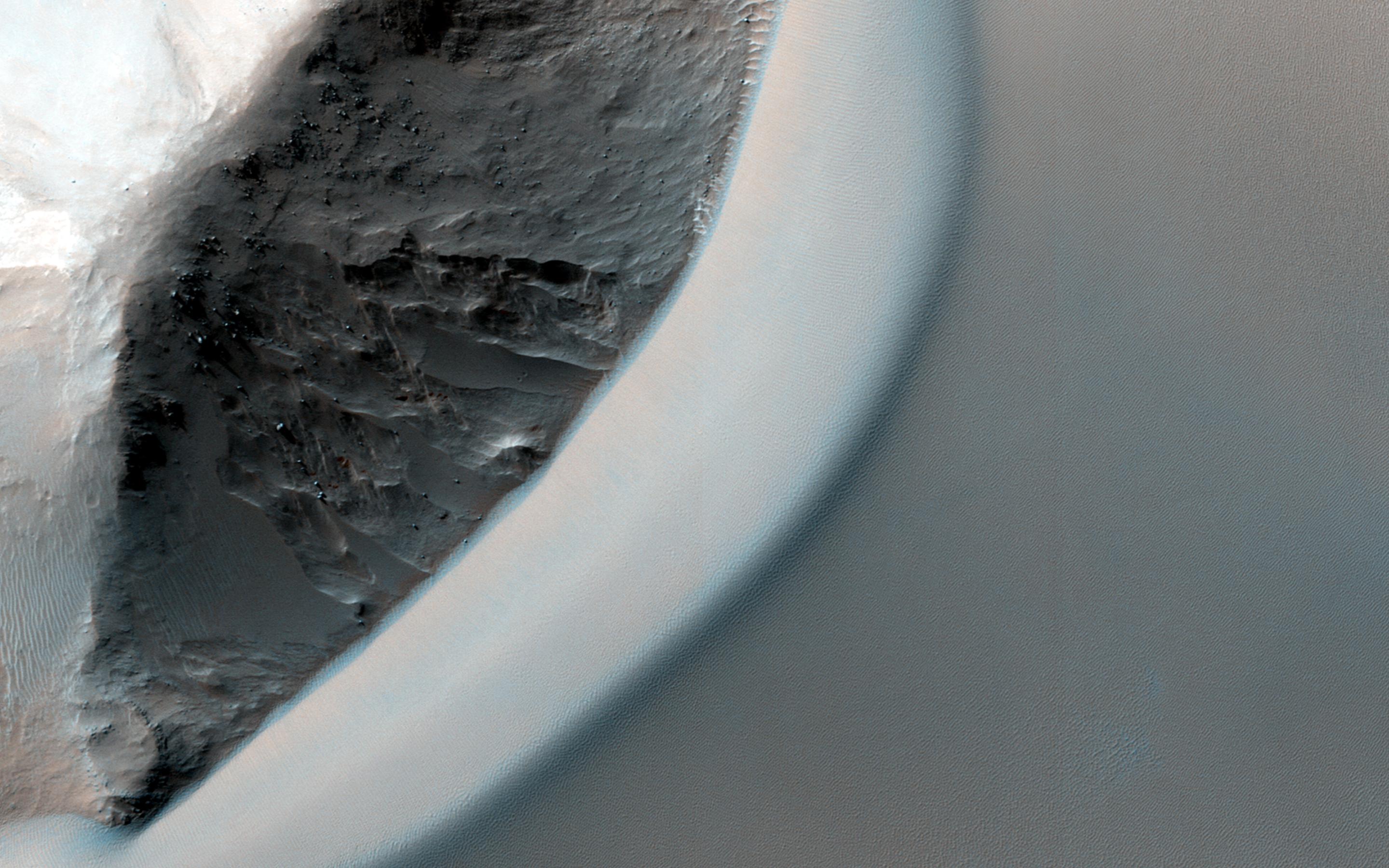
2014-02-22
Mars
Mars Reconnaissance Orbiter (MRO)
HiRISE
2880x1800x3
PIA17927:
Light-Toned Deposits along Coprates Chasma Slopes
Full Resolution:
TIFF
(15.56 MB)
JPEG
(607.3 kB)
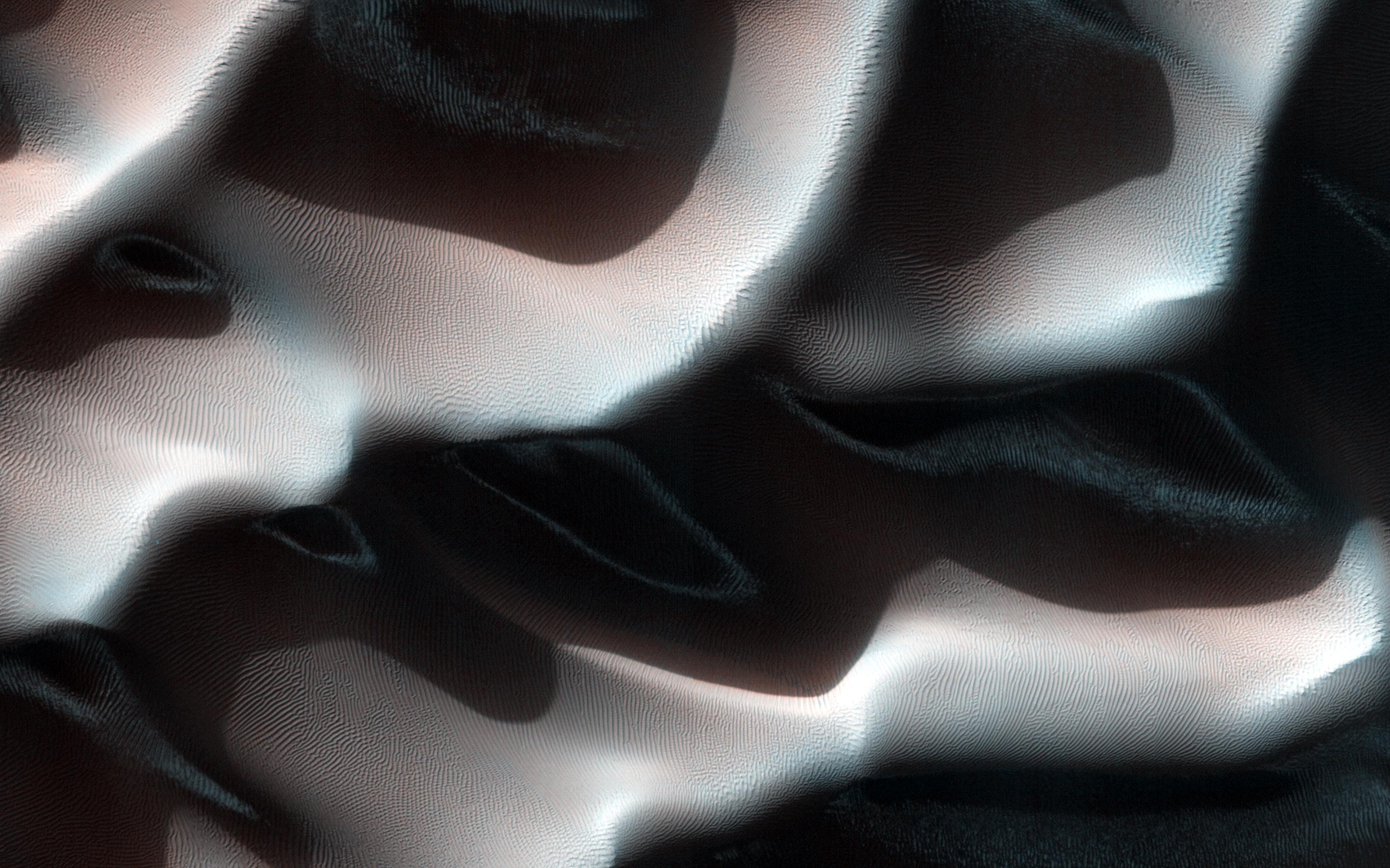
2014-02-22
Mars
Mars Reconnaissance Orbiter (MRO)
HiRISE
2880x1800x3
PIA17928:
Shapes and Spots on a Polar Sand Dune
Full Resolution:
TIFF
(15.56 MB)
JPEG
(858 kB)
2014-02-22
Mars
Mars Reconnaissance Orbiter (MRO)
HiRISE
2880x1800x3
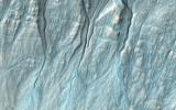
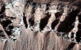
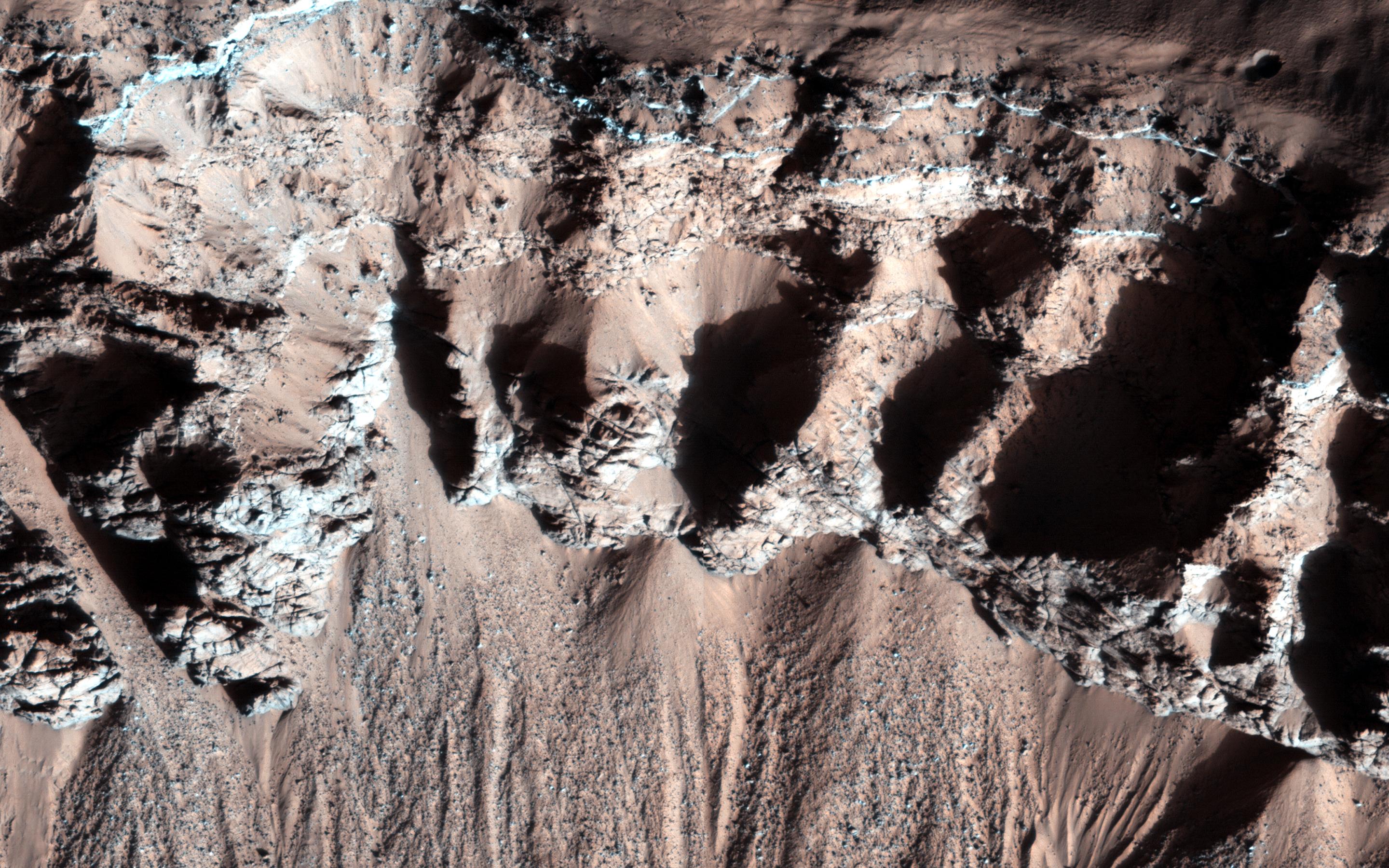
PIA17929:
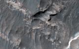
Giant Gullies North of the Argyre Impact Basin
Full Resolution:
TIFF
(15.56 MB)
JPEG
(857.3 kB)
2014-02-24
Mars
2001 Mars Odyssey
THEMIS
1487x2933x1
PIA18024:
Tempe Terra
Full Resolution:
TIFF
(4.366 MB)
JPEG
(393.6 kB)
2014-02-25
Mars
2001 Mars Odyssey
THEMIS
1483x2937x1
PIA18025:
Rubicon Valles
Full Resolution:
TIFF
(4.36 MB)
JPEG
(478 kB)
2014-02-26
Mars
2001 Mars Odyssey
THEMIS
1429x2924x1
PIA18026:
Which Came First?
Full Resolution:
TIFF
(4.183 MB)
JPEG
(367.8 kB)
2014-02-26
Mars
Mars Reconnaissance Orbiter (MRO)
HiRISE
2880x1800x3
PIA18113:
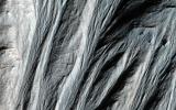
Dunes Streaming through Hills
Full Resolution:
TIFF
(15.56 MB)
JPEG
(609.6 kB)
2014-02-26
Mars
Mars Reconnaissance Orbiter (MRO)
HiRISE
2880x1800x3
PIA18114:
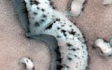
Frost in Dune Shadows
Full Resolution:
TIFF
(15.56 MB)
JPEG
(675.7 kB)
2014-02-26
Mars
Mars Reconnaissance Orbiter (MRO)
HiRISE
2880x1800x3
PIA18115:
Craters in an Icy Surface
Full Resolution:
TIFF
(15.56 MB)
JPEG
(984.6 kB)
2014-02-26
Mars
Mars Reconnaissance Orbiter (MRO)
HiRISE
2880x1800x3
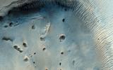
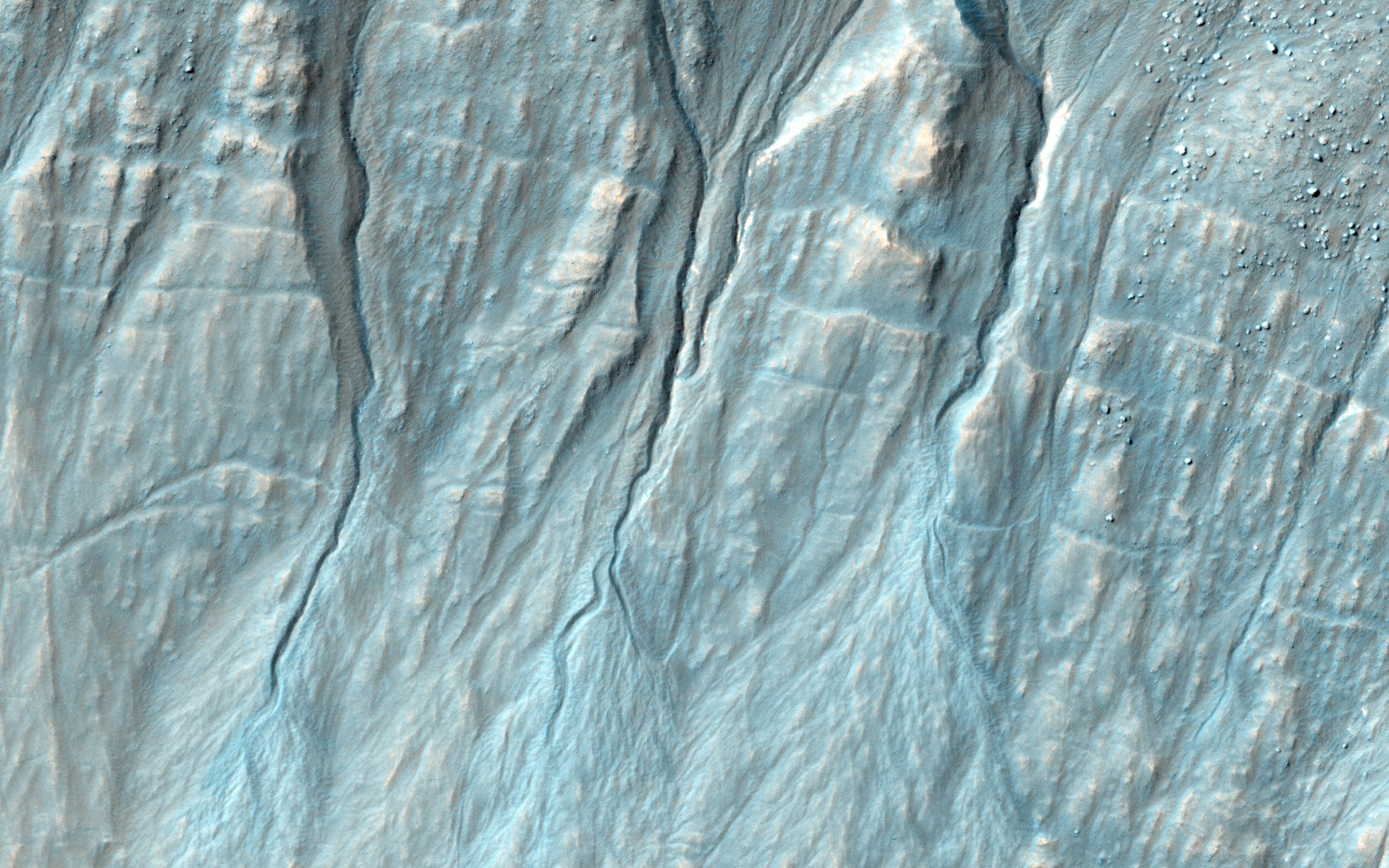
PIA18116:
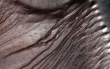
Equatorial Gullies
Full Resolution:
TIFF
(15.56 MB)
JPEG
(685.4 kB)
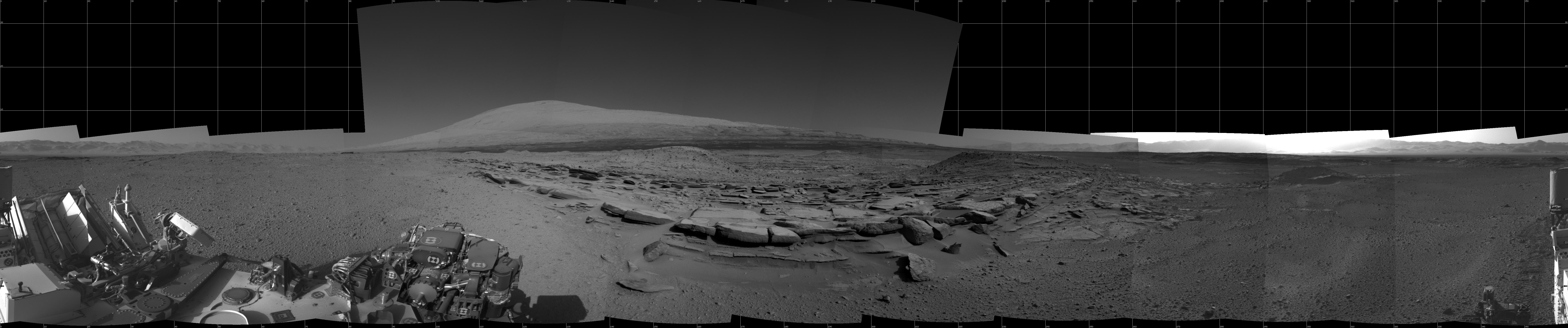
2014-02-27
Mars
Mars Science Laboratory (MSL)
Navcam (MSL)
3482x972x1
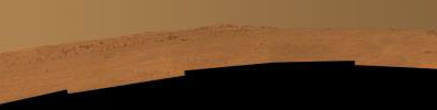
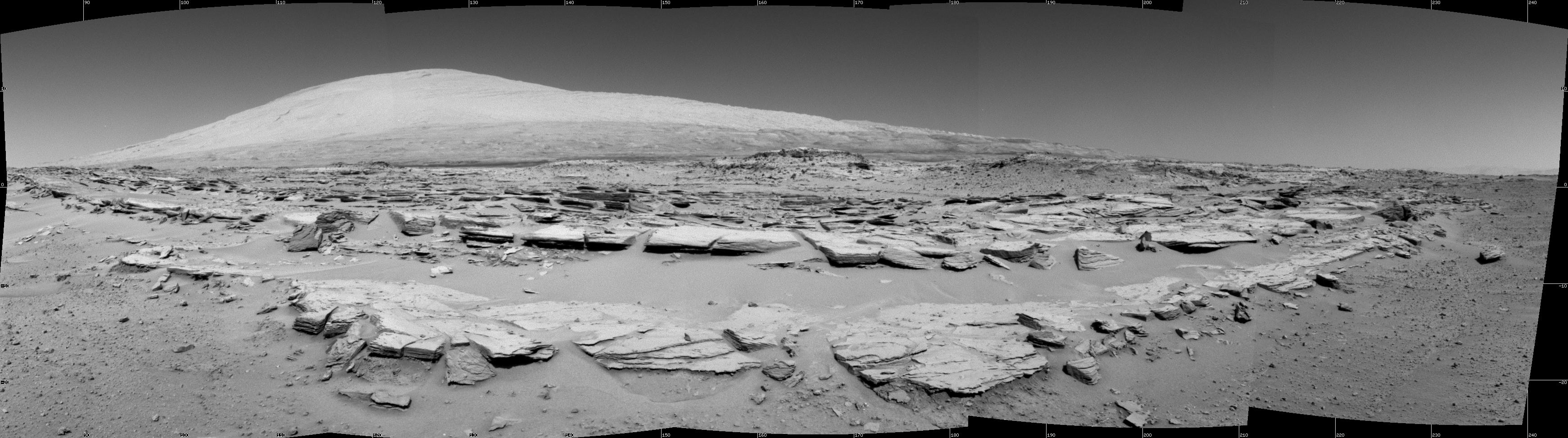
PIA17947:
Martian Landscape with Rock Rows and Mount Sharp
Full Resolution:
TIFF
(3.389 MB)
JPEG
(476.3 kB)
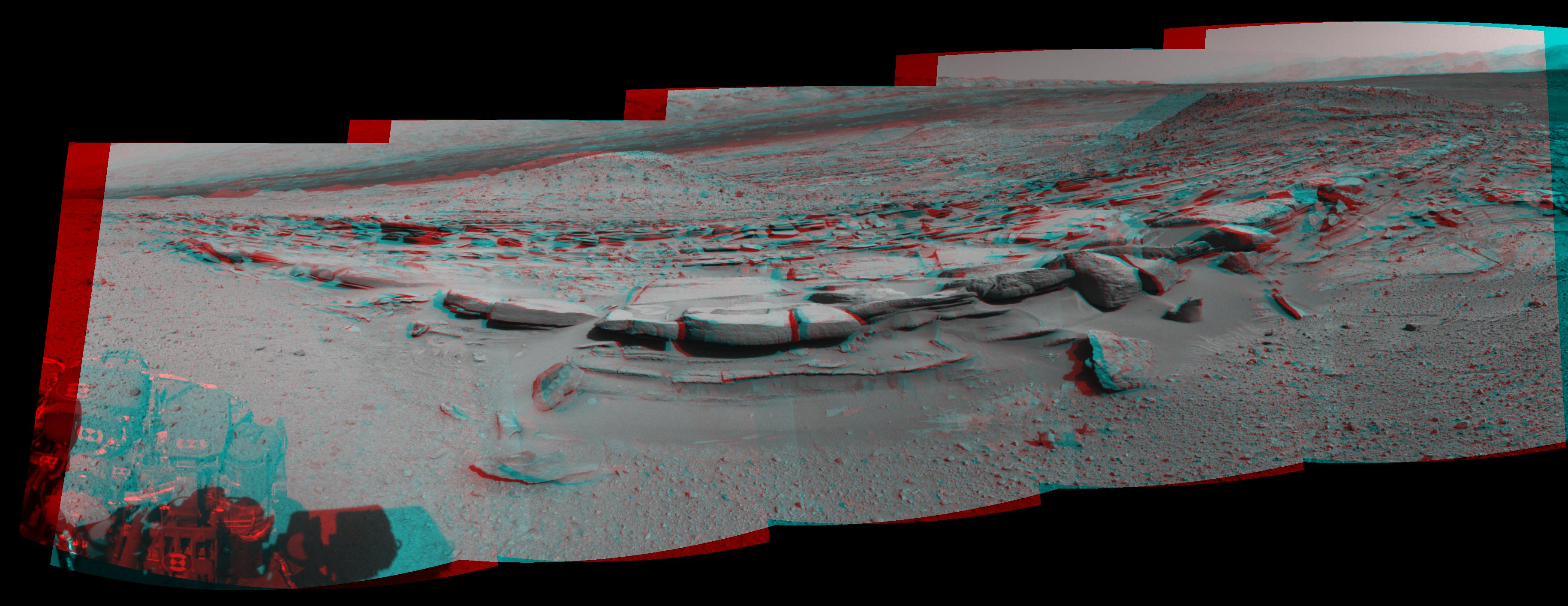
2014-02-27
Mars
Mars Science Laboratory (MSL)
Navcam (MSL)
3563x1131x3
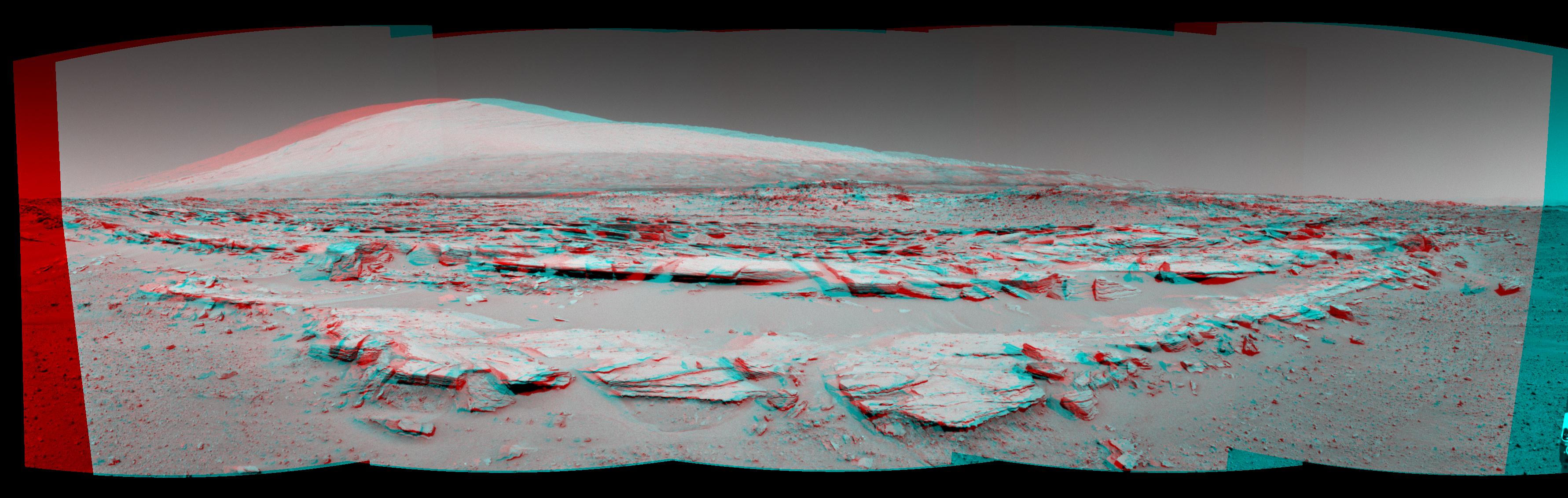
PIA17948:
Martian Landscape With Rock Rows and Mount Sharp (Stereo)
Full Resolution:
TIFF
(12.09 MB)
JPEG
(503.8 kB)
2014-02-27
Mars
Mars Science Laboratory (MSL)
Navcam (MSL)
1024x1024x1
PIA17949:
Curiosity's View Back After Passing 'Junda' Striations
Full Resolution:
TIFF
(1.05 MB)
JPEG
(240.6 kB)
2014-02-27
Mars
Mars Science Laboratory (MSL)
Navcam (MSL)
4945x973x1
PIA17950:
Panoramic View From West of 'Dingo Gap'
Full Resolution:
TIFF
(4.819 MB)
JPEG
(818.6 kB)
2014-02-27
Mars
Mars Science Laboratory (MSL)
Navcam (MSL)
5015x1132x3
PIA17951:
Panoramic View From West of 'Dingo Gap' (Stereo)
Full Resolution:
TIFF
(17.04 MB)
JPEG
(954 kB)
2014-02-27
Mars
2001 Mars Odyssey
THEMIS
1393x2925x1
PIA18027:
Small and Subtle
Full Resolution:
TIFF
(4.079 MB)
JPEG
(317.4 kB)
2014-02-28
Mars
2001 Mars Odyssey
THEMIS
1427x2927x1
PIA18028:
Into the Crater
Full Resolution:
TIFF
(4.182 MB)
JPEG
(353 kB)
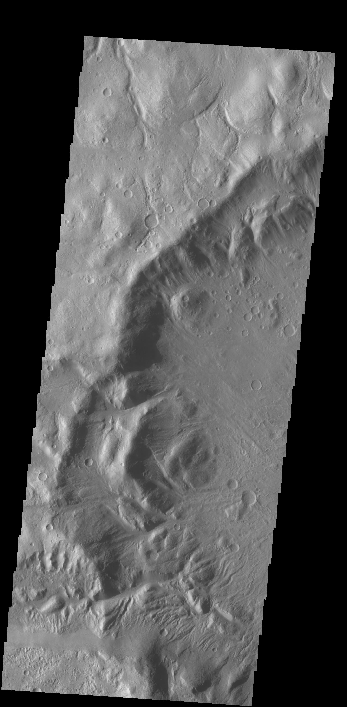
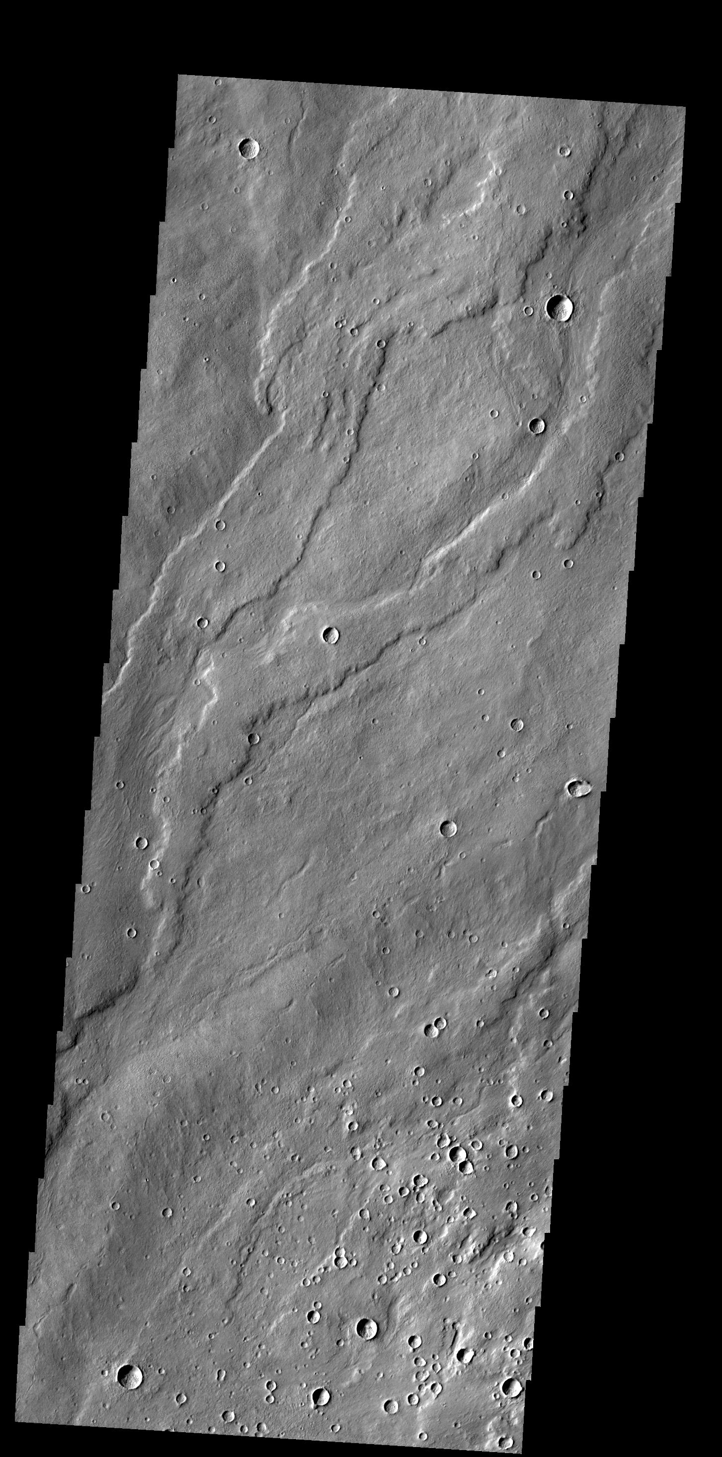
2014-03-03
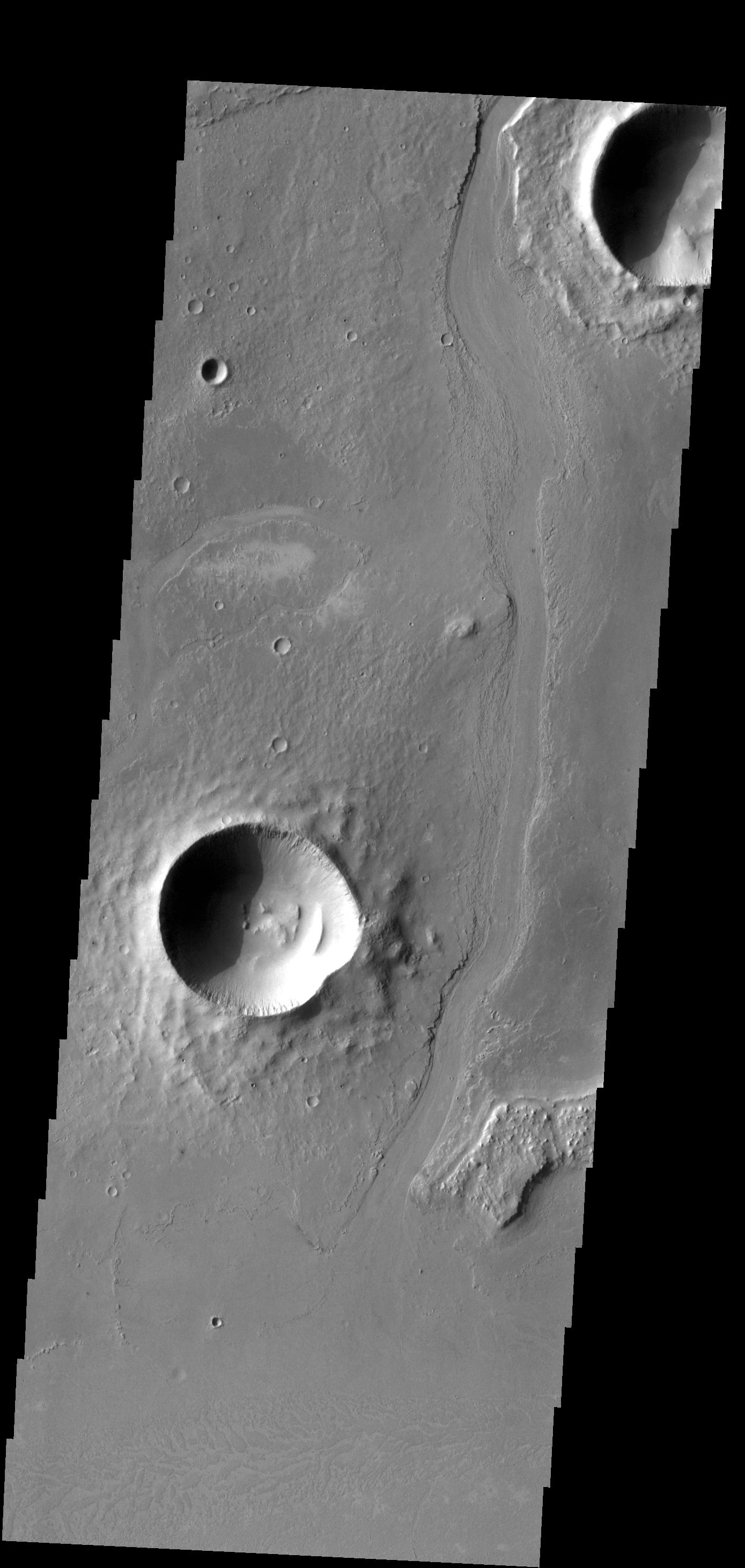
Mars
2001 Mars Odyssey
THEMIS
1441x2934x1
PIA18029:
Crater Rim Channels
Full Resolution:
TIFF
(4.233 MB)
JPEG
(325.1 kB)
2014-03-04
Mars
2001 Mars Odyssey
THEMIS
1395x2923x1
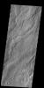
PIA18064:
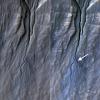
Dark Slope Streaks
Full Resolution:
TIFF
(4.082 MB)
JPEG
(362 kB)
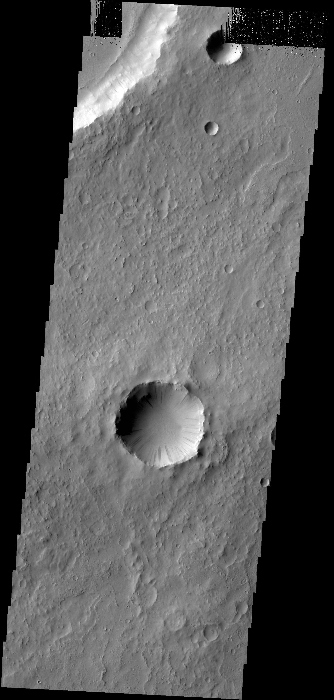
2014-03-05
Mars
2001 Mars Odyssey
THEMIS
1449x2932x1
PIA18065:
Crater Ejecta
Full Resolution:
TIFF
(4.253 MB)
JPEG
(332.3 kB)
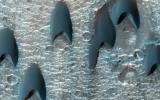
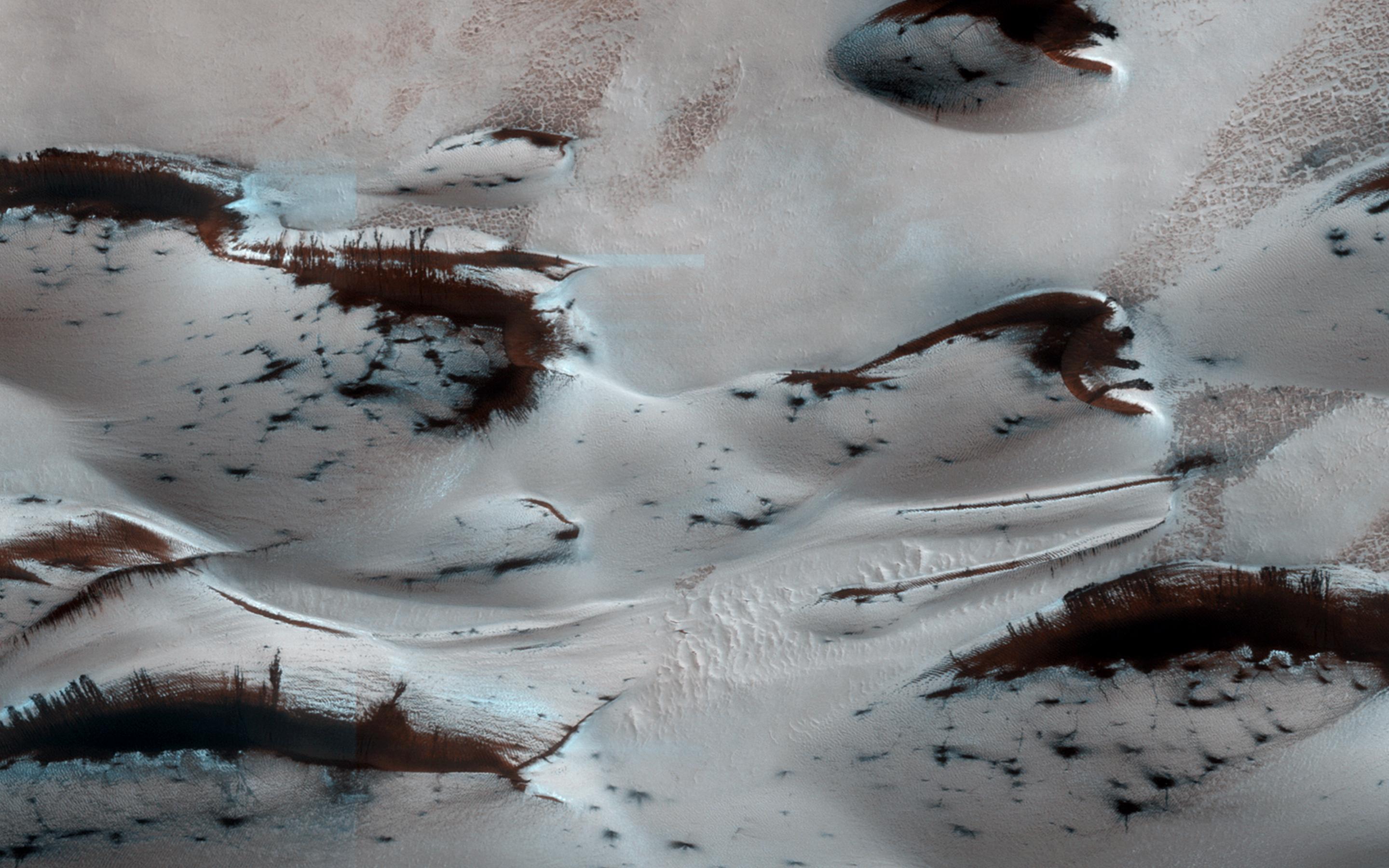
2014-03-05
Mars
Mars Reconnaissance Orbiter (MRO)
HiRISE
2880x1800x3
PIA18109:
Sand Dunes in Spring
Full Resolution:
TIFF
(15.56 MB)
JPEG
(552 kB)
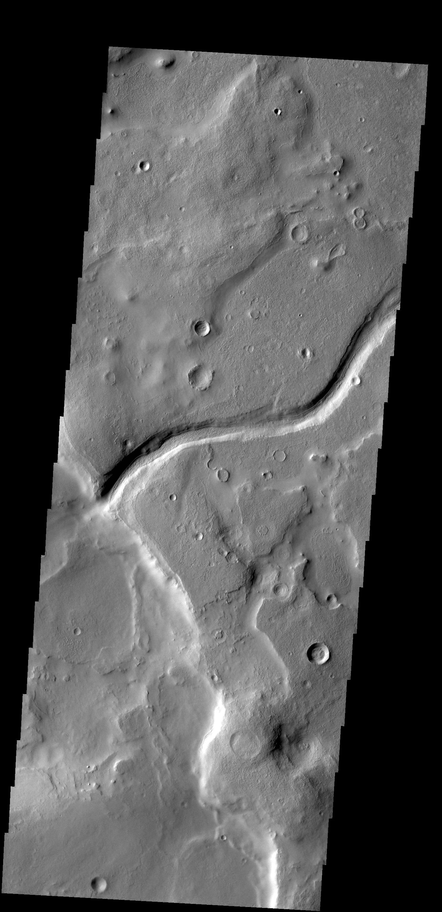
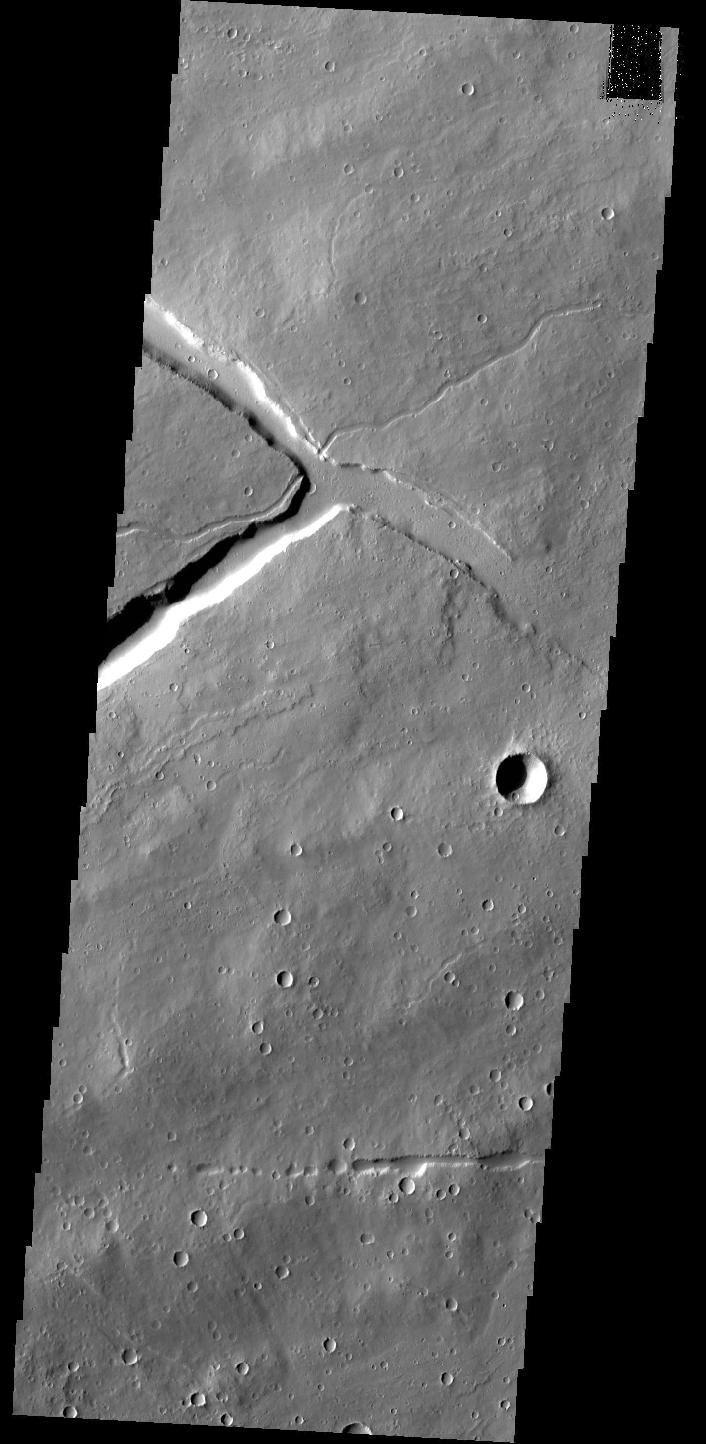
2014-03-05
Mars
Mars Reconnaissance Orbiter (MRO)
HiRISE
2880x1800x1
PIA18110:
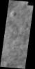
A Crater Straddling Two Terrain Units
Full Resolution:
TIFF
(5.191 MB)
JPEG
(612.7 kB)
2014-03-05
Mars
Mars Reconnaissance Orbiter (MRO)
HiRISE
2560x1920x3
PIA18111:
Don't Get Lost in the North Polar Ice Cap
Full Resolution:
TIFF
(14.75 MB)
JPEG
(902.1 kB)
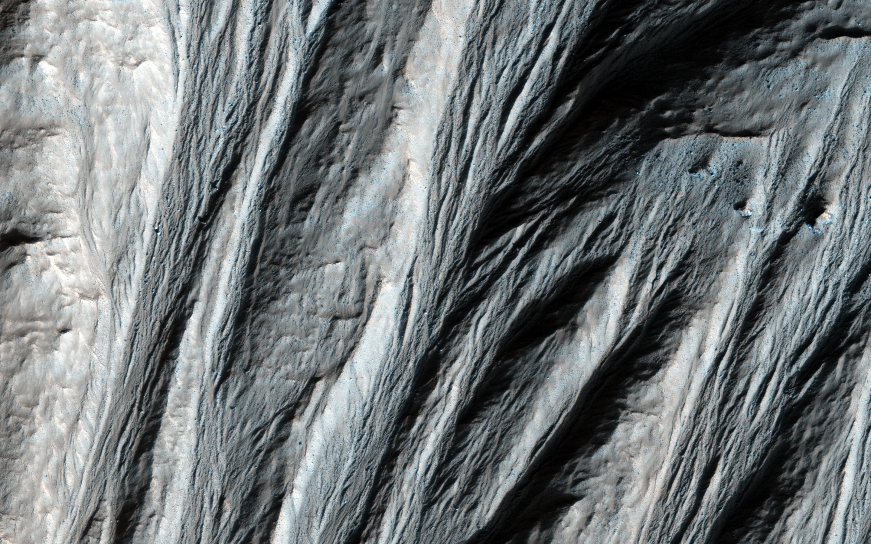
2014-03-05
Mars
Mars Reconnaissance Orbiter (MRO)
HiRISE
2880x1800x3
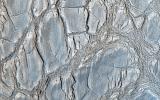
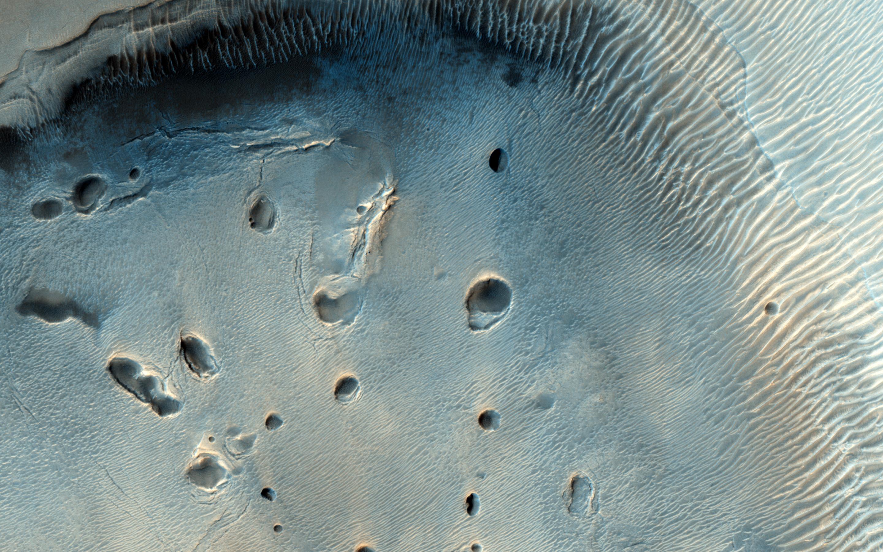
PIA18112:
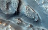
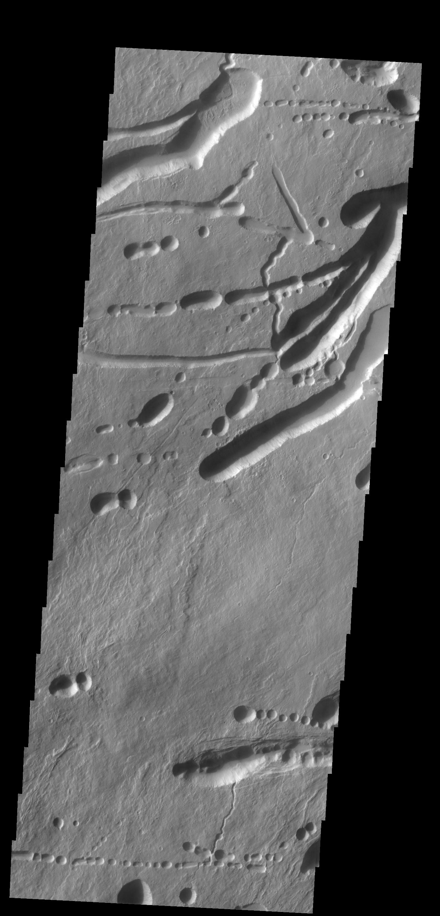
Many Small Interesting Ridges in Erythraea Fossa
Full Resolution:
TIFF
(15.56 MB)
JPEG
(747.4 kB)
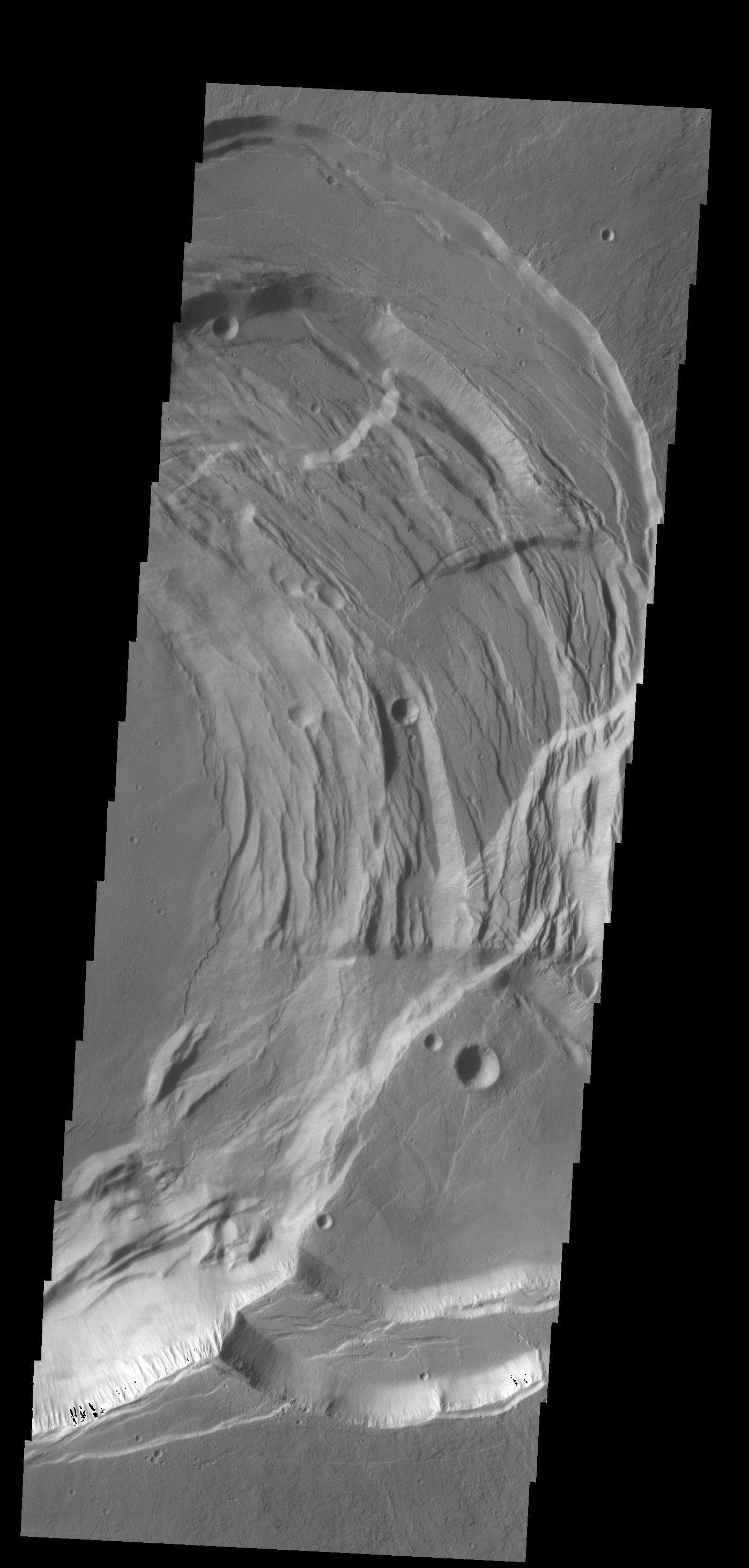
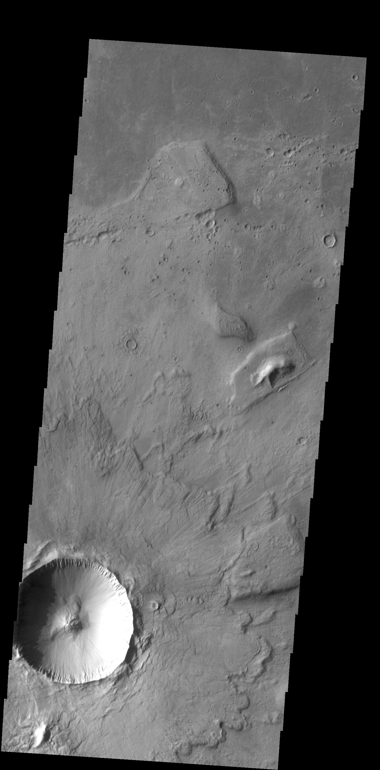
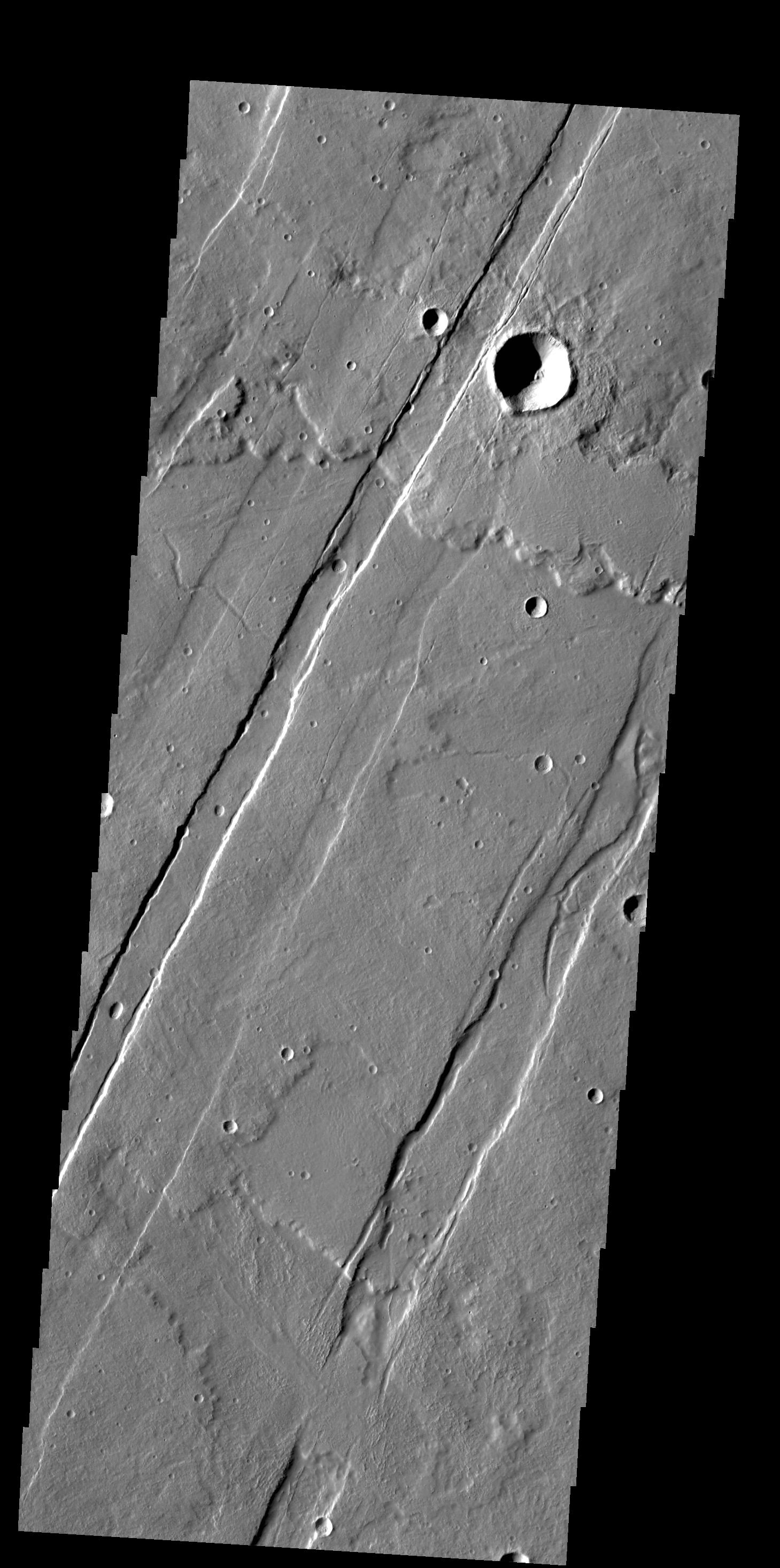
2014-03-06
Mars
2001 Mars Odyssey
THEMIS
1407x2928x1
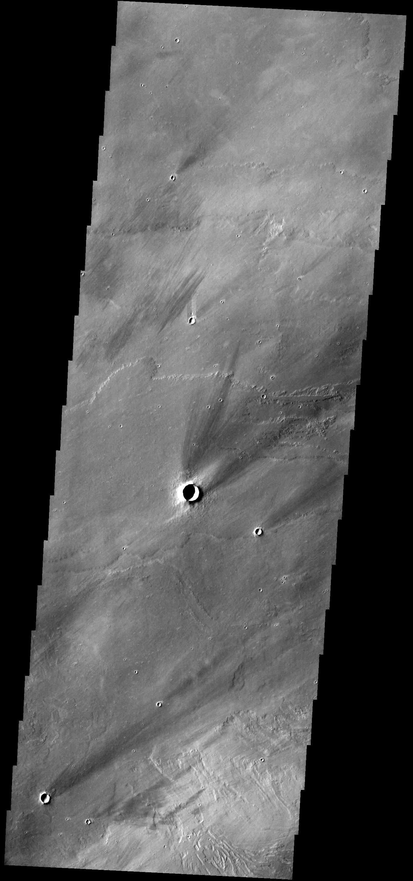
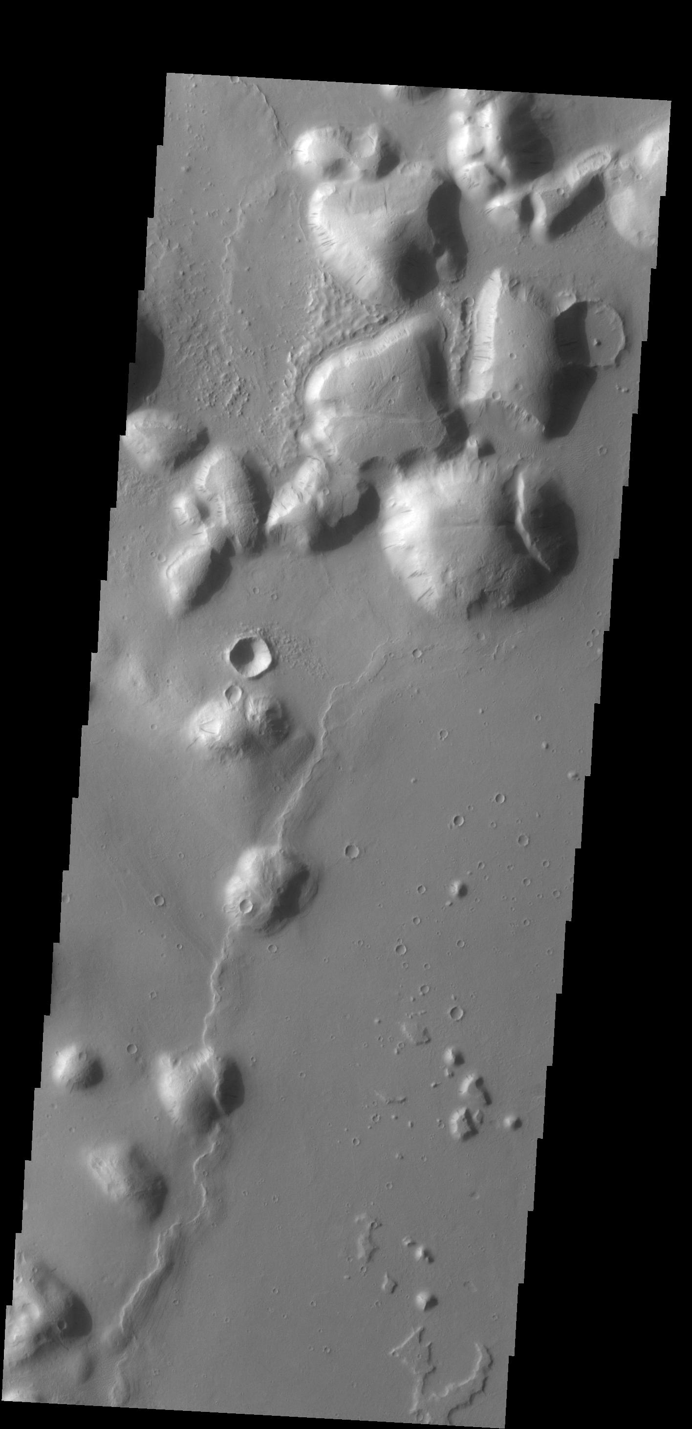
PIA18066:
Ceraunius Tholus
Full Resolution:
TIFF
(4.125 MB)
JPEG
(368.8 kB)
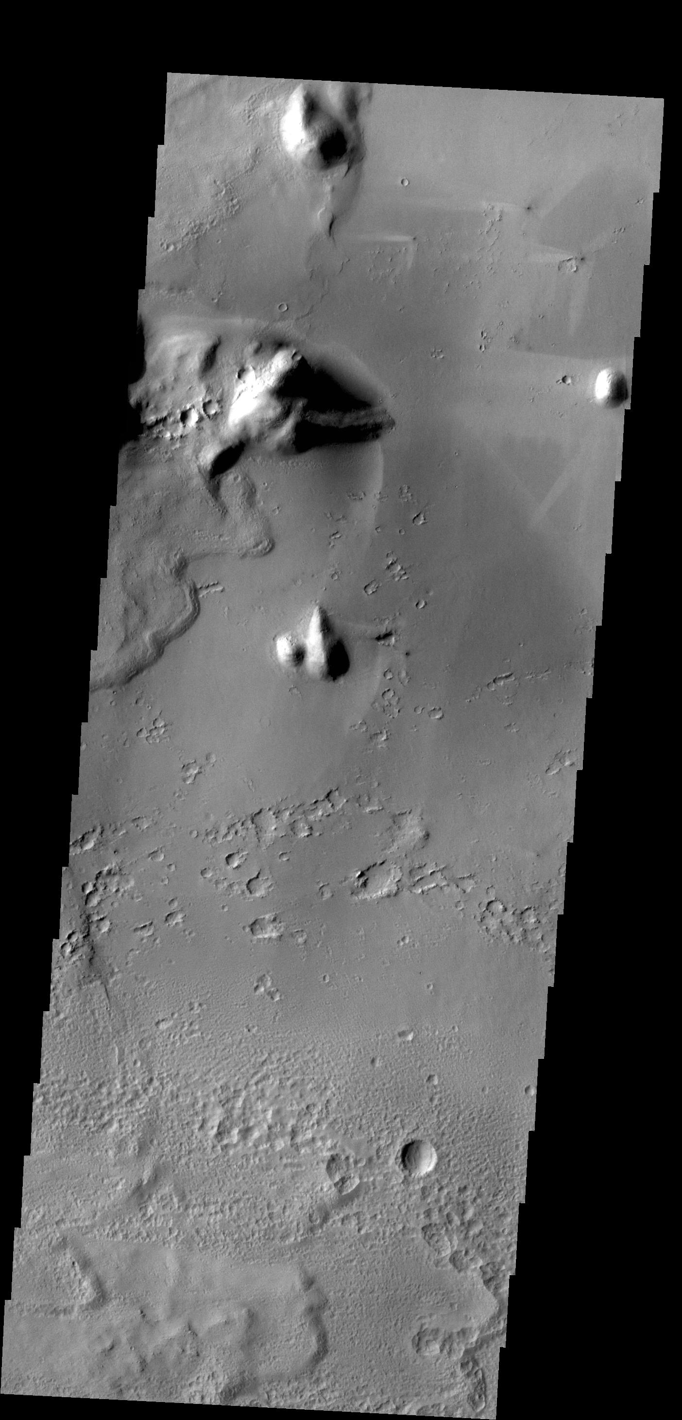
2014-03-07
Mars
2001 Mars Odyssey
THEMIS
1396x2926x1
PIA18100:
Volcanic Complexity
Full Resolution:
TIFF
(4.09 MB)
JPEG
(413.8 kB)
2014-03-10
Mars
2001 Mars Odyssey
THEMIS
1447x2927x1
PIA18101:
Hecates Tholus
Full Resolution:
TIFF
(4.24 MB)
JPEG
(272.2 kB)
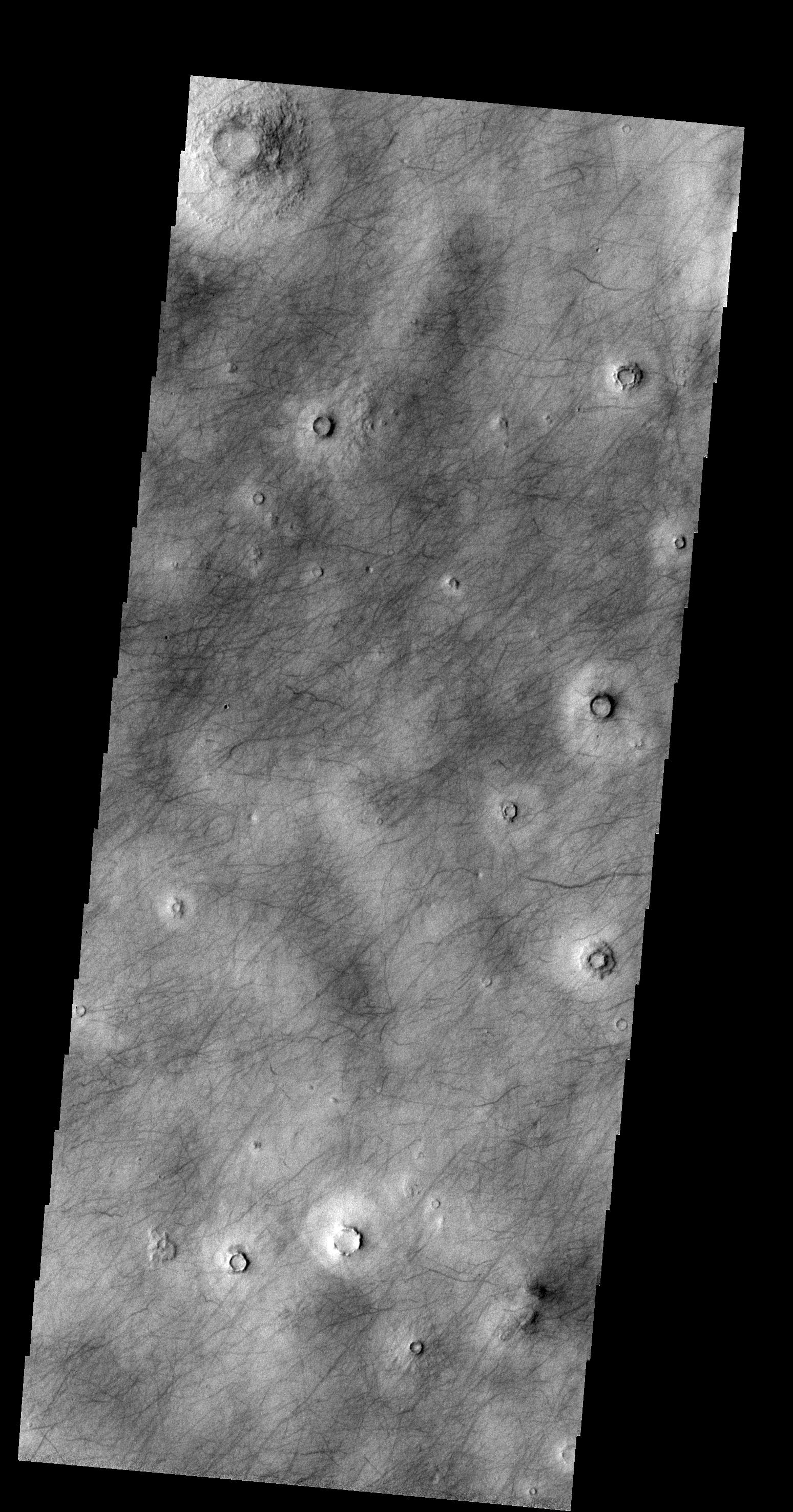
2014-03-11
Mars
2001 Mars Odyssey
THEMIS
1508x2953x1
PIA18102:
Dust Devil Tracks
Full Resolution:
TIFF
(4.458 MB)
JPEG
(467.4 kB)
2014-03-12
Mars
2001 Mars Odyssey
THEMIS
1431x2926x1
PIA18103:
Kasei Valles
Full Resolution:
TIFF
(4.192 MB)
JPEG
(419.7 kB)
2014-03-12
Mars
Mars Reconnaissance Orbiter (MRO)
HiRISE
2880x1800x1
PIA17903:
Ejecta in Excess
Full Resolution:
TIFF
(5.191 MB)
JPEG
(877.3 kB)
2014-03-12
Mars
Mars Reconnaissance Orbiter (MRO)
HiRISE
2880x1800x3
PIA17904:
Craters within Craters
Full Resolution:
TIFF
(15.56 MB)
JPEG
(679.5 kB)
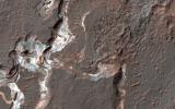
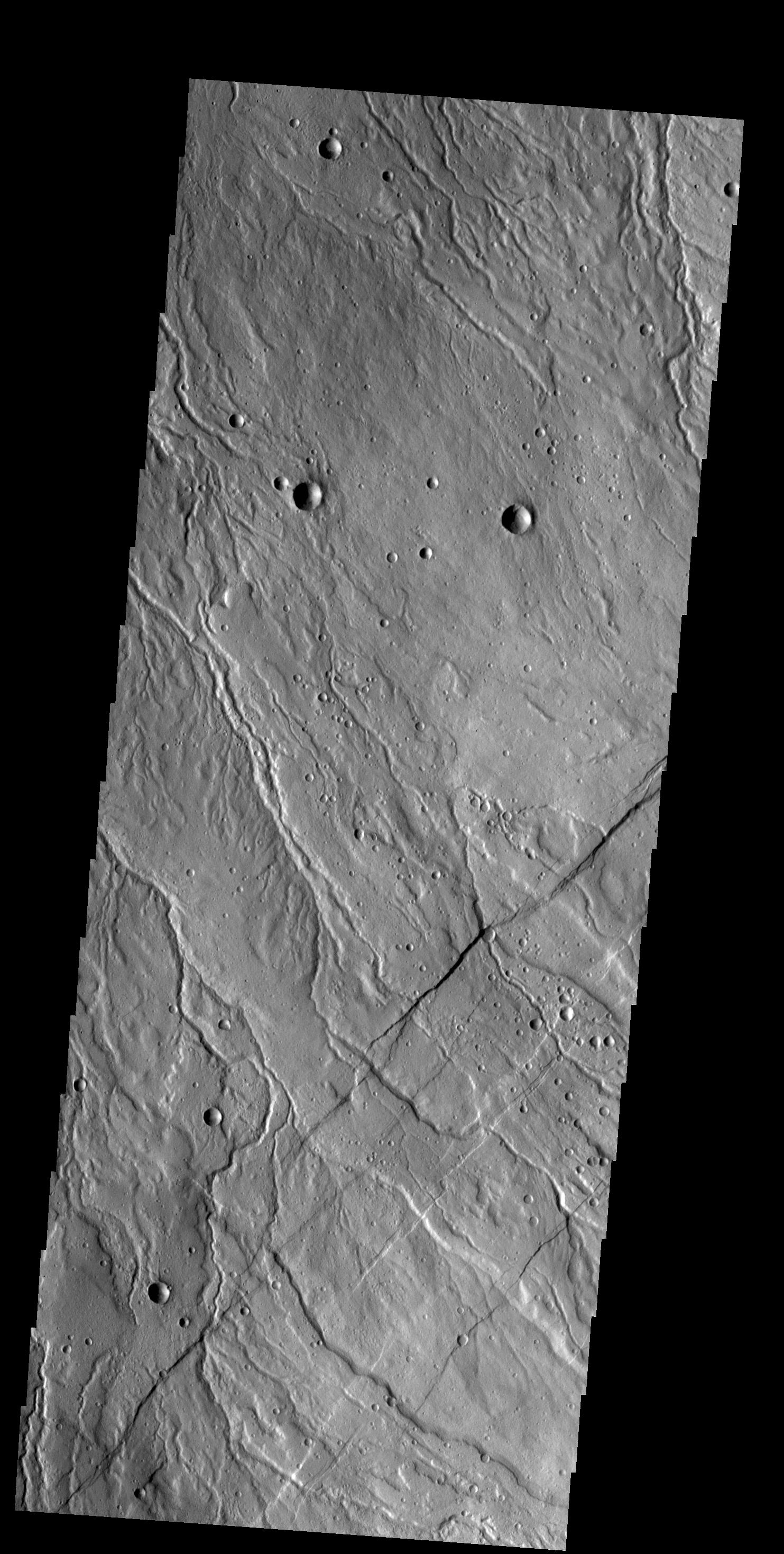
2014-03-12
Mars
Mars Reconnaissance Orbiter (MRO)
HiRISE
2880x1800x3
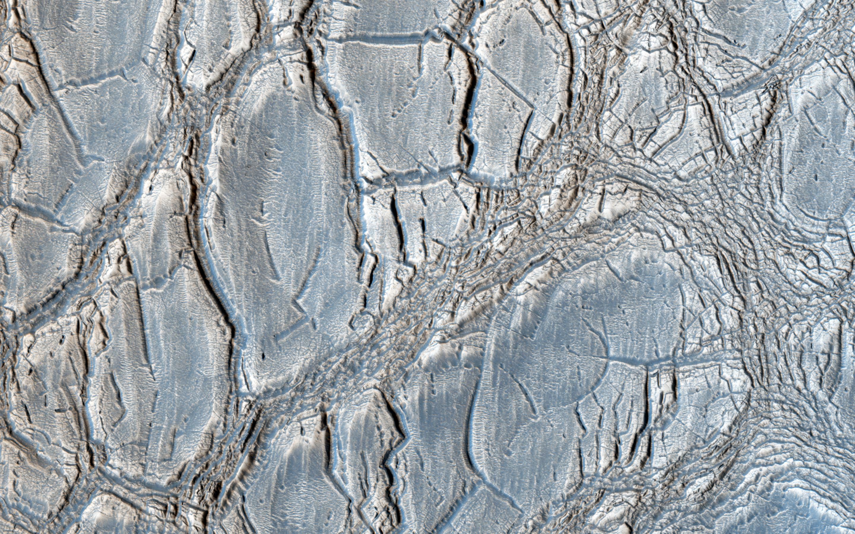
PIA17905:
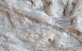
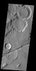
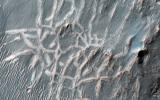
A Complex Valley Network Near Idaeus Fossae
Full Resolution:
TIFF
(15.56 MB)
JPEG
(840.2 kB)
2014-03-13
Mars
2001 Mars Odyssey
THEMIS
1402x2925x1
PIA18104:
Olympus Mons Lava
Full Resolution:
TIFF
(4.106 MB)
JPEG
(551.4 kB)
2014-03-14
Mars
2001 Mars Odyssey
THEMIS
1388x2926x1
PIA18105:
Gordii Fossae
Full Resolution:
TIFF
(4.066 MB)
JPEG
(444.8 kB)
2014-03-17
Mars
2001 Mars Odyssey
THEMIS
1435x2928x1
PIA18106:
Delta Deposit
Full Resolution:
TIFF
(4.207 MB)
JPEG
(239.9 kB)
2014-03-18
Mars
2001 Mars Odyssey
THEMIS
1447x2928x1
PIA18125:
Wind Streaks
Full Resolution:
TIFF
(4.242 MB)
JPEG
(525.7 kB)
2014-03-19
Mars
2001 Mars Odyssey
THEMIS
1449x2929x1
PIA18126:
Alba Mons Flows
Full Resolution:
TIFF
(4.249 MB)
JPEG
(373.1 kB)
2014-03-19
Mars
Mars Reconnaissance Orbiter (MRO)
HiRISE
800x800x3
PIA17958:
A New Gully Channel in Terra Sirenum, Mars
Full Resolution:
TIFF
(1.921 MB)
JPEG
(100.4 kB)
2014-03-19
Mars
Mars Reconnaissance Orbiter (MRO)
HiRISE
2880x1800x3
PIA17906:
A New Gully Channel in Terra Sirenum
Full Resolution:
TIFF
(15.56 MB)
JPEG
(754 kB)
2014-03-20
Mars
2001 Mars Odyssey
THEMIS
1416x2924x1
PIA18127:
Tartarus Colles
Full Resolution:
TIFF
(4.145 MB)
JPEG
(248.2 kB)
2014-03-21
Mars
2001 Mars Odyssey
THEMIS
1411x2922x1
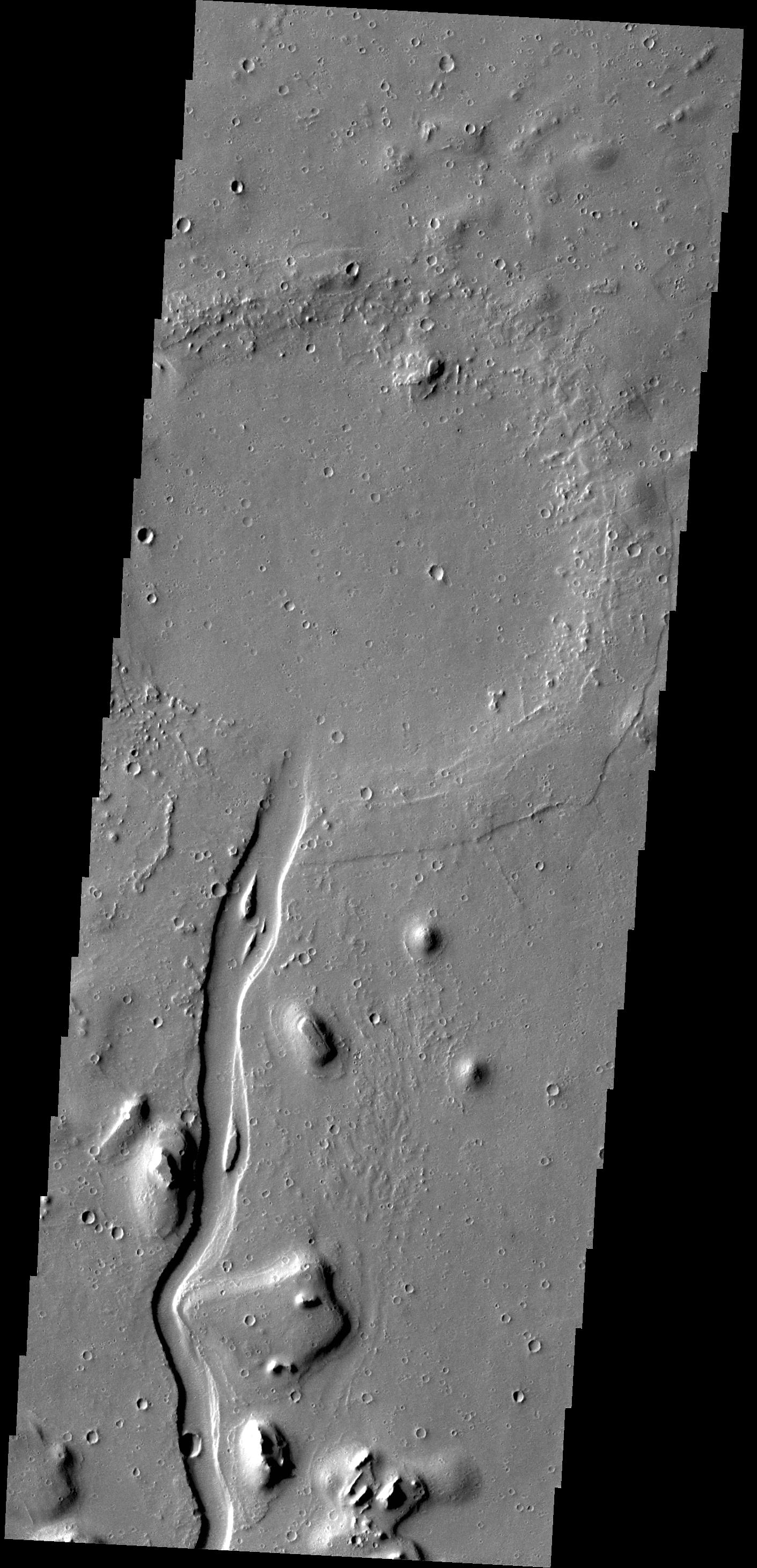
PIA18128:
Hebrus Valles
Full Resolution:
TIFF
(4.128 MB)
JPEG
(485 kB)
2014-03-24
Mars
2001 Mars Odyssey
THEMIS
1438x2927x1
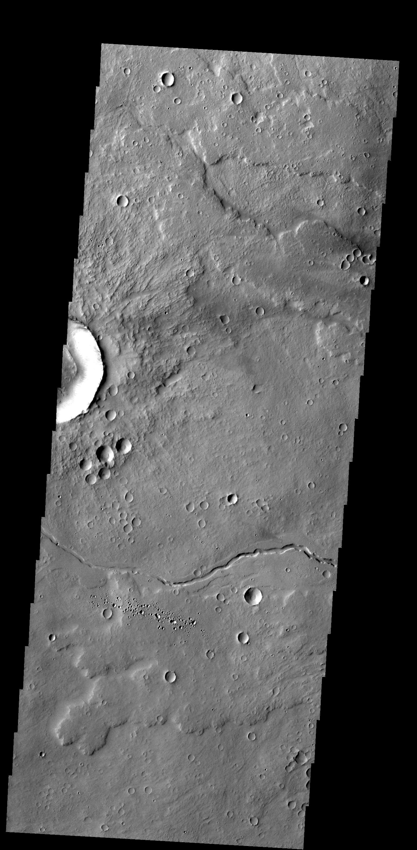
PIA18129:
Channel
Full Resolution:
TIFF
(4.214 MB)
JPEG
(485.3 kB)
2014-03-24
Mars
Mars Science Laboratory (MSL)
Mastcam
2340x1143x3
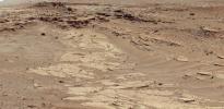
PIA17959:
Differential Erosion at Work on Martian Sandstones
Full Resolution:
TIFF
(8.027 MB)
JPEG
(556.2 kB)
2014-03-24
Mars
Mars Science Laboratory (MSL)
Navcam (MSL)
7696x1609x1
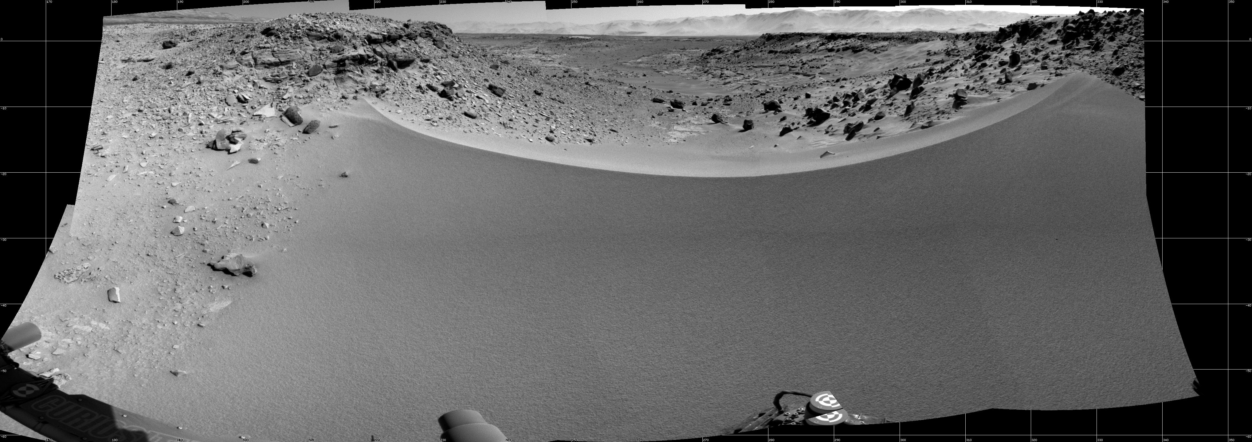
PIA18069:
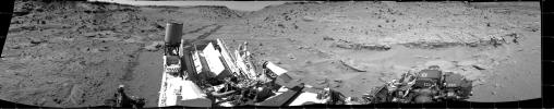
Panorama With Sandstone Outcrop Near 'The Kimberley' Waypoint
Full Resolution:
TIFF
(12.4 MB)
JPEG
(1.052 MB)
2014-03-24
Mars
Mars Science Laboratory (MSL)
Navcam (MSL)
3657x1414x3
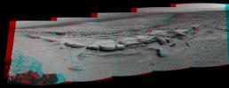
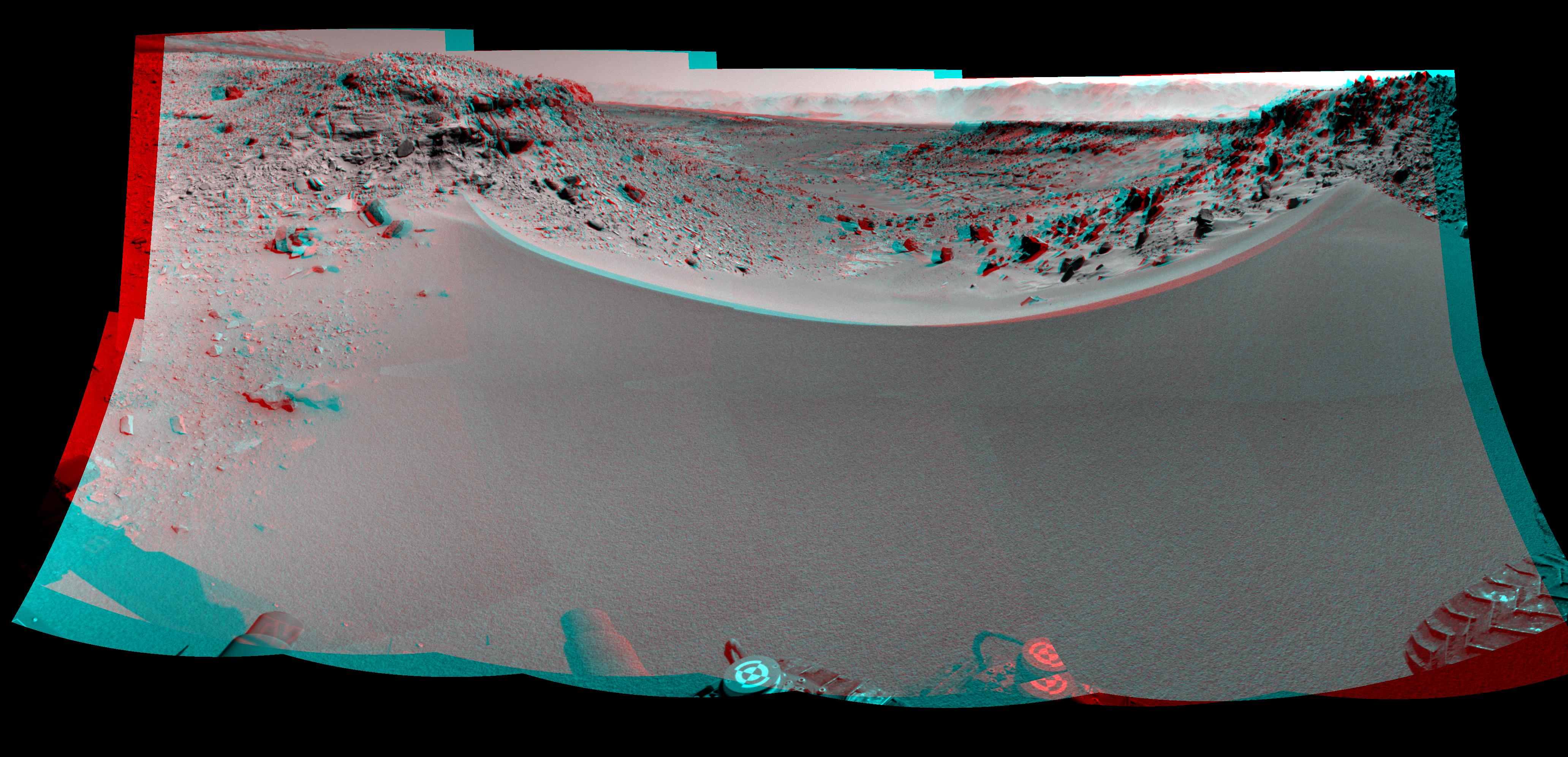
PIA18070:
Panorama With Sandstone Outcrop Near 'The Kimberley' Waypoint (Stereo)
Full Resolution:
TIFF
(15.52 MB)
JPEG
(573.6 kB)
2014-03-25
Mars
2001 Mars Odyssey
THEMIS
1453x2931x1
PIA18130:
Alba Mons Flows
Full Resolution:
TIFF
(4.264 MB)
JPEG
(556.3 kB)
2014-03-26
Mars
2001 Mars Odyssey
THEMIS
1459x2932x1
PIA18131:
Acheron Catena
Full Resolution:
TIFF
(4.283 MB)
JPEG
(421.3 kB)
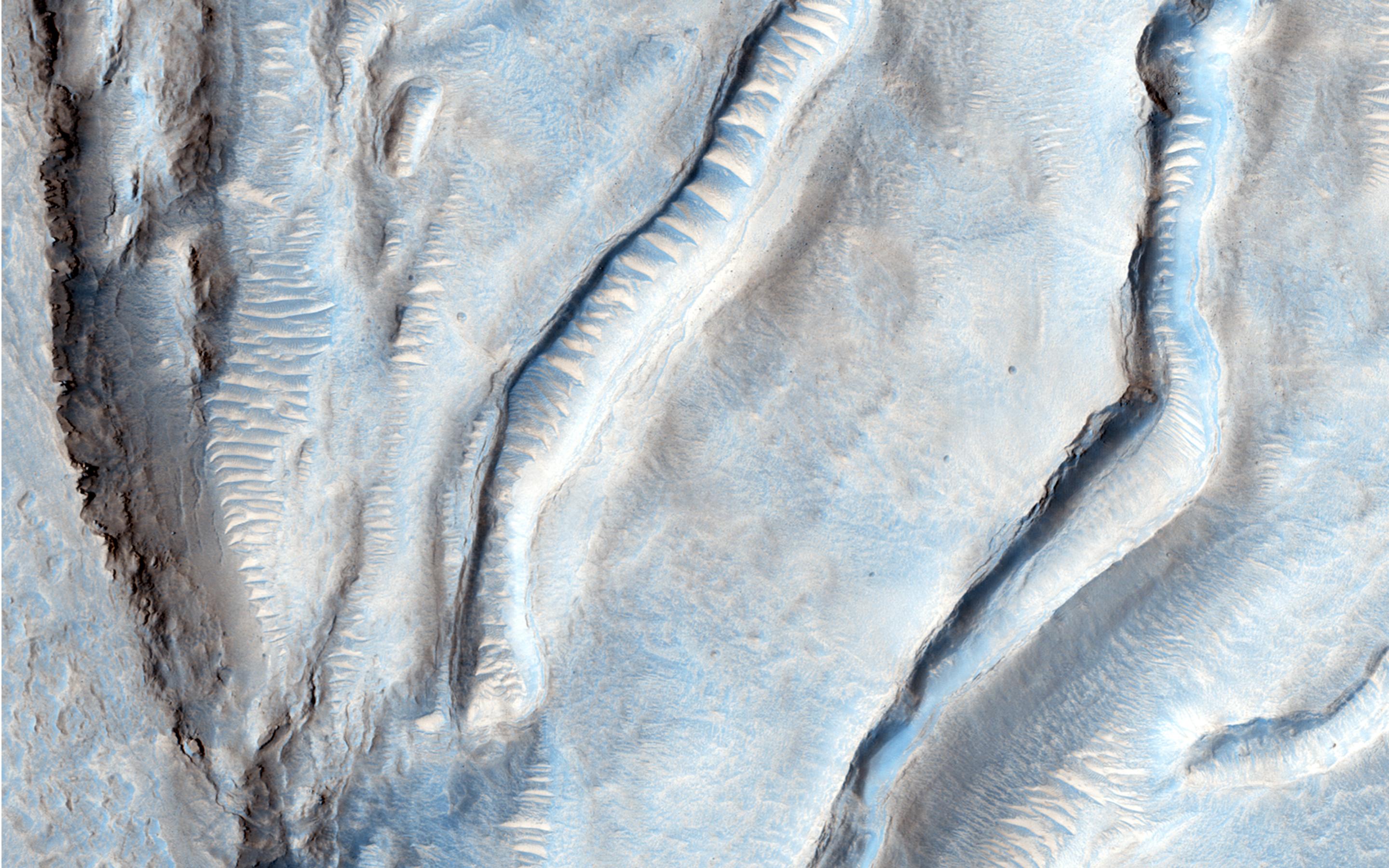
2014-03-26
Mars
Mars Reconnaissance Orbiter (MRO)
HiRISE
2880x1800x3
PIA17907:
Bedrock in a Trough in Asimov Crater
Full Resolution:
TIFF
(15.56 MB)
JPEG
(914.3 kB)
2014-03-26
Mars
Mars Reconnaissance Orbiter (MRO)
HiRISE
2880x1800x3
PIA17908:
A Dark-Toned, Pitted Mound in a Crater in Northeast Arabia Terra
Full Resolution:
TIFF
(15.56 MB)
JPEG
(774.2 kB)
2014-03-26
Mars
Mars Reconnaissance Orbiter (MRO)
HiRISE
2880x1800x3
PIA17909:
A Large, Banded Angular Fragment in Nili Fossae
Full Resolution:
TIFF
(15.56 MB)
JPEG
(963.6 kB)
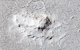
2014-03-26
Mars
Mars Reconnaissance Orbiter (MRO)
HiRISE
2880x1800x3
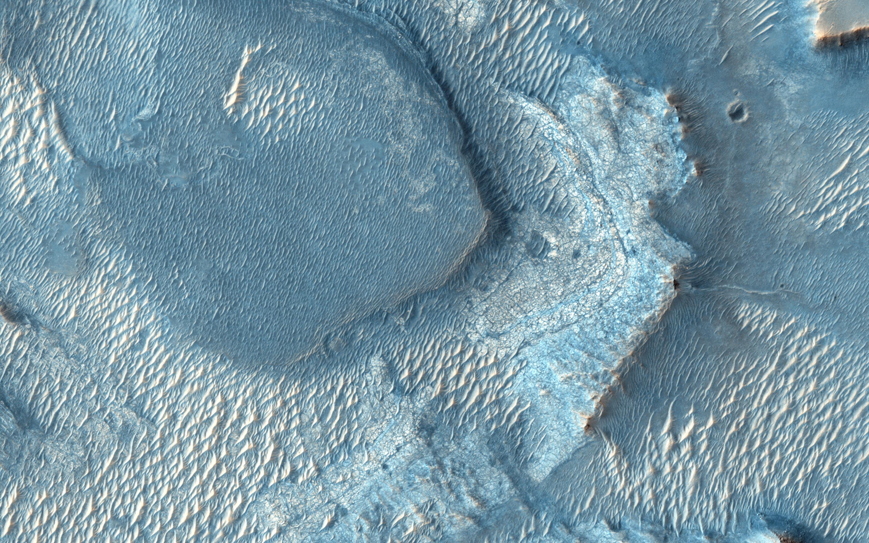
PIA17910:
An Unusual Mound
Full Resolution:
TIFF
(15.56 MB)
JPEG
(1.045 MB)
2014-03-27
Mars
2001 Mars Odyssey
THEMIS
1430x2925x1
PIA18132:
Lycus Sulci
Full Resolution:
TIFF
(4.188 MB)
JPEG
(227.7 kB)
2014-03-27
Mars
Mars Exploration Rover (MER)
Hazcam
1024x1024x1
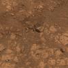
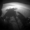
PIA17956:
Shadow Portrait of NASA Rover Opportunity on Martian Slope
Full Resolution:
TIFF
(1.05 MB)
JPEG
(98.26 kB)
1-100
101-200
201-300
301-400
401-500
501-600
601-700
701-800
801-900
901-1000
Currently displaying images:
8301 - 8400
of 12760


