Click on an image for detailed information
Click on a column heading to sort in ascending or descending order

My
List |
Addition Date
|
Target
|
Mission
|
Instrument
|
Size
|

|
2010-11-04 |
Mars
|
2001 Mars Odyssey
|
THEMIS
|
1342x2770x1 |
|
-
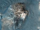
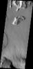
PIA13569:
-
Something Different
Full Resolution:
TIFF
(3.721 MB)
JPEG
(392.6 kB)
|
|
|
2010-11-05 |
Mars
|
2001 Mars Odyssey
|
THEMIS
|
1344x2769x1 |
|
-
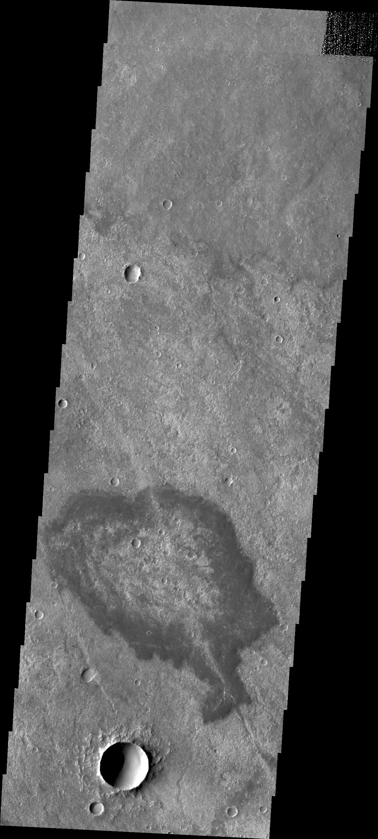
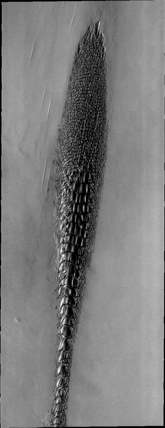
PIA13603:
-
Dark Slope Streaks within Tikhonravov Crater
Full Resolution:
TIFF
(3.725 MB)
JPEG
(252.5 kB)
|
|
|
2010-11-08 |
Mars
|
2001 Mars Odyssey
|
THEMIS
|
1363x2776x1 |
|
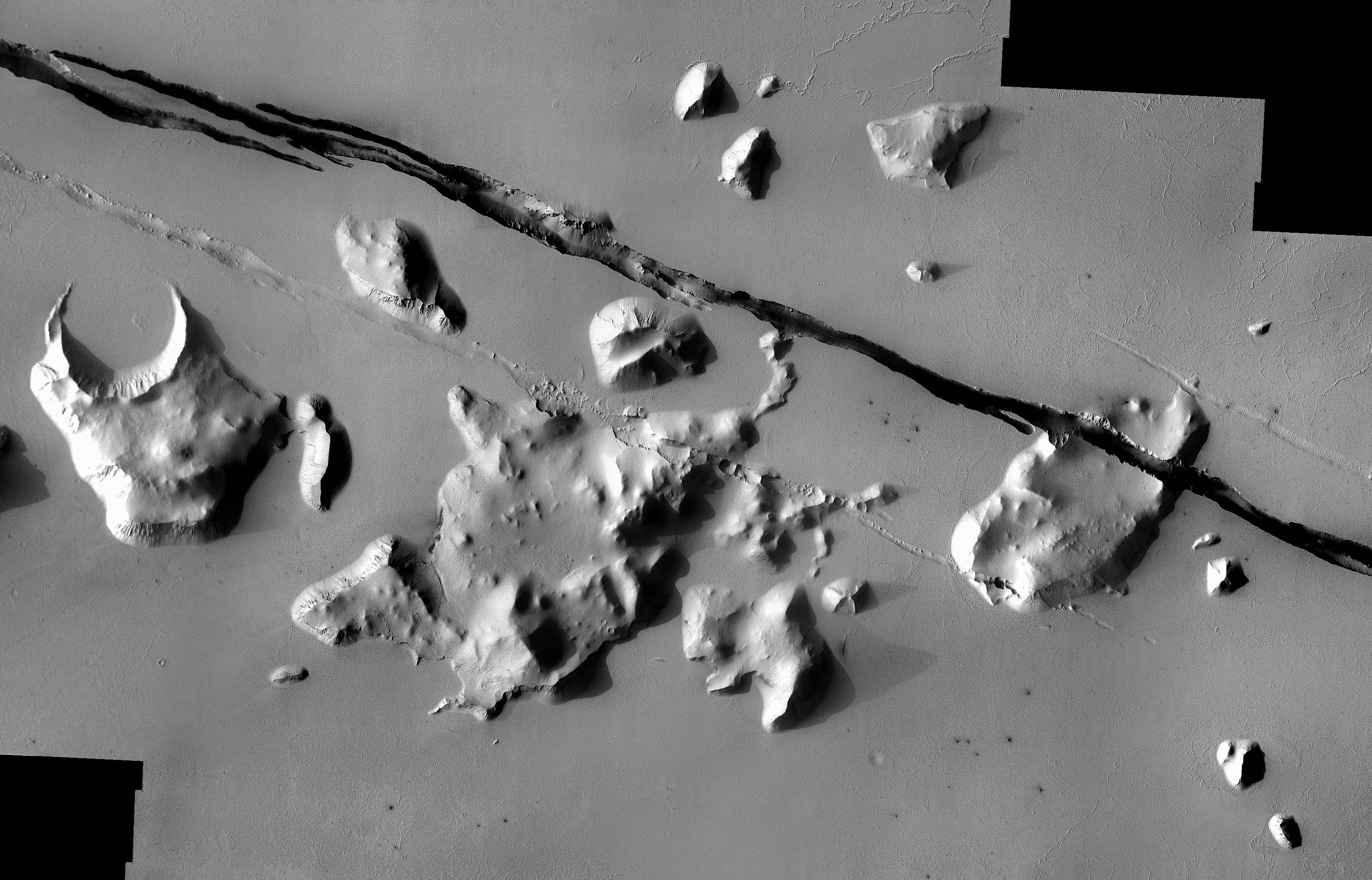
-
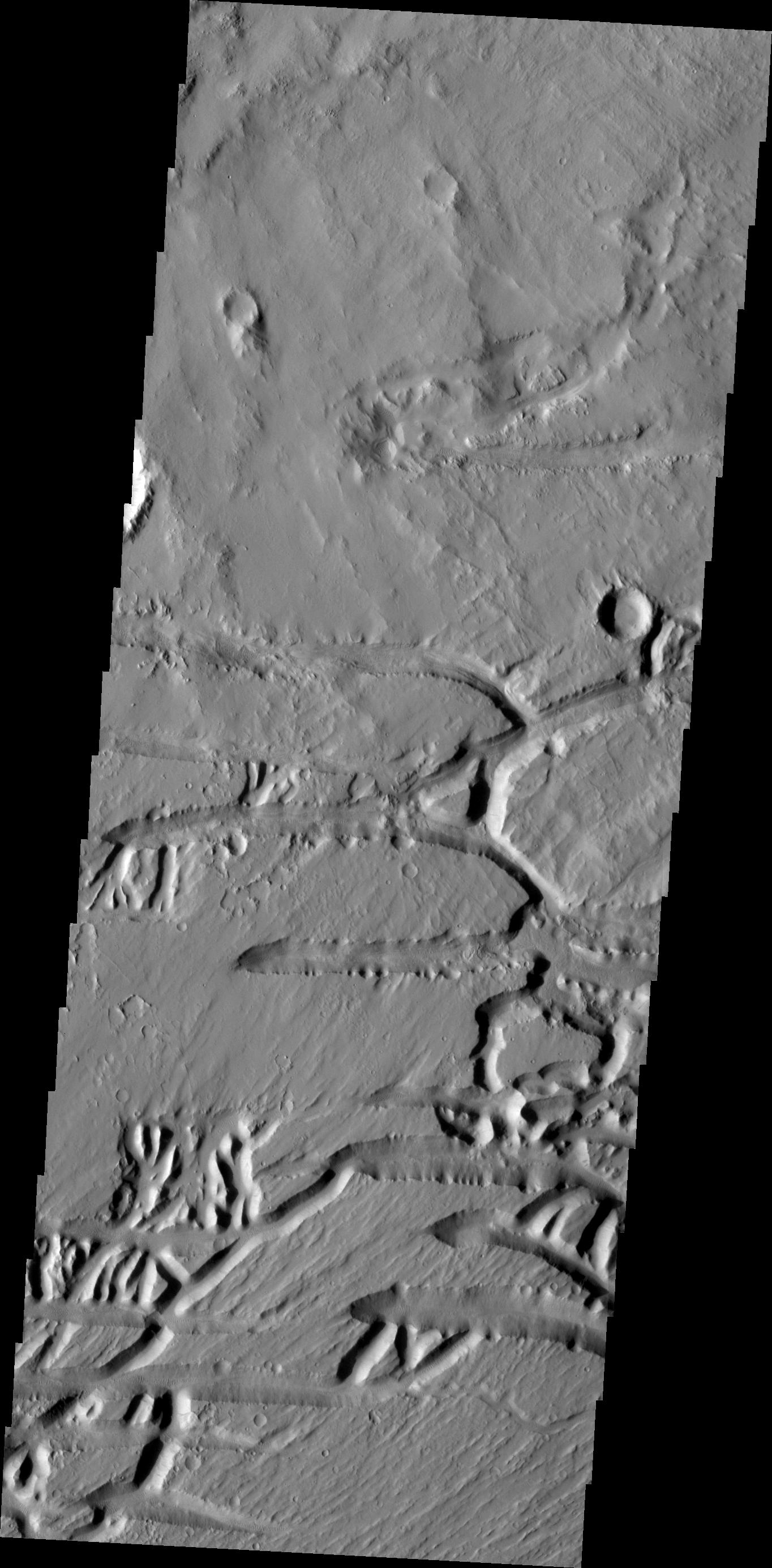
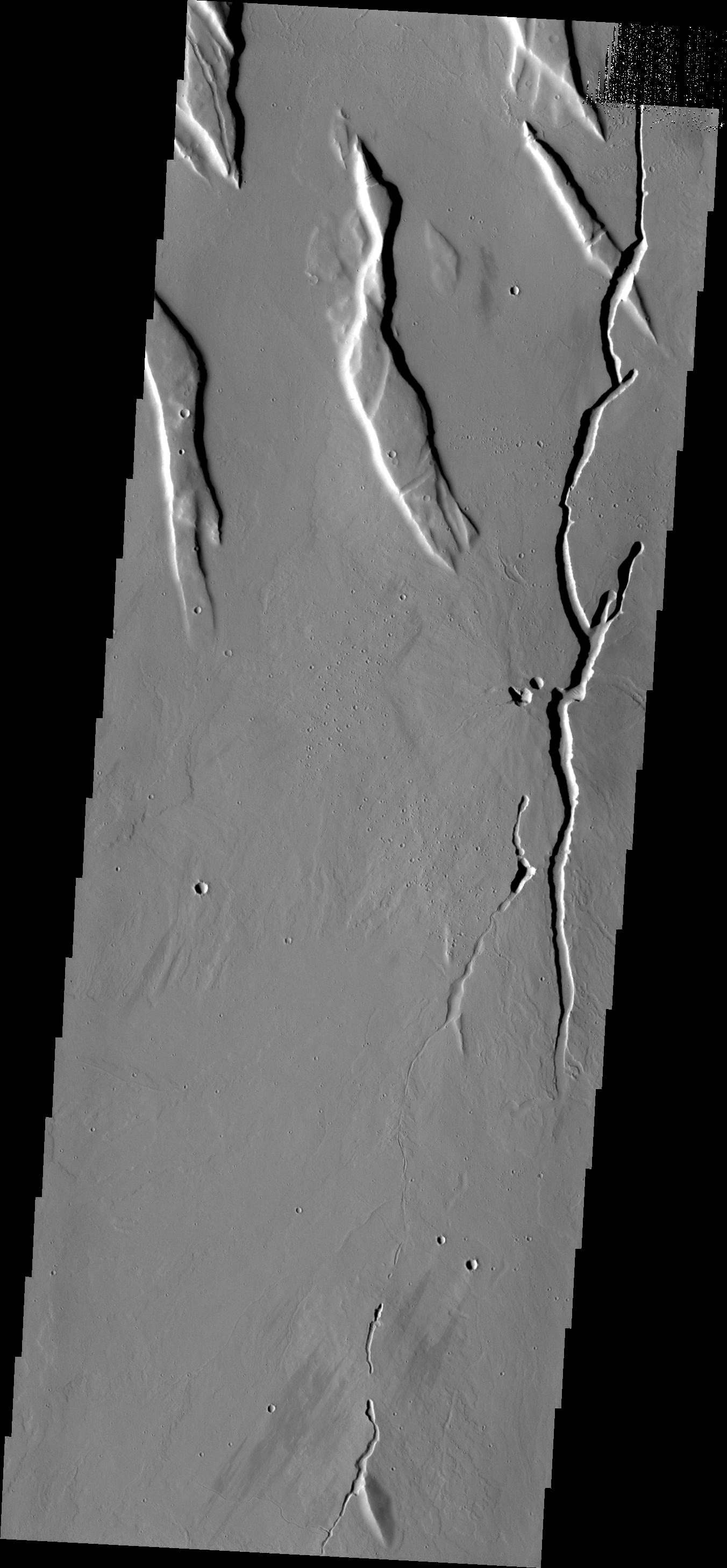
PIA13604:
-
Acheron Fossae
Full Resolution:
TIFF
(3.788 MB)
JPEG
(367 kB)
|
|
|
2010-11-10 |
Mars
|
2001 Mars Odyssey
|
THEMIS
|
1327x2773x1 |

|
-
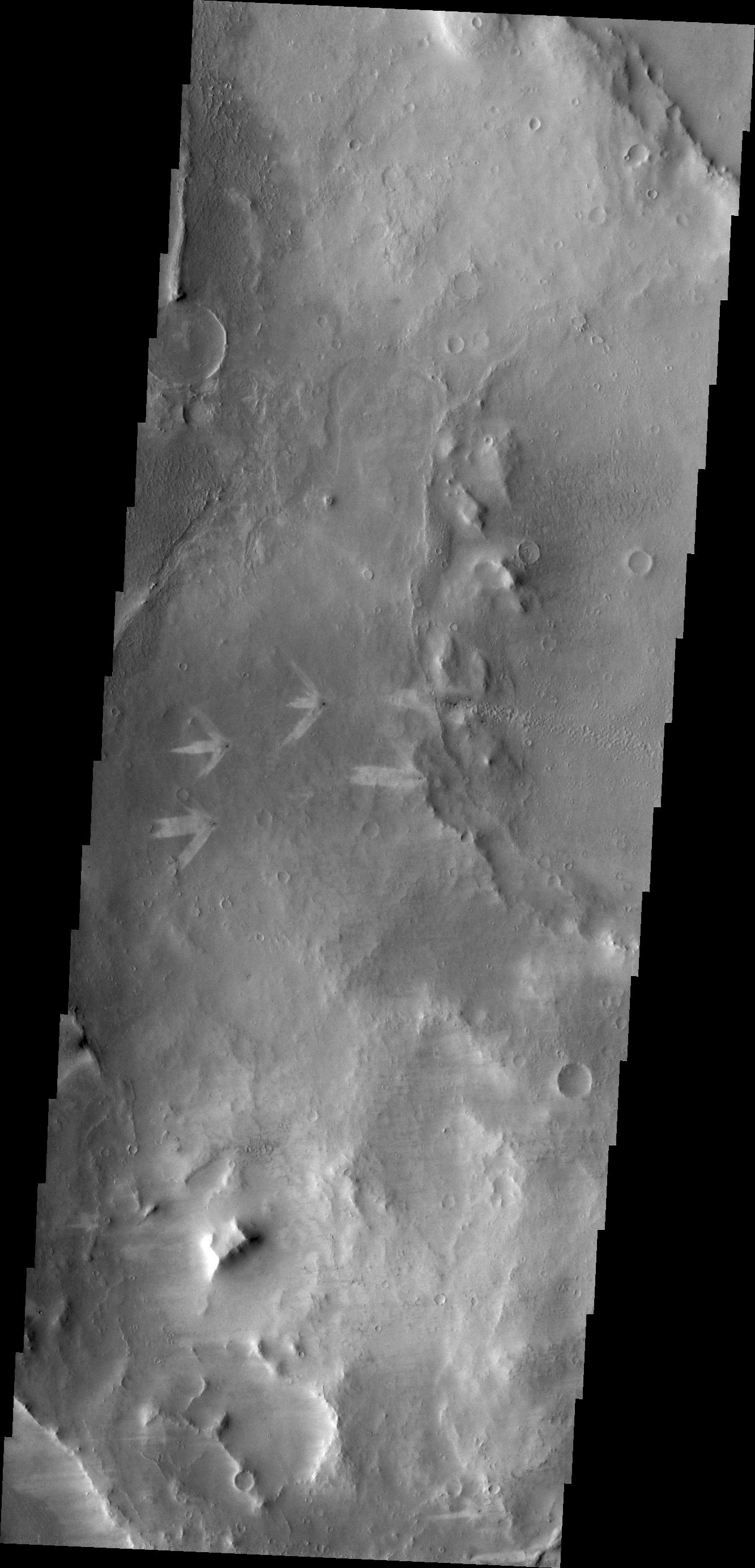
PIA13606:
-
Wind Texture
Full Resolution:
TIFF
(3.684 MB)
JPEG
(564.9 kB)
|
|
|
2010-11-10 |
Mars
|
Mars Reconnaissance Orbiter (MRO)
|
HiRISE
|
2560x1920x3 |

|
-
PIA13608:
-
Concentric Structures in Meridiani Planum
Full Resolution:
TIFF
(14.76 MB)
JPEG
(925.2 kB)
|
|
|
2010-11-10 |
Mars
|
2001 Mars Odyssey
|
THEMIS
|
1354x2771x1 |
|
-
PIA13609:
-
Lycus Sulci
Full Resolution:
TIFF
(3.756 MB)
JPEG
(246 kB)
|
|
|
2010-11-11 |
Mars
|
Mars Reconnaissance Orbiter (MRO)
|
HiRISE
|
2560x1920x3 |
|
-
PIA13610:
-
Light-Toned Outcrop in Aureum Chaos
Full Resolution:
TIFF
(14.76 MB)
JPEG
(663.9 kB)
|
|
|
2010-11-11 |
Mars
|
2001 Mars Odyssey
|
THEMIS
|
1349x2922x1 |
|
-
PIA13615:
-
Avernus Colles
Full Resolution:
TIFF
(3.946 MB)
JPEG
(629.3 kB)
|
|
|
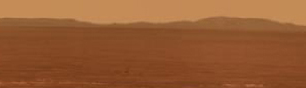
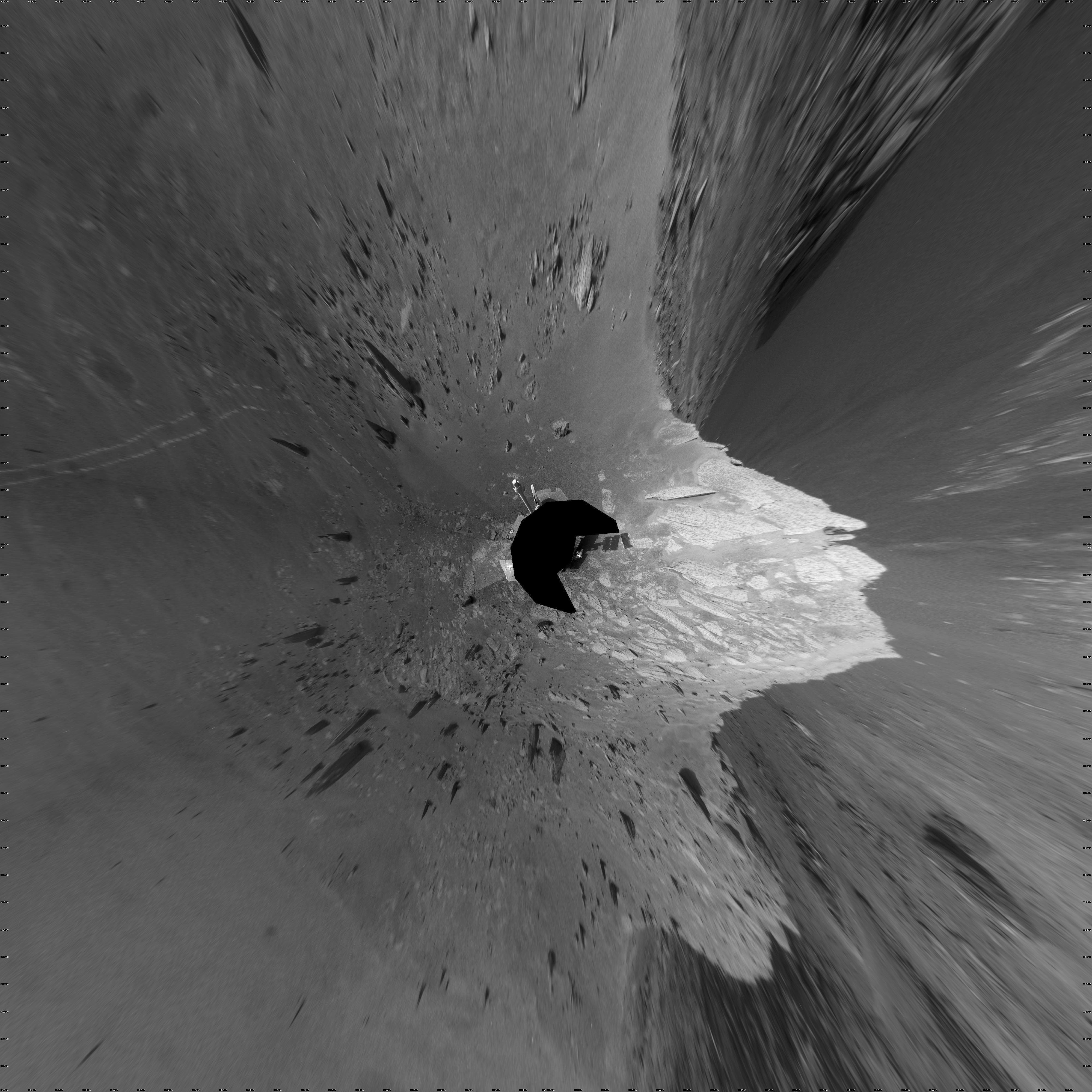
2010-11-12 |
Mars
|
Mars Exploration Rover (MER)
|
Navigation Camera
|
4000x4000x1 |

|
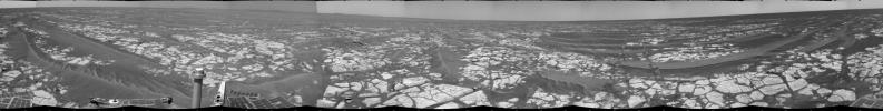
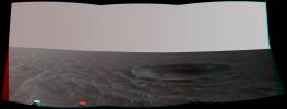
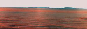
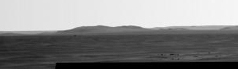
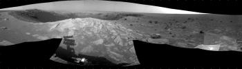
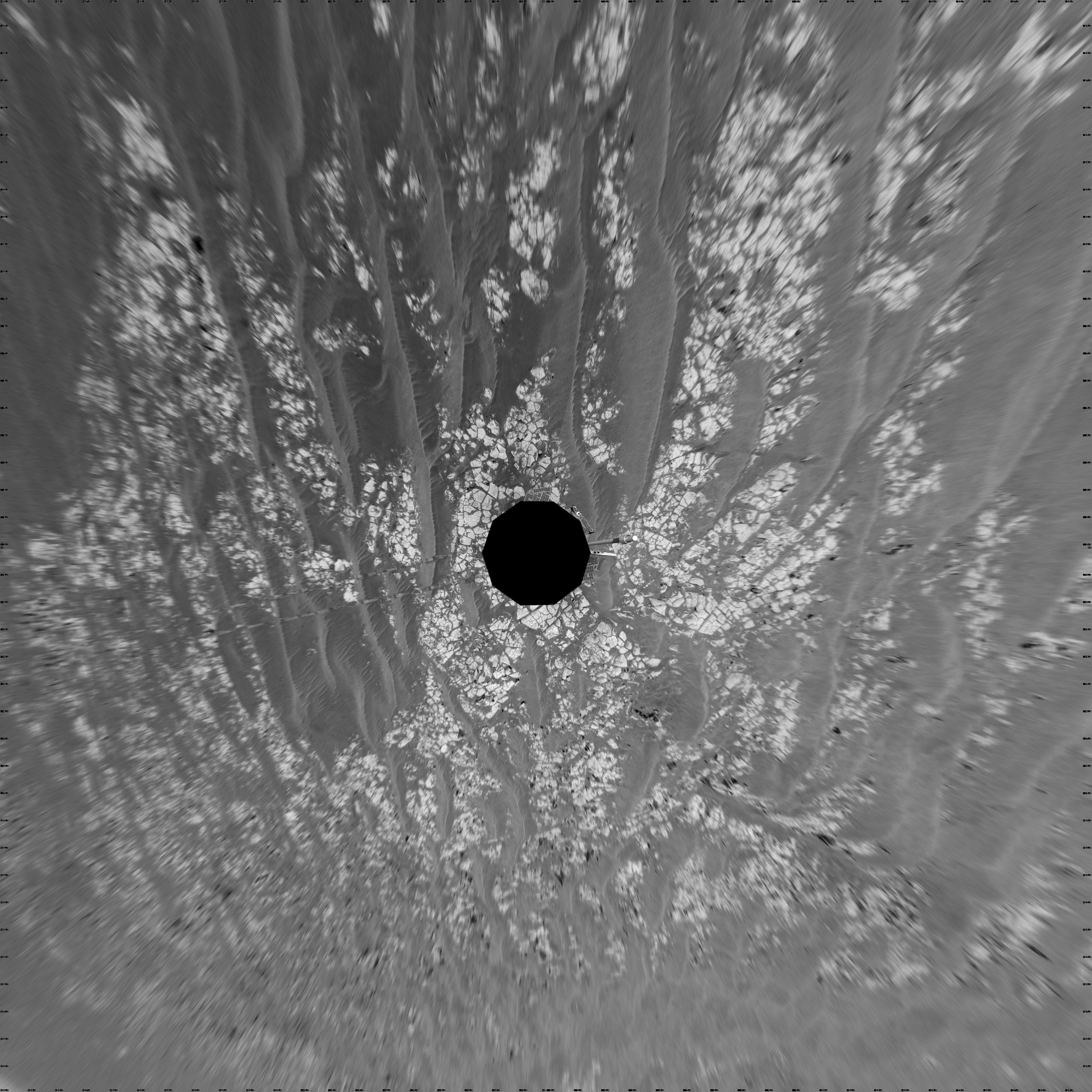
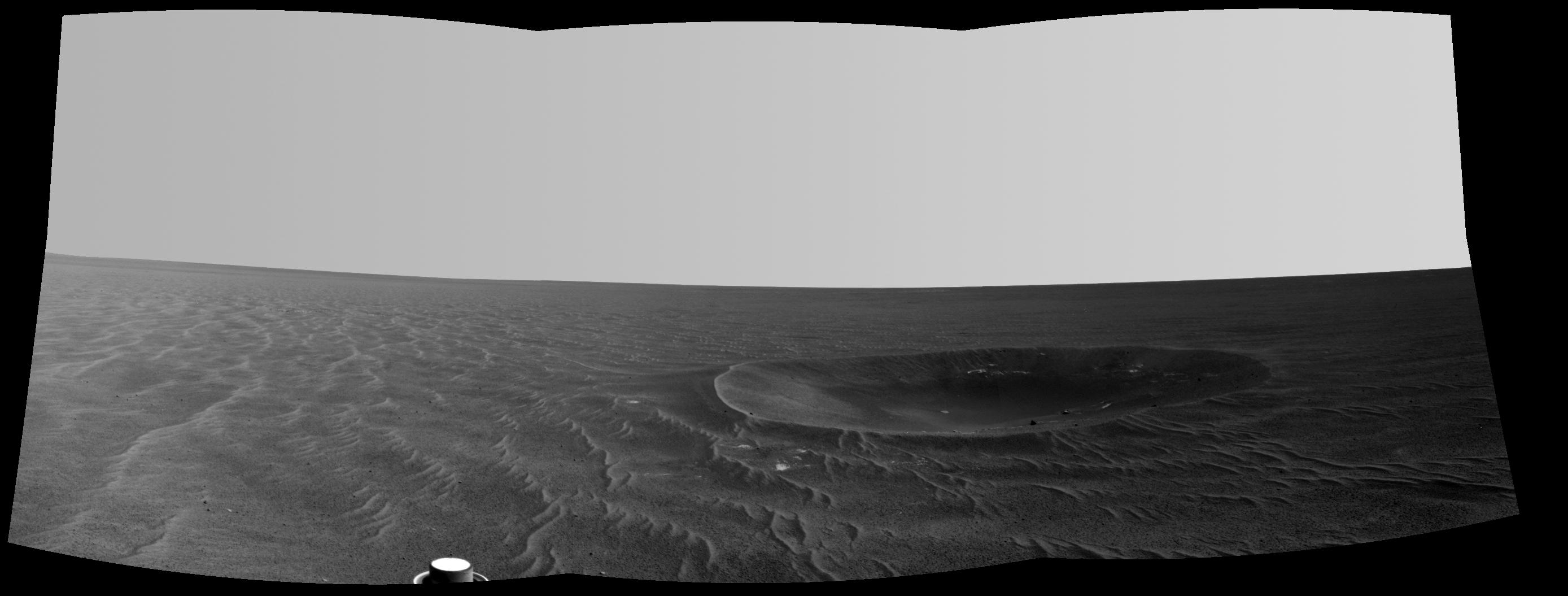
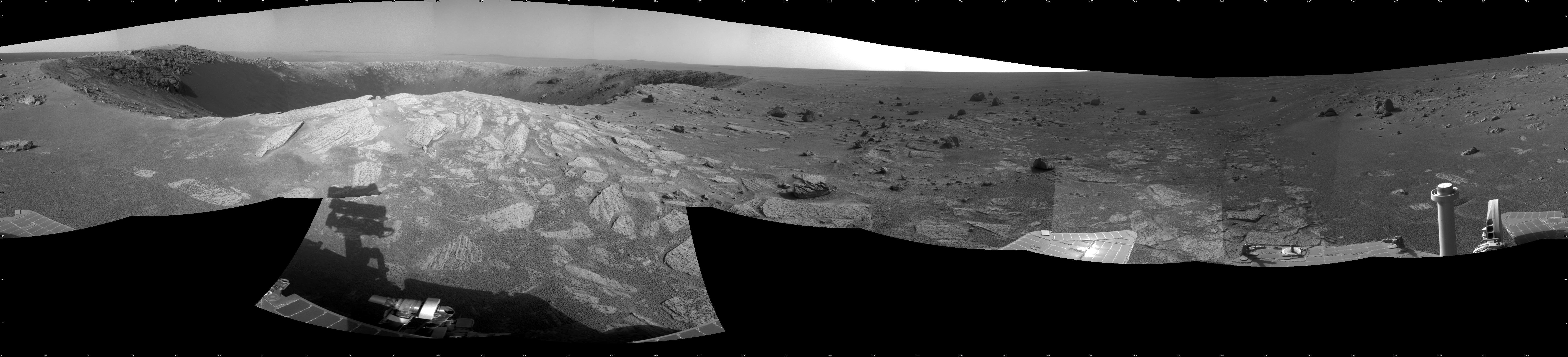
-
PIA13591:
-
Opportunity's Surroundings After Sol 2393 Drive (Vertical)
Full Resolution:
TIFF
(16.02 MB)
JPEG
(1.529 MB)
|
|
|
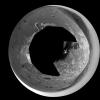
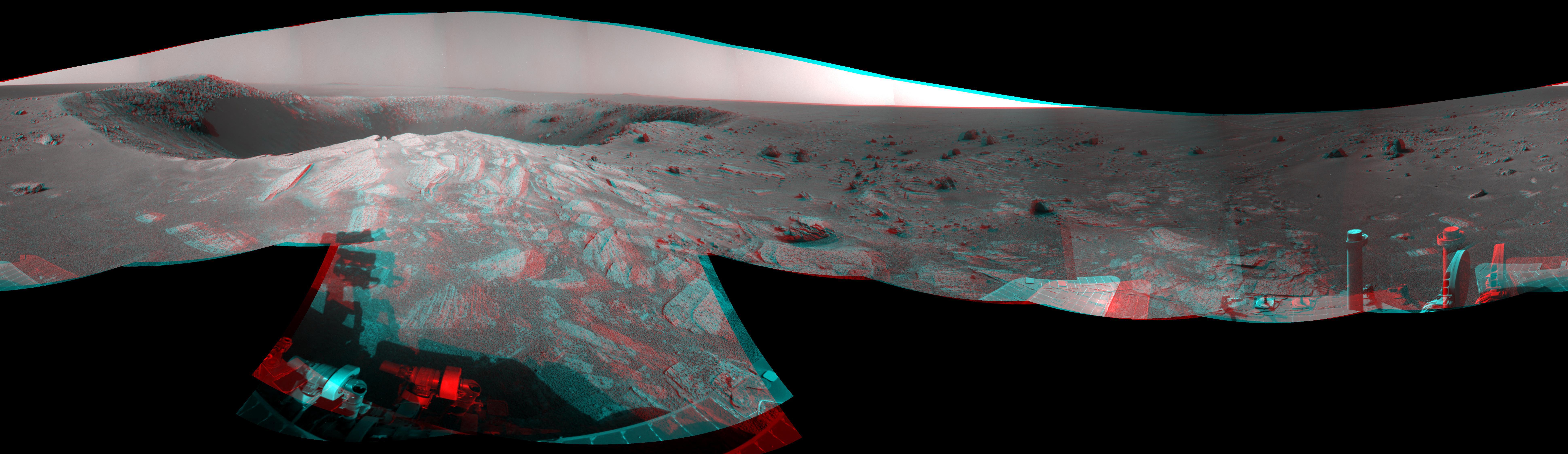
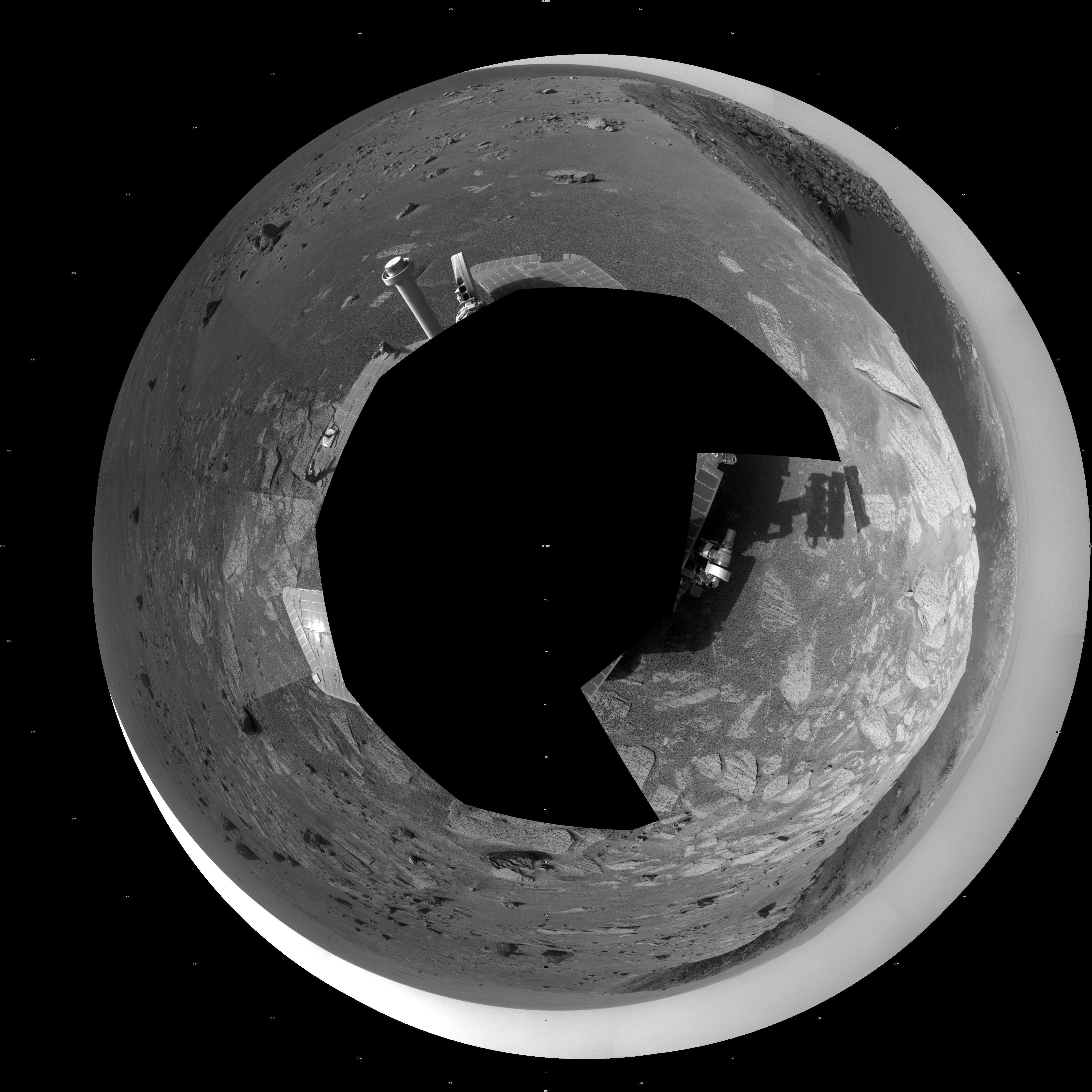
2010-11-12 |
Mars
|
Mars Exploration Rover (MER)
|
Navigation Camera
|
4077x4077x1 |
|
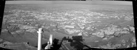
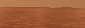
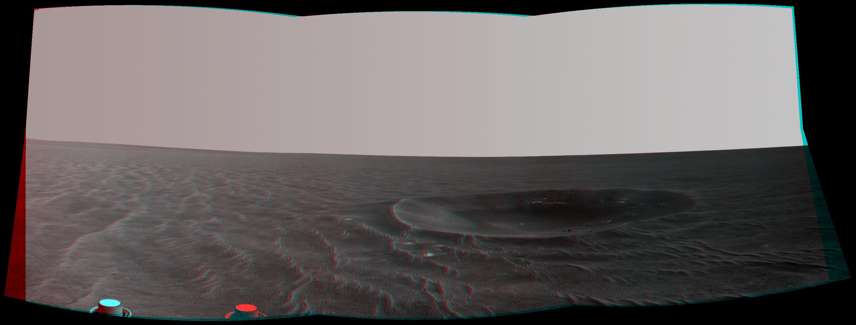
-
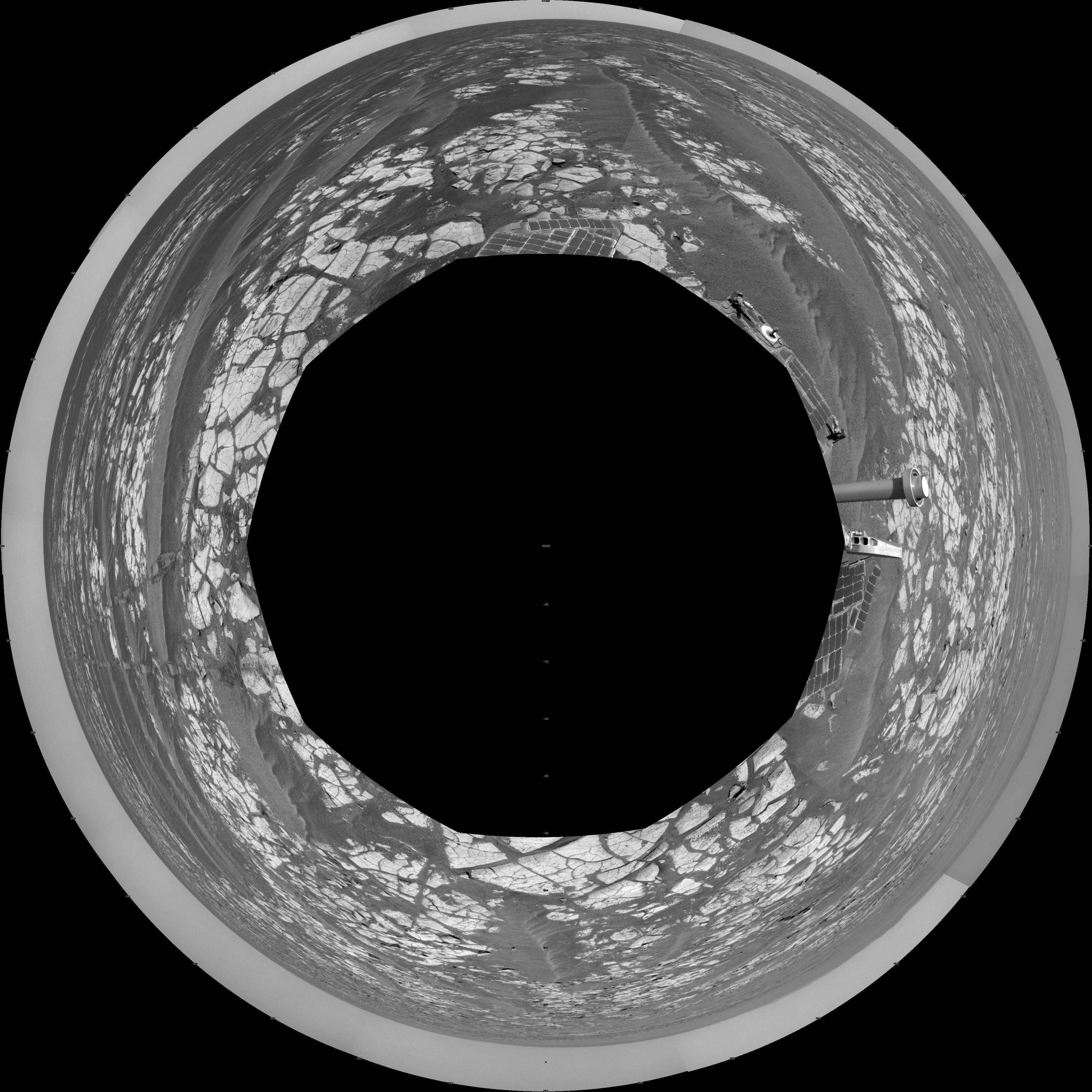
PIA13590:
-
Opportunity's Surroundings After Sol 2393 Drive (Polar)
Full Resolution:
TIFF
(16.64 MB)
JPEG
(1.452 MB)
|
|
|
2010-11-12 |
Mars
|
Mars Exploration Rover (MER)
|
Navigation Camera
|
7753x1131x3 |
|
-
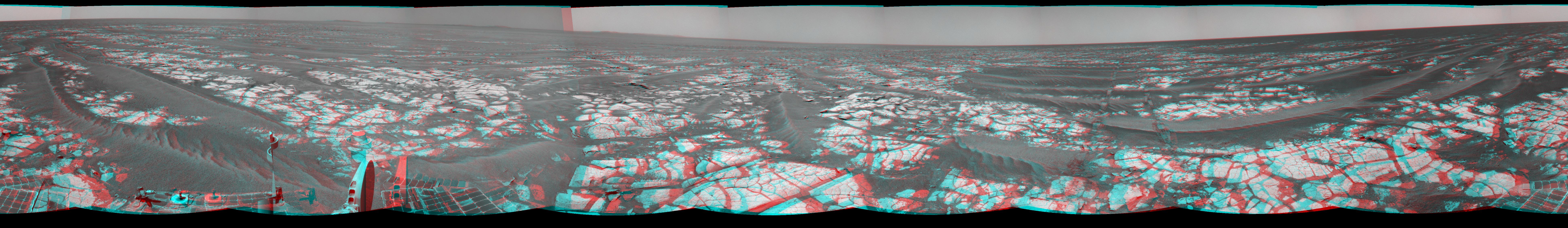
PIA13589:
Opportunity's Surroundings After Sol 2393 Drive (Stereo)
Full Resolution:
TIFF
(26.31 MB)
JPEG
(1.238 MB)
|
|
|
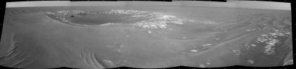
2010-11-12 |
Mars
|
Mars Exploration Rover (MER)
|
Navigation Camera
|
7688x970x1 |
|
-
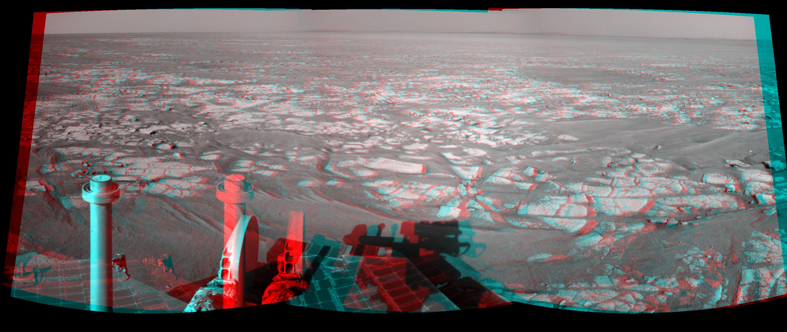
PIA13588:
Opportunity's Surroundings After Sol 2393 Drive
Full Resolution:
TIFF
(7.465 MB)
JPEG
(1.064 MB)
|
|
|
2010-11-12 |
Mars
|
Mars Exploration Rover (MER)
|
Navigation Camera
|
2681x1133x3 |

|
-
PIA13587:
-
Opportunity's Eastward View After Sol 2401 Drive (Stereo)
Full Resolution:
TIFF
(9.122 MB)
JPEG
(390.4 kB)
|
|
|
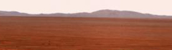
2010-11-12 |
Mars
|
Mars Exploration Rover (MER)
|
Navigation Camera
|
2659x971x1 |
|
-
PIA13586:
-
Opportunity's Eastward View After Sol 2401 Drive
Full Resolution:
TIFF
(2.585 MB)
JPEG
(348.3 kB)
|
|
|
2010-11-12 |
Mars
|
Mars Exploration Rover (MER)
|
Navigation Camera
|
4176x980x1 |
|
-
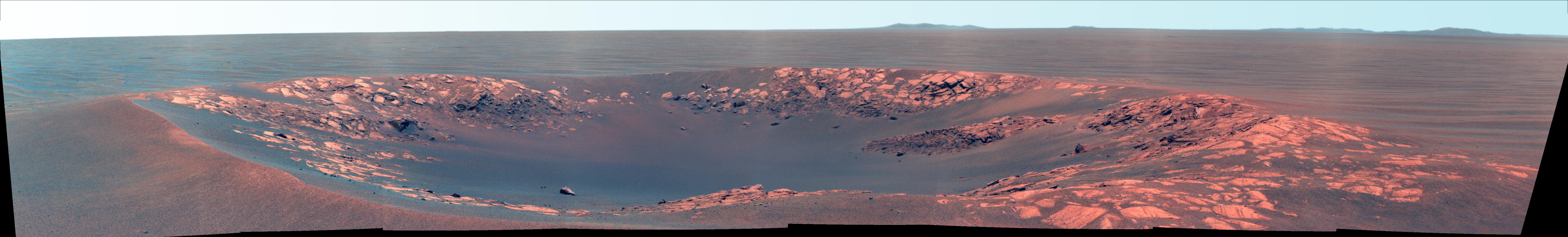
PIA13592:
'Intrepid' Crater on Opportunity's Martian Trek
Full Resolution:
TIFF
(4.101 MB)
JPEG
(439.6 kB)
|
|
|
2010-11-12 |
Mars
|
Mars Reconnaissance Orbiter (MRO)
|
HiRISE
|
2560x1920x3 |
|
-
PIA13611:
-
Fresh Crater with Gullies
Full Resolution:
TIFF
(14.76 MB)
JPEG
(768.3 kB)
|
|
|
2010-11-12 |
Mars
|
2001 Mars Odyssey
|
THEMIS
|
1330x2766x1 |
|
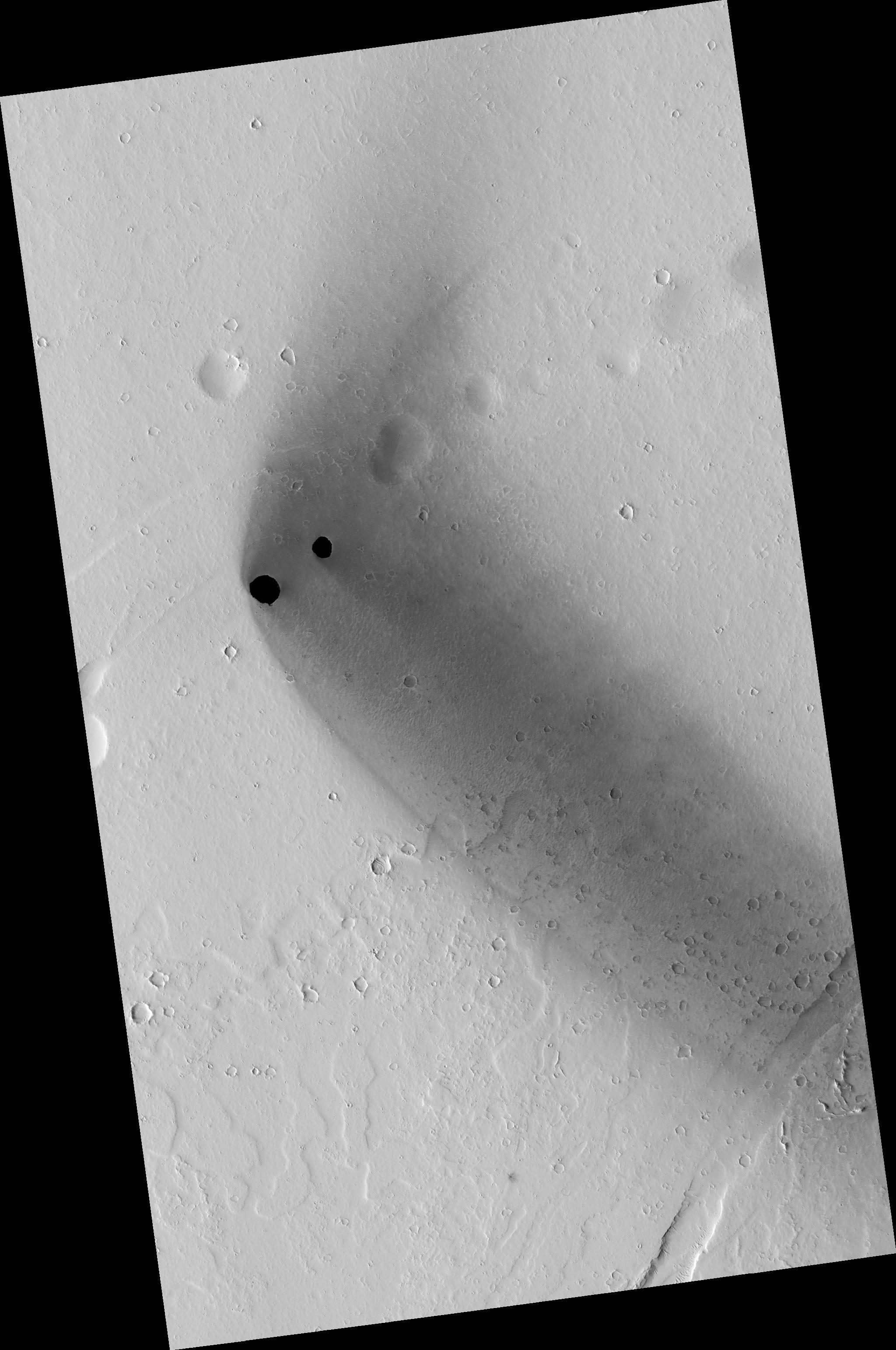
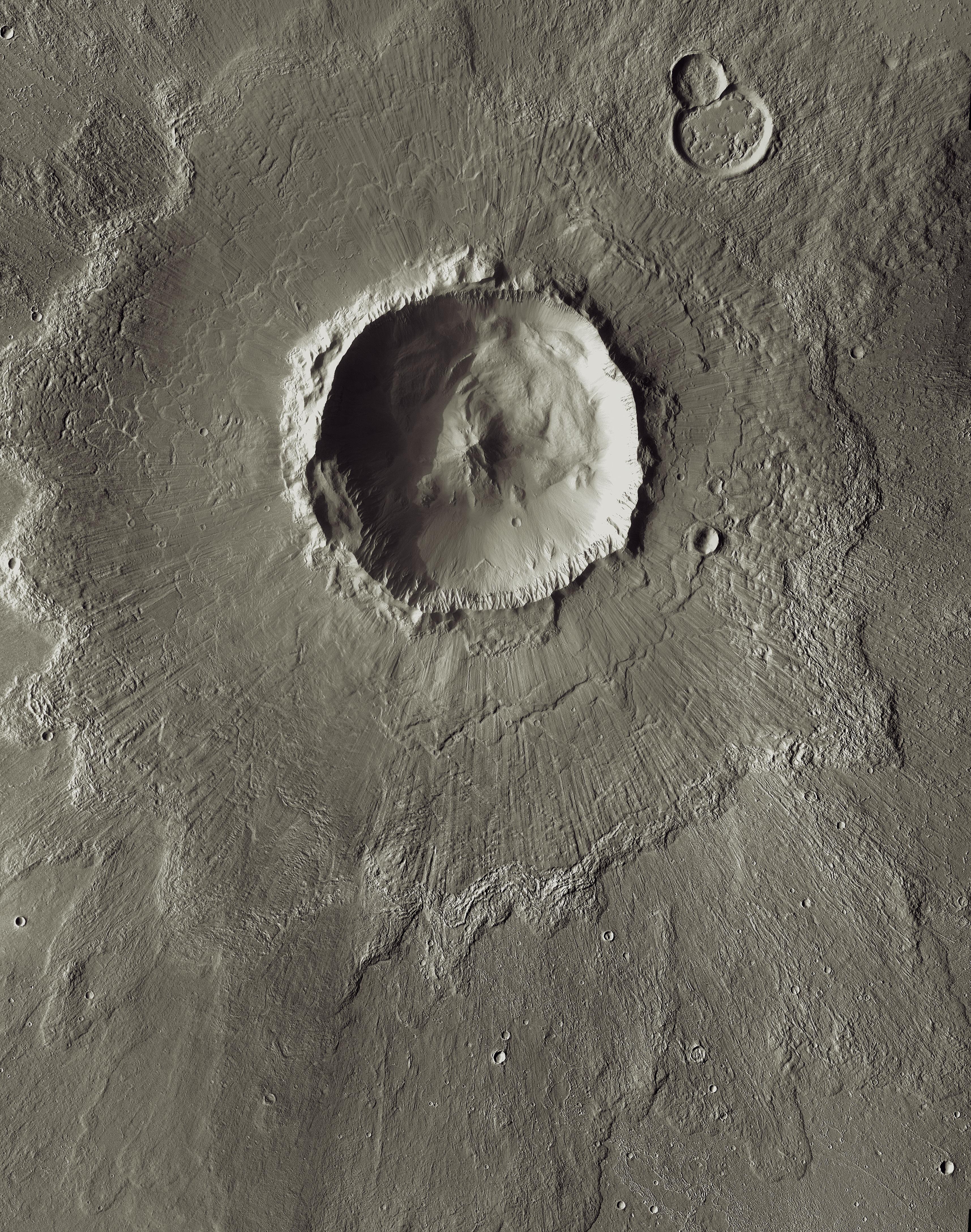
-
PIA13617:
-
Ceraunius Tholus
Full Resolution:
TIFF
(3.683 MB)
JPEG
(290.1 kB)
|
|
|
2010-11-15 |
Mars
|
Mars Reconnaissance Orbiter (MRO)
|
HiRISE
|
2560x1920x3 |
|
-
PIA13612:
-
End of Lethe Vallis
Full Resolution:
TIFF
(14.76 MB)
JPEG
(944.5 kB)
|
|
|
2010-11-15 |
Mars
|
2001 Mars Odyssey
|
THEMIS
|
1333x2768x1 |

|
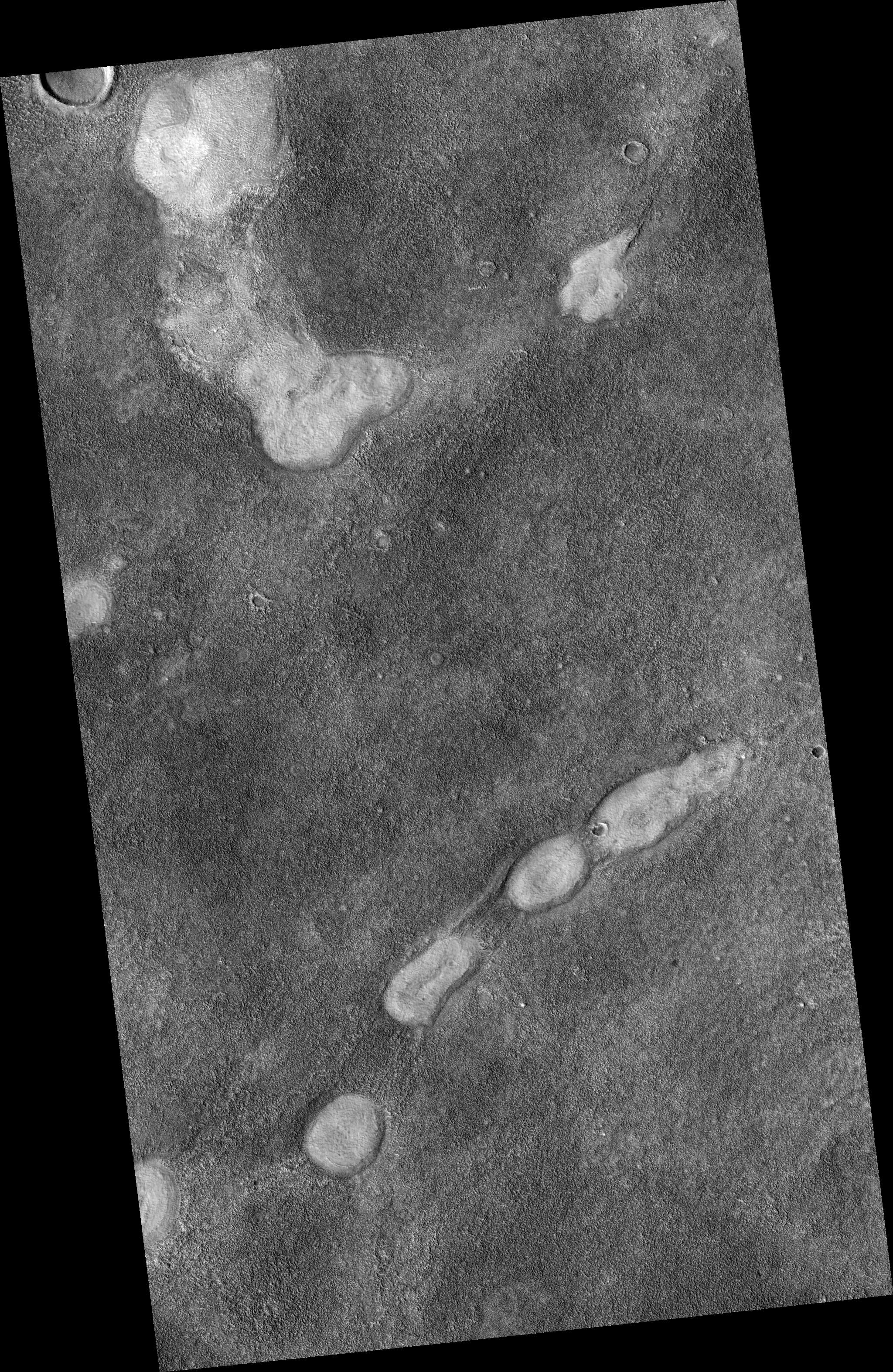
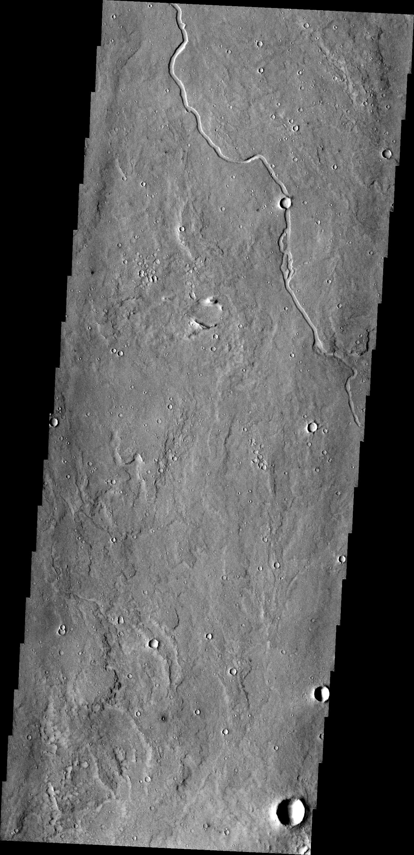
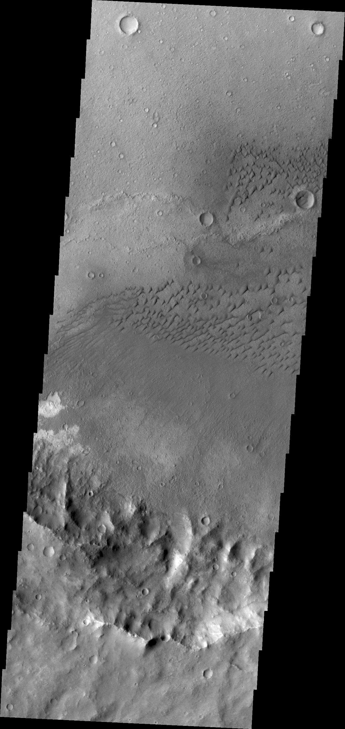
-
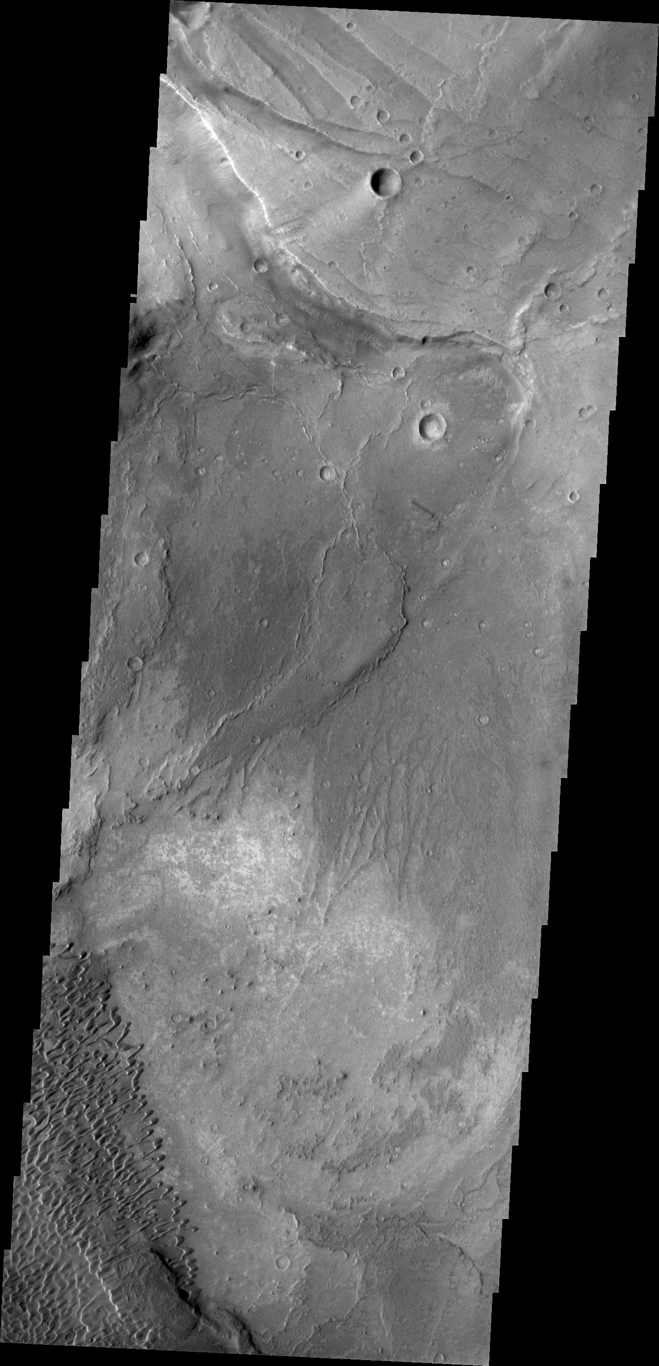
PIA13618:
-
Channel in Terra Cimmeria
Full Resolution:
TIFF
(3.694 MB)
JPEG
(258.2 kB)
|
|
|
2010-11-16 |
Mars
|
Mars Reconnaissance Orbiter (MRO)
|
HiRISE
|
2560x1920x3 |
|
-
PIA13613:
-
Proctor Crater Dune Field
Full Resolution:
TIFF
(14.76 MB)
JPEG
(685.5 kB)
|
|
|
2010-11-17 |
Mars
|
2001 Mars Odyssey
|
THEMIS
|
1354x2769x1 |

|
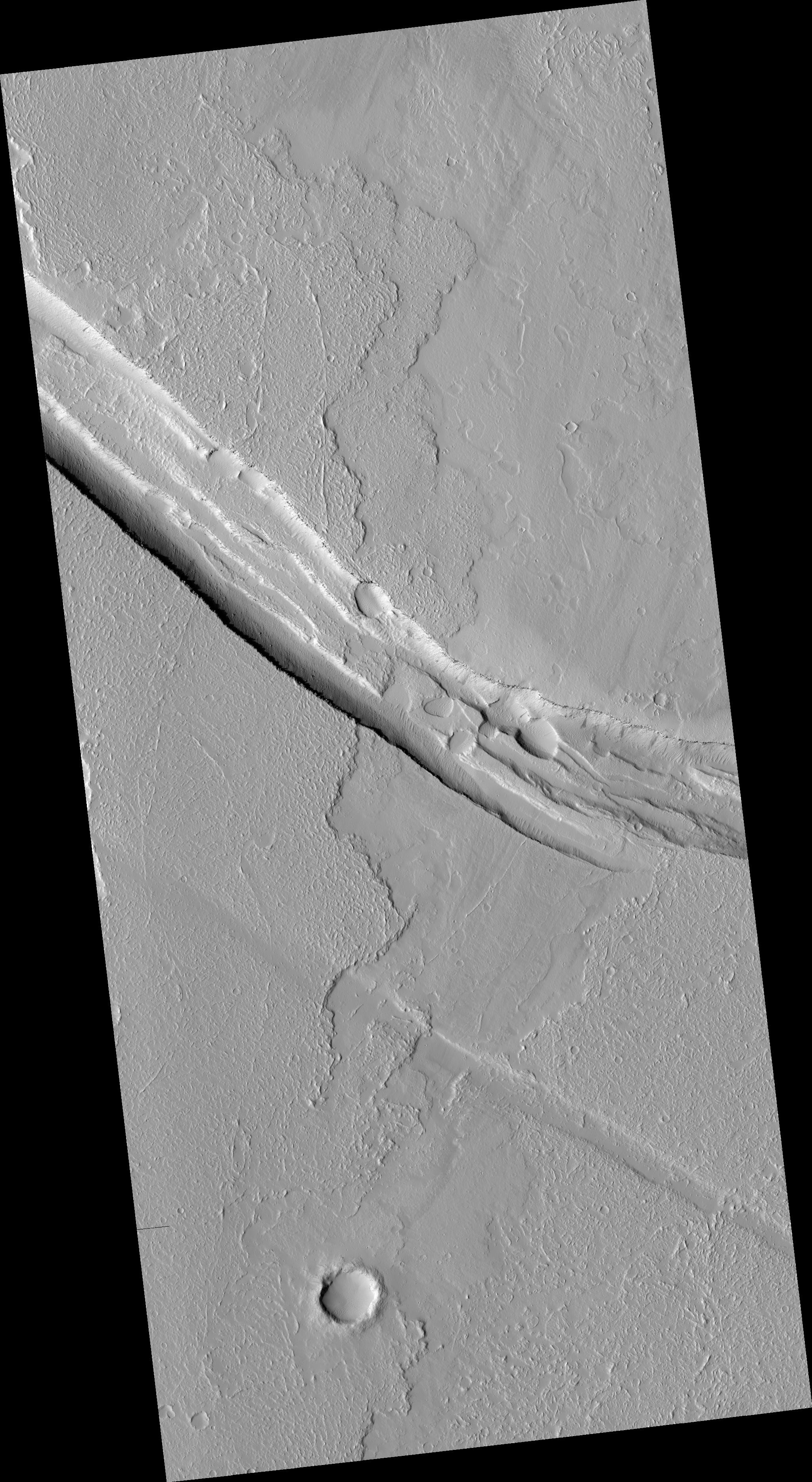
-
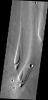
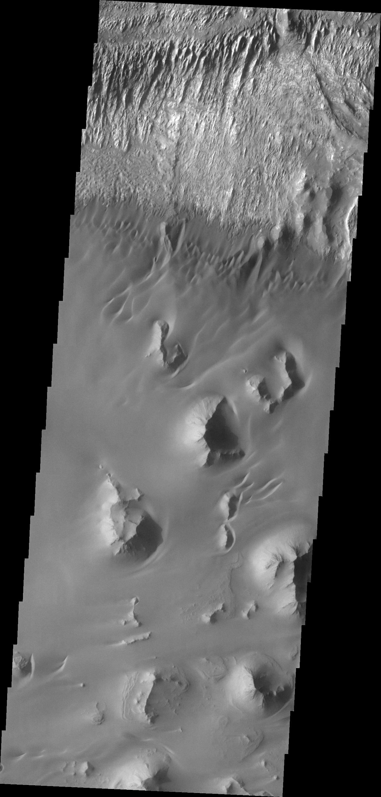
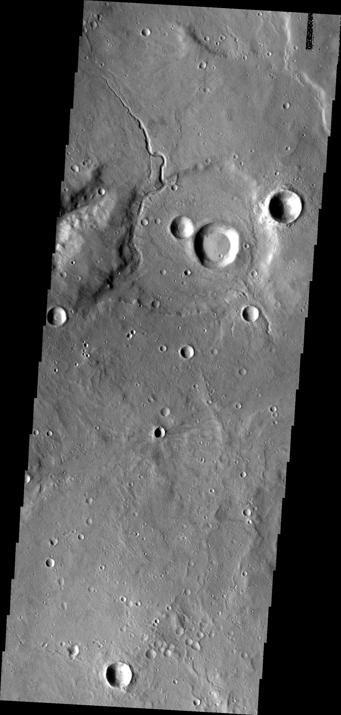
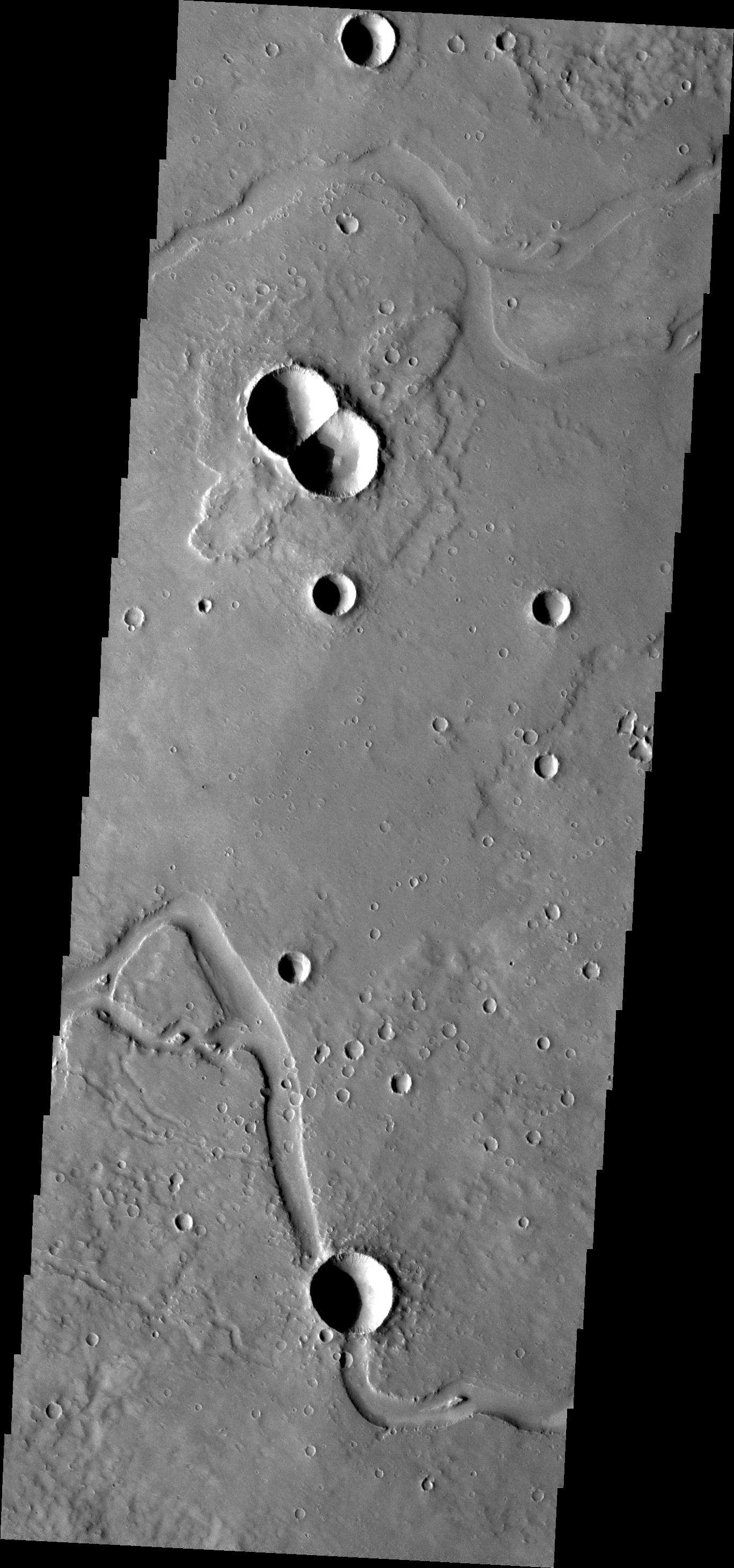
PIA13630:
-
Kasei Valles
Full Resolution:
TIFF
(3.753 MB)
JPEG
(265.9 kB)
|
|
|
2010-11-17 |
Mars
|
Mars Reconnaissance Orbiter (MRO)
|
HiRISE
|
2560x1920x3 |
|
-
PIA13614:
-
Curvilinear Ridge in Terra Meridiani
Full Resolution:
TIFF
(14.76 MB)
JPEG
(708.1 kB)
|
|
|
2010-11-18 |
Mars
|
2001 Mars Odyssey
|
THEMIS
|
1338x2769x1 |
|
-
PIA13631:
-
Maja Valles
Full Resolution:
TIFF
(3.709 MB)
JPEG
(375.7 kB)
|
|
|
2010-11-18 |
Mars
|
2001 Mars Odyssey
|
THEMIS
|
1356x2769x1 |

|
-
PIA13633:
-
Wind and Rock
Full Resolution:
TIFF
(3.759 MB)
JPEG
(386 kB)
|
|
|
2010-11-18 |
Mars
|
Mars Exploration Rover (MER)
|
Panoramic Camera
|
7010x1061x3 |
|
-
PIA13593:
'Intrepid' Crater on Mars (Color)
Full Resolution:
TIFF
(22.31 MB)
JPEG
(538.9 kB)
|
|
|
2010-11-18 |
Mars
|
Mars Exploration Rover (MER)
|
Panoramic Camera
|
7010x1061x3 |
|
-
PIA13594:
'Intrepid' Crater on Mars (False Color)
Full Resolution:
TIFF
(22.31 MB)
JPEG
(834 kB)
|
|
|
2010-11-18 |
Mars
|
Mars Exploration Rover (MER)
|
Panoramic Camera
|
6876x1055x3 |
|
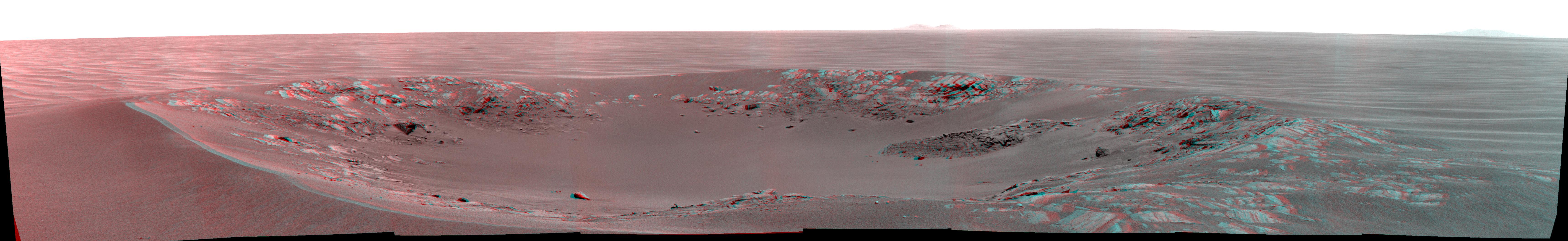
-
PIA13595:
'Intrepid' Crater on Mars (Stereo)
Full Resolution:
TIFF
(21.76 MB)
JPEG
(873.7 kB)
|
|
|
2010-11-18 |
Mars
|
Mars Exploration Rover (MER)
|
Navigation Camera
|
2777x1055x1 |

|
-
PIA13596:
-
'Yankee Clipper' Crater on Mars
Full Resolution:
TIFF
(2.934 MB)
JPEG
(180.2 kB)
|
|
|
2010-11-18 |
Mars
|
Mars Exploration Rover (MER)
|
Navigation Camera
|
2777x1055x3 |
|
-
PIA13597:
-
'Yankee Clipper' Crater on Mars (Stereo)
Full Resolution:
TIFF
(8.789 MB)
JPEG
(184.1 kB)
|
|
|
2010-11-19 |
Mars
|
2001 Mars Odyssey
|
THEMIS
|
1364x2769x1 |

|
-
PIA13635:
-
Kasei Valles
Full Resolution:
TIFF
(3.781 MB)
JPEG
(340.3 kB)
|
|
|
2010-11-22 |
Mars
|
2001 Mars Odyssey
|
THEMIS
|
1347x2922x1 |
|
-
PIA13636:
-
Zephyria Planum
Full Resolution:
TIFF
(3.94 MB)
JPEG
(531 kB)
|
|
|
2010-11-24 |
Mars
|
2001 Mars Odyssey
|
THEMIS
|
1327x2776x1 |
|
-
PIA13637:
-
Ganges Chasma
Full Resolution:
TIFF
(3.688 MB)
JPEG
(333.9 kB)
|
|
|
2010-11-25 |
Mars
|
2001 Mars Odyssey
|
THEMIS
|
1341x2927x1 |
|
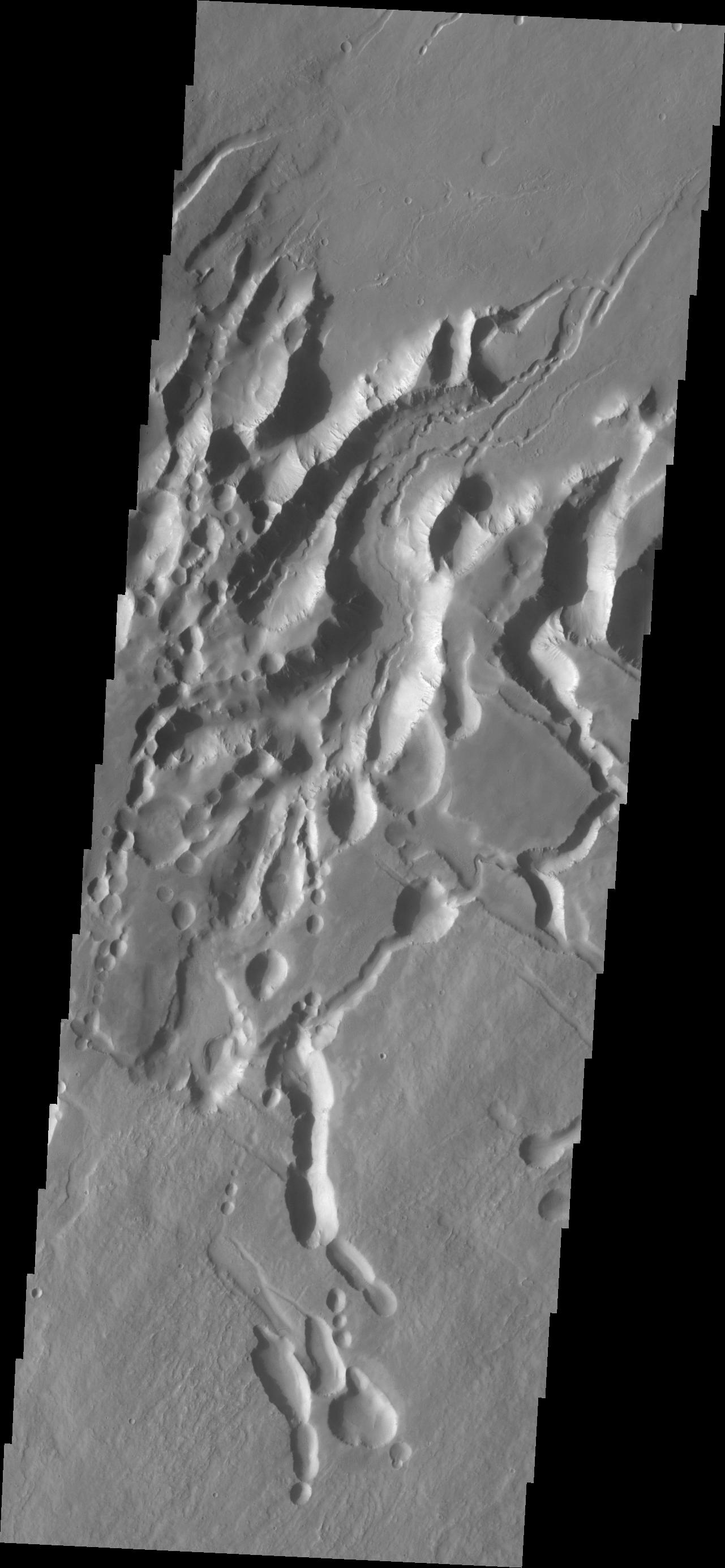
-
PIA13639:
-
Melas Chasma Landslides
Full Resolution:
TIFF
(3.929 MB)
JPEG
(365.9 kB)
|
|
|
2010-11-26 |
Mars
|
2001 Mars Odyssey
|
THEMIS
|
1382x2919x1 |
|
-
PIA13641:
-
Gullies in Tempe Terra
Full Resolution:
TIFF
(4.039 MB)
JPEG
(268.8 kB)
|
|
|
2010-11-27 |
Mars
|
2001 Mars Odyssey
|
THEMIS
|
1337x2769x1 |

|
-
PIA13643:
-
Nili Patera Dunes
Full Resolution:
TIFF
(3.706 MB)
JPEG
(394.1 kB)
|
|
|
2010-11-29 |
Mars
|
2001 Mars Odyssey
|
THEMIS
|
1339x2769x1 |

|
-
PIA13645:
-
Nanedi Valles
Full Resolution:
TIFF
(3.712 MB)
JPEG
(364.8 kB)
|
|
|
2010-11-30 |
Mars
|
2001 Mars Odyssey
|
THEMIS
|
1321x2931x1 |

|
-
PIA13670:
-
Solis Planum
Full Resolution:
TIFF
(3.876 MB)
JPEG
(474.9 kB)
|
|
|
2010-12-01 |
Mars
|
2001 Mars Odyssey
|
THEMIS
|
1295x2765x1 |
|
-
PIA13671:
-
Pavonis Mons
Full Resolution:
TIFF
(3.585 MB)
JPEG
(306.2 kB)
|
|
|
2010-12-01 |
Mars
|
Mars Reconnaissance Orbiter (MRO)
|
HiRISE
|
2048x3086x1 |

|
-
PIA13650:
-
Dark Rimless Pits in the Tharsis Region
Full Resolution:
TIFF
(6.327 MB)
JPEG
(508.2 kB)
|
|
|
2010-12-01 |
Mars
|
Mars Reconnaissance Orbiter (MRO)
|
HiRISE
|
2048x3737x1 |

|
-
PIA13651:
-
Graben Cutting Lava Flow in Tharsis
Full Resolution:
TIFF
(7.661 MB)
JPEG
(938.6 kB)
|
|
|
2010-12-01 |
Mars
|
Mars Reconnaissance Orbiter (MRO)
|
HiRISE
|
2048x3145x1 |

|
-
PIA13652:
-
Proposed Future Mars Landing Site: Acidalia Planitia Mud Volcanoes
Full Resolution:
TIFF
(6.447 MB)
JPEG
(1.617 MB)
|
|
|
2010-12-03 |
Mars
|
2001 Mars Odyssey
|
THEMIS
|
1395x2921x1 |
|
-
PIA13672:
-
Channel in Arabia Terra
Full Resolution:
TIFF
(4.08 MB)
JPEG
(451.9 kB)
|
|
|
2010-12-04 |
Mars
|
2001 Mars Odyssey
|
THEMIS
|
1391x2922x1 |
|
-
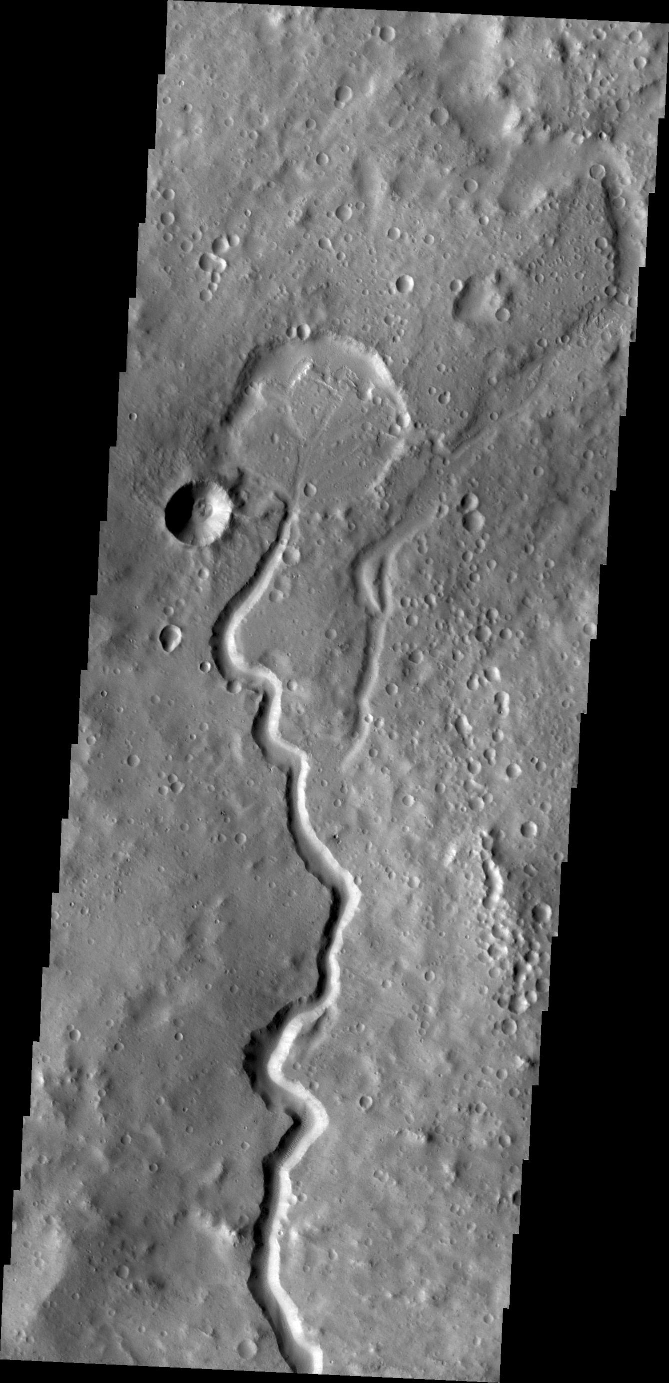
PIA13673:
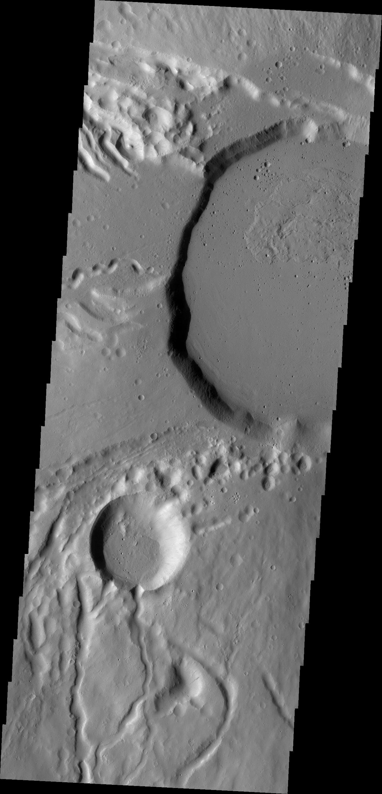
-
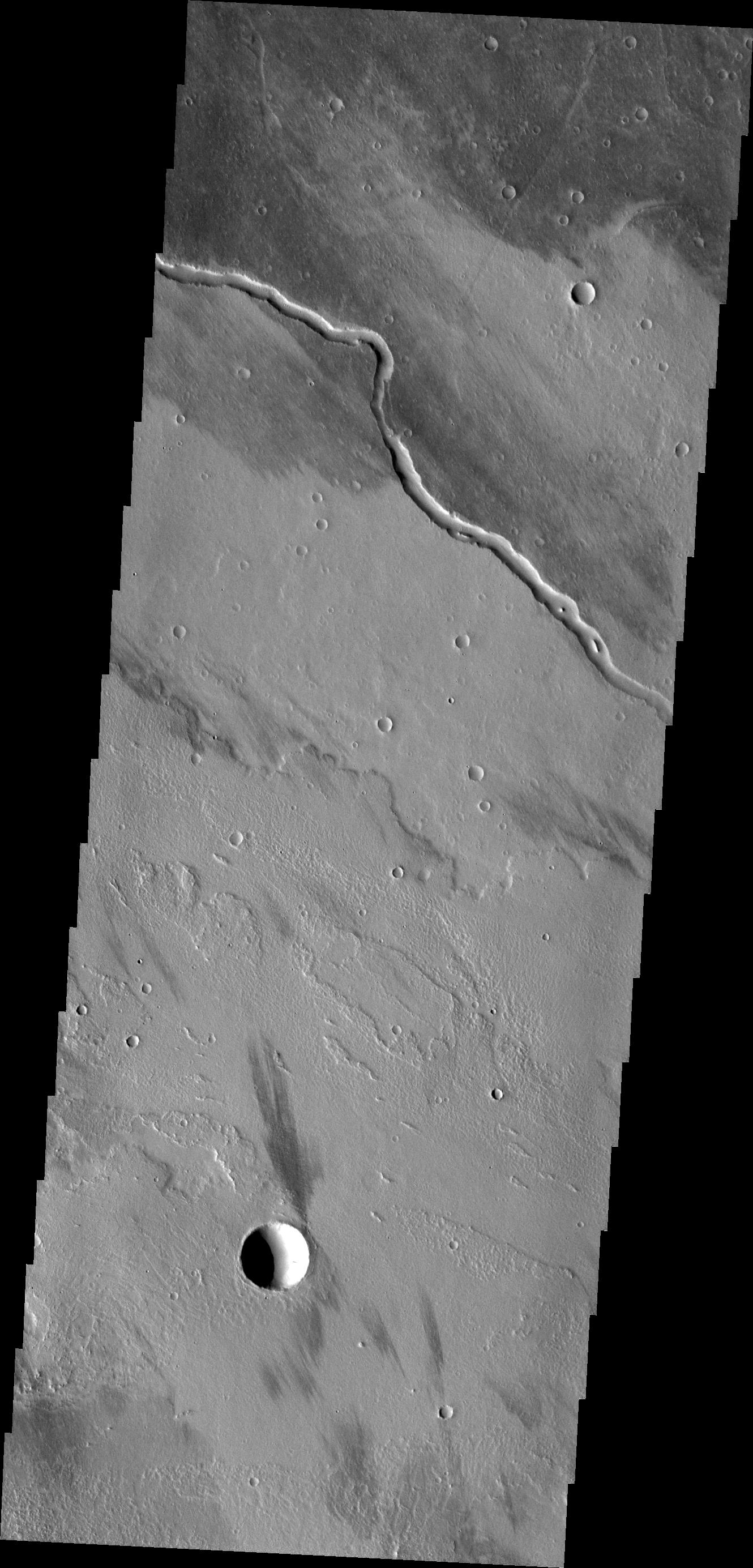
Unusual Channel
Full Resolution:
TIFF
(4.069 MB)
JPEG
(384.7 kB)
|
|
|
2010-12-06 |
Mars
|
2001 Mars Odyssey
|
THEMIS
|
1341x2768x1 |
|
-
PIA13527:
-
Elysium Planitia
Full Resolution:
TIFF
(3.716 MB)
JPEG
(565.1 kB)
|
|
|
2010-12-07 |
Mars
|
2001 Mars Odyssey
|
THEMIS
|
1346x2769x1 |
|
-
PIA13692:
-
Cyane Sulci
Full Resolution:
TIFF
(3.731 MB)
JPEG
(222.9 kB)
|
|
|
2010-12-08 |
Mars
|
2001 Mars Odyssey
|
THEMIS
|
1322x2776x1 |
|
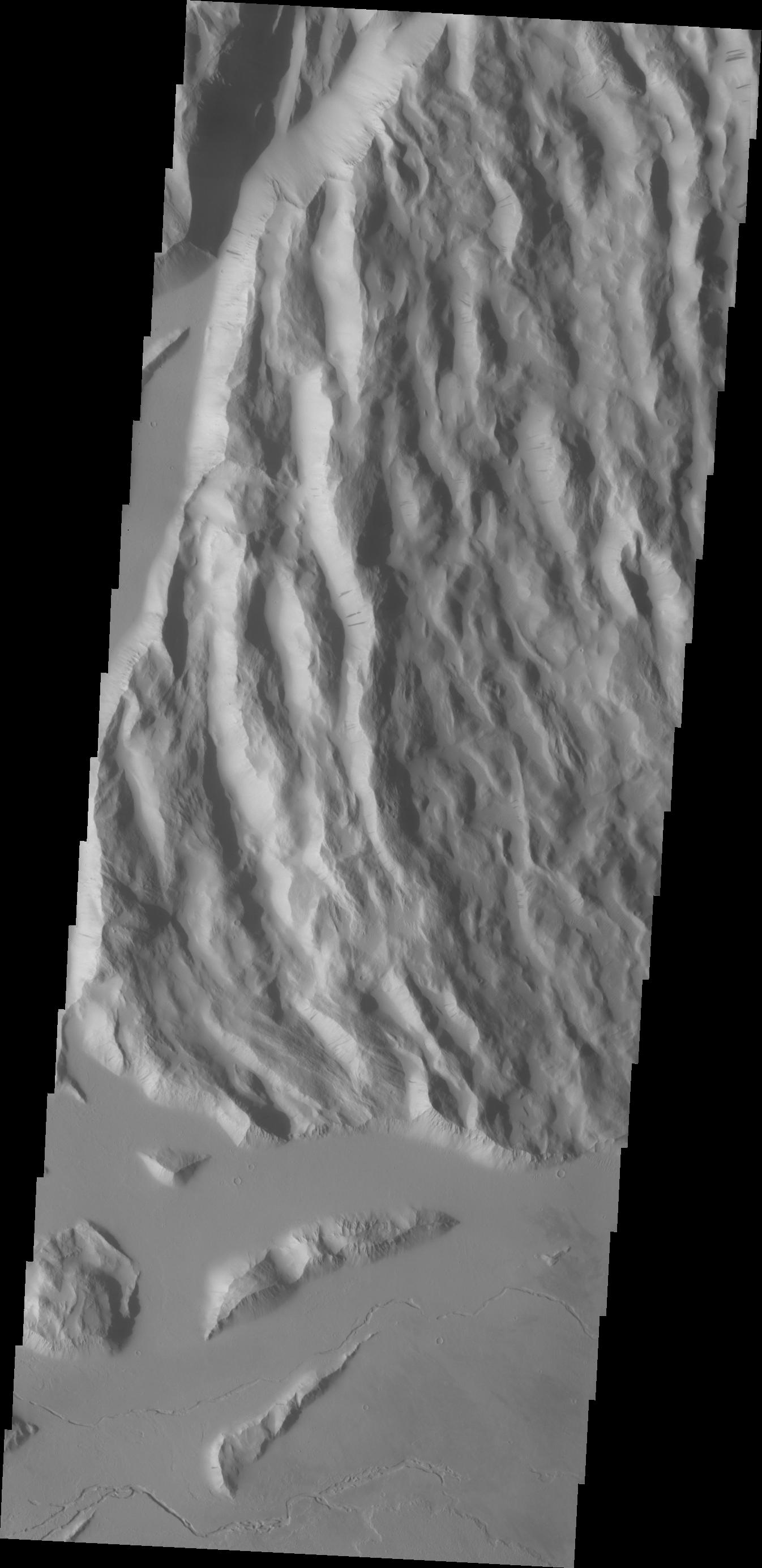
-
PIA13693:
-
Tithonium Chasma
Full Resolution:
TIFF
(3.674 MB)
JPEG
(189 kB)
|
|
|
2010-12-09 |
Mars
|
2001 Mars Odyssey
|
THEMIS
|
1281x2770x1 |

|
-
PIA13499:
-
Arsia Chasmata
Full Resolution:
TIFF
(3.552 MB)
JPEG
(240.4 kB)
|
|
|
2010-12-09 |
Mars
|
2001 Mars Odyssey
|
THEMIS
|
2652x2824x3 |
|
-
PIA13653:
-
Mars Odyssey All Stars: Ares Vallis
Full Resolution:
TIFF
(22.49 MB)
JPEG
(2.123 MB)
|
|
|
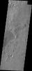
2010-12-09 |
Mars
|
2001 Mars Odyssey
|
THEMIS
|
738x1146x1 |
|
-
PIA13654:
-
Mars Odyssey All Stars: Bunge Crater Dunes
Full Resolution:
TIFF
(846.8 kB)
JPEG
(249.2 kB)
|
|
|
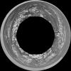
2010-12-09 |
Mars
|
2001 Mars Odyssey
|
THEMIS
|
10402x3606x3 |

|
-
PIA13655:
-
Mars Odyssey All Stars: Noctis Vista
Full Resolution:
TIFF
(112.5 MB)
JPEG
(2.541 MB)
|
|
|
2010-12-09 |
Mars
|
2001 Mars Odyssey
|
THEMIS
|
1635x2300x3 |
|
-
PIA13656:
-
Mars Odyssey All Stars: Noctis Canyon
Full Resolution:
TIFF
(11.3 MB)
JPEG
(731 kB)
|
|
|
2010-12-09 |
Mars
|
2001 Mars Odyssey
|
THEMIS
|
1653x2360x3 |
|
-
PIA13657:
-
Mars Odyssey All Stars: Udzha Crater
Full Resolution:
TIFF
(11.72 MB)
JPEG
(636.2 kB)
|
|
|
2010-12-09 |
Mars
|
2001 Mars Odyssey
|
THEMIS
|
2092x1907x3 |
|
-
PIA13658:
-
Mars Odyssey All Stars: Arabia Dunes
Full Resolution:
TIFF
(11.98 MB)
JPEG
(1.352 MB)
|
|
|
2010-12-09 |
Mars
|
2001 Mars Odyssey
|
THEMIS
|
4000x2000x3 |
|
-
PIA13659:
-
Mars Odyssey All Stars: Chasma Boreale
Full Resolution:
TIFF
(24 MB)
JPEG
(654.4 kB)
|
|
|
2010-12-09 |
Mars
|
2001 Mars Odyssey
|
THEMIS
|
708x1105x1 |

|
-
PIA13660:
-
Mars Odyssey All Stars: Dual Crater
Full Resolution:
TIFF
(783.4 kB)
JPEG
(271.5 kB)
|
|
|
2010-12-09 |
Mars
|
2001 Mars Odyssey
|
THEMIS
|
1071x870x1 |
|
-
PIA13661:
-
Mars Odyssey All Stars: Dunes Engulf Crater
Full Resolution:
TIFF
(933 kB)
JPEG
(258.2 kB)
|
|
|
2010-12-09 |
Mars
|
2001 Mars Odyssey
|
THEMIS
|
1729x2583x3 |
|
-
PIA13662:
-
Mars Odyssey All Stars: Polar Dunes
Full Resolution:
TIFF
(13.42 MB)
JPEG
(960.7 kB)
|
|
|
2010-12-09 |
Mars
|
2001 Mars Odyssey
|
THEMIS
|
557x1443x1 |

|
-
PIA13663:
-
Mars Odyssey All Stars: Reptilian Dunes
Full Resolution:
TIFF
(804.8 kB)
JPEG
(119 kB)
|
|
|
2010-12-09 |
Mars
|
2001 Mars Odyssey
|
THEMIS
|
3430x4348x3 |
|
-
PIA13664:
-
Mars Odyssey All Stars: Bacolor Crater
Full Resolution:
TIFF
(44.74 MB)
JPEG
(4.379 MB)
|
|
|
2010-12-09 |
Mars
|
2001 Mars Odyssey
|
THEMIS
|
3154x2023x1 |

|
-
PIA13665:
-
Mars Odyssey All Stars: Cerberus Crack
Full Resolution:
TIFF
(6.389 MB)
JPEG
(1.383 MB)
|
|
|
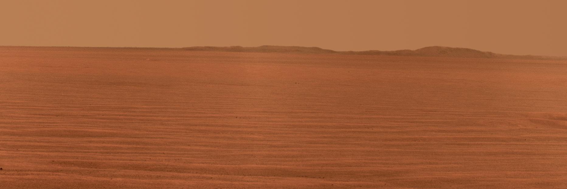
2010-12-10 |
Mars
|
Mars Exploration Rover (MER)
|
CTX
HiRISE
|
3038x6485x1 |
|
-
PIA13598:
-
Opportunity's Martian Traverse Through Sol 2442
Full Resolution:
TIFF
(19.73 MB)
JPEG
(1.488 MB)
|
|
|
2010-12-10 |
Mars
|
2001 Mars Odyssey
|
THEMIS
|
1315x2778x1 |
|
-
PIA13702:
-
Terra Cimmeria Dunes
Full Resolution:
TIFF
(3.657 MB)
JPEG
(389.3 kB)
|
|
|
2010-12-13 |
Mars
|
2001 Mars Odyssey
|
THEMIS
|
1333x2768x1 |
|
-
PIA13711:
-
Triple Tails of Windstreaks
Full Resolution:
TIFF
(3.694 MB)
JPEG
(320.9 kB)
|
|
|
2010-12-15 |
Mars
|
2001 Mars Odyssey
|
THEMIS
|
1353x2920x1 |
|
-
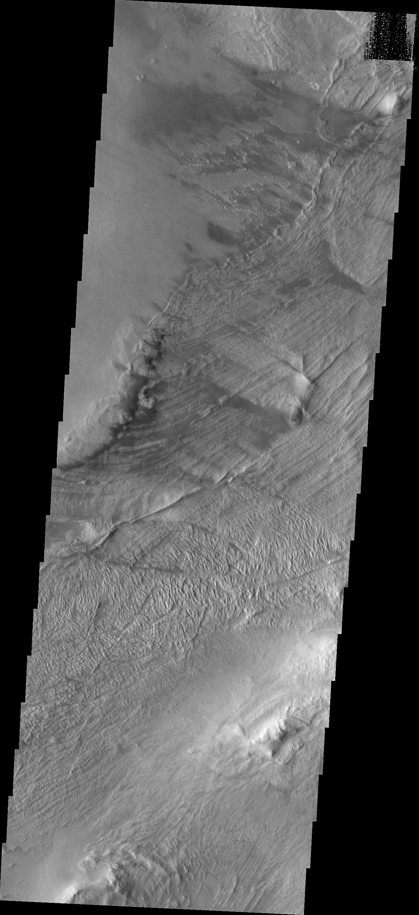
PIA13712:
-
Ceraunius Fossae
Full Resolution:
TIFF
(3.955 MB)
JPEG
(395.2 kB)
|
|
|
2010-12-15 |
Mars
|
2001 Mars Odyssey
|
THEMIS
|
1336x2770x1 |
|
-
PIA13713:
-
Olympus Mons
Full Resolution:
TIFF
(3.705 MB)
JPEG
(259.6 kB)
|
|
|
2010-12-16 |
Mars
|
Mars Exploration Rover (MER)
|
Panoramic Camera
|
1865x622x3 |
|
-
PIA13666:
-
East Rim of Endeavour Crater in Opportunity's View, Sol 2407 (False Color)
Full Resolution:
TIFF
(3.485 MB)
JPEG
(208.2 kB)
|
|
|
2010-12-16 |
Mars
|
Mars Exploration Rover (MER)
|
Panoramic Camera
|
1865x622x3 |
|
-
PIA13667:
-
East Rim of Endeavour Crater in Opportunity's View, Sol 2407
Full Resolution:
TIFF
(3.485 MB)
JPEG
(98.8 kB)
|
|
|
2010-12-16 |
Mars
|
Mars Exploration Rover (MER)
|
Panoramic Camera
|
4431x268x3 |
|
-
PIA13668:
-
Rim of Endeavour on Opportunity's Horizon, Sol 2424 (False Color)
Full Resolution:
TIFF
(3.563 MB)
JPEG
(126.6 kB)
|
|
|
2010-12-16 |
Mars
|
Mars Exploration Rover (MER)
|
Panoramic Camera
|
4435x270x3 |
|
-
PIA13669:
-
Rim of Endeavour on Opportunity's Horizon, Sol 2424
Full Resolution:
TIFF
(3.593 MB)
JPEG
(83.02 kB)
|
|
|
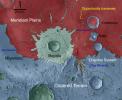
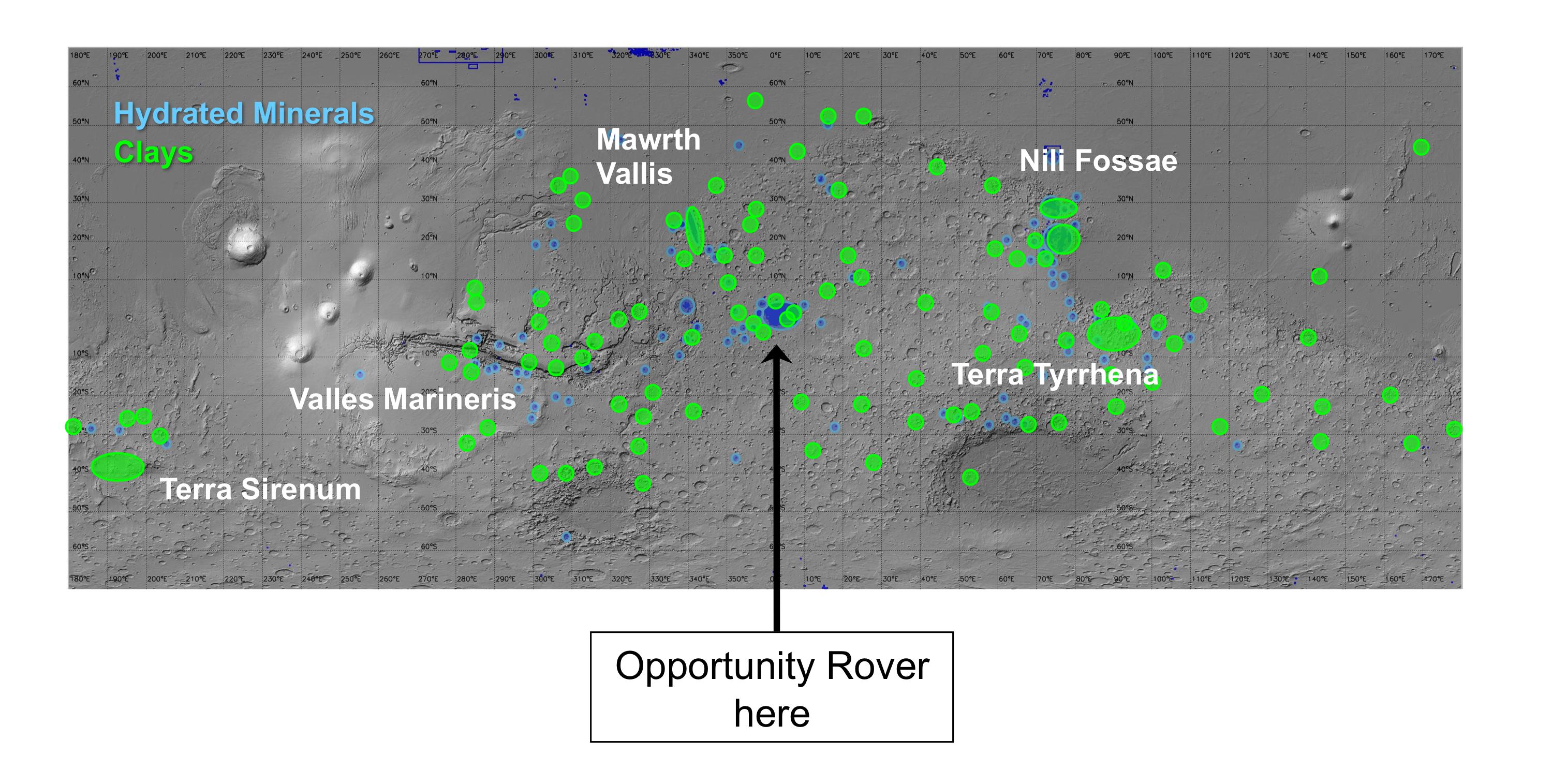
2010-12-16 |
Mars
|
Mars Express (MEX)
Mars Global Surveyor (MGS)
Mars Reconnaissance Orbiter (MRO)
|
Altimeter
CRISM
Visible and Infrared Mineralogical Mapping Spectrometer
|
2999x1515x3 |
|
-
PIA13703:
-
Regions of Mars with Clays and Hydrated Minerals Identified from Orbit
Full Resolution:
TIFF
(13.63 MB)
JPEG
(581.5 kB)
|
|
|
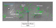
2010-12-16 |
Mars
|
Mars Reconnaissance Orbiter (MRO)
|
CRISM
|
2736x2250x3 |
|
-
PIA13704:
-
Geologic Setting of Opportunity Traverse and Meridiani Planum
Full Resolution:
TIFF
(18.47 MB)
JPEG
(486.1 kB)
|
|
|
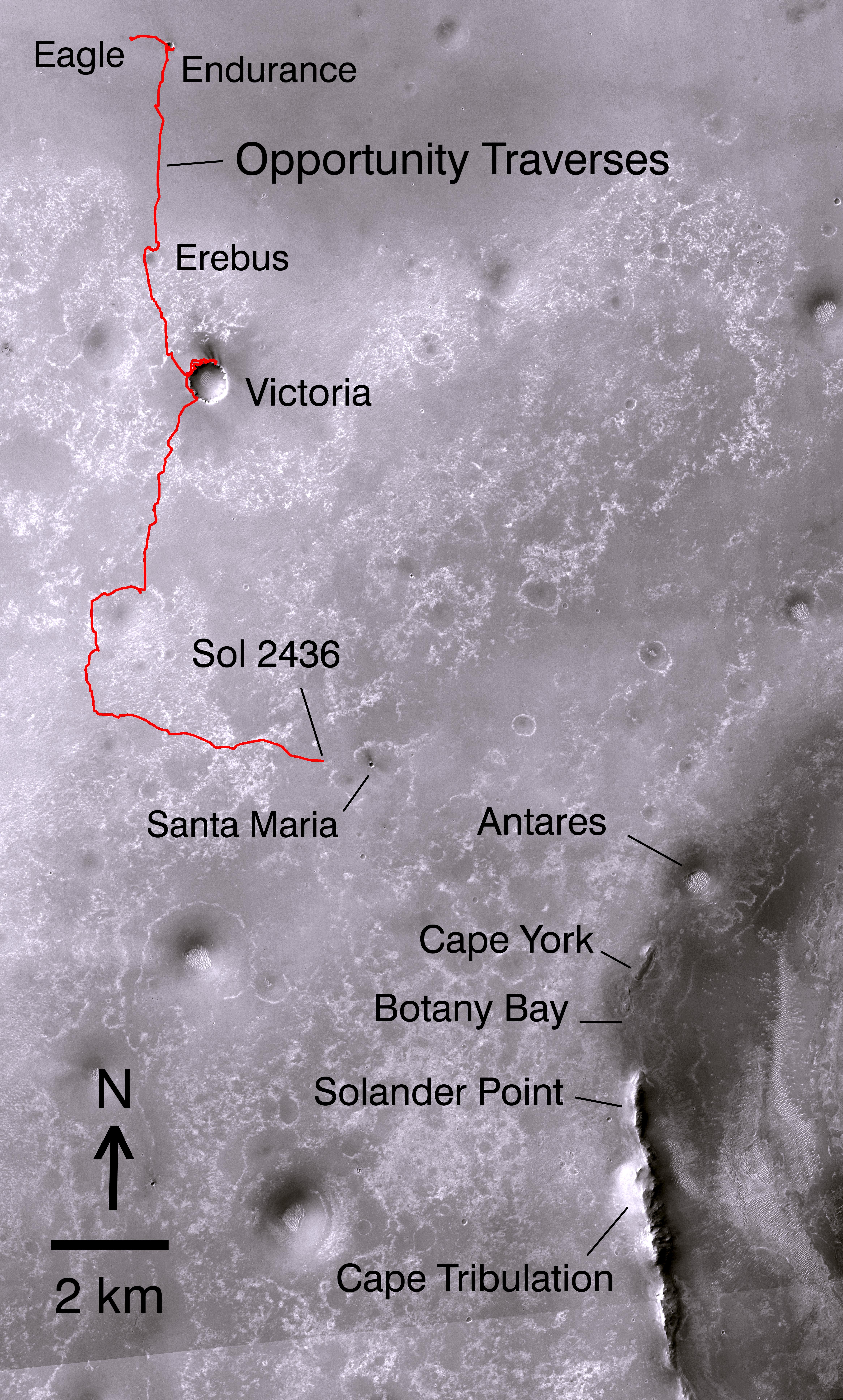
2010-12-16 |
Mars
|
Mars Reconnaissance Orbiter (MRO)
|
CTX
|
4664x7746x3 |

|
-
PIA13705:
-
Opportunity's Path on Mars Through Sol 2436
Full Resolution:
TIFF
(108.4 MB)
JPEG
(5.199 MB)
|
|
|
2010-12-16 |
Mars
|
Mars Reconnaissance Orbiter (MRO)
|
HiRISE
|
8192x7051x1 |

|
-
PIA13706:
-
Orbital Observations of Crater on Mars Rover's Route
Full Resolution:
TIFF
(57.82 MB)
JPEG
(2.181 MB)
|
|
|
2010-12-16 |
Mars
|
Mars Exploration Rover (MER)
|
Navigation Camera
|
3451x1001x1 |
|
-
PIA13707:
-
Opportunity's View of Santa Maria Crater, Sol 2450
Full Resolution:
TIFF
(3.459 MB)
JPEG
(464.5 kB)
|
|
|
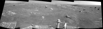
2010-12-16 |
Mars
|
Mars Reconnaissance Orbiter (MRO)
|
CRISM
|
4023x7854x3 |

|
-
PIA13708:
-
Geologic Map, West Rim of Endeavour Crater, Mars
Full Resolution:
TIFF
(94.79 MB)
JPEG
(4.431 MB)
|
|
|
2010-12-16 |
Mars
|
Mars Exploration Rover (MER)
|
Panoramic Camera
|
7892x1206x1 |
|
-
PIA13709:
-
Super-Resolution View of Cape Tribulation, Sol 2298
Full Resolution:
TIFF
(9.528 MB)
JPEG
(278.7 kB)
|
|
|
2010-12-16 |
Mars
|
2001 Mars Odyssey
|
THEMIS
|
1353x2919x1 |
|
-
PIA13721:
-
Layering
Full Resolution:
TIFF
(3.954 MB)
JPEG
(332 kB)
|
|
|
2010-12-17 |
Mars
|
Mars Reconnaissance Orbiter (MRO)
|
HiRISE
|
2560x1920x3 |
|
-
PIA13723:
-
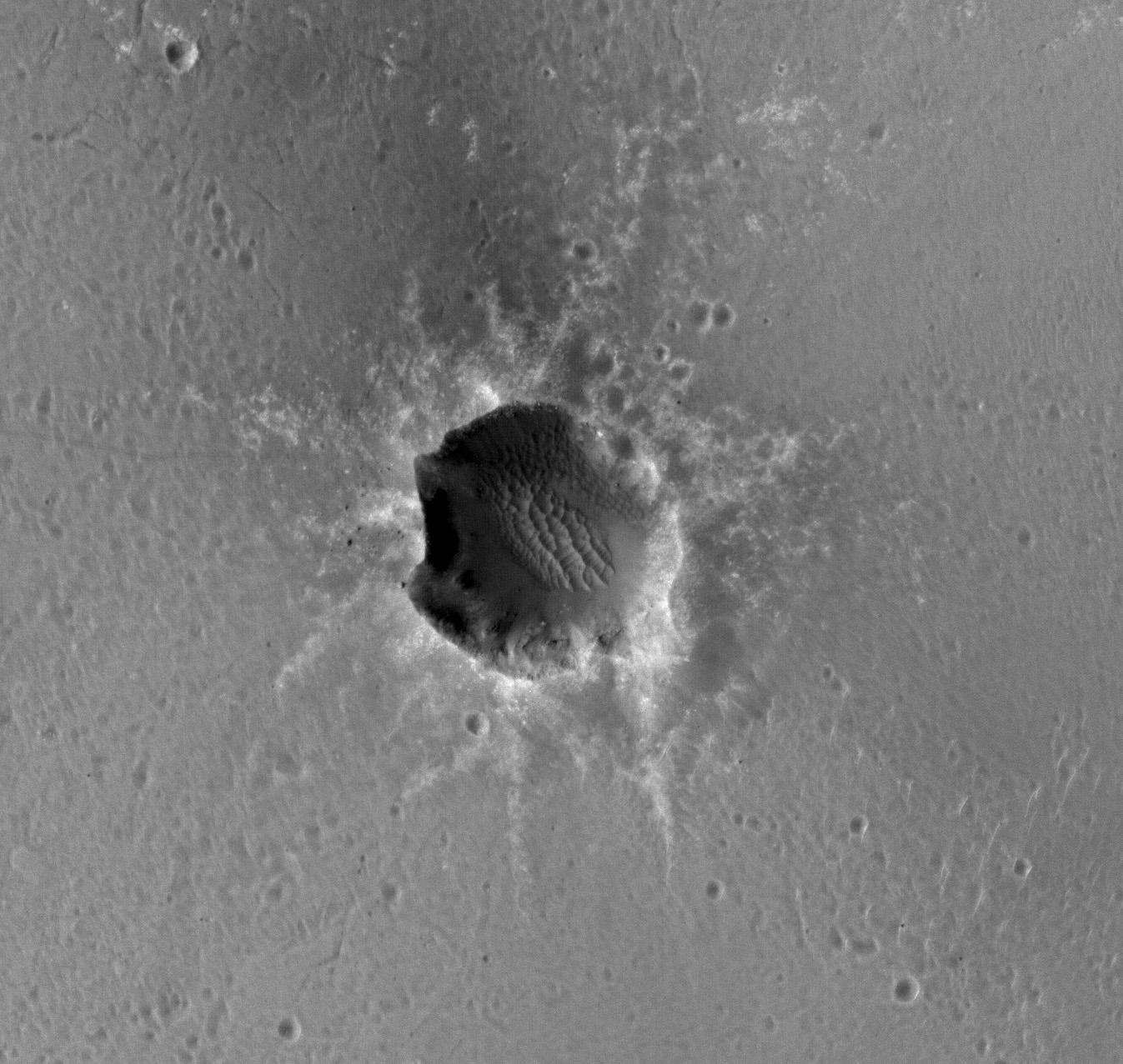
A Fresh, Lunar-Like Crater on Mars
Full Resolution:
TIFF
(14.76 MB)
JPEG
(855.5 kB)
|
|
|
2010-12-17 |
Mars
|
2001 Mars Odyssey
|
THEMIS
|
1345x2931x1 |
|
-
PIA13729:
-
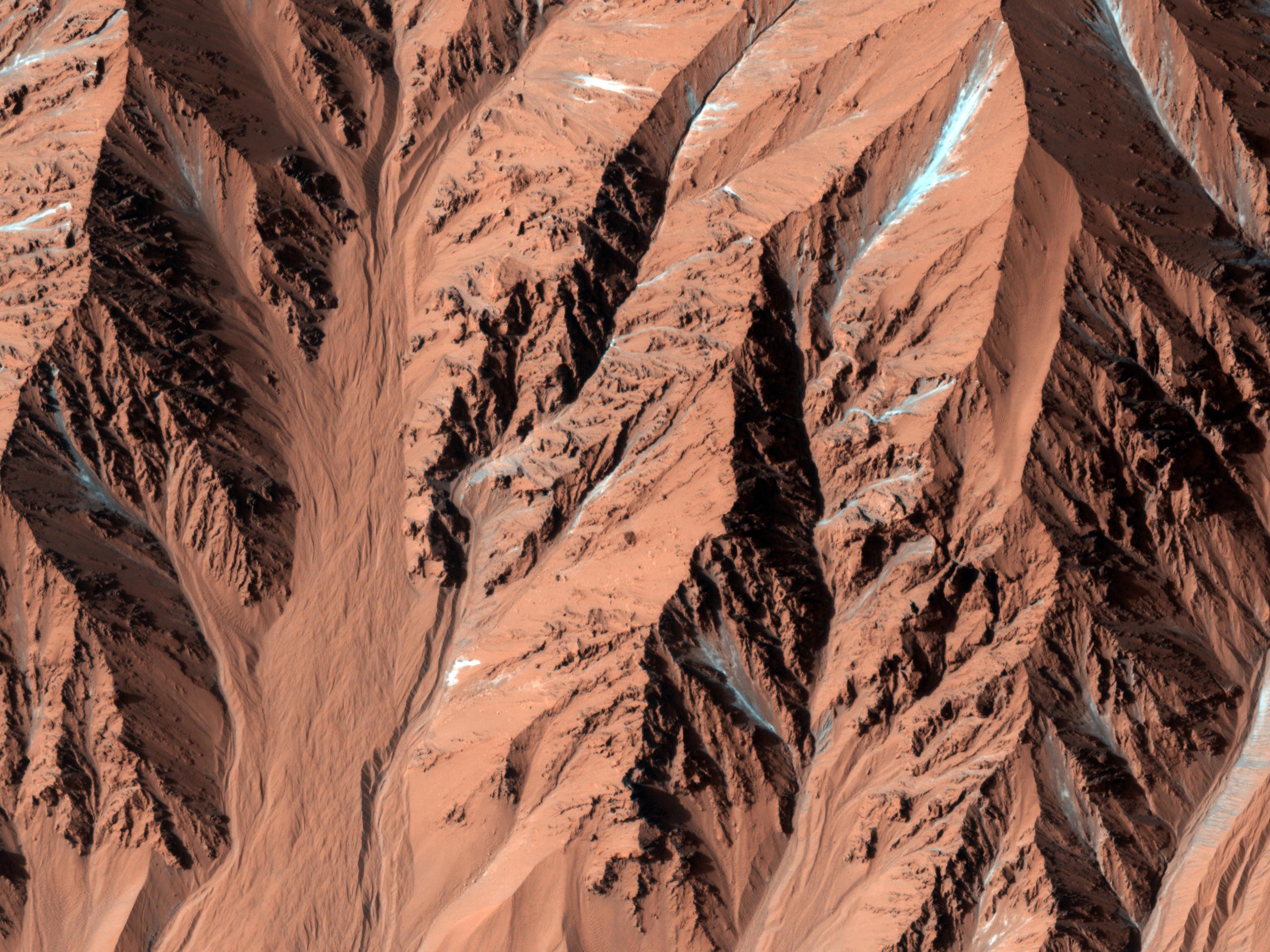
Melas Chasma Landslides
Full Resolution:
TIFF
(3.946 MB)
JPEG
(428.3 kB)
|
|
|
2010-12-17 |
Mars
|
Mars Exploration Rover (MER)
Mars Reconnaissance Orbiter (MRO)
|
CTX
|
1392x1080x3 |
|
-
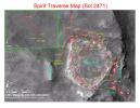
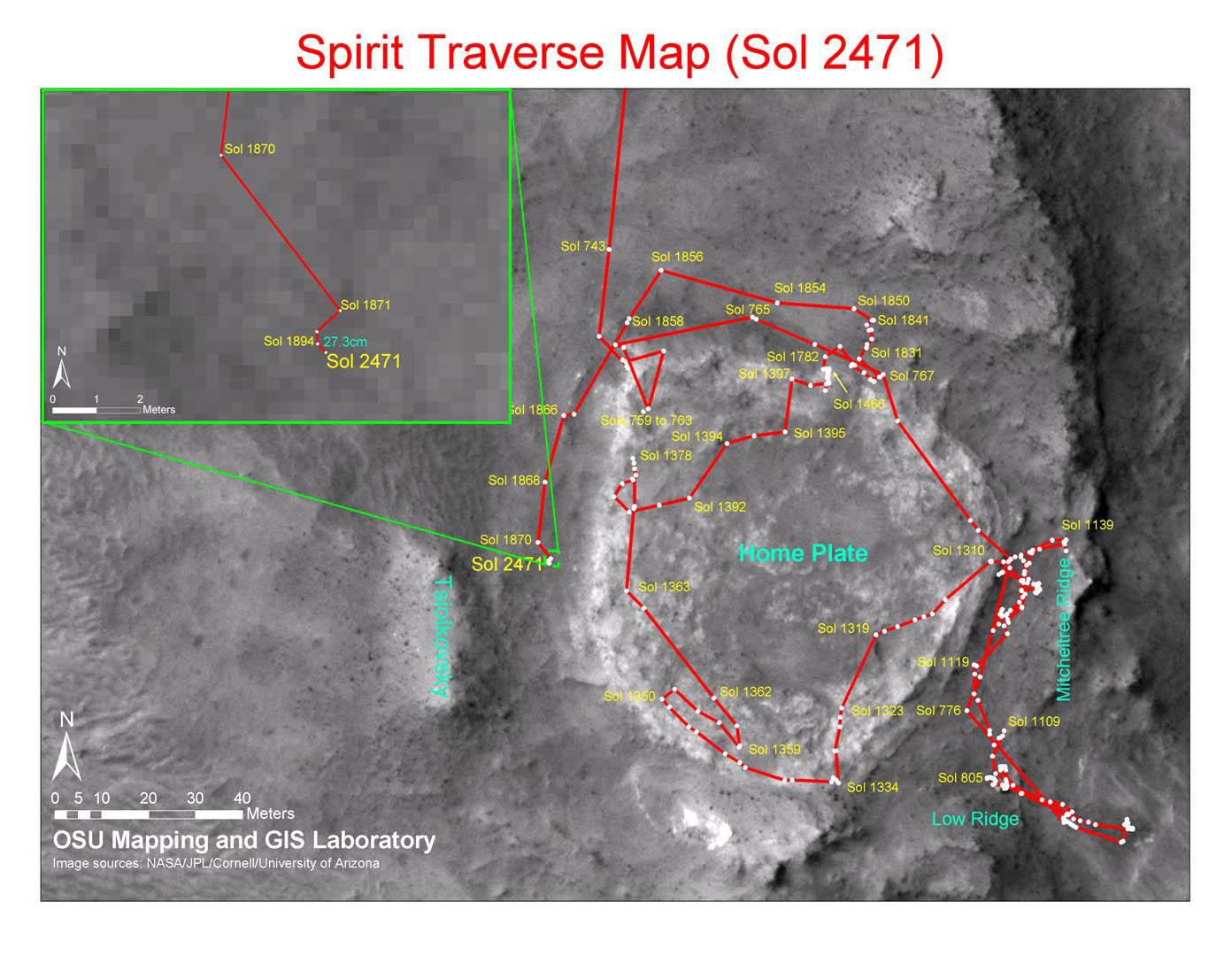
PIA13730:
-
Spirit Traverse Map, Sol 2471
Full Resolution:
TIFF
(4.519 MB)
JPEG
(176.5 kB)
|
|
|
2010-12-17 |
Mars
|
Mars Exploration Rover (MER)
Mars Reconnaissance Orbiter (MRO)
|
CTX
|
1460x1080x3 |
|
-
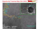
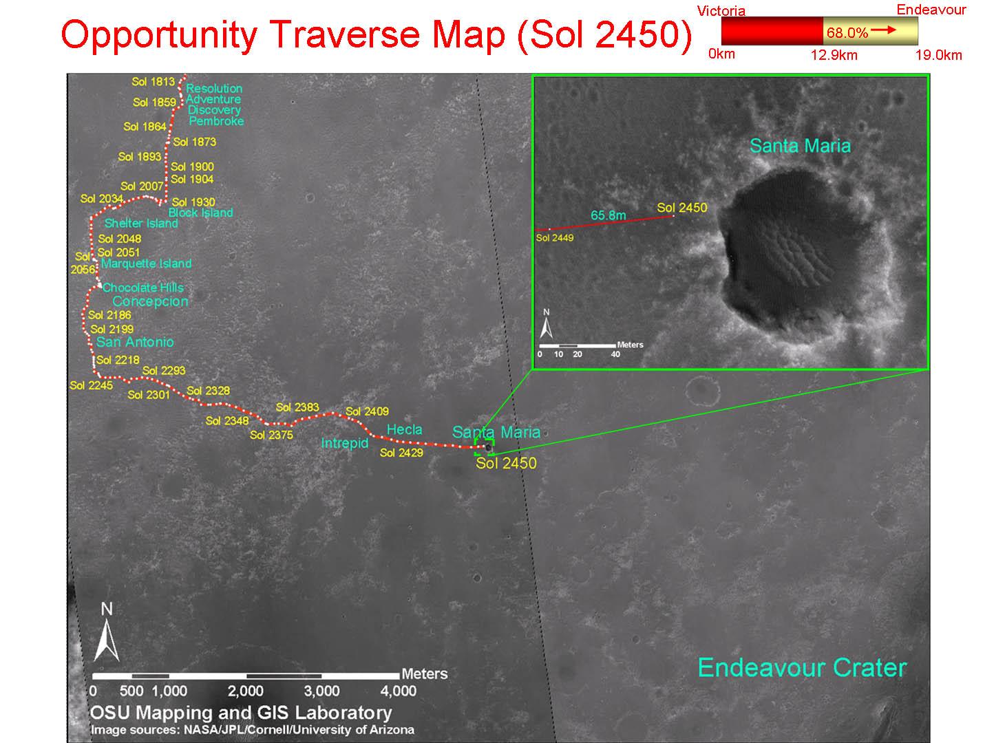
PIA13731:
-
Opportunity Traverse Map, Sol 2450
Full Resolution:
TIFF
(4.739 MB)
JPEG
(178 kB)
|
|
|
2010-12-20 |
Mars
|
Mars Reconnaissance Orbiter (MRO)
|
HiRISE
|
2560x1920x3 |

|
-
PIA13724:
-
Nili Fossae Trough, Candidate MSL Landing Site
Full Resolution:
TIFF
(14.76 MB)
JPEG
(844 kB)
|
|
|
2010-12-21 |
Mars
|
2001 Mars Odyssey
|
THEMIS
|
1347x2772x1 |
|
-
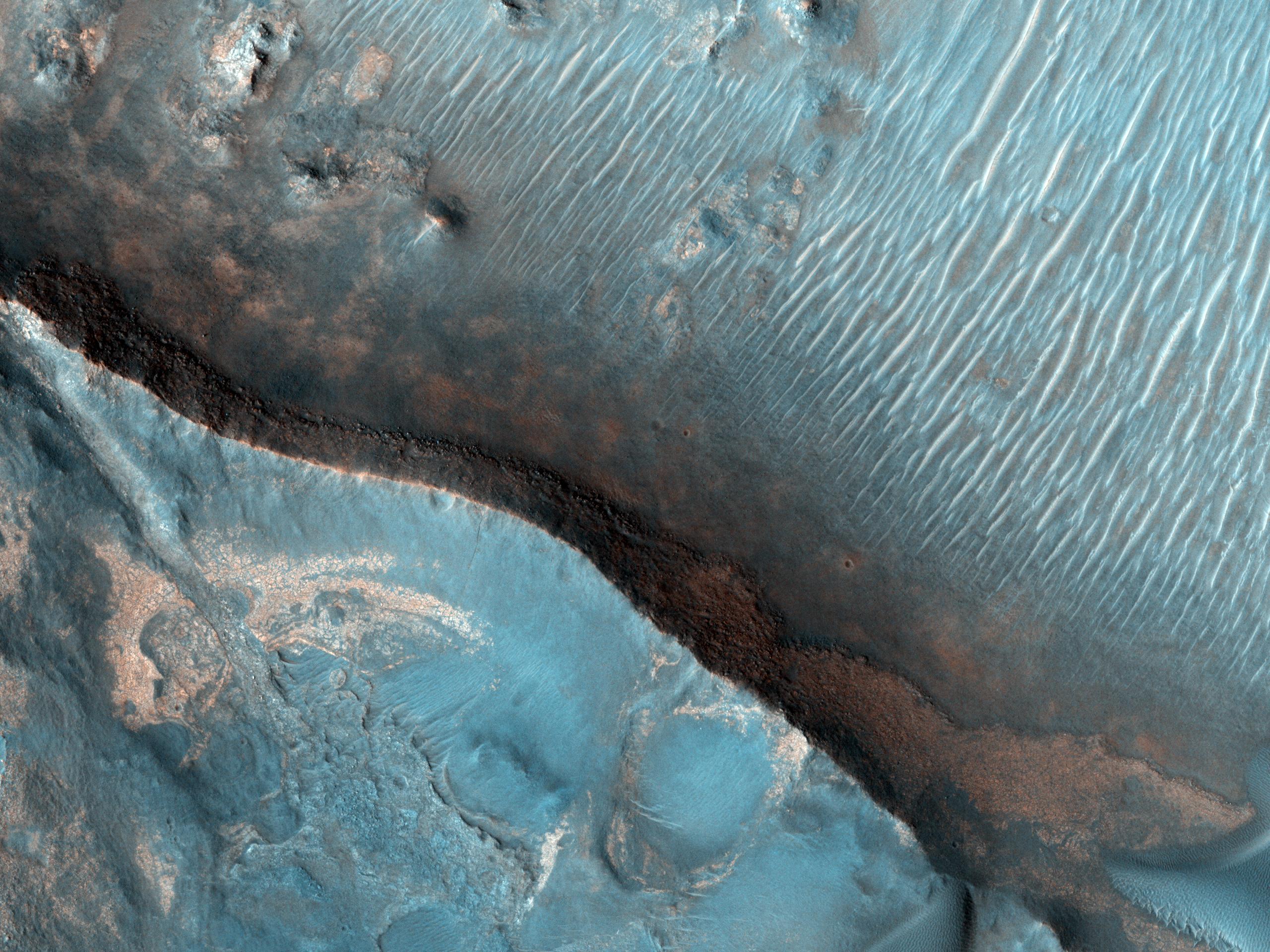
PIA13733:
-
Sand Dunes
Full Resolution:
TIFF
(3.738 MB)
JPEG
(278.3 kB)
|
|
|
2010-12-21 |
Mars
|
2001 Mars Odyssey
|
THEMIS
|
1352x2917x1 |

|
-
PIA13734:
-
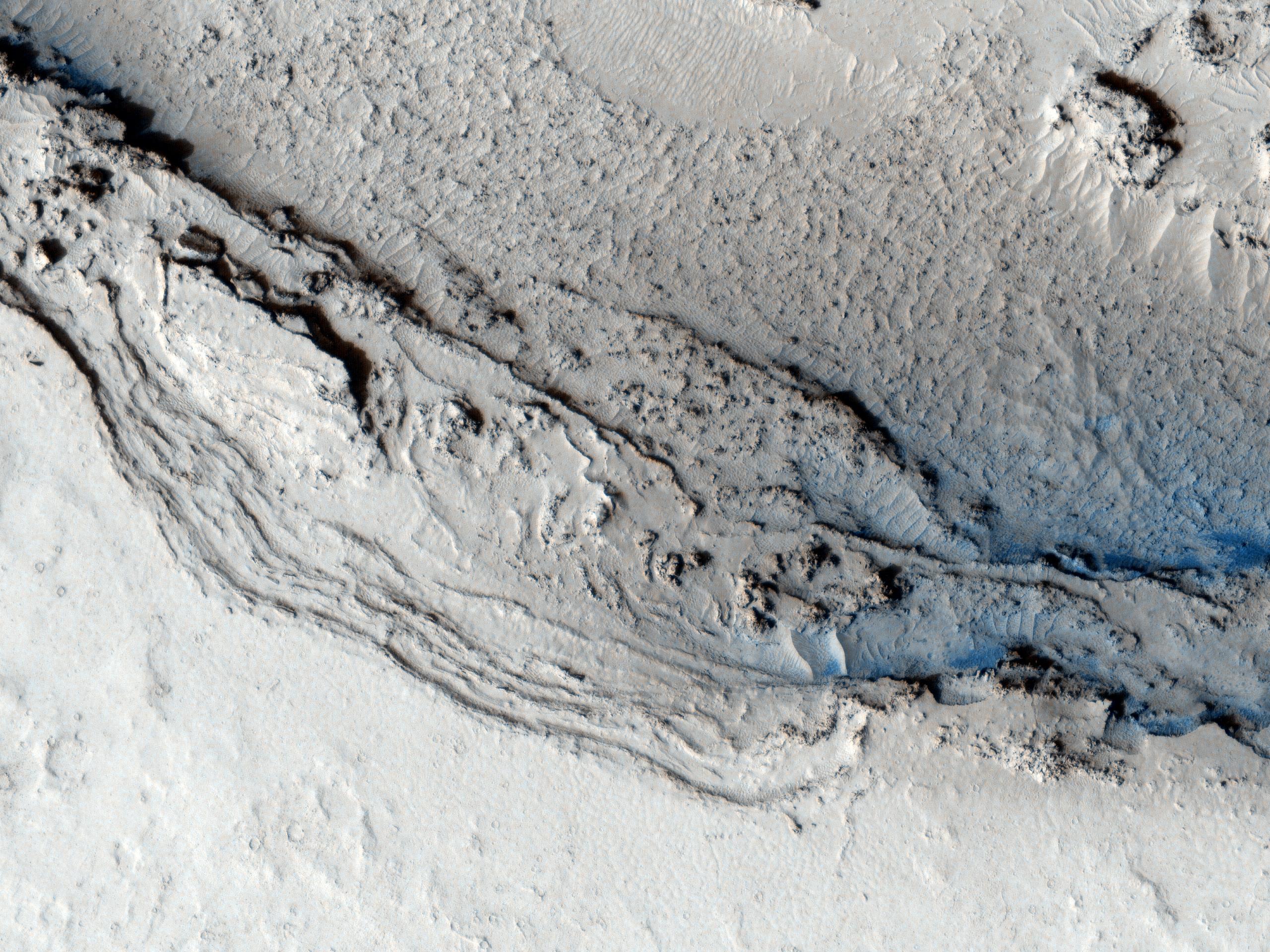
Collapse Features
Full Resolution:
TIFF
(3.948 MB)
JPEG
(306 kB)
|
|
|
2010-12-22 |
Mars
|
2001 Mars Odyssey
|
THEMIS
|
1368x2920x1 |
|
-
PIA13738:
-
Doublet Crater
Full Resolution:
TIFF
(3.999 MB)
JPEG
(390.1 kB)
|
|
|
2010-12-23 |
Mars
|
2001 Mars Odyssey
|
THEMIS
|
945x2770x1 |
|
-
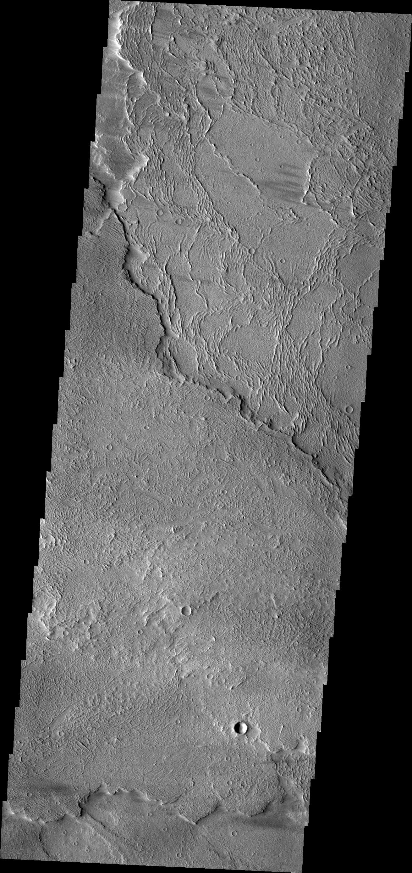
PIA13739:
-
South Polar Spots
Full Resolution:
TIFF
(2.621 MB)
JPEG
(254.4 kB)
|
|
|
2010-12-24 |
Mars
|
2001 Mars Odyssey
|
THEMIS
|
1317x2778x1 |
|
-
PIA13740:
-
Sand Dunes
Full Resolution:
TIFF
(3.663 MB)
JPEG
(376.8 kB)
|
|
|
2010-12-27 |
Mars
|
2001 Mars Odyssey
|
THEMIS
|
1311x2775x1 |
|
-
PIA13741:
-
Daedalia Planum
Full Resolution:
TIFF
(3.642 MB)
JPEG
(638.9 kB)
|
|
|
2010-12-28 |
Mars
|
Mars Exploration Rover (MER)
|
Hazcam
|
1004x1024x3 |
|
-
PIA13710:
-
Fisheye Stereo from Edge of 'Santa Maria' Crater, Sol 2459
Full Resolution:
TIFF
(3.089 MB)
JPEG
(111.5 kB)
|
|
|
2010-12-28 |
Mars
|
2001 Mars Odyssey
|
THEMIS
|
1371x2918x1 |
|
-
PIA13742:
-
Kasei Valles
Full Resolution:
TIFF
(4.005 MB)
JPEG
(261.6 kB)
|
|
|
2010-12-29 |
Mars
|
2001 Mars Odyssey
|
THEMIS
|
1359x2920x1 |
|
-
PIA13743:
-
Channels
Full Resolution:
TIFF
(3.972 MB)
JPEG
(441.1 kB)
|
|
|
2010-12-30 |
Mars
|
2001 Mars Odyssey
|
THEMIS
|
1339x2771x1 |
|
-
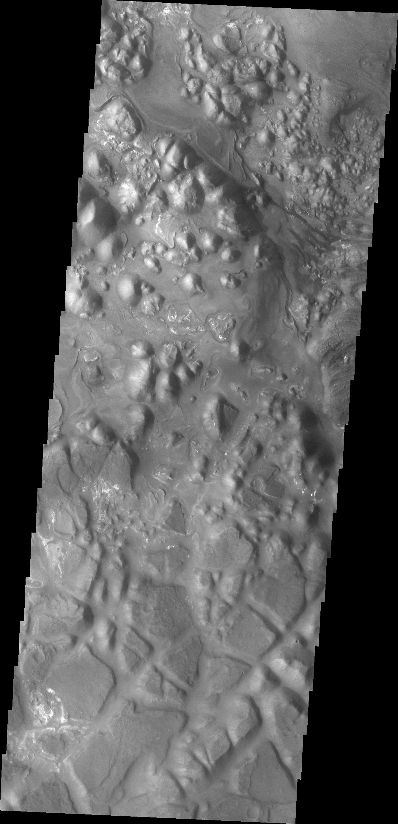
PIA13744:
-
Aram Chaos
Full Resolution:
TIFF
(3.714 MB)
JPEG
(320.8 kB)
|
|
|
2010-12-31 |
Mars
|
2001 Mars Odyssey
|
THEMIS
|
1304x2765x1 |
|
-
PIA13745:
-
Ascraeus Mons
Full Resolution:
TIFF
(3.609 MB)
JPEG
(243.8 kB)
|
|
|
2011-01-03 |
Mars
|
2001 Mars Odyssey
|
THEMIS
|
1302x2904x1 |

|
-
PIA13747:
-
Olympus Mons
Full Resolution:
TIFF
(3.785 MB)
JPEG
(373.4 kB)
|
|
|
2011-01-03 |
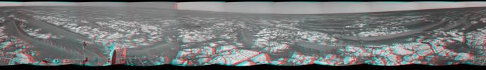
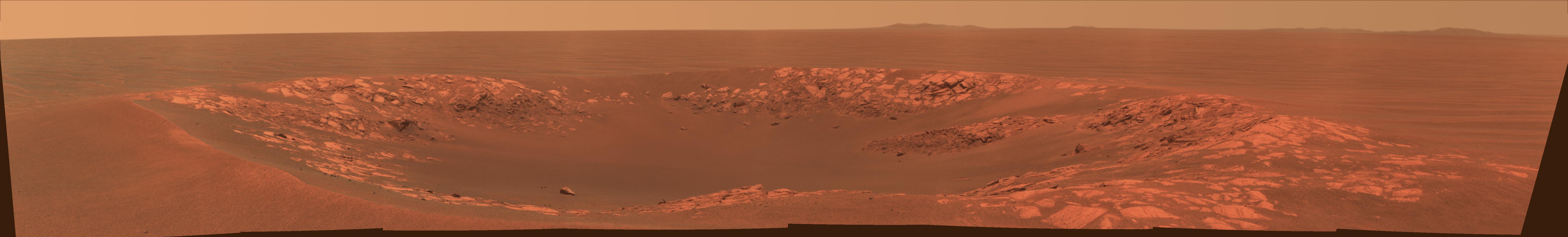
Mars
|
Mars Exploration Rover (MER)
|
Navigation Camera
|
7688x1752x1 |
|
-
PIA13750:
-
'Santa Maria' Crater in 360-Degree View, Sol 2451
Full Resolution:
TIFF
(13.48 MB)
JPEG
(1.236 MB)
|
|
|
2011-01-03 |
Mars
|
Mars Exploration Rover (MER)
|
Navigation Camera
|
7753x2243x3 |

|
-
PIA13751:
-
'Santa Maria' Crater in 360-Degree View, Sol 2451 (Stereo)
Full Resolution:
TIFF
(52.17 MB)
JPEG
(1.44 MB)
|
|
|
2011-01-03 |
Mars
|
Mars Exploration Rover (MER)
|
Navigation Camera
|
4443x4443x1 |
|
-
PIA13752:
-
'Santa Maria' Crater in 360-Degree View, Sol 2451 (Polar)
Full Resolution:
TIFF
(19.78 MB)
JPEG
(1.462 MB)
|
|
|
2011-01-03 |
Mars
|
Mars Exploration Rover (MER)
|
Navigation Camera
|
4000x4000x1 |

|
-
PIA13753:
-
'Santa Maria' Crater in 360-Degree View, Sol 2451 (Vertical)
Full Resolution:
TIFF
(16.02 MB)
JPEG
(1.289 MB)
|
|
|
2011-01-04 |
Mars
|
Mars Exploration Rover (MER)
Mars Reconnaissance Orbiter (MRO)
|
HiRISE
|
1347x1277x1 |

|
-
PIA13754:
-
Mars Orbiter Sees Rover Opportunity at Crater Edge
Full Resolution:
TIFF
(1.722 MB)
JPEG
(195 kB)
|
|
|
2011-01-04 |
Mars
|
2001 Mars Odyssey
|
THEMIS
|
1330x2769x1 |

|
-
PIA13749:
-
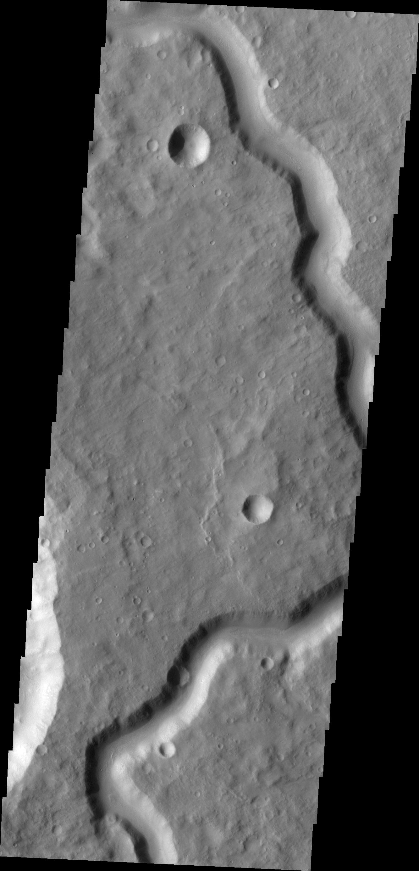
Channel
Full Resolution:
TIFF
(3.687 MB)
JPEG
(416.4 kB)
|


