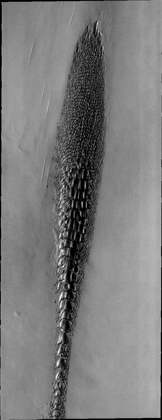
Although this may look like a hostile alien life form, it's actually a complex line of sand dunes near the northern ice cap of Mars. The image covers an area about 10 kilometers (6 miles) wide. It was taken in April 2006 by the Thermal Emission Imaging System instrument on NASA's Mars Odyssey orbiter. It is part of a special set of images marking the occasion of Odyssey becoming the longest-working Mars spacecraft in history. The pictured location on Mars is 82.4 degrees north latitude, 314.5 degrees east longitude.
NASA's Jet Propulsion Laboratory manages the 2001 Mars Odyssey mission for NASA's Science Mission Directorate, Washington, D.C. The Thermal Emission Imaging System (THEMIS) was developed by Arizona State University, Tempe, in collaboration with Raytheon Santa Barbara Remote Sensing. The THEMIS investigation is led by Dr. Philip Christensen at Arizona State University. Lockheed Martin Astronautics, Denver, is the prime contractor for the Odyssey project, and developed and built the orbiter. Mission operations are conducted jointly from Lockheed Martin and from JPL, a division of the California Institute of Technology in Pasadena.
