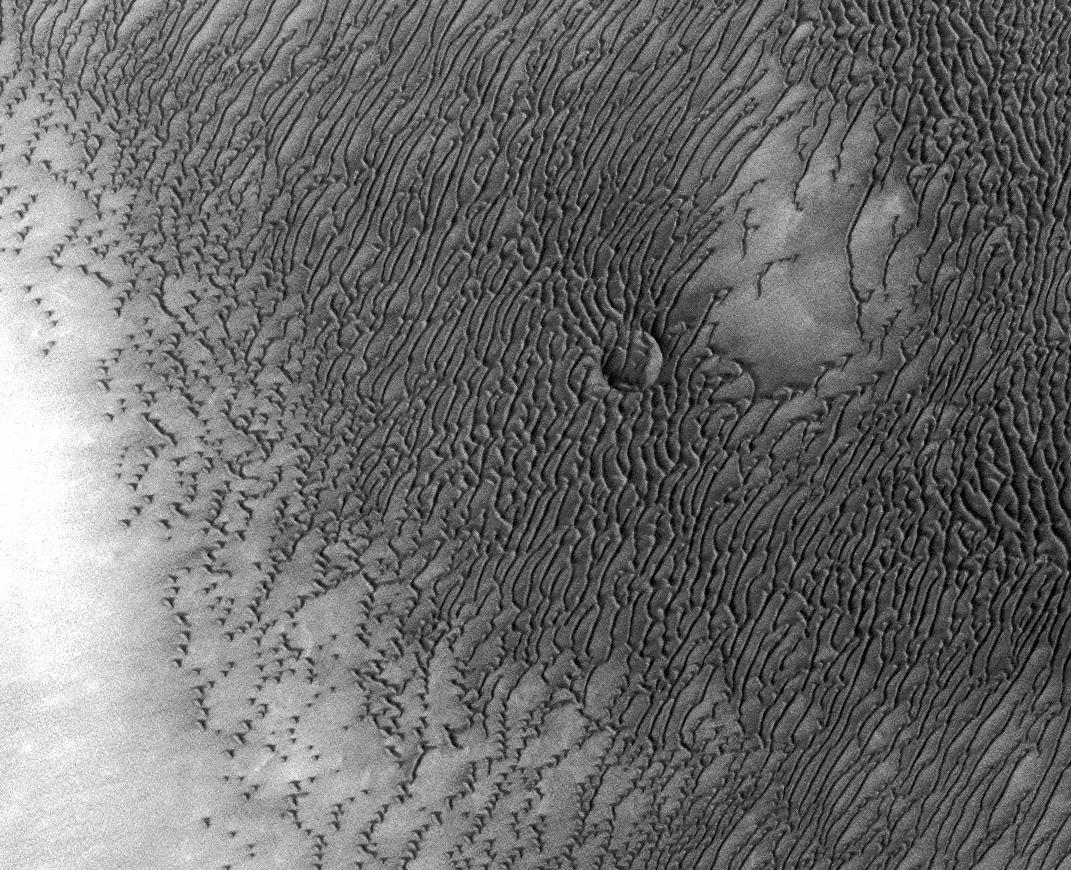
A vast dune field lies near the northern polar cap of Mars. Seen here in summer, the dunes have partially buried an impact crater about 1,000 meters (3,300 feet) wide.
This image was taken in August 2010 by the Thermal Emission Imaging System instrument on NASA's Mars Odyssey orbiter and posted in a special December 2010 set marking the occasion of Odyssey becoming the longest-working Mars spacecraft in history. The pictured location on Mars is 79.1 degrees north latitude, 245.5 degrees east longitude.
NASA's Jet Propulsion Laboratory manages the 2001 Mars Odyssey mission for NASA's Science Mission Directorate, Washington, D.C. The Thermal Emission Imaging System (THEMIS) was developed by Arizona State University, Tempe, in collaboration with Raytheon Santa Barbara Remote Sensing. The THEMIS investigation is led by Dr. Philip Christensen at Arizona State University. Lockheed Martin Astronautics, Denver, is the prime contractor for the Odyssey project, and developed and built the orbiter. Mission operations are conducted jointly from Lockheed Martin and from JPL, a division of the California Institute of Technology in Pasadena.