Your search criteria found
12748
images
Target is Mars (and available satellites)
Go to PIAxxxxx:
Refine this list of images by:
Target:
Deimos
Mars
Phobos
Mission:
2001 Mars Odyssey
Antarctic Meteorite Location and Mapping Project (AMLAMP)
Dawn
ExoMars
Hubble Space Telescope
InSight
MAVEN
Mariner Mars 1964 (Mariner 4)
Mariner Mars 1969 (Mariner 7)
Mariner Mars 1971 (Mariner 9)
Mars 2020
Mars 2020 Rover
Mars Atmosphere and Volatile Evolution MissioN (MAVEN)
Mars Climate Orbiter
Mars Cube One (MarCO)
Mars Exploration Rover (MER)
Mars Express (MEX)
Mars Global Surveyor (MGS)
Mars Helicopter
Mars Pathfinder (MPF)
Mars Reconnaissance Orbiter (MRO)
Mars Sample Return
Mars Sample Return (MSR)
Mars Science Laboratory (MSL)
Phoenix
Rosetta
Viking
Spacecraft:
2001 Mars Odyssey
Curiosity
Dawn
InSight Mars Lander
Ingenuity
MAVEN
MarCO-B
Mariner 4
Mariner 7
Mariner 9
Mars Climate Orbiter
Mars Express (MEX)
Mars Express (MEX) Orbiter
Mars Global Surveyor Orbiter
Mars Pathfinder Lander
Mars Pathfinder Rover
Mars Reconnaissance Orbiter (MRO)
Mars Sample Return
Mars Science Laboratory (MSL)
NASA's Mars Pathfinder Lander
Opportunity
Perseverance
Philae Lander
Phoenix Lander
Phoenix Mars Lander
Spirit
Viking Lander 1
Viking Lander 2
Viking Orbiter 1
Viking Orbiter 2
Instrument:
Alpha Particle X-ray Spectrometer
Alpha Particle X-ray Spectrometer (MSL)
Atmospheric Structure / Meteorology Instrument
CHIMRA
Camera 1
Camera 2
Chemistry & Mineralogy (CheMin)
Chemistry and Camera (ChemCam)
Comet Infrared and Visible Analyser (CIVA
Compact Reconnaissance Imaging Spectrometer for Mars (CRISM)
Context Camera (CTX)
Deep Space Network
Descent Image Motion Estimation System (DIMES)
Dynamic Albedo of Neutrons
Dynamic Albedo of Neutrons (DAN)
Gamma Ray Spectrometer - Neutron Spectrometer
Gamma Ray Spectrometer Suite
Hazard Avoidance Camera
Hazard Avoidance Camera (M2020)
Hazard Avoidance Camera (MSL)
Heat and Physical Properties Package (HP3)
High Resolution Imaging Science Experiment (HiRISE)
High Resolution Instrument (HRI)
High Resolution Stereo Camera
Imager for Mars Pathfinder
Imaging Ultraviolet Spectrograph
Imaging Ultraviolet Spectrograph (IUVS)
Instrument Context Camera (ICC)
Instrument Deployment Camera (IDC)
Lander Vision System Camera (LCAM)
Magnetometer
Mars Advanced Radar for Subsurface and Ionosphere Sounding (MARSIS)
Mars Advanced Radar for Subsurface and Ionospheric Sounding (MARSIS)
Mars Climate Sounder (MCS)
Mars Color Imager (MARCI)
Mars Descent Imager
Mars Environmental Dynamics Analyzer (MEDA)
Mars Hand Lens Imager (MAHLI)
Mars Horizon Sensor Assembly
Mars Orbiter Camera (MOC)
Mars Orbiter Laser Altimeter
Mars Radiation Experiment
Mastcam
Mastcam-Z
Microscopic Imager
Microscopy Electrochemistry and Conductivity Analyzer (MECA)
Miniature Thermal Emission Spectrometer
Moessbauer Spectrometer
Navigation Camera
Navigation Camera (M2020)
Navigation Camera (MSL)
Neutral Gas and Ion Mass Spectrometer
Neutron Spectrometer
Optical Microscope
Optical Navigation Camera
Panoramic Camera
Planetary Instrument for X-ray Lithochemistry (PIXL)
Radar System
Radiation Assessment Detector (RAD)
Radio Science Subsystem
Robotic Arm
Robotic Arm (MSL)
Robotic Arm Camera (RAC)
Rock Abrasion Tool (RAT)
Rover Cameras
Rover Environmental Monitoring Station (REMS)
Sample Analysis at Mars (SAM)
Scanning Habitable Environments with Raman & Luminescence for Organics and Chemicals (SHERLOC)
Seismic Experiment for Interior Structure (SEIS)
Shallow Subsurface Radar (SHARAD)
Stereo Imager (SSI)
SuperCam
Surface Stereo Imager (SSI)
Thermal Emission Imaging System
Thermal Emission Spectrometer
Thermal and Electrical Conductivity Probe
Thermal and Evolved Gas Analyzer
Trace Gas Orbiter
Visual Imaging Subsystem
Visual Imaging Subsystem - Camera A
Visual Imaging Subsystem - Camera B
Wide Field Planetary Camera 2
Click on an image for detailed information
Click on a column heading to sort in ascending or descending order
My
List
Addition Date
Target
Mission
Instrument
Size
2005-07-28
Mars
2001 Mars Odyssey
THEMIS
1443x3228x1
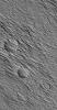
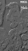
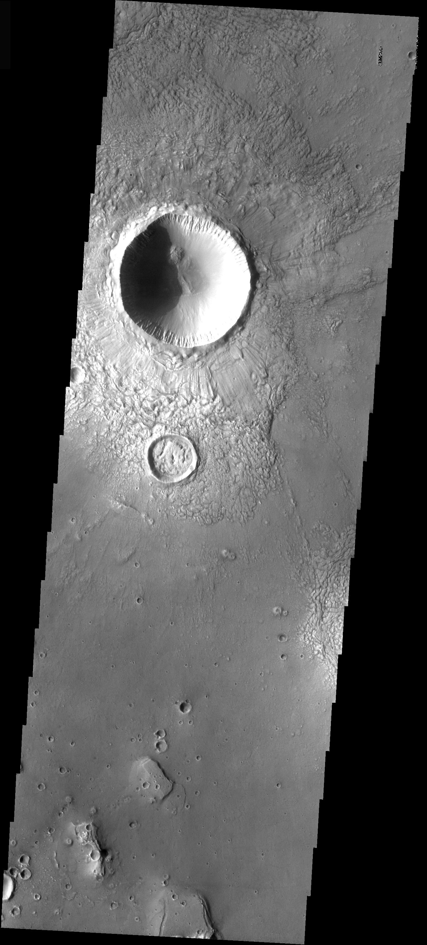
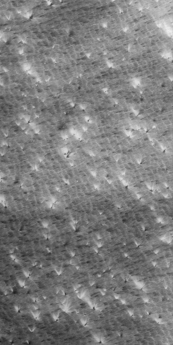
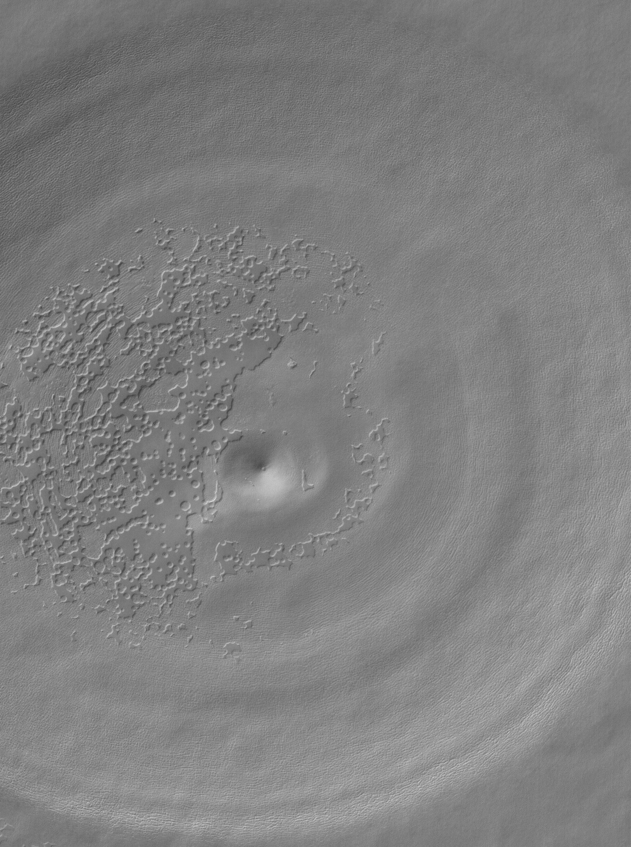
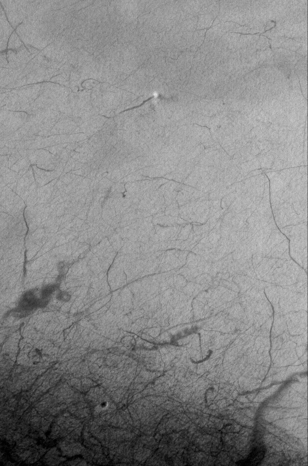
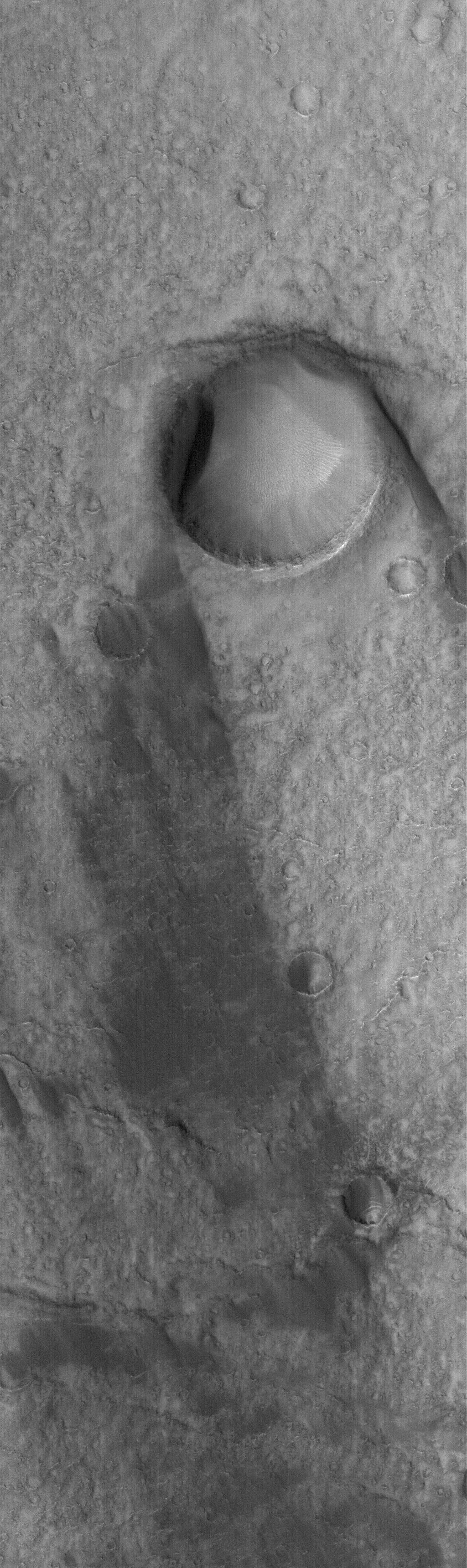
PIA04126:
Radial Erosion
Full Resolution:
TIFF
(4.663 MB)
JPEG
(727.3 kB)
2005-07-29
Mars
Mars Global Surveyor (MGS)
Mars Orbiter Camera (MOC)
2048x3239x1
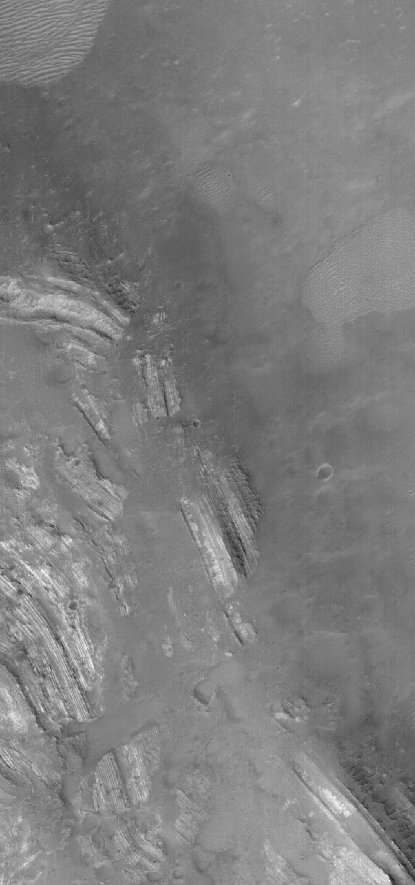
PIA04125:
Sedimentary Rock Remnants
Full Resolution:
TIFF
(6.64 MB)
JPEG
(838.7 kB)
2005-07-29
Mars
2001 Mars Odyssey
THEMIS
1462x3230x1
PIA04127:
Craters Filling Craters
Full Resolution:
TIFF
(4.728 MB)
JPEG
(454.2 kB)
2005-07-30
Mars
Mars Global Surveyor (MGS)
Mars Orbiter Camera (MOC)
672x1285x1
PIA04128:
Exhuming Craters
Full Resolution:
TIFF
(864.6 kB)
JPEG
(258.2 kB)
2005-07-31
Mars
Mars Global Surveyor (MGS)
Mars Orbiter Camera (MOC)
836x2248x1
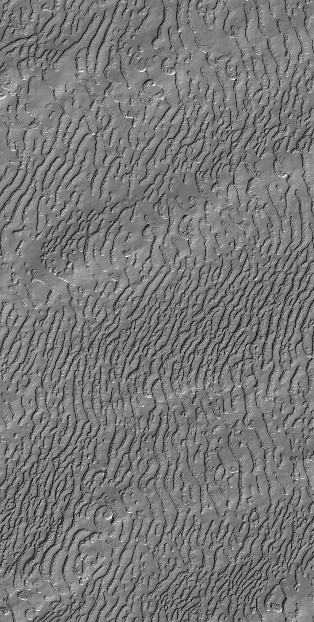
PIA04129:
Nilosyrtis Dunes
Full Resolution:
TIFF
(1.882 MB)
JPEG
(209.7 kB)
2005-08-01
Mars
Mars Global Surveyor (MGS)
Mars Orbiter Camera (MOC)
1024x2027x1
PIA04130:
Frozen Carbon Dioxide
Full Resolution:
TIFF
(2.078 MB)
JPEG
(430.3 kB)
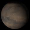
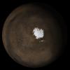
2005-08-02
Mars
Mars Global Surveyor (MGS)
Mars Orbiter Camera (MOC)
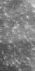
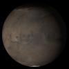
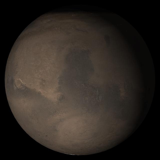
640x640x3
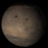
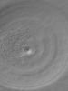
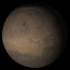
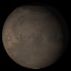
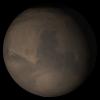
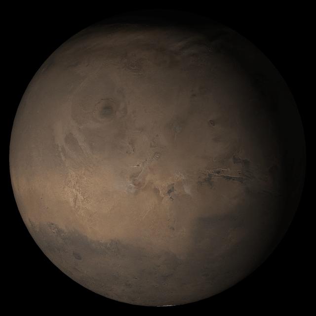
PIA04131:
Mars at Ls 269°: Tharsis
Full Resolution:
TIFF
(411.8 kB)
JPEG
(22.57 kB)
2005-08-03
Mars
Mars Global Surveyor (MGS)
Mars Orbiter Camera (MOC)
836x2491x1
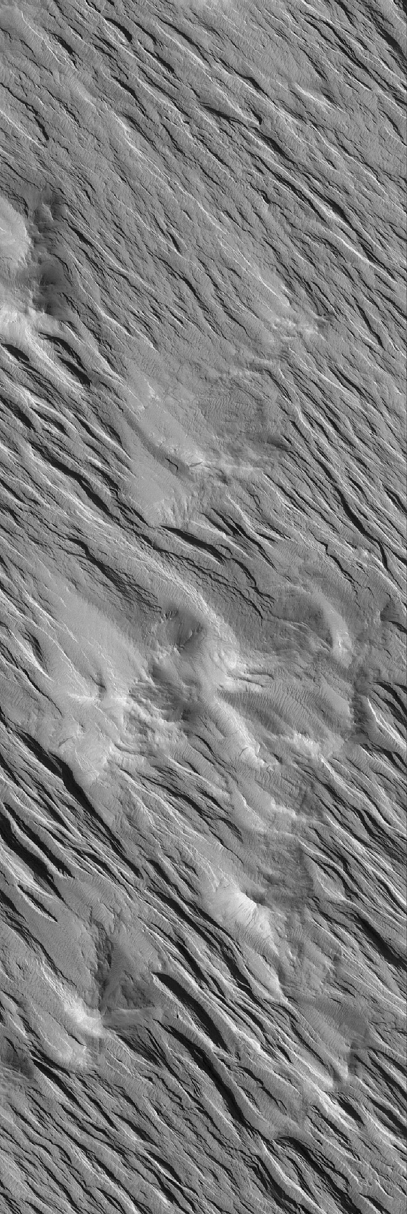
PIA04132:
Wind-Eroded Terrain
Full Resolution:
TIFF
(2.085 MB)
JPEG
(613.5 kB)
2005-08-04
Mars
Mars Global Surveyor (MGS)
Mars Orbiter Camera (MOC)
836x2083x1
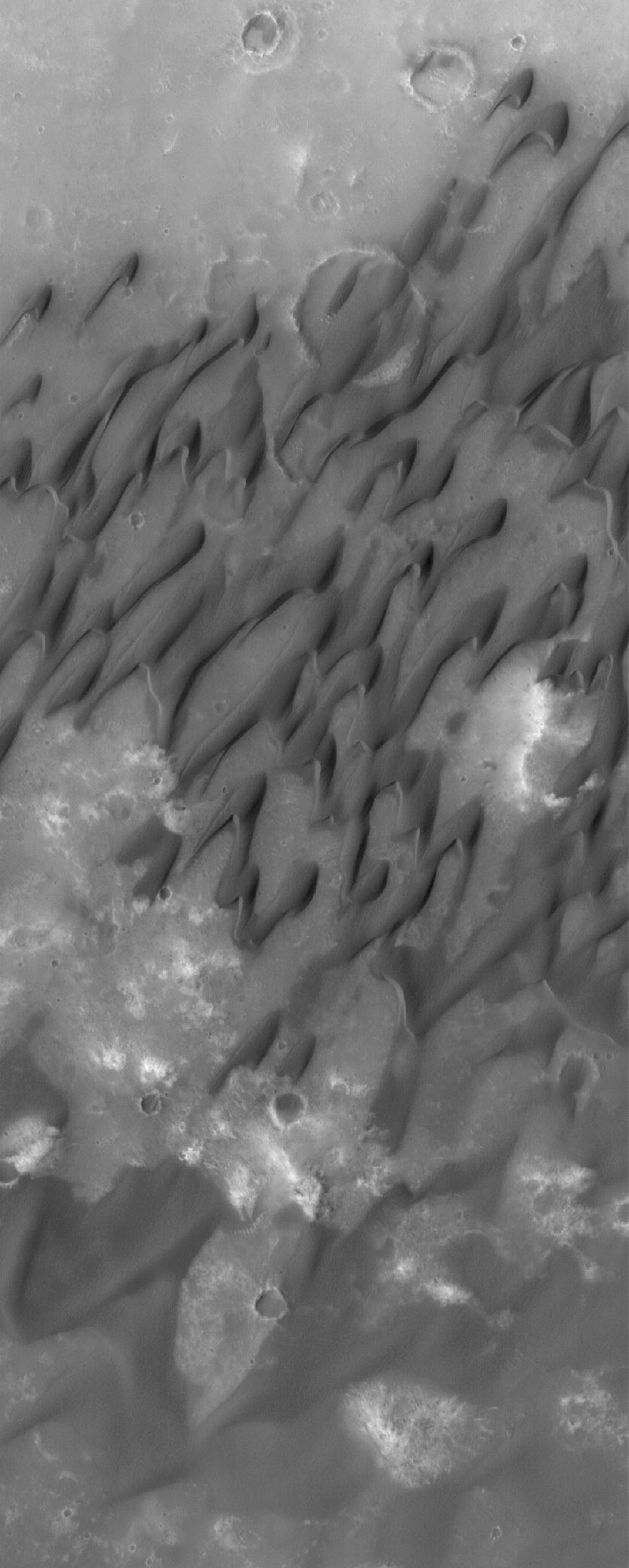
PIA04133:
Dunes of Herschel
Full Resolution:
TIFF
(1.743 MB)
JPEG
(156 kB)
2005-08-05
Mars
Mars Global Surveyor (MGS)
Mars Orbiter Camera (MOC)
2048x4864x1
PIA04134:
Wind-Eroded Landscape
Full Resolution:
TIFF
(9.971 MB)
JPEG
(1.095 MB)
2005-08-06
Mars
Mars Global Surveyor (MGS)
Mars Orbiter Camera (MOC)
1024x1661x1
PIA04135:
Windblown Dunes
Full Resolution:
TIFF
(1.703 MB)
JPEG
(103.8 kB)
2005-08-07
Mars
Mars Global Surveyor (MGS)
Mars Orbiter Camera (MOC)
672x1766x1
PIA04136:
Mid-latitude Dunes
Full Resolution:
TIFF
(1.188 MB)
JPEG
(143.8 kB)
2005-08-08
Mars
Mars Global Surveyor (MGS)
Mars Orbiter Camera (MOC)
672x1341x1
PIA04137:
Defrosting Patterns
Full Resolution:
TIFF
(902.3 kB)
JPEG
(160 kB)
2005-08-09
Mars
Mars Global Surveyor (MGS)
Mars Orbiter Camera (MOC)
640x640x3
PIA04138:
Mars at Ls 269°: Acidalia/Mare Erythraeum
Full Resolution:
TIFF
(411.8 kB)
JPEG
(23.68 kB)
2005-08-10
Mars
Mars Global Surveyor (MGS)
Mars Orbiter Camera (MOC)
2048x3200x1
PIA04139:
Polar Landforms
Full Resolution:
TIFF
(6.56 MB)
JPEG
(928 kB)
2005-08-11
Mars
Mars Global Surveyor (MGS)
Mars Orbiter Camera (MOC)
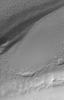
836x1783x1
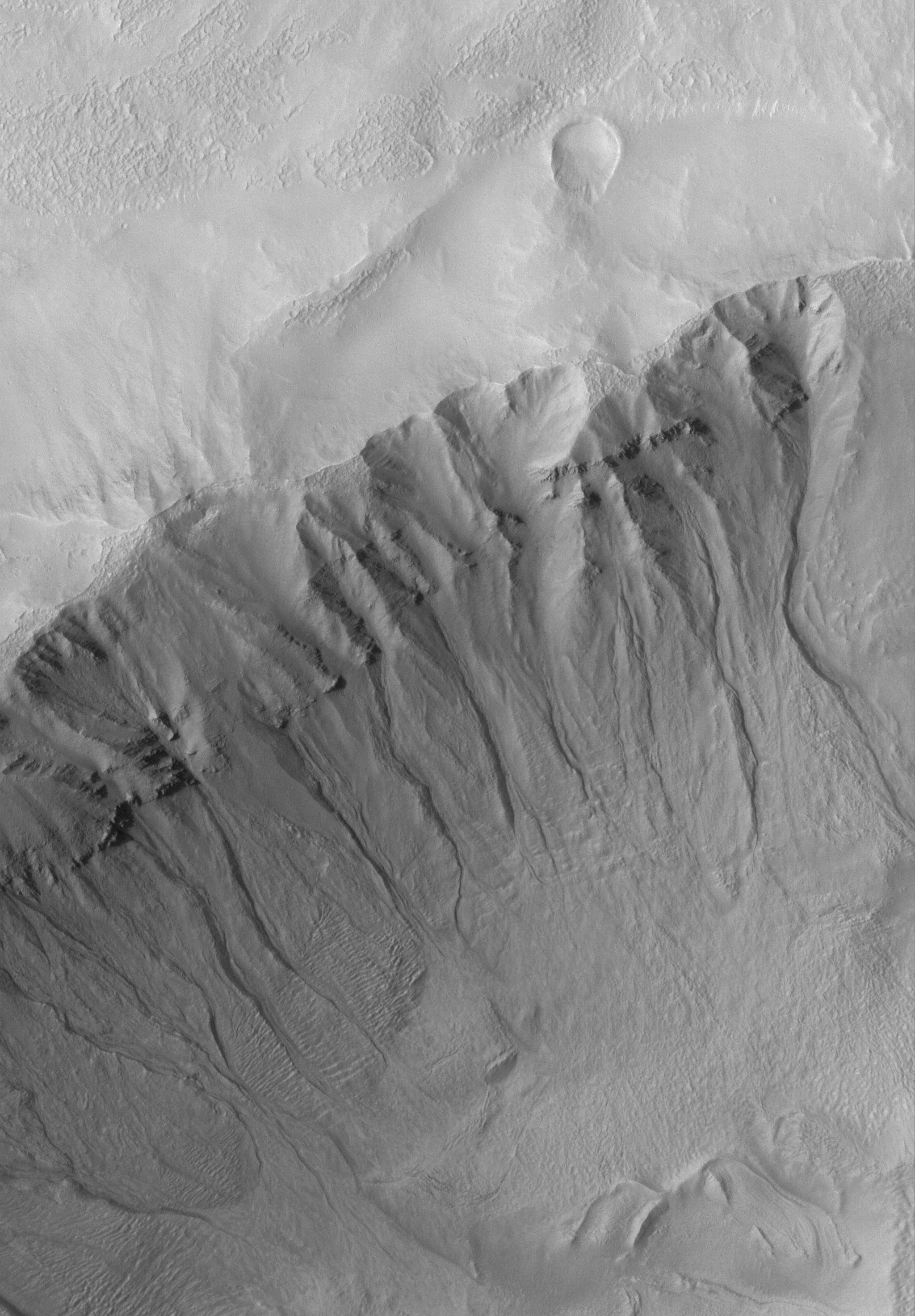
PIA04140:
Severely-Dipping Layers
Full Resolution:
TIFF
(1.492 MB)
JPEG
(157.8 kB)
2005-08-12
Mars
Mars Global Surveyor (MGS)
Mars Orbiter Camera (MOC)
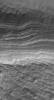
672x1248x1
PIA04145:
Polar Layers
Full Resolution:
TIFF
(839.7 kB)
JPEG
(100.1 kB)
2005-08-13
Mars
Mars Global Surveyor (MGS)
Mars Orbiter Camera (MOC)
2048x2944x1
PIA04146:
Martian Gullies
Full Resolution:
TIFF
(6.035 MB)
JPEG
(761.6 kB)
2005-08-14
Mars
Mars Global Surveyor (MGS)
Mars Orbiter Camera (MOC)
2048x2748x1
PIA04147:
South Polar Depression
Full Resolution:
TIFF
(5.634 MB)
JPEG
(888 kB)
2005-08-15
Mars
Mars Global Surveyor (MGS)
Mars Orbiter Camera (MOC)
672x1397x1
PIA04148:
Rugged Terrain
Full Resolution:
TIFF
(940 kB)
JPEG
(165.4 kB)
2005-08-16
Mars
Mars Global Surveyor (MGS)
Mars Orbiter Camera (MOC)
640x640x3
PIA04149:
Mars at Ls 269°: Syrtis Major
Full Resolution:
TIFF
(411.8 kB)
JPEG
(22.99 kB)
2005-08-17
Mars
Mars Global Surveyor (MGS)
Mars Orbiter Camera (MOC)
2048x3243x1
PIA04150:
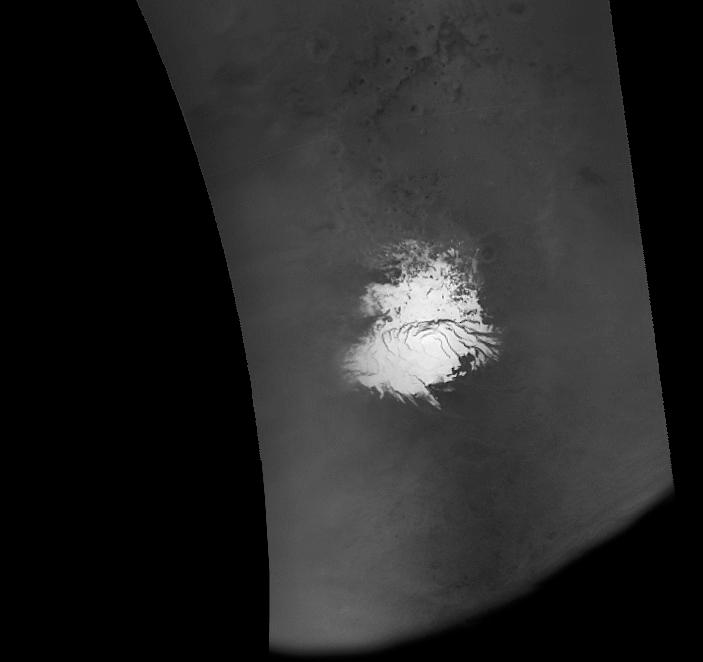
Polar Cap Pits
Full Resolution:
TIFF
(6.648 MB)
JPEG
(549.9 kB)
2005-08-18
Mars
Mars Global Surveyor (MGS)
Mars Orbiter Camera (MOC)
836x1659x1
PIA04151:
Polar Polygons
Full Resolution:
TIFF
(1.389 MB)
JPEG
(247.4 kB)
2005-08-19
Mars
Mars Global Surveyor (MGS)
Mars Orbiter Camera (MOC)
672x1524x1
PIA04161:
South Polar Layers
Full Resolution:
TIFF
(1.025 MB)
JPEG
(325.5 kB)
2005-08-19
Mars
Mars Exploration Rover (MER)
Navigation Camera
1024x256x1
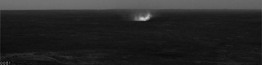
PIA04152:
Dust Devils at Gusev, Sol 525
Full Resolution:
TIFF
(262.6 kB)
JPEG
(35.14 kB)
2005-08-19
Mars
Mars Exploration Rover (MER)
Navigation Camera
1024x256x1
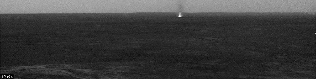
PIA04153:
Gusev Dust Devil, sol 532
Full Resolution:
TIFF
(262.6 kB)
JPEG
(18.98 kB)
2005-08-19
Mars
Mars Exploration Rover (MER)
Navigation Camera
1024x256x1
PIA04154:
Dust Devils at Gusev, Sol 537
Full Resolution:
TIFF
(262.6 kB)
JPEG
(15.08 kB)
2005-08-19
Mars
Mars Exploration Rover (MER)
Navigation Camera
1024x256x1
PIA04155:
Gusev Dust Devil, Sol 543
Full Resolution:
TIFF
(262.6 kB)
JPEG
(35.02 kB)
2005-08-19
Mars
Mars Exploration Rover (MER)
Hazcam
1024x245x1
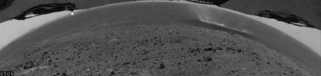
PIA04156:
Wide-Angle View of Gusev Dust Devil, Sol 559
Full Resolution:
TIFF
(251.4 kB)
JPEG
(33.66 kB)
2005-08-19
Mars
Mars Exploration Rover (MER)
Navigation Camera
1024x256x1
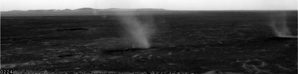
PIA04157:
Sol 568 Dust Devil in Gusev, Unenhanced
Full Resolution:
TIFF
(262.6 kB)
JPEG
(27.96 kB)
2005-08-19
Mars
Mars Exploration Rover (MER)
Panoramic Camera
1024x512x3
PIA04158:
Rind-Like Features at a Meridiani Outcrop
Full Resolution:
TIFF
(1.575 MB)
JPEG
(163.2 kB)
2005-08-20
Mars
Mars Global Surveyor (MGS)
Mars Orbiter Camera (MOC)
672x1624x1
PIA04162:
The Defrosting South
Full Resolution:
TIFF
(1.093 MB)
JPEG
(194.2 kB)
2005-08-21
Mars
Mars Global Surveyor (MGS)
Mars Orbiter Camera (MOC)
836x1554x1
PIA04163:
Sediments of Arabia
Full Resolution:
TIFF
(1.301 MB)
JPEG
(159.4 kB)
2005-08-22
Mars
Mars Global Surveyor (MGS)
Mars Orbiter Camera (MOC)
836x1828x1
PIA04164:
West Argyre
Full Resolution:
TIFF
(1.53 MB)
JPEG
(220.4 kB)
2005-08-23
Mars
Mars Global Surveyor (MGS)
Mars Orbiter Camera (MOC)
640x640x3
PIA04165:
Mars at Ls 269°: Elysium/Mare Cimmerium
Full Resolution:
TIFF
(411.8 kB)
JPEG
(21.56 kB)
2005-08-24
Mars
Mars Global Surveyor (MGS)
Mars Orbiter Camera (MOC)
836x3868x1
PIA04166:
Valley Crossing
Full Resolution:
TIFF
(3.237 MB)
JPEG
(623.8 kB)
2005-08-25
Mars
Mars Global Surveyor (MGS)
Mars Orbiter Camera (MOC)
836x2865x1
PIA04167:
Terby's Rocks
Full Resolution:
TIFF
(2.398 MB)
JPEG
(431.6 kB)
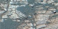
2005-08-25
Mars
Mars Exploration Rover (MER)
Microscopic Imager
1949x1863x1
PIA04168:
Mars Rocks Continue to Fascinate
Full Resolution:
TIFF
(3.635 MB)
JPEG
(431.6 kB)
2005-08-25
Mars
Mars Exploration Rover (MER)
Microscopic Imager
2265x2262x1
PIA04169:
Mars Climate Continues to Fascinate
Full Resolution:
TIFF
(5.13 MB)
JPEG
(461.2 kB)
2005-08-26
Mars
Mars Global Surveyor (MGS)
Mars Orbiter Camera (MOC)
836x4389x1
PIA04170:
Amazonis Yardangs
Full Resolution:
TIFF
(3.673 MB)
JPEG
(673.2 kB)
2005-08-27
Mars
Mars Global Surveyor (MGS)
Mars Orbiter Camera (MOC)
2048x4240x1
PIA04171:
East Candor's Rocks
Full Resolution:
TIFF
(8.692 MB)
JPEG
(1.842 MB)
2005-08-28
Mars
Mars Global Surveyor (MGS)
Mars Orbiter Camera (MOC)
836x1940x1
PIA04172:
Layered Slope
Full Resolution:
TIFF
(1.624 MB)
JPEG
(252.2 kB)
2005-08-29
Mars
Mars Global Surveyor (MGS)
Mars Orbiter Camera (MOC)
512x1298x1
PIA04173:
Frosty Dunes
Full Resolution:
TIFF
(665.5 kB)
JPEG
(171.3 kB)
2005-08-30
Mars
Mars Global Surveyor (MGS)
Mars Orbiter Camera (MOC)
640x640x3
PIA04177:
Mars at Ls 269°: South Polar Region
Full Resolution:
TIFF
(411.8 kB)
JPEG
(26.14 kB)
2005-08-31
Mars
Mars Global Surveyor (MGS)
Mars Orbiter Camera (MOC)
836x1547x1
PIA04197:
Meridiani Crater
Full Resolution:
TIFF
(1.295 MB)
JPEG
(152.2 kB)
2005-08-31
Mars
Mars Exploration Rover (MER)
Panoramic Camera
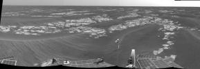
13838x3319x3
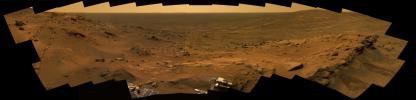
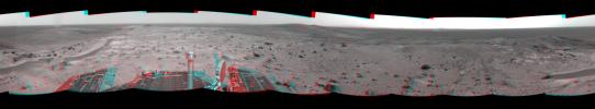
PIA04179:
A Whale of a Panorama
Full Resolution:
TIFF
(137.8 MB)
JPEG
(4.095 MB)
QTVR
(4.479 MB)
2005-08-31
Mars
Mars Exploration Rover (MER)
Panoramic Camera
8529x3113x3
PIA04180:
Looking Up from the Deep
Full Resolution:
TIFF
(79.65 MB)
JPEG
(2.092 MB)
QTVR
(2.358 MB)
2005-09-01
Mars
Mars Global Surveyor (MGS)
Mars Orbiter Camera (MOC)
836x1937x1
PIA04198:
Cut By Troughs
Full Resolution:
TIFF
(1.621 MB)
JPEG
(156.3 kB)
2005-09-01
Mars
Mars Exploration Rover (MER)
Panoramic Camera
3595x983x1
PIA04181:
Top of the World
Full Resolution:
TIFF
(3.538 MB)
JPEG
(327.8 kB)
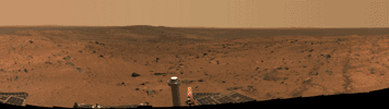
2005-09-01
Mars
Mars Exploration Rover (MER)
Panoramic Camera
22348x4563x3
PIA04182:
"Independence" Panorama
Full Resolution:
TIFF
(305.9 MB)
JPEG
(13.93 MB)
QTVR
(15.38 MB)
2005-09-01
Mars
Mars Exploration Rover (MER)
Panoramic Camera
6592x3077x3
PIA04183:
Postcard Above Tennessee Valley
Full Resolution:
TIFF
(60.85 MB)
JPEG
(1.906 MB)
2005-09-01
Mars
Mars Exploration Rover (MER)
Panoramic Camera
14242x4000x3
PIA04184:
Spirit's Spectacular View from the Summit
Full Resolution:
TIFF
(170.9 MB)
JPEG
(5.75 MB)
QTVR
(6.274 MB)
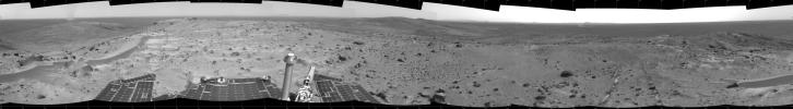
2005-09-01
Mars
Mars Exploration Rover (MER)
Navigation Camera
7466x1029x1
PIA04185:
A Great Place to Watch the Weather
Full Resolution:
TIFF
(7.691 MB)
JPEG
(891.2 kB)
2005-09-01
Mars
Mars Exploration Rover (MER)
Navigation Camera
7704x1423x3
PIA04186:
A Great Place to Watch the Weather (3-D)
Full Resolution:
TIFF
(32.89 MB)
JPEG
(1.073 MB)
2005-09-01
Mars
Mars Exploration Rover (MER)
Navigation Camera
4000x4000x1
PIA04187:
A Great Place to Watch the Weather (vertical)
Full Resolution:
TIFF
(16.02 MB)
JPEG
(1.255 MB)
2005-09-01
Mars
Mars Exploration Rover (MER)
Navigation Camera
4073x4073x1
PIA04188:
A Great Place to Watch the Weather (polar)
Full Resolution:
TIFF
(16.61 MB)
JPEG
(1.152 MB)
2005-09-01
Mars
Mars Exploration Rover (MER)
Panoramic Camera
1024x512x3
PIA04189:
Rind-Like Features at a Meridiani Outcrop
Full Resolution:
TIFF
(1.575 MB)
JPEG
(79.2 kB)
2005-09-01
Mars
Mars Exploration Rover (MER)
Hazcam
1024x1024x1
PIA04190:
Busy at 'Lambert'
Full Resolution:
TIFF
(1.05 MB)
JPEG
(76.42 kB)
2005-09-01
Mars
Mars Exploration Rover (MER)
Panoramic Camera
1024x1024x3
PIA04191:
Sitting on 'Voltaire'
Full Resolution:
TIFF
(3.15 MB)
JPEG
(193.1 kB)
2005-09-01
Mars
Mars Exploration Rover (MER)
Panoramic Camera
1209x987x1
PIA04192:
Visiting 'Voltaire'
Full Resolution:
TIFF
(1.195 MB)
JPEG
(196.2 kB)
2005-09-01
Mars
Mars Exploration Rover (MER)
Panoramic Camera
1954x1944x1
PIA04193:
Windblown 'Whymper'
Full Resolution:
TIFF
(3.803 MB)
JPEG
(680.6 kB)
2005-09-01
Mars
Mars Exploration Rover (MER)
Navigation Camera
1024x1024x1
PIA04194:
Windy Summit and Plains in Gusev
Full Resolution:
TIFF
(1.05 MB)
JPEG
(181.5 kB)
2005-09-01
Mars
Mars Exploration Rover (MER)
Panoramic Camera
1024x1024x3
PIA04195:
Opportunity Examines Cracks and Coatings on Mars Rocks
Full Resolution:
TIFF
(3.15 MB)
JPEG
(262.6 kB)
2005-09-01
Mars
Mars Exploration Rover (MER)
Microscopic Imager
1502x1560x1
PIA04196:
Focus on 'Rue Legendre'
Full Resolution:
TIFF
(2.346 MB)
JPEG
(291 kB)
2005-09-02
Mars
Mars Global Surveyor (MGS)
Mars Orbiter Camera (MOC)
836x3188x1
PIA04199:
Defrosting Sand
Full Resolution:
TIFF
(2.668 MB)
JPEG
(473.1 kB)
2005-09-03
Mars
Mars Global Surveyor (MGS)
Mars Orbiter Camera (MOC)
672x1247x1
PIA04212:
Polygons and Craters
Full Resolution:
TIFF
(839 kB)
JPEG
(248.8 kB)
2005-09-04
Mars
Mars Global Surveyor (MGS)
Mars Orbiter Camera (MOC)
1024x2480x1
PIA04259:
Sediments of Terby
Full Resolution:
TIFF
(2.542 MB)
JPEG
(411 kB)
2005-09-05
Mars
Mars Global Surveyor (MGS)
Mars Orbiter Camera (MOC)
1024x1552x1
PIA04283:
Caught in the Act
Full Resolution:
TIFF
(1.591 MB)
JPEG
(327.3 kB)
2005-09-06
Mars
Mars Global Surveyor (MGS)
Mars Orbiter Camera (MOC)
640x640x3
PIA04284:
Mars at Ls 288°: Tharsis
Full Resolution:
TIFF
(411.8 kB)
JPEG
(21.63 kB)
2005-09-07
Mars
Mars Global Surveyor (MGS)
Mars Orbiter Camera (MOC)
1542x1892x3
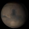
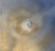
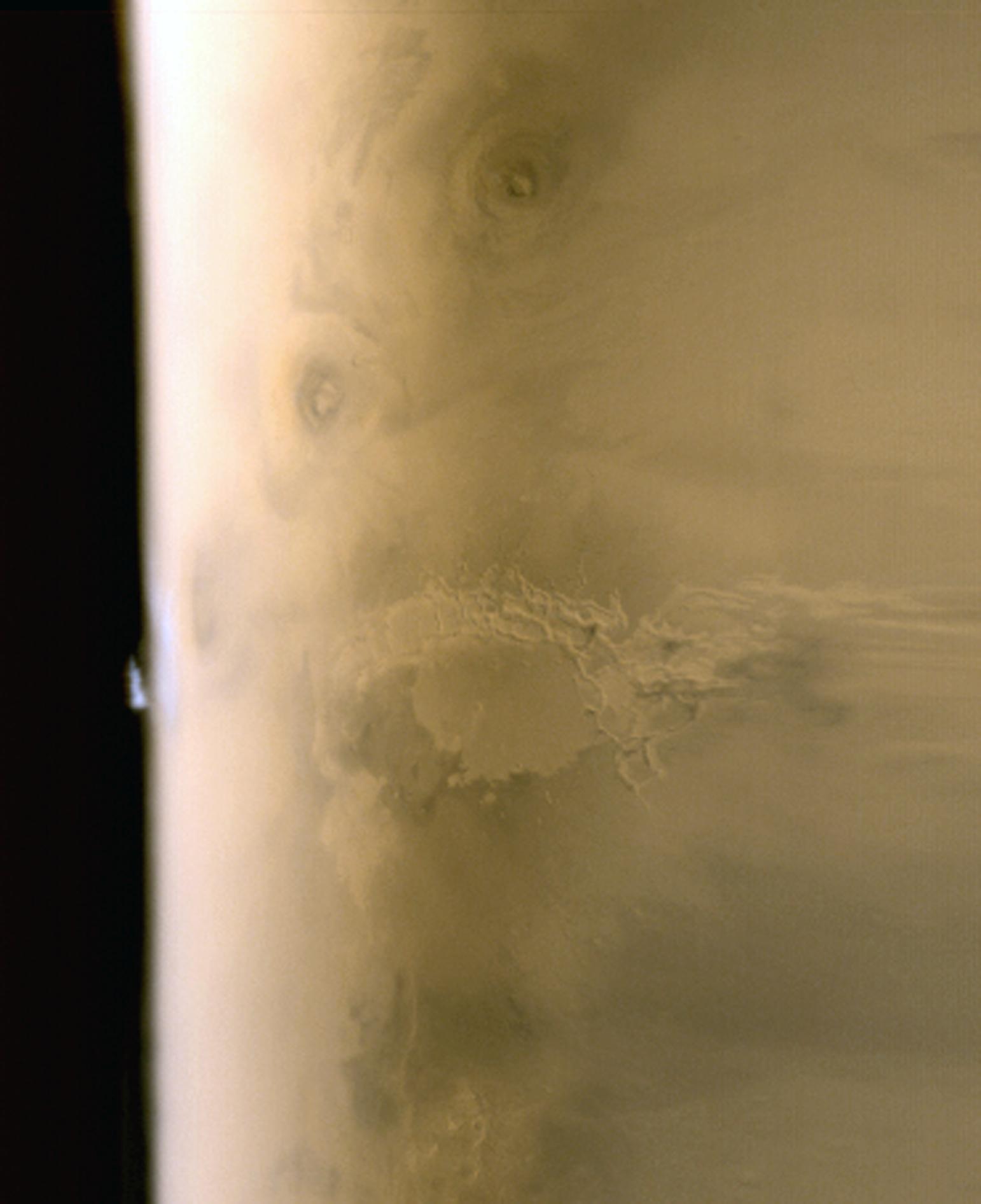
PIA04285:
Tharsis Limb Cloud
Full Resolution:
TIFF
(8.768 MB)
JPEG
(121.5 kB)
2005-09-08
Mars
Mars Global Surveyor (MGS)
Mars Orbiter Camera (MOC)
836x1953x1
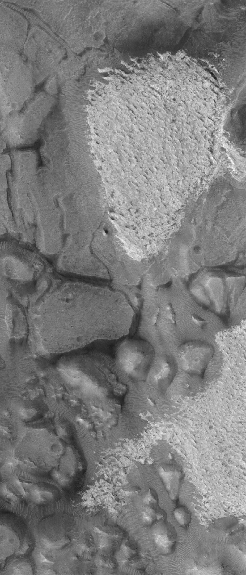
PIA04286:
Aram Chaos Rocks
Full Resolution:
TIFF
(1.635 MB)
JPEG
(252.2 kB)
2005-09-09
Mars
Mars Global Surveyor (MGS)
Mars Orbiter Camera (MOC)
703x662x1
PIA04287:
MOC Imaging Resumes
Full Resolution:
TIFF
(466.1 kB)
JPEG
(20.13 kB)
2005-09-10
Mars
Mars Global Surveyor (MGS)
Mars Orbiter Camera (MOC)
672x2327x1
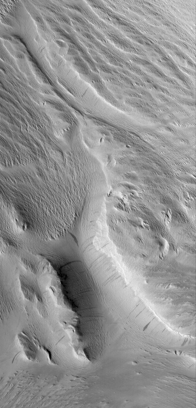
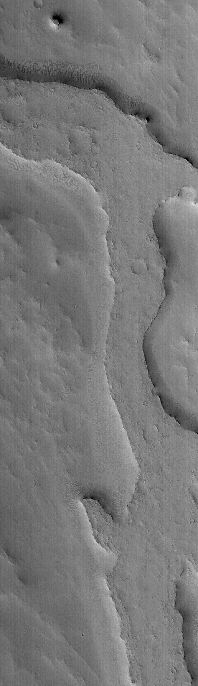
PIA04288:
Inverted Valley
Full Resolution:
TIFF
(1.566 MB)
JPEG
(224.5 kB)
2005-09-11
Mars
Mars Global Surveyor (MGS)
Mars Orbiter Camera (MOC)
672x1790x1
PIA04289:
Flows of Ascraeus
Full Resolution:
TIFF
(1.204 MB)
JPEG
(252 kB)
2005-09-11
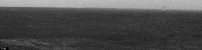
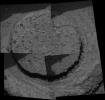
Phobos
Mars Express (MEX)
Mars Exploration Rover (MER)
Panoramic Camera
High Resolution Stereo Camera (HRSC)
700x228x1
PIA06335:
Phobos Viewed from Mars
Full Resolution:
TIFF
(160 kB)
JPEG
(7.163 kB)
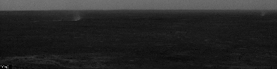
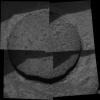
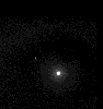
2005-09-11
Phobos
Mars Exploration Rover (MER)
Panoramic Camera
1024x1024x1
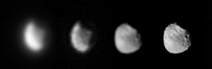
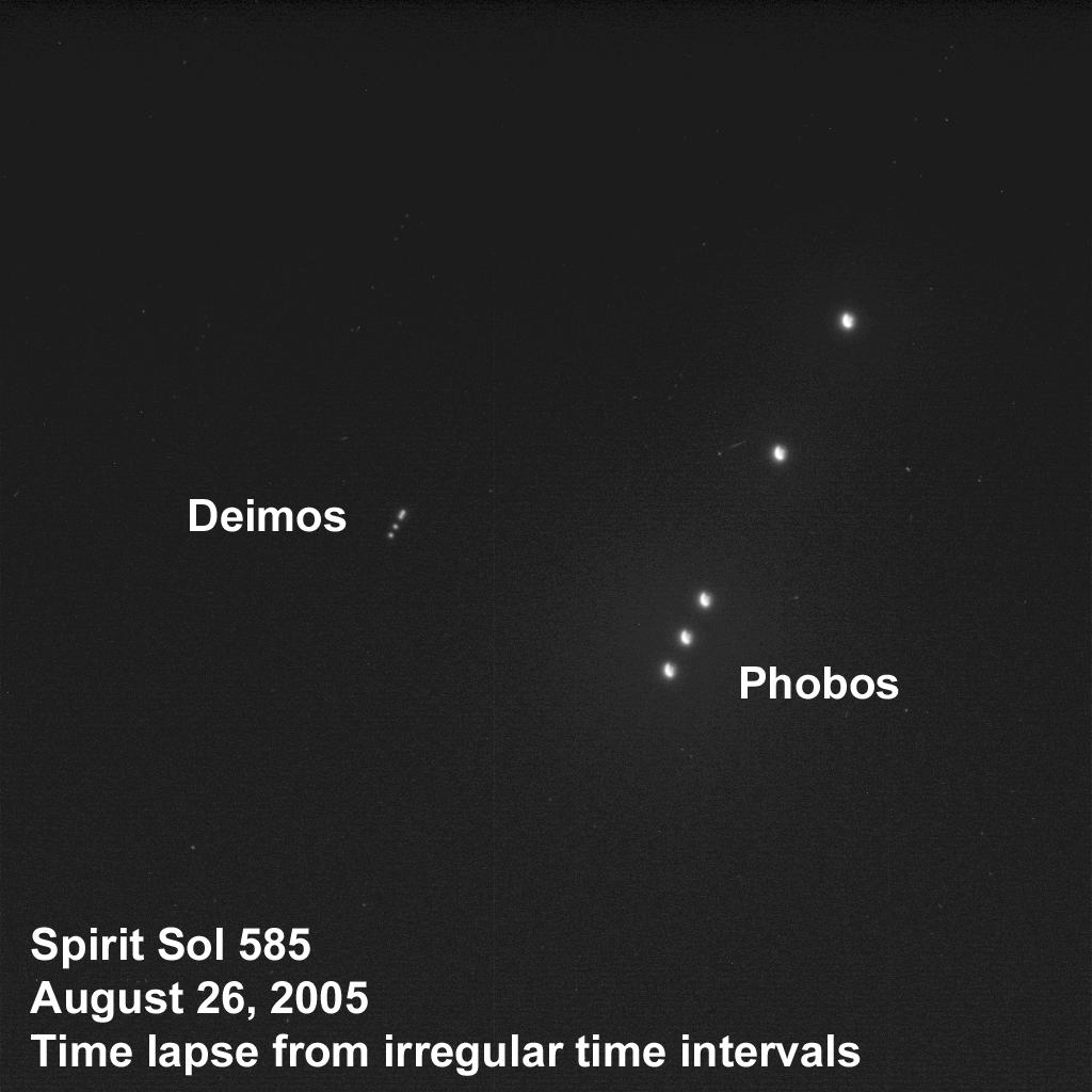
PIA06336:
The Two Moons of Mars as Seen from Mars
Full Resolution:
TIFF
(1.05 MB)
JPEG
(76.3 kB)
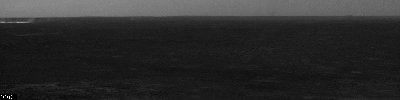
2005-09-11
Mars
Mars Exploration Rover (MER)
Panoramic Camera
1024x1024x1
PIA06337:
The Night Sky on Mars
Full Resolution:
TIFF
(1.05 MB)
JPEG
(111.7 kB)
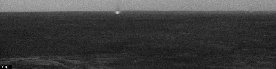
2005-09-11
Mars
Mars Exploration Rover (MER)
Panoramic Camera
1024x1024x1
PIA06338:
The Two Moons of Mars As Seen from "Husband Hill"
Full Resolution:
TIFF
(1.05 MB)
JPEG
(82.38 kB)
2005-09-11
Mars
Mars Exploration Rover (MER)
Panoramic Camera
2100x1075x1
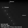
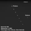
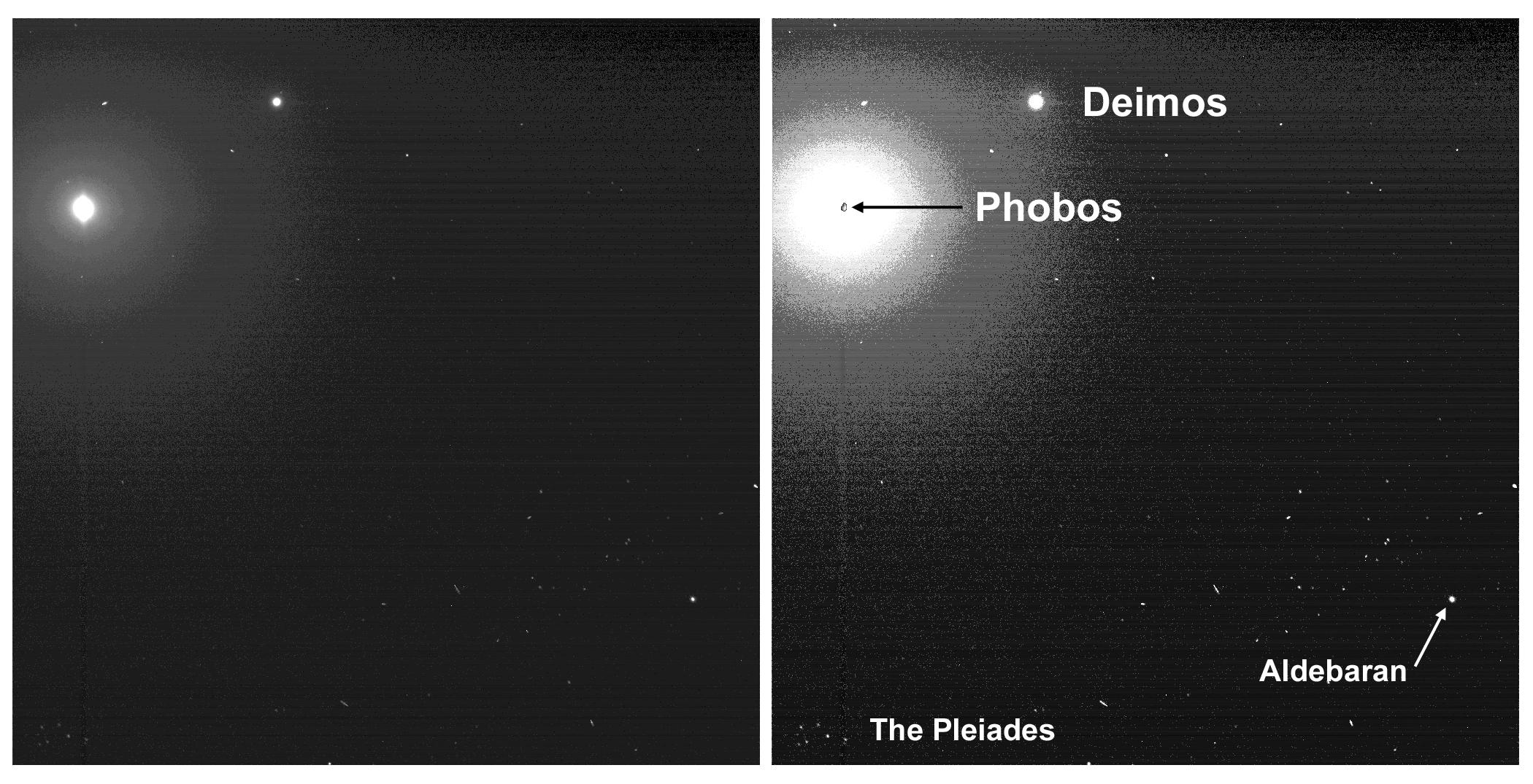
PIA06339:
Two Moons and the Pleiades from Mars
Full Resolution:
TIFF
(2.261 MB)
JPEG
(349.4 kB)
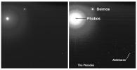
2005-09-11
Mars
Mars Exploration Rover (MER)
Panoramic Camera
1091x1161x6
PIA06340:
Two Moons and the Pleiades from Mars
Full Resolution:
TIFF
(1.268 MB)
JPEG
(134.9 kB)
2005-09-12
Mars
Mars Global Surveyor (MGS)
Mars Orbiter Camera (MOC)
967x979x3
PIA05079:
Celebrating 8 Years at Mars: Repeated Weather Events
Full Resolution:
TIFF
(2.844 MB)
JPEG
(123.5 kB)
2005-09-13
Mars
Mars Global Surveyor (MGS)
Mars Orbiter Camera (MOC)
640x640x3
PIA05217:
Mars at Ls 288°: Acidalia/Mare Erythraeum
Full Resolution:
TIFF
(411.8 kB)
JPEG
(22.06 kB)
2005-09-14
Mars
Mars Global Surveyor (MGS)
Mars Orbiter Camera (MOC)
1024x2002x1
PIA05258:
Lonely Butte
Full Resolution:
TIFF
(2.052 MB)
JPEG
(385 kB)
2005-09-15
Mars
Mars Global Surveyor (MGS)
Mars Orbiter Camera (MOC)
1024x1854x1
PIA06008:
Rippled Valley Floor
Full Resolution:
TIFF
(1.901 MB)
JPEG
(341.9 kB)
2005-09-15
Mars
Mars Exploration Rover (MER)
Hazcam
256x256x43
PIA04423:
Spirit Ascent Movie, Rover's-Eye View
Full Resolution:
TIFF
(65.83 kB)
JPEG
(10.12 kB)
2005-09-16
Mars
Mars Global Surveyor (MGS)
Mars Orbiter Camera (MOC)
672x1014x1
PIA06078:
Meridiani Rocks
Full Resolution:
TIFF
(682.3 kB)
JPEG
(219.9 kB)
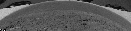
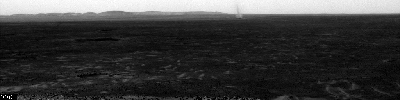
2005-09-16
Mars
Mars Exploration Rover (MER)
Navigation Camera
1119x387x1
PIA06009:
Heading South on 'Erebus Highway'
Full Resolution:
TIFF
(433.7 kB)
JPEG
(68.68 kB)
2005-09-17
Mars
Mars Global Surveyor (MGS)
Mars Orbiter Camera (MOC)
672x1410x1
PIA03003:
Wind-Eroded Terrain
Full Resolution:
TIFF
(948.7 kB)
JPEG
(167.5 kB)
2005-09-18
Mars
Mars Global Surveyor (MGS)
Mars Orbiter Camera (MOC)
836x1520x1
PIA03004:
Inverted Channels
Full Resolution:
TIFF
(1.272 MB)
JPEG
(354 kB)
2005-09-19
Mars
Mars Global Surveyor (MGS)
Mars Orbiter Camera (MOC)
1024x3441x1
PIA03005:
Huygens Wind Streak
Full Resolution:
TIFF
(3.527 MB)
JPEG
(588 kB)
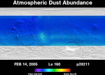
2005-09-19
Mars
Mars Global Surveyor (MGS)
Thermal Emission Spectrometer
355x256x3
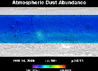
PIA04297:
Three Years of Monitoring Mars' Atmospheric Dust (Animation)
Full Resolution:
TIFF
(273.2 kB)
JPEG
(16.88 kB)
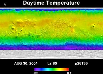
2005-09-19
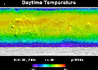
Mars
Mars Global Surveyor (MGS)
Thermal Emission Spectrometer
355x256x3
PIA04298:
Five Years of Monitoring Mars' Daytime Surface Temperatures (Animation)
Full Resolution:
TIFF
(273.2 kB)
JPEG
(19.58 kB)
2005-09-20
Mars
Mars Global Surveyor (MGS)
Mars Orbiter Camera (MOC)
596x550x1
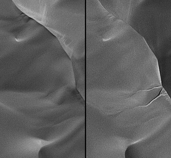
PIA04290:
New Gullies on Martian Sand Dune
Full Resolution:
TIFF
(328.4 kB)
JPEG
(48.5 kB)
2005-09-20
Mars
Mars Global Surveyor (MGS)
Mars Orbiter Camera (MOC)
3871x1860x1
PIA04291:
Rolling Stones Make New Boulder Tracks
Full Resolution:
TIFF
(7.208 MB)
JPEG
(1.359 MB)
2005-09-20
Mars
Mars Global Surveyor (MGS)
Mars Orbiter Camera (MOC)
2531x1529x1
PIA04292:
Recently-Formed Impact Crater
Full Resolution:
TIFF
(3.874 MB)
JPEG
(445.3 kB)
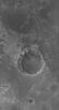
2005-09-20
Mars
Mars Global Surveyor (MGS)
Mars Orbiter Camera (MOC)
4405x4976x3
PIA04293:
Eberswalde Delta in High Resolution
Full Resolution:
TIFF
(65.76 MB)
JPEG
(4.641 MB)
2005-09-20
Mars
Mars Global Surveyor (MGS)
Mars Orbiter Camera (MOC)
968x1756x1
PIA04295:
Four Mars Years of South Polar Changes
Full Resolution:
TIFF
(1.702 MB)
JPEG
(158.1 kB)
2005-09-20
Mars
Mars Global Surveyor (MGS)
Mars Orbiter Camera (MOC)
328x300x3
PIA04294:
Repeated Clouds over Arsia Mons
Full Resolution:
TIFF
(295.7 kB)
JPEG
(5.9 kB)
2005-09-20
Mars
Mars Global Surveyor (MGS)
Mars Orbiter Camera (MOC)
10413x9194x1
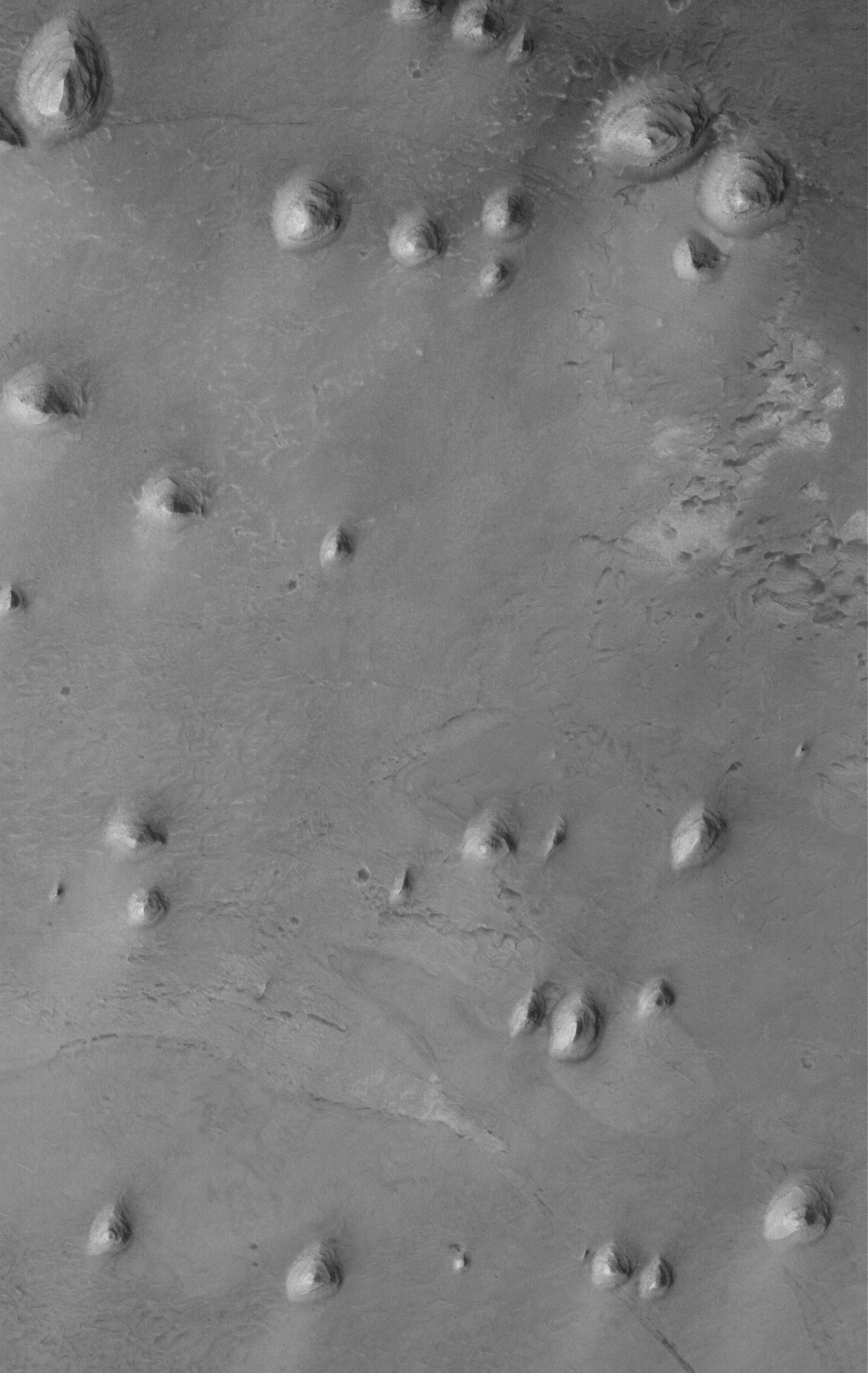
PIA04296:
Scarp at Head of Chasma Boreale
Full Resolution:
TIFF
(95.74 MB)
JPEG
(5.089 MB)
2005-09-21
Mars
Mars Global Surveyor (MGS)
Mars Orbiter Camera (MOC)
640x640x3
PIA06343:
Mars at Ls 288°: Syrtis Major
Full Resolution:
TIFF
(411.8 kB)
JPEG
(21.79 kB)
1-100
101-200
201-300
301-400
401-500
501-600
601-700
701-800
801-900
901-1000
Currently displaying images:
3701 - 3800
of 12748


