- Original Caption Released with Image:
-
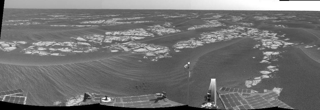
NASA's Mars Exploration Rover Opportunity is currently traveling southward over a pavement of outcrop dubbed the "Erebus Highway." "Erebus Crater," the rover's next target, lies less than 100 meters (328 feet) south of its current position. This view is a mosaic produced from from frames taken by the rover's navigation camera during Opportunity's 582nd martian day, or sol (Sept. 13, 2005). It shows fractured blocks of ancient sedimentary rock separated by recent sand dunes. Mars Exploration Rover team scientists are investigating both the composition of the rocks and the processes by which the distinctive fracture pattern arose.
- Image Credit:
-
NASA/JPL
Image Addition Date: -
2005-09-16
|